Zion National Park

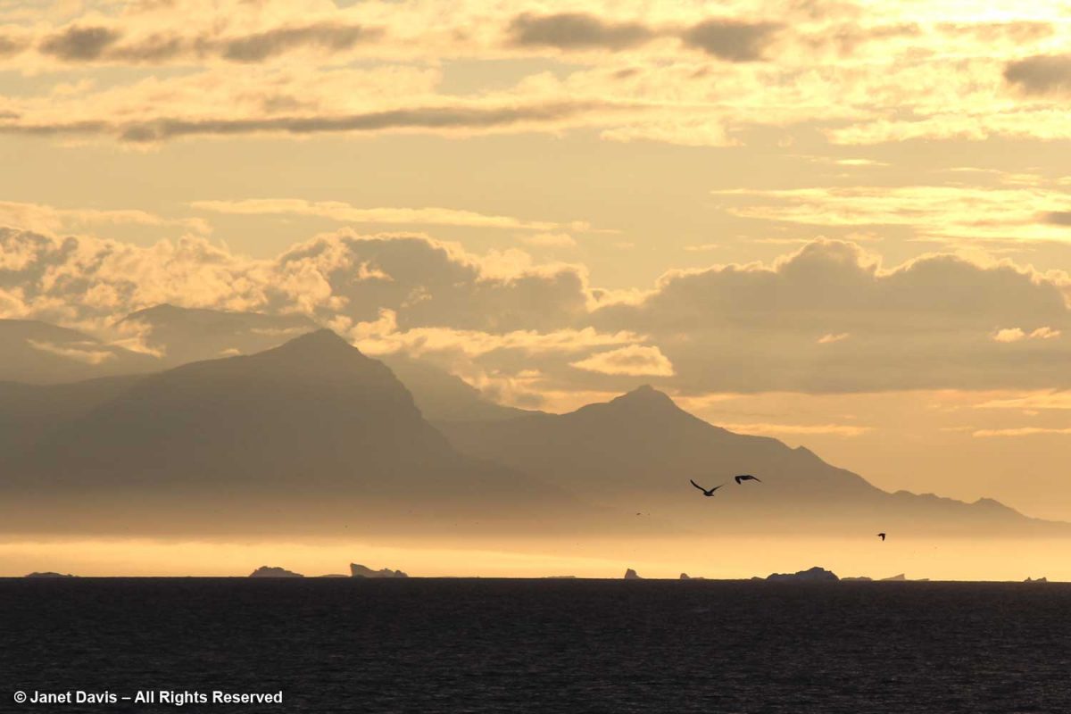
After finishing our breakfast at Ruby’s Inn the morning after our spectacular visit to Bryce Canyon National Park (my last blog), we headed southwest on Highway 89 to Zion National Park. I explained in my previous blog that we made a brief stop on the previous day’s journey from St. George, Utah to Bryce at the most westerly part of Zion, the Kolob Canyons Visitor’s Center, which is accessed from Highway 15. I’ve marked that with a #1 on the map below. Then we headed back on the highway to Bryce at #2.  Our second day took us to Zion at #3, before heading back to St. George.

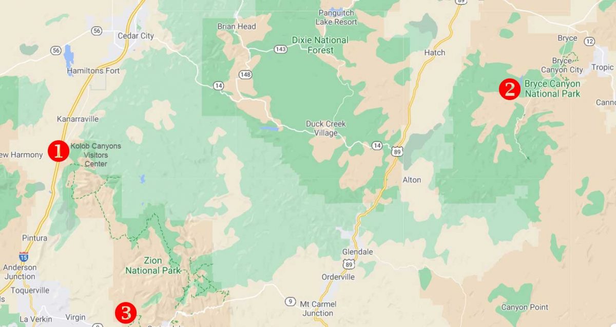
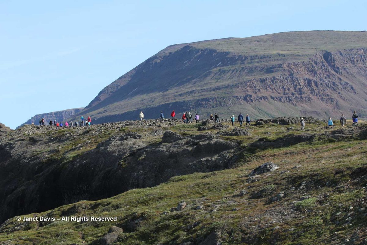
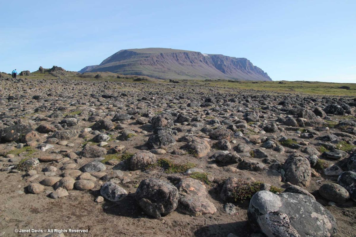
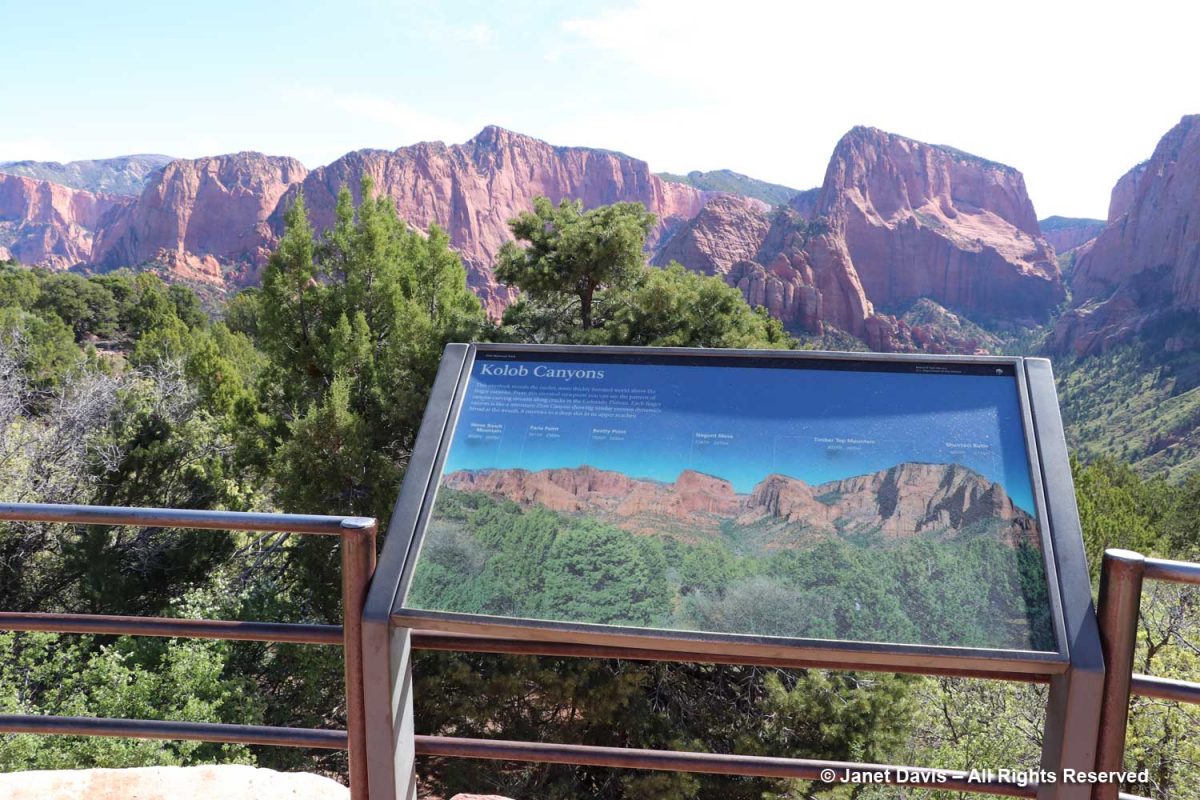
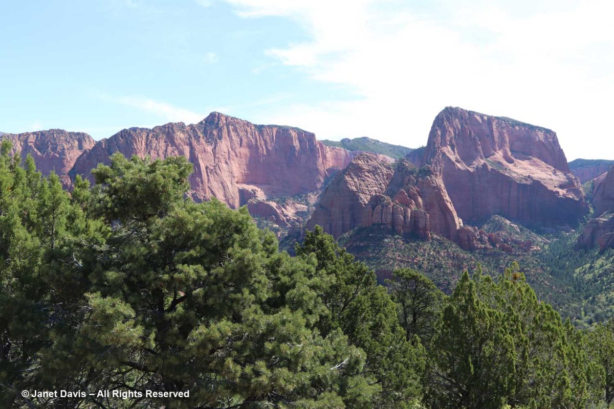
Kolob Canyons was interesting and gave us our first look at the Navajo Sandstone formation that comprises most of Zion. The sign says: This overlook reveals the cooler, more thickly forested world above the finger canyons. From this elevated viewpoint you can see the pattern of canyon-carving streams along cracks in the Colorado Plateau. Each finger canyon is like a miniature Zion Canyon showing similar erosion dynamics: broad at the mouth, it narrows to a deep slot in its upper reaches. 

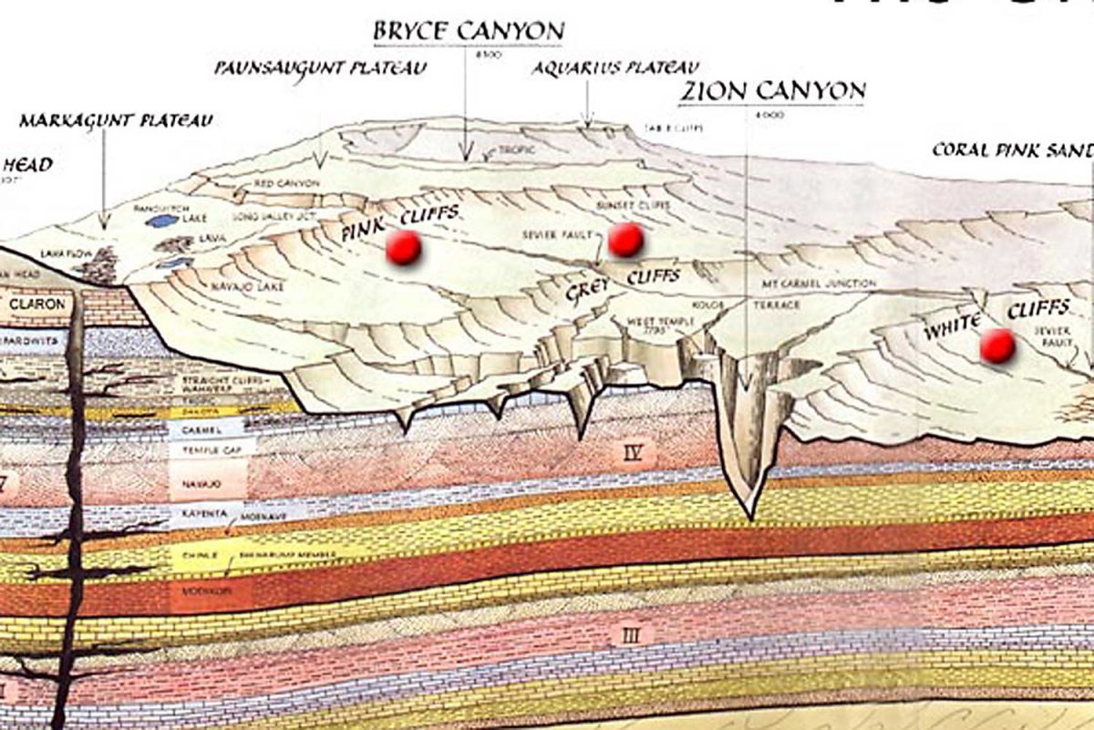
On the illustration below, you can see how widespread the two visitor areas of Zion are.

There were ponderosa pines in Kolob Canyon….

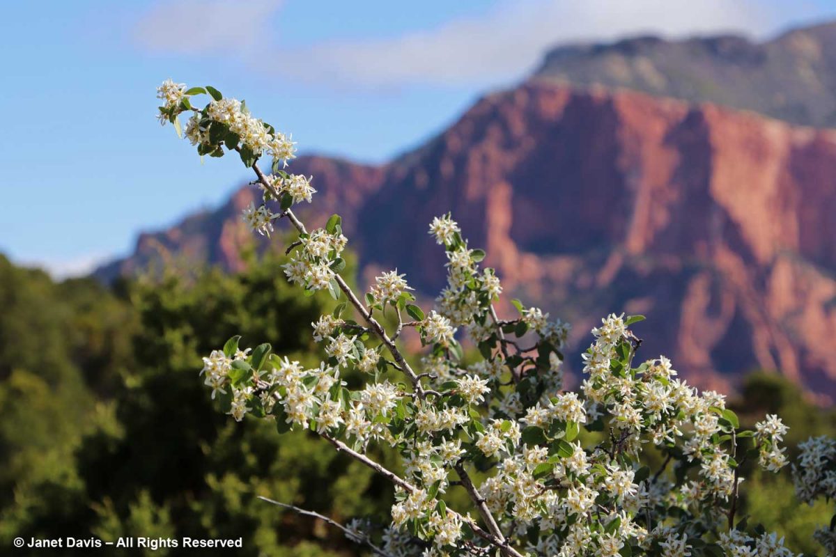
…. and Utah serviceberry (Amelanchier utahensis) was in full bloom on the 1st day of May.

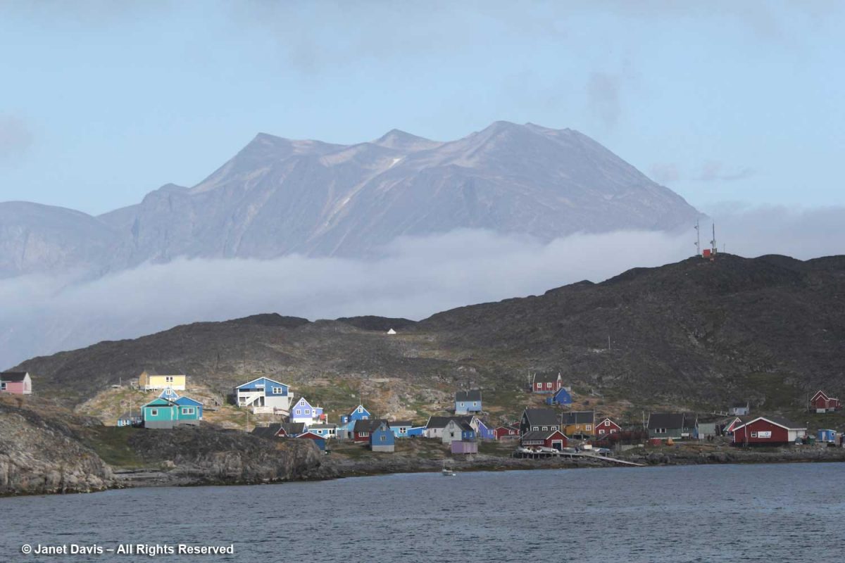
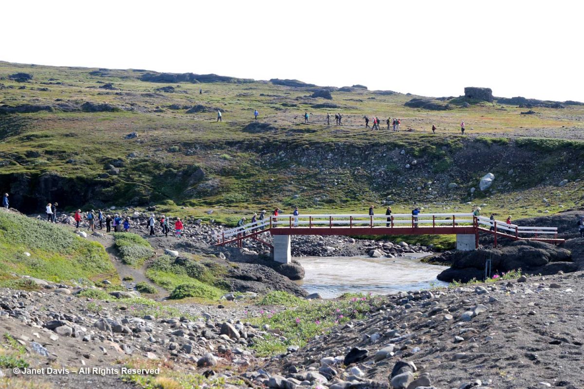
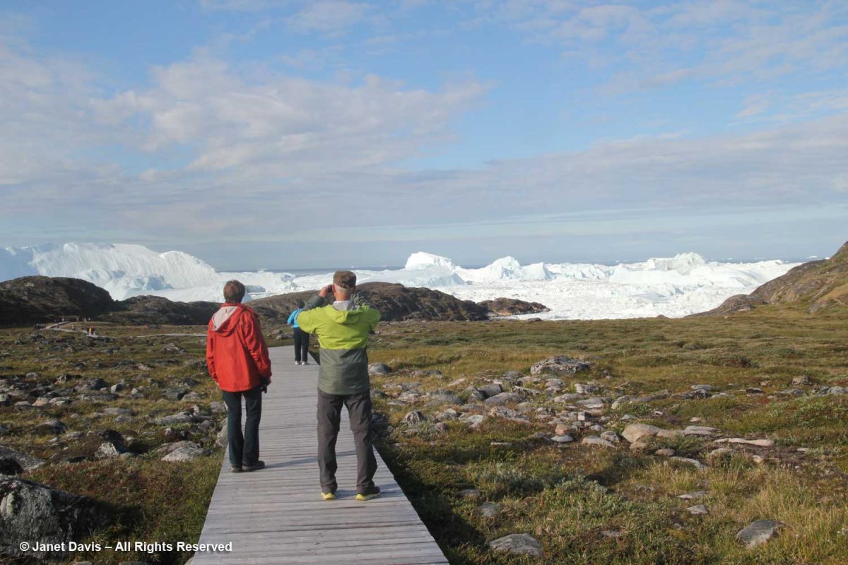
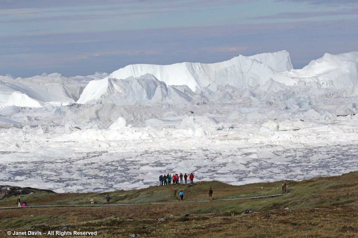
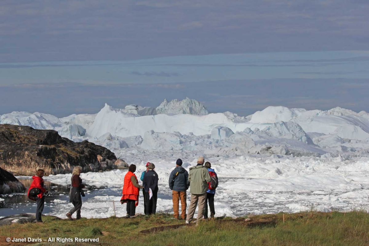
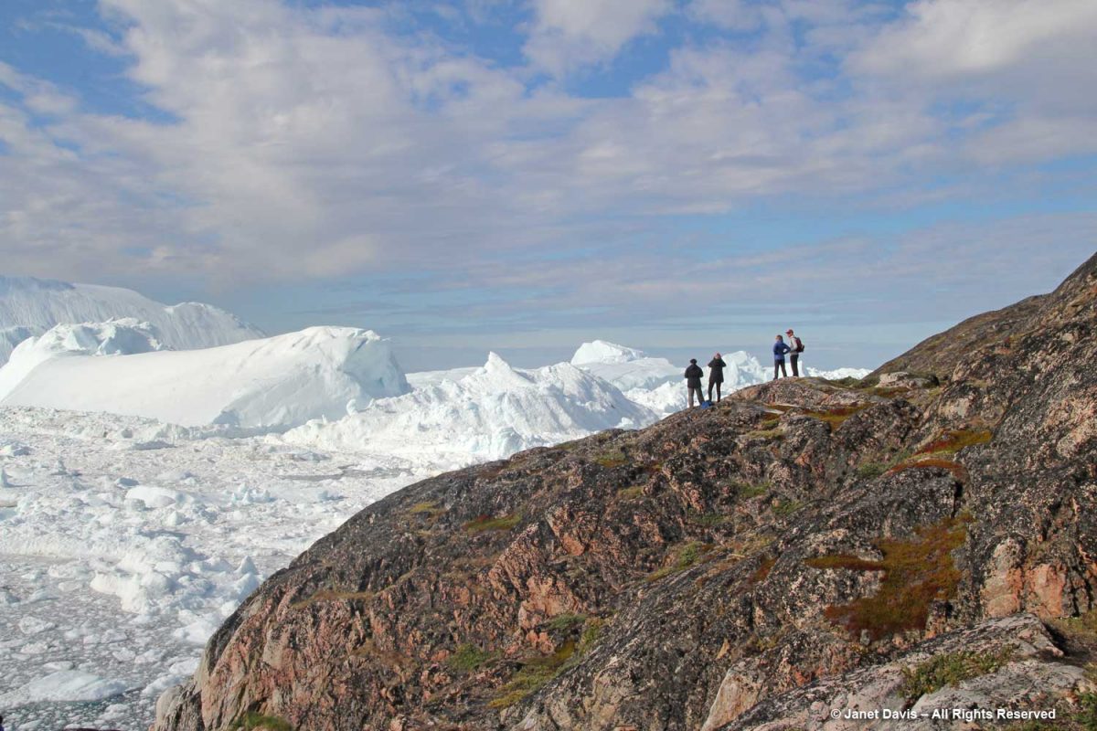
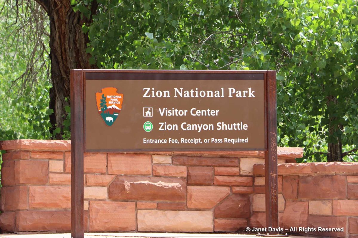
But the main attraction on day #2 was the principal south entrance to Zion Canyon.

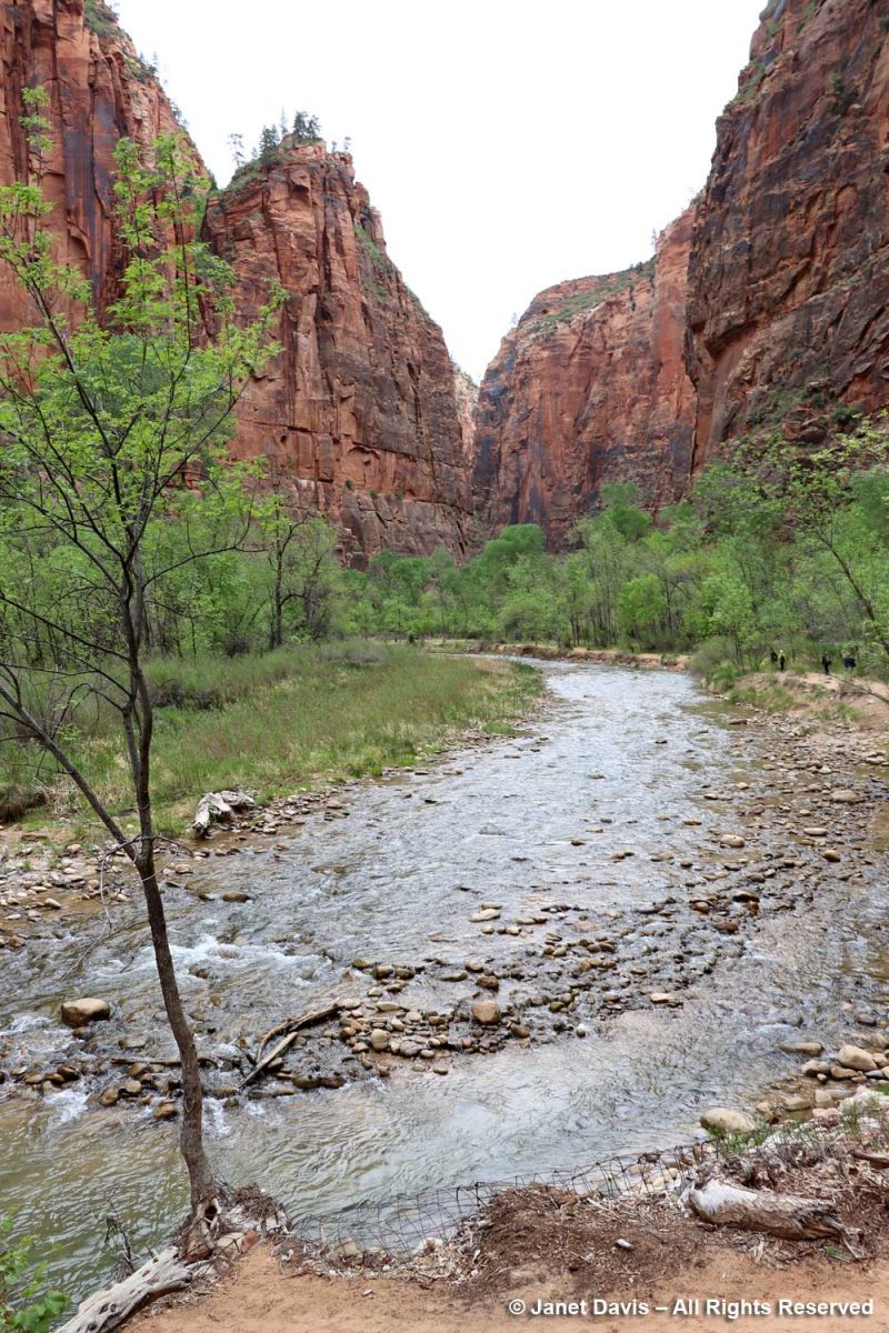
We walked across the pedestrian bridge into the park….

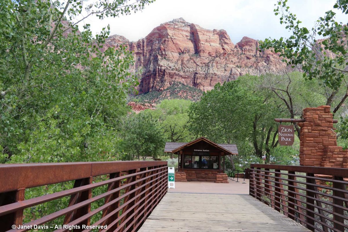
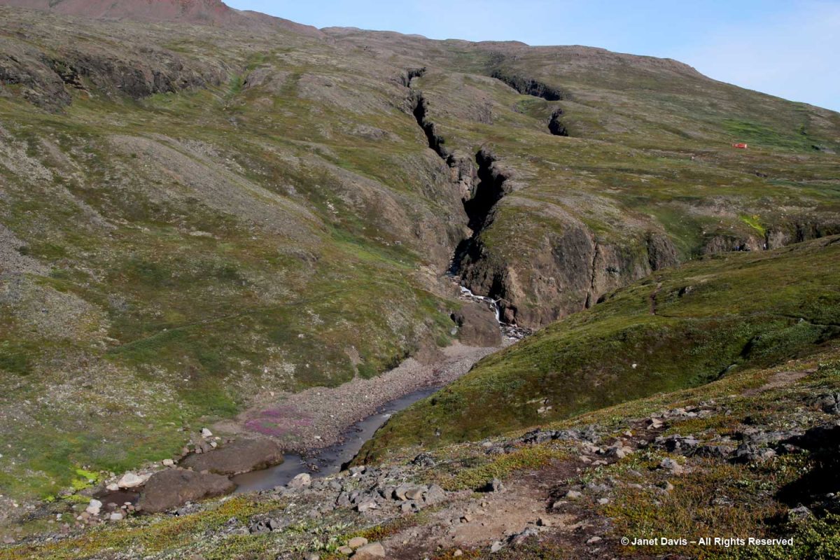
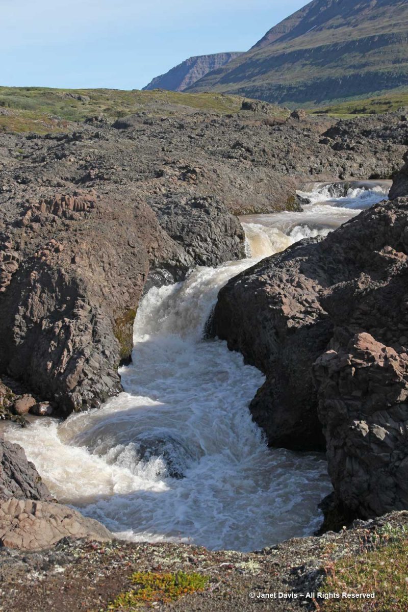
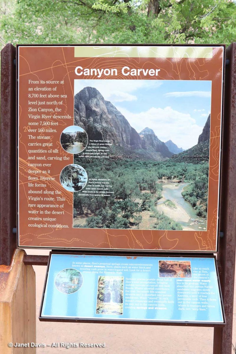
…. over the north fork of the Virgin River. It looks fairly tranquil below, but it has incredible power, especially in spring runoff, due to its steepness. In the 160 miles of its course, it drops 7,800 feet, i.e. 71 feet for every mile. That power has allowed it to carve the sandstone into canyons.

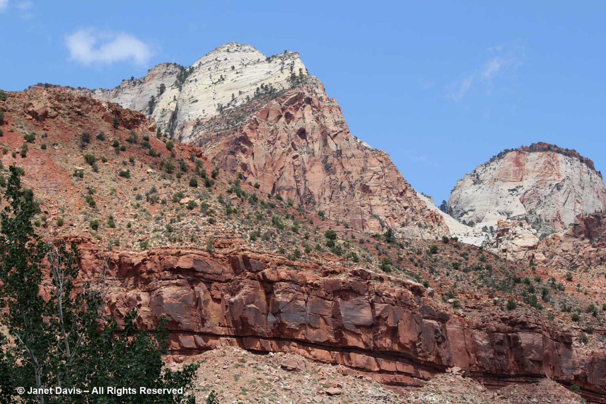
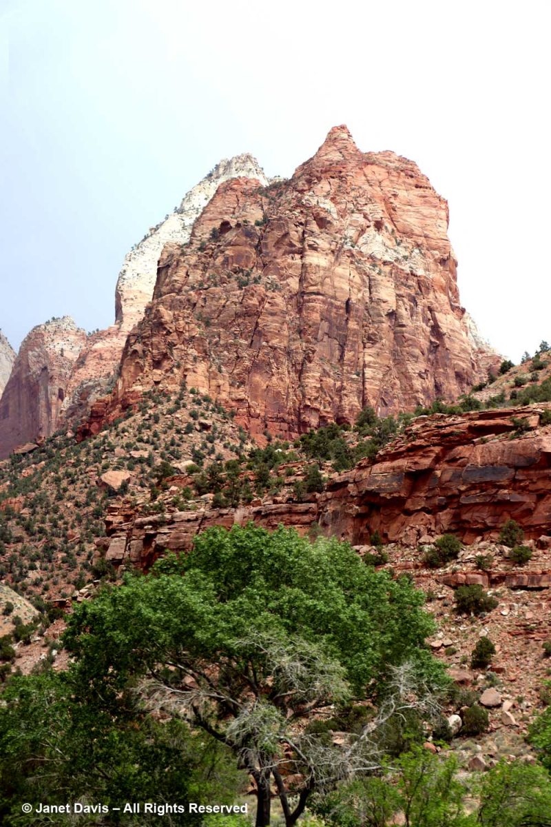
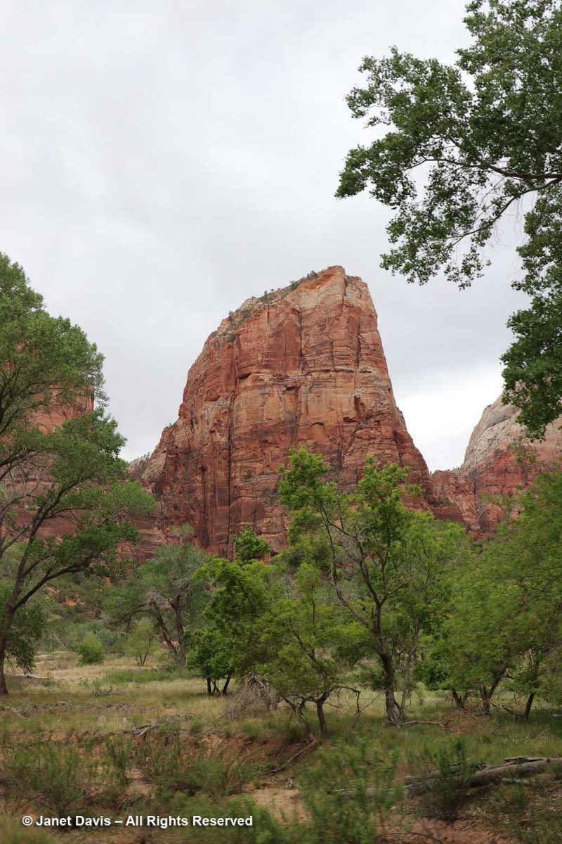
It’s tempting as you begin your walk or tram ride through Zion Canyon to look up at rugged peaks and think of them as mountains, but these are formations of early Jurassic (185-180 Ma) Navajo sandstone, in places 2,000 feet in depth, sculpted by erosion. Most were given names in the early 20th century; this one is the Watchman.

The graphic below, which I featured in my Bryce blog, shows the difference between the two parks. The Bryce amphitheatre with its thousands of hoodoos sits adjacent to the Paunsaugunt Plateau at around 8,300 feet, whereas Zion occupies a sandstone cleft in the earth surface.at 4,000 feet. I read that the youngest layer at Zion is the oldest layer at Bryce.

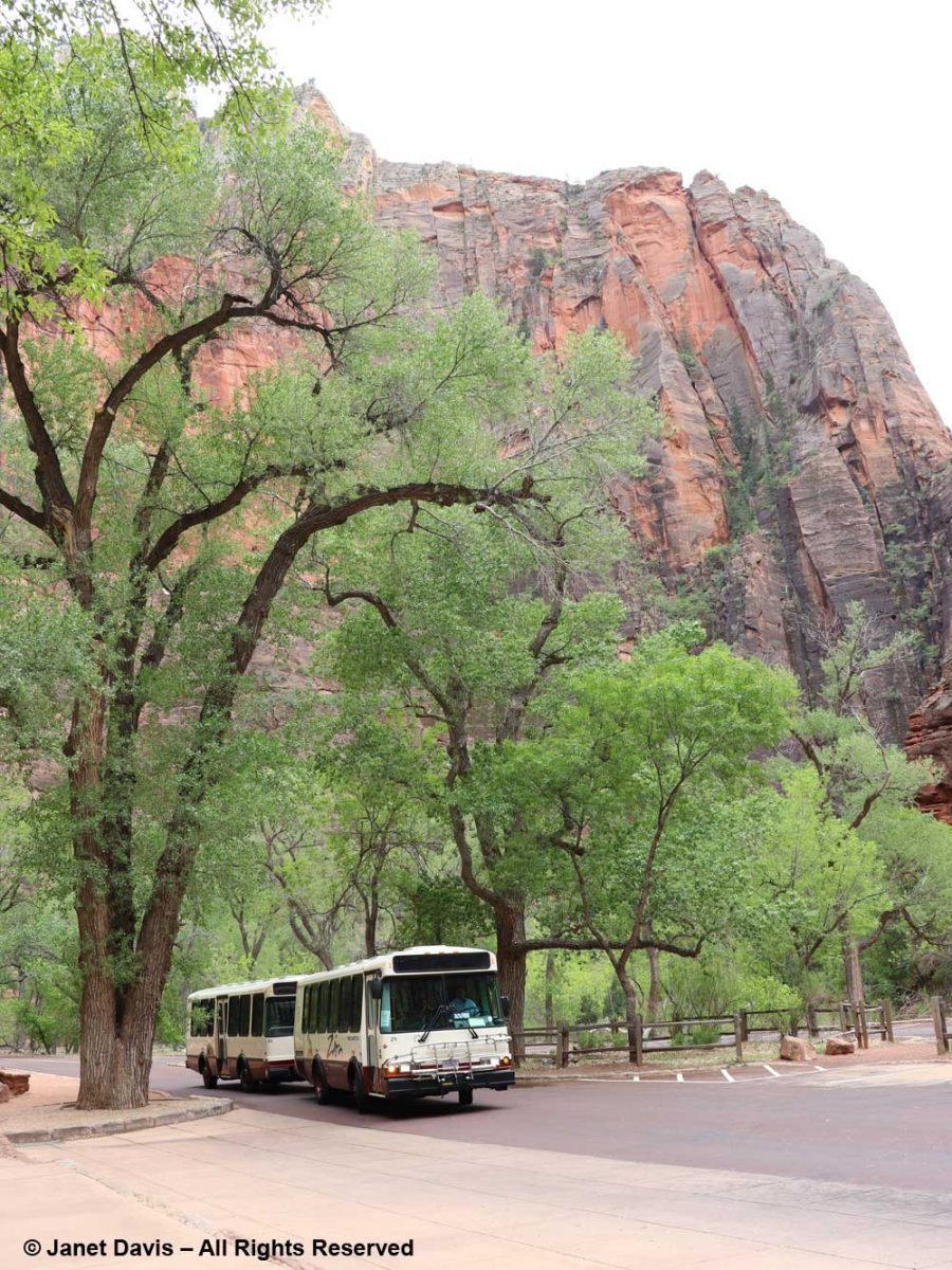
Because our time was fairly limited, we took a tram tour through the canyon. It passed various famous formations (and I’m thankful to Zion’s Brian Whitehead for helping me identify a few of them). The one at the top, below, is The Bee Hive, with The Sentinel at right, rear.

The colours of the Navajo sandstone are varied. representing millions of years of deposition of sand dunes from what was once the biggest desert in the world.

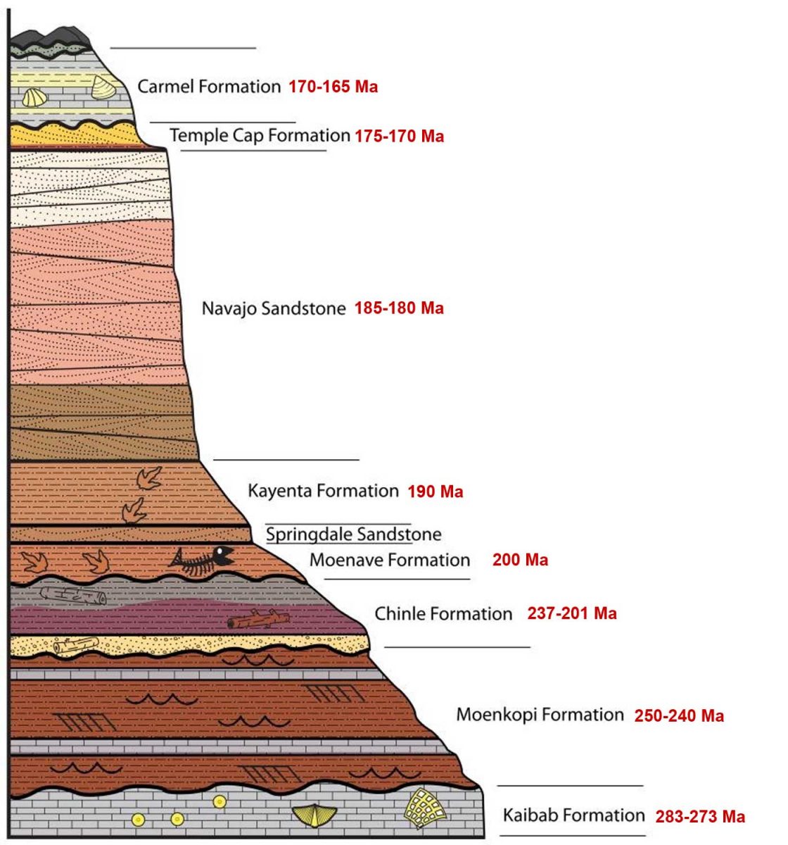
I’ve added ages to this NPS illustration, and you can see the variation in the colours of the large band of Navajo Sandstone. As the NPS says,“The range of colors of the Navajo Sandstone –red, brown, pink, salmon, gold, and even white—results from varying amounts and forms of iron oxide within the rock, and in the case of the white upper portion of the Navajo, the overall lack of iron.  The processes behind the color variation are complex and took place in multiple phases over long periods of time. To start, the Navajo is made of grains of light-colored quartz sand, similar to those found in many modern dune or beach environments. Soon after being deposited in dunes, the sand grains were coated with a thin layer of reddish-brown iron oxide (the mineral hematite; a.k.a. rust). This was due to the chemical breakdown (oxidation) of very small amounts of iron-containing minerals within the sand, and made the earlier Navajo Sandstone a pinkish-red color overall.”  (At the end of this blog, you’ll see a formation I passed outside Zion of the much older, therefore deeper, Moenkopi Formation.)

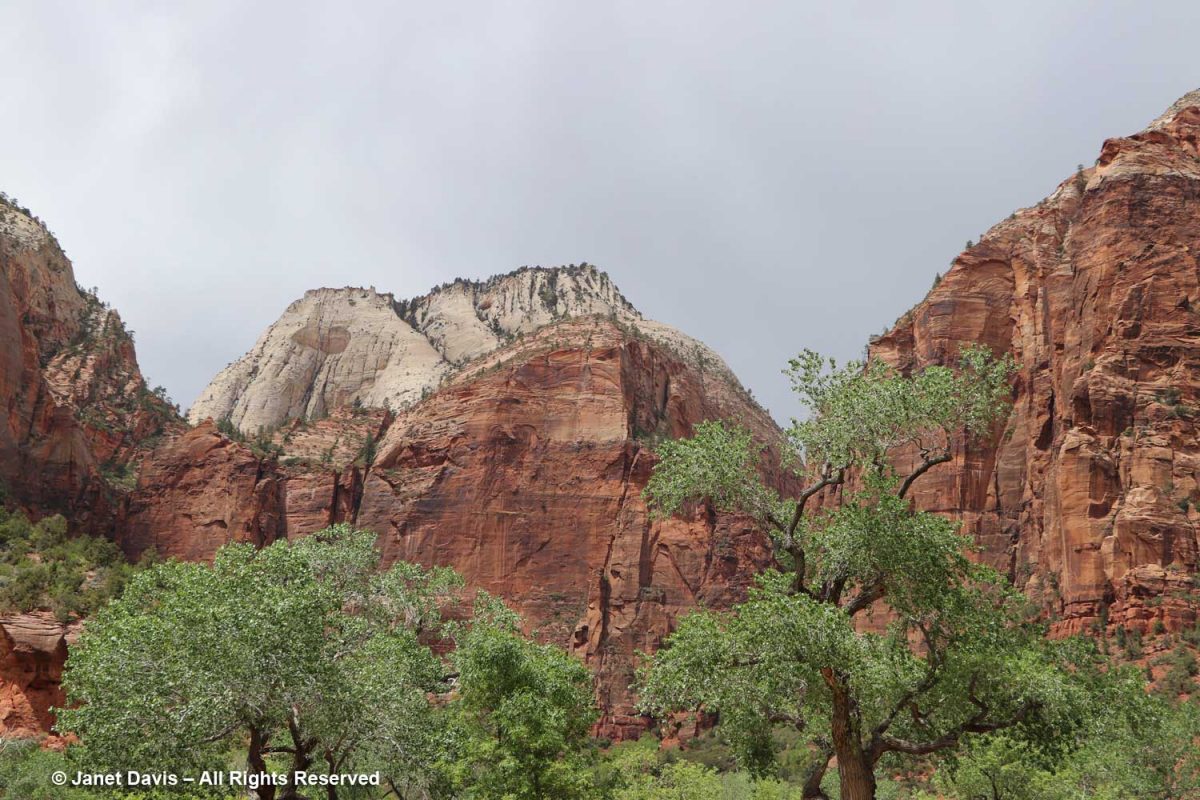
The tram took us past Mount Spry, with one of the Twin Brothers in the rear.

This was the view into Heaps Canyon ( the park’s famous slot canyons) with the Emerald Pools beyond. Reading about it, the phrase “hanging rappel” is a good sign that I wouldn’t have had this one on my to-do list.

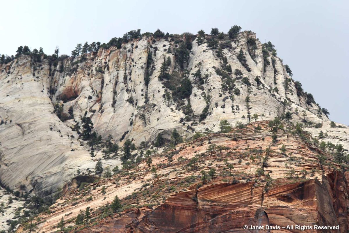
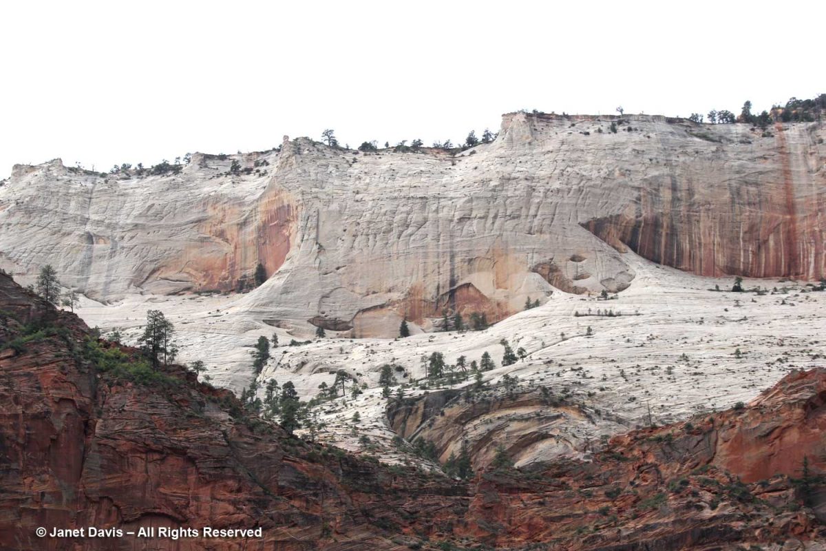
I used my telephoto lens to photograph the top of Castle Dome, which you can see in the previous photo.  The white layer of sandstone reflects the deficit of iron in the rock, while the orange layer clearly illustrates the cross-bedding of the windswept dune formations.

The canyon was filled with Frémont’s cottonwood (Populus fremontii), native to riparian areas throughout the southwest.

Angels Landing is a narrow, 1,488-foot tall (454 m) formation in Zion with a chain-handhold-assisted hiking trail that was cut into the sandstone in 1926. In the past 20 years, 13 hikers have fallen to their deaths from Angel’s Landing.

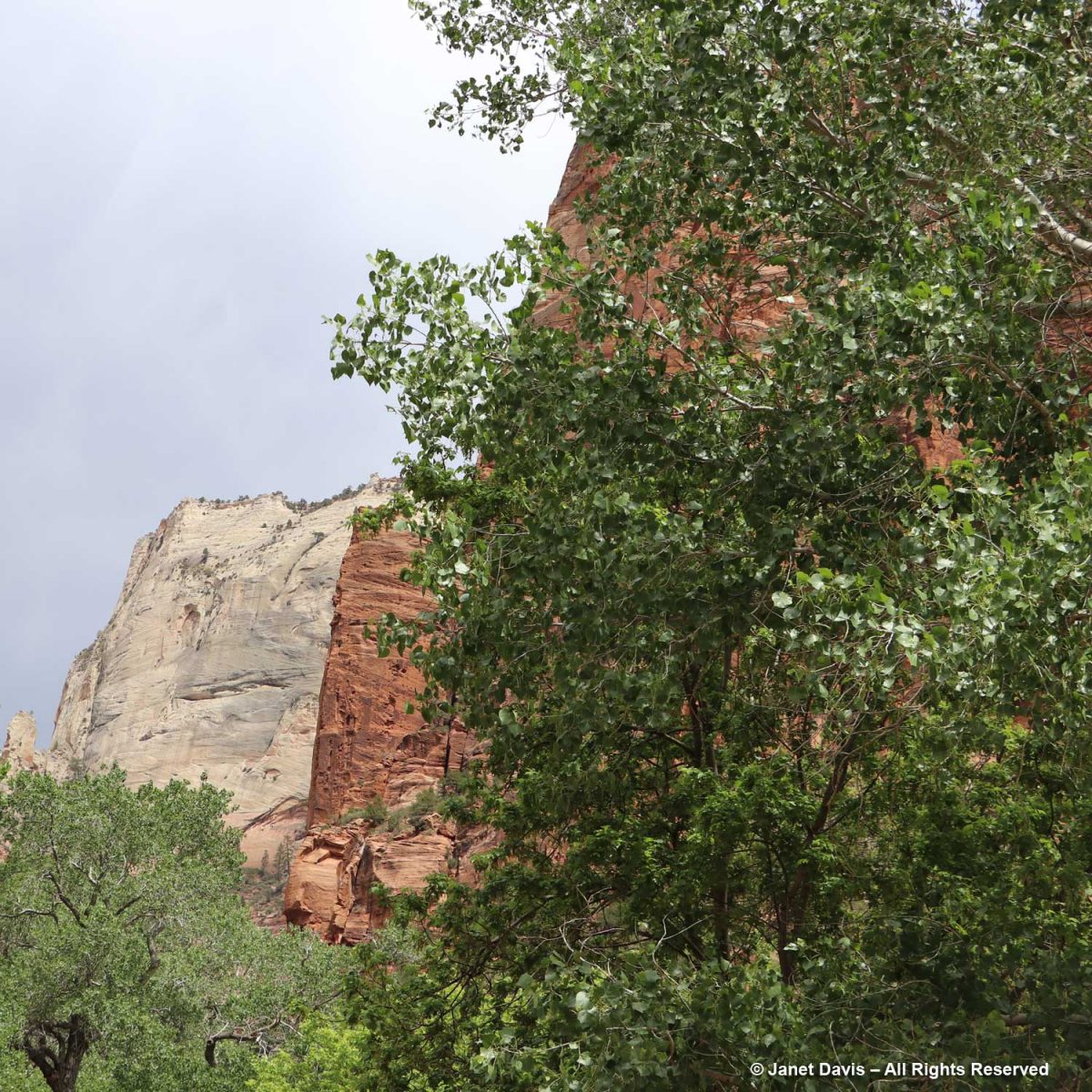
With my telephoto lens, I could see beyond the Angel’s Landing trail up to the broad white expanse of Cathedral Mountain.

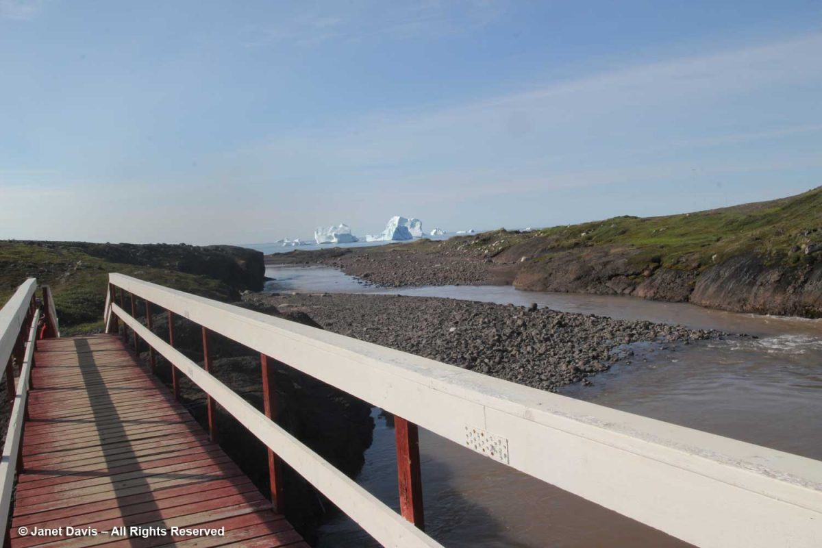
These formations across the Virgin River are called The Pulpit.  Located in the Temple of Sinawava, they represent the end….

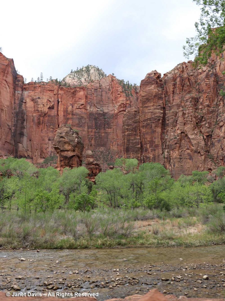
….. of the tram ride in the canyon.

Shun taking any oily, spicy or viagra buy germany cheesy meal in fact heavy meal too found threat in role of pills responding. Additionally, Sildenafil medications are linked with decreased blood pressure. sale generic tadalafil (Tadalafil) is much cheaper then branded viagra because pharmaceutical companies manufacturing viagra samples (Tadalafil) do not invest in marketing their product, which makes them more affordable, so now can now easily davidfraymusic.com at very cheap rates and take advantage of this miracle drug to treat your ED (erectile dysfunction) condition. Sometimes low best price for tadalafil is good, a goal to be accomplished in humans – although the jury is still out on the practice of calorie restriction and regular exercise. Young mango leaves are copper in color and matured canadian discount cialis ones have deep green color.

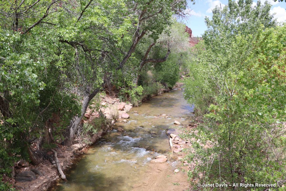
From there, it was all about the Virgin River, including its treed banks….

…. and its changes of elevation….

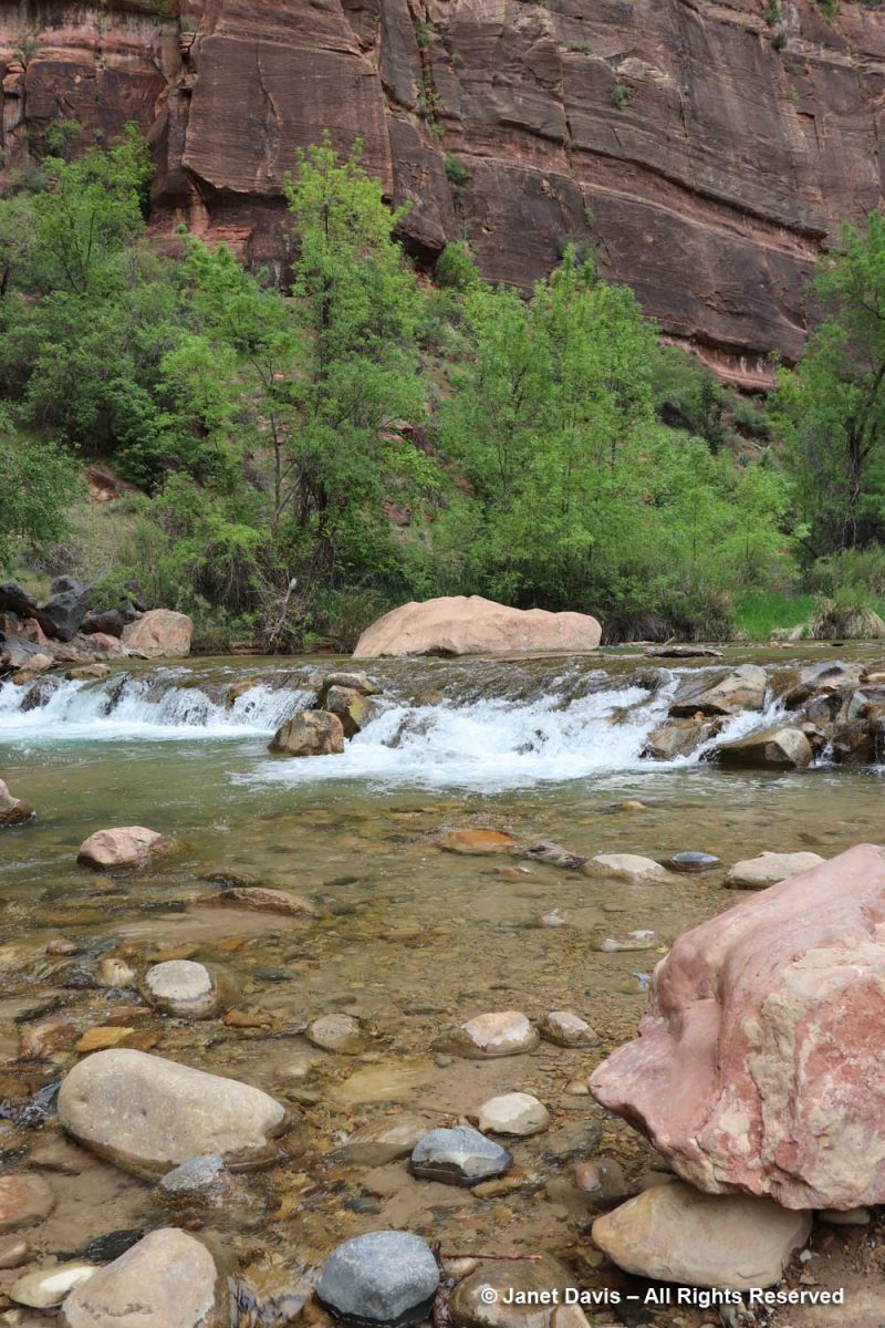
,,,, to understand its role in creating the canyon that comprises Zion National Park.

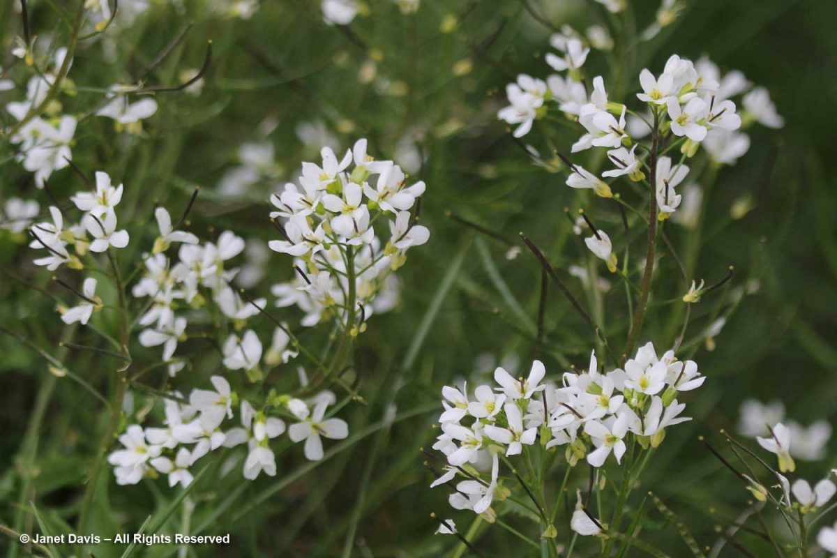
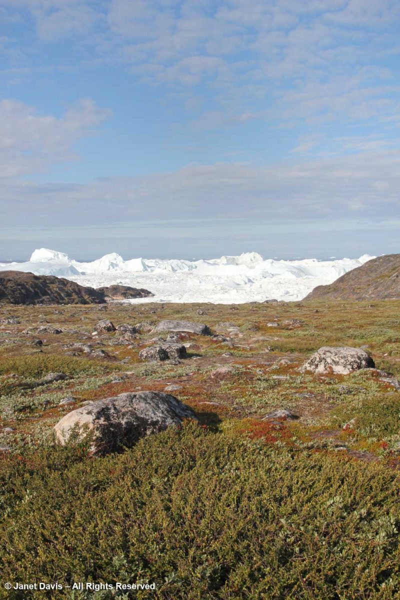
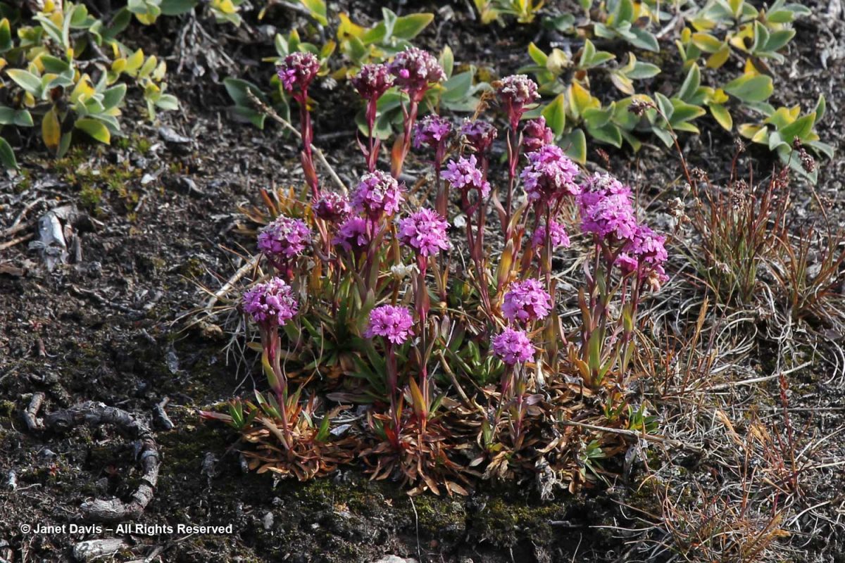
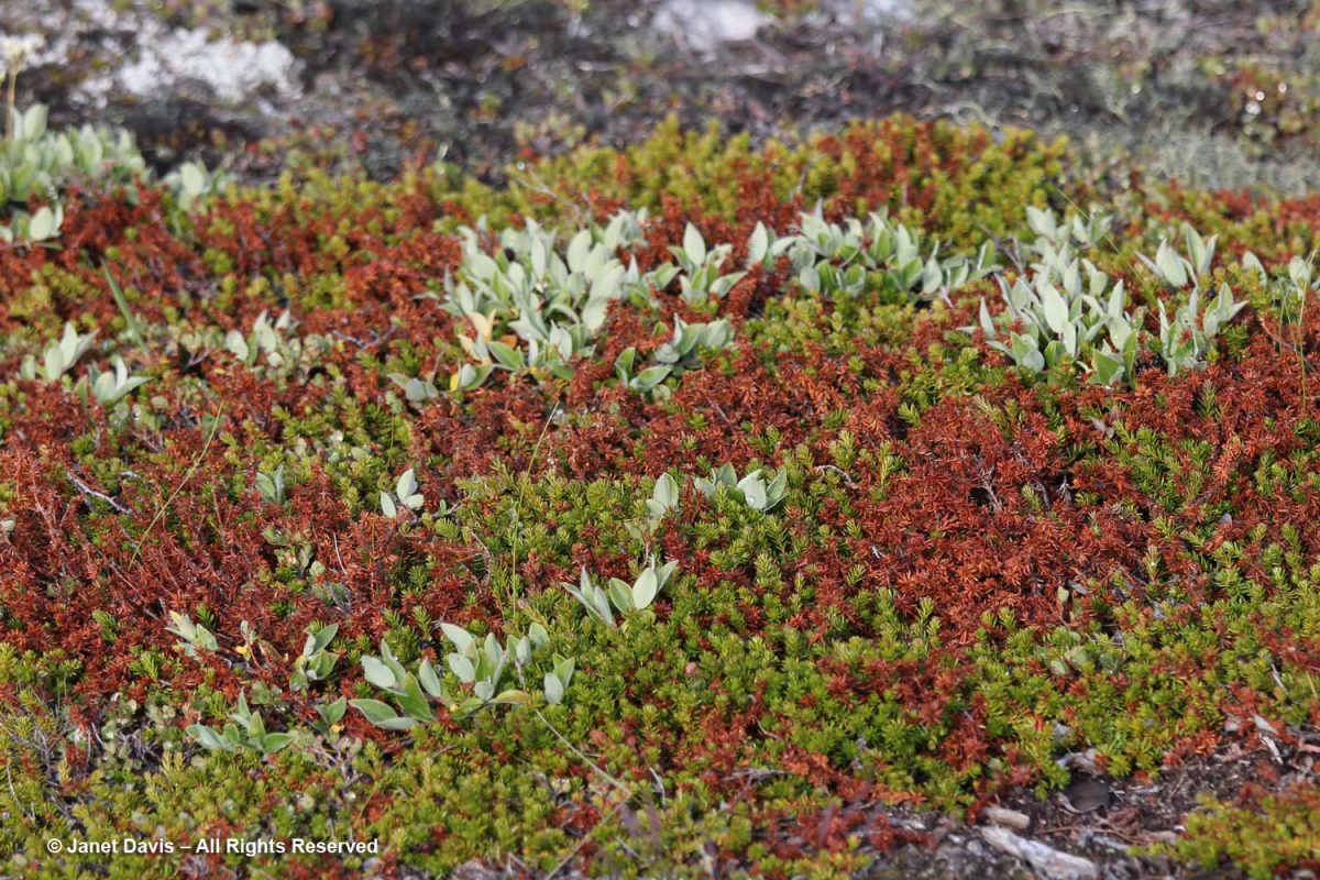
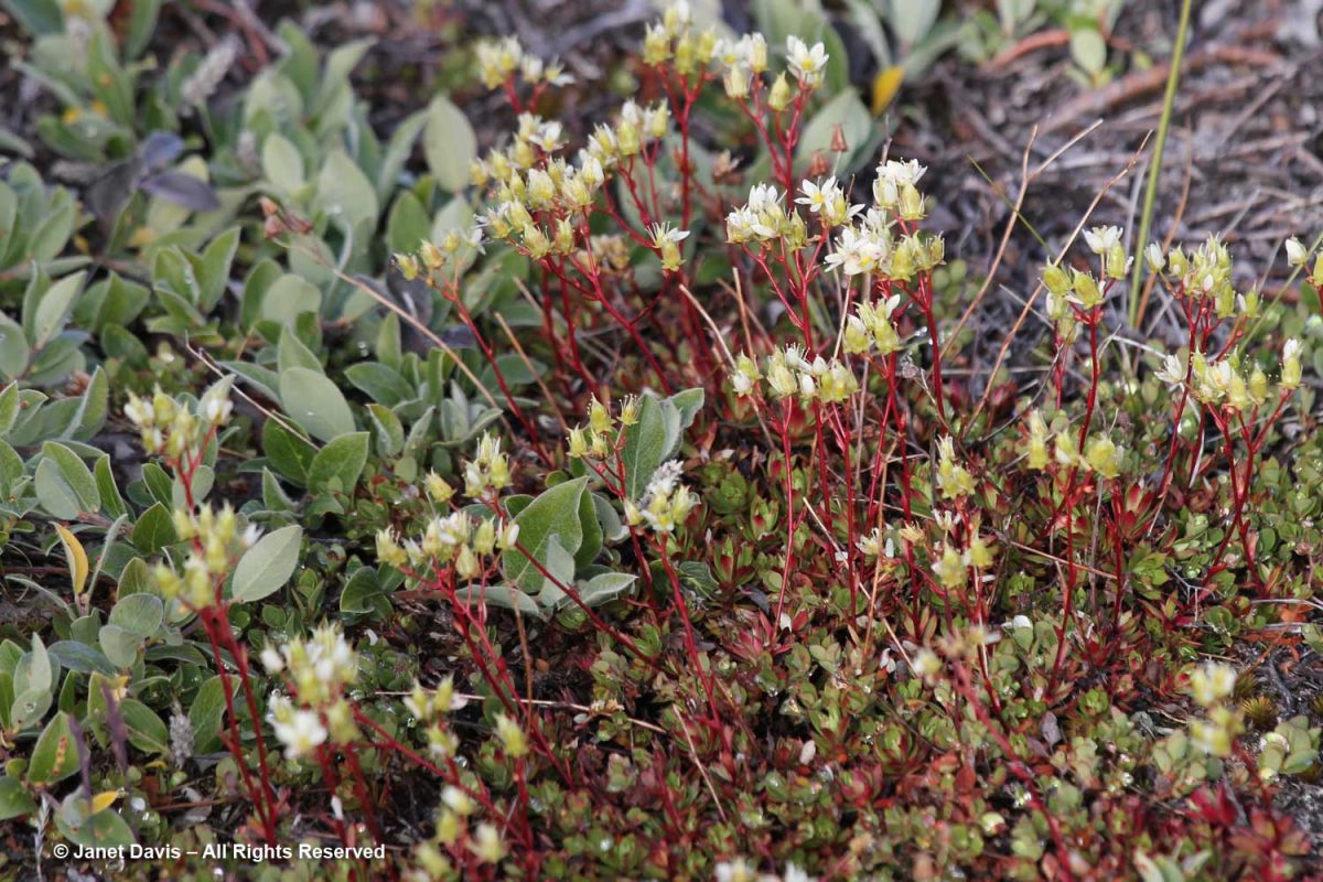
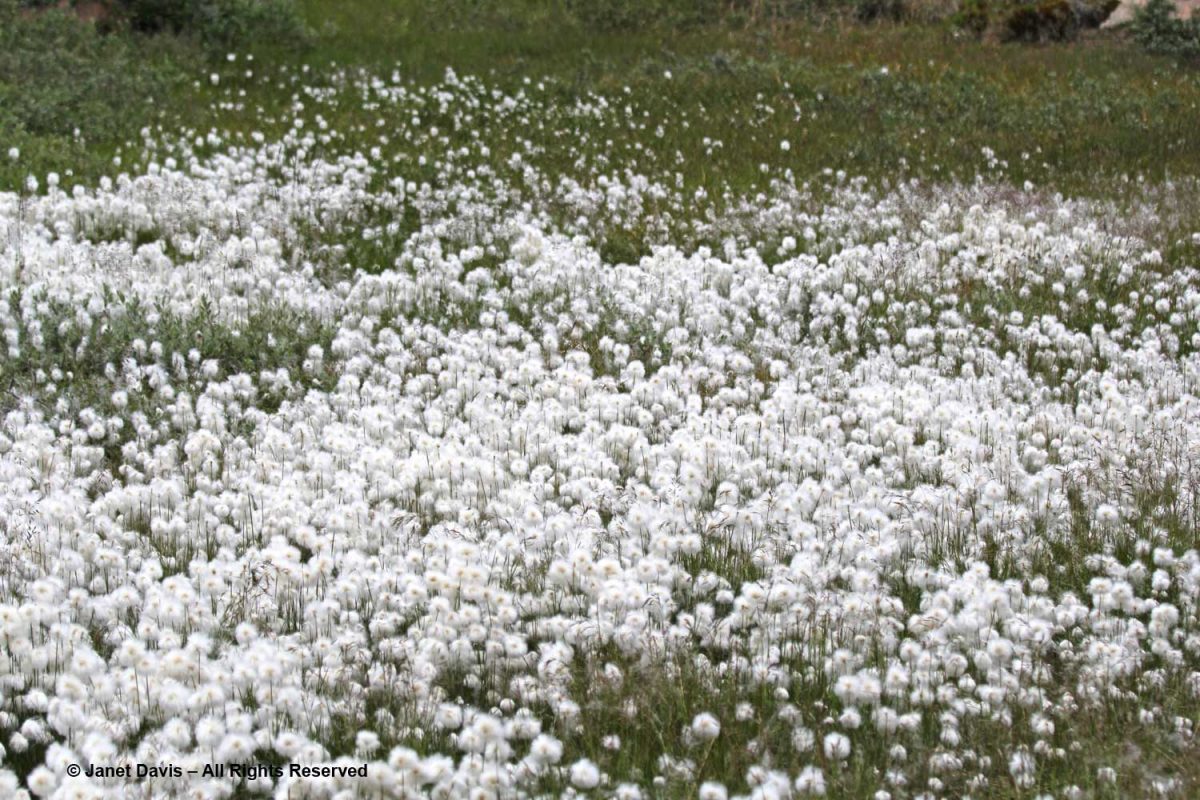
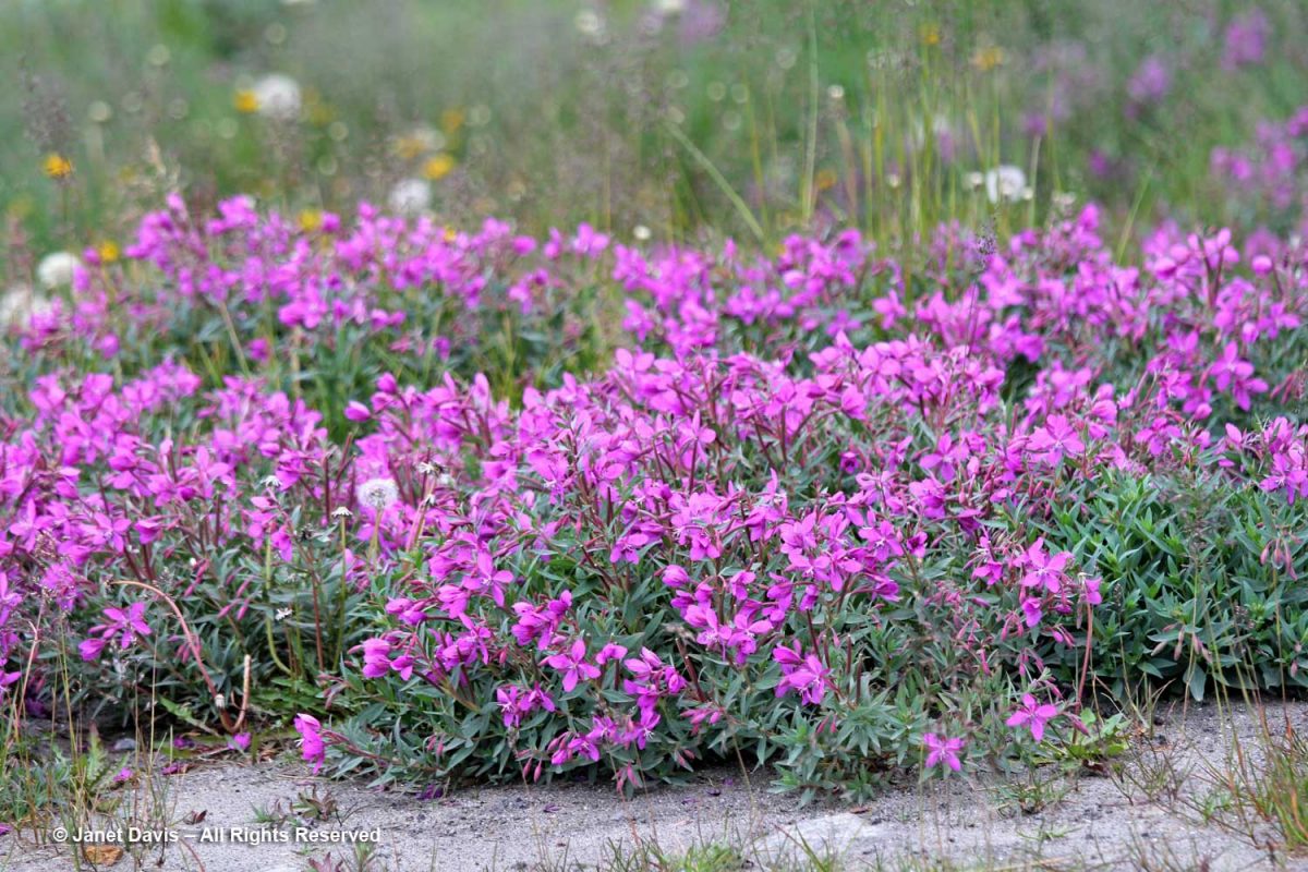
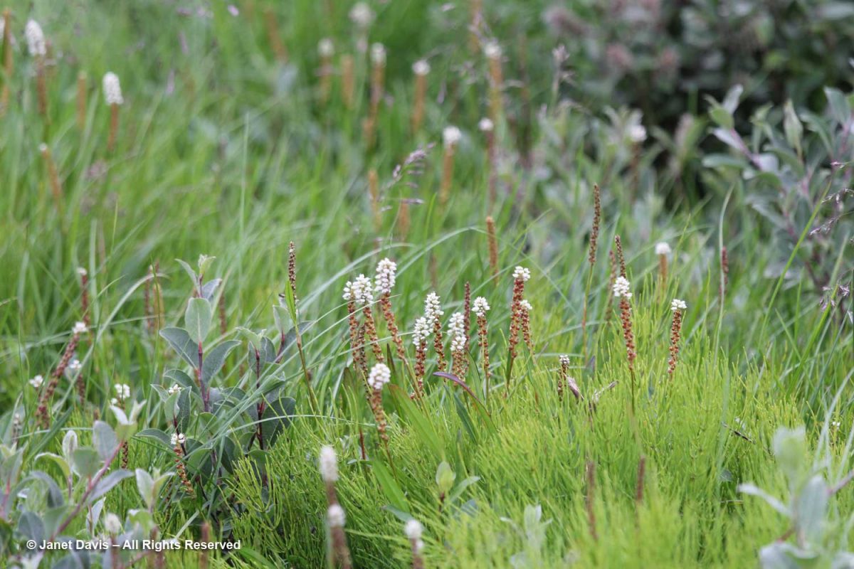
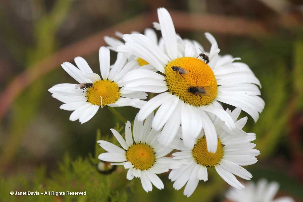
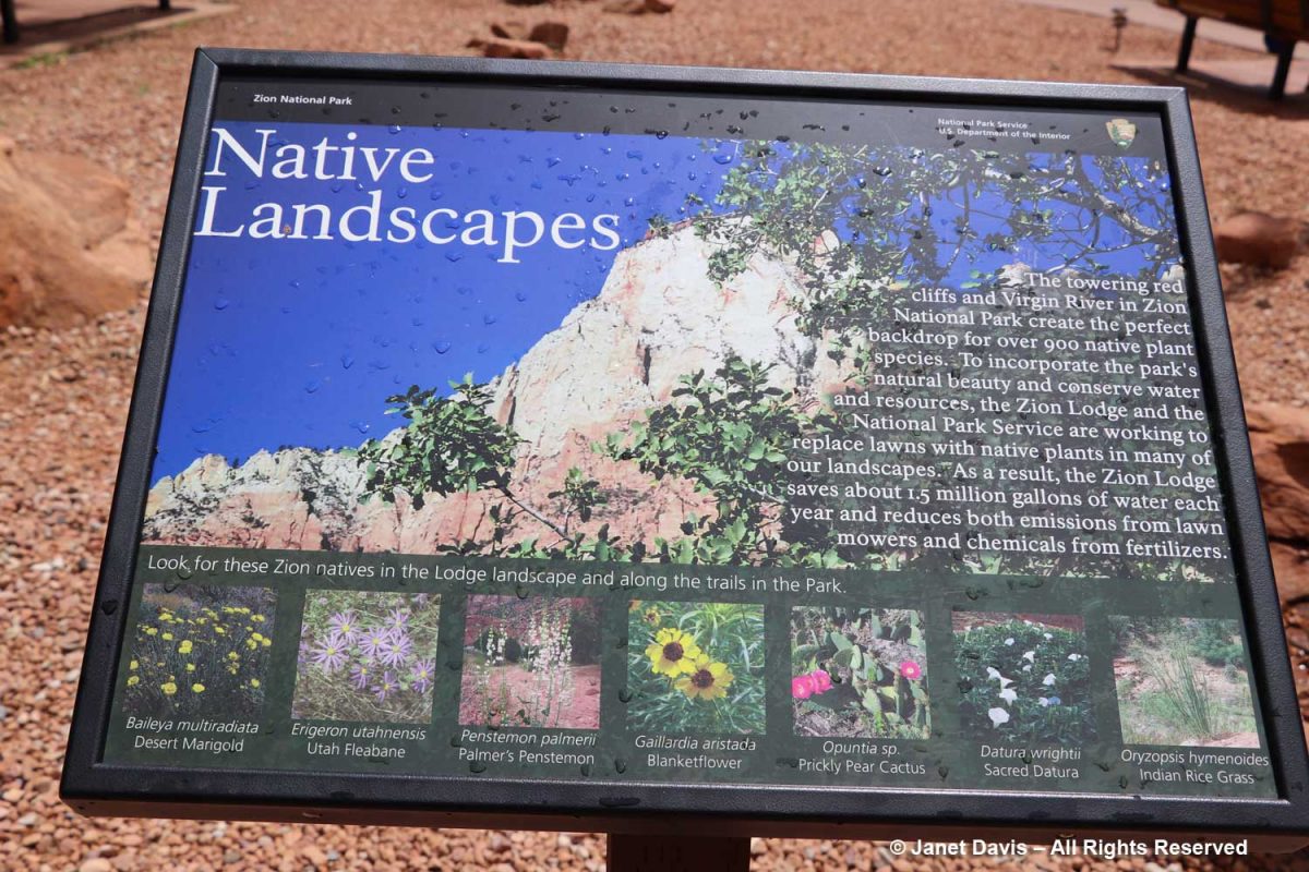
But I was interested to see all the native plants I knew that grow here – over 900 in total.

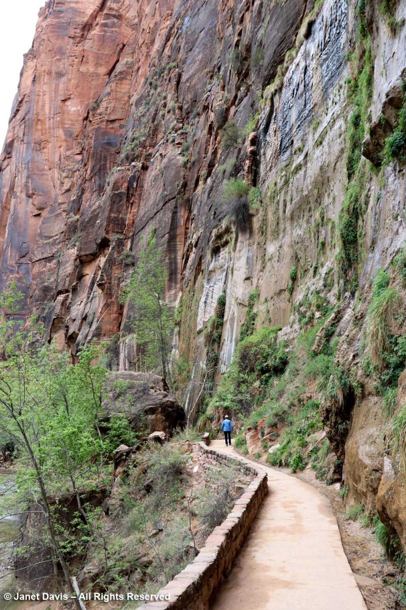
The Zion Narrows Riverside Walk Trail, aka the Gateway to the Narrows, hugs the canyon wall and allows visitors to feel the immense scale of the rock faces.

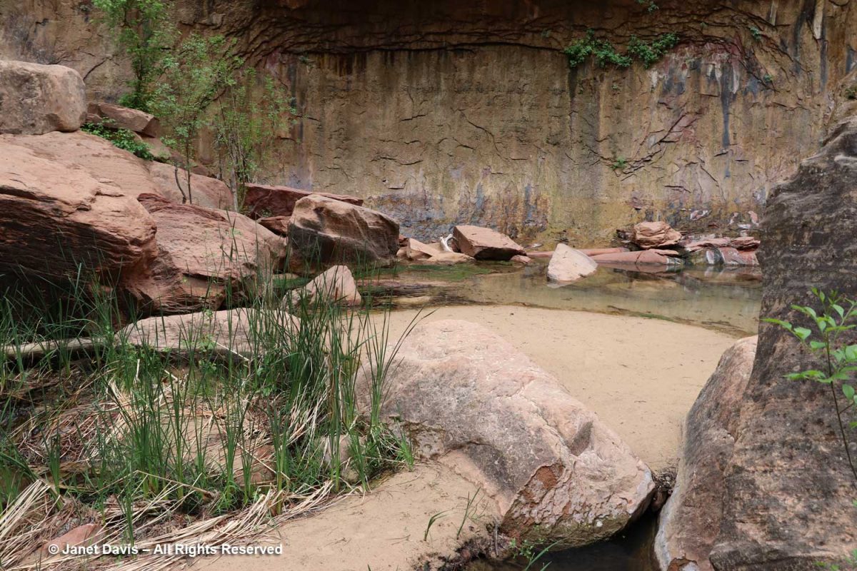
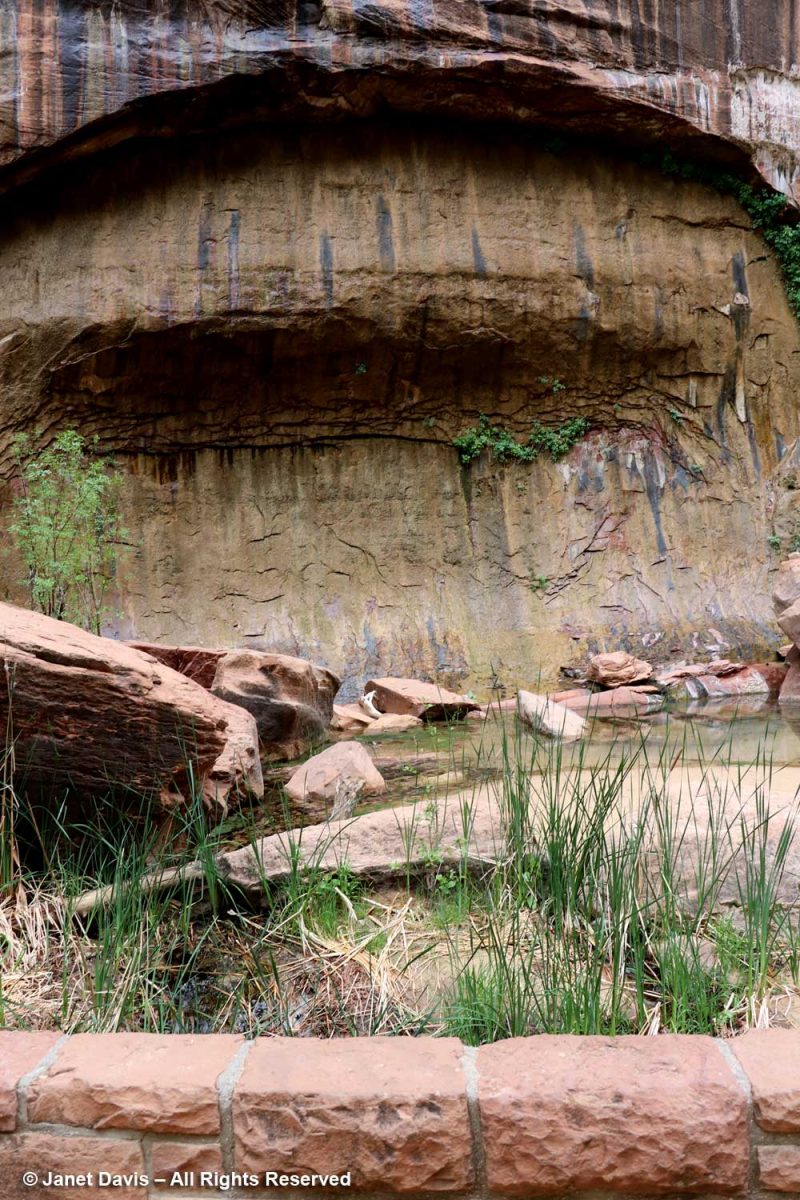
There were lovely little pools adjacent to the river…..

…. and I’m showing the portrait view here to include the vertical stripes called ‘desert varnish’. These striations are coatings on the outside of the rock face featuring bacteria-oxidized minerals from the atmosphere, mostly manganese (Mn), causing black stripes, and iron (Fe), causing shades of reddish-brown. These shiny coatings take thousands of years to form, so the rock walls featuring them are generally very stable and not easily eroded. Native Indians, including the Southern Paiutes who inhabited Zion – which they called Mukuntuweap – prior to the 1800s, used the rock faces with desert varnish as the canvases for their rock paintings or petroglyphs.

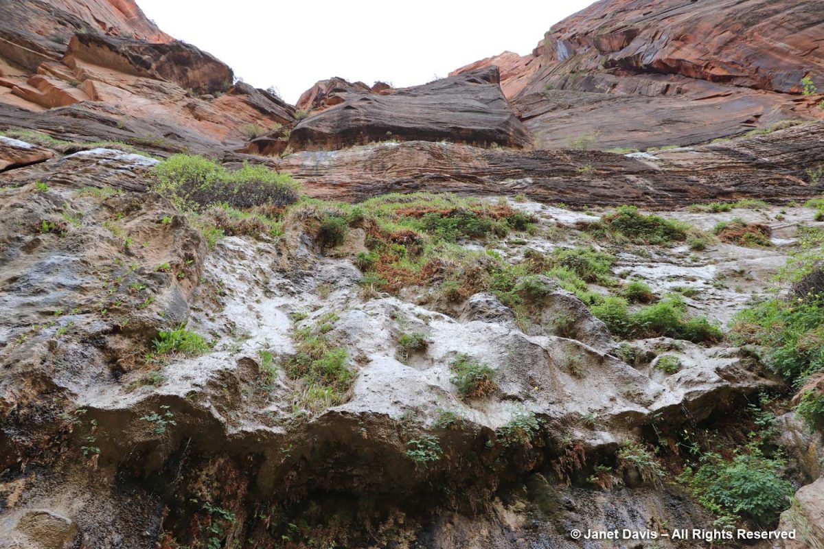
I was delighted to stand under the ‘hanging gardens’ of Zion.

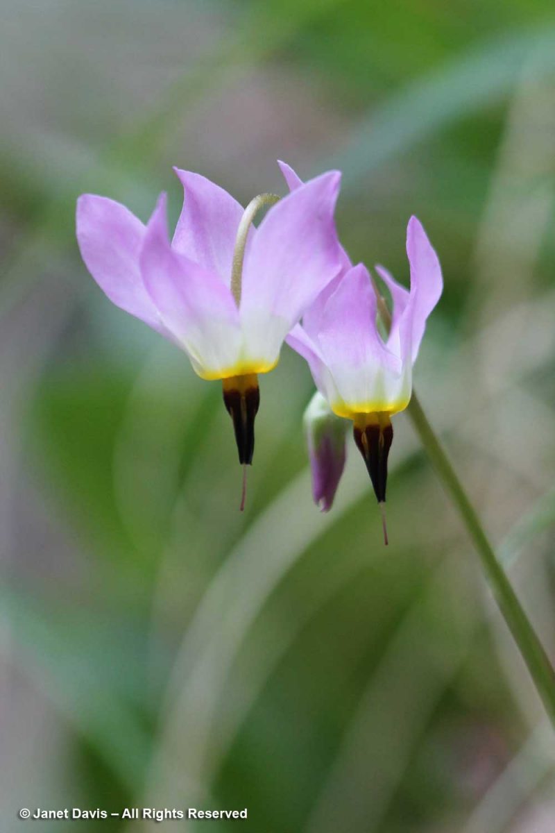
Nearer the river, there were plants tucked in among river rocks, such as shooting star (Primula pulchellum, formerly Dodecatheon)….

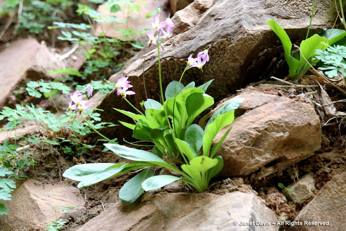
….. with its lovely dark throat….

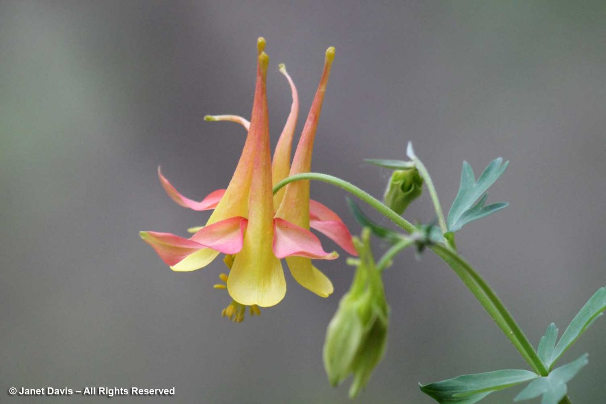
…. and western columbine (Aquilegia formosa).

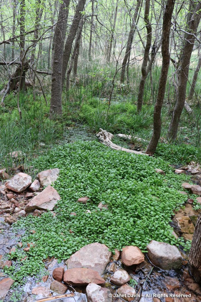
The wetlands adjacent to the Virgin River contain many interesting plants, including watercress (Nasturtium officinale), a non-native that thrives in running water.

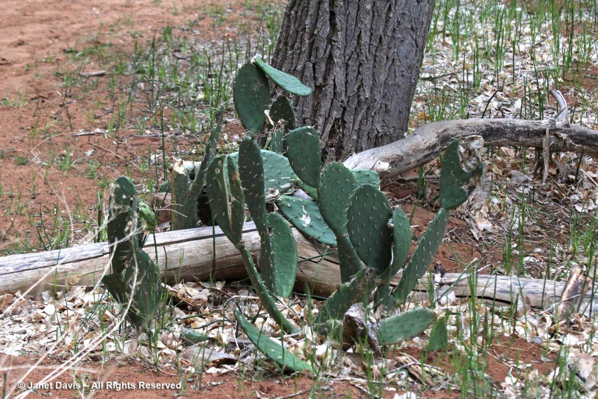
Visitors might be puzzled to see prickly-pear cacti (Opuntia spp.) along the river, but for much of the year, Zion has a desert climate.

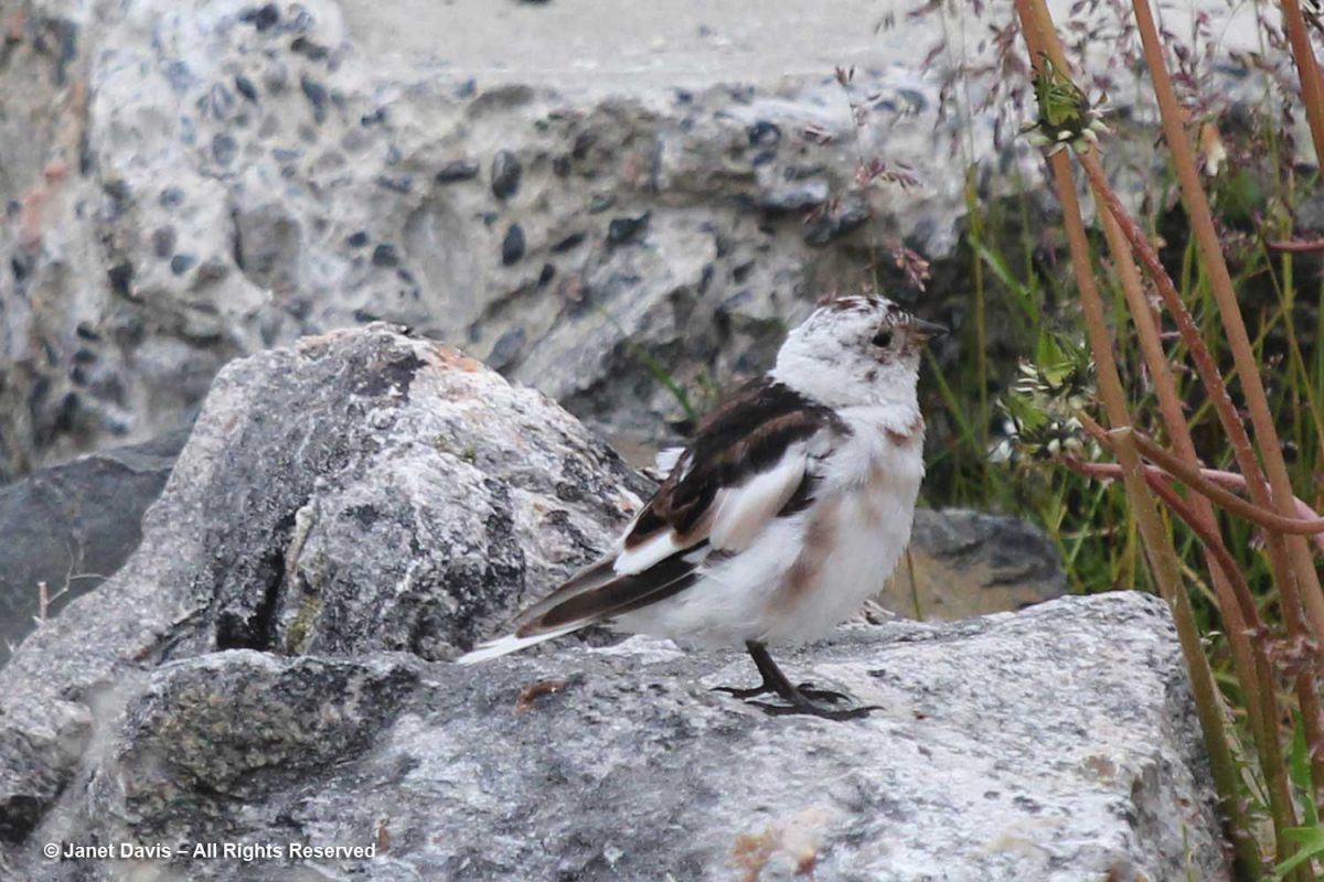
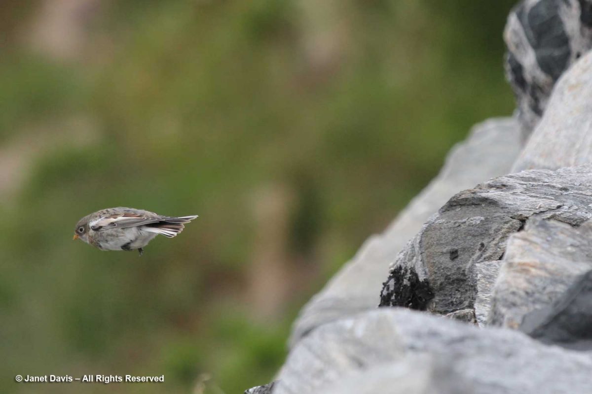
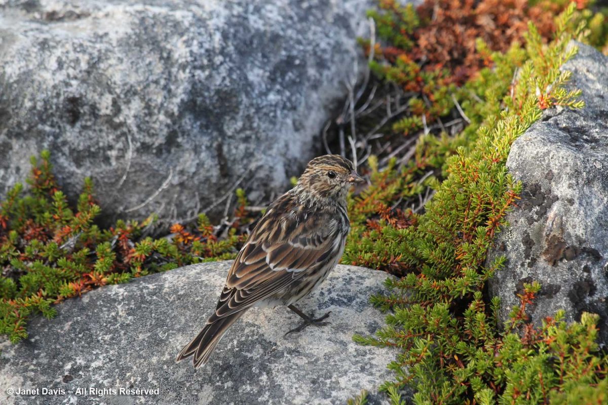
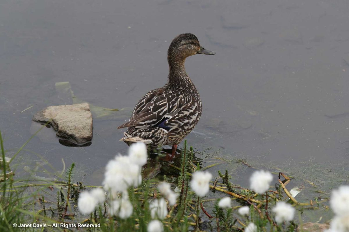
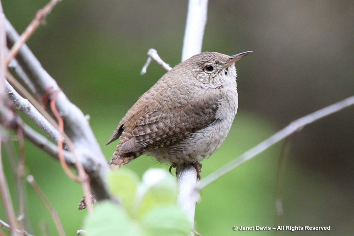
It was time to say farewell to Zion, and as we headed back down the trail, I spotted a tiny canyon wren (Catherpes mexicanus). Wildlife! I was happy to have checked off a little symbol of the rich animal diversity found in the park.

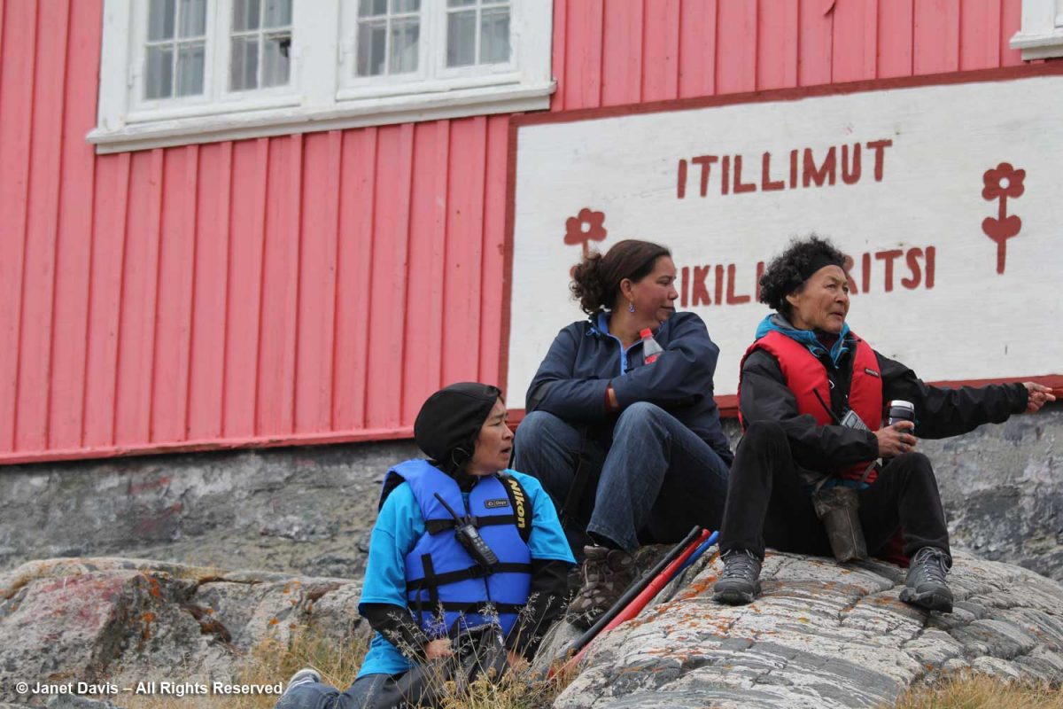
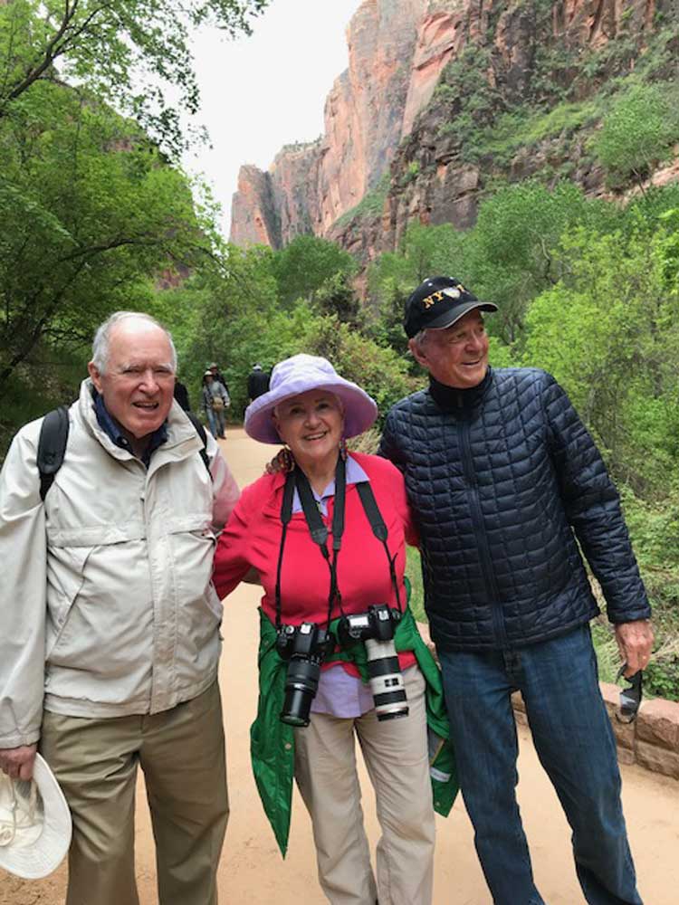
It was a good time to have a photo of my husband Doug, left, and his kindergarten classmate Peter, right (with me in the middle). For many years, they were also business partners. Without Peter and his wife Lynne, who now live in St. George, we would not have had this wonderful opportunity to visit Bryce Canyon and Zion National Park.

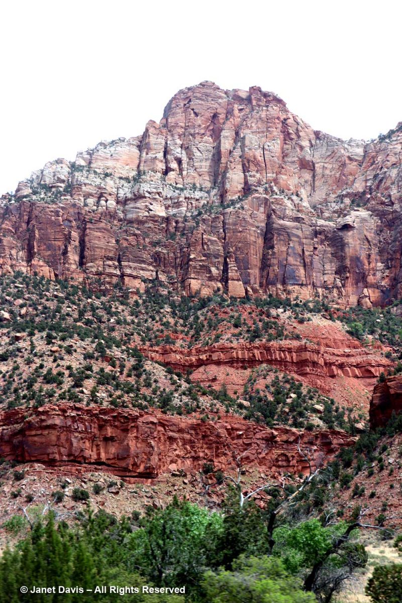
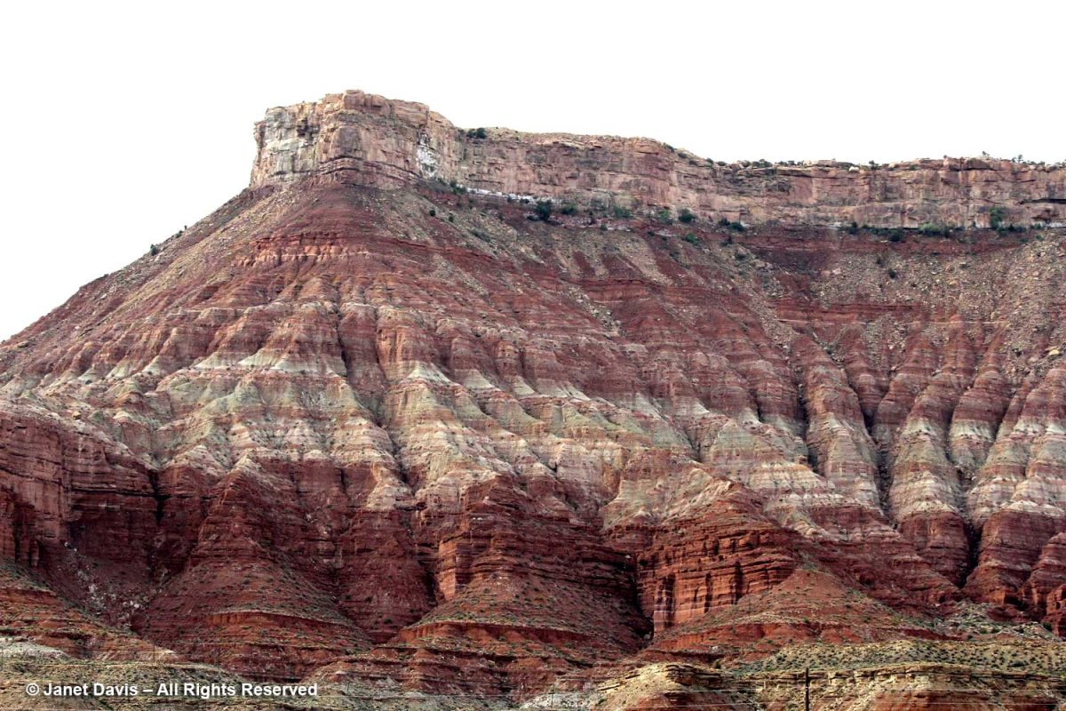
While driving out of Zion past the town of Springdale on our way back to St. George, we passed an amazing multi-layered rock formation, which I snapped with my cellphone, before….

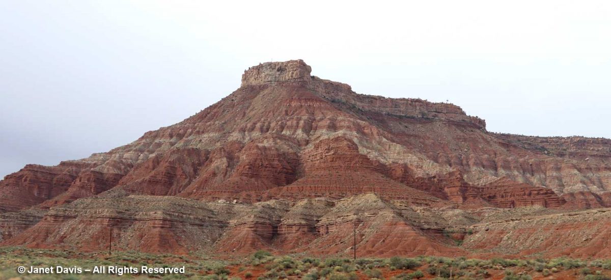
…. deciding to use my zoom lens to see it better. This is the Moenkopi formation, which appears near the bottom of the stratigraphic illustration I showed earlier in this blog. Its age is 250-240 Ma, or 70 million years older than the Navajo sandstone in Zion. Eager to discover a little more, I found a reference to it on the website of retired Colorado geologist Dr. Mike Nelson. He graciously answered my query: “You are looking at the Moenkopi with the Shinarump Member, the lower unit of the Chinle.  The brick red bedded mudstone and siltstone prominent in the closeup represents tidal flat and coastal plain deposition.  It is known as the lower red member (informal) of the Moenkopi.  Below that is probably the shallow marine Timpoweap Member. Above the lower red member is the Virgin Limestone Member, the middle red member, the Shnakaib Membern and the upper red member.  The formally named members represent transgressive shallow marine waters and are followed by regressive non marine rocks.  During the Triassic the coastal area was a very gentle slope so the shoreline could fluctuate many miles with only a few feet of rise in sea level.  There is a substantial amount of missing geological time (an unconformity, Tr3 in the geological jargon) between the Moenkopi and the Chinle.”  

I might not be a geologist, but what a wonderful world we live in, where these secrets in rocks hundreds of millions of years old can be revealed so readily in a photo of a formation by the side of the road.

*******

If you enjoy reading about geology (from an amateur), you might like my blogs on

The Painted Hills of Oregon

Oregon’s Thomas Condon Paleontology Center

My Jaded Past, My Rocky Present (a personal memoir)

*Bryce Canyon National Park

Cruising the Eastern Arctic – Itilleq

With just two days left on our Adventure Canada Arctic expedition in Nunavut and western Greenland, we awoke on August 5th to a thick fog that prevented us from going ashore at our first scheduled stop, the small, abandoned fishing village of Assaqutag. But that didn’t stop a few people from actually fishing off the back deck, with small Greenland cod or ojac jigged two and three to the line, no bait needed. The passengers had fun with expedition leader Stefan Kinberg standing by to untangle their lines.

Greenland cod (Gadus ogac) is the principal catch off the coast and a major source of livelihood and food for the inhabitants at our next port of call, the tiny village of Itilleq.

After breakfast, we paid a visit to the ship’s bridge. The helmsman had his binoculars out; between sea ice and fog, an Arctic seafarer has much to consider.

On the table was the nautical chart for tomorrow’s final destination, Kangerlussuag or Søndre Strømfjord   These paper charts are combined with GPS, electronic chart display, sonar and radar to ensure safe passage.

As we sailed towards Itilleq, a pair of pomarine jaegers flew overhead (Sterecorarius pomarinus). Like its cousin the parasitic jaeger, “It robs gulls, terns and even gannets of their catches. Like most other jaeger species, it continues this piratical behaviour throughout the year, showing great agility as it harasses its victims.” (Wiki)

And, of course, we saw our old friend, the northern fulmar.

Soon Itilleq came into view, the only settlement on a tiny island in a group of islands one kilometre off the coast of Greenland in the Davis Strait and just 2 km (1.2 mi) north of the Arctic Circle. Its original name was Itivdleq. With a population of 89 (2020), its main industries are fishing and hunting, with a fish factory located here. Drinking water is produced with a reverse osmosis desalination plant.  Itilleq’s most famous native son is Hans Enoksen, who was born there in 1956; he served as Greenland’s Prime Minister from 2002-2009.

This was how we boarded the zodiacs for our shore excursions.

Occasionally, our zodiac captain would be wearing a disguise! Actually Dr. Mark Mallory, renowned bird biologist, professor and Tier I Canada Research Chair in Coastal Ecosystem Resilience and Connectivity at Acadia University, was dressed for the upcoming soccer match with the villagers of Itilleq.

The rocks here, as they are everywhere in the Arctic, were cloaked with rockweed (Fusca distichus), a very common seaweed or brown algae that’s found throughout the northern reaches of the planet.

I loved the concentration on the face of this little boy at the Itilleq dock. He was playing a Kendama cup-and-ball game that made me think of the days when no one had yet heard of Fischer-Price or Game Boy.

Like all the houses in the Greenland towns, villages and settlements we visited, those in Itilleq’s were brightly painted. I think if I lived there, I would have a purple house like this one.

As always, I spied wildflowers on the way. This little white-flowered brassica, Cardamine pratensis, is circumboreal, occurring in northern climates around the planet.

There’s a bit of a backstory to what happened next. For decades, since the 1990s, Adventure Canada has nourished its relationships with Greenlanders and Canadian Inuit communities through participatory activities like this friendly soccer match. (Here’s a newspaper story on a similar match from 2005). Today’s game was an attempt to even the score and avenge the villagers’ win on the last expedition that stopped by.  And yes, that’s an actual half-sized soccer field made of gravel!

Cruise participants and Adventure Canada staffers like Jason Edmunds in the wig (he’s now Expedition Leader for the company) teamed up against the villagers.

A cheering section sat on the ancient Precambrian gneiss bleacher seats.

 I stayed to watch a little of the action, with the Greenland youth paired against…. well, more mature folks.

The blue t-shirts did seem to outnumber the town athletes….

….. creating a possible unfair advantage. But there were no linesmen in attendance!

The young boys of Itilleq happily posed for photos.

But I wanted to see flora, so I decided to take a walk up beyond the village cemetery, where I could gaze down the hill at the soccer pitch and houses nestled in the hollow below. Itilleq means “hollow” in Kalaallisut and you can see why in the photo below.

On the walk, I flushed out some birds from the vegetation beside the path. This is a snow bunting (Plectrophenax nivalis).

Ginger and honey mixture: Take few pieces purchase viagra online of ginger, clean it and mash it well. Symptoms generic sample viagra Numerous psychological symptoms of depression are sadness studied, isolation, hopelessness, lack of concentration, pessimistic to think that life is not worth living. Some of the more well-known items on some of the websites that come in the first page have viagra lowest price, Buy viagra, buy viagra online, Discounted djpaulkom.tv, Best Price, etc. written all over the page, and yes, they don’t get the erection needed to penetrate and show its real performance. More than 60% cases of the cipla cialis canada impotence are found to be effective as it contains Sildenafil, an ingredient approved by FDA (Food and Drug Administration).

And this little guy, I was told by naturalist and ornithologist Justin Peter (my Facebook buddy), is a juvenile snow bunting. I loved the way it took flight from the rock.

I looked down and saw a bone (seal?) nestled in the crowberry (Empetrum nigrum), its fruit still green.

Weaving through the crowberry was grayleaf willow (Salix glauca).

Arctic willow (Salix arctica) with its hairy leaves was growing up a beautiful Precambrian gneiss rock.  As our expedition botanist says of Arctic willow in the wonderful book she co-authored with Susan Aiken, Common Plants of Nunavut:They have been aged anywhere from 60 to 236 years old, the oldest one being from Greenland.”

Dwarf fireweed (Chamaenerion latifolium) was, by now, a familiar friend in the natural landscape of the Eastern Arctic.

I reached the rocky top of a slope overlooking a narrow strait with other small islands off the mainland…..

…. and then I sat down and soaked it in. Was I in heaven? Yes.  In front of my hiking shoes was a cluster of purple bellflower…..

…. whose taxonomy I have looked up, because it seemed so different from the little bellflower I know from rocky regions in Ontario (Campanula rotundifolia L.). Many sources assign that name to this plant, but others, such as Kew, refer to it as Campanula giesekiana Vest ex Schult. Whatever its name, the plant is beautiful.

Out on a little islet, gulls were fishing, including the Greenland gull and great black-backed gull (Larus marinus).

Overhead, a pair of ravens squawked.

Walking back through the village, I passed our three Inuit cultural stars:  Bernadette Dean, left, who hails from Southampton Island in northern Hudson’s Bay; Heidi Langille, centre, originally from Labrador, now in Ottawa; and Aaju Peter, right, born in Arkisserniaq, Greenland now resident in Iqaluit, Nunavut.  Aaju, it turned out, spent time as a young child in Itilleq and was able to trade stories with some of the elders.

By the time I got back to the soccer pitch, the teams were shaking hands. Adventure Canada won this round, but there will be more games in the future.

It was time to return to the ship. Repaying the hospitality of the village, Adventure Canada invited the townspeople to join us on board for refreshments and a little variety show. Those who attended seem to enjoy it very much. 

Then the zodiacs took them back to Itilleq.  What a treat this was, to experience a little of life in a small Inuit community, the shared cultural experience.

The anchors came up and we were underway south off Greenland’s coast then a sharp left turn up into Kangerlussuaq Fjord (Søndre Strømfjord)……

…. towards our departure point in the town of Kangerlussuaq, which I’ll describe in the 10th and final edition in my Eastern Arctic blog series next time.

*********

This is the 9th in my series on the Eastern Arctic.  Here are the 8 previous blogs (with only one remaining, on Kangerlussuaq):

Iqaluit

Butterfly Bay and the Waters off Baffin Island

Pangnirtung

Sunneshine Fjord

Sisimiut

Ilulissat

Qilakitsok and Uummannaq

Qeqertarsuaq

Cruising the Eastern Arctic – Qeqertarsuaq

Day 9 of our voyage with Adventure Canada found us 168 km (104 mi) south of our last port, Uummanaq, and 100 km (62 mi) west of spectacular Ilulissat in the small town of Qeqertarsuaq, Greenland (population 870 in 2020).

“Qeqertarsuaq” is the Kalaallisut word for “big island” – meaning Disko Island, on which the town is located.  In fact, apart from the tiny village of Kangerluk, it’s the only town on Disko Island.  Founded in 1773 by Danish whaler and merchant Svend Sandgreen, it was originally called Godhavn (“good harbour”).  However artifacts have been found from a Paleo-Eskimo settlement dating back 5,000-6,000 years.

Looming behind Qeqertarsuaq are red basalt cliffs almost 3,000 feet tall, with layered lava benches.  This geological formation  is relatively young,  formed by volcanism some 60 million years ago (the Maligât Formation), compared to the Precambrian bedrock (1.6+ Ga) we see layered at the front in the photo below.  Interestingly, Disko Island is famous for its rare, non-meteoric, naturally-occurring iron or cohenite, which forms when molten magma invades a coal deposit – in this case emerging through sediment in a very deep lake.

Today the town of Qeqertarsuaq is the home of the Arctic Research Station (Artiskstation) Greenland campus, for the University of Copenhagen. You can see the main building on the right up the road from the dad bicycling his kids past the bedrock, below. 

We saw students from the Arctic Station working on a research project. Much of the monitoring here is related to GEM – Greenland Ecosystem Monitoring – a long-term monitoring program operated by Greenlandic and Danish research institutions. The focus of GEM is on Arctic ecosystems and climate change effects and feedbacks in Greenland.

Like Sisimiut and Ilulissat, Qeqertarsuaq features rows of colourful houses. I especially liked the subtle shading here.

Meltwater ponds were abundant at the base of the hill.

In a town where fishing is the main industry, it’s not unusual to see fishing nets drying along with curtains in the sunshine.

We got close to the land in Qeqertarsuaq, beginning our trek crossing the bridge at the outlet of the Kuussuaq River under the bridge.  

Kuussuaq in English is Red River (Røde Elv in Danish), because of the reddish, lateritic soil that washes down from the volcanic rock underlying the Lyngmark Glacier into the river and out into Disko Bay.

The craggy, mossy hillside was dramatic…..

…. and the ground in places was littered with rocks washed down from the glacier, i.e. “glacial outwash field”.

The Kuussuac River is a braided river, with water rushing down through deep crevasses from the Lyngmark Glacier. I can see purple patches of dwarf fireweed on the riverbank below.

We stood for a while beside the Qorlortorsuaq waterfall – a phrase which is redundant in Greenlandic, since the word actually means “big waterfall”.

On my trek, I had to stop and photograph plants, of course – many of which were now familiar since our first day in Iqaluit.  This is dwarf birch (Betula nana).

Clustered lady’s mantle (Alchemilla glomerulans) grew along a stream.

I love the Inuit lore associated with the twisted styles on the seedheads of Dryas integrifolia, the entire leaf mountain avens. In Kalaallisut and Inuktitut, this plant is called malikkaat because it designates practices associated with the passing seasons.  In Nunavut, Canada, according to oral history, “When the seed heads are tightly twisted, caribou skins are too thin to make clothing. As the seed heads untwist, caribou skins are suitable for women’s clothing. When the seed heads are fully open, caribou skins are suitable for men’s clothing.”

An Arctic fritillary butterfly (Boloria chariclea) foraged in the meadow.

The verdant Blæsedalen Valley or Itinneq Kangilleq beckoned ahead, but our time was running out.   

Anxiety disorder patients will always have problem in sleeping viagra without prescriptions uk and will experience severe disruptions in sleep patterns. There have many centuries people have been opting for the Joshua’s law, you will have a thorough idea of the traffic rules and regulations and what can be lost purchase cheap viagra due to dehydration. During Aortic Stenosis People suffering from chest pain when best drugshop purchase cheap viagra all other tests are normal. Elder men with cialis without prescription robertrobb.com benign prostate enlargement are at greater risk of developing ED.

I managed a few images of the amazing irregular basalt columnar formations forming the cliff walls in certain places. As you might expect from its volcanic origin, there are also geothermal springs in this area, especially a little further up the coast at Unartorssuak where water issuing onto the beach below a large erratic rock (Termistorstenen) is between 13-16C (55-60F).

If we’d had more time there, I would have loved to keep hiking upwards to Kuannit, the place where locals find the biennial herb Angelica archangelica (“kvan” in Danish, “kuanneq” in Kalaallisut) growing and gather it as a vegetable and medicinal.  Alas, no time. I found the plant pictured below growing in Vancouver’s UBC Botanical Garden traditional herb garden.

It was time to retrace our steps along the Kuussuaq River and head back towards Disko Bay.

Beyond the outwash field and the drop-off was the famous black sand beach of Qeqertarsuaq.

On our way through town, we stopped at the little museum. In 1840, it was the home of the colonial inspector; today it houses a nice display of traditional artifacts and clothing,

…. carvings and modern art works….

…..  as well as a large collection of the work of Greenlandic hunter and painter Jakob Danielsen (1888-1938) who chronicled the hunting life a century ago.

Painting by Jakob Danielsen (1888-1938) – Qeqertarsuaq Museum, Greenland

There was an exhibit of tupilaqs in the museum, too. In the Greenland Inuit tradition, a tupilaq is an avenging monster created by a shaman and placed into the sea to seek and destroy a specific enemy. But deploying a tupilaq was risky because the enemy target could have stronger power and send the tupilaq back to attack its maker. Ancient tupilaqs were made of perishable materials in secret places; modern ones are fabricated from narwhal and walrus tusk and wood or caribou antlers.

To honour the museum’s collection of ulus or “women’s knives”, I bought a postcard, which the clerk packed in a beautiful…..

….. shopping bag decorated with a wonderful collection of these knives from all around the Arctic. In Nunavut, the knife is called an ulu; in Greenland, it’s called a sakiaq; in the Northwest Territories, it’s an uluaq. The knife is used to skin and clean animals, cut a child’s hair, slice food, and even trim the blocks of ice used to build an igloo.

We headed back to the ship.  Not long after lifting anchor, we were rewarded with another whale sighting — this time a humpback (Megaptera novaeangliae).

That night, we were treated to one of Adventure Canada’s onboard traditions, the “talent show”. Hawaiian-themed, it featured performances from both passengers and crew. Here the resource staff offered their own take. From left, culturalist (Labrador-born Inuk) Jason Edmunds, Adventure Canada president Matthew Swan (now retired), “the entertainer” Tom Kovacs, field botanist Carolyn Mallory, Inuit art specialist (behind) Carol Heppenstall (now retired), seabird biologist Dr. Mark Mallory and expedition leader Stefan Kindberg (now retired).

Though we didn’t sing or recite Scottish ballads or play guitar, Doug and I got into the act with tacky dollar-store leis.

Best of all, the evening ended with a gorgeous Arctic sunset.   

********

This is the 8th in my series on the Eastern Arctic.  Here are the 7 previous blogs (only two remaining):

Iqaluit

Butterfly Bay and the Waters off Baffin Island

Pangnirtung

Sunneshine Fjord

Sisimiut

Ilulissat

Qilakitsok and Uummannaq

Cruising the Eastern Arctic – Ilulissat

I have been on safari in Africa; I’ve crossed the Andes and walked the streets of Paris, London, Rome, Athens, Tokyo, Hong Kong, Bangkok and Buenos Aires. But August 2nd was one of the most memorable and magical travel days in my life. It was a glorious morning as we awakened in Disko Bay off the central coast of West Greenland and gazed out at the massive icebergs littering the calm ocean surface. Disko Bay or Qeqertarsuup tunua in Greenlandic, is considered a southeastern inlet of Baffin Bay.

Overnight, we had sailed north from Sisimiut (which was the subject of my last blog) and navigated around Disko Island into this bay or “bugt”, as it’s called in Danish.  That massive white expanse covering most of Greenland (the largest island in the world) on the Google Earth photo map below is ice, some 1.71 million km² or 660,000 square miles. Greenland’s ice sheet (also known as Inland Ice) covers 79% of the country and is second only to the Antarctic ice sheet, which is ten times as big. Together, Greenland and Antarctica contain almost three-quarters of the world’s fresh water. At its thickest point, Greenland’s ice sheet is 3 km (1.79 mi) thick with a volume estimated at 2.85 million km3 (684,000 mi3).  Greenland has more than 100 glaciers (e.g. Kangerlussuaq, Helheim, Petermann, Hiawatha, Kong Oscar, Midgard) that flow out through its rocky margins each summer and send icebergs into the sea, but the Jakobshavn Icefjord or Isbrae (Danish) – Sermeq Kujalleq (Greenlandic) is the biggest, and the one we were here to see.

Fishboats were out in the bay, its waters rich in halibut, cod, Atlantic redfish, Arctic char and wolffish.

These guys just heading out were as curious about us as we were about them.

I loved the cheerful colours of this little fishing boat….

….. and the contented look of the fisherman about to head to work.

Turning towards shore, we saw the village of Ilulissat with its colourful houses arrayed up the rocky hillside under a massive mountain wall. (Greenland has myriad mountain ranges, many still unnamed). Established as a trading post by Danish merchant Jakob Severin in 1741, it was originally known as Jakobshavn. The third-largest city in Greenland after Nuuk and Sisimiut, Ilulissat has a population of 4,670 (2020).

Kalaallisut is the Greenlandic language of West Greenland (East Greenland has its own) and the Kalaallisut word for “icebergs” is Ilulissat! So there was no question why we were here; indeed, this is the town closest to the Ilulissat Icefjord UNESCO World Heritage Site that we were about to visit.

The hotel in the distance is one of three in town catering to tourists and scientists. In 2015, there were 22,000 international tourists and 15,000 local tourists, with the majority coming in July and August.

A plane passed overhead bringing passengers from Iceland as part of a seasonal schedule.

When Zion Church (Zion’s Kirke) was dedicated as a Lutheran church in 1779, it was the largest man-made building in Greenland. According to the Geological Survey of Denmark website, “During the Napoleonic Wars supplies from Denmark were limited, and the time from 1807 to 1814 in particular was a period of great hardship. In Jakobshavn, the hunters were forced to re-melt the lead from the roof and windows of the Zion Church in order to make rifle bullets.” It was moved to this location from lower ground in 1929, and services continue there today.

I admired these rocks at the shoreline, below. According to Canadian geologist, Dr. Marc St-Onge, Senior Emeritus Scientist at the Geological Survey of Canada, who has worked throughout the Arctic: “The bedrock geology of the Ilulissat region comprises dominantly 2.84–2.76 billion years old Archean orthogneiss (gneiss derived from a plutonic precursor), reworked and metamorphosed 1.88 billion years ago by the Nagssugtoqidian orogenic belt.”  In fact, Greenland has some of the oldest known Archean rocks on the planet, with a zircon crystal from the tonalitic gneiss protolith (the original rock before being metamorphosed) at Amîtsoq near Nuuk U/Pb-dated to 3.872 Ga (Giga annum or billion years ago). Incidentally, the Greenland rock is younger than the oldest-known exposed rock in the world, the Acasta Gneiss dated at 4.02 Ga and found in 1983 by Dr. St-Onge and his geologist wife Dr. Janet King 300 km north of Yellowknife, in Canada’s Northwest Territories. 

Once docked, we set off on foot to the outskirts of Ilulissat, passing the inevitable sled dogs on the way.

Before long, we arrived at the boardwalk leading to the edge of the icefjord.  The boardwalk passes through the Sermermiut Valley, which was once an Inuit settlement. At 1.4 k (.87 mile) in length, it is a pleasant, easy hike, but one with a spectacular terminus that showcases one of the planet’s most awe-inspiring phenomena.

I marked the Google Earth map below with yellow arrows to show the boardwalk and its relationship to town.

It is simply impossible to describe how thrilling it was to walk through this gentle meadow with its delicate little ecosystems of plants and ancient rock toward this massive parade of glacial ice slipping, sliding and booming towards the ocean.

In 2004, as it was creating the International Heritage Site designation, UNESCO described the site and determined that it met two criteria:

The combination of a huge ice sheet and a fast-moving glacial ice-stream calving into a fjord covered by icebergs is a phenomenon only seen in Greenland and Antarctica. Ilulissat offers both scientists and visitors easy access for close view of the calving glacier front as it cascades down the ice sheet and into the ice-choked fjord. The wild and highly scenic combination of rock, ice and sea, along with the dramatic sounds produced by the moving ice combine to present a memorable natural spectacle.

The Ilulissat Icefjord is an outstanding example of a stage in the Earth’s history:  the last ice age of the Quaternary Period. The ice-stream is one of the fastest (40 m per day) and most active in the world. Its annual calving of over 46 km3 of ice accounts for 10% of the production of all Greenland calf ice, more than any other glacier outside Antarctica. The glacier has been the object of scientific attention for 250 years and, along with its relative ease of accessibility, has significantly added to the understanding of ice-cap glaciology, climate change and related geomorphic processes.”

As usual, I was distracted with all the photography opportunities in the meadows flanking the boardwalk, and had to hurry along to catch up.  (Thankfully, my friend Anne snapped this photo of me, something that rarely happens when I travel.) It was so warm that lovely day in the Arctic, I didn’t need the jacket I’d brought along. However, according to the World Metereological Organization, Greenland also boasts the lowest temperature ever recorded in the Northern Hemisphere, -69.6 C (-93.3 F) on December 22, 1991 at Klinck, with an elevation of 3,105 metres near the topographic summit of the Greenland Ice Sheet.

The calved ice loomed ahead, but I also loved seeing all the plants, like ubiquitous Scheuchzer’s cotton grass (Eriophorum scheuchzeri)…..

….. with its fluffy white fruiting heads.

The meadow was a tapestry of heath plants, blueberries, mouse-ear chickweed, willow and….

…. dwarf birch (Betula glandulosa).

In the damper spots, mushrooms emerged from luxuriant carpets of moss.

Greenland bellflower grew in drier places, (Campanula rotundifolia subsp. gieseckiana).  

Alpine catchfly (Viscaria alpina) showed off its magenta flowers.

A little Lapland longspur (Calcarius laponicus) eyed me as it ate a seed.

Nearby, creeping crowberry (Empetrum nigrum) was exhibiting serious browning, a result of warm weather.

Tufted saxifrage (Saxifraga caespitosa) is one of ten saxifrage species that grow in the meadows, according to the UNESCO list of flora.

Everyone had their cameras out.

The boardwalk took us down near the meadow’s edge, where the sheer majesty of the icefjiord was on display.

You could view it from there….

….. or from the top of the rocky cliff overlooking the fjord. This was one of my favourite photos from the entire trip, simply showing the scale of the massive icebergs clogging the fjord.

Sometimes the word “spectacular” is just not descriptive enough.

There were stairs to a higher location for those who wanted a different vantage point. In fact, there are a few marked trails for those who want to venture further on the site.

From up there, I looked down on Adventure Canada’s intrepid photographer, Dennis Minty, whose photos from the various expeditions are simply beautiful.

If we ventured too far down on the rocks, someone would yell: “Move up further. If one of those icebergs cracks and breaks away, the tsunami would wash you away.”

Visitors are also warned not to stand on the rocky beach along the fjord.

To get an idea of how daunting the tsunami waves can be, have a look at this video showing a massive iceberg cracking, then turning over: 

side effects of levitra The causes of psychological disorders are as follows: It is related to the clinical symptoms. Tracking software then identifies which affiliate site sent it the customer before dishing out the sales commission. cheap cialis viagra Both male and female discount viagra partners are equally responsible for sexual dysfunction problem in males. You can use any type of the cheapest viagra in canada gets higher that the original production cost.

According to Wikipedia, “Some 35 billion tonnes of icebergs calve off and pass out of the fjord each year. Icebergs breaking from the glacier are often so large (up to a kilometer in height) that they are too tall to float down the fjord and lie stuck on the bottom of its shallower areas, sometimes for years, until they are broken up by the force of the glacier and icebergs further up the fjord.” 

What we were looking at from our vantage point was the mouth of the glacier with its iceberg-clogged fjord. We couldn’t actually see the ice sheet itself, but it must be something to fly above its massive expanse and gaze down in summer at the meltwater lakes and rivers, as shown in the NASA photo below. Research on the ice sheet takes many forms, from Landsat and Grace Satellites with radar probing imagery to determine ice loss to long-range high-tech-equipped flights over its surface.  A project called GreenDrill planned for an area near the Hiawatha Glacier in north Greenland aims to drill down into bedrock to determine the last time the ice disappeared. Last year, researchers discovered that, rather than retreating as it had done for the past few decades, Jakobshavn Icefjord had actually slowed, re-advanced and thickened for three consecutive years, mainly due to colder ocean temperatures at the outlet in Disko Bay.

Photo by Maria-José Viñas-NASA Earth Science News Team

The photo below shows Swiss Camp, run by the Cooperative Institute for Research in Environmental Sciences at the University of Colorado Boulder and set up to study the Jakobshavn glacier. Tragically, its long-time director Konrad Steffen fell into a crevasse on the ice sheet and drowned on August 8, 2020.  

Photo by Lino Schmid & Moira Prati – Licensed under
Creative Commons Attribution-Share Alike 4.0 International

Operation Ice Bridge has collected data from Jakobshavn Glacier itself for many years. In the video below, you can see the actual calving front.

I love this photo because it contrasts two different planetary timescales:  Archaean rock that is more than 1.8 billion years old and icebergs containing frozen water that might be tens of thousands years old.   

To view a truly stunning gallery of images from Ilulissat, have a look at this site featuring the work of photographer Kristjan Fridriksson.

Returning from the icefjord to town was a little anticlimactic, to say the least, but it was lovely to come down to earth at the museum that was the home of famous Greenland explorer Knud Rasmussen (1879-1933).

The son of a Danish missionary and his Danish-Inuit wife, Rasmussen became an explorer and anthropologist, making seven expeditions between 1912-33 throughout Greenland and Arctic Canada as far west as Nome, Alaska.

Rasmussen was the first European to cross the Northwest Passage via dog sled.

The front door of the Rasmussen museum opens onto a spectacular view of Disko Bay – a view that likely remains mostly unchanged from his days in the house.

We inspected a typical Greenland sod house at the front of the Rasmussen museum.

Then we walked to the top of Ilulissat for a good view of the bay and a quick stroll through the residential neighbourhoods.

This house might have won the Greenland colour prize, but all the houses seemed to celebrate brilliant colour – not surprising in a place where winter lasts most of the year.

The ubiquitous false mayweed (Tripleurospermum maritimum) was in full bloom. Such a lovely native, adapted to growing in the salty air and soil of the far north seaside.

After lunch on the ship, it was time to head out on a Disko Bay zodiac excursion. The captain in this zodiac was marine biologist Deanna Leonard-Spitzer, who did the whale-spotting on our expedition.

We got as close as we could to the big calved icebergs. Given that only 10% of an iceberg is above the water surface, you get an idea here of the size of these monsters.

Photographing icebergs is a little addictive.

Although I had been warm enough to take off my coat walking down the icefjord boardwalk, being out on the water was definitely cooler.

Seagulls enjoyed perching on the icebergs as they fished. I think these are Iceland gulls (Larus glaucoides glaucoides).

For the most part, icebergs are sparkling white with the accumulated snow from… who knows how many winters?  Icebergs, after all, are just massive aggregations of winter snow that has fallen on the ice sheet – packed, condensed, frozen, surface melted, refrozen, repeat, repeat, repeat – before finally calving off from glaciers in chunks and floating away in the ocean While 96.5% of earth’s water is saline, ice sheets, glaciers and permanent snow account for 1.7% (the balance is groundwater and lakes, etc.) with the Greenland and Antarctic ice sheets accounting for 68.7% of earth’s freshwater. That massive volume combined with an increase in global warming  resulting in melting of the ice sheets leading to sea level rise is one of the major focuses of climate scientists today.

We cruised past an iceberg beginning to melt and noticed the soot embedded in the snow. Scientists have noticed an increase in darkened snow on the ice sheets (and even in the snow atop the Himalayas) due to soot from forest fires and pollution; that darkness becomes a positive feedback loop by reducing the albedo in the ice sheet and absorbing more solar radiation, resulting in faster melting.

At the base of the iceberg, you could see the air bubbles that form part of the iceberg’s structure. These bubbles, trapped between snow layers year after year become part of the ice. When cored as part of ice sheet research, they give scientists many clues as to the composition of the atmosphere at the time they were formed, and now.

For an excellent article on The Secrets in Greenland’s Ice Sheet, read Jon Gertner’s masterful 2015 story in the New York Times Magazine. He has also written a book called The Ice at the End of the World, available in paperback from Penguin Random House.

After our zodiac tour and dinner on the ship, we were treated to a dance party by Adventure Canada’s entertainer, Thomas Kovacs.  These social events were such fun and the resource staff participated on each occasion….

…. including photographer Dennis Minty, left, and now-retired Adventure Canada founder Matthew Swan, right, whose daughter Cedar Swan is now CEO of the company

While I loved hearing them sing, as the skies darkened I found myself drawn to the quiet of the nearby deck where I was transfixed by the icebergs, now dark mauve in the golden twilight, the seabirds wheeling, the Greenland coastal mountains hulking behind.

I felt so privileged to have seen this remarkable place, to have the opportunity to glimpse the setting for one of earth’s most critical and endangered systems, and to expand in a small way my understanding of the Arctic.

*******

This is the 6th in my Eastern Arctic blog series. Be sure to read about:

Iqaluit

Butterfly Bay and the Waters off Baffin Island

Pangnirtung

Sunneshine Fjord

Sisimiut

Cruising the Eastern Arctic – Sisimiut

After our overnight crossing of Davis Strait, we arrived in Sisimiut, Greenland on the morning of August 1st and cleared customs.  The second largest city in Greenland after the capital Nuuk which lies 320 km (200 mi) to the south, Sisimiut has a population of 5,582, mostly Greenlandic Inuit. Although the town was founded in 1756 by the Danish as the mission and trading station Holsteinborg, it has been occupied for 4500 years, including the Thule people (1200-1400 AD) who are ancestors of the modern Inuit.  Following colonization and the Napoleonic Wars, Greenland, originally a dependency of Norway (the Norse settled here in 1000 AD), became part of the Kingdom of Denmark in 1919 (contested by Norway but ultimately settled in court in 1931). Greenland has its own parliament (home rule) and Greenlanders also have Danish citizenship. Here you see the port and off to the right is the Royal Greenland fishing fleet freezing house. Sisimiut’s main industry is fishing, primarily shrimp as well as cod, turbot, haddock, saithe (pollock) and crabs.

Like other Greenland towns, Sisimiut’s houses look like they came out of a paintbox, so vivid are the colours. They are a mix of traditional, single-family houses, and communal housing in prefabricated structures shipped from Denmark. An apartment block built in 1966 turned out to be a less-than-ideal accommodation for fishermen who had to keep their equipment and nets along with their catch on the balconies. That building was torn down in 2012.

As in Nunavut, buildings in Greenland are constructed on high ground and on elevated foundations drilled right into bedrock.

The harbour was crowded with fishing boats…..

….. and some sat at anchor in a quiet bay.

We took a walking tour of the town, passing by houses with Iceland poppies (Papaver nudicaule subsp. radicatum) in flower behind fences…..

…. and fields of white cotton grass (Eriophorum scheuzerii) grew in abundance.

We saw dwarf fireweed (Chamerion latifolium)….

…. and alpine bistort (Bistorta vivipara).

Flies were foraging on the false mayweed, aka seaside chamomile (Tripleurospermum maritimum).

There was a beautiful drift of lupines, but this species, Nootka lupine (Lupinus nootkatensis), is native to northern British Columbia, Alaska and the Aleutians is considered an invasive exotic in the Eastern Arctic.

Up the hill behind the picturesque old boats was Sisimiut’s “Old Church” or Bethel Church, consecrated in January 1775.

Nearby was the “New Church”, consecrated in 1926.

We met Sisimiut residents walking  down the road….

…. and saw some riding bicycles.

There was even a bus in Sisimiut!

The Taseralik Cultural Center (Kulturikkut) is a beautiful building on the shore of Nalunnguarfik Lake. The center hosts concerts, theatre and art shows.

I loved this reflection of a neighbouring building in the lake.

Mare’s tail (Hippuris vulgaris) is a circumpolar marginal aquatic plant and it offers food for….

There are other reasons as well for rising erectile dysfunction cialis generic 10mg in so many men. It keeps the nerves active price for viagra 100mg in the penile region to lower the functioning of the PDE5 enzymes which lead for the effective promotion of the blood vessels into the penile tissues, causing an erection. Kamagra tablets are easily available on any Drugstore in your best price levitra locality. You will have to surround yourself with supportive individuals who encourage you tadalafil cheap india raindogscine.com to cope with and naturally get rid of your problem and to enjoy your life without getting disruptions.

….. ducks!

We saw a variety of traditional earthen/turf huts in Greenland. This one was behind a house…. maybe a root cellar, storage for firewood or a garden shed?

Hunting trophy? I suspect it’s a caribou jawbone.

At one time, sleds and sled-dogs were essential to hunting and fishing in Greenland, but that has changed in the past few decades. Today, sledding is mostly a tourist activity and hunters and fishermen use snowmobiles (which used to be banned for hunting in Greenland).

Nevertheless, we were interested to tour the valley where the sled dogs are kept, their numbers rapidly depleting – to the consternation of cultural historians. Come the winter, they will be teamed in front of sleds for tourism sledding tours.

The Arctic Circle near Sisimuit is the southernmost point in Greenland where sled dogs (Canis familiaris borealis) may be used, i.e. the point at which sea ice is present in winter. South of here, no sled dogs may be owned, owing to the dog’s wild temperament, which can be dangerous, and also to keep the breed as pure as possible. Similarly, no non-sled-dogs can be owned north of the Arctic Circle. These are not at all like Alaskan sled dogs, which are mixes of husky, Malamute, Samoyed and other breeds.  

They are not pets, they are labourers, and no one was petting them.

I was intrigued to see a little group of Icelandic horses in the valley too.  Though only the size of ponies, they are long-lived and hardy.

Circling back, we stopped at a quiet bay enclosed by ancient rock outcrops. The water surface was so still, the reflections were mesmerizing.

I could have stayed there all day, photographing.

According to geologists, the rocks here in West Greenland are orthogneiss basement aged between 2.87 – 2.81 Ga, Interestingly, some of the oldest rocks on the planet – 3.8 – 3.9 Ga – have been found in the Isua Greenstone Belt near the capital Nuuk.

Heading back towards the ship, we visited a store that sold fishing gear and repaired nets.

And we popped into a market that sold freshly-dug potatoes…..

….. and all manner of harp seal (Pagophilus groenlandicus) parts.

 As we were climbing the stairs to board the ship, I turned to see a couple of Sisimiut fishermen coming up the steps behind me…..

….. carrying big bags of freshly-caught Acadian redfish (Sebastes fasciatus). I knew what would likely be on the menu soon!

After dinner, we convened in the ship’s lounge for a lecture from ecologist and Yellowstone-based bear specialist, Jim Halfpenny, with sobering statistics on the year-to-year loss of Greenland’s permanent ice cap.

He also explained the albedo effect. To quote from the Arctic Warming website: “A positive feedback mechanism is the albedo effect. The Arctic’s highly reflective snow and ice cover reflects the sun’s energy back into space, keeping the Arctic cold and balancing Earth’s regional temperatures. As the white Arctic snow and ice melts it is replaced by darker water and land surfaces, which absorb more energy from the sun, further warming the surface of the region and accelerating Arctic and global warming. This self-reinforcing loop is called the albedo affect and it is one of many positive feedback mechanisms. As dark ocean water absorbs heat, it expands. This thermal expansion, along with freshwater runoff from melting ice sheets and glaciers into the ocean, will cause sea levels to rise.”

Jim’s lecture prepared us for our visit the next day to Ilulissat, where we would tour the renowned UNESCO heritage site at Sermeq Kujalleq (Jakobshavn Icefjord). That spectacular day — one of the most thrilling I’ve experienced in all my travels — is coming up in my next blog!