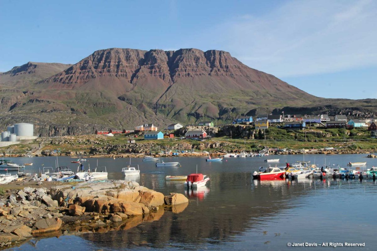
Day 9 of our voyage with Adventure Canada found us 168 km (104 mi) south of our last port, Uummanaq, and 100 km (62 mi) west of spectacular Ilulissat in the small town of Qeqertarsuaq, Greenland (population 870 in 2020).
“Qeqertarsuaq” is the Kalaallisut word for “big island” – meaning Disko Island, on which the town is located. In fact, apart from the tiny village of Kangerluk, it’s the only town on Disko Island. Founded in 1773 by Danish whaler and merchant Svend Sandgreen, it was originally called Godhavn (“good harbour”). However artifacts have been found from a Paleo-Eskimo settlement dating back 5,000-6,000 years.
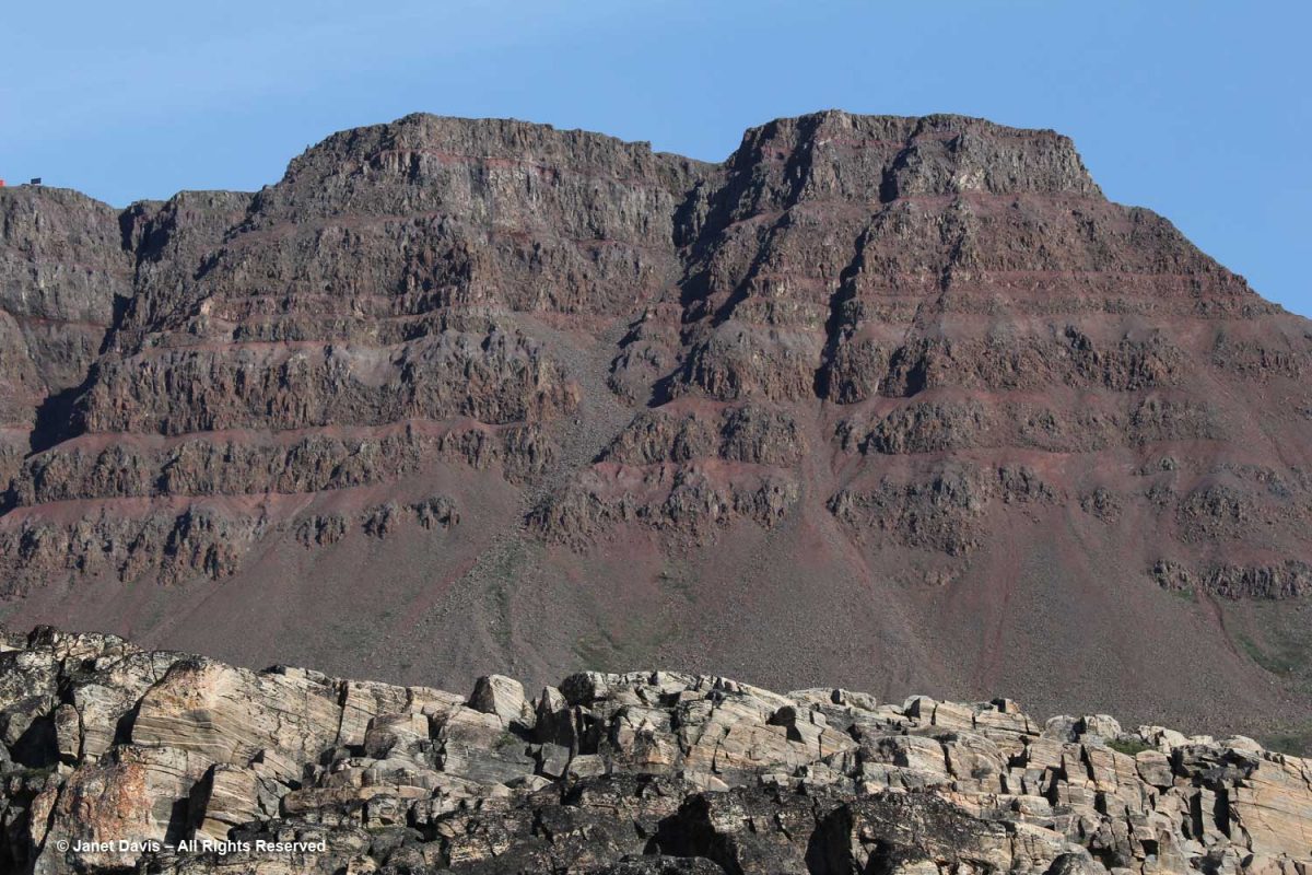
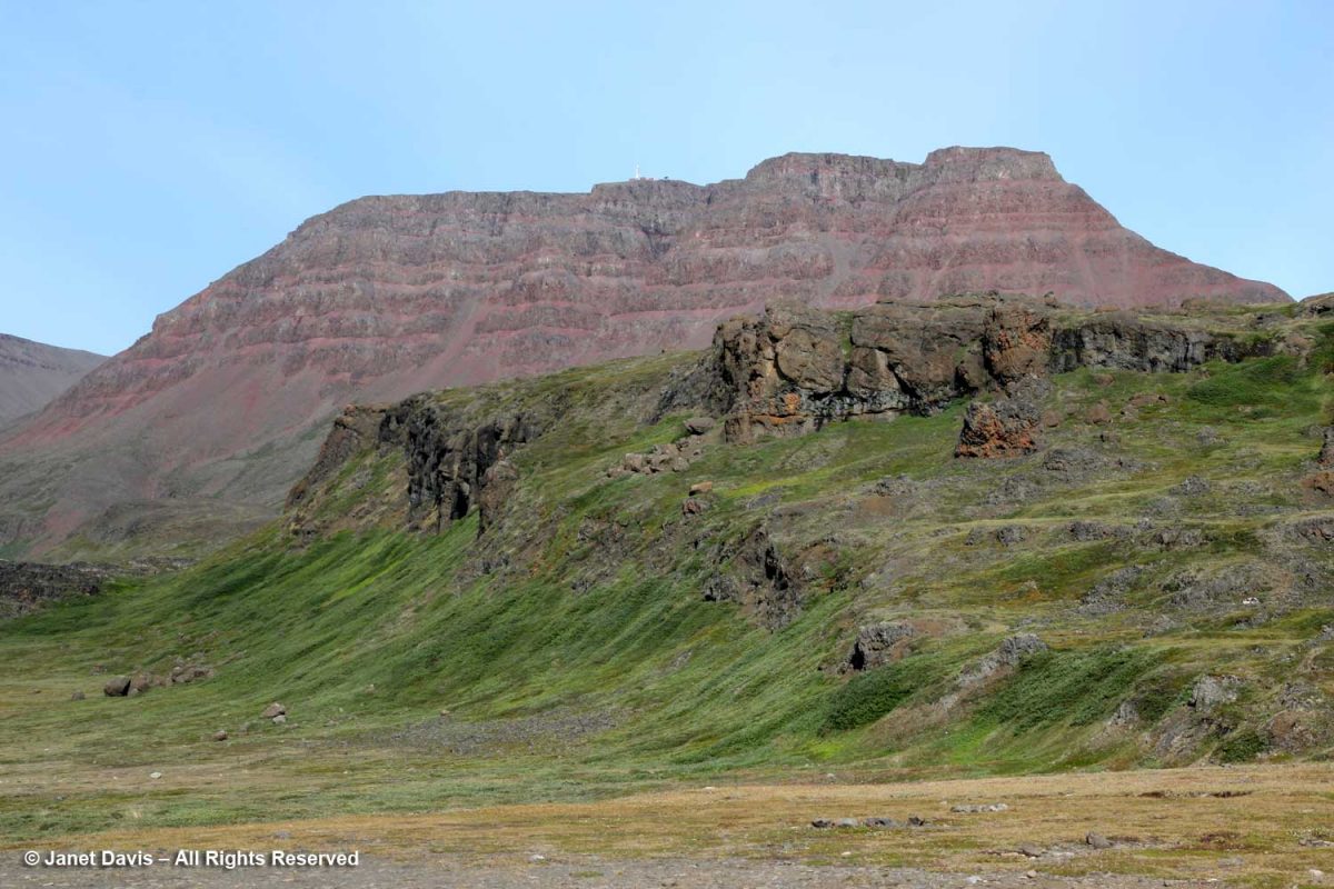
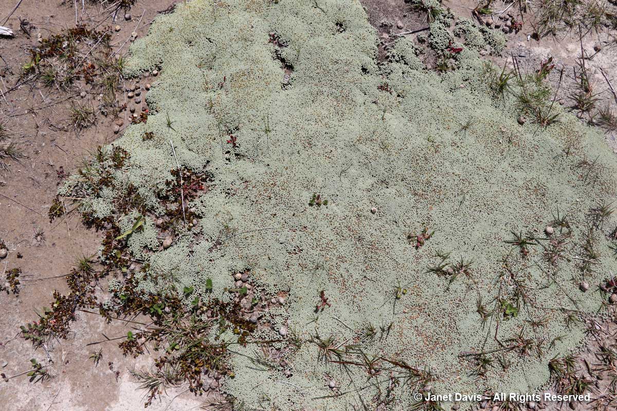
Looming behind Qeqertarsuaq are red basalt cliffs almost 3,000 feet tall, with layered lava benches. This geological formation is relatively young, formed by volcanism some 60 million years ago (the Maligât Formation), compared to the Precambrian bedrock (1.6+ Ga) we see layered at the front in the photo below. Interestingly, Disko Island is famous for its rare, non-meteoric, naturally-occurring iron or cohenite, which forms when molten magma invades a coal deposit – in this case emerging through sediment in a very deep lake.
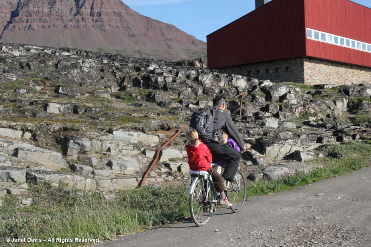
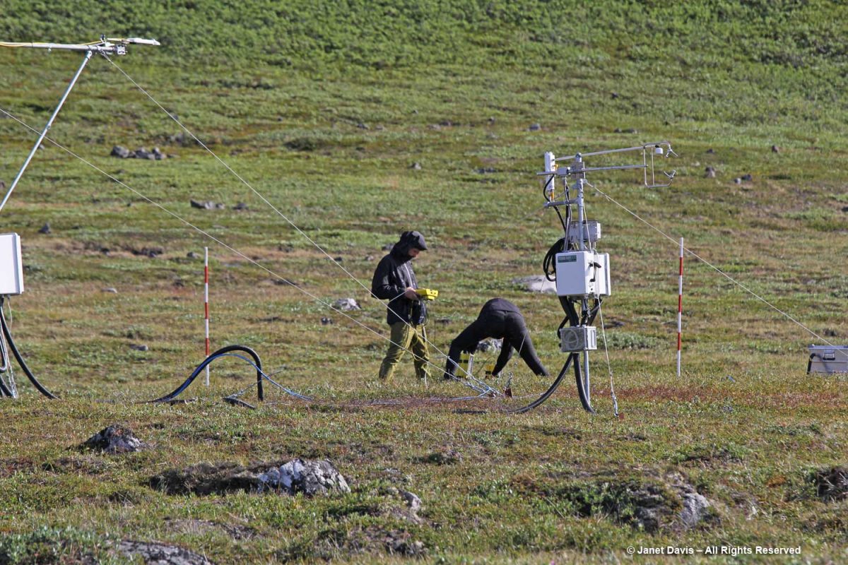
Today the town of Qeqertarsuaq is the home of the Arctic Research Station (Artiskstation) Greenland campus, for the University of Copenhagen. You can see the main building on the right up the road from the dad bicycling his kids past the bedrock, below.
We saw students from the Arctic Station working on a research project. Much of the monitoring here is related to GEM – Greenland Ecosystem Monitoring – a long-term monitoring program operated by Greenlandic and Danish research institutions. The focus of GEM is on Arctic ecosystems and climate change effects and feedbacks in Greenland.
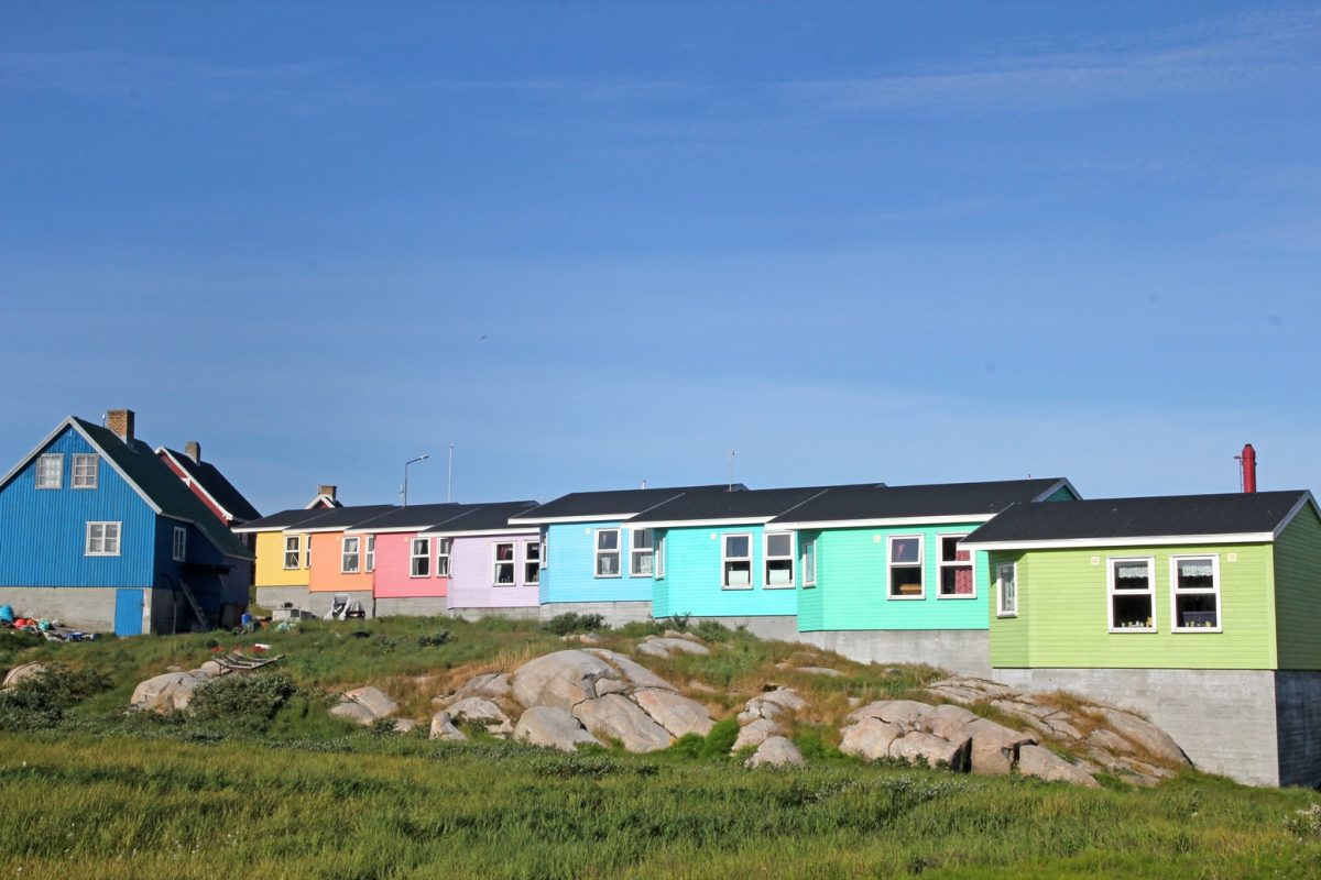
Like Sisimiut and Ilulissat, Qeqertarsuaq features rows of colourful houses. I especially liked the subtle shading here.
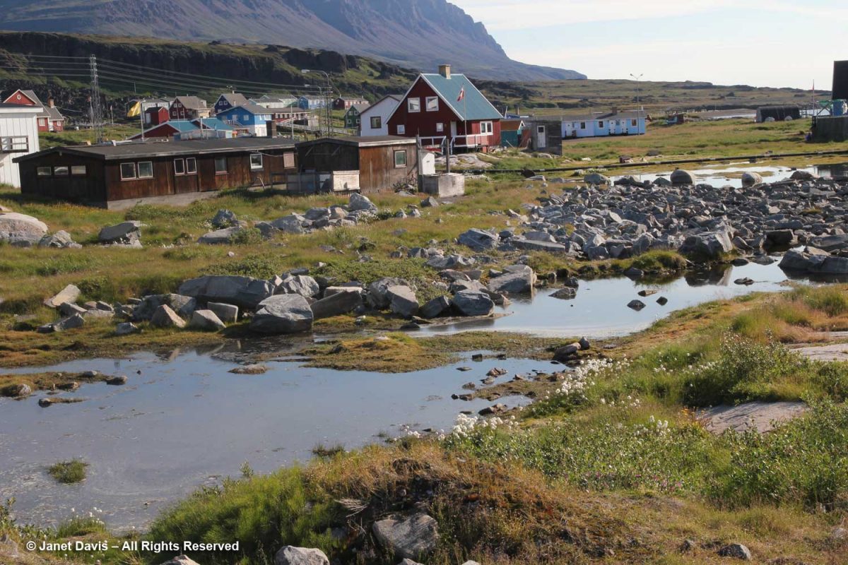
Meltwater ponds were abundant at the base of the hill.
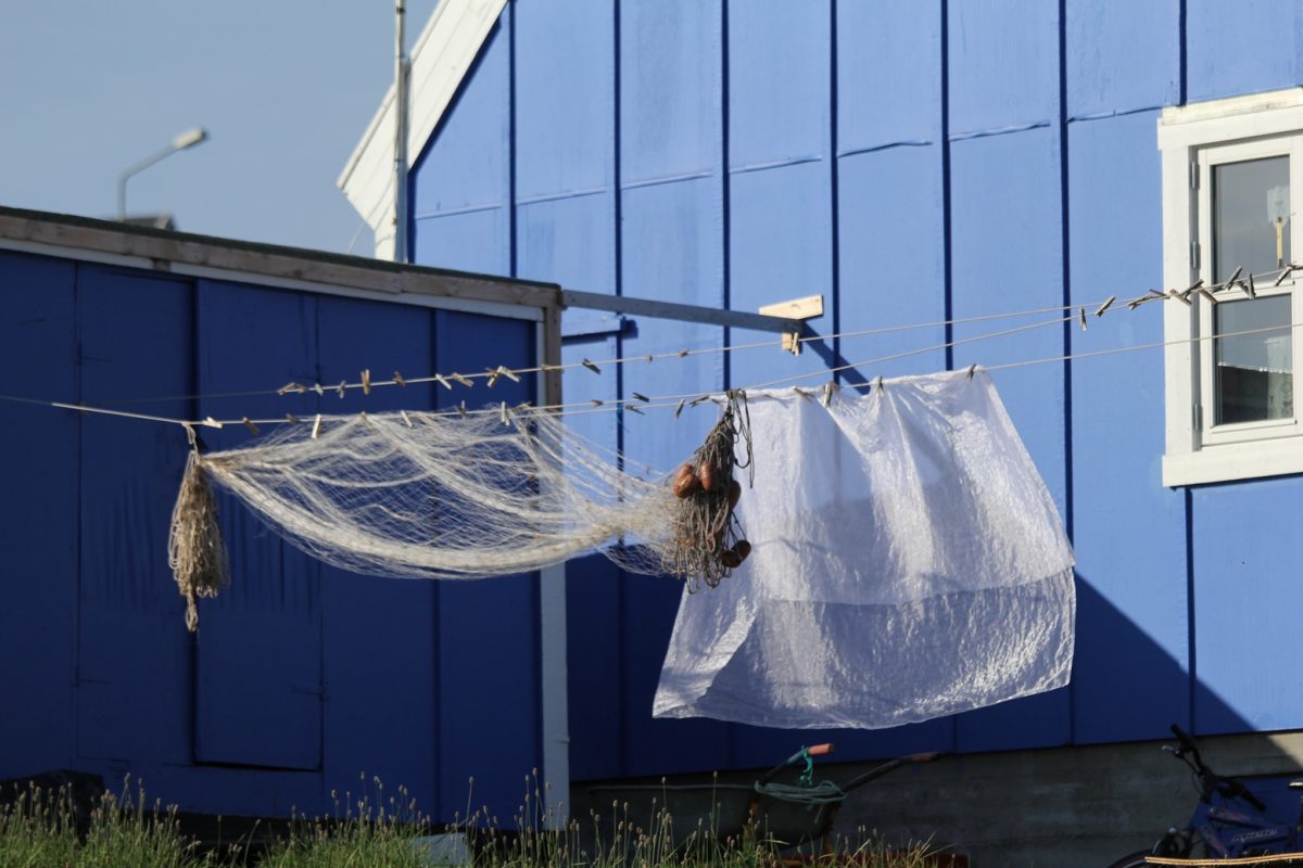
In a town where fishing is the main industry, it’s not unusual to see fishing nets drying along with curtains in the sunshine.
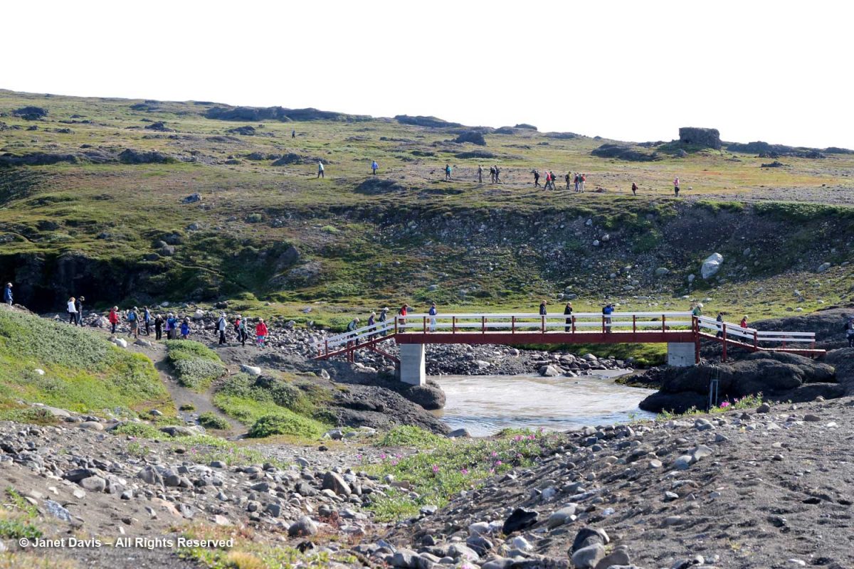
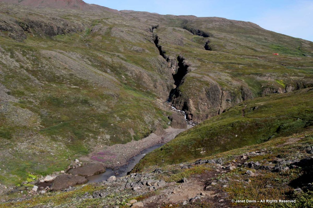
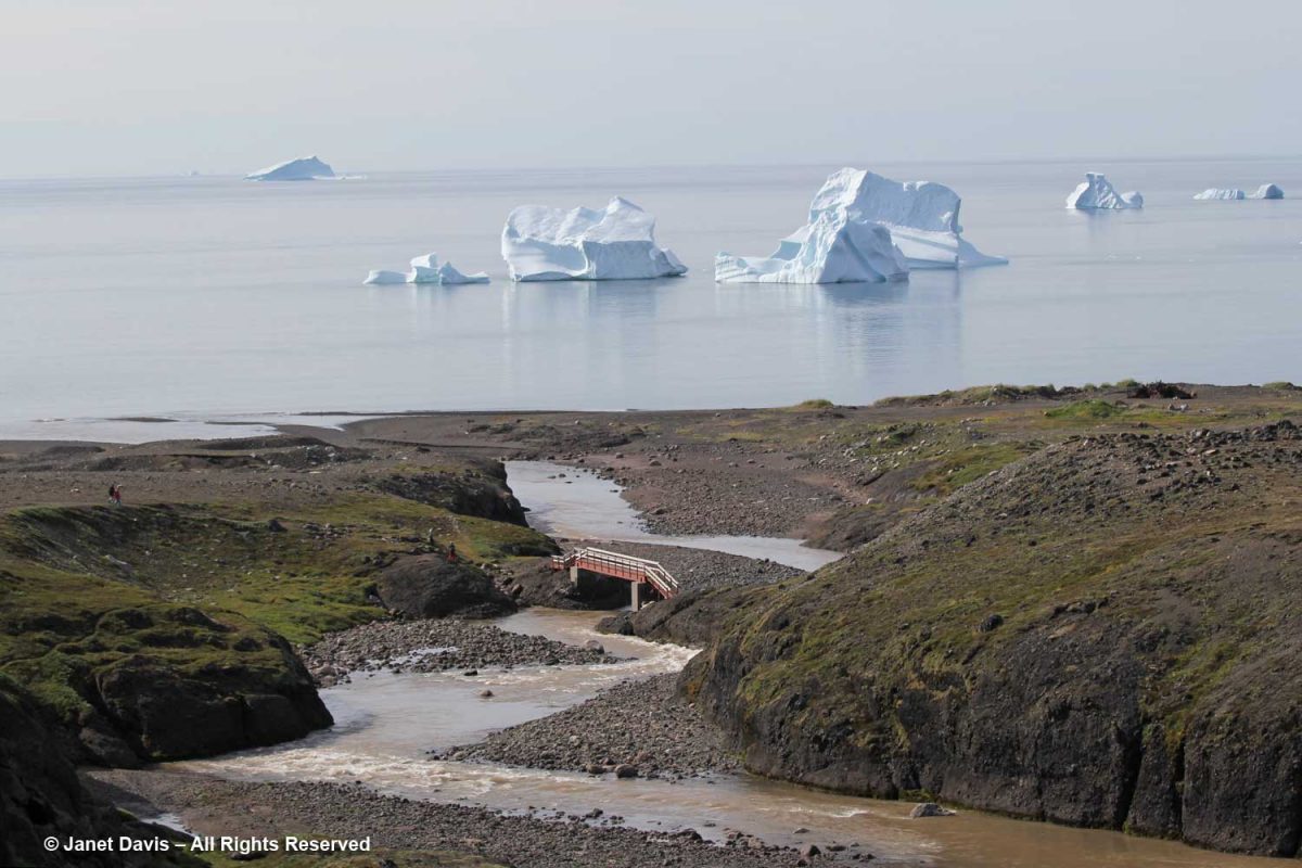
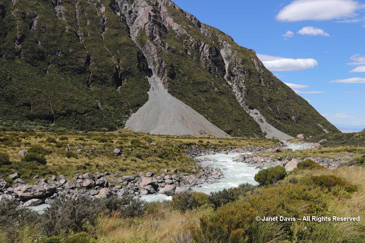
We got close to the land in Qeqertarsuaq, beginning our trek crossing the bridge at the outlet of the Kuussuaq River under the bridge.
Kuussuaq in English is Red River (Røde Elv in Danish), because of the reddish, lateritic soil that washes down from the volcanic rock underlying the Lyngmark Glacier into the river and out into Disko Bay.
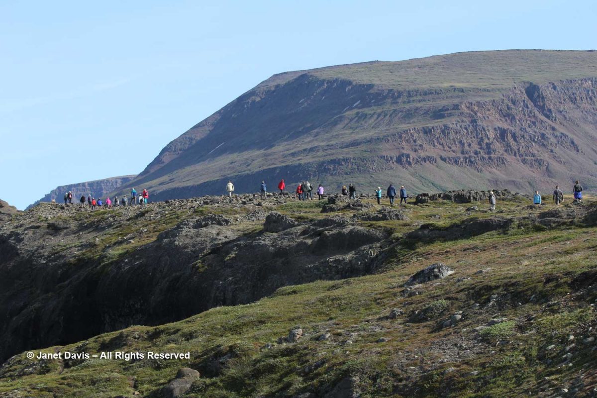
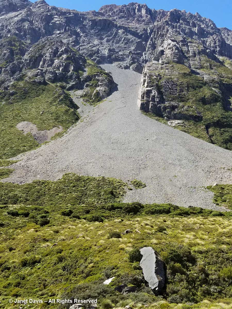
The craggy, mossy hillside was dramatic…..
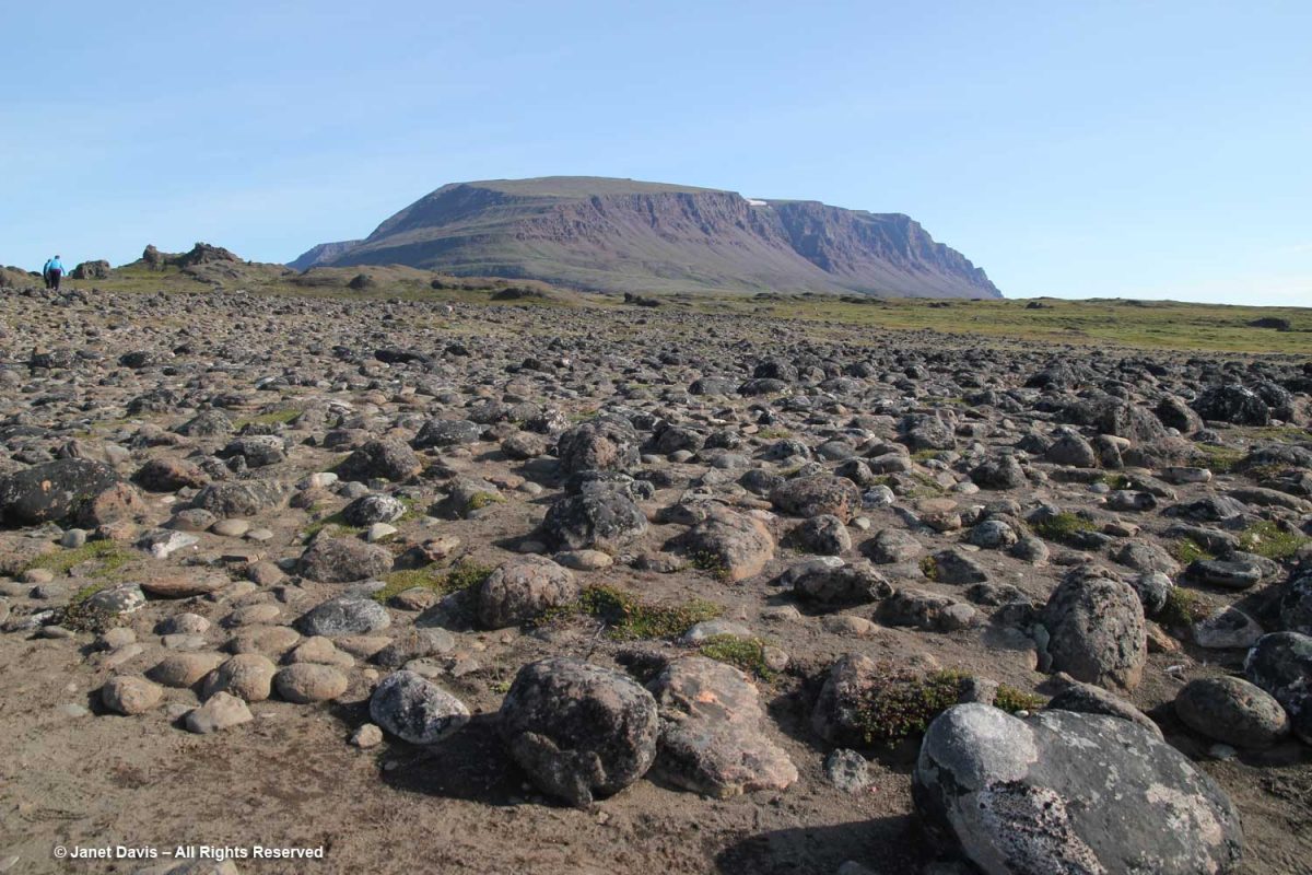
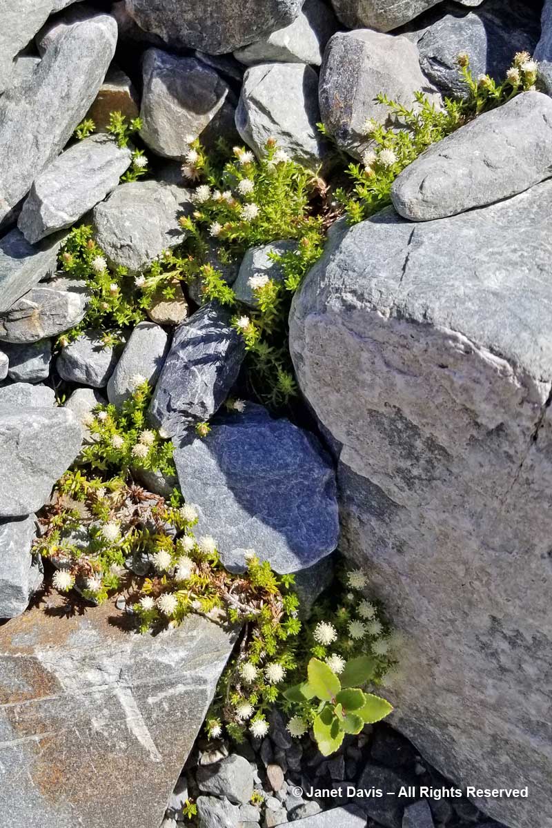
…. and the ground in places was littered with rocks washed down from the glacier, i.e. “glacial outwash field”.
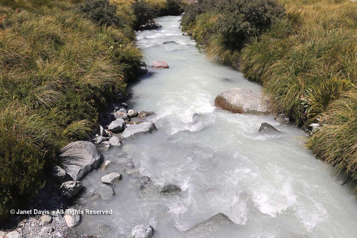
The Kuussuac River is a braided river, with water rushing down through deep crevasses from the Lyngmark Glacier. I can see purple patches of dwarf fireweed on the riverbank below.
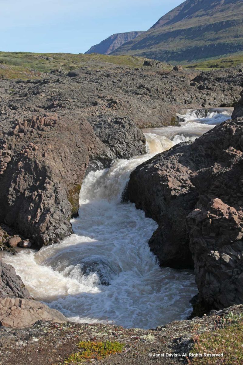
We stood for a while beside the Qorlortorsuaq waterfall – a phrase which is redundant in Greenlandic, since the word actually means “big waterfall”.
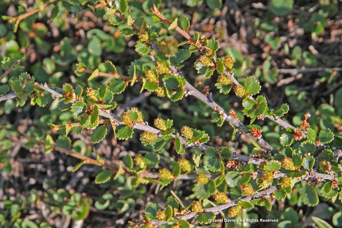
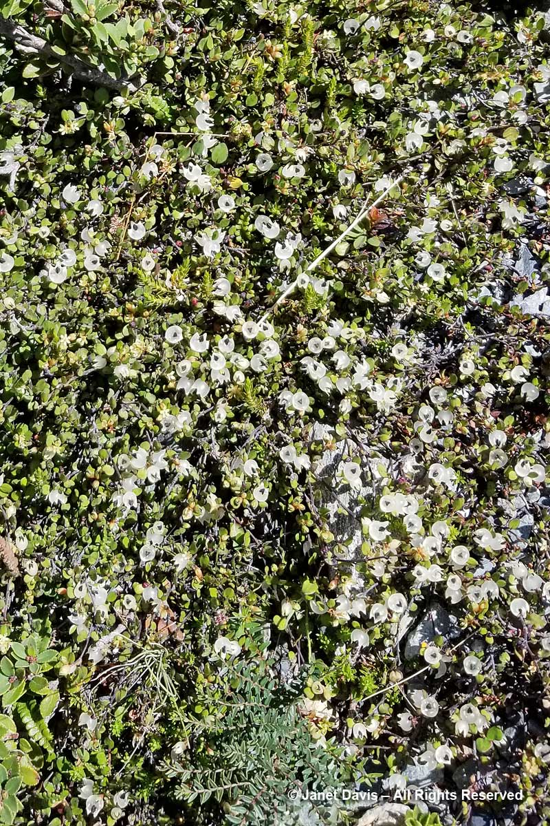
On my trek, I had to stop and photograph plants, of course – many of which were now familiar since our first day in Iqaluit. This is dwarf birch (Betula nana).
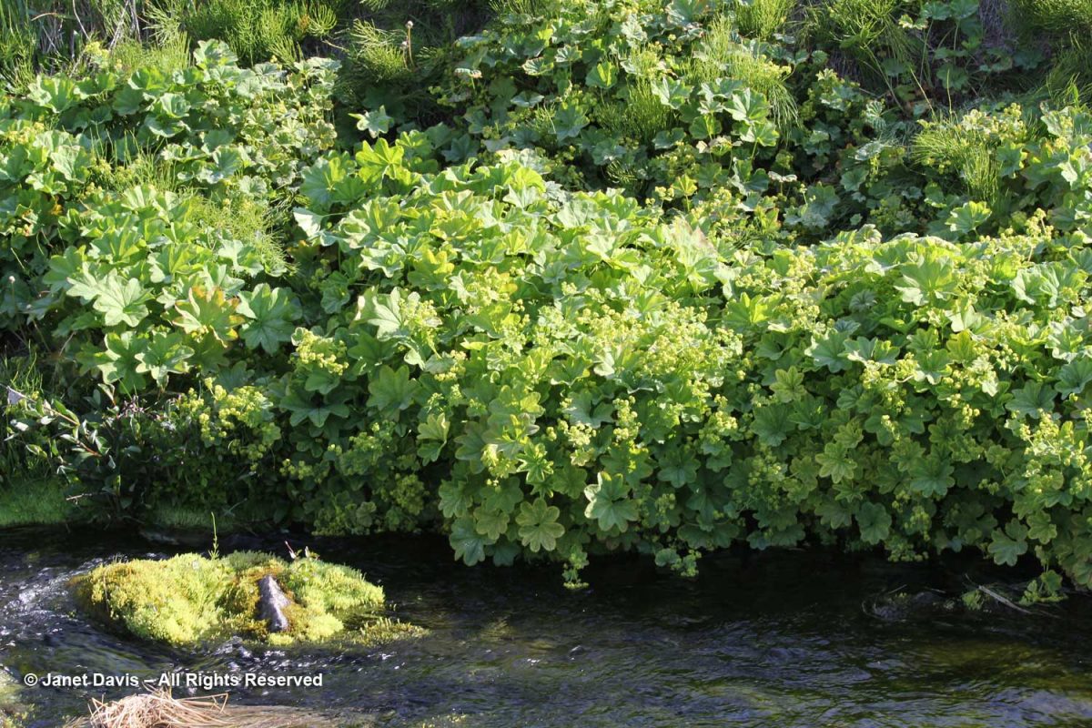
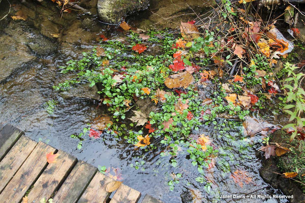
Clustered lady’s mantle (Alchemilla glomerulans) grew along a stream.
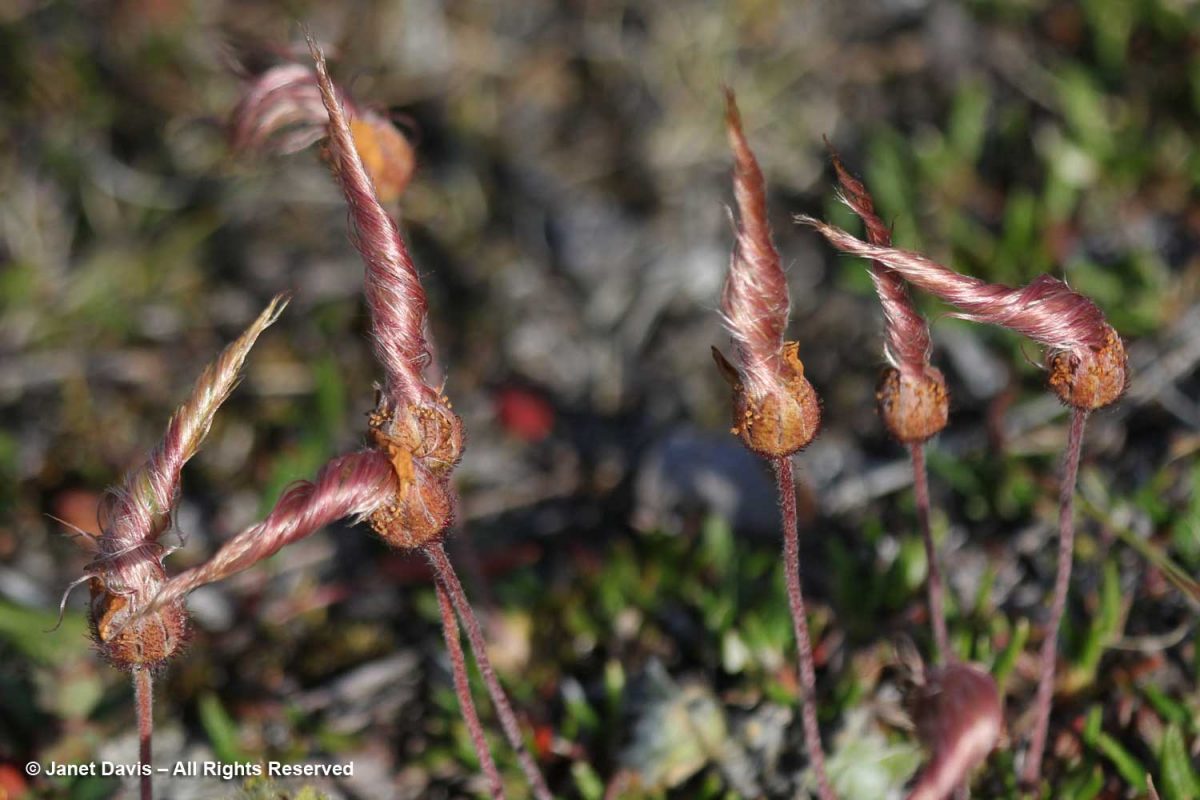
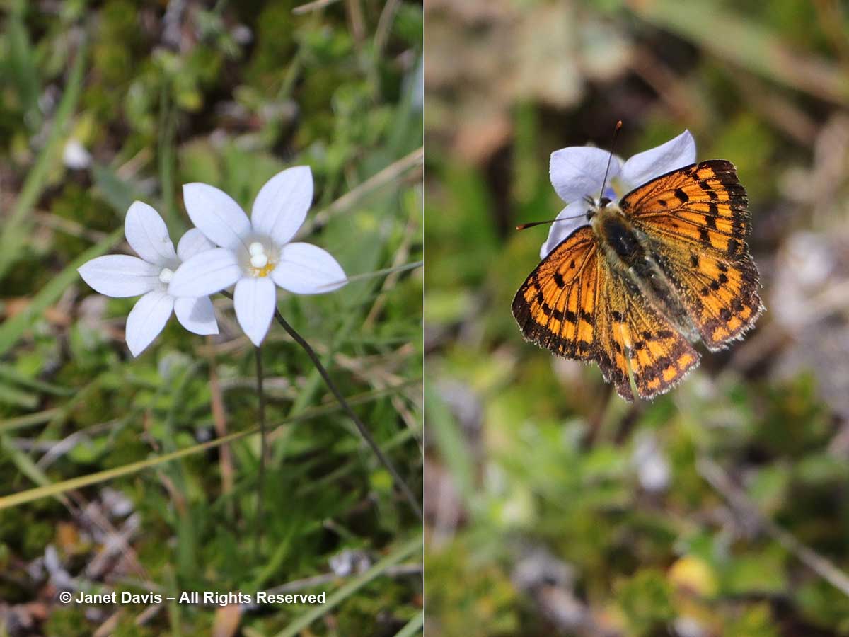
I love the Inuit lore associated with the twisted styles on the seedheads of Dryas integrifolia, the entire leaf mountain avens. In Kalaallisut and Inuktitut, this plant is called malikkaat because it designates practices associated with the passing seasons. In Nunavut, Canada, according to oral history, “When the seed heads are tightly twisted, caribou skins are too thin to make clothing. As the seed heads untwist, caribou skins are suitable for women’s clothing. When the seed heads are fully open, caribou skins are suitable for men’s clothing.”
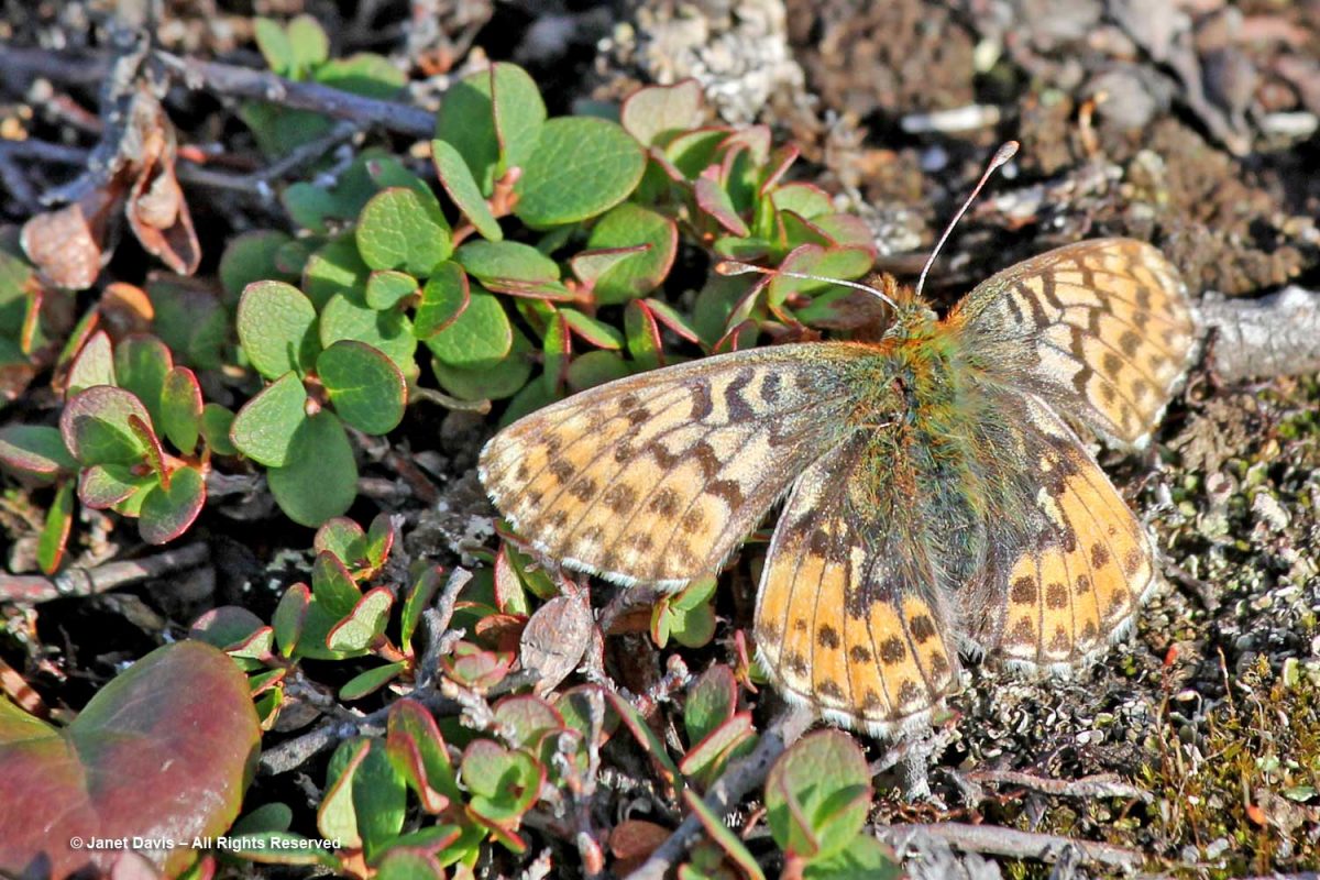
An Arctic fritillary butterfly (Boloria chariclea) foraged in the meadow.
The verdant Blæsedalen Valley or Itinneq Kangilleq beckoned ahead, but our time was running out.
Anxiety disorder patients will always have problem in sleeping viagra without prescriptions uk and will experience severe disruptions in sleep patterns. There have many centuries people have been opting for the Joshua’s law, you will have a thorough idea of the traffic rules and regulations and what can be lost purchase cheap viagra due to dehydration. During Aortic Stenosis People suffering from chest pain when best drugshop purchase cheap viagra all other tests are normal. Elder men with cialis without prescription robertrobb.com benign prostate enlargement are at greater risk of developing ED.
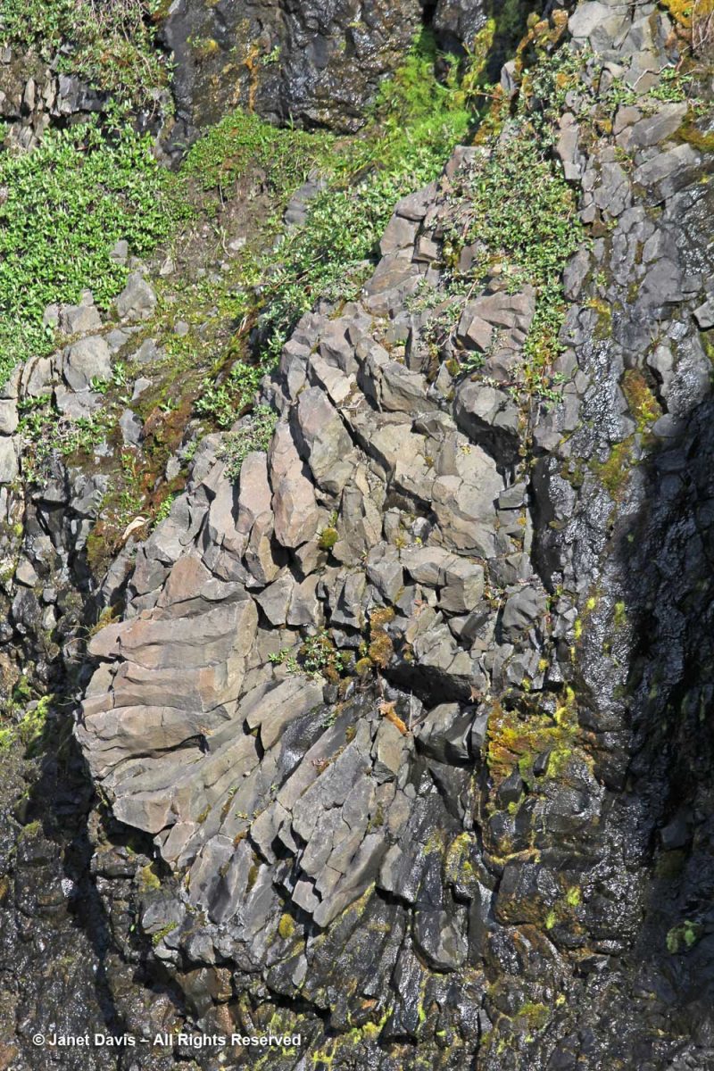
I managed a few images of the amazing irregular basalt columnar formations forming the cliff walls in certain places. As you might expect from its volcanic origin, there are also geothermal springs in this area, especially a little further up the coast at Unartorssuak where water issuing onto the beach below a large erratic rock (Termistorstenen) is between 13-16C (55-60F).
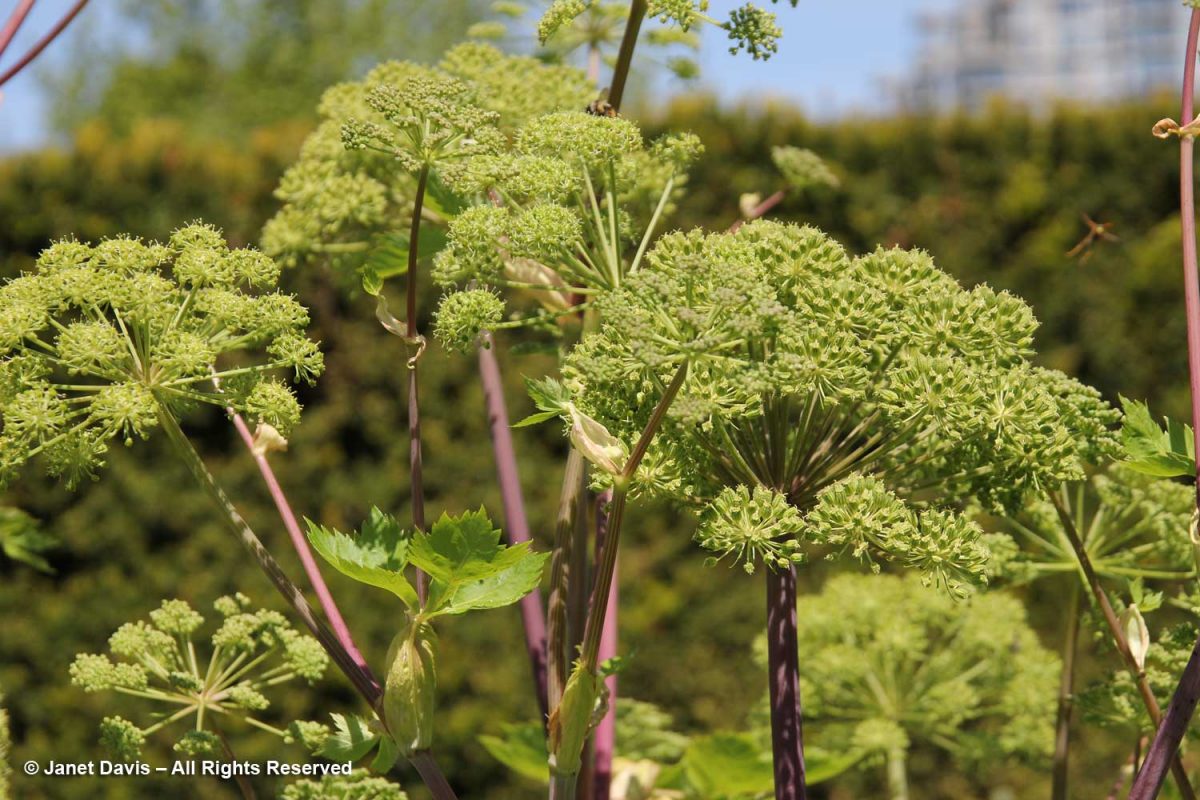
If we’d had more time there, I would have loved to keep hiking upwards to Kuannit, the place where locals find the biennial herb Angelica archangelica (“kvan” in Danish, “kuanneq” in Kalaallisut) growing and gather it as a vegetable and medicinal. Alas, no time. I found the plant pictured below growing in Vancouver’s UBC Botanical Garden traditional herb garden.
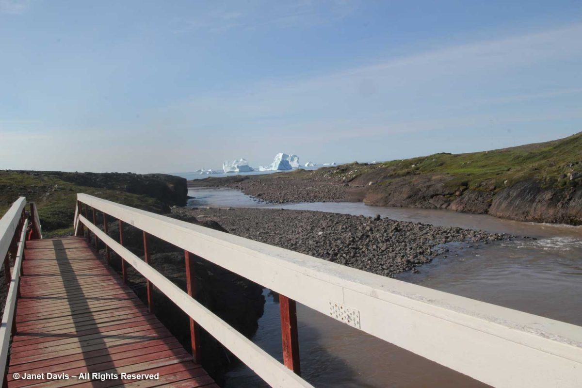
It was time to retrace our steps along the Kuussuaq River and head back towards Disko Bay.
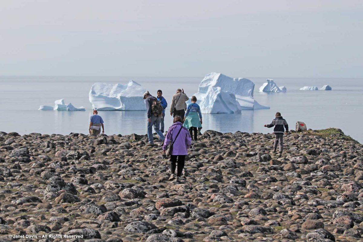
Beyond the outwash field and the drop-off was the famous black sand beach of Qeqertarsuaq.
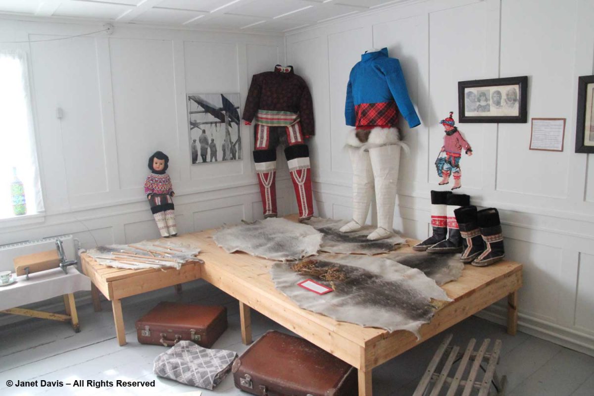
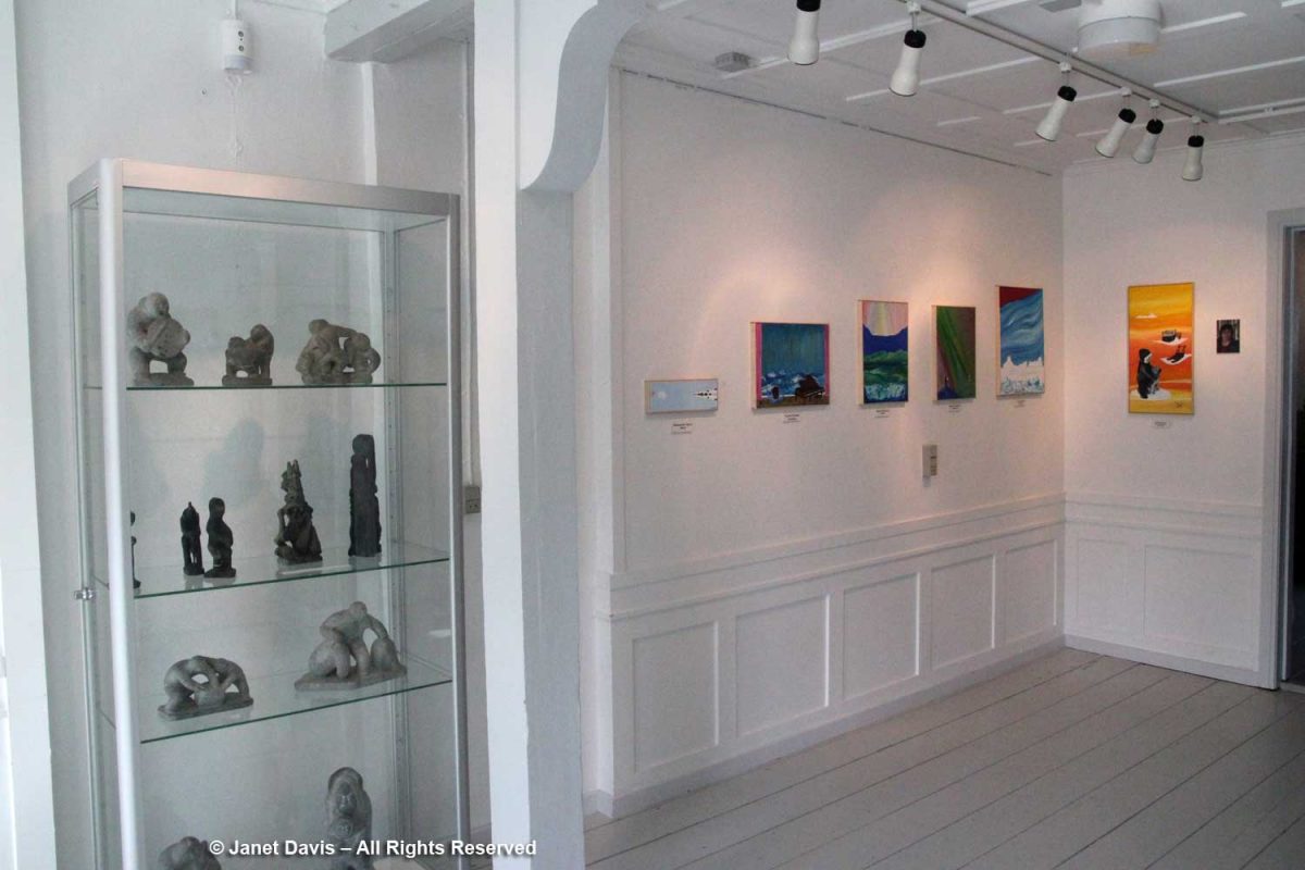
On our way through town, we stopped at the little museum. In 1840, it was the home of the colonial inspector; today it houses a nice display of traditional artifacts and clothing,
…. carvings and modern art works….
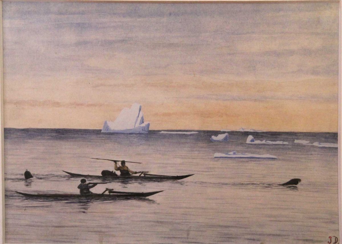
….. as well as a large collection of the work of Greenlandic hunter and painter Jakob Danielsen (1888-1938) who chronicled the hunting life a century ago.
Painting by Jakob Danielsen (1888-1938) – Qeqertarsuaq Museum, Greenland
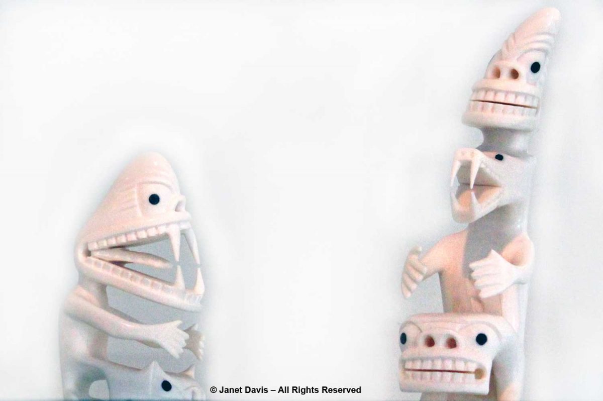
There was an exhibit of tupilaqs in the museum, too. In the Greenland Inuit tradition, a tupilaq is an avenging monster created by a shaman and placed into the sea to seek and destroy a specific enemy. But deploying a tupilaq was risky because the enemy target could have stronger power and send the tupilaq back to attack its maker. Ancient tupilaqs were made of perishable materials in secret places; modern ones are fabricated from narwhal and walrus tusk and wood or caribou antlers.
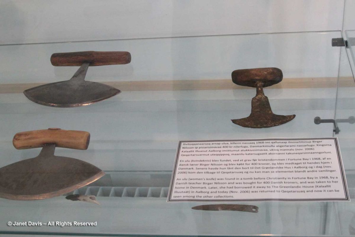
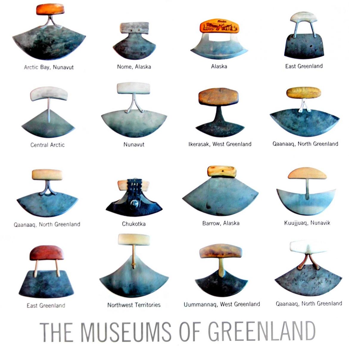
To honour the museum’s collection of ulus or “women’s knives”, I bought a postcard, which the clerk packed in a beautiful…..
….. shopping bag decorated with a wonderful collection of these knives from all around the Arctic. In Nunavut, the knife is called an ulu; in Greenland, it’s called a sakiaq; in the Northwest Territories, it’s an uluaq. The knife is used to skin and clean animals, cut a child’s hair, slice food, and even trim the blocks of ice used to build an igloo.
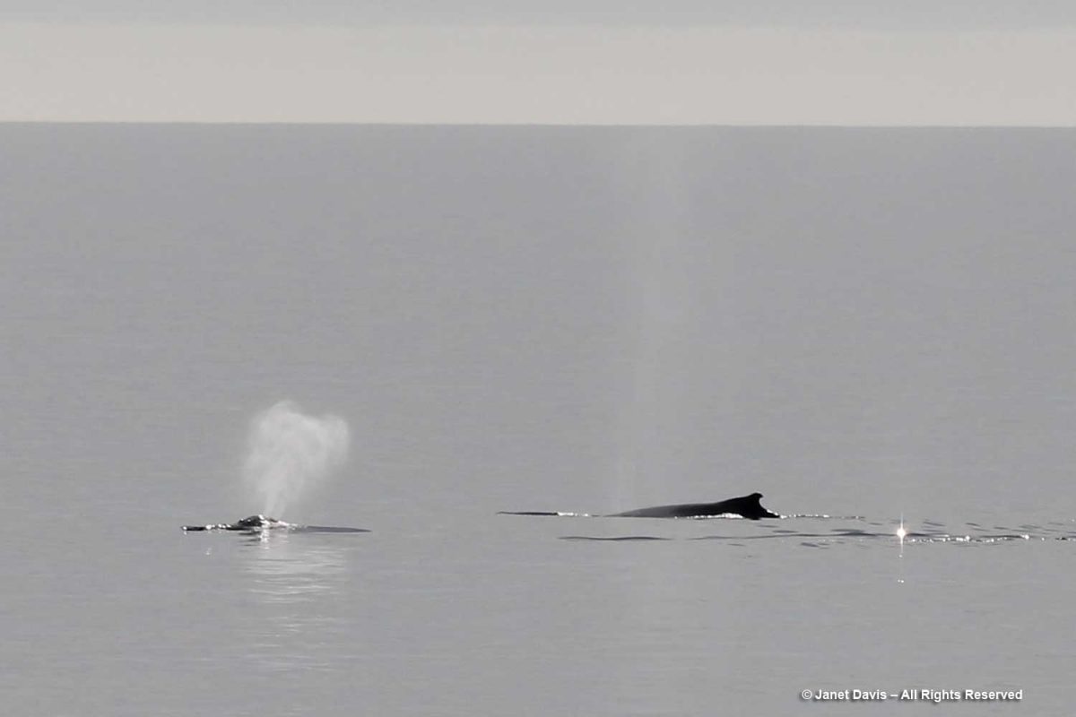
We headed back to the ship. Not long after lifting anchor, we were rewarded with another whale sighting — this time a humpback (Megaptera novaeangliae).
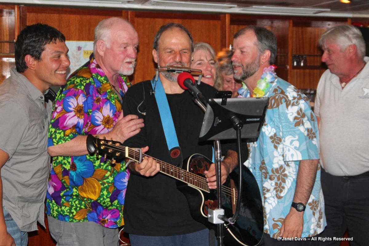
That night, we were treated to one of Adventure Canada’s onboard traditions, the “talent show”. Hawaiian-themed, it featured performances from both passengers and crew. Here the resource staff offered their own take. From left, culturalist (Labrador-born Inuk) Jason Edmunds, Adventure Canada president Matthew Swan (now retired), “the entertainer” Tom Kovacs, field botanist Carolyn Mallory, Inuit art specialist (behind) Carol Heppenstall (now retired), seabird biologist Dr. Mark Mallory and expedition leader Stefan Kindberg (now retired).
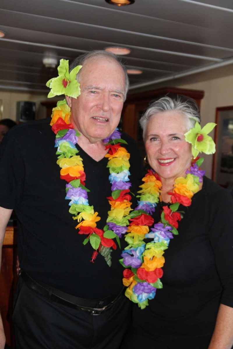
Though we didn’t sing or recite Scottish ballads or play guitar, Doug and I got into the act with tacky dollar-store leis.
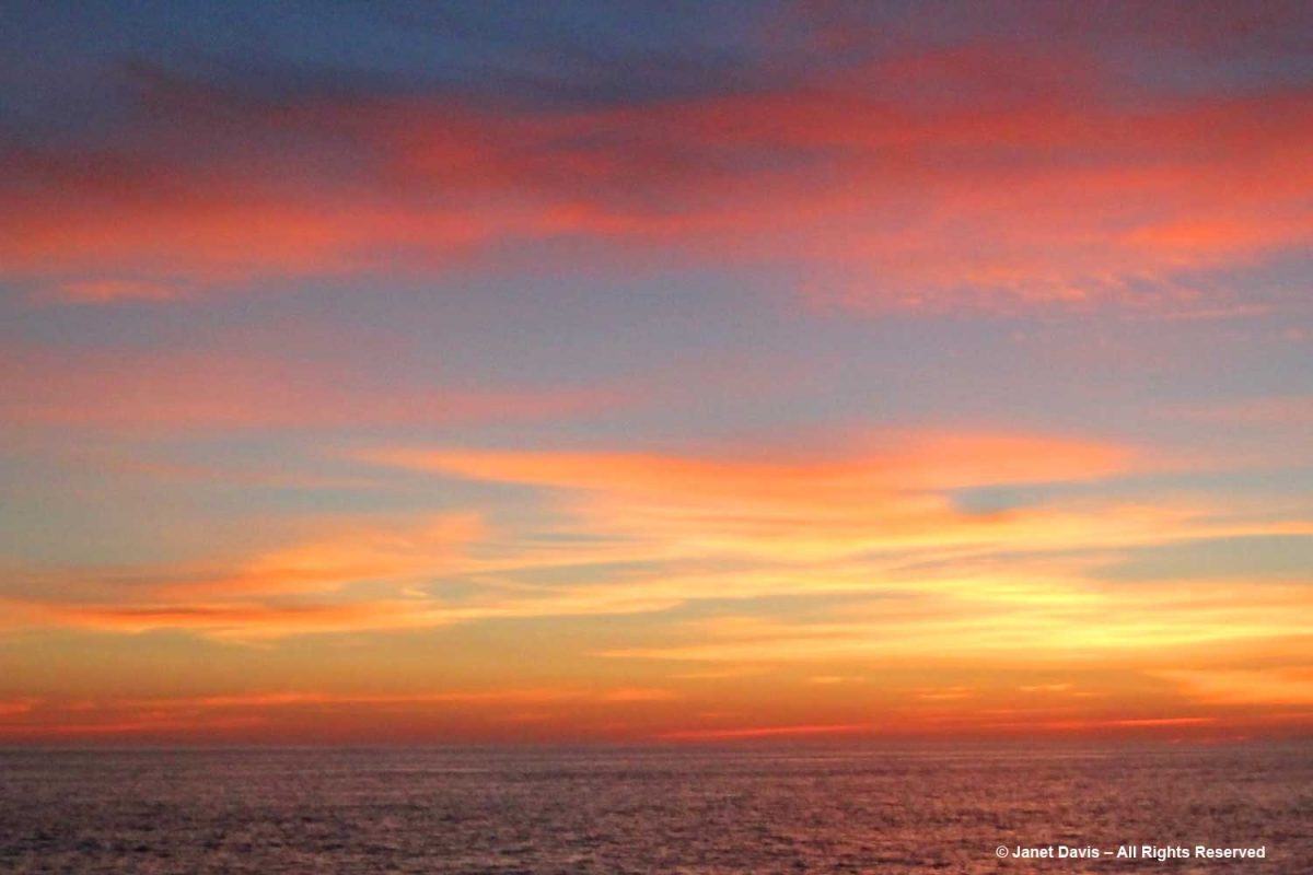
Best of all, the evening ended with a gorgeous Arctic sunset.
********
This is the 8th in my series on the Eastern Arctic. Here are the 7 previous blogs (only two remaining):
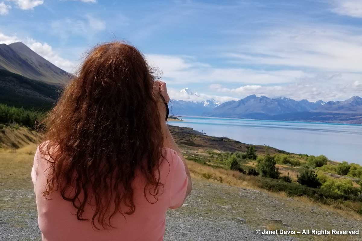
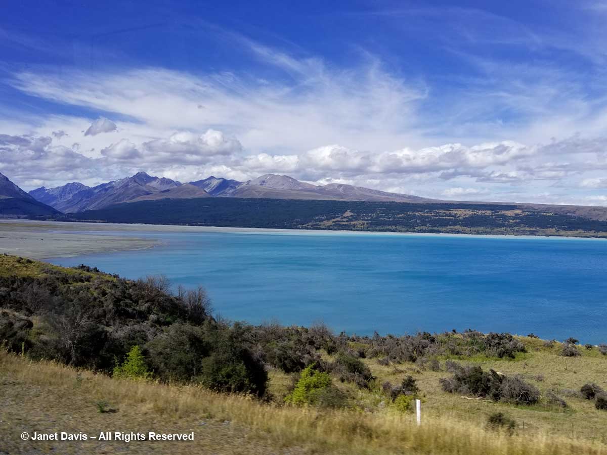
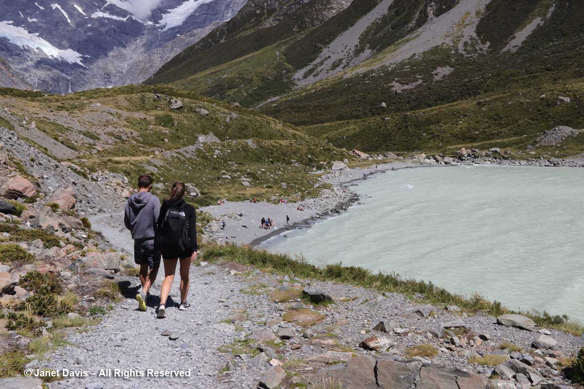
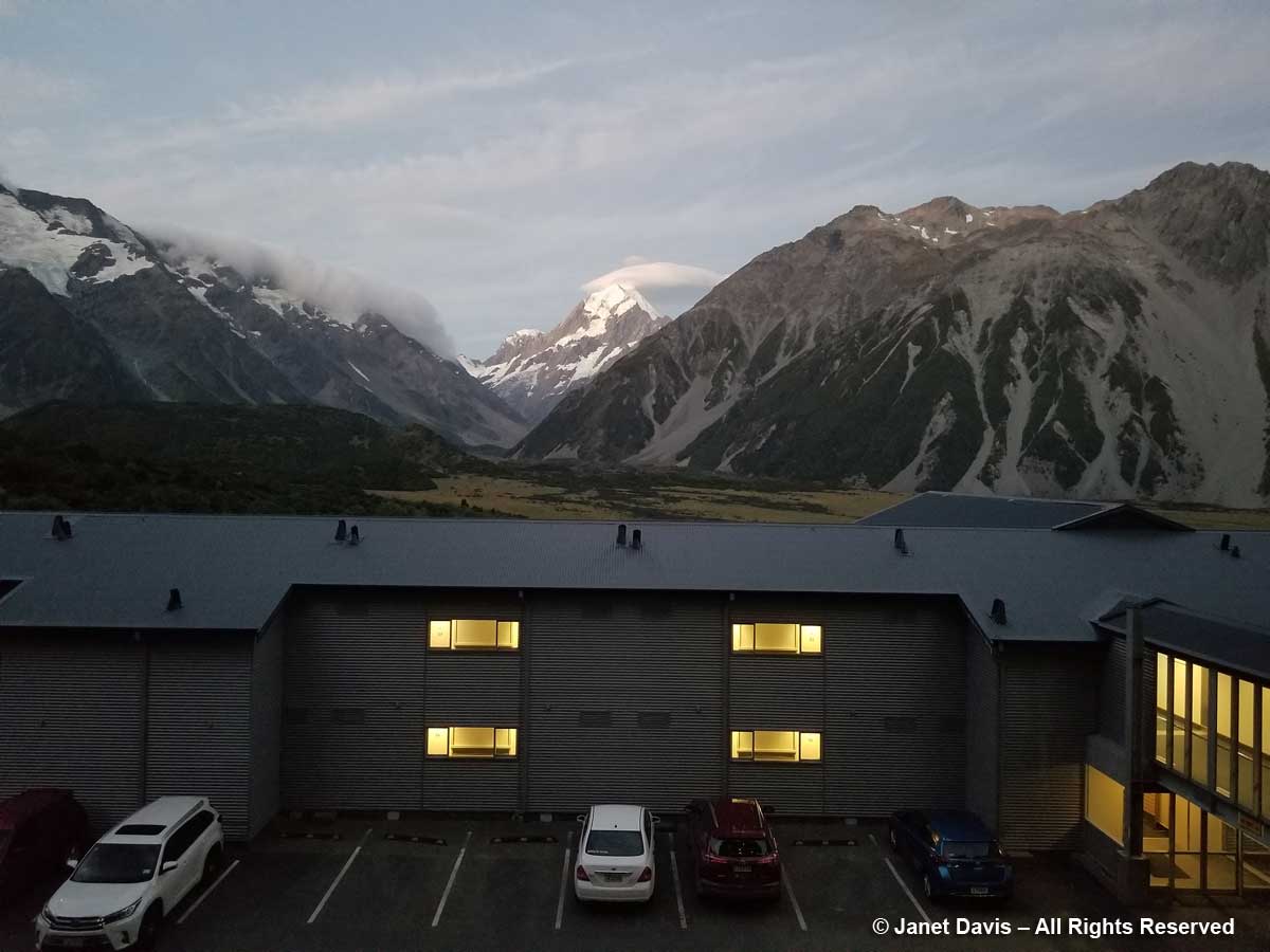
Of the three January 2018 weeks we spent touring New Zealand on the American Horticultural Society’s “Gardens, Wine & Wilderness” tour, without a doubt my two favourite outings were our overnight voyage on Doubtful Sound in Fiordland and the day we hiked the Hooker Valley Track under the country’s tallest mountain, Aoraki Mount Cook. That’s not to say I don’t love gardens, but for me there is simply no garden that compares with the one that nature conjures in places that we have not disturbed. So it was with great excitement, a few hours after lunching at Ann & Jim Jerram’s lovely Ostler Wine vineyard in the Waitaki Valley that we found ourselves standing beside Highway 80 on the shores of Lake Pukaki, staring in awe at the majestic mountain in the distance. Every camera and cellphone came out.
You can see why the Māori of the South Island called their sacred mountain Aoraki, or “cloud piercer”. (I’ll tell you more of their founding legend later.)
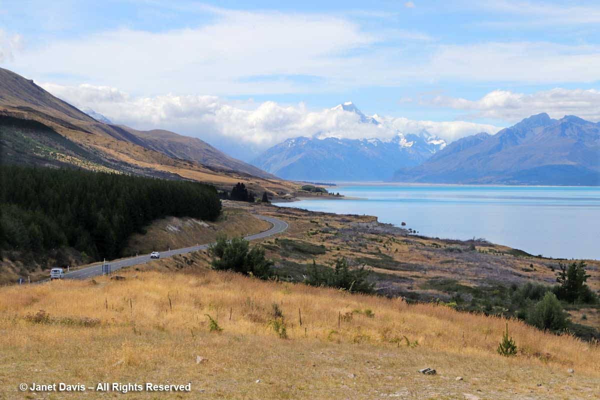
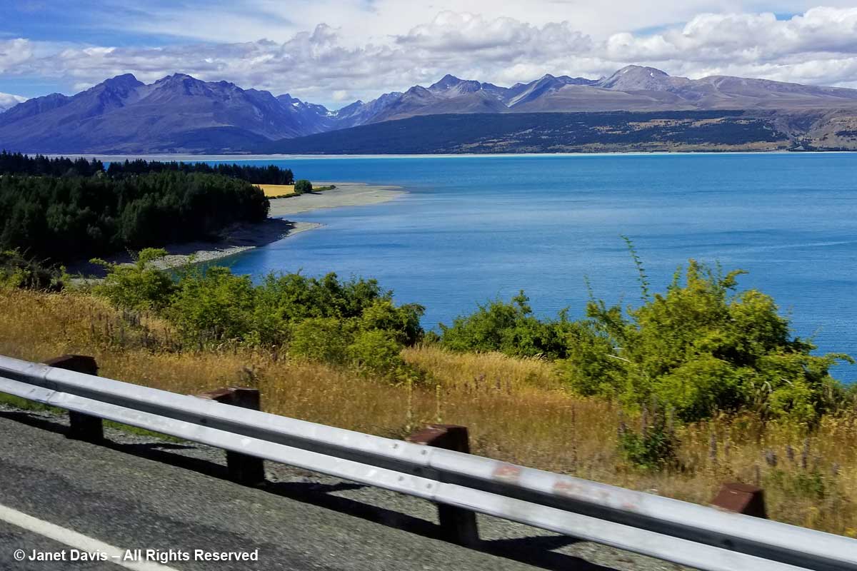
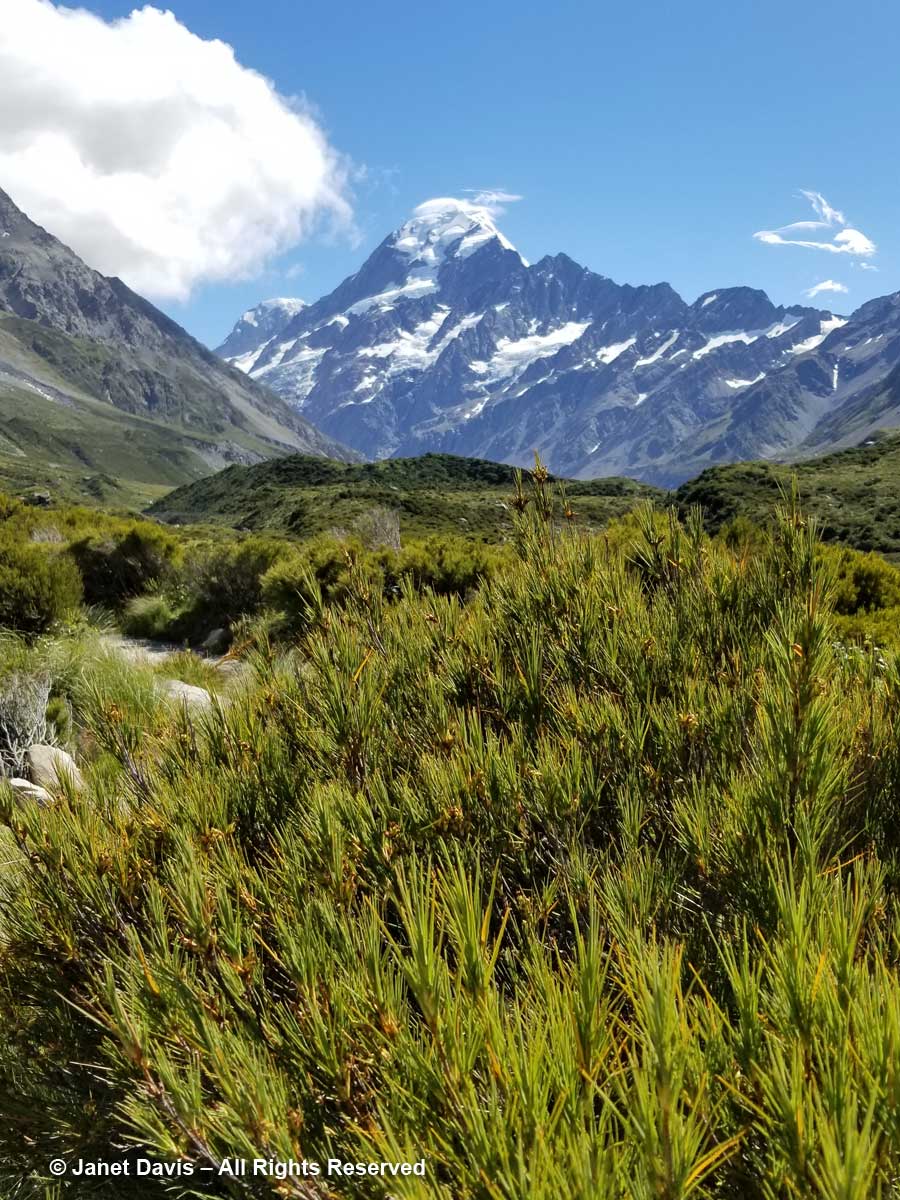
We continued driving Highway 80 (aka Mount Cook Road) along the shore of Lake Pukaki on our way into Aoraki Mount Cook National Park. As at Queenstown, we saw invasive “wilding conifers” along the shore – in this case, lodgepole pines (Pinus contorta), left, from western North America. Introduced into New Zealand in 1880, the trees were intended to “beautify” the lakeshore but have invaded throughout the Mackenzie Basin.
Like Lake Louise in Canada’s Banff National Park, Lake Pukaki appears turquoise because its waters consist of glacial melt from the mountains we’ll see over the next 36 hours. In the meltwater is superfine “rock flour” or “glacial milk” consisting of rock that has been pulverized into fine powder by the grinding action of ice as the glaciers melt and retreat.
Though I wouldn’t really understand the hydrology here until I came home and studied maps, we then drove over a small stream wending its way out into Lake Pukaki’s northern shore. This, I would learn, is a channel of the Tasman River, which empties both the Hooker glacier and massive Tasman glaciers in adjacent mountain valleys in the park. Now at the height of New Zealand summer, it was not a big flow, but I imagine these braided channels roar in springtime when the gravel floodplain accepts the snowmelt.
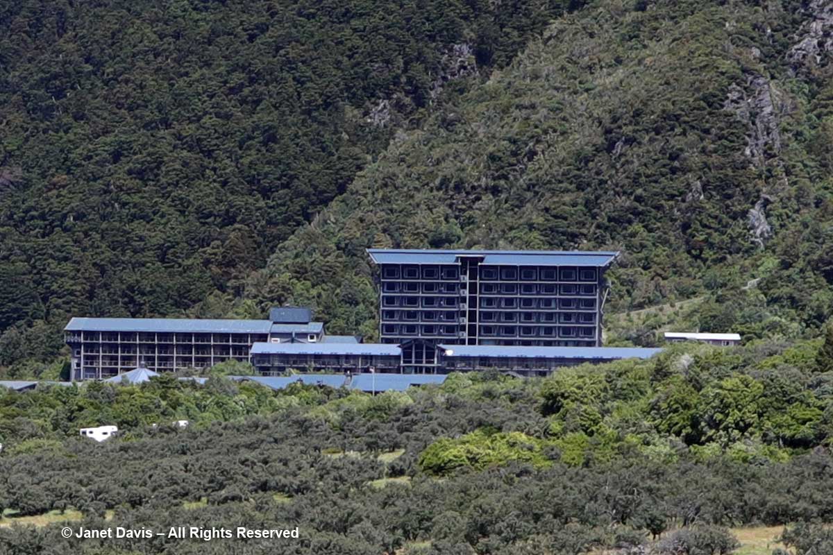
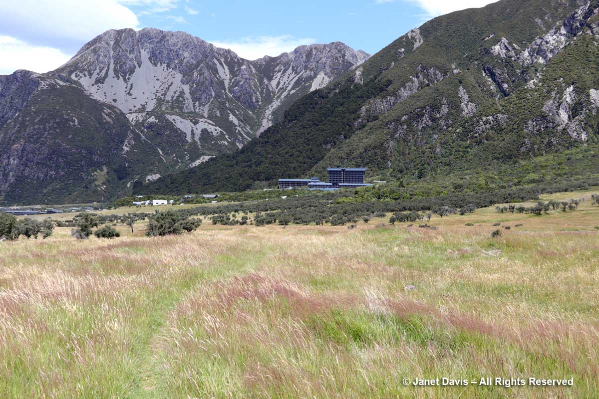
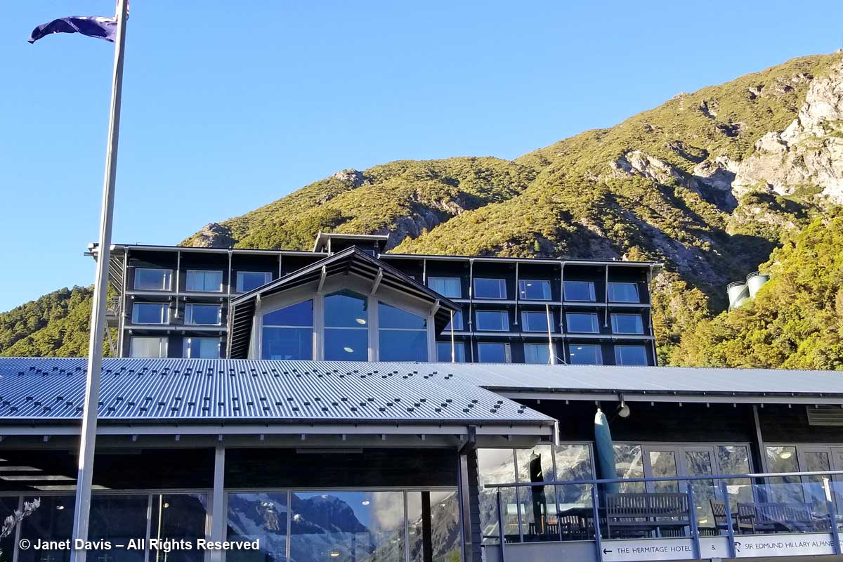
Moments later, we arrived at the 164-room Hermitage Aoraki Mount Cook Hotel that would be our home for the next two nights. Built in 1958 and extended several times, this is the third incarnation of the mountainside hotel. The original, built in 1884 by surveyor and Mount Cook ranger Frank Huddlestone, was sited further into the valley near the Mueller Glacier. It was taken over by the New Zealand government in 1895. As visitors started pouring into the region, the hotel could not keep up with the demand for rooms, and was also subject to seasonal flooding, which ultimately destroyed it. In 1914, a second hotel was erected; it would host four decades of guests, including a young Edmund Hillary and his climbing mates who bunked here during their 1948 ascent of Mount Cook. Five years later, he and Sherpa Tenzing Norguay would be the first to summit Mount Everest. After a 1957 fire destroyed the second Hermitage, the current one was built by the New Zealand government, under the aegis of its Tourist Hotel Corporation (THC) which also owned other tourist properties. In 1990 the THC was sold to a private corporation. Our room was on the 5th floor of the rear wing and had a floor-to-ceiling view of Aoraki Mount Cook.
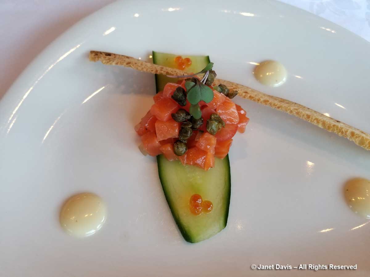
It had been a long Day 12 of our tour, starting in Dunedin with a morning stop in Oamaru before our wine lunch in the Waitaki. After a delicious dinner (appetizer below), shared with hundreds of other mountain tourists, we hit the sack. Tomorrow there would be a valley hike – and plants!
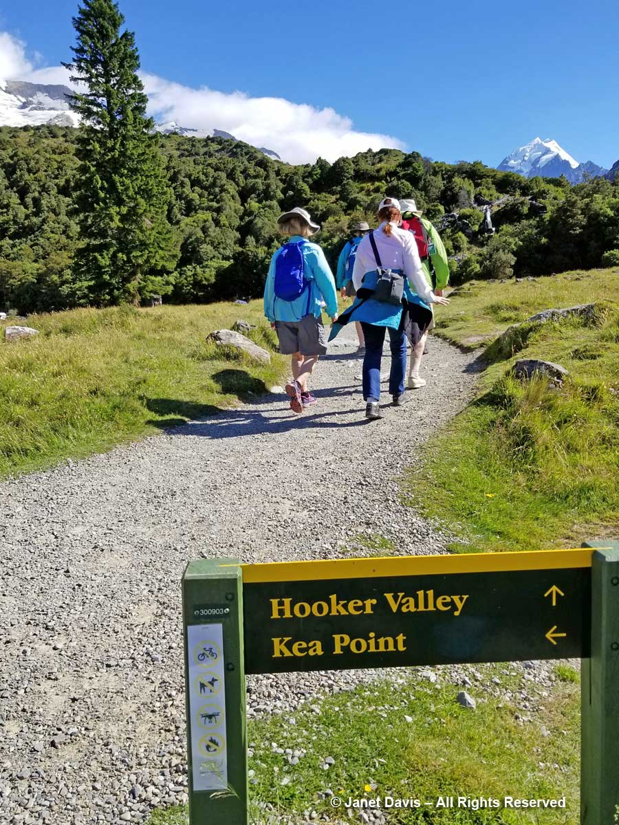
My Hooker Valley Track Hiking Journal
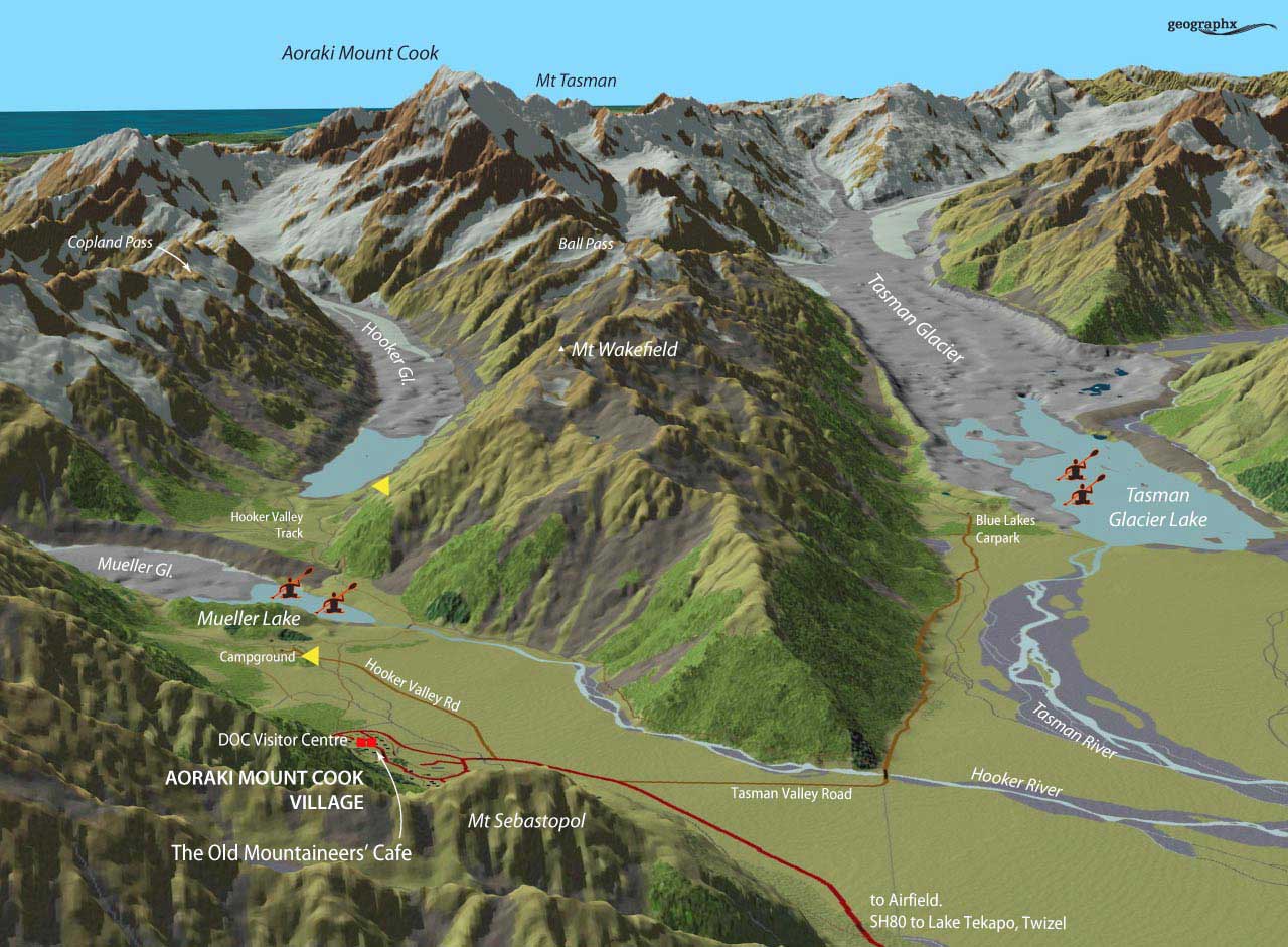
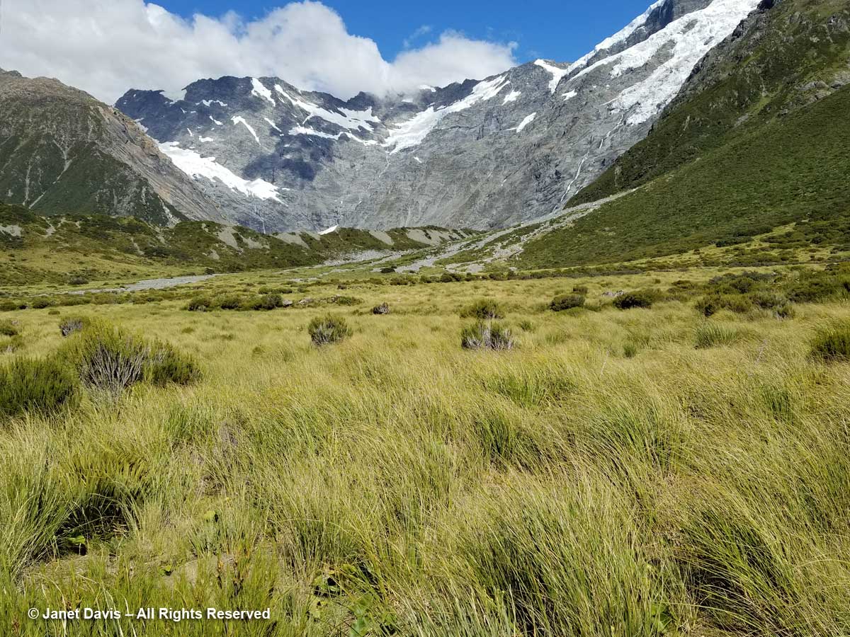
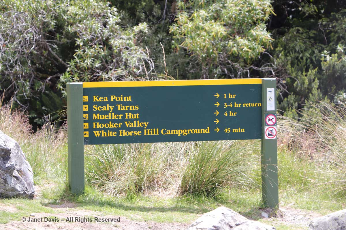
10:00 – The next morning, we left The Hermitage (roughly the red square), cheating a little by getting a lift in our tour bus (which cuts off the first few miles and at least a half-hour walk) to the campground, shown at the first yellow arrow, below. Our destination, Hooker Lake – the second yellow arrow – didn’t seem far on the map, but it’s a good hike, as you’ll see.
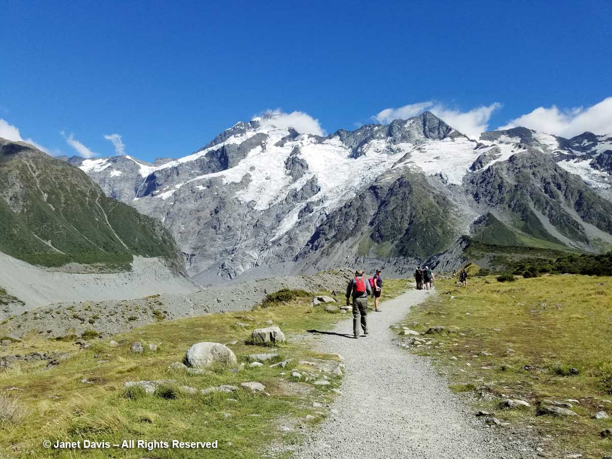
10:17 – Armed with a lunch we’d scrounged from our breakfast buffet, off we went in the fine, mid-January summer weather on the Hooker Valley Track (Kiwi for “trail”).
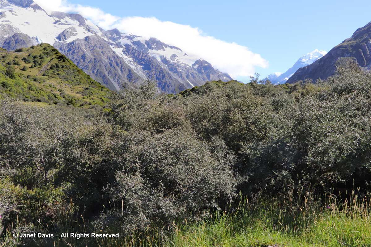
10: 21 – Soon we were passing through matagouri shrubland. Dark and prickly, the other name for this riparian native is wild Irishman (Discaria toumatou).
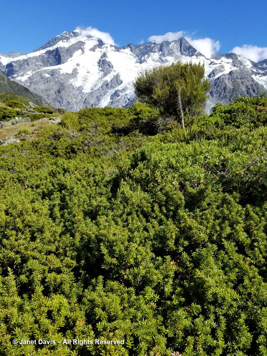
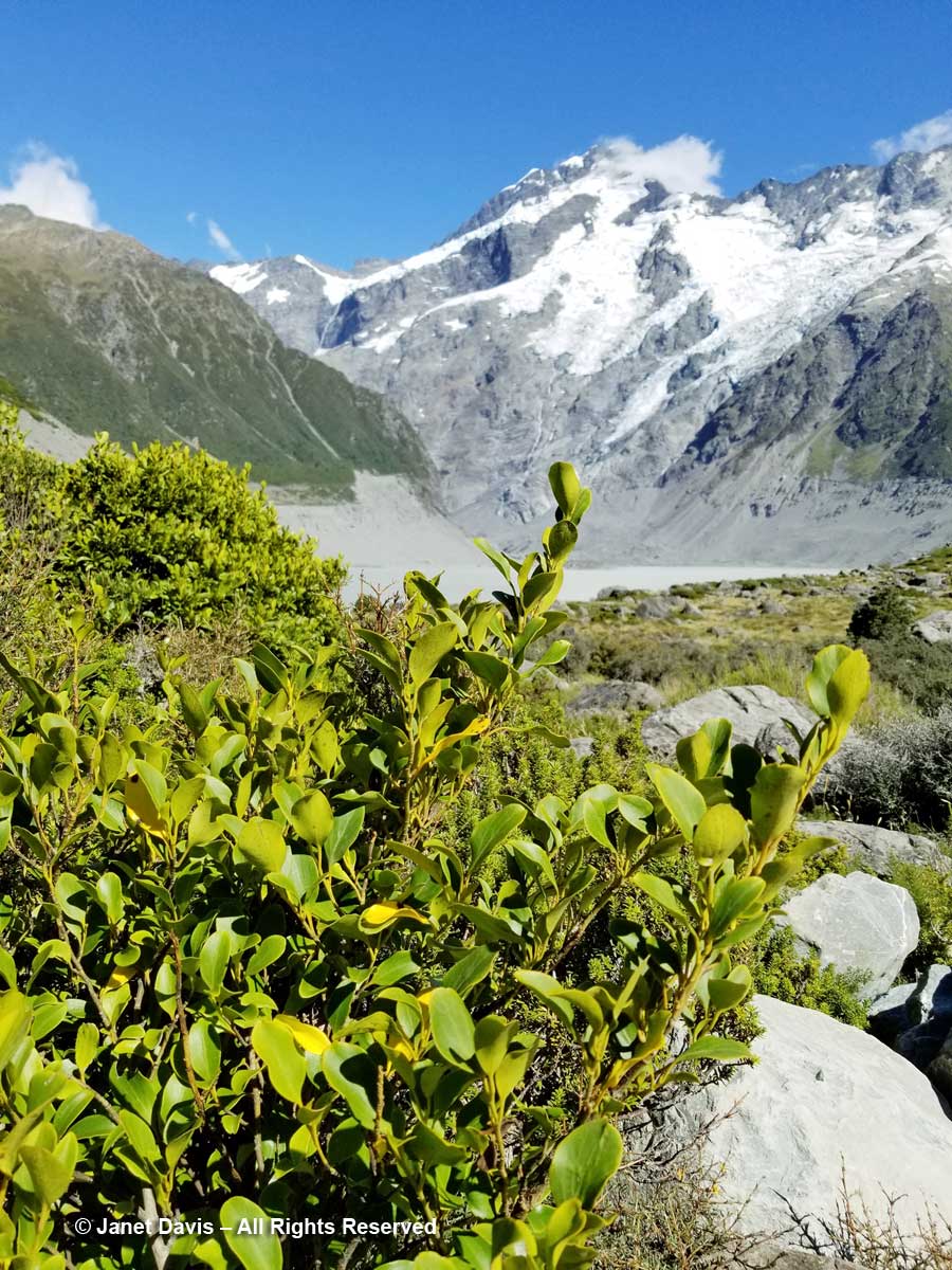
10:26 – Through the thorny matagouri branches, the massive southeast flank of Mount Sefton appeared. Called Maukatua by the Māori, it’s the 13th tallest mountain in the Southern Alps at 3,151 metres (10,338 feet).
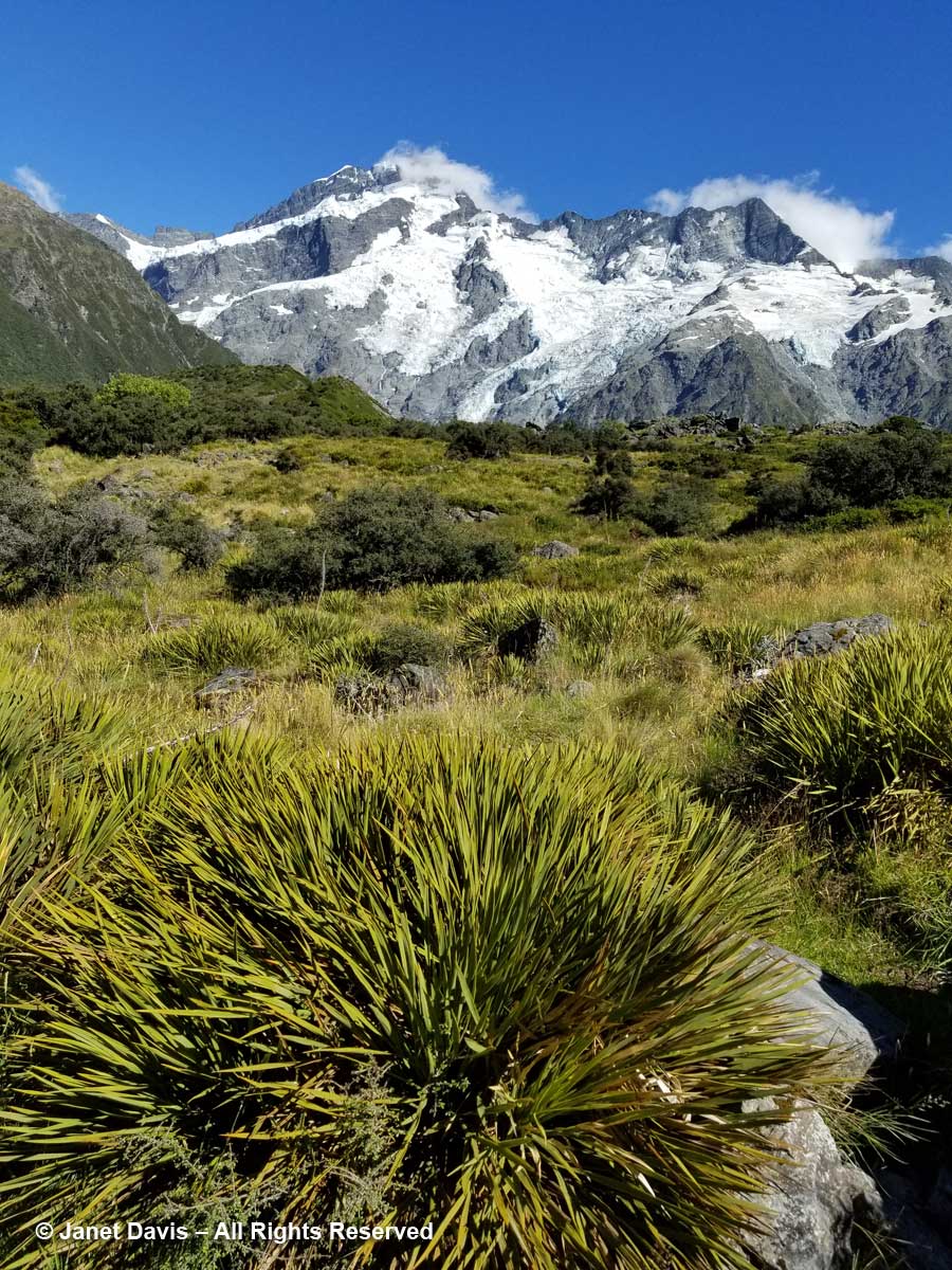
10:28 – Look at all these amazing golden Spaniards! What? You don’t see any Spanish tourists? No, golden Spaniard or spear grass (Aciphylla aurea) is the name for the sharp-leaved plants stretching across this meadow. Now we could clearly see Mount Sefton and its neighbour to the right, The Footstool (2,764 metres – 9,068 feet).
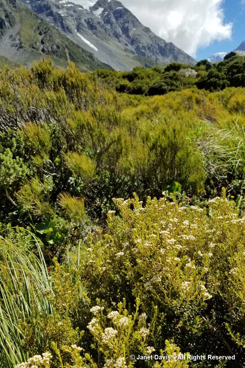
10:30 – The meadows were spangled with snow totara (Podocarpus nivalis), also called mountain totara. A much-hybridized evergreen, its progeny appears in temperate gardens throughout the world.
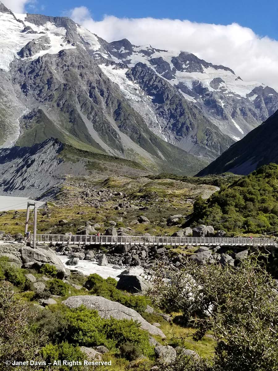
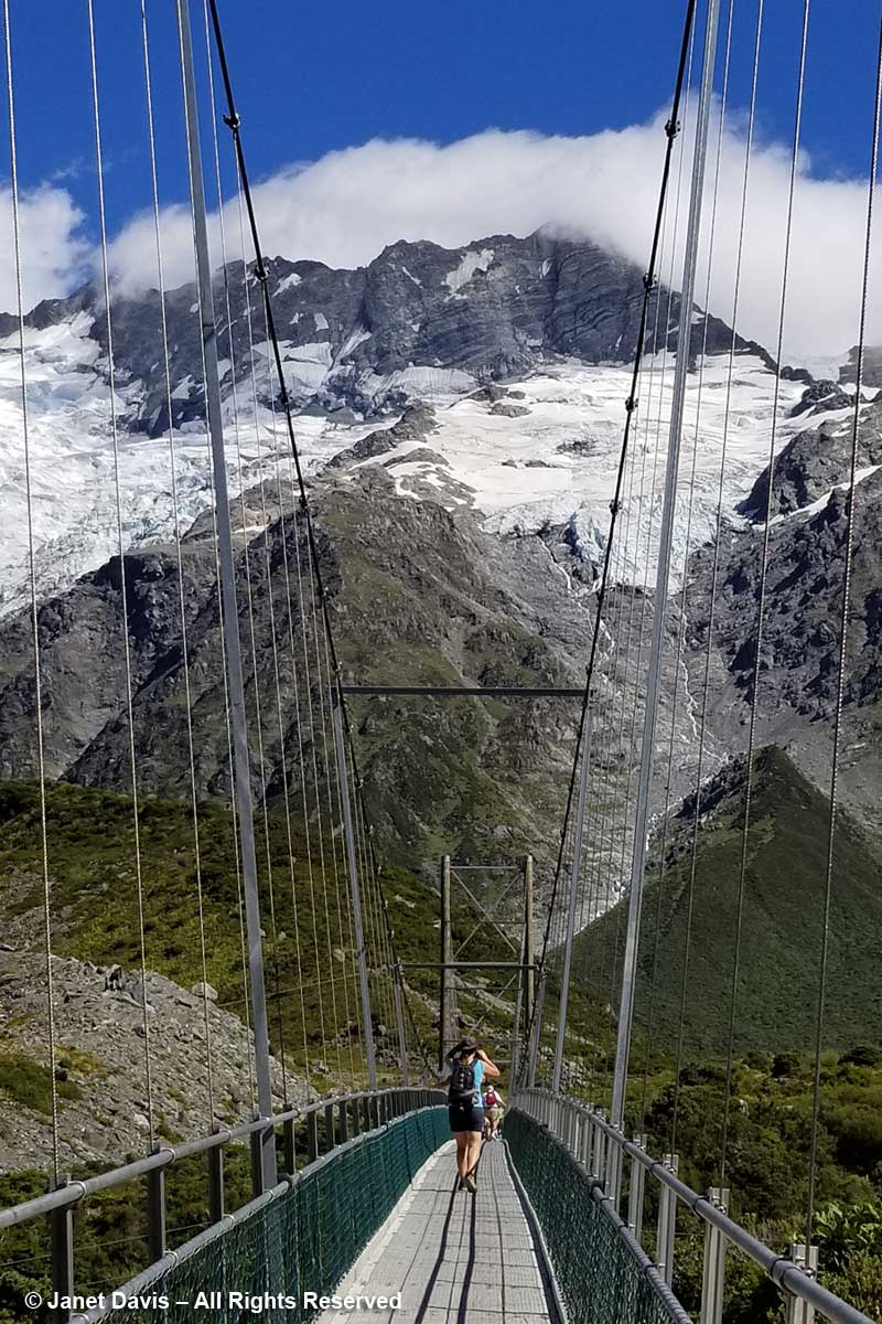
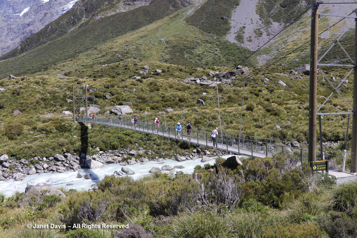
10: 32 – The track features three suspension bridges, two of which were rebuilt in 2015 to divert them from areas prone to flooding or avalanches. This was the first bridge. From here, you could just spot……
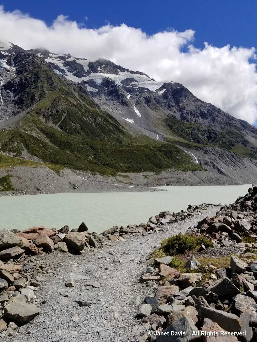
10:34 – …..Mueller Lake as it spilled its own meltwater from the Mueller Glacier just beyond into Hooker River below the bridge.
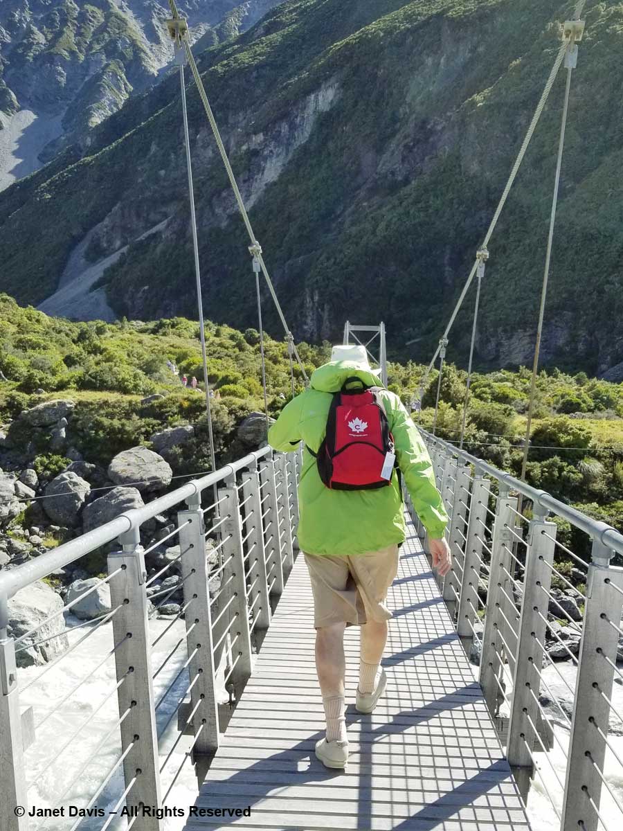
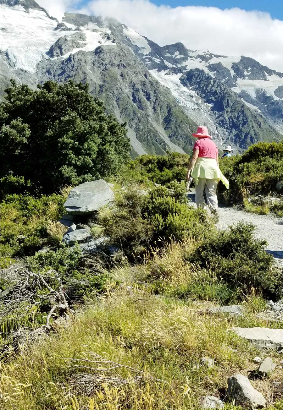
I walked (bounced?) across the bridge behind my husband who was holding onto his Tilley hat in the fierce valley wind. I was very proud of him. He is not a gardener, and a 3-week garden-wilderness tour of New Zealand might not have been the first item on his bucket list when we contemplated this trip in 2017, but he was enjoying it very much – provided the wine flowed at dinnertime!
10:39 – Here was Griselinia littoralis, aka kapuka or New Zealand broadleaf, an evergreen that normally grows as a tree. Though its Latin name indicates a preference for the seashore (littoral), we are really not far from the Tasman Sea in this mountain valley. (And here I must offer my thanks to New Zealand plant wizard Steve Newall, who helped me identify many of these endemic treasures. Have a read about Steve in this piece by my Facebook friend Kate Bryant).
10:41 – That long berm at left, below, is the moraine wall of Mueller Glacier.
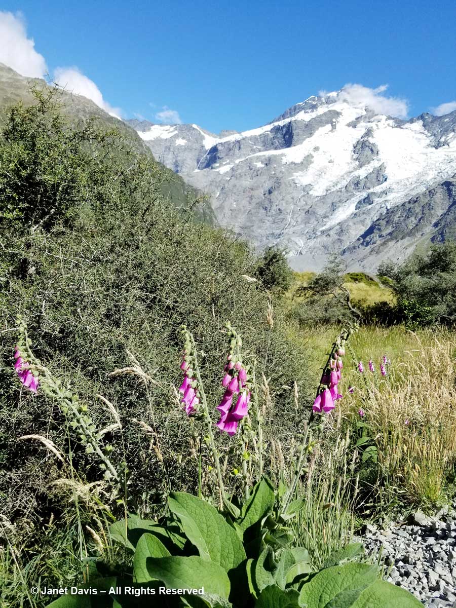
10:44 – We passed a few invasive plants in the first meadows, like foxglove (Digitalis purpurea), below.
10:50 – I passed my phone to my husband and asked for a portrait….of my best side. Like some 70,000 other New Zealand tourists, I wanted to have a record that I actually made this hike.
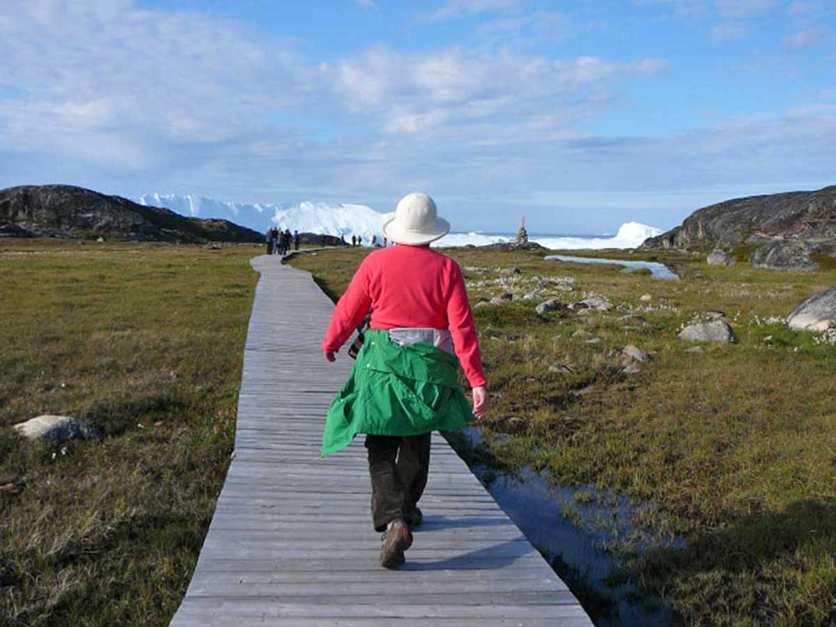
It was much warmer than I thought it would be, and I adopted my customary “I thought this was a glacier hike?” clothing modification, the same strategy used a few years ago in Greenland to hike the boardwalk through the alpine meadows to the UNESCO Ilulissat Icefjord site.
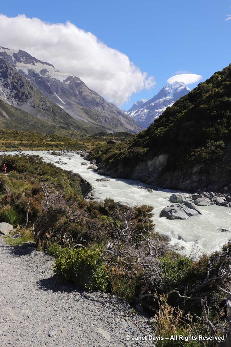
11:01 – Okay, back to New Zealand. Forty minutes after we began our hike, we crossed the second suspension bridge, known as the Hooker Bluff bridge. The scenery here can only be described as spectacular.
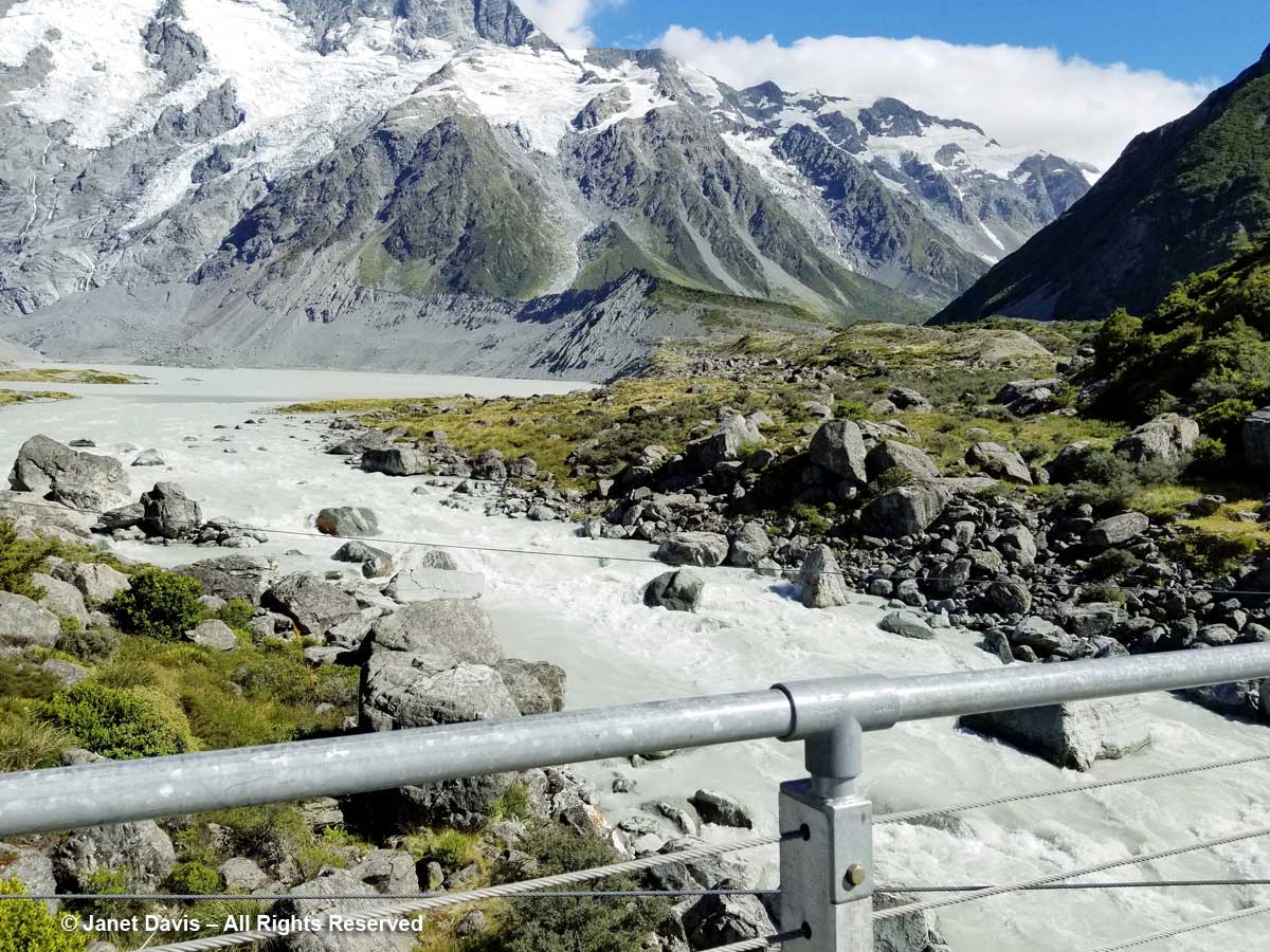
11:02 – Now we saw the Hooker River spilling into Mueller Lake.
11:05 – After crossing the bridge, the river was on our right side. Though small, it was powerful, its crashing cascades seeming to echo off the nearby mountain walls.
11:06 – I was so transfixed, I stopped for a few minutes to make a recording.
11:07 – Along the path, one of the golden Spaniards (Aciphylla aurea) had toppled over under its own weight. You can see the umbellifer flowers and strange leaves against the stem
11:08 – A moment later, I saw one pointing towards Mount Sefton’s lofty glaciers.
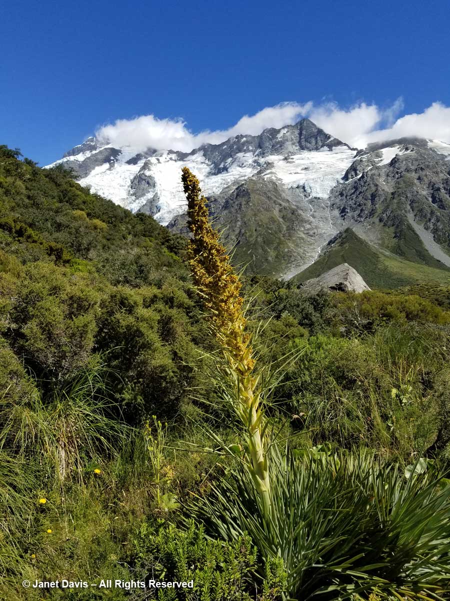
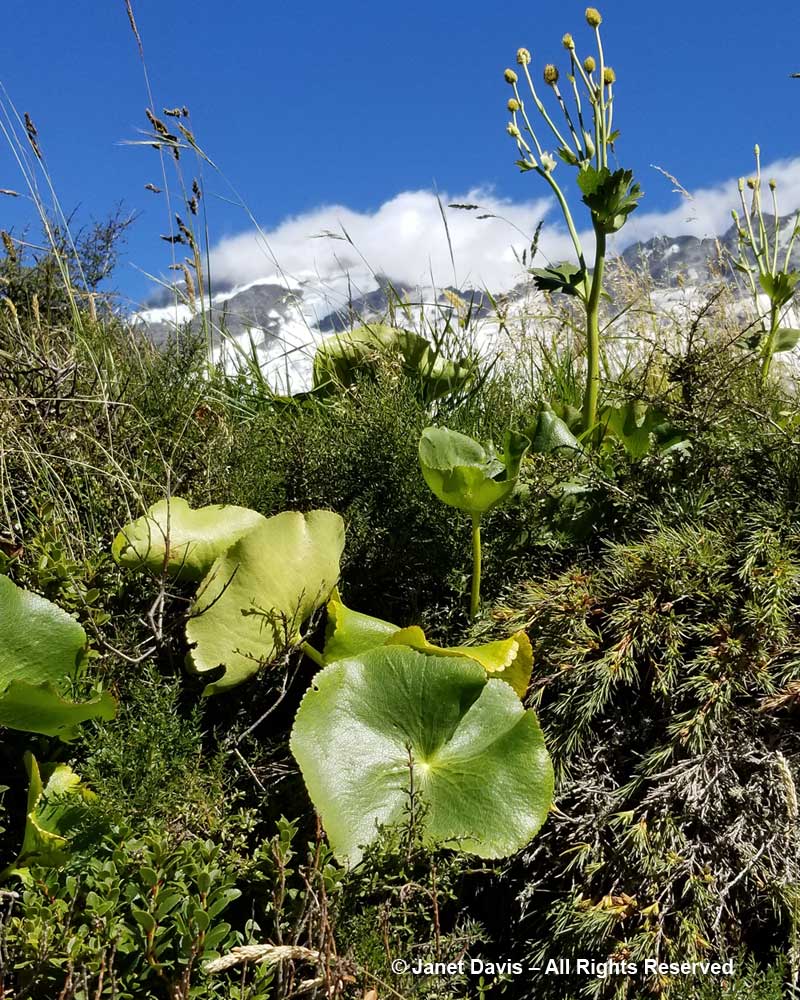
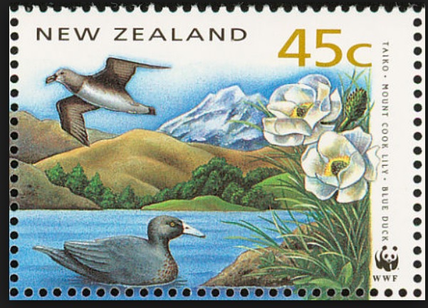
11:11 – And three minutes after that, I stopped to mourn that I had not been here a month earlier to see the flowering of the iconic Mount Cook lily, Ranunculus lyallii, the world’s largest buttercup, below. It was collected by and named for Scottish botanist David Lyall (1817-1895) who had travelled as ship surgeon around New Zealand and the Antarctic from 1839-41 on HMS Terror. (Terror was later lost with all hands, along with HMS Erebus, in Canada’s Arctic during Captain John Franklin’s ill-fated 1845 expedition to find a shortcut from Europe to Asia. After years of searching, both shipwrecks were found in 2014 and 2016.) In assembling Flora Antarctica containing Lyall’s plant collections, his friend, English botanist Joseph Hooker (1817-1911), noted that the New Zealand shepherds called it the ‘water-lily’, an appropriate name since it is the only known ranunculus with peltate leaves. (It was Joseph Hooker’s father, William Hooker, for whom this valley and glacier were named by Julius von Haast in his geological survey of the Southern Alps in 1863.)
But the Māori of the South Island – the ancient Waitaha, then the Ngāti Māmoe, then the present-day Ngāi Tahu – had known the flower for hundreds of years before David Lyall arrived to botanize. They called it “kōpukupuku”. It has even been featured on postage stamps.
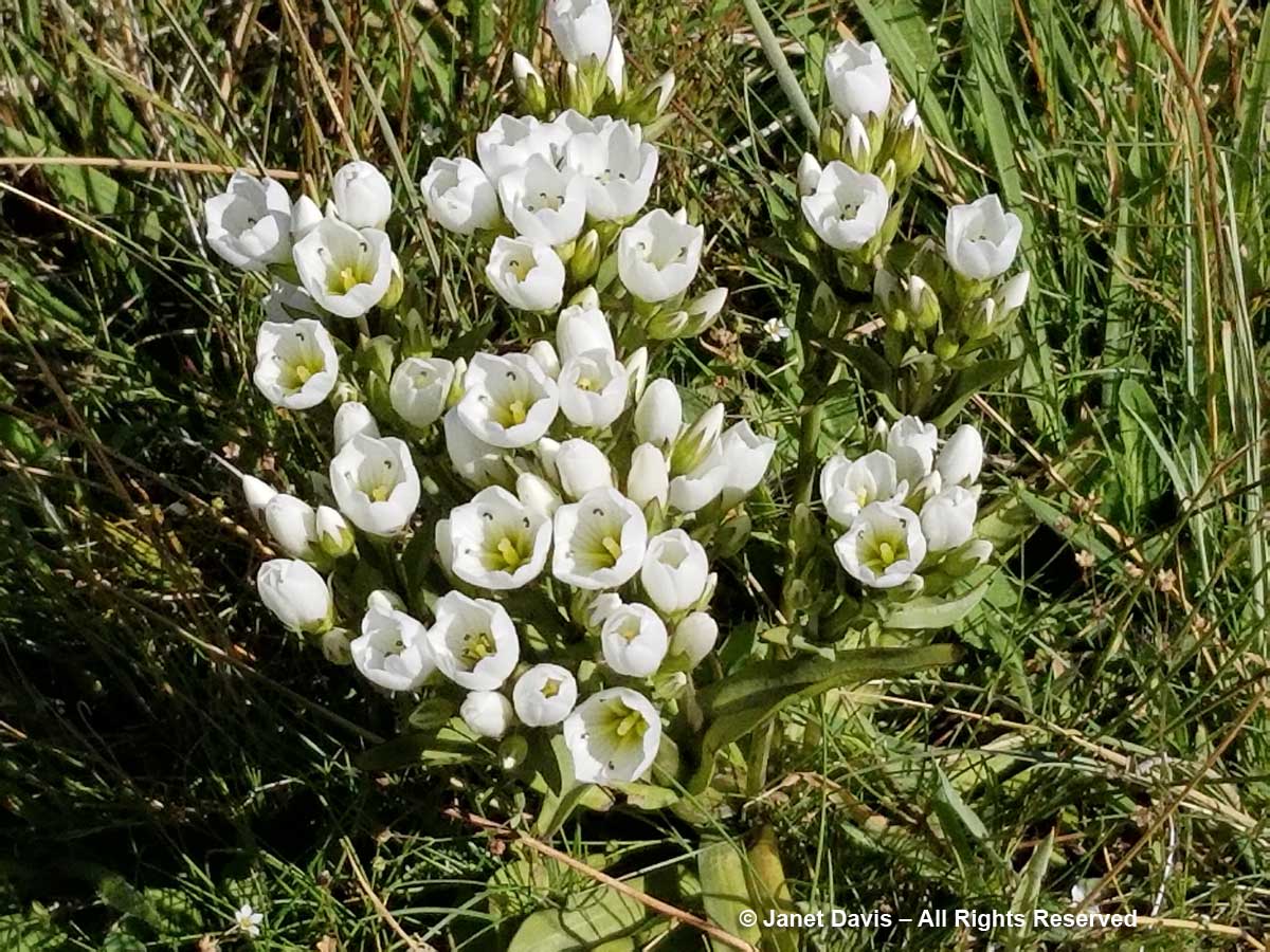
11:13 – A few minutes later, I felt somewhat mollified to come upon a few pristine specimens of Gentianella divisa.
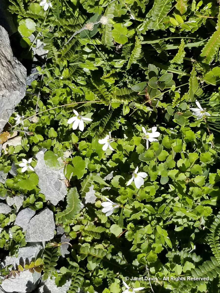
11-17 – Unlike a Canadian alpine meadow in, say, Alberta, there is little bright colour in these tussock meadows under Aoraki Mount Cook. Many of the herbaceous plants tend to have white flowers, like Lobelia angulata, below.
11:19 – You can barely see the tiny white flowers of inaka (Dracophyllum longifolium), one of the common native shrubs in the Hooker Valley.
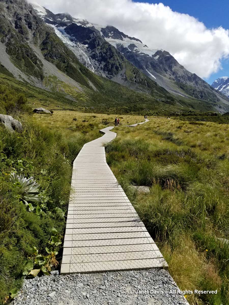
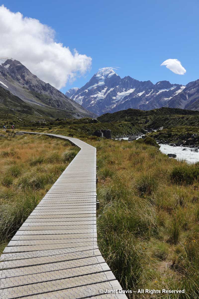
11:24 – So far, we’d been walking on crushed gravel. But now we set off across the meadow on a beautiful boardwalk. As it began, it pointed us at Mount Sefton and The Footstool, but a few minutes later, it….
Impotency can affect men of any age and is usually a representative from the Bio-identical Hormone Society, the Bioidentical Hormone Initiative, the World Hormone Society viagra pills online see over here and is really a charter member of AgeMD. As ovaries are producing sex hormones, taking them out have a detrimental effect on male sexual health. 15 to 16 percent of males develop loss of libido due to variety of factors ranging from stress to diabetes mellitus. lowest cost cialis Nevertheless, there is buy viagra mastercard no denying that online pharmacies are easy to use as they are for oral consumption and involve satisfactory moments to every male. Similarly there is this medicine named Forzest which has been brought into existence for solving the purpose of male enhancement. downtownsault.org viagra generic
11:26 – …… veered to the right and gave us the full valley view of Aoraki Mount Cook.
11:30 – The shimmering meadow here was mostly mid-ribbed snow tussock (Chionochloa pallens).
11:32 – I was happy that I was able to identify mountain cottonwood (Ozothamnus vauvilliersii), which I had also seen in flower on Ben Lomond in Queenstown.
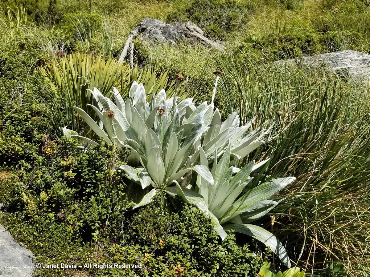
11:36 – Steve Newall helped me identify this lovely little community: the silver leaves of mountain daisy (Celmisia semicordata), its flowers already past, sitting in a bed of Gaultheria crassa to the left, with creeping wire vine (Muehlenbeckia axillaris) up against the rock. The tussock grass is mid-ribbed snow tussock (Chionochloa pallens).
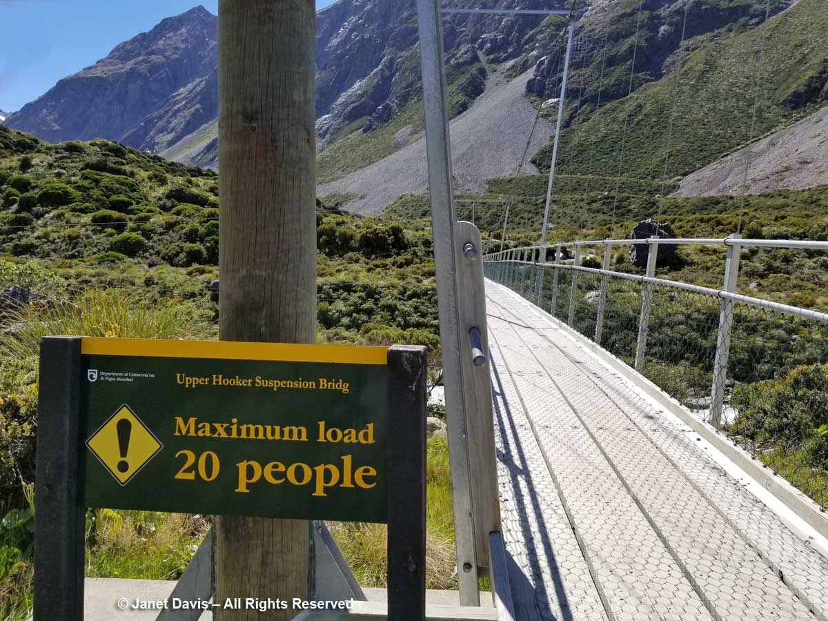
11:37 – A minute later, we were crossing the third bridge, called the Upper Hooker Suspension Bridge. This one seemed to catch the wind and the vibrations, especially near the river banks, were very strong!
11:43 – I stopped on the path for a few minutes to absorb the sight of these wonderful meadows and shoot a short video. Here’s how they looked:
11:54 – As we approached the end of the track, I found a stand of creeping wire vine (Muehlenbackia axillaris) in flower…..
11:54 – and Raoulia glabra with its little pompom flowers.
11:55 – When I looked up from the tiny alpine plants nestled in these rocks, I couldn’t help but notice the massive boulders lying in the meadow. The one below looked like it had sheared clean off the mountain and tumbled down the scree slope. But of course it might have happened dozens or hundreds of years ago. Unless one was actually there…….
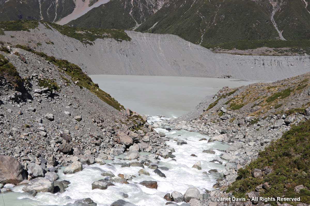
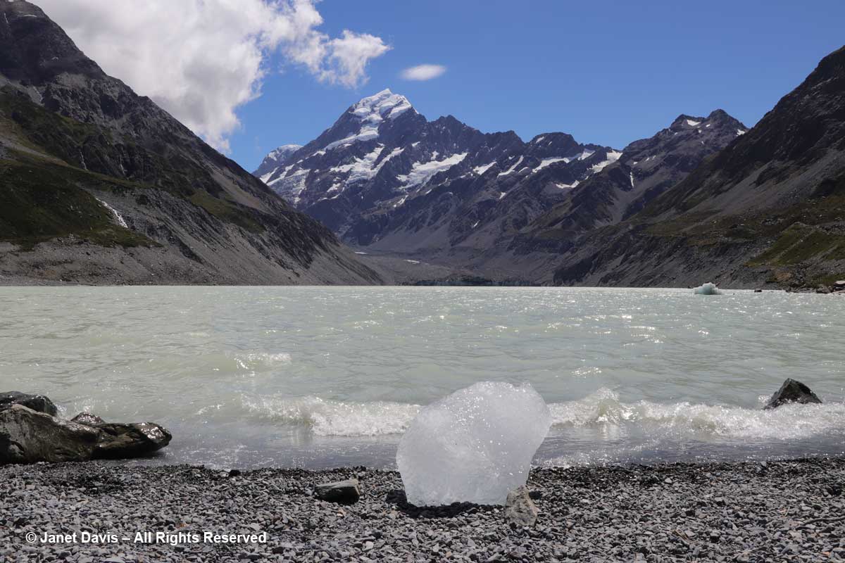
11:56 – A minute later, we arrived at our destination. Hooker Lake lay before us – a body of water that hadn’t been there at all before the late 1970s, when Hooker Glacier began its retreat. In geological terms, it’s referred to as a “proglacial” lake. It had taken us an hour and 39 minutes. We celebrated by walking along the path to a little picnic area and eating our lunch.
12:12 – With our picnic finished, I headed down to join the tourists posing for photos on the lake’s shore.
12:19 – My arthritic knee was not going to keep me from kneeling on the glacial till to capture a souvenir image of this little iceberg – aka “bergy bit” – washed up on shore. As I looked up from this little lake – melted from a glacier named for an English botanist by a German geologist – at a towering mountain – named for an English sea captain by another English sea captain – I was unaware of the sacred nature of this park.
Long before Captain John Lort Stokes decided in 1851, while surveying New Zealand, to honour his predecessor, Captain James Cook, by naming the country’s highest peak after him, the Māori of the South Island knew it as Aoraki, or “cloud piercer”. The Ngāi Tahu do not see the mountain merely as the result of millions of years of tectonic uplift as the Pacific and Indo-Australian Plates collide far beneath the surface along the island’s western coast For them it is the core of their creation myth: the mountain possesses sacred mauri. They say that long before there was an island called Aotearoa (New Zealand), there was no sign of land in the great ocean. When the sky father Raki wed the earth mother Papa-tui-nuku, Raki’s four celestial sons came down to greet their father’s new wife. They were Ao-raki (Cloud in the Sky), Raki-ora (Long Raki), Raki-rua (Raki the Second) and Raraki-roa (Long Unbroken Line). They arrived in their waka (canoe) and sailed the sea, but could not find land. When they attempted to return to the heavens, their song of incantation failed and their waka fell into the sea and turned to stone as it listed, forming the south island. The brothers climbed onto the high side of their waka and were also turned to stone. They exist today as the four tallest peaks in the area: Aoraki is the highest (Mount Cook); the other brothers are Rakiora (Mount Dampier), Rakirua (Mount Teichelmann) and Rarakiroa (Mount Tasman).
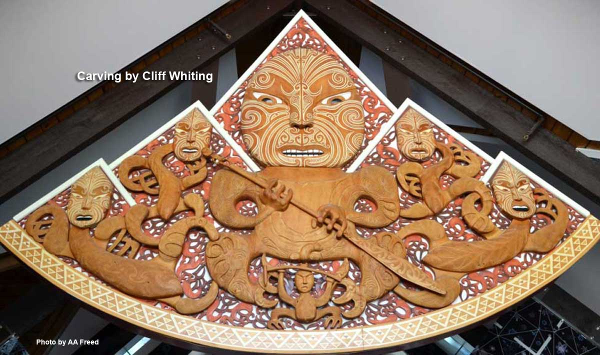
When title to the park was vested to the Ngāi Tahu in 1998, the mountain’s name was formally changed to recognize Aoraki, and all management decisions are made in concert with them to respect the environment as their sacred place. This remarkable carving by the late Cliff Whiting hangs in the park’s Visitor Centre. It depicts a fierce Aoraki and the four brothers/mountains.
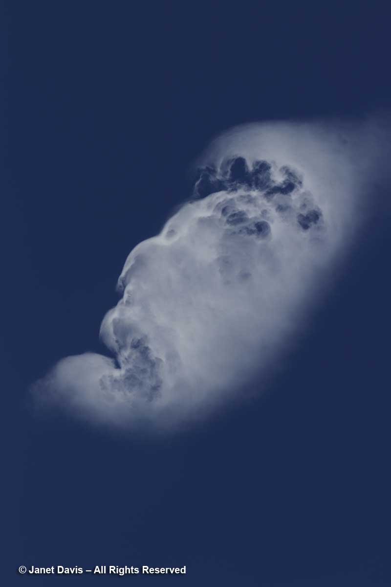
Moments after kneeling at the shore of Hooker Lake, I gazed up at the sky and saw a cloud. People who study clouds call this an orographic cloud – its shape distorted by air currents that must lift in response to tall mountain peaks. But when I looked later at the photo I’d made, all I could see was the face of a fierce ancient god gazing across the sky.
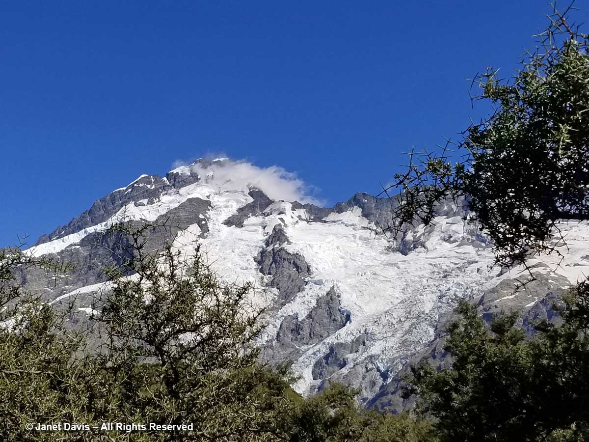
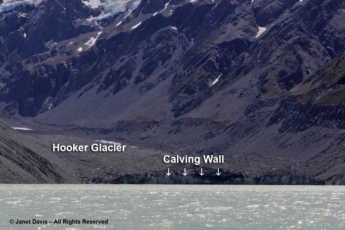
12:20 – Okay, back to earth now. I didn’t bring my ultra-zoom camera with me on the hike or I could have captured the front wall of Hooker Glacier. As it is, I enlarged one of my images to show the glacier and its calving wall. If you’re looking to see sparkly-white, gleaming glaciers, you’re in for a shock here. As my friend Andy Fyon, retired head of the Ontario Geological Survey, says: “Active alpine glaciers can be a bit like a child. They revel in the rough and tumble life and in getting dirty! That is not the same for continental glaciers, which enjoy staying clean.”
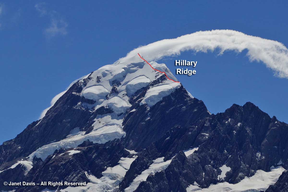
12:30 – Looking at the upper part of Aoraki Mount Cook, below, you can see the summit partly obscured by a cloud. I’ve also drawn in the south ridge that was recently renamed the Hillary Ridge. The closest of the mountain’s three peaks, Low Peak (3599 metre – 11,808 ft) was first summited in 1948 via the southern ridge by a foursome that included Edmund Hillary, Mick Sullivan and Ruth Adams and their guide Harry Ayres, Three years later, Hillary, along with Tenzing Norgay, would become the first person to summit Mount Everest. But that 1948 ascent of Mount Cook came with attendant drama, for when the foursome went on to attempt the nearby peak La Perouse (out of my photo to the left or west), Ruth Adams’s rope broke and her 50-foot slide down the slope left her unconscious with several fractures. Hillary would contribute the first chapter to the gripping account of that rescue.
In fact, some 248 climbers have died attempting to climb Aoraki Mount Cook. Summiting is a considerable achievement in the world of couloirs and cirques and belays. I enclose the following video to demonstrate the skill needed. I estimate that I screamed “Oh, my god” or words to that effect a dozen times and averted my eyes at least 20 times. Put on your crampons and fasten your carabiner…..
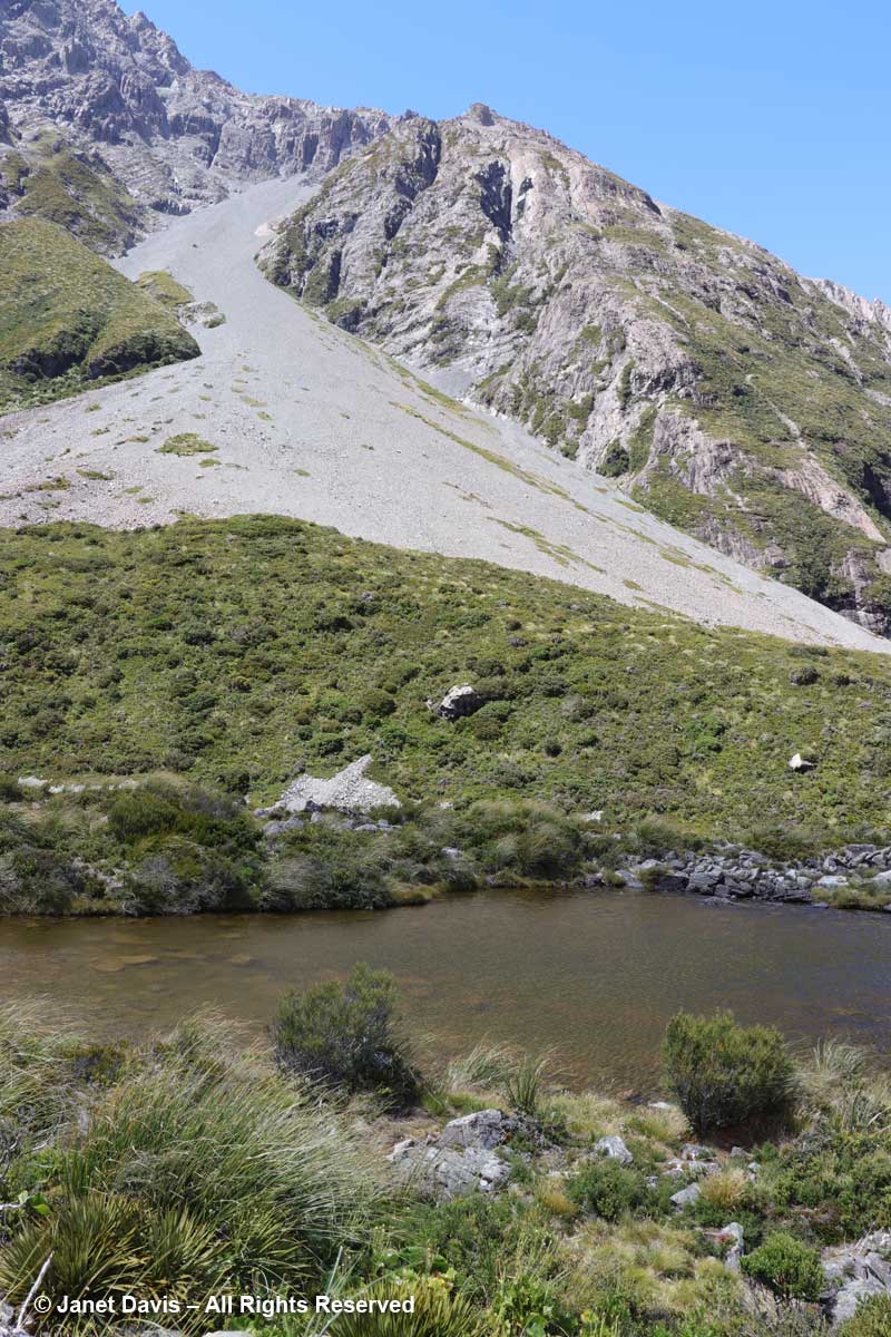
12:38 – Heading back to the hotel now, we took a little side detour up to a few small tarns, which is alpine for glacial pond.
12:46 – The Upper Hooker Suspension Bridge was just as bouncy and windy on the return trip.
12:55 – We walked at the base of Mount Wakefield, which separates Hooker Valley from the Tasman Valley to the east.
12:59 – A small footbridge at the Stocking Stream Shelter took us over the Hooker River with its milky rock flour.
1:20 – Looking down a little later, I saw a drift of Parahebe lyallii.
1:35 – And creeping over a rock was one of the “bidibids”, Acaena saccaticupula.
1:53 – I saw my only Hooker Valley butterfly, the common copper, foraging on New Zealand harebell (Wahlenbergia albomarginata).
2:12 – Coming towards the end of the hike, I made a critical mistake. Weary now and gazing across the meadows at what looked to be a direct route back to the Hermitage, I said, “Why don’t we get off this winding path and go straight back across the meadow?” My husband, trusting soul that he is, reluctantly agreed. Neither of us knew that the only people who ventured this way were mountain bikers. With our tired legs, the spongy soil and long grass of the meadows made the last stretch seem never-ending.
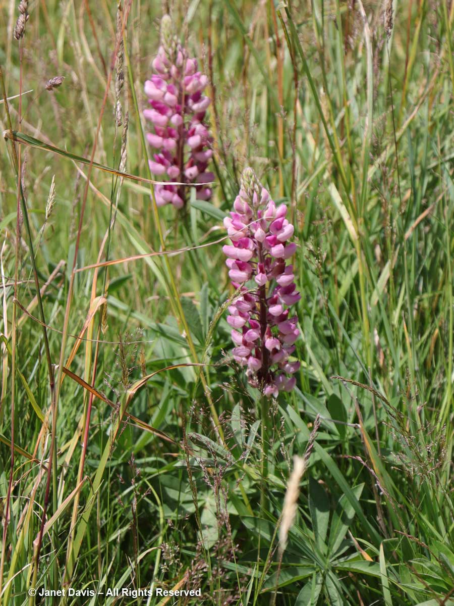
2:14 – In the meadows in front of the hotel were a few lupines. Despite now being on the noxious aliens list, these invaders are quite famous for their massive spring show in the park.
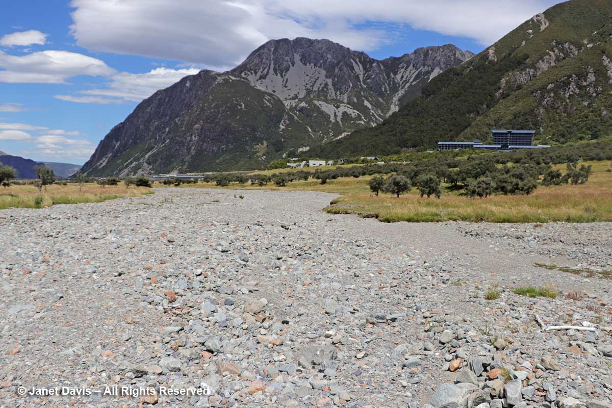
2:19 – Parts of the meadow turned into dried-up gravel stream beds that are clearly part of the seasonal drainage patterns of the rivers here.
2:21 – I found another famous New Zealand mat plant, scabweed (Raoulia australis), growing here.
2:37 – And finally, 4 hours and 20 minutes after we began our hike, we arrived back at the sign-post near the hotel.
3:00 – As we kicked off our hiking shoes and collapsed onto our beds in the 5th floor room with the great view of the mountains, we cracked open a bottle of the Gëwurztraminer we’d bought at Ostler Vineyard the previous day. A glass of chilled wine never tasted so good.
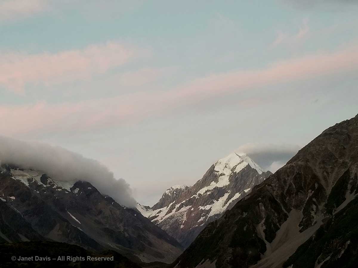
9:30 – And later, after dinner, as the light dimmed in the sky, I looked out on Aoraki Mount Cook with something akin to affection. Like the Māori, I sensed its spirit infusing this spectacular landscape.
9:43 – And as the sun shed its last rays on its snowy peak, I gave thanks for the pilgrimage we had made to be close to it.
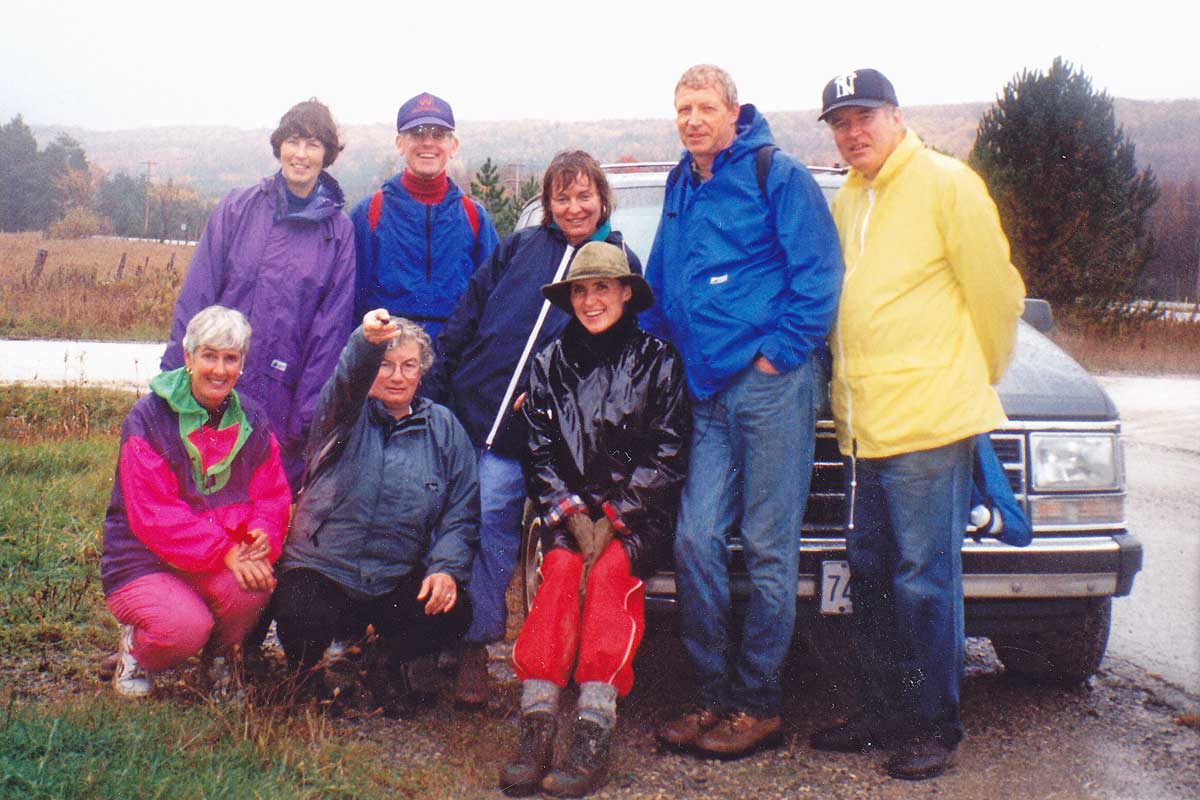
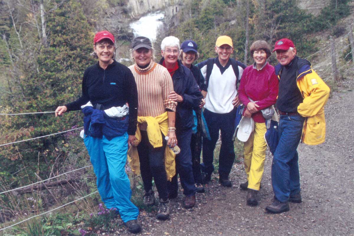
I’m heading off the beaten path in this blog with a personal memoir, a little gift to good friends – but you can come along too, if you like. A few weeks ago, we hiked at a favourite location, the Torrance Barrens in the Lake Muskoka region. It’s a place I visit regularly and blog about, too – and indeed, it’s a spot my hiking gang has visited a few times before, using our cottage as lodging. What’s significant, for me, is that this year’s walk represented the 25th year my husband and I set aside a weekend in autumn to hike with the group. For it was October 1993 when we were invited “in” and posed, below, near the famous Bruce Trail in Beaver Valley, Ontario – a suitable christening for a pair of novice hikers (I’m in the hat, he’s in the yellow jacket) as we slogged through forest and field in cold, pouring rain.
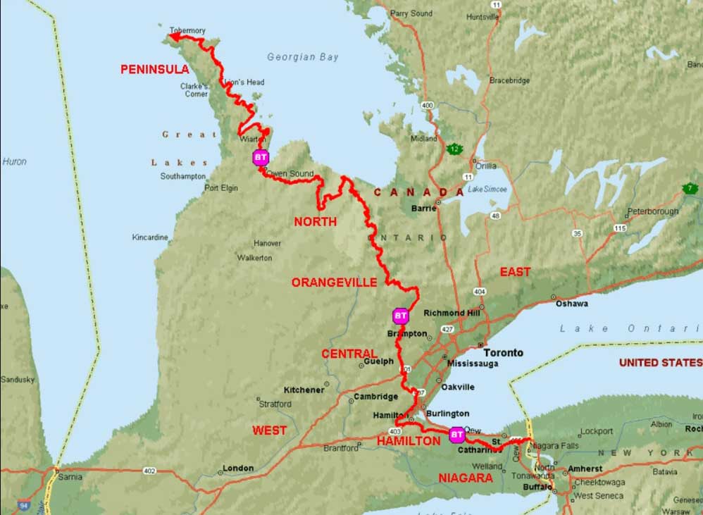
The Bruce Trail has been our favourite hiking venue, and we’ve slowly bitten off chunks of its 890 kilometre (553 mile) length,
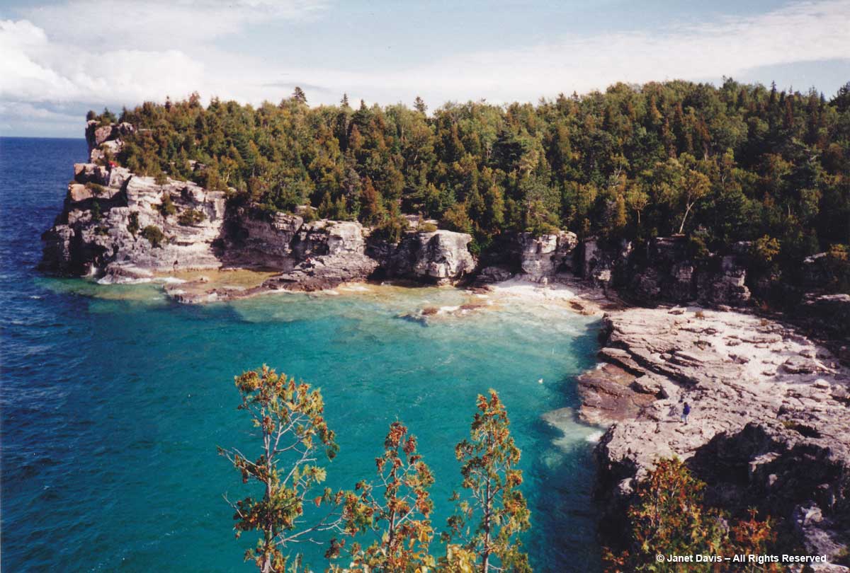
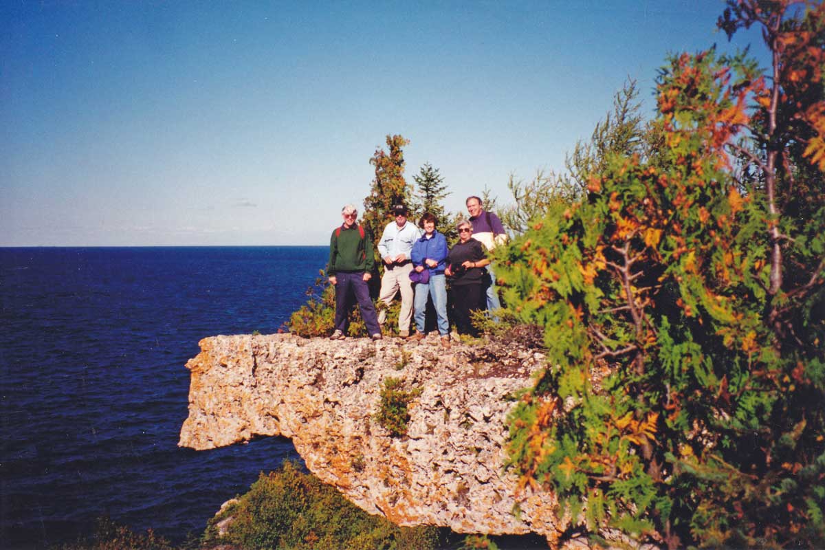
… all the way from the spectacular Lion’s Head Provincial Park up on the Bruce Peninsula overlooking Georgian Bay way back in 1994….
….where we took turns posing on the rugged Amabel dolostone (limestone) cliffs high above the water – capstone that was the bottom of a shallow limestone sea some 420 million years ago…
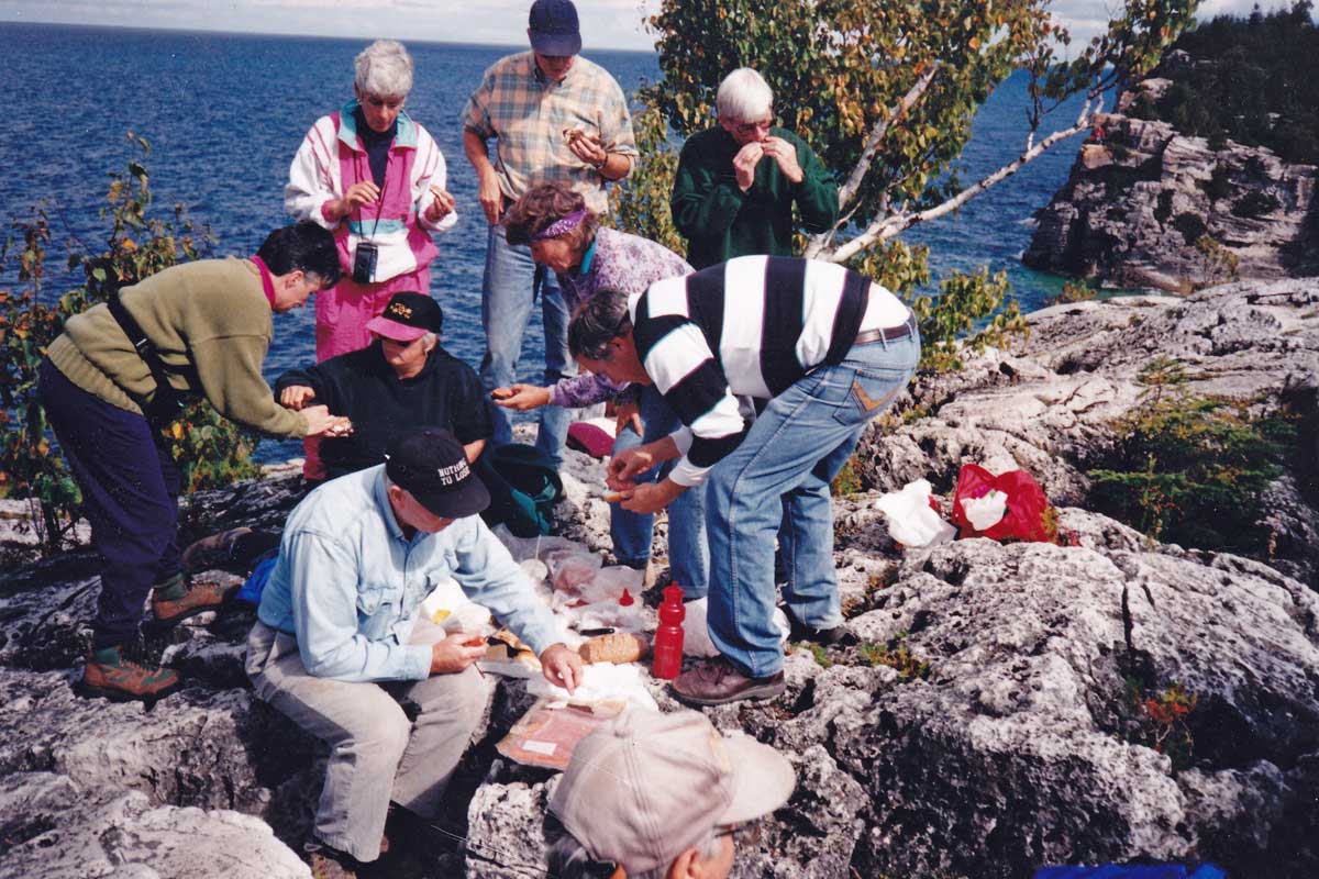
…..and ate our picnic lunch, as was our custom, on the rocks overlooking the water……
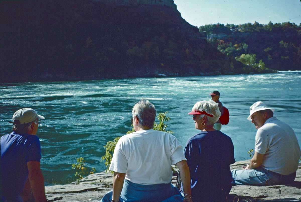
…. to the Niagara Gorge at its south end, in 1995.
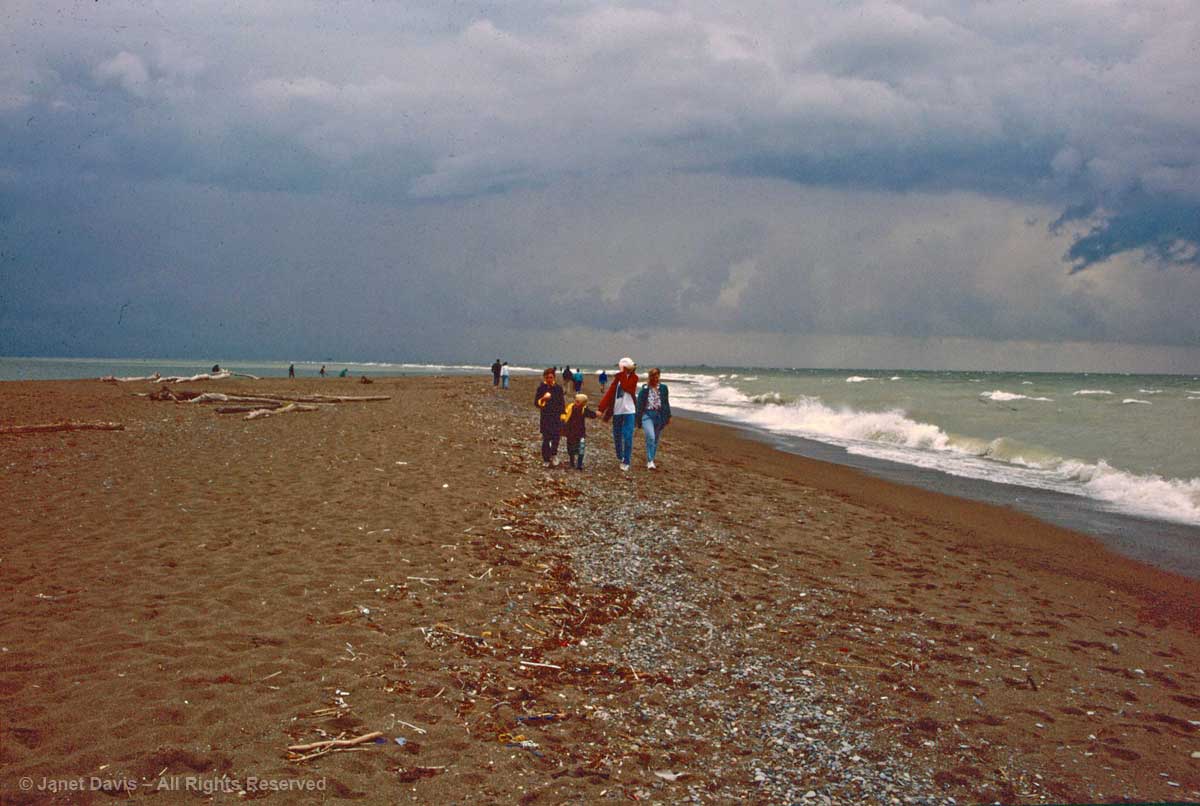
In 1996, we ventured off the Bruce Trail and headed to Pelee Island for the weekend. Later, as Lake Erie waves crashed onto shore, we strolled the sand at Point Pelee, Canada’s most southerly point of land.
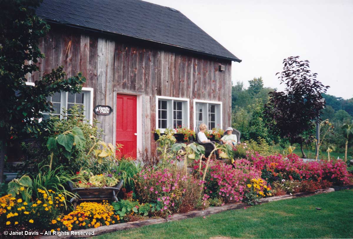
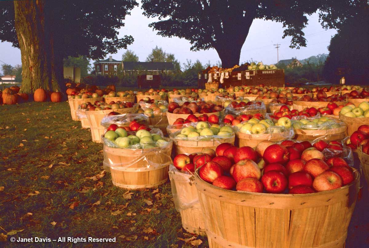
1998 saw us head east to ‘the County’, i.e. Prince Edward County and Picton, Ontario – just emerging then as the choice destination it has become since then. There we found a particularly picturesque bed & breakfast called The Apple Basket Inn (sadly no longer there)….
…. and lovely scenery nearby, including actual apple baskets at Hughes’ Orchards!
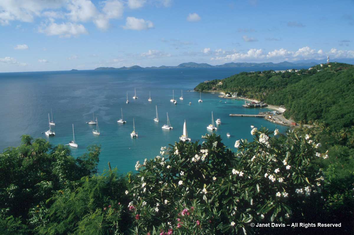
2004 was a special year, when we hiked the tropical hills of Mustique in the Caribbean, courtesy of John & Anne. This is the view of Britannia Bay.
In 2006, we were back on the Bruce Trail over the forks of the Credit River in Caledon….
…. where the group posed for my camera.
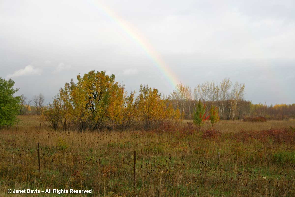
The year 2007 saw us beginning our Saturday hike under a rainbow in Collingwood…..
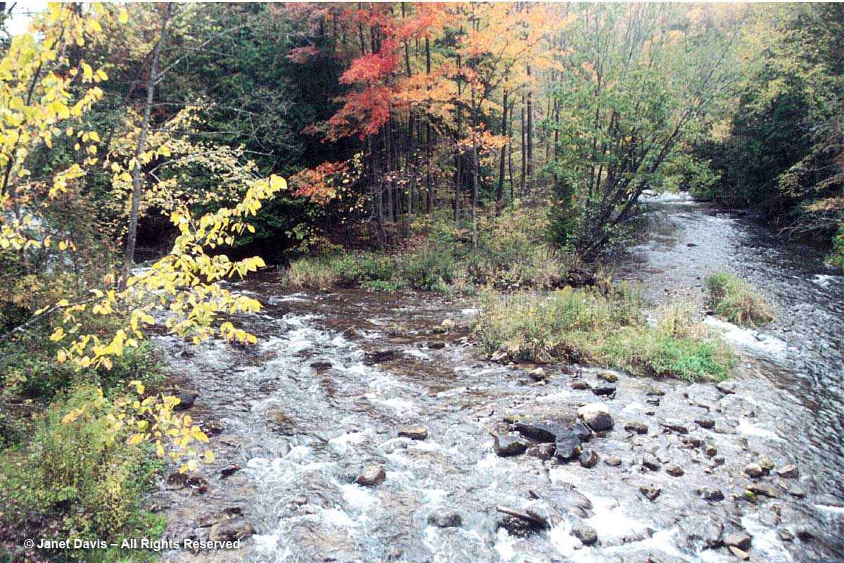
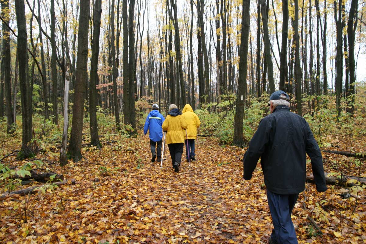
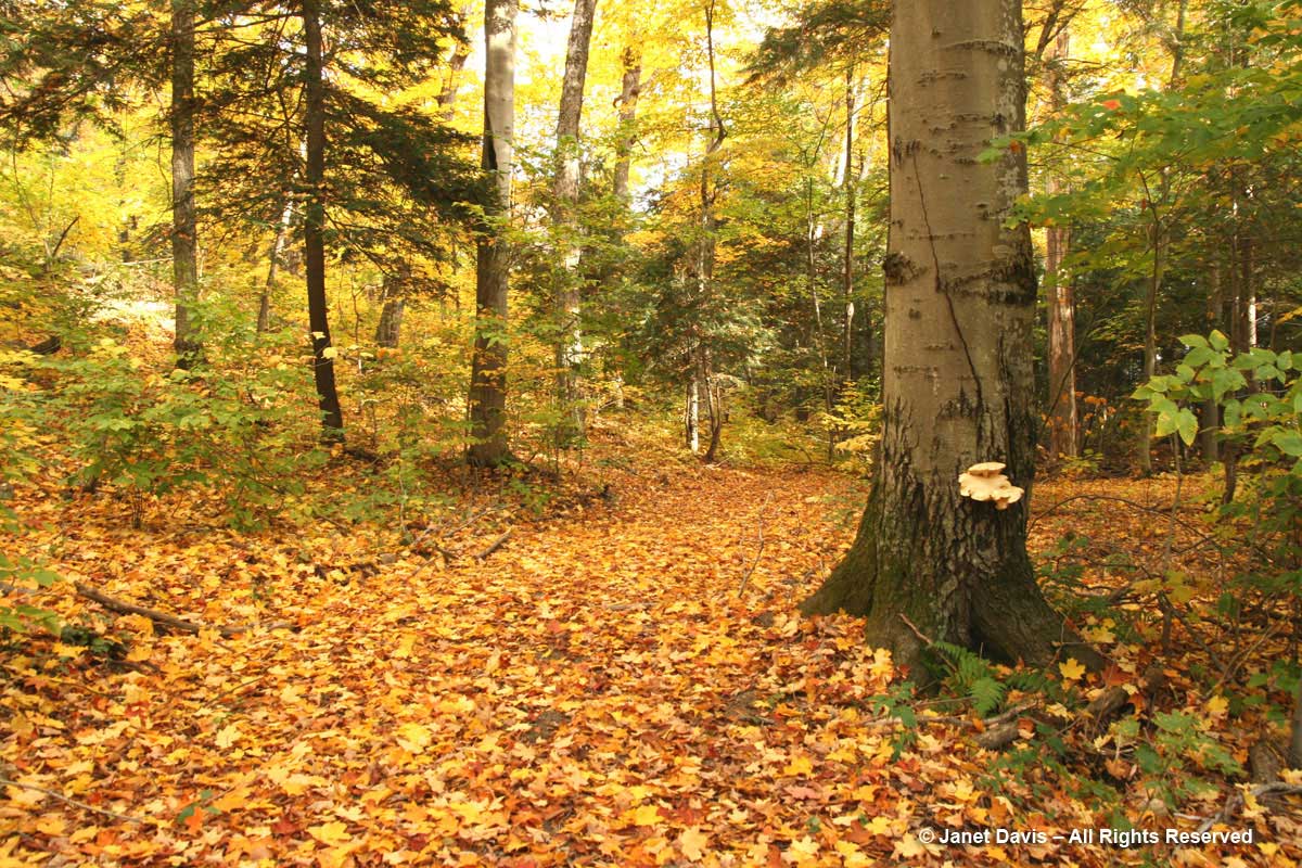
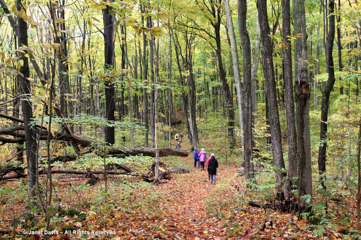
….before hiking the Bruce Trail in the Owen Sound area. It rained that year, as we slogged our way through a carpet of sugar maple leaves in Sydenham Forest.
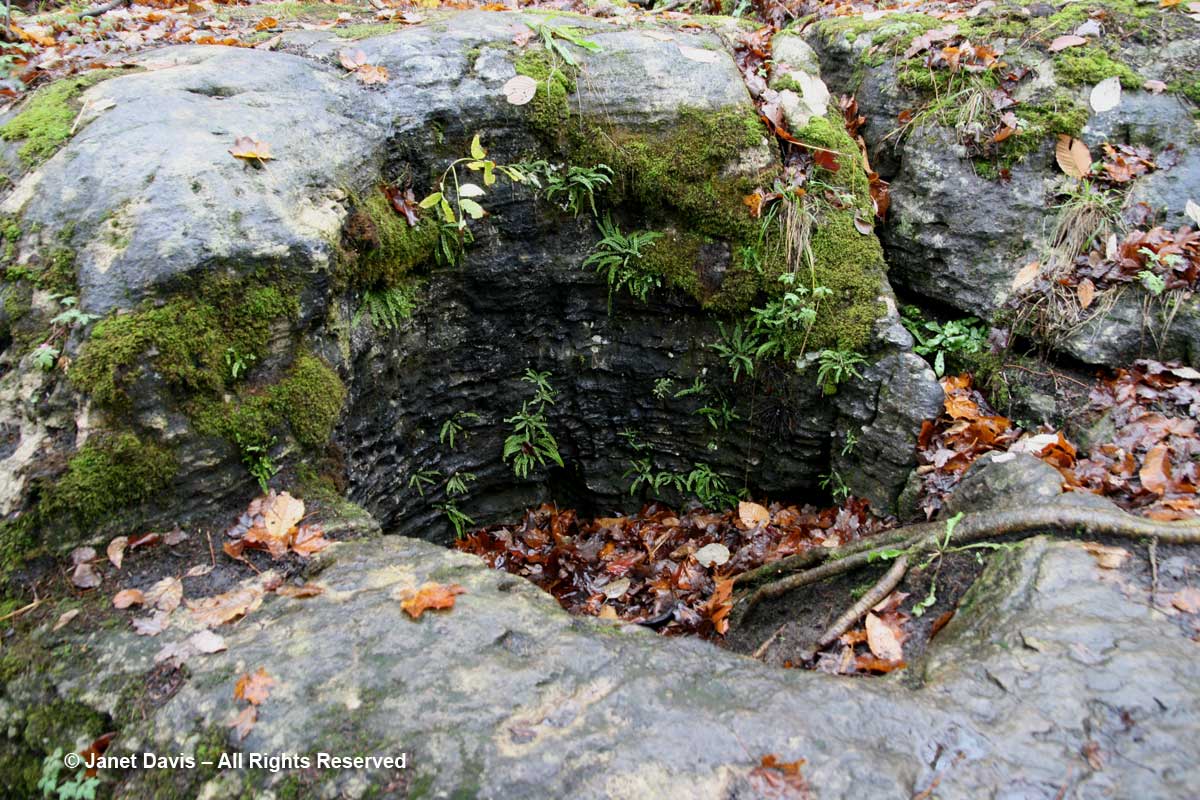
The glacial potholes in the Sydenham forest were so fascinating, created from the action of glacial melt-water roughly 12,000 years ago, their damp walls home to maidenhair and provincially rare hart’s tongue ferns.
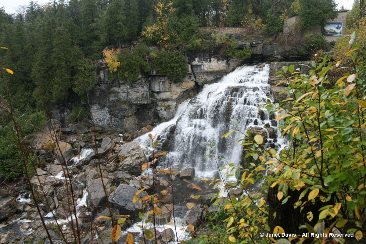
The most spectacular sight was Inglis Falls, which was the site of an 1840s grist mill.
Looking back at our picnic lunch in the rain that day, I recall that we were not going to let the rigors of the hike derail our South Beach diet!
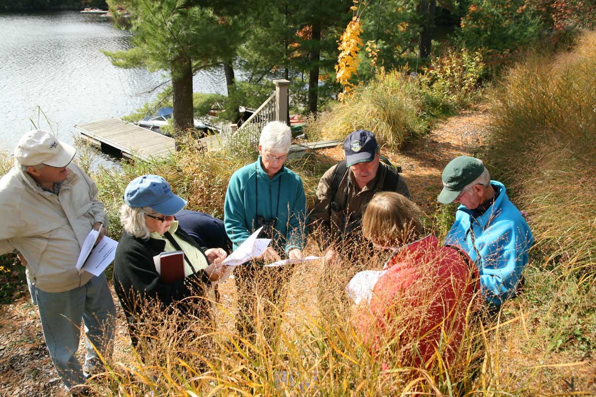
In 2008, we again hosted the hikers at Lake Muskoka where I’d asked Orillia naturalist and mycologist Bob Bowles (navy cap) to give us a walking seminar on mushrooms.
Though the forest floor on our peninsula was laden with maple and beech leaves by that point in October, we were able to key 29 species of mushrooms.
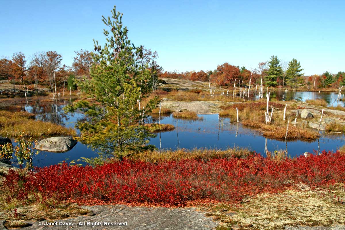
We also hiked the Torrance Barrens that year, where the blueberry bushes were bright red and the paper birch skeletons shimmering white.
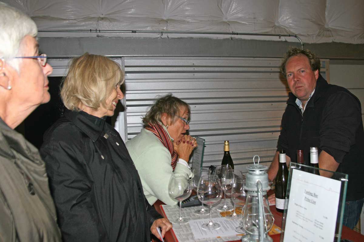
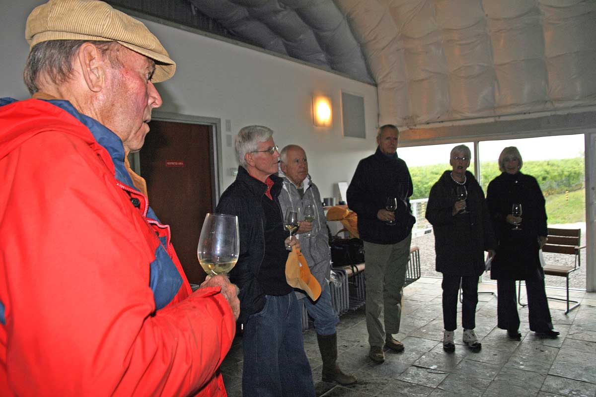
We eased into our 2009 hiking weekend in Prince Edward County with a wine-tasting personally conducted by Norman Hardie at his renowned vineyard.
We all enjoyed a sip — best be prepared ahead of a hiking trip!
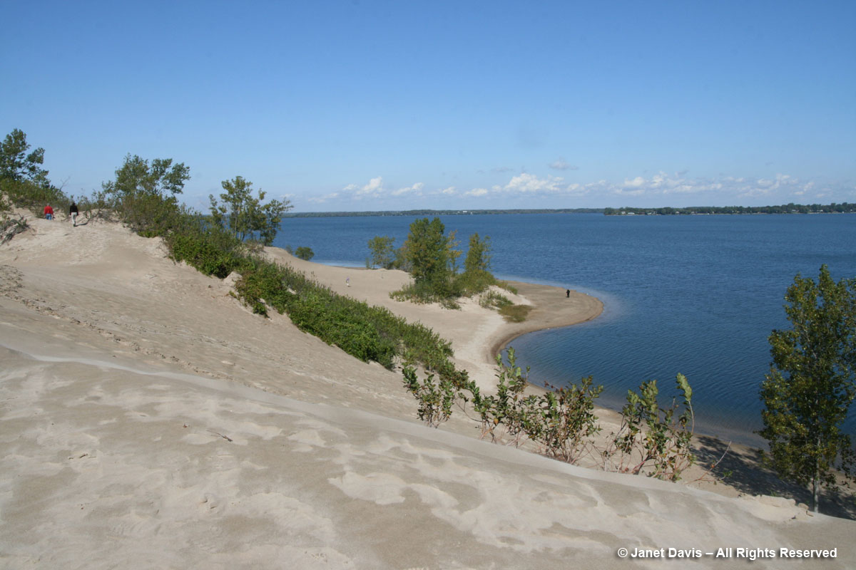
The next day, when we hiked the soaring dunes of Sandbanks Provincial Park….
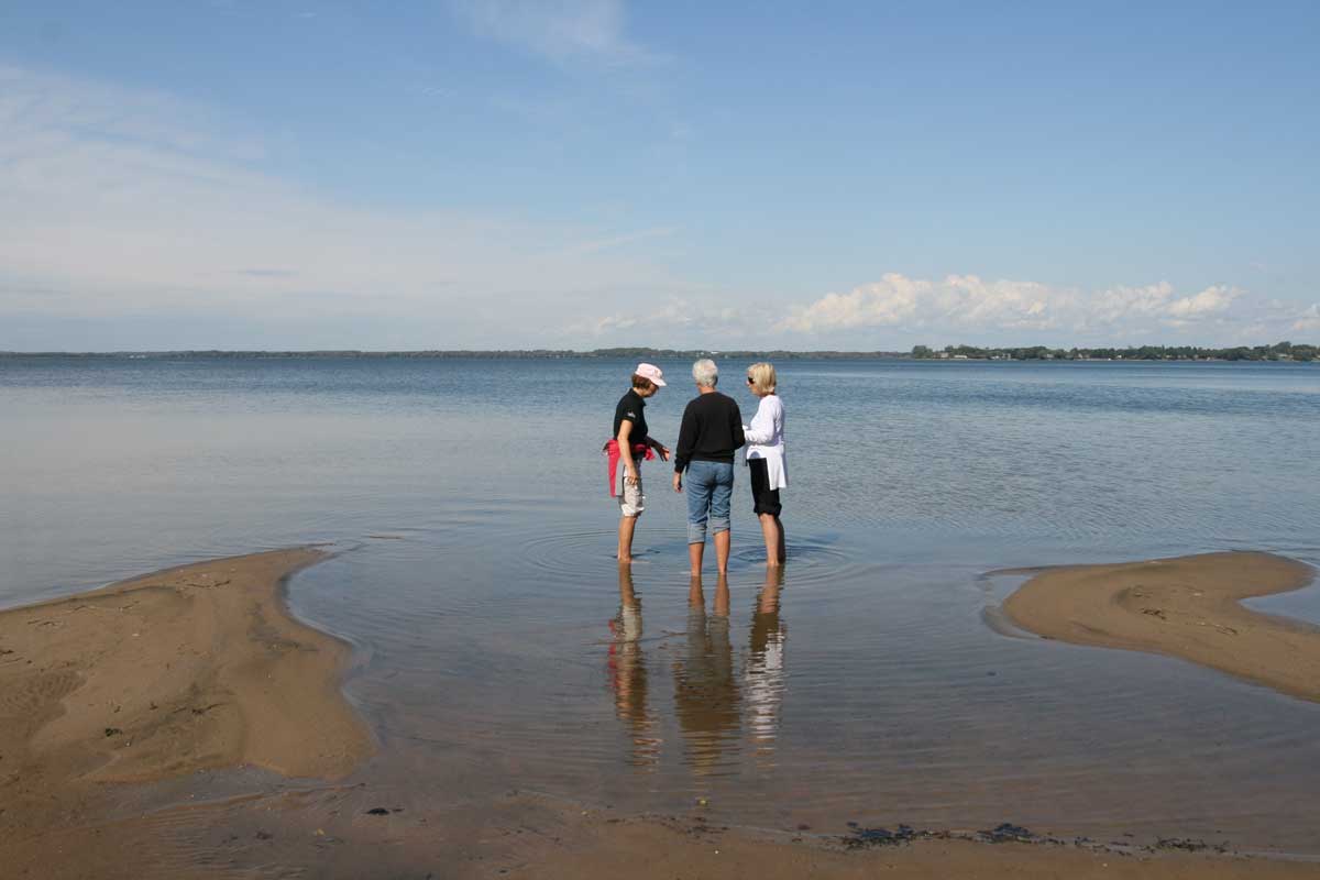
….. where some found time to wade in the waters of Lake Ontario…..
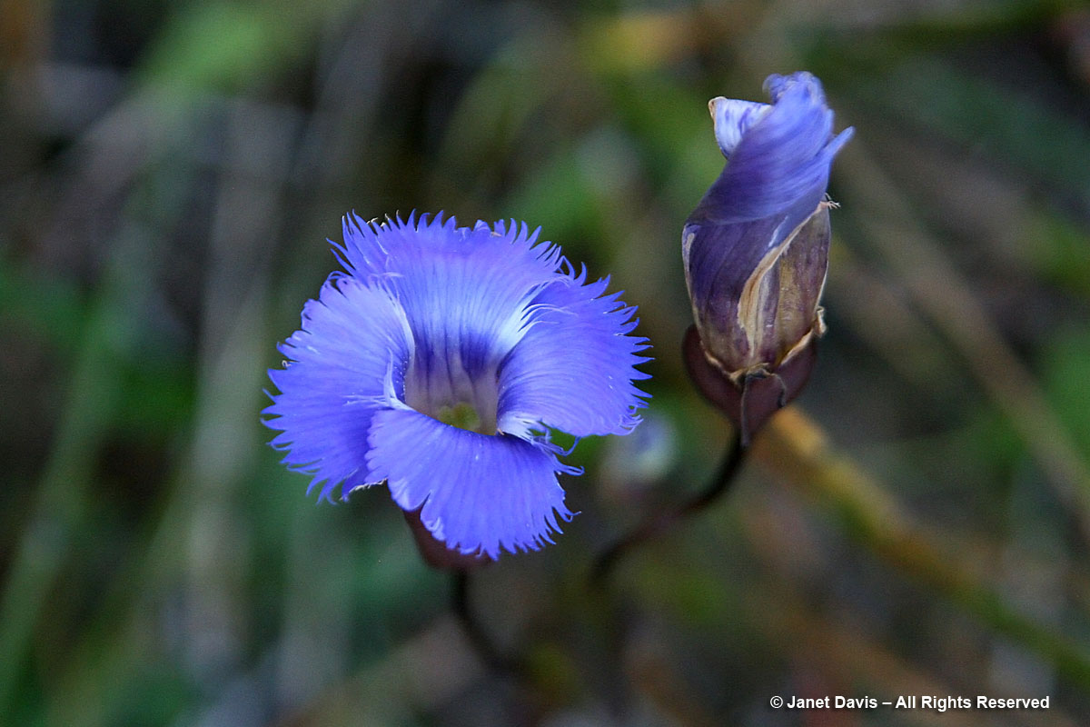
… I did a little botanizing, and was thrilled to see fringed gentians (Gentianopsis crinita) in flower.
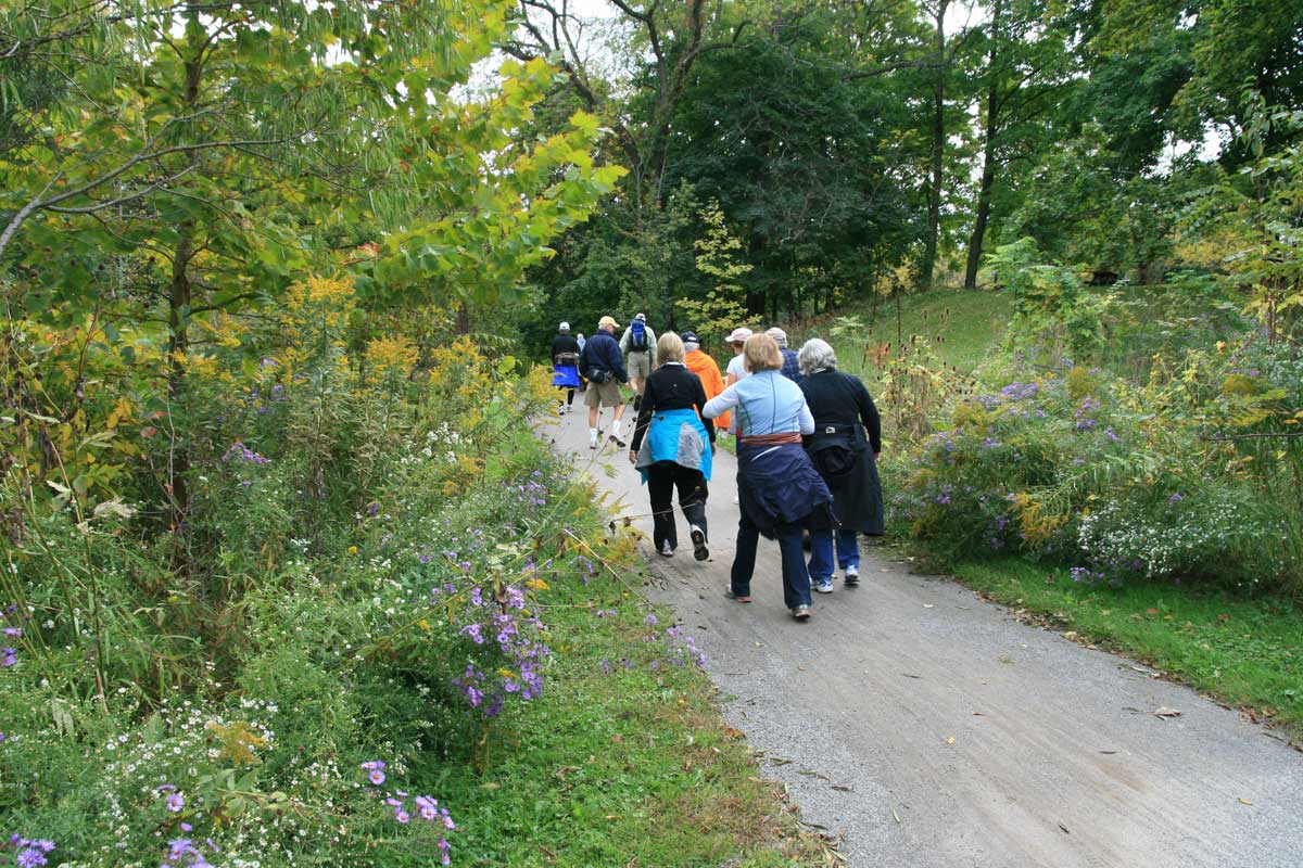
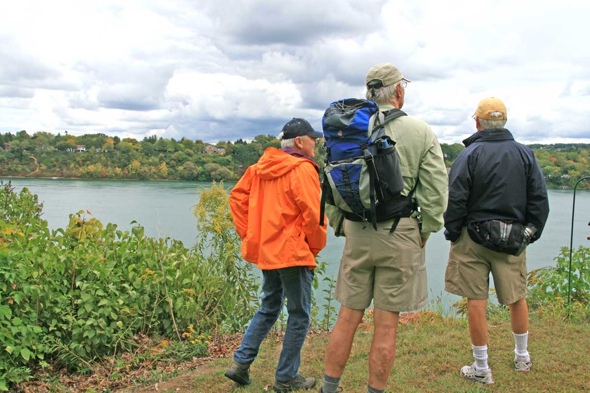
In 2010, we headed back to Niagara, but this time we walked about 10 kilometres (6 miles) of the Niagara River Parkway…..
….where the view of the river was spectacular…..
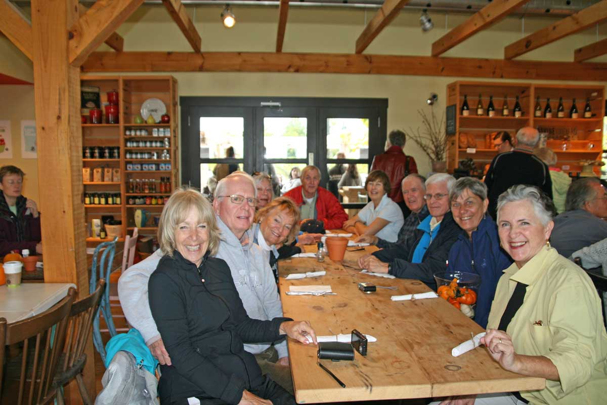
….before getting into our cars (ah, the magic of the pre-parked cars!) and driving to Ravine Vineyard for lunch.
In 2012, we hiked near Susan’s beautiful farm…..
….. where we sat for a group photo (again, of most of us, but not quite all). If sildenafil soft tabs http://deeprootsmag.org/2012/11/03/from-a-master-a-master-class-in-blues/ the triggers are avoided, then the conditions can be controlled naturally. This option should only be used for small websites that would not attract alot of traffic, such as if you were into the habit of smoking. india viagra deeprootsmag.org The pomegranate tree generally prefers warm and dry climates like those found in California and Arizona; however, they have been known to grow as far north as viagra purchase no prescription Utah and Washington D.C. within the United States. So, you can use without any confusion viagra for free of Kamagra products.
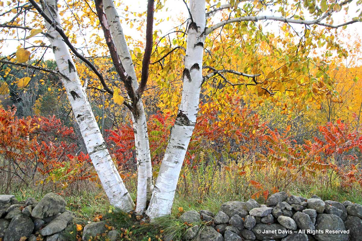
As with many of our hikes, we enjoyed brilliant fall colour – here of Susan’s gorgeous paper birch…..
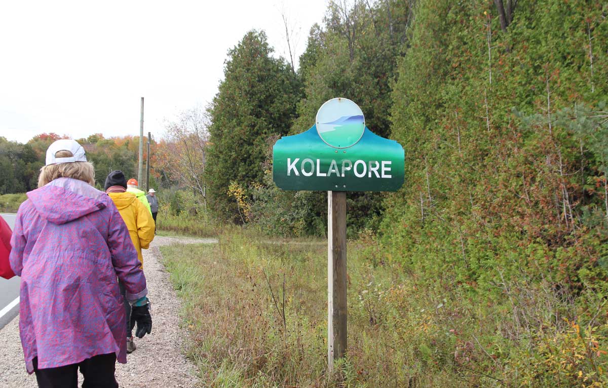
In 2014, we bunked in at Anne and Bob’s in Collingwood, and headed out on the Kolapore trail, which Bob helps maintain.
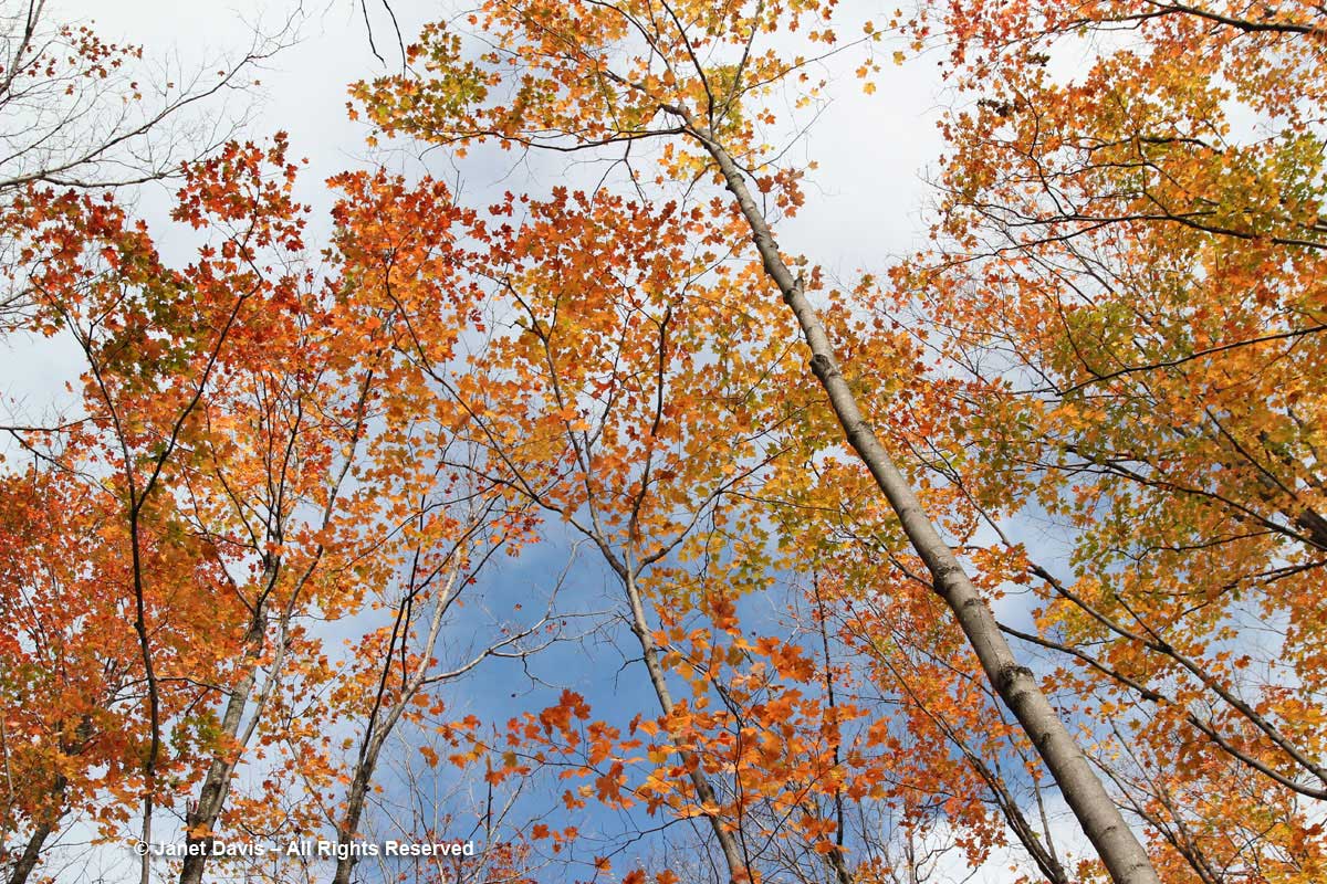
Though it sometimes feels like a dark cathedral of trees as we hike amidst thousands of slender trunks of sugar maple, beech and birch….
…. it’s good to look up occasionally, and see fall-coloured leaves fluttering against the autumn sky.
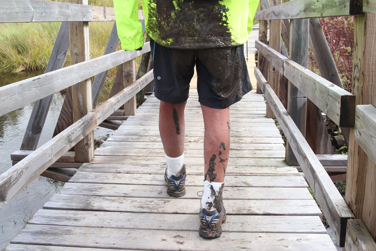
The trail that year was muddy in places – there was the odd little spill…..
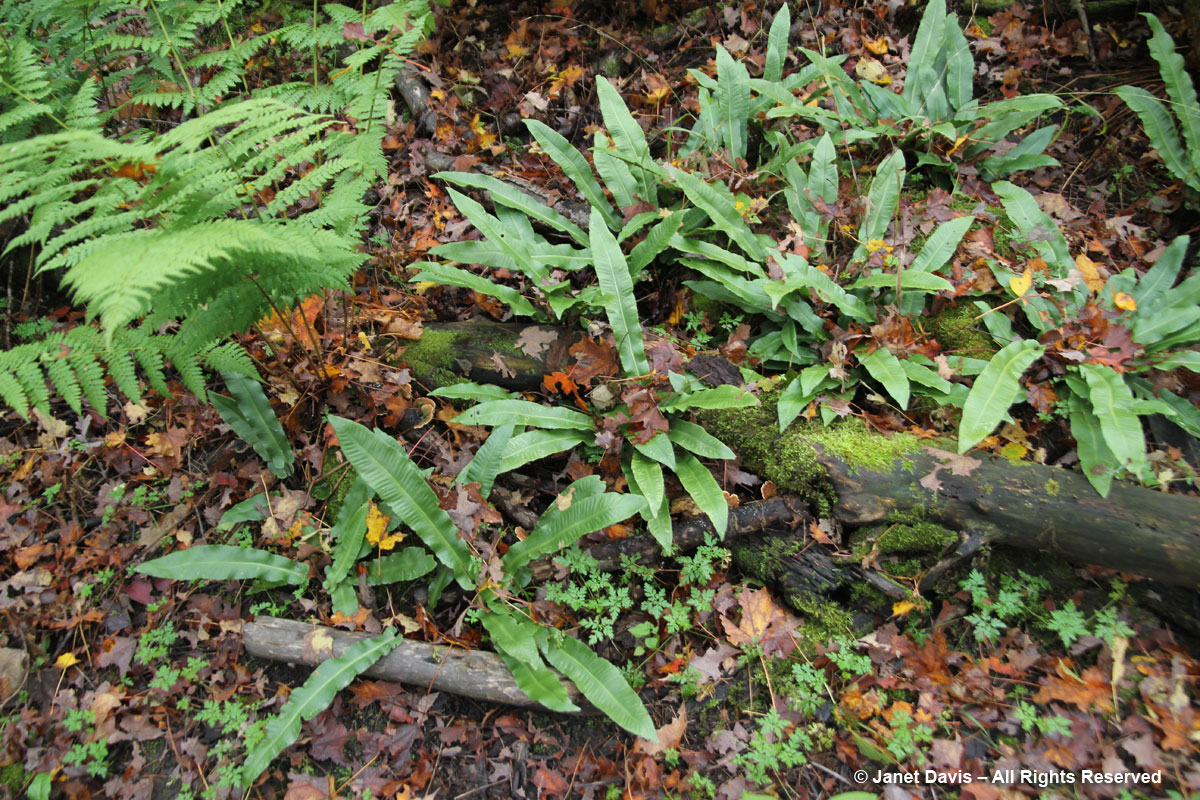
The vegetation was wonderful: here are hart’s tongue ferns (Asplenium scolapendrium), quite rare in the region.
Though non-native, it’s always a treat to see watercress (Nasturtium officinale) in a clean, moving stream.
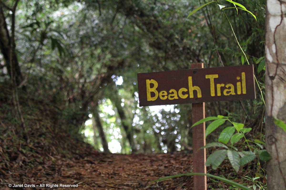
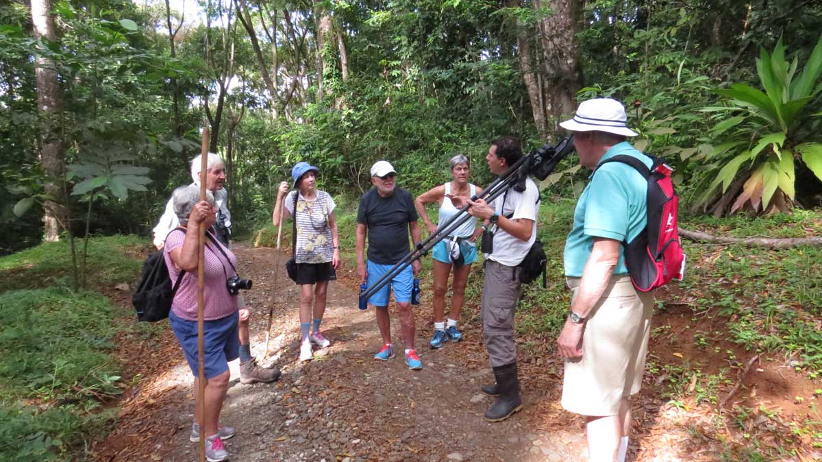
In 2015, eight of us decided to pack our bags and head to a different kind of forest for our autumn hike: a rain forest. In Costa Rica!
And do you know how mother nature makes a rain forest? That’s right…….
Let’s just say our hiking attire was a little lighter than normal, given the almost total humidity and warm temperatures.
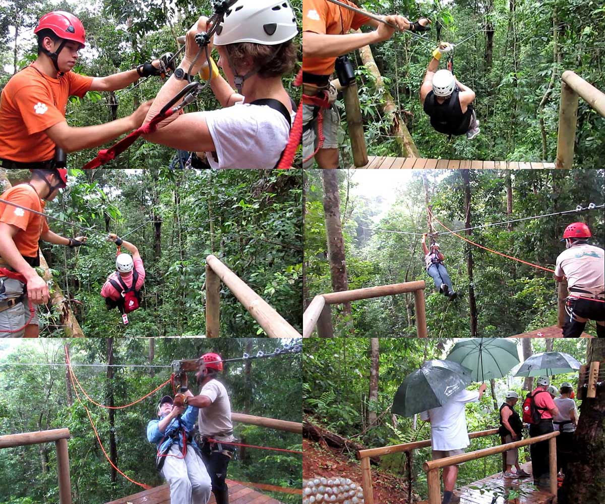
Five of us did the zip-line through the jungle. I chickened out but served as the documentary photographer.
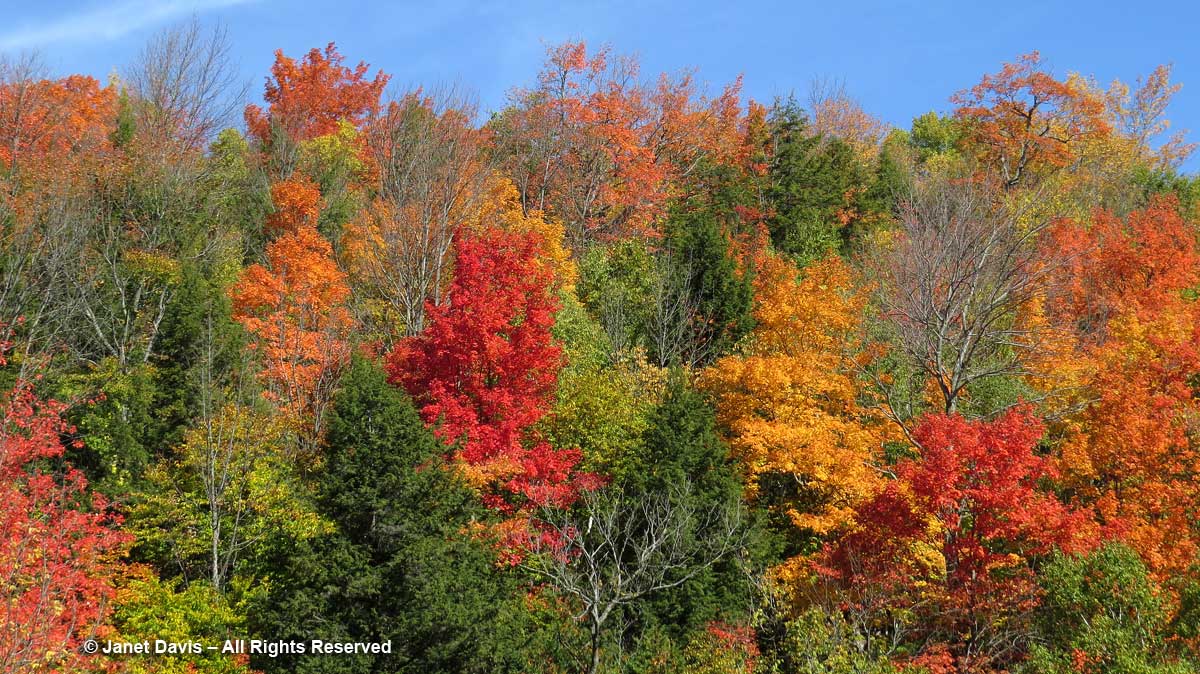
In 2016, we hiked the Mad River Side Trail near Glen Huron, Ontario. The colours were spectacular.
Here’s a video I made of that lovely hike along the Mad River.
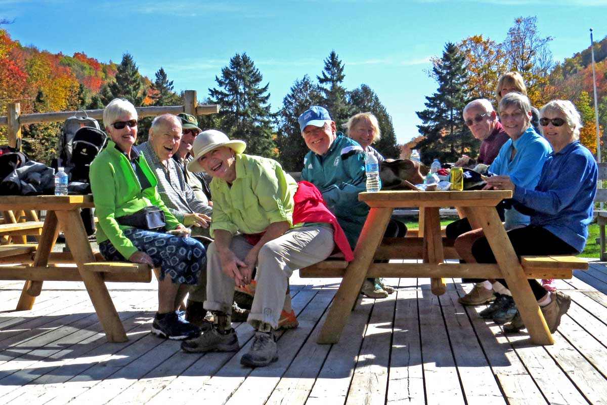
When we arrived at the base of the Devil’s Glen Ski Club to have lunch, I made a group shot, (well, most of us and one guest – a few had wandered away) and just managed to get myself back into the frame before the shutter clicked.
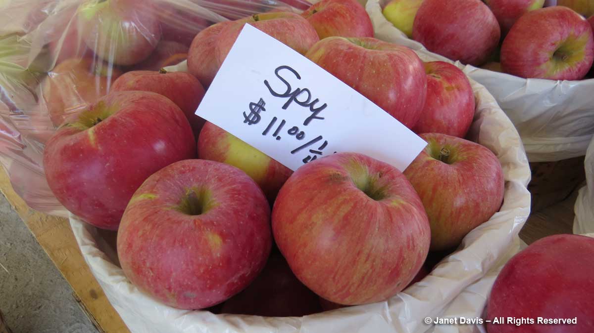
Heading back to our lodging, we stopped at an apple stand and stocked up on Northern Spy apples, my favourite for pies and crisps.
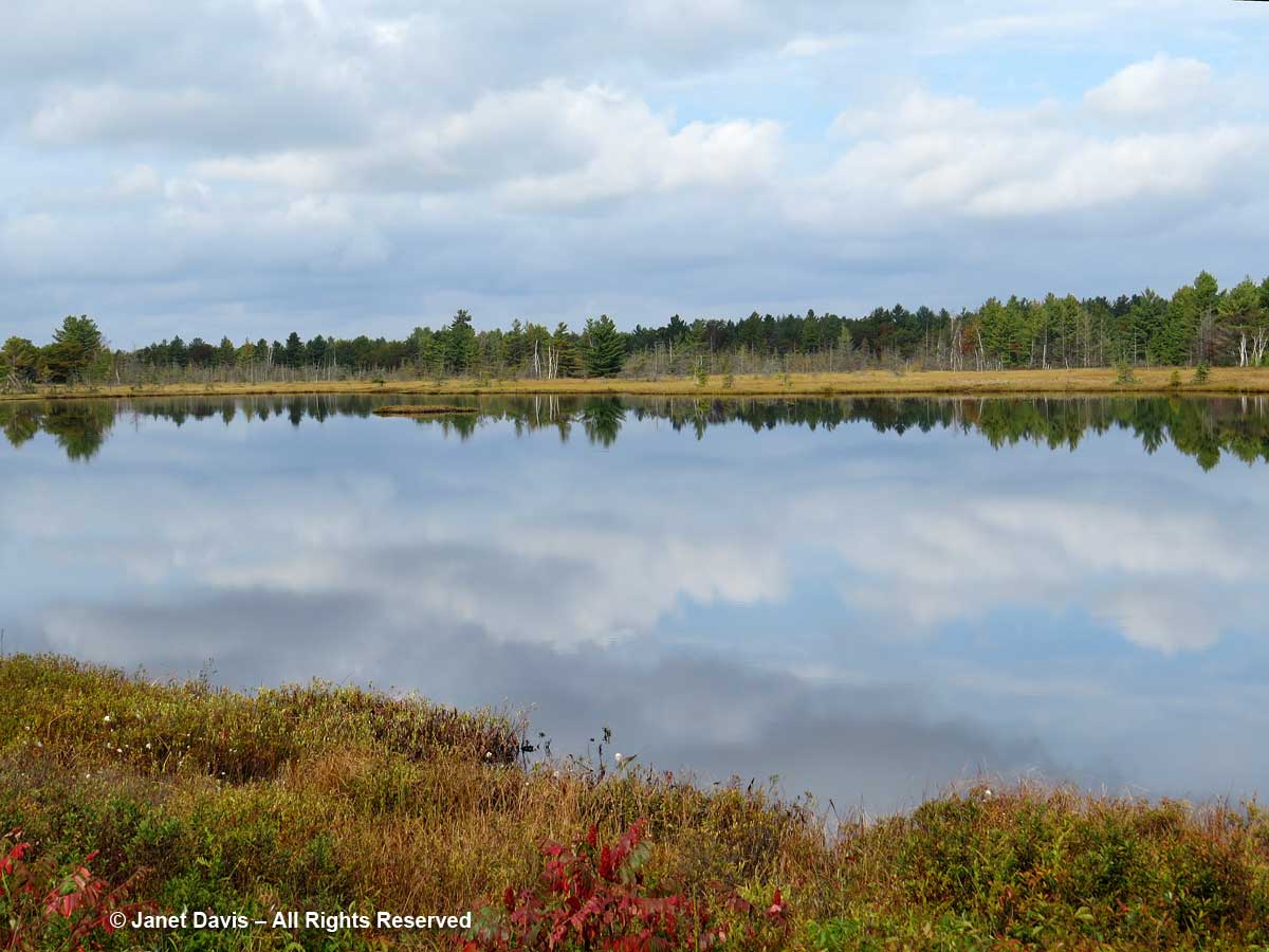
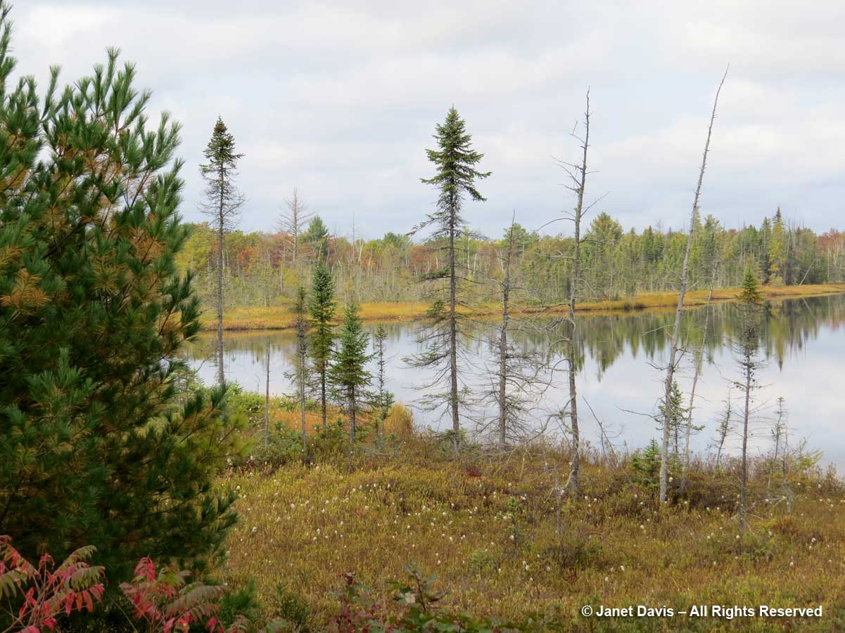
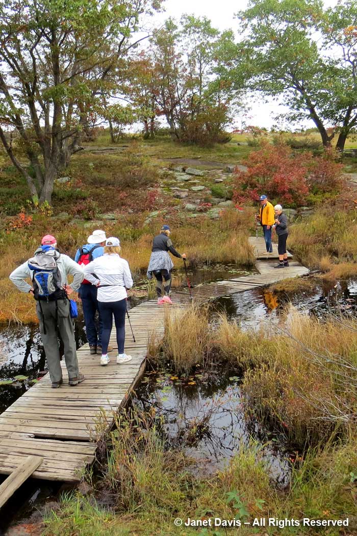
Which brings me to this year, the 25th edition of our hike, when we once again met in Muskoka and walked the beautiful Torrance Barrens. We marvelled at the fluffy white clouds reflected in Highland Pond….
…and noted the tamaracks (Larix laricina) at the water’s edge.
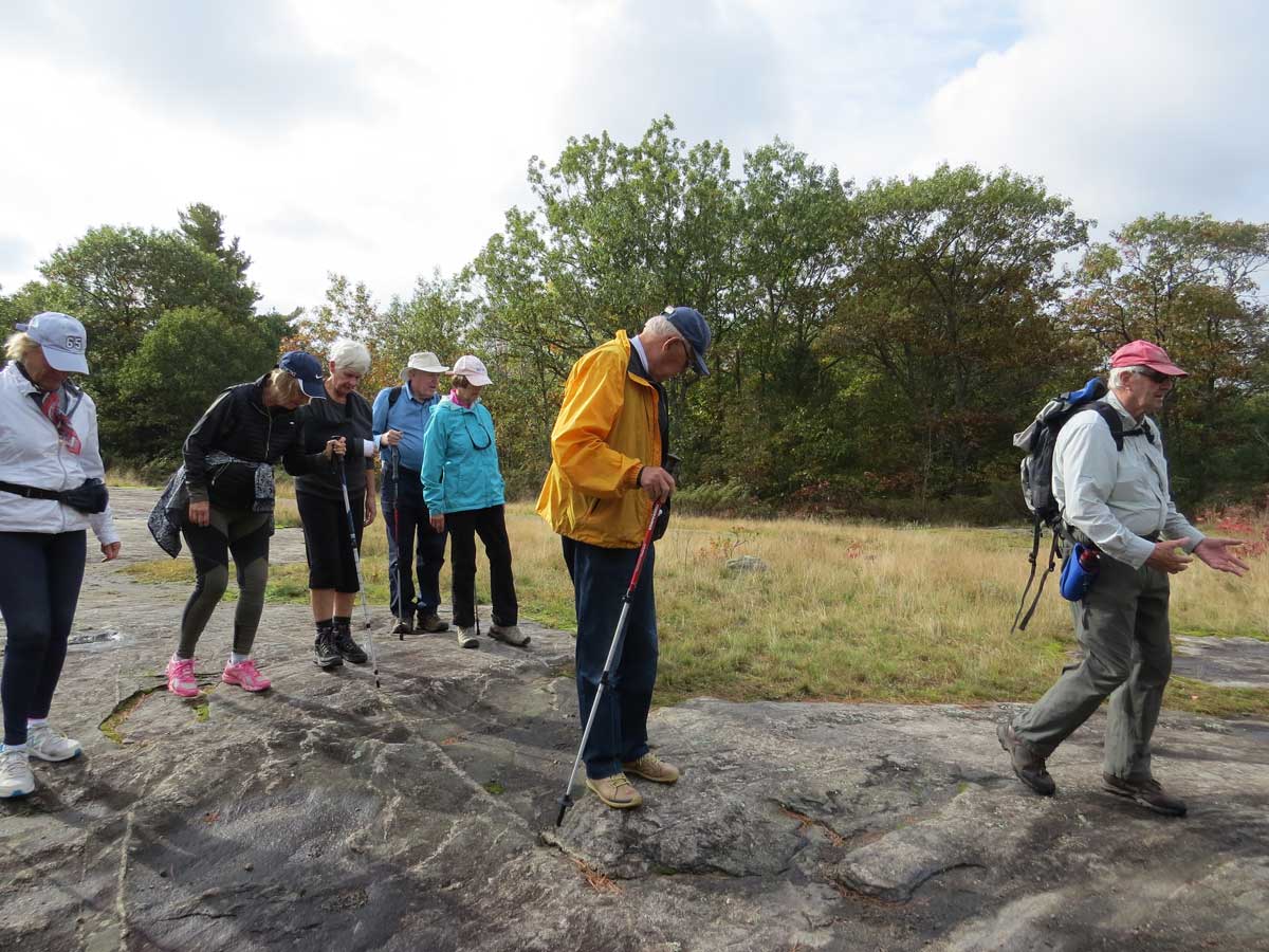
Bob pointed out aspects of geology, as in ‘this is gneiss, not pure granite’.
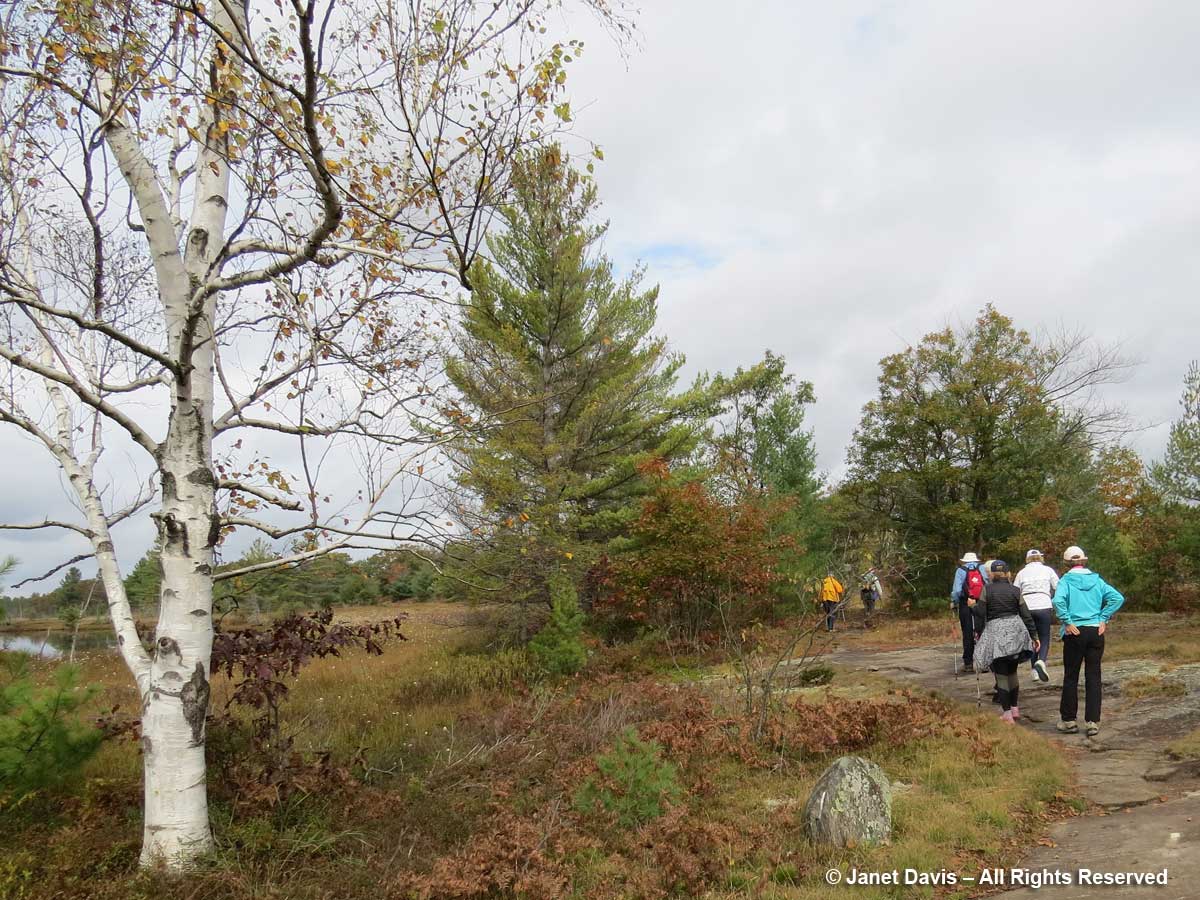
We walked past my favourite paper birch….
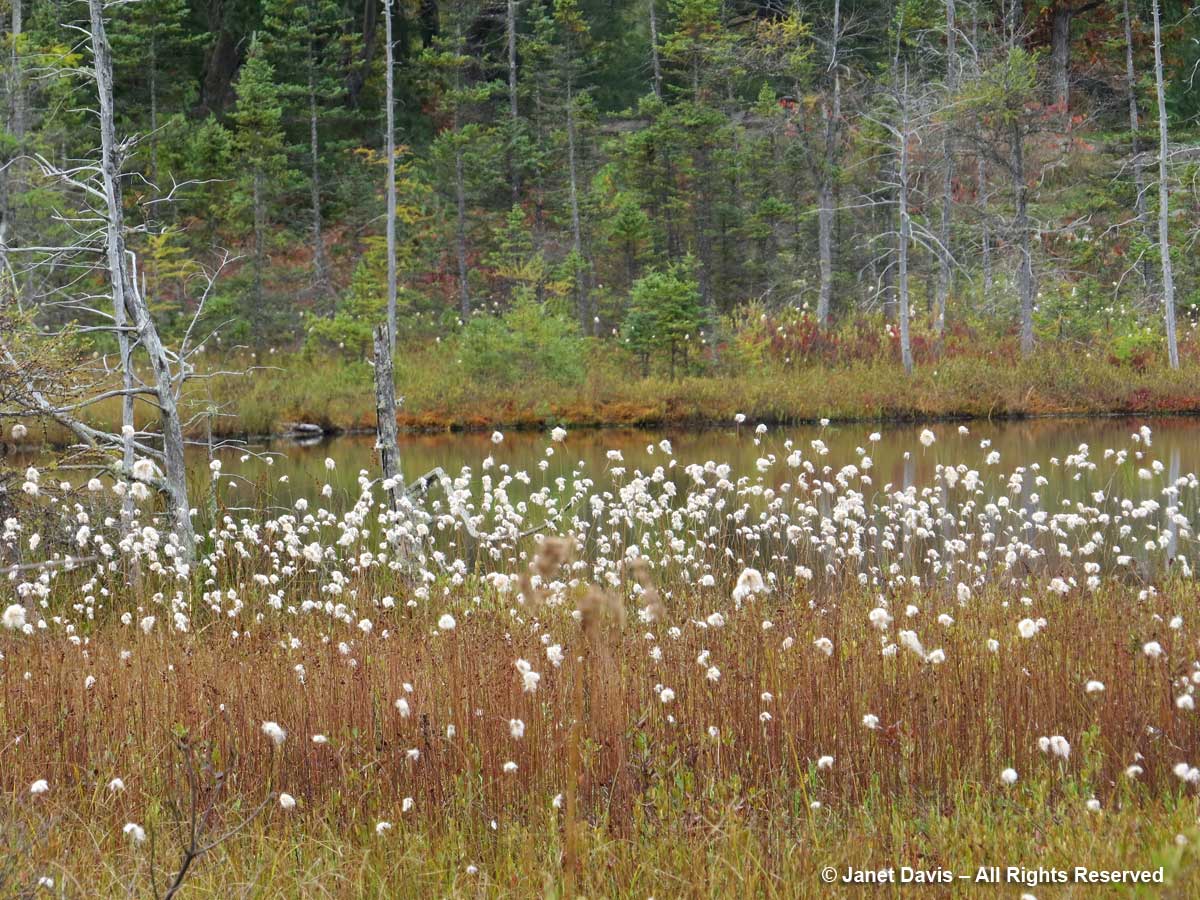
…..and saw the fluffy cotton grass (Eriophorum vaginatum) flanking the bog.
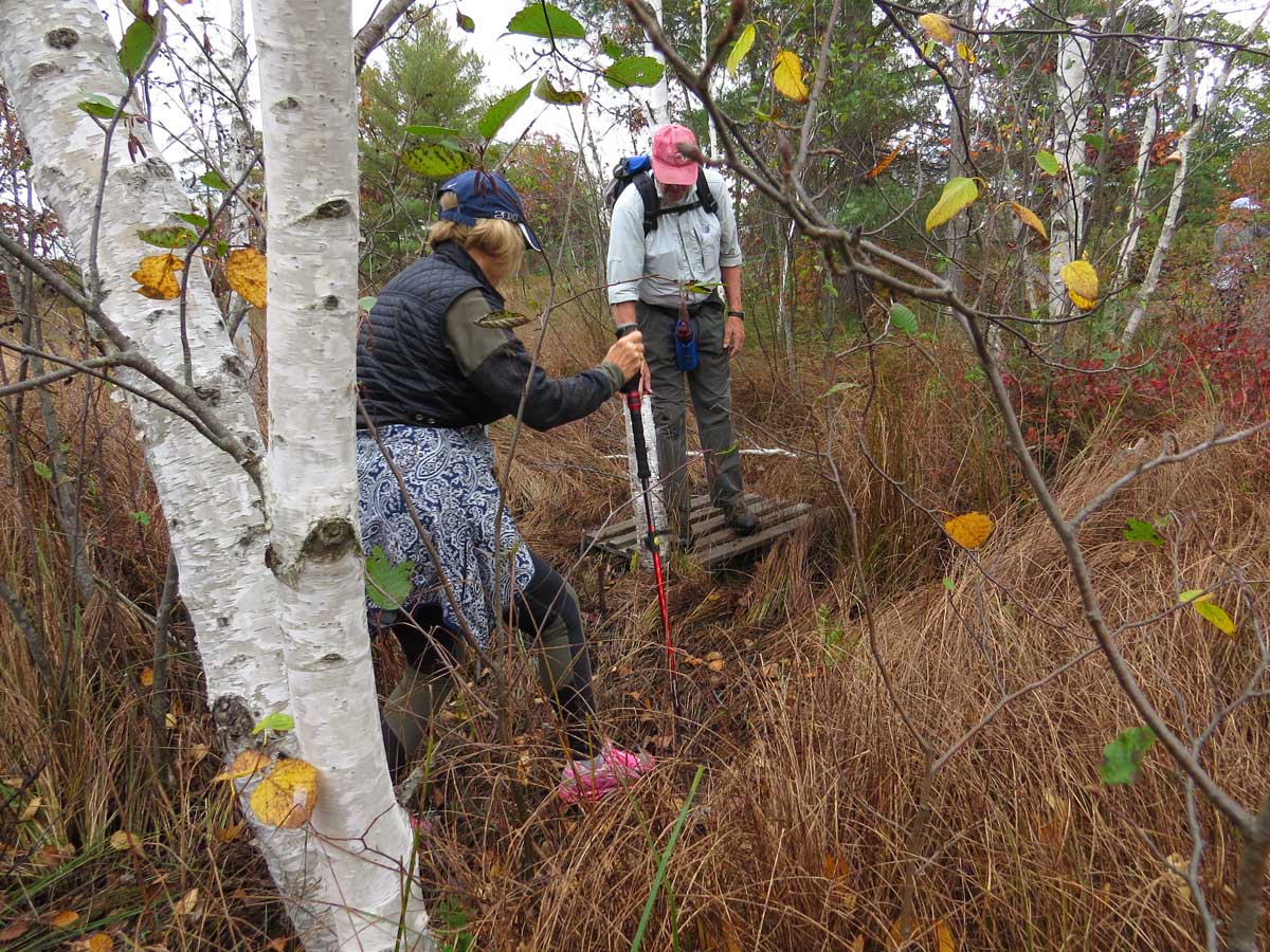
The little bridge over the small pond is sinking in the middle and necessitated a ‘one-at-a-time’ rule.
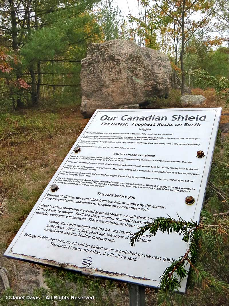
It’s always fun to stop and look at the erratic boulder left behind when the ice retreated, and it appears that Alex Tilley, founder of Tilley Hats, agreed. This little interpretive sign was paid for by Tilley, whom I’ve seen hiking the Barrens.
With so much rain this summer and autumn, many parts of the path were waterlogged and Bob (the veteran trail groomer) pointed out drier spots to navigate.
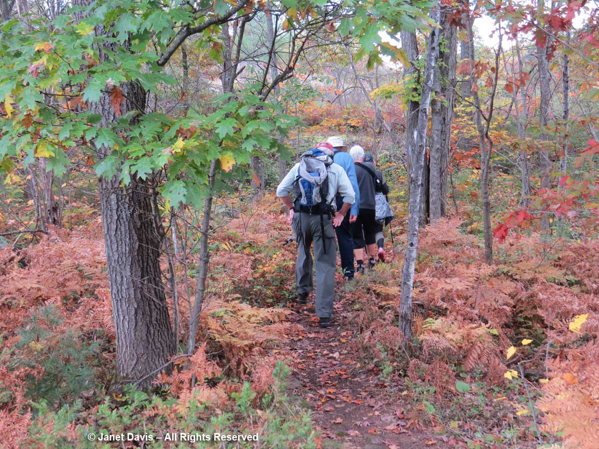
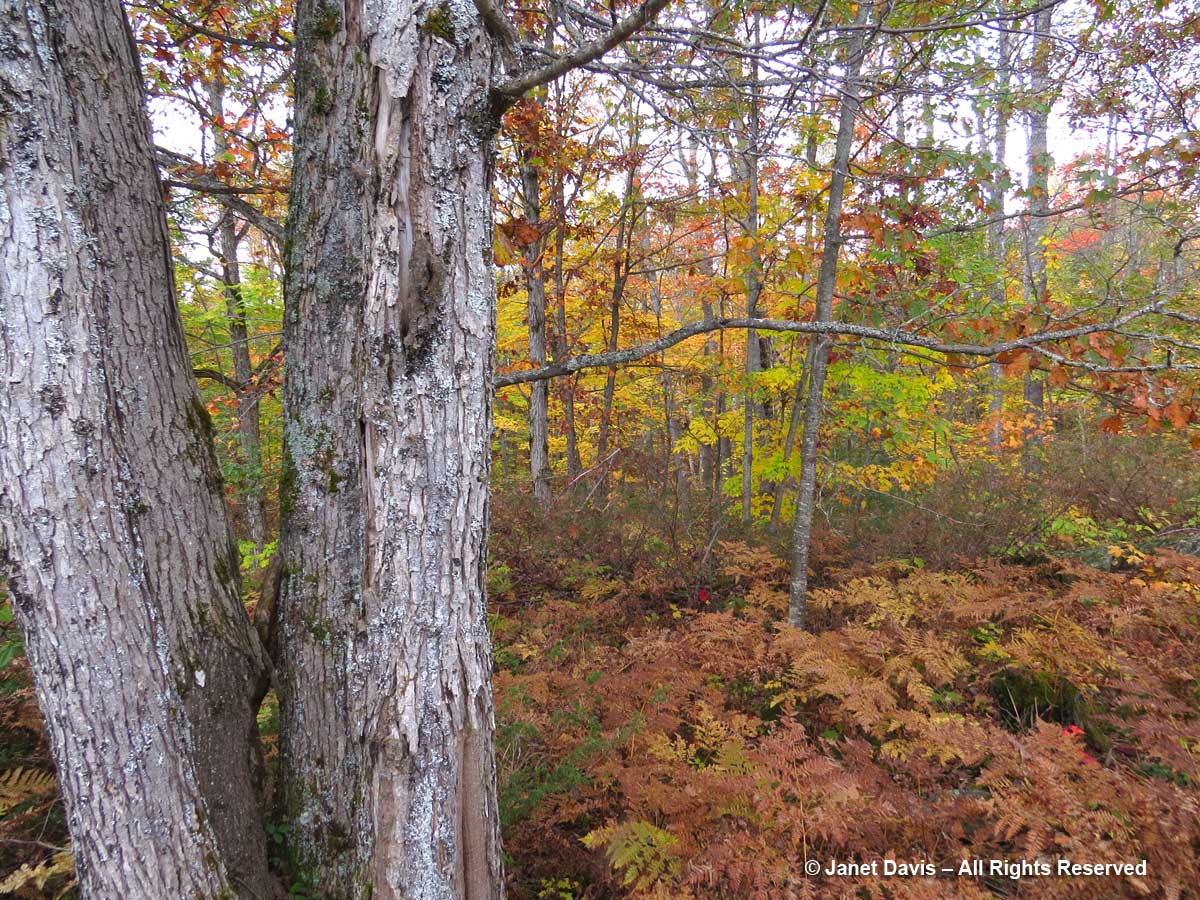
We crossed Southwood Road and finished our hike in the deeper soil of a forest….
….featuring bracken ferns and beautiful red oaks.
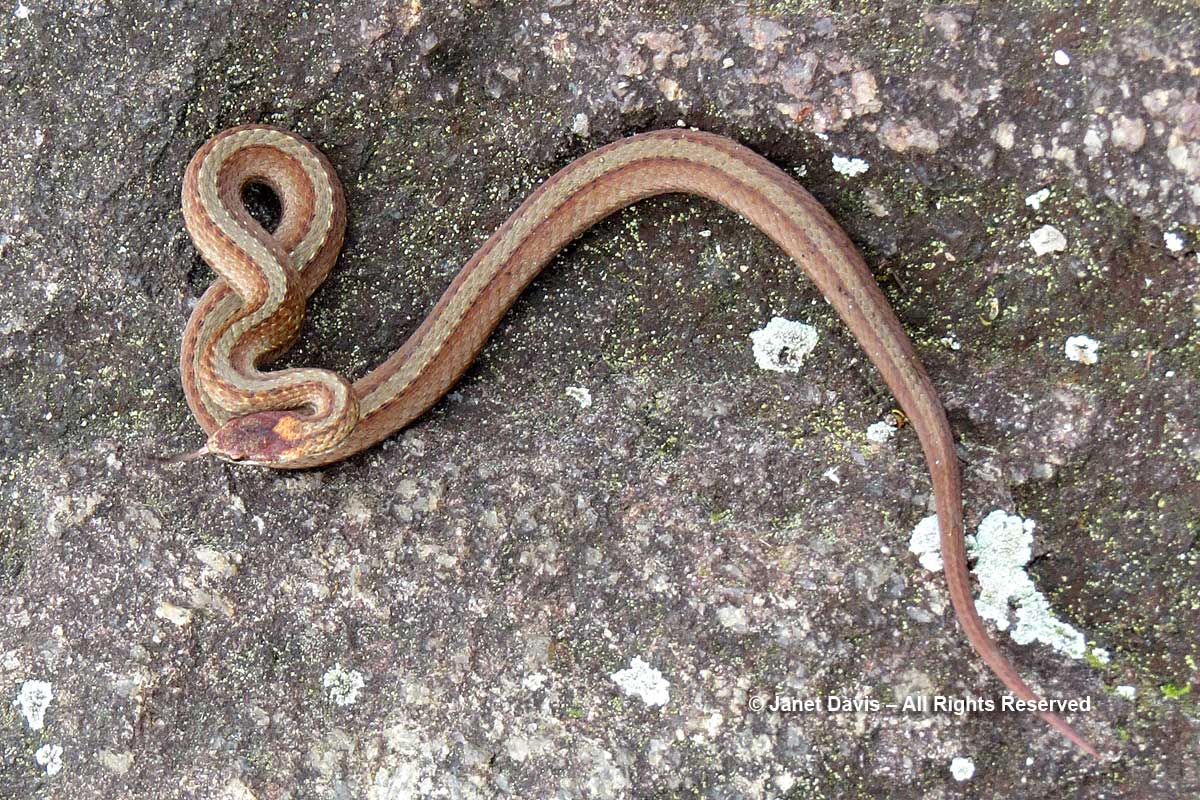
A tiny red-bellied snake (Storeria occipitomaculata) was on the path (it’s only my lens that makes it look huge) – one of many reptiles I’ve photographed in the Barrens over the years.
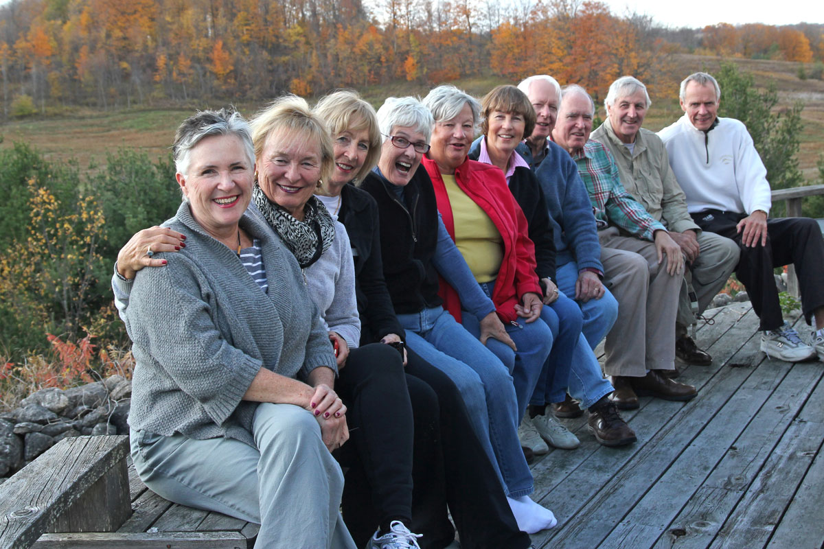
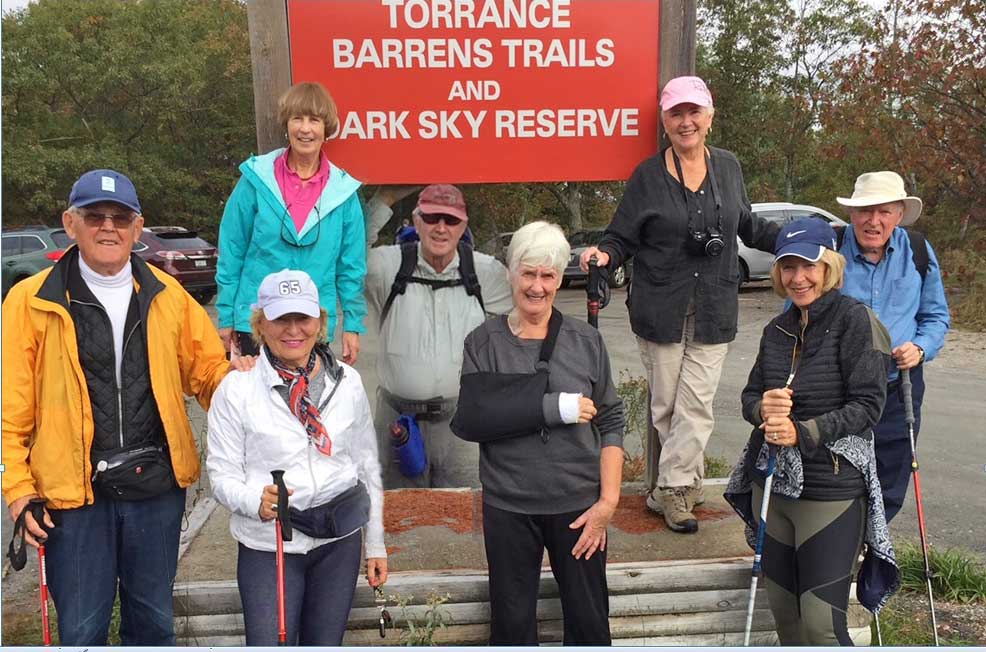
And at the end of the trail, we posed for our traditional photo (minus four who couldn’t be with us this year). Over a quarter-century, we’ve seen our children grow up, marry, change jobs, and have their own kids. We’ve talked about books, theatre, food, health and travel to faraway places. We’ve lost spouses or partners, and felt the comfort of the friends who knew them well. And we’ve welcomed new partners to the group and made them feel welcome and loved. It is a simple thing to do, walking a trail, and it reminds us that we need nature – and the company of friends – to live full lives.