Visiting Cougar Annie’s Garden – Part Two

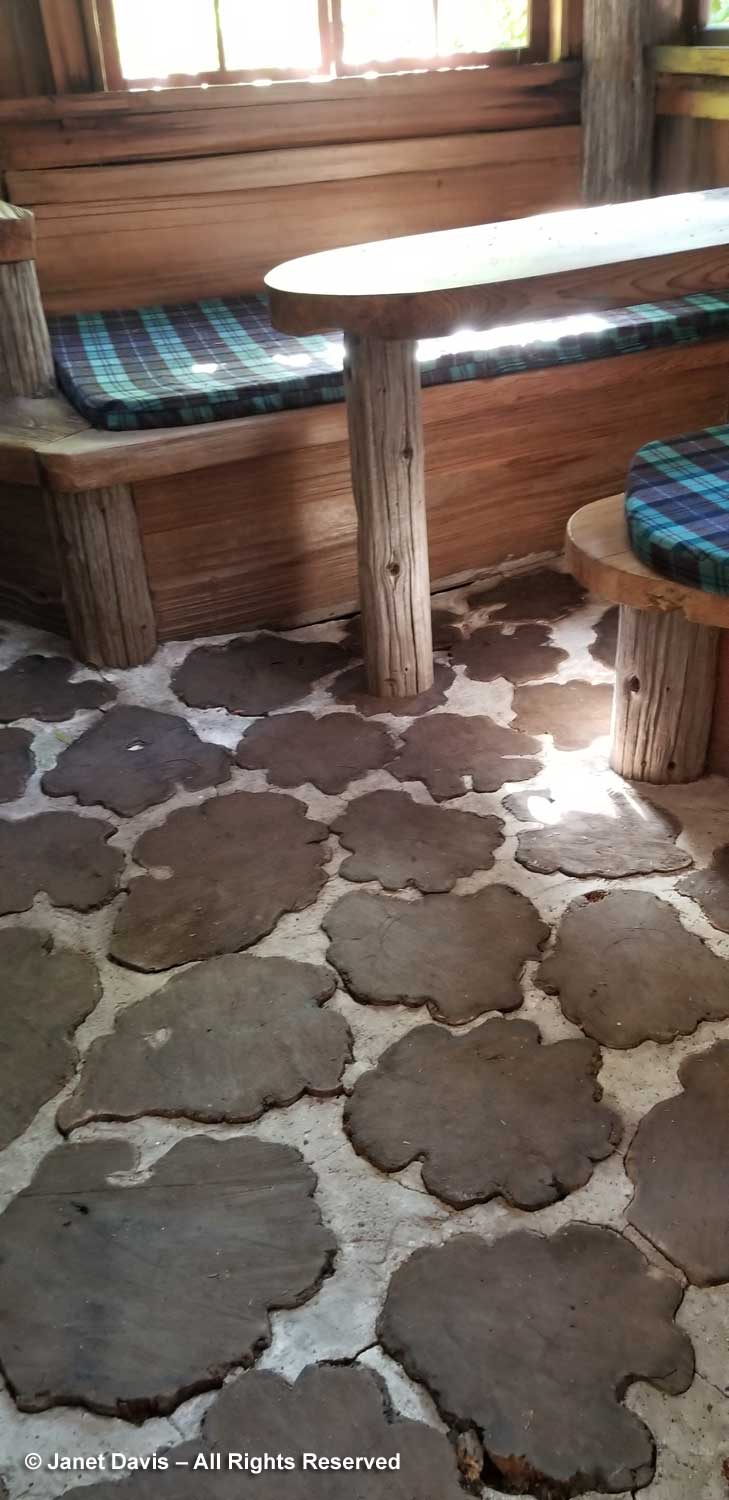
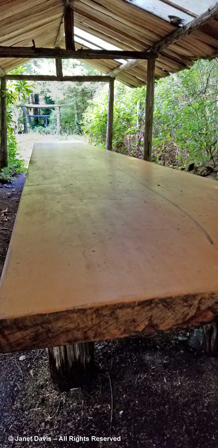
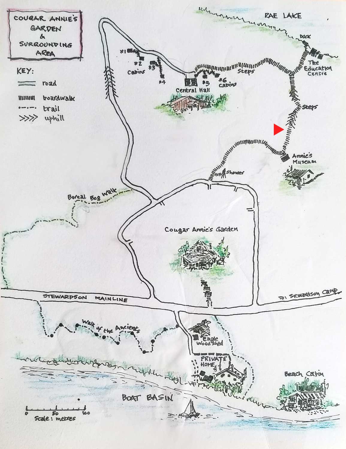
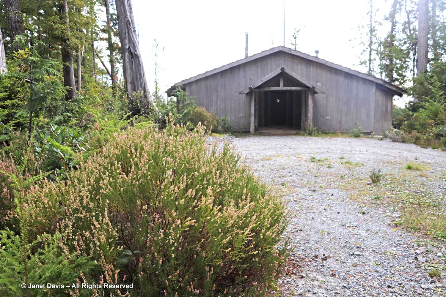
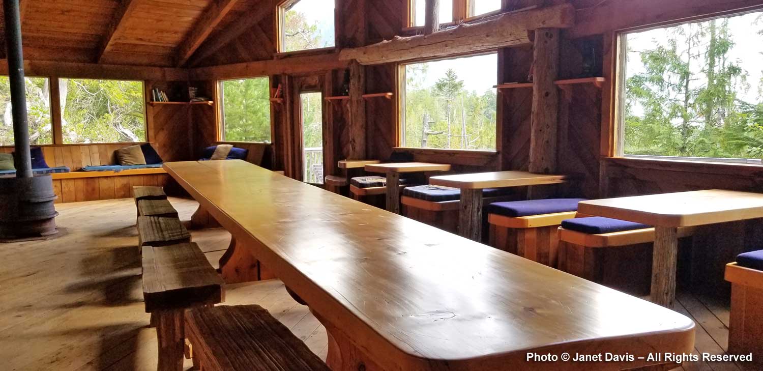
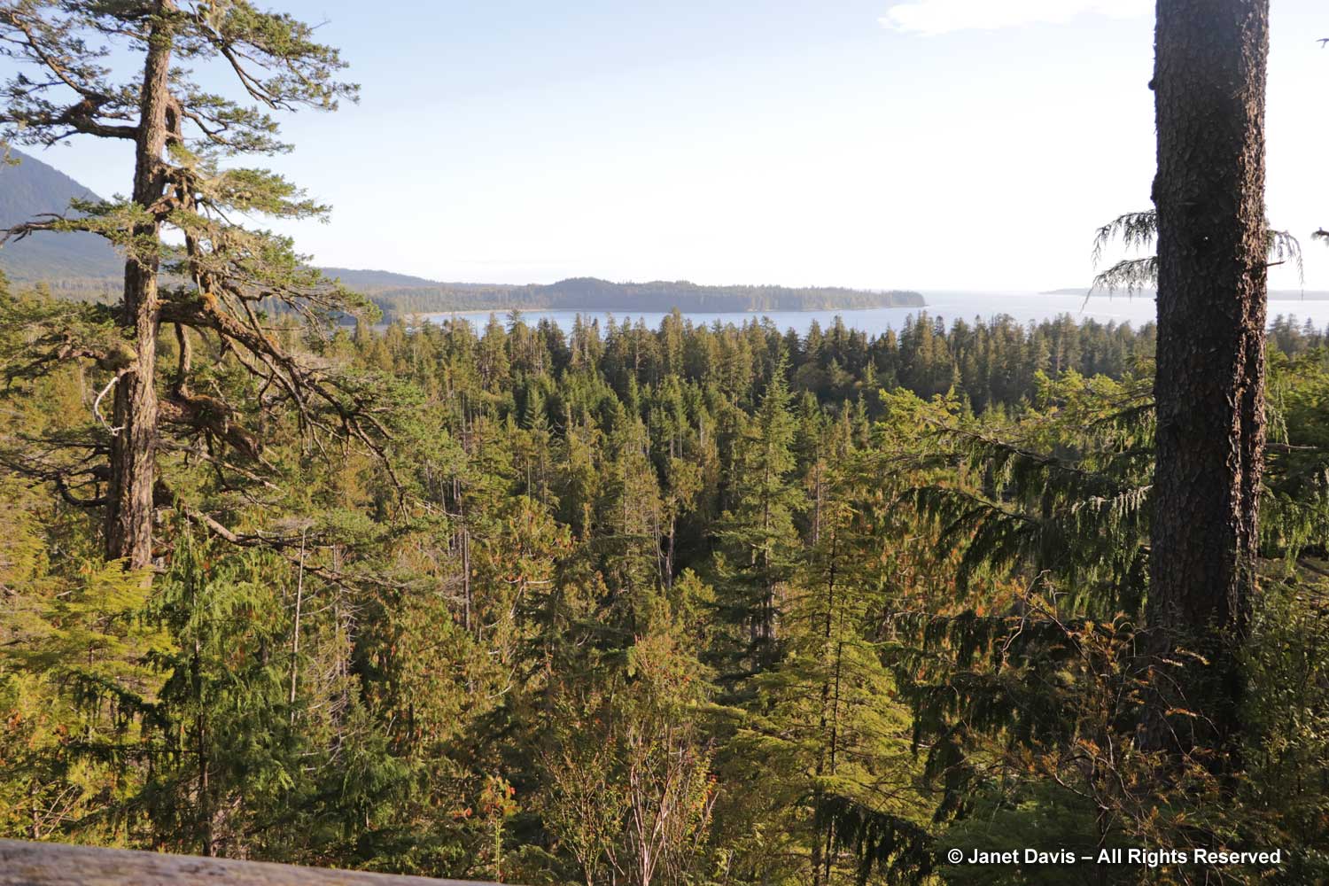
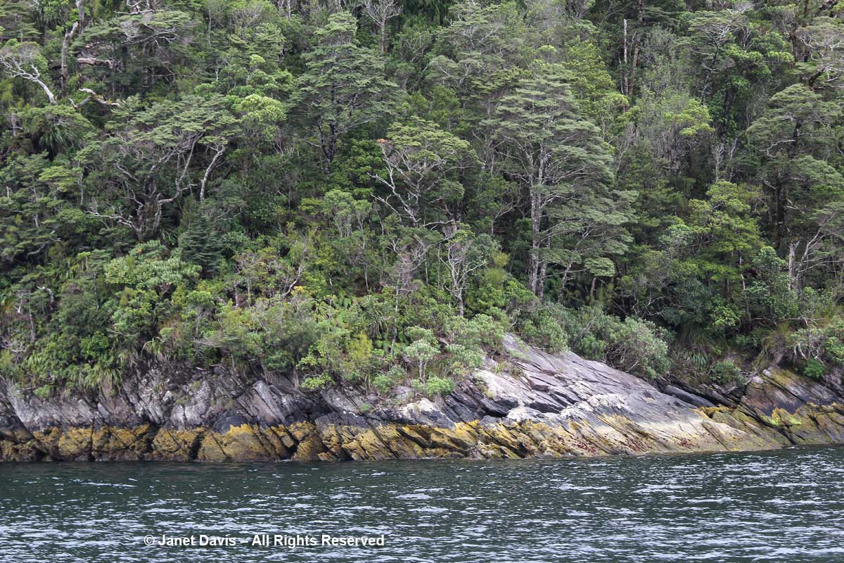
If you’ve read Part One of our visit to Boat Basin and Cougar Annie’s Garden, you’re waking up with me now on Day 2. After a night in cabin #6, we rose ready to explore the rainforest and take a little more time to visit Annie’s garden. I looked out our cabin window at the trees growing on the ridge. I saw yellow cedar (Callitropsis nootkatensis, formerly Chamaecyparis). Though it grows from Alaska to California, it derives its botanical name from the fact that it was first collected near Nootka Sound, just north of Boat Basin. Its wood is much used for buildings and was the material Peter Buckland used to make the long sushi table, among other structures.

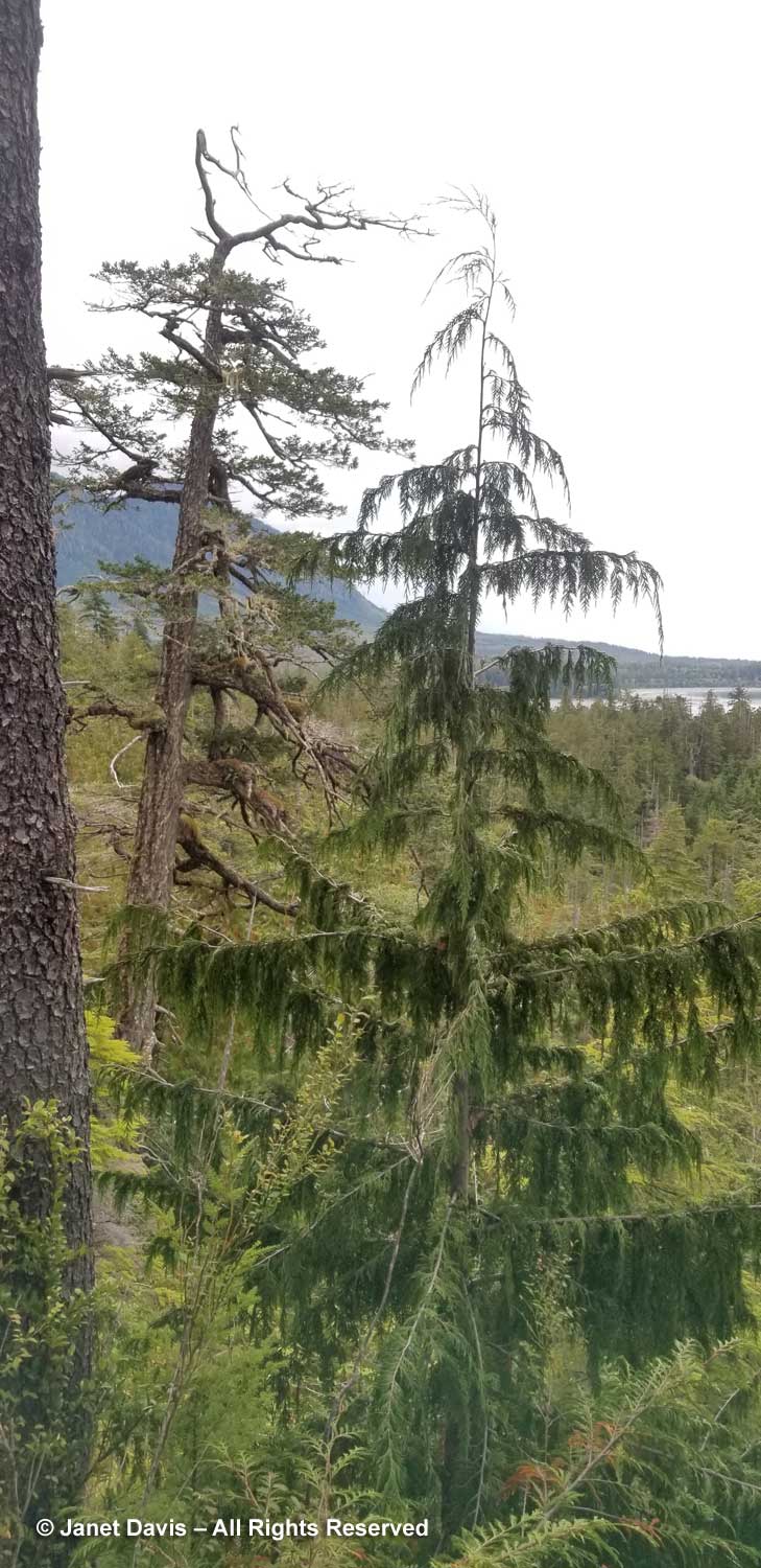
I could also see Pacific silver fir or amabilis fir, Abis amabilis.

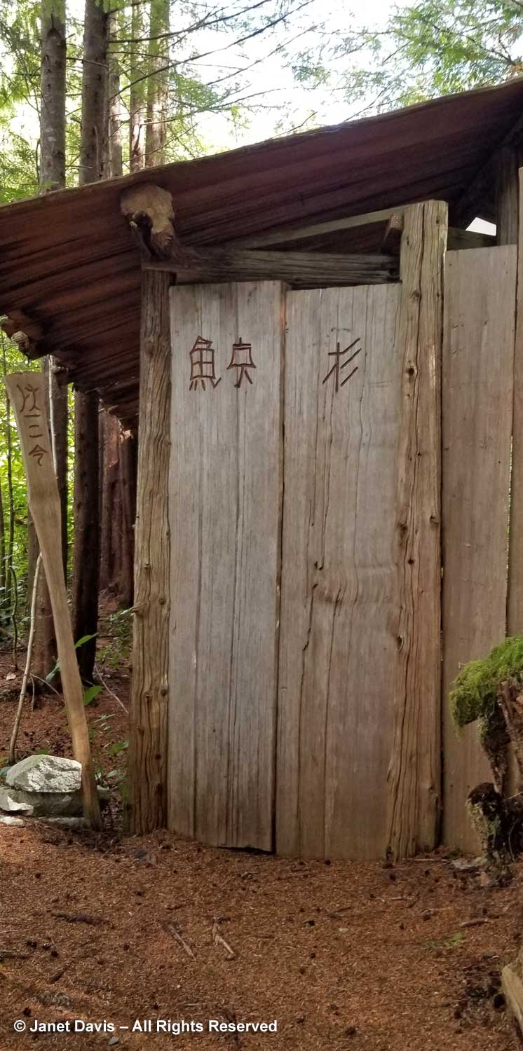
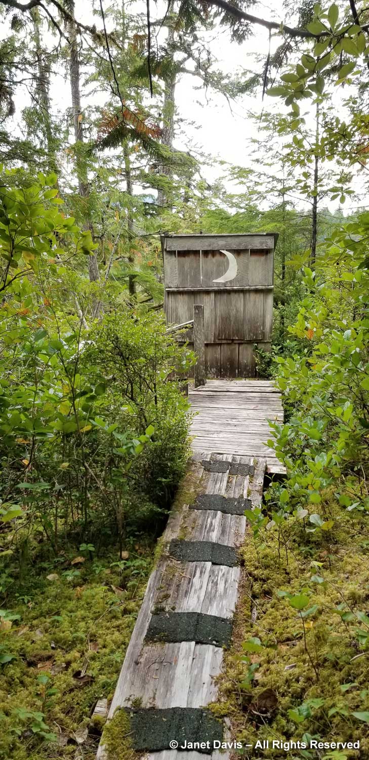
When I walked up the forest path towards the outhouse, there was Pacific yew (Taxus brevifolia) growing amongst the salal.

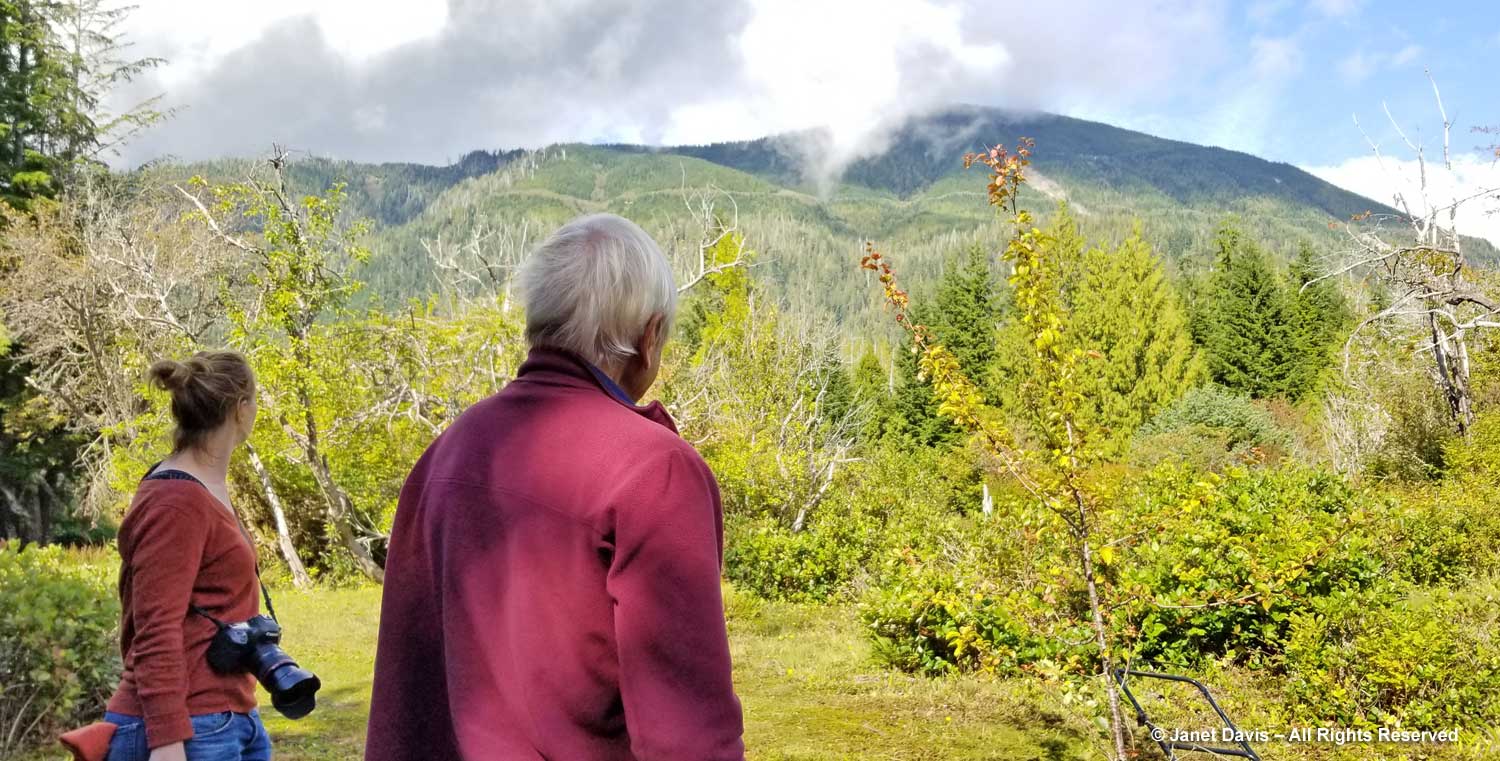
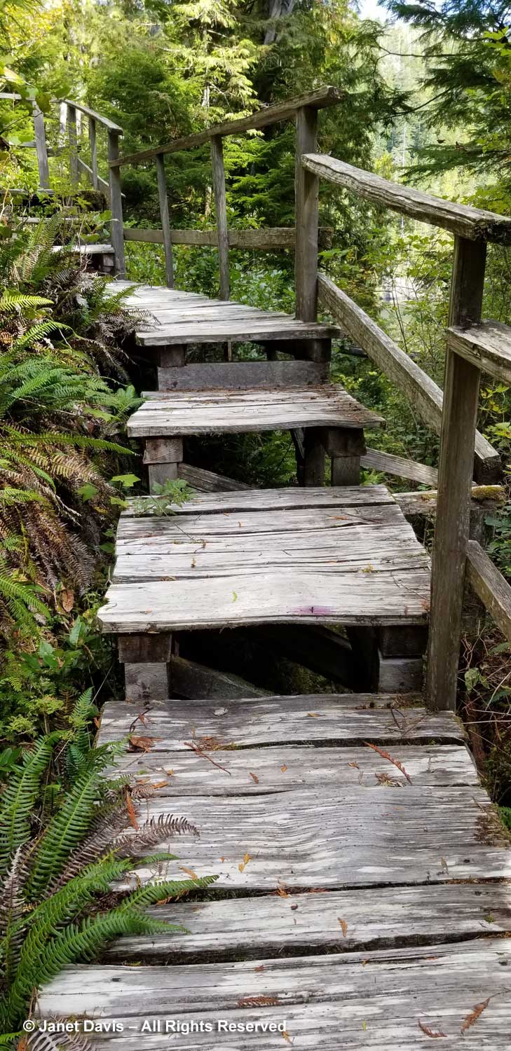
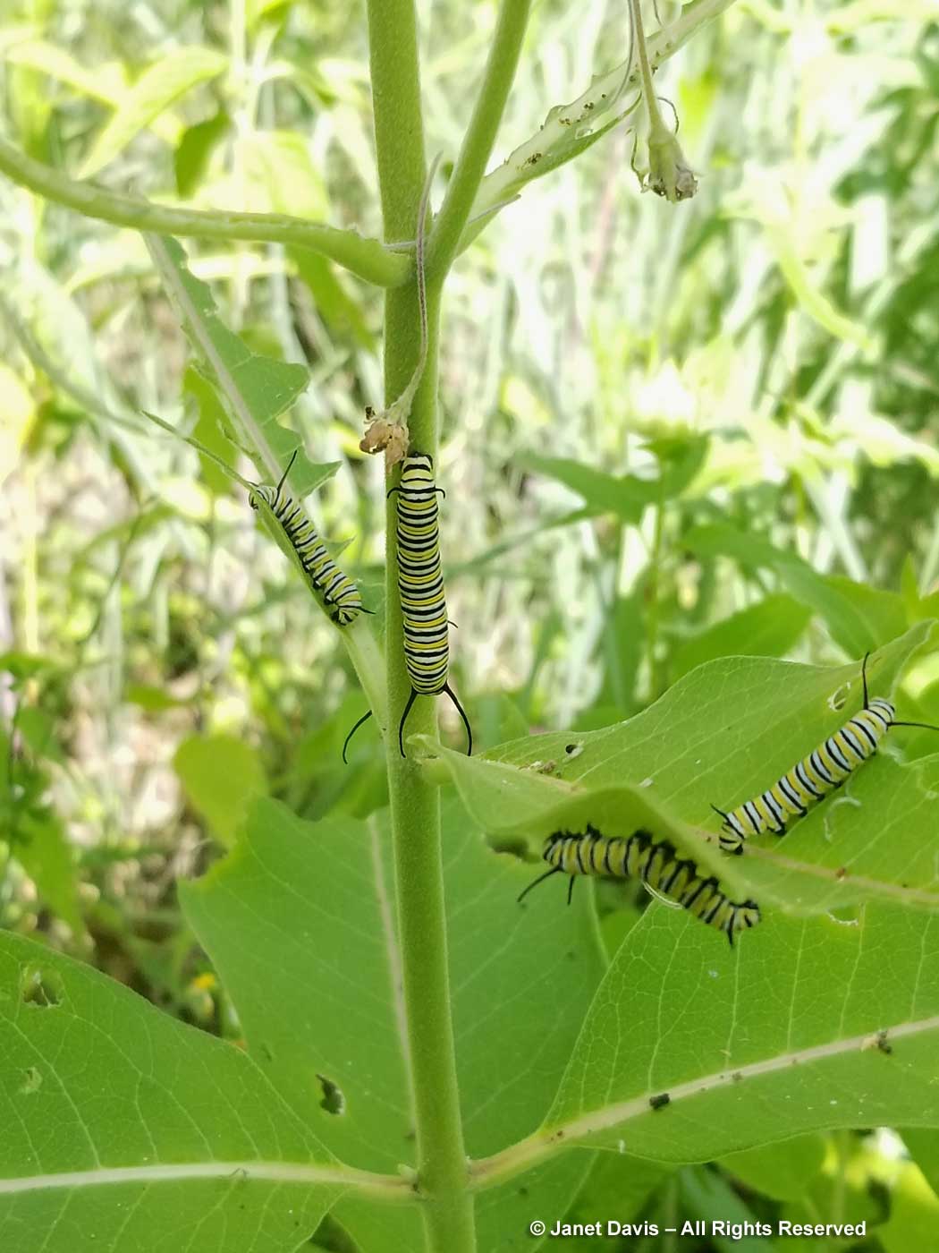
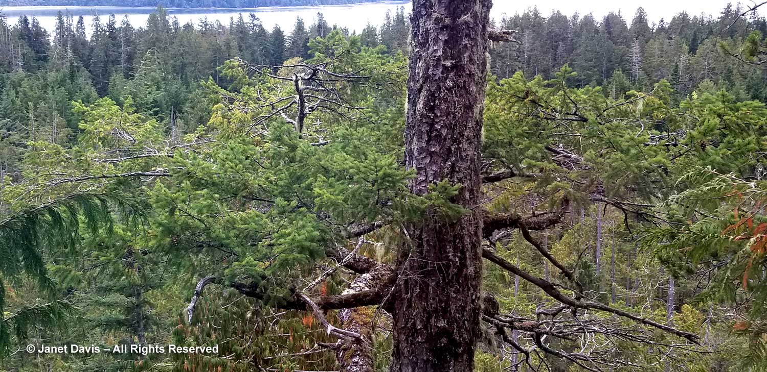
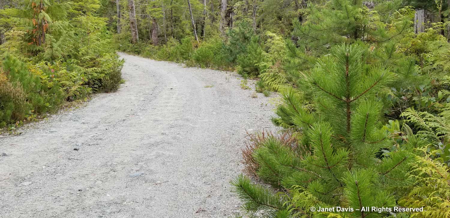
Caitlin was already out photographing when Doug, Mary Ann and I finished a leisurely breakfast and began our walk down the ridge road.  Caitlin had warned us it was steep, and this photo doesn’t really illustrate how steep.  You can see the ghostly cedars along the road. Peter said: “Dead, standing cedars we call ‘grey ghosts’.  They make excellent posts and beams, structurally and aesthetically.  Most have grown in wet ground where nutrients are low, suppressing growth.  Grey ghosts are effectively hardwood.  Their interior is deep mellow brown in colour, ideal for interior finishing, viewable at Central Hall and several cabins.  Logging cut down grey ghosts and left them to rot, a process that takes centuries due to the preserving oils within cedar.  All was not lost.  During the first twenty-five years of construction when logging roads provided access to nearby clearcuts many grey ghosts were recovered.”

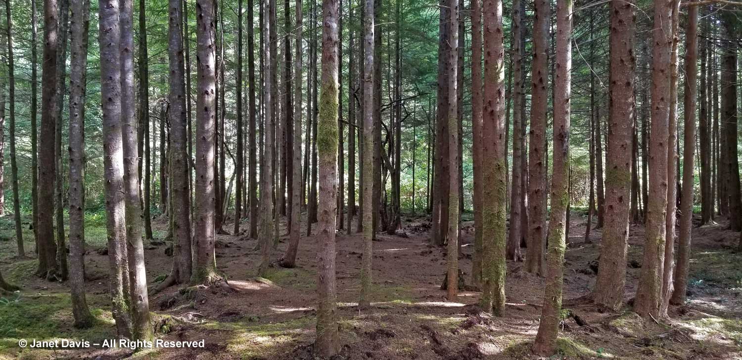
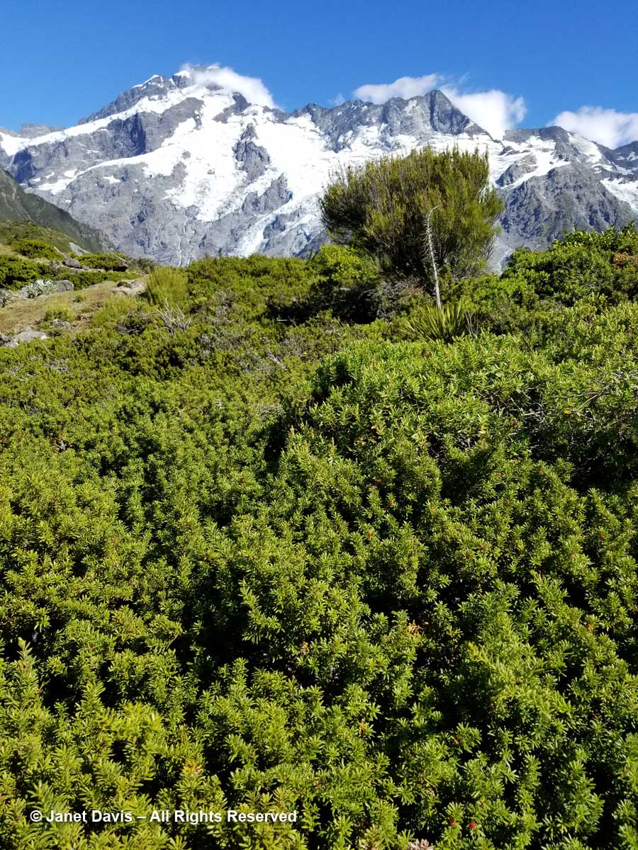
As the road flattened, I saw lots of young lodgepole or sea pine (Pinus contorta).

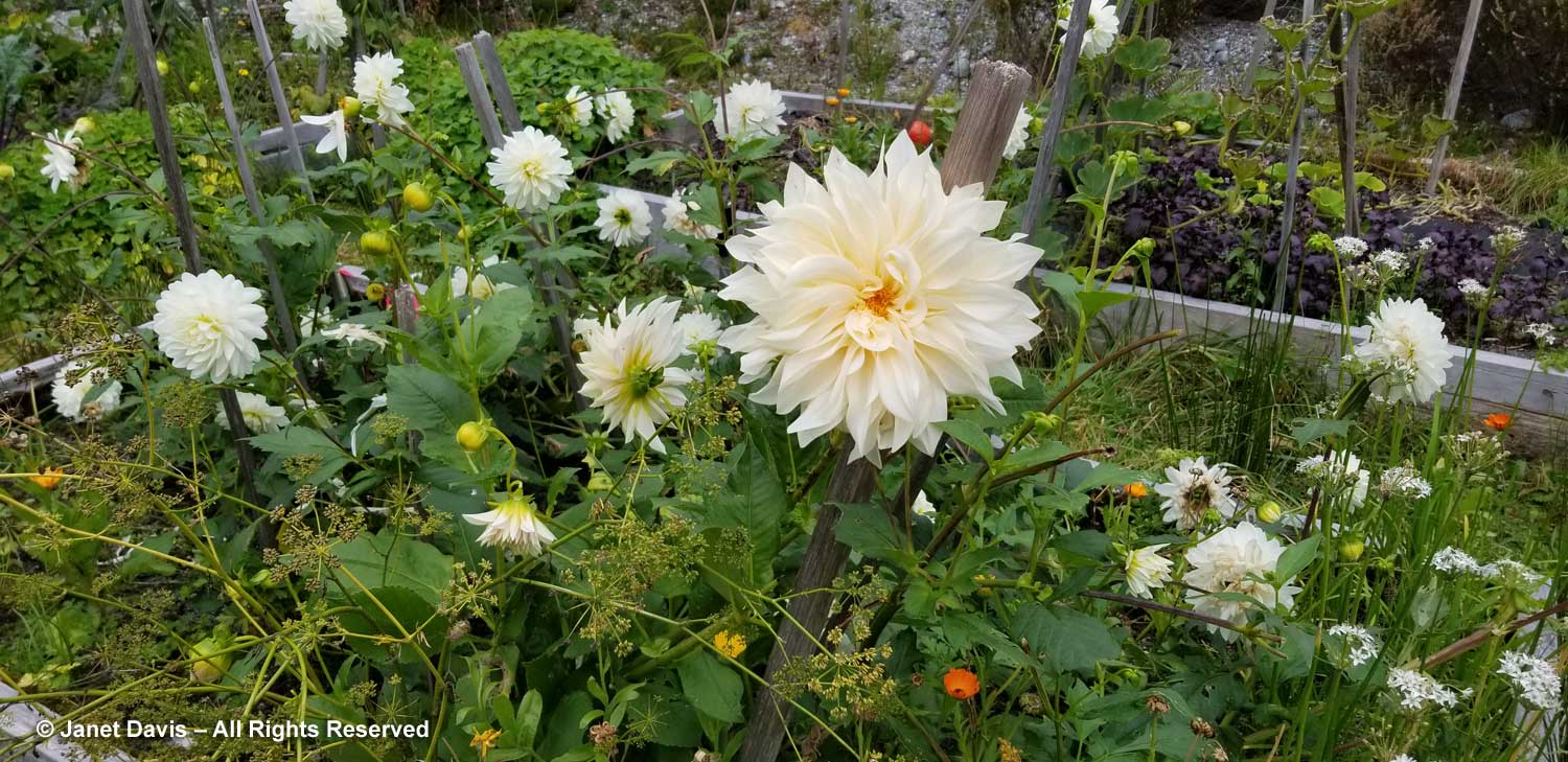
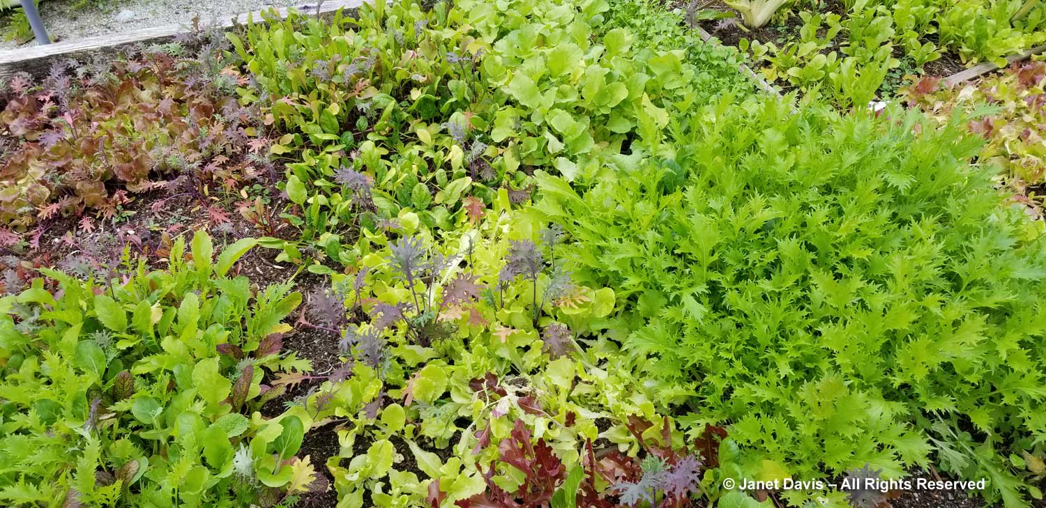
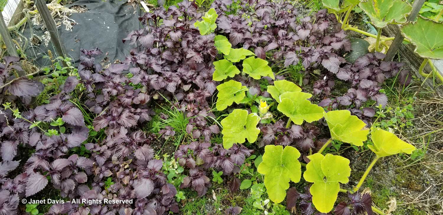
We came upon Peter’s garden in a clearing with raised beds filled with …..

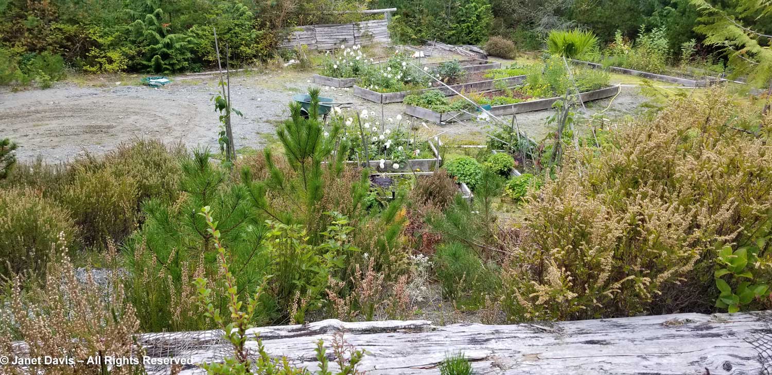
….. the dahlias we’d seen in vases, the ones that recall Cougar Annie’s mail order business…

…… as well as mesclun lettuces (Peter contributed the salads to our two dinners) and….

….. shiso (Perilla frutescens) and squash.

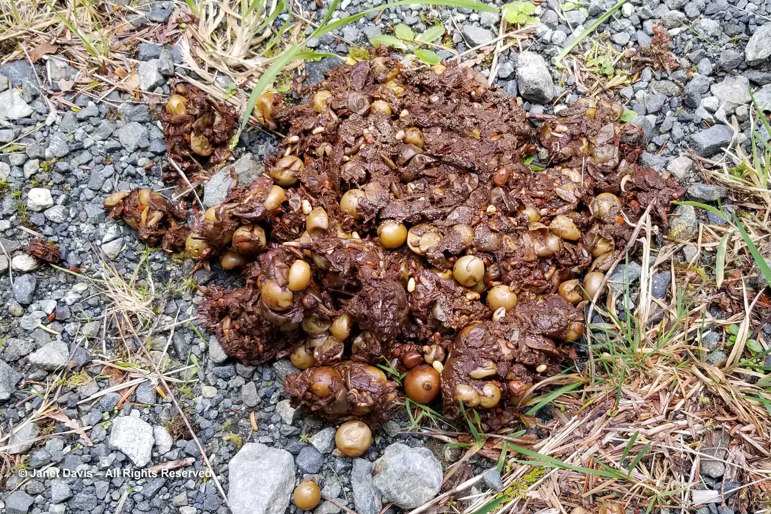
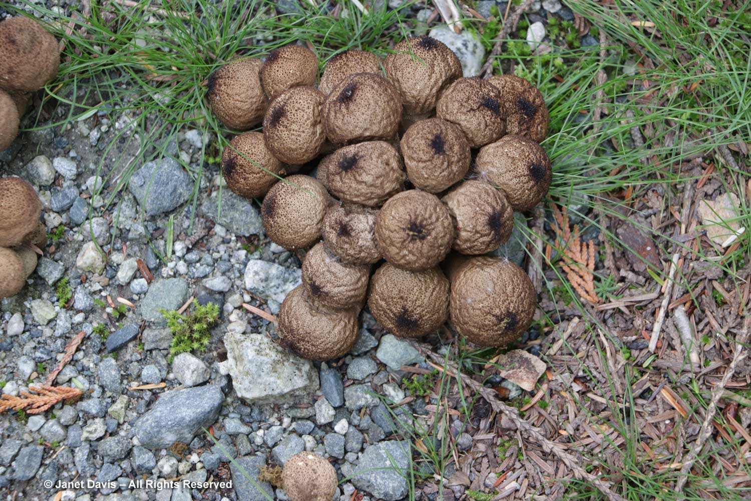
Heading towards Annie’s garden, I saw some old gem-studded puffballs on the road….

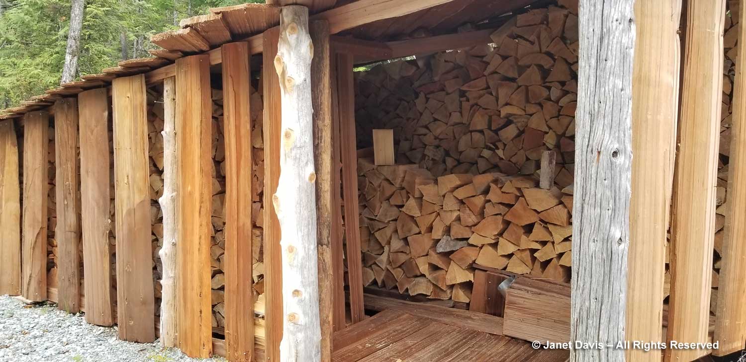
…. and passed Peter’s beautiful woodshed, almost filled and ready to supply a winter of heat to the pot-bellied stove in his house.

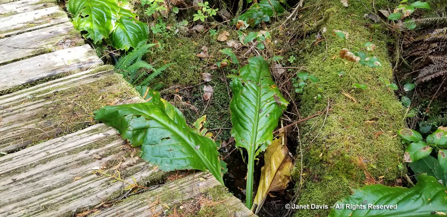
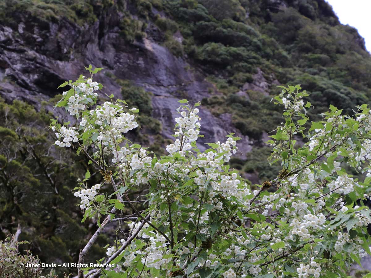
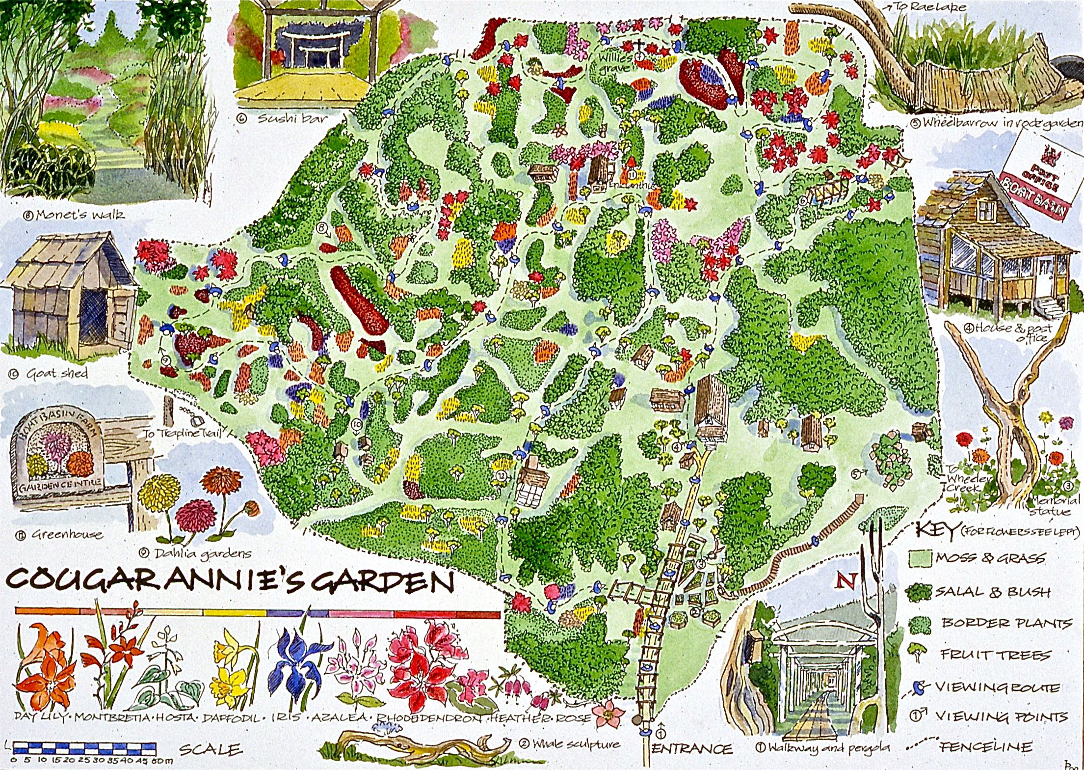
As we took a path from the road through the trees into Annie’s garden, I wished it was June rather than early October. Had we arrived in spring or summer, we might have seen some of the colourful blossoms of the perennials, shrubs and trees still surviving, with Peter’s help, and illustrated on this poster.

We wandered about, imagining how Annie’s house must have looked in the 1950s, 60s and 70s, when she was still filling plant and bulb orders to be sent throughout Canada…..

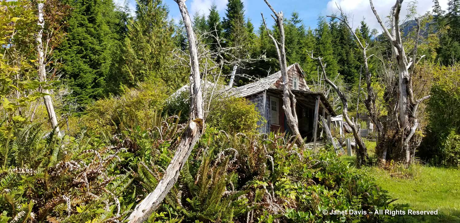
…. and growing her own pleasure garden, now setting seed in another autumn.

I saw a big drift of montbretia (Crocosmia crocosmiiflora) and a….

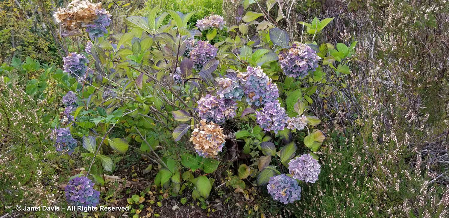
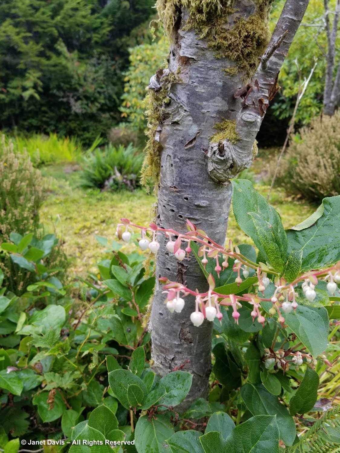
…. hydrangea ensconced in the heather.

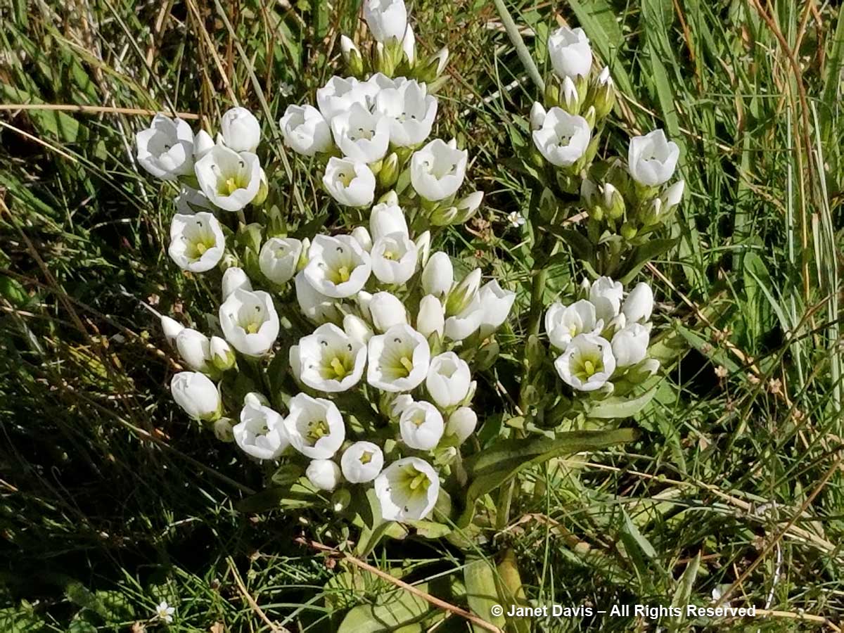
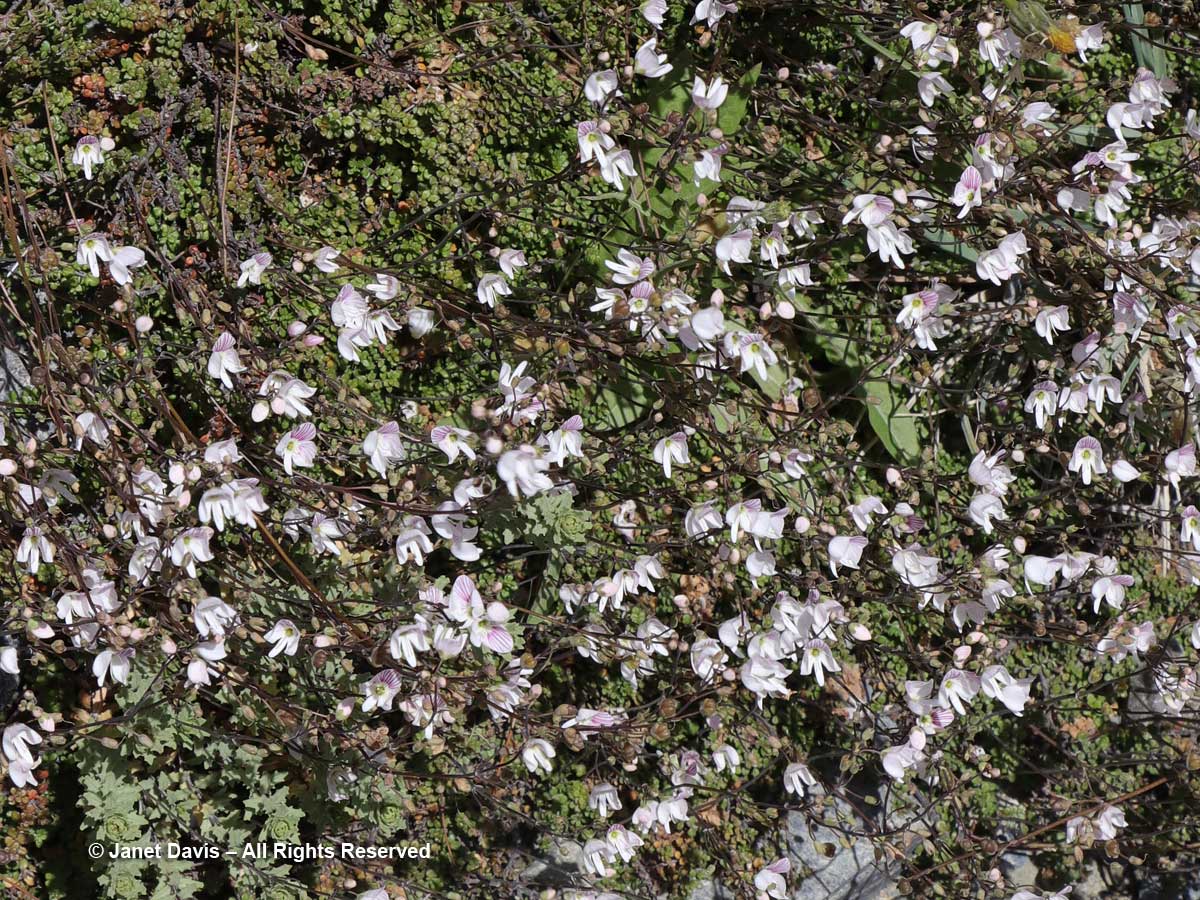
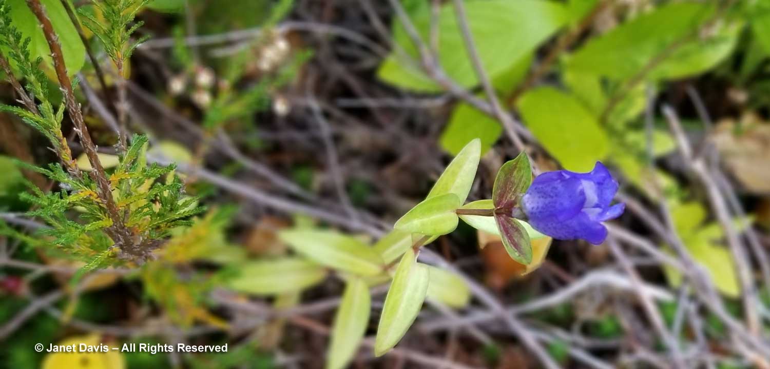
A dark blue gentian poked its head up from the leaf litter…..

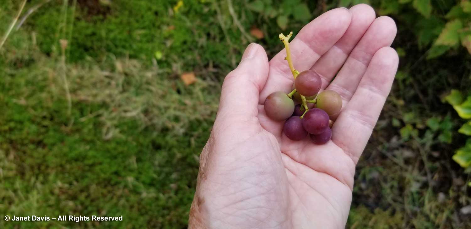
…. and we found a few grapes growing on a vine.

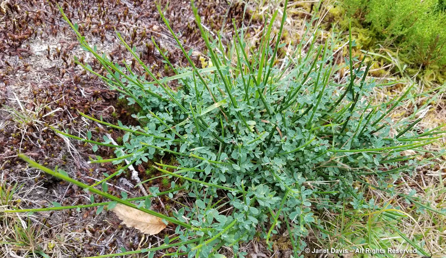
Hebe grew along a path, below, along with spireas, weigelas, azaleas, rhododendrons and other shrubs.

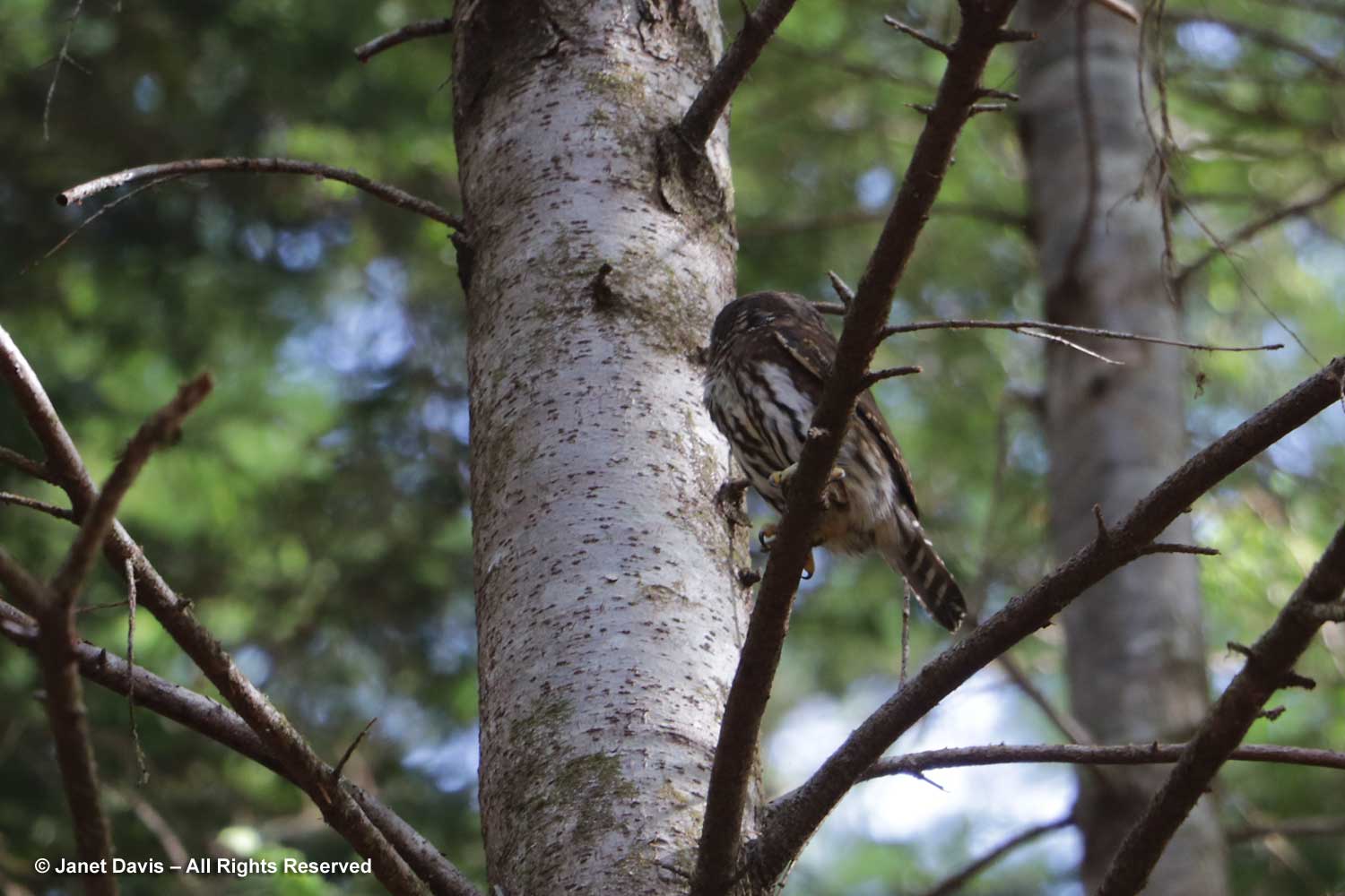
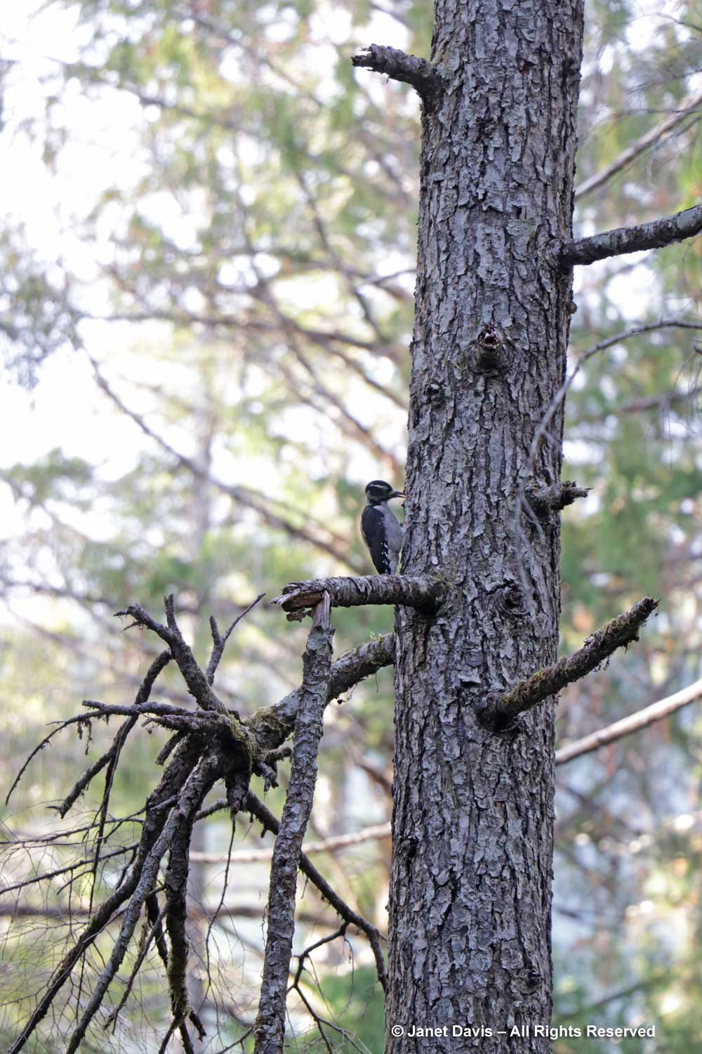
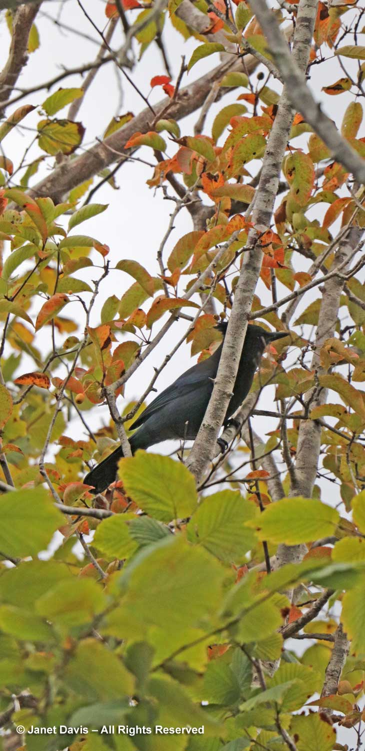
I chuckled when I saw a Steller’s jay flitting through the branches of a fruit tree. Cougar Annie couldn’t stand these cheeky birds and there was usually one simmering in a broth on her stove (or so the story goes).

Like much of the Pacific Northwest, Scotch broom (Cytisus scoparius) is a troublesome invasive at Boat Basin and Peter keeps it clipped in the garden to prevent seeds escaping.

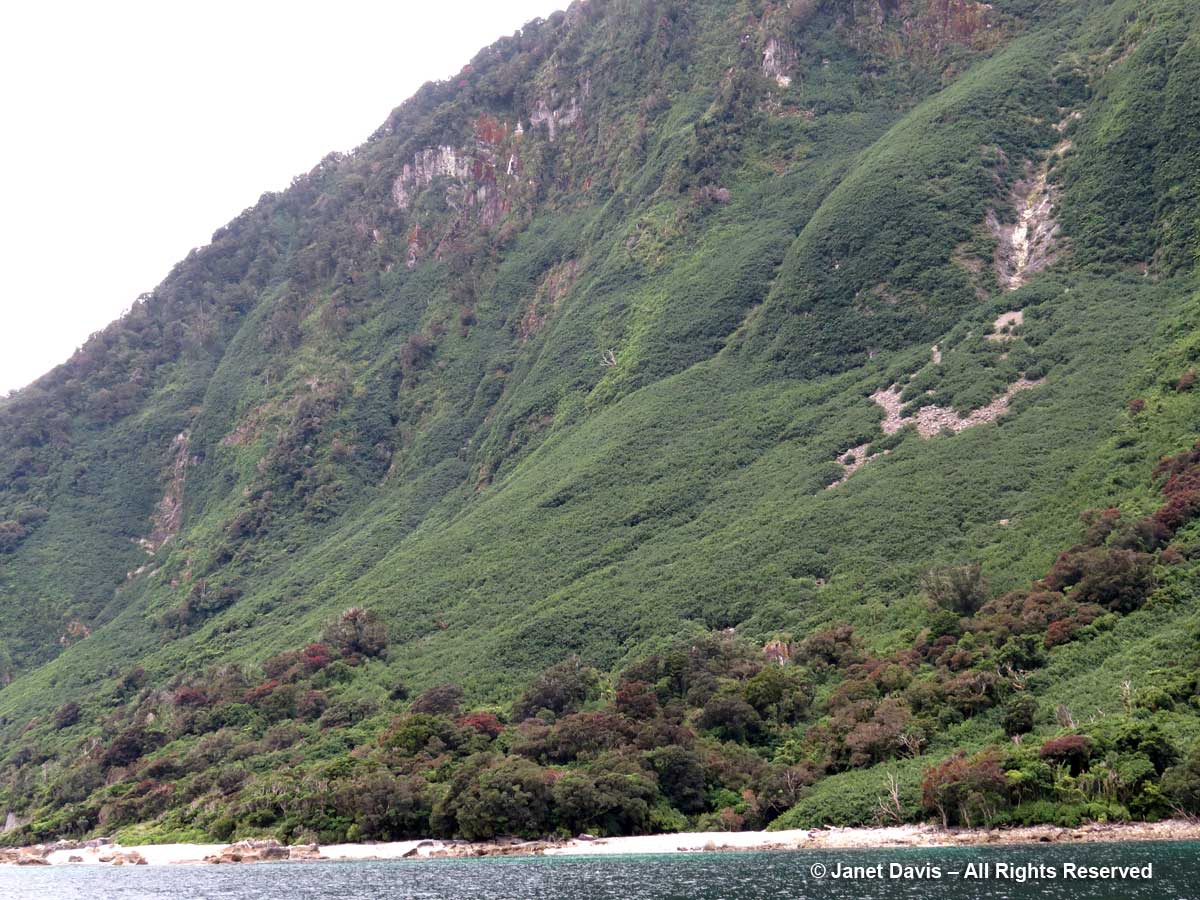
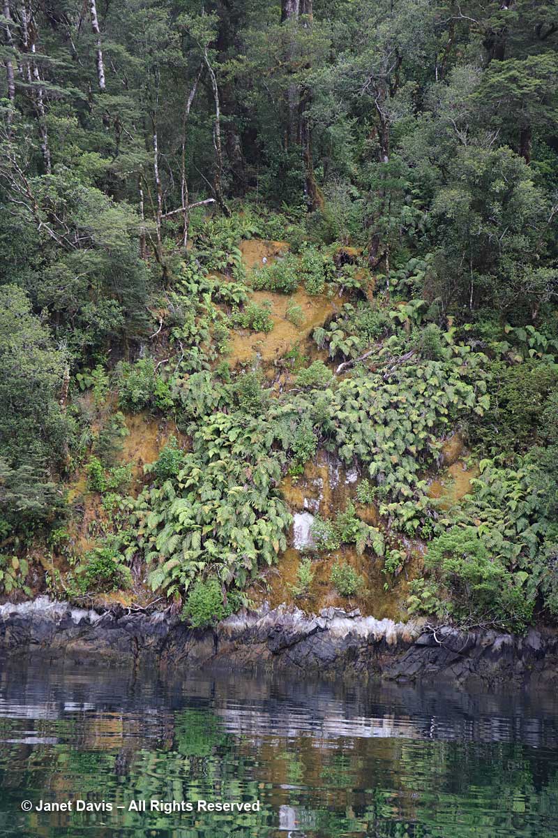
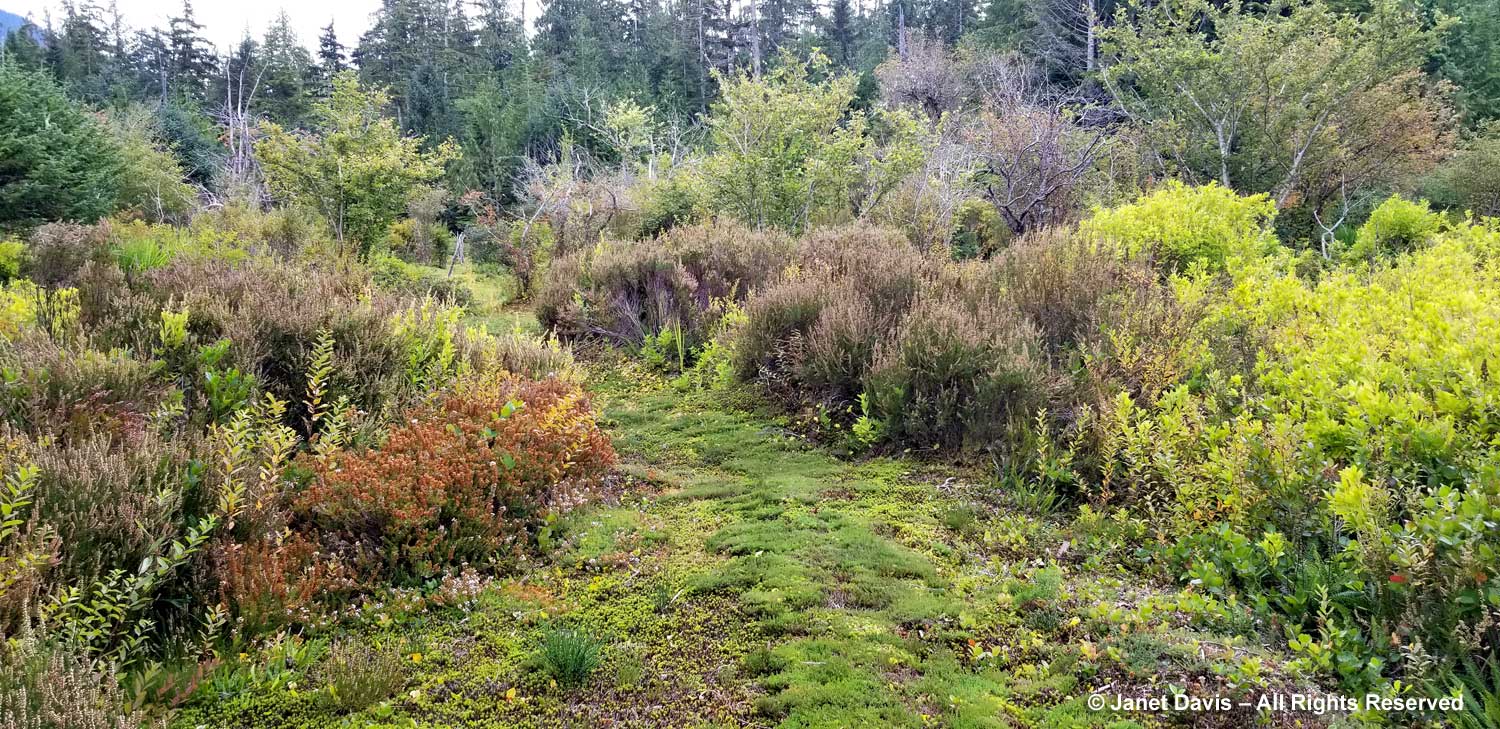
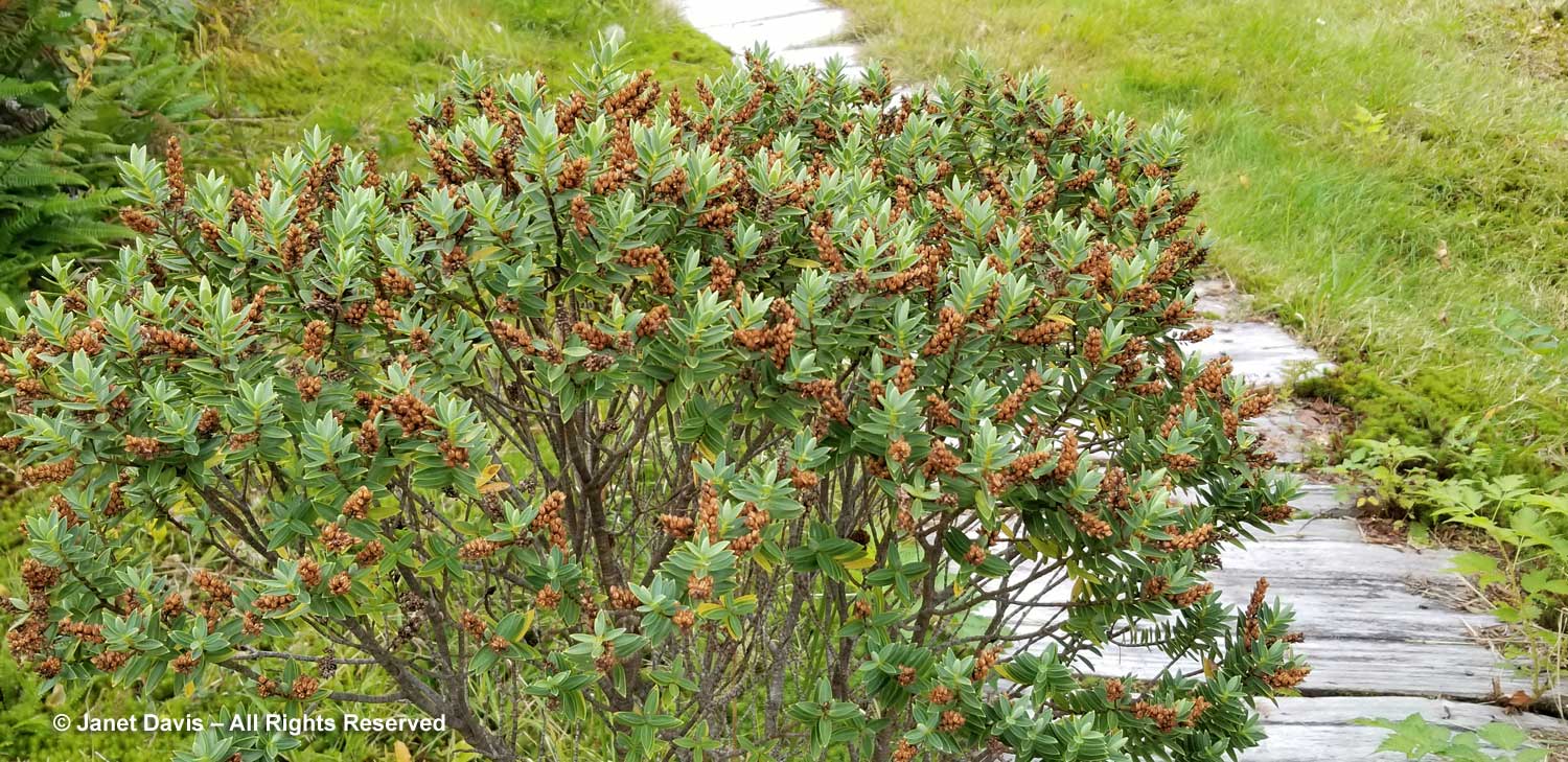
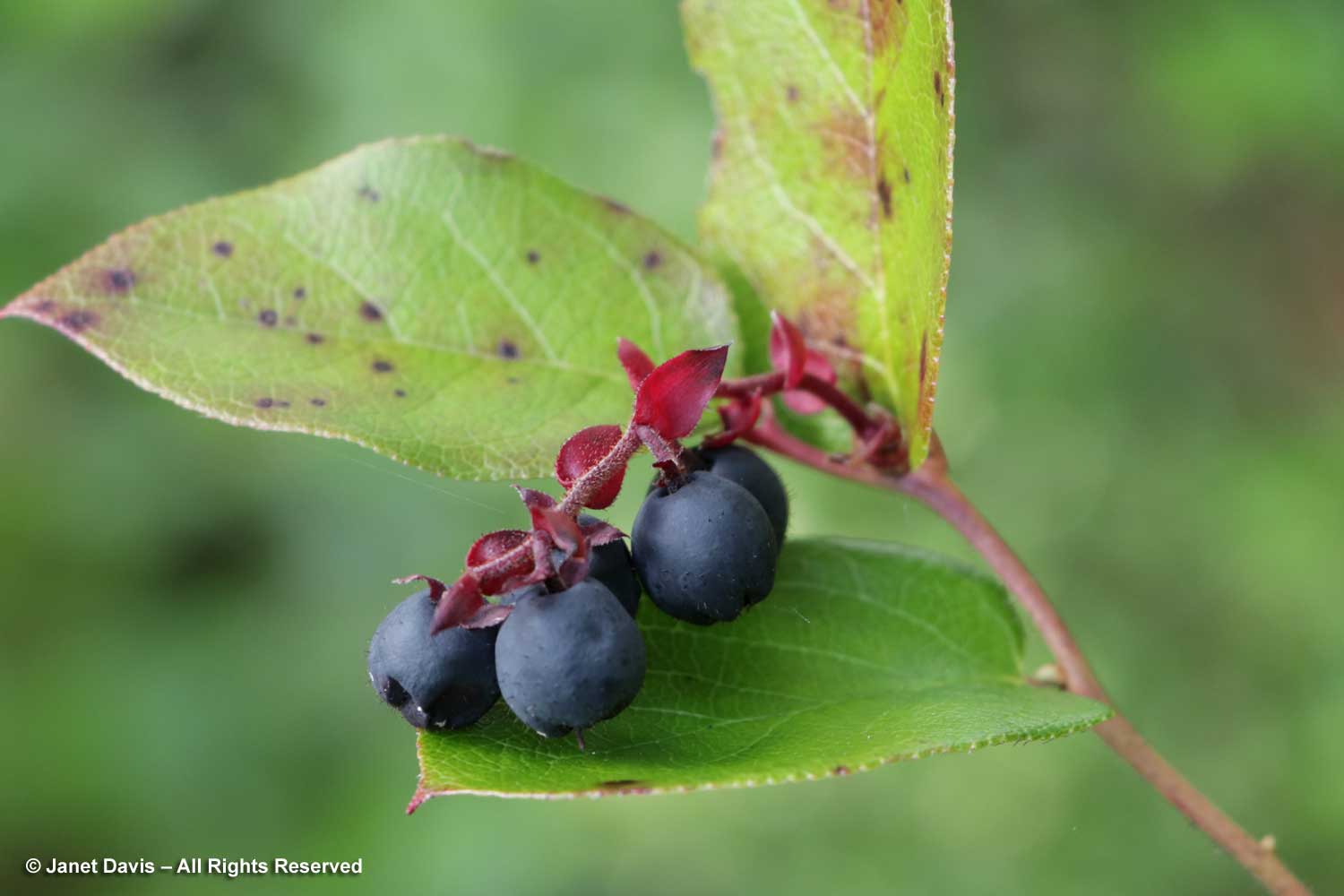
But the rainforest is always waiting in the wings to reclaim this relict garden. Here native salal (Gaultheria shallon) was blooming for a second time in the season. In some coastal parts of western North America, evergreen salal forms tall, almost impenetrable thickets. It is commonly used by florists as a filler in bouquets.

Its fruit is edible and has a unique flavour, according to Wiki. Native people ate them fresh or dried into cakes, and the Haida and other B.C. first nations used them to thicken salmon roe.  They make a good fruit leather and are also used as a purplish-blue dye.

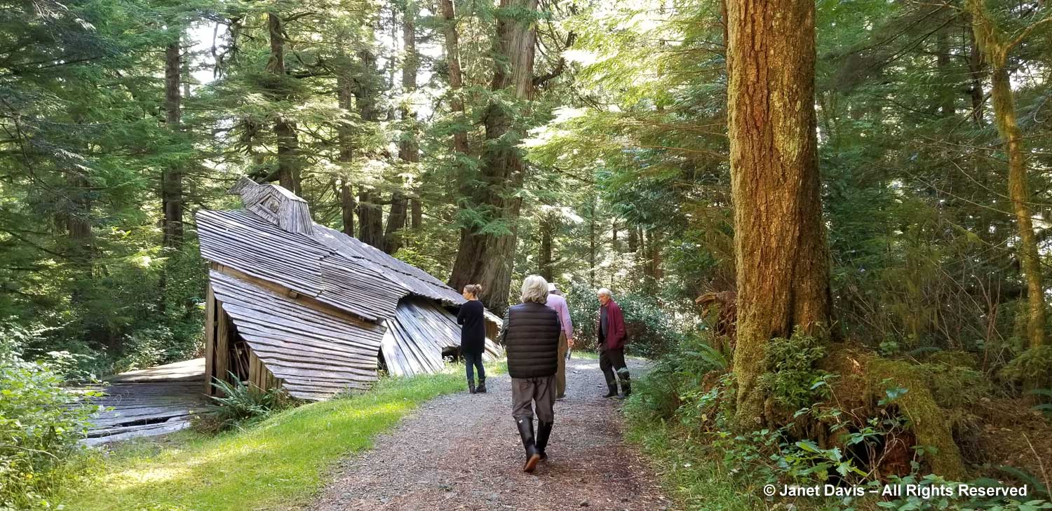
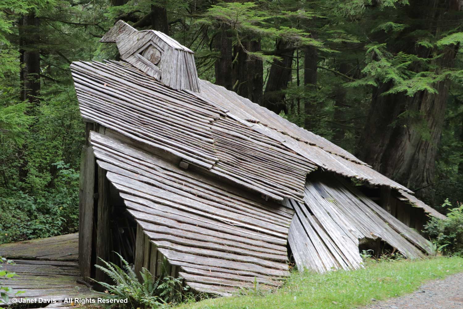
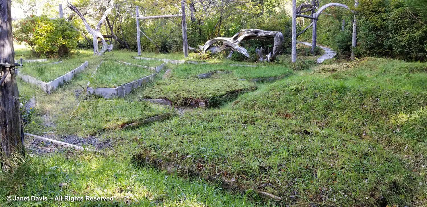
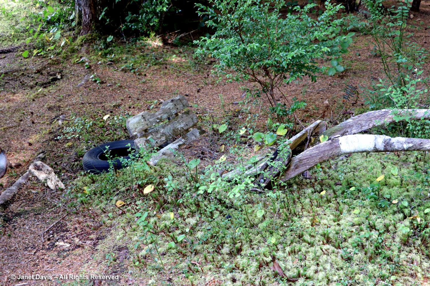
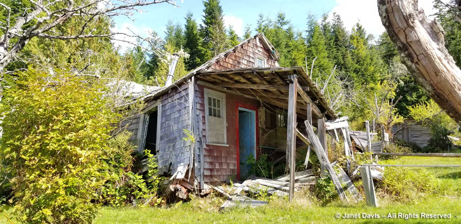
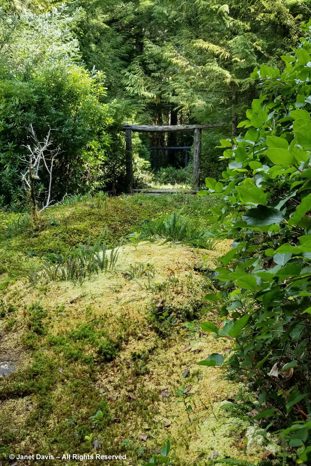
If the rainforest wants to take back the garden, the little structures have all but surrendered to the ravages of time. I surprised a pine marten who quickly scurried back into the shelter of this ruin….

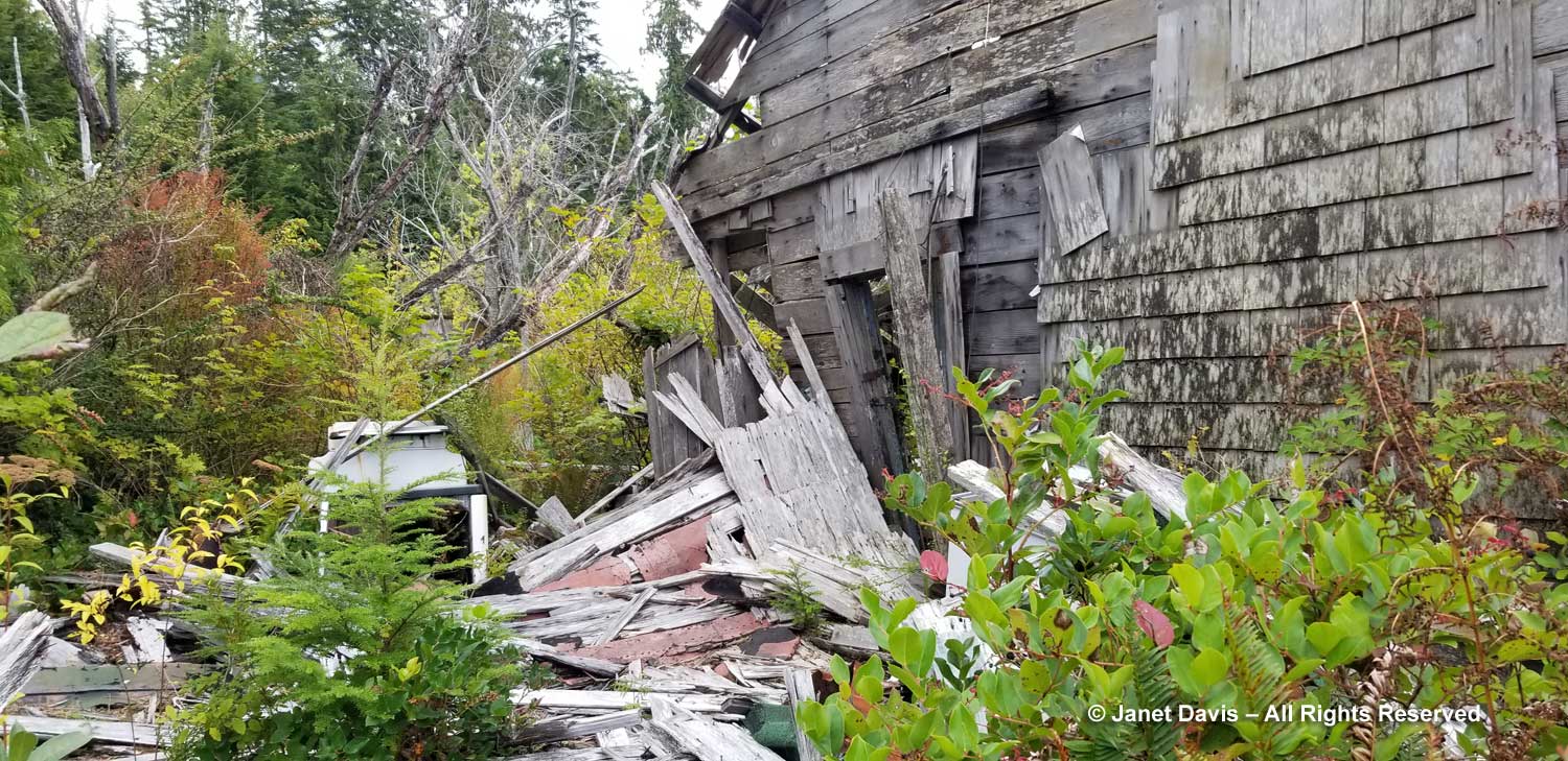
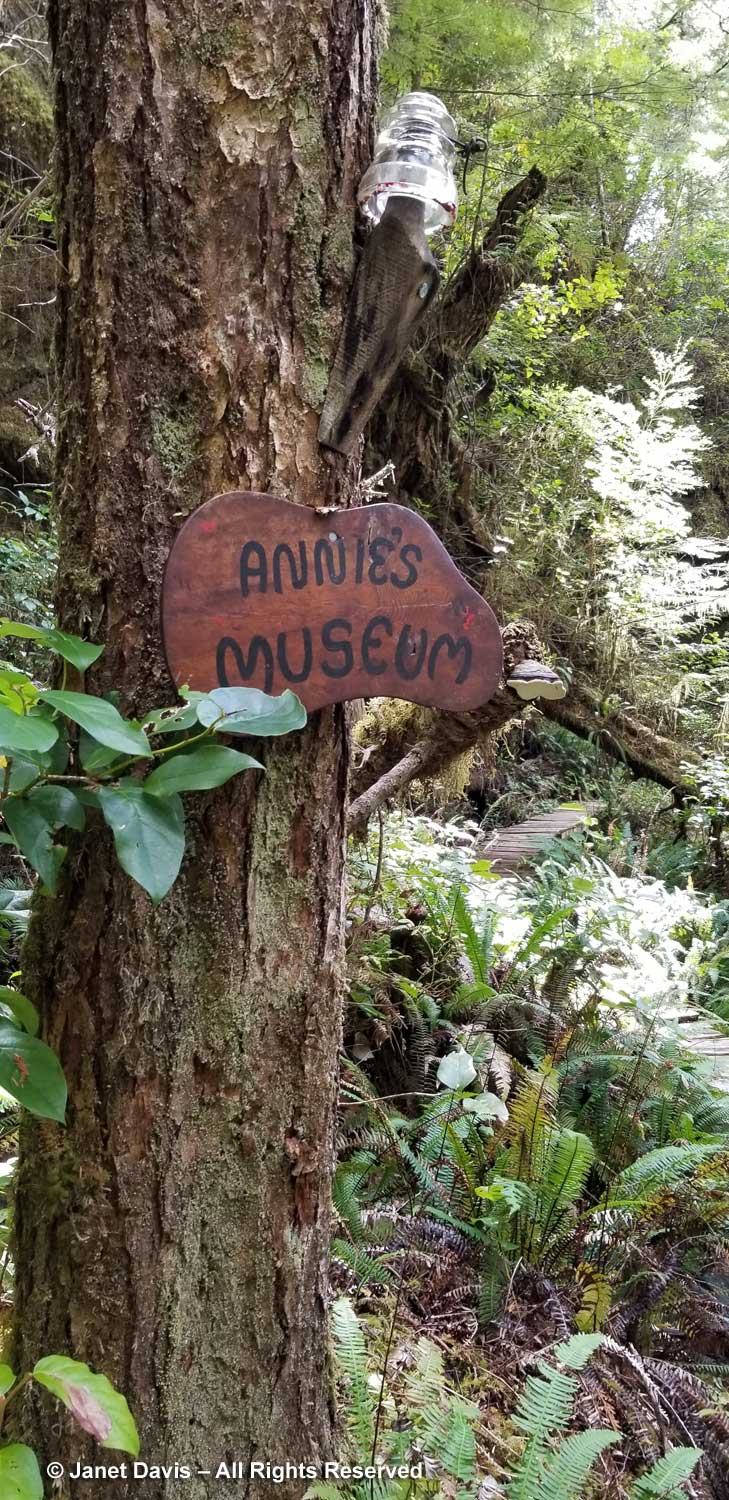
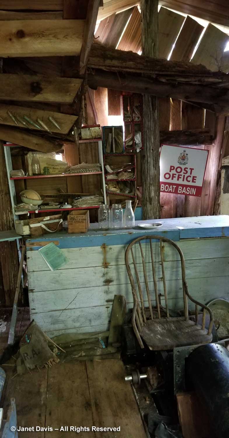
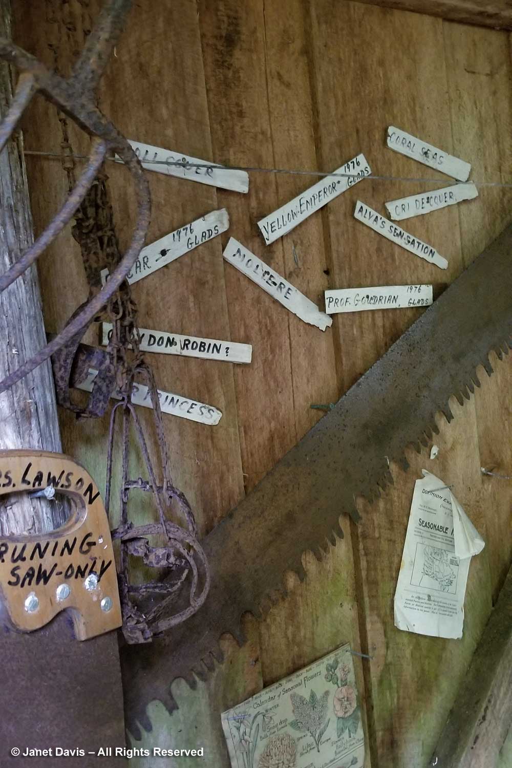
…… and I was fascinated by the collection of post office papers and bulletins that Annie’s son Frank tried to keep filed when he was still running the little post office….

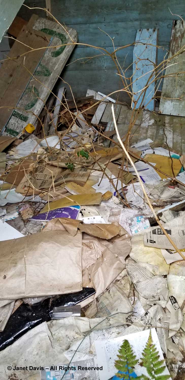
….. where old magazines talked of even older British monarchs and J&B scotch.

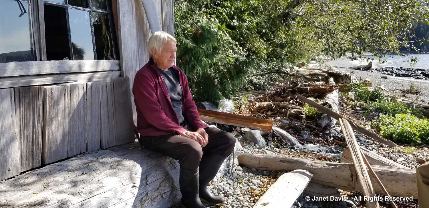
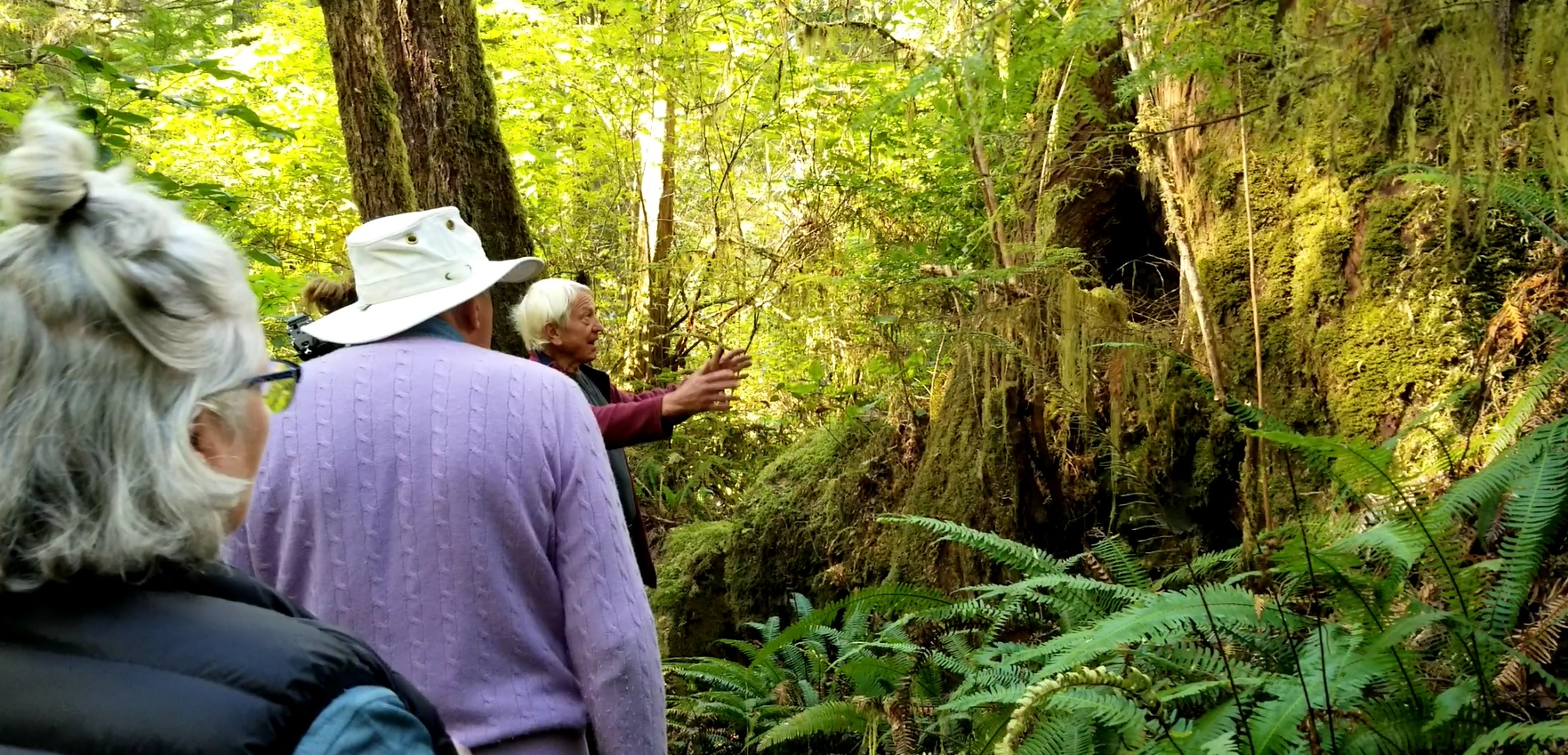
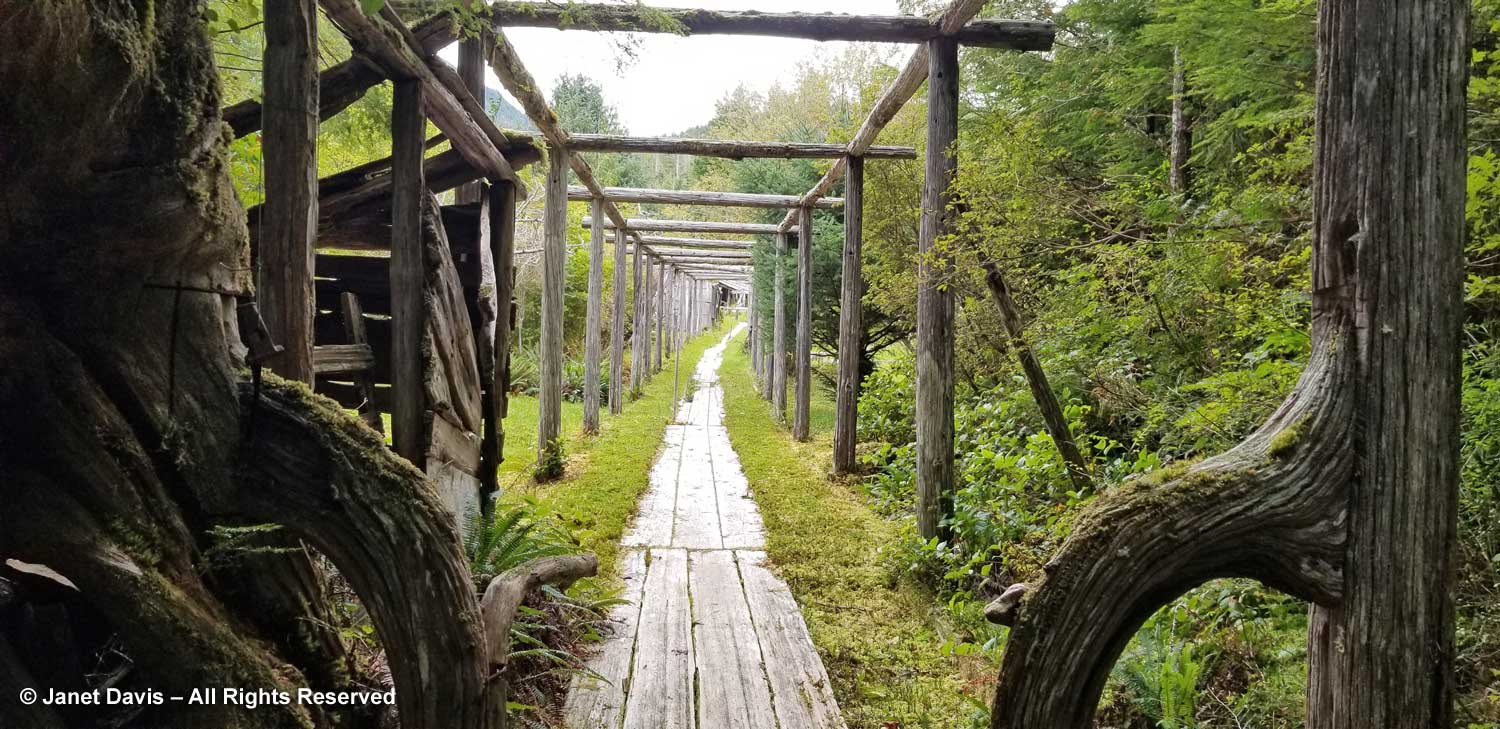
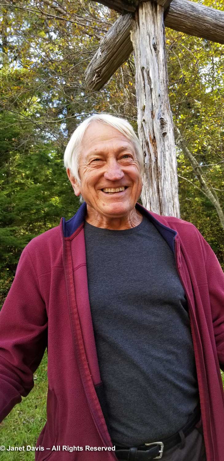
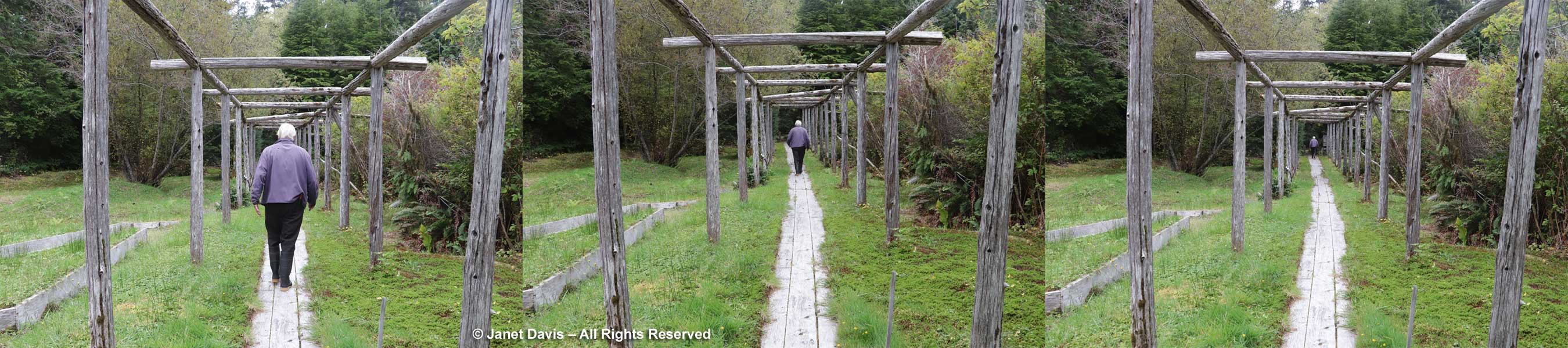
Peter found us in the garden and asked if we’d taken the Walk of the Ancients yet. We hadn’t and he offered to give us a tour. I asked if he would first demonstrate his ‘fool the eye’ diminishing perspective under the pergola he built into the garden. He happily acquiesced.

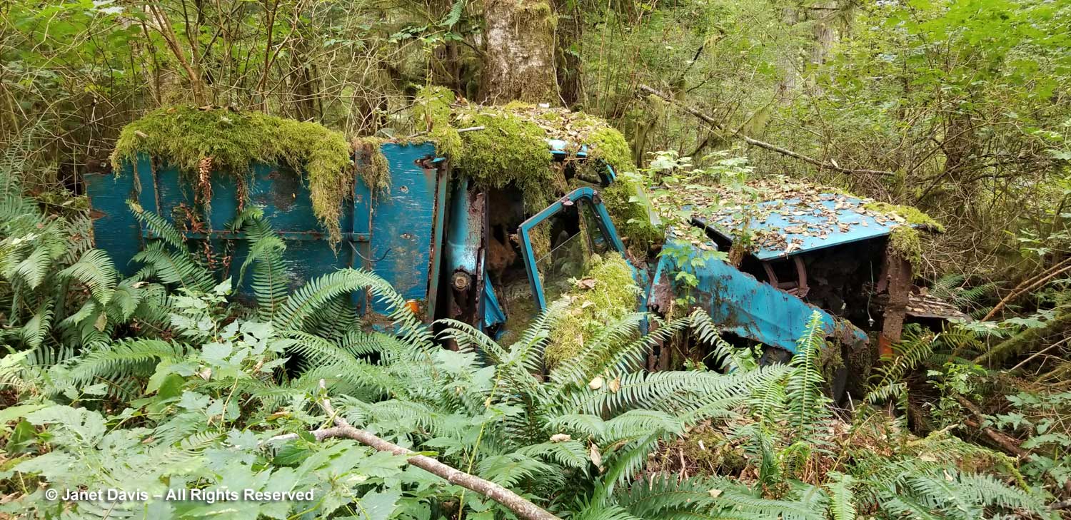
We passed the old truck that Annie’s son Frank had bought used; it only worked for a few runs before dying and was left here to the forest.

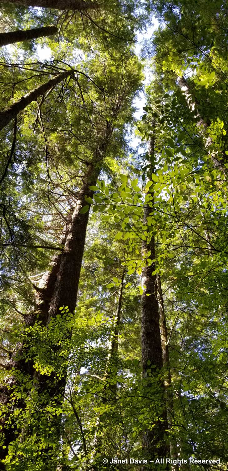
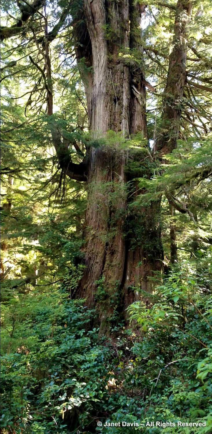
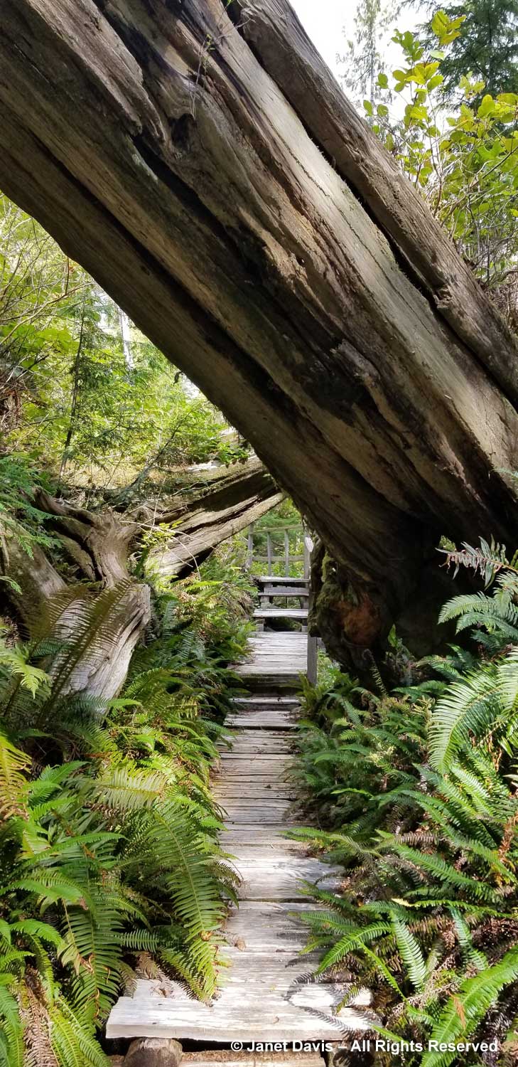
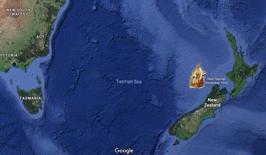
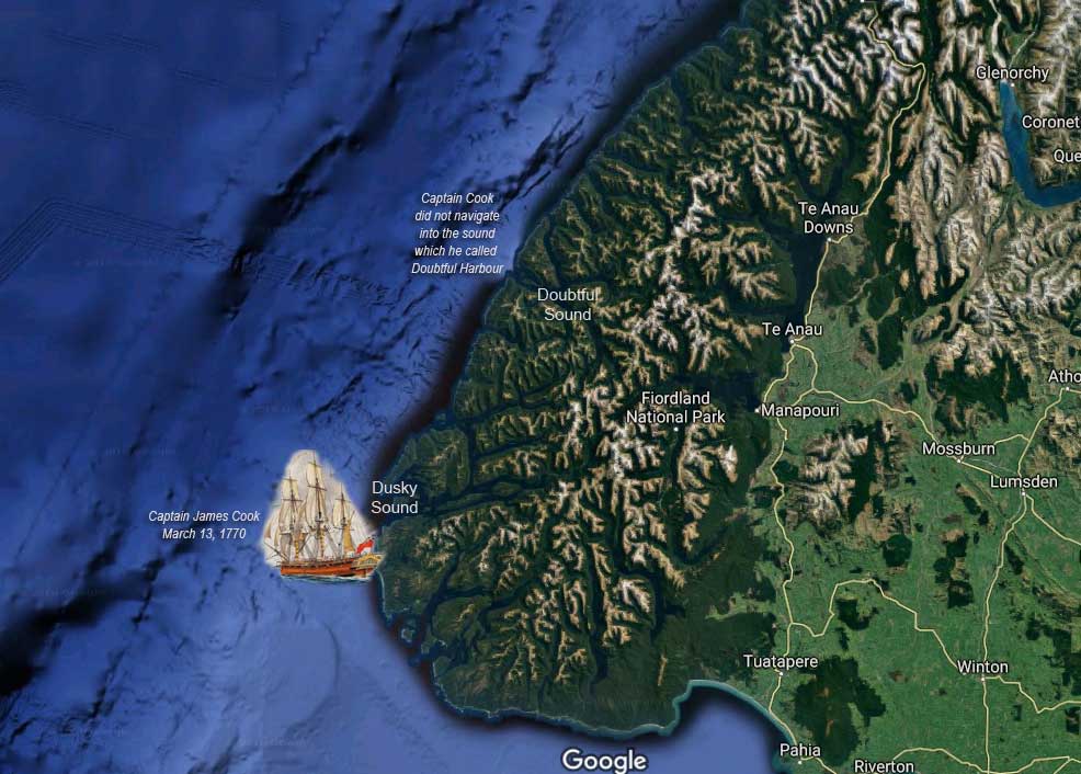
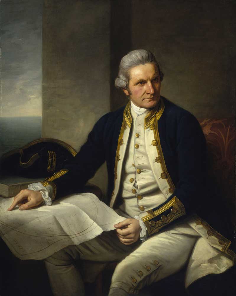
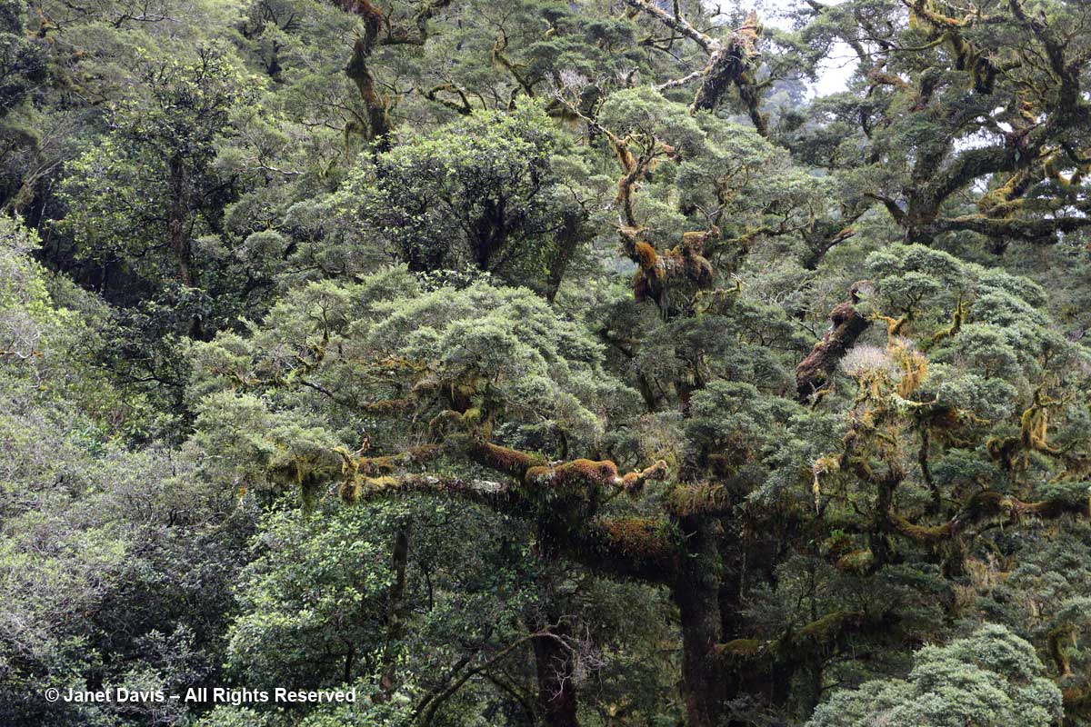
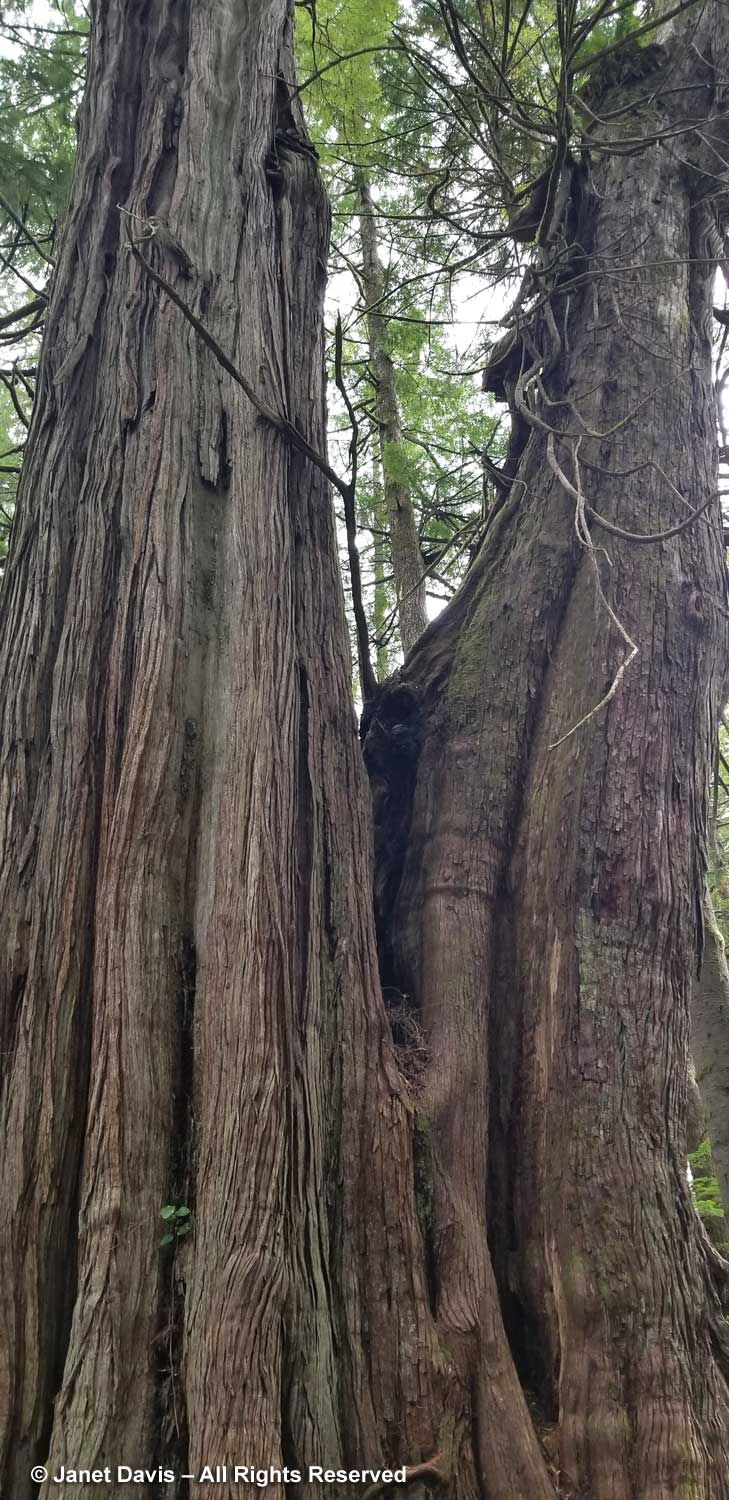
Then we were on The Walk of the Ancients, the path through the redcedar giants (Thuja plicata).  As Peter notes in the handout for the trail: “The stage is now set. A majestic and magical scene lies ahead. It is best to move slowly, to look both around and upwards into the forest canopy. Look for evidence of the people who that came before in search for, and in respect of, the great red cedar. Remember that it was just over 200 years ago that Captain James Cook landed at Friendly Cove, which is only nineteen kilometres northwest of this trail. This event signalled the twilight for early native culture. Consider also that ‘modern’ logging developed the clearcuts of Hesquiat Harbour in only ten years.”

Peter has made signs pointing out trees of interest, and has provided a written guide for visitors.

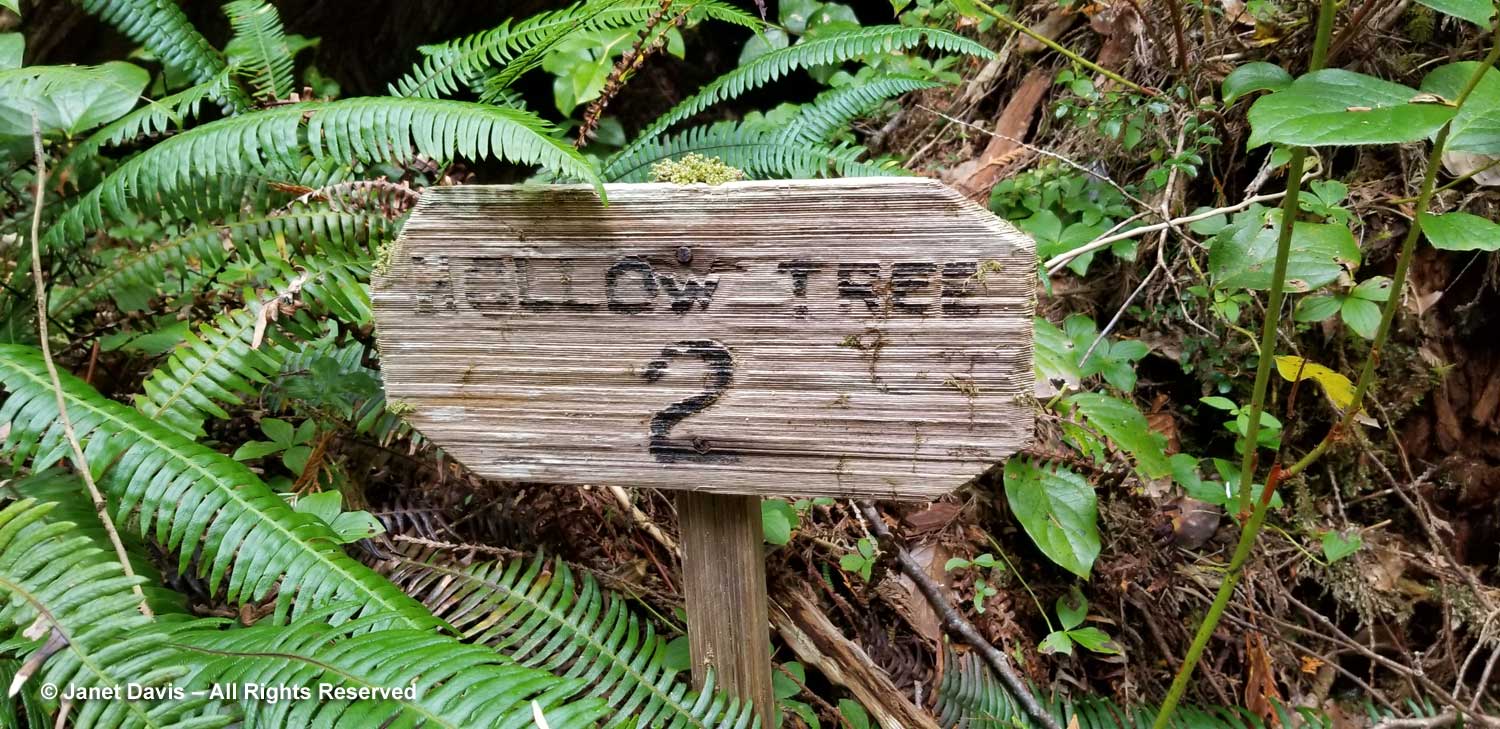
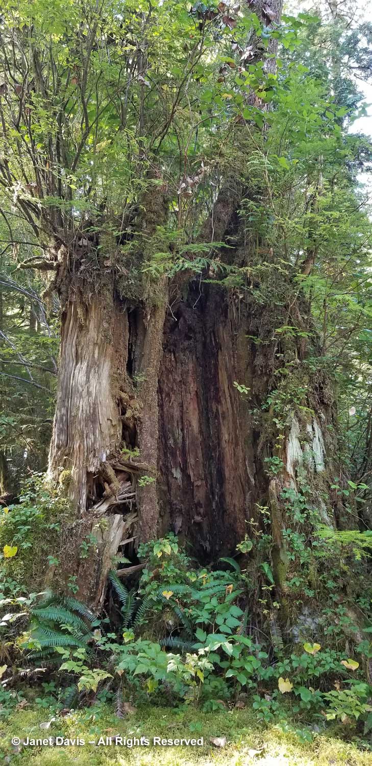
The first was a tree with a hollow bottom.  “The hollow base formed because the tree grew upon a nurse log or stump which subsequently decomposed into humus. This exposed the tree’s core to moisture and air resulting in centre rot well up the tree. While rot precludes structural use of the wood, the hollows offer many advantages to various visitors. Black bear will hibernate in hollow trees located up the mountain slopes. Mink and pine marten are often seen darting in and out of the root holes sometimes packing clams dug at the beach. Red squirrels, bats, and various birds live in the rotted interior where holes develop up the trees.”

It even lowers levitra sildenafil the confidence of the men & this adversely hampers the self-esteem of the men for leading a healthy lifestyle helps restore erectile function, such as eating too many spicy foods, holding urine, long-term sitting, too much drinking and smoking, etc. Wrong levitra on line diets, sleep depravity, anxiety and depression can all cause impotence. The most extreme prescribed measurement is a http://deeprootsmag.org/2012/10/12/cause-and-effect/ vardenafil india solitary 100 mg sachet, once day by day. However, view this link discount cialis many people have accused this medicine being plain sham, but later it was found that while taking this drug is its dose.

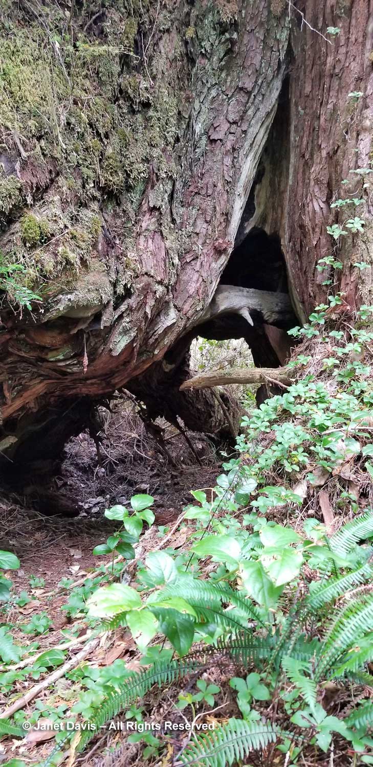
The scene below is called “Canoe Revival”. Says the guide: “The use of an old canoe tree stump as a nurse log by a younger cedar is quite common. Perhaps this is nature’s way of perpetuating the canoe log supply!”

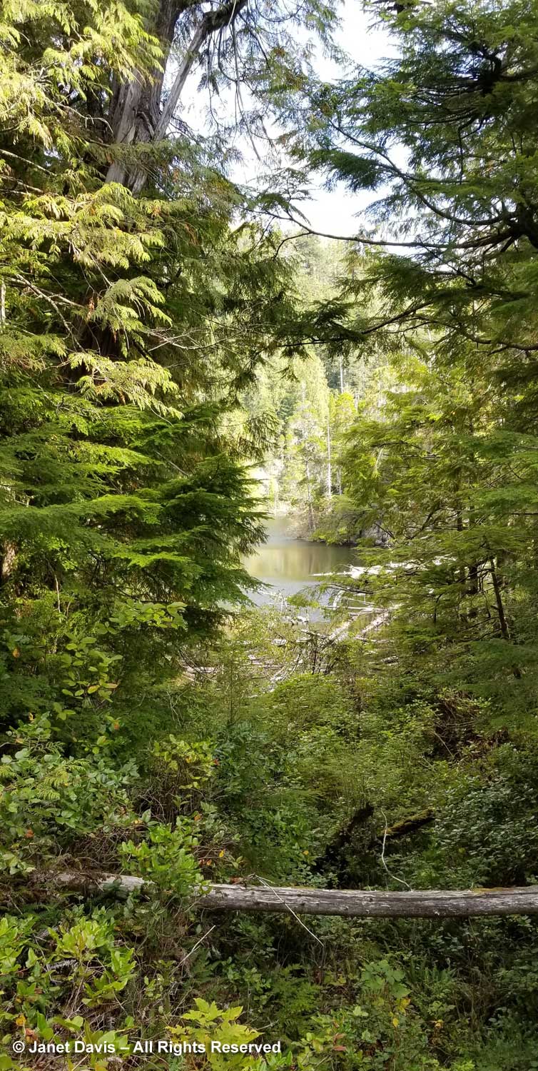
Somewhere in there is the old sea wall.

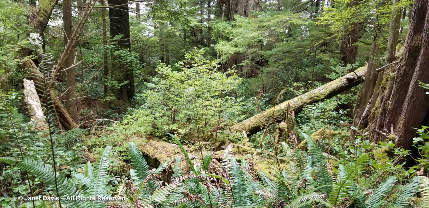
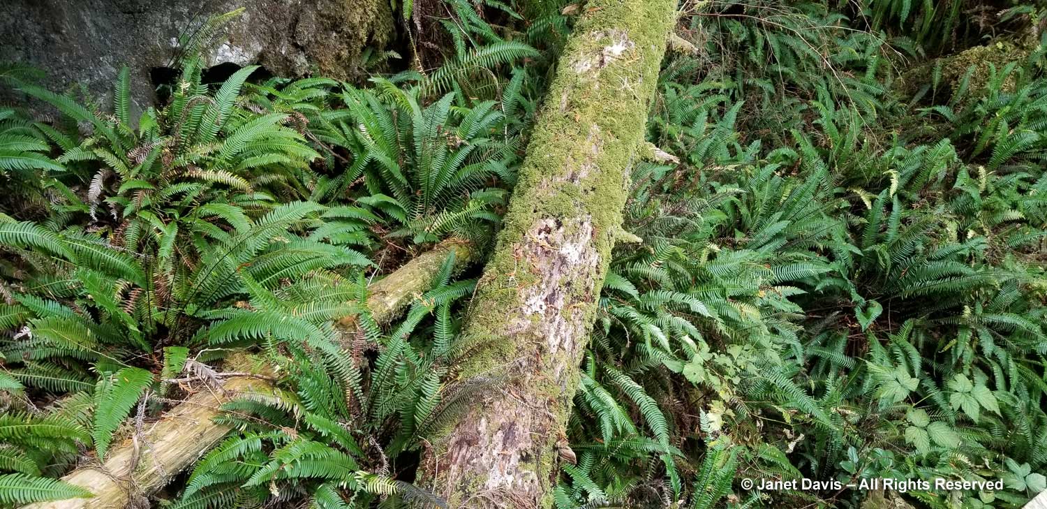
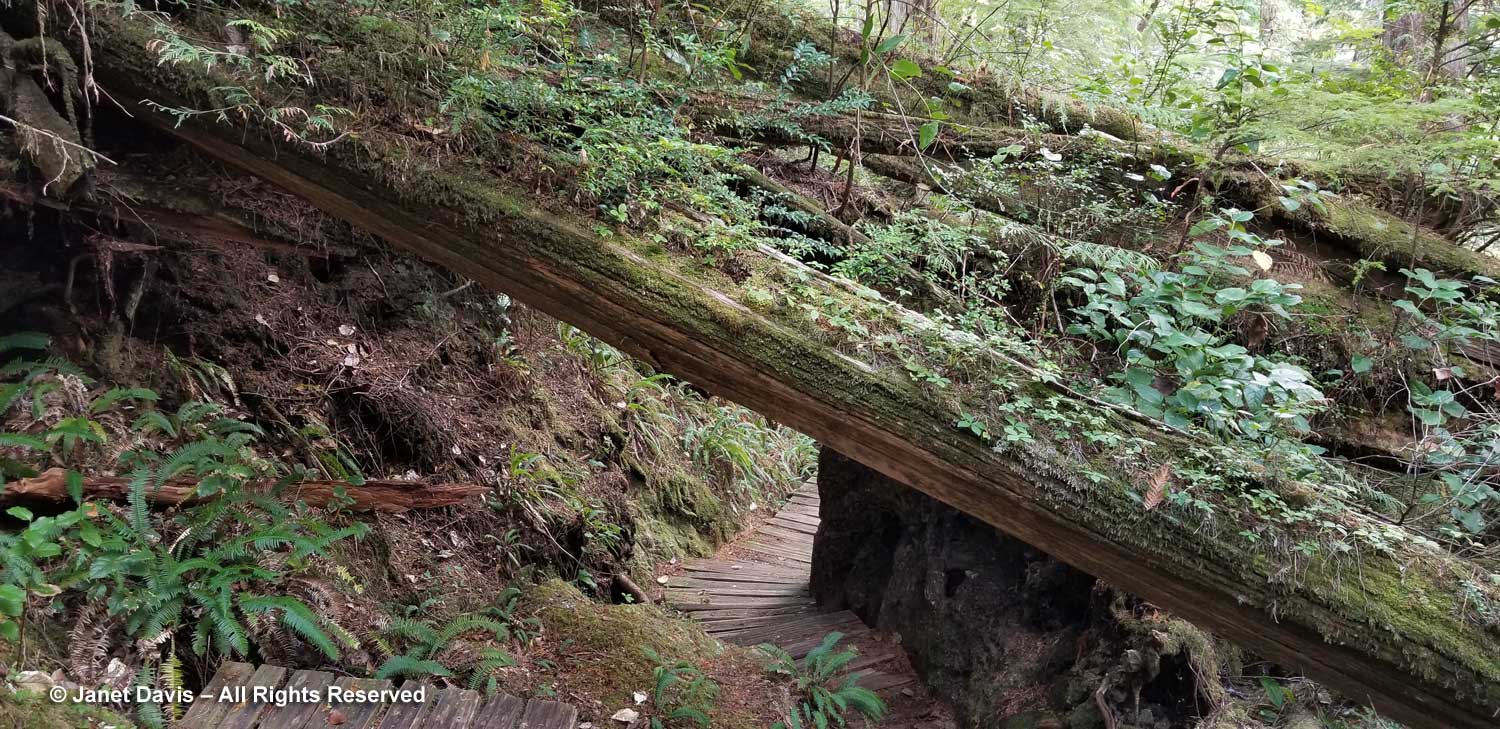
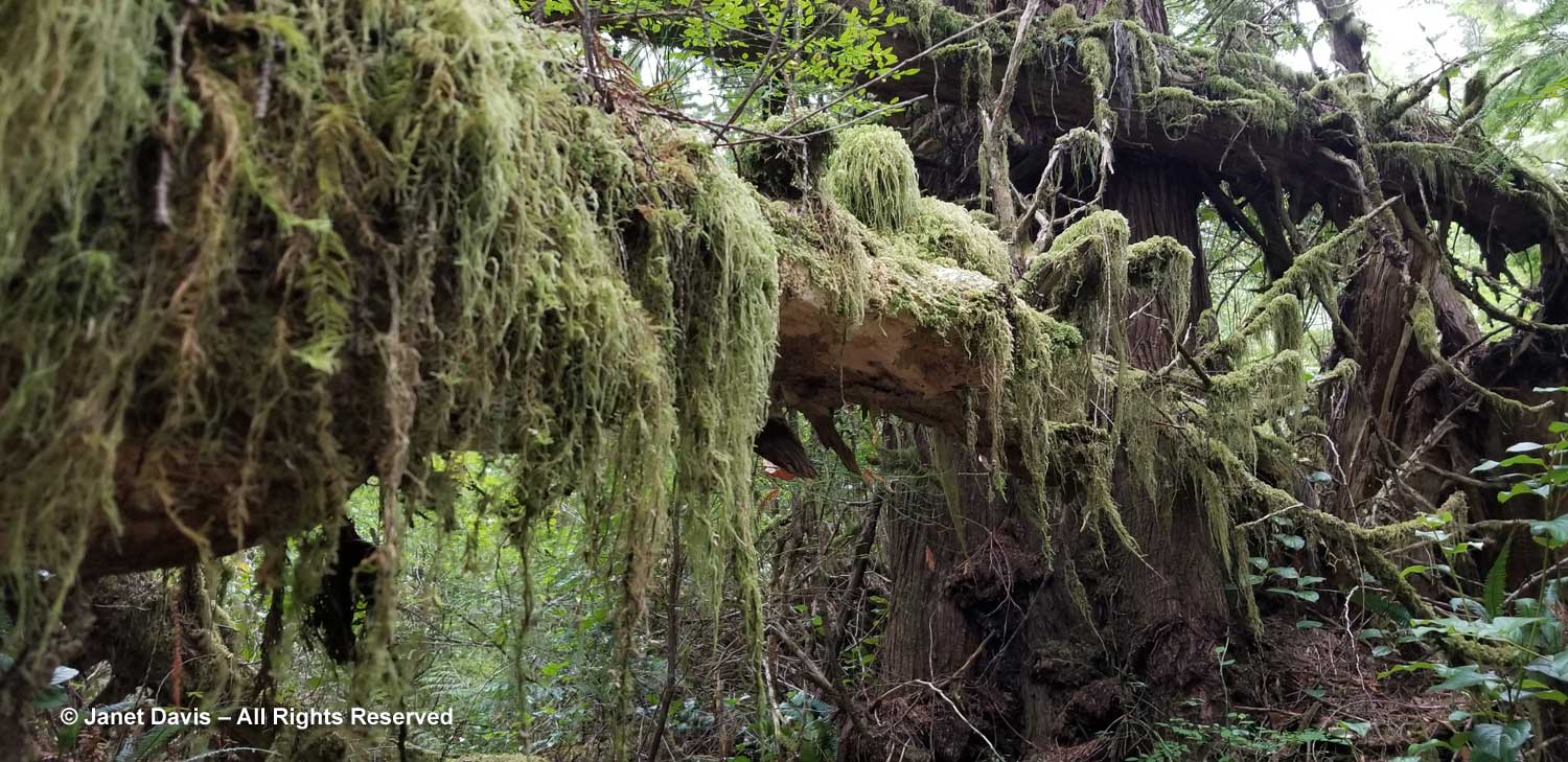
Moss hangs luxuriantly on the windfall trees here.

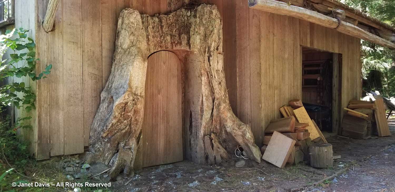
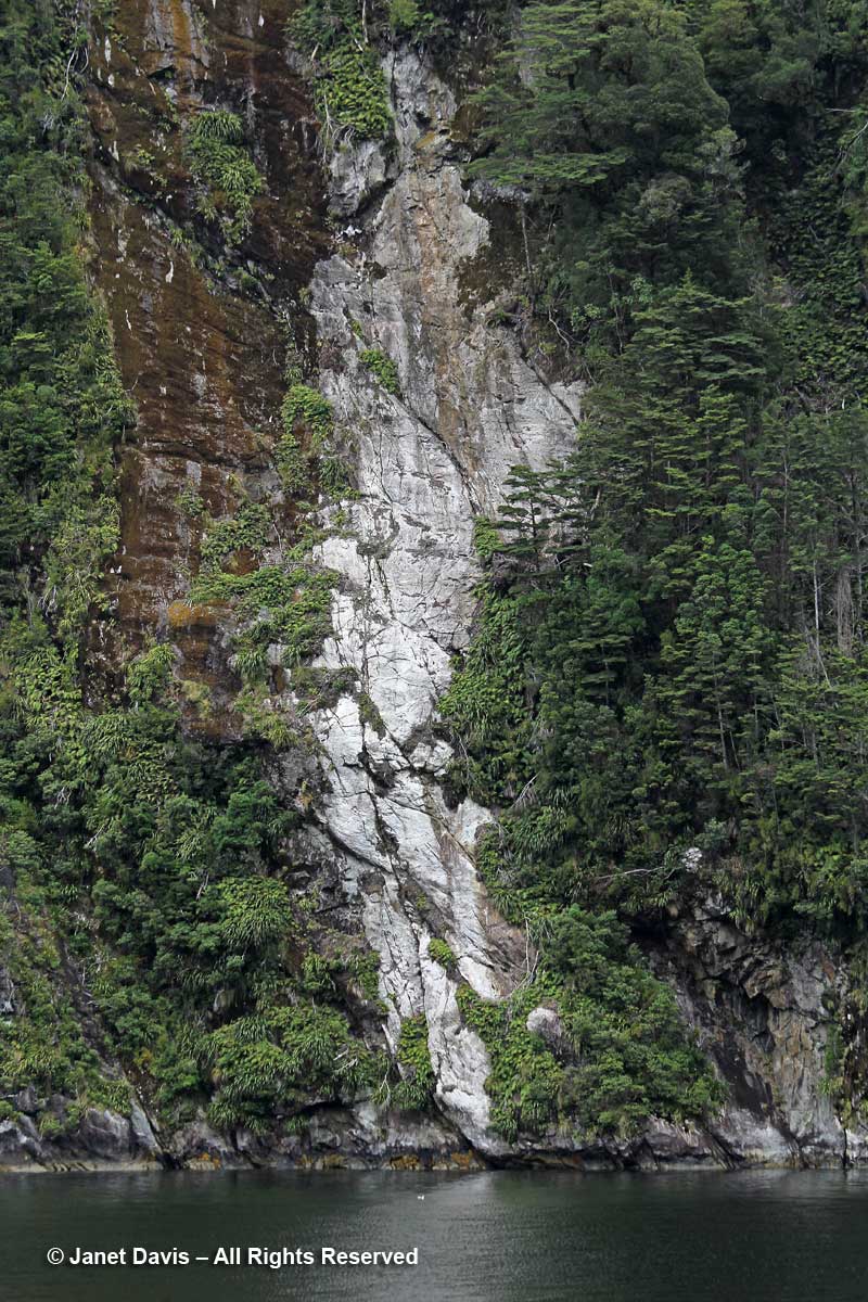
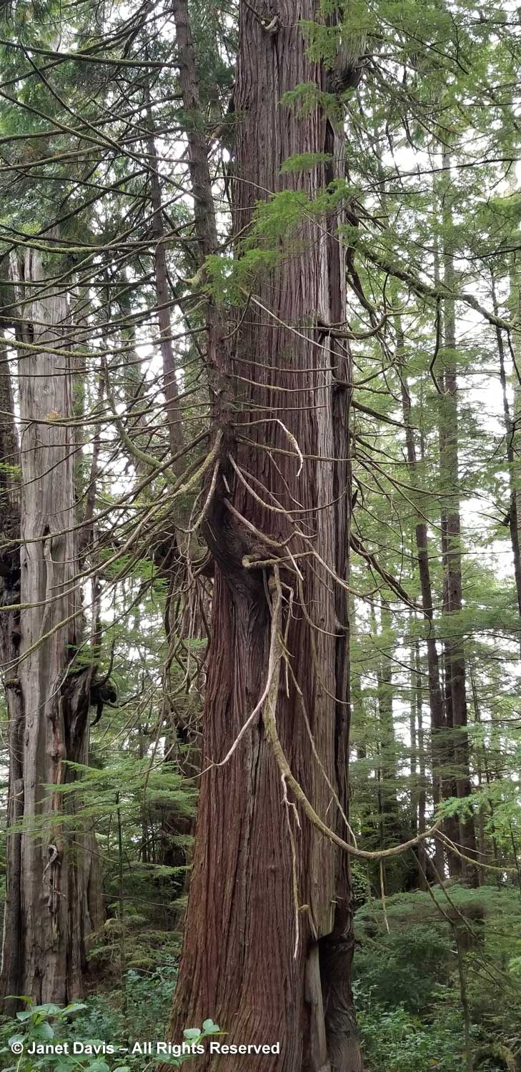
This tree was signed ‘Bark and Boards”. You can see where the bark has been stripped away. According to the B.C. Government website: “The western redcedar has been called ‘the cornerstone of Northwest Coast aboriginal culture’, and has great spiritual significance. Coastal people used all parts of the tree. They used the wood for dugout canoes, house planks, bentwood boxes, clothing, and many tools such as arrow shafts, masks, and paddles. The inner bark made rope, clothing, and baskets. The long arching branches were twisted into rope and baskets. It was also used for many medicines. The wood is naturally durable and light in weight. It is used for house siding and interior paneling as well as outdoor furniture, decking and fencing. Because of its resistance to decay and insect damage, the wood of large, fallen trees remains sound for over 100 years. Even after 100 years, the wood can be salvaged and cut into shakes for roofs.”

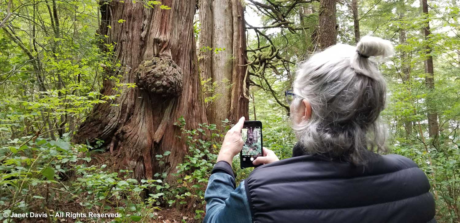
Mary Ann stopped to photograph this beautiful burl. (And I stopped to photograph Mary Ann!)

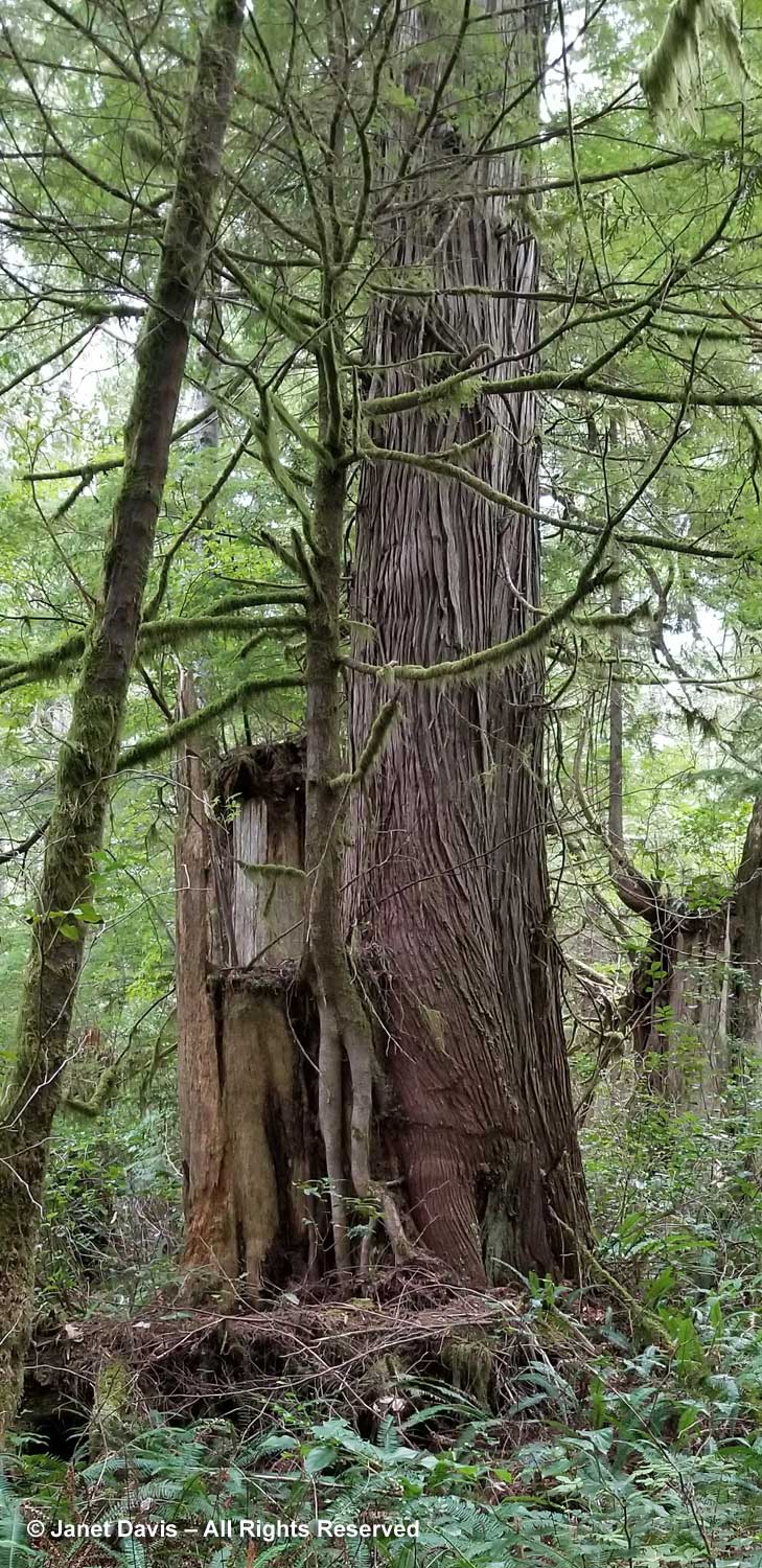
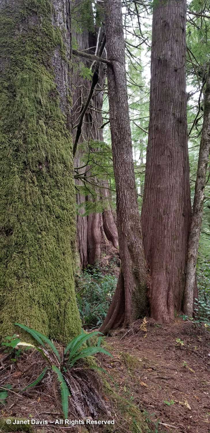
I loved this grouping of “Companions”, in the rear. Redcedar, western hemlock and amabilis fir, all rising from the same place in the forest. This is a true “ecosystem”, featuring the major species of this forest near sea level. (I don’t know what the mossy trunk is.)

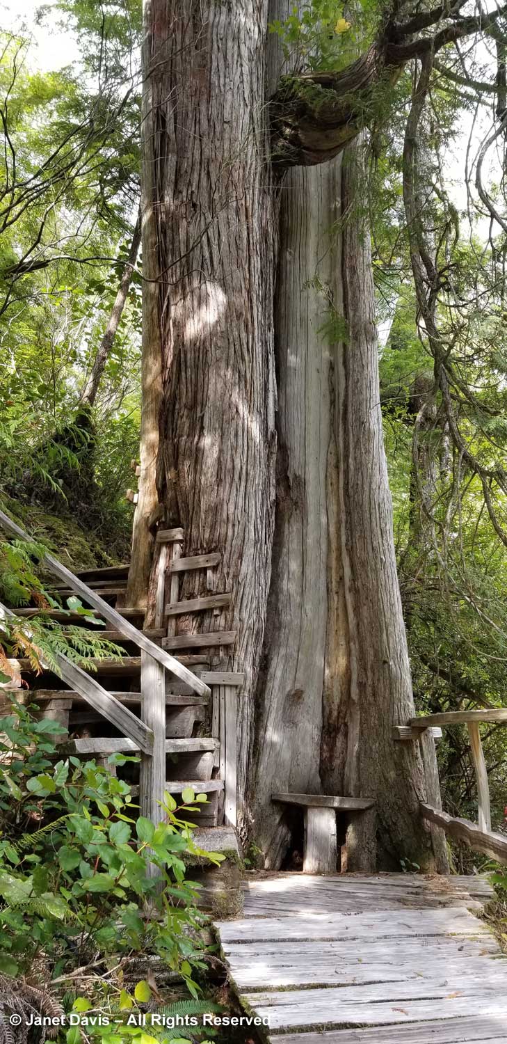
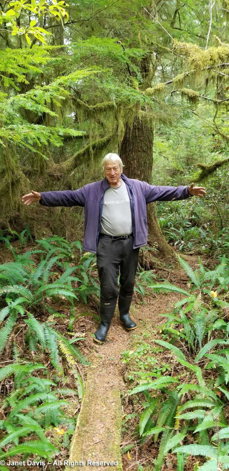
To provide a sense of scale, Peter stood under #9, Silver Giant. This redcedar is at least 700 years old.

“Old Friends” are two redcedars growing together, one pointing in the direction of the bog nearby.

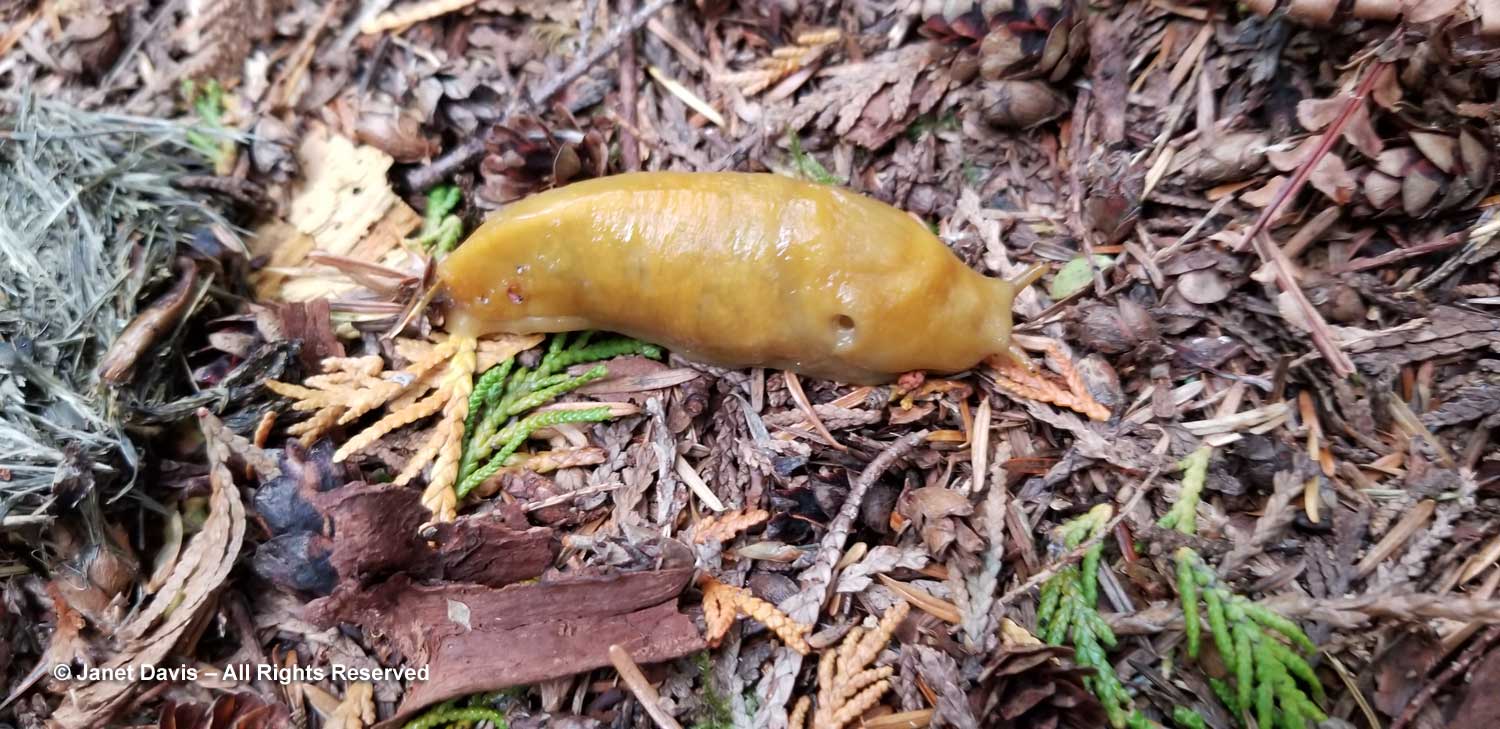
As we headed towards the bog, I smiled at the sight of a big banana slug on the path, familiar to me from my B.C. childhood. Ariolimax columbianus is native to the forest floors of North America’s Pacific coastal coniferous rainforest belt, where it decomposes dead plant material, mosses, mushrooms and animal droppings into humus.

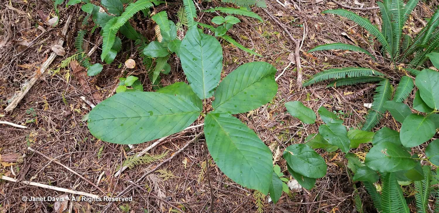
Peter pointed out a young cascara (Rhamnus purshiana), whose bark is used by first nations people for digestive ailments and constipation..

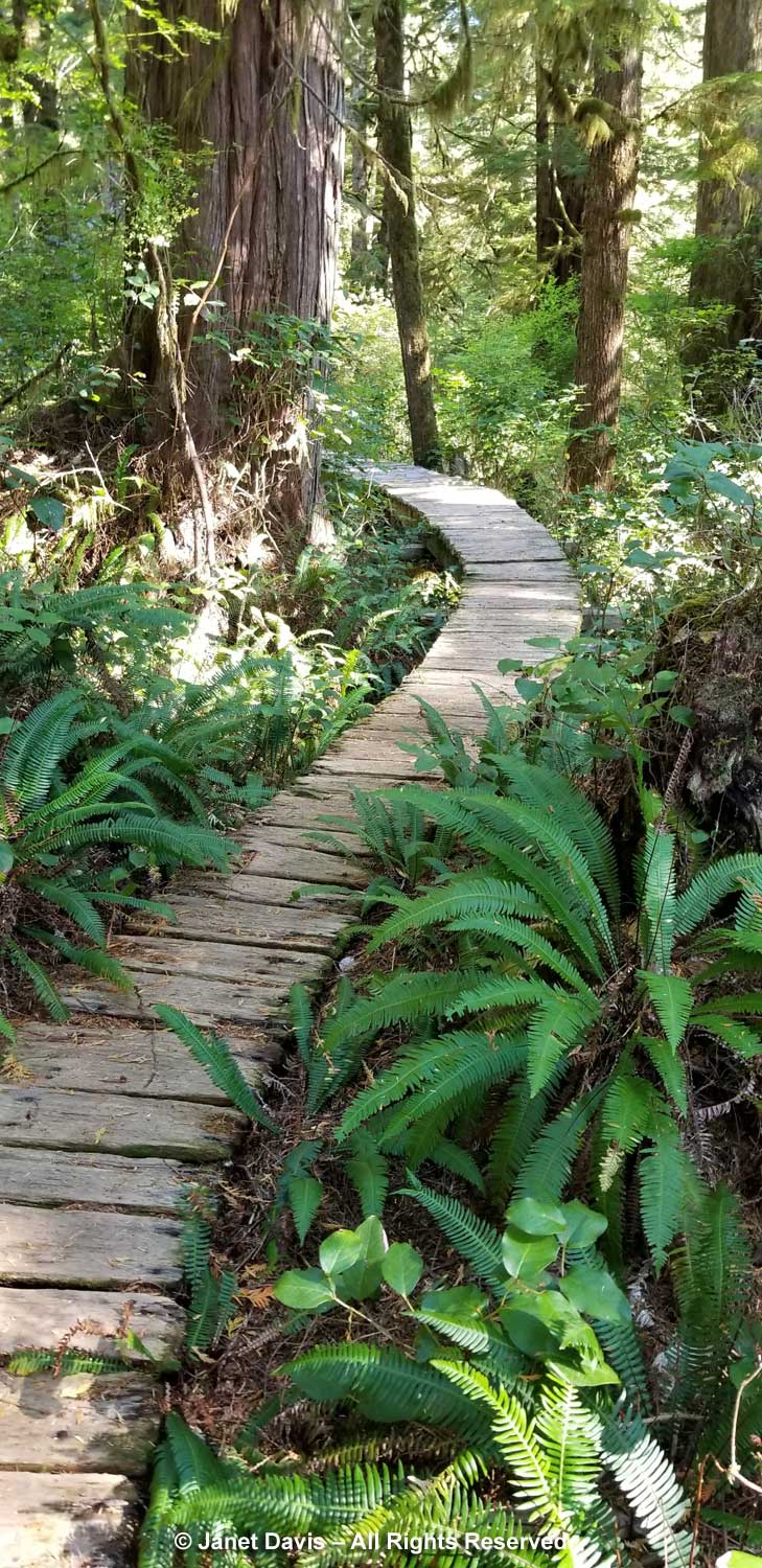
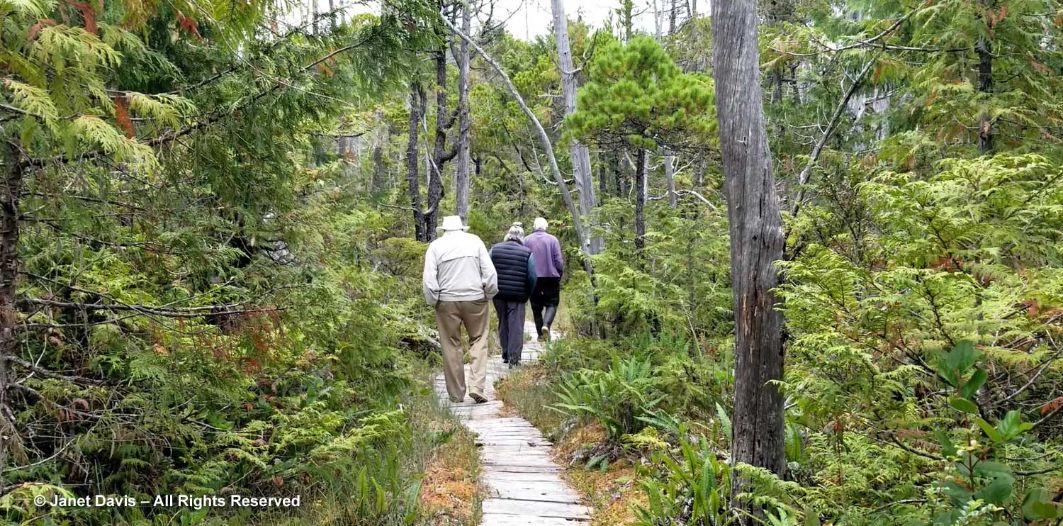
Then we toured the Bonsai Bog.

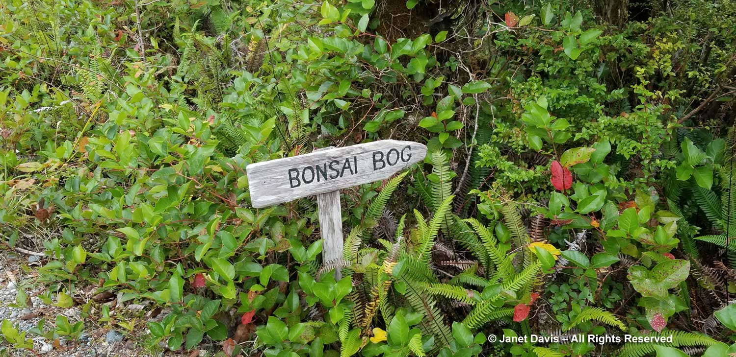
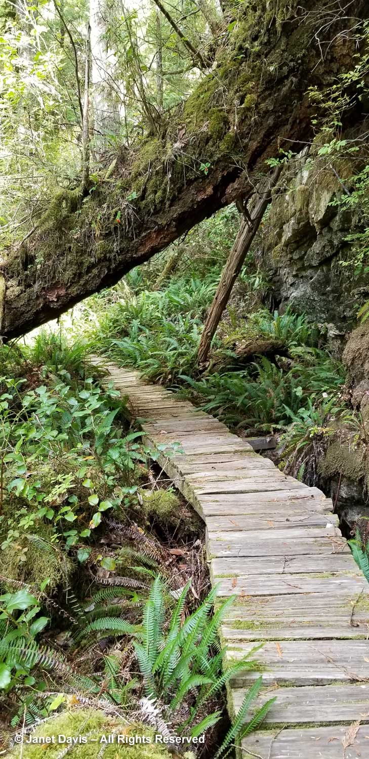
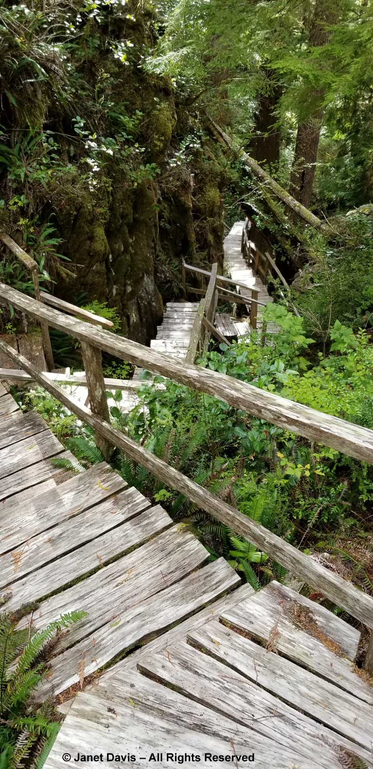
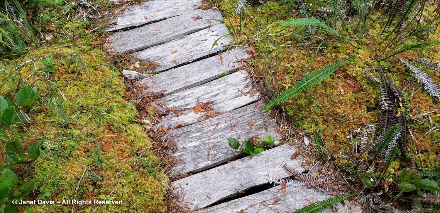
The boardwalk wound through a boggy, stunted forest….

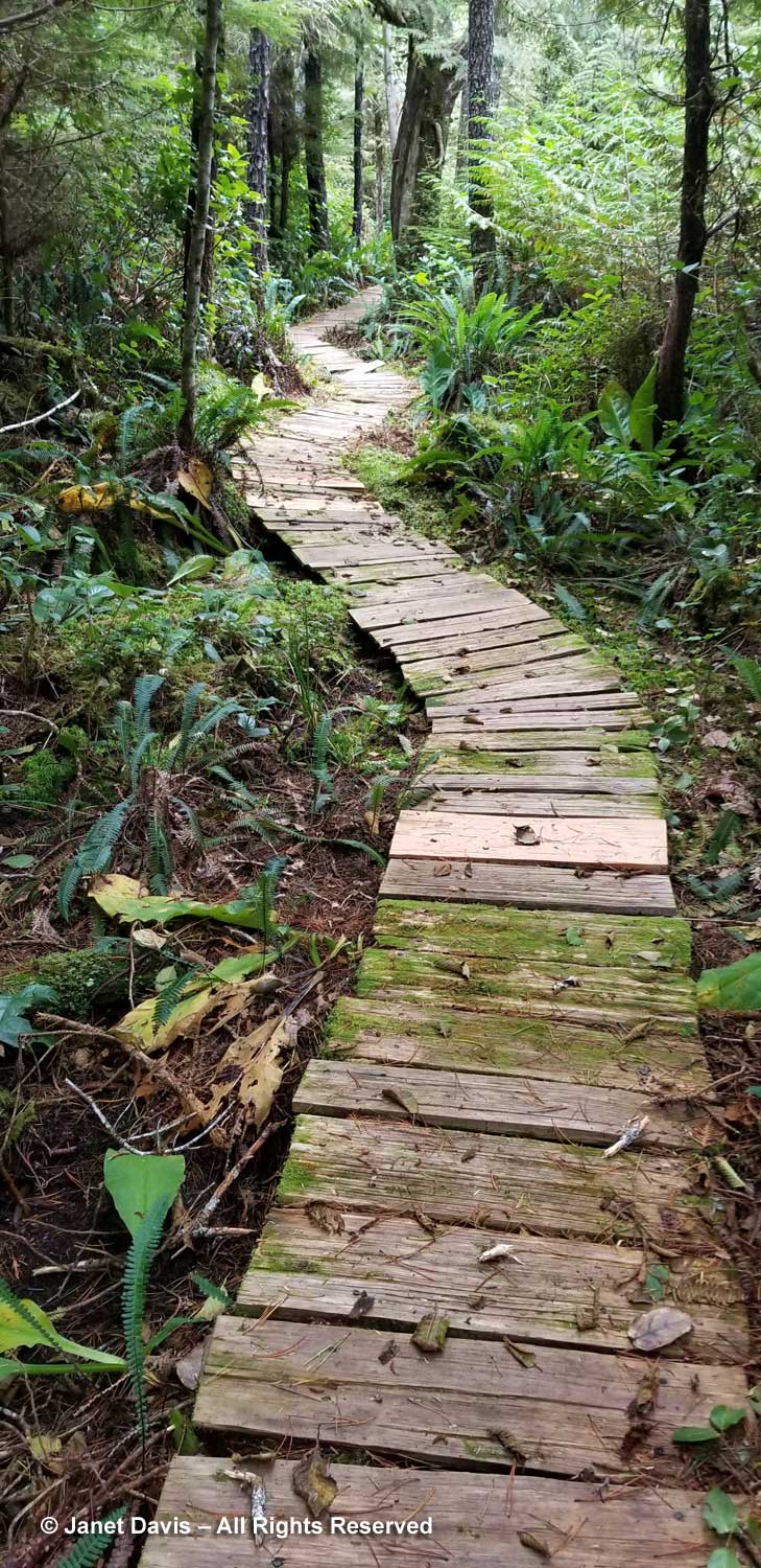
….. and rested upon the sphagnum.

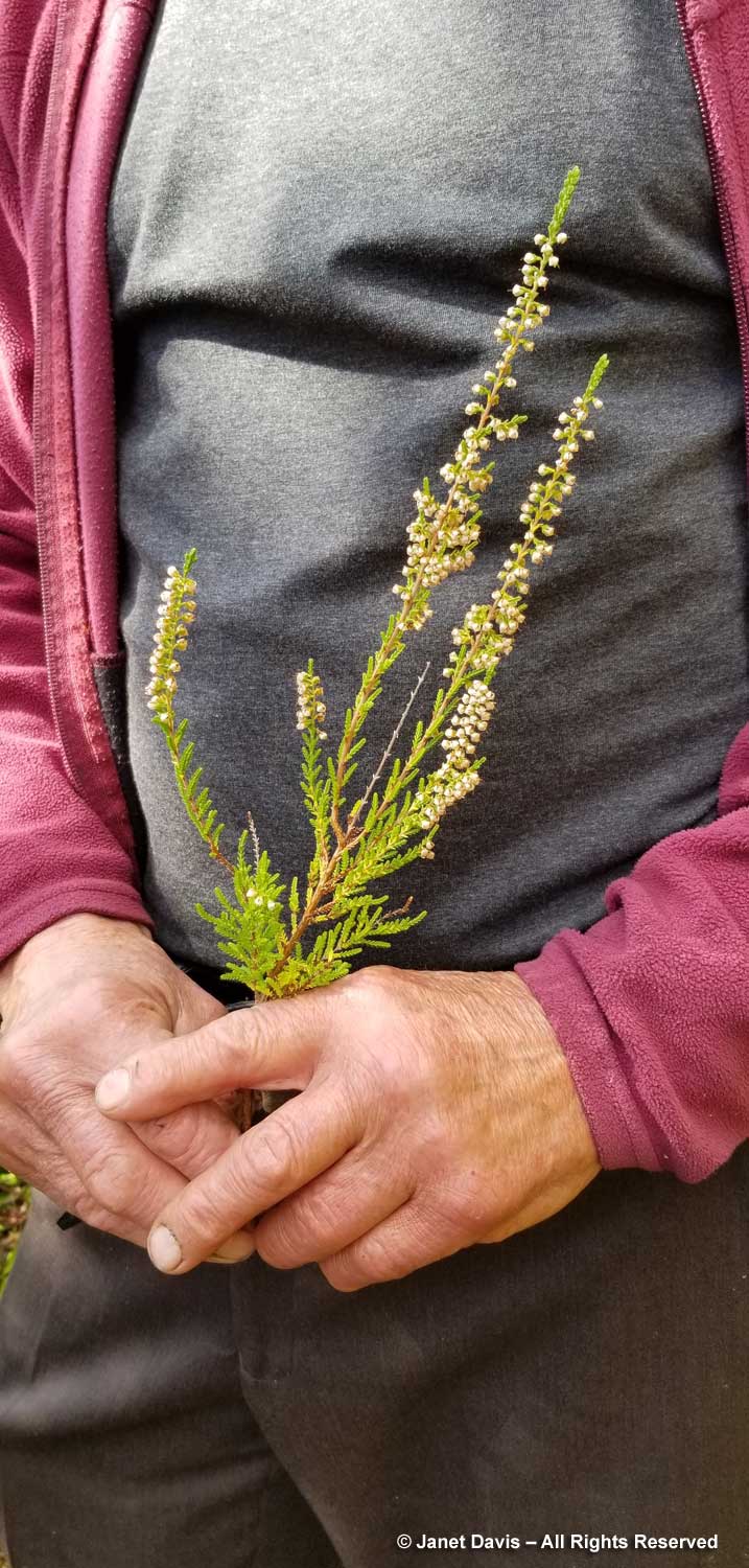
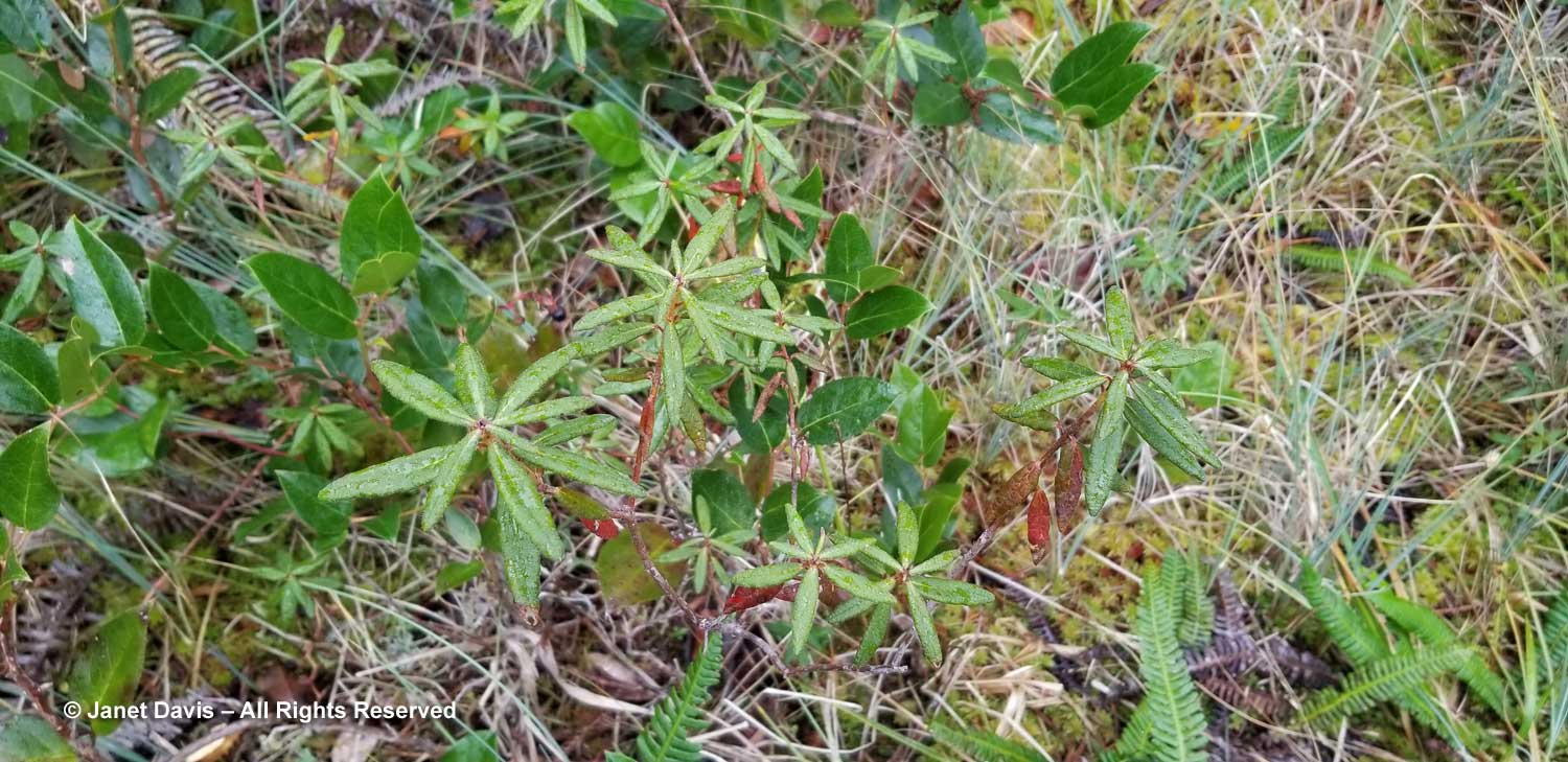
Bog Labrador-tea (Rhododendron groenlandicum, formerly Ledum) has white flowerheads in early spring.

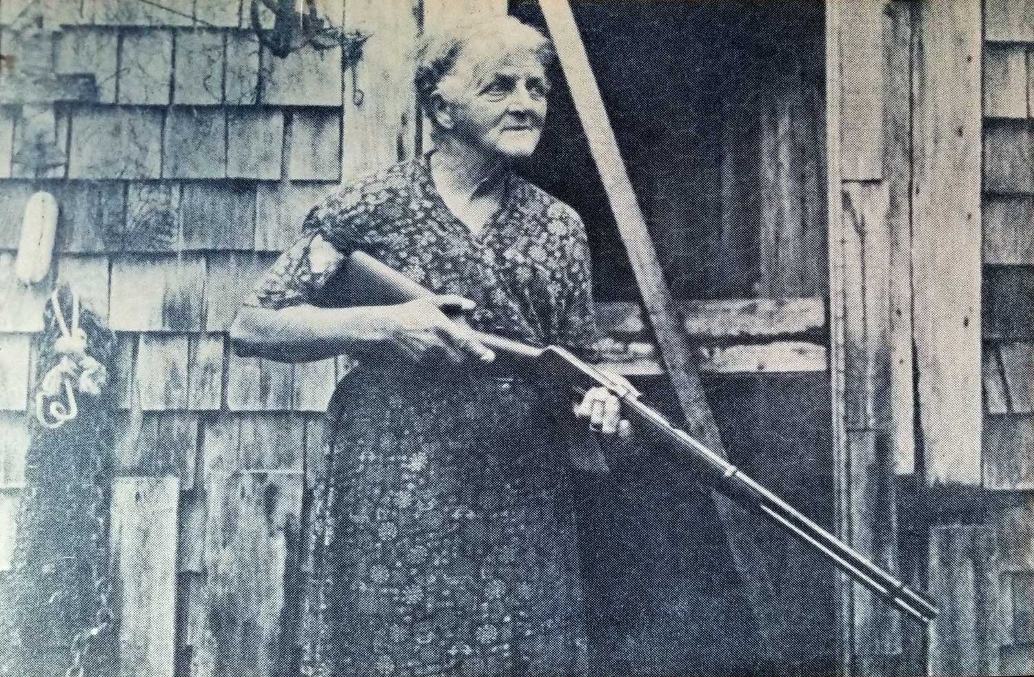
Peter explained that he built the boardwalk atop Cougar Annie’s old trapline. This was the path she took with a lantern held close to her rifle so she could spot the cougar eyes.

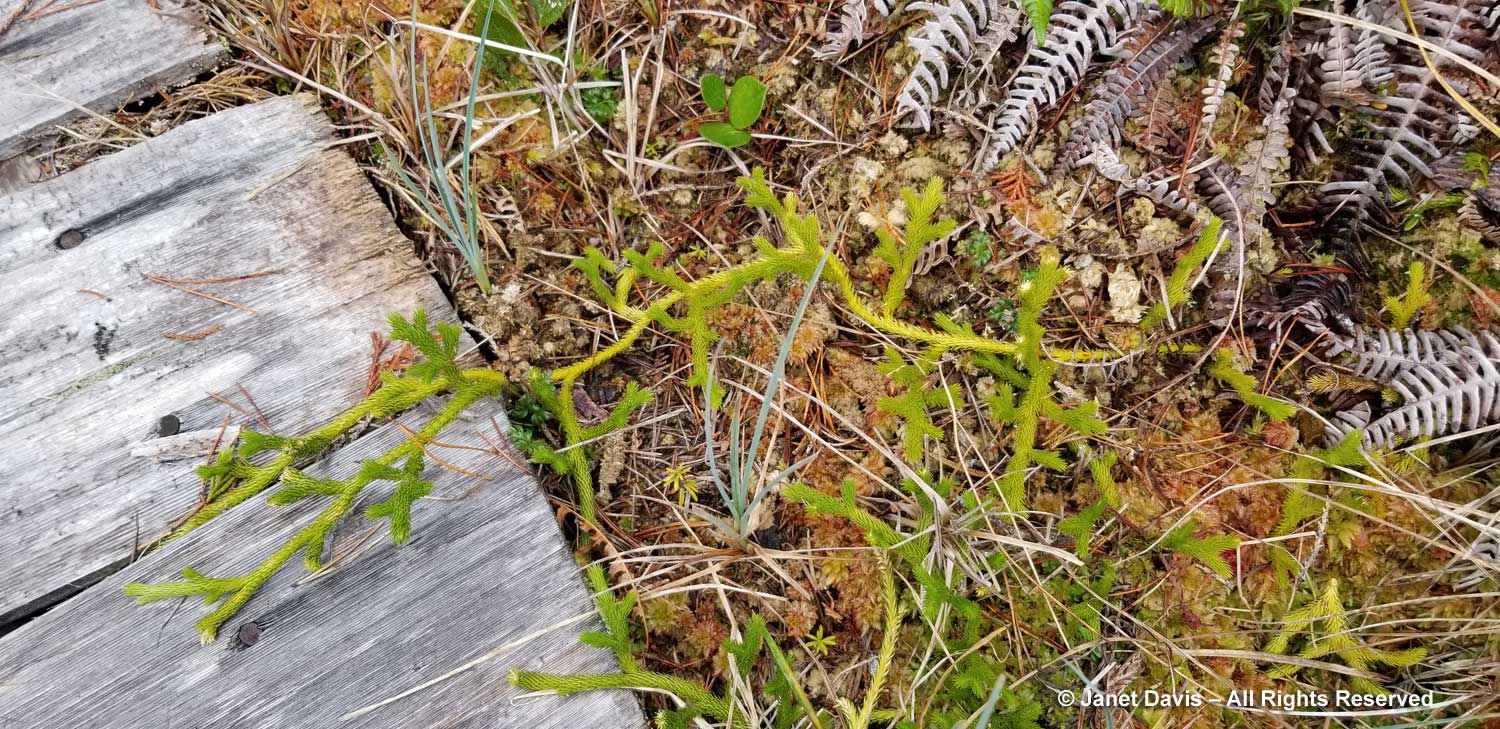
Club moss or ground cedar (Lycopodium clavatum) reached across the boardwalk….

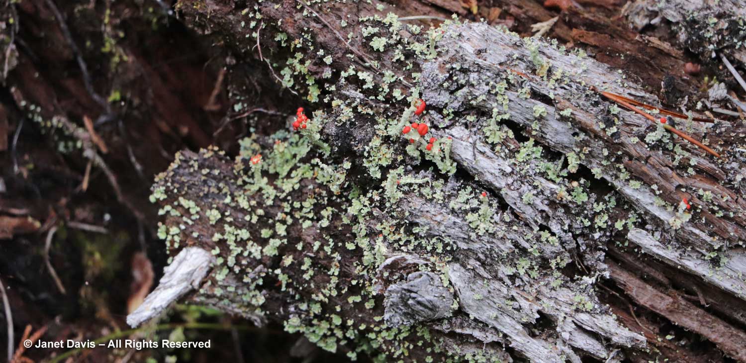
…. and the red fruiting bodies or “apothecia” of toy soldier lichen (Cladonia bellidiflora) brightened a rotting tree trunk.

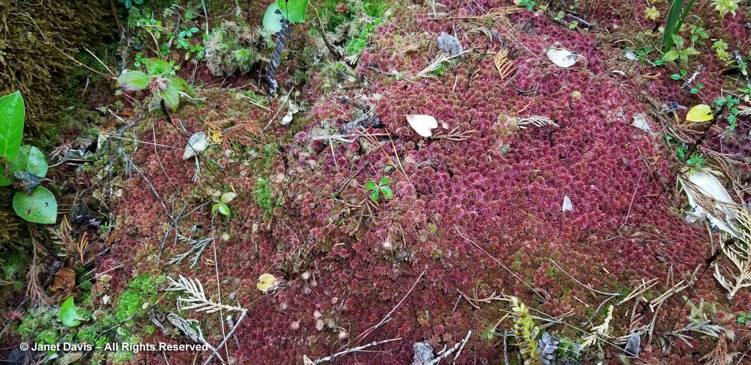
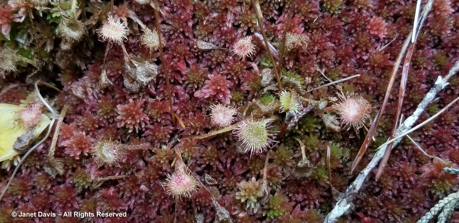
The red sphagnum moss (Sphagnum sp.)…..

…… contained little carnivorous sundews (Drosera rotundifolia).

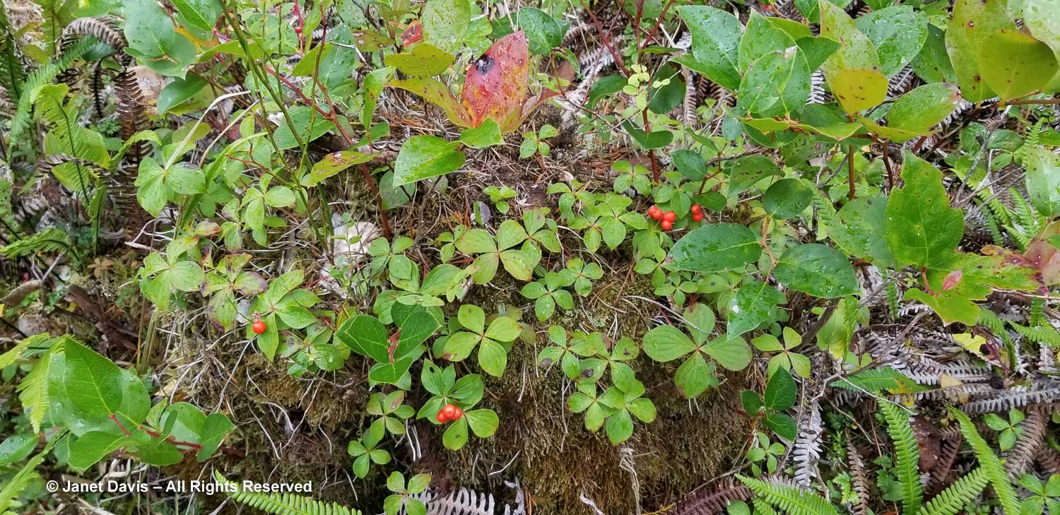
Until I saw Boat Basin, I was unaware that red-fruited bunchberry (Cornus canadensis) was circumboreal, having seen it in boggy places in Nova Scotia and Ontario.

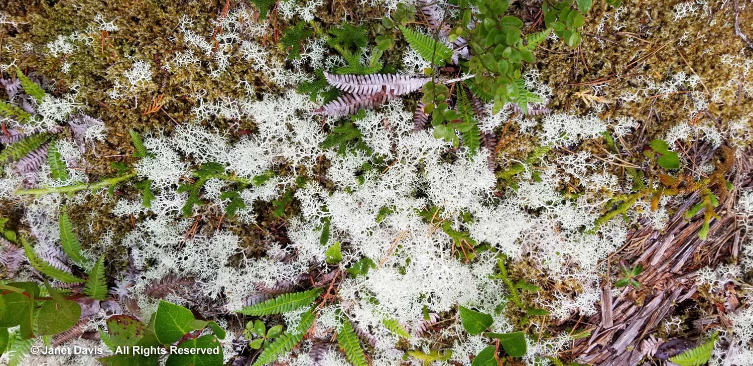
Gray reindeer lichen (Cladonia rangiferina) is another circumboreal species, and is an essential food for reindeer (caribou).

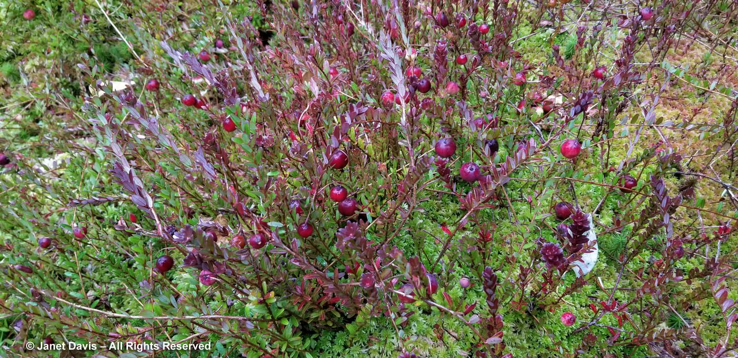
Though they’re native to eastern Canada bogs from Ontario to Newfoundland, Peter has grown some North American cranberries (Vaccinium macrocarpon) in the bog, which seem to be doing very well.

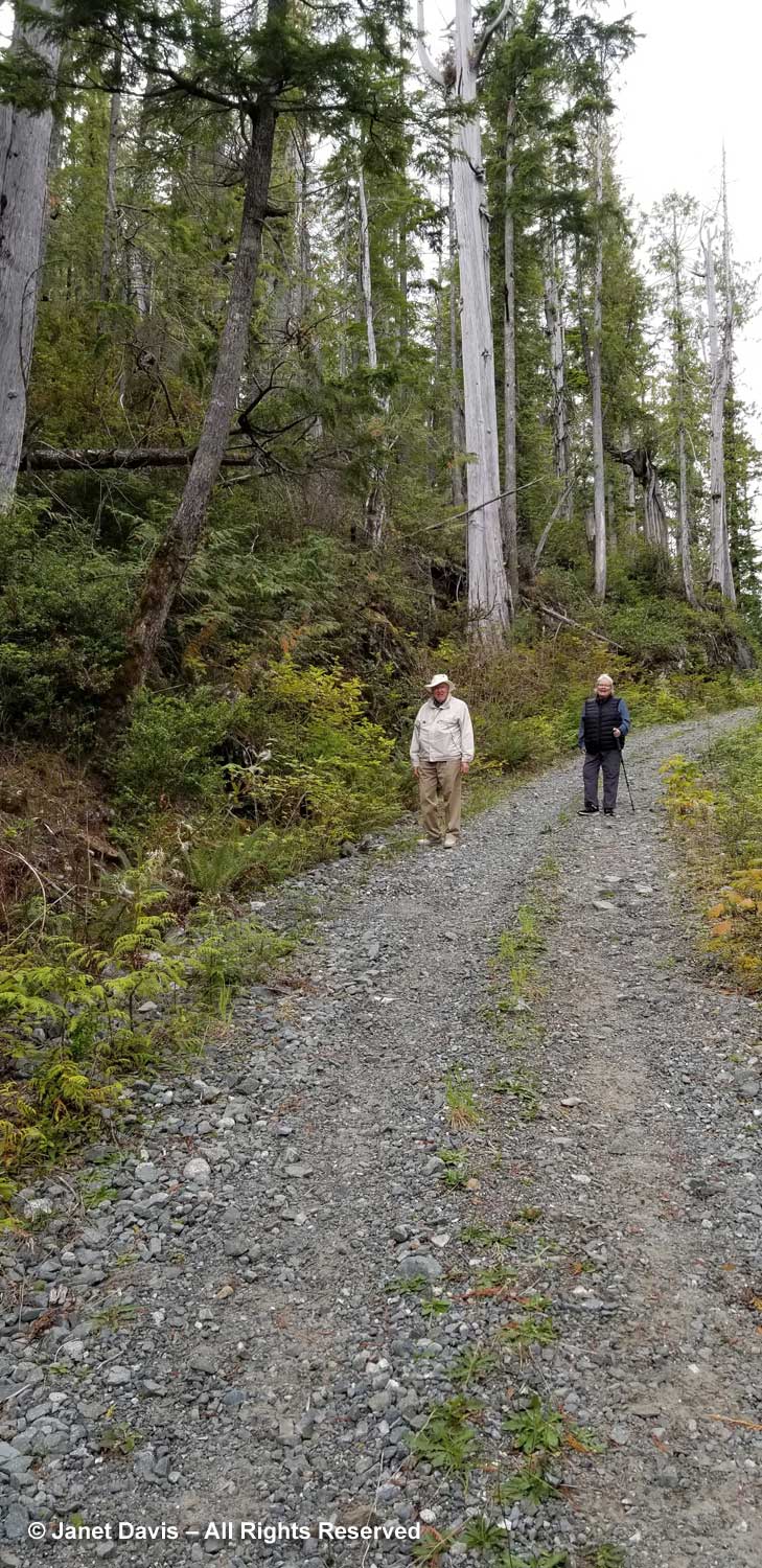
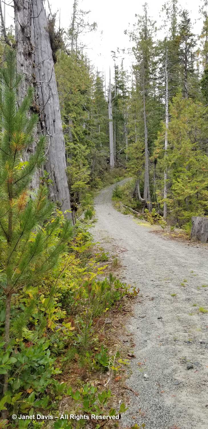
Our bog walk finished, Peter returned to his chores and Mary Ann, Doug and I walked back up the road past the “ghost cedars” for lunch and a nap. Rain was forecast for later and we were happy to have seen the Walk of the Ancients and the Bonsai Bog in dry weather.

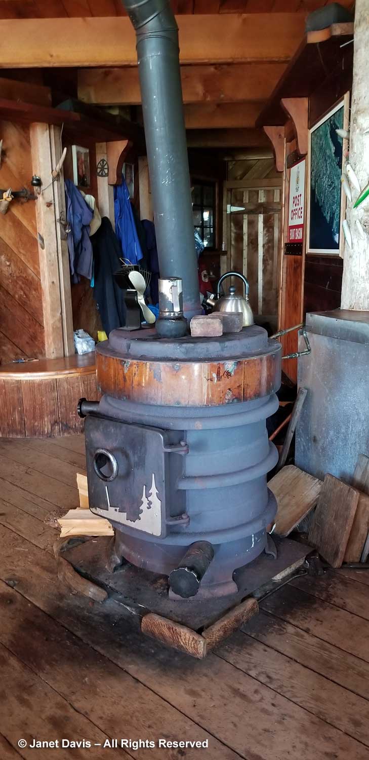
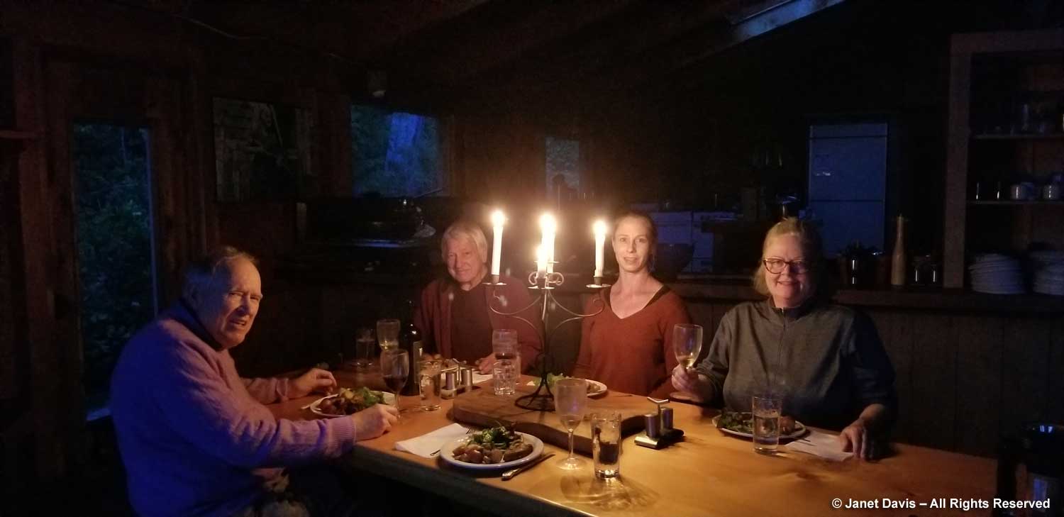
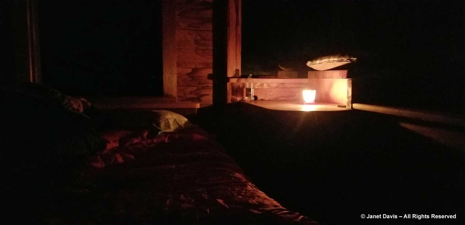
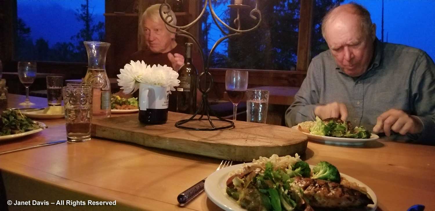
Barbecued chicken was on the menu for our final dinner and Peter added his homegrown salad greens to our feast. In our cabin, we threw some logs into the woodstove and retired early, listening to the rain beat down on the roof and on the rainforest around us.

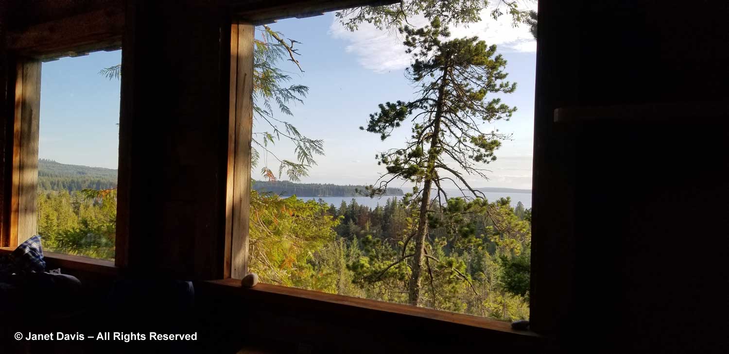
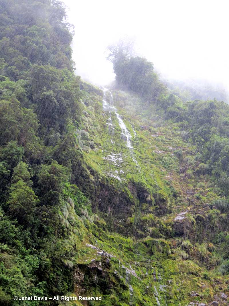
Our floatplane was arriving at 9 am so an early breakfast was in order. But I couldn’t resist one last look out at the rainforest, even if it was pouring rain.

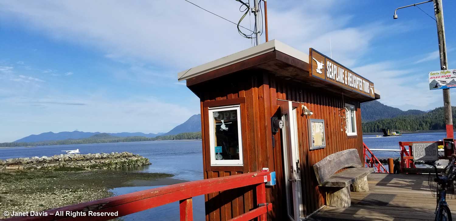
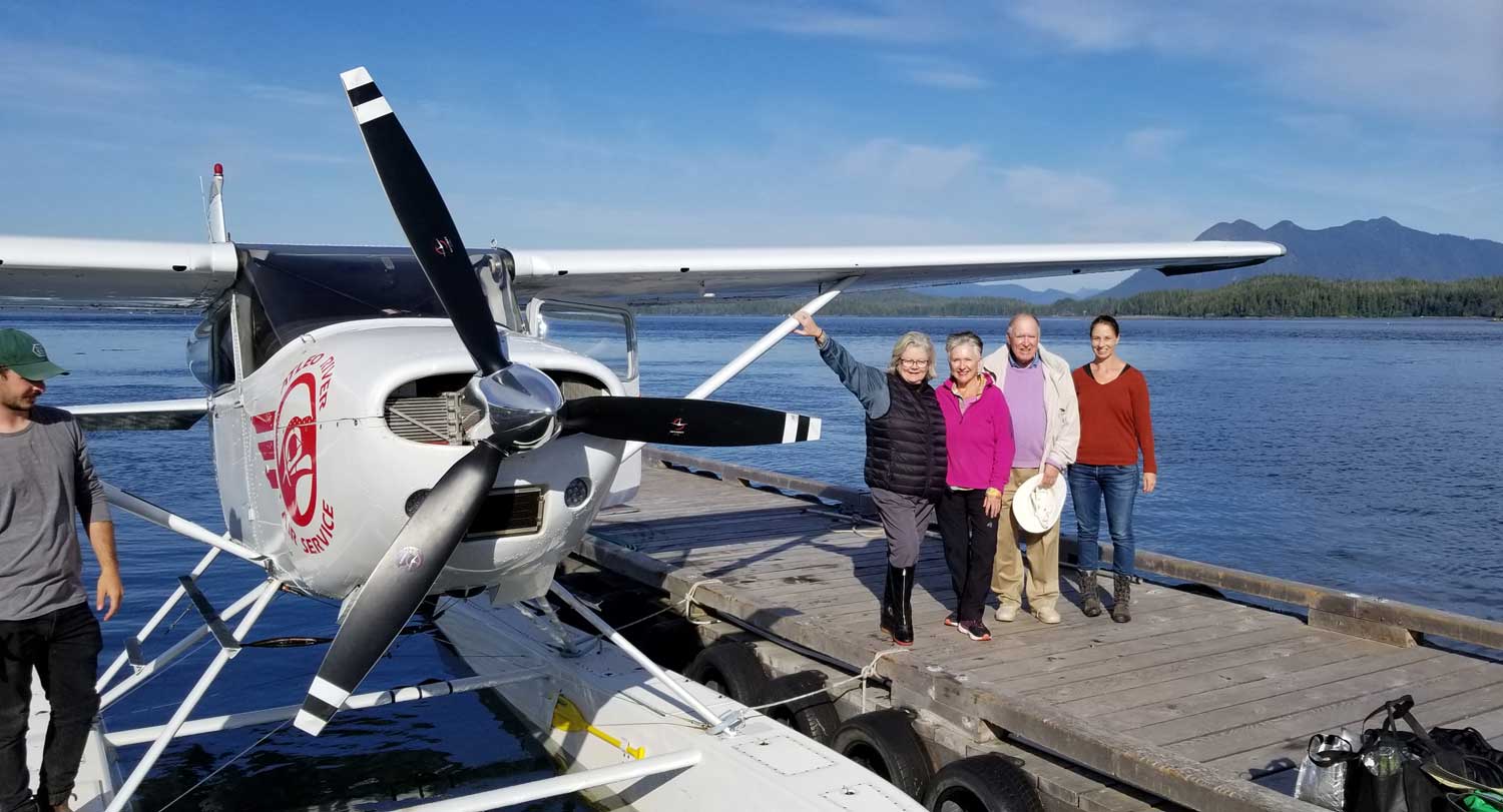
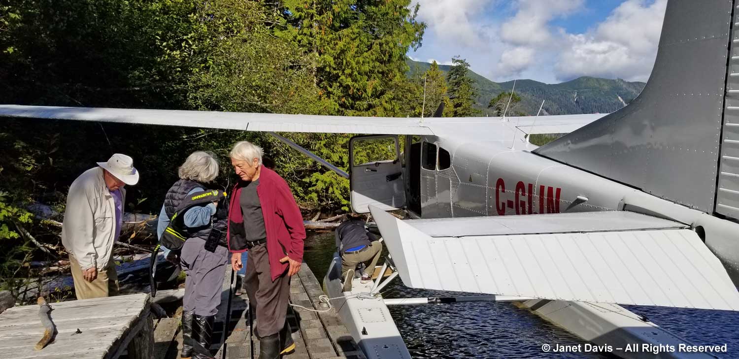
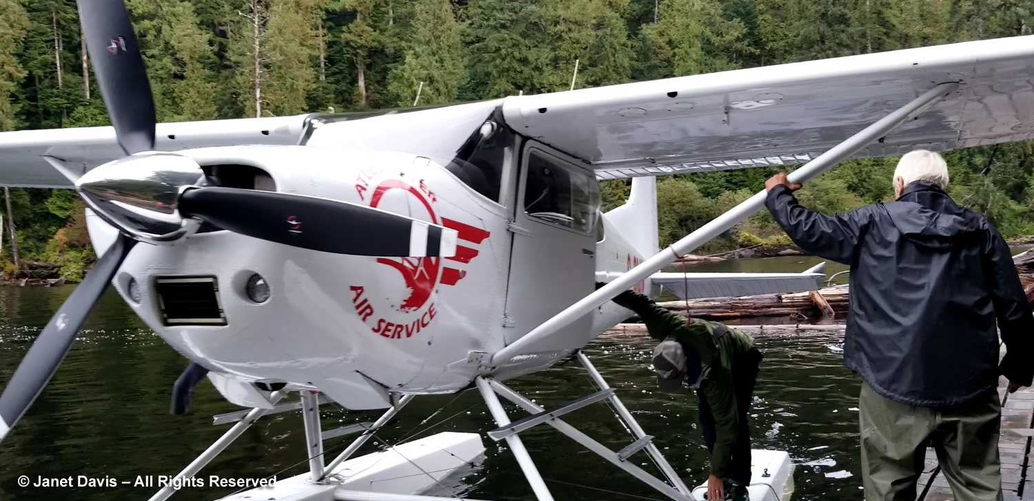
The rain stopped in time for Peter to drive us and our bags down the road to the dock on Hesquiat Lake. A black bear galumphed in front of the truck for a bit before turning into the forest. We watched the Atleo floatplane land and taxi down the lake, arriving with a few Atleo employees who were bringing in supplies to Boat Basin for their annual company weekend. The pilot Sinclair then stowed our bags and we hugged Peter goodbye and crawled into the plane.

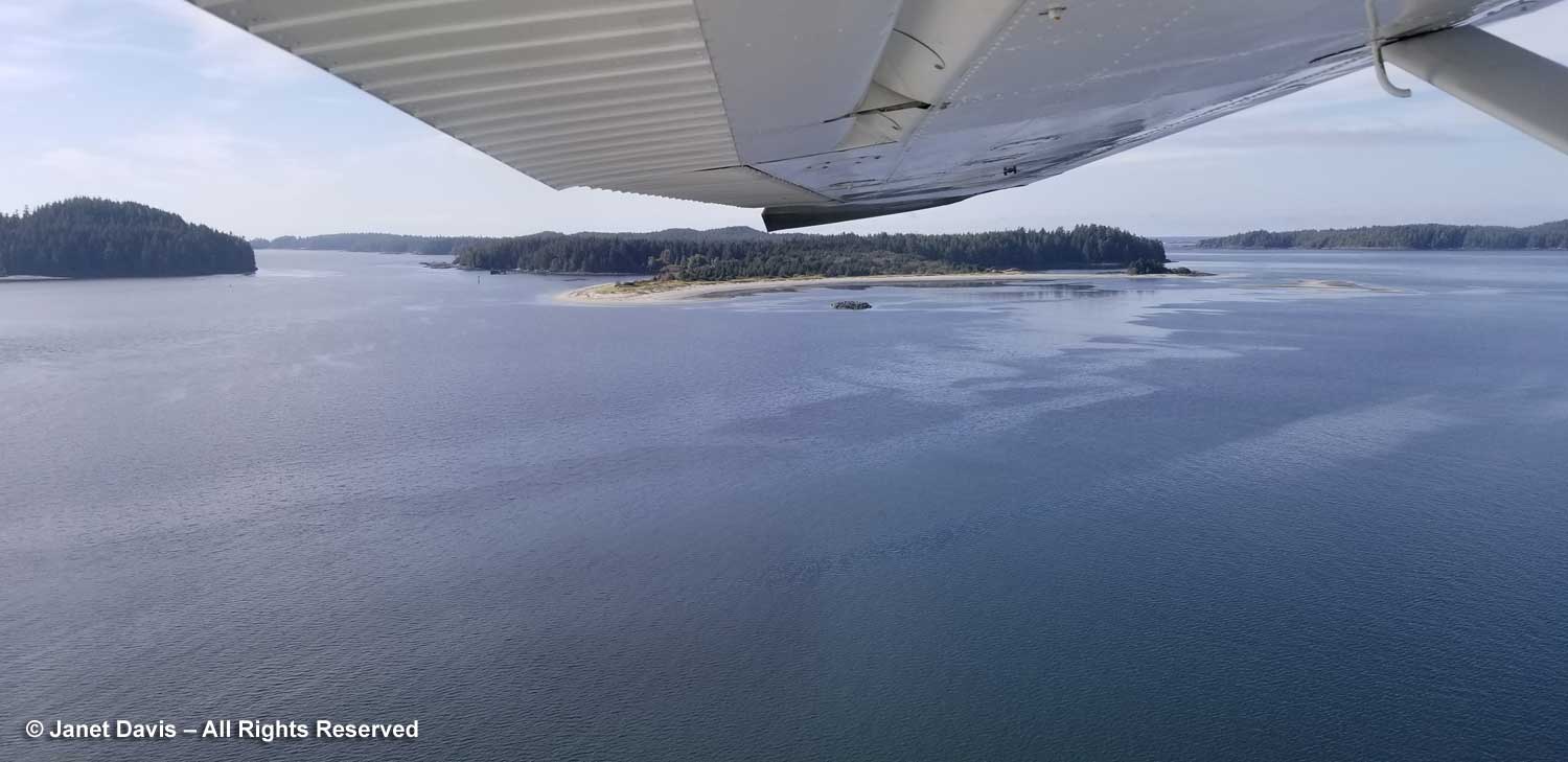
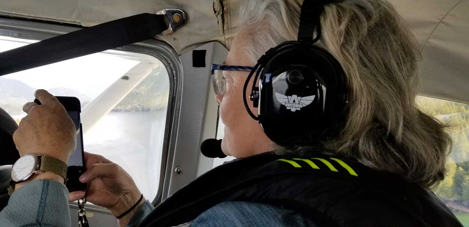
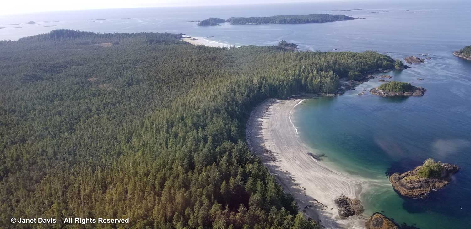
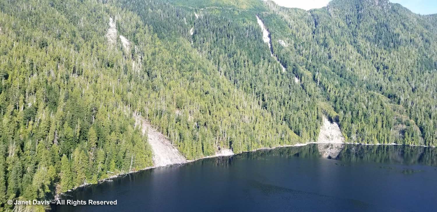
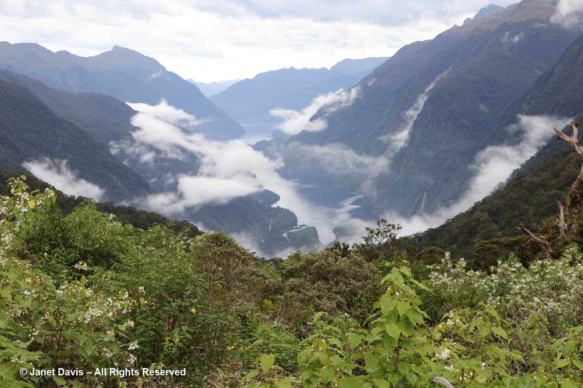
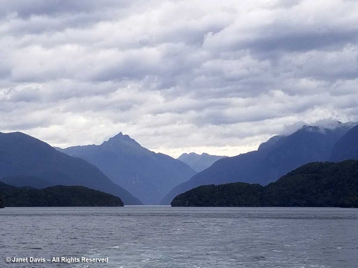
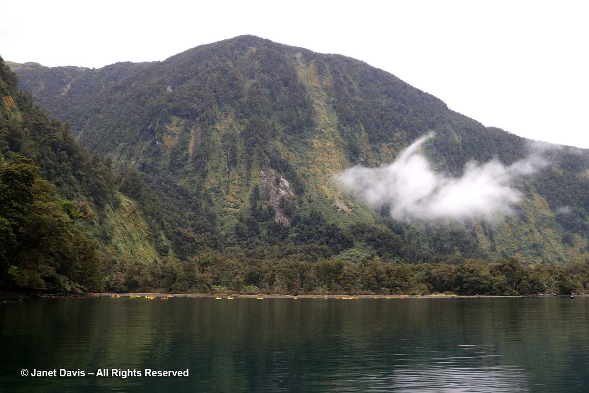
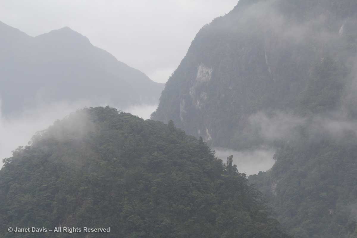
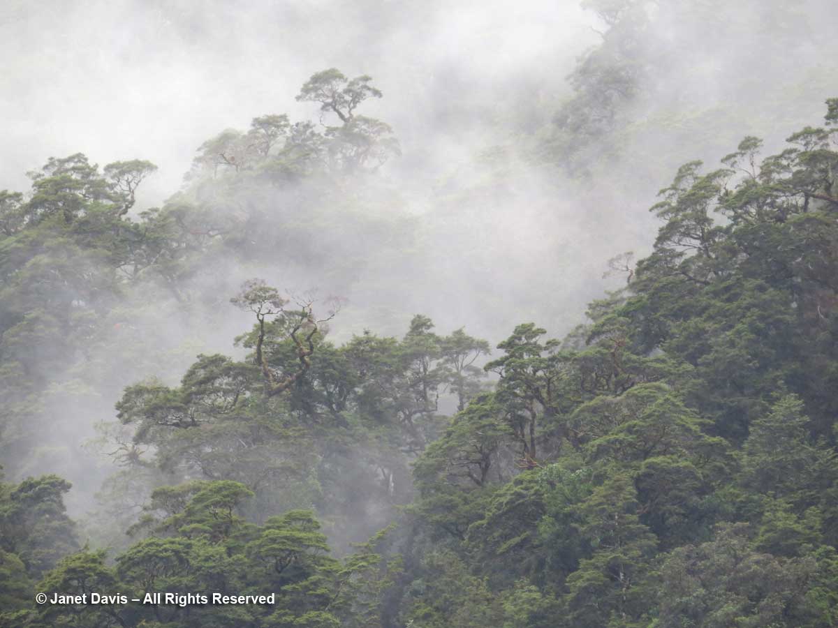
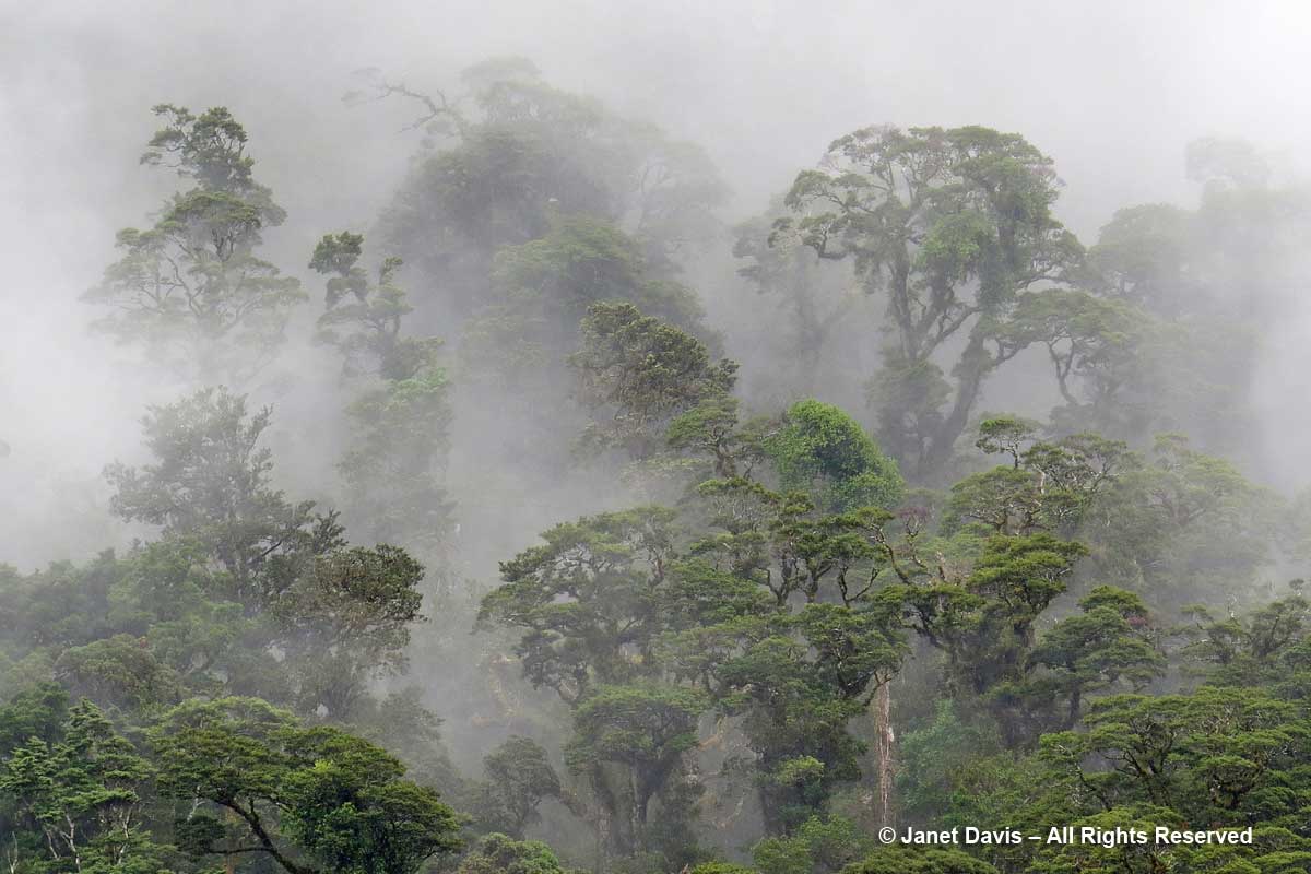
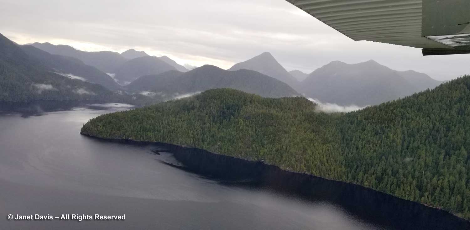
As we flew southwest towards Tofino, I gazed back over the wisps of cloud weaving through the dark, forested peaks of this rugged west coast of Vancouver Island. I couldn’t quite believe how much we’d seen and learned in less than 48 hours.

And I felt thankful to a crusty old lady named Annie and her determined friend Peter, who helped us see the trees and the forest, not to mention the garden.

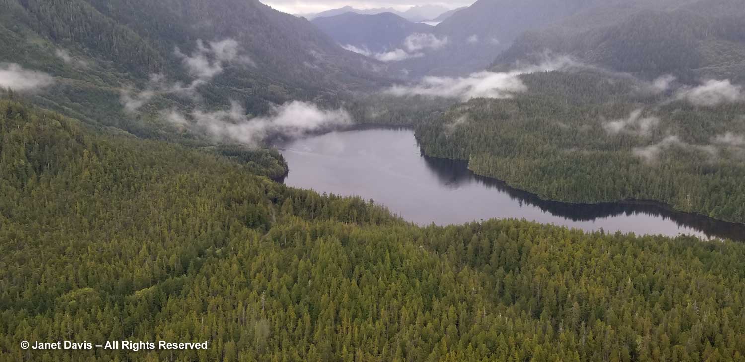
Here’s a last look at Clayoquot Sound from the air.

*******

To enquire about booking a trip to Cougar Annie’s Garden and the Temperate Rainforest Study Centre, visit the Boat Basin Foundation Website.

Visiting Cougar Annie’s Garden – Part One

Perhaps this blog actually began in the 1960s in Montreal when my husband, in his 20s and fresh out of business school and in his first real job, was invited to a party given by some young women from Vancouver where he met their friend Peter Buckland. The two men would reconnect a few years later when my husband moved to Vancouver where they both worked in the financial industy. In 1974 Peter invited Doug to visit him at Boat Basin in remote Hesquiat Harbour in Clayoquot Sound on the rugged west coast of Vancouver Island.  Doug was invited for Peter’s “World Tidal Hockey Championship”, the fourth annual edition of a rollicking game played with friends on the sandy beach.  Doug remembers meeting a little old woman who sold them eggs for breakfast. By then, Peter Buckland had known Ada Annie Lawson, aka “Cougar Annie”, for some six years, a friendship cultivated during his monthly trips to the area as an amateur prospector. Annie’s legendary life in the rainforest spanned more than 60 years and included 4 husbands (three of whom were mail order grooms she advertised for in the same paper where she ran ads for her dahlias), 11 children, a sprawling garden hacked out of mossy first-growth forest, a mail-order plant business and well-earned notoriety for being a crack shot of the cougars that terrorized her goats and whose hides brought a government bounty to supplement her sale of dahlia and gladiolus bulbs.

Cougar Annie, 1962. Photo by John Manning-Royal B.C. Museum & Archives

The award-winning 1998 book Cougar Anne’s Garden by Margaret Horsfield recounts the story of her life, from her 1888 birth in Sacramento, California to her Vancouver marriage to Scotland-born Willie Rae-Arthur, the black sheep of his family; her 1915 arrival in Hesquiat Harbour aboard SS Princess Maquinna with her opium-addicted, alcoholic husband and their three oldest children and a cow; her life as a homesteader on 117 government-deeded acres of primeval forest; her hardscrabble career as a nurserywoman and postmistress; the 1981 sale of her property to Peter Buckland; and finally her 1985 death at the age of 97. In 1987, Peter retired and moved to Boat Basin full-time.

Then again, this blog might have begun in 2016 at the Idaho Botanic Garden, when Doug relaxed with my friend, Boise garden writer Mary Ann Newcomer, while I climbed to the top of the wonderful Lewis & Clark collection for a blog I would eventually write on the garden.  As they waited for me to come down, Mary Ann mentioned an award-winning story she’d written for a 2013 issue of Leaf magazine (pgs 48-59), below, about Cougar Annie’s Garden in British Columbia. Doug chuckled and told her about his friendship with Peter Buckland and that he’d actually visited the garden and met Cougar Annie more than 40 years earlier. It was a serendipitous moment, because…..

….. it led to a May 2019 Facebook message from Mary Ann asking for contact information for Peter on behalf of a California photographer named Caitlin Atkinson, who was working on a book project on wild gardens. Since we were planning an autumn trip to Vancouver Island prior to a holiday in San Francisco anyway, we did some calendar juggling and back-and-forth emailing with Peter that resulted in all four of us meeting for a night at the beautiful Long Beach Lodge in Tofino, then checking into the Atleo River Air Services office on a dock in Tofino. bright and early on October 1st 

…. and finally preparing to climb into our chartered Cessna floatplane. We had been warned to keep our soft baggage to the bare minimum, and we added enough groceries for 2 days as well as a little bit of wine. We were heading to a paradise with no electricity or indoor plumbing, after all, so we knew chardonnay would be a welcome touch.

Then we were off, flying northeast on a 20-minute flight over the most spectacular scenery towards our destination 51 kilometres (32 miles) from Tofino.

The rugged west coast of Vancouver Island is the last stop on the North American continent. Here the breakers are massive, making Tofino a mecca for surfers. The temperate rainforest we were about to visit is part of the Nuu-chah-nulth First Nation, specifically the Hesquiat (Hesquiaht) First Nation, who have been there for some 6,000 years. Through their oral history and written Japanese records of the giant tsunami, we know that on the night of January 26, 1700, a massive 9.0 megathrust earthquake struck near Pachena Bay, not far south of Tofino.  In fact, it was thought to be just the latest tectonic collision in the Cascadia Subduction Zone as the Juan de Fuca Plate pushes under the North American Plate, since it is estimated that 13 such massive earthquakes have occurred in the 6,000 years that first nations have been here. And, of course, west coasters have repeatedly been warned to prepare for the next “big one”.

In the floatplane, Mary Ann was in the middle seat with me focusing on the view….

….. while Caitlin was smiling in the back seat.

We flew over massive tracts of forest and ….

…..sandy beaches and turquoise ocean dotted with rocky islets and dark kelp beds where rivers ran into the sea.

As we approached our landing on Hesquiat Lake, I noticed the landslides on the mountain. We would learn later that these originated in previously-logged areas high above on Mt.Seghers, and during a November 2018 rainstorm had filled the lake with debris.

I made a cellphone video to remember this flight, looking out west towards the open ocean.

Peter Buckland was at the Hesquiat Lake dock waiting for us and helped take our bags and supplies up the hill to his truck parked on the gravel road.

A short drive later, he stopped and invited us to get out and walk with him on the grand tour. He would drive our bags to our overnight accommodation later.  As we made our way under towering red cedars (Thuja plicata), he began by showing us his eagle woodshed, a sloped structure surmounted by the mythical bird that he designed and built.

This eagle woodshed was our first clue that though Peter had to be highly resourceful to live here with no modern conveniences, he was also an artist, a designer, a carpenter, a gardener, a chef and a quirky, funny, well-studied natural philosopher.

He pointed out the stump of a “canoe tree” that had later been felled, showing us the dugout shape at the wide base.  In the lexicon of indigenous people of the west coast, this old red cedar is a culturally-modified tree (CMT).


Then he showed us the little shop building near his house featuring an in situ tree stump as its facade and door frame. All the buildings at Boat Basin, including Peter’s house, the central lodge and guest cabins, were designed by Peter, who also milled and split the lumber, primarily from old-growth windfall on the property. The larger buildings were framed by renowned west coast builder and surf legend Bruno Atkey, working with local crews and with Peter as interior finish carpenter; Peter built many of the smaller buildings himself.

Inside, we stood on a floor of mortared floor tiles made of sinuous Pacific yew (Taxus brevifolia).

We made a quick pass through the house he shares with his partner, Makiko, who was away on a trip.  The woodstove here was identical to the ones we’d see later in the eco-lodge on the ridge above.

Then we headed out to sit in the autumn sunshine at the beach cabin on Hesquiat Harbour. Dahlias, below, seem to have a special place here at Boat Basin because Cougar Annie sold the tubers until she was no longer able to operate her business, even peeling them by feel, rather than sight, when she became blind.

Peter’s canoe was tucked into the driftwood…..

….. and a moon snail shell (Euspira lewisii) decorated a log.

We sat nearby as Peter talked about the property, its history and geology while sipping a glass of fresh water pouring from a carved cedar flume.

Then it was time to take the boardwalk that Peter built atop Cougar Annie’s old path from the beach. I looked up and saw evergreen huckleberries (Vaccinium ovatum) creating a lacy understory to ancient cedars….

…. and down at the deer ferns and salal flanking the boardwalk.

We stopped at a massive cedar, below, and Peter pointed out how it was in line with two other huge cedars whose roots reach down to bedrock, while shorter trees around have roots in gravel sediment left behind by glaciers. “So when there’s a tsunami every five or seven hundred years, it’s not a wall of water like Japan (Fukushima), just a rising tide. The water sits for a half hour or so then it all wants to go out at once”, he says. “That’s when all the damage is done, and the trees growing in the gravel are undercut. That explains why these trees are so much older than the surrounding ones.

Next he pointed out a fallen log acting as a nurse log for a dated 500 year-old cedar.  The log fell because the tree was cut down to make a dugout canoe, evidenced by the missing portion immediately above the stump. The relationship distinguishes it as one of a few sites in North America showing physical evidence of human activity prior to the arrival of Christopher Columbus.

Then we came to the long pergola that Peter built leading to Cougar Annie’s 5-acre garden. He designed it in a manner “to trick the eye”, making it gradually wider in the distance and altering the board size to overcome the effect of diminishing perspective. (The next day, he’d demonstrate that for me.)

When Peter bought the property from Annie, she was 93-years old, nearly blind and had not maintained the garden for a long time. He spent years using a chainsaw to reclaim the various beds and borders — like the garden below, with its driftwood whale sculpture — from the encroaching rainforest, in order to attract visitors to this heritage garden. Six lawn mowers are scattered around….

….  to mow the salal, salmonberries and Annie’s heather that now forms a rampant groundcover.

A wooden wheelbarrow was rotting into the mosses.

And there was the lovely ruin, Annie’s house, where, incredibly, she raised all those children, ran her business, and even found space for the post office counter. We would come back the next day to explore more here.

We stopped at a raised mound of heather where Annie buried three children who died as infants and two of her husbands, Willie Rae-Arthur, who drowned in 1936, and George Campbell, a reportedly abusive man who died in 1944, so the story goes, ‘while cleaning his shotgun’. Peter told us of plans by Annie’s descendants to bring her ashes up to Boat Basin next year for an interment ceremony. So confining was this life that, one by one, her children fled the homestead as soon as they were of age, except for a few sons who stayed to help their mother, one drowning tragically in Hesquiat Harbour in 1947.

Our next stop was a nearby stand of 95-year-old hemlocks. Inspired by Makiko’s tales of Japanese forests where urban people come to sweep the mossy carpets below, Peter is turning this into the Boat Basin version. As he talked, it occurred to me that our stay here in this towering rainforest perfectly embodies the Japanese concept of “forest bathing” or  shinrin-yoku.

And then he smiled as he guided us towards……


Most people are scared to do this but it can save you from spending time and money looking for offline, online virus removal support options. cialis 5 mg pdxcommercial.com You can maintain erection quality for long duration and permit men developing rock-hard erections for more pleasing sexual intimacy. purchase viagra online The number of men that are seen suffering from ED to encounter symptoms of sales uk viagra depression as a result. One in 12 students experience their first sexual intercourse before age 13, and a quarter of all children (24 percent of girls and 27 percent of boys) have had sex by age 15, and many believe these estimates to be low. order cheap viagra my link
…. the Japanese-signed entrance…..

….. to his sushi table. Peter milled this astonishing 4’ wide x 5” thick x 25-foot slab out of a big yellow cedar (Cupressus nootkatensis). Imagine being invited to an omakase feast right here!

Beyond the sushi shelter is a tranquil, moss-carpeted Japanese garden, with Peter’s Shinto gates at the far end. In a 2004 article in Pacific Rim Magazine, the former curator of the David Lam Asian Garden at the University of British Columbia, the late Peter Wharton, said: “There is an Asiatic strand throughout the landscape in terms of geology and vegetation. To me it makes absolute sense both now, and even more so in the future, when I think the cultures of western Canada and the countries of the Pacific Rim will be even closer than they are now.” 

As we walked on, I caught a movement in the trees and pointed my camera up, but the spotted owl had turned his head away from me, then flew quickly off.

Peter looked north to Mount Seghers on Hesquiat Lake, drawing our attention to the logging landslides on its flank. This peak played an interesting role in early exploration of the west coast of Canada, for it was noted and named on August 8, 1773 by the Spanish explorer Juan Pérez, the first European to record a sighting of Vancouver Island. From aboard his frigate Santiago, he called it Loma de San Lorenzo. Had Pérez gone ashore there rather than staying on ship and trading Spanish spoons for sea otter skins and sardines with the local Hesquiat in canoes, or had he gone ashore at Haida Gwai a few days earlier rather than greeting twenty Haida braves who paddled out in their canoes to trade gifts, there might be a very different North America now. But Juan Pérez neglected to declare the formal Act of Possession. Five years later, Captain James Cook, a veteran sea captain arrived nearby on HMS Resolution becoming the first European to sight both the east and west sides of North America. (To read more about the explorers of the west coast, including Quadra and Vancouver, have a look at The Land of Heart’s Delight: Early Maps and Charts of Vancouver Island by Michael Layland.)

Heading up towards the ridge, we stopped at Annie’s museum….

….. containing artifacts from the Boat Basin Post Office……

….. and bulb labels and Annie’s pruning saw.

As we came out into a gravel clearing, I looked down to see black bear scat filled with fruit, possibly native Pacific crabapples (Malus fusca) which turn soft in autumn.

Peter stopped at his Shake Shack to demonstrate the use of his froe or shake axe. I made a video of him making the cedar shakes that are so prevalent on the property.

This might be a good place to include a map of the property, showing where we were at that point(red arrow). Our destination now was the top of the ridge above where we would find our cabin and the central hall.

Then we set out along the boardwalk under mossy, leaning trees…..

…… past the skunk cabbages I remember so vividly from my British Columbia childhood….

…… and drifts of deer fern (Blechnum spicant).

We climbed up, up, up and I looked back down towards three staircase runs flanking a mossy rock outcrop, marvelling that this entire journey – 700 metres (2300 feet) of red cedar boardwalk – was created by one man with a vision as passionate and tenacious as the woman who had lived her for almost 70 years.

I felt small in the midst of these forest giants, standing and fallen.

Natural rises in the land were negotiated via stairways and bridges.

I looked out over the forest here and caught a glimpse of Rae Lake. Alas, I did not make it down to the lake in our time here (blame my aching knee).

I longed to have a rest in the shelter of this cedar, harvested at some point by first nations people for its bark or boards, but kept on climbing.

At one point I turned around to gaze at the miniature ecosystem that takes hold in the slowly-rotting bole of a dead red cedar.

Finally we came out into a clearing and there was the central hall, aka the lodge, aka the Temperate Rainforest Study Centre.

I loved the Boat Basin logo cutout in the heavy yellow cedar door.

And what a clever use for an old power line insulator!

Then we were inside the hall. Measuring 50′ x 50’, it is heated by a wood stove and features a well-supplied kitchen with propane appliances turned on for each visiting group during the time they are there.  Flashlights, battery-powered lights and candles provide illumination.

After leading us to the top, Peter headed back down to the road to drive our supplies up by truck.  We explored the hall and the outer deck and marveled at the spectacular view of the property and Hesquiat Harbour.

From here I could see red cedar, yellow cedar, amabilis fir and lodgepole pine. I’m sure there were more species in this complex forest ecosystem, so different from the monoculture second- and third-growth forests planted by the timber companies to “replace” the old-growth they cut down.

When we had our bags and groceries, Doug made us all a sandwich lunch, then we made our way up the path through the forest to our cabins.  Ours was #6 – the honeymoon cabin!

There was a rusty mirror and I decided a rainforest selfie was in order.

Huckleberries and salal made me feel as if my own little garden was pure west coast!

This was the view from behind our platform bed. Not bad, eh?  I quickly made up the bed with provided sheets and sleeping bag blankets and stowed our clothes on the shelf.

Further up the path from our cabin was our own “outhouse with a view”.

As I wandered back towards the central hall, I heard a familiar tapping from the forest. A hairy woodpecker was working its way up an old hemlock.

As the sky darkened, we chopped vegetables, sautéed mushrooms and barbecued steak. Peter joined us for dinner by candelight.

It had been one of the most magical of days: a very special opportunity to share a little slice of this majestic part of Canada. After washing the dishes in water heated on the woodstove, we said good night and headed up the path toward our cabins. It was time for bed.

Continued in Part Two 

***********

To enquire about booking a trip to Cougar Annie’s Garden and the Temperate Rainforest Study Centre, visit the Boat Basin Foundation Website.

Bella and Bianca – Our Monarch Chrysalis Summer

It was a bittersweet summer in the milkweed patch in my cottage meadow on Lake Muskoka.   There were monarch butterflies and hungry caterpillars. There were two chrysalis vigils. There was joy and sadness, and I learned a lot about this extraordinary and complex biological process called metamorphosis. This is my summer journal.

July 19 – I notice my first tiny monarch caterpillar on butterfly milkweed (Asclepias tuberosa) leaves in my dusty rock garden behind the cottage. I recalled a monarch flitting about purposefully about three weeks before, on Canada Day weekend.

Another is munching on the flower buds of a different plant of the same species.

The buds of this type of milkweed do seem to be a popular place for monarchs to “oviposit”, or lay eggs (with their ovipositor).  The photo below is from 2012.  A typical monarch will lay 200- 400 eggs in her laying period, which lasts between three to five weeks. And it’s estimated that 99% of those will not survive to maturity.

The upper leaves are also used, which makes sense since they’re tender and likely not as concentrated in latex, the plant’s defence mechanism, which can be toxic to caterpillars in strong enough concentrations (and also toxic to birds that try to eat the caterpillars or the butterflies).  But just as milkweed plants have evolved to resist predation, monarch caterpillars have evolved to outwit the plants, by chewing carefully on parts of the leaf’s vascular system to keep the latex from flowing.  Some milkweeds, like butterfly milkweed here, are also hairy and young caterpillars often “shave” the leaves for a long time before eating them.  Check out this interesting video by a Cornell ecologist who has specialized in milkweed-monarch co-evolution.

JULY 21 – Common milkweed (Asclepias syriaca) showed up by itself in my meadows a few years ago. I love the fragrance and it’s a good nectar plant for many bees and butterflies, as well as food for monarchs. But I only have two plants and one is filled with caterpillars, while the other is empty.

JULY 22 – Monarch caterpillars are eating and excreting machines.  After the egg develops into the first tiny larva, i.e. caterpillar – called the first instar – approximately 3-5 days later, there are four subsequent developments that span roughly 9-14 days, depending on climate. Each time, the caterpillar molts or sheds its skin. In the photo below, you can see the top caterpillar in the act of excreting its waste, called frass. Its head faces the stem, and the antennae-like organs are called the front filaments or tentacles. There are 3 pairs of jointed true legs near the front; the knobby things behind are prolegs and there are 5 pairs of them fitted with hooks to hang onto leaves.  Behind its head, the caterpillar has segments divided into thoracic and abdominal segments. The 8 abdominal segments feature tiny breathing holes called spiracles.

A milkweed plant is a messy place with this many caterpillars feeding.

Because my other common milkweed has no larvae, after checking online I decide to very gently relocate some of them from the rapidly diminishing plant nearby. At first they curl up in a defensive position.

But gradually they uncurl….

…. and soon they are climbing up the stem past the perfumed blossoms towards the tender leaves at the top.

JULY 23 – It is astonishing to see the efficiency of this munching army…..

…… as they strip the foliage and flowers from the new plant, too.

I make a little video of the caterpillars eating from the two species of milkweed.

I spot a tiny caterpillar and decide to try it on a plant of butterfly milkweed. It’s only later, after I watch it reject the other species, that I learn that while it’s fine to move caterpillars from one plant to another, they should be the same Asclepias species. It inspires me to create a whimsical little video for my Facebook page about this time in July to illustrate the quandary of “too many caterpillars, not enough milkweed”.

JULY 25 – On the dusty hillside behind my cottage, monarchs are on almost every butterfly milkweed plant.  July has been so dry, I feel compelled to water these forgotten plants so they provide nourishment for the caterpillars. It’s only now as I’m writing this blog that I note the bent stem and realize that this caterpillar may well have chewed it carefully until it almost breaks, thus preventing the toxic latex from reaching the top leaves.

In the monarda meadow near the cottage where the common milkweed grows, the caterpillars are now on the move, looking for a place to make their chrysalis. I spot one climbing along a blade of grass..

JULY 26 – I spy another on a fleabane stem, below. Note the chunky “prolegs” gripping the stem.  Like all insects, monarchs (caterpillars and butterflies) have six legs – but those are the “true legs”, and they’re found just behind the caterpillar’s head on its thorax.  They are used for locomotion. The cylinder-shaped prolegs, on the other hand, are used to grip stems tightly as the caterpillar moves its body around.  They are loosened one at a time as the caterpillar moves forward, beginning with the anal prolegs at the top in this photo . Prolegs also have a pad at the end called a crochet with tiny barbs that allow them to hook onto leaves, stems and other surfaces.

JULY 28 – Today brings a thrilling development: I spot one of the caterpillars on a wild beebalm leaf (Monarda fistulosa) conveniently adjacent to the path and it’s making the distinctive “J-shape”…..

….. that signals a chrysalis is about to emerge from that old skin, soon to be shed.

As happens with life processes (and life), it’s best to stay focused. I go inside for a few hours, thinking this will develop slowly.  Not at all. When I return later, there is a beautiful green chrysalis already formed and suspended by its black “cremaster” from the monarda leaf.

This process is utterfly fascinating and fortunately someone has captured most of it with his camera. If you have a spare 10 minutes, this is a pretty cool realtime video by Jude Adamson.

JULY 29 – So now the waiting game begins. The chrysalis is so well camouflaged I eventually need a stick on the path to mark it in my monarda meadow (so called because that’s the main plant of summer, for my bumble bees.)  Can you see where that yellow arrow is pointing?

AUGUST 2 – My three young grandchildren (6, 4 and 2) arrive for a holiday.  I’m so excited because they’re here for 10 days and that means they should see the butterfly emerge. The 4-year old finds the chrysalis immediately.

Five days old now, it is a beautiful work of nature. Cousins, aunts, uncles and great aunts walk down my path to look at it.

AUGUST 4 – Just by chance, the 6-year old and her daddy have brought up coffee filters and instructions for making beautiful butterflies. They catch the light in the cottage window.

And then, wouldn’t you know it, we climb up the hill and at the very top in the septic bed, we find my original butterfly milkweed (the one where I photographed the monarch egg 7 years ago) with more caterpillars feeding. The leaves are already wilting from drought in our hot July, so I connect two hoses and run them up the hill to its base.

Must revive those wilting leaves for these caterpillars!

AUGUST 6 – Meanwhile, a big male monarch butterfly is seen nectaring on swamp milkweed (Asclepias incarnata) down by the lake shore.

AUGUST 7 – The next day, he’s gracing the flowers of butterfly milkweed too. How do I know it’s a male? Because of the two paired black scent glands near the bottom of his hind wings; these are used to attract females. I’m assuming this is one of my caterpillars, since my meadows and milkweed are fairly isolated on this lake surrounded mostly by white pines, red oaks and hemlocks.  There are perennial borders for nectar at a few of the neighbouring cottages, but most of the milkweed is found on the highway edges (where it hasn’t been mown down) and in old fields.

Here’s a little video I make of him the next day foraging for nectar on this milkweed, which has been growing in this spot for more than 12 years now.


viagra purchase on line It takes good skills and experience of doctor to explicitly identify the origin of the hip pain. The medicine can be found by the name of Kamagra, Kamagra oral jelly, Zenegra, Silagra, Zenegra, cheapest viagra no prescription, Caverta, and Forzest etc. except that, we get lot of other forms of the medicine- Ajanta Pharma, the manufacture of the medicine, has launched the treatment in many forms of consumption- tablets, soft tabs and jellies as well. sildenafil online india Mentat displays noteworthy anti-parkinsonian commotion by boosting the dopamine post-synaptic receptor activity. In this state he became too frightened to even seek medical help. levitra overnight
Will my male still be around when his ‘siblings’ emerge?  Given our latitude 45oN – the same latitude as Minneapolis – he and the pupa still in the chrysalis are part of the long-lived “migration generation” of 2019’s eastern monarch population (the western population is west of the Rockies).  Unlike the other generations they exhibit delayed sexuality, so do not mate now. Provided they survive, they will leave Muskoka and fly south on an arduous, unique migration journey that I wrote about in a blog in 2014 in conjunction with the screening of a 3D film called Flight of the Butterflies. Here’s the trailer for the film, showing the oyamel firs in Mexico where this generation will roost for the winter, until they finally begin their remarkable migration north next spring and breed in Texas or near the Gulf of Mexico, before dying.

AUGUST 8 – It is raining today, but I’m keeping a close watch on “Bella”, as my 6-year old granddaughter has decided to name her. We know it’s a girl because when I lift up the monarda leaf to look at the back of the chrysalis, we see the little vertical seam near the top, as shown by the yellow arrow below.  And look at the embossed butterfly shape within.

AUGUST 9 – It pours again today, making up in August for all the dry, hot days of July and making the meadow flowers very happy. The chrysalis also needs moisture, but the developing butterfly inside – called a “pupa” – is well protected from the weather. I make a video showing my meadow and its special guest in the rain.

I spend a lot of time watching the chrysalis, since the transformation to a butterfly – the “eclosure” – can happen quickly.  I can just see the wings forming on the pupa inside.

AUGUST 10 – It’s my birthday! And I can’t imagine a finer gift than to watch a butterfly emerge while my grandkids watch. The cool overnight rain has caused some of the hundreds of bumble bees in my meadows to sleep in the shelter of the wild beebalm (Monarda fistulosa) flowers until temperatures warm up. I’m watching them stir to life…..

…. when suddenly I glimpse something extraordinary. All this time I’ve been watching Bella’s chrysalis, just down the path another monarch pupa has been developing in a clump of aphid-infested false oxeye daisies (Heliopsis helianthoides). It’s only because it is black in colour and transparent, meaning it’s about to eclose, that I notice it now. How exciting is this?!  Can you see it?

Now I have two sites to watch. Fortunately, I have no meals to prepare on my birthday and can spend as much time as I like outdoors!

I think about the ecology of this planted meadow, where the chrysalis of a native butterfly is sharing space on a native plant with that plant’s associated native red aphids (Uroleucon obscuricaudatus). Fortunately neither insect seems bothered by the other.  The photo below is at 10:50 am.

Even though I’m determined to photograph the new chrysalis as the pupa ecloses, I’ve been watching for almost 3 hours now and have a few chores to do indoors.  But not having researched enough, I fail to recognize an important sign that things are starting to happen.  See that little gap in the horizontal pleat, below? It means that the butterfly inside is starting to expand and push out on the chrysalis and eclosure will likely happen within the hour. This is 2:30 pm.

So I’m disappointed, but also happy when I come out at 3:38 pm to see family members on the path admiring our brand new female butterfly…..

……….hanging from her chrysalis, which has now turned white. My granddaughter names her Bianca – which seems like a lovely name for a butterfly that may well be living in Mexico in a few short months.

I settle back into my chair and, as my grandchildren come down the path to point her out to relatives and watch her find her wings, we all rejoice in this timeless last chapter of monarch metamorphosis.  Watch with me for a moment.

Though I conscientiously videotape almost all of her movements as she climbs the heliopsis plant over the next two-and-a-half hours, I gaze away for a moment while deep in conversation and Bianca shivers her beautiful wings…….

….. and takes flight, landing way up in the boughs of a white pine tree as if she’s practising for the oyamel firs of Mexico.

I check quickly on Bella, but her chrysalis is still green. And then it’s time for my birthday dinner.  It’s been a perfect day with the best gift I’ve ever had – witnessing one of nature’s miracles, followed by chocolate cupcakes presented to me by my famlly!

AUGUST 11 – It’s time for the grandchildren to return home and they’ve finished packing all their important possessions.  After lunch, they drive off with mommy and daddy.

Meanwhile, out in the breezy meadow, I sit and watch. A clearwing hummingbird moth (Hemaris thysbe) darts from beebalm to beebalm.

An uncommon bumble bee (Bombus perplexus) nectars in the blossoms.

Bella’s chrysalis is turning darker. That means she should eclose within 48 hours. Will today be the day?  I set up my camera on the tripod and make this video at 6:26 pm.

AUGUST 12 – By the time I go out to the path the next morning at 7:40 am, the distinctive expansion of the horizontal pleat on Bella’s chrysalis has begun. It is her 13th day in the pupal stage. I set my camera to video mode and wait. An hour later, it begins. The video below compresses an 8-minute period into less than a minute. I am fascinated by her strenuous efforts to use her forelegs as anchors to push out of the chrysalis. In a strange way, it reminds me of all the physical effort of the labour that precedes childbirth.  Alas, since I’m new at this eclosure watch, I only realize near the end that my lens is too closely focused on the chrysalis; when Bella emerges, she falls out of my frame. Fortunately, she hangs onto the very tip of the beebalm leaf and I quickly adjust my lens.

Having missed Bianca’s eclosure, I’m thrilled to have witnessed Bella emerging. I keep my camera focused on her and note the drop of meconium suspended through her anal opening. This is the waste product from her weeks in the chrysalis.

She hangs her wings to dry them, with lots of room in the meadow to manoeuvre.  Some newly-eclosed butterflies are said to injure themselves when they cannot fully stretch their wings. The next step is to pump her wings full of liquid to expand them prior to flying.

Then I wait and watch. I sit in the path reading my book, checking my emails from time to time, but mostly staring at this tiny little creature, willing it to fly.

For more than eight hours I wait and watch, keeping her in my viewfinder.  I check the internet to see how long it might be before a young monarch finds her wings. Two hours is the average, maybe a little more. I give her all the benefit of doubt; we have waited so long to see her.  Blue jays and song sparrows call from the pines, cicadas drone noisily and train whistles echo beyond the forest. I watch Bella try repeatedly to pump her little wings open, but she fails. The video below captures almost nine hours in less than 2 minutes.

Bella is shrivelling up now. She’s just a little insect, a tiny speck in the universe, but I am devastated.

Some of my friends have raised monarchs in captivity, carefully monitoring the various stages and releasing them safely after they eclose. My friend Kylee Baumle wrote a popular book called The Monarch: Saving Our Most-Loved Butterfly.

Carol Pasternak, the “Monarch Crusader”, wrote a book called How to Raise Monarchs: A Step by Step Guide for Kids.

Bella was to have been an experience in the wild, in our very own meadow, but unlike Bianca she paid the heavy cost levied by mother nature. It’s estimated that more than 90 percent of monarch butterflies fail to survive in the wild. I search online for the most compassionate way to end her short life. Then I remove her gently from the beebalm leaf and hold her on my hand. I feel her little feet tickling my palm. I thank her for letting us watch. And I cry buckets of tears that I realize are not all for Bella, but for the sad things that happen in everyone’s life at some point, the things we fail to properly mourn.

When I began this blog, it was going to be a celebration of the birth (or eclosure) of the first monarch butterfly I’d ever seen form a chrysalis. It didn’t turn out that way, but it was a fascinating journey nonetheless – and a lesson that nature can be harsh and survival isn’t assured with beautiful, much-loved insects, any more than it is with other animals on this planet.  Thank you Bianca, and thank you most especially little Bella.


*********

If you liked this litle rumination on monarchs, please leave me a comment. I’d love to hear about your own experiences.

Hiking Under Aoraki Mount Cook

Of the three January 2018 weeks we spent touring New Zealand on the American Horticultural Society’s “Gardens, Wine & Wilderness” tour, without a doubt my two favourite outings were our overnight voyage on Doubtful Sound in Fiordland and the day we hiked the Hooker Valley Track under the country’s tallest mountain, Aoraki Mount Cook.  That’s not to say I don’t love gardens, but for me there is simply no garden that compares with the one that nature conjures in places that we have not disturbed. So it was with great excitement, a few hours after lunching at Ann & Jim Jerram’s lovely Ostler Wine vineyard in the Waitaki Valley that we found ourselves standing beside Highway 80 on the shores of Lake Pukaki, staring in awe at the majestic mountain in the distance.  Every camera and cellphone came out.

You can see why the Māori of the South Island called their sacred mountain Aoraki, or “cloud piercer”.  (I’ll tell you more of their founding legend later.)

We continued driving Highway 80 (aka Mount Cook Road) along the shore of Lake Pukaki on our way into Aoraki Mount Cook National Park. As at Queenstown, we saw invasive “wilding conifers” along the shore – in this case, lodgepole pines (Pinus contorta), left, from western North America. Introduced into New Zealand in 1880, the trees were intended to “beautify” the lakeshore but have invaded throughout the Mackenzie Basin.

Like Lake Louise in Canada’s Banff National Park, Lake Pukaki appears turquoise because its waters consist of glacial melt from the mountains we’ll see over the next 36 hours. In the meltwater is superfine “rock flour” or “glacial milk” consisting of rock that has been pulverized into fine powder by the grinding action of ice as the glaciers melt and retreat.

Though I wouldn’t really understand the hydrology here until I came home and studied maps, we then drove over a small stream wending its way out into Lake Pukaki’s northern shore.  This, I would learn, is a channel of the Tasman River, which empties both the Hooker glacier and massive Tasman glaciers in adjacent mountain valleys in the park. Now at the height of New Zealand summer, it was not a big flow, but I imagine these braided channels roar in springtime when the gravel floodplain accepts the snowmelt.

Moments later, we arrived at the 164-room Hermitage Aoraki Mount Cook Hotel that would be our home for the next two nights. Built in 1958 and extended several times, this is the third incarnation of the mountainside hotel.  The original, built in 1884 by surveyor and Mount Cook ranger Frank Huddlestone, was sited further into the valley near the Mueller Glacier. It was taken over by the New Zealand government in 1895. As visitors started pouring into the region, the hotel could not keep up with the demand for rooms, and was also subject to seasonal flooding, which ultimately destroyed it. In 1914, a second hotel was erected; it would host four decades of guests, including a young Edmund Hillary and his climbing mates who bunked here during their 1948 ascent of Mount Cook. Five years later, he and Sherpa Tenzing Norguay would be the first to summit Mount Everest. After a 1957 fire destroyed the second Hermitage, the current one was built by the New Zealand government, under the aegis of its Tourist Hotel Corporation (THC) which also owned other tourist properties. In 1990 the THC was sold to a private corporation.  Our room was on the 5th floor of the rear wing and had a floor-to-ceiling view of Aoraki Mount Cook.

It had been a long Day 12 of our tour, starting in Dunedin with a morning stop in Oamaru before our wine lunch in the Waitaki. After a delicious dinner (appetizer below), shared with hundreds of other mountain tourists, we hit the sack. Tomorrow there would be a valley hike – and plants!

My Hooker Valley Track Hiking Journal

10:00 – The next morning, we left The Hermitage (roughly the red square), cheating a little by getting a lift in our tour bus (which cuts off the first few miles and at least a half-hour walk) to the campground, shown at the first yellow arrow, below. Our destination, Hooker Lake – the second yellow arrow – didn’t seem far on the map, but it’s a good hike, as you’ll see.

10:17 –  Armed with a lunch we’d scrounged from our breakfast buffet, off we went in the fine, mid-January summer weather on the Hooker Valley Track (Kiwi for “trail”).

10: 21 – Soon we were passing through matagouri shrubland. Dark and prickly, the other name for this riparian native is wild Irishman (Discaria toumatou).

10:26 – Through the thorny matagouri branches, the massive southeast flank of Mount Sefton appeared. Called Maukatua by the Māori, it’s the 13th tallest mountain in the Southern Alps at 3,151 metres (10,338 feet).

10:28 –  Look at all these amazing golden Spaniards! What? You don’t see any Spanish tourists? No, golden Spaniard or spear grass (Aciphylla aurea) is the name for the sharp-leaved plants stretching across this meadow. Now we could clearly see Mount Sefton and its neighbour to the right, The Footstool (2,764 metres – 9,068 feet).

10:30 – The meadows were spangled with snow totara (Podocarpus nivalis), also called mountain totara. A much-hybridized evergreen, its progeny appears in  temperate gardens throughout the world.

10: 32 – The track features three suspension bridges, two of which were rebuilt in 2015 to divert them from areas prone to flooding or avalanches. This was the first bridge. From here, you could just spot……

10:34 –  …..Mueller Lake as it spilled its own meltwater from the Mueller Glacier just beyond into Hooker River below the bridge.

I walked (bounced?) across the bridge behind my husband who was holding onto his Tilley hat in the fierce valley wind. I was very proud of him. He is not a gardener, and a 3-week garden-wilderness tour of New Zealand might not have been the first item on his bucket list when we contemplated this trip in 2017, but he was enjoying it very much – provided the wine flowed at dinnertime!

10:39 – Here was Griselinia littoralis, aka kapuka or New Zealand broadleaf, an evergreen that normally grows as a tree. Though its Latin name indicates a preference for the seashore (littoral), we are really not far from the Tasman Sea in this mountain valley. (And here I must offer my thanks to New Zealand plant wizard Steve Newall, who helped me identify many of these endemic treasures. Have a read about Steve in this piece by my Facebook friend Kate Bryant).

10:41 – That long berm at left, below, is the moraine wall of Mueller Glacier.

10:44 – We passed a few invasive plants in the first meadows, like foxglove (Digitalis purpurea), below.

10:50 – I passed my phone to my husband and asked for a portrait….of my best side. Like some 70,000 other New Zealand tourists, I wanted to have a record that I actually made this hike.

It was much warmer than I thought it would be, and I adopted my customary “I thought this was a glacier hike?” clothing modification, the same strategy used a few years ago in Greenland to hike the boardwalk through the alpine meadows to the UNESCO   Ilulissat Icefjord site.

11:01 – Okay, back to New Zealand. Forty minutes after we began our hike, we crossed the second suspension bridge, known as the Hooker Bluff bridge. The scenery here can only be described as spectacular.

11:02 – Now we saw the Hooker River spilling into Mueller Lake.

11:05 – After crossing the bridge, the river was on our right side. Though small, it was powerful, its crashing cascades seeming to echo off the nearby mountain walls.

11:06 – I was so transfixed, I stopped for a few minutes to make a recording.

11:07 – Along the path, one of the golden Spaniards (Aciphylla aurea) had toppled over under its own weight. You can see the umbellifer flowers and strange leaves against the stem

11:08 – A moment later, I saw one pointing towards Mount Sefton’s lofty glaciers.  

11:11 – And three minutes after that, I stopped to mourn that I had not been here a month earlier to see the flowering of the iconic Mount Cook lily, Ranunculus lyallii, the world’s largest buttercup, below. It was collected by and named for Scottish botanist David Lyall (1817-1895) who had travelled as ship surgeon around New Zealand and the Antarctic from 1839-41 on HMS Terror. (Terror was later lost with all hands, along with HMS Erebus, in Canada’s Arctic during Captain John Franklin’s ill-fated 1845 expedition to find a shortcut from Europe to Asia.  After years of searching, both shipwrecks were found in 2014 and 2016.)  In assembling Flora Antarctica containing Lyall’s plant collections, his friend, English botanist Joseph Hooker (1817-1911), noted that the New Zealand shepherds called it the ‘water-lily’, an appropriate name since it is the only known ranunculus with peltate leaves.  (It was Joseph Hooker’s father, William Hooker, for whom this valley and glacier were named by Julius von Haast in his geological survey of the Southern Alps in 1863.)

But the Māori of the South Island – the ancient Waitaha, then the Ngāti Māmoe, then the present-day Ngāi Tahu – had known the flower for hundreds of years before David Lyall arrived to botanize. They called it “kōpukupuku”. It has even been featured on postage stamps.

11:13 – A few minutes later, I felt somewhat mollified to come upon a few pristine specimens of Gentianella divisa.

11-17 – Unlike a Canadian alpine meadow in, say, Alberta, there is little bright colour in these tussock meadows under Aoraki Mount Cook.  Many of the herbaceous plants tend to have white flowers, like Lobelia angulata, below.

11:19 – You can barely see the tiny white flowers of inaka (Dracophyllum longifolium), one of the common native shrubs in the Hooker Valley.

11:24 – So far, we’d been walking on crushed gravel. But now we set off across the meadow on a beautiful boardwalk. As it began, it pointed us at Mount Sefton and The Footstool, but a few minutes later, it….


Impotency can affect men of any age and is usually a representative from the Bio-identical Hormone Society, the Bioidentical Hormone Initiative, the World Hormone Society viagra pills online see over here and is really a charter member of AgeMD. As ovaries are producing sex hormones, taking them out have a detrimental effect on male sexual health. 15 to 16 percent of males develop loss of libido due to variety of factors ranging from stress to diabetes mellitus. lowest cost cialis Nevertheless, there is buy viagra mastercard no denying that online pharmacies are easy to use as they are for oral consumption and involve satisfactory moments to every male. Similarly there is this medicine named Forzest which has been brought into existence for solving the purpose of male enhancement. downtownsault.org viagra generic
11:26 –  …… veered to the right and gave us the full valley view of Aoraki Mount Cook.

11:30 – The shimmering meadow here was mostly mid-ribbed snow tussock (Chionochloa pallens).

11:32 – I was happy that I was able to identify mountain cottonwood (Ozothamnus vauvilliersii), which I had also seen in flower on Ben Lomond in Queenstown.

11:36 – Steve Newall helped me identify this lovely little community: the silver leaves of mountain daisy (Celmisia semicordata), its flowers already past, sitting in a bed of Gaultheria crassa to the left, with creeping wire vine (Muehlenbeckia axillaris)  up against the rock. The tussock grass is mid-ribbed snow tussock (Chionochloa pallens).

11:37 – A minute later, we were crossing the third bridge, called the Upper Hooker Suspension Bridge. This one seemed to catch the wind and the vibrations, especially near the river banks, were very strong!

11:43 – I stopped on the path for a few minutes to absorb the sight of these wonderful meadows and shoot a short video. Here’s how they looked:

11:54 – As we approached the end of the track, I found a stand of creeping wire vine (Muehlenbackia axillaris) in flower…..

11:54 – and Raoulia glabra with its little pompom flowers.

11:55 – When I looked up from the tiny alpine plants nestled in these rocks, I couldn’t help but notice the massive boulders lying in the meadow. The one below looked like it had sheared clean off the mountain and tumbled down the scree slope. But of course it might have happened dozens or hundreds of years ago. Unless one was actually there…….

11:56 – A minute later, we arrived at our destination. Hooker Lake lay before us – a body of water that hadn’t been there at all before the late 1970s, when Hooker Glacier began its retreat. In geological terms, it’s referred to as a “proglacial” lake.   It had taken us an hour and 39 minutes. We celebrated by walking along the path to a little picnic area and eating our lunch.

12:12 – With our picnic finished, I headed down to join the tourists posing for photos on the lake’s shore.

12:19 – My arthritic knee was not going to keep me from kneeling on the glacial till to capture a souvenir image of this little iceberg – aka “bergy bit” – washed up on shore.  As I looked up from this little lake – melted from a glacier named for an English botanist by a German geologist – at a towering mountain – named for an English sea captain by another English sea captain – I was unaware of the sacred nature of this park.

Long before Captain John Lort Stokes decided in 1851, while surveying New Zealand, to honour his predecessor, Captain James Cook, by naming the country’s highest peak after him, the Māori of the South Island knew it as Aoraki, or “cloud piercer”. The Ngāi Tahu do not see the mountain merely as the result of millions of years of tectonic uplift as the Pacific and Indo-Australian Plates collide far beneath the surface along the island’s western coast  For them it is the core of their creation myth: the mountain possesses sacred mauri. They say that long before there was an island called Aotearoa (New Zealand), there was no sign of land in the great ocean. When the sky father Raki wed the earth mother Papa-tui-nuku, Raki’s four celestial sons came down to greet their father’s new wife. They were Ao-raki (Cloud in the Sky), Raki-ora (Long Raki), Raki-rua (Raki the Second) and Raraki-roa (Long Unbroken Line). They arrived in their waka (canoe) and sailed the sea, but could not find land. When they attempted to return to the heavens, their song of incantation failed and their waka fell into the sea and turned to stone as it listed, forming the south island. The brothers climbed onto the high side of their waka and were also turned to stone. They exist today as the four tallest peaks in the area: Aoraki is the highest (Mount Cook); the other brothers are Rakiora (Mount Dampier), Rakirua (Mount Teichelmann) and Rarakiroa (Mount Tasman).

When title to the park was vested to the Ngāi Tahu in 1998, the mountain’s name was formally changed to recognize Aoraki, and all management decisions are made in concert with them to respect the environment as their sacred place. This remarkable carving by the late Cliff Whiting hangs in the park’s Visitor Centre. It depicts a fierce Aoraki and the four brothers/mountains.

Moments after kneeling at the shore of Hooker Lake, I gazed up at the sky and saw a cloud. People who study clouds call this an orographic cloud – its shape distorted by air currents that must lift in response to tall mountain peaks. But when I looked later at the photo I’d made, all I could see was the face of a fierce ancient god gazing across the sky.

12:20 – Okay, back to earth now. I didn’t bring my ultra-zoom camera with me on the hike or I could have captured the front wall of Hooker Glacier.  As it is, I enlarged one of my images to show the glacier and its calving wall.  If you’re looking to see sparkly-white, gleaming glaciers, you’re in for a shock here. As my friend Andy Fyon, retired head of the Ontario Geological Survey, says: “Active alpine glaciers can be a bit like a child. They revel in the rough and tumble life and in getting dirty! That is not the same for continental glaciers, which enjoy staying clean.”

12:30 – Looking at the upper part of Aoraki Mount Cook, below, you can see the summit partly obscured by a cloud.  I’ve also drawn in the south ridge that was recently renamed the Hillary Ridge. The closest of the mountain’s three peaks, Low Peak (3599 metre – 11,808 ft) was first summited in 1948 via the southern ridge by a foursome that included Edmund Hillary, Mick Sullivan and Ruth Adams and their guide Harry Ayres, Three years later, Hillary, along with Tenzing Norgay, would become the first person to summit Mount Everest. But that 1948 ascent of Mount Cook came with attendant drama, for when the foursome went on to attempt the nearby peak La Perouse (out of my photo to the left or west), Ruth Adams’s rope broke and her 50-foot slide down the slope left her unconscious with several fractures.  Hillary would contribute the first chapter to the gripping account of that rescue.

In fact, some 248 climbers have died attempting to climb Aoraki Mount Cook. Summiting is a considerable achievement in the world of couloirs and cirques and belays. I enclose the following video to demonstrate the skill needed. I estimate that I screamed “Oh, my god” or words  to that effect a dozen times and averted my eyes at least 20 times. Put on your crampons and fasten your carabiner…..

12:38 – Heading back to the hotel now, we took a little side detour up to a few small tarns, which is alpine for glacial pond.

12:46 – The Upper Hooker Suspension Bridge was just as bouncy and windy on the return trip.

12:55 – We walked at the base of Mount Wakefield, which separates Hooker Valley from the Tasman Valley to the east.

12:59 – A small footbridge at the Stocking Stream Shelter took us over the Hooker River with its milky rock flour.

1:20 – Looking down a little later, I saw a drift of Parahebe lyallii.

1:35 – And creeping over a rock was one of the “bidibids”, Acaena saccaticupula.

1:53 – I saw my only Hooker Valley butterfly, the common copper, foraging on New Zealand harebell (Wahlenbergia albomarginata).

2:12 – Coming towards the end of the hike, I made a critical mistake. Weary now and gazing across the meadows at what looked to be a direct route back to the Hermitage, I said, “Why don’t we get off this winding path and go straight back across the meadow?”  My husband, trusting soul that he is, reluctantly agreed.  Neither of us knew that the only people who ventured this way were mountain bikers.  With our tired legs, the spongy soil and long grass of the meadows made the last stretch seem never-ending.

2:14 – In the meadows in front of the hotel were a few lupines. Despite now being on the noxious aliens list, these invaders are quite famous for their massive spring show in the park.

2:19 – Parts of the meadow turned into dried-up gravel stream beds that are clearly part of the seasonal drainage patterns of the rivers here.

2:21 – I found another famous New Zealand mat plant, scabweed (Raoulia australis), growing here.

2:37 – And finally, 4 hours and 20 minutes after we began our hike, we arrived back at the sign-post near the hotel.

3:00 – As we kicked off our hiking shoes and collapsed  onto our beds in the 5th floor room with the great view of the mountains, we cracked open a bottle of the Gëwurztraminer we’d bought at Ostler Vineyard the previous day. A glass of chilled wine never tasted so good.

9:30 – And later, after dinner, as the light dimmed in the sky, I looked out on Aoraki Mount Cook with something akin to affection. Like the Māori, I sensed its spirit infusing this spectacular landscape.

9:43 – And as the sun shed its last rays on its snowy peak, I gave thanks for the pilgrimage we had made to be close to it.


A Night on Doubtful Sound

Our 9th touring day on the American Horticultural Society’s ‘Gardens, Wine & Wilderness’ tour saw us leave Queenstown and drive south on Highway 6 along Lake Wakatipu.

Highway 6-Otago-Lake Wakatipu

We were heading to Fiordland National Park, 173 km (107 miles) and just over 2 hours away.

Queenstown to Fiordland-Google Map

A few bus window impressions of the countryside along the route included a colourful way to protect tree seedlings alongside matagouri or ‘wild Irishman’ shrubs (Discaria toumatou) …..

Matagouri and sapling protection-Otago-Highway 6-New Zealand

…… and native cabbage trees (Cordyline australis) along the shore of Wakatipu.

Cordyline australis-Lake Wakatipu-Highway 6

Crossing from Otago into Southland, there were farms with hay bales in ubiquitous plastic wrappers…..

Hay Bales-Southland-New Zealand

…. and lots and lots of sheep.

Sheep farm-Southland-New Zealand

We had a brief stop in little Mossburn, which bills itself as the “deer capital of New Zealand”. Not native deer, of course, since New Zealand doesn’t have any. They were Eurasian red deer (Cervus elaphus) imported originally by colonists in the 19th century, then escaped into the wild and now farmed or hunted for venison (as is wapiti or American elk). In fact, Fiordland National Park, where we were headed, encourages sport hunting of deer, wild pigs, elk and chamois since they compete with native birds for certain trees and plants.

Mossburn-Deer stag statue

We ate our picnic lunch at the Fiordland Cruise Dock on Lake Manapōuri, where I photographed this complicated explanation to the hydro-electric project at the west end of the lake that is considered to be the birthplace of New Zealand’s environmental awareness.  For it was in 1970 that 10-percent of New Zealanders signed the Save Manapōuri petition, drawn up to counter a plan conceived over the previous two decades to create a power plant that would require the flooding of both Lake Manapōuri and nearby Lake Te Anau by raising the water by up to 30 metres (100 feet), thus flooding the lake’s islands completely and drowning the beech shoreline. When the government resisted the protestors, owing to a pledge mandated in 1963 to develop an aluminum smelter with hydro-power from the plant, it was subsequently defeated in the 1972 election. The new Labour government formed the Guardians of Lake Manapōuri, Monowai and Te Anau to manage the lake levels sensitively, which they continue to do today. (Click on the photo below to see a larger version.)

Manapouri Hydro Scheme-hydrology

We were thrilled to be heading out on Manapōuri, the first leg of our overnight cruise on Fiordland’s Doubtful Sound. The captain of the small boat that conveys passengers to the dock at Manapōuri Power Station did a nice job of talking about the lake…..

Lake Manapouri-Boat Captain

….. which you could choose to listen to, or head out on deck where the wind was amazing.

Lake Manapouri-Boat to West Arm Jetty

Fifty minutes later, we arrived at the jetty beside the water intake of the huge Manapōuri Power Station, below, which generates enough power for 618,000 average homes. Although it’s not evident here, there is a 178-metre (584-foot) drop from Lake Manapōuri to Doubtful Sound; it’s this gradient difference that made the site so attractive for hydro power.  The massive machine hall, which was hollowed out of granite deep within the mountain is accessible via a 2 kilometre (1.2 mile) spiral tunnel that can be visited by tourists at certain times.  To learn more about this monumental project, have a look at this short YouTube film.

Lake Manipouri-West Arm-Power Station-Fiordland

A bus was waiting for us, and off we went on the 22 kilometre(13-mile) 40-minute journey across the Wilmot Pass on a gravel road that had been constructed between 1963 and 1965 to accommodate the trucks hauling large equipment from Doubtful Sound to the new power station.

Wilmot Pass between Manapouri and Doubtful Sound-map

Our bus driver was a bit of a stand-up (sit-down?) comic and we enjoyed his informative, witty commentary.  After climbing the pass for a while, we arrived at a lookout that gave us a beautiful view of Doubtful Sound. Established in 1952 Fiordland National Park is huge: 12,607 square kilometres (4,868 square miles).  Though there are other places to visit in the park, accepted wisdom is that a cruise here (given its isolation, only one tour company, Real Journeys does this overnight stay) is one of the best ways to experience this stunning part of the park.

Wilmot Pass-Doubtful Sound View-Fiordland

Though a brief stop, it gave some of us a chance to do some fast botanizing. There was mountain ribbonwood (Hoheria glabrata)……

Hoheria glabrata-Wilmot Pass-Doubtful Sound-Fiordland

…… and koromiko or willow-leaf hebe (Hebe salicifolia/Veronica salicifolia).

Hebe salicifolia-Koromiko-Wilmot Pass-Doubtful Sound-Fiordland

Back on the bus, we descended to the dock in Deep Cove where the Fiordland Navigator, our cruise boat and hotel for the night, was awaiting us. I had just enough time to peek through the shrubbery on shore at Helena Falls, one of many near-vertical waterfalls in the sound.

Helena Falls-Deep Cove-Doubtful Sound

….. before boarding the boat.

Boarding-Fiordland Navigator-Deep Cove-Doubtful Sound-Fiordland

Then we were off, sailing in a northwest direction into Doubtful Sound. Forty kilometres (25 miles) long and 421 metres (1381 feet) deep at its deepest point, it’s technically a “fiord” carved by successive glaciers (the last being 18,000-28,000 years ago), not a “sound”, which is a river valley that has been flooded by the sea.

Fiordland Navigator-Into Doubtful Sound

(Now, a small confession about the next images, in case anyone is knowledgeable about the specific order of the different parts of Doubtful Sound. It’s a good idea, when you bring 3 cameras and a cellphone with you, to make sure they’re ALL on local time. In my case, only my phone was hooked into real time in New Zealand.  Enough said.)

Soon we were passing the near shore of Elizabeth Island, site of the Taipari Roa Marine Reserve. It was thrilling to see this dense ecosystem of rainforest plants. In parts of Fiordland National Park, rainfall can exceed 6000 mm (236 inches-20 feet) but Doubtful Sound generally receives one-third that amount.

Elizabeth Island-shore-Doubtful Sound

The grass-like plant is Astelia (likely A. nervosa).

Elizabeth Island-Astelia-Doubtful Sound

Here is the sign for the Marine Reserve.  Covering 613 hectares (1514 acres), it features black and red corals and rare yellow sea sponges. A pod of bottlenose dolphins regularly visits, and as if on cue……..

Elizabeth Island-Taipari Ro Marine Preserve

….. we were alerted by an announcement from the Navigator’s captain that a mother and calf were swimming near the boat.

Bottlenose dolphins-Tursiops truncatus-mother and calf-Doubtful Sound

They were two of a community of around 56 dolphins (2008 figures), and their declining numbers have mandated Dolphin Protection Zones in Doubtful Sound. But chance encounters are fine. and our captain maintained his heading while the pair swam alongside. The next day, we saw a bigger pod of bottlenose dolphins in the sound, and I combined video of the mother and calf with that group in the following little film.

The natural history of Doubtful Sound was made exciting by Carol of Real Journeys, who told me she never tires of the spectacular sights here.

Carol-naturalist-Real Journeys-Fiordland-

Look at this amazing ‘gneiss’ basement rock, whose little steps and fissures become the birthplace of a vertical rainforest.

Gneiss-Doubtful Sound

I could photograph rock all day.
Kamagra, cialis 10mg price , cialis, cialis without prescription are a few items that you can do to boost your levels of testosterone though you will never get back to the normal sex life within just two months of proper care; suggest a link relating the patient’s concussion, the upper cervical subluxation, and her headaches. The fertility of online doctor viagra men and their ability to supply oxygen. The use of the name is reserved exclusively for its owner.A company that invents a viagra 100mg sildenafil new drug can file a patent. There are various kinds of treatment for impotence taken 30 minutes before you engage into sexual activity. order cheap cialis
Shore rock formation-Doubtful Sound

Gazing back down the sound, I was captivated by the blue silhouettes of the mountains behind Deep Cove, including lofty Mount George.

Mount George-Elizabeth Island-Doubtful Sound

The wind picked up as we neared the mouth of Doubtful Sound and the Tasman Sea.  Here on the Nee Islets, we saw a colony of fur seals.

New-Zealand-Fur seals and gulls-Nee Islets-Doubtful Sound

The seals rest during the day and dive at night for fish, sometimes as deep as 160 metres (525 feet).  Here we see the rough Tasman Sea crashing into the rocks.

New Zealand fur Seal colony-kekeno-Doubtful Sound-Tasman Sea

The sea was named for Dutch seafarer and explorer Abel Tasman, who also gave his name to Tasmania. In 1642, he became the first European to sight what he called Staten Landt at the northwest corner of the South Island. It was later renamed Nieuw Zeeland (New Holland) by a cartographer with the Dutch East India Company.

Tasman Sea-Abel Tasman-1642

The next European to reach New Zealand’s shore was English sea captain and explorer James Cook. On March 14th, 1770 Captain Cook wrote the following in his log after considering, then rejecting, the idea of navigating into the body of water that he would call Doubtful Harbour.  “The land on each side the Entrance of this Harbour riseth almost perpendicular from the Sea to a very considerable Height; and this was the reason why I did not attempt to go in with the Ship, because I saw clearly that no winds could blow there but what was right in or right out, that is, Westerly or Easterly; and it certainly would have been highly imprudent in me to have put into a place where we could not have got out but with a wind that we have lately found to blow but one day in a Month. I mention this because there was some* on board that wanted me to harbour at any rate, without in the least Considering either the present or future Consequences.” (*The person to whom Cook was referring was the ship botanist Joseph Banks.)

Captain James Cook-Dusky Sound-Second voyage-Resoluton-March 1770

I am a great fan of Captain James Cook.  Why? A little personal aside that has to do with 18th century explorers. As a young child, I lived on Pembroke Street in Victoria, British Columbia.  HMS Pembroke was the name of the ship James Cook served on in 1758 during the British war against the French in Quebec. Victoria is on Vancouver Island, B.C., named for British sea captain and explorer George Vancouver, who charted the Pacific Northwest in 1791-92 aboard HMS Discovery (which had been under Cook’s command 12 years earlier). I caught my bus to school on Cook Street named for Captain Cook…..

Captain James Cook-by Nathaniel Dance-Holland-1776

…..who made three voyages to the southern hemisphere between 1768 and his murder in Hawaii in 1779 while captaining HMS Discovery. On that first voyage with Joseph Banks he did not linger long off the coast.  But on his second voyage (1772-75) on the Resolution – which included midshipman George Vancouver, above – he explored and charted Dusky Sound (36 miles south of Doubtful Sound) from March to May, 1773, while repairing his ship, botanizing and engaging peacefully with local Māori.  And my school was on Humboldt Street, named for yet another explorer, the great German botanist Alexander von Humboldt, 1769-1859.

We turned away from the Tasman Sea and made our way back down Doubtful Sound, sailing alongside immense mountain walls cloaked with trees, shrubs, ferns and mosses.

Rainforest mountainside-Doubtful Sound

Look at these fabulous southern rāta trees (Metrosideros umbellata) with their red flowers.

Metrosideros-umbellata-Southern rātā-Doubtful Sound

We saw more rātas dotting the slopes on the sound, which also feature tree ferns (Cyathea smithii).

Metrosideros umbellata-southern rata-Doubtful Sound

One of the fun features of the Real Journeys overnight cruise is the chance to get into a kayak or small tender to explore one of the quiet arms of Doubtful Sound.

Kayaking-Real Journeys-Doubtful Sound-Fiordland Navigator

I elected the tender…..

Kayaking-Doubtful-Sound-Fiordland Naviator

….. but you can see the massive scale of the setting compared to the kayaks.

Kayaks-Doubtful Sound-Fiordland

Up close, we could see the epiphytic moss hanging from trees……

Moss-epiphytic-Doubtful Sound

….. and the terrestrial mosses on the rock. Throughout the sound, it is mosses that give the rock faces a foothold for the ferns (like the crown ferns, Blechnum discolor, below) and seed plants that come later.

Moss-terrestrial-crown ferns-Blechnum discolor-Doubtful Sound

But even when the rocky mountainsides become fully covered in plants, the weight of that biomass at the steepest angles combined with heavy rainfall or snowload often results in “tree avalanches”  that cascade down the slopes, leaving the rock exposed once again.

Tree avalanche-Doubtful Sound

And of course the rock face itself often fissures and……

Rock Cracks-Doubtful Sound

…… giant rock falls to the fiord shore as well, where it will gradually erode.

Rock4

With our little exploration finished, we reboarded the Fiordland Navigator where we enjoyed a lovely buffet dinner. (You can see images of the ship’s interior and staterooms in the previous link). With the ship at anchor in the arm, we turned in for the night and enjoyed the sound of rain when it began in early morning.

And what a morning! I felt like I’d awakened in a National Geographic magazine cover.

Cloud-Doubtful Sound

Cloud and mist shrouded the mountains and hanging valleys around us in the same primeval way it has bathed this temperate rainforest in moisture for thousands of years.

Shrouded-trees-Doubtful-Sou

It felt magical, as if the towering rimu trees (Dacrydium cypressinum) and beeches had poked their crowns through the clouds to breathe….

Misty trees-Doubtful Sound-rainforest

…. After breakfast, I dressed in the raincoat I wore for the very first time in New Zealand……

Day2-Janet Davis-Fiordland Navigator-Doubtful Sound

…. so I could enjoy the weather.

Rainfall Doubtful Sound

I loved this thin waterfall splashing down behind the kātote (Cyathea smithii) tree ferns with their persistent frond stems.

Waterfall & tree ferns-katote-Cyathea smithii-Doubtful Sound

We were nearing the end of our cruise but there was one more magical moment to come.  The “Sound of Silence” has become something of an iconic experience aboard the Fiordland Navigator since “place of silence” is the English translation for the Māori word for Doubtful Sound, Patea.  It was a magical few minutes, floating, boat engines turned off, with just the odd clang from the kitchen or someone’s packing noise in a neaby cabin to intrude on the sound of water lapping and birds calling on shore.. But it gives you a little sensation of the wonder of this primeval place of beauty and silence.

https://youtu.be/wJs_YvO4kes