It’s a big week for moon-lovers. Tuesday July 16th marked the 50th anniversary of the thrilling Florida blast-off of the Apollo 11 spacecraft on the three-stage Saturn V rocket, propelling the three astronauts, Michael Collins, Neil Armstrong and Buzz Aldrin into space. The astronauts sat in the Columbia command module. Attached to Columbia were a service module and the Lunar Module Eagle tucked away inside. The Lunar Module had two parts, a descent module with rockets for landing gently on the moon and an ascent module with its own rockets for returning to Columbia.
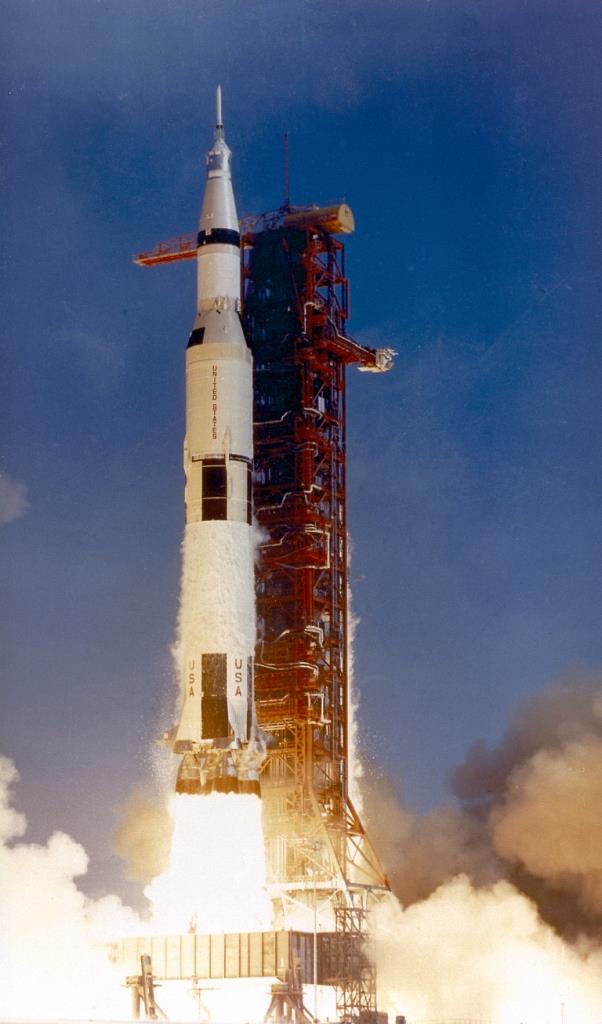
With the third stage of the Saturn rocket still attached, Apollo reached its orbital path just over 100 miles above earth. Then Saturn fired again, pointing Apollo on its route towards the moon in a move called the “translunar injection”. Finally, the Command and Service Modules detached from the protective compartment carrying the Lunar Module, flipped 180 degrees in space, and extracted the Lunar Module. At the same time, they jettisoned the third stage of Saturn V. Only 3-1/2 hours had passed since blast-off. Incidentally, you can follow these complex steps on a great video here.
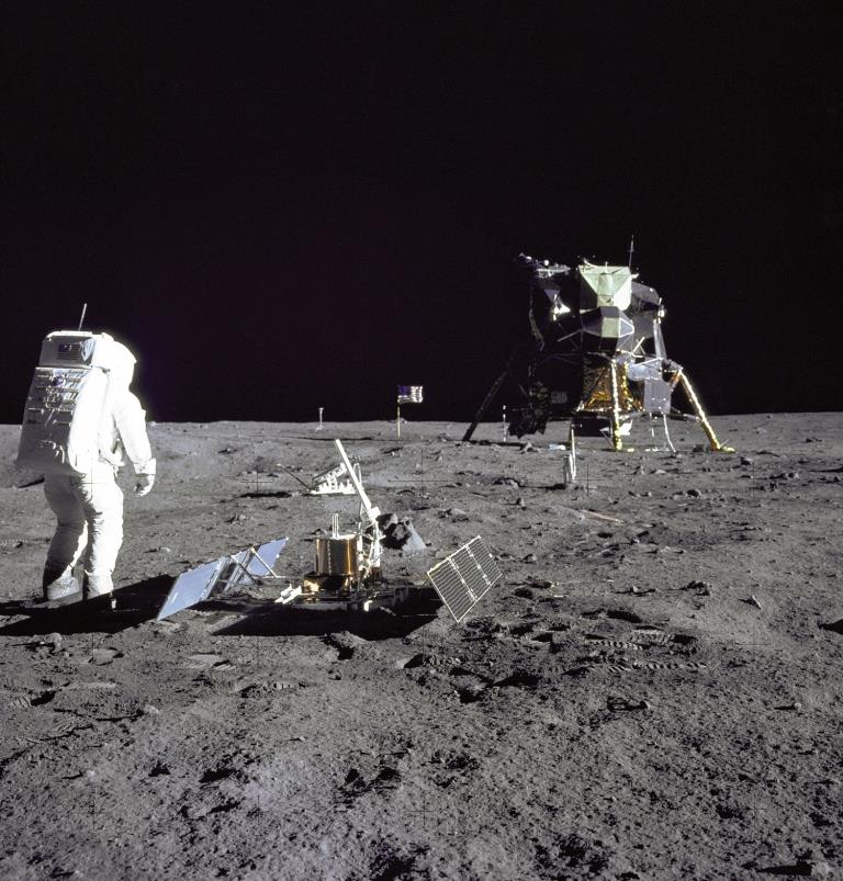
For three days, Apollo 11 flew through space, reaching the moon’s orbit on July 19th, 1969. While pilot Michael Collins remained in Columbia, Armstrong and Aldrin transferred into Eagle and descended slowly to the lunar suface on July 20th. This part was broadcast live throughout the world. Does anyone of a certain age not remember where exactly they sat in front of a television beaming audio of Neil Armstrong and his “giant step for mankind”, then watching Buzz Aldrin clomping around in his bulky space suit? I was in my family’s living room in North Delta, a Vancouver B.C. suburb, along with various friends and neighbours. Even our parish priest was there. It was the most thrilling thing we’d ever seen. Armstrong and Aldrin would stay on the moon for more than 20 hours.
Forty years later, as I related in a recent blog, I would spend a few years working with the music of the late California singer-songwriter John Stewart (1939-2008) to develop a theatrical treatment of his songs. The former Kingston Trio member was a huge space fan, had become friends with John Glenn and Scott Carpenter during the Mercury 7 flights of the early 60s, and was watching the Apollo 11 landing with a song he’d composed all ready to be recorded. Later that week, ‘Armstrong’ was pressed as a single and sent out to radio stations everywhere. Though it met with disapproval from some station execs who wanted only to focus on the glory of the moon shot, John Stewart’s lyrics captured beautifully the universal awe that attended the landing. This is the video I made featuring his song.
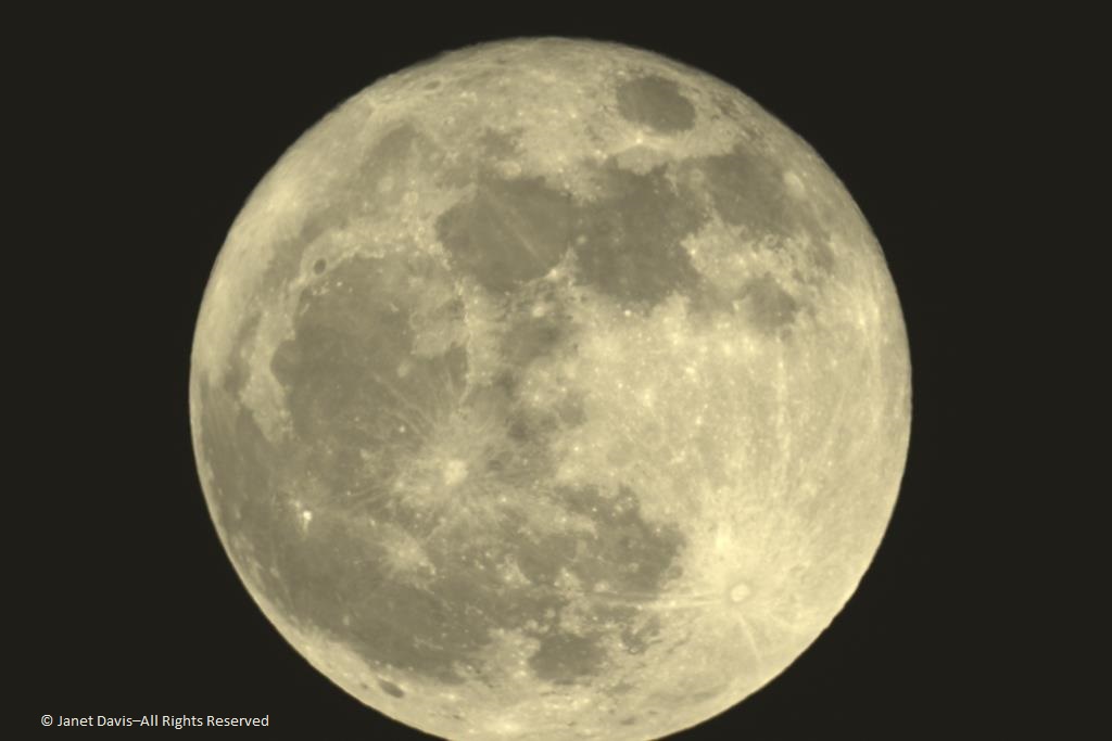
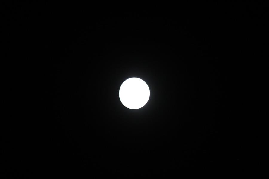
I love photographing the moon. Winter, spring, summer, fall, eclipses …. I like nothing better than to point my lens skyward and feel connected to that silvery orb. So here are some of my images from the past eight years, with some fun facts about our only natural satellite. I’ll start with the only photo I made using our Schmidt-Cassegrain telescope and an adaptor ring to attach my camera, on April 6, 2012. So close is the moon to earth – 384,402 km (238,856 mi) that I was unable to fit the whole moon into the photo. In terms of space-time, the moon is 1.3 light seconds from earth, compared with 8.3 light minutes from the sun.
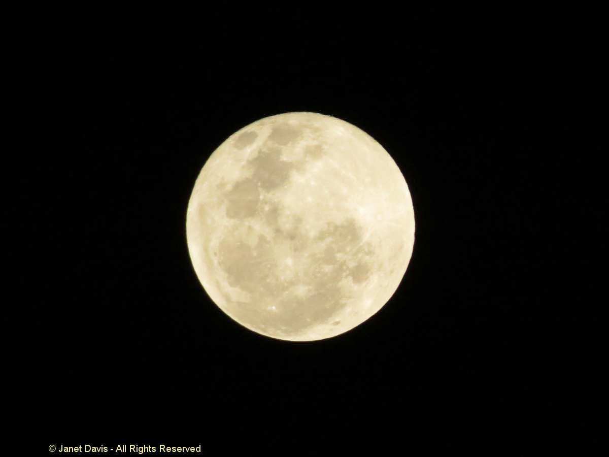
Without a telescope, my little zoom lens camera manages to capture some of the moon’s topography, though not as clearly. This was a full moon on August 7, 2017. To photograph the moon, it’s a good idea to use a tripod, but my 50x fixed lens on my little old Canon SX50HS does manage pretty well.
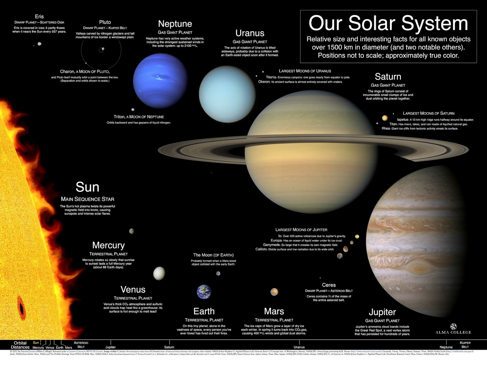
How big is the moon compared to other planets in our solar system? Here is the list according to size of planets and moons in our Solar Galaxy, beginning with the biggest celestial body, our star, the sun. SUN-Jupiter-Saturn-Uranus-Neptune-EARTH-Venus-Mars-Ganymede-Titan-Mercury-Callisto-Io-MOON-Europa-Triton-Pluto. The sun’s radius is 696,342 km radius, earth is 6,371km, the moon is 1,731km. Put another way in another dimension for another country, the sun’s diameter is 864,400 miles, earth’s is 7,917.5 miles, the moon is 2,160 miles. So the sun is 400 times as big and as distant as the moon, and earth is 3.7 times as big as our moon.
Why do we see only one face of the moon… i.e. “the man in the moon” or the “near side of the moon” (unlike the Apollo astronauts, who landed on the dark side)? My son tried to explain this one night by slowly rotating a beer bottle so its label was always facing the same side of another rotating object on our deck. It may have been the wine, but I didn’t really understand then; having read about it, I can now say it’s the result of “synchronous rotation”. Moon orbit also gives earth its high and low tides. Have a look at this YouTube video, which is an excellent tutorial.
The moon was once part of earth. Earth formed 4.54 billion years ago (or 4.54 thousand million years ago, since billion means different things in different countries). According to the Giant Impact Hypothesis, the moon is believed to have formed slightly later, 4.51 billion years ago, originating as a debris ring when an astral body the size of Mars, named Theia, which was also orbiting the sun, hit either a glancing blow to young earth (proto-earth) or smashed into it head-on and ejected some of earth into space. Although some of the debris went into deep space, enough ejecta remained in the vicinity to begin accreting into a sphere that started its orbit of the mother planet, becoming earth’s only permanent natural satellite. Scientists have found Theia’s signature remains both in earth rocks and in samples of rock collected on the moon. The little bit of treed earth beneath the September 11, 2011 full “corn moon” below is a cliff of roughly 1.4 billion-year-old Precambrian Shield that forms the shore of Lake Muskoka, north of Toronto, where we have a cottage (and where I blog about my meadow gardens). In aboriginal tradition, each of the full moons was named for the season, September being the time to harvest corn.
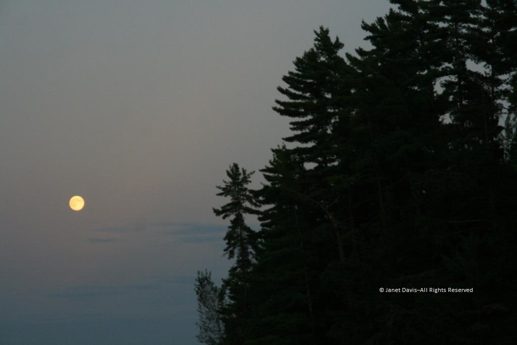
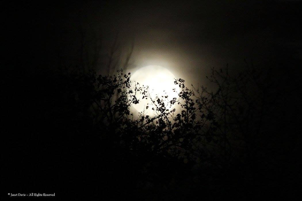
In ancient times, the moon cast its light onto a world where darkness was the nightly norm. When I turn out the lights at our cottage and photograph the sky “by the light of the silvery moon”, it’s easy to see the natural advantage moonlight gave to those wanting to travel or work at night. I made the photo below this week, on the anniversary of Apollo 11’s blastoff. Sometimes, a partly cloudy sky illuminated by the full moon is even more interesting than a black velvet sky.
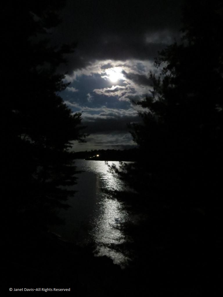
The night before, I was transfixed by the reflection of the nearly-full moon in the waves lapping at our shore below. I thought that dreamy vision would be a suitable accompaniment to the most famous song about the moon, Claude Debussy’s 1890 ‘Clair de Lune’, played by Francois-Joel Thiollier.
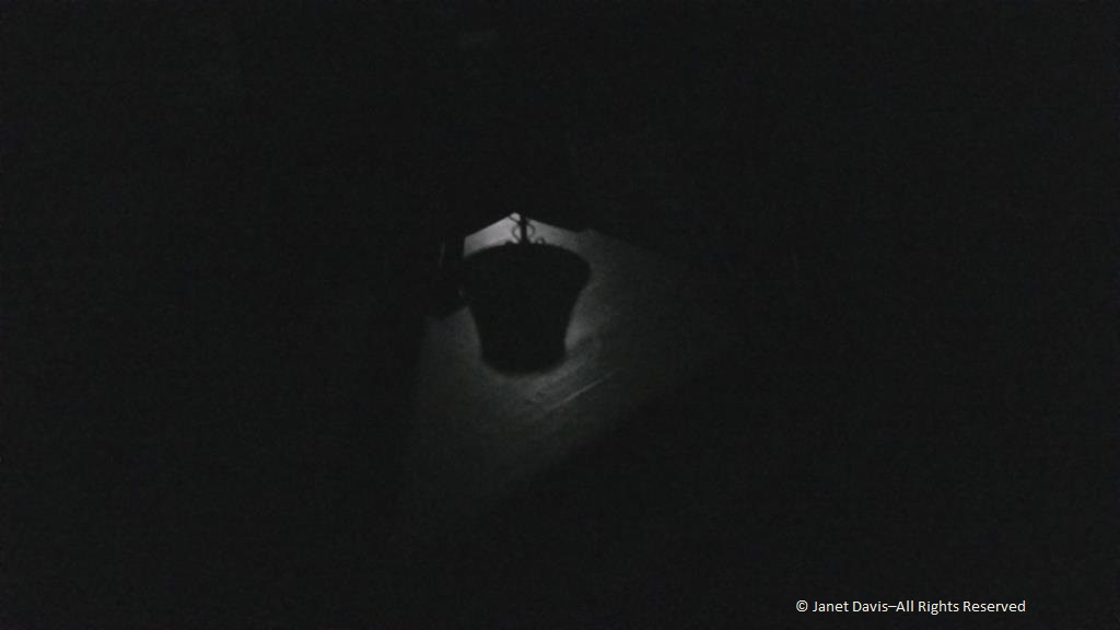
One moonlit night as I was turning out the lights to head to bed, I noticed our lamp silhouetted on the floor in our perfectly dark cottage. For some reason, this little image struck me and I photographed it. It made me reflect upon shadow and light, natural chiaroscuro, and our over-lit society.
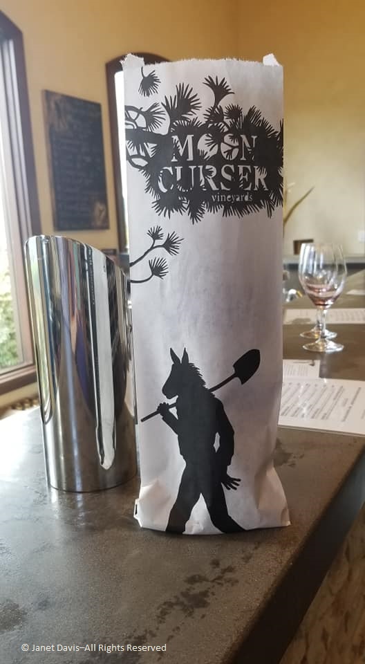
But the light of the moon isn’t always an advantage. Full darkness is a way to hide troop movements (though D-Day apparently, needed a full moon for tidal reasons, not illumination) and criminal activity. When we were in Osoyoos, B.C. last September doing a little wine-tasting, we liked the vintages of Mooncurser Vineyards, below. “Osoyoos, the border town where our winery is located, has long been celebrated for the rich soil and brilliant sunshine. But during the gold rush, it was the dark of night that brought commotion to the area. Then, an unscrupulous procession of gold-smuggling miners returned stateside by the hundreds, if not by the thousands. All under the cover of night – trying to avoid customs agents at all cost. Often, the light of the moon would foil their plans, shedding light onto their surreptitious travels and activities. Need we say more about our name?”
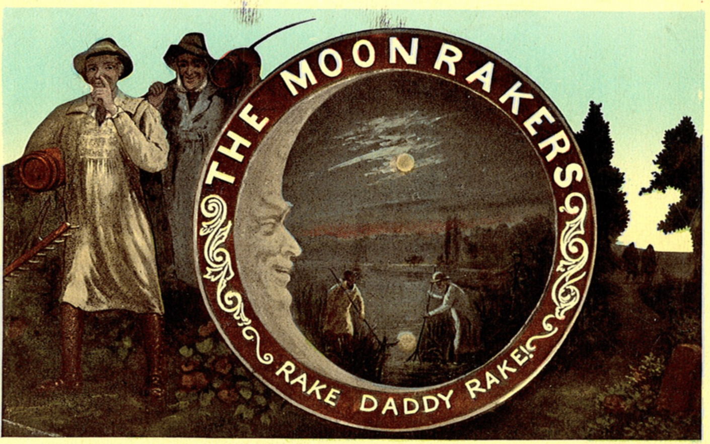
But what about moonshine? Turns out that’s a derivative of “moonrakers”. And who were they? From Wikipedia: “This name refers to a folk story set in the time when smuggling was a significant industry in rural England, with Wiltshire lying on the smugglers’ secret routes between the south coast and customers in the centre of the country. The story goes that some local people had hidden contraband barrels of French brandy from customs officers in a village pond. While trying to retrieve it at night, they were caught by the revenue men, but explained themselves by pointing to the moon’s reflection and saying they were trying to rake in a round cheese. The revenue men, thinking they were simple yokels, laughed at them and went on their way. But, as the story goes, it was the moonrakers who had the last laugh.”
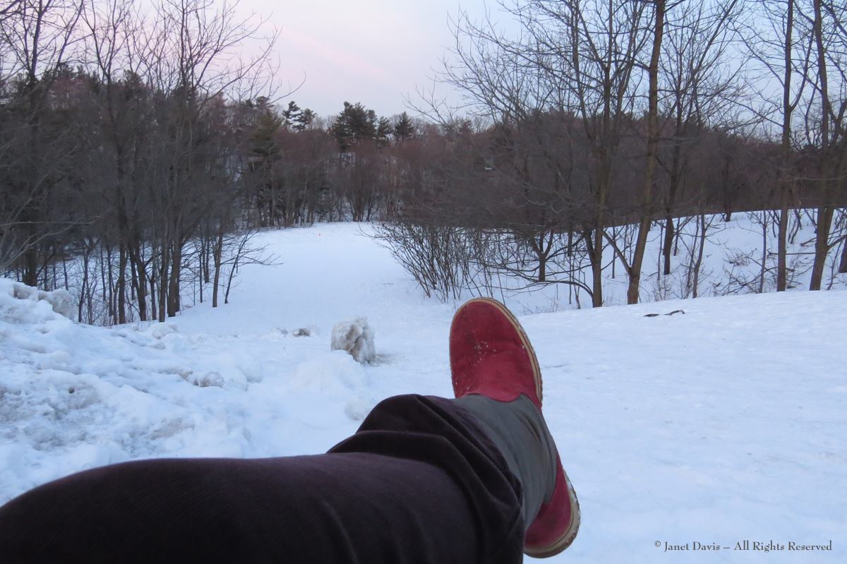
I have often walked by the light of the moon. In fact, on March 6, 2012, I made the photo below during a year when – out of a conviction that I need more physical activity than getting up from my computer afforded – I pledged to walk a mile per day and post on Facebook a photo made during my walk, accompanied by a little verse. I called the poems my “walking rhymes”. The rather boring photo below was made late at night on my street. Incidentally, in aboriginal tradition, that early March full moon would be a “sap moon”.
Another night, another moon
I really should try sleeping soon…
This sphere could be made of Ivory soap
I wish I had my telescope!
What’s a “blue moon”? It’s reserved for those calendar months that see two moons, since the lunar month is 29.5 days. So blue moons will always be at the very end of the month. I love this song by Nanci Griffith, recorded many decades ago. Listen to ‘Once in a Very Blue Moon’.
This was my view from the cottage path on May 20, 2016. In aboriginal tradition, it’s called the planting moon or the milk moon. Here on Lake Muskoka, I call it the new oak leaf moon, the young pine cone moon.
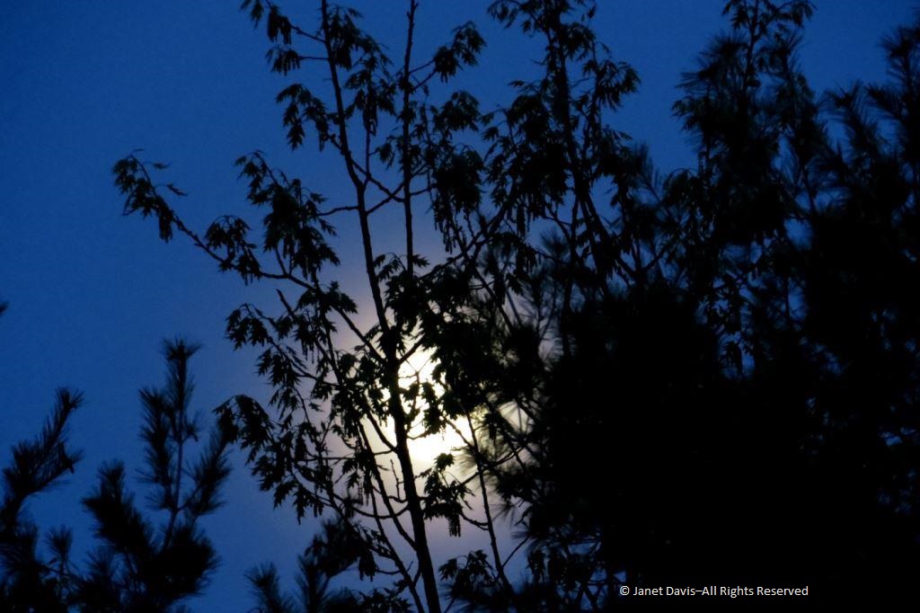
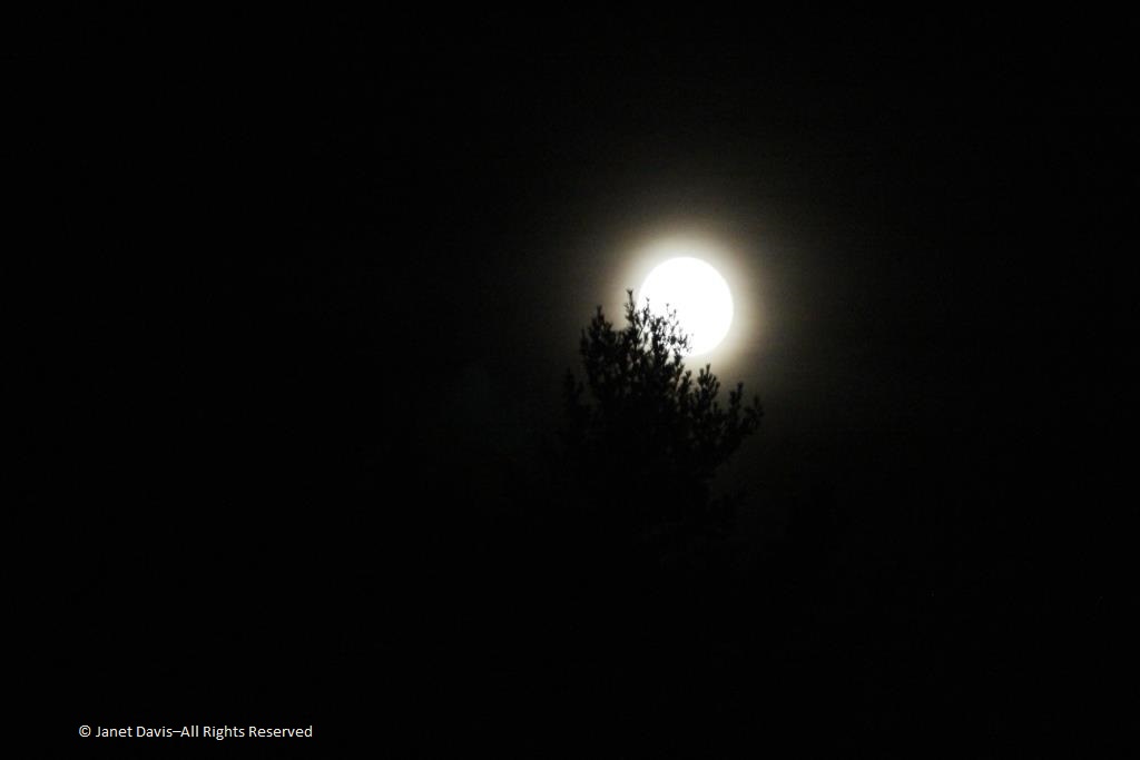
In fact, I find it more interesting to give context to my moon photography, which means I usually frame it with the flora that grows here on our rocky granite shore. This was the moon shining down on the top of a towering white pine on August 1, 2015.
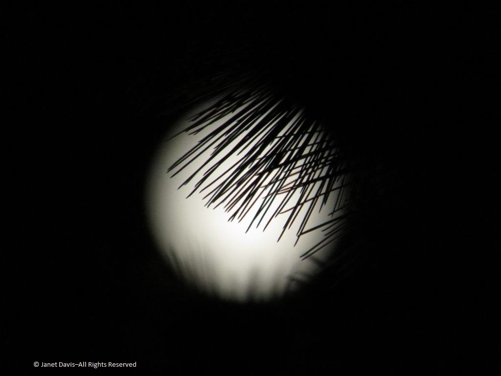
On October 4, 2017, I found pine needles to feature in front of the moon.
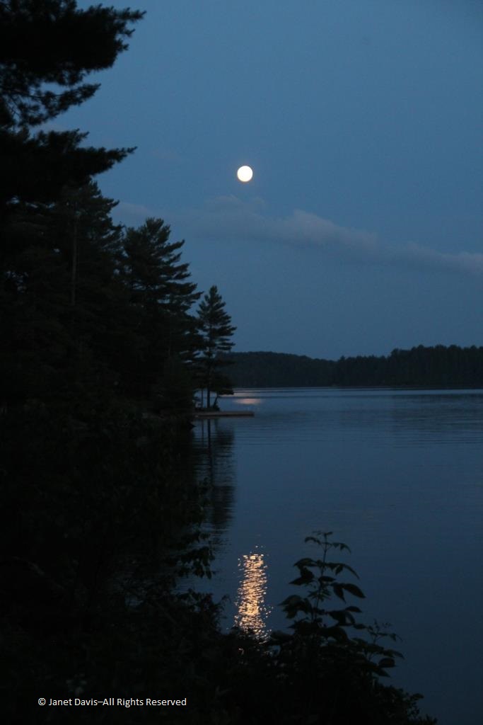
Sometimes, I draw back and photograph the moon shining on our entire little east-facing bay on Lake Muskoka. In fact, the lake is so big (120 km2 or 46 sq mi) that this is just a small part of the section of the area described on maps as East Bay. The scene below on June 22, 2013, featured the strawberry moon.
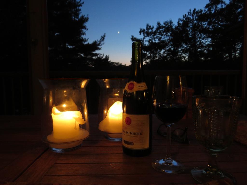
The moon is usually described as having eight phases: New moon, Waxing Crescent, First Quarter, Waxing Gibbous, Full moon, Waning Gibbous, Third Quarter, and finally Waning Crescent. Did you know that you can find the moon phase for any past date? The photo below was made from our screened porch at the end of a dinner that clearly featured some lovely wine. Knowing the date was September 23, 2017, I looked that up on this website and found it described as a Waxing Crescent. As for the other stuff on that site, I am a complete non-believer. Science is too interesting and magical in itself to confuse it with superstition!
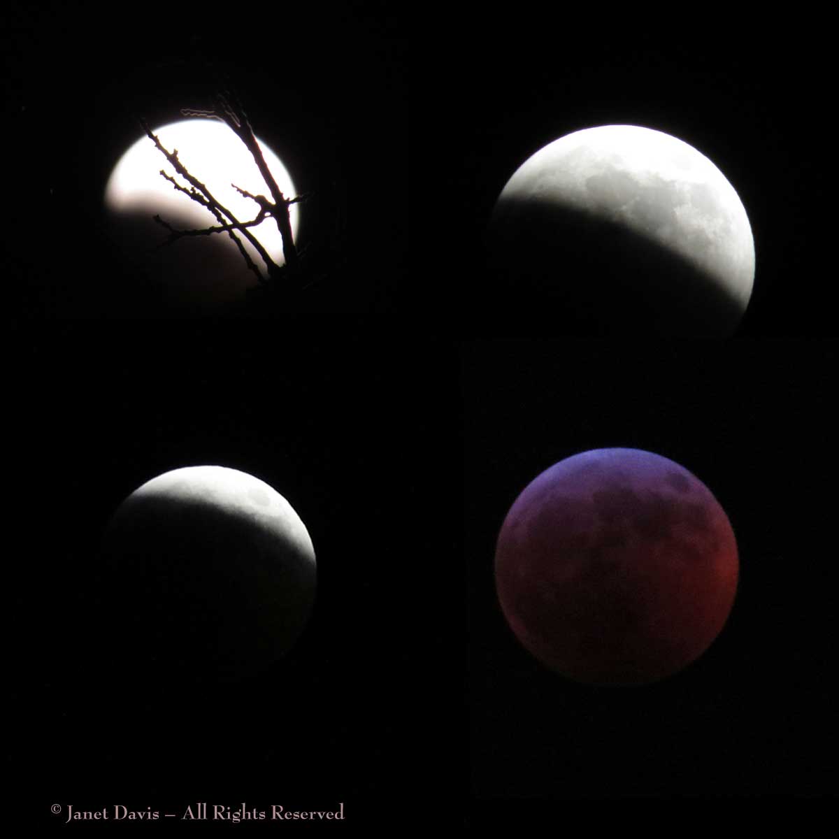
Once every now and then, the moon puts on a show that draws us out of our houses to find a viewing spot. A lunar eclipse occurs when “when Earth’s shadow blocks the sun’s light, which otherwise reflects off the moon. There are three types — total, partial and penumbral — with the most dramatic being a total lunar eclipse, in which Earth’s shadow completely covers the moon”. (from space.com) Interestingly, in this week celebrating Apollo 11, the moon put on just such a show for many parts of the world, but sadly not North America. However, this winter I stood in front of my house shivering in temperatures that dipped to -20C to record the phases of the January 21st full lunar eclipse, below. That last red image is the colour of the moon in earth’s shadow, something the pre-science ancients called a “blood moon”. In the bible, it is written: “The sun shall be turned into darkness, and the moon into blood, before the great and notable day of the Lord.” – Acts 2:20.
Perhaps the most popular phenomenon to capture the public imagination in the past decade or so has been the “supermoon”. A so-called supermoon is a full moon that occurs when the moon appears to us at perigee, i.e. when the moon is closest to earth. Not all astronomers are fond of this supercalifragilistic hype. Neil deGrasse Tyson is one of them, and has created a funny video to illustrate his point:
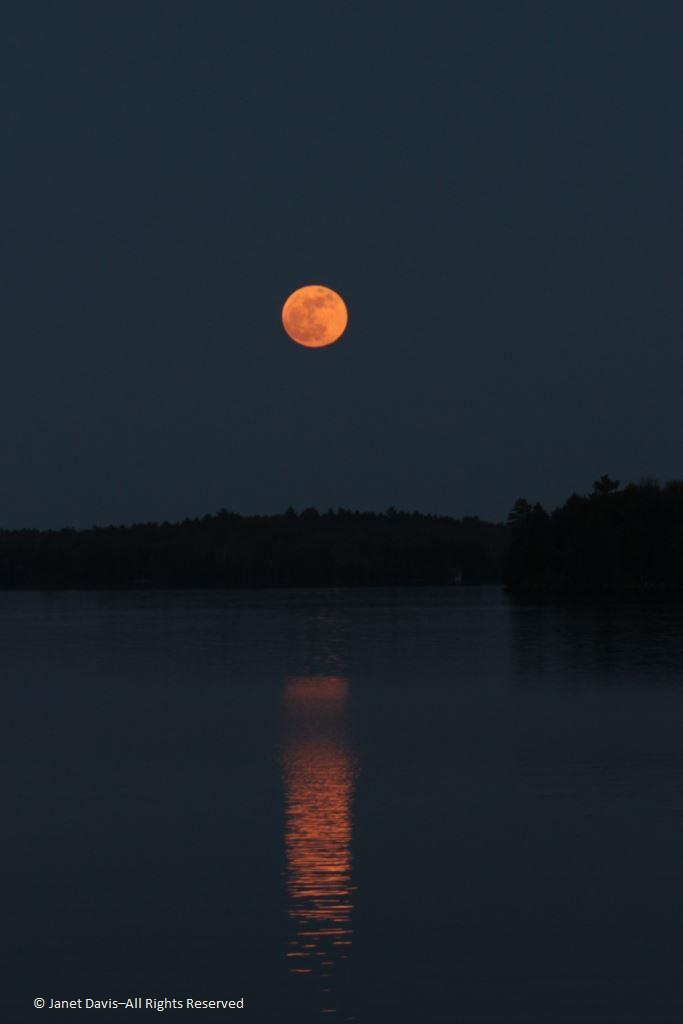
But there’s no question that when a full “supermoon” rises in the east over Lake Muskoka, it is a vision to behold. We went across the bay to my brother-in-law’s cottage on May 5, 2012, just so I could capture the full effect of the supermoon as it rose over the pines on the horizon, seemingly orange because of particles in the earth’s atmosphere.
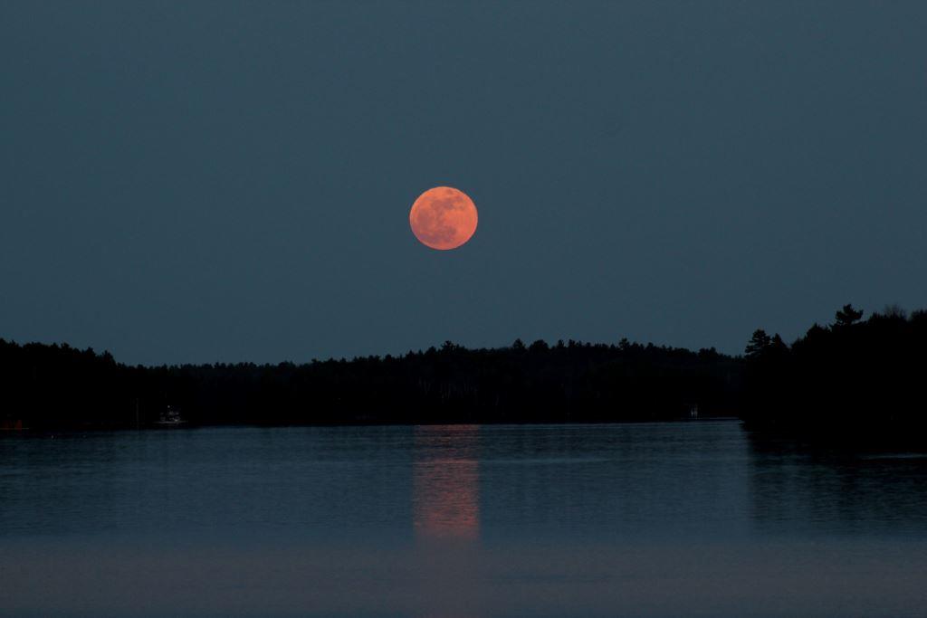
It was worth it, wasn’t it?
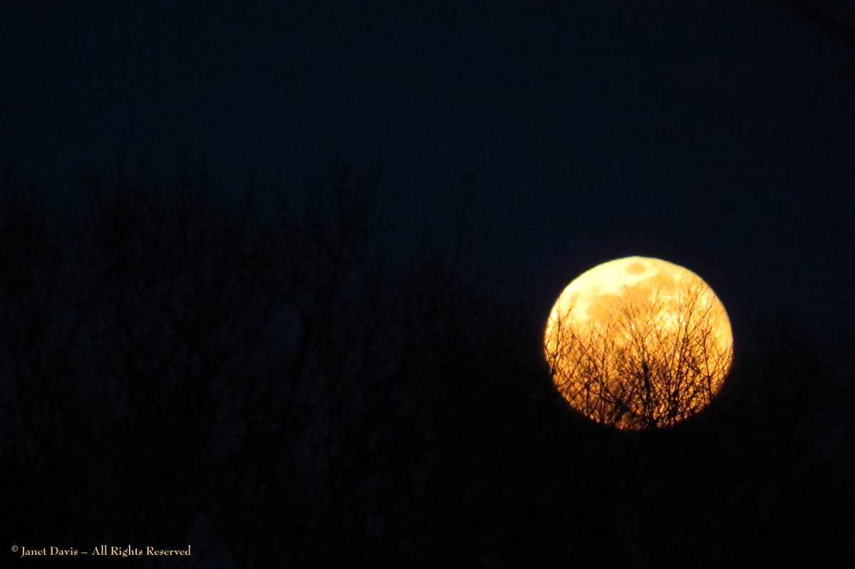
On February 19 this winter, I marched down the street to Toronto’s Sherwood Park at the end of our block at dusk to make sure I didn’t miss the “supersnowmoon”. I sat alone shivering on a park bench, wondering where 73 degrees (longitude? latitude?) was as I peered at the trees lining the ravine.
Then, there it was, framing the leafless maples and elms.
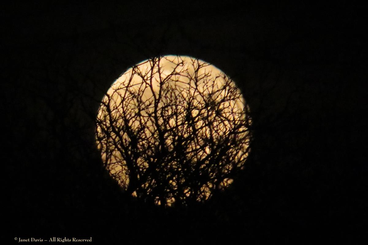
I loved making this witchy moon photo.
Speaking of witches, let’s have a little etymology. Month, of course, comes from moon. But where does the word “lunatic” come from? According to Wikipedia: “The term ‘lunatic’ derives from the Latin word lunaticus, which originally referred mainly to epilepsy and madness, as diseases thought to be caused by the moon….. By the fourth and fifth centuries, astrologers were commonly using the term to refer to neurological and psychiatric diseases. Philosophers such as Aristotle and Pliny the Elder argued that the full moon induced insane individuals with bipolar disorder by providing light during nights which would otherwise have been dark, and affecting susceptible individuals through the well-known route of sleep deprivation. Until at least 1700, it was also a common belief that the moon influenced fevers, rheumatism, episodes of epilepsy and other diseases.” Today, though we joke about bad behavior under a full moon, “lunacy” has rightfully been consigned to the dustbin.
Back to supermoons. My most challenging supermoon photo shoot was on November 14, 2016, when I took the ferry from Toronto’s Harbourfront to Wards Island in Lake Ontario. I thought how wonderful it would be to see the moon rise above the city skyline. I parked myself on the rocky shore with a young Irish girl and together we waited patiently.
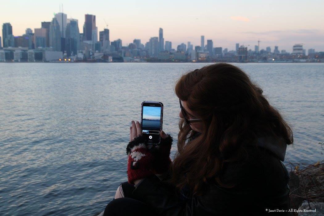
Alas, the sky darkened and the moon did not show. Could we have gotten something wrong? The Irish girl took her leave and, shivering in the cold, I waited.
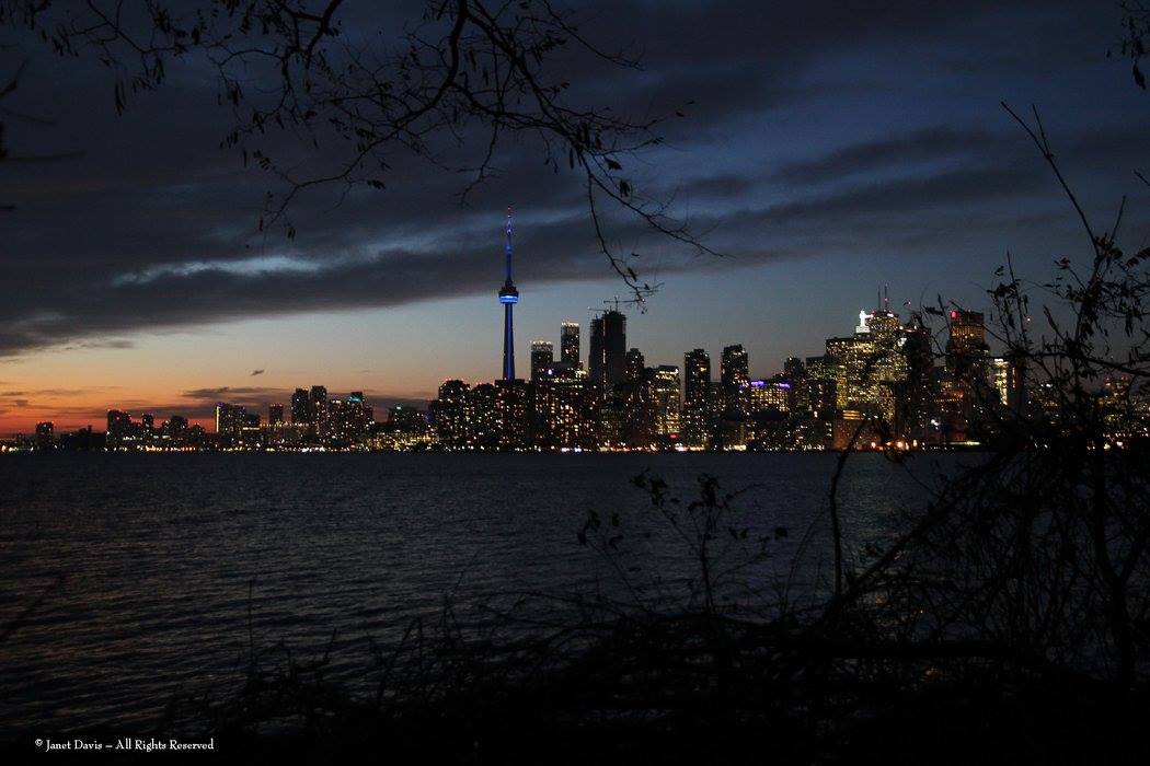
My hands and feet finally felt numb, and I gathered my things together. On the way back to the ferry, I glanced up through the trees and there it was, my moon. We had been looking in the wrong direction. As I pointed my lens up through the lacy foliage, I felt relieved and strangely elated. The moon seemed to be saying, “See, I’ve been up here all the time. You don’t need a super-duper supermoon behind tall skyscrapers; you just need the comfort of me lighting the sky, as I have for almost as long as earth has been around.”
Happy 50th anniversary, Apollo 11. You brought the moon closer to us moonstruck folks on earth.