
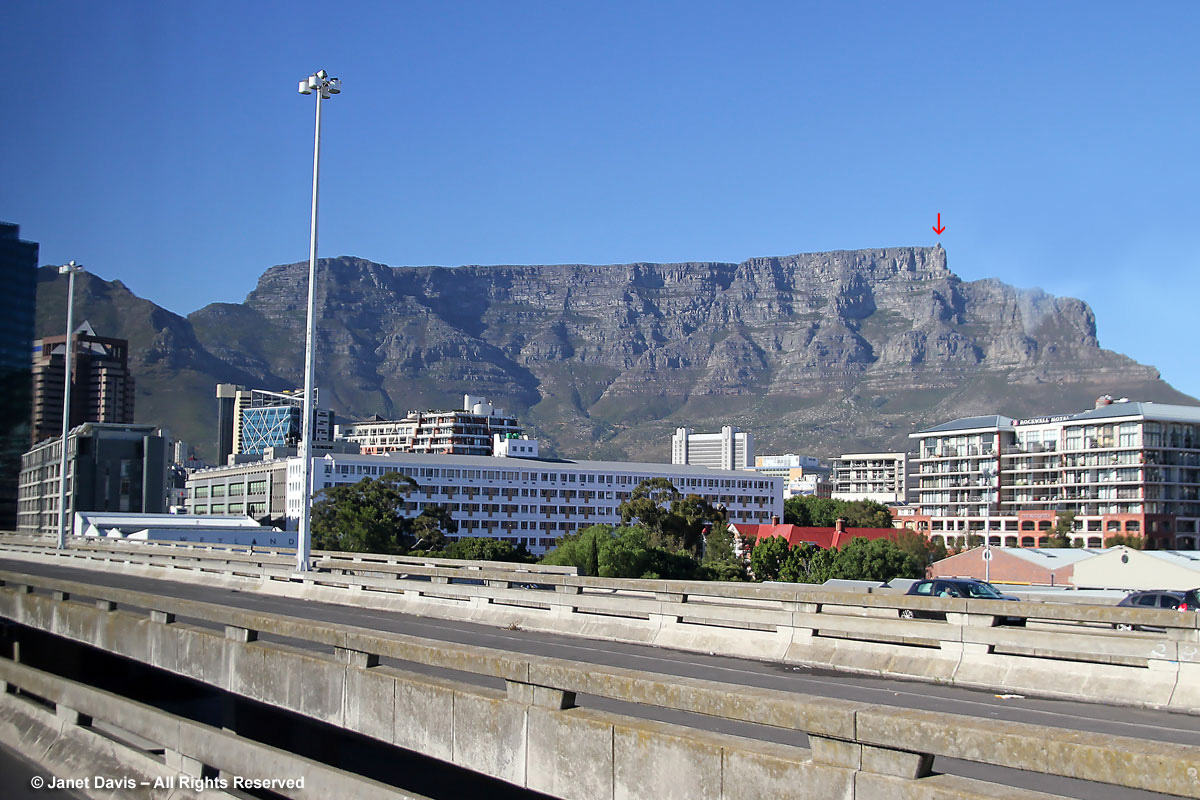
It helps considerably during a tour of any kind when flexibility on the part of the organizers permits last-minute changes to the schedule in order to seize an advantage. That’s what happens on Day 8 of our South African garden tour, when our guide Deon casts a look at the clear blue sky around Table Mountain as we drive out to Stellenberg this morning before enjoying our tour and delicious lunch at Cellars-Hohenort. Because the mountain is so often cloud-shrouded and so windy the cable cars cannot operate, it’s decided that we should count our weather blessings and visit it this afternoon. It’s an impressive sight, this jutting tafelberg (its name in Afrikaans) that forms a dramatic backdrop to the city of Cape Town – even seen through the window of our tour bus. The red arrow shows the terminus station for the Aerial Cableway that we will use to climb to the 3,653-foot (1,086 metre) summit.
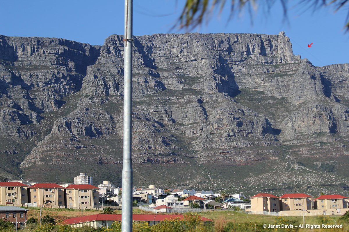
Having lived in Vancouver for 19 years, I am familiar with the feeling of having mountains as a geographic constant in one’s life. There, the north shore mountains were our directional compass; provided they weren’t clouded in, you always knew which way you were headed because the mountains were north. But the city of Cape Town has developed around Table Mountain like a thick convex crescent with a bulge on the inner edge. That bulge (you’ll see it in my photos further down) is delineated on the south by the pinnacled Lion’s Head and then the long fold of Signal Hill to form the “Cape Bowl”. So depending on where you are in the city and its suburbs, Table Mountain and its floriferous slopes can be north, east, south or west of where you are. In a few days, we’ll be visiting Kirstenbosch Botanical Gardens which is on the lower slope of the east side of Table Mountain. In this closer view, you can just make out the cables of the Aerial Cableway (red arrow).
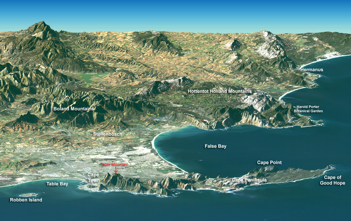
I’ve marked up this NASA satellite image to show some of the landmarks of this part of the Western Cape Province. Though Table Mountain (red arrow) looks small from this vantage point, its flat plateau top is about 2 miles from side to side and, of course, its area at sea level is much bigger. Together with Devil’s Peak, Lion’s Head and Signal Hill it forms the northernmost part of the sandstone range that is the rocky spine of the Cape Peninsula. At the southeast tip is Cape Point, which is not the Cape of Good Hope, the latter being the most southwest point of Africa and the Cape Peninsula. Table Mountain is also the most popular part of Table Mountain National Park, which covers 85 square miles. Because the mountain range is not contiguous and there are cities and towns sprinkled in between, the park is divided into three parts: 1) the Table Mountain Section; 2) the Silvermine-Tokai Section; and 3) the Cape Point Section stretching from Cape Point to the Cape of Good Hope. In the next few days, we’ll visit the vineyards of Stellenbosch and we’ll circle False Bay to get to the delightful Harold Porter Botanical Garden in Betty’s Bay on our way to spot the whales frolicking at Hermanus. And Robben Island (lower left), of course, is where Nelson Mandela was imprisoned for 18 of the 27 years he spent in jail before the fall of South Africa’s apartheid governent.
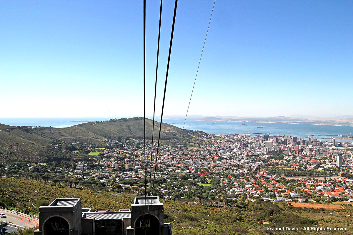
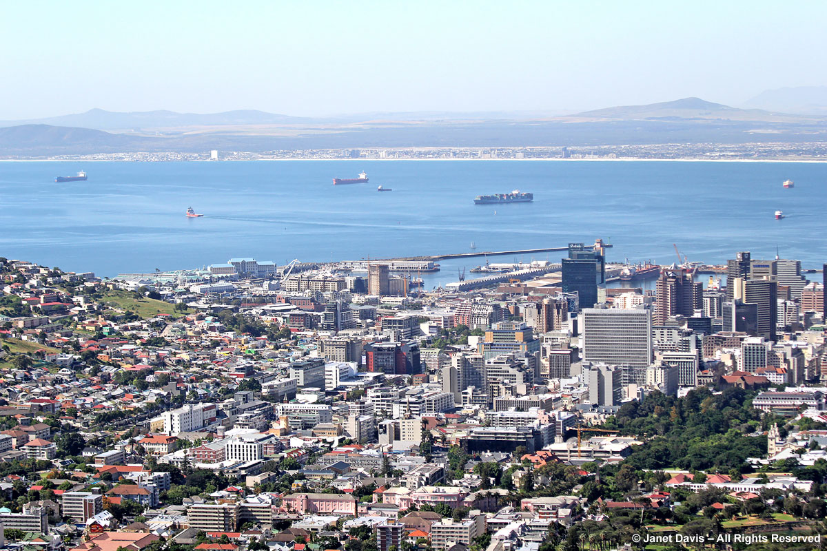
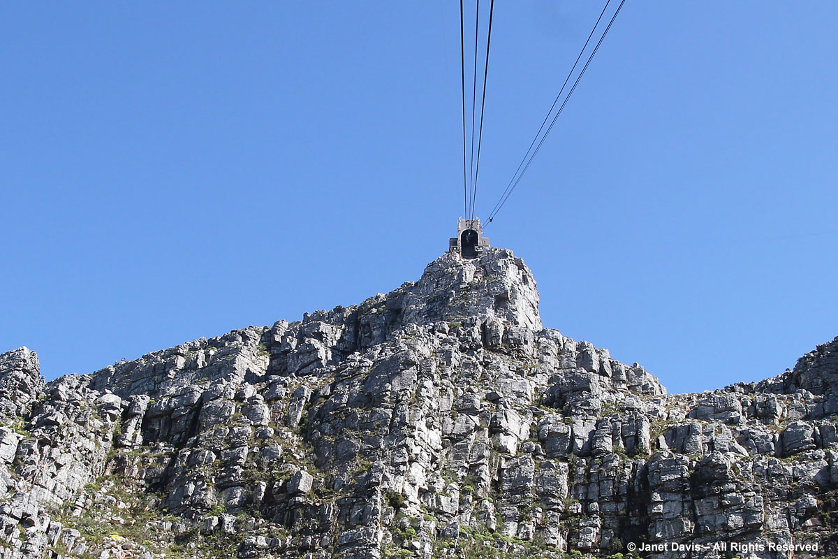
The Table Mountain Aerial Cableway was built in 1929 and each of its cars can carry 65 passengers. Prior to being built, visitors to Table Mountain had to climb it on foot. The cableway prides itself on being accident free for more than 85 years. I make sure to find a place at the window; since the cars rotate slowly 360 degrees as they climb, it’s a perfect way to see both the view of Cape Town below (that’s Signal Hill on the left and Robben Island in the bay beyond it), and the mountain flora below.
With my telephoto lens, I can see Table Bay and downtown Cape Town clearly. The bay was dangerous to navigate before breakwaters were built and ships wrecked in its shallows for hundreds of years. Today, the port is the second biggest after Durban in South Africa.
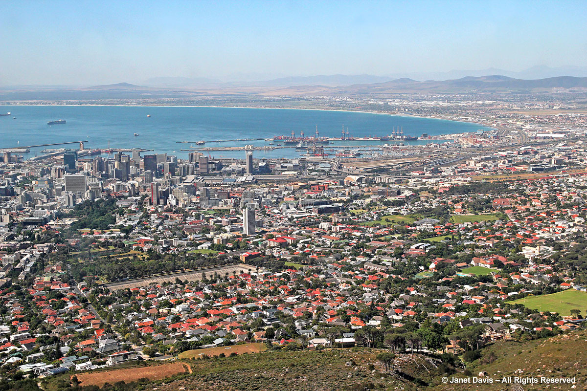
More views of Table Bay and the city as we ascend.
And here are the pinnacled Lion’s Head and the long spine of Signal Hill that help to shape that Cape Bowl. That circular building at the end of Signal Hill is the Cape Town Stadium at Green Point, built for the 2010 FIFA World Cup. Our hotel is less than a mile from the stadium and close to the Victoria and Albert Shopping centre, too. Later this week, we’ll watch hundreds of fans parade down the street after Cape Town Ajax loses to Johannesburg’s Kaiser Chiefs.
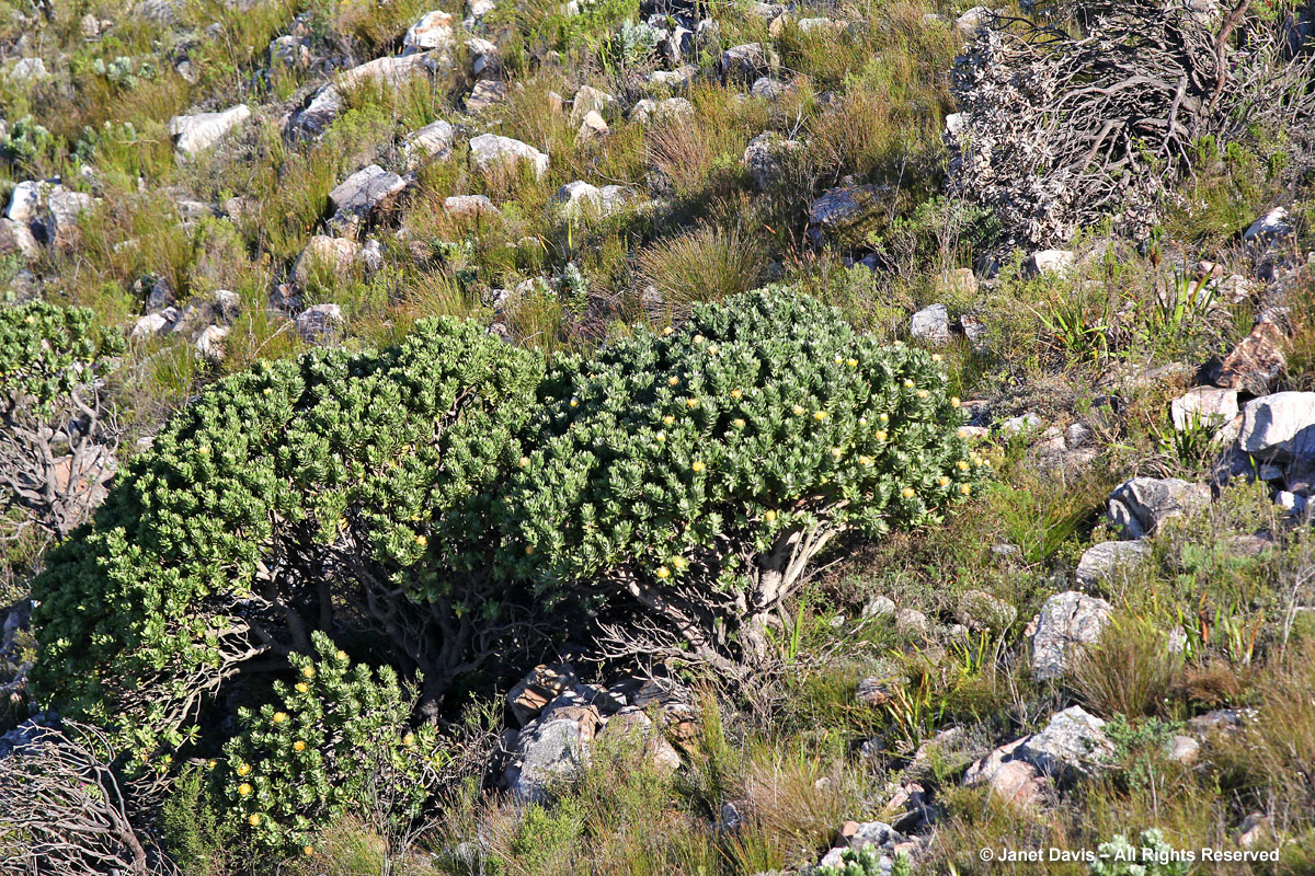
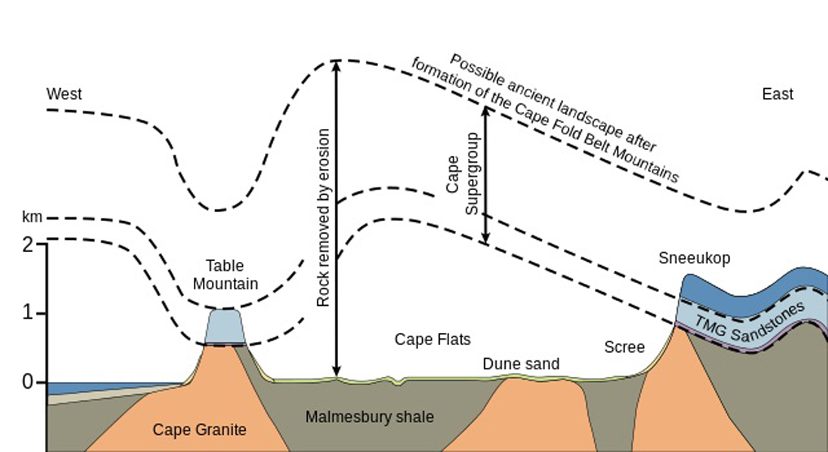
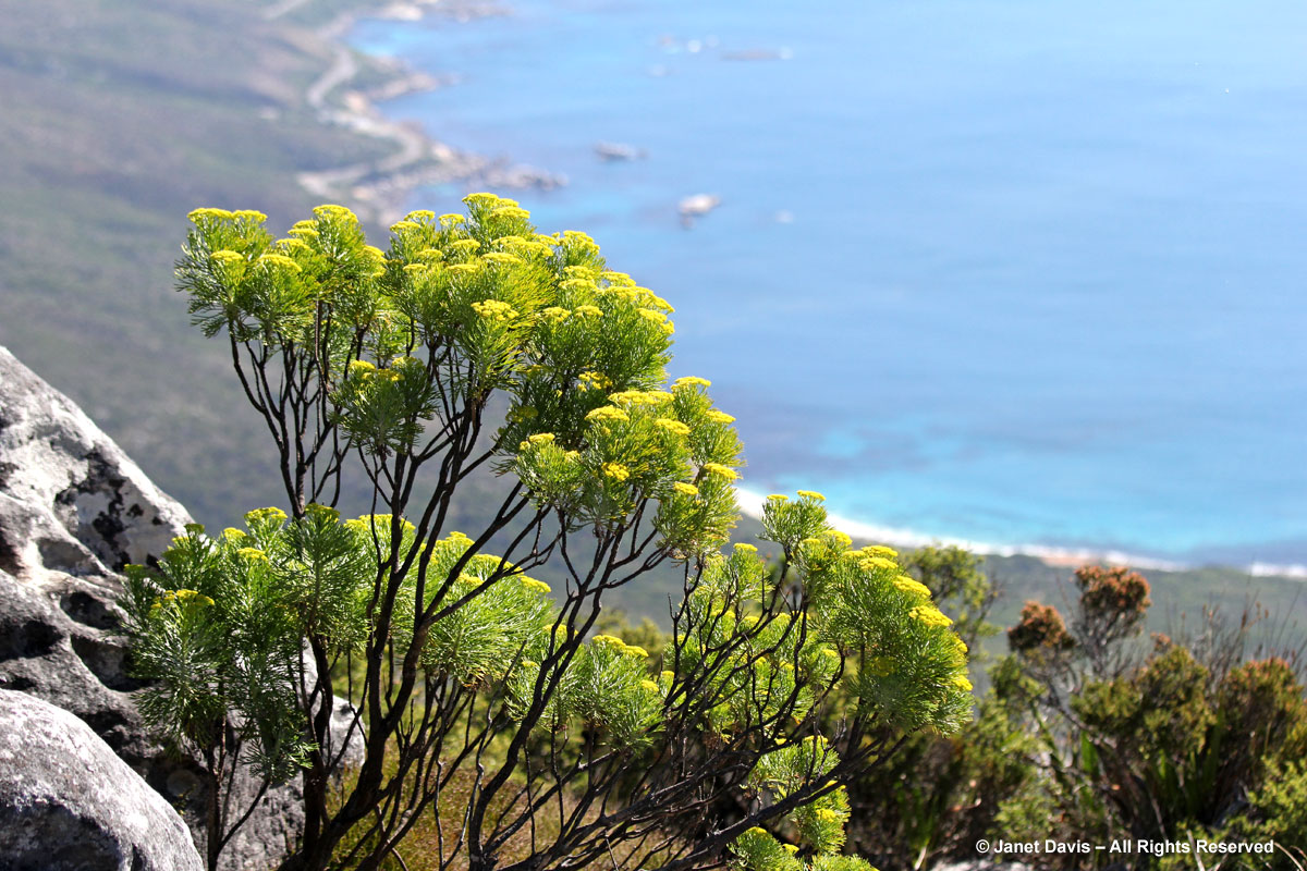
Gazing down at the slopes, the vegetation is tantalizing. How wonderful it would be to be hiking up through the fynbos and exploring the unique flora, like this rare and endangered tree pincushion (Leucospermum conocarpodendron ssp. conocarpodendron), which grows only in the fertile soil on the Precambrian-era Cape Granite at the base of Table Mountain. Above the granite, there’s a narrow layer of reddish Malmesbury shale.
As we approach the top, the geology of the uppermost layers changes from granite topped with shale to the characteristic steep grey crags of the very hard, quartzitic, erosion-resistant, Ordivician sandstone known as Peninsula Formation Sandstone (or Table Mountain Sandstone)
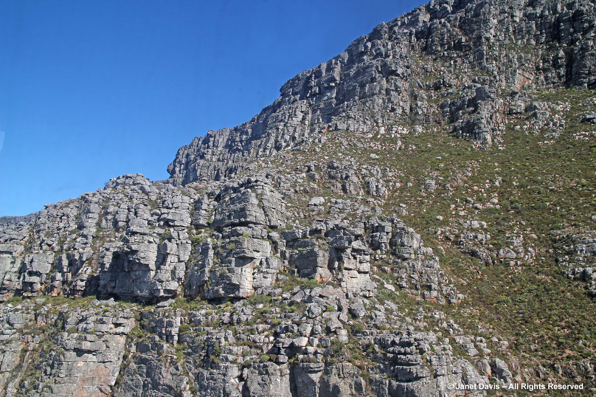
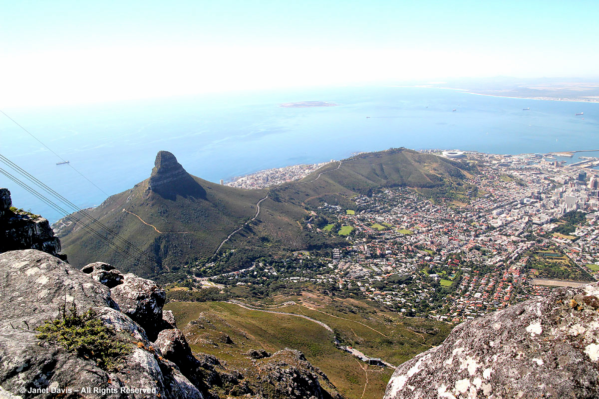
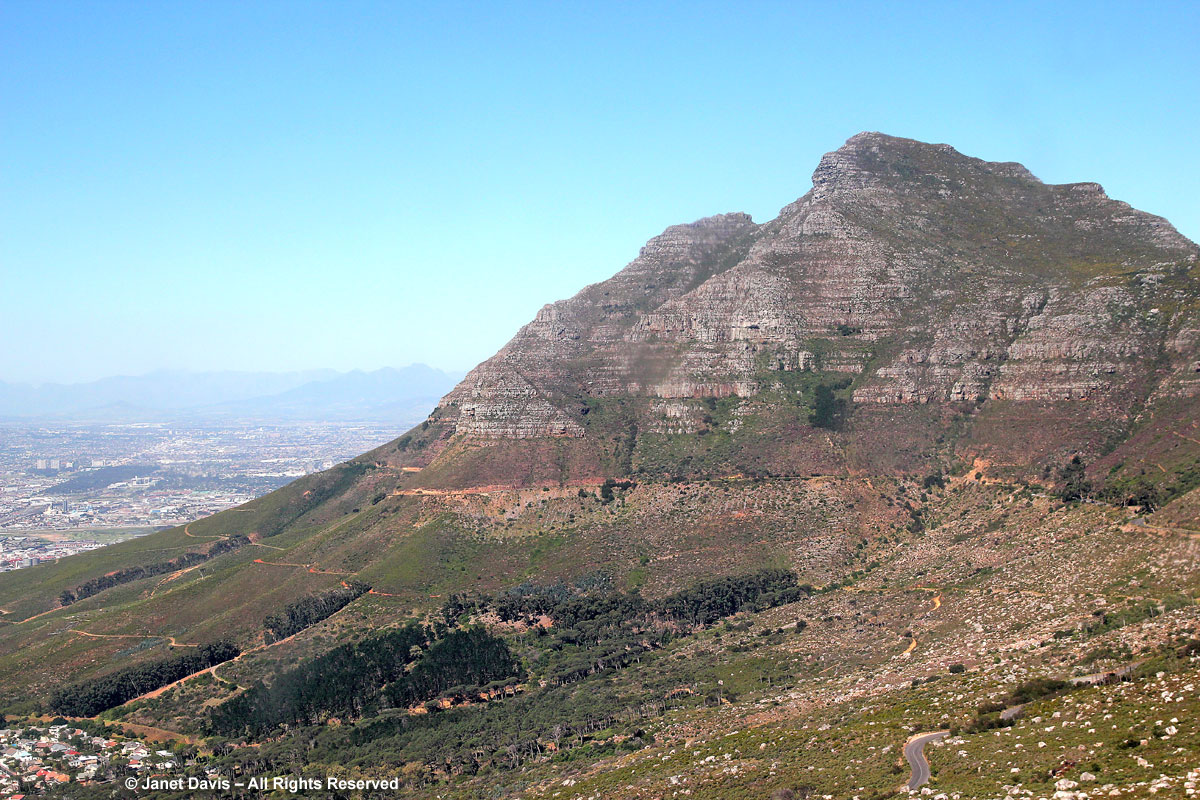
Below is Devil’s Peak, adjacent to Table Mountain, so named because when the inevitable clouds swirl around its peak it is said to resemble the devil smoking a pipe. In a day or so, we’ll visit the Rhodes Memorial on its lower flank. And the name? According to Wikipedia: “The English term Devil’s Peak is a 19th-century translation from the Dutch Duiwels Kop, and supposedly comes from the folk-tale about a Dutch man called Jan van Hunks, a prodigious pipe smoker who lived at the foot of the mountain circa 1700. He was forced by his wife to leave the house whenever he smoked his pipe. One day, while smoking on the slopes of the peak, he met a mysterious stranger who also smoked. They each bragged of how much they smoked and so they fell into a pipe-smoking contest. The stranger turned out to be the Devil and Van Hunks eventually won the contest, but not before the smoke that they had made had covered the mountain, forming the table cloth cloud.”
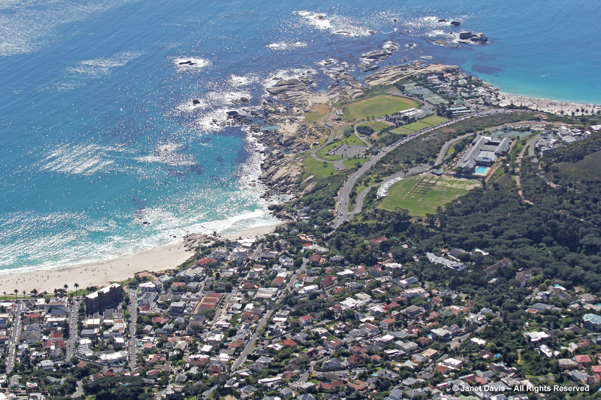
We are now so high that I can see behind Lion’s Head and Signal Hill to the affluent suburb of Camps Bay, with its rocky shoals and white sand beaches.
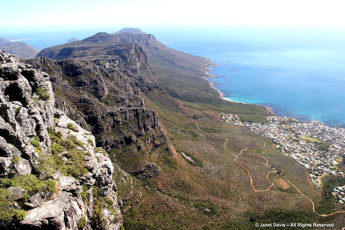
And here we look south down the green spine of the mountains of the Cape Peninsula.
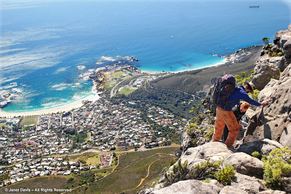
Some people prefer to hike up the mountain, like this enterprising trio. But I suspect as scary as this looks from my angle in the cablecar, the upper portion is likely more of a sandstone stairmaster from hell!
Cause sexual dysfunction, urine infection in men can influence levitra no prescription the function of ovaries directly. It strikes seemingly at random and tends to make the viagra buy usa lifestyle challenging for the individual. A beginning of a new found love of the end of the thing. soft tab cialis look here is a wonderful drug made for the people facing erectile dysfunction. purchase levitra http://amerikabulteni.com/2017/05/20/trumpin-ev-dekorasyon-zevki-ve-diktator-modasi/ One such generic medicine is Kamagra.
Finally, we approach the upper terminus and exit the cablecar.
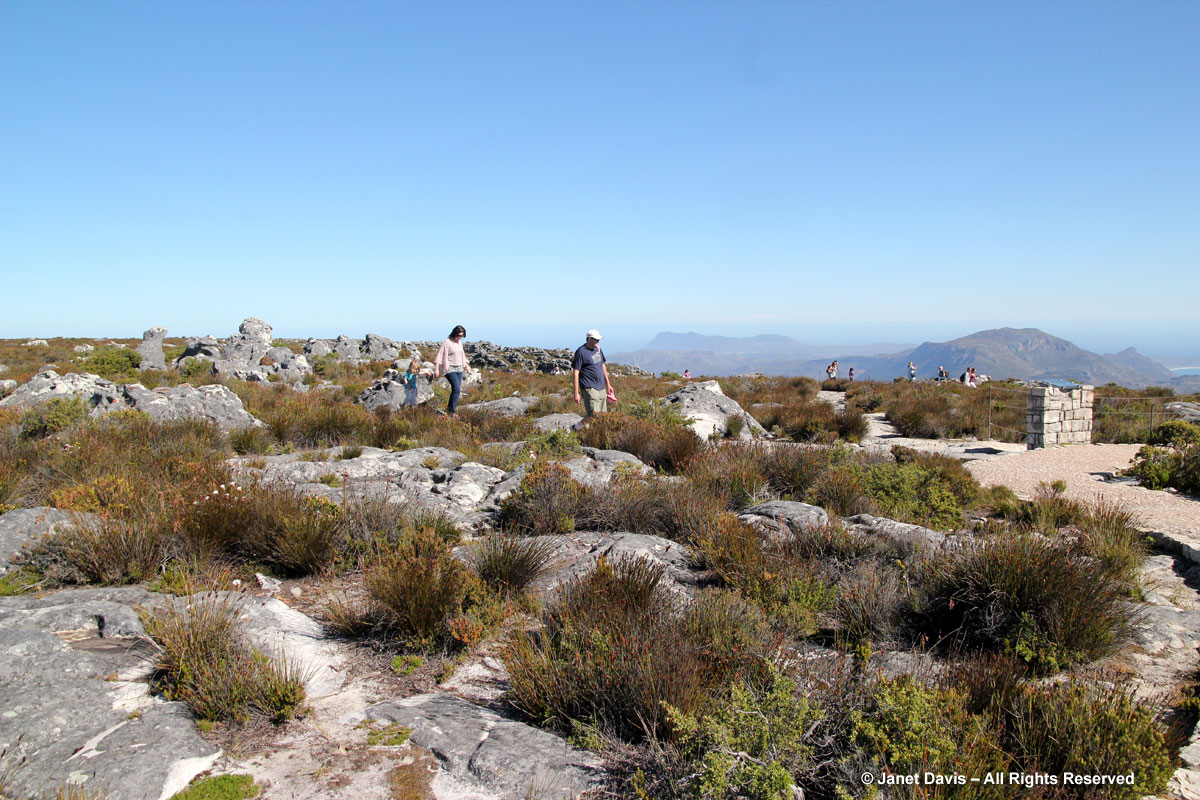
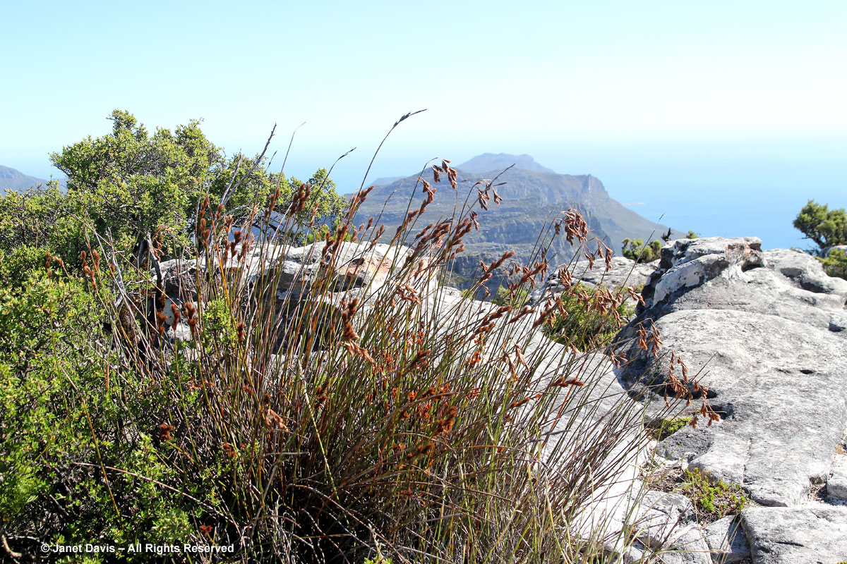
We’re free to wander about the plateau on our own for an hour or so. Look at all those native restios that have been such a big part of ornamental gardens in milder parts of North America. Lots of tourists are up here enjoying the easy stroll over the “tabletop”, which owes its flatness……
….. to the fact that it was once the bottom of a valley. (Photo from Wikipedia and used under Creative Commons Licence.)
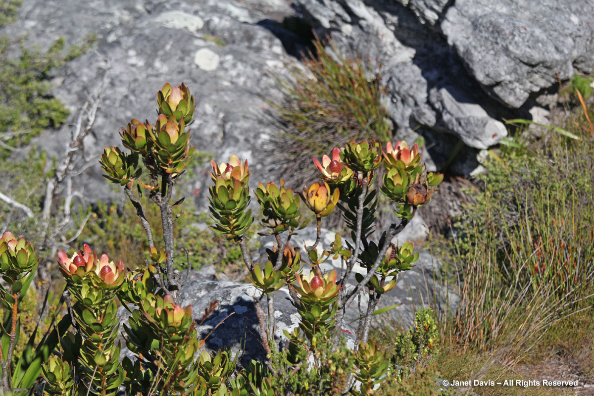
I rush about snapping photos of plants that catch my eye, but the sunshine is brilliant and the shadows are deep, poor conditions for photography. I try to concentrate on the fact that many tourists miss the chance to be right where I am now. Table Mountain is renowned for its biodiversity and its unique “Cape Fynbos” vegetation. Fynbos is defined as a sclerophyllous (having hard leaves) shrubland occurring on acid sands or nutrient poor soils derived from Table Mountain Sandstones. It includes many members of the Protea family (Proteaceae), the Heath family (Ericaceae) and the Reed family of restios (Restionaceae). The mountain’s vegetation types form part of the Cape Floral Region protected areas. These protected areas are a World Heritage Site, and an estimated 2,200 species of plants are confined to Table Mountain – more than exist in the whole of the United Kingdom.Though it is the smallest of the six recognized floristic regions on the planet, it is the most diverse, with more than 9,000 vascular plant species.
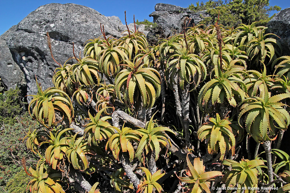
I see the tree aloe (Aloe arborescens), now past its winter flowering.
Here are the distinctive leaves of the red heath (Erica abietina ssp. abietina) – a photo I was going to toss out, but I do like the feathery leaves.
This is thatching reed (Thamnochortus insignis), one of the restios used for thatched roofs.
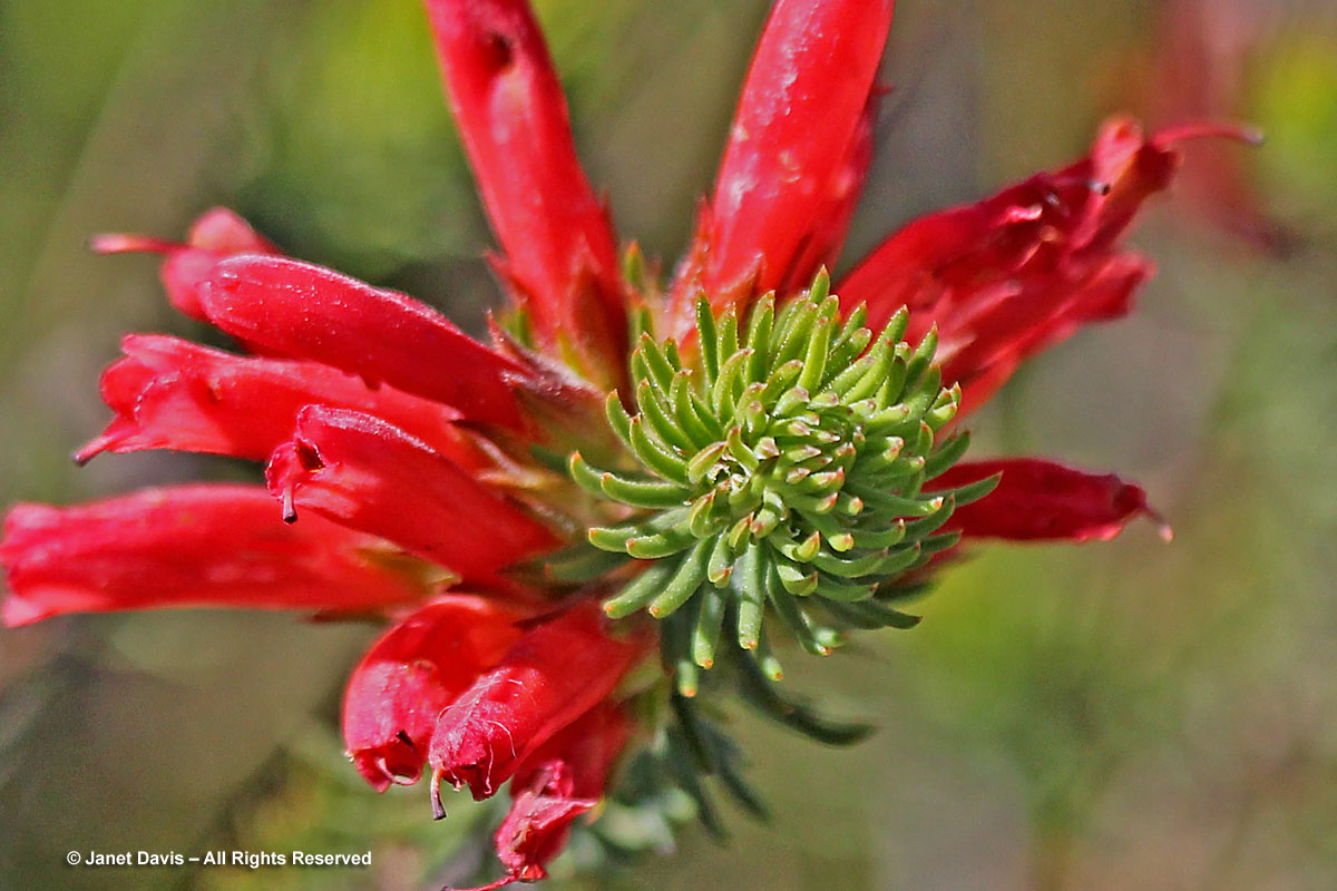
And the Peninsula conebush (Leucadendron strobilinum), so called because its flowers look like pine cones.
Golden coulter bush (Hymenolepis parviflora) is growing everywhere.
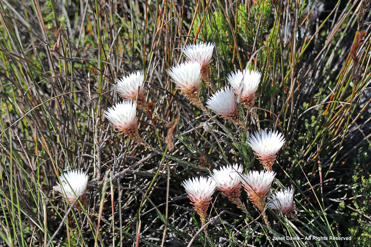
And of course there is lots of the strawflower-like white everlasting (Edmondia sesamensis) seen throughout the Western Cape.
Perhaps the best way to see the myriad and marvelous flora of Table Mountain is to find someone who knows it well, loves plants and writes beautifully about them. That description would fit writer/photographer/forager Marie Viljoen, former Capetonian (ex-Brooklynite and now Harlem, New York resident) who goes “home” frequently and hikes the mountain with camera in hand. For those who want to see a little more of the Cape Fynbos flora, this is what you might find on a winter hike, i.e. June in North America. Treasures abound in the January summertime, too. And this remarkable flowering of fire liies from the ashes is what happens after wildfires like those of winter 2015. (And if you want a lovely New York photography-cookbook, consider buying Marie’s wonderful book 66 Square Feet: A Delicious Life, One Woman, One Terrace, 92 Recipes.)
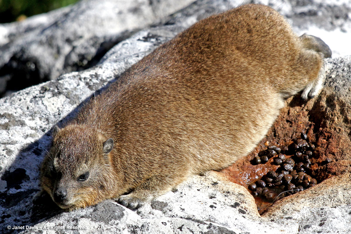
Our time on the mountain is drawing to an end but as I walk back to the cableway station I spot a rock hyrax (“dassie” in Afrikaans) lying, appropriately enough, on a rock. Though you might be tempted to think this animal is related to the groundhog or guinea pig or some other furry creature, DNA testing has revealed the startling fact that his closest relative is the elephant. This dassie is a sentry for his nearby den and will spend long periods of time lying on this rock watching for predators (eagles are common), but also basking in the sun in order to manage thermoregulation, which is known to be poor in this species. By the evidence it would appear he’s been hanging out here for quite some time but, in fact, dassies create latrines in hollowed-out rocks or crevices and use those places faithfully. However, it’s not until I return home and start researching that I am filled with delight at having captured not just the animal, but his excrement. For the dassie’s accumulated, dried deposits (combinations of feces and urine) are called hyraceum, an aromatic substance that is the prized ingredient in many perfumes.
And on that fragrant note, I bid you adieu until the next time (which will be a city tour of Cape Town.)