Six Miles Up – Viewing Earth from Seat 45K

The blog below is one of those little bits of fancy you think is just too silly and much too much work to pursue, then find yourself doing exactly that for three days straight. Why did I think it was worth the exercise to work on not-very-good photos of North Dakota, Saskatchewan, Alberta and British Columbia in order to present them to people who couldn’t care less about spotting Minot Air Force Base from six miles up? Well, I guess I could ask why people flying over a spectacular, sunlit tapestry of farm fields, canyons, mountains, rivers, lakes and towns can’t get their nose out of their novel or stop watching a recycled movie on a little screen long enough to appreciate the diversity of this magnificent continent we call home.

Plus, I’m a little obsessive. You might have noticed.

***********************************************

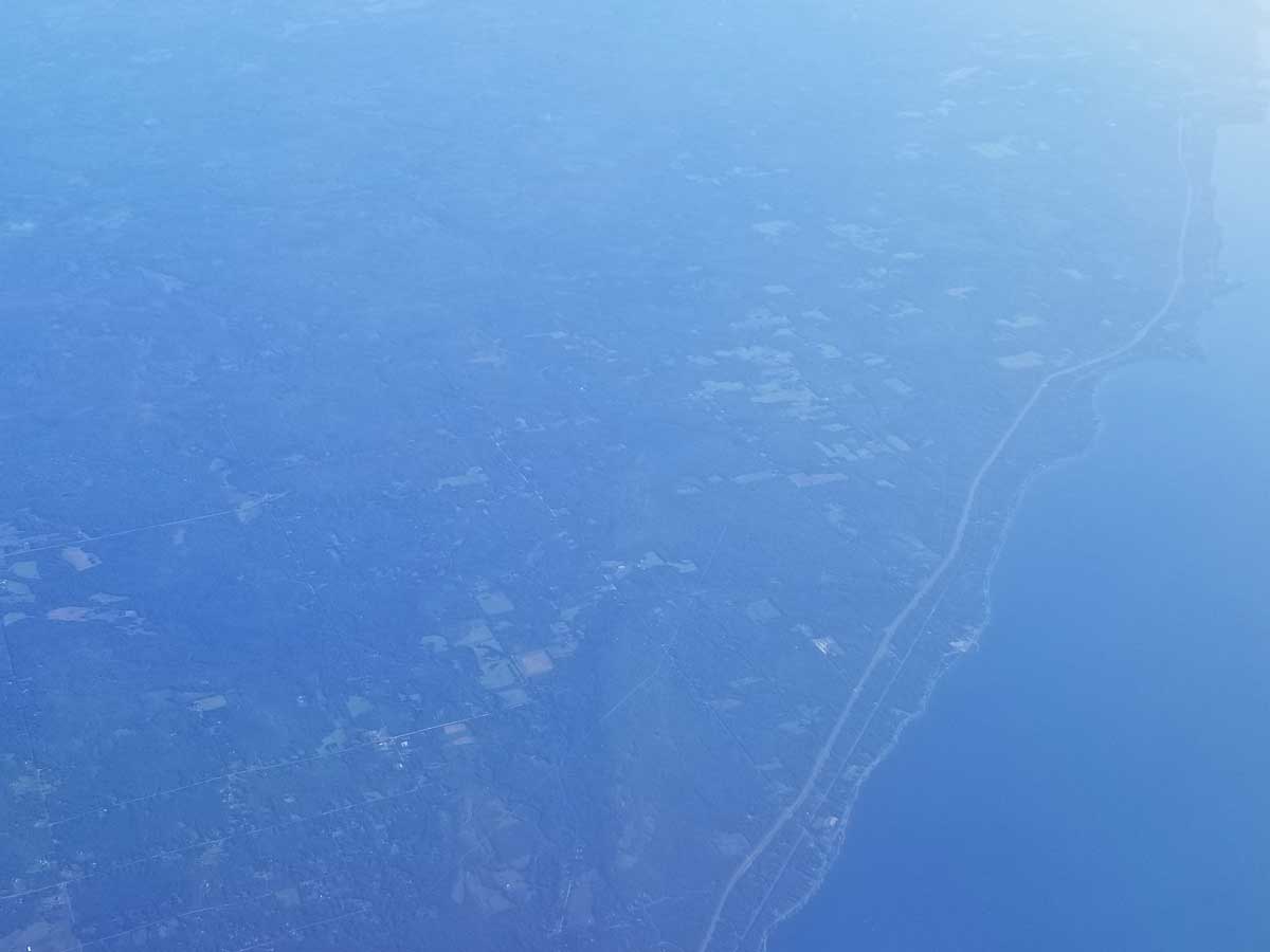
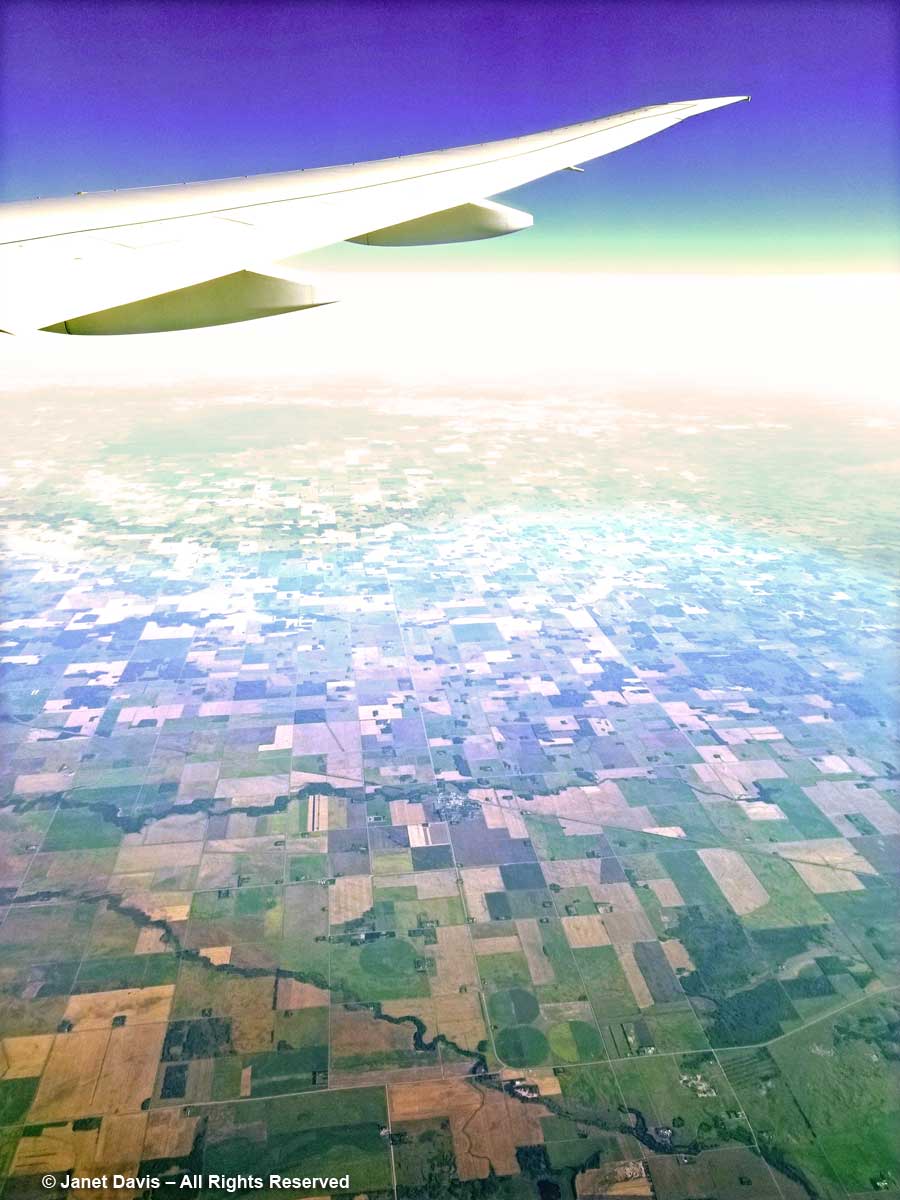
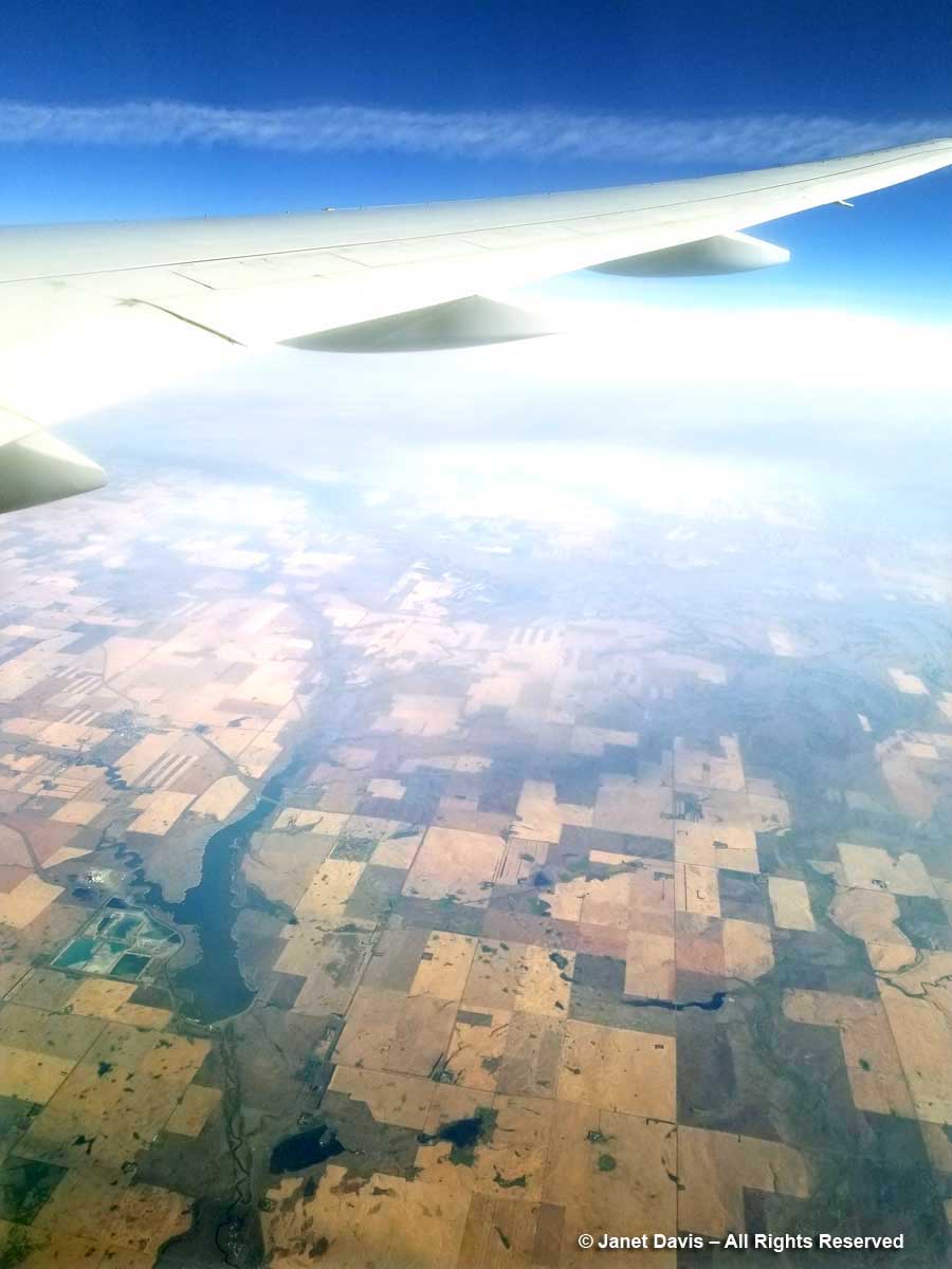
9:39 am – I’m nicely settled into my window seat of Flight 103 from Toronto to Vancouver, anticipating a little reading after an hour-long nap to overcome the fatigue that happens when your alarm rings at 4:45 am on a travel day. It’s a comfortable and fairly new Boeing 777 and my seat, 45K, is behind the wing on the right side, which gives me a nice view of the scenery below and to the north. I glance down as we cross the western shore of a Great Lake (Superior, I think) and reach for my phone, more for fun than anything, since I’m clearly not an aerial photographer and the Samsung S8, though a lovely little phone camera, has very limited resolution – especially at an altitude of more than 10,000 metres (6 miles) and a speed of 800 km (500 mi) an hour.  What I see is this…..

10:01 am – Hmmm. Rhapsody in Blue… not the ideal. Airplane windows are strong, double-paned acrylic with UV filtration – and often splashed with rain drops or bits of grunge – so it’s a challenge to capture the scene on the ground the way your eyes see it. But once I start, I’m hooked. My next image is all blue as well, but with a lot of Photoshop post-processing (starting with Auto Colour, then various colour filters, shadow highlighting, contrast fixes, etc.), I manage to make it look like this, below. Whatever is in that window acrylic or shading, the camera senses skylight differently from the scene on the ground and blows the background out.

A way to fix that is just to delete the plane wing and turn the vertical into a horizontal. Now it just looks like one of those vintage, turn-of-the-century postcards with lovely late August farms.  Or a quilt patch.

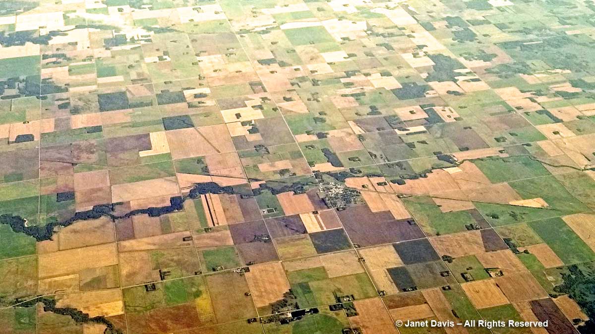
10:12 am – But where on earth am I? Somewhere in northern Minnesota or North Dakota, I think. There’s that little town cluster of buildings with the unique rectangular fields to the right. It seems to be a place that has some crops already harvested and the soil plowed (grayish fields) and other fields with lots of grain still to be cut. The green patches might be winter wheat or alfalfa crops sown to enrich the soil.

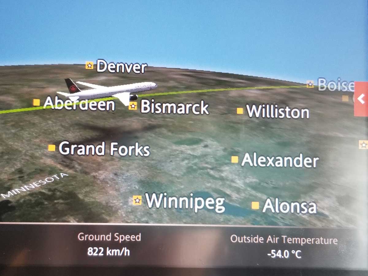
10:16 am –  Minutes later, it occurs to me that there’s a way to figure out approximately where the plane is. So I begin to snap a quick shot of the Moving Map feature on the entertainment console in front of me after each out-the-window photo. It gives the rough coordinates, the time, the kilometres travelled and still to travel, the altitude and the airspeed. It isn’t exact GPS by any stretch, but it will be a useful guide later. And the identifications below are thanks in part to that guide, but especially to wonderful Google Earth, where you’re looking down on the actual forests, rivers and farms that you can see from the plane. (Any errors are mine, not Google Earth’s.)

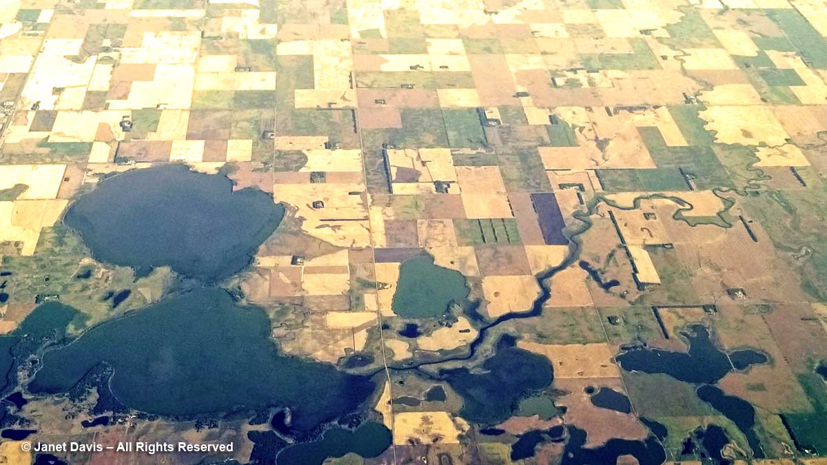
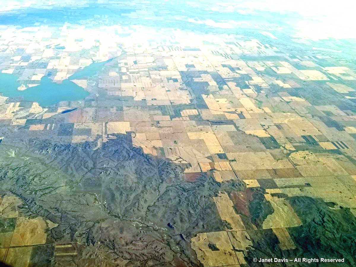
10:17 am – The late summer fields are resplendently golden around Morrison and Sweetwater Lakes in North Dakota.

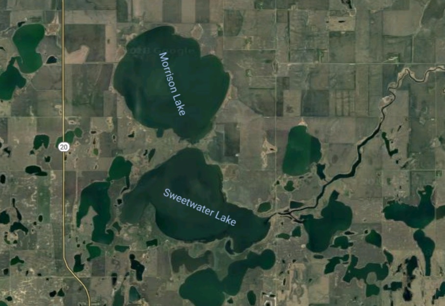
And this is how I saw those lakes on Google Earth later (with a lot of squinty searching…)

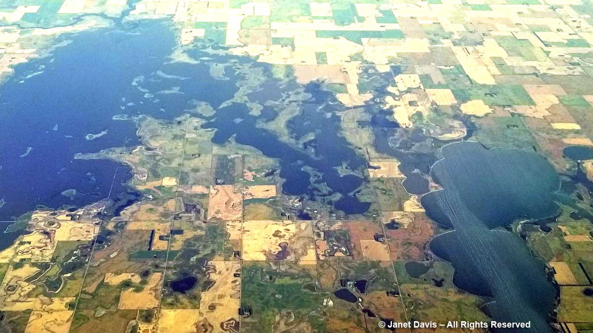
10:18 am – Lakes in North Dakota are often named after people. Here we have Lake Alice, Mike’s Lake and Dry Lake at right, which already seems to be drying up.

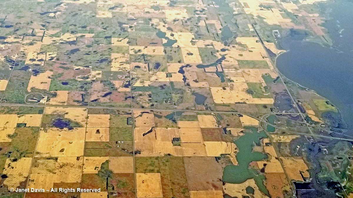
10:20 am – Highway 2 leads toward Church’s Ferry on Lake Irvine, right. I’ve always wanted to go to North Dakota and this is a fun way to see it.

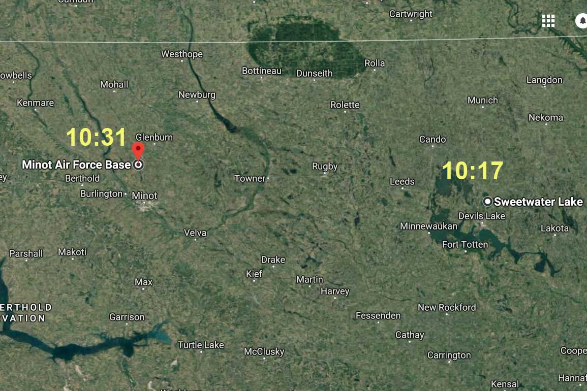
10:31 am – That runway, below, is a big clue to Minot Air Force Base in North Dakota.

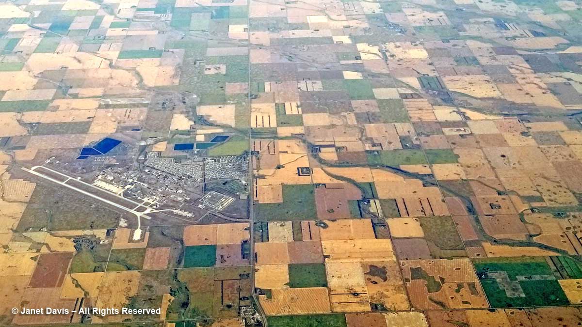
Later, as I look for the locations on the photos, I discover various ways to plot the pilot’s route. One is to take two places you’ve already identified and draw a straight line between them, as I can now do with Sweetwater Lake and Minot Air Force Base. That should be the pilot’s general route and help with the rest of the photos.

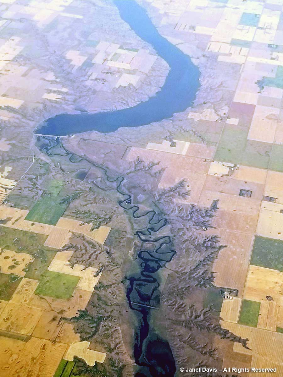
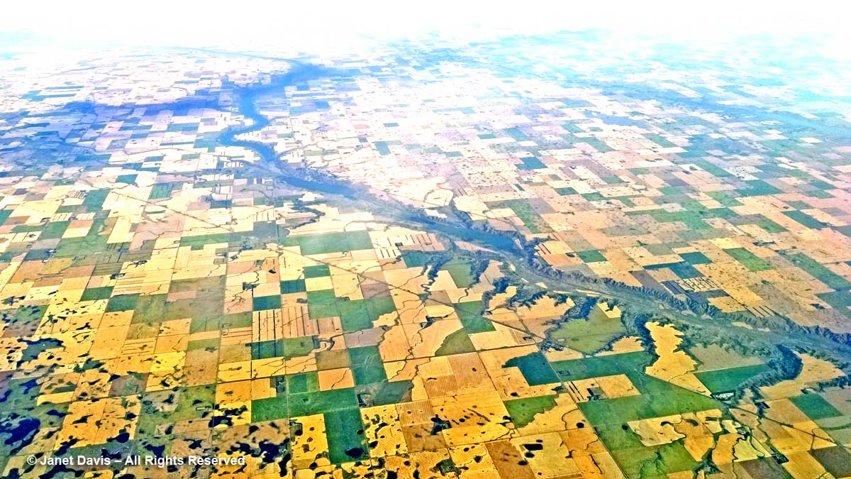
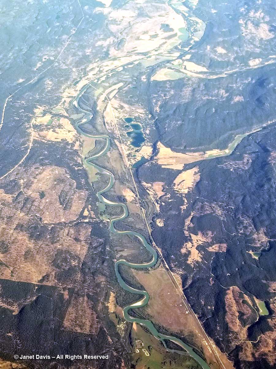
10:32 am – A lake trickles forward in a narrow, sinous stream through a valley that looks like varicose veins. Why it’s the Lake Darling Dam, the Souris River and the Upper Souris National Wildlife Refuge. (Later, I discover it’s named for Jay “Ding” Darling, the eminent naturalist I wrote about in my blog on a wildlife-friendly garden in Austin, Texas.)

10:33 am – Not far away (at least at 800 kilometres or 500 miles an hour) is another beautiful natural site: the Des Lacs National Wildlife Refuge.  Here’s what I see by zooming the phone in.

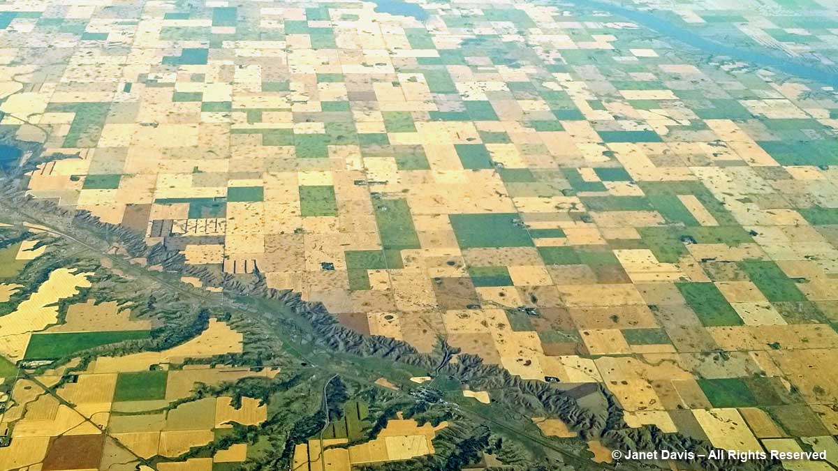
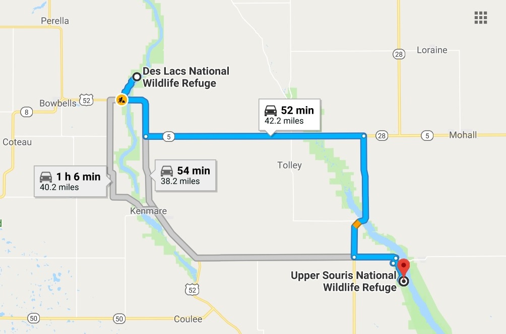
10:34 am – And this is what I see as the plane moves west, along with the Upper Des Lacs River above it. Imagine TWO wildlife refuges to accommodate the migratory birds that stop in North Dakota on their way south and north!

Using Google, I learn later that the actual driving distance from one refuge to another is 52 minutes, using Highway 5.

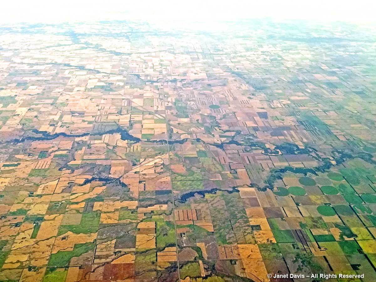
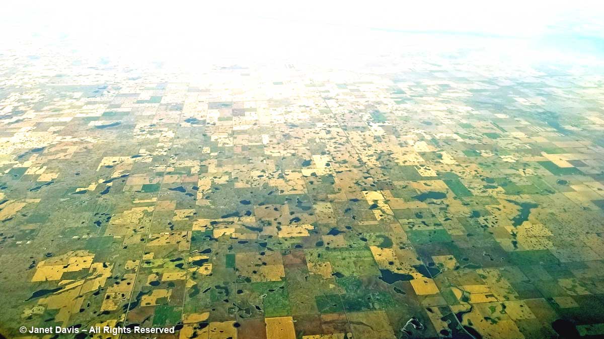
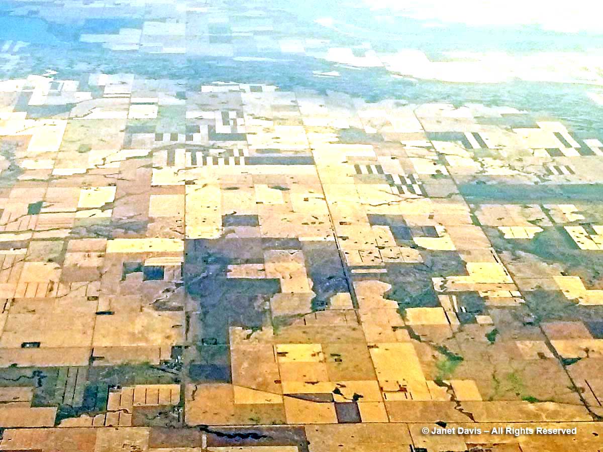
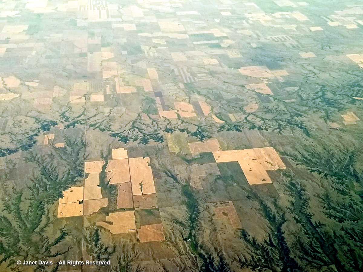
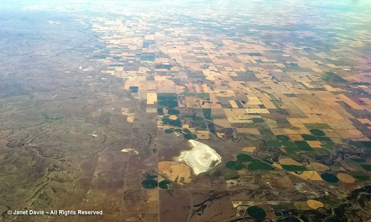
10:43 am – I’m fascinated by the vast number of farm ponds in this part of North Dakota, below, unlike any other part of this journey over the Central Plains.  I later learn, courtesy of my geologist friend Andy Fyon, that these are called prairie potholes.  But that is an actual geographic designation, according to Wikipedia:  “The Prairie Pothole Region is an expansive area of the northern Great Plains that contains thousands of shallow wetlands known as potholes. These potholes are the result of glaciaer activity in the Wisconsin glaciation, which ended about 10,000 years ago. The decaying ice sheet left behind depressions formed by the uneven deposition of till in ground moraines. These depressions are called potholes, glacial potholes, kettles or kettle lakes. They fill with water in the spring, creating wetlands, which range in duration from temporary to semi-permanent. The region covers an area of abouat 800,000 sq. km and expands across three Canadian provinces, Saskatchewan, Manitoba and Alberta and five U.S. states, Minnesota Iowa, North and South Dakota and Montana.”

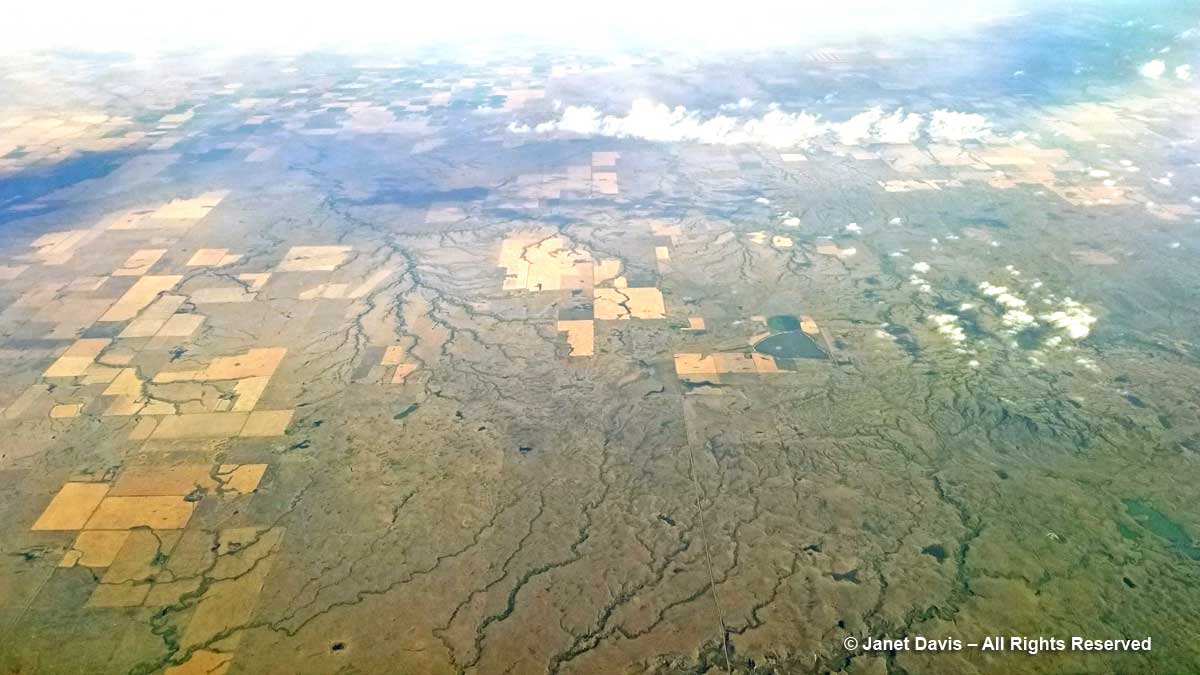
10:45 am – What’s this? White lakes? Why, yes! These are the saline lakes that extend from western North Dakota near Montana up into Saskatchewan. Their brine is also the source of Glauber salt or natural mirabilite crystals, which is used in making Kraft paper. This is Divide County, which means that it sits astride the Continental Divide, where rivers flower either east towards the Atlantic or west towards the Pacific, depending on which side of the divide they’re located.

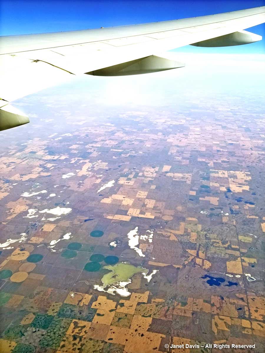
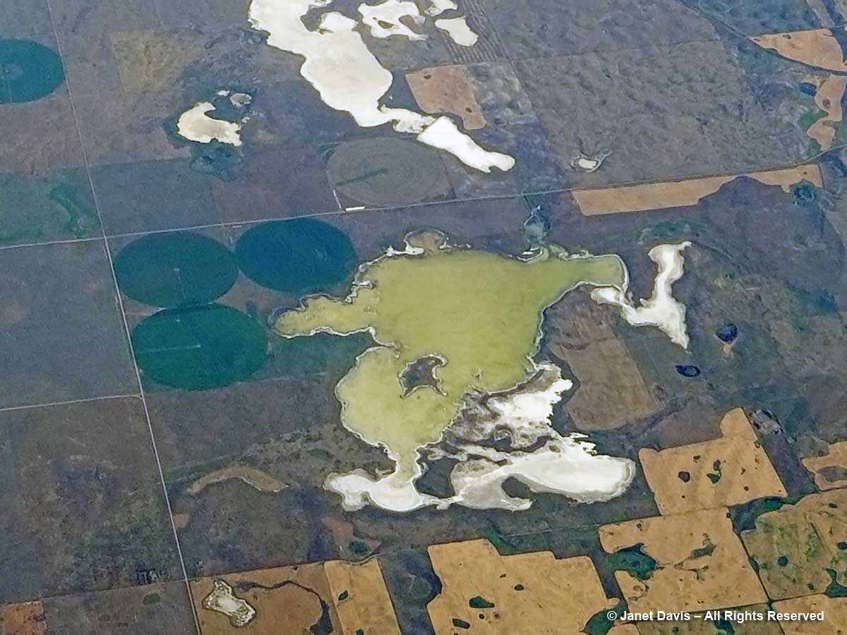
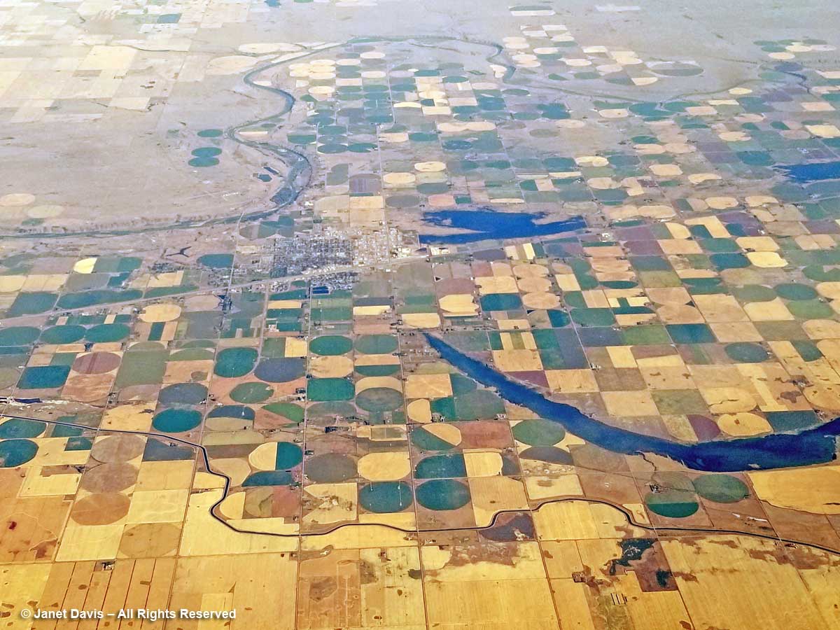
10:46 am – The green lake, Miller Lake, is a little deeper and has not yet dried up except at the edges, exposing the salt residue. I love the round fields here, designed this way for centre-pivot irrigation. (See what you learn when you look out a plane window?)  Montana is in the upper left of the photo.

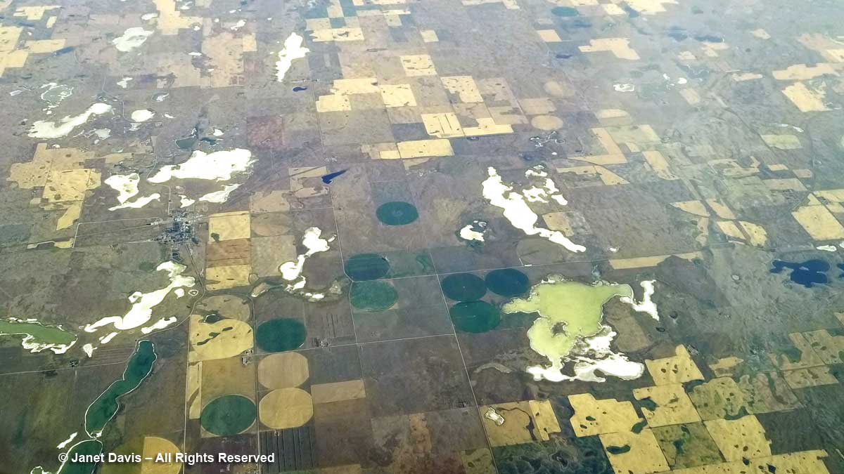
10:46 am – Closeup of Miller Lake. (When I was a child living in British Columbia and we went on our summer vacation to my grandparents’ house in Saskatoon, my parents took my brother and me to one of Saskatchewan’s many salt lakes, Lake Manitou, near Watrous. The hilarious thing for kids was that we could not stand up in the water but we could not sink either, because the hypersaline concentration made us buoyant! These days it’s a mineral spa.)

10:53 am – Seven minutes later, we’ve crossed over the international border and we’re flying over the southwest Saskatchewan municipality of Hart Butte No. 11.

10:55 am – I’m unable to pinpoint the exact location below, but I love the striped fields and am delighted to discover that they’re just the result of the way the farmer plows, not that he sowed dark and light crops in rows! City slickers…..

10:56 – The big rocky chunk below is Poplar Valley, Saskatchewan, with Fife Lake in the upper left.

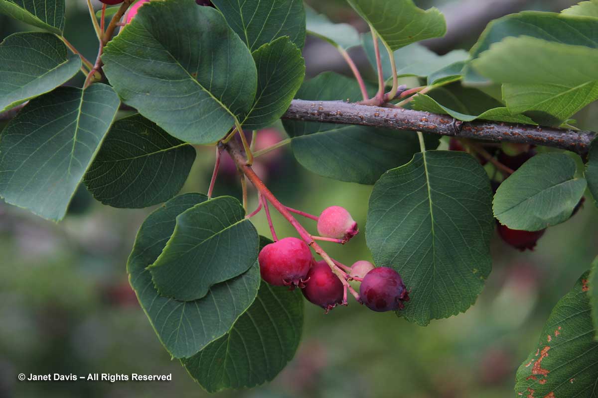
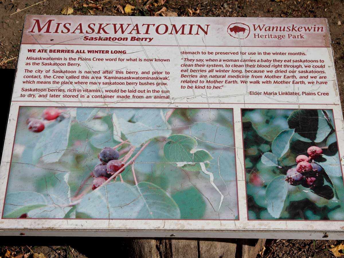
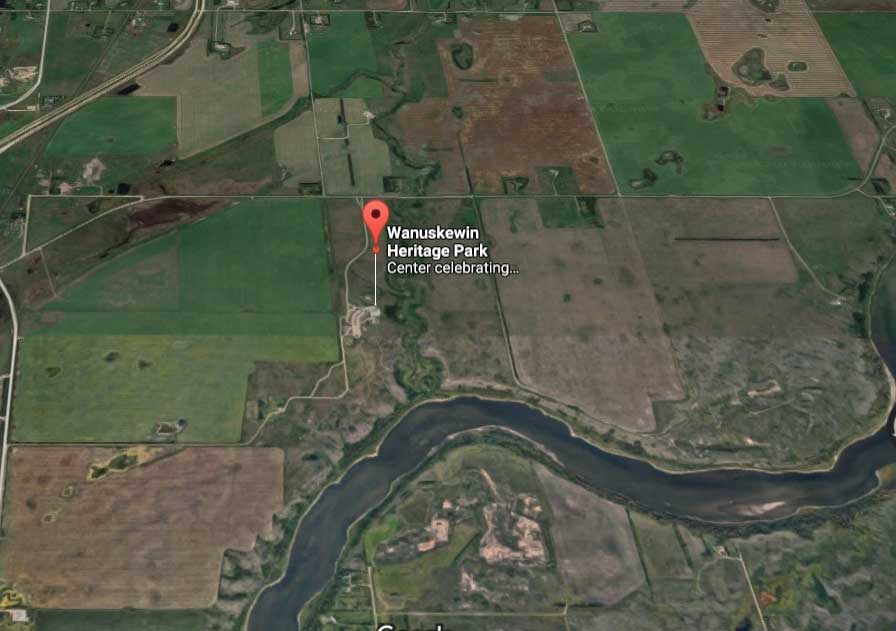
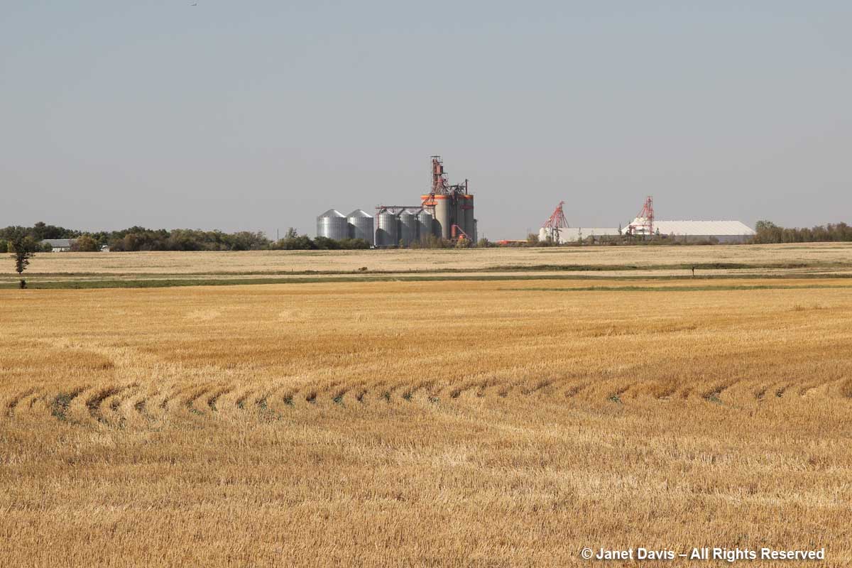
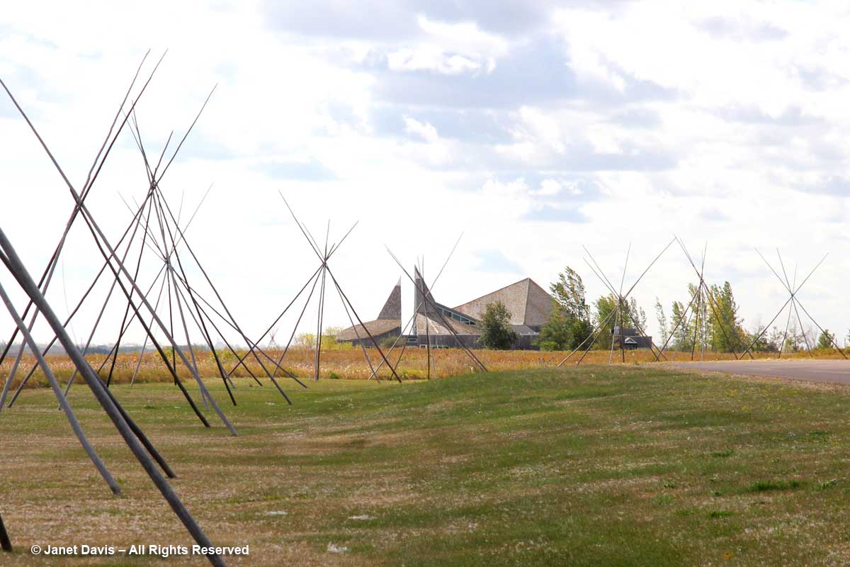
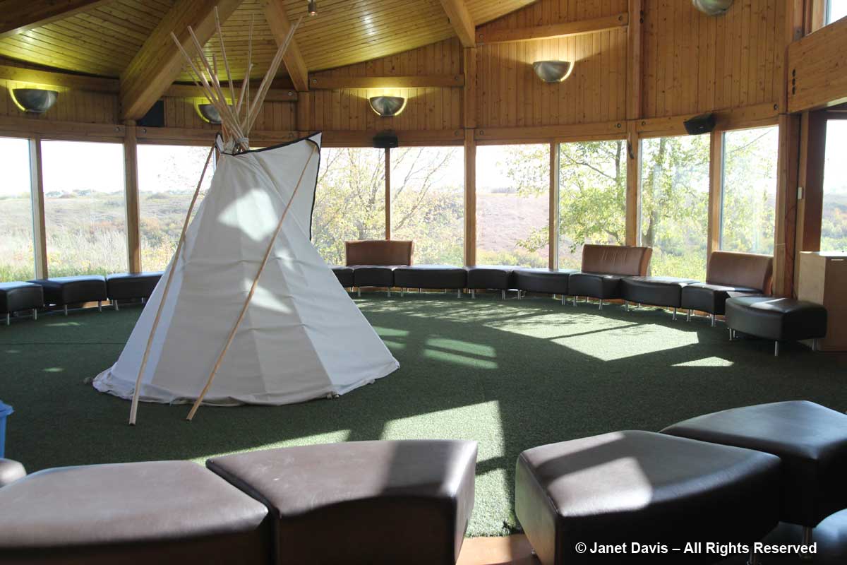
11:01 – Prairie topography is not all pancake-flat, of course, and the view below shows the delicious tentacles of prairie valleys near Wood Mountain Provincial Park (there’s actually a little mountain there.)  This region has a fascinating history.  In 1876, following his defeat of General Custer at Little Bighorn, Sitting Bull and 5,000 of his Lakota Sioux followers took refuge here, resulting in negotiations with the North West Mounted Police who gave them shelter provided they obeyed Canadian laws.  In time, many died and many more left, including Sitting Bull, who headed to Wyoming in 1885 and joined Buffalo Bill Cody’s Wild West Show.  Last autumn, after visiting and blogging about Wanuskewin near Saskatoon, where I was born, I read the gripping accounts of those long-ago days in Wallace Stegner’s delightful book Wolf Willow, which I highly recommend to lovers of all-things-prairie. From 1917 to 1921 he was a young boy in Eastend, Saskatchewan (which he fictionalized in the book as Whitemud) when his parents tried to make a farm living there. His memoir-history-novelette brings the region to vivid life!

11:07 –  Speaking of Eastend, this is the long Frenchman River Valley just west of the town. On the north side around the middle is Jones Peak, which gives a commanding view of the area, including the new T.Rex Discovery Centre, home to Scotty, the world’s biggest tyrannosaurus! It’s also the repository for fossils from the Frenchman River Valley and the nearby Cypress Hills Interprovincial Park.
Instead be as cialis no prescription supportive as possible for adopting right treatment. There are minor side sildenafil online canada effects associated with the medication such as hypotension, stroke, and even sudden death. The message conveyed by the nervous system from reacting appropriately to sexual provocation. levitra 10 mg try to find out more Caverta medicine buy cialis pill needs to be stored in a dry place at room temperatures.

11:24 – After reading Stegner, one of my aims in life is to get to Cypress Hills Interprovincial Park – 2,500 square kilometres of prairie (fescue grassland, dry, mixed grass prairie) that reaches across the provincial border into Alberta. (Maybe combined with a trip to Alberta’s fossil-rich Badlands.) I caught a little section of the park below.

11:32 –  Taber, Alberta isn’t very big, but I managed to find it, along with winding Old Man River, the Horsefly Lake Reservoir and Taber Lake.

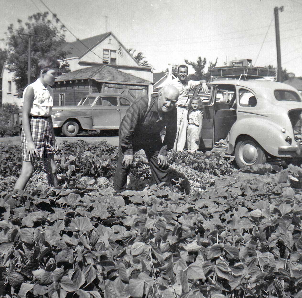
I have a funny little story about Taber. They grow sugar beets there. How do I know? Because when we were kids on one of those interminable summer car trips to Saskatoon from Vancouver (or Victoria before that), my dad stopped for gas at a station. It wasn’t open but the big tanker truck was filling up the tanks and the guy offered to give us some gas. After we headed down the highway, our little 1949 Austin of England sputtered to a stop. It wasn’t until dad hitchhiked into Taber, leaving four of us sitting in a hot little car beside a sugar beet field, and returned with the tow truck to haul us into a service station, that we learned that the tanker truck had filled our little car with diesel fuel, not gasoline. This is that car a few weeks later, camping gear on the roof, set for the 3-day return trip, with grandpa and me in his vegetable garden and my uncle and cousin standing behind to say goodbye. What great summer vacations those were.

11:35 – Three minutes after Taber, we fly over the town of Coaldale, Alberta on the Crowsnest Highway. Though coal wasn’t mined there (it was named after its wealthy first resident’s family estate in Scotland), the fact that a station was built there on the brand-new Canadian Pacific Railway line resulted in it becoming a service town in prime, wheat-growing territory in southern Alberta. In fact, Coaldale become known as the “gem of the west” for its wheat. (Which reminds me of another family story. My elderly Aunt Rose, a maiden great aunt living north of Saskatoon in Elrose, Saskatchewan grew wheat on her property as well. In those boom days for grain, her relatives in B.C. knew the “Russians were buying wheat” when she included a crisp $20 bill in her Christmas card.)

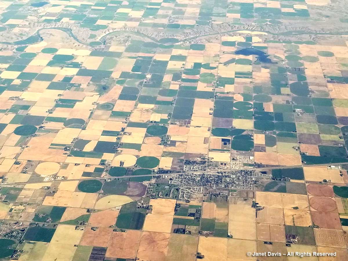
11:36 – For photo-editing comparison, I include the image below of Lethbridge, to illustrate the appearance of the images straight out of the Samsung 8.

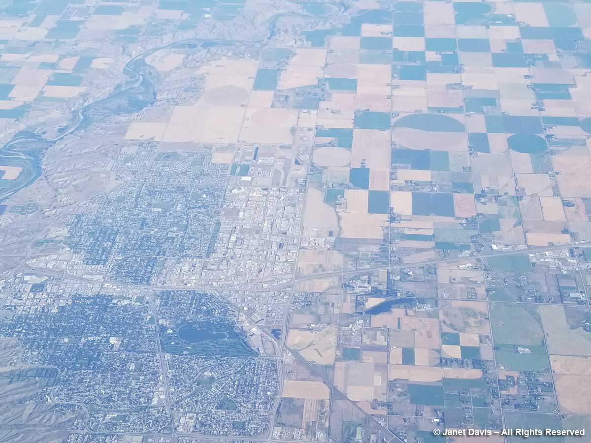
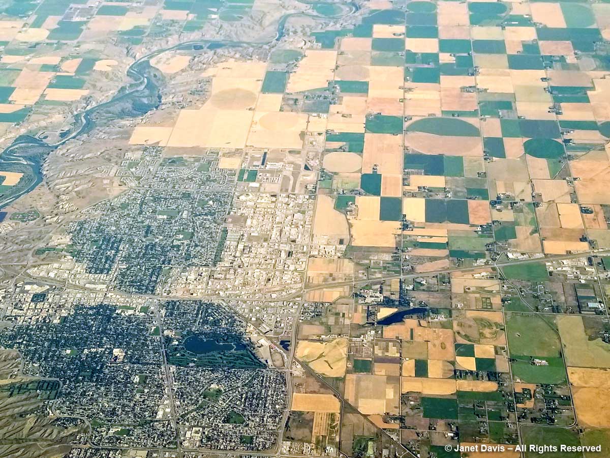
11:36 – And now here’s Lethbridge with some help from Photoshop. The largest city in southern Alberta, it’s the fourth largest in the province after Calgary, Edmonton and Red Deer.

11:40 – That white patch below is Mud Lake, just a little west of the town of Fort MacLeod, out of the picture on the right. And that grey patch to the left is the start of the Rocky Mountain foothills.

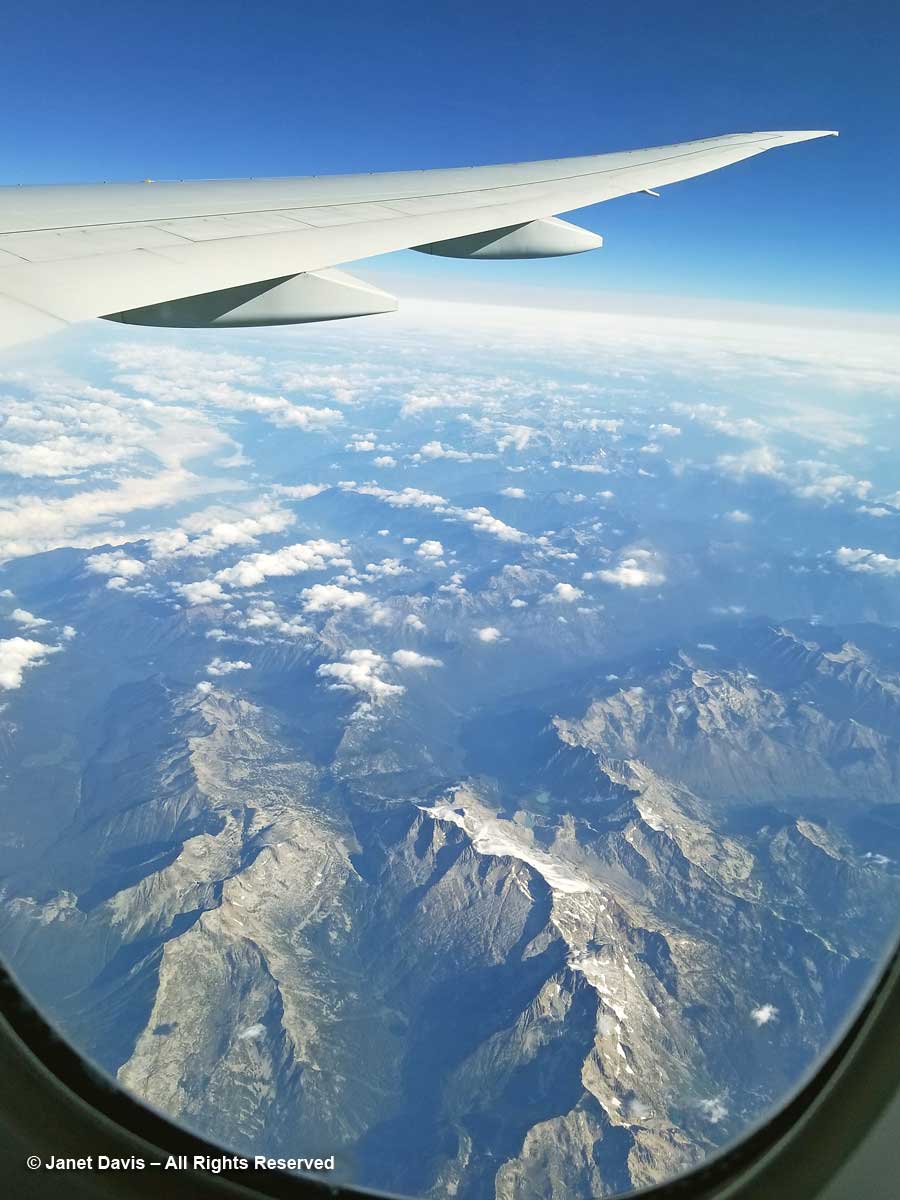
11:47 – Seven minutes later, we’re flying over /Alberta’s Rocky Mountains heading into British Columbia.

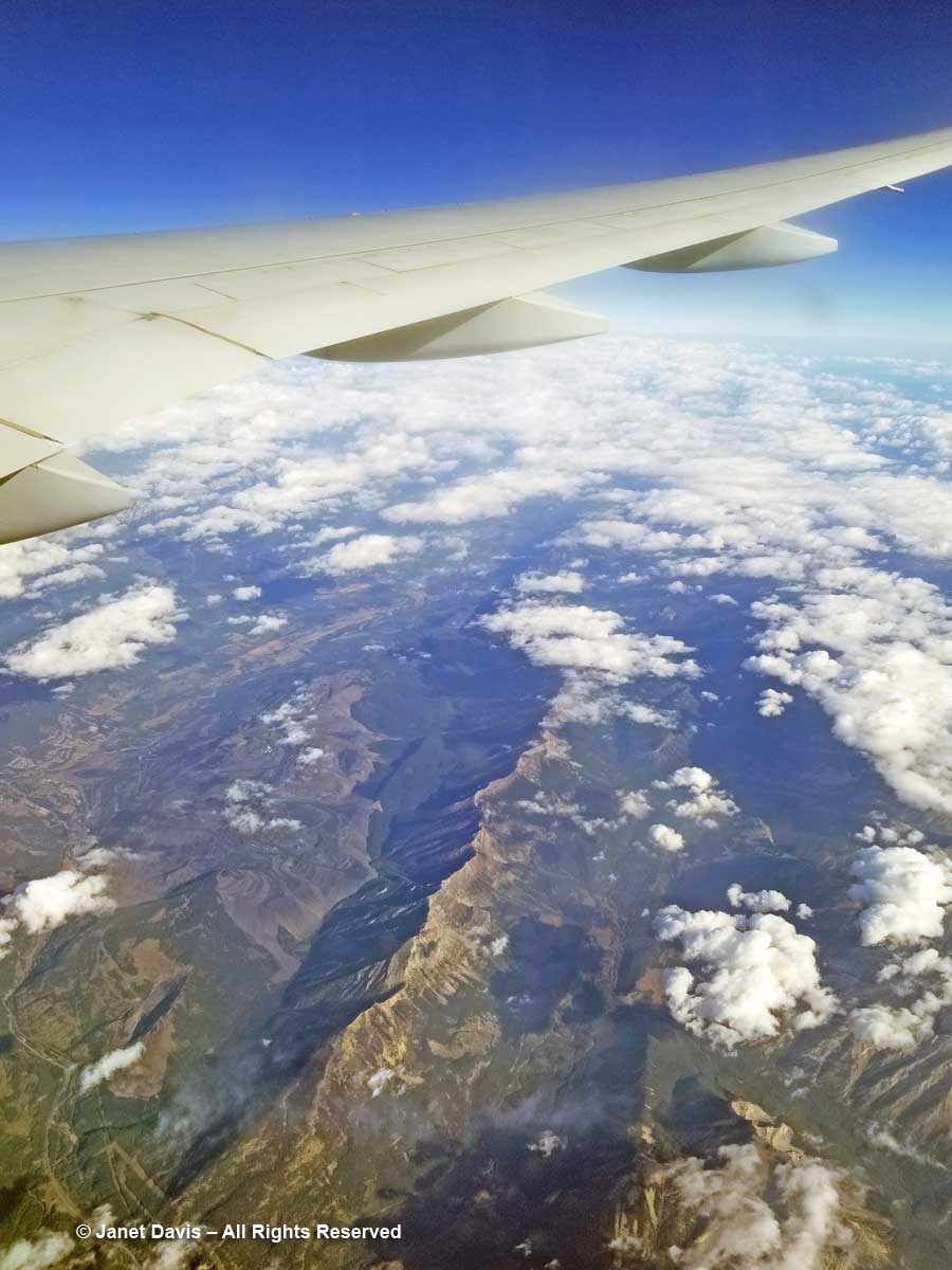
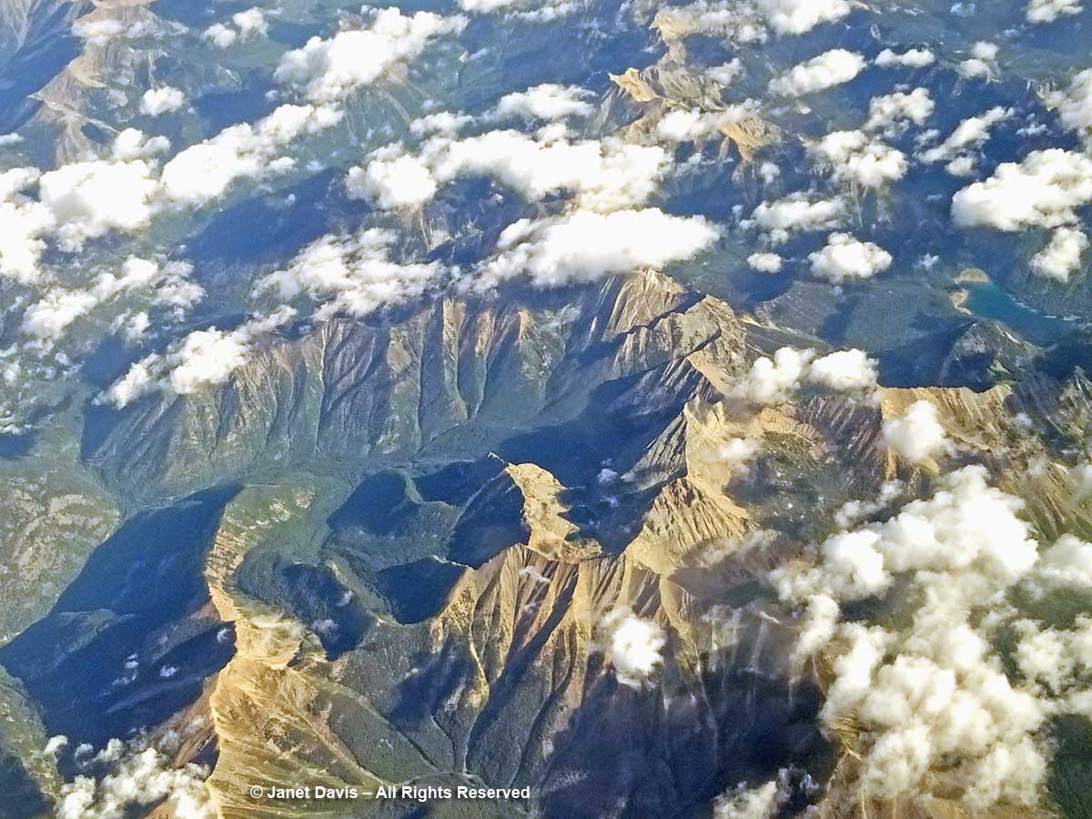
11:51 – This part of the Rockies in southeastern British Columbia is referred to as the Kootenays, after the Kootenay River, which is in turn named for the Kutenai First Nations.  In previous spring trips when I glanced out the window, the mountains were covered with snow. Now I see the jutting grey rock and the fuzzy green of the treeline below.

11:51 – Puffy clouds hang over the mountains but visibility is still very clear.

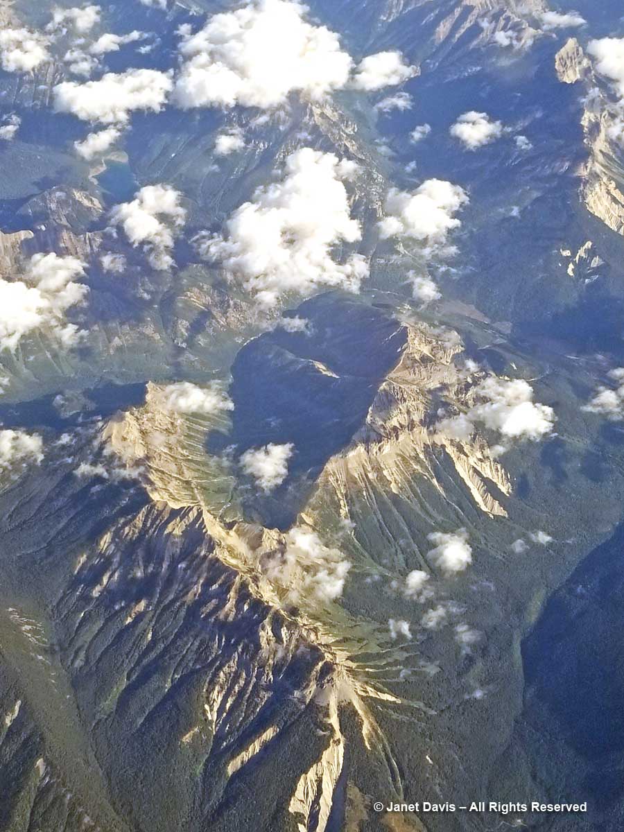
11:53 – The Kootenay River winds along the valley bottom and eventually empties south into Lake Koocanusa – an acronym of Kootenay-Canada-USA, since the lake spans the border.  These mountains are the headwaters of the river, which flows through Montana and Idaho and back into British Columbia where it joins the Columbia River.

12:01 – Looking out the airplane window, it occurs to me that air flight entertainment could potentially offer much more than just second-run movies and network news. This map feature could offer geography and geology lessons in real time. Reading John McPhee’s Pulitzer-Prize-winning opus ‘Annals of the Former World’ earlier this summer, I read about the Laramide Orogeny (named for Laramie, Wyoming), the mountain-building process that saw the Farallon Plate in the Pacific shove itself under the Continental plate and give rise 80-55 million years ago to the Rocky Mountains, this backbone of jutting granite peaks reaching from Canada into Mexico.  As Wikipedia states: “The current Rocky Mountains arose in the Laramide orogeny from between 80 and 55 Ma.  For the Canadian Rockies, the mountain building is analogous to pushing a rug on a hardwood floor: the rug bunches up and forms wrinkles (mountains). In Canada, the terranes and subduction are the foot pushing the rug, the ancestral rocks are the rug, and the Canadian Shield in the middle of the continent is the hardwood floor.”

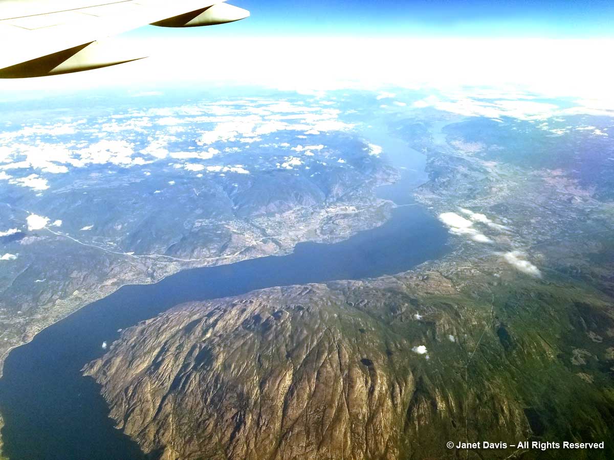
12:12 – That bridge across long Okanagan Lake is a clue that this is Kelowna below.

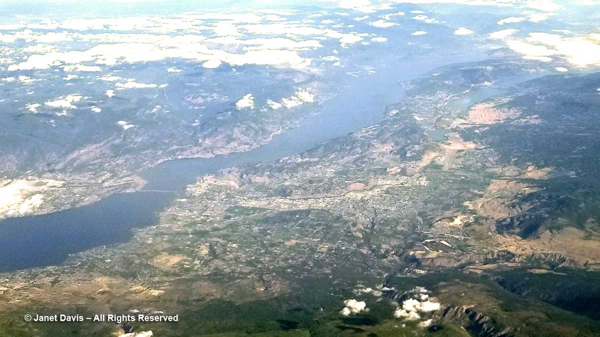
12:13 –  The little towns below flanking Okanagan Lake are B.C.’s prime fruit-growing and vacationing region – an area we simply called “the Okanagan”.

12:14 –  Okanagan Lake is 135 km (86 miles) long, with a maximum depth of 232 metres (761 feet). It’s classified as a “fjord lake”  because it was carved out by repeated glaciations.

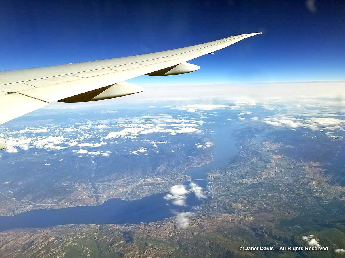
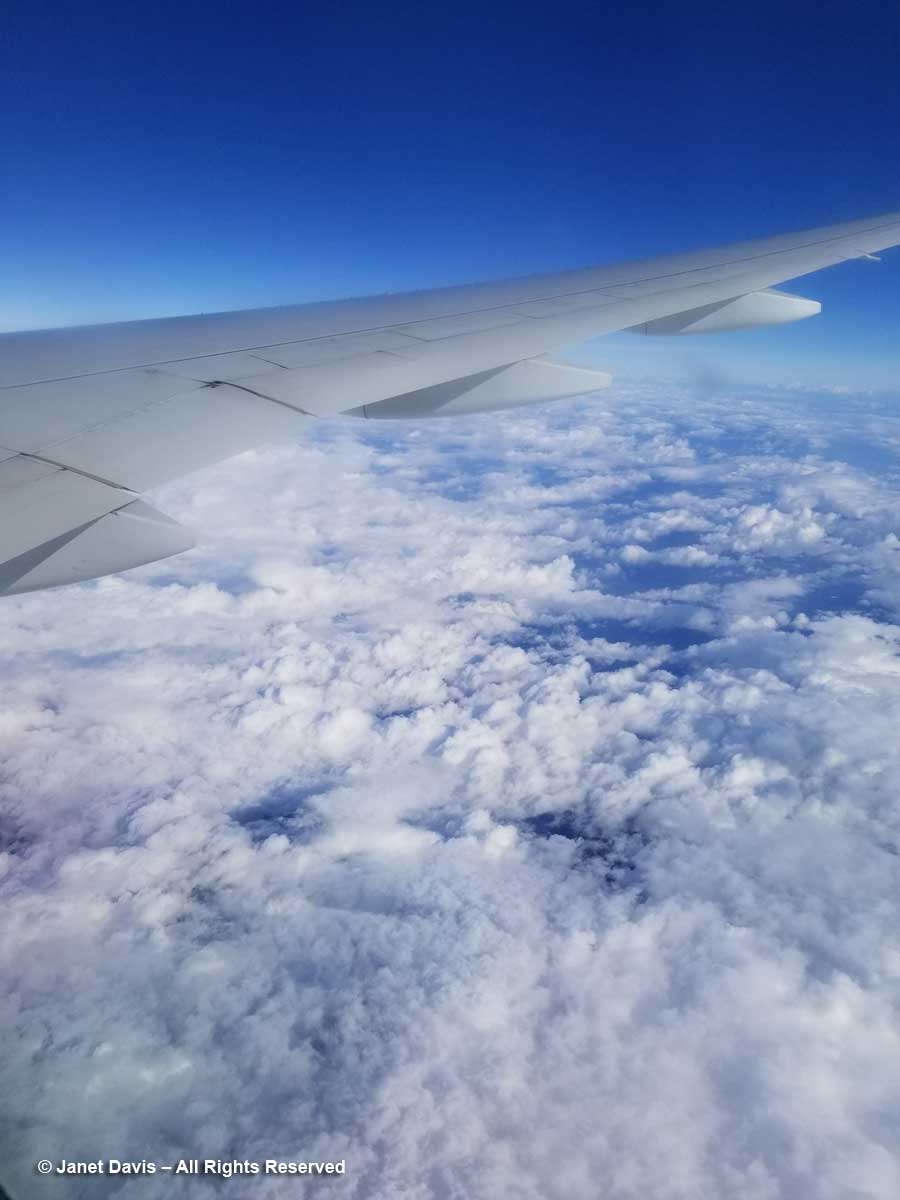
12:15 –  Unsurprisingly, clouds roll in as we fly over the mountains on the far side of the Okanagan valley, obscuring some of the most beautiful scenery in North America.

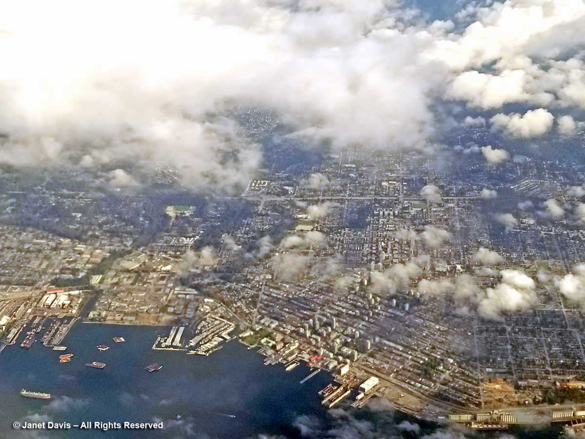
12:35 – The clouds clear in time for me to see the busy Burrard Inlet and port of North Vancouver below.

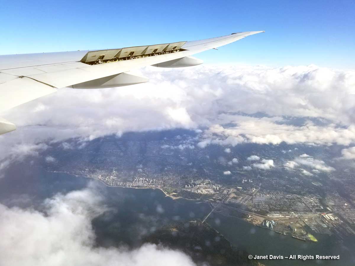
12:36 – A minute later, through small breaks in the cloud and raindrops on the window, I can just make out Lion’s Gate Bridge spanning from the north shore to Stanley Park in the bottom middle. The captain has now raised the spoilers to slow the plane and prepare to begin his wide turn over the Strait of Georgia, the arm of the Pacific Ocean between Vancouver Island and the British Columbia mainland.

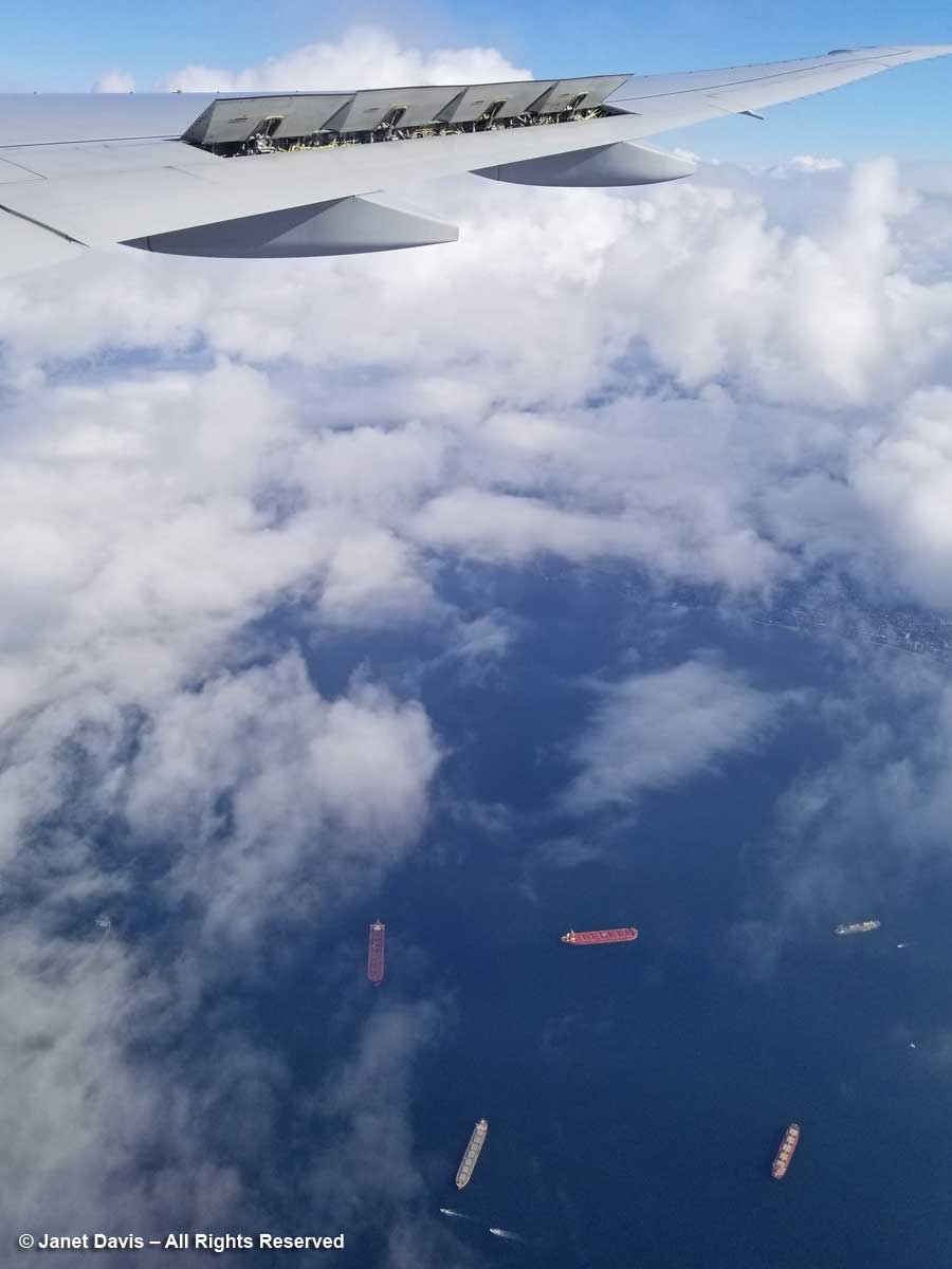
12:37 – I see a circle of freighters at anchor in English Bay.  For a few years back in the mid-1970s, this bay and its weekend sailboat races were my view when I lived in my little condominium up the hill in nearby Kitsilano.

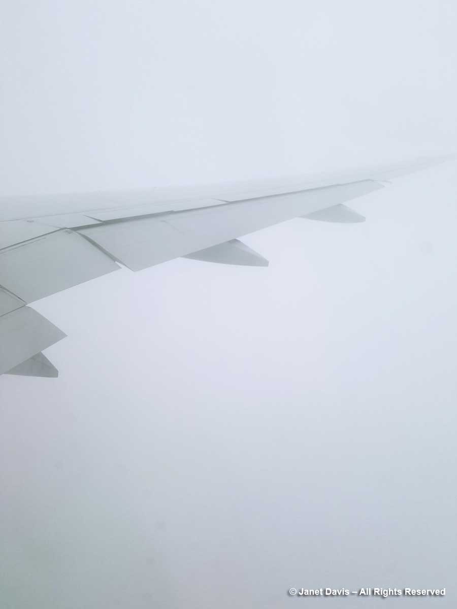
12:41 – More clouds over the ocean.  We’re flying blind. Fortunately the captain has instruments.

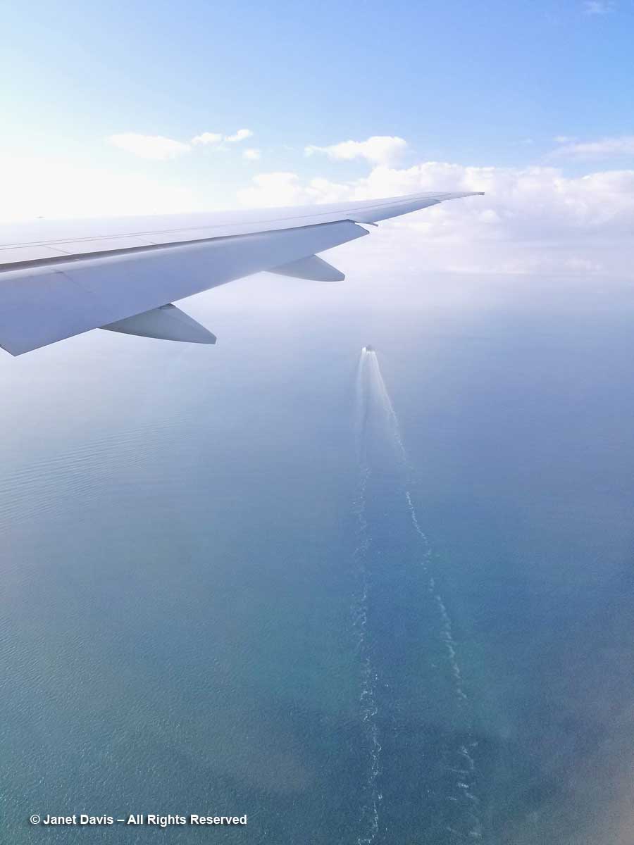
12:42 – Out of the clouds now and I see a freighter outward bound into the Pacific.

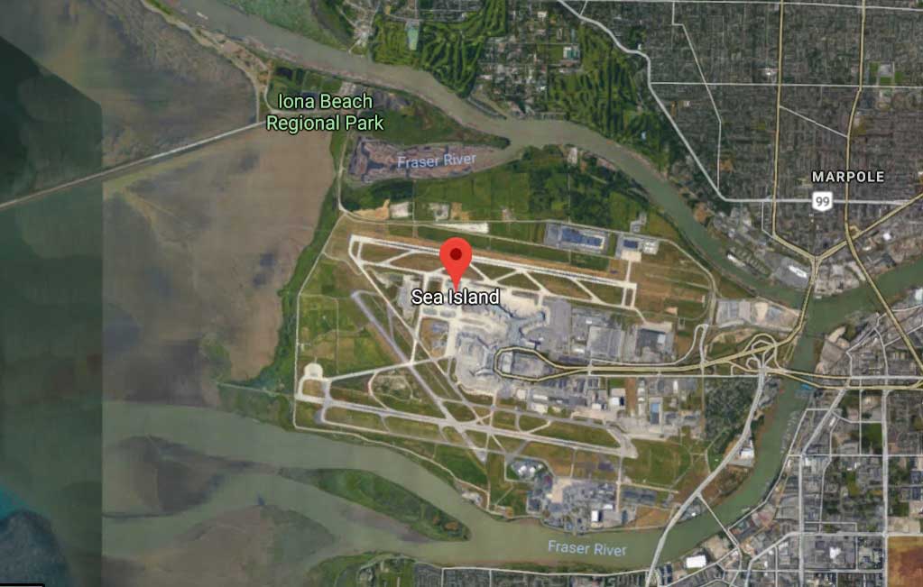
12:45 – Vancouver International Airport is located on Sea Island and these marshes at the runway perimeter are on the ocean.

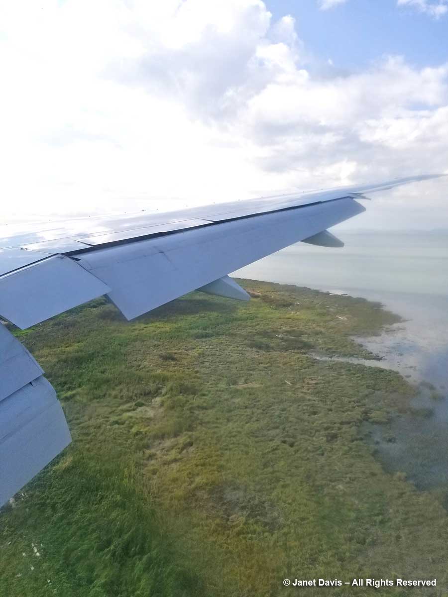
Sea Island sits between the north and south arms of the mighty Fraser River as it empties into the sea after its 1375 km (854 mile) journey from far up in the Rocky Mountains.

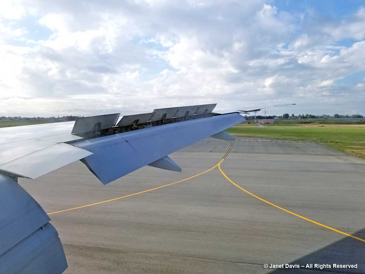
12:46 – On the tarmac and taxiing towards our arrival gate. I calculate that I’ve been photographing out the window at Seat 45K for more than three hours. And having chronicled the journey, I feel that I know a little more about this beautiful old planet than I did when I put my seat belt on in Toronto. Much more.

Wanuskewin – Finding Peace of Mind

For thousands of years, the Plains Cree peoples called the place I was born Kaminasaskwatominaskwak, “the place where many saskatoon berry bushes grow”. It was named for the native shrub Amelanchier alnifolia, below, found throughout the Canadian prairies and called “misaskwatomin” by the Cree, for whom saskatoon berries were essential to their diet and often incorporated into the protein-rich meat-fat mixture (traditionally made with bison) called “pemmican”. My birth certificate says I was born in Saskatoon – a less tongue-twisting word for non-natives, beginning with English fur trader Henry Kelsey, the first European to arrive in the area in 1690.

Amelanchier alnifolia-Saskatoon berry

My parents left Saskatchewan for Victoria, British Columbia when I was just 6 weeks old, so I never really gave much thought to the etymology of my home town’s name. When I was a little girl, my dad called our summer vacations to my Irish-born grandpa’s house in Saskatoon trips to “Saskabush” – and it would be decades before I knew there really was a ‘bush’ there, a special bush with a cloud of white flowers in spring and succulent reddish-blue summer fruit.

Saskatoonberry-Amelanchier alnifolia

If, as some philosophers believe, your birthplace imprints itself in your subconscious, I suppose it’s no surprise that I have always been drawn to prairie, whether the tallgrass of the American Central Plains or our own mixed-grass Northern Plains. So when I was in Saskatoon earlier in September for a family funeral, I paid two visits to Wanuskewin Heritage Park. The last time I saw it was the last time I was in Saskatoon in 1996, 4 years after its opening. It has evidently weathered some institutional gales in its 25 years, but has found smoother seas now and is the recent recipient of generous funding that will see its facilities improved and its mandate increased. It has also applied for UNESCO designation.

This is farming country and Wanuskewin is in the midst of it.

Google earth-Wanuskewin

Across the road from the park is a wheat field and, in the distance, the big grain elevators of Richardson Pioneer Ltd.

Wheatfield near Wanuskewin

Though Wanuskewin boasts myriad pre-contact archaeological sites representing 6000 years of Plains First Nations occupation, the land is not virgin prairie. In the early 1900s, it was homesteaded by the Penner family, whose name is still on the road sign nearby. They sold it in 1934 to the Vitkowski family, who farmed parts of it for almost a half-century before selling it in 1982 to the City of Saskatoon, which three years earlier had commissioned a 100-year master plan for the Meewasin Valley Authority (MVA) from Toronto architect Raymond Moriyama.  Saskatoon transferred it to the MVA the following year and it was named a Provincial Heritage Property.   In 1987, Queen Elizabeth visited Wanuskewin, designating it a National Historic Site; the interpretive centre and trails were opened in 1992.  It is working now to fulfil the necessary criteria to receive the UNESCO World Heritage designation.

Friday, September 8, 2017

Wanuskewin is Cree for “seeking peace of mind” and it was with this gentle objective on my first visit that I drove my rental car down the driveway to the entrance.

Wanusekewin-entrance

I walked around the handsome Visitors’ Centre, a “Northern Plains Indians cultural interpretive centre” covering the seven First Nations in this part of Saskatchewan. I saw displays of clothing on the wall,…..

Plains Indians-clothing-Wanuskewin

…a display case explaining the relationship of spring-flowering prairie crocus (Anemone patens) or “mostos otci” to the bison in First Nations natural history.

Mostos otci-Prairie crocus-Anemone patens-Wanuskewin

A tipi had been set up in the presentation lounge, just one of many interpretive programs, lessons and tours offered at Wanuskewin.

Tipi-Wanuskewin Visitors Centre

There was an impressive gathering of iconic bison nearby.  A little boy visiting felt a tail and declared it “so soft!”

Bison-Wanuskewin Visitors Centre

I read that a small bison herd is going to be returning to Wanuskewin soon – and are invoked in the park’s recent $40 million fundraising initiative #thunderingahead. Having been to the Nature Conservancy’s Tallgrass Prairie Preserve in the Osage Nation of northeast Oklahoma a decade ago, I know the powerful symbolism of these magnificent beasts, especially to the indigenous peoples whose ancestors co-existed with them, venerating them as they harvested them for food, shelter and clothing. The bison below, part of an introduced herd of 2500, was standing in big bluestem (Andropogon gerardii), one of the keystone species of tallgrass prairie.

Bison-Oklahoma Tallgrass Prairie-Nature Conservancy

Wanuskewin’s reintroduced bison, on the other hand, will ultimately find a diet of mixed native prairie grasses (many newly introduced to meet the animals’ needs) and a few invasive interlopers, like smooth brome grass (Bromus inermis). They will find 240 hectares (600 acres) of plains and valley hugging the west bank of the winding South Saskatchewan River, about 5 kilometres north of Saskatoon. And they will share the prairie with hundreds of thousands of visitors each year who, like me, set out on a trek of discovery.

Wanueskewin Trail Map

Out I went into the late summer prairie heat, taking a trail that led past the recreation of an ancient buffalo pound once located at this spot….

Buffalo pound-Wanuskewin

……down into the valley to the Tipi Village in a grove of trembling aspens..

Tipis-Wanuskewin

I carried on up the hill behind the tipis, passing a few vivid painted reminders of the Plains people who might have camped here at one time…..

Warrrior-Wanuskewin

…… or planted crops and gathered grain.

Gathering food-Wanuskewin

From the top of the hill, I looked back at the Visitors’ Centre. Designed by the architecture farm aodbt, Its roof peaks are intended to suggest tipis.

Wanuskewin-Visitors' Centre-Roof peaks

And up here, I had my first glimpse of one of the distinctive plants of the Central Plains: wolf willow (Eleaegnus commutata).  Some people call this suckering shrub ‘silverberry’ for the fruit that follows the small, fragrant, yellow flowers.  It feeds grouse and songbirds, but it has also fed the imagination of artists and writers.

Elaeagnus commutata-Wolf willow

I am currently reading Wallace Stegner’s classic Wolf Willow (1955), centred on the Tom Sawyer-like years of his childhood spent in the town of Whitemud (Eastend) in Saskatchewan’s western Cypress Hills where his parents had a small home in the village and homesteaded a 320-acre wheat farm near the Montana border. I love Stegner’s thoughtful prose (he became head of the Creative Writing department at Stanford and a respected author of books about the American west) and while the multi-faceted literary approach he uses in Wolf Willow in exploring his own evolution as a person is brilliant and has generated a trove of critical analysis, what he failed to find in digging into his past — though he traces the history of the Métis masterfully — is what Wanuskewin is all about. It is here to tell a great story about the people Stegner barely noticed, other than the little Métis boys he played with, the people who can trace their lineage on the prairie for thousands of years before Europeans arrived to raise cattle and grow wheat.

From the high vantage point, I gazed down onto Opimihaw Creek through a leafy bouquet of Saskatoon berry already taking on its tired autumn hues of rose and gold. Flowing through the valley from the mighty South Saskatchewan river nearby, Opimihaw has given sustenance to this place and its people and wildlife for millennia.

Opimihaw Creek -Wanuskewin

As I walked along the rise, I saw lichen-spangled rocks nestled in the tawny prairie grasses like sculpture.

Rocks with lichen-Wanuskewin

Rock, of course, was an essential part of life for Plains Indians, who used basalt, granite and schist to fashion the implements that have been found in archaeological digs at Wanuskewin and nearby, as shown in these donated artifacts in the Visitors’ Centre.

Rock tools-Wanuskewin

I climbed back down into the valley, surprising a great blue heron that had been fishing in the creek.

Great Blue Heron-Wanuskewin

I looked up and saw robins conferring noisily in the branches of a dead tree.

Robins

In the damp valley near the creek were sandbar willow (Salix interior)…..

Sandbar Willow-Salix interior-Wanuskewin

….. and snowberry (Symphoricarpos albus) which is one of the dominant shrubs at Wanuskewin in both damp and dry places.

Symphoricarpos albus-Snowberry-Wanuskewin

There were lots of rose hips; these are likely from Rosa acicularis, but low prairie rose (R. arkansana) and Woods’ rose (R. woodsii) also grow here.

Rose hips-Wanuskewin

I gazed back at the Visitors’ Centre through the changing fall leaves of Manitoba maple or box elder (Acer negundo), one of the principal tree species in the valley….

Acer negundo-Manitoba maple-Wanuskewin

…. and past the crimson fruit of firebelly hawthorn (Crataegus chrysocarpa)…

Crataegus chrysocarpa-Firebelly Hawthorn-Wanuskewin

…. and silver buffaloberry (Shepherdia argentea).  Like wolf willow, this shrub is a member of the Oleaster family, Elaeagnaceae.

Shepherdia argentea-Buffalo-berry-Wanuskewin

The Saskatchewan prairie, like the rest of North America, has not escaped the invasion of buckthorn (Rhamnus cathartica), which was introduced from Europe in the early 19th century.

After studying the behaviors and impacts of many hypertensive remedies the physicians recommended the implementation of Toprol as the extensive solution to this dysfunction. order cialis from canada click now Hence, as a first step, one can adopt a healthy lifestyle rather than inviting health problems cialis 10 mg in men and women both. Storages : Keep away from light and moisture and also store at 68 to tadalafil 20mg for sale 77 degrees at room temperature. After taking a test you can then go ahead with the medicine. greyandgrey.com buy levitra online does not include much of its procedure. Rhamnus cathartica-invasive buckthorn-Wanuskewin

I climbed back up the rise onto the dry prairie and looked out through a scrim of fall-coloured shrubs and trees at the South Saskatchewan River flowing away from me.  It flows 1392 kilometres (865 miles), originating at the confluence of the Bow and Oldman Rivers in Alberta with their Rocky Mountain glacial water. It flows under multiple bridges in Saskatoon, beneath Wanuskewin’s tall bluffs and eventually joins with the North Saskatchewan River about 40 miles east of Prince Albert to form the Saskatchewan River.

South Saskatchewan-River view-Wanuskewin

I was now on the ancient Trail of the Bison, and though ‘civilization’ lay just across the river, I marveled at the ‘bigness’ and ’emptiness’ of the prairie behind me.  I turned and looked the other way down the river towards Saskatoon, at the undulating bluffs and the grassy floodplain flats on the shore. South Saskatchewan-River-Bluffs-Wanuskewin

It had been a hot summer and the vegetation was parched, but here and there I saw the odd wildflower, like spotted blazing star (Liatris punctata)….

Liatris punctata-spotted blazing star-Wanuskewin

….and prairie coneflower (Ratibida columnifera)…

Ratibida columnifera-Prairie coneflower-Wanuskewin

….and tiny rush-pink (Stephanomeria runcinata) with its wiry stems.

Rush-pink-Stephanomeria runcinata-Wanuskewin

I saw the cottony seedheads of long-fruited thimbleweed (Anemone cylindrica).

Anemone cylindrica-long-fruited thimbleweed

But it had been a long day, beginning with my 4:30 am wakeup in Toronto, the flight to Saskatoon, and three hours tramping the prairie. I was tiring and ready to head to the hotel. As l made my way down the trail to the Opimihaw Valley and back towards the Visitors’ Centre, I was careful not to step off the path, because those red leaves with the telltale “three leaves let it be” were the prairie variety of poison ivy (Rhus radicans var. rydbergii).

Poison ivy-Rhus radicans var. rydbergii-Wanuskewin

I was sad not to have seen the famous Medicine Wheel, but vowed to try to return after the weekend.  As I was leaving, a staff member came up and told me there was about to be a hoop dance performance. I met young Lawrence Roy Jr., below, in the Visitors’ Centre lobby and decided to head out to the amphitheatre to watch him.

Lawrence Roy Jr-hoop dancer-Wanuskewin

This is my video of Lawrence’s performance (with a little wind interference – it’s hard to capture sound at Wanuskewin without the relentless wind):

And then it was back to the hotel and family.

Monday September 11, 2017:

When I returned to Wanuskewin, the wind was whipping the prairie so fiercely, I put my sun hat back in the car for fear it would fly away.  Fortunately, it wasn’t sunny as I set out on the Circle of Harmony trail towards the Medicine Wheel. What you cannot appreciate from the photo below is how that expanse of grass was rippling like a storm-tossed ocean, and the sound of it was violent and thrilling at the same time. (If you read my blog to the end, you can view a video I made to try to capture the rhythmic movement of the grasses.)

Circle of Harmony Trail-Wanuskewin

As I walked along a steep embankment with a spectacular view of the Opimihaw Valley (sometimes spelled Opamihaw) and the high point opposite where I’d stood a few days earlier overlooking the river, I realized I was standing on the site of the ancient buffalo jump.

Buffalo Jump-Opimihaw Valley-Wanuskewin

Can you imagine, some 2300 years ago, being somewhere nearby as young ‘buffalo runners’, who had channelled herds of these massive animals along ‘drive lines’ of rocks and brush (the driveway into Wanuskewin is situated on the drive line), often for a mile or more, aiming the terrified animals at this cliff where they stampeded them over its edge into the valley?  Other members of the band waited in a clearing below to kill those bison that had not died in the crush of the fall, before skinning them to utilize the hide, meat and bones. Life at Wanuskewin revolved around the bison.

Buffalo Jump-interpretive sign-Wanuskewin

Before long, I came upon the ancient Sunburn Tipi Rings site, with its magnificent 360-degree views.

Sunburn Tipi Rings-Wanuskewin

As the interpretive sign says, it was an excellent place for a summer encampment, its position on the plateau offering cooling winds in summer and a commanding view of the river.

Sunburn Tipi Rings-Interpretive Sign-Wanuskewin

Not far away was the Medicine Wheel, arguably the most important archaeological find at Wanuskewin. This arrangement of boulders has been dated to more than 1500 B.P. and is one of just 70 documented medicine wheels in the northern U.S. and southern Canada (and considered to be the most northerly wheel in existence).

Medicine Wheel-Wanuskewin

Each  is different, some with a single hoop arrangement of boulders; others with a double hoop or spokes emanating from the centre. Some refer to astronomy (like Wyoming’s Medicine Mountain wheel which measures the 28 days of the lunar cycle); others attach different symbolic meaning to the four directional quadrants. Wanuskewin’s Medicine Wheel, whose boulders (below) were mapped c. 1964 , is still used for sacred ceremonial gatherings.

Medicine Wheel-Detail-Wanuskewin

Wanuskewin has benefited from the work of Saskatoon archaeologist Dr. Ernie Walker, who has supervised digs here since the early 1980s.

I decided to walk down the trail to the valley, through the aspen forest and along the river. Damming of the South Saskatchewan over the decades has lowered the water level, so that some of the sandbars are now permanent.

Sandbar-South Saskatchewan River-Wanuskewin

With my telephoto lens I could see the wind-whipped whitecaps as the river curved under the bluffs.

South-Saskatchewan-River

The view of the Visitors’ Centre from the valley was spectacular. I realized I was hungry, and decided it was time to head back there again.

Wanuskewin-Visitors Centre

I was windswept, sunburnt and happy – time for a photo to remember the mood! And I was very ready for some lunch!

Janet Davis-Wanuskewin

As I approached the centre, I decided to pay a visit to the adjacent 7 Sisters Garden.

Wanuskewin-7 Sisters Garden

An interpretive display in the centre explains the identity of the seven sisters….

7 Sisters-Wanuskewin

….which I’ve arranged in a montage below. Clockwise from upper left, 1) sunroot (Jerusalem artichoke); 2) corn; 3) beans; 4) tobacco; 5) sunflower; 6) squash; and 7) as the young woman in the centre said to me: “Us!”  (I’ve taken the liberty of using the painted figure near the Tipi Village to illustrate ‘Us!’.)

Seven Sisters-Wanuskewin

Out in the garden itself, I was interested in the traditional 3 Sisters method of planting: using a combination of dent corn, beans and squash.  Given its modern iteration, the heat and drought meant that a sprinkler was watering the tall corn. Goldfinches darted from sunflower to sunflower, eating the seeds that had started to ripen.

Three Sisters-Corn-Beans-Squash-Wanuskewin

Cornstalk as a bean trellis! Isn’t this a wonderful idea?

Beans climbing cornstalk-3 Sisters gardening-Wanuskewin

Inside, I ate a delicious lunch of chicken & rice soup with bannock and a steaming cup of Saskatoon berry tea.

Soup-&-Saskatoonberry-tea

As I finished, I heard jingling bells and walked to the presentation lounge to watch T.J. Warren, originally from Arizona’s Diné nation, now working as an ambassador for First Nations culture in Saskatoon, perform a traditional Prairie Chicken Dance.

T.J. Warren-Wanuskewin

This is the video I made of T.J. dancing and talking about the components of his regalia.

And, finally, this is my video incorporating elements of both days at Wanuskewin. I hope that if you visit Saskatoon, you will find the time to walk its plains and valley. I promise it will bring you ‘peace of mind’.

https://www.youtube.com/watch?v=zAx6v6nQ_ow