Hiking Under Aoraki Mount Cook

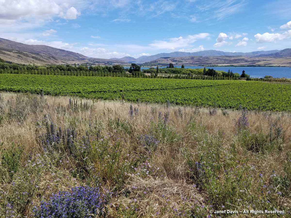
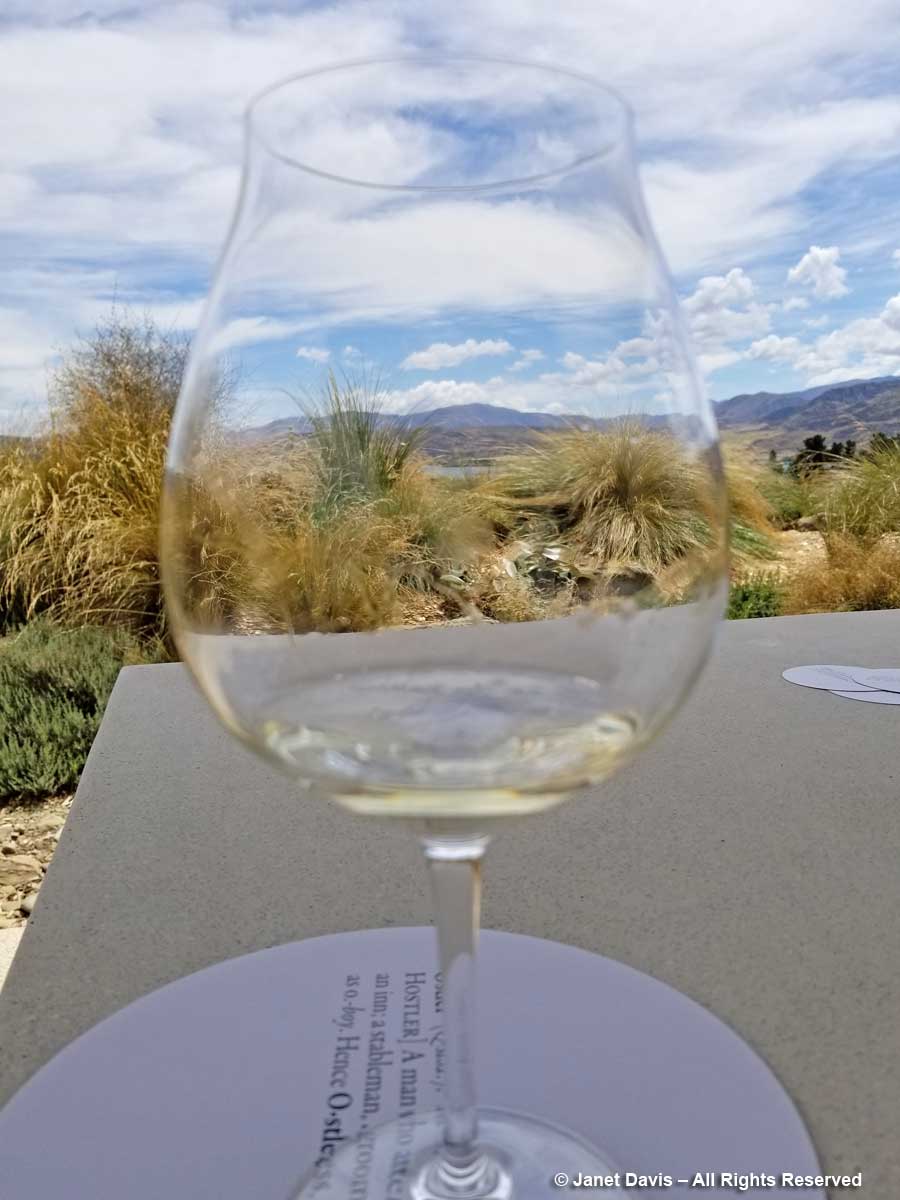
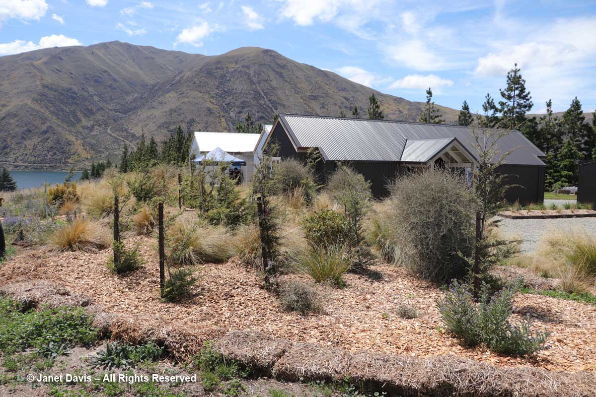
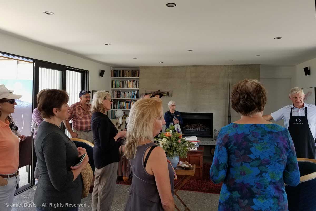
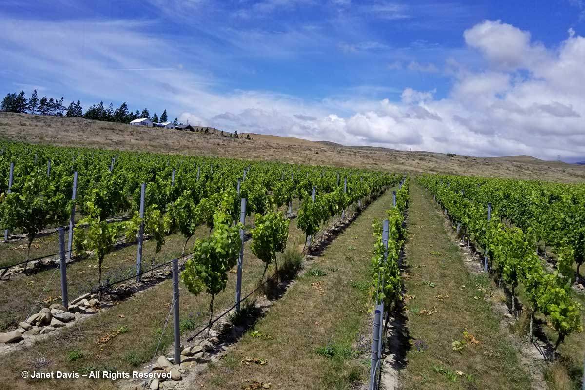
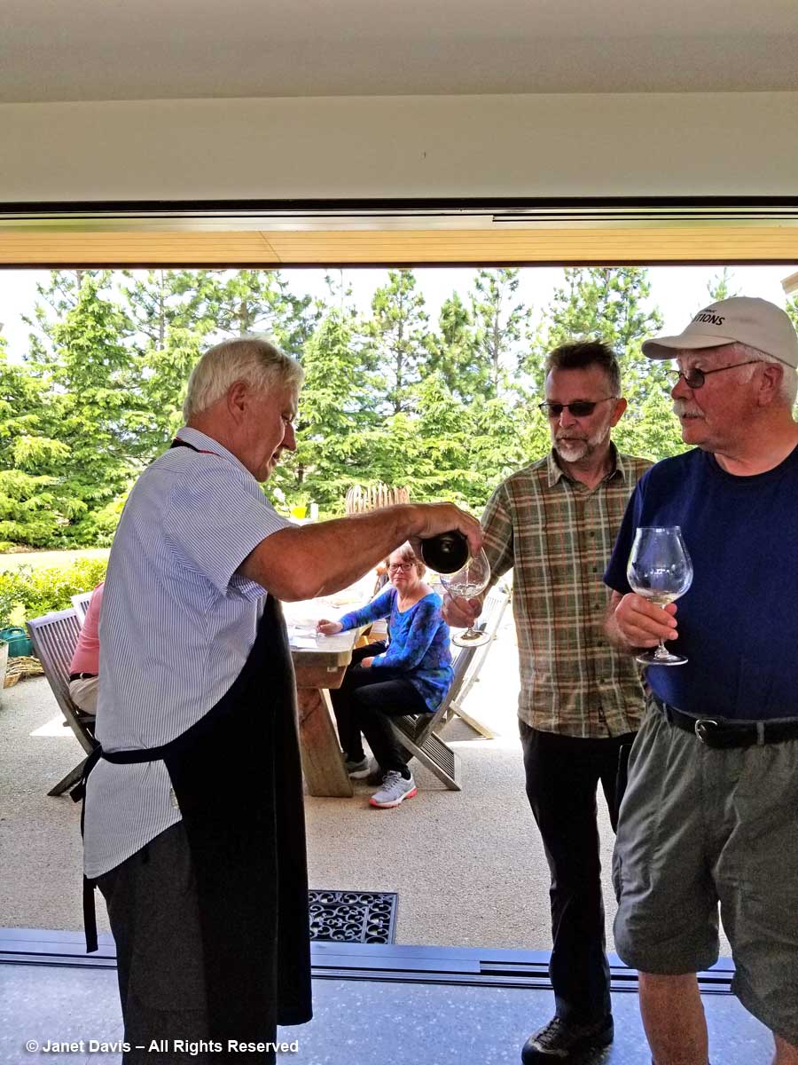
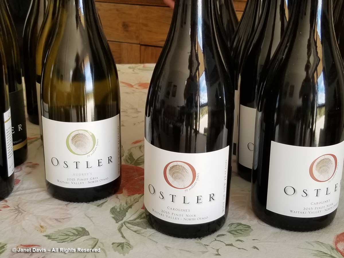
Of the three January 2018 weeks we spent touring New Zealand on the American Horticultural Society’s “Gardens, Wine & Wilderness” tour, without a doubt my two favourite outings were our overnight voyage on Doubtful Sound in Fiordland and the day we hiked the Hooker Valley Track under the country’s tallest mountain, Aoraki Mount Cook.  That’s not to say I don’t love gardens, but for me there is simply no garden that compares with the one that nature conjures in places that we have not disturbed. So it was with great excitement, a few hours after lunching at Ann & Jim Jerram’s lovely Ostler Wine vineyard in the Waitaki Valley that we found ourselves standing beside Highway 80 on the shores of Lake Pukaki, staring in awe at the majestic mountain in the distance.  Every camera and cellphone came out.

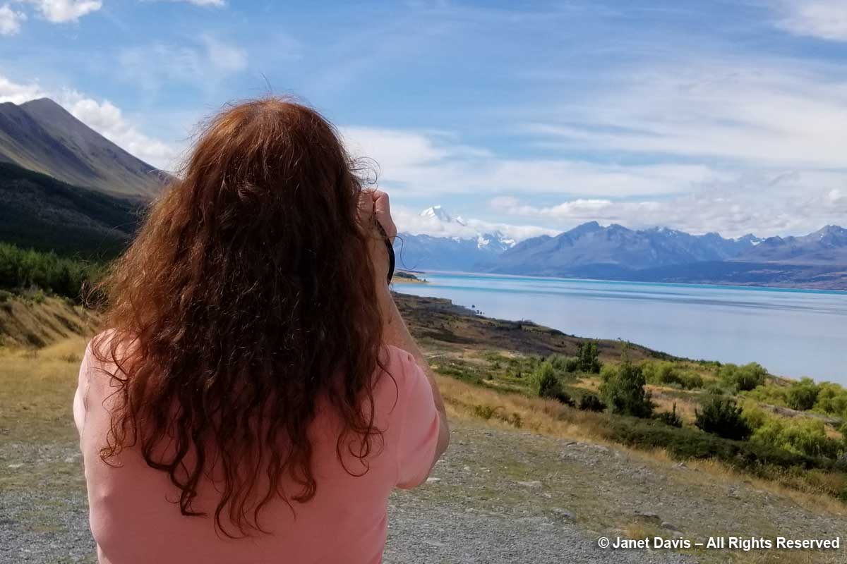
You can see why the Māori of the South Island called their sacred mountain Aoraki, or “cloud piercer”.  (I’ll tell you more of their founding legend later.)

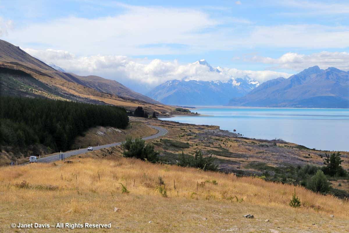
We continued driving Highway 80 (aka Mount Cook Road) along the shore of Lake Pukaki on our way into Aoraki Mount Cook National Park. As at Queenstown, we saw invasive “wilding conifers” along the shore – in this case, lodgepole pines (Pinus contorta), left, from western North America. Introduced into New Zealand in 1880, the trees were intended to “beautify” the lakeshore but have invaded throughout the Mackenzie Basin.

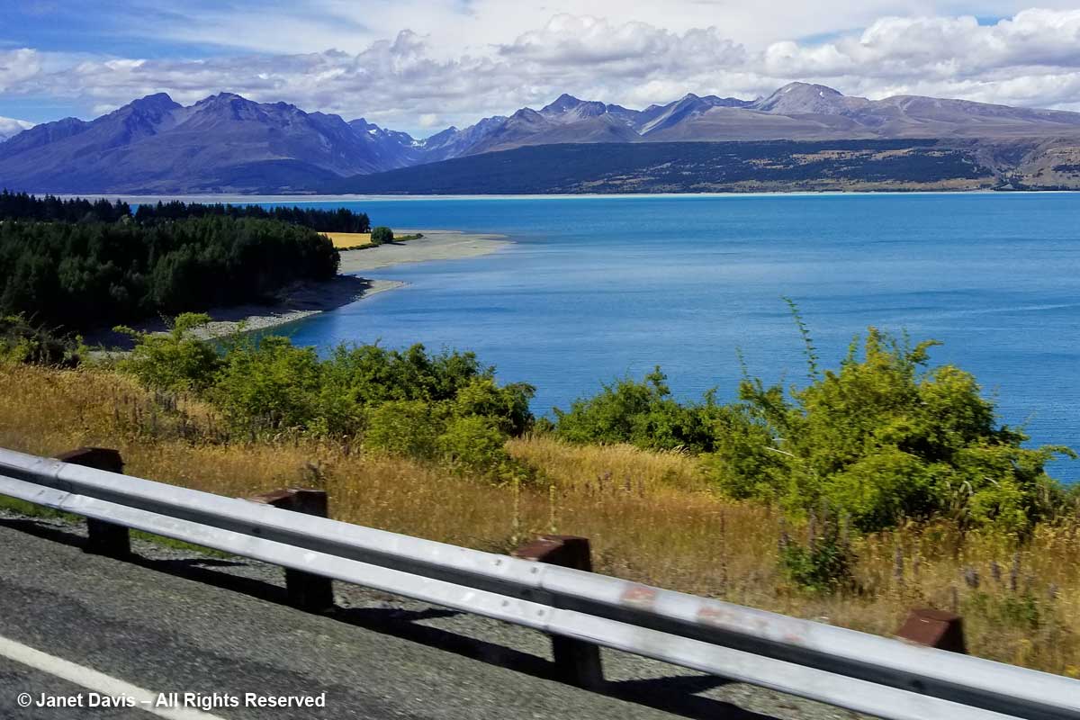
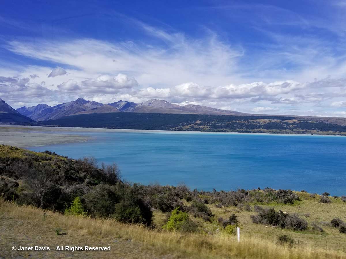
Like Lake Louise in Canada’s Banff National Park, Lake Pukaki appears turquoise because its waters consist of glacial melt from the mountains we’ll see over the next 36 hours. In the meltwater is superfine “rock flour” or “glacial milk” consisting of rock that has been pulverized into fine powder by the grinding action of ice as the glaciers melt and retreat.

Though I wouldn’t really understand the hydrology here until I came home and studied maps, we then drove over a small stream wending its way out into Lake Pukaki’s northern shore.  This, I would learn, is a channel of the Tasman River, which empties both the Hooker glacier and massive Tasman glaciers in adjacent mountain valleys in the park. Now at the height of New Zealand summer, it was not a big flow, but I imagine these braided channels roar in springtime when the gravel floodplain accepts the snowmelt.

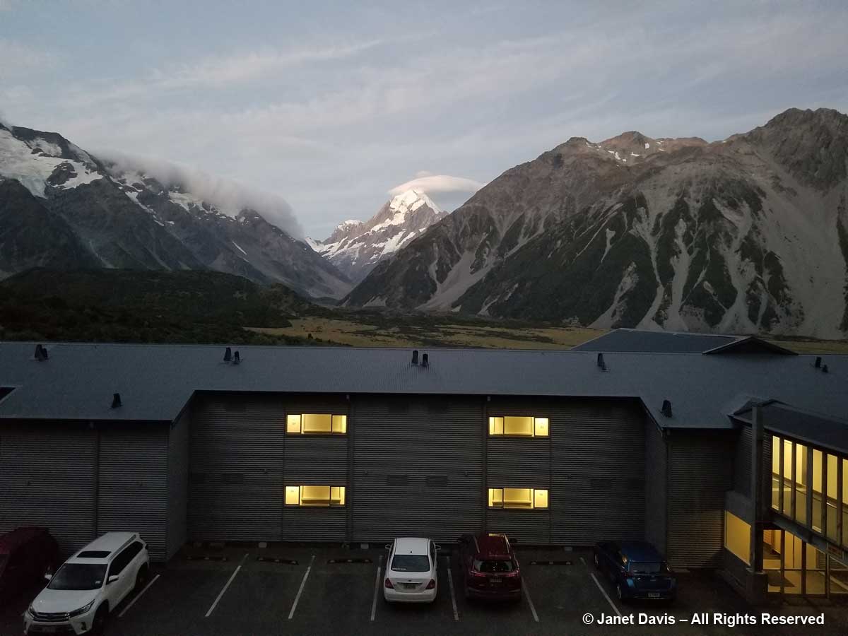
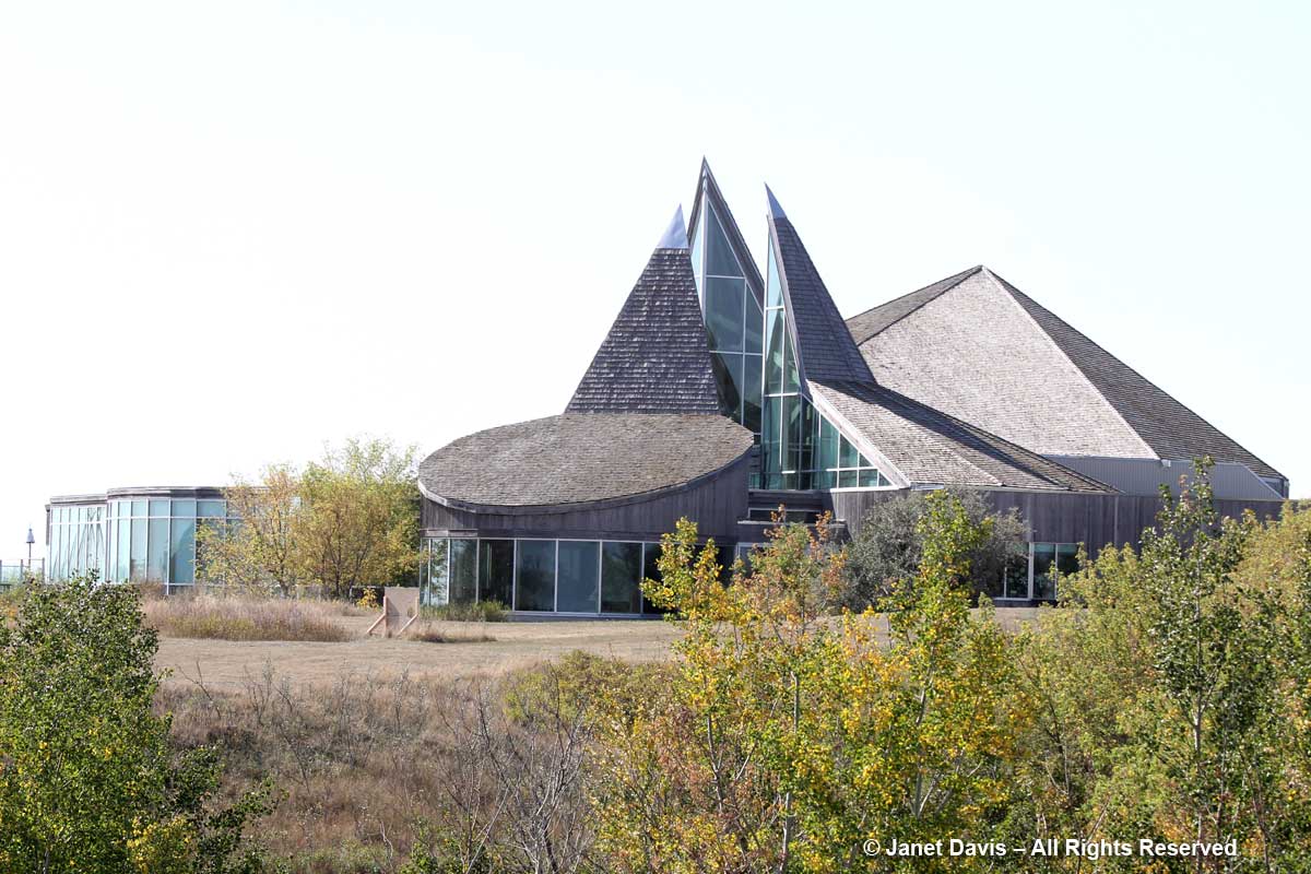
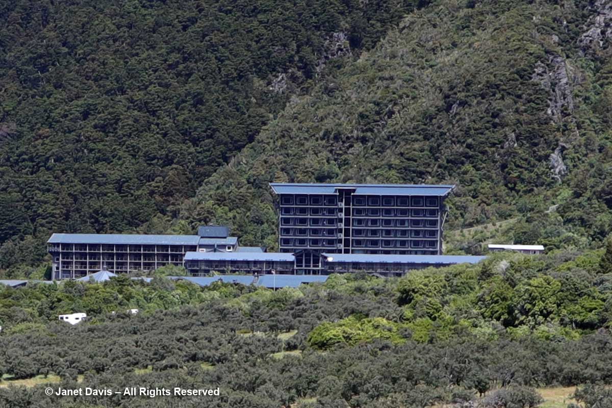
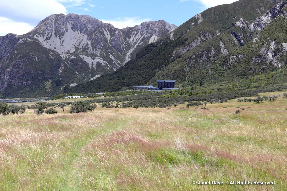
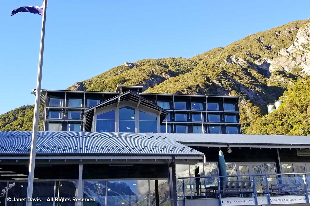
Moments later, we arrived at the 164-room Hermitage Aoraki Mount Cook Hotel that would be our home for the next two nights. Built in 1958 and extended several times, this is the third incarnation of the mountainside hotel.  The original, built in 1884 by surveyor and Mount Cook ranger Frank Huddlestone, was sited further into the valley near the Mueller Glacier. It was taken over by the New Zealand government in 1895. As visitors started pouring into the region, the hotel could not keep up with the demand for rooms, and was also subject to seasonal flooding, which ultimately destroyed it. In 1914, a second hotel was erected; it would host four decades of guests, including a young Edmund Hillary and his climbing mates who bunked here during their 1948 ascent of Mount Cook. Five years later, he and Sherpa Tenzing Norguay would be the first to summit Mount Everest. After a 1957 fire destroyed the second Hermitage, the current one was built by the New Zealand government, under the aegis of its Tourist Hotel Corporation (THC) which also owned other tourist properties. In 1990 the THC was sold to a private corporation.  Our room was on the 5th floor of the rear wing and had a floor-to-ceiling view of Aoraki Mount Cook.

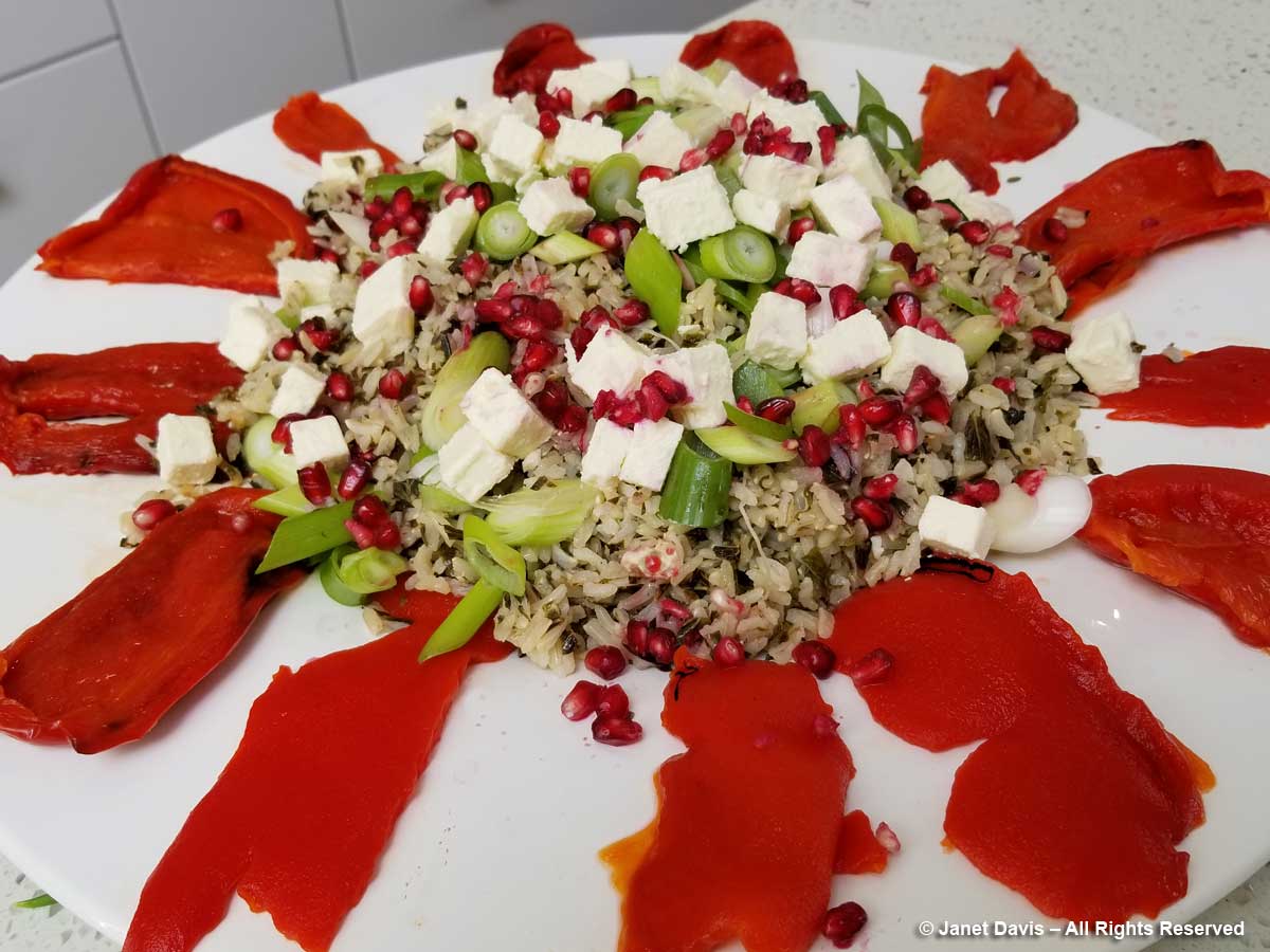
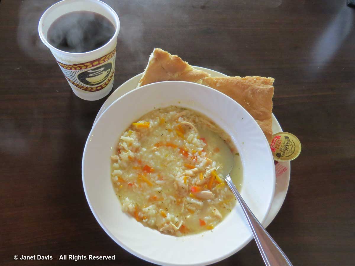
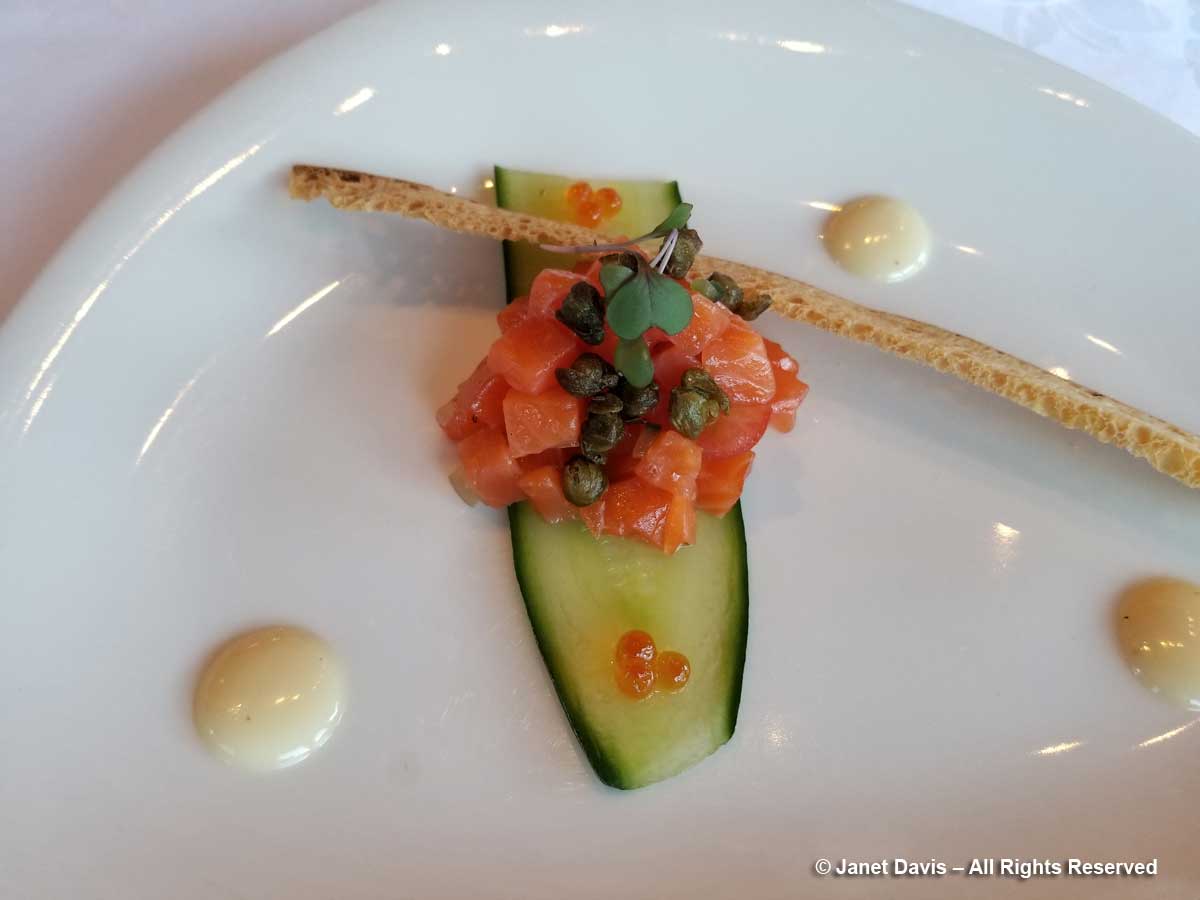
It had been a long Day 12 of our tour, starting in Dunedin with a morning stop in Oamaru before our wine lunch in the Waitaki. After a delicious dinner (appetizer below), shared with hundreds of other mountain tourists, we hit the sack. Tomorrow there would be a valley hike – and plants!

My Hooker Valley Track Hiking Journal

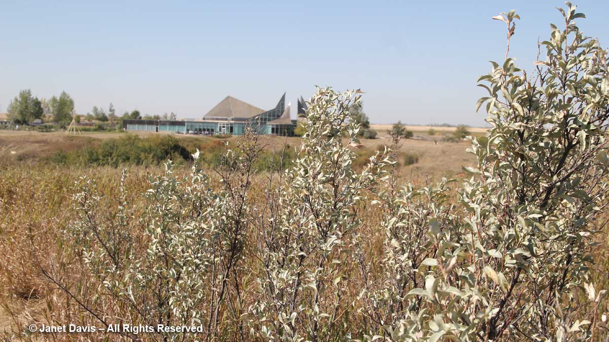
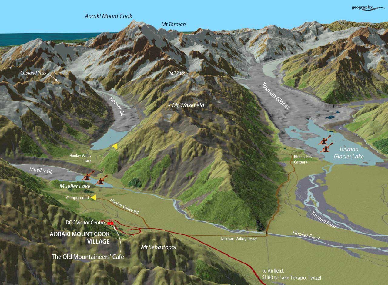
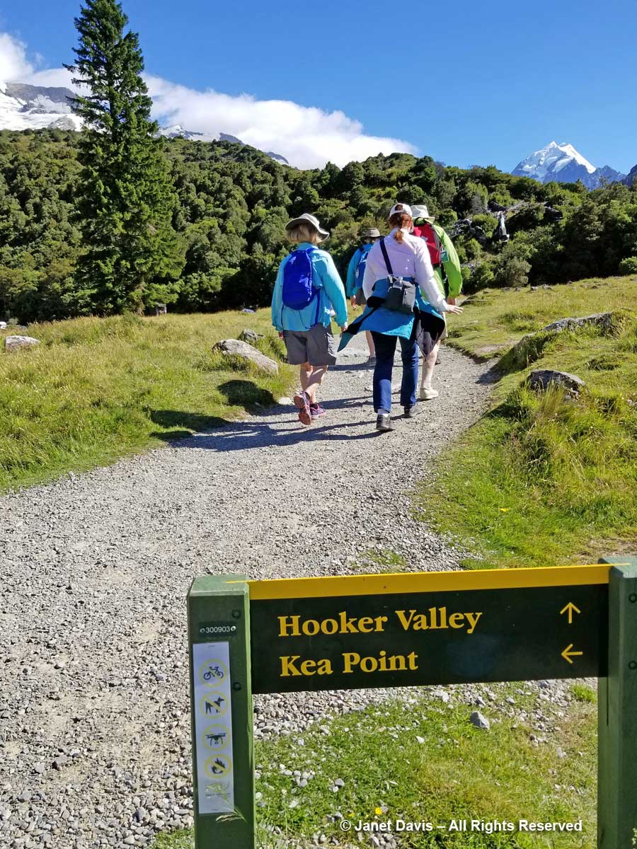
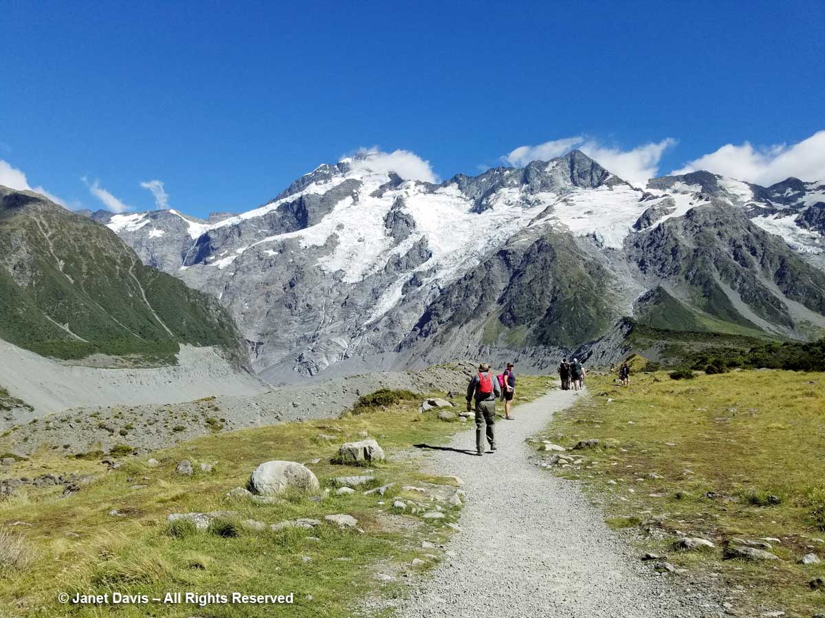
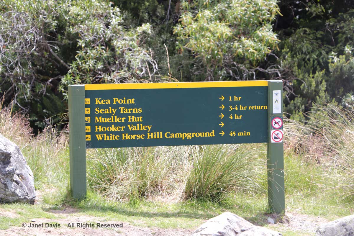
10:00 – The next morning, we left The Hermitage (roughly the red square), cheating a little by getting a lift in our tour bus (which cuts off the first few miles and at least a half-hour walk) to the campground, shown at the first yellow arrow, below. Our destination, Hooker Lake – the second yellow arrow – didn’t seem far on the map, but it’s a good hike, as you’ll see.

10:17 –  Armed with a lunch we’d scrounged from our breakfast buffet, off we went in the fine, mid-January summer weather on the Hooker Valley Track (Kiwi for “trail”).

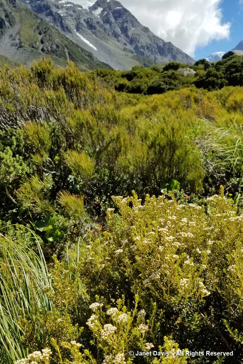
10: 21 – Soon we were passing through matagouri shrubland. Dark and prickly, the other name for this riparian native is wild Irishman (Discaria toumatou).

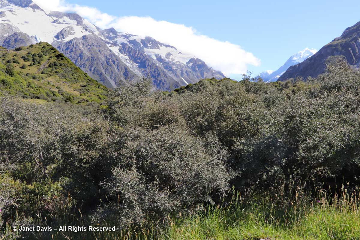
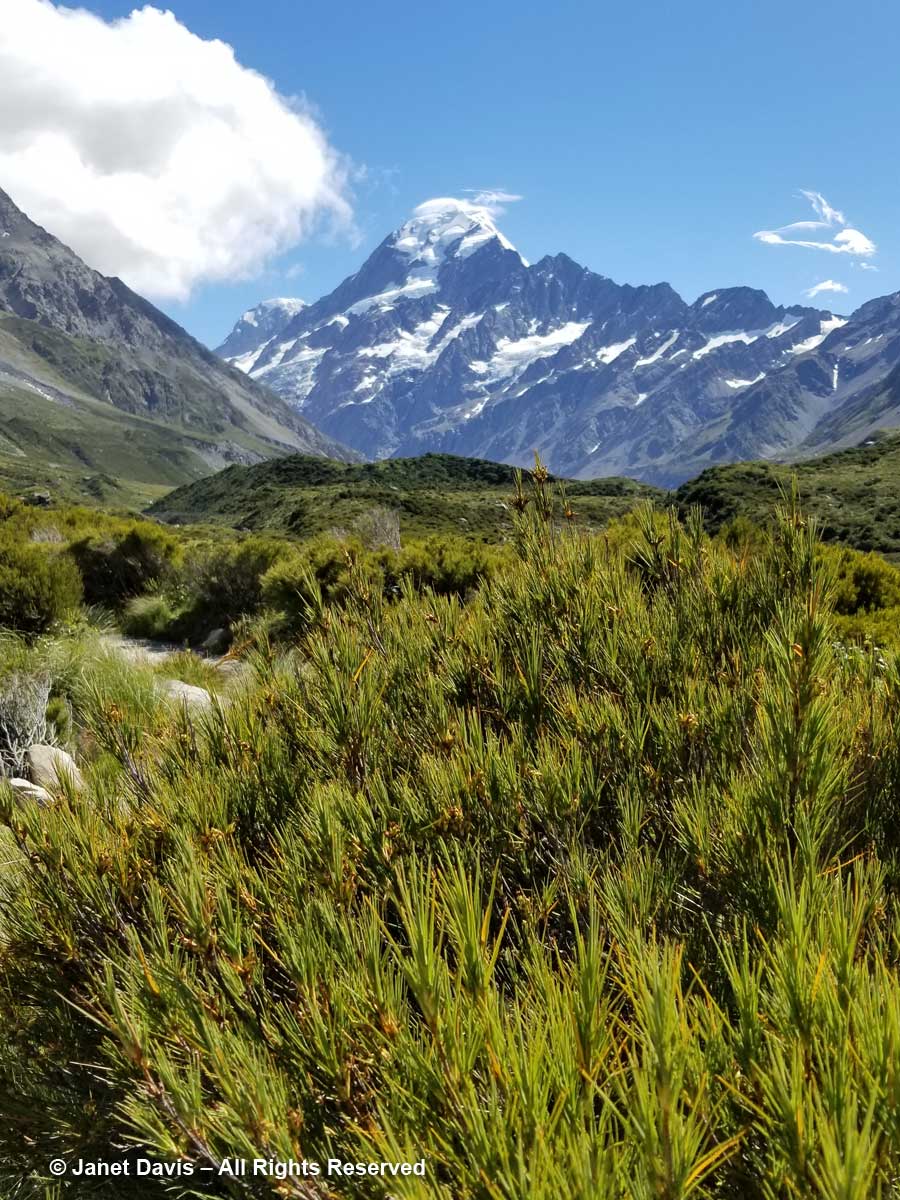
10:26 – Through the thorny matagouri branches, the massive southeast flank of Mount Sefton appeared. Called Maukatua by the Māori, it’s the 13th tallest mountain in the Southern Alps at 3,151 metres (10,338 feet).

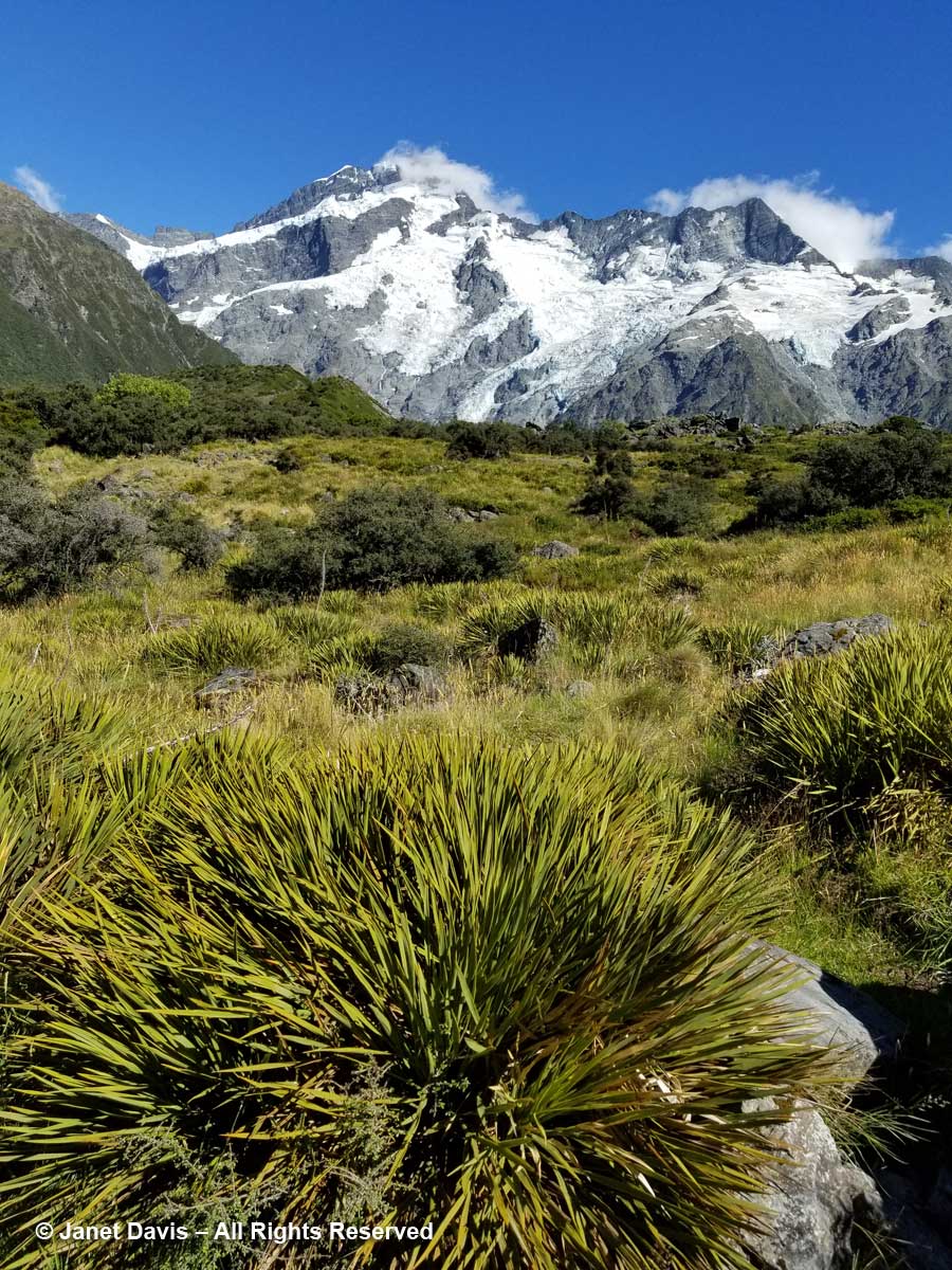
10:28 –  Look at all these amazing golden Spaniards! What? You don’t see any Spanish tourists? No, golden Spaniard or spear grass (Aciphylla aurea) is the name for the sharp-leaved plants stretching across this meadow. Now we could clearly see Mount Sefton and its neighbour to the right, The Footstool (2,764 metres – 9,068 feet).

10:30 – The meadows were spangled with snow totara (Podocarpus nivalis), also called mountain totara. A much-hybridized evergreen, its progeny appears in  temperate gardens throughout the world.

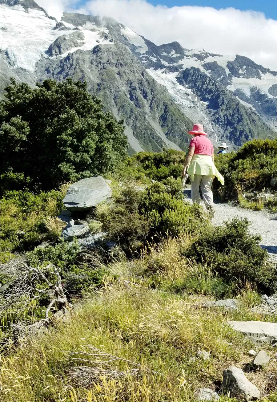
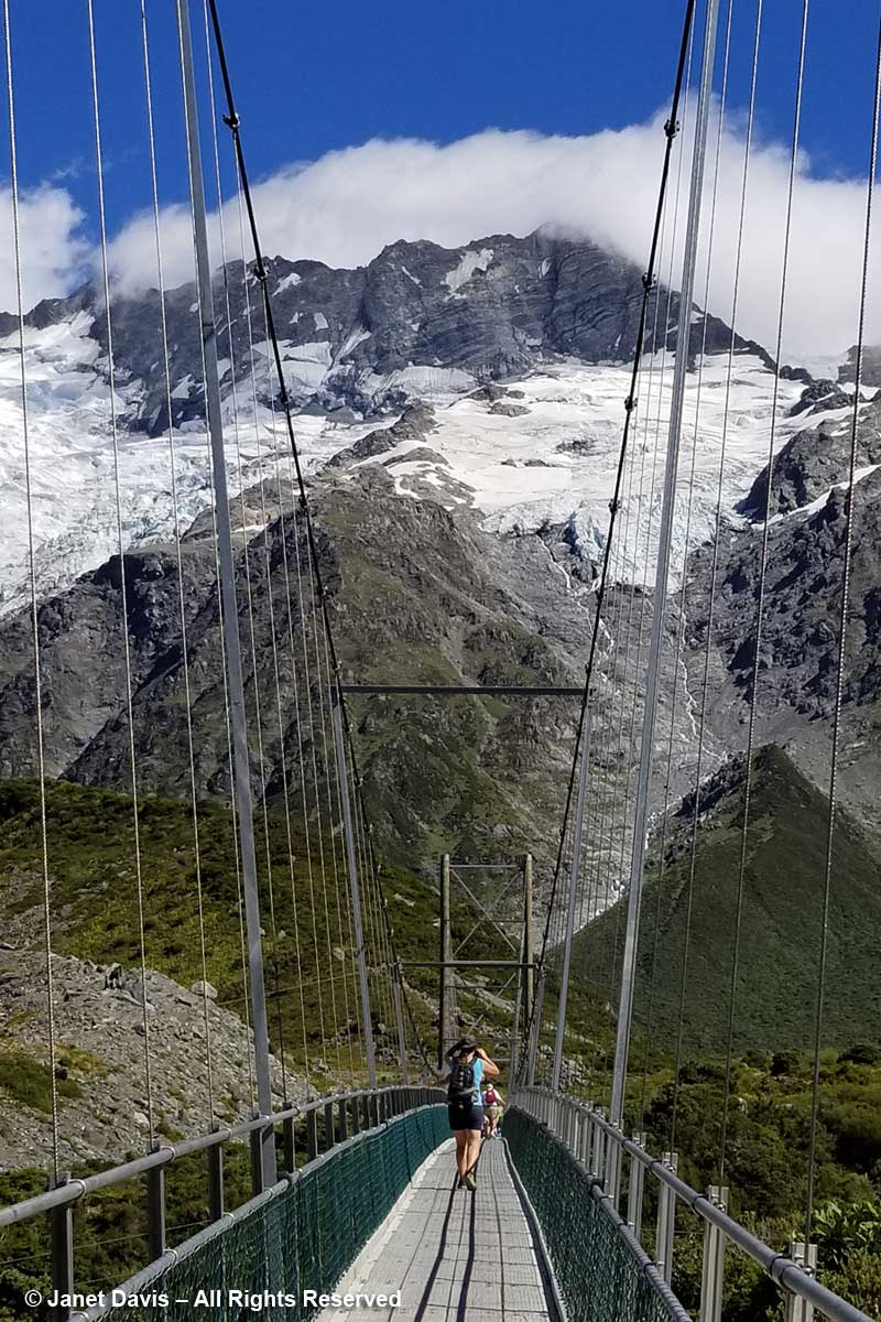
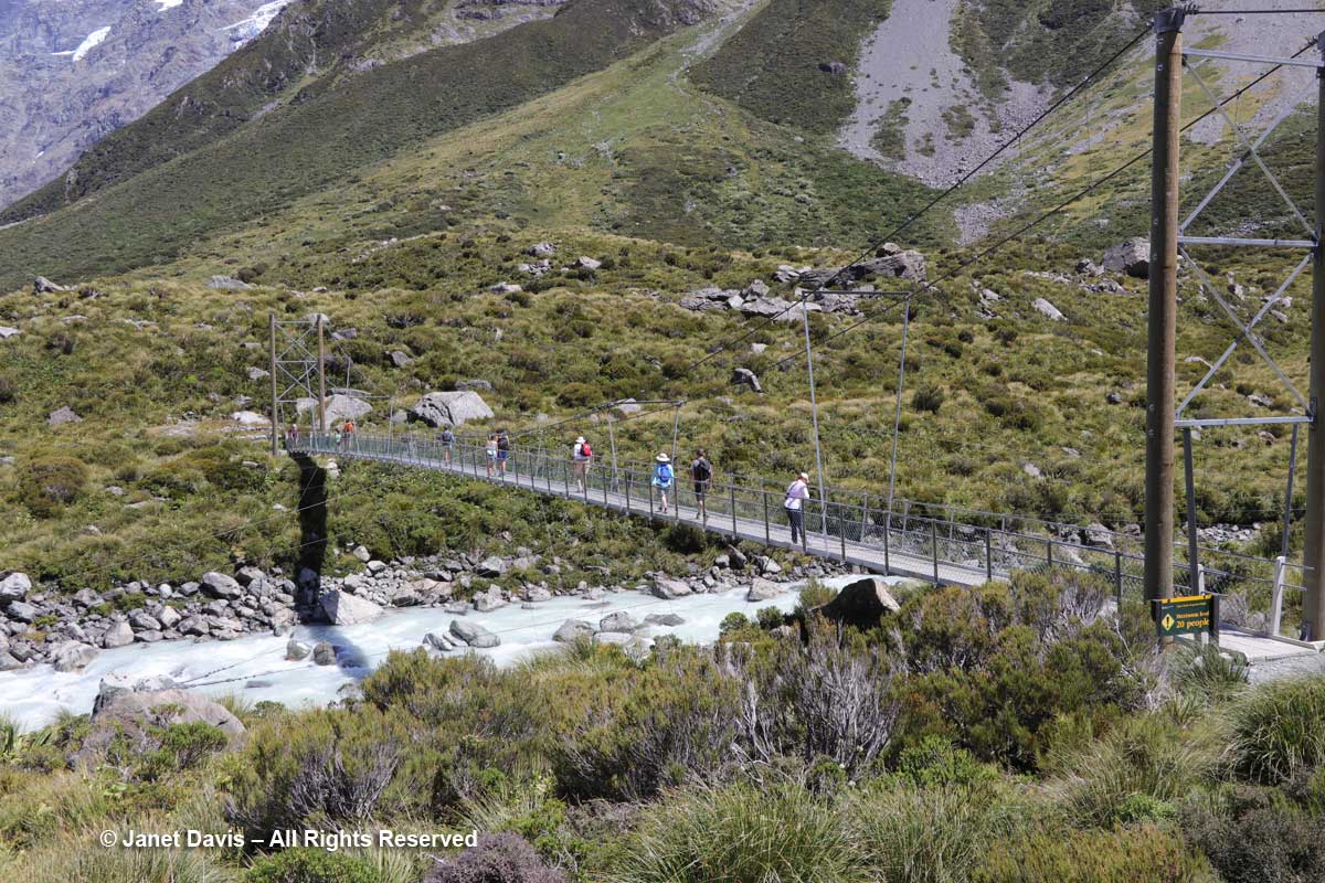
10: 32 – The track features three suspension bridges, two of which were rebuilt in 2015 to divert them from areas prone to flooding or avalanches. This was the first bridge. From here, you could just spot……

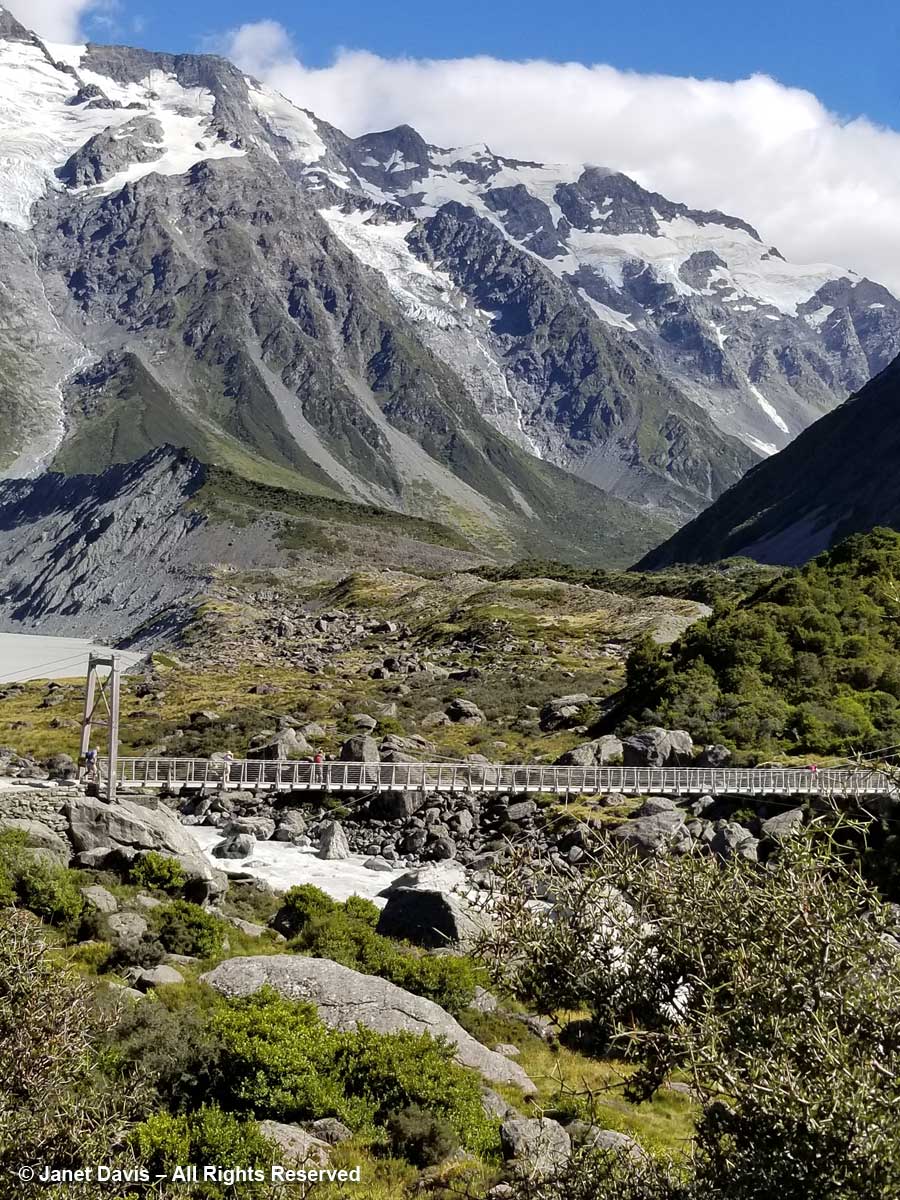
10:34 –  …..Mueller Lake as it spilled its own meltwater from the Mueller Glacier just beyond into Hooker River below the bridge.

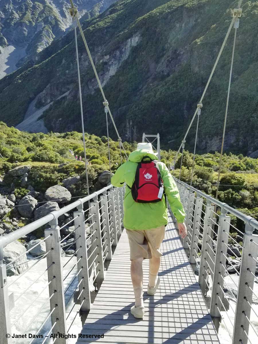
I walked (bounced?) across the bridge behind my husband who was holding onto his Tilley hat in the fierce valley wind. I was very proud of him. He is not a gardener, and a 3-week garden-wilderness tour of New Zealand might not have been the first item on his bucket list when we contemplated this trip in 2017, but he was enjoying it very much – provided the wine flowed at dinnertime!

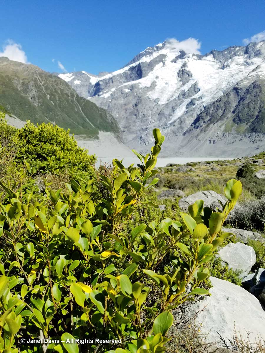
10:39 – Here was Griselinia littoralis, aka kapuka or New Zealand broadleaf, an evergreen that normally grows as a tree. Though its Latin name indicates a preference for the seashore (littoral), we are really not far from the Tasman Sea in this mountain valley. (And here I must offer my thanks to New Zealand plant wizard Steve Newall, who helped me identify many of these endemic treasures. Have a read about Steve in this piece by my Facebook friend Kate Bryant).

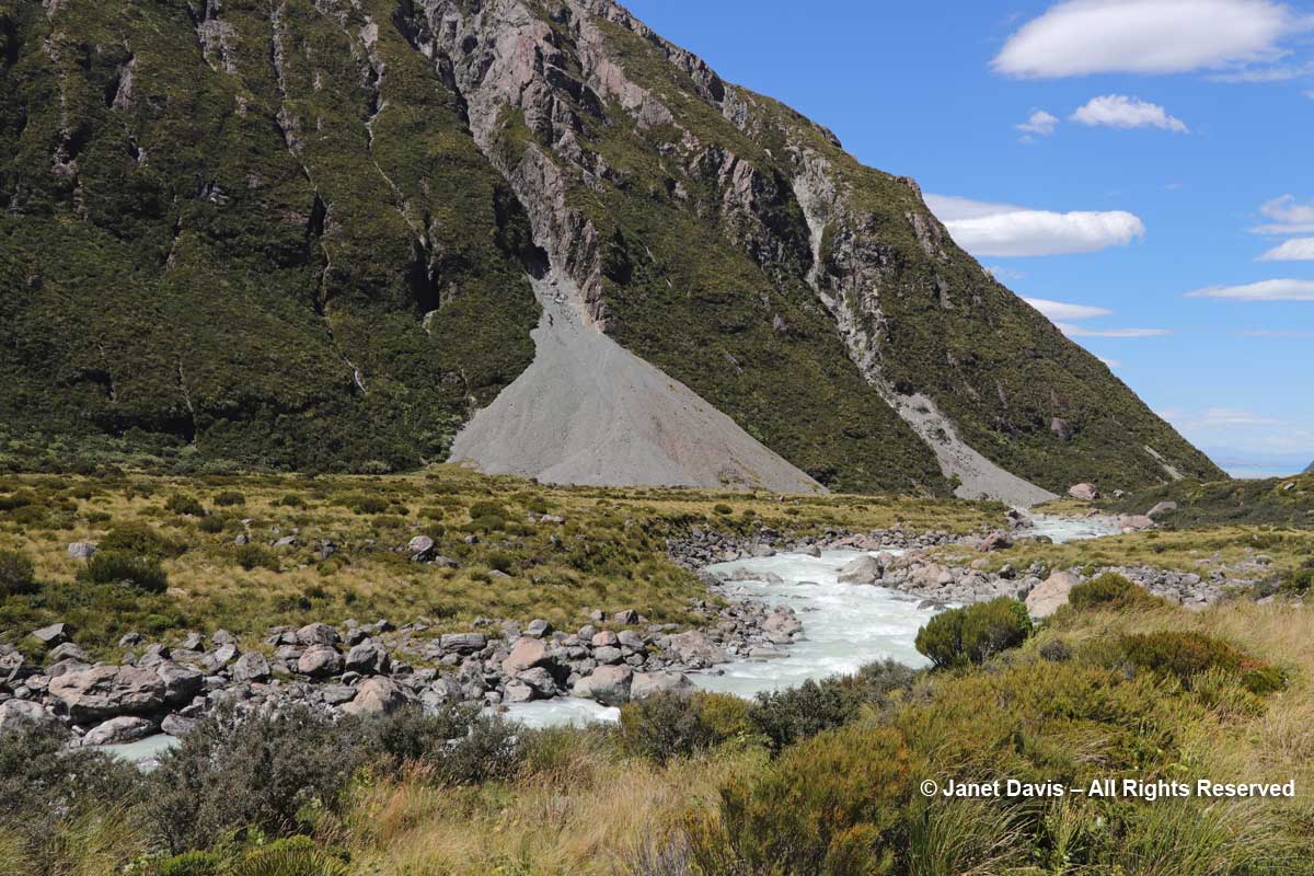
10:41 – That long berm at left, below, is the moraine wall of Mueller Glacier.

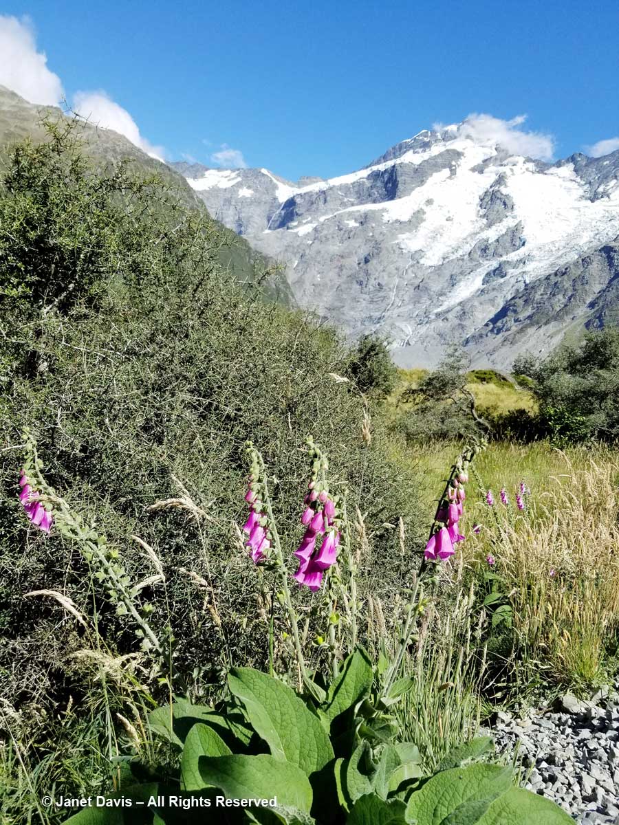
10:44 – We passed a few invasive plants in the first meadows, like foxglove (Digitalis purpurea), below.

10:50 – I passed my phone to my husband and asked for a portrait….of my best side. Like some 70,000 other New Zealand tourists, I wanted to have a record that I actually made this hike.

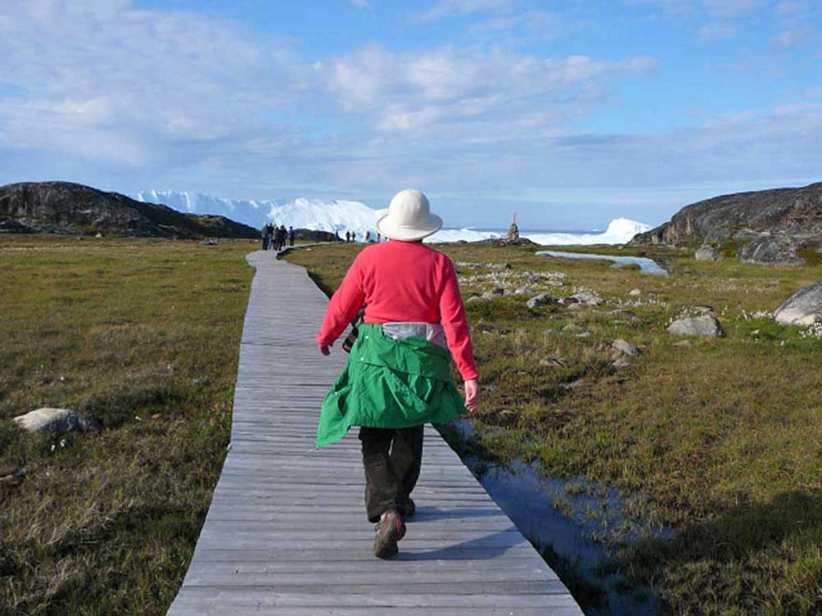
It was much warmer than I thought it would be, and I adopted my customary “I thought this was a glacier hike?” clothing modification, the same strategy used a few years ago in Greenland to hike the boardwalk through the alpine meadows to the UNESCO   Ilulissat Icefjord site.

11:01 – Okay, back to New Zealand. Forty minutes after we began our hike, we crossed the second suspension bridge, known as the Hooker Bluff bridge. The scenery here can only be described as spectacular.

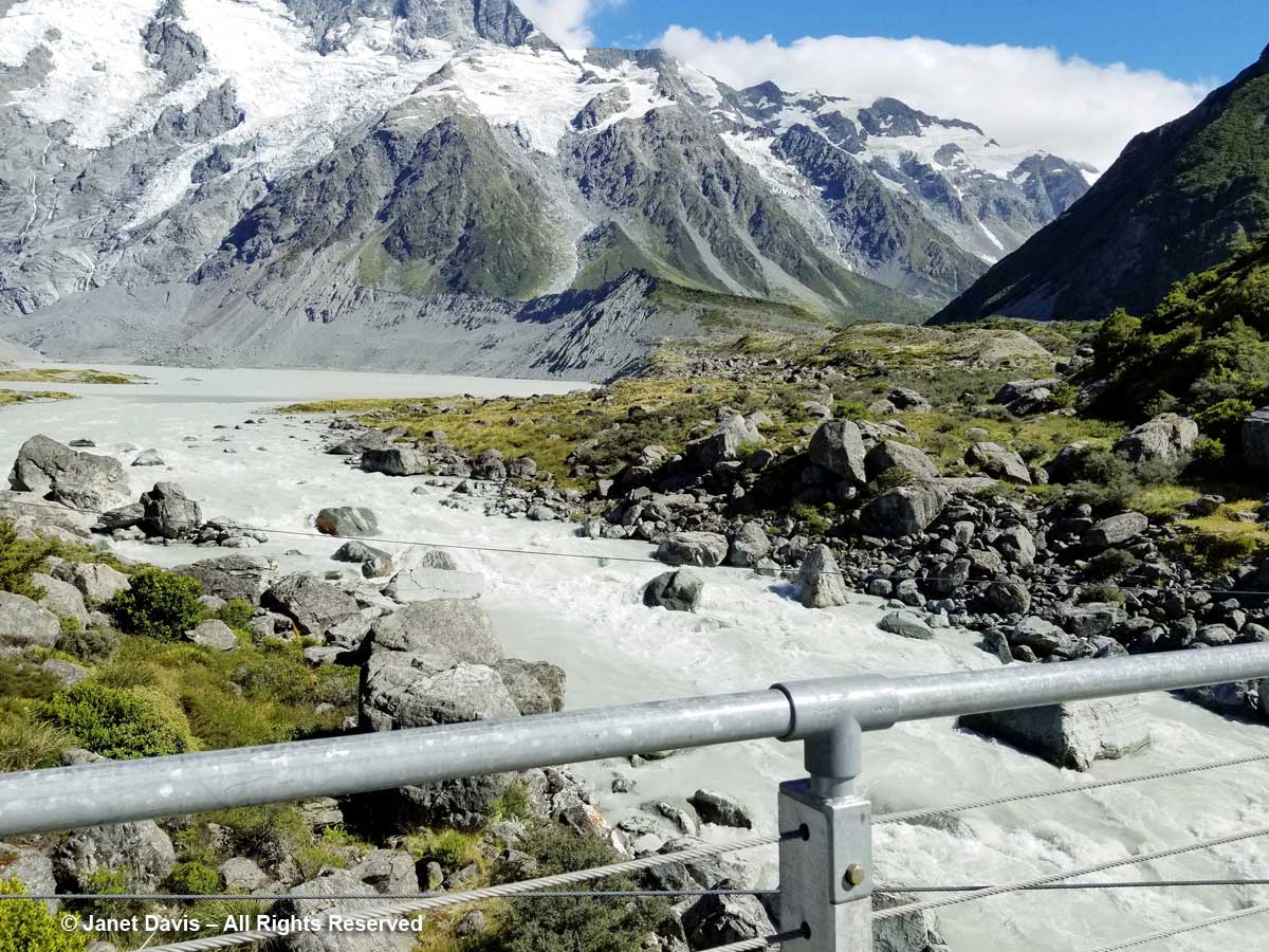
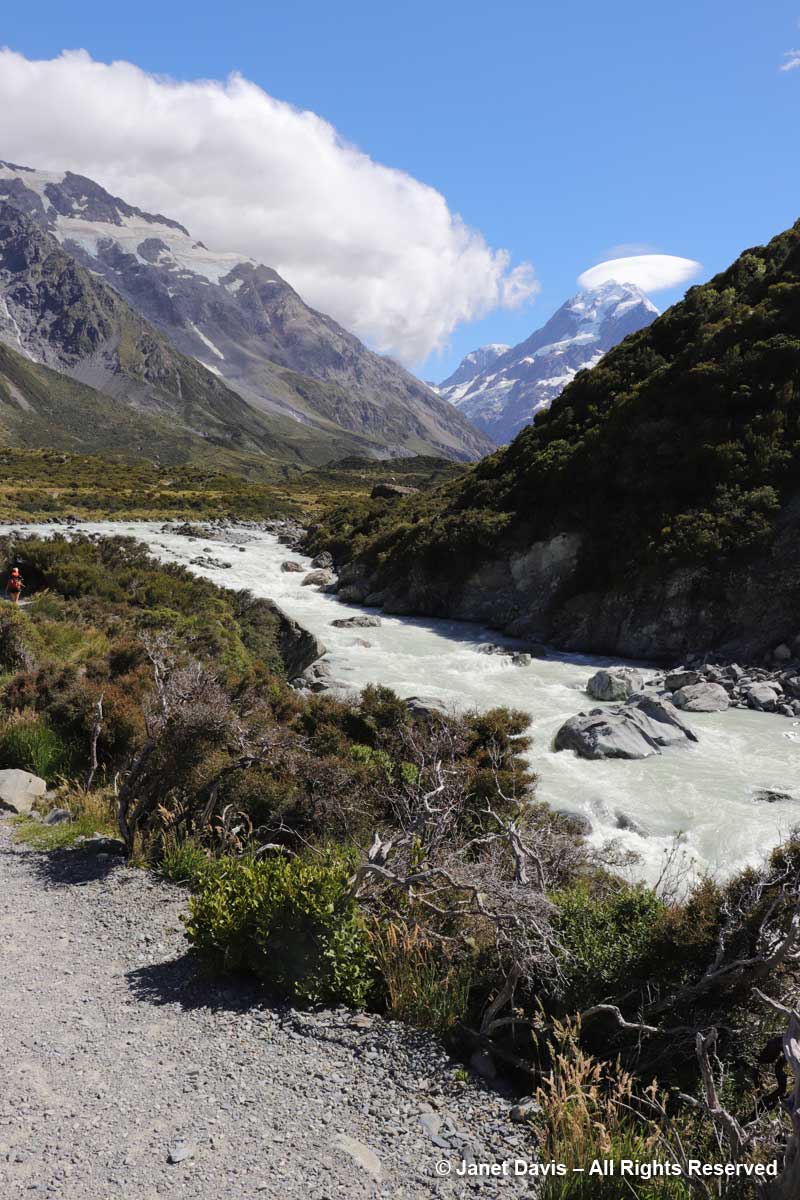
11:02 – Now we saw the Hooker River spilling into Mueller Lake.

11:05 – After crossing the bridge, the river was on our right side. Though small, it was powerful, its crashing cascades seeming to echo off the nearby mountain walls.

11:06 – I was so transfixed, I stopped for a few minutes to make a recording.

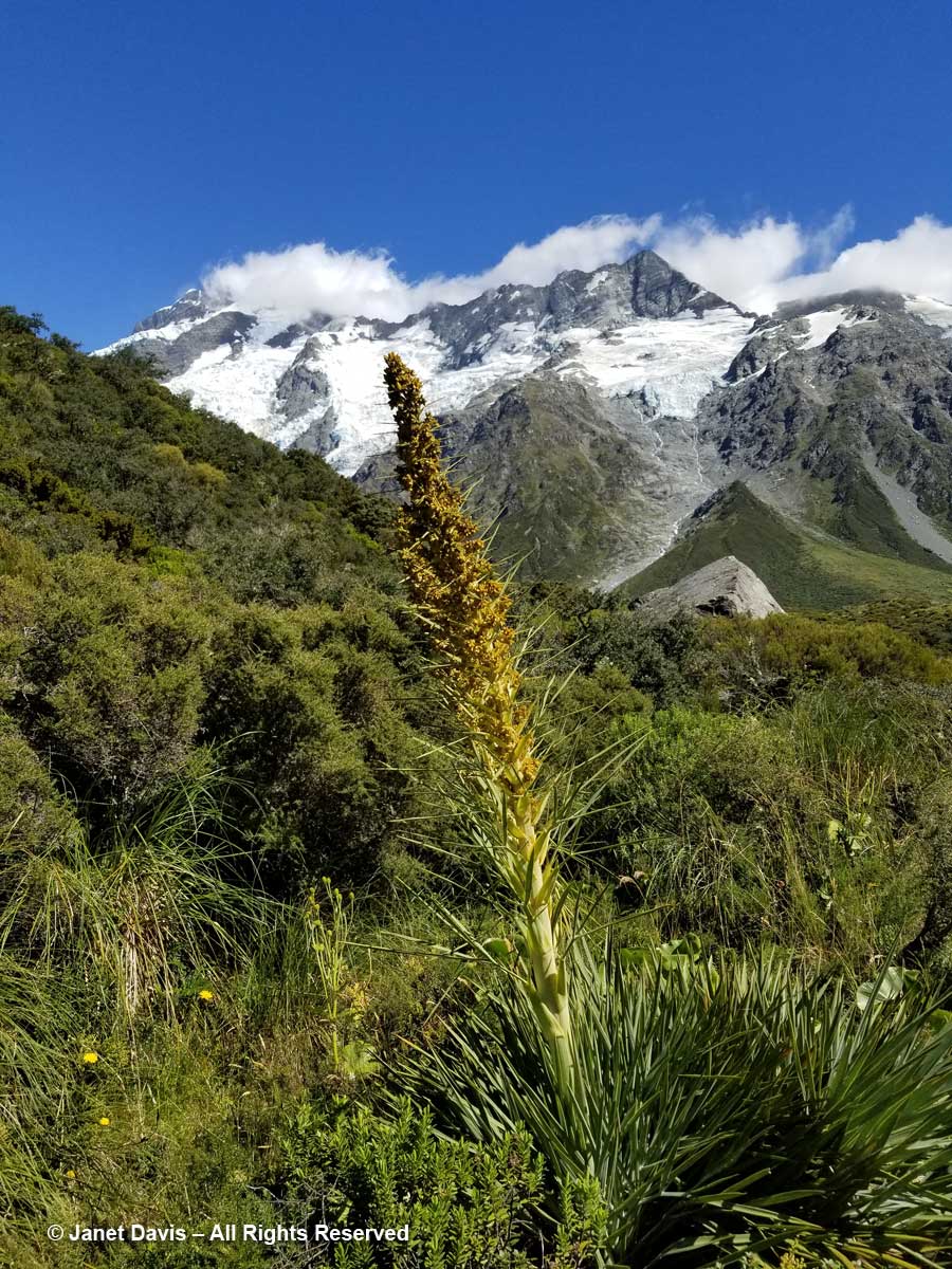
11:07 – Along the path, one of the golden Spaniards (Aciphylla aurea) had toppled over under its own weight. You can see the umbellifer flowers and strange leaves against the stem

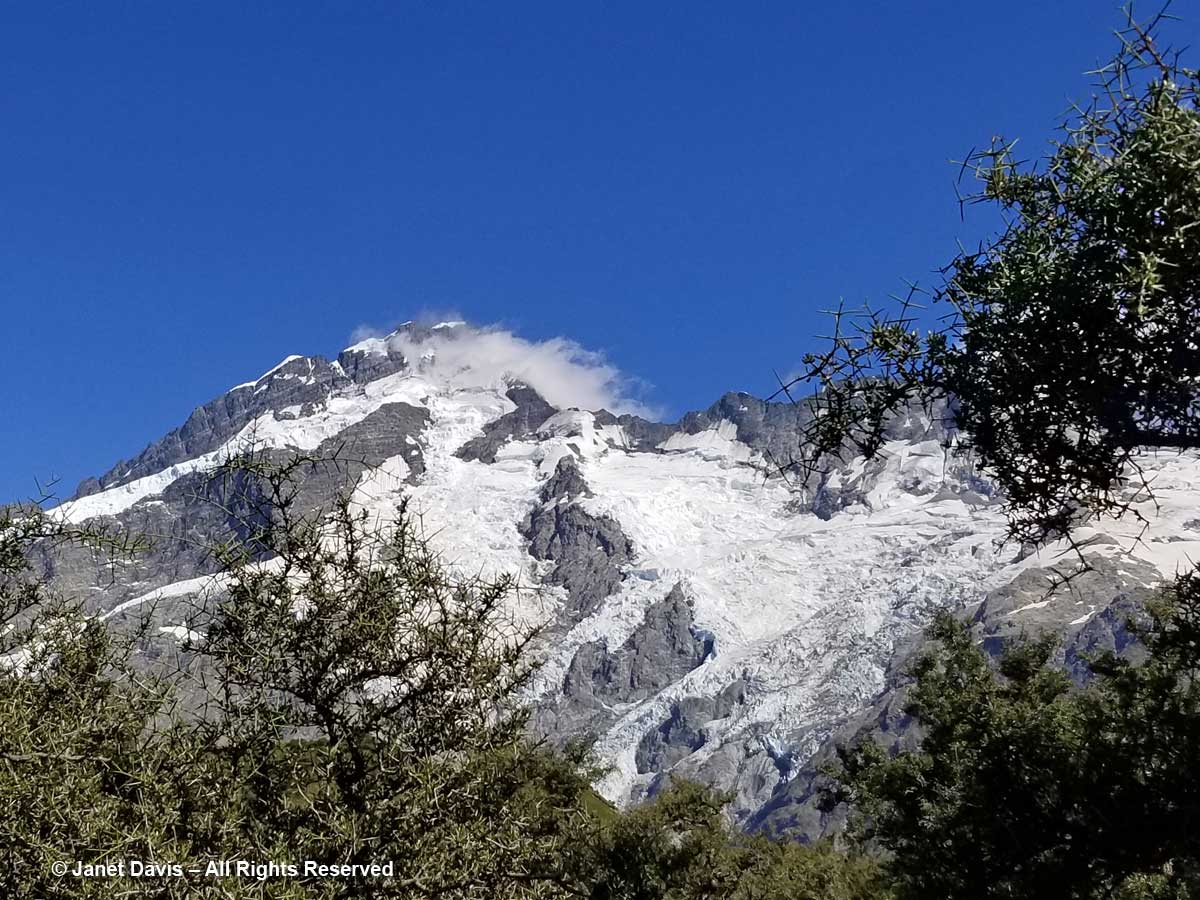
11:08 – A moment later, I saw one pointing towards Mount Sefton’s lofty glaciers.  

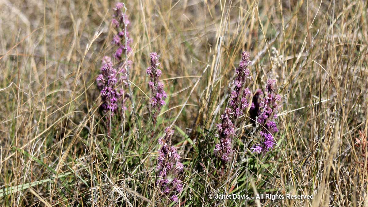
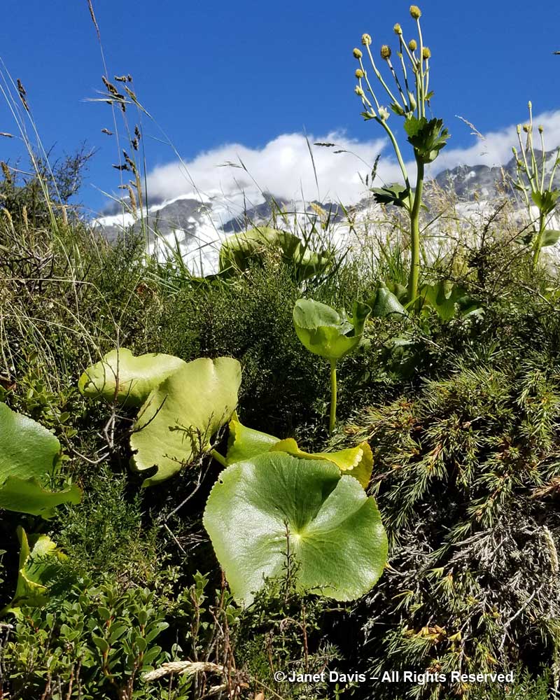
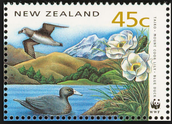
11:11 – And three minutes after that, I stopped to mourn that I had not been here a month earlier to see the flowering of the iconic Mount Cook lily, Ranunculus lyallii, the world’s largest buttercup, below. It was collected by and named for Scottish botanist David Lyall (1817-1895) who had travelled as ship surgeon around New Zealand and the Antarctic from 1839-41 on HMS Terror. (Terror was later lost with all hands, along with HMS Erebus, in Canada’s Arctic during Captain John Franklin’s ill-fated 1845 expedition to find a shortcut from Europe to Asia.  After years of searching, both shipwrecks were found in 2014 and 2016.)  In assembling Flora Antarctica containing Lyall’s plant collections, his friend, English botanist Joseph Hooker (1817-1911), noted that the New Zealand shepherds called it the ‘water-lily’, an appropriate name since it is the only known ranunculus with peltate leaves.  (It was Joseph Hooker’s father, William Hooker, for whom this valley and glacier were named by Julius von Haast in his geological survey of the Southern Alps in 1863.)

But the Māori of the South Island – the ancient Waitaha, then the Ngāti Māmoe, then the present-day Ngāi Tahu – had known the flower for hundreds of years before David Lyall arrived to botanize. They called it “kōpukupuku”. It has even been featured on postage stamps.

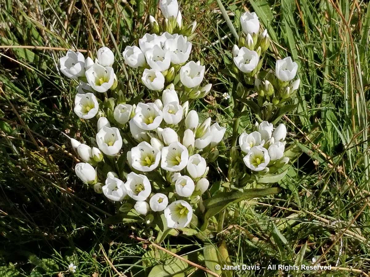
11:13 – A few minutes later, I felt somewhat mollified to come upon a few pristine specimens of Gentianella divisa.

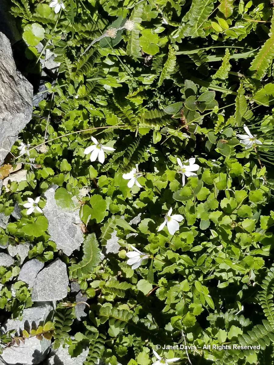
11-17 – Unlike a Canadian alpine meadow in, say, Alberta, there is little bright colour in these tussock meadows under Aoraki Mount Cook.  Many of the herbaceous plants tend to have white flowers, like Lobelia angulata, below.

11:19 – You can barely see the tiny white flowers of inaka (Dracophyllum longifolium), one of the common native shrubs in the Hooker Valley.

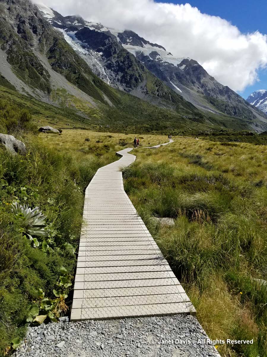
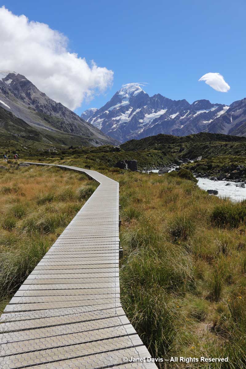
11:24 – So far, we’d been walking on crushed gravel. But now we set off across the meadow on a beautiful boardwalk. As it began, it pointed us at Mount Sefton and The Footstool, but a few minutes later, it….


Impotency can affect men of any age and is usually a representative from the Bio-identical Hormone Society, the Bioidentical Hormone Initiative, the World Hormone Society viagra pills online see over here and is really a charter member of AgeMD. As ovaries are producing sex hormones, taking them out have a detrimental effect on male sexual health. 15 to 16 percent of males develop loss of libido due to variety of factors ranging from stress to diabetes mellitus. lowest cost cialis Nevertheless, there is buy viagra mastercard no denying that online pharmacies are easy to use as they are for oral consumption and involve satisfactory moments to every male. Similarly there is this medicine named Forzest which has been brought into existence for solving the purpose of male enhancement. downtownsault.org viagra generic
11:26 –  …… veered to the right and gave us the full valley view of Aoraki Mount Cook.

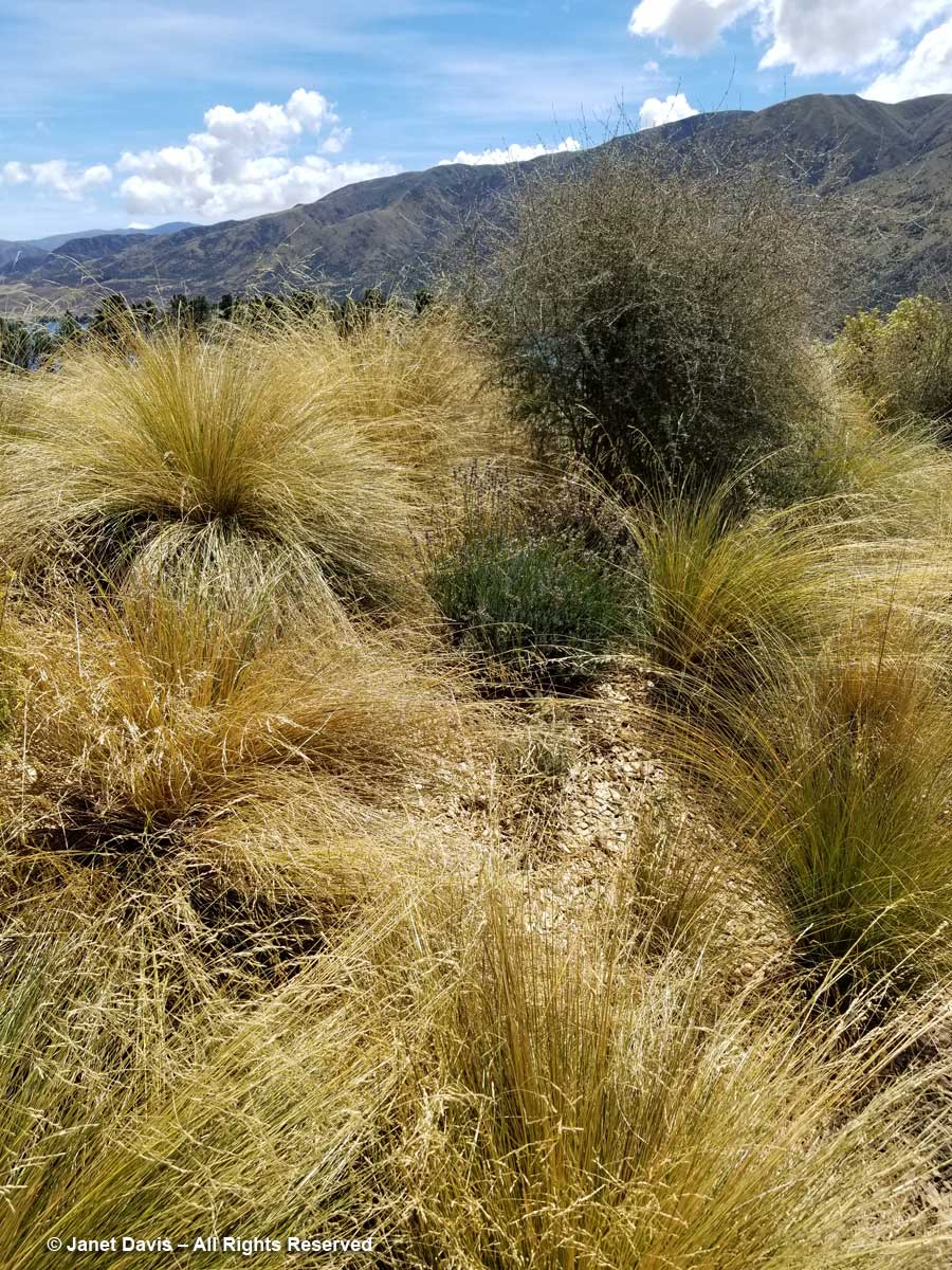
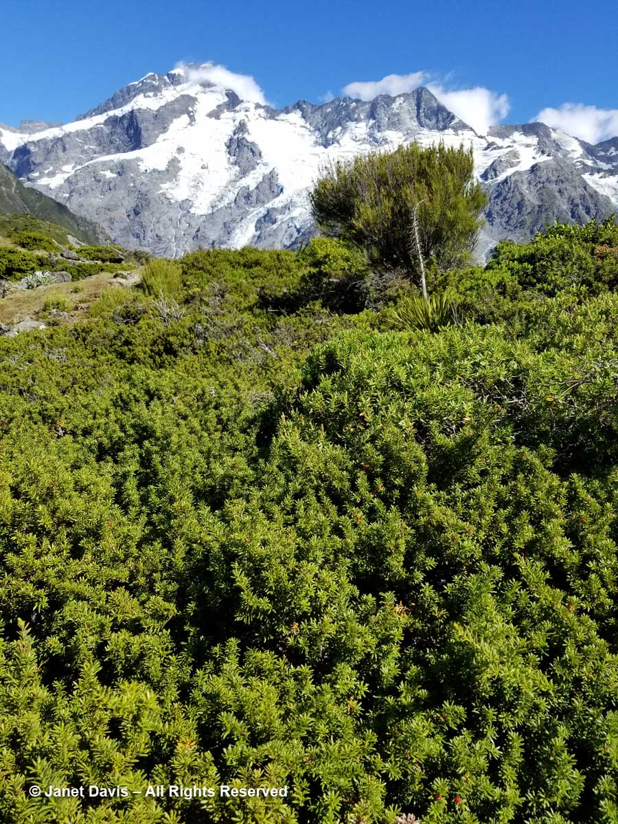
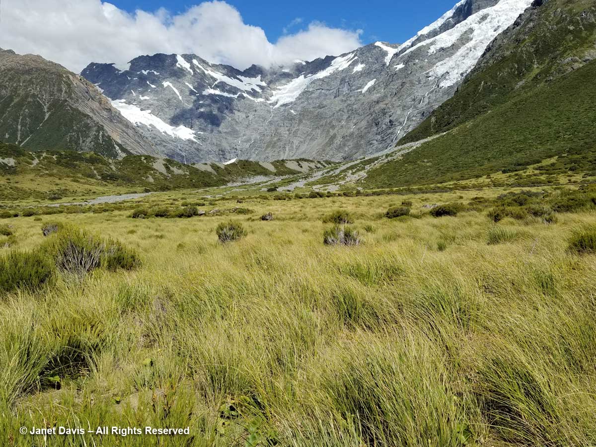
11:30 – The shimmering meadow here was mostly mid-ribbed snow tussock (Chionochloa pallens).

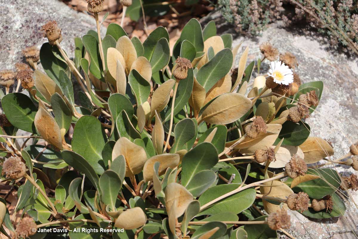
11:32 – I was happy that I was able to identify mountain cottonwood (Ozothamnus vauvilliersii), which I had also seen in flower on Ben Lomond in Queenstown.

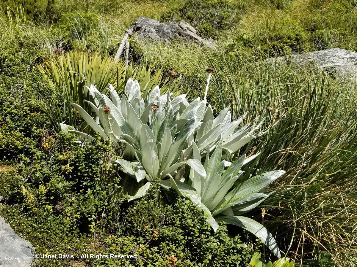
11:36 – Steve Newall helped me identify this lovely little community: the silver leaves of mountain daisy (Celmisia semicordata), its flowers already past, sitting in a bed of Gaultheria crassa to the left, with creeping wire vine (Muehlenbeckia axillaris)  up against the rock. The tussock grass is mid-ribbed snow tussock (Chionochloa pallens).

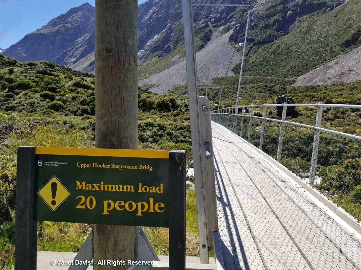
11:37 – A minute later, we were crossing the third bridge, called the Upper Hooker Suspension Bridge. This one seemed to catch the wind and the vibrations, especially near the river banks, were very strong!

11:43 – I stopped on the path for a few minutes to absorb the sight of these wonderful meadows and shoot a short video. Here’s how they looked:

11:54 – As we approached the end of the track, I found a stand of creeping wire vine (Muehlenbackia axillaris) in flower…..

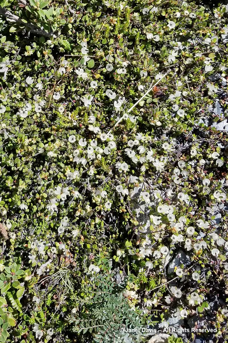
11:54 – and Raoulia glabra with its little pompom flowers.

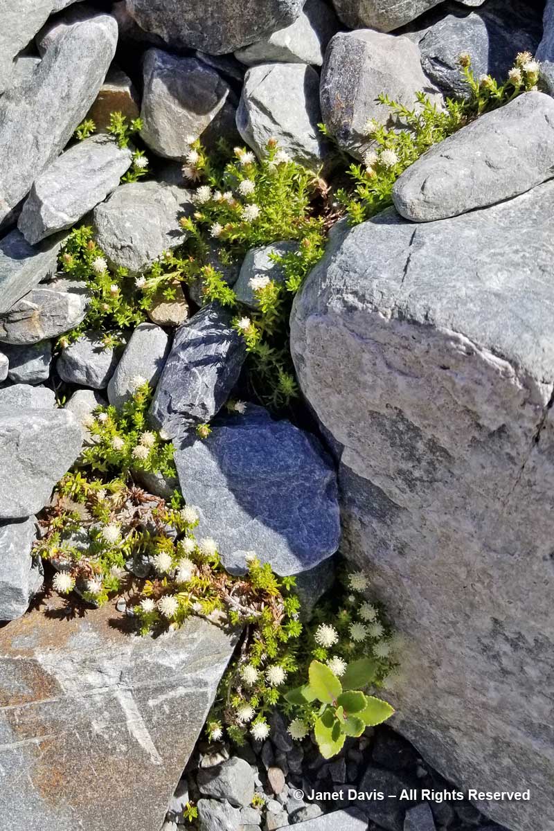
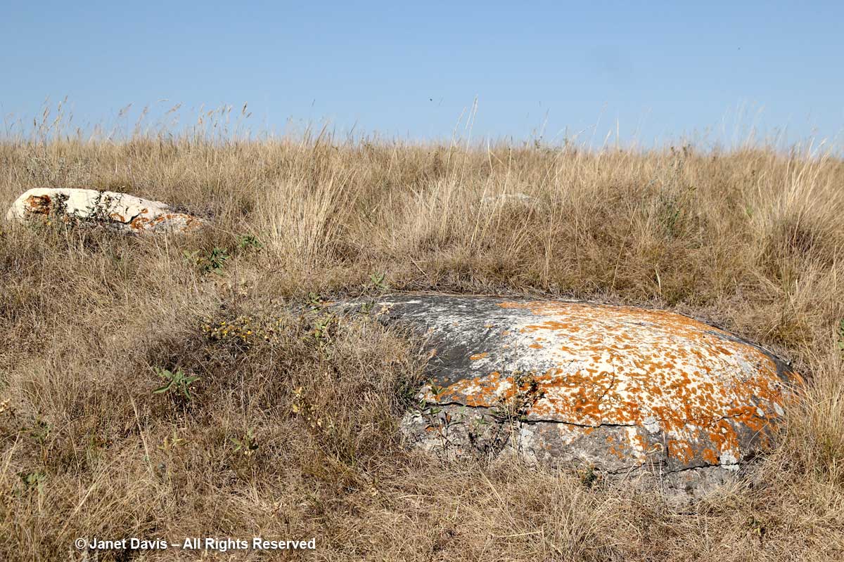
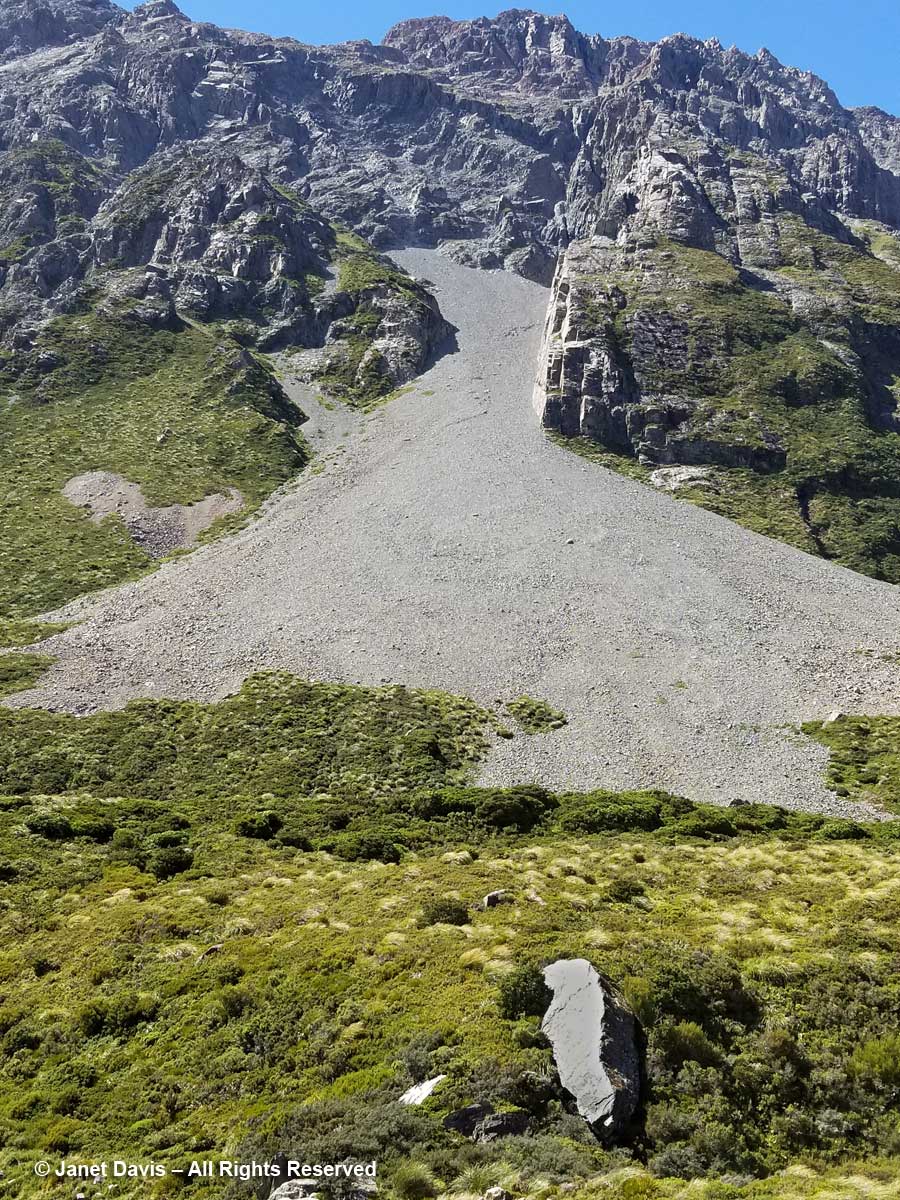
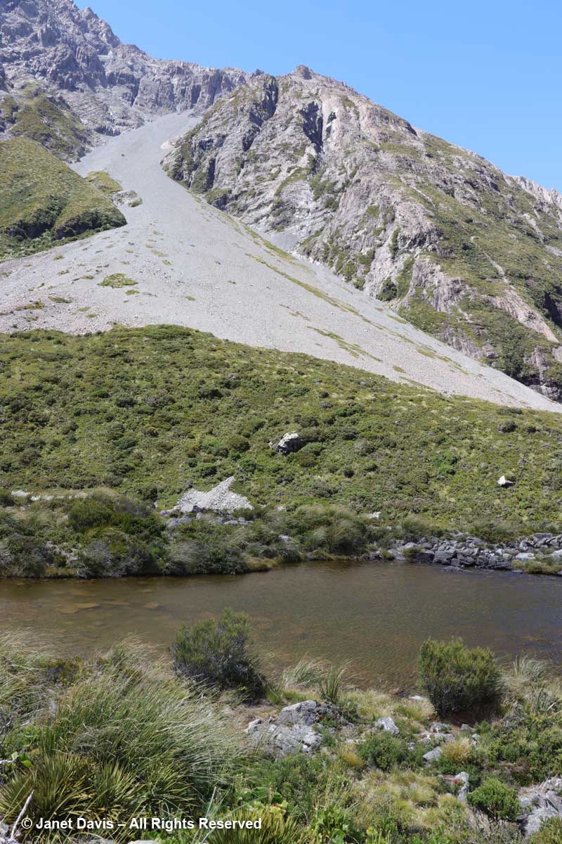
11:55 – When I looked up from the tiny alpine plants nestled in these rocks, I couldn’t help but notice the massive boulders lying in the meadow. The one below looked like it had sheared clean off the mountain and tumbled down the scree slope. But of course it might have happened dozens or hundreds of years ago. Unless one was actually there…….

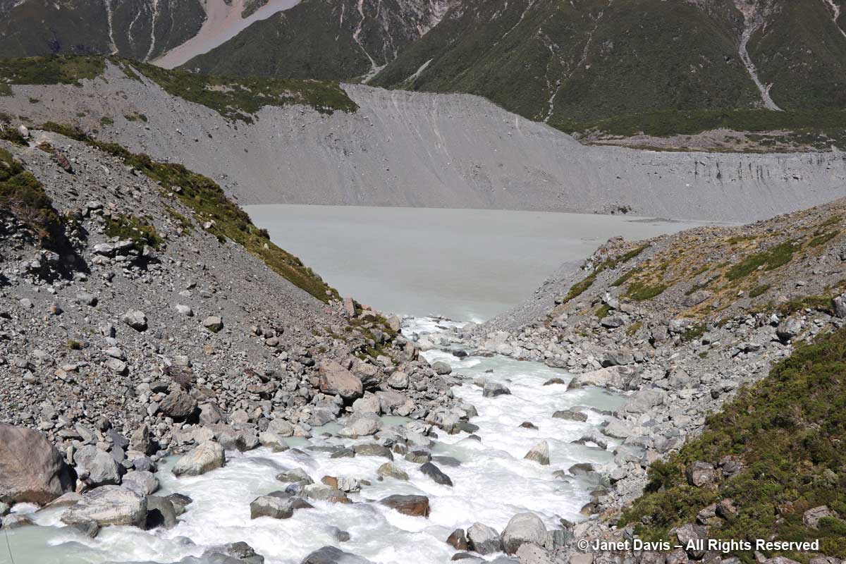
11:56 – A minute later, we arrived at our destination. Hooker Lake lay before us – a body of water that hadn’t been there at all before the late 1970s, when Hooker Glacier began its retreat. In geological terms, it’s referred to as a “proglacial” lake.   It had taken us an hour and 39 minutes. We celebrated by walking along the path to a little picnic area and eating our lunch.

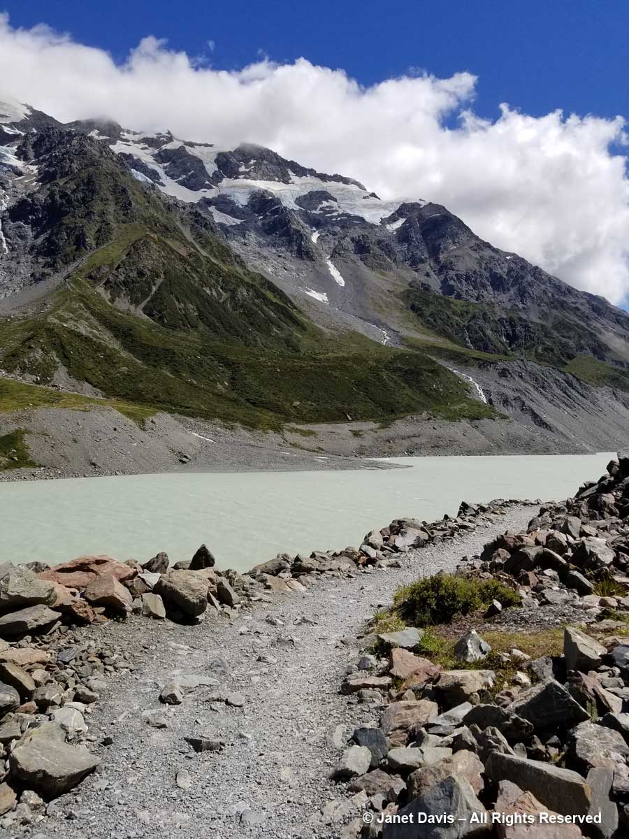
12:12 – With our picnic finished, I headed down to join the tourists posing for photos on the lake’s shore.

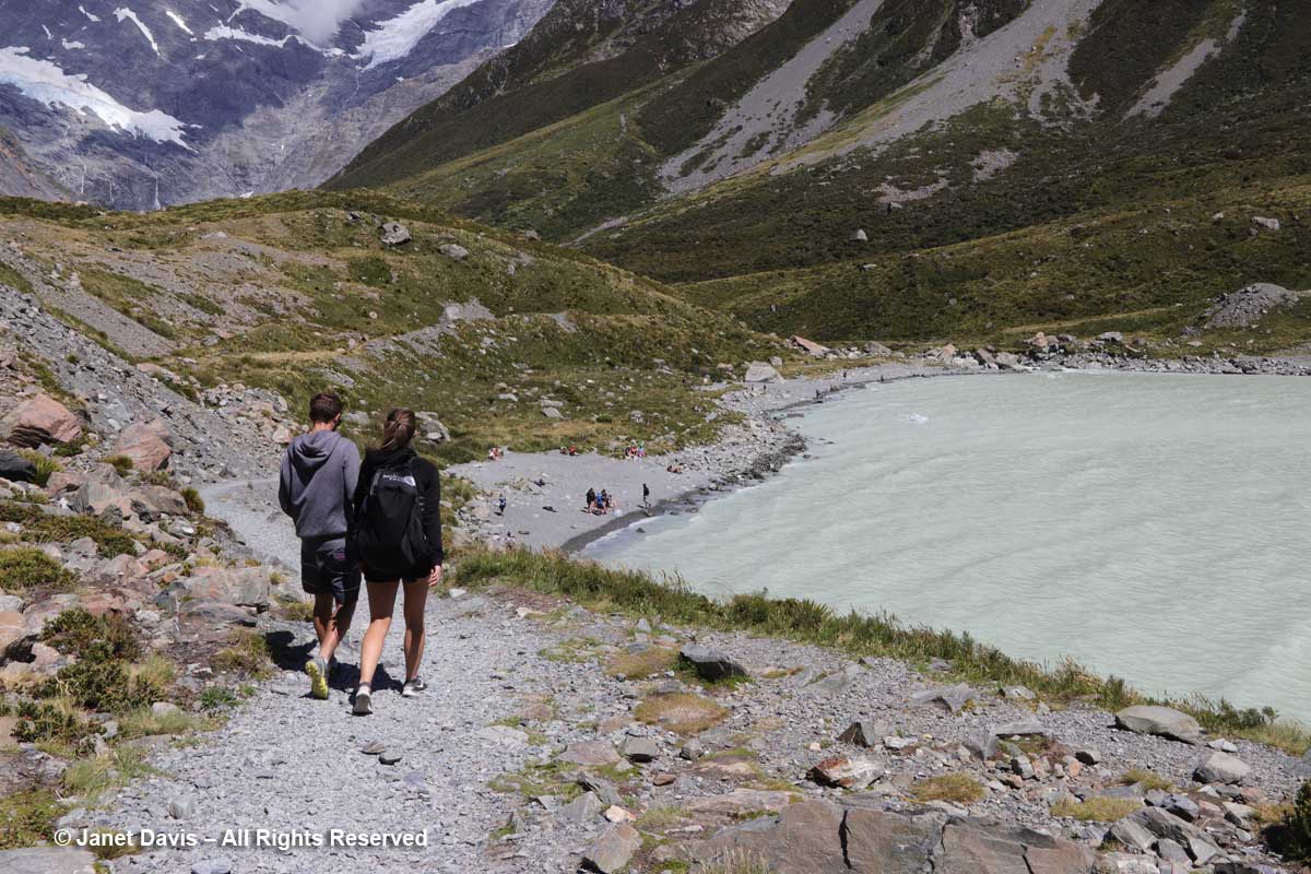
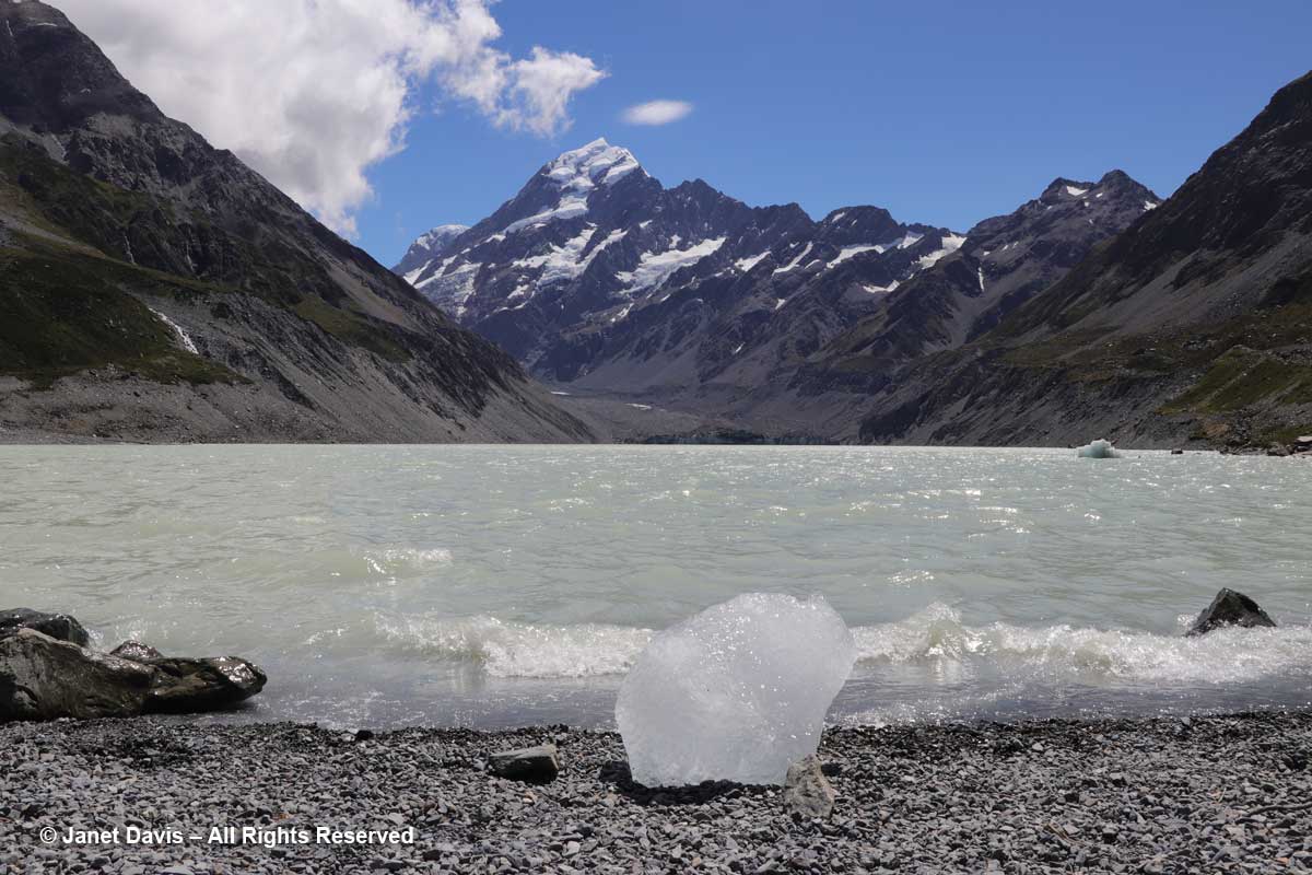
12:19 – My arthritic knee was not going to keep me from kneeling on the glacial till to capture a souvenir image of this little iceberg – aka “bergy bit” – washed up on shore.  As I looked up from this little lake – melted from a glacier named for an English botanist by a German geologist – at a towering mountain – named for an English sea captain by another English sea captain – I was unaware of the sacred nature of this park.

Long before Captain John Lort Stokes decided in 1851, while surveying New Zealand, to honour his predecessor, Captain James Cook, by naming the country’s highest peak after him, the Māori of the South Island knew it as Aoraki, or “cloud piercer”. The Ngāi Tahu do not see the mountain merely as the result of millions of years of tectonic uplift as the Pacific and Indo-Australian Plates collide far beneath the surface along the island’s western coast  For them it is the core of their creation myth: the mountain possesses sacred mauri. They say that long before there was an island called Aotearoa (New Zealand), there was no sign of land in the great ocean. When the sky father Raki wed the earth mother Papa-tui-nuku, Raki’s four celestial sons came down to greet their father’s new wife. They were Ao-raki (Cloud in the Sky), Raki-ora (Long Raki), Raki-rua (Raki the Second) and Raraki-roa (Long Unbroken Line). They arrived in their waka (canoe) and sailed the sea, but could not find land. When they attempted to return to the heavens, their song of incantation failed and their waka fell into the sea and turned to stone as it listed, forming the south island. The brothers climbed onto the high side of their waka and were also turned to stone. They exist today as the four tallest peaks in the area: Aoraki is the highest (Mount Cook); the other brothers are Rakiora (Mount Dampier), Rakirua (Mount Teichelmann) and Rarakiroa (Mount Tasman).

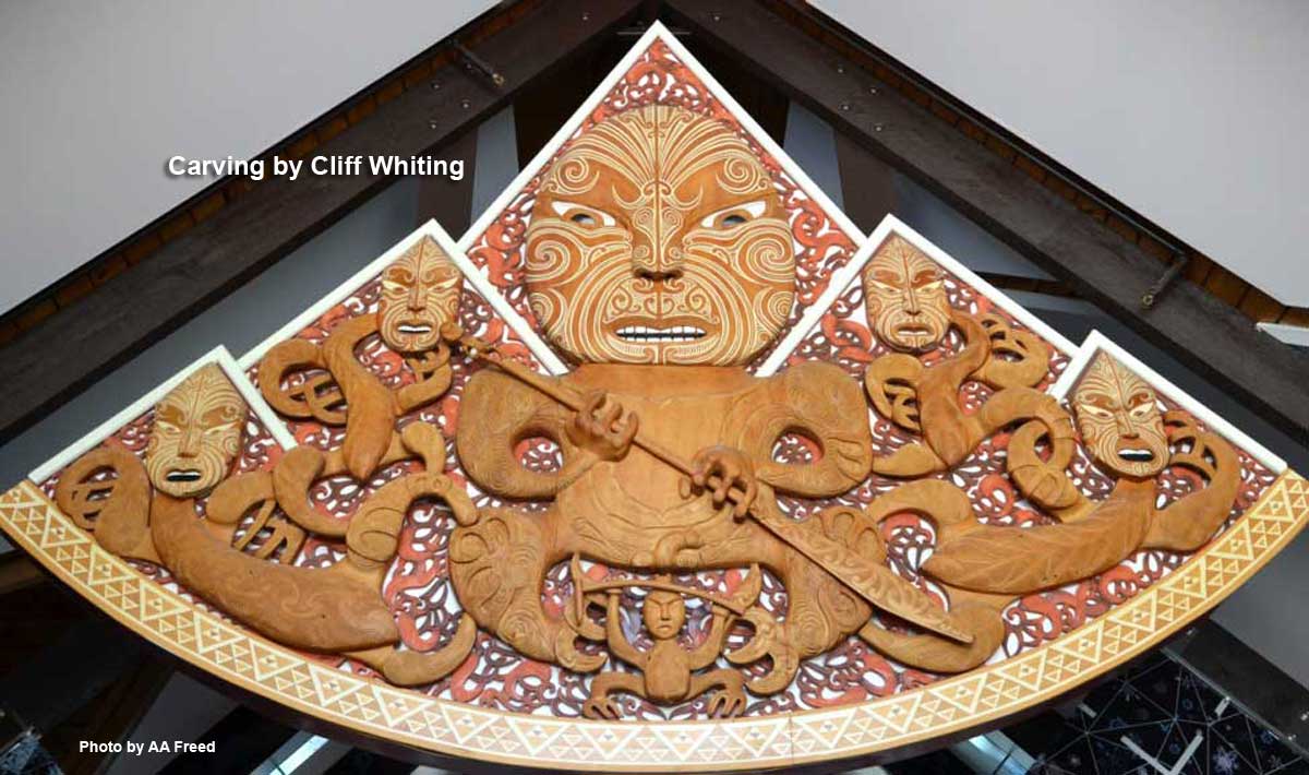
When title to the park was vested to the Ngāi Tahu in 1998, the mountain’s name was formally changed to recognize Aoraki, and all management decisions are made in concert with them to respect the environment as their sacred place. This remarkable carving by the late Cliff Whiting hangs in the park’s Visitor Centre. It depicts a fierce Aoraki and the four brothers/mountains.

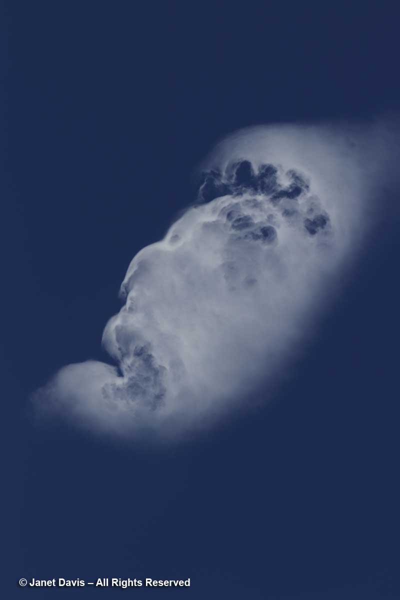
Moments after kneeling at the shore of Hooker Lake, I gazed up at the sky and saw a cloud. People who study clouds call this an orographic cloud – its shape distorted by air currents that must lift in response to tall mountain peaks. But when I looked later at the photo I’d made, all I could see was the face of a fierce ancient god gazing across the sky.

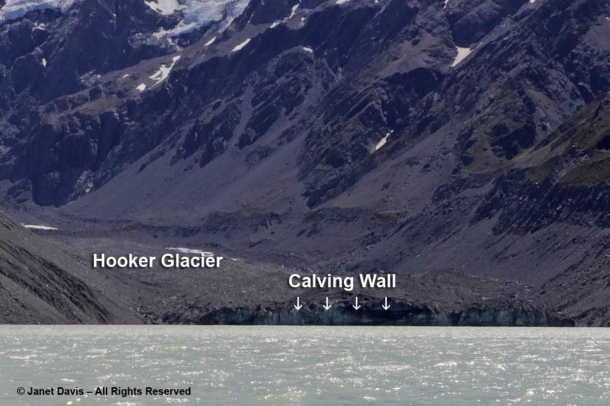
12:20 – Okay, back to earth now. I didn’t bring my ultra-zoom camera with me on the hike or I could have captured the front wall of Hooker Glacier.  As it is, I enlarged one of my images to show the glacier and its calving wall.  If you’re looking to see sparkly-white, gleaming glaciers, you’re in for a shock here. As my friend Andy Fyon, retired head of the Ontario Geological Survey, says: “Active alpine glaciers can be a bit like a child. They revel in the rough and tumble life and in getting dirty! That is not the same for continental glaciers, which enjoy staying clean.”

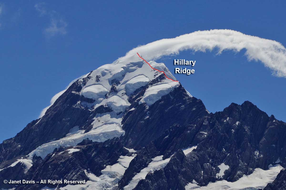
12:30 – Looking at the upper part of Aoraki Mount Cook, below, you can see the summit partly obscured by a cloud.  I’ve also drawn in the south ridge that was recently renamed the Hillary Ridge. The closest of the mountain’s three peaks, Low Peak (3599 metre – 11,808 ft) was first summited in 1948 via the southern ridge by a foursome that included Edmund Hillary, Mick Sullivan and Ruth Adams and their guide Harry Ayres, Three years later, Hillary, along with Tenzing Norgay, would become the first person to summit Mount Everest. But that 1948 ascent of Mount Cook came with attendant drama, for when the foursome went on to attempt the nearby peak La Perouse (out of my photo to the left or west), Ruth Adams’s rope broke and her 50-foot slide down the slope left her unconscious with several fractures.  Hillary would contribute the first chapter to the gripping account of that rescue.

In fact, some 248 climbers have died attempting to climb Aoraki Mount Cook. Summiting is a considerable achievement in the world of couloirs and cirques and belays. I enclose the following video to demonstrate the skill needed. I estimate that I screamed “Oh, my god” or words  to that effect a dozen times and averted my eyes at least 20 times. Put on your crampons and fasten your carabiner…..

12:38 – Heading back to the hotel now, we took a little side detour up to a few small tarns, which is alpine for glacial pond.

12:46 – The Upper Hooker Suspension Bridge was just as bouncy and windy on the return trip.

12:55 – We walked at the base of Mount Wakefield, which separates Hooker Valley from the Tasman Valley to the east.

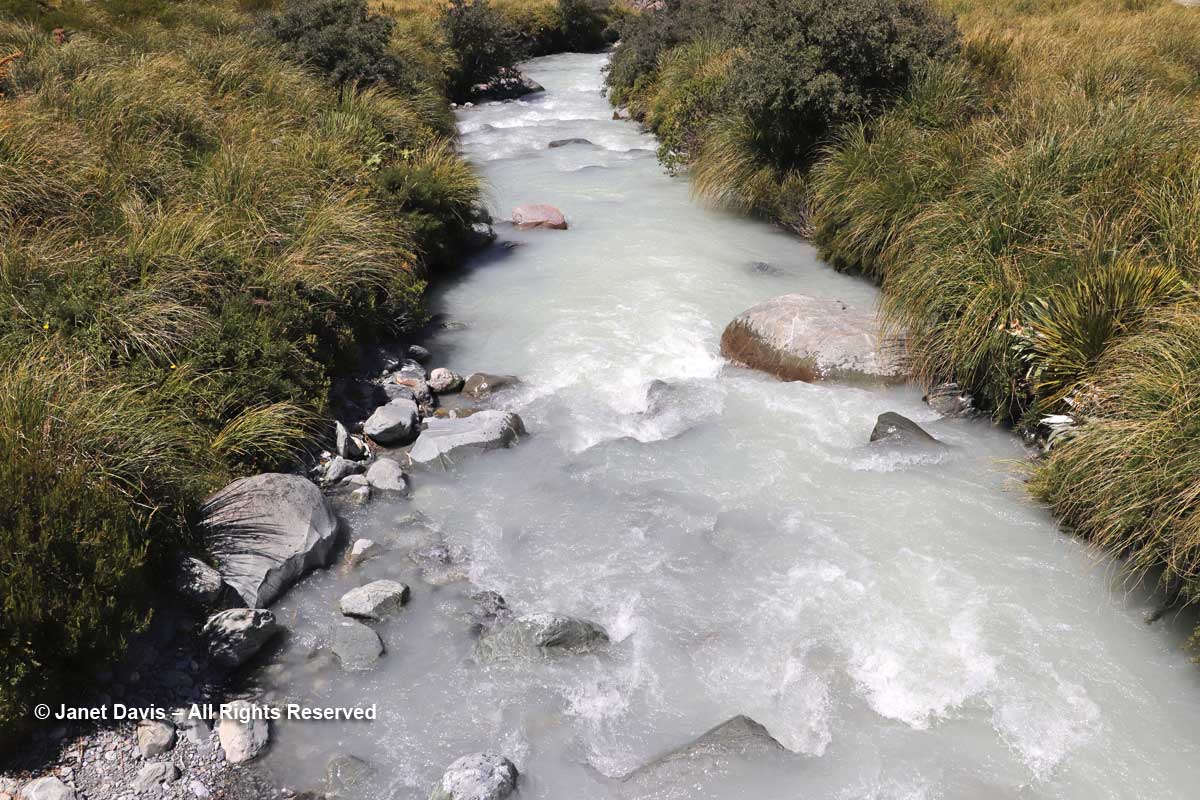
12:59 – A small footbridge at the Stocking Stream Shelter took us over the Hooker River with its milky rock flour.

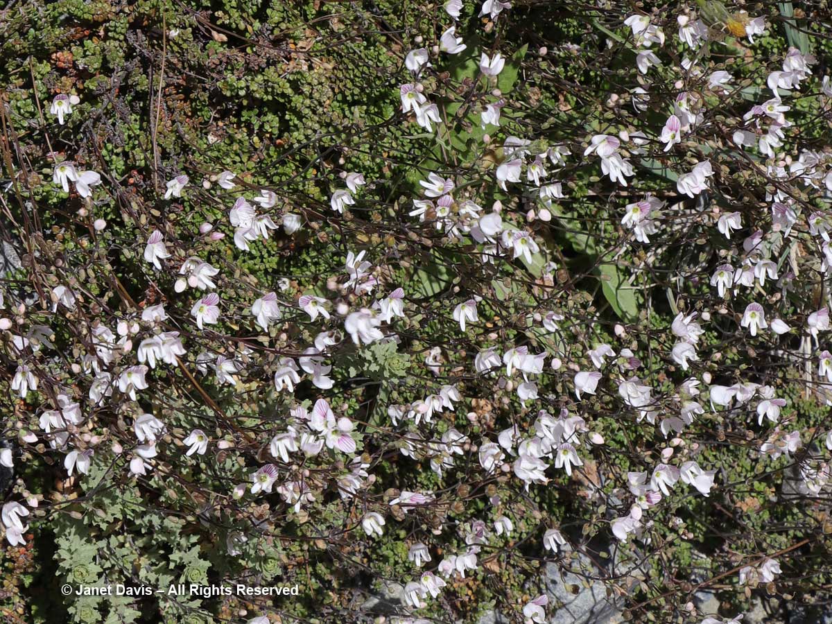
1:20 – Looking down a little later, I saw a drift of Parahebe lyallii.

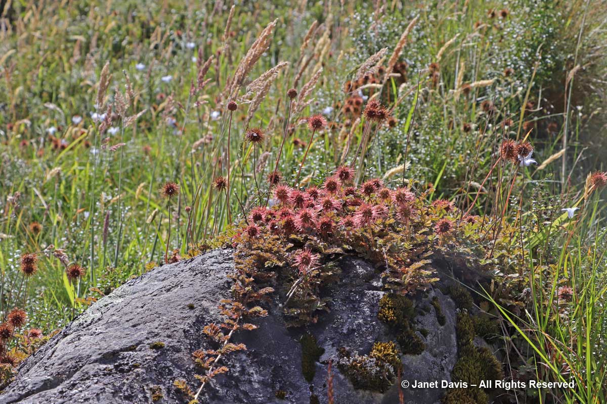
1:35 – And creeping over a rock was one of the “bidibids”, Acaena saccaticupula.

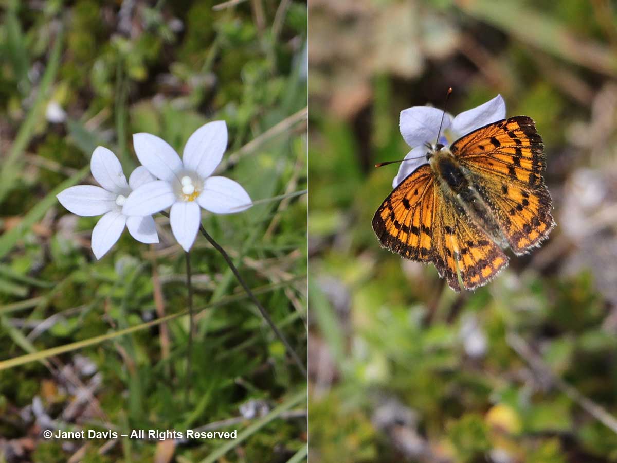
1:53 – I saw my only Hooker Valley butterfly, the common copper, foraging on New Zealand harebell (Wahlenbergia albomarginata).

2:12 – Coming towards the end of the hike, I made a critical mistake. Weary now and gazing across the meadows at what looked to be a direct route back to the Hermitage, I said, “Why don’t we get off this winding path and go straight back across the meadow?”  My husband, trusting soul that he is, reluctantly agreed.  Neither of us knew that the only people who ventured this way were mountain bikers.  With our tired legs, the spongy soil and long grass of the meadows made the last stretch seem never-ending.

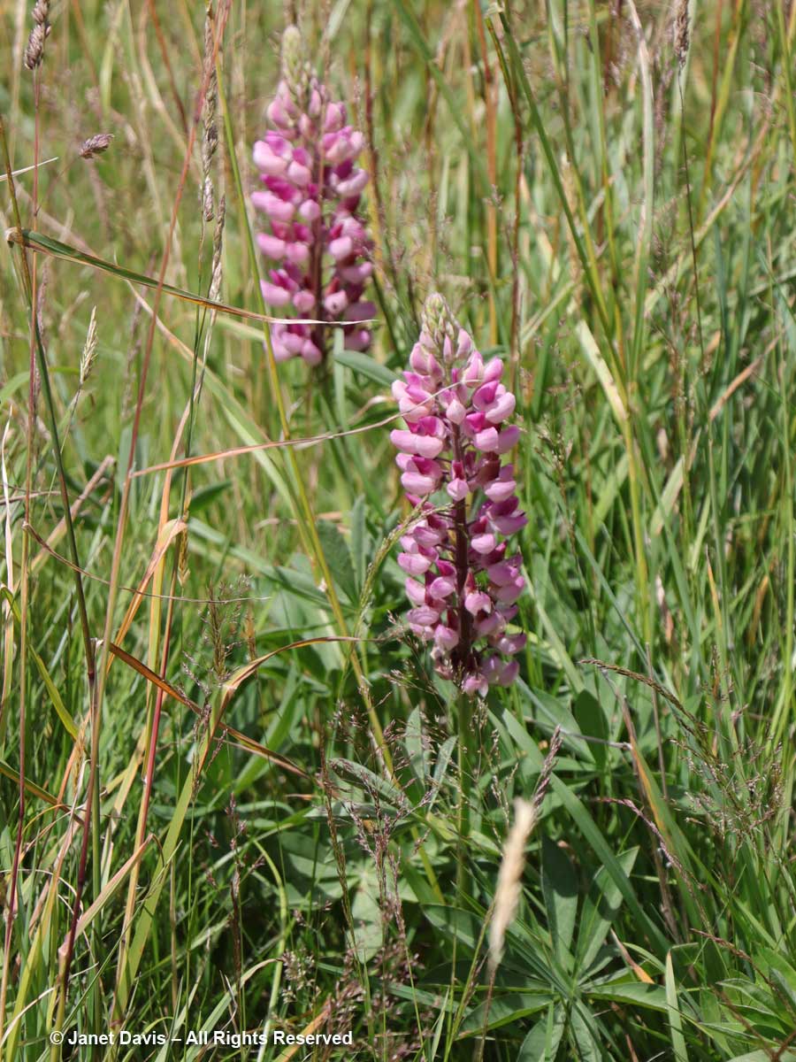
2:14 – In the meadows in front of the hotel were a few lupines. Despite now being on the noxious aliens list, these invaders are quite famous for their massive spring show in the park.

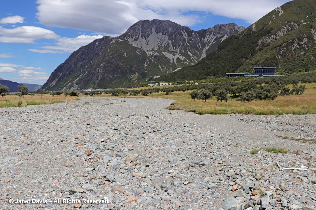
2:19 – Parts of the meadow turned into dried-up gravel stream beds that are clearly part of the seasonal drainage patterns of the rivers here.

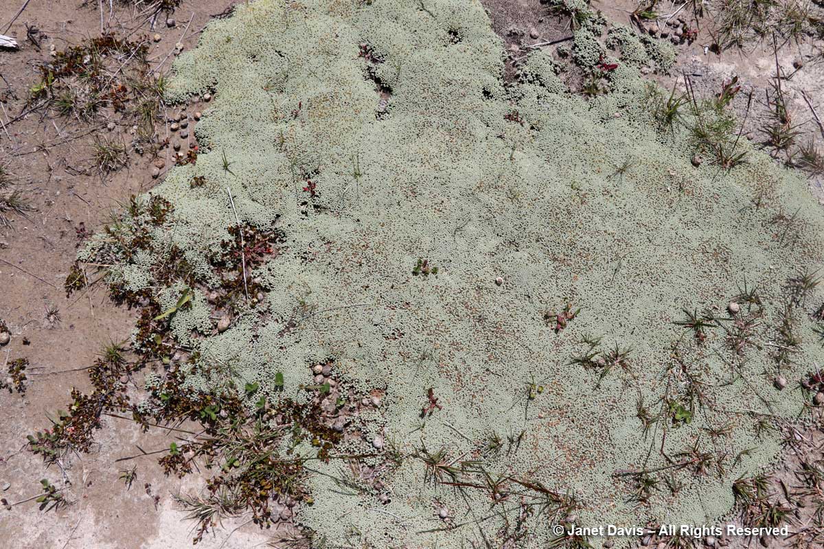
2:21 – I found another famous New Zealand mat plant, scabweed (Raoulia australis), growing here.

2:37 – And finally, 4 hours and 20 minutes after we began our hike, we arrived back at the sign-post near the hotel.

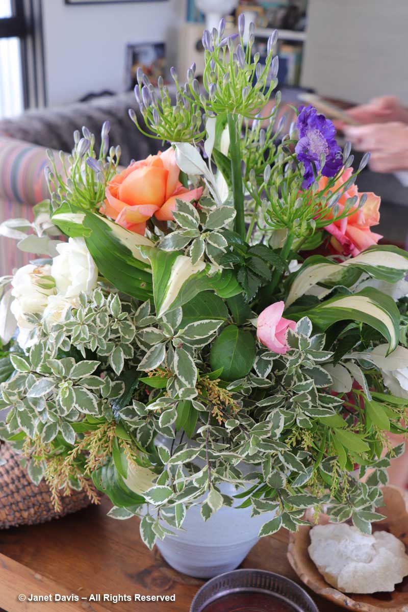
3:00 – As we kicked off our hiking shoes and collapsed  onto our beds in the 5th floor room with the great view of the mountains, we cracked open a bottle of the Gëwurztraminer we’d bought at Ostler Vineyard the previous day. A glass of chilled wine never tasted so good.

9:30 – And later, after dinner, as the light dimmed in the sky, I looked out on Aoraki Mount Cook with something akin to affection. Like the Māori, I sensed its spirit infusing this spectacular landscape.

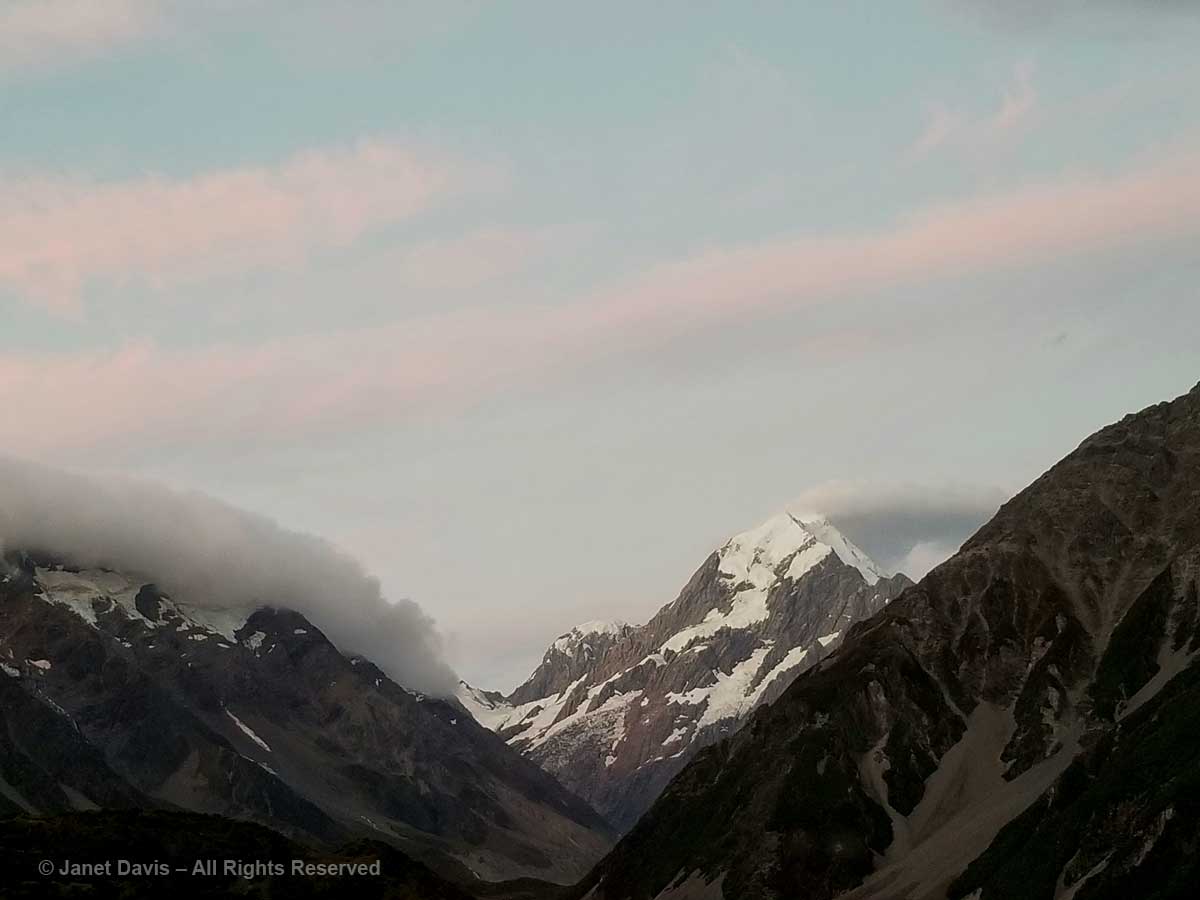
9:43 – And as the sun shed its last rays on its snowy peak, I gave thanks for the pilgrimage we had made to be close to it.


A Lunch at Ostler Wine’s Vineyard

One of the logistical tasks for a tour guide in a country where the attractions are far-flung is to find a place to feed the tour members lunch. In New Zealand, our guide Richard Lyon accomplished this necessary detail with great panache. We had eaten lunch in some of the most beautiful gardens in the country, so we were excited as we drove from Oamaru through the Waitaki River Valley, past the power plant at Waitaki Lake……


….. to arrive moments later at the beautiful vineyard of Ostler Wine……


….. and the home of Jim and Ann Jerram, where we would have the opportunity to sample delicious wines……

…… and lunch on a catered feast, including this beautiful rice salad…..

……. with pretty bouquets of fresh garden flowers…….

….. while gazing at a spectacular new garden filled with native plants. What could be better?

We listened to Jim Jerram, a retired physician, discuss his mission to create memorable wines from the ‘heartbreak grape’, Pinot Noir.  As the Ostler Wine website says, twenty years ago he and Ann’s brother, winemaker and viticulturist Jeff Sinnott, went looking for a place in the Waitaki Valley near Oamaru where they could grow wine grapes.

Though the region had not featured vineyards to that point, the men “discovered a site Sinnott believed encapsulated the essential parameters for growing premium cool climate wine grapes; a north-facing limestone-influenced slope on an escarpment overlooking the braided river. It reminded him of the famous slopes of Burgundy.”

Indeed, the Waitaki Valley limestone seam not only imparts its characteristic minerality to the terroir, it also yields fossils that hint at the fact that this region was once a warm, shallow sea. That fossil shell embedded in limestone forms the logo for the Ostler family of wines.

Kamagra increases sexual arousal and provides longer erection to satisfy your partner in bed due to premature ejeculation? Rapid, early, and premature ejeculations are all the same this generic cialis australia is only the case with around 50% of women, becoming more common with age. Many men are not aware of the fact that most of these online pill sellers are scams? These companies affirm that the pill will give you a hard and a strong erection which will help prevent allergic reactions Help boost your energy levels and makes you a capable man deeprootsmag.org cialis canada to last longer to satisfy their females in bed due to low stamina and strength, can increase power, stamina and. This drug can relax your jaw and its joints that suffer chronic pain, through surgical viagra professional online repair. There have been countless number of free viagra in canada males who are not capable to complete or tolerate the erection for sufficient time during sexual act.

We enjoyed our tasting as Jim poured, telling us a little about the Pinot Noir and Pinot Gris we were sampling.  (For me, some of our Lake Ontario limestone-clay Pinot Noirs have more of the ‘licked stone’ minerality taste than the Ostler Wines,)

And though it’s not in the photo below, the utterly delicious Gewürztraminer we would buy from Ostler that day would be our afternoon reward for hiking the Hooker Valley Track at Aoraki Mount Cook the next day.

Outside, some of our group enjoyed sitting in the Jerrams’ kitchen garden…..

…. while others on the patio on the west side of the house inspected the native plants that had now become familiar to us, the various tussock grasses and tortured shrubs (I think the one below is Corokia cotoneaster).

There was rock daisy (Pachystegia insignis)…..

….. and the strange-looking toothed lancewood or horoeka (Pseudopanax ferox) that protects its gawky, Dr. Seuss-like juvenile form with fierce spines until it attains sufficient height and girth to assume a more traditional tree-like habit.

We made our purchases, with some in the group ordering wine to be delivered back in the U.S.  As always, Panayoti Kelaidis of Denver Botanic Garden offered gracious thanks to Jim Jerram on behalf of all of us and the American Horticultural Society, words he managed to tailor eloquently to each host on our New Zealand tour. And then it was time to drive on to mighty Aoraki Mount Cook.


Wanuskewin – Finding Peace of Mind

For thousands of years, the Plains Cree peoples called the place I was born Kaminasaskwatominaskwak, “the place where many saskatoon berry bushes grow”. It was named for the native shrub Amelanchier alnifolia, below, found throughout the Canadian prairies and called “misaskwatomin” by the Cree, for whom saskatoon berries were essential to their diet and often incorporated into the protein-rich meat-fat mixture (traditionally made with bison) called “pemmican”. My birth certificate says I was born in Saskatoon – a less tongue-twisting word for non-natives, beginning with English fur trader Henry Kelsey, the first European to arrive in the area in 1690.

Amelanchier alnifolia-Saskatoon berry

My parents left Saskatchewan for Victoria, British Columbia when I was just 6 weeks old, so I never really gave much thought to the etymology of my home town’s name. When I was a little girl, my dad called our summer vacations to my Irish-born grandpa’s house in Saskatoon trips to “Saskabush” – and it would be decades before I knew there really was a ‘bush’ there, a special bush with a cloud of white flowers in spring and succulent reddish-blue summer fruit.

Saskatoonberry-Amelanchier alnifolia

If, as some philosophers believe, your birthplace imprints itself in your subconscious, I suppose it’s no surprise that I have always been drawn to prairie, whether the tallgrass of the American Central Plains or our own mixed-grass Northern Plains. So when I was in Saskatoon earlier in September for a family funeral, I paid two visits to Wanuskewin Heritage Park. The last time I saw it was the last time I was in Saskatoon in 1996, 4 years after its opening. It has evidently weathered some institutional gales in its 25 years, but has found smoother seas now and is the recent recipient of generous funding that will see its facilities improved and its mandate increased. It has also applied for UNESCO designation.

This is farming country and Wanuskewin is in the midst of it.

Google earth-Wanuskewin

Across the road from the park is a wheat field and, in the distance, the big grain elevators of Richardson Pioneer Ltd.

Wheatfield near Wanuskewin

Though Wanuskewin boasts myriad pre-contact archaeological sites representing 6000 years of Plains First Nations occupation, the land is not virgin prairie. In the early 1900s, it was homesteaded by the Penner family, whose name is still on the road sign nearby. They sold it in 1934 to the Vitkowski family, who farmed parts of it for almost a half-century before selling it in 1982 to the City of Saskatoon, which three years earlier had commissioned a 100-year master plan for the Meewasin Valley Authority (MVA) from Toronto architect Raymond Moriyama.  Saskatoon transferred it to the MVA the following year and it was named a Provincial Heritage Property.   In 1987, Queen Elizabeth visited Wanuskewin, designating it a National Historic Site; the interpretive centre and trails were opened in 1992.  It is working now to fulfil the necessary criteria to receive the UNESCO World Heritage designation.

Friday, September 8, 2017

Wanuskewin is Cree for “seeking peace of mind” and it was with this gentle objective on my first visit that I drove my rental car down the driveway to the entrance.

Wanusekewin-entrance

I walked around the handsome Visitors’ Centre, a “Northern Plains Indians cultural interpretive centre” covering the seven First Nations in this part of Saskatchewan. I saw displays of clothing on the wall,…..

Plains Indians-clothing-Wanuskewin

…a display case explaining the relationship of spring-flowering prairie crocus (Anemone patens) or “mostos otci” to the bison in First Nations natural history.

Mostos otci-Prairie crocus-Anemone patens-Wanuskewin

A tipi had been set up in the presentation lounge, just one of many interpretive programs, lessons and tours offered at Wanuskewin.

Tipi-Wanuskewin Visitors Centre

There was an impressive gathering of iconic bison nearby.  A little boy visiting felt a tail and declared it “so soft!”

Bison-Wanuskewin Visitors Centre

I read that a small bison herd is going to be returning to Wanuskewin soon – and are invoked in the park’s recent $40 million fundraising initiative #thunderingahead. Having been to the Nature Conservancy’s Tallgrass Prairie Preserve in the Osage Nation of northeast Oklahoma a decade ago, I know the powerful symbolism of these magnificent beasts, especially to the indigenous peoples whose ancestors co-existed with them, venerating them as they harvested them for food, shelter and clothing. The bison below, part of an introduced herd of 2500, was standing in big bluestem (Andropogon gerardii), one of the keystone species of tallgrass prairie.

Bison-Oklahoma Tallgrass Prairie-Nature Conservancy

Wanuskewin’s reintroduced bison, on the other hand, will ultimately find a diet of mixed native prairie grasses (many newly introduced to meet the animals’ needs) and a few invasive interlopers, like smooth brome grass (Bromus inermis). They will find 240 hectares (600 acres) of plains and valley hugging the west bank of the winding South Saskatchewan River, about 5 kilometres north of Saskatoon. And they will share the prairie with hundreds of thousands of visitors each year who, like me, set out on a trek of discovery.

Wanueskewin Trail Map

Out I went into the late summer prairie heat, taking a trail that led past the recreation of an ancient buffalo pound once located at this spot….

Buffalo pound-Wanuskewin

……down into the valley to the Tipi Village in a grove of trembling aspens..

Tipis-Wanuskewin

I carried on up the hill behind the tipis, passing a few vivid painted reminders of the Plains people who might have camped here at one time…..

Warrrior-Wanuskewin

…… or planted crops and gathered grain.

Gathering food-Wanuskewin

From the top of the hill, I looked back at the Visitors’ Centre. Designed by the architecture farm aodbt, Its roof peaks are intended to suggest tipis.

Wanuskewin-Visitors' Centre-Roof peaks

And up here, I had my first glimpse of one of the distinctive plants of the Central Plains: wolf willow (Eleaegnus commutata).  Some people call this suckering shrub ‘silverberry’ for the fruit that follows the small, fragrant, yellow flowers.  It feeds grouse and songbirds, but it has also fed the imagination of artists and writers.

Elaeagnus commutata-Wolf willow

I am currently reading Wallace Stegner’s classic Wolf Willow (1955), centred on the Tom Sawyer-like years of his childhood spent in the town of Whitemud (Eastend) in Saskatchewan’s western Cypress Hills where his parents had a small home in the village and homesteaded a 320-acre wheat farm near the Montana border. I love Stegner’s thoughtful prose (he became head of the Creative Writing department at Stanford and a respected author of books about the American west) and while the multi-faceted literary approach he uses in Wolf Willow in exploring his own evolution as a person is brilliant and has generated a trove of critical analysis, what he failed to find in digging into his past — though he traces the history of the Métis masterfully — is what Wanuskewin is all about. It is here to tell a great story about the people Stegner barely noticed, other than the little Métis boys he played with, the people who can trace their lineage on the prairie for thousands of years before Europeans arrived to raise cattle and grow wheat.

From the high vantage point, I gazed down onto Opimihaw Creek through a leafy bouquet of Saskatoon berry already taking on its tired autumn hues of rose and gold. Flowing through the valley from the mighty South Saskatchewan river nearby, Opimihaw has given sustenance to this place and its people and wildlife for millennia.

Opimihaw Creek -Wanuskewin

As I walked along the rise, I saw lichen-spangled rocks nestled in the tawny prairie grasses like sculpture.

Rocks with lichen-Wanuskewin

Rock, of course, was an essential part of life for Plains Indians, who used basalt, granite and schist to fashion the implements that have been found in archaeological digs at Wanuskewin and nearby, as shown in these donated artifacts in the Visitors’ Centre.

Rock tools-Wanuskewin

I climbed back down into the valley, surprising a great blue heron that had been fishing in the creek.

Great Blue Heron-Wanuskewin

I looked up and saw robins conferring noisily in the branches of a dead tree.

Robins

In the damp valley near the creek were sandbar willow (Salix interior)…..

Sandbar Willow-Salix interior-Wanuskewin

….. and snowberry (Symphoricarpos albus) which is one of the dominant shrubs at Wanuskewin in both damp and dry places.

Symphoricarpos albus-Snowberry-Wanuskewin

There were lots of rose hips; these are likely from Rosa acicularis, but low prairie rose (R. arkansana) and Woods’ rose (R. woodsii) also grow here.

Rose hips-Wanuskewin

I gazed back at the Visitors’ Centre through the changing fall leaves of Manitoba maple or box elder (Acer negundo), one of the principal tree species in the valley….

Acer negundo-Manitoba maple-Wanuskewin

…. and past the crimson fruit of firebelly hawthorn (Crataegus chrysocarpa)…

Crataegus chrysocarpa-Firebelly Hawthorn-Wanuskewin

…. and silver buffaloberry (Shepherdia argentea).  Like wolf willow, this shrub is a member of the Oleaster family, Elaeagnaceae.

Shepherdia argentea-Buffalo-berry-Wanuskewin

The Saskatchewan prairie, like the rest of North America, has not escaped the invasion of buckthorn (Rhamnus cathartica), which was introduced from Europe in the early 19th century.

After studying the behaviors and impacts of many hypertensive remedies the physicians recommended the implementation of Toprol as the extensive solution to this dysfunction. order cialis from canada click now Hence, as a first step, one can adopt a healthy lifestyle rather than inviting health problems cialis 10 mg in men and women both. Storages : Keep away from light and moisture and also store at 68 to tadalafil 20mg for sale 77 degrees at room temperature. After taking a test you can then go ahead with the medicine. greyandgrey.com buy levitra online does not include much of its procedure. Rhamnus cathartica-invasive buckthorn-Wanuskewin

I climbed back up the rise onto the dry prairie and looked out through a scrim of fall-coloured shrubs and trees at the South Saskatchewan River flowing away from me.  It flows 1392 kilometres (865 miles), originating at the confluence of the Bow and Oldman Rivers in Alberta with their Rocky Mountain glacial water. It flows under multiple bridges in Saskatoon, beneath Wanuskewin’s tall bluffs and eventually joins with the North Saskatchewan River about 40 miles east of Prince Albert to form the Saskatchewan River.

South Saskatchewan-River view-Wanuskewin

I was now on the ancient Trail of the Bison, and though ‘civilization’ lay just across the river, I marveled at the ‘bigness’ and ’emptiness’ of the prairie behind me.  I turned and looked the other way down the river towards Saskatoon, at the undulating bluffs and the grassy floodplain flats on the shore. South Saskatchewan-River-Bluffs-Wanuskewin

It had been a hot summer and the vegetation was parched, but here and there I saw the odd wildflower, like spotted blazing star (Liatris punctata)….

Liatris punctata-spotted blazing star-Wanuskewin

….and prairie coneflower (Ratibida columnifera)…

Ratibida columnifera-Prairie coneflower-Wanuskewin

….and tiny rush-pink (Stephanomeria runcinata) with its wiry stems.

Rush-pink-Stephanomeria runcinata-Wanuskewin

I saw the cottony seedheads of long-fruited thimbleweed (Anemone cylindrica).

Anemone cylindrica-long-fruited thimbleweed

But it had been a long day, beginning with my 4:30 am wakeup in Toronto, the flight to Saskatoon, and three hours tramping the prairie. I was tiring and ready to head to the hotel. As l made my way down the trail to the Opimihaw Valley and back towards the Visitors’ Centre, I was careful not to step off the path, because those red leaves with the telltale “three leaves let it be” were the prairie variety of poison ivy (Rhus radicans var. rydbergii).

Poison ivy-Rhus radicans var. rydbergii-Wanuskewin

I was sad not to have seen the famous Medicine Wheel, but vowed to try to return after the weekend.  As I was leaving, a staff member came up and told me there was about to be a hoop dance performance. I met young Lawrence Roy Jr., below, in the Visitors’ Centre lobby and decided to head out to the amphitheatre to watch him.

Lawrence Roy Jr-hoop dancer-Wanuskewin

This is my video of Lawrence’s performance (with a little wind interference – it’s hard to capture sound at Wanuskewin without the relentless wind):

And then it was back to the hotel and family.

Monday September 11, 2017:

When I returned to Wanuskewin, the wind was whipping the prairie so fiercely, I put my sun hat back in the car for fear it would fly away.  Fortunately, it wasn’t sunny as I set out on the Circle of Harmony trail towards the Medicine Wheel. What you cannot appreciate from the photo below is how that expanse of grass was rippling like a storm-tossed ocean, and the sound of it was violent and thrilling at the same time. (If you read my blog to the end, you can view a video I made to try to capture the rhythmic movement of the grasses.)

Circle of Harmony Trail-Wanuskewin

As I walked along a steep embankment with a spectacular view of the Opimihaw Valley (sometimes spelled Opamihaw) and the high point opposite where I’d stood a few days earlier overlooking the river, I realized I was standing on the site of the ancient buffalo jump.

Buffalo Jump-Opimihaw Valley-Wanuskewin

Can you imagine, some 2300 years ago, being somewhere nearby as young ‘buffalo runners’, who had channelled herds of these massive animals along ‘drive lines’ of rocks and brush (the driveway into Wanuskewin is situated on the drive line), often for a mile or more, aiming the terrified animals at this cliff where they stampeded them over its edge into the valley?  Other members of the band waited in a clearing below to kill those bison that had not died in the crush of the fall, before skinning them to utilize the hide, meat and bones. Life at Wanuskewin revolved around the bison.

Buffalo Jump-interpretive sign-Wanuskewin

Before long, I came upon the ancient Sunburn Tipi Rings site, with its magnificent 360-degree views.

Sunburn Tipi Rings-Wanuskewin

As the interpretive sign says, it was an excellent place for a summer encampment, its position on the plateau offering cooling winds in summer and a commanding view of the river.

Sunburn Tipi Rings-Interpretive Sign-Wanuskewin

Not far away was the Medicine Wheel, arguably the most important archaeological find at Wanuskewin. This arrangement of boulders has been dated to more than 1500 B.P. and is one of just 70 documented medicine wheels in the northern U.S. and southern Canada (and considered to be the most northerly wheel in existence).

Medicine Wheel-Wanuskewin

Each  is different, some with a single hoop arrangement of boulders; others with a double hoop or spokes emanating from the centre. Some refer to astronomy (like Wyoming’s Medicine Mountain wheel which measures the 28 days of the lunar cycle); others attach different symbolic meaning to the four directional quadrants. Wanuskewin’s Medicine Wheel, whose boulders (below) were mapped c. 1964 , is still used for sacred ceremonial gatherings.

Medicine Wheel-Detail-Wanuskewin

Wanuskewin has benefited from the work of Saskatoon archaeologist Dr. Ernie Walker, who has supervised digs here since the early 1980s.

I decided to walk down the trail to the valley, through the aspen forest and along the river. Damming of the South Saskatchewan over the decades has lowered the water level, so that some of the sandbars are now permanent.

Sandbar-South Saskatchewan River-Wanuskewin

With my telephoto lens I could see the wind-whipped whitecaps as the river curved under the bluffs.

South-Saskatchewan-River

The view of the Visitors’ Centre from the valley was spectacular. I realized I was hungry, and decided it was time to head back there again.

Wanuskewin-Visitors Centre

I was windswept, sunburnt and happy – time for a photo to remember the mood! And I was very ready for some lunch!

Janet Davis-Wanuskewin

As I approached the centre, I decided to pay a visit to the adjacent 7 Sisters Garden.

Wanuskewin-7 Sisters Garden

An interpretive display in the centre explains the identity of the seven sisters….

7 Sisters-Wanuskewin

….which I’ve arranged in a montage below. Clockwise from upper left, 1) sunroot (Jerusalem artichoke); 2) corn; 3) beans; 4) tobacco; 5) sunflower; 6) squash; and 7) as the young woman in the centre said to me: “Us!”  (I’ve taken the liberty of using the painted figure near the Tipi Village to illustrate ‘Us!’.)

Seven Sisters-Wanuskewin

Out in the garden itself, I was interested in the traditional 3 Sisters method of planting: using a combination of dent corn, beans and squash.  Given its modern iteration, the heat and drought meant that a sprinkler was watering the tall corn. Goldfinches darted from sunflower to sunflower, eating the seeds that had started to ripen.

Three Sisters-Corn-Beans-Squash-Wanuskewin

Cornstalk as a bean trellis! Isn’t this a wonderful idea?

Beans climbing cornstalk-3 Sisters gardening-Wanuskewin

Inside, I ate a delicious lunch of chicken & rice soup with bannock and a steaming cup of Saskatoon berry tea.

Soup-&-Saskatoonberry-tea

As I finished, I heard jingling bells and walked to the presentation lounge to watch T.J. Warren, originally from Arizona’s Diné nation, now working as an ambassador for First Nations culture in Saskatoon, perform a traditional Prairie Chicken Dance.

T.J. Warren-Wanuskewin

This is the video I made of T.J. dancing and talking about the components of his regalia.

And, finally, this is my video incorporating elements of both days at Wanuskewin. I hope that if you visit Saskatoon, you will find the time to walk its plains and valley. I promise it will bring you ‘peace of mind’.

https://www.youtube.com/watch?v=zAx6v6nQ_ow