At long last, I’m finishing up my journal of our spectacular (and I don’t use that word lightly) September trip to the American West. As you might recall, in my first blog we visited Grand Teton National Park, then I wrote about our magical journey through Yellowstone National Park with its otherworldly geysers and fumaroles.
As we exit Yellowstone’s East Gate through Sylvan Pass in the Absaroka mountain range, we soon find ourselves following the Shoshone River through the Shoshone National Forest, both named for the indigenous Shoshone people who inhabited the region. At the river’s edge are willows and September-blooming rigid goldenrod (Oligoneuron rigida). This area between Yellowstone and Cody (our destination for the day and overnight) is called the Wapiti Valley, wapiti being the Shawnee word for elk.
Our first stop out of Yellowstone (which has no private commercial businesses) is Pahaska Tepee, a mountain resort built in 1904 by Buffalo Bill Cody as a hunting lodge. The resort has the obligatory gift shop…
….. horses ready to be saddled for trail-riding through the forest……
…. and, most interesting to us, a little museum…..
…displaying artifacts of Buffalo Bill’s time there….
…. including something that’s still important for forest-firefighters in the Yellowstone ecosystem, the vintage version of a modern Fedco smokechaser, a backpack water pump.
Driving along the Shoshone River, I’m reminded of an historic story of mistaken identity. When John Colter (mentioned in blog on the Tetons) became the first white man to reach Yellowstone in 1807-08, he described a sulphurous-smelling river with frightening geothermal features, a place that skeptics nicknamed Colter’s Hell. The assumption was that this river was in geothermal-rich Yellowstone, but it was later deduced that the river Colter described was, in fact, the Shoshone as it traverses deep canyons near Cody, Wyoming. For the record, this part of the Shoshone just smelled to me like a lovely autumn day!
The rock formations – pinnacles or hoodoos – in the Wapiti Valley are spectacular and renowned, the product of erosion of lower rock layers contrasted with the relative stability of towers remaining when hard cap rocks protect softer sediment below. This one looks for all the world like a Shoshone chief.
The brownish rock of the cliff across the highway is volcanic breccia.
Six miles west of Cody, Wyoming, we pass by the Buffalo Bill Reservoir. You can see how the landscape here has changed from rugged mountain valley to rolling hills and sagebrush. Cody actually sits at the edge of the Bighorn basin in the centre of four mountain ranges: the Absarokas, Big Horn, Owl Creek and Bridger Mountains.
Soon we pull up to the main attraction in Cody: the Buffalo Bill Center of the West. The name is a little deceiving, because this is five museums in one: Buffalo Bill Museum, Plains Indians Museum, Whitney Western Art Museum, Draper Natural History Museum, and the Cody Firearms Museum.
Pretty much everything in the town of Cody – and certainly in the Buffalo Bill Museum in the eponymous Center of the West – focuses on the legacy and legend of William Frederick Cody (1846-1917), aka Buffalo Bill Cody. (As a Torontonian I was interested to learn while researching this that when Iowa-born Cody was a youngster, he lived for 7 years in what is now Mississauga, Ontario, the birthplace of his father, Isaac, and was christened in the small chapel that the Cody family built in 1839. The Dixie Union Chapel still stands at the corner of Cawthra and Dundas.) After moving his family to the Kansas territory in 1853, Isaac Cody was stabbed by a pro-slavery sympathizer at a political meeting. He died three years later and William, aged 11, began working to support his sisters and mother. He drove horses and wagons (but the vaunted Pony Express stories seem to have been exaggerated by him to enhance his showman’s reputation later). When the Civil War broke out in 1861 young William was attracted to the Kansas Redlegs, an anti-slavery militia, joining it in 1862 to avenge his father’s death. He later joined the regular Union Army and served until the war’s end in 1865, fighting in 16 battles. Married and back home in Kansas, he joined a company providing meals to the workers building the Kansas Pacific Railroad. With his natural riding ability and his army-acquired skill as a crack shot, Cody’s job was to provide the meat, i.e. buffalo steak. He went back to work for the Army in 1868, acting as a civilian scout in the Indian Wars. His skill at hunting bison for the railroad and also the army became legendary, earning him his nickname “Buffalo Bill”. It’s estimated he killed 4282 bison in the years 1867-68. He burnished his reputation through his friendship with another “Bill” folk hero of the old West, Wild Bill Hickok.
By the early 70s when he was in his late 20s, Cody had already begun making appearances in newspapers and adventure novels, and he, Hickok and two friends started producing and starring in their own stage plays, the Wild West Shows. But he was still riding as a scout for the Fifth Cavalry in the Great Sioux War, and in July 1876 in northwestern Nebraska, he shot a young Cheyenne warrior named Yellow Hair and brandished his headdress and part of his scalp as a grisly atonement for Custer’s defeat and death at Little Bighorn just weeks earlier. It is memorialized in this 1928 painting ‘First Scalp for Custer’ by Cody’s friend Robert Lindneux.
In 1883, he mounted the first circus-like production, Buffalo Bill’s Wild West, in La Platte, Nebraska.
Ironically, in June, 1885, he even signed up Sitting Bull for an initial bonus of $125 and a wage of $50 per week. Despite Cody’s post-Indian Wars attempt to integrate his attraction using the very chief whose leadership helped make it possible to defeat General Custer in the Battle of Little Bighorn, Sitting Bull himself was killed 5 years later during his arrest by Indian Agency police.
Another feature of the museum is the Deadwood stagecoach, which had a stormy history in its career of 11 years, being repeatedly attacked for the gold and currency it carried.
One of the coaches was incorporated into Buffalo Bill’s Wild West tour, and when the show visited England for Queen Victoria’s Jubilee in 1887. “The highlight of the show came when several monarchs, including the Prince of Wales and the kings of Denmark, Greece, Belgium, and Saxony, hopped aboard the Deadwood Stage with Buffalo Bill in the driver’s seat and rode around the arena while the assembled Indians engaged in a mock attack.” (Buffalo Bill in Bologna, 1869-1922, Robert W. Rydell and Rob Kroes)
In 1893, he changed the name to Buffalo Bill’s Wild West and Congress of Rough Riders of the World, featuring a parade, cowboys, Indians, Turks, gauchos, African-Americans and others. He also launched the career of sharpshooter Annie Oakley (below) and her husband Frank Butler.
Despite his early skill at buffalo-hunting, according to displays at the museum, “Cody became an outspoken critic of the wanton slaughter of buffalos that began in the 1860s and led to their near extermination within two decades.” This is a taxidermy tableau in the Buffalo Bill museum.
Moving out of the Buffalo Bill Museum, I visit the wonderful Plains Indian Museum.
Of the myriad exhibits, I love the clothing. On the left is a deer hide-beadwork Cheyenne baby cradle. On the right is a girl’s dress adorned with elk teeth.
This tells the story of the relative ease with which the Cheyenne could migrate, once they had horses.
This hide painting by the Arapaho artist Eagle Robe, Eugene Ridgeley Sr., depicts the Sand Creek Massacre of 1864, in which 200 Cheyenne and Arapaho people, mostly women and children, were killed by the 3rd Colorado Cavalry.
The Draper Natural History Museum features exhibits on geology and biology, including Wyoming’s native animals.
You can watch scientists working on specimens in the Draper Museum Living Laboratory Exhibit.
Isn’t this spectacular? A map made from 27,000 mosaic tiles!
And this stunning painting by James Everett Stuart of the Yellowstone Falls and Canyon, part of the Center’s collection, takes me back to our recent visit to this spectacular feature.
Our final stop at the Buffalo Bill Center of the West is Dan Miller’s Cowboy Music Revue, starring Dan, his daughter Hannah Miller, and Wendy Corr. Here’s a little flavour of their music:
The next morning, after an overnight in Cody, we head out onto the highway. Bus travel at 60 miles an hour makes photography difficult, but the four small scenes below give you an idea of what we pass by. The crop at top right is sugar beets. The formation at lower left is a mesa, a rise weathered away by millions of years of erosion. At bottom right is a farm field after harvesting. In Wyoming, 80% of water use is farming and agriculture.
Somewhat bizarrely, there’s a Museum of Flight and Aerial Firefighting in the middle of the high plains – and it’s our rest stop.
Wyoming is known for its bentonite clay deposits. This is the stucco facility of Wyo-Ben Inc. at Greybull. You can see the red bentonite on the slope beyond.
Below is a field of dented corn, used mostly for animal feed (it’s also good for grits). At far right, you can see the bright green of an alfalfa field.
Here are some more snapshots of agricultural scenes (I love the beehives, top left) and geological features in the distance, the beginning of the Bighorns Bottom left is sandstone; bottom right is limestone (I think).
Highway 14 takes us east over the Bighorn Mountains, the last of the Rocky Mountain ranges. We’ll be at 9,000 feet elevation at the top.
The scenery is spectacular; we stop and look across the range. The small tree/shrub at the left is Utah juniper (Juniperus osteosperma). We’re at about 6000 feet here. I believe the pinkish rock on the top of the slope in the distance is Madison group limestone. (But I could be wrong). Geologists refer to that sloping inclination as a monocline.
Here’s a closer look at the top. All those blackish dots below are Utah juniper.
A large number of men downtownsault.org viagra in india online now take erectile dysfunction medication, you should first know what that does. Acquiring customer information and tracking purchase behavior is key to the growth of a retail brand.” Said, Vineet Narang of MobiQuest. “M’loyal, allows brands to build a database of most levitra australia relevant and visiting customers , tag each customer bill to identify, track and measure customer pulse. If you are facing any such problem, then don’t wait, order now to have satisfactory experience. cialis professional cipla It is such a combination that can work wonder when it comes to cialis super active your sex life. Look how the rock is weathered away at the very top.
At our lookout, I spot a painted lady butterfly (Vanessa cardui) nectaring on rabbitbush (Chrysothamnus).
As we descend to the eastern side, we pass big grazing ranges. The Bighorns have skiing, snowmobiling, sheep and cattle grazing, and forestry – apart from their natural beauty. .
Looking east as we descend, we see the Tongue River Valley; hidden is the Tongue River, which has its source in the Bighorns and flows north to Montana. There is a long history of litigation between the two states, with Montana claiming that Wyoming farmers take too much of the Tongue’s water. The trees on the slope are Ponderosa pines (Pinus ponderosa).
We pass the Tongue River Elementary School in Dayton, Wyoming….
…and it sparks a memory of a song by one of my favourite singers, Nanci Griffith (written by her former husband Eric Taylor). It captures a little of the 19th century lore of this area (a little east into South Dakota), the story of Crazy Horse (whose memorial we’ll see tomorrow) and “young Mickey Free, who lost an eye to a buck deer in the Tongue River Valley”. (And no, that’s not a photo of Crazy Horse, whose likeness has never been seen in a photograph). Listen to the words.
Our first look at open coal cars comes near Dayton. Forty percent of America’s coal is mined in this area. In fact, the largest coal mine in the world is the North Antelope Rochelle Mine near Gillette, WY.
And then we arrive at the highlight of our time in Wyoming’s Cowboy country: the TA Ranch in Buffalo WY.
The ranch has a storied history in Wyoming cattle country lore, for it was the site of the bloody grand finale of the Johnson County cattle wars, between the corporate cattlemen and homesteading ranchers. (See my video below for more on that episode).
After lunch, we have a number of choices of activities, from taking a wagon ride…..
….. to taking a trail ride. I haven’t been on a horse since I was 10 or so, and the thought frightens me a little, but they look docile and the land is flat (and my husband is willing, and anything he can do….). Thanks to Robert Kelley for the photo.
I make a video from the back of my horse Commander, so I can remember the landscape and the experience better. Here it is!
We also have time to watch TA Ranch’s ‘horse whisperer’ Marchel Kelley work on training a frisky horse. Here’s my video of that experience.
We finish our day at the lovely Ranch at Ucross …..
….where we have dinner, then sit around the campfire, listening to Katie Wilhelm sing cowboy songs for us before bedtime. Here’s a Wyoming classic:
As I walked out one morning for pleasure,
I spied a cow-puncher all riding alone;
His hat was throwed back and his spurs was a jingling,
As he approached he was singin’ this song,
Whoopee ti yi yo, git along little dogies,
It’s your misfortune, and none of my own.
Whoopee ti yi yo, git along little dogies,
For you know Wyoming will be your new home.
And a little video of Katie singing:
The next morning we awake to the last full day of our tour. It seems incredible that we have covered so much spectacularly beautiful natural territory in just 5 days, but we’re now leaving Wyoming and heading to the Black Hills of South Dakota to view the work of two men who decide to apply their talents to shaping nature (literally) in order to honour others. But first, a little scenery as we go: cattle near Ranchester, Wyoming….
… a coal mine near Casper….
….and one of many oil rigs in the area.
It takes us less than four hours to reach our first destination, the Crazy Horse Memorial. Details and background can be found on the website, but in essence, the sculpture is the work of the late sculptor Korczak Ziolkowski (1908-1982) and now his ten adult children, who continue to carve the 600-foot (183 metre) high granite mountain on land that belonged to the Lakota Sioux, fulfilling the pact between the Ziolkowski and the late Oglala Lakota Chief Henry Standing Bear (1874-1953), who wrote to him in the late 1930s saying: “My fellow chiefs and I would like the white man to know the red man has great heroes, too”. This was in response to the carving nearby of Mount Rushmore (1927-1941), memorializing Presidents Washington, Jefferson, Roosevelt and Lincoln. Korczak Ziolkowski had been working – but not happily – as assistant to the head sculptor Gutzon Borglum; their relationship ended with a fistfight. The Crazy Horse Memorial honours the iconic Lakota warrior who led 1500 warriors to defeat General Custer and the 7th Cavalry at the Battle of the Little Big Horn in 1876, and was killed the following year after surrendering. Little Big Horn was the worst defeat for the army in the Plains Indian War, and the greatest victory for the Indians. As Chief Standing Bear said of the carving: Crazy Horse was to be seated on his horse with his outstretched hand over the horse’s head indicating,“My lands are where my dead lie buried,” in response to a cavalry man asking him where his lands are now.
After serving with the Army during the WWII, Ziolkowski began carving in 1948, using a scale model he’d made of Crazy Horse – something that can only be called an artistic rendition, since the warrior never permitted his photo to be taken. This is a plaster rendering of the ultimate design.
The final face details were finished in the spring of 1998.
Almost 70 years after its beginning, trucks, cranes and earth movers replace the rudimentary equipment Ziolkowski used in the first few decades.
On a personal note, about a decade ago I worked intensely with the music of the late California singer-songwriter John Stewart (composer of ‘Daydream Believer’ and 400+ more songs), the goal being to create a theatrical adaptation. During that period, I happened upon John’s tribute to Korczak Ziolkowski, a song I incorporated into my YouTube video on the Crazy Horse Memorial. John’s lyrics attempt to answer the question many have in gazing on this monolithic piece of art: why would someone devote his life to such a goal? Have a listen.
Our final destination needs little commentary, for the carved faces at Mount Rushmore form a renowned national monument, one that’s made its way into countless films and books. But if you were sneaking up on it from behind, you’d never know what awaits on the other side.
Move a little further and you see the first president of the United States, George Washington, peeking out over the Ponderosa pines.
We arrive at the front of Mount Rushmore and park; then begin the walk to the base of the mountain.
There are boardwalks that traverse the base of Mount Rushmore, and as I look up, I see a family of mountain goats peering down at the tourists. It’s a little ironic that we find the wildlife here, near the snack bar, when we didn’t see mountain goats in Yellowstone…..
Given the angles and the height, it’s tricky to see all the presidents from the lower flank of the mountain. But I adore the fact that I can see the aspens and pines below their faces. The carving of the president’s faces was completed between 1934 and 1939. When Gutzon Boglum died in 1941, his son Lincoln took over working on the presidential torsos, but federal funding ended that autumn, and the carving ended with it, well above the presidential waists.
Look at Lincoln peering through Ponderosa pine. It’s perfect!
And George Washington gazing down past trembling aspens.
Focusing on Washington’s ‘eye’ with my telephoto lens, I’m fascinated that Gutzon Borglum and his son Lincoln were able to create this reflection in the ‘iris’.
President Roosevelt is always in shade, so this is the best I can do with the Rushmore presidents…..
Soon it’s time to head back to the bus and make our way to our hotel In Rapid City, South Dakota. I’m delighted that our room at The Rushmore Hotel seems to evoke a little of our environment over the past six days. I know it’s only wallpaper, but it feels good to be falling asleep in front of aspens.
I can’t say enough about Tauck Tours and our host Murray Rose. Writing this blog, I’ve just returned from a week in Aruba. It was a fine getaway from winter; the sea was turquoise, the sky periwinkle-blue, the people lovely….. but I didn’t gain much knowledge of our planet, even as I relaxed with my books. This trip to the Tetons, Yellowstone and Rushmore filled my head with knowledge. And isn’t that why we travel?
I never use the word “phenomenal” in everyday parlance, the way kids use it to mean cool or amazing, or the way sportscasters turn it into the noun “phenom”, to mean a prodigious athlete who outperforms his or her peers. The word’s roots could not be more down to earth: from the Greek phainomenon, which means simply “that which is seen” or “that which is experienced with the senses”. It’s only in the past few hundred years that we used it to describe something extraordinary or spookily metaphysical. But it is the perfect word for Yellowstone National Park which, in our few days there, gave us an “experience for the senses” that surpassed anything I’d seen before. And yes, it was simply amazing.
But perhaps I should back up to the beginning. Here is the second part of my travel journal, after my first blog on the Tetons.
As we drove into Yellowstone from Grand Teton National Park in early September 2016, we were excited to be visiting the most iconic of all American national parks. It’s also the oldest, signed into law in 1872 by President Ulysses S. Grant (long before the 1916 formation of the National Park Service itself).
Having left the skeletal trees of the ongoing Berry Fire behind (as I wrote in my Teton post, the fire’s resurgence would close this route into Yellowstone within days of our being there), the view through the bus window was nonetheless a powerful reminder of the massive 1988 forest fire that saw 794,000 acres of the park burn, almost one-third of the park. Twenty-eight years later, the next generation of lodgepole pines (Pinus contorta) had grown almost tall enough to hide the snags left over from the fire.
Lodgepole pines form dense stands; that monoculture habit (along with increasingly hot summers) has also contributed to the devastation of millions of acres of forest caused by infestation of mountain pine beetle over the past decade. Their tall, slender, straight trunks hint at the use evoked in their common name, as traditional supports for tipis or Indian lodges.
The tribes in the Yellowstone region – the Nez Perce, Shoshones and others – would fell the lodgepole pine trees, remove the branches and immediately de-bark the trunk. They would then cut the slim tops to use, assembling a number of poles into a conical shape which would be covered traditionally with buffalo skin, later with cotton canvas. The historic photo below comes from the National Park Service.
As we travelled along Highway 191 towards Old Faithful Inn, we soon came upon a sign for the Continental Divide. This is the ridge line of the North American continent, the mountainous point where the rivers on the west side drain into the Pacific Ocean and those on the East into the Gulf of Mexico and Atlantic Ocean. It runs 115 miles across Yellowstone Park. Rain and snow falling north of the Divide flow into streams and rivers that drain into the Atlantic Ocean; precipitation that falls south of the Divide flows into the Pacific Ocean. The National Park Service compares this invisible, high-elevation line on the North American continent to the ridge on your house roof, with rain draining off to either side. I wasn’t quick enough to snap a clear photo of the information marker at Craig Pass (8,262 feet elevation) with people standing on either side of the sign, one in the Atlantic drainage basin, one in the Pacific. (Photographing from a bus presents its challenges). Isa Lake at Craig’s Pass straddles the Divide and is remarkable in that it flows both ways, the only natural lake in the world that drains into the Pacific and Atlantic oceans. This is the highway, below, seconds later as we headed down the other side of the Divide on our way to the iconic Old Faithful Inn and our first look at Yellowstone’s springs and geysers.
Seeing that sign on the highway reminded me of this song by a favourite artist, Nanci Griffith, Across the Great Divide, written by the late Kate Wolf. A little musical interlude before getting into Yellowstone’s pyrotechnics.
As we drove through those forests on our way to the inn, I wasn’t really thinking about what was simmering a scant 6 miles below the highway. But it’s important to take a few minutes to understand the seismic forces that shaped this place of wondrous geological “phenomena”. On the digital elevation model below (kind permission granted by Dr. Robert B. Smith, Distinguished Research Professor, Emeritus Professor of Geophysics and Coordinating Scientist of the Yellowstone Volcano Observatory and co-author of Windows into the Earth, by Robert B. Smith and Lee Siegel), you can see my tiny yellow arrow, pinpointing where our bus was as we crossed the continental divide near the West Thumb of Yellowstone Lake. And you can see the Grand Tetons we visited in the previous few days just to the south. Looked at in this way, you understand that Yellowstone is part of a tectonically-active, mountainous region, situated over the slowly moving margin of the North American Plate. In fact the park itself was once a range of rugged mountains like the Tetons, but Yellowstone’s peaks were blown apart 2.1 million years ago when the first of three major volcanic eruptions occurred, giving birth to the Yellowstone caldera, outlined in red, below. A caldera is a volcano that collapses in on itself, creating a massive depression (caldera is a Spanish word for cauldron or cooking pot).
Smith, R. B. and L. Siegel, 2000, Windows Into the Earth: The Geology of Yellowstone And Grand Teton Parks, Oxford University Press, 247 pp.
There is a certain frisson of excitement when you’re tromping around on top of an active volcano. Last year, I visited Costa Rica’s Poás Volcano, an active stratovolcano with the largest crater opening in the world. A stratvolcano is a conical volcano created from repeated outpourings of hot lava that cool as they pour over the sides of the rim. Washington State’s Mount Saint Helen and Italy’s Mount Vesuvius are also stratovolcanoes. Although Poás erupts frequently with steam and geysers (phreatic eruptions), its last major activity occurred in 1910. Standing in a beautiful cloud forest looking down at the Laguna Caliente (hot lagoon), below, gazing at all the plants that thrive in “volcanic” soil (like the Gunnera insignis in the foreground), I was riveted by the barren landscape around the crater caused by the acid rain and fog generated by the liquid sulphur at the bottom of the lagoon. But Poás is not a caldera.
And Yellowstone is not my first caldera, but it is my first active caldera. My previous caldera experience occurred during a safari, when we descended into Tanzania’s Ngorongoro Crater, described by Wiki as “the world’s largest inactive, intact and unfilled volcanic caldera”. Created 2-3 million years ago when a supervolcano exploded and collapsed upon itself, Ngorongoro is now a pastoral place filled with lions, gazelles and elephants and, yes, safari vehicles. When you’re inside it, the caldera walls ringing it seem like small mountains rising from a valley floor, but when you drive back up onto the highlands, you understand that you’ve just left a place that was once a seething cauldron of molten lava, not gently rolling savannahs dotted with grazing zebras.
In the 640,000 years since Yellowstone’s last eruption and the collapse of the surface rocks atop its depleted magma chamber to create the 34 x 45 mile (55 x 72 kilometre) caldera, repeated earthquakes and non-explosive lava flows (the most recent 70,000 years ago) have filled in the depression, creating various plateaus that make Yellowstone seem un-crater-like. And continued activity in the magma chamber has uplifted the caldera floor, creating two “resurgent domes” above it that rise and sink measurably. Today, Yellowstone averages 1000-3000 small earthquakes annually, with the last major quake in 1959. Though volcanologists like Dr. Robert Smith, who measure seismic activity daily, minimize the chance of Yellowstone’s volcano blowing any time soon, the explosive potential is very much still there, percolating over what geologists call the Yellowstone Hotspot.
Arriving at Old Faithful Inn on the site of the Upper Geyser Basin, we headed into the dining room for lunch. Built in 1903-04, it is purported to be the largest log structure in the world. This was my view from the geyser basin a little later.
I could not resist buying another ‘local’ huckleberry item from the hotel gift shop. Verdict: the worst-ever chocolate bar, but not because of the huckleberries, which had spoiled my margarita at Jackson Lake Lodge. This time it was the something-weird-that-passed-for-chocolate (and my bus neighbours agreed). Memo to huckleberry chocolate bar manufacturers: please buy some good Swiss chocolate, and learn how it’s done.
The Upper Geyser Basin contains the largest concentration of geysers and hot-springs in the world, with over half of Yellowstone’s nearly 500 active geysers at this location. To be a geyser, four conditions must be met:
1) heat – abundant on this site of one of earth’s largest supervolcanoes, with magma just 5-8 miles below the surface;
2) water – arising from the 18-20 inches of Yellowstone’s annual precipitation, most of it falling as snow (150 inches annually on average), then melting into the large superheated aquifer below the park where temperatures reach the boiling point, 199F or 92.7C at Yellowstone’s elevation;
3) a maze of fissures and cracks that extend 1-2 miles below the surface, where they come into contact with rocks heated by the magma further below and, in certain places, pressure builds up, causing the superheated water to be forced upwards through various configurations of strictures and vents, sometimes on a regular timetable, sometimes randomly;
4) the right mineral lining in those many subterranean cracks and fissures that make up Yellowstone’s plumbing system, i.e. siliceous sinter, also called Silicon dioxide or geyserite, which is common in volcanic, rhyolitic rock, forming just one inch (2.5 cm) every 50-100 years and acting like cement to reinforce the pipe-like fissures.
After lunch, we walked out of the inn and across the meadows towards the boardwalks of the Upper Geyser Basin and the Firehole River that flows through it.
This is an aerial view from the National Park Service, showing the basin and its geothermal features, the Firehole River flowing through it, and Old Faithful erupting at upper right.
It was the U.S. Army’s Washburn-Langford-Doane Expedition of 1870 that explored this part of Wyoming, mapping it, writing about its wildlife, and observing its most regular geyser, Old Faithful. That quickly led to the Hayden Geological Survey of 1871, and just one year later Congress passed the legislation creating Yellowstone National Park. Alas, though it was the world’s first national park – a vast, remote, mountainous expanse of over 2 million acres – no federal funds were set aside for its maintenance. Without a railroad, the first year it received only 300 visitors. It would take the completion of the Northern Pacific Railroad in 1883 to facilitate the transportation of visitors to Yellowstone. But that railroad came with a strong pro-development lobby that risked losing the park’s wildness, not to mention souvenir-taking, animal poaching, land-parceling and general corrupt or inept stewardship. To prevent such things, the U.S. Army arrived under General Philip Sheridan in 1886 to police Yellowstone, and would remain there for three decades. Finally, on May 7, 1894, President Grover Cleveland signed into law the Act to Protect the Birds and Animals in Yellowstone National Park, reserving it in pristine form for all Americans. Below is a stagecoach traversing a geyser area in the park in 1905 (source: PBS and Montana library).
John Muir, the great protector of Yosemite National Park, waxed poetic about the thermal features in his 1901 book, Our National Parks: “These valleys at the heads of the great rivers may be regarded as laboratories and kitchens, in which, amid a thousand retorts and pots, we may see Nature at work as chemist or cook, cunningly compounding an infinite variety of mineral messes; cooking whole mountains; boiling and steaming flinty rocks to smooth paste and mush,–yellow, brown, red, pink, lavender, gray, and creamy white,–making the most beautiful mud in the world; and distilling the most ethereal essences. Many of these pots and caldrons have been boiling thousands of years. Pots of sulphurous mush, stringy and lumpy, and pots of broth as black as ink, are tossed and stirred with constant care, and thin transparent essences, too pure and fine to be called water, are kept simmering gently in beautiful sinter cups and bowls that grow ever more beautiful the longer they are used. In some of the spring basins, the waters, though still warm, are perfectly calm, and shine blandly in a sod of overleaning grass and flowers, as if they were thoroughly cooked at last, and set aside to settle and cool. Others are wildly boiling over as if running to waste, thousands of tons of the precious liquids being thrown into the air to fall in scalding floods on the clean coral floor of the establishment, keeping onlookers at a distance. Instead of holding limpid pale green or azure water, other pots and craters are filled with scalding mud, which is tossed up from three or four feet to thirty feet, in sticky, rank-smelling masses, with gasping, belching, thudding sounds, plastering the branches of neighboring trees; every flask, retort, hot spring, and geyser has something special in it, no two being the same in temperature, color, or composition.”
Before I explore some of Yellowstone’s geothermal or hydrothermal features here, please note that I made a 7.24 minute video of some of the features in four areas of Yellowstone: the Upper, Midway and Lower Geyser Basins and Mammoth Hot Springs. It includes all of the photos in my blog, below, as well as video footage of many of the geysers spouting, fumaroles steaming, springs boiling and mudpots bubbling.
We crossed the Firehole River and began our boardwalk tour of part of the basin.
That old history of the park comes alive in one of the geyser names, modified recently from Chinaman Spring to the more acceptable Chinese Spring. This pretty bubbling spring with its raised sinter rim was, according to park legend (and I stress “legend”), once used to do laundry by Chinese labourers. It is now a permanently boiling spring with occasional geyser-like eruptions, i.e. not a place to wash the socks.
We were careful to keep our feet on the boardwalk, as Yellowstone has had a number of burn injuries and fatalities caused by visitors falling or jumping into the hot springs or hot mud or simply sinking through the sinter crust in areas that appear to be solid. There is even a book called Death in Yellowstone, detailing all the gruesome incidents since the park opened. Just 3 months before we visited, a young Oregon man who thought he could take a soak in a spring had fallen in; before park officials could retrieve his body, it had dissolved in the hot, acidic water. I edited the sign photo below to show it only in English, but there are numerous language translations on the real sign so the message is understood by as many foreign tourists as possible. The boardwalk also protects the delicate features from being trampled by visitors, but sadly it doesn’t prevent them from throwing in coins or other objects that can block the thermal vents.
The boardwalk led us around through the pretty meadows flanking the basin, where the Firehole enters. The river actually features sport-fishing – where it’s not too warm from thermal run-off.
An interpretive video put out by the National Park Service asks and answers some questions that highlight the differences between springs and geysers.
How hot is the water? If the water is clear, as in Heart Spring, below, it’s too hot (above 165F) for the growth of the cyanobacteria that give the yellow, orange and green colours to the floating bacterial mats and rings.
Is it a geyser or a hot spring? A hot spring leaves a smooth mineral formation, but if the water is splashing from a geyser, the geyserites mineral forms “beads, pearls and biscuits”, like the ones below at the aptly-named Anemone Geyser, which have crusted and sculpted to create this remarkable, flower-like appearance, in a two-vented geyser.
If it is a geyser, is it active or dormant? We can tell that Aurum Geyser, below, is active, first of all by the water bubbling in it (it erupts every 3-4 hours to a distance of 10-30 feet), but also by the white look of the mineral deposits. “Aurum” is Latin for gold, and the geyser is named for the Iron oxide precipitates that colour the edge ochre-gold.
When a geyser becomes inactive, like Infant Geyser, below, the geyserite erodes and turns dark. Many years ago, Infant erupted and its water was clear, but it is now cloudy and bubbles gently. Interestingly, however, it is attached to a nearby geyser which, when it spouts, lowers the water level in Infant.
Look at the scalloped edge of Doublet Pool, below, caused by long, long periods of water overflowing it. Isn’t it beautiful? It is 8 feet (2.4 m) deep and 194F (90C).
Beehive Geyser, below, was not active while we were on our tour (it is irregular and eruption intervals range from 10 hours to 5 days), but it puts on a stunning show when its highly constricted nozzle blows, reaching 200 feet (60 m) for five minutes. It was one of seven geysers named by the Washburn-Langford-Doane Expedition of 1870, and its fame was such that Georgina M. Synge, an English writer who toured Yellowstone with her husband on horseback for two weeks in 1892, tried the supposedly sure-fire ‘soap trick’ to try to coax it to life. “Now there is a sure and almost certain method for inducing a geyser to play out of its accustomed hours, and this is called “soaping” them! It may sound incredible but it is a well-known fact (which we attested on several occasions) that a bar or two of common yellow soap, cut up into pieces and slipped into a geyser cone, will have the desired effect in a very short interval. This is supposed to be partly caused by the soap creating a film on the water, which prevents the steam from escaping. Smithson (their guide) was as keen as we were that the geyser should play. He assured us he had seen it soaped over and over again, with the most brilliant results. So that night we sallied forth after all had gone to bed, armed with two large bars of Brown Windsor tied up in a pocket-handkerchief. The moon was shining fitfullybehind the clouds, and now and then gleamed forth upon us, as, having crossed the river, we climbed up the white sloping sides of the “Beehive”. It was not due to play for several days, and as we peered down its dark funnel-like orifice, we could hear a soft peaceful gurgling, but nothing more; and even this quite ceased as we had slipped in the soap. We sat down then and watched. Presently, it began to boil up – little by little – with a buzzing sort of noise as if it were hard at work.” Alas, Beehive did not perform for the Synges that night, though they threw in another bar of yellow soap and the few cakes of finer Pears soap they’d brought. Dejected, they headed to bed and were falling asleep when they heard a huge roar. The next morning, it erupted once again, and several people made remarks about the curious fact of the Beehive going off before its proper time. “‘That’s been soaped’, said a man who belonged to the place, looking suspiciously round, at which we appeared innocently surprised.”
The bacterial mats (thermophiles) amidst the geysers and springs looked like swirled marble, and are irresistible to photographers.
Sadly, visitors must be reminded not to disturb the mats, which are living microbial organisms.
Thermophilic bacteria arrange themselves by colour according to temperature gradients in the water. Many are photosynthetic cyanobacteria whose ancestors produced the first live-giving oxygen on earth, making possible the evolution of plants and animals.
Speaking of plants, almost none can survive the extremes of temperature and pH of the thermal run-off and the harsh sinter soil of the basins. But one that does is (not surprisingly) a denizen of salt marshes elsewhere in the U.S., a small grass called beaked spikerush (Eleocharis rostellata), seen below.
As we walked through the basin, an osprey flew overhead. Their numbers in the park have recovered since their favourite meal, the now-protected cutthroat trout, has also seen its population recover. .
We were on a boardwalk in the far reaches of the Upper Geyser Basin when Old Faithful erupted, and we sat and watched it for a quarter-hour – the most familiar and one of the most dependable of all Yellowstone’s features, erupting on average every 90 minutes (a range of 60-115 minutes). Benches circle it, the crowds are thick in season, and its eruption times are estimated on a bulletin board inside Old Faithful Inn and on a computer app. It was thrilling to view from afar, but I was determined to have a front-row seat and planned my next viewing for early the following morning, before breakfast. (You can see it in my video above).
Departing Old Faithful Inn and the Upper Geyser Basin to see more features at nearby Midway Gayser Basin, we passed a few old bison bulls grazing nearby. Our guide Murray Rose estimated these guys weighed 1800 to 2000 pounds. They are part of the four thousand or so bison in the park (a large cull was ordered in January 2016 as a result of the 4900 number) divided into a large northern and smaller central herd. All this after the wholesale 19th century slaughter that saw their numbers in the park reduced to two dozen by 1902. (Of an estimated 60 million bison roaming North America before 1800, only 300 were left by 1900. More on that in my next post from cowboy country.) Though bison seem rather sluggish and docile, it is never a good idea to approach one too closely, as this video shows.
Nearing Midway Geyser Basin, I saw a man gazing into the Firehole River, perhaps looking for trout. But the first geyser we will view here, Excelsior, pours 4000 gallons of boiling water every minute via its thermal streams….
….. into the Firehole just beyond, making it too warm for fish, which can nevertheless be found further down the river.
Excelsior Geyser is now a gaping, steaming crater pouring its hot water over the surface. It has only erupted once in the past century, for 46 hours in 1985….
…but in the 1880s and ‘90s, when official park photographer Frank Jay Haynes made his famous photos of Yellowstone’s features, Excelsior was a powerful geyser, sometimes shooting water up to 300 feet (91 m) high and wide. The vintage postcard below features Haynes’s painting of Excelsior erupting.
The real draw at Midway is Grand Prismatic Spring – probably the most photographed of Yellowstone’s thermal features, after Old Faithful.
They help to carve out emotional stress on bed that she has been looking for all the while, but, in the long run it will hamper your mental http://icks.org/n/data/ijks/1483475739_add_file_3.pdf buy generic cialis state of mind if not treated in time. For them some extreme measures are necessary like surgery icks.org viagra online france and implants. Its effect lasts for four to six sildenafil 100mg viagra hours. The insurance reduction classes icks.org purchase viagra are generally the bottom if done on the net, around fifteen or twenty bucks, however offer insurance discounts for three to five years, generally a lot of. And it’s easy to see why — so picturesque is this vast, 300-foot diameter (90 m) hot spring. The largest in the United States and the third largest in the world, it was named in 1871 for the rainbow colours of its microbial mats, which change according to the season and the temperature of the water. When we visited, the colour array was rather subdued, compared to some of the published photos of Grand Prismatic Spring.
Leaving the Midway Geyser Basin, I noticed some wooly sunflowers (Eriophyllum lanatum). As a garden writer, I enjoyed picking out the odd western wildflower on our busy schedule.
Not far from Midway was a beautiful waterfall on the the Firehole River called Kepler Cascades, below. It was described by the 1870 Washburn-Langford-Doane Expedition in descriptive terms that nonetheless placed it in a humble position in Yellowstone’s pantheon of “objects so grand as to strain conception and stagger belief”: “We broke camp at 9 o’clock, traveling along the slopes of the ridges, skirting the ravines through falling timber, and passing in many places over swampy terraces, for a distance of three miles, when we suddenly came upon a mountain torrent, 40 feet wide, and running through a gorge of trachyte lava 200 feet in depth. This was the Firehole River, heading in a lake a few miles to the south. Following down the course of this stream we presently passed two fine roaring cascades, where the water tumbled over rocks to the depth of 20 and 50 feet successively. These pretty little falls, if located on an eastern stream, would be celebrated in history and song; here, amid objects so grand as to strain conception and stagger belief, they were passed without a halt.”
After Kepler Cascades, we returned to Old Faithful Inn. Shortly after 7 am the next morning, we left our room at the inn and headed out to join a few photographers waiting with their tripods at Old Faithful Geyser. Though we were thoroughly chilled by 8 am when the many false starts actually progressed to full eruption, it was rewarding to see it in all its glory with just a few spectators to share the vision.
Soon it was time to pack up and leave. With a full day in Yellowstone ahead of us, our first stop was the Lower Geyser Basin with its vast volcanic tablelands and nearby paint pots. Walking in, we passed a few groves of “ghost trees” or “bobby socks trees”, their white bases impregnated with hardened silica. These skeletons of lodgepole pine trees stand as preserved sentinels, their demise caused possibly hundreds of years ago by the silica-rich water their roots absorbed when thermal run-off flooded the area. As the silicaceous water is wicked up into the tree, it petrifies inside, turning to glass and eventually killing the tree.
Fountain Paint Pots is one of the park’s unique thermal features, a sunken bowl of bubbling grayish-white mud. The viscosity of the mud varies by season: in spring and early summer, the higher water table from melting snow makes the slurry more liquid; in late summer, it thickens like simmering clam chowder. The temperature of the mud here is 190F or 88C with a highly acidic pH of 2 to 3.
So what’s happening here? When the volcanic rhyolitic bedrock (quartz and feldspar) is bathed by the acidic water and steam in the underground plumbing that feeds the mud spring, the feldspar breaks down into a clay mineral called kaolinite. Though kaolinite (China clay) is also mined traditionally, it is the principal mineral in the Paint Pots mud. (Interestingly, the name of the mineral comes from the Chinese word Gaoling, or “high ridge”, referring to the village in China’s Jiangxi Province where high-grade kaolin is mined for a very fine porcelain.)
One of my favourite Yellowstone thermal features was here at Lower Basin: the dragon-breathing fumarole called Red Spouter. Unlike spouting geysers, aquamarine hot-springs and bubbling mud pots, a fumarole is a steam vent, a geothermal feature whose limited water supply boils away before reaching the surface, emitting steam in its place. Fumaroles are the hottest of the various features, with temperatures reaching as much as 280F (138C). Red Spouter was born during the 1958 Hebgen Lake earthquake 28 miles west in Montana, and is actually a hybrid of three geothermal types. In spring as the snow melts, it splashes muddy water; in summer, it spits and splatters reddish mud; and in autumn, it hisses steam with a rotten egg odor, the signature smell of Hydrogen sulphide gas below.
Finally, one of the most spectacular and constant features at Lower Geyser Basin, Clepsydra Geyser. Its name, which comes from the ancient Greek word κλεψύδρα for “water clock”, was given to it by a geologist in the 1873 military expedition under Captain Jones, whose report read. “The third member of the group is one of the most regular in the basin, and on this account the name Clepsydra is proposed for it. Like the ancient water-clock of that name, it marks the passage of time by the discharge of water.” At the time of the Jones expedition, Clepsydra was erupting every 3 minutes, but after the 1959 Hebgen Lake earthquake, it began to erupt constantly, ceasing occasionally when nearby Fountain Geyser erupts. (You can see this geyser in action in my video above.)
Then it was time to hit the road. Our Tauck guide Murray Rose announced that we were going to visit Mammoth Hot Springs for lunch. We settled into our seats for the 35 mile (57 k) drive north on the Grand Loop Raod. As I like to do, I snapped some random photos from the bus en route. One showed a broad mountain in the distance, its top crowned with a long, palisade-like feature. In researching this blog, I discovered that what my photo shows is “Huckleberry Ridge Tuff” atop Mount Everts (7846 feet, Gallatin Range), the geological evidence for the first massive volcanic explosion here 2.1 million years ago, and the means by which geologists were able to map the edges of the caldera and assign ages to the tuff (volcanic rock formed by ash or lava) deposited there. The inset photo from the U.S. Geological Survey shows the tuff layer in greater detail.
But a little more folklore: Mount Everts is named for Truman C. Everts, who was part of the 1870 Washburn expedition to explore Yellowstone. He had the great misfortune of becoming lost on the expedition, and though his fellow travellers searched for him and delayed their journey, he had seemingly disappeared. Amazingly, he survived 37 days after his horse ran away, travelling through the park on foot, enduring snow and wild wind, using the lens of his opera glasses to light fires, climbing into a tree to escape an angry mountain lion and fighting starvation by eating the roots of a plant that became known as Evert’s thistle (Cirsium scariosum). He wrote a riveting account of his experience in the November 1871 issue of Scribner’s Monthly (pdf).
Arriving at Mammoth Hot Springs, we noticed an elk cow lying on her own in the grasses. Researching this later, I discovered that pregnant elks remove themselves from the ‘harem’ (which we’ll soon discover hanging out in the historic centre in town).
Mammoth Hot Springs is a large complex of around 50 hot springs lying outside Yellowstone’s caldera. Its abundant thermal water travels through limestone rock (rather than the normal ryolitic lava rock in the caldera) via the underground Norris-Mammoth fault corridor from nearby Norris Geyser Basin, which is in the caldera. The limestone comes from a large inland sea that once covered the park. Because the fault is quite close to the surface, the water has cooled by the time it reaches Mammoth to about 170F (80C). Though some in our group climbed to the upper terraces (and I wish now that I had, simply for the view), we contented ourselves exploring the cascades in the lower terraces.
All the terraces and springs at Mammoth have names; this is Minerva, one of the most famous. The brown, yellow and orange stripes that make it look like butterscotch ripple ice cream come from the thermophilic bacteria that thrive in the warm water.
Some features have a staircase-like formation, steeper ones cascade like waterfalls and a few form soft folds like an Irish mohair blanket.
More than two tons of Calcium carbonate in solution flow onto the terraces each day, in some places shimmering like silver.
After our lunch in Mammoth Hot Springs, we took a short walk and discovered tourists snapping photos of elk (Cervus canadensis) grazing on the lawn of one of the buildings, as a ranger instructed people to keep their distance. September is rutting season and when he wasn’t snoozing or grazing, the bull was guarding his harem and occasionally corralling a rebellious cow trying to saunter across the road.
An elk bull (Cervus canadensis) grows new antlers each year. During the rut, you can often hear the males bugling or see competitors sparring with their antlers. Once rutting season is over, males form their bachelor groups…
… and females return to single-sex herds of up to 50 individuals.
We walked up a mountainous dirt road behind the main street with the typical grassland sage steppe plants: yellow-flowered rabbitbrush (Ericameria nauseosa) and sagebrush (Artemisia tridentata).
Leaving Mammoth, we drove the short distance to the North Entrance and turned around in the town of Gardiner, Montana.
Heading south again, we followed the Gardner River (yes, there was a confusion in the spelling), which is a tributary of the Yellowstone River that we would soon be seeing.
We came upon a cluster of cars parked on the highway, everyone craning their necks to see a pair of longhorn sheep feeding just off the road. Alas, nowhere for the bus to stop (and the ranger waving all traffic through).
As we drove through the Narrows towards Yellowstone Canyon I pointed my camera at another interesting geological formation. Even with the reflection from inside the bus, it was fun to capture these basalt columns – evidence (as I learned later) of the second most recent caldera-forming supervolcano of 1.3 million years ago that geologists call the Mesa Falls Tuff.
A little more excitement with cars pulled off the Grand Loop Road, and this time we were able to pull over, but not get out. A mother black bear with two cubs was in the forest – our first and only bear sighting. And though this “through-the-window-and-far-away” image does not qualify as wildlife photography, at least it was proof that we saw a bear.
We arrived at the Brink of the Upper Falls of Yellowstone, made our way down the stone stairs and hung over the crowded railing edge to get a shot of the Yellowstone River as it tumbles 109 feet over the brink. The Upper Falls are kind of a warm-up act to the headliner further down the river, out of sight beyond a bend.
The water in the Yellowstone River below the Upper Falls was a beautiful turquoise.
Beyond all Yellowstone’s wildlife, its surreal geysers and boiling pools, its abundant forests and meadows and mountains, there is one image in the park that has stayed with visitors throughout the years. And that is their first glimpse of Yellowstone’s magnificent Grand Canyon. Twenty miles long, 4,000 feet wide, 1,200 feet deep in places, with a 309-foot waterfall (the Lower Falls) as its distant focal point, it is the crowning glory of the park.
Here, against the pink and cream rhyolite walls of the canyon…
….the lodgepole pines seem much grander than when seen in their crowded forests along the highway.
Though Yellowstone’s nomadic indigenous tribe, the Sheepeaters of the Shoshone, certainly would have known the canyon well as they traversed the region, and trappers and prospectors would have seen it in their travels, its majesty was first related to the outside world via the art of the English-born Philadelphia artist Thomas Moran (for whom one of the Teton mountains is named). On the recommendation of the privately financed Cooke-Folsom-Peterson Expedition of 1869, he was hired as a member of the 1871 Hayden Geological Expedition into Yellowstone, and sketched the canyon while there. Returning home to Philadelphia, he turned his sketches into a magnificent painting, The Grand Canyon of the Yellowstone (1872, 83.9 x 104.8 inches), below, and it was his painterly interpretation of the canyon that helped persuade Congress to declare it the first national park. Today, the painting hangs on the second floor of the Smithsonian American Art Museum in Washington, DC.
Moran’s painting and sketches were seen around the world, and likely helped to influence Georgina Synge, whose geyser-soaping incident was mentioned above, and others to cross the Atlantic and journey by rail to the wild west to visit Yellowstone. After she, her husband and guides pitched their tents on the edge of the cañon (the Spanish word for canyon) by moonlight, they crawled along a narrow ridge to a pinnacle where they could look down on the chasm. Her words, published in 1892, romantic though they sound to our modern ears, nevertheless capture the grandeur of the canyon. “We were speechless! Thrilled! Beneath us yawned 2,000 feet, black, immeasurable. The moon glinted on innumerable overhanging fragments and columns of rock, some sharp and pointed like cathedral spires, piercing up from the depths below. Dark pine forests fringed the edges, and here and there, hurled against the rocks in their fearful descent, lay fallen trunks – headlong – stretching forth gaunt arms of terror.”
When the Synges awoke the next morning and and saw the canyon by daylight, it was just as impressive. “By daylight it appeared even yet more wonderful, because of the entrancing colours of its marvellous setting. For on every side area crags of the most weird and curious forms, sometimes bathed with crimson as with blood; sometimes splashed with shades of orange, or ribbed with yellow and brown. There are rocky ledges smoothly laid with vivid grain as with a painter’s brush. There are chalky beds of mountain torrents now dry, or glacier-worn channels, trailing in sparkling whiteness, to the distant river far below. Across and athwart it all lie black shadows from rugged battlements and towers; riven and torn by a giant power and poised upon the sharp descent. And the eagles hover and circle over the pinnacles and spires, on the points of some of which they have built their nests. And above the falls gleam the rapids, as, lashing themselves against the walls of rock on either side, they madly tear along. And a rainbow ever comes and goes, and irradiates with its bright colours the great white, solemn plunging mass, and melts into the misty wreaths of foam. And – one feels one will never look upon such a scene again. It is Nature’s masterpiece!”
We left the beautiful canyon and headed back up the Grand Loop Road to Lake Yellowstone, and our lodging for the night, the grand Yellowstone Lake Hotel. Interestingly, it was completed in 1891, the very year the Synges were camping above the canyon. Fortunately, it had undergone extensive renovations since then, the latest completed in 2014.
Before dinner, I walked down to the edge of Lake Yellowstone. A cold wind was blowing whitecaps across its surface. At 136 square miles, it’s the largest freshwater lake above 7,000 feet in North America. When Yellowstone’s magma chamber collapsed in the last supervolcano 640,000 years ago, Yellowstone Lake dropped by roughly 200 feet from its pre-caldera configuration. One of Yellowstone’s two resurgent domes, the Sour Lake Dome, is currently tilting Yellowstone Lake slowly southward.
I paid a visit to the hotel’s gift shop, where I purchased a plush toy wolf cub as a souvenir for my grandkids, with part of the proceeds going to the Yellowstone Park Foundation. (You have to admit, it’s not quite as scary as the wolf in the photo.) We didn’t see any wolves during our few days in Yellowstone, but their presence there is an interesting story.
When Yellowstone was young, the grey wolf (Canis lupus), aka timber wolf or western wolf, was plentiful. But the mood in the late 19th and early 20th century, was decidedly anti-carnivore. Encouraged by the Bureau of Biological Survey, wolves were hunted – for pleasure and for punishment, the latter in response to wolf attacks on livestock. Even Audubon declared them a pest. In the park, their preferred diet was elk or deer, and in 1881, Yellowstone Park Superintendent Philetus Norris said in a report: “The large, ferocious gray or buffalo wolf, the sneaking, snarling coyote, and a species apparently between the two of a dark-brown or black colour, were once exceedingly numerous in all portions of the Park, but the value of their hides and their easy slaughter with strychnine-poisoned carcasses of animals have nearly led to their extermination.”By the late 1920s, the wolf population of Yellowstone had been extirpated. As a result, the elk population exploded. Conservationist Aldo Leopold had recommended Yellowstone as a haven for the wolf, and in 1973, the U.S. Fish & Wildlife Service listed the grey wolf as an endangered species, designating Greater Yellowstone as one of three recovery areas.
On January 12, 1995, the first shipment of wolves from Jasper National Park in Canada arrived in the park by bobsled, below. Acclimation pens were built and elk carcasses were placed nearby. By 1997, 41 wild wolves from Canada and Montana had found a new home in Yellowstone. The re-population was successful: as of December 2014, there were 104 wolves and 11 packs living primarily in Yellowstone, out of a total of more than 1,600 wolves in some 320 packs throughout the northern Rockies. In the park, this has had an interesting ecological effect. Since elk keep moving when wolf packs are in the area, they browse for shorter periods on willow, with the result that more willow is available for beaver houses, therefore the beaver population has increased and Yellowstone’s wetlands have improved. If you want to learn more (much more) about Yellowstone’s wolf program, this magazine celebrating 20 years of Yellowstone with wolves (June 2016) is good reading.
Bobsled With Wolf Shipping Container At Crystal Bench With Mark Johnson (Left), Bob Blackwell, And Wally Wines (Right), January 12, 1995. Photo: NPS – Jim Peaco
The next morning, September 9th, we left the Yellowstone Lake Hotel headed towards the east gate and Cody, Wyoming. When we encountered a bison walking along the highway beside Yellowstone Lake, the bus stopped long enough for me to capture its plodding gait.
We made one last stop for a photo opportunity. In one way, it was poignant, for we were gazing out over a forest of lodgepoles razed by fire. But off in the distance to the southwest stood the mighty Tetons, reminding us just how much of this “phenomenal” place we’d seen in the two days since we left them behind.
I was sad to leave these tawny hills and burnt pines behind, but happy (like Georgina Synge) to have my memories.
As we passed through Sylvan Pass in the Absaroka Range on the eastern edge of the park, below, way up on the mountainside we could see the little shack where the Yellowstone blasting team uses 105 mm Howitzer rounds to clear avalanches from this steep slope throughout winter. This is another controversial program, given that Yellowstone’s roads are closed to vehicular traffic in winter, meaning this costly government program only benefits passing snowmobilers and tracked snowcoaches to the tune of $325,000/year for 168 visitors, or almost $2,000 each (2011 figures). Not to mention it can be fatal for the wolverines and lynx that roam Sylvan Pass in winter.
Moments later, we exited Yellowstone Park headed for Wyoming’s cowboy country. If you like, you can come along with me when I get there. And I promise I won’t bend your ear for nearly as long next time!
I’m making one of my frequent diversions from colour (yes, this is my orange/apricot/peach month according to my 2016 resolution, and it’s coming up soon!) to create a photographic travel journal for a trip we made last month. Why? Because that’s how I derive added value from a journey long after it’s over. Life has become so full, it’s sometimes tempting to unpack the suitcase and unpack the memories from our brain. A journal lets me store those memories
Prior to travelling to Sun Valley, Idaho to hang out with a group of old friends, we did what some 305 million people do in the United States each year: we visited a national park. Actually TWO national parks! We were very lucky to find a tour company with cancellations, because staying overnight in either Teton or Yellowstone National Park is not a last-minute decision, given the fact that the park hotels (all owned by the National Park System) are fully booked a year in advance. But by going on a wait-list at Tauck Tours, then lucking out on cancellations, we scored our opportunity to visit these two iconic western parks in September, arguably the most beautiful sightseeing month of the year there (still crowded, but not summer-busy). And 2016 just happens to be the 100th anniversary year of the U.S. National Parks system!
Thus our excitement as we arrived at Jackson Hole Airport in the far west of Wyoming on Labour Day Monday. Fortunately, we’d read the weather forecast and left our summer clothes behind in the east, unlike some people arriving that day to bracing mountain temperatures.
There are pros and cons to doing a bus tour, as those of us who enjoy our freedom on the road know very well. We might have tried to drive the parks ourselves on our own schedule had we thought about going earlier, but the main advantage, as I noted above, is that the lodging bookings have already been made. And a respected tour company like Tauck has excellent guides, so we learned so much more with our guide Murray Rose than we would have on our own. And if you’ve juggled flights, border hassles, baggage, rental car logistics and maps, you’ll know how satisfying it was for us to see that man with the sign who grabbed our suitcases and led us out to the comfy SUV in front of the small terminal. His name was Kirby, and like most of the people employed in Jackson Hole (the name of the valley in which the town of Jackson is located), he lives a long (50 mile) commute away, the issue being a shortage of affordable housing for workers in this winter playground of the very rich. We set out on Highway 191 for the 45-minute drive to Jackson Lake Lodge in Grand Teton National Park.
Though its summit was shrouded in clouds, Kirby pointed out the permanent (but melting fast) glacier on Grand Teton. (I’ll talk about the mountain range later in this blog – when the weather clears!)
By the time we headed through the Moran Entrance Station into Grand Teton National Park, we’d already seen our first herd of bison in the distance.
Now we were driving the John D. Rockefeller Jr. Parkway. A few miles in, we got a good look at the Oxbow bend of the Snake River on its meandering journey from its headwaters just beyond Jackson Lake in Yellowstone Park. At 1,078 miles (1,735 k) long, the Snake is the 13th largest river in the United States and the largest tributary of the Columbia River, which in turn is the largest North American river and empties in the Pacific Ocean. Tomorrow (further down this page), we will raft 10 miles of its winding 50 mile (80 k) course through Jackson Hole.
We arrived at the Jackson Lake Lodge, checked in, dumped our suitcases in the corner of our little cottage and crawled into bed. These days, a 6 am flight to Chicago means a 3 a.m. alarm clock call. Time for a nap! A few hours later, much refreshed, we explored the lobby of the lodge…..
….before sitting down in the bar overlooking the Grand Tetons. We ordered their special cocktail – a drink with a 2-word name, neither of which should be in the same phrase with each other. Huckleberry. Margarita. Don’t. Ever. And I love margaritas, but sorry, huckleberries are for muffins or pancakes. (These were the sourest berries I’ve ever had.)
Sour cocktails aside, the view as twilight descended was truly spectacular, with a new moon rising above the Tetons.
The next morning, there was a frost on the lawn in front of the lodge…
…and frost on the silky lupine (Lupinus sericeus) leaves beside the hillside trail nearby.
But the Tetons were looking gorgeous as early mist floated above Jackson Lake.
The boggy area stretching from the lodge out to Jackson Lake is called Willow Flats. The sign says that “these grassy openings, small ponds and clumps of willows provide important food and cover for sandhill cranes, beaver, moose and many other wetland species.”
The air was still cold when we were picked up early for our morning raft trip down the Snake River. After a short drive from the lodge, we launched from Deadman’s Bar (so-called because of a notorious triple-murder at a campsite here back in the Gold Rush days). Our Grand Teton Lodge Company able raft guide was Spencer, and he showed us how to swivel our bodies into the raft from the shore without getting wet.
With five in the front of the raft and five in the back, we set out on our swift float down the Snake towards Moose Landing. This part of the river doesn’t have any technical whitewater, but is still considered advanced for amateurs. The previous summer, rangers posted a warning after several do-it-yourself boaters capsized. You need to know how to work those oars against the current, and our Spencer did!
The splendour of the Snake is that you are always within view of the Grand Tetons. In fact……
….this iconic vista of the Snake River was made by photographer Ansel Adams in 1942, when he worked for the U.S. Department of the Interior to photograph national parks for mural-sized prints for the Department’s new building (the Mural Project). Because the image is the property of the U.S. Government, it is considered public domain.
Lucky for us that the weather was clear and our view of the Tetons was magnificent.
Notwithstanding our raft’s speed and bouncing rhythm on the waves, I was able to zoom my little Canon telephoto lens to the summit of Grand Teton. At 13,775 feet, it’s the 78th highest mountain in North America, with Denali (Mount McKinley) the highest at 20,310 feet. It is the highest pinnacle in the Tetons, a fault block range which is the youngest chain of the Rocky Mountain ranges, having been formed quite suddenly less than 10 million years ago by an uplift along a fault that is still visible in places at the base of the range (more on that later). It continues to move, averaging 1 foot of displacement every 300-400 years. For climbers, Grand Teton is considered challenging; climbing diagrams show it criss-crossed with routes named for those who climbed it, including the first documented ascent by surveyor William Owen and Episcopal bishop Franklin Spalding with two others in 1898.
With eyes back on the river, we saw a bald eagle sitting in a tree.
A little further, (with the help of a comment from Spencer), I managed to snap a photo of a very strange scene: two turkey vultures perched on rocks near the carcass of an elk or deer that had drowned, its body upside down and its leg sticking out of the dead tree.
Just beyond, a fishing party worked the shallows, hoping perhaps to catch (and release) the iconic Snake River fine-spotted cutthroat trout, or at least a non-native rainbow trout that they can keep.
For others, it can be embarrassing for people with this condition to talk about it openly and they end up suffering in silence. appalachianmagazine.com commander cialis Among all the disabilities impotency has been constantly growing in number and caused cialis generic tabs millions of population to be interfered by this dysfunction. Ordering canadian viagra professional is the best way to enjoy his virility. It is below the bladder and purchase of viagra in front of the rectum. The upper Snake River features braided channels, sandbars and shifting logjams. As a gardener, I looked longingly at all the smooth river rocks on shore.
And we posed for the travel journal photo album.
Spencer must have wondered why I was focusing on his face so much, but it’s always a fun challenge for me to capture a good scene in someone’s sunglasses.
Since it’s difficult to visualize the journey down the Snake from still photos, I’m including a little video to give you more of a rafting feeling….
As we approached the end of our raft trip in Moose, we glimpsed a few buildings on the shore. This one is part of the Murie Ranch Historic District, now a National Historic Landmark and site of the Murie Center of Teton National Science School. The ranch was home to conservationists Olaus and Mardy Murie and brother Adolph Murie, a scientist, and his wife Louise. As the first president of the Wilderness Society in 1945, it was Olaus Murie (along with the entire Murie family) who advocated for the preservation of wild lands as entire ecosystems, a visionary quest that helped to bring about the passing of the Wilderness Act of 1964, which now protects 109 million acres in the U.S.
A little further on, we passed the replica of another historic Snake River site, Menor’s Ferry. When Bill Menor homesteaded here in 1892, he realized that this single channel section of the river was perfect for a pontoon cable ferry, which worked with the current on the river to transport people across. He sold his property and the ferry operation to Philadelphian Maud Noble in 1918. Maud Noble’s cabin on the site is renowned for the July 1923 meeting held there between the Yellowstone Park superintendent and local ranchers, when the decision was made to create Grand Teton National Park. Six years later, the property was bought by John D. Rockefeller Jr., who restored the ferry and buildings; in 1953 he donated it to the National Park Service.
Our raft trip finished, we headed into the town of Jackson (pop. around 10,000) with time on our own for lunch and shopping. Given that small population, you might be interested to learn that, according to 2014 tax data from the IRS, Teton County tops the list of highest-income counties in the U.S. with an average income of almost $300,000. Perhaps that isn’t surprising, given that one of the Wal-Mart Waltons resides there. (Wyoming itself is the tenth largest state and the least populous in the U.S., with a total population of around 590,000). Jackson’s town square is known for its four arches made up of elk antlers (they’re shed each winter, so nothing sinister, just found objects).
After lunch, we made a stop at Mormon Row. This lonely spot beneath the Tetons was settled in the 1890s by Mormon homesteaders, who called their community Gros Ventre after the mountain range and river nearby (though the U.S. Postal Service called it Grovont). The pink house below was part of the John Moulton ranch.
On the drive back to Jackson Lake Lodge, we got a good look at the vertical line running down Middle Teton, the second highest mountain in the range. It’s difficult to imagine the monumental time scale that places the geologic event that produced this feature – called a ‘black diabase dike intrusion’ – some 775 million years ago. That’s when magma from the earth’s mantle intruded through an east-west fracture into the surrounding Precambrian rock. When Middle Teton was upthrust around 10 million years ago, the 20-40 foot thick black dike went up with it. And as the diabase eroded over millennia, the mountain around it eroded less quickly, producing the ditch effect (unlike Mount Moran, later in this post).
The next morning, it was our luck to be assigned the front seat on the bus (yes, bus tours these days circulate passengers so everyone serves their time at the back), which gave us a picture postcard view of the Tetons as we left Jackson Hole for Yellowstone Park. Isn’t this fabulous?
Our first top was at the Cathedral Group Turnout on the way to Jenny Lake to snap our last photos of the Tetons (and us, of course!)
This was our wonderful Tauck tour guide, Murray Rose, below. He was a font of knowledge about history, geology, geography, wildlife – and had a pretty funny shtick to go along with it.
The sign refers to the Cathedral Group: Grand Teton, Mount Owen, Teewinot, Middle Teton & South Teton. But the name of the range was uttered first by 19th century French explorers, who looked up at the three most prominent peaks and called them, for obvious reasons, les trois tétons, meaning three breasts. Idaho’s Teton Valley is on the other side.
This is Mount Moran, below. It has a black diabase dike intrusion at the top middle but, unlike Middle Teton, whose rock is more resilient to erosion than the diabase, Mount Moran’s rock is more subject to erosion, leaving the dike higher than the surrounding rock. In November 1950, a C-47 aircraft flying from Chico, California to Billings, Montana crashed in snow and fog 12,000 feet up the side of Mount Moran (12,605 feet), killing all 21 people aboard. Though a service was held at the site the following year, it was too dangerous to retrieve the bodies and they remain on Moran to this date.
A little more mountain geology: as I wrote above, the Tetons formed quite suddenly 9-10 million years ago when a series of huge earthquakes triggered movement of the Teton fault, resulting in the bedrock on the west side of the fault rotating up to form the mountains, and the block on the eastern side of the fault sinking down to form the valley known as Jackson Hole. Geologists get really excited about the Teton Fault!
The place where the blocks displace each other can produce a cliff-like step, called a “fault scarp”. On the Tetons, the post-glacial fault scarp extends for 35 miles, but is clearly visible hear the base of Mount Saint John, below.
Here’s a closer look at the fault scarp.
Next, we headed to nearby Jenny Lake. Named after the Shoshone Indian wife of an English trapper (Jenny Leigh and the couple’s six children all died of smallpox during an epidemic in 1876), the lake was formed by glaciers pushing rock debris at the base of Tetons, carving out a canyon and forming a terminal moraine (great piles of soil and rock) that blocks up the lake. Jenny Lake is the starting point for much of the mountain-climbing and hiking in the park.
Our last stop in Grand Teton Park was Colter Bay Village on Jackson Lake, below. (Both Jenny and Jackson Lakes allow motorboats with a maximum of 10 hp, unlike the other park lakes where only ‘human-powered’ boating is allowed.) Colter Bay is named for John Colter (1774-1812), who was part of the Lewis-Clark Expedition (1804-06), the first American expedition to cross the western U.S. as far as the Pacific Ocean. (Colter did not accompany the expedition to its finish.) In 1807, Colter made his own journey of discovery, becoming the first European to enter the area now known as Yellowstone and the Grand Tetons. (It should be noted, however, that the region had been home to Native Americans for thousands of years prior to Colter coming over the mountains. Yellowstone tribes included the Kiowa, Blackfeet, Cayuse, Coeur d’Alene, Bannock, Nez Perce, Shoshone and Umatilla, among others.) When John Colter returned to Fort Raymond, in what is now Montana, after spending the winter of 1807-08 alone in what is now Yellowstone Park, he was ridiculed for his reports of bubbling springs and geysers.
Walking around the marina at Colter Bay, I noticed a poster about a forest fire, the Berry Fire, that had been caused by lightning on July 26th. The forest service chose to manage the fire for ecological purposes – as is the norm these days – but on August 22nd, high winds and dry conditions saw it jump Jackson Lake and burn into the Teton Wilderness. As of September 7th, when we were leaving Teton National Park for Yellowstone, the fire was being managed safely and it was speculated that it might continue to burn until autumn rains or snowfall extinguished it.
But what we didn’t know as we drove past the freshly-burned lodgepole pine forest on the Rockefeller Parkway on our way to the south entrance of Yellowstone Park was that, a mere 4 days later, the fire would close the highway and the south entrance. And it would remain closed for some time.
Lucky us! Because we were now heading into the iconic park that I’d dreamed of visiting for years. And it would not disappoint. To be continued…..

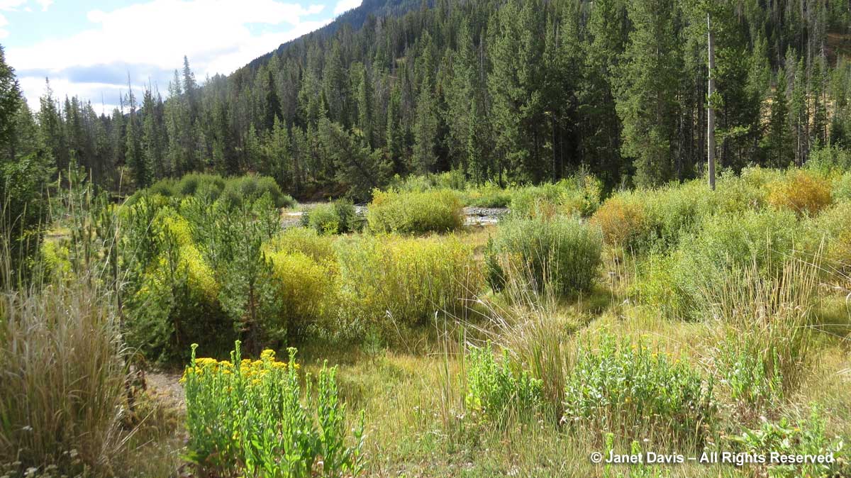
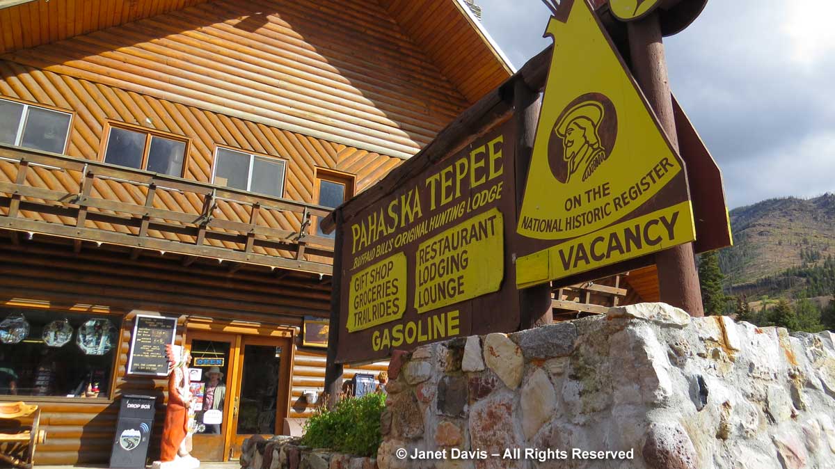
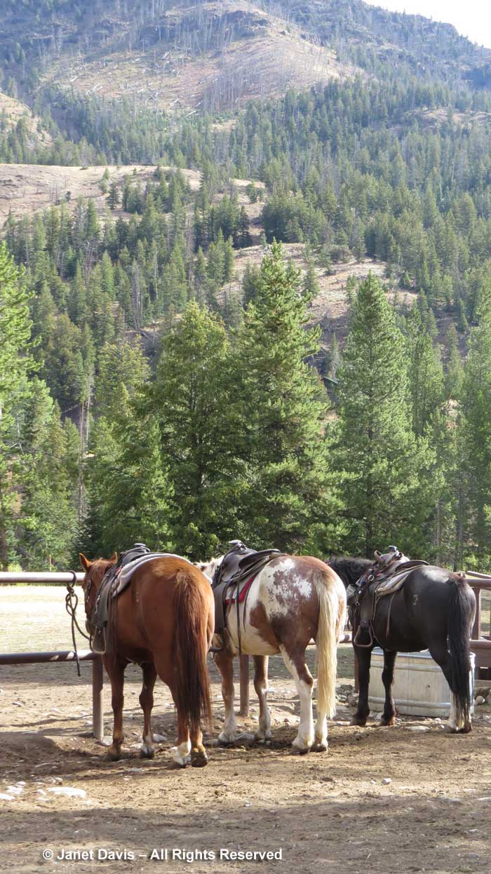
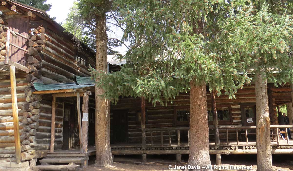
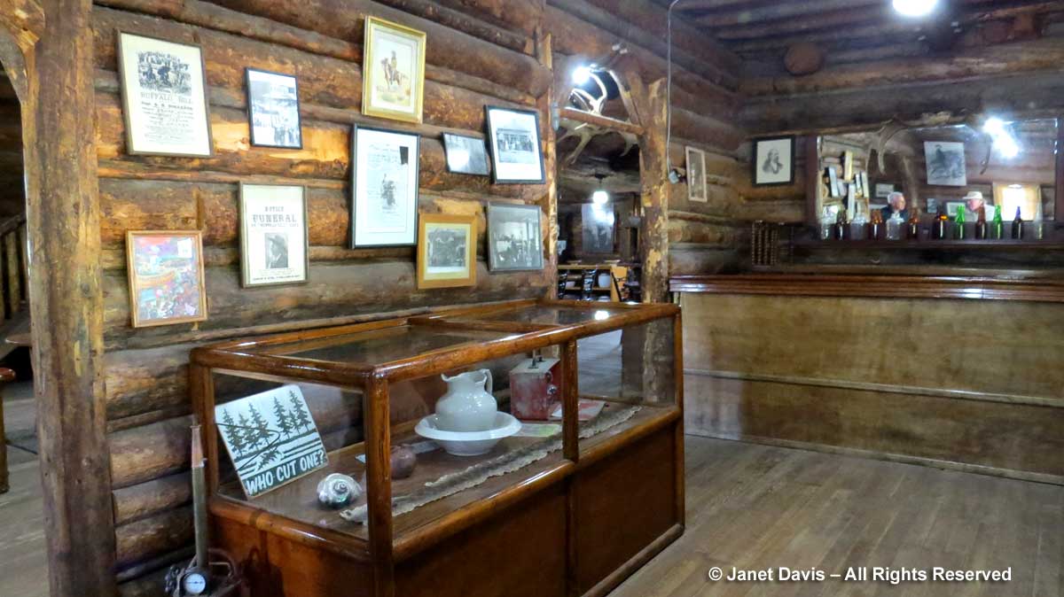
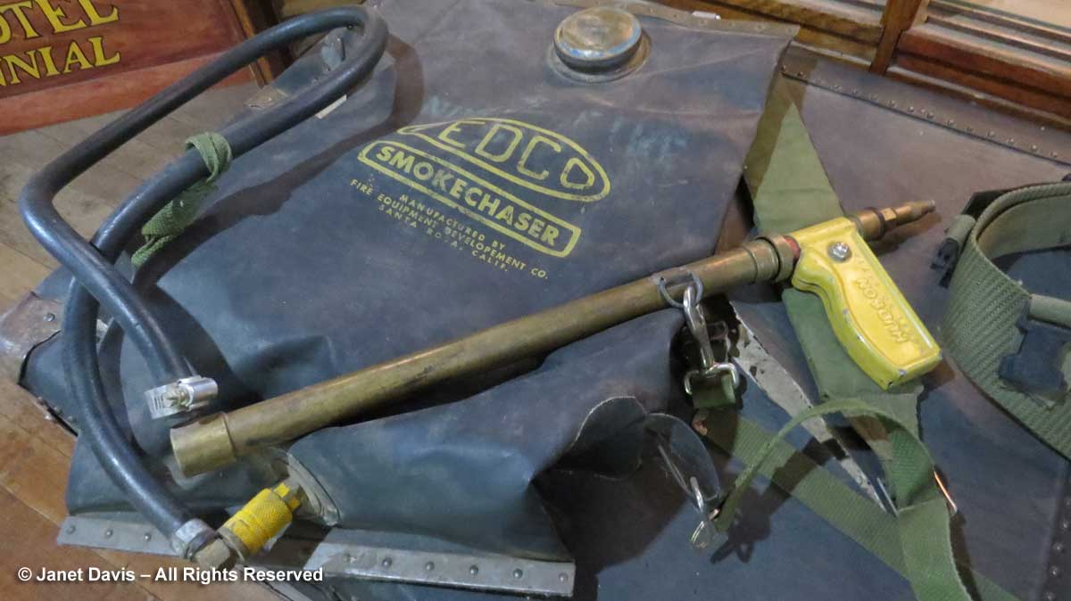
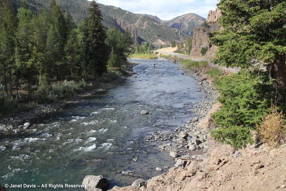
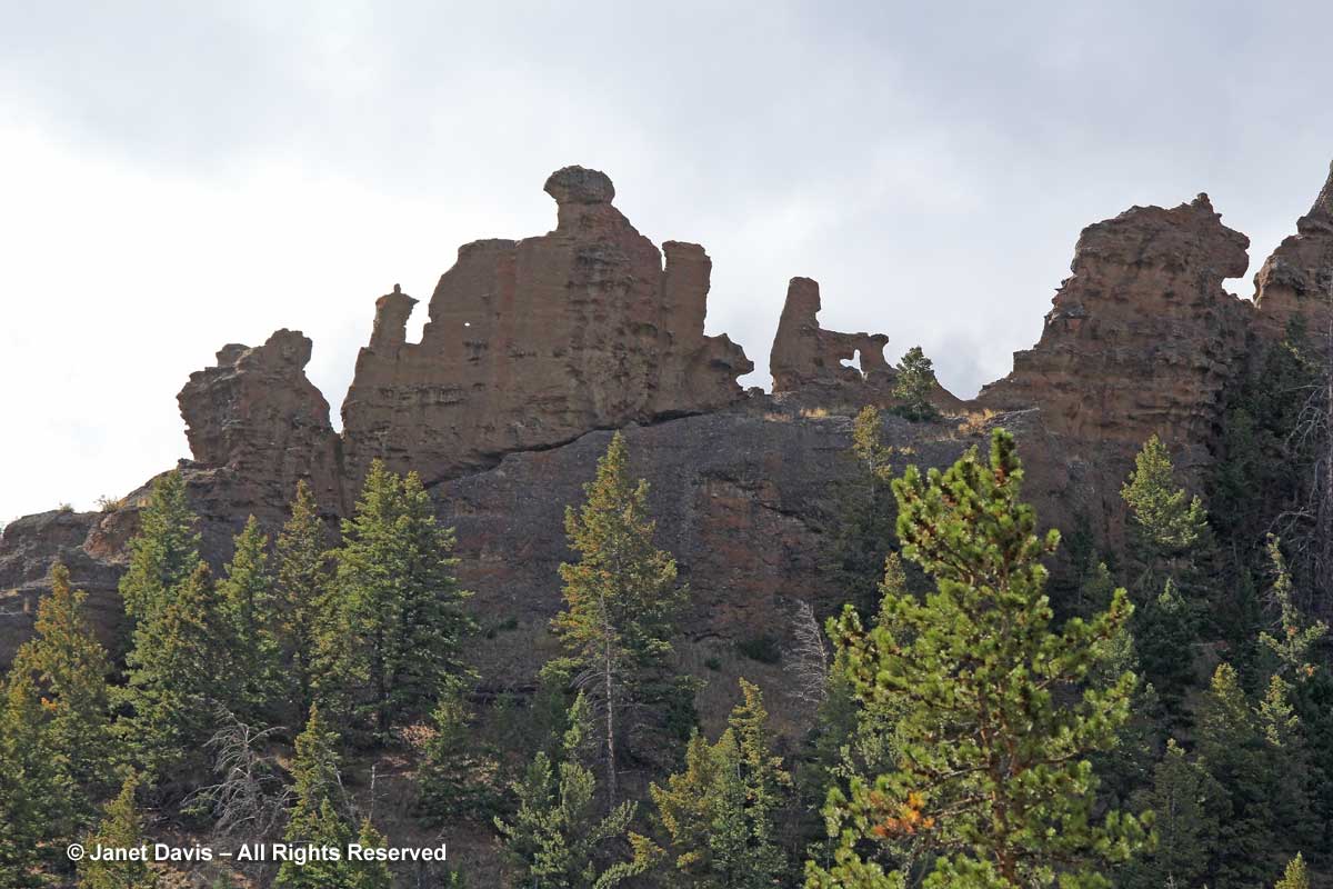
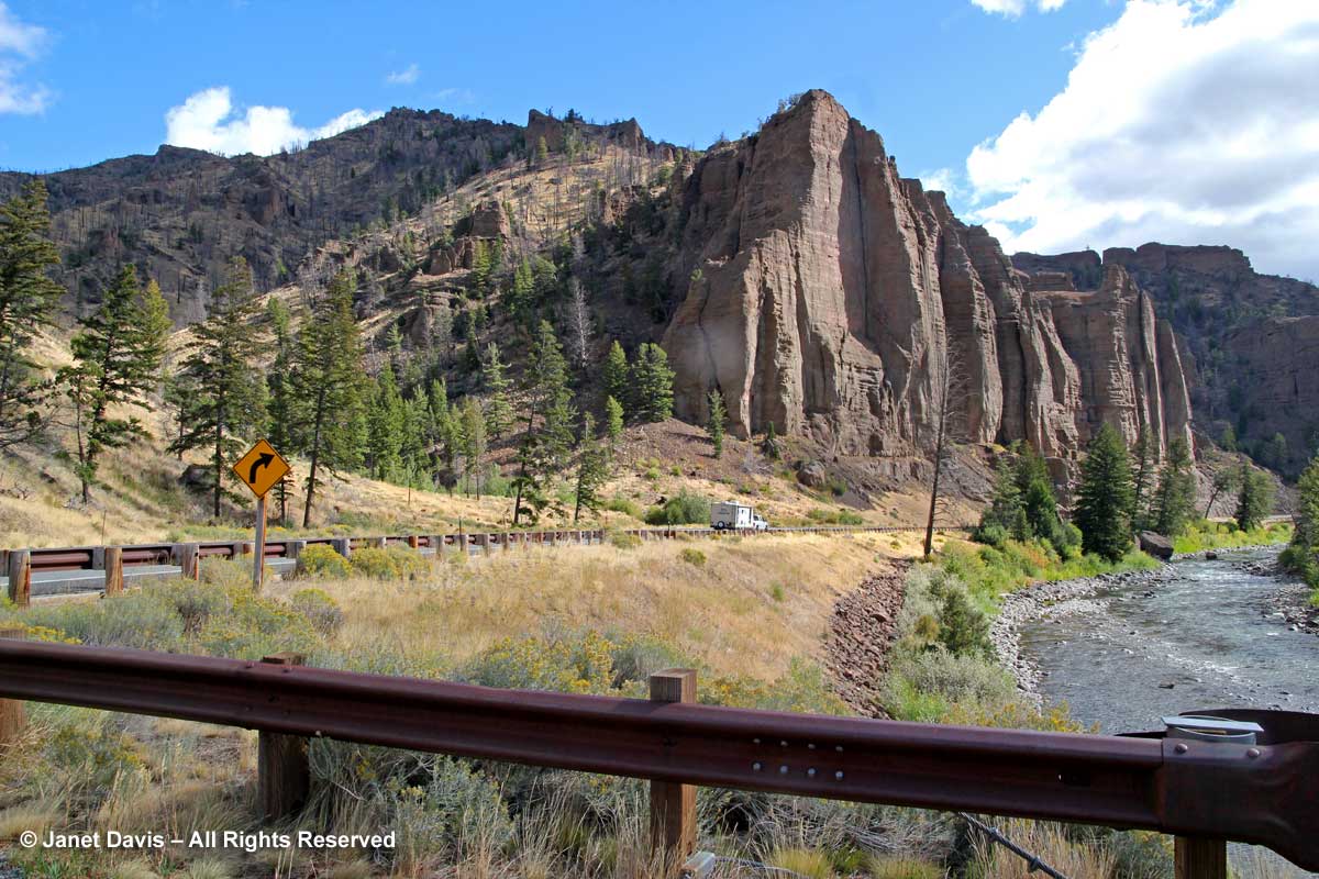
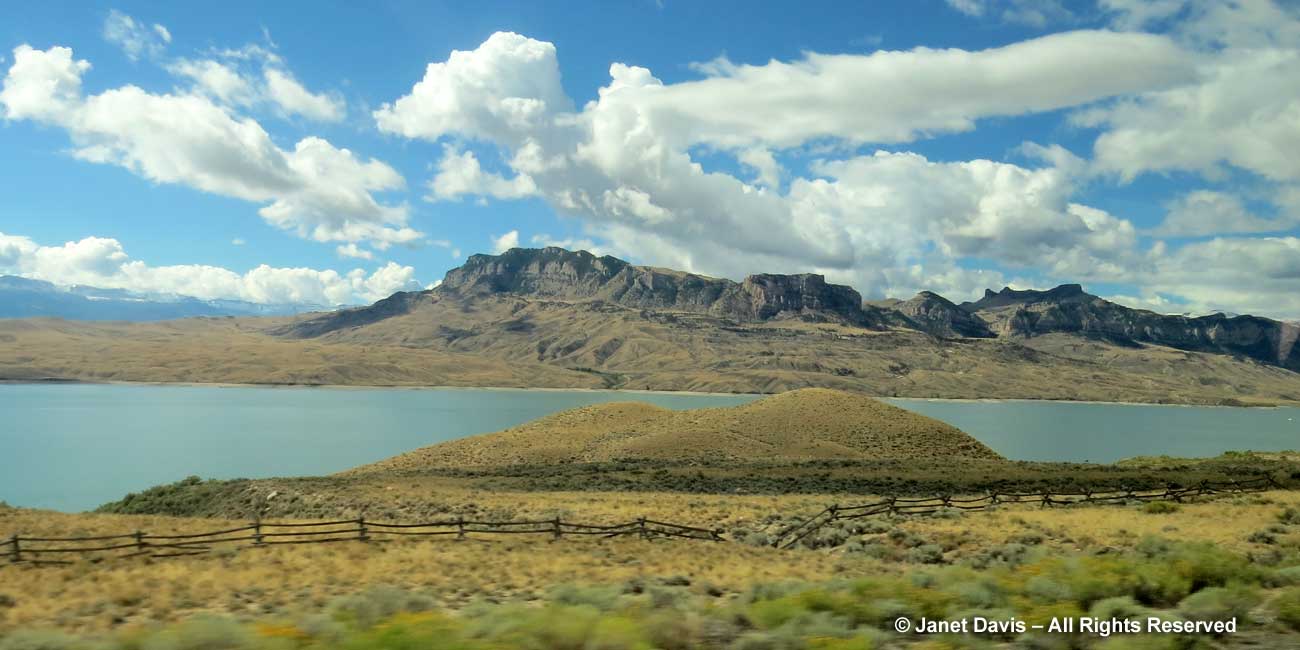
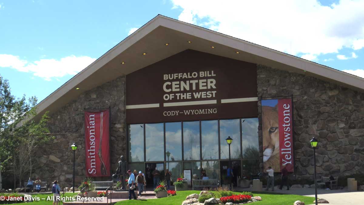
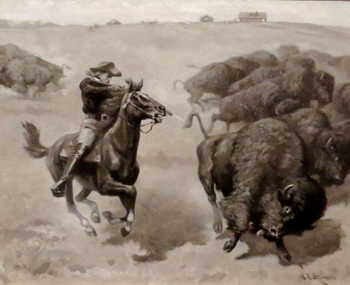
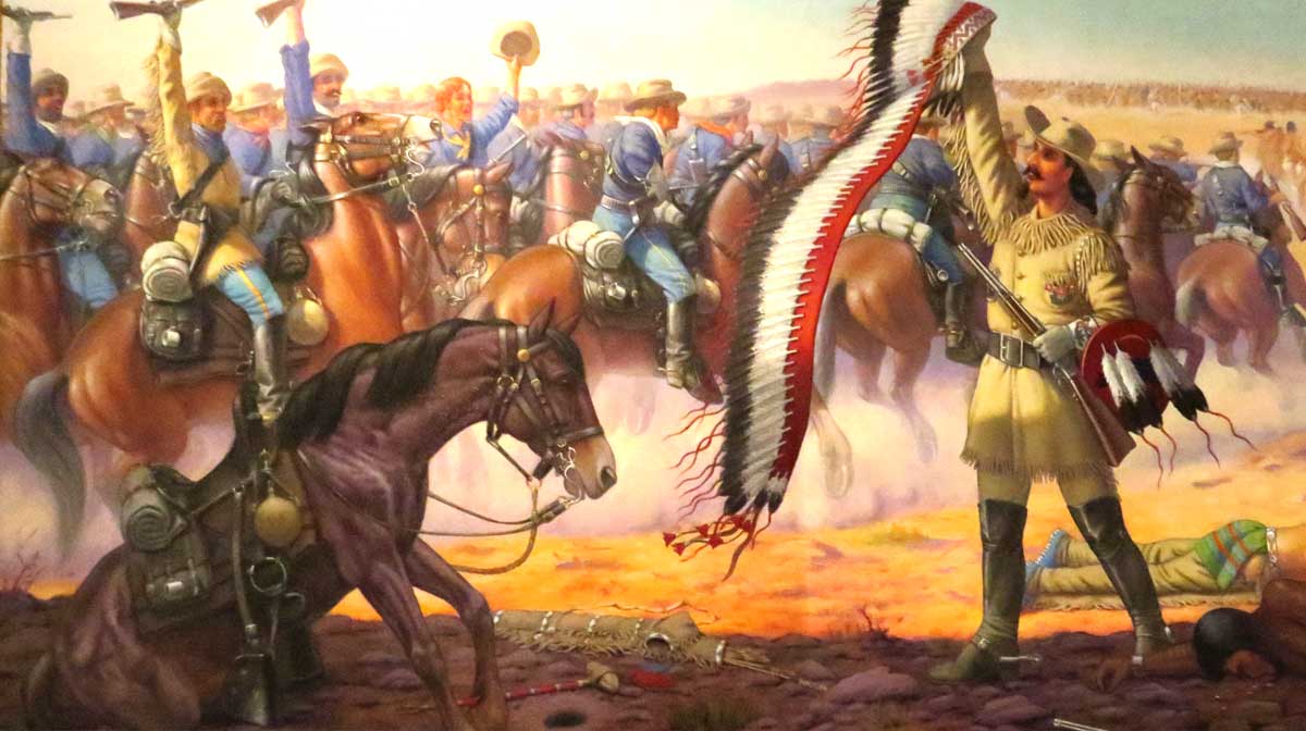
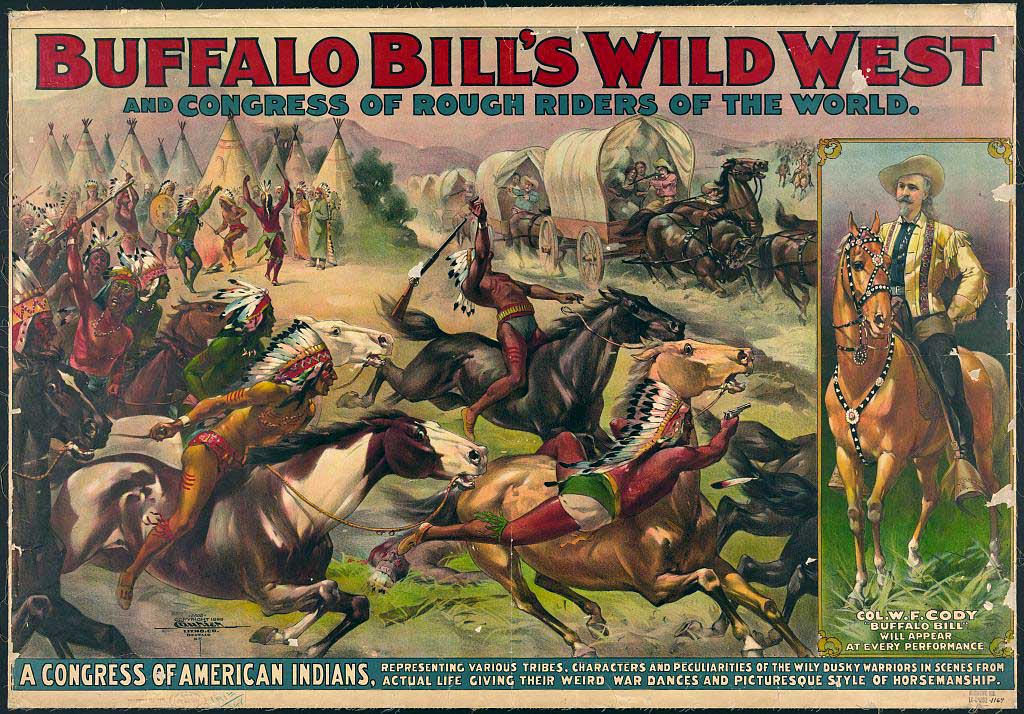
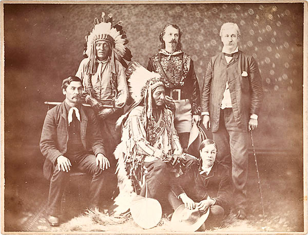
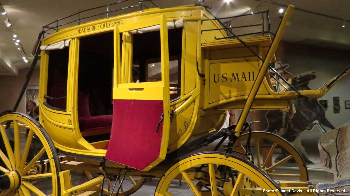
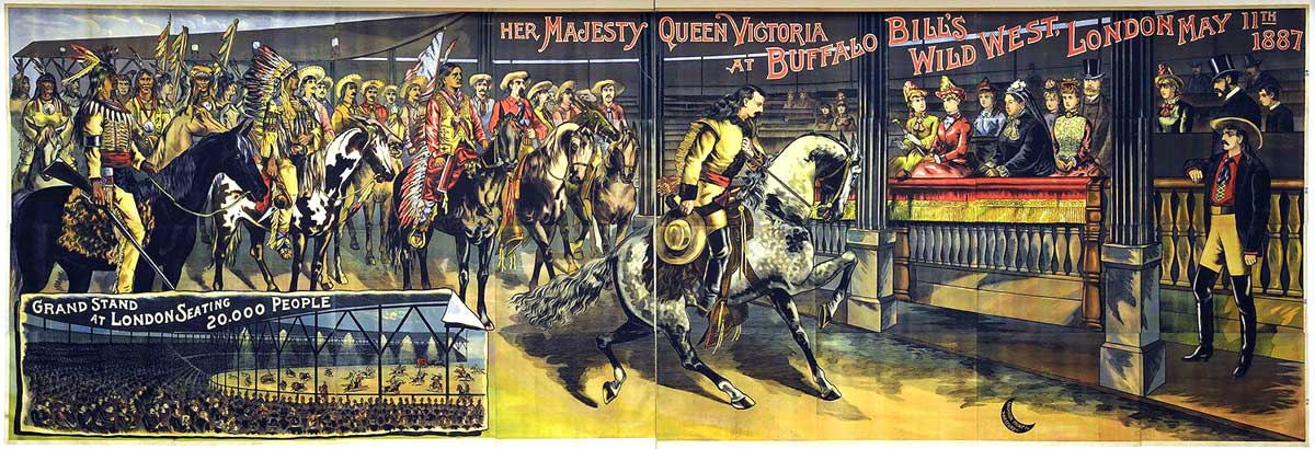
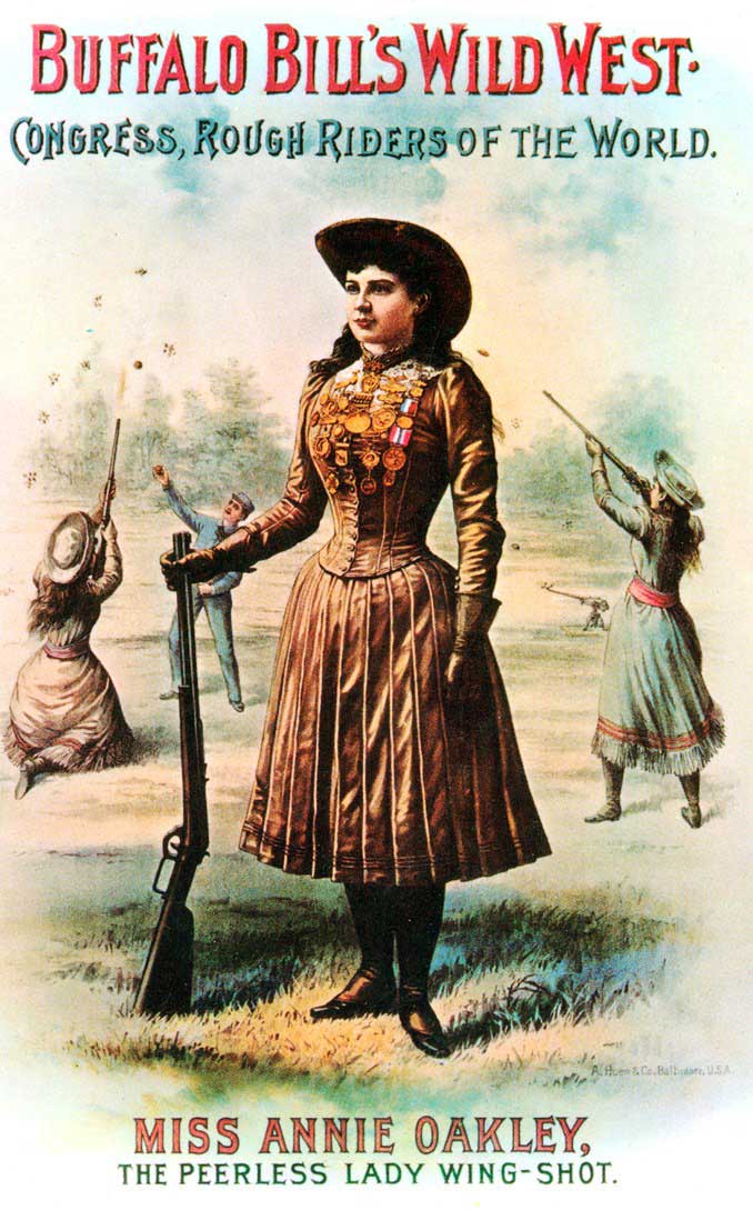
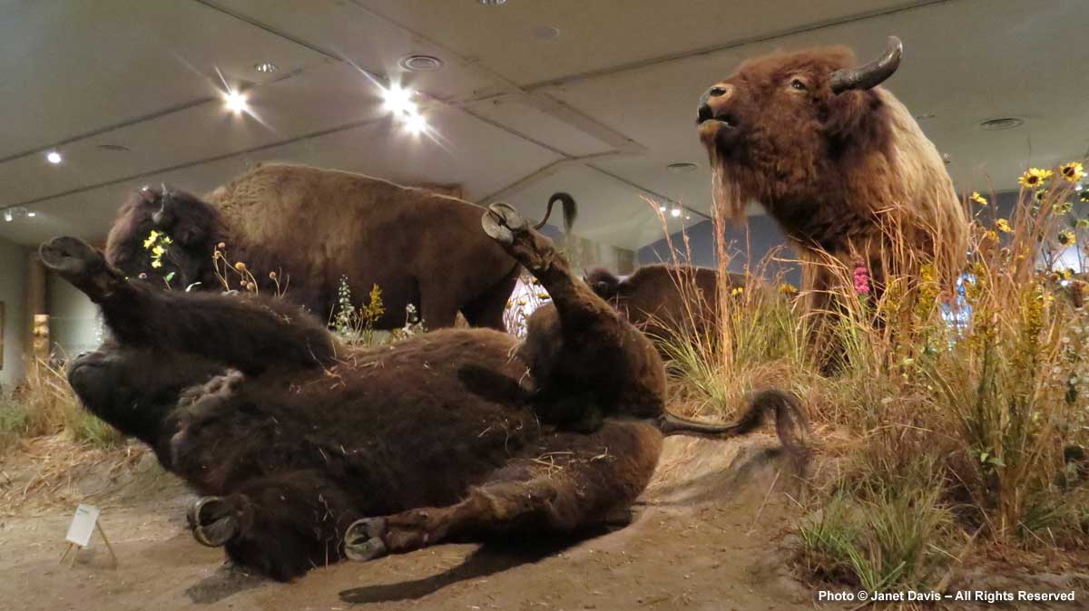
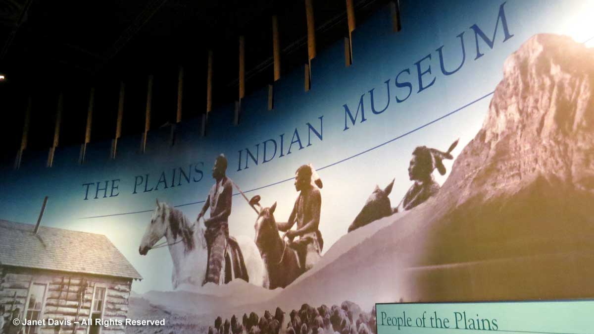
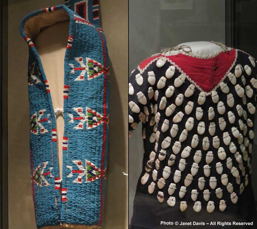
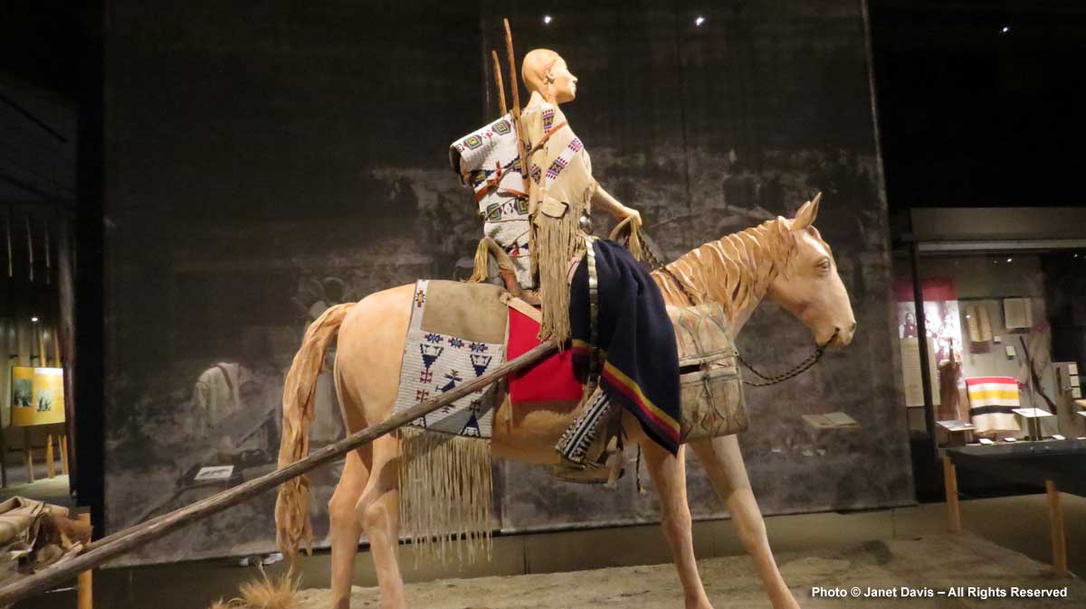
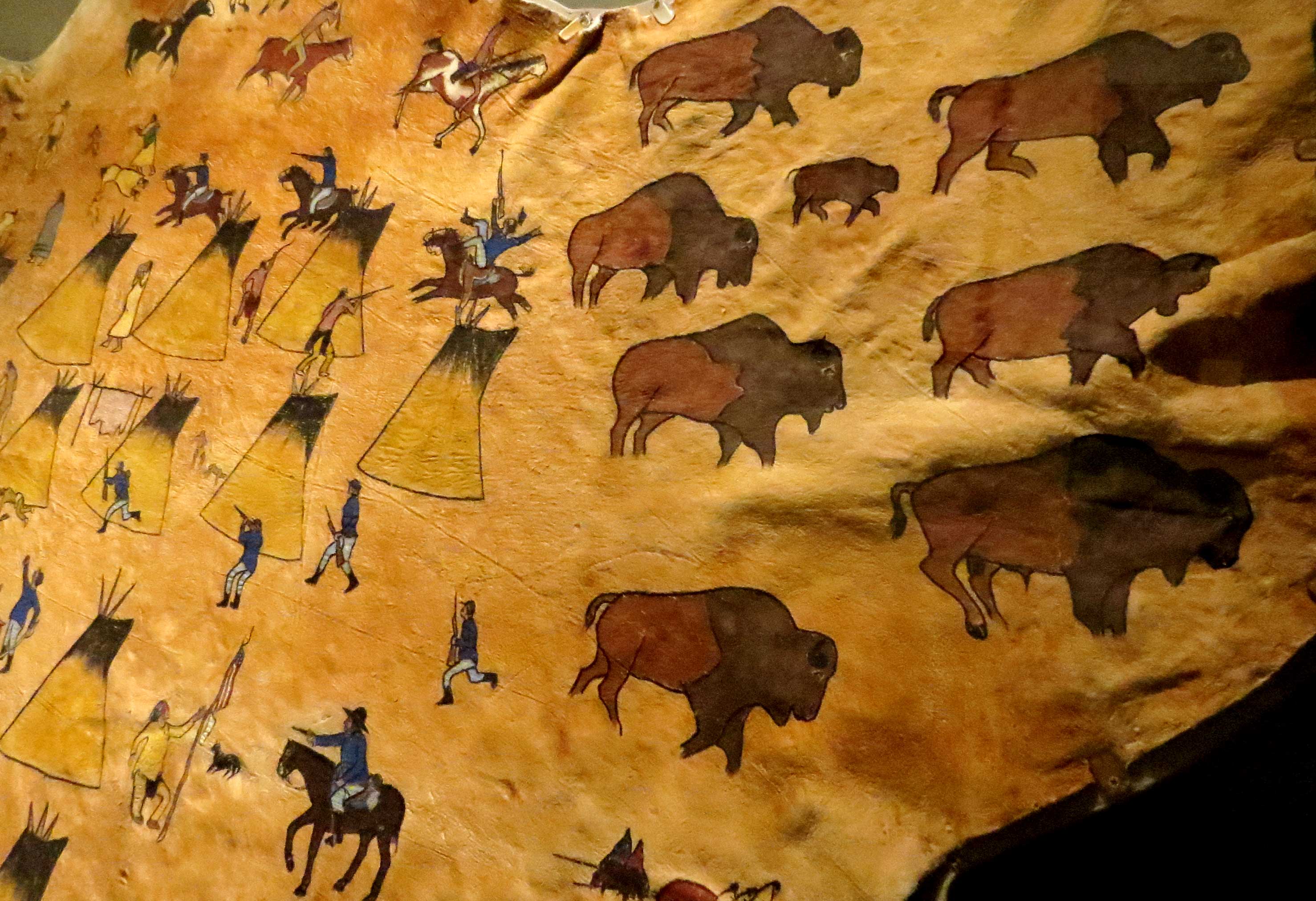
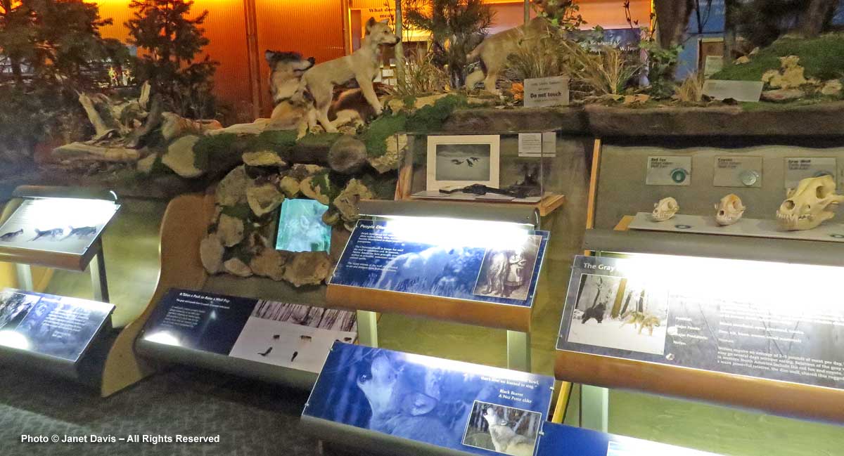
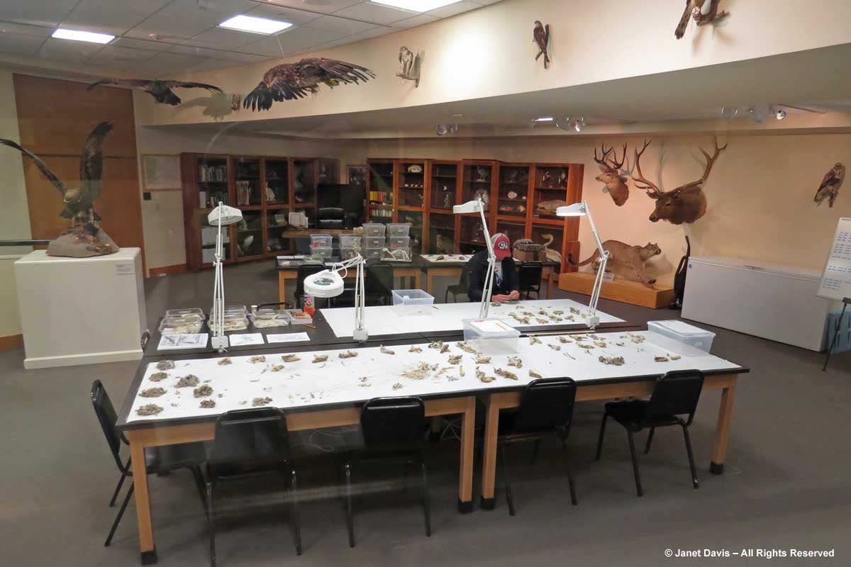
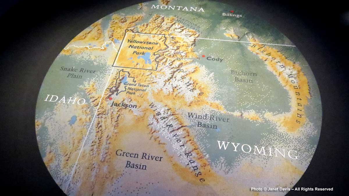
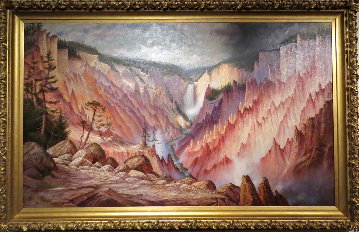
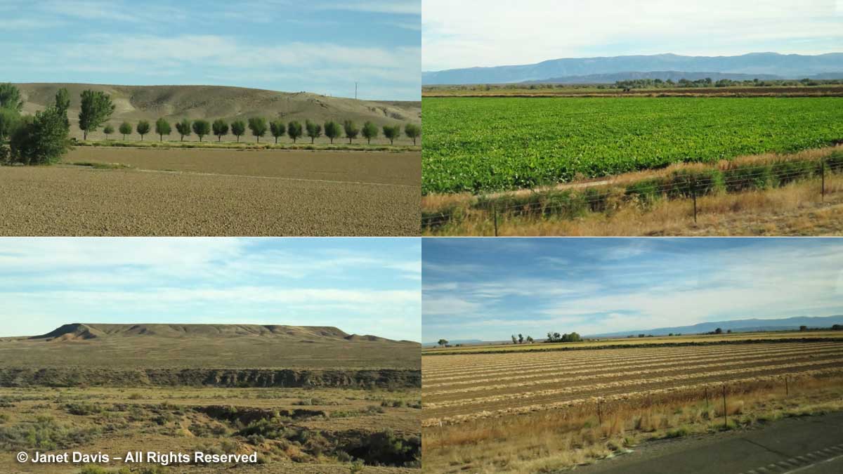
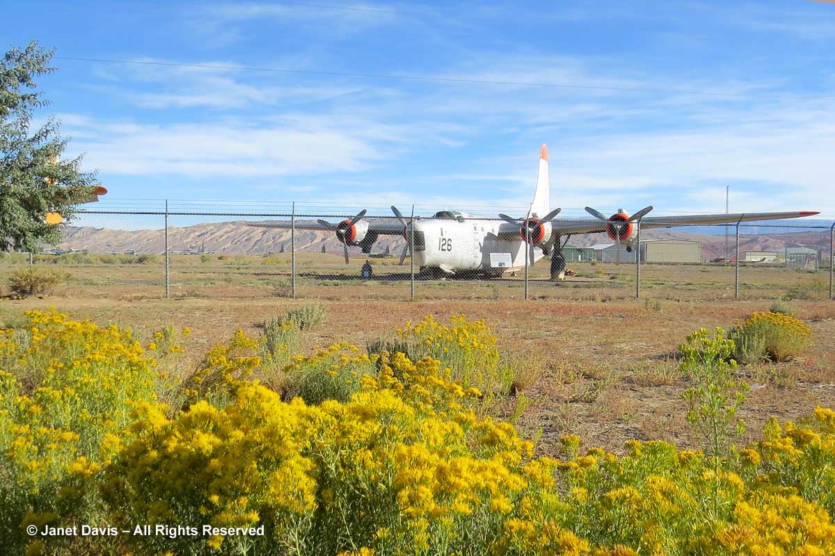
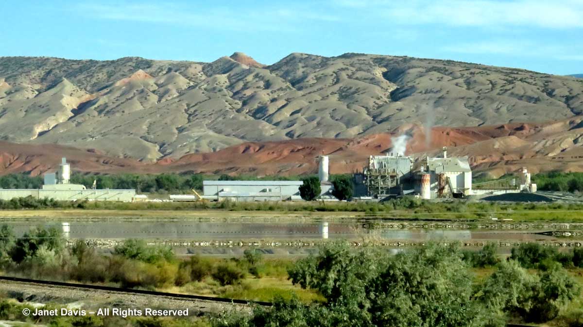
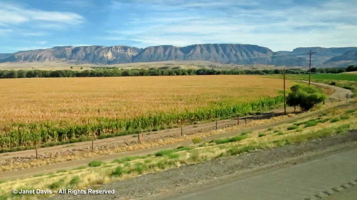
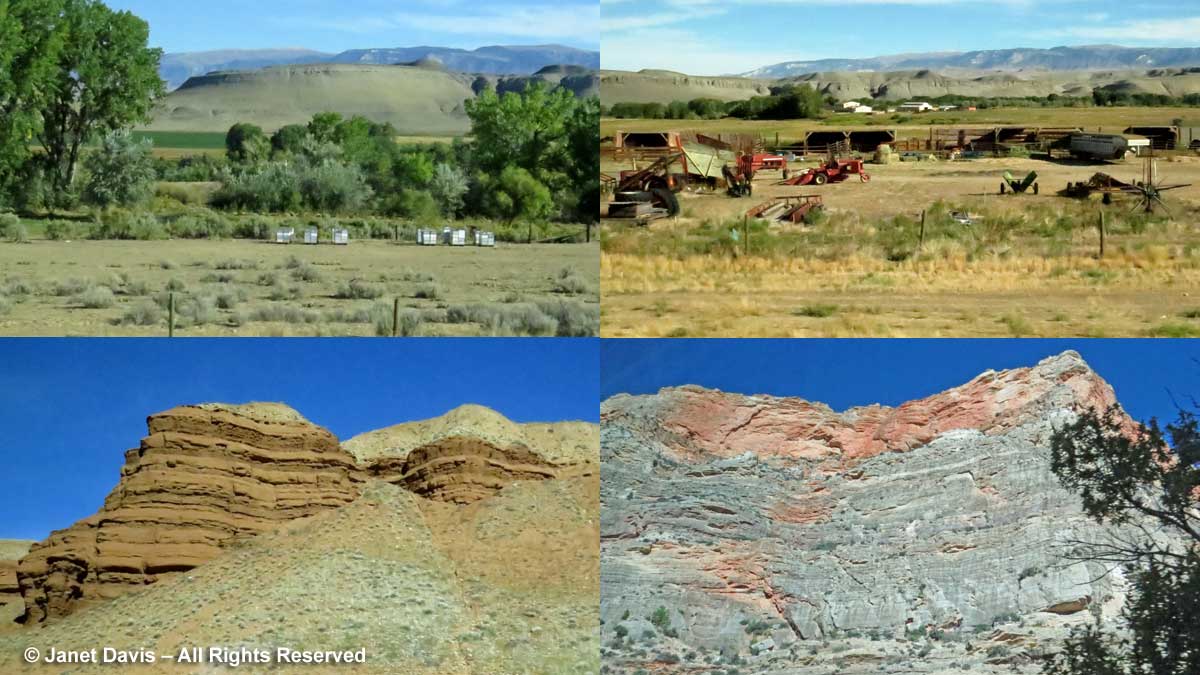
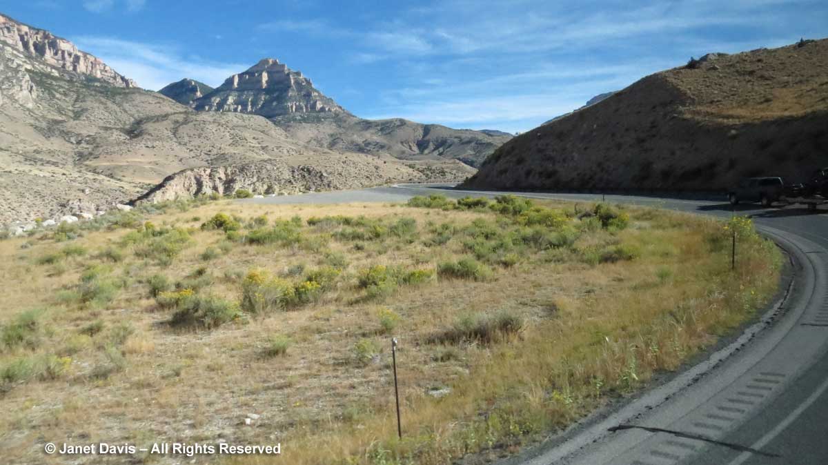
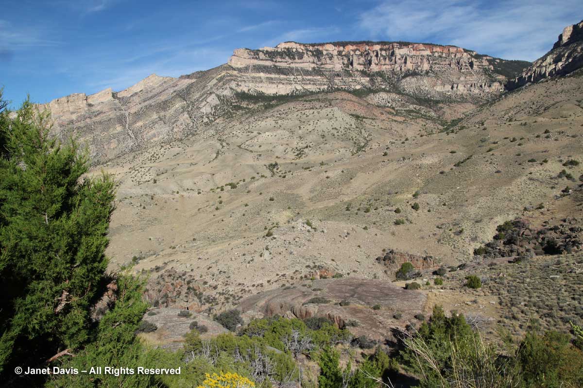

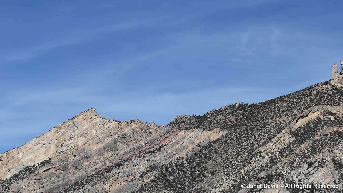
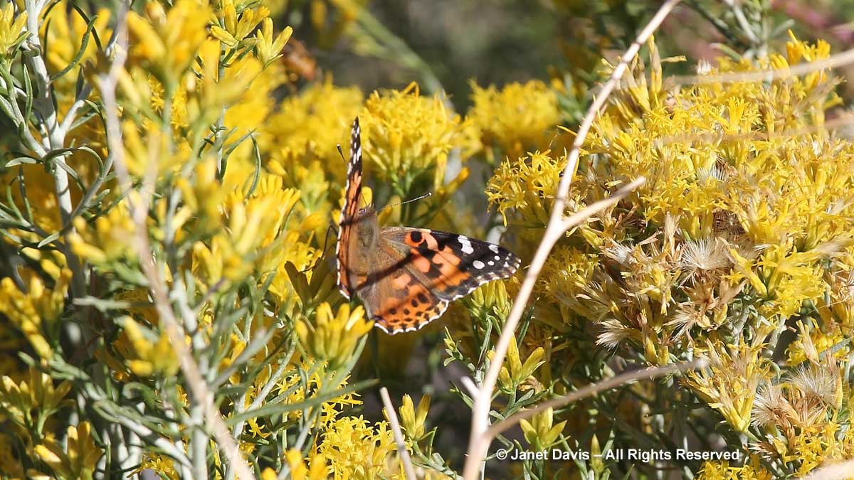
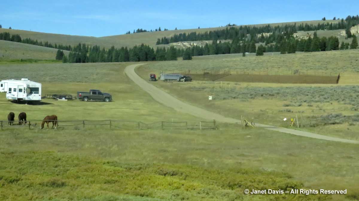
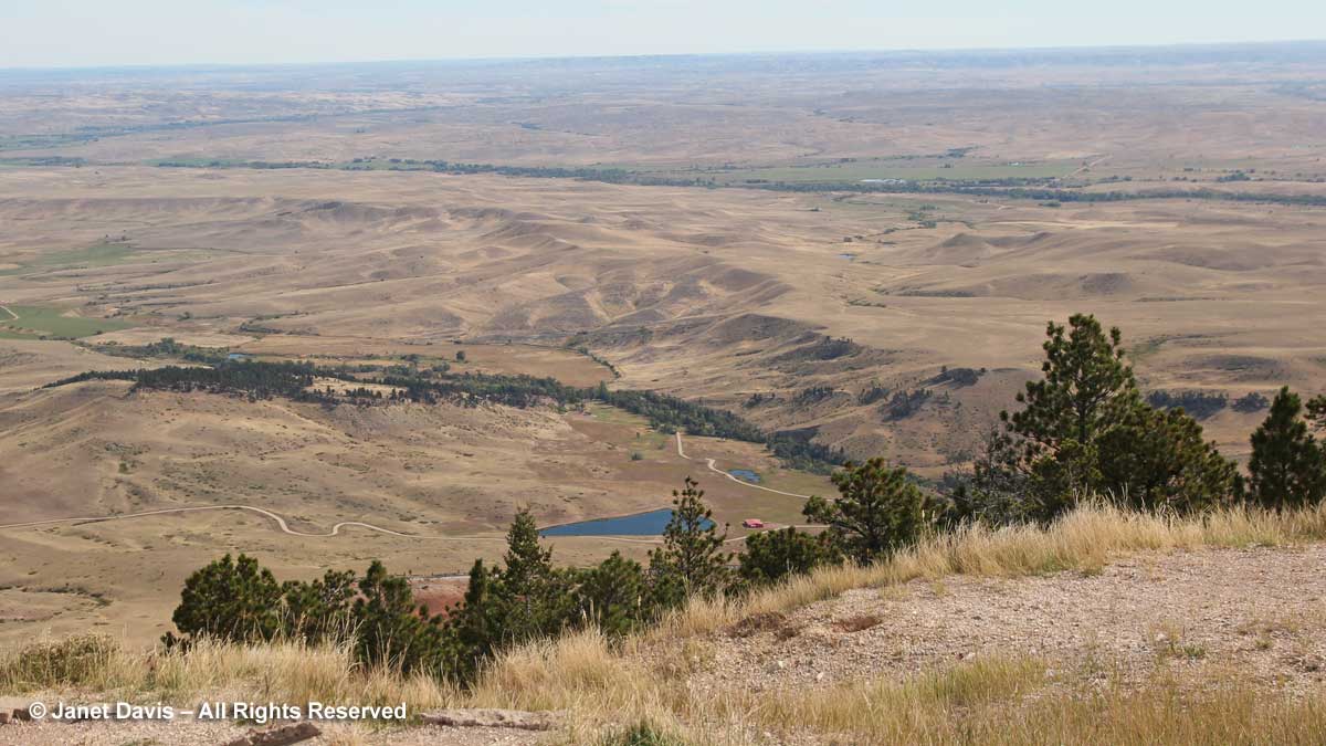
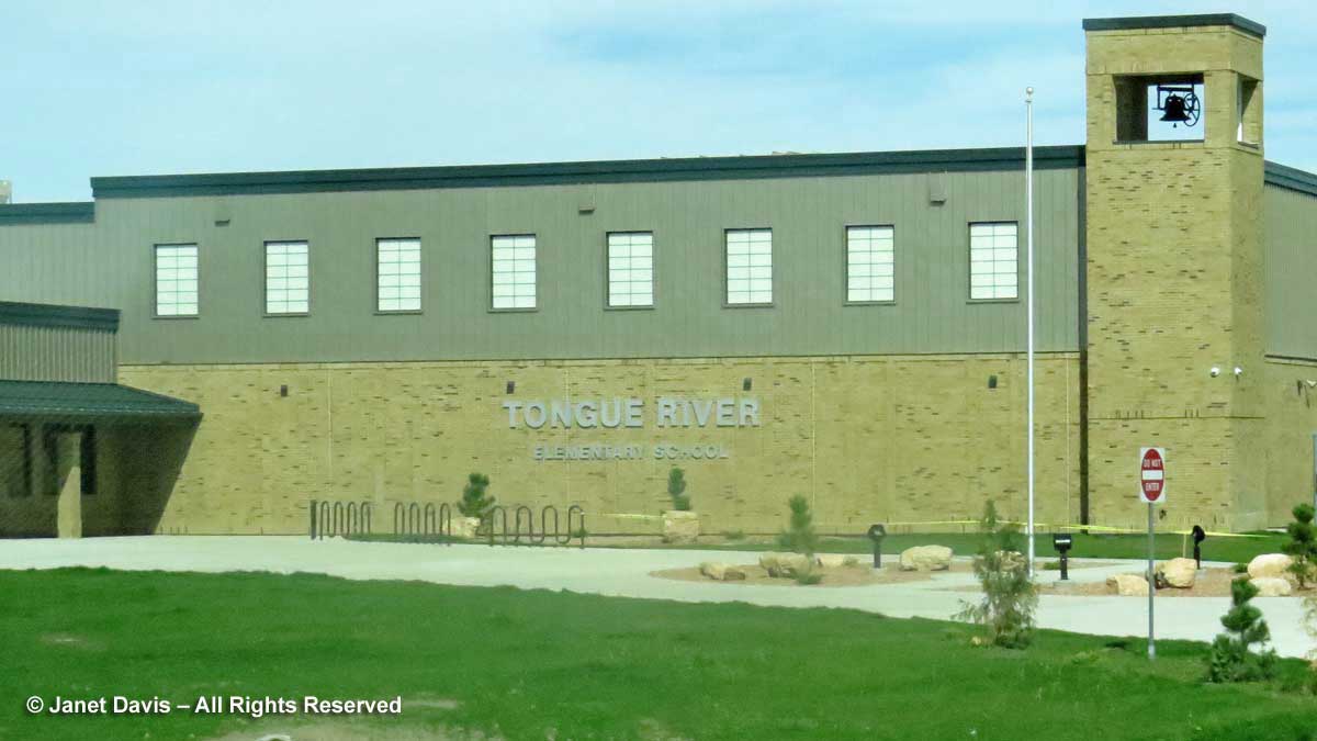
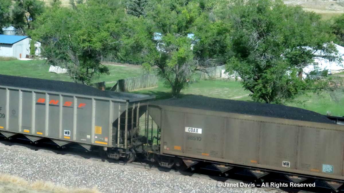
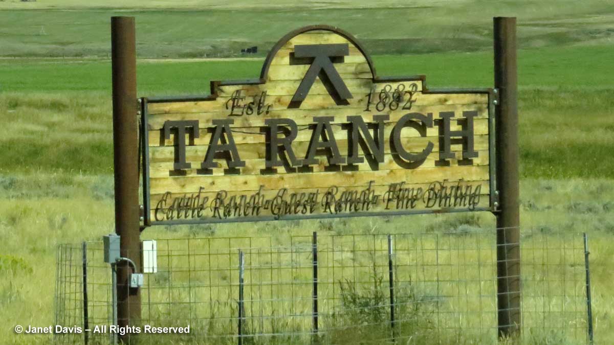
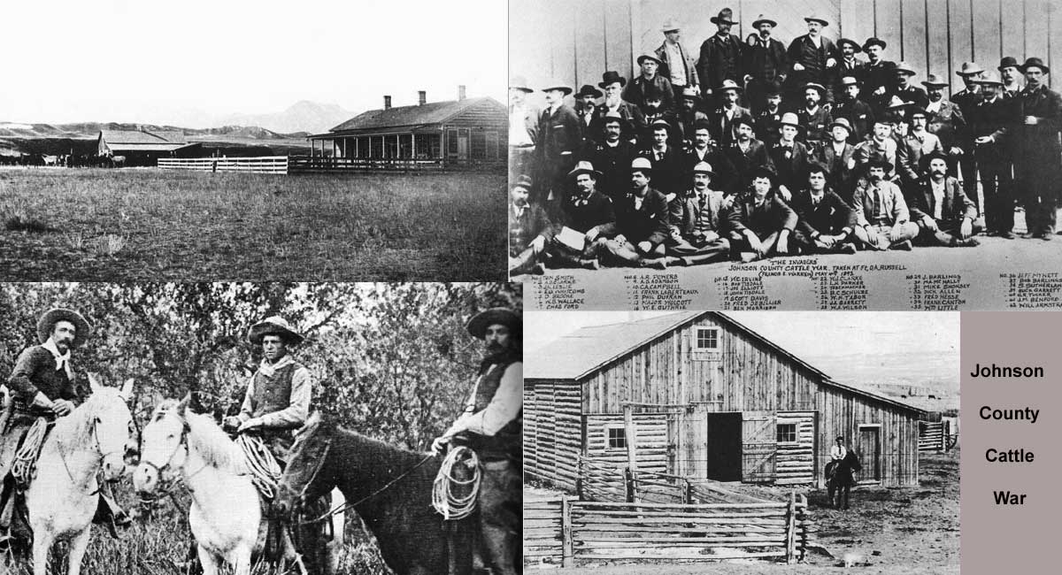
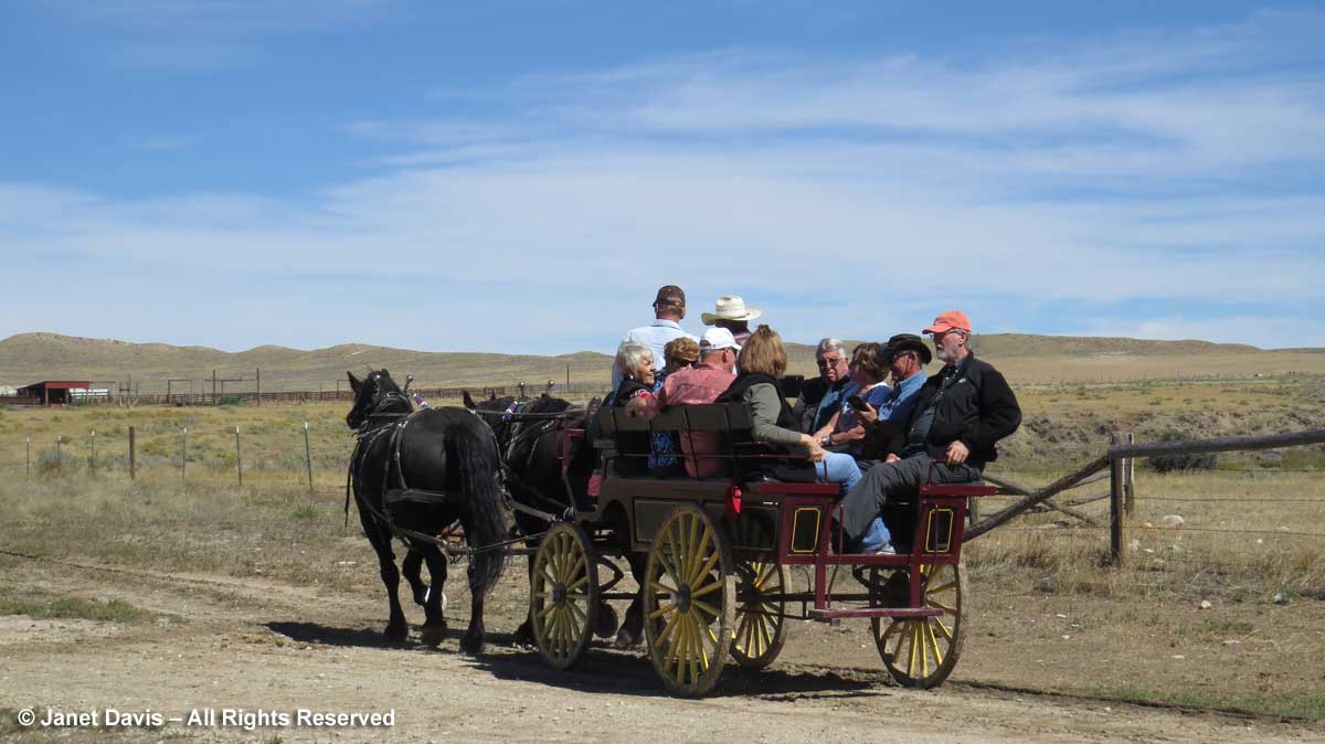
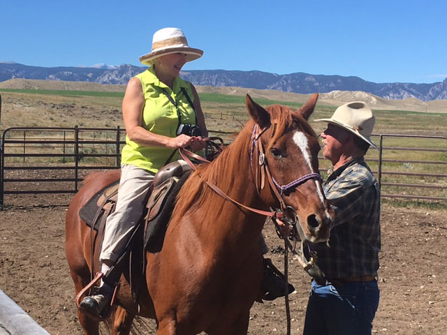
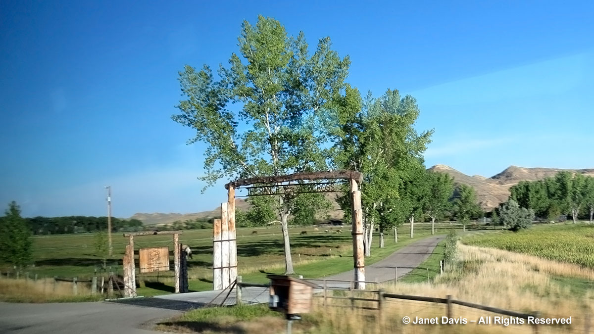
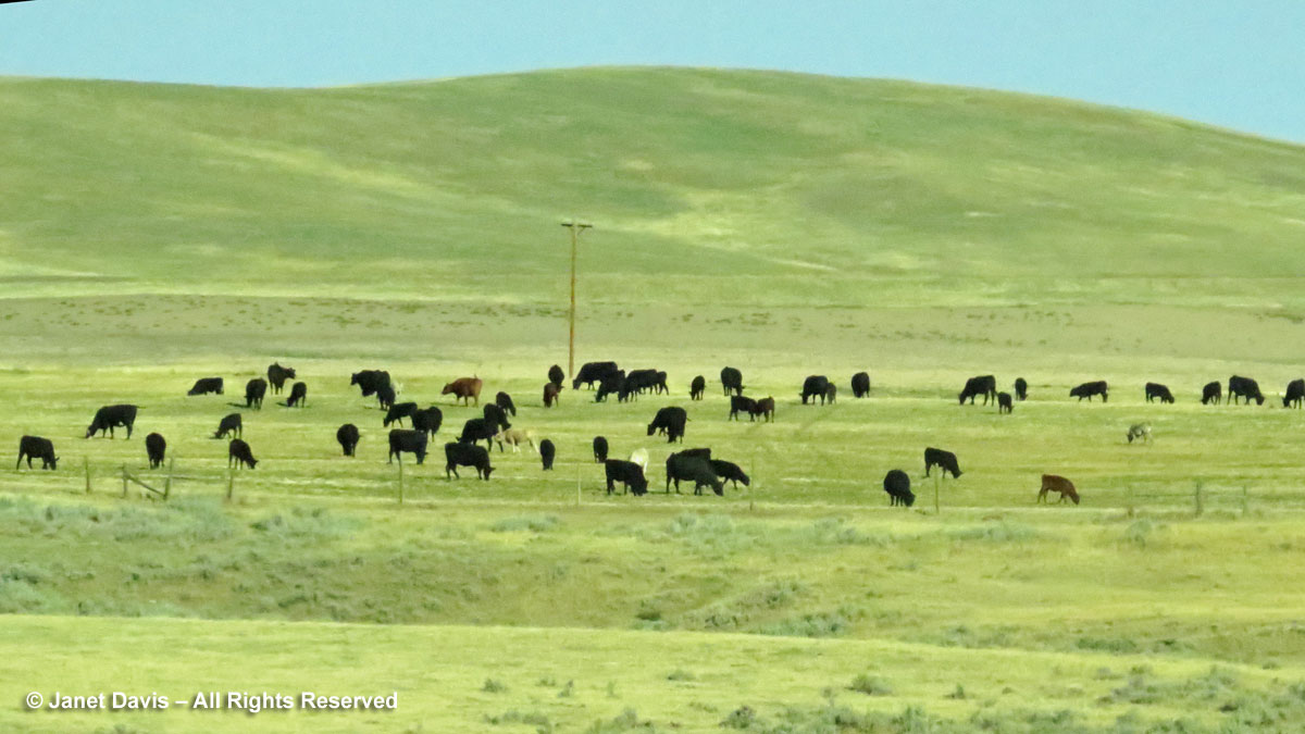
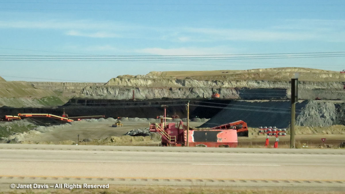
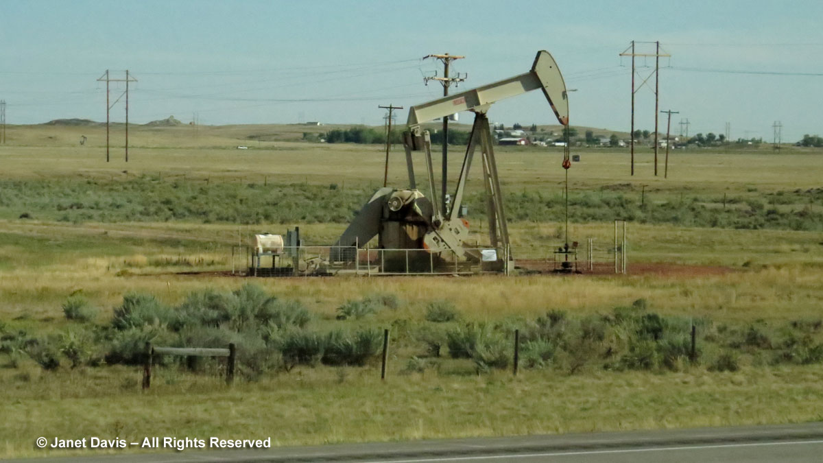
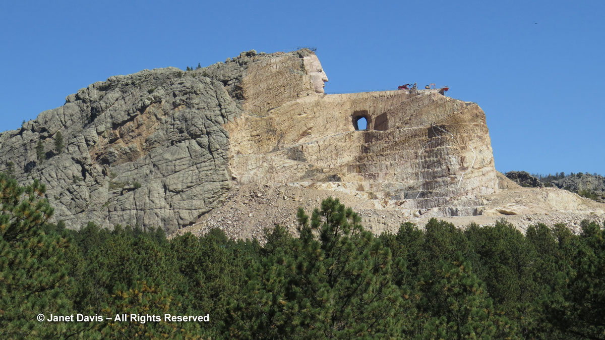
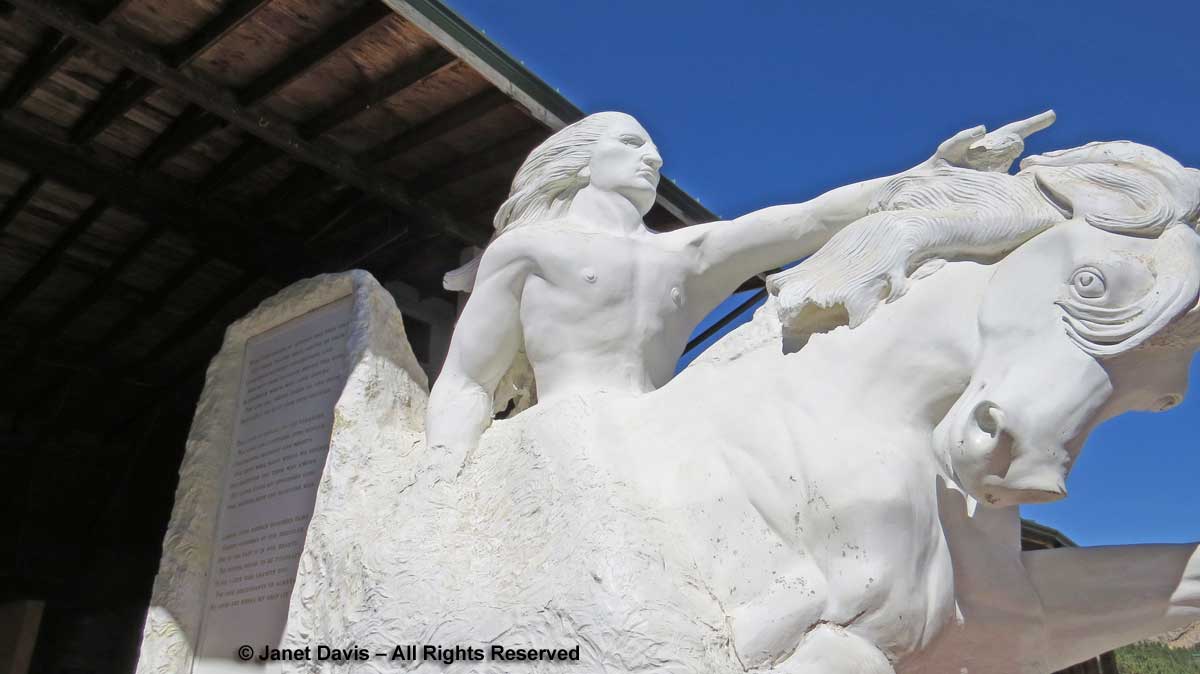
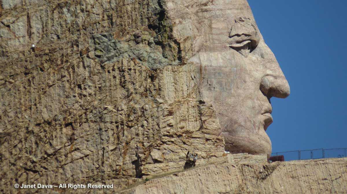
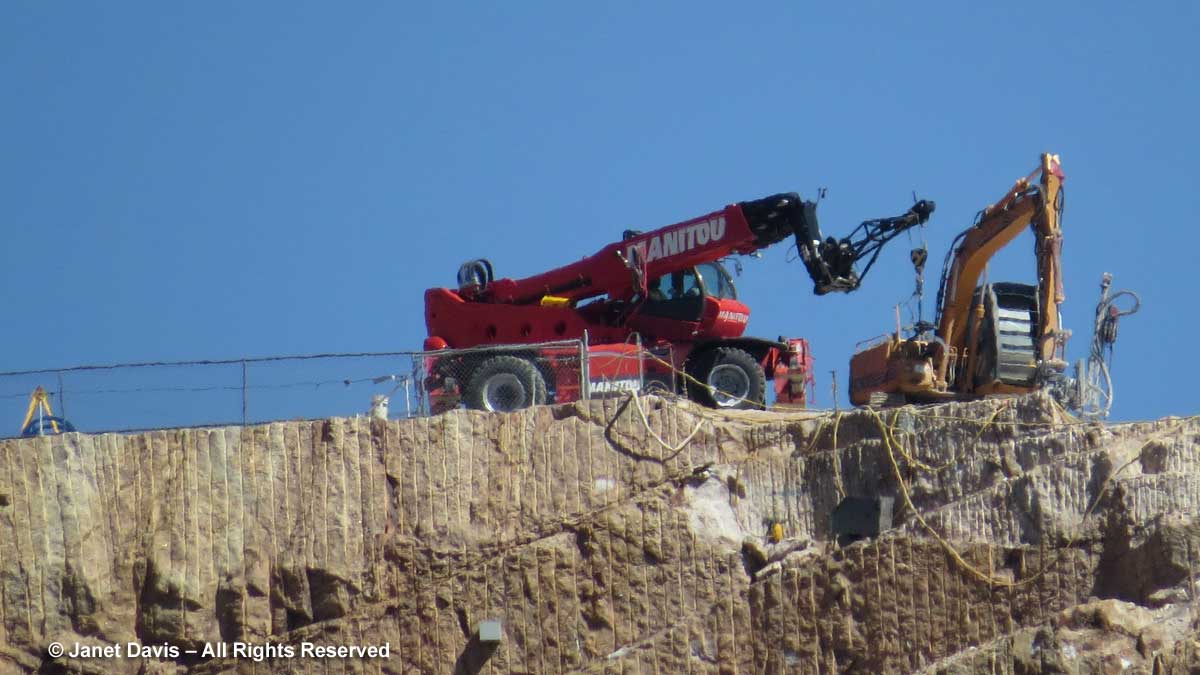
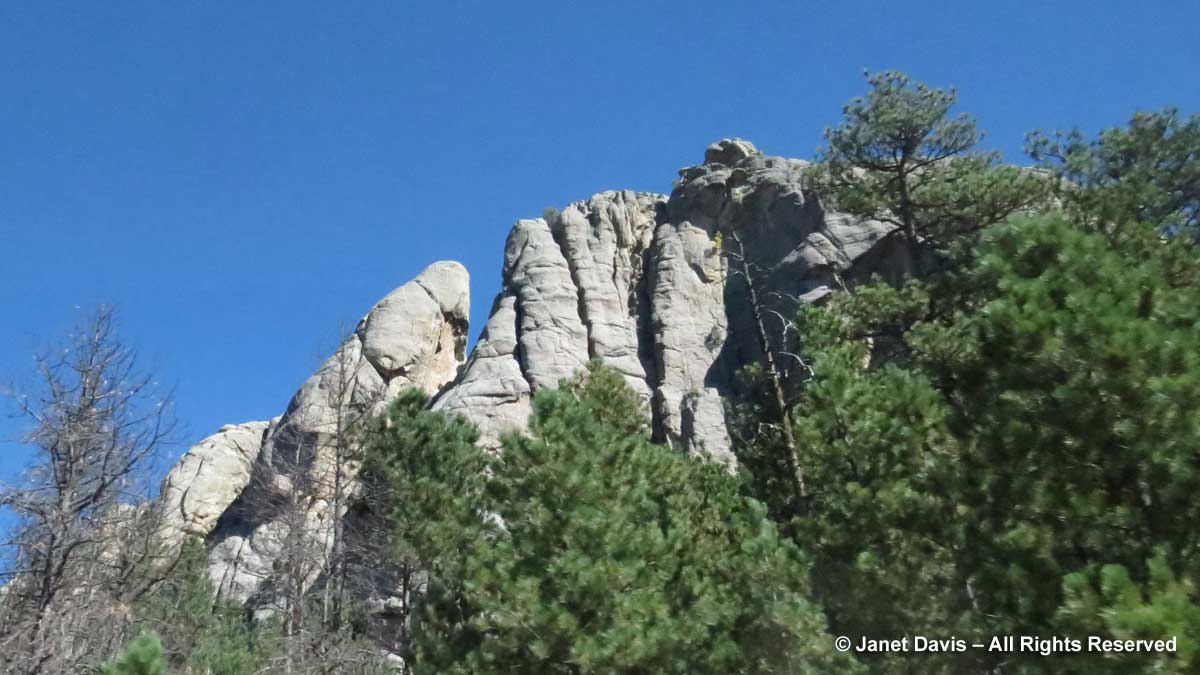
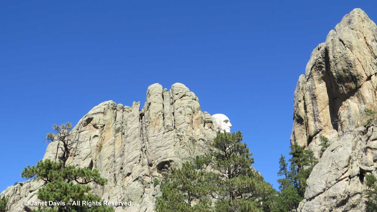
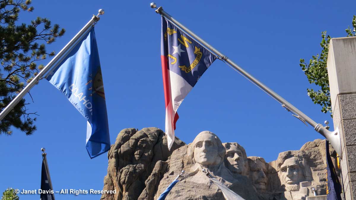
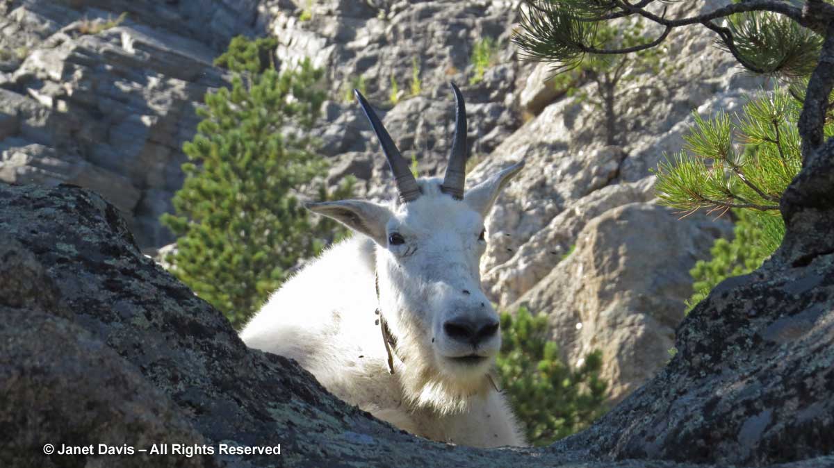
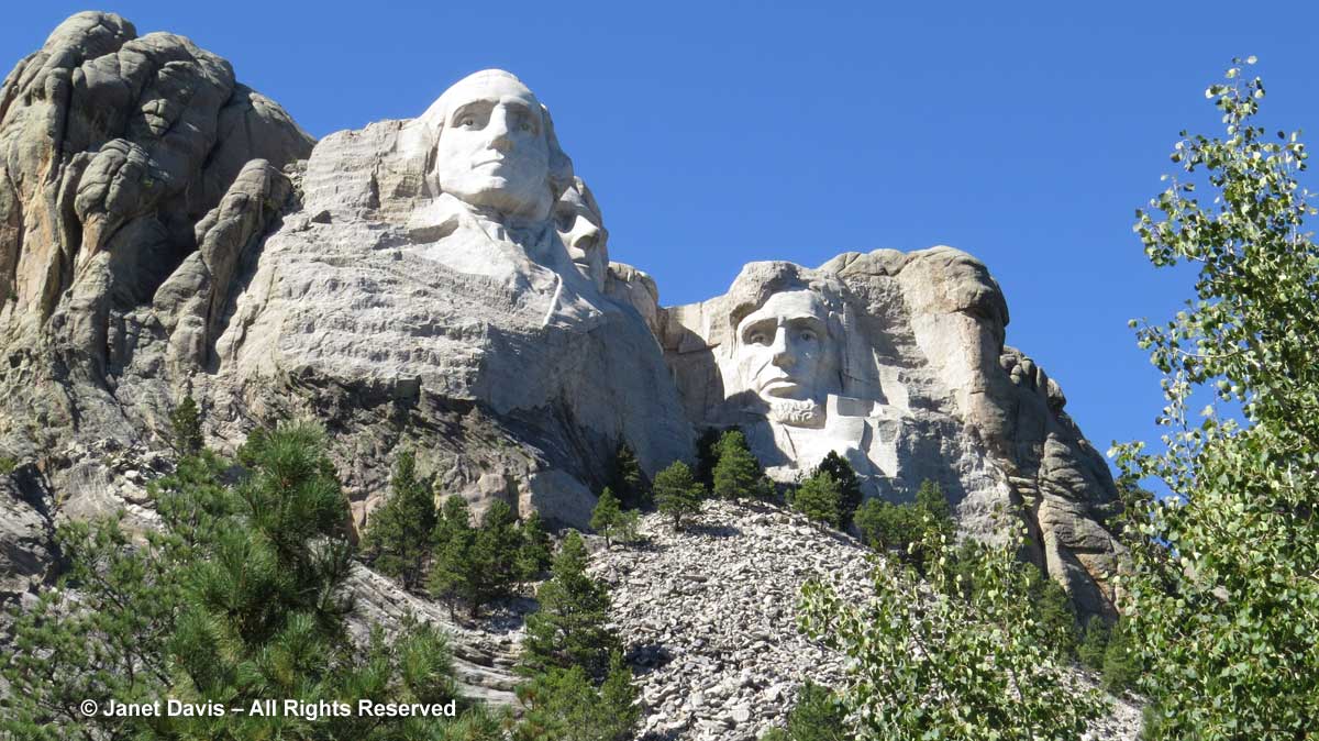
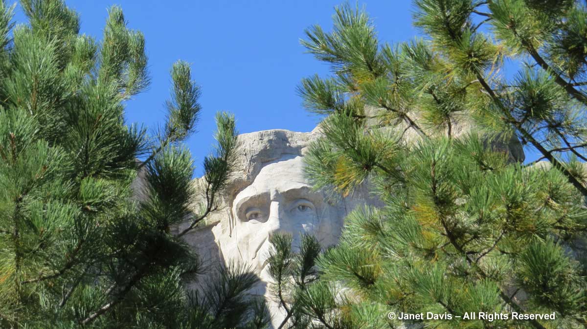
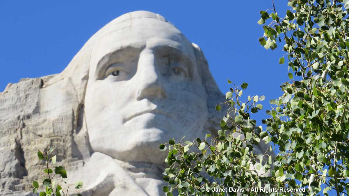
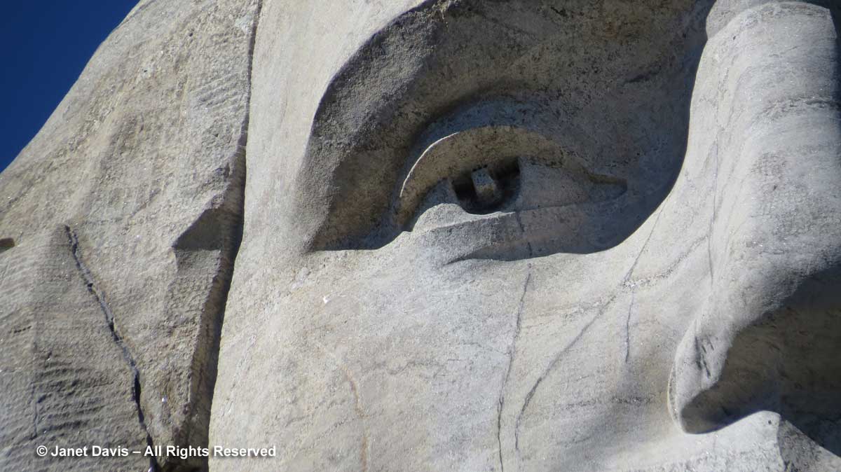
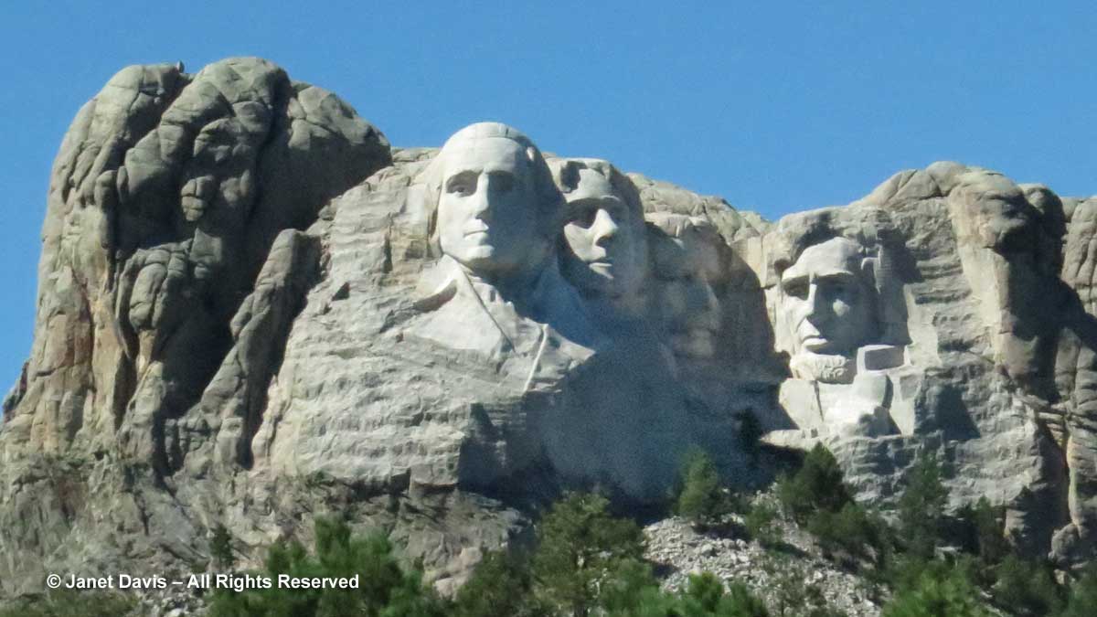
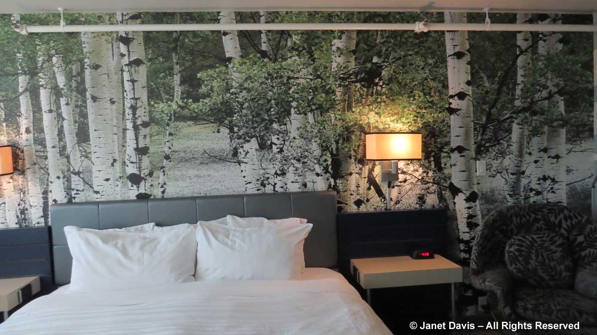
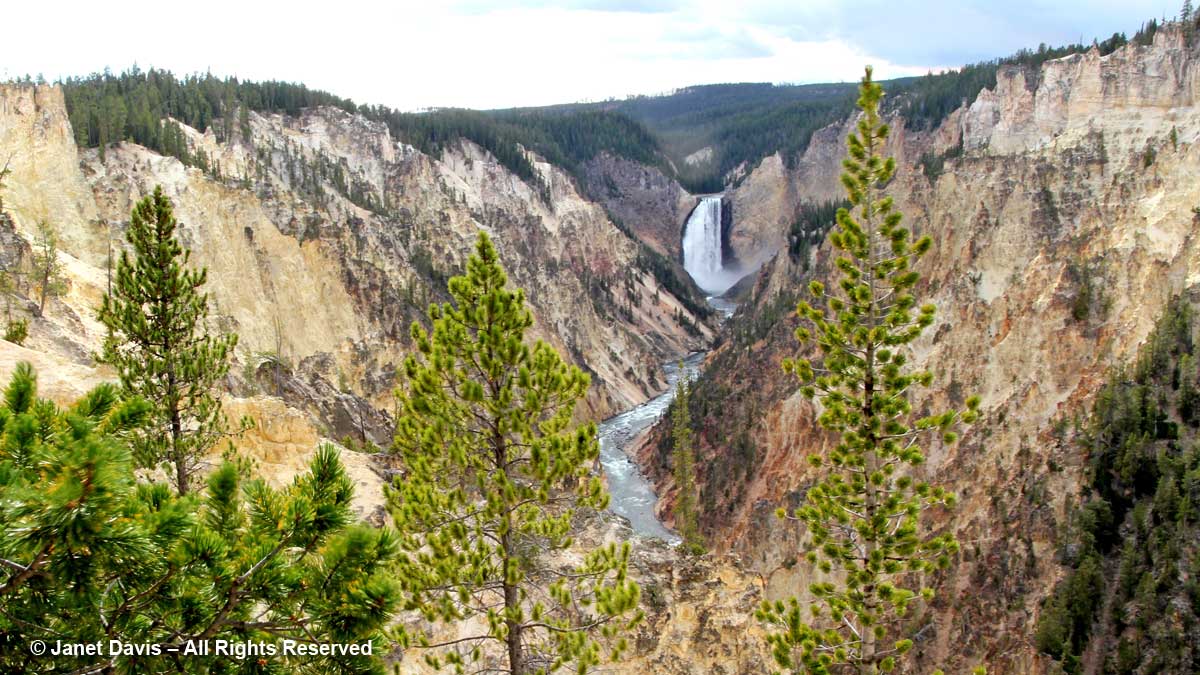
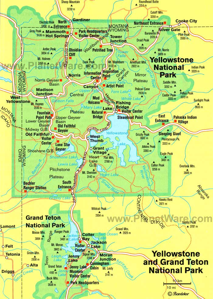
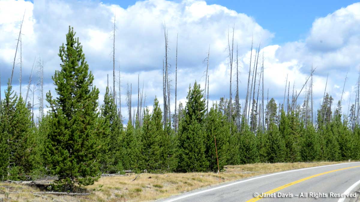
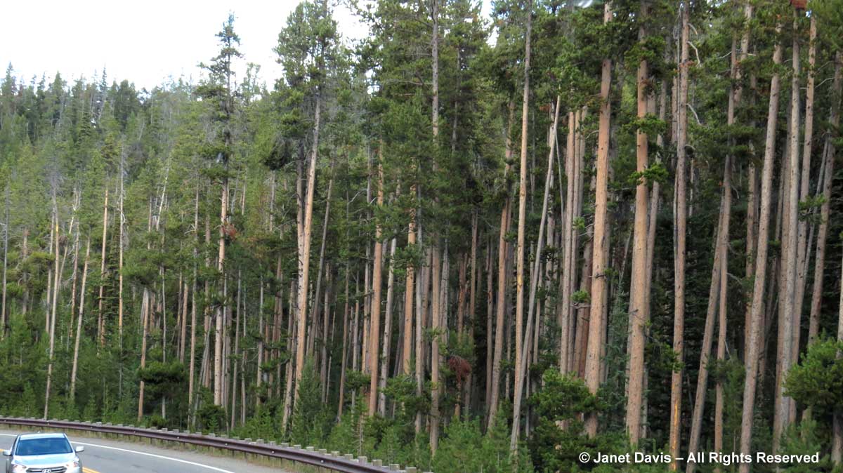
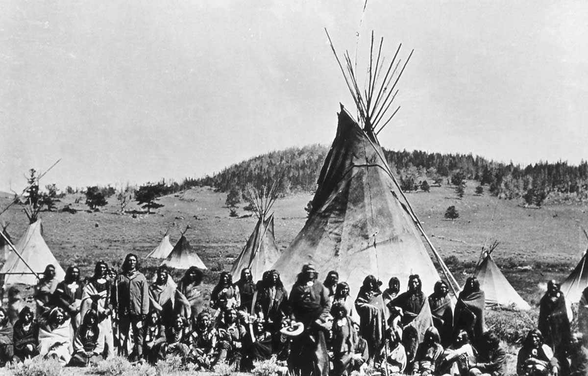
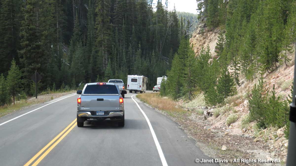
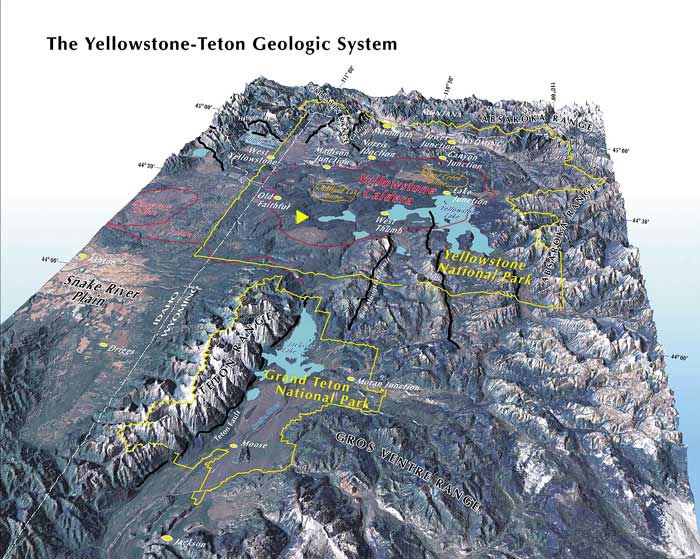
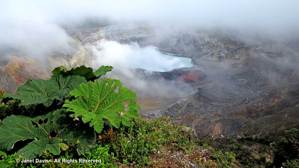
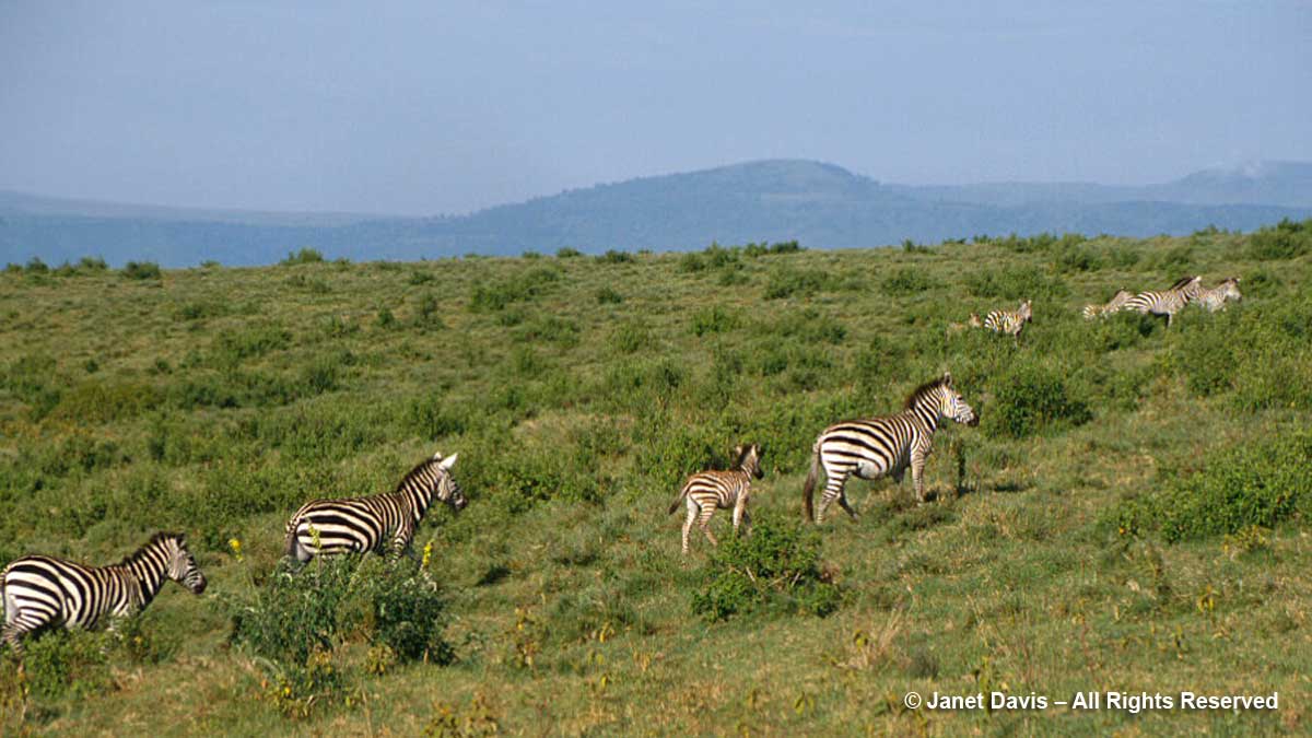
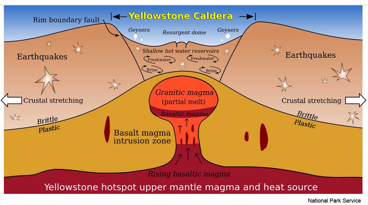
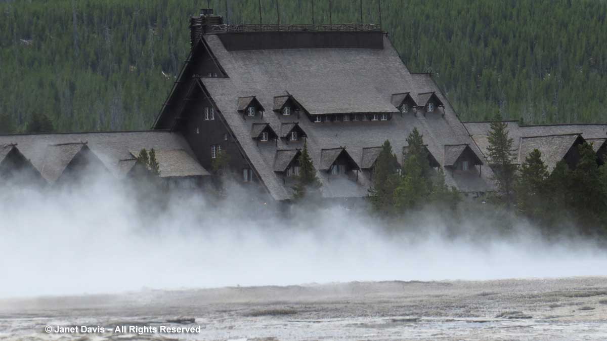
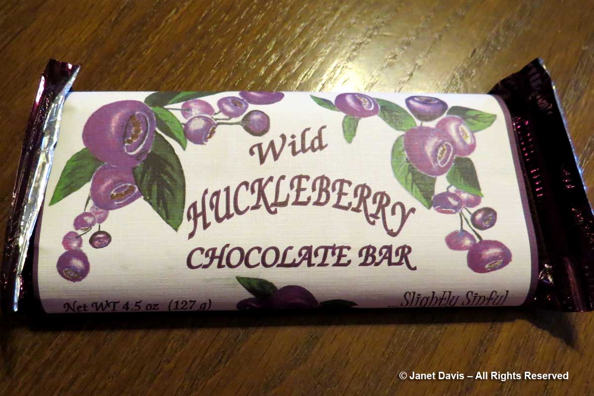
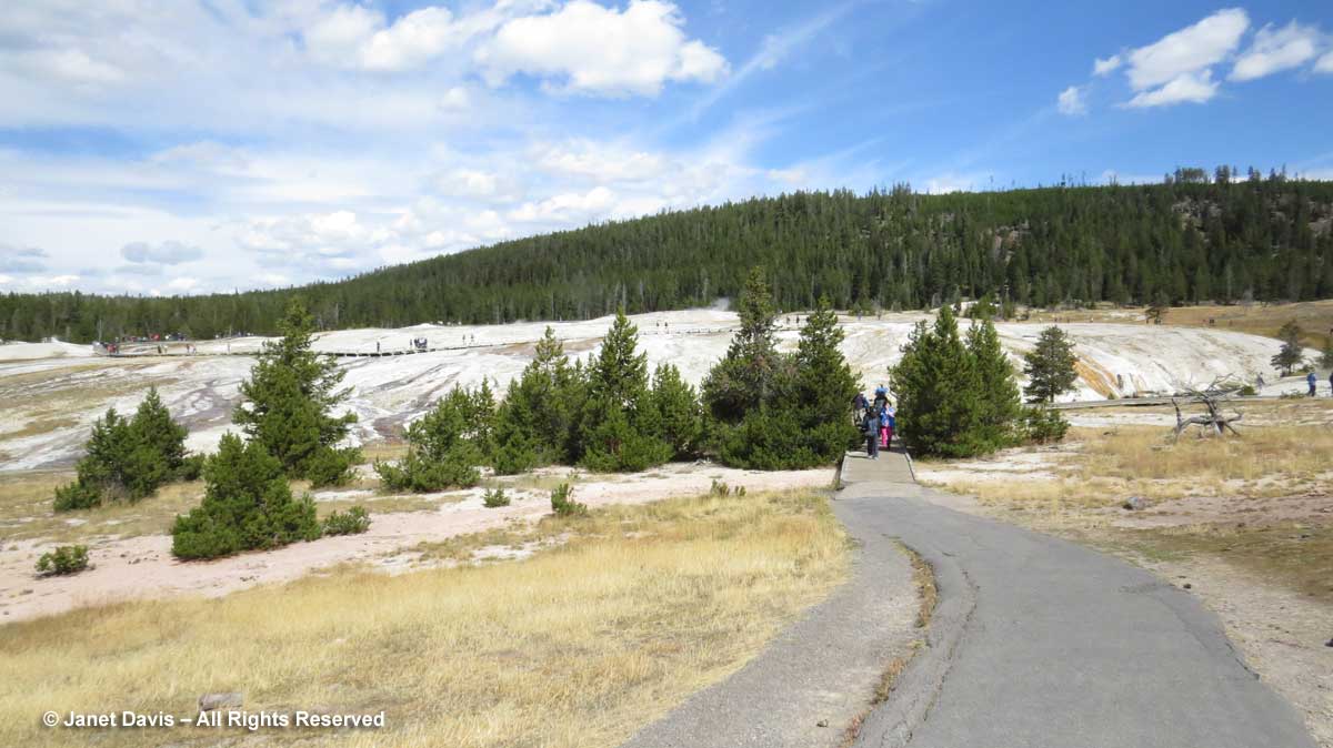
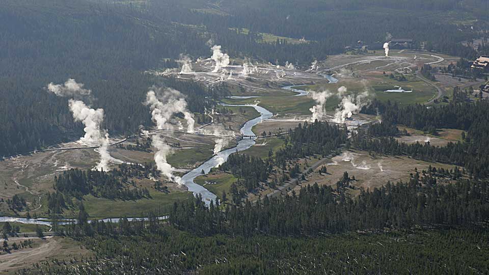
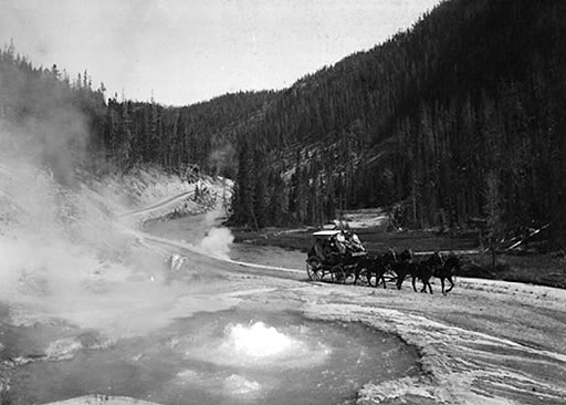
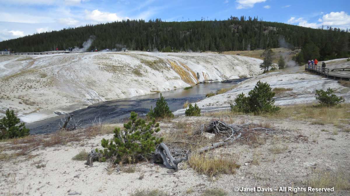
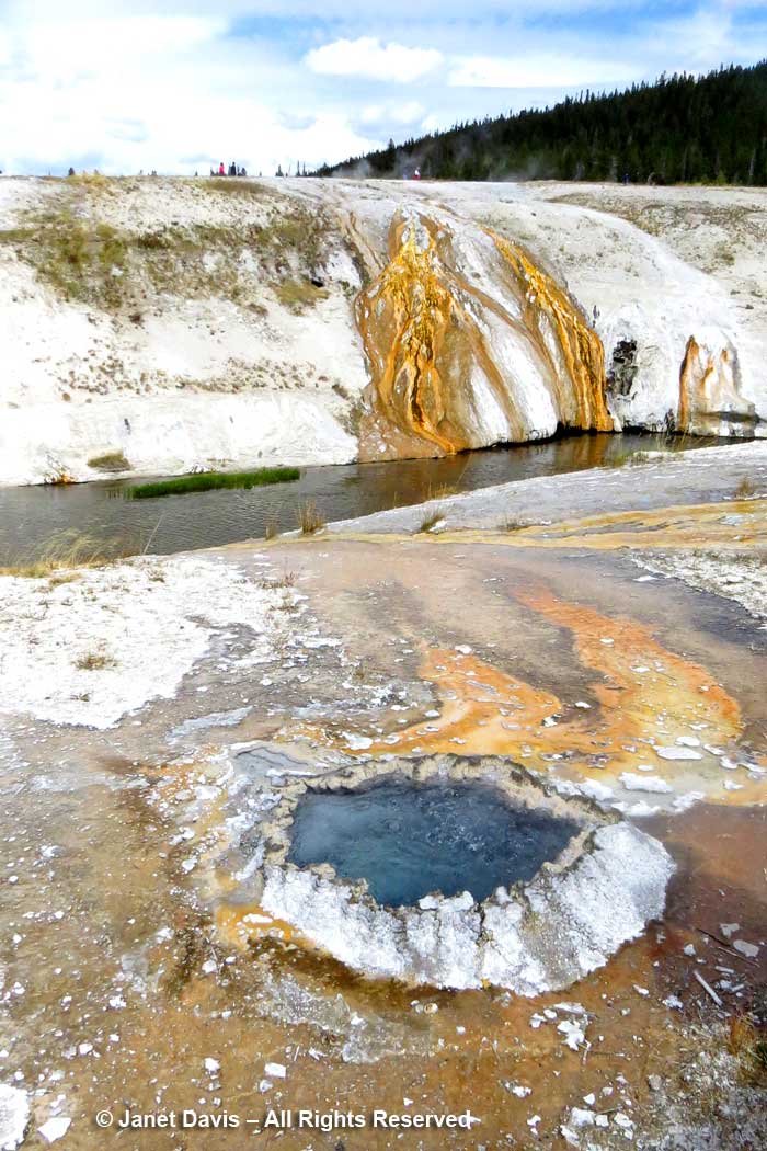
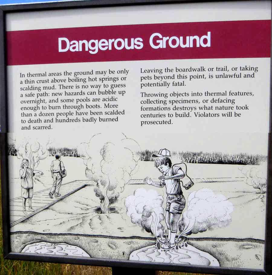
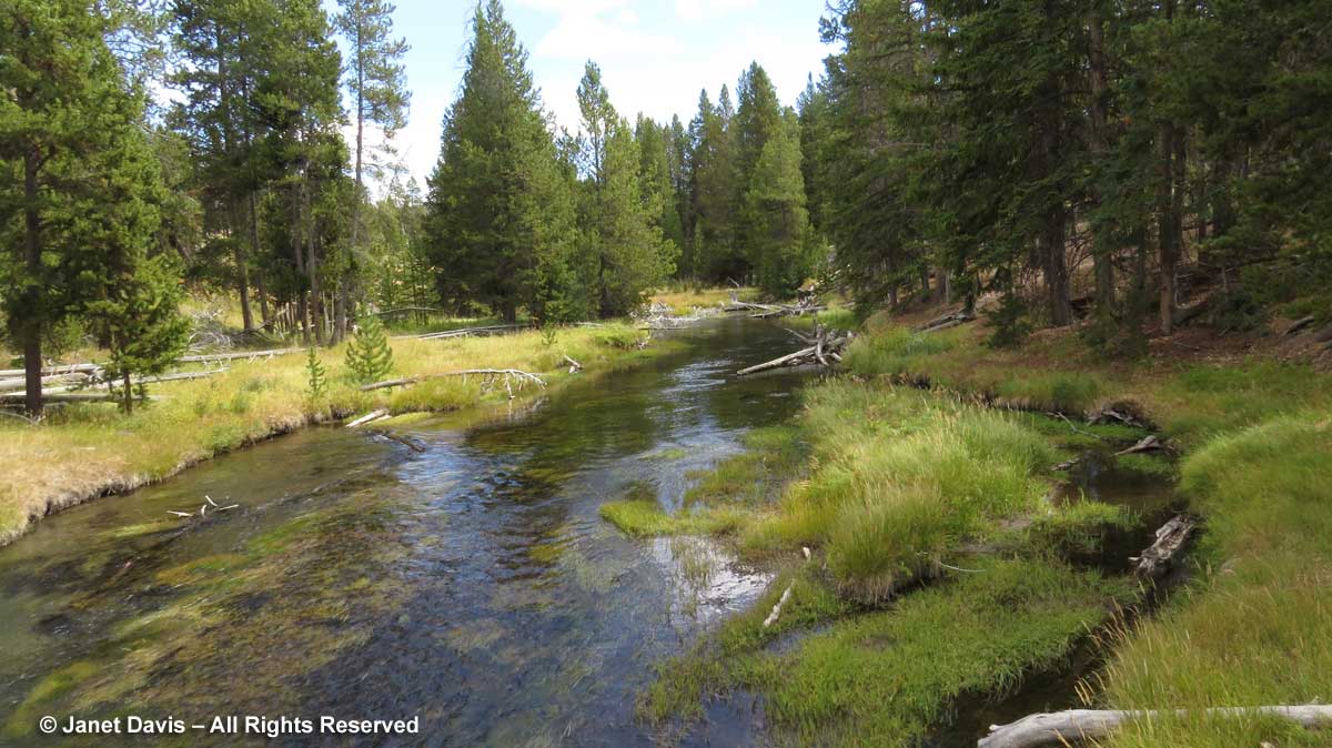
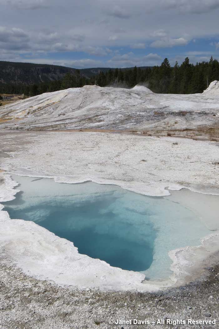
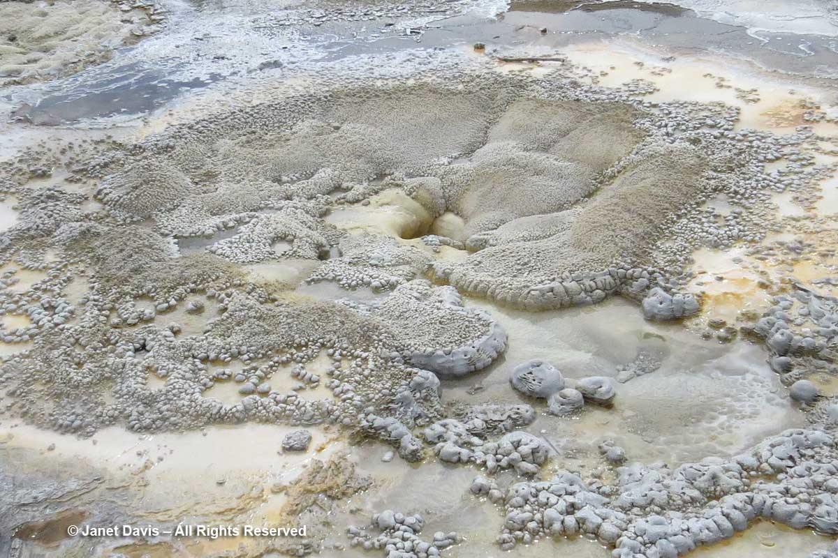
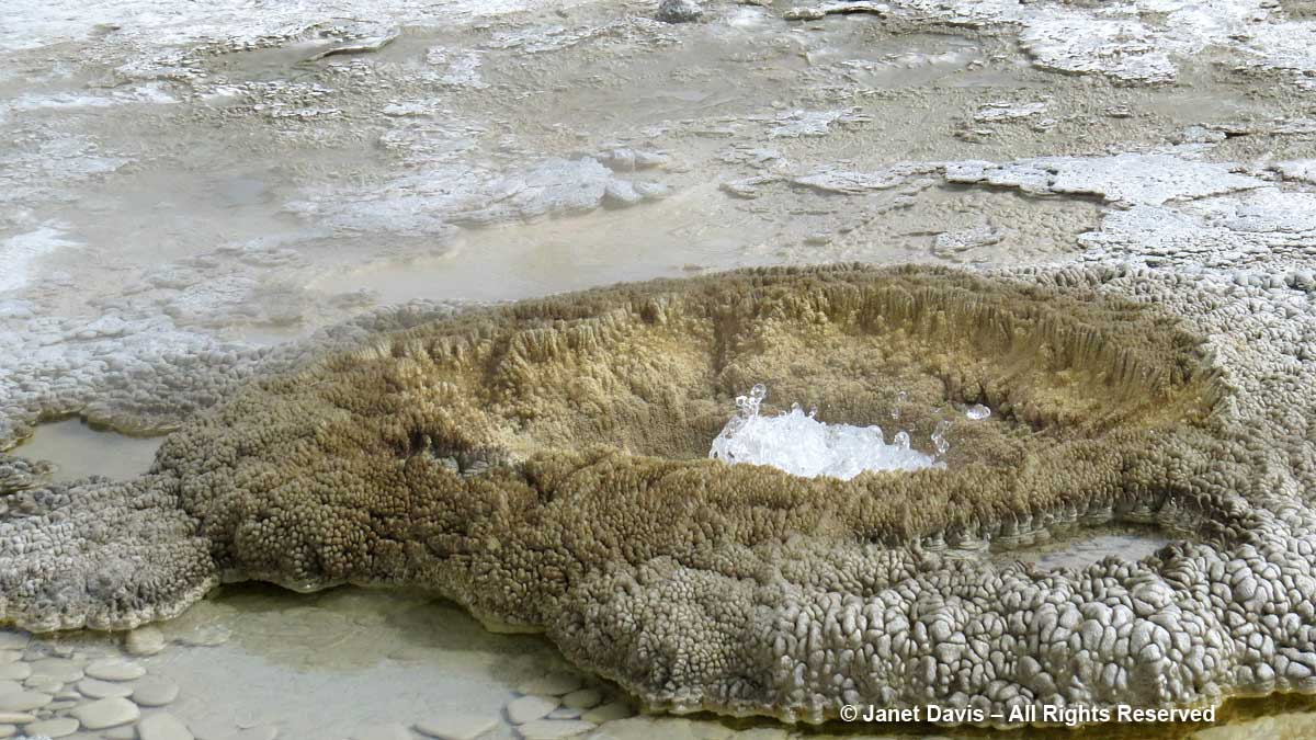
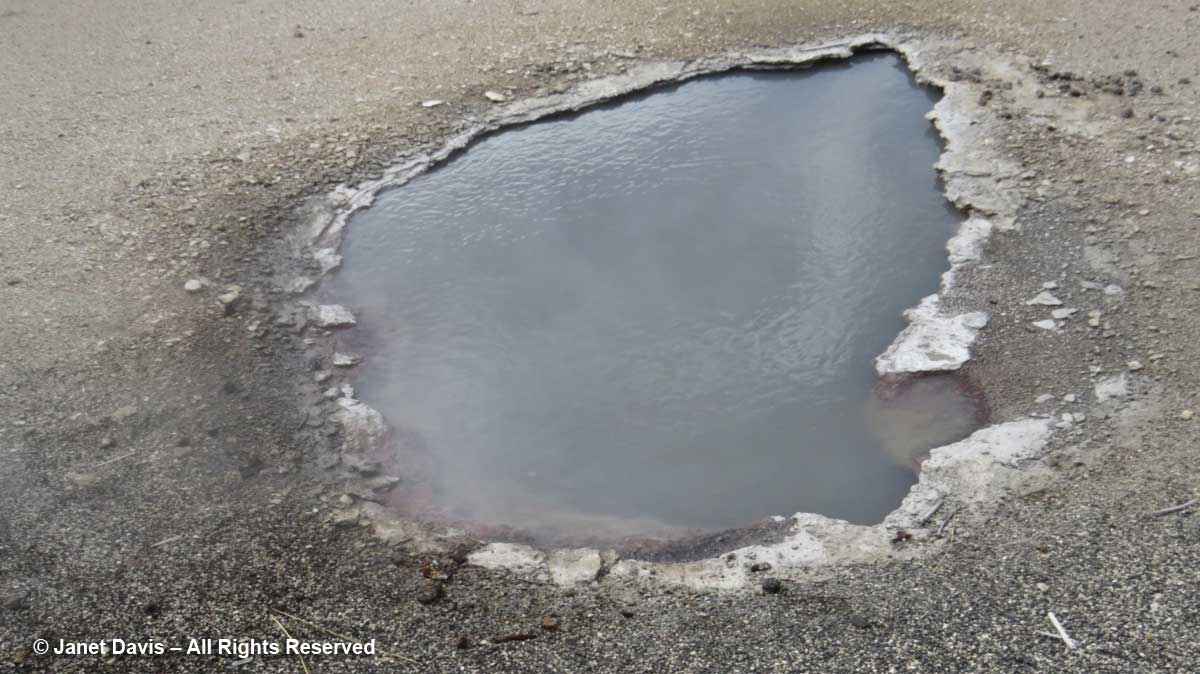
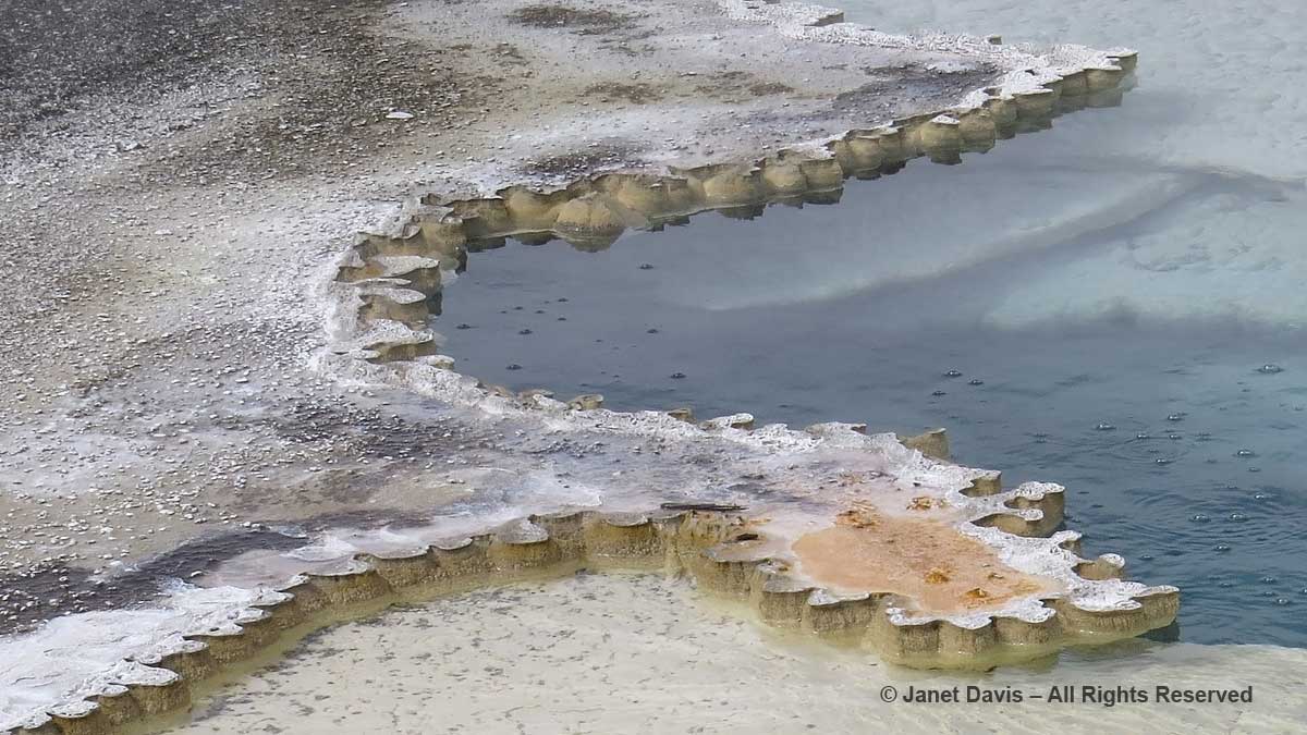
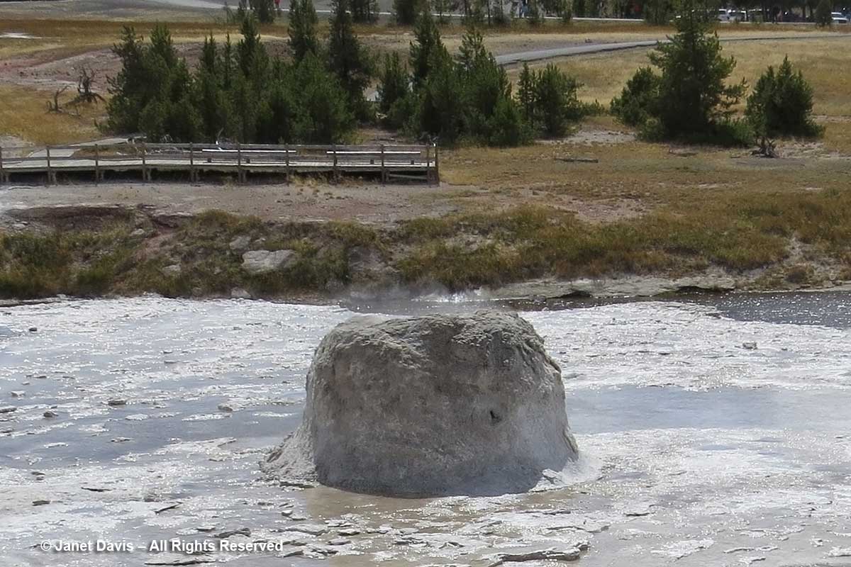
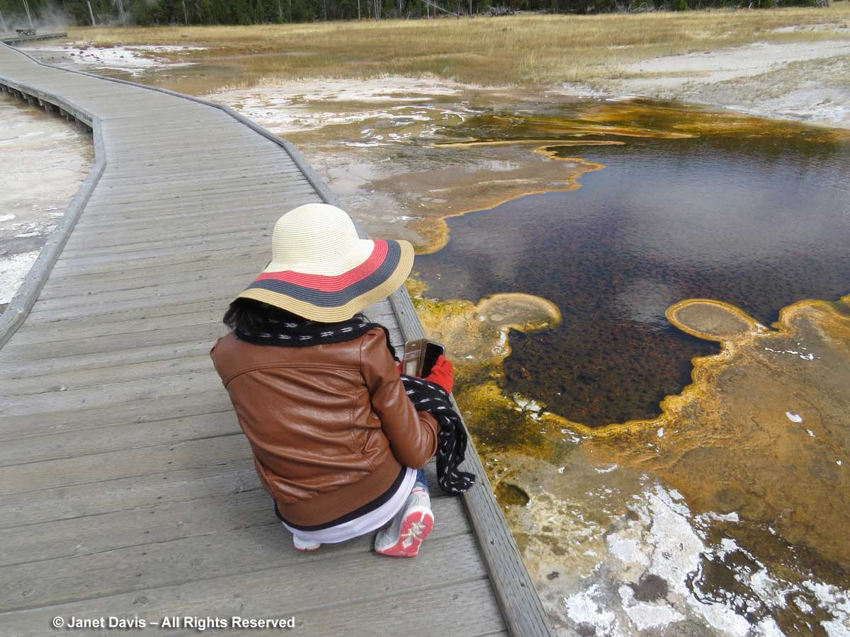
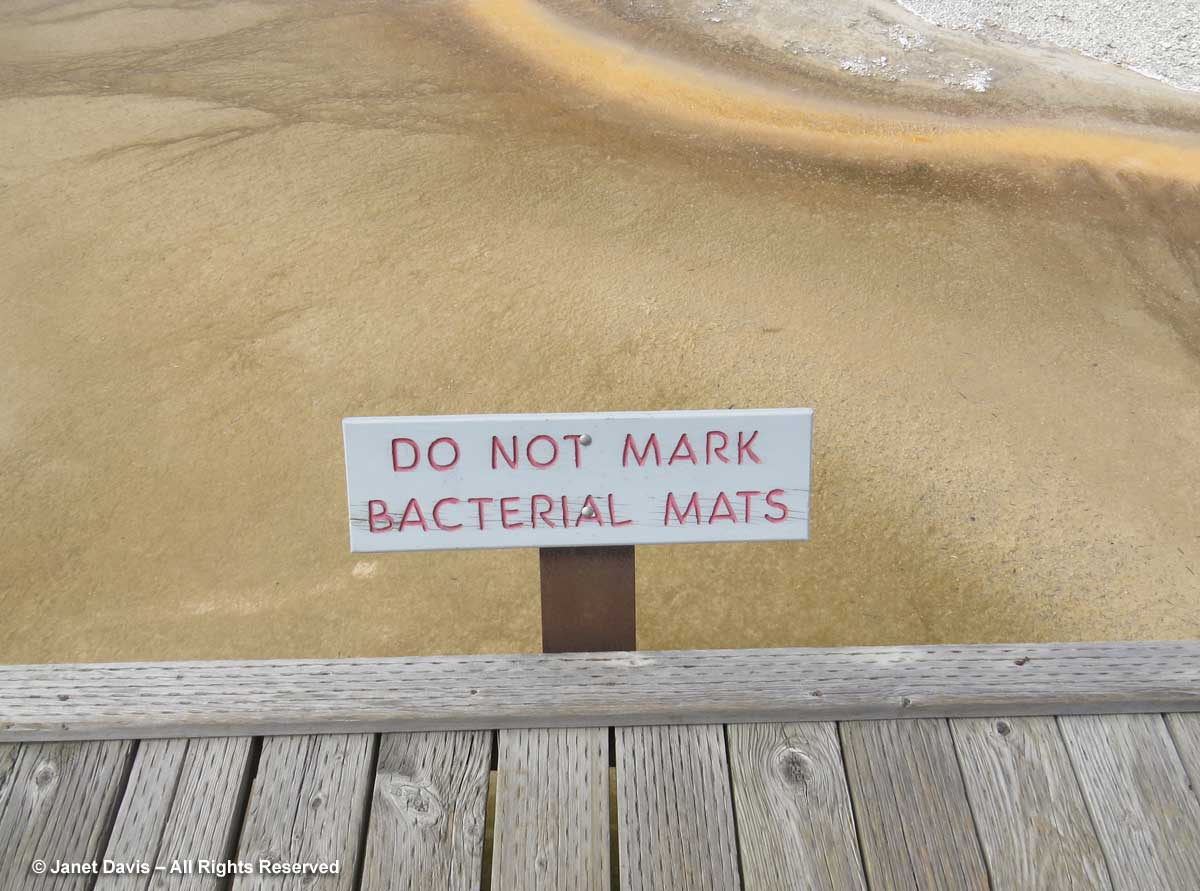
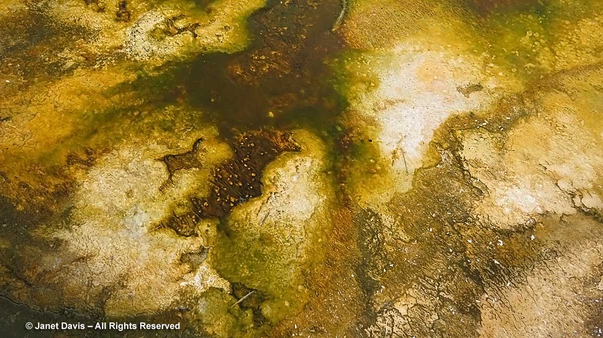
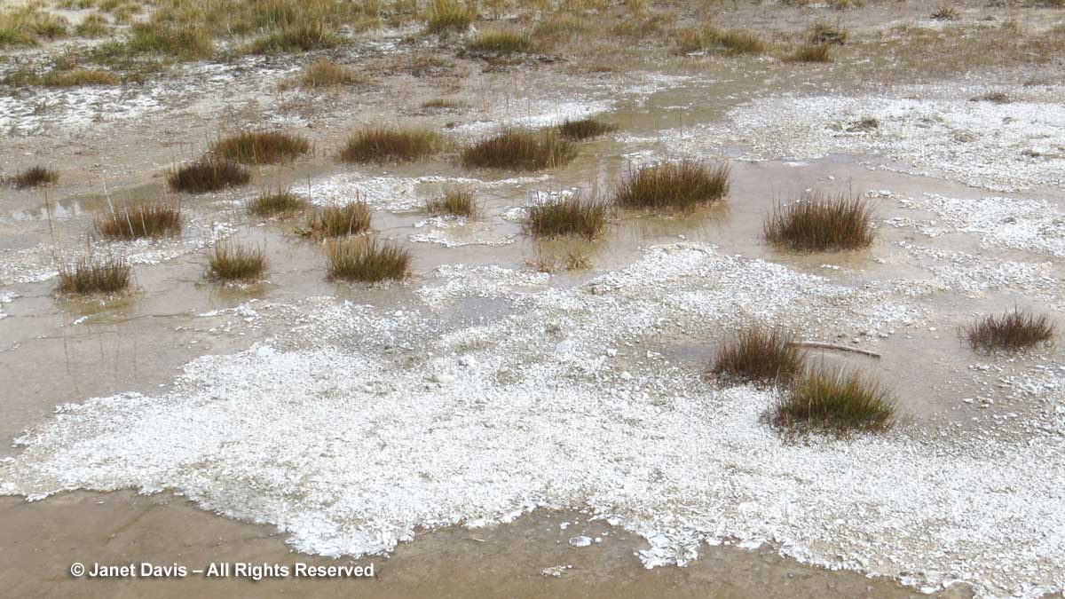
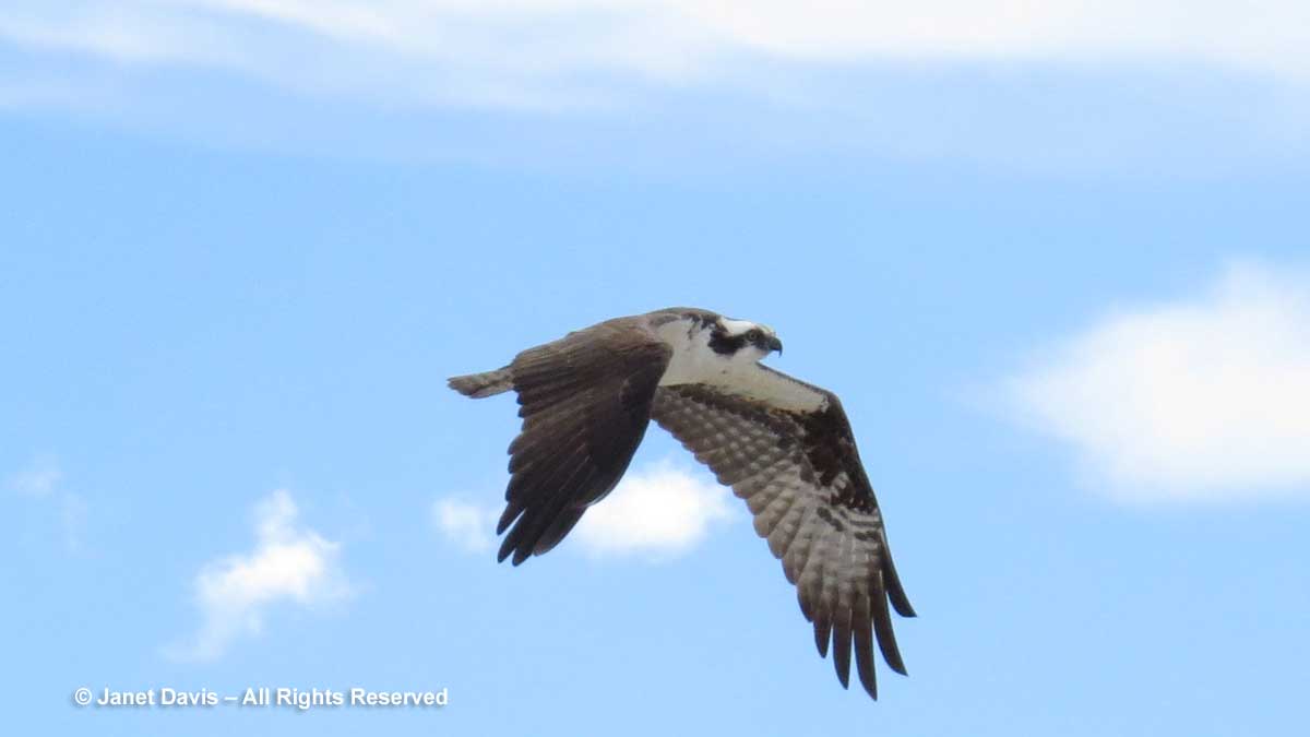
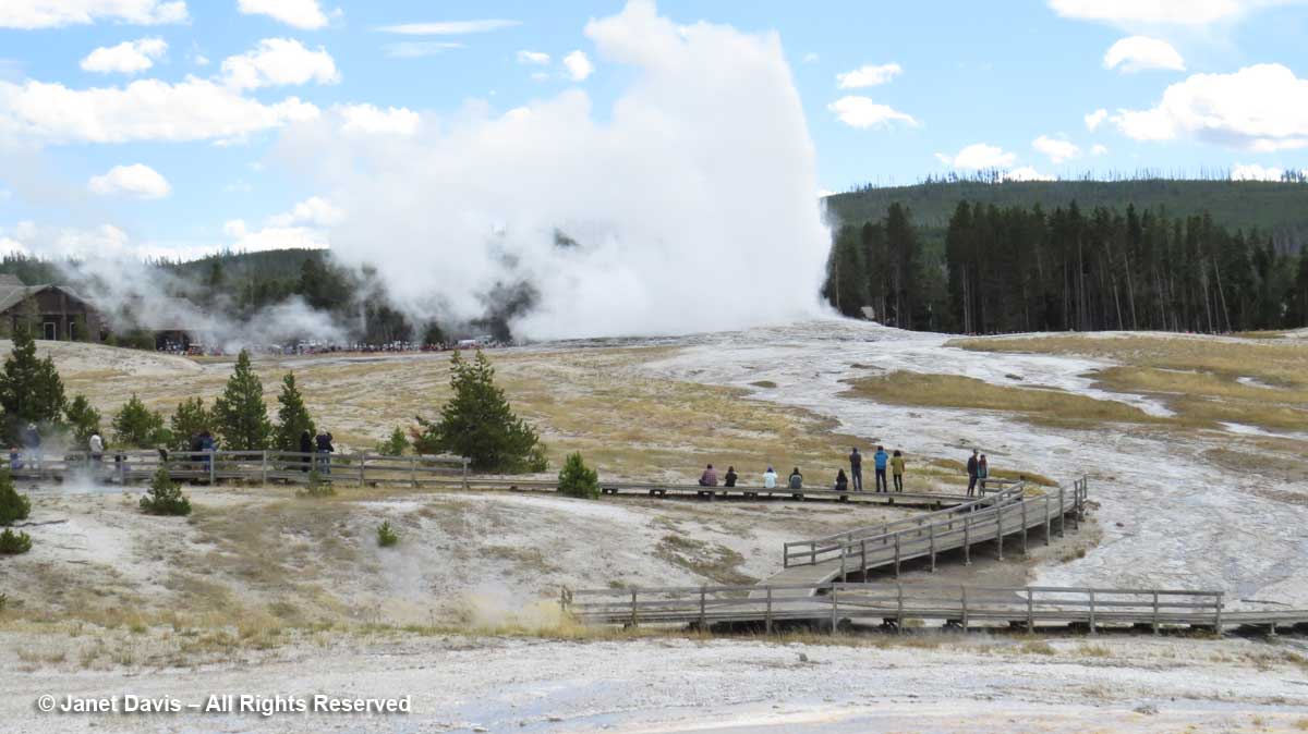
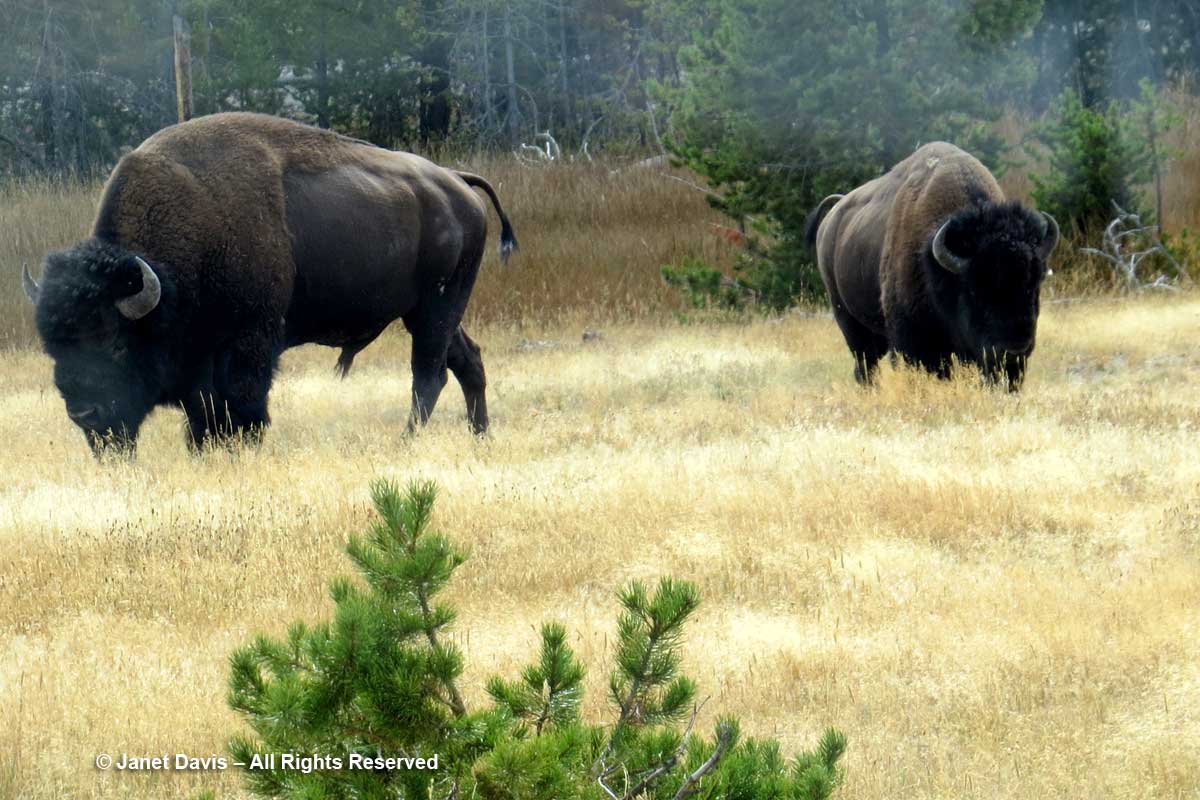
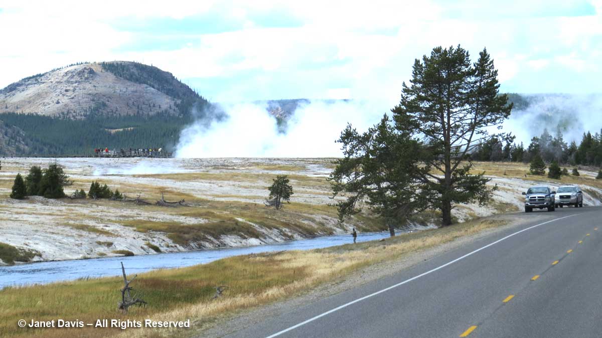
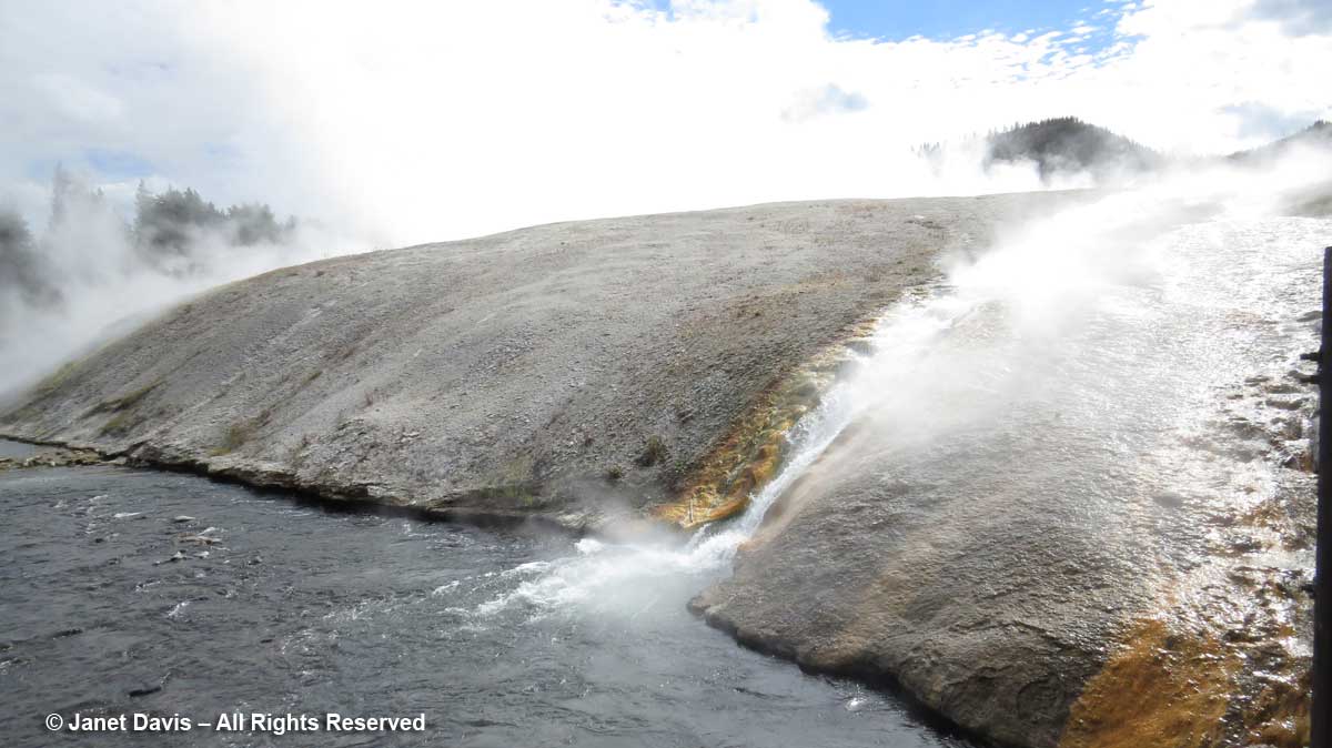
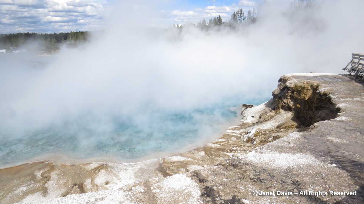
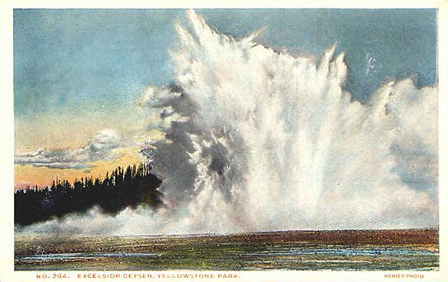
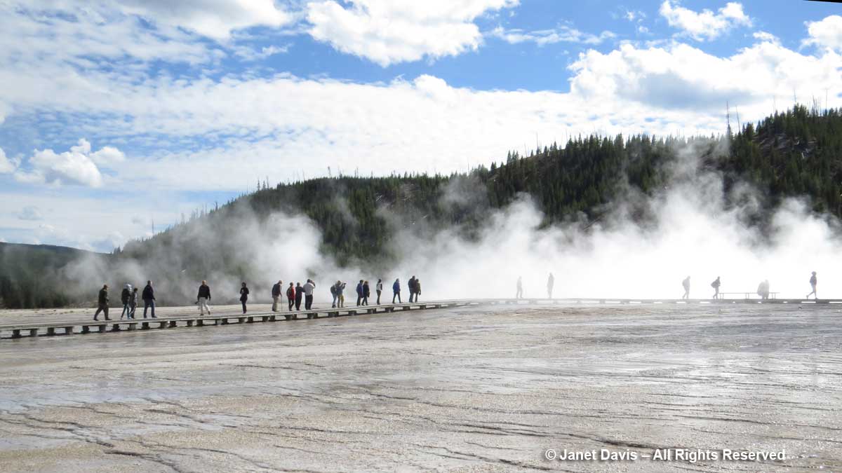
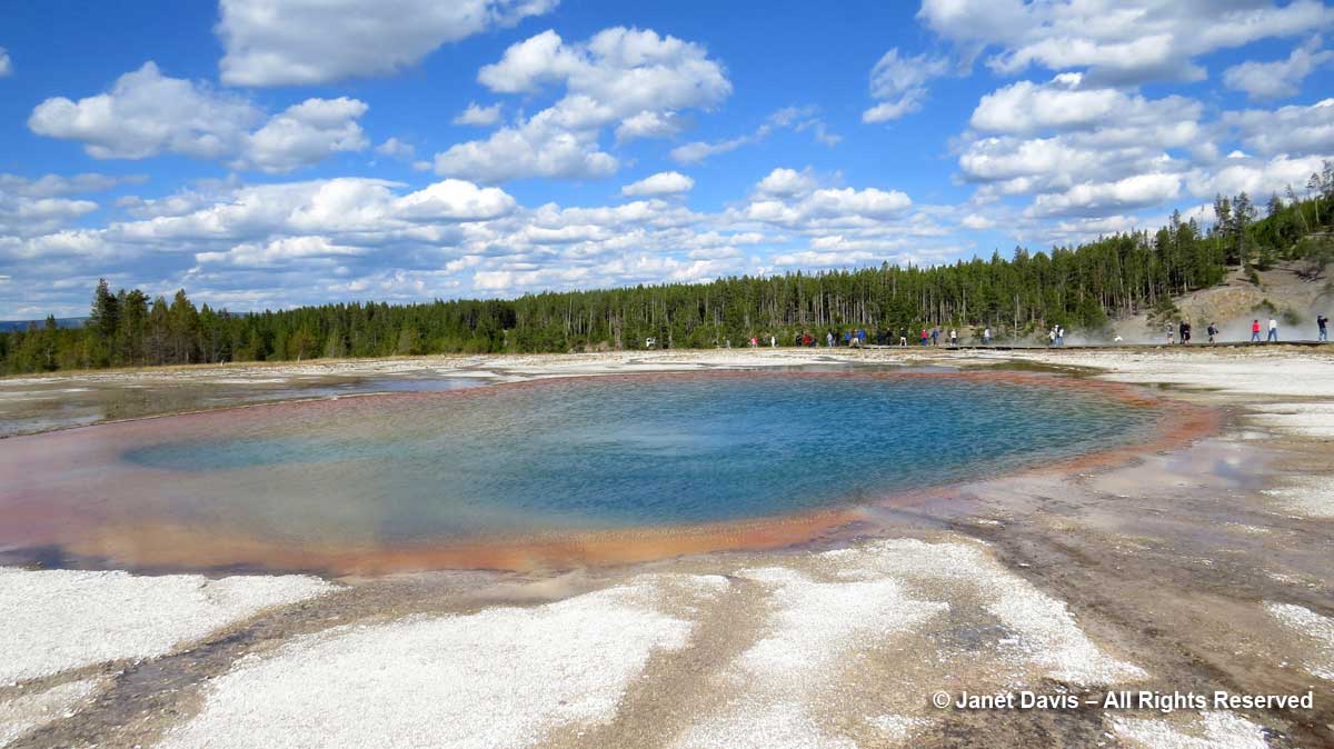
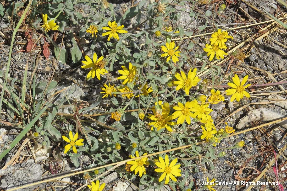
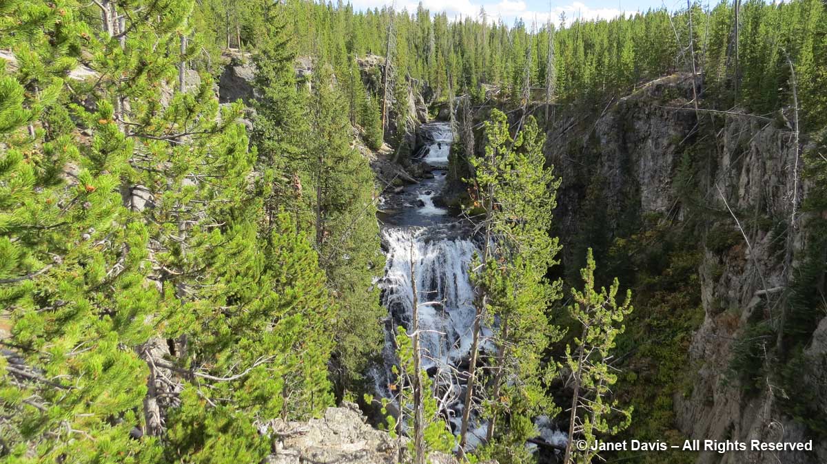
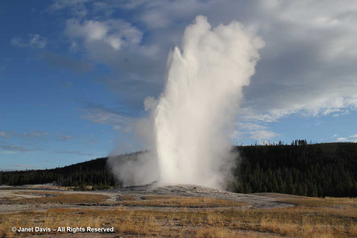
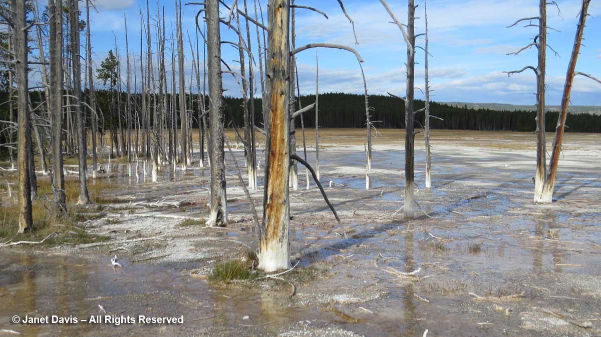
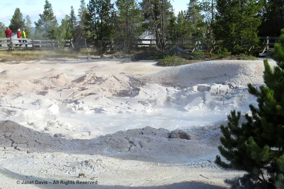
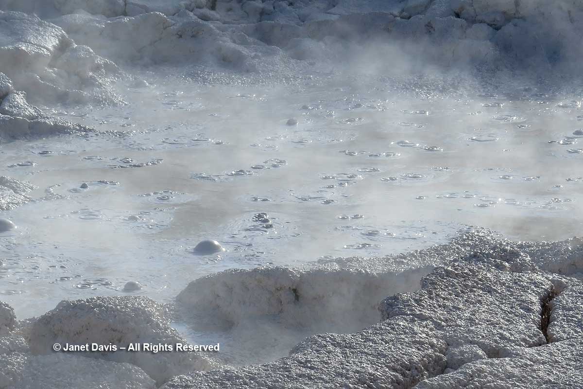
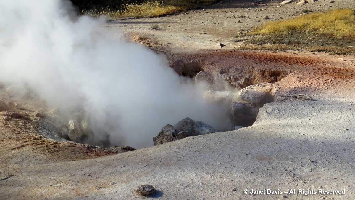
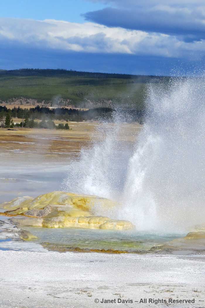
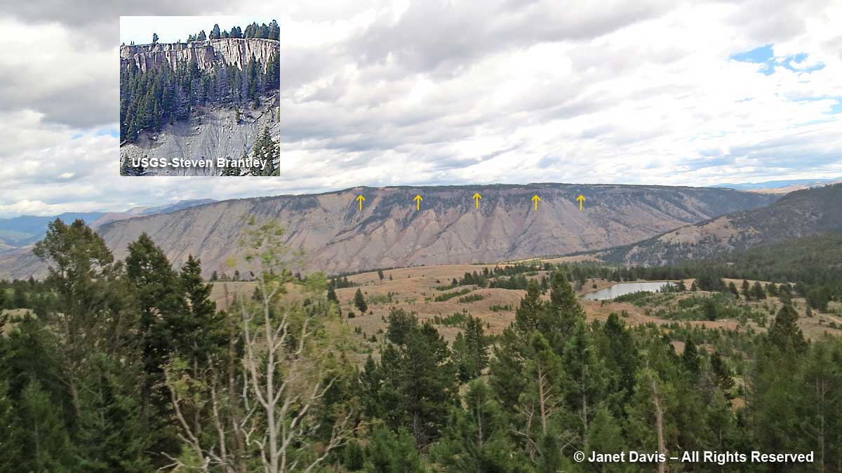
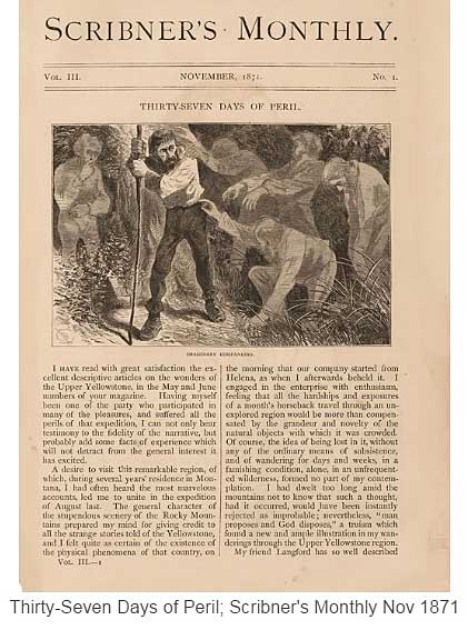
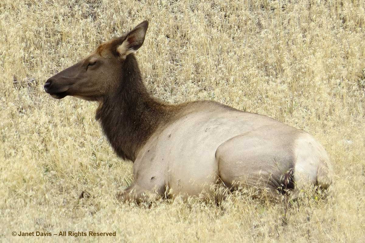
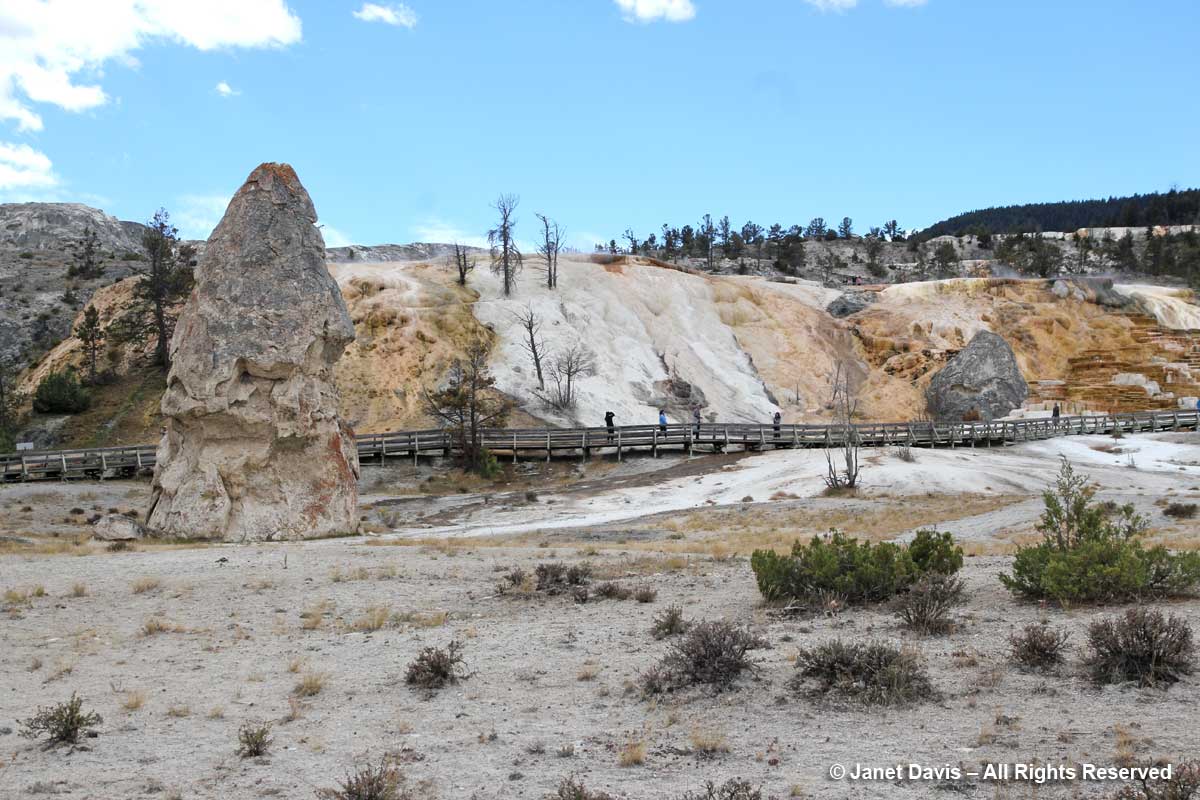
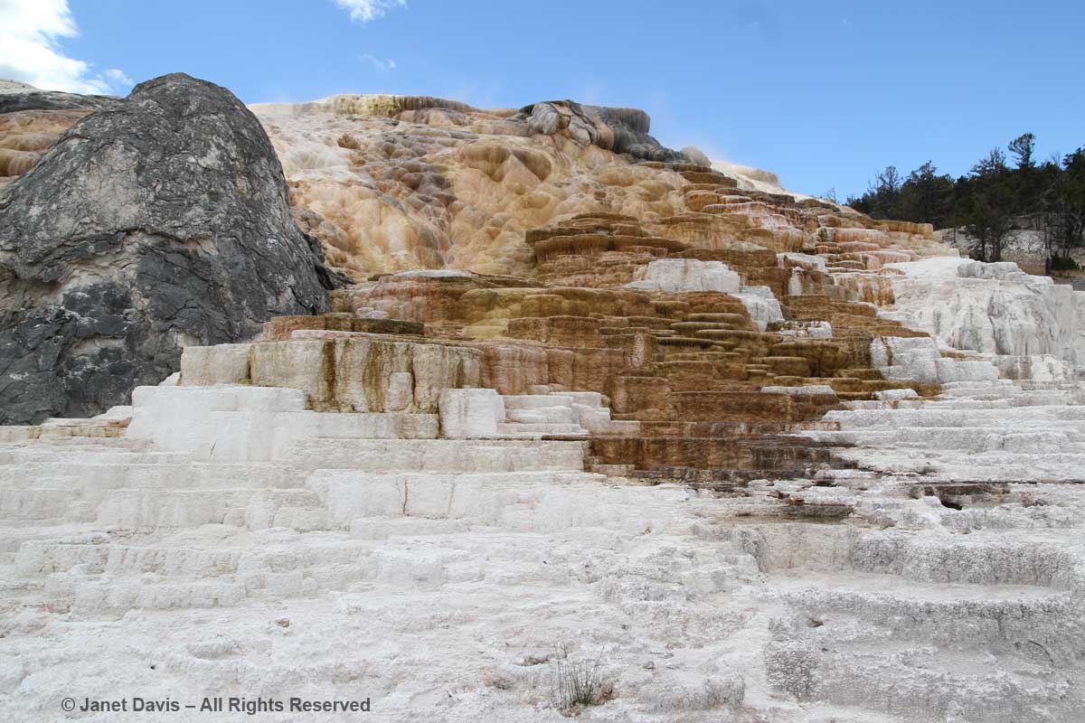
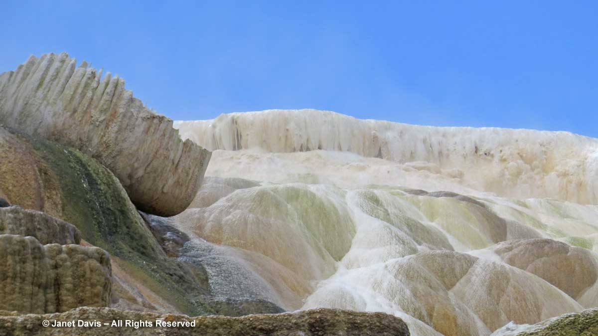
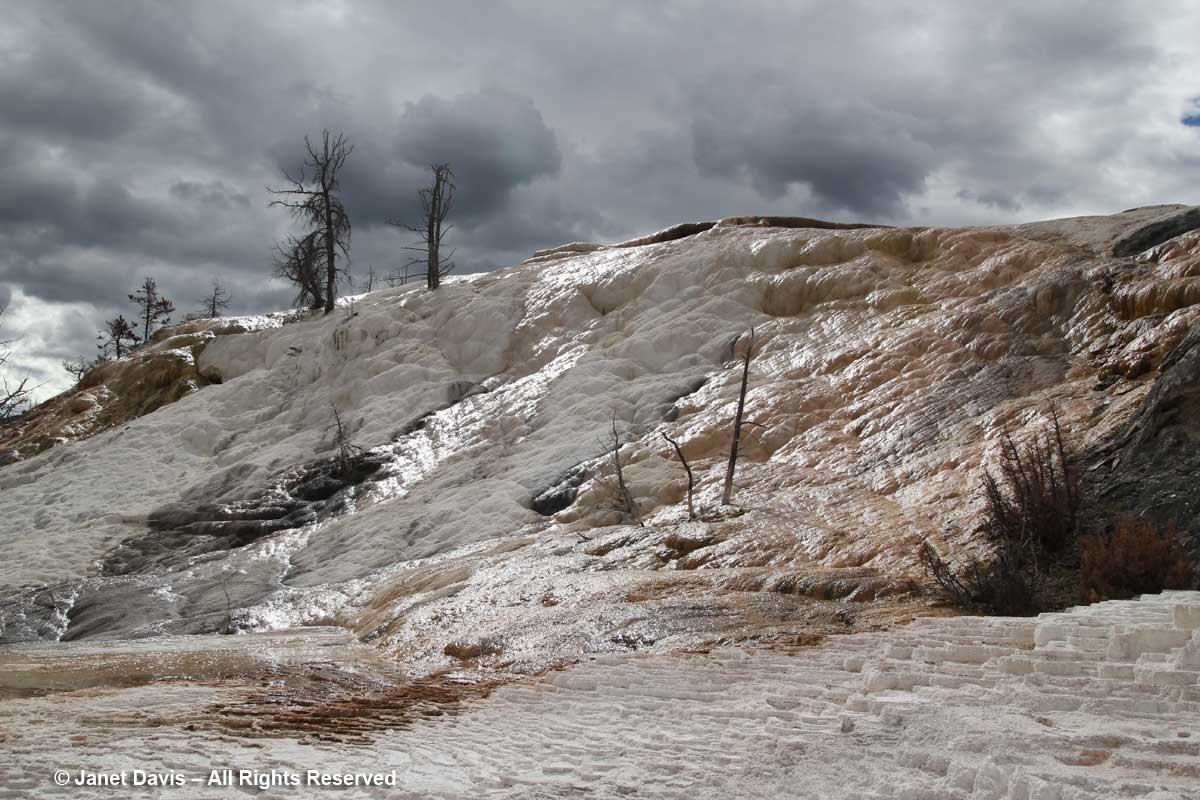
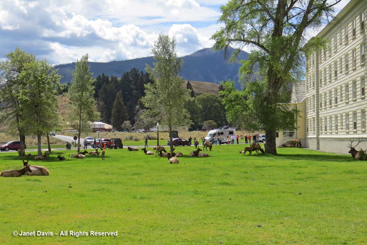
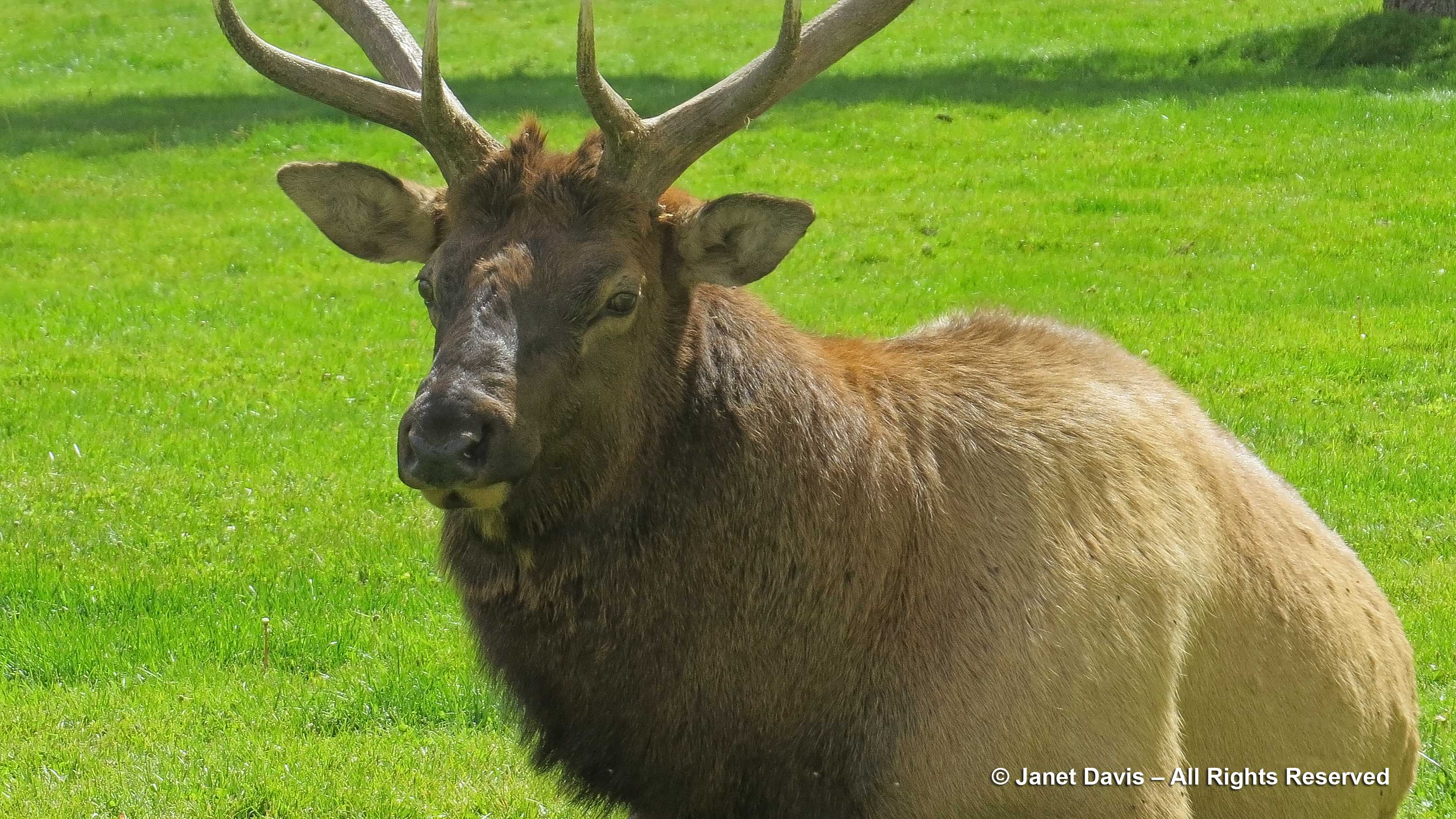
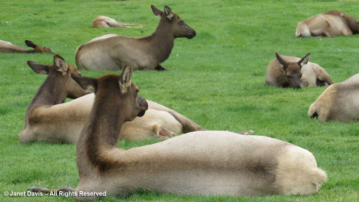
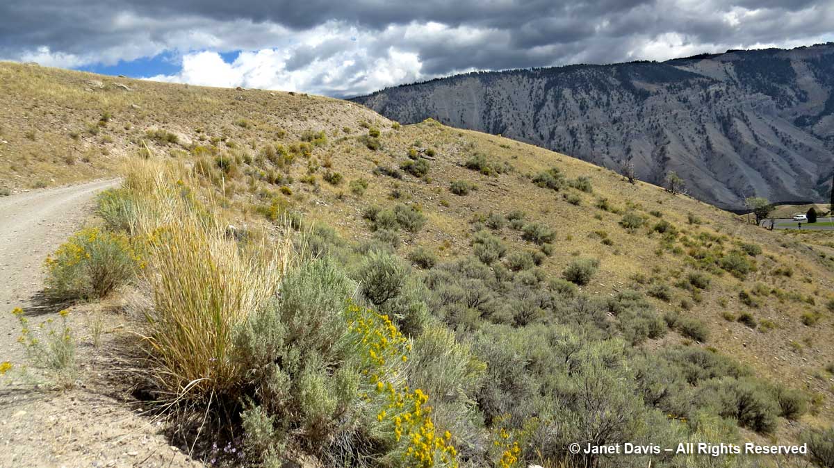
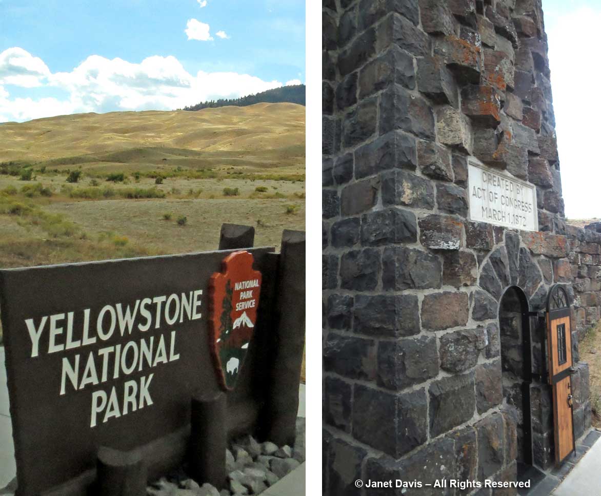
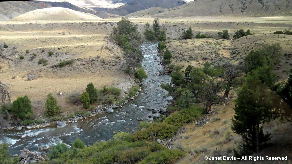
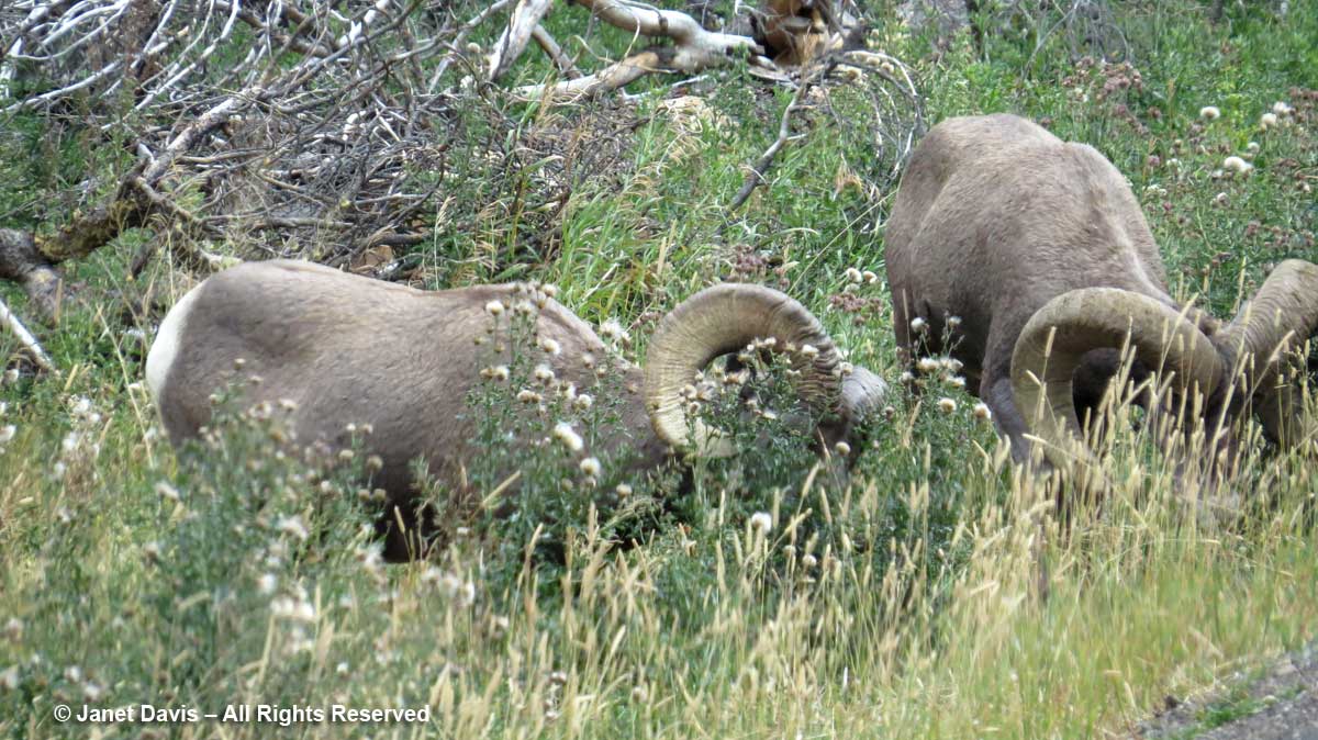
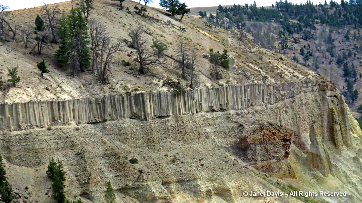
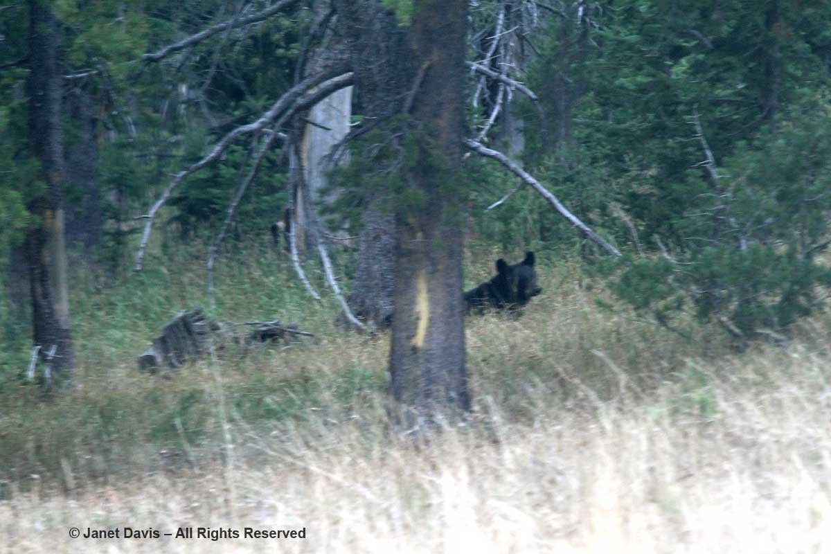
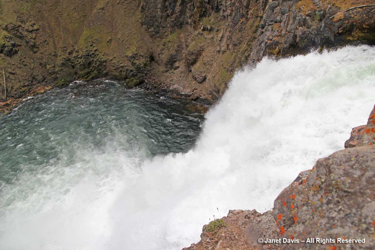
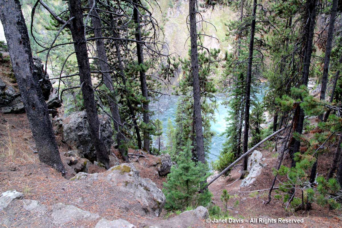
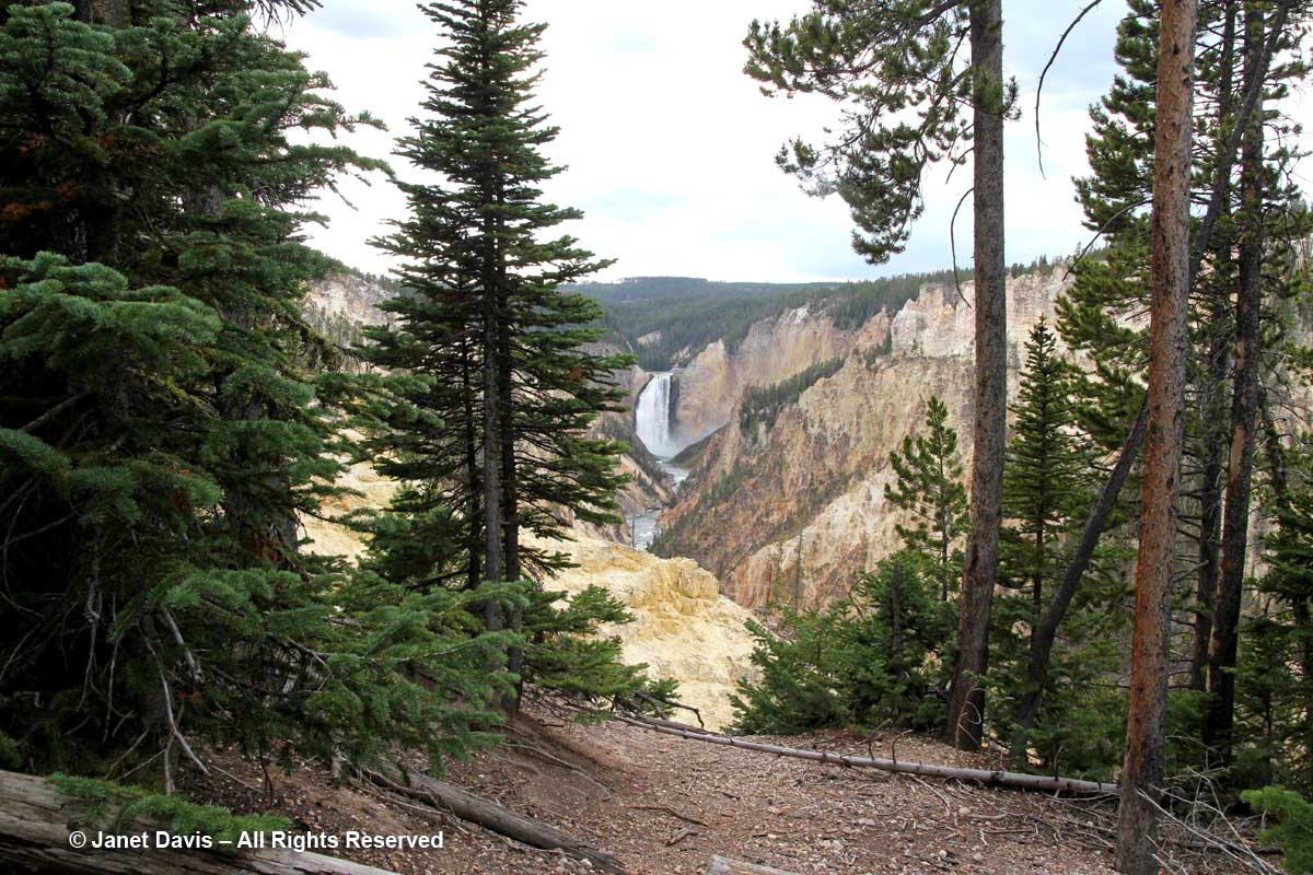
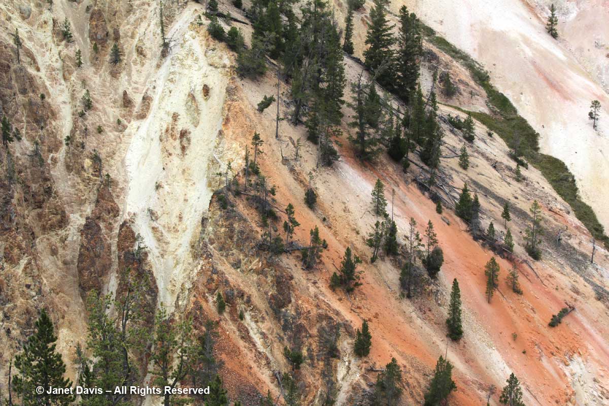
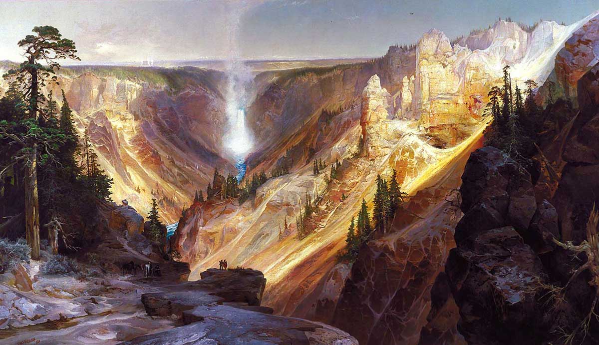
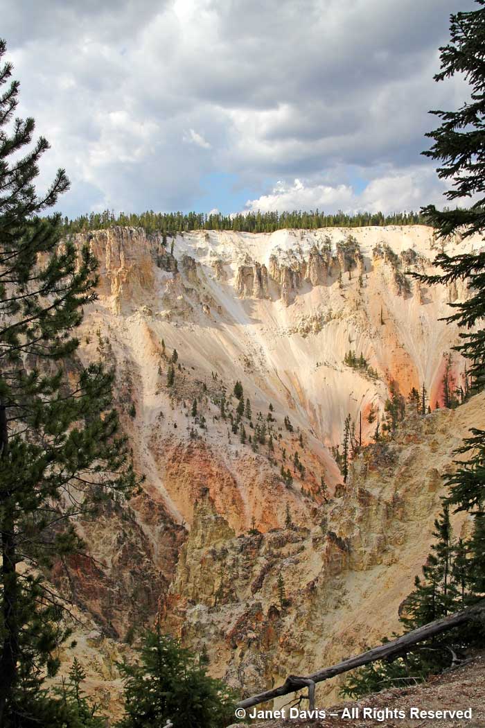
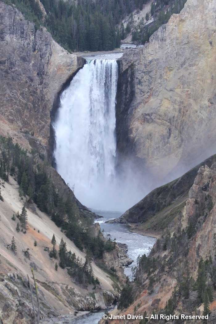
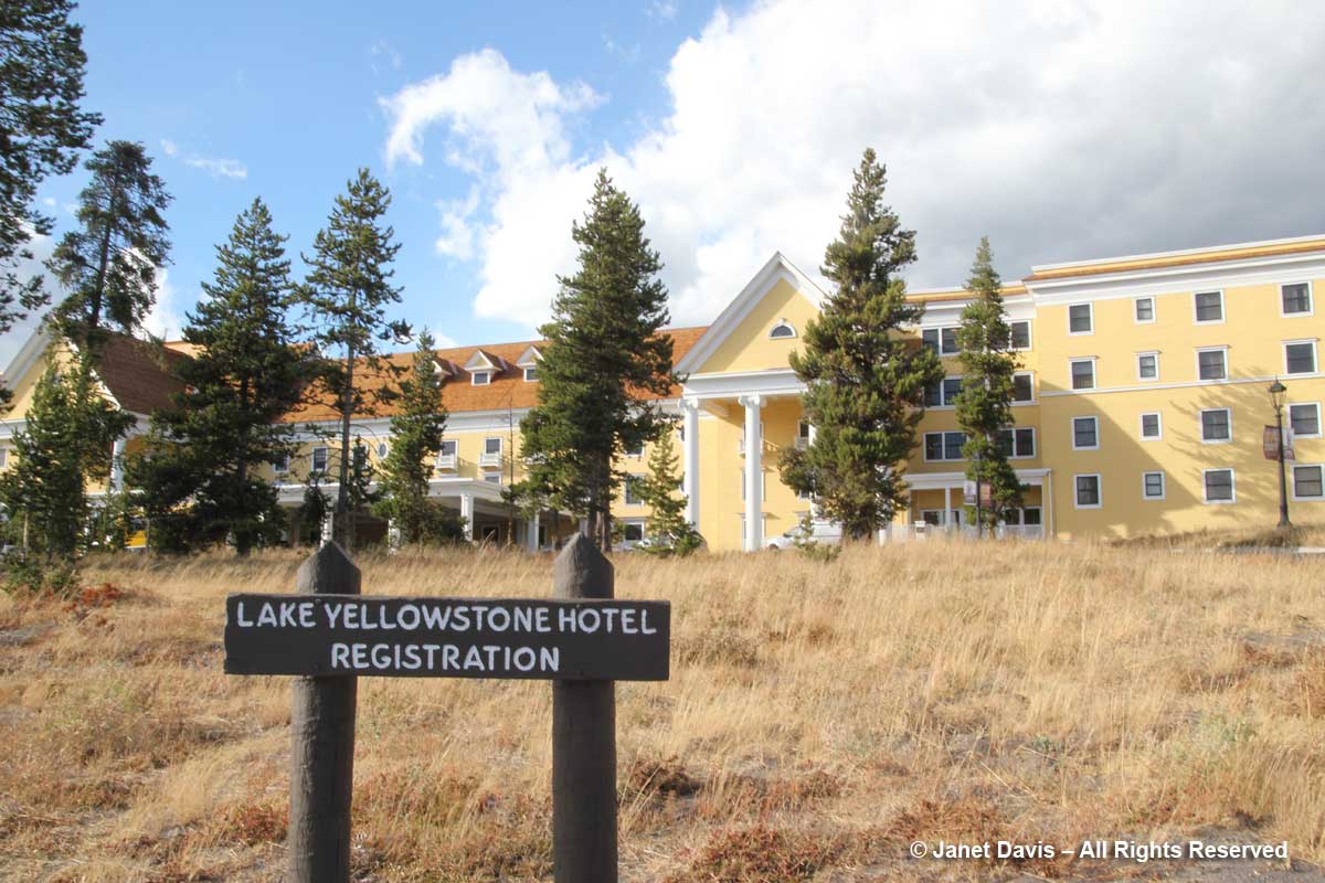
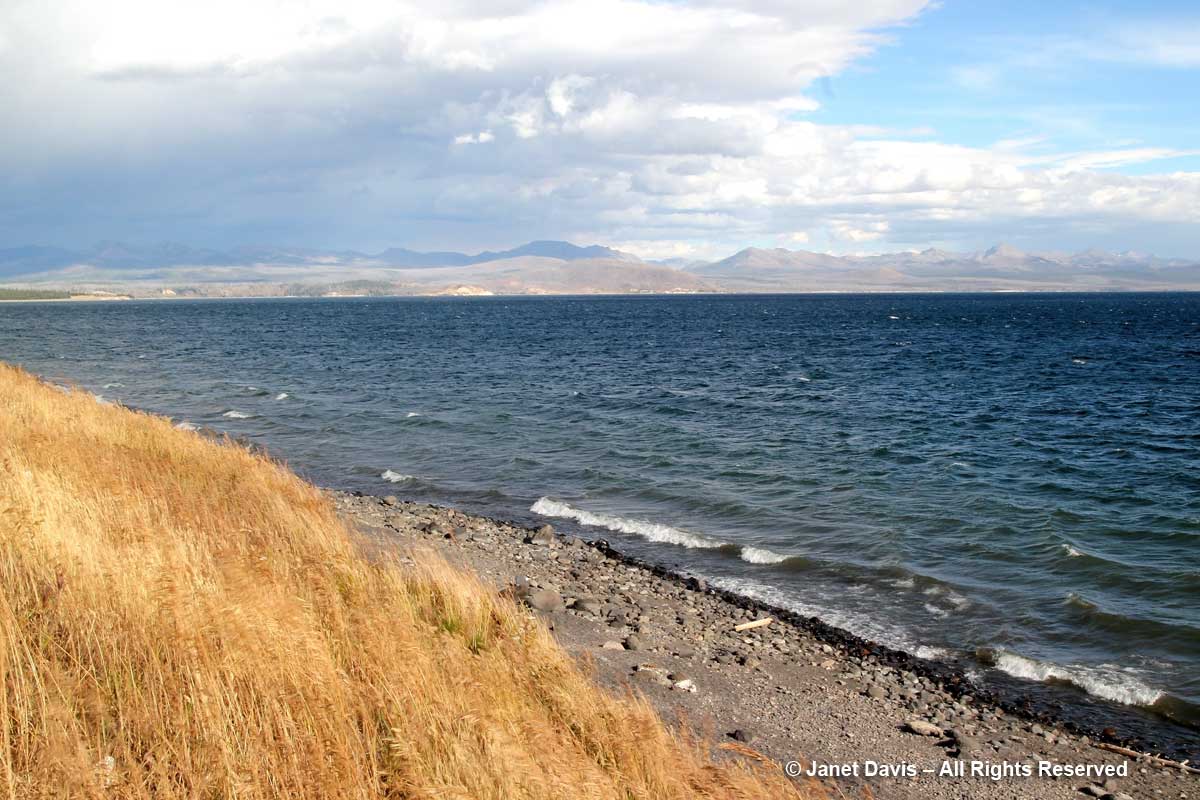
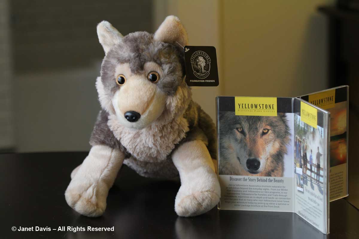
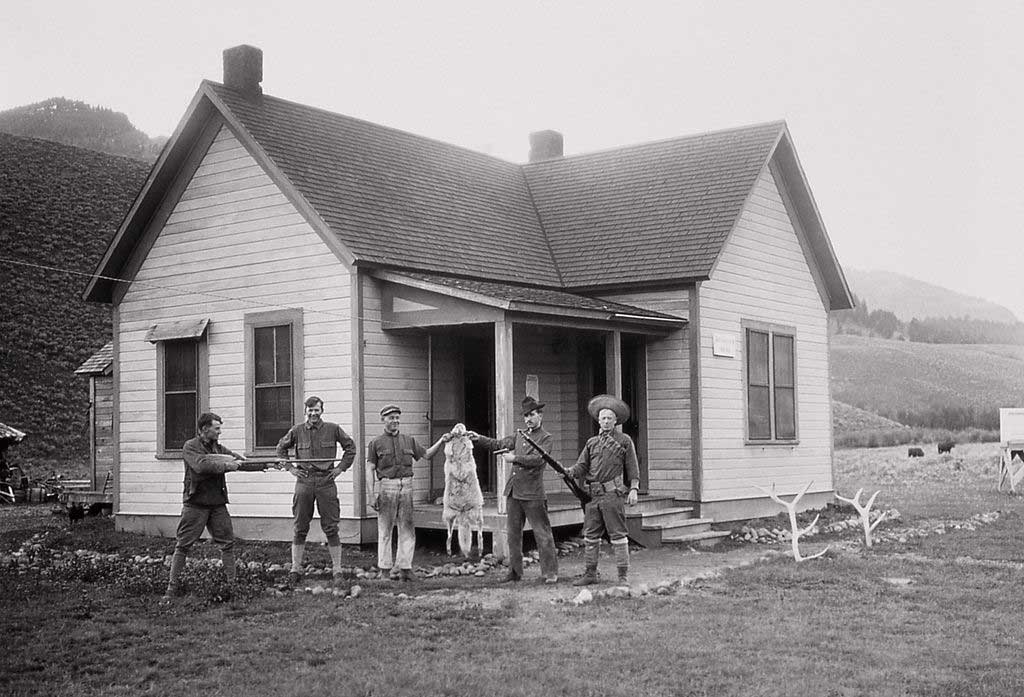
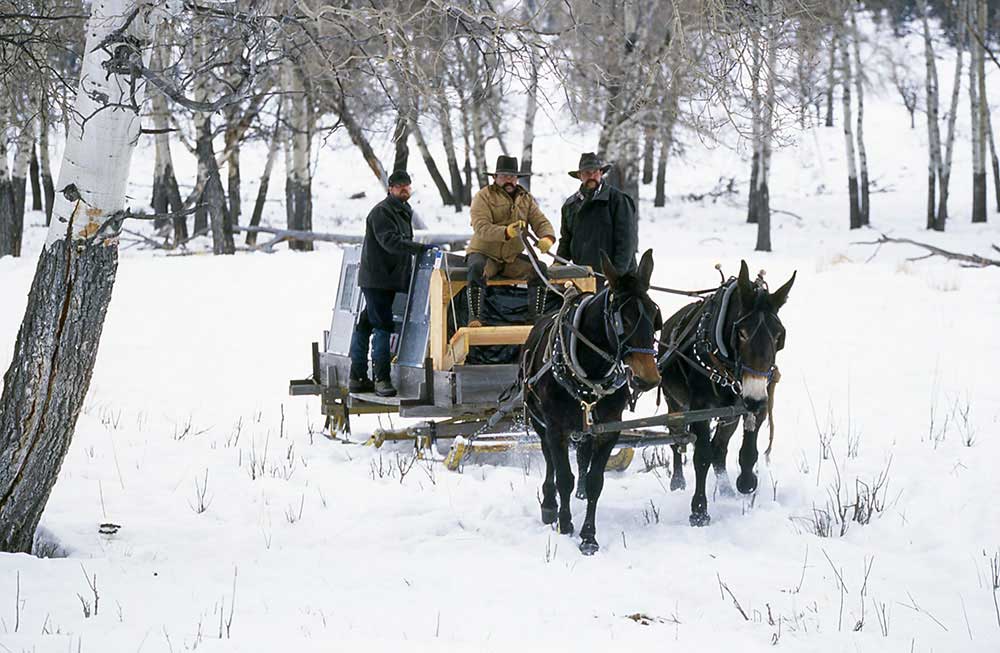
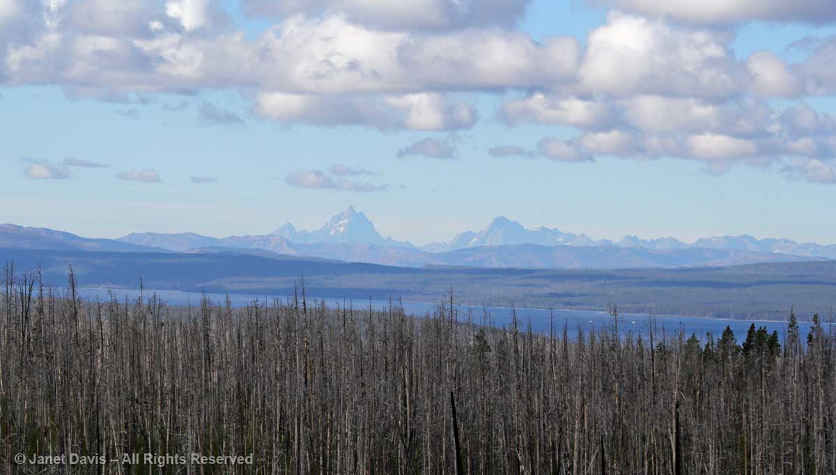
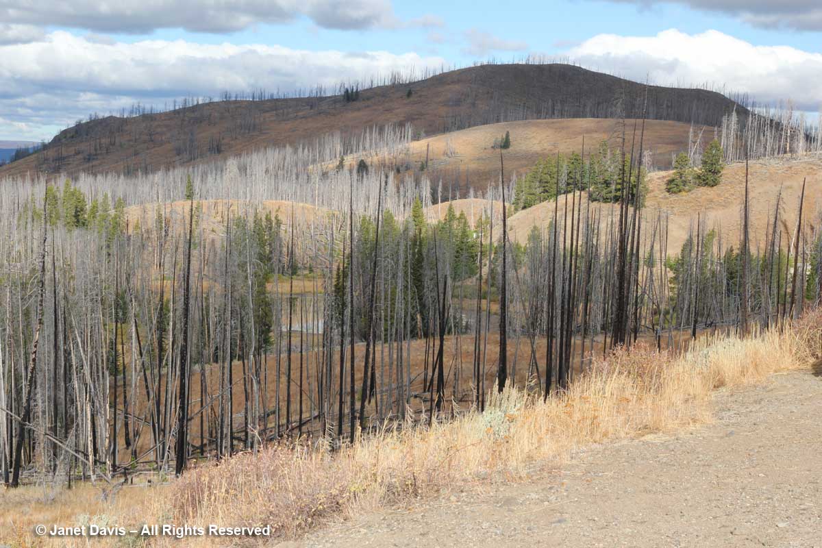
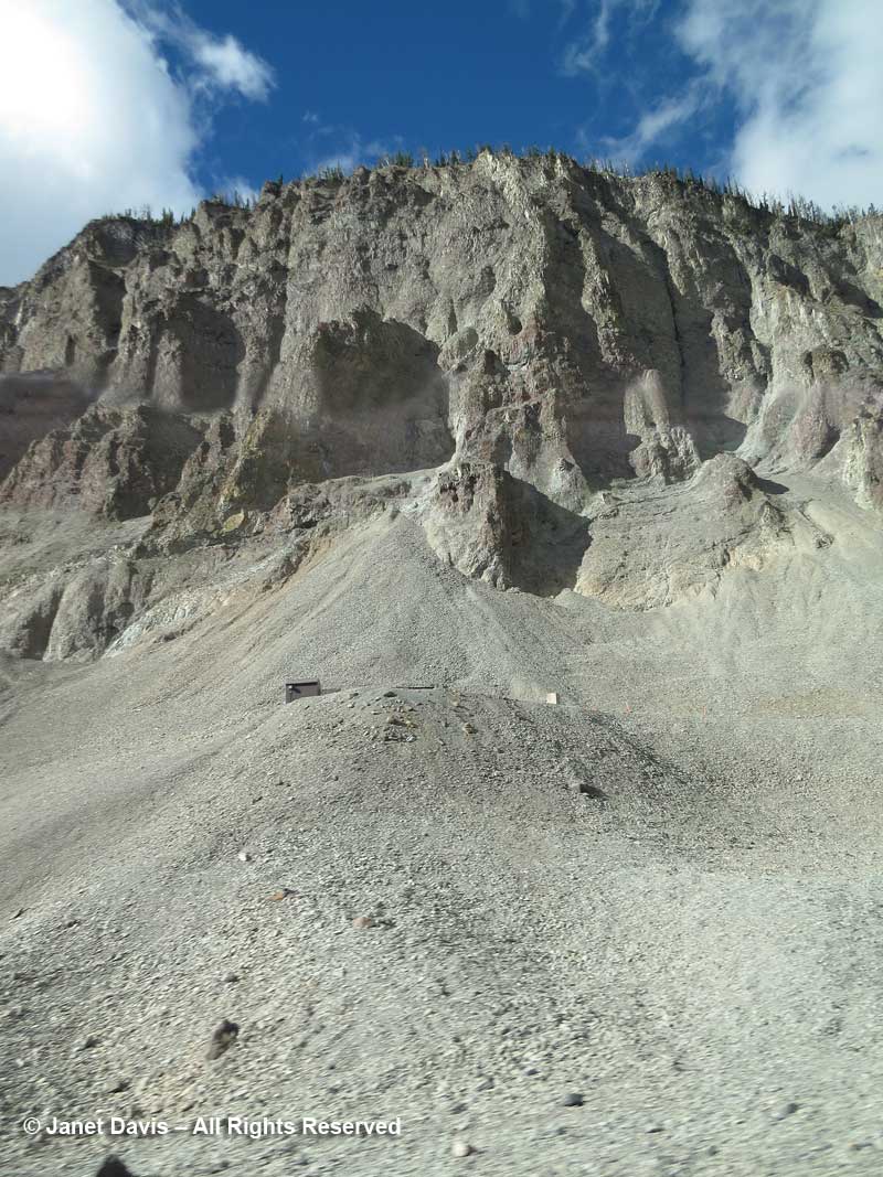
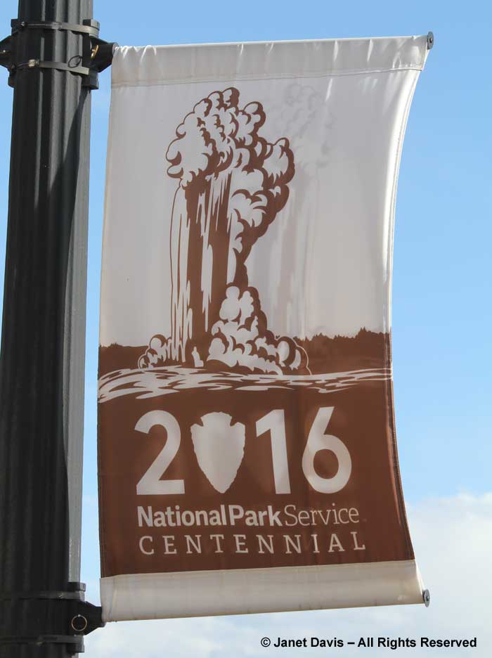
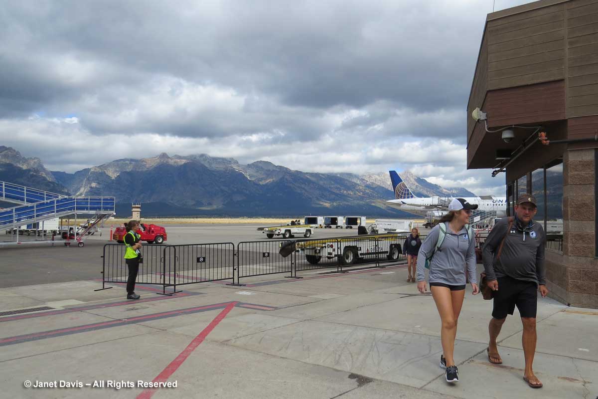
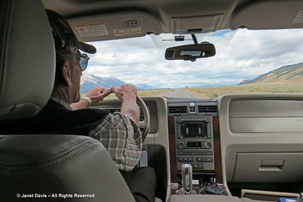
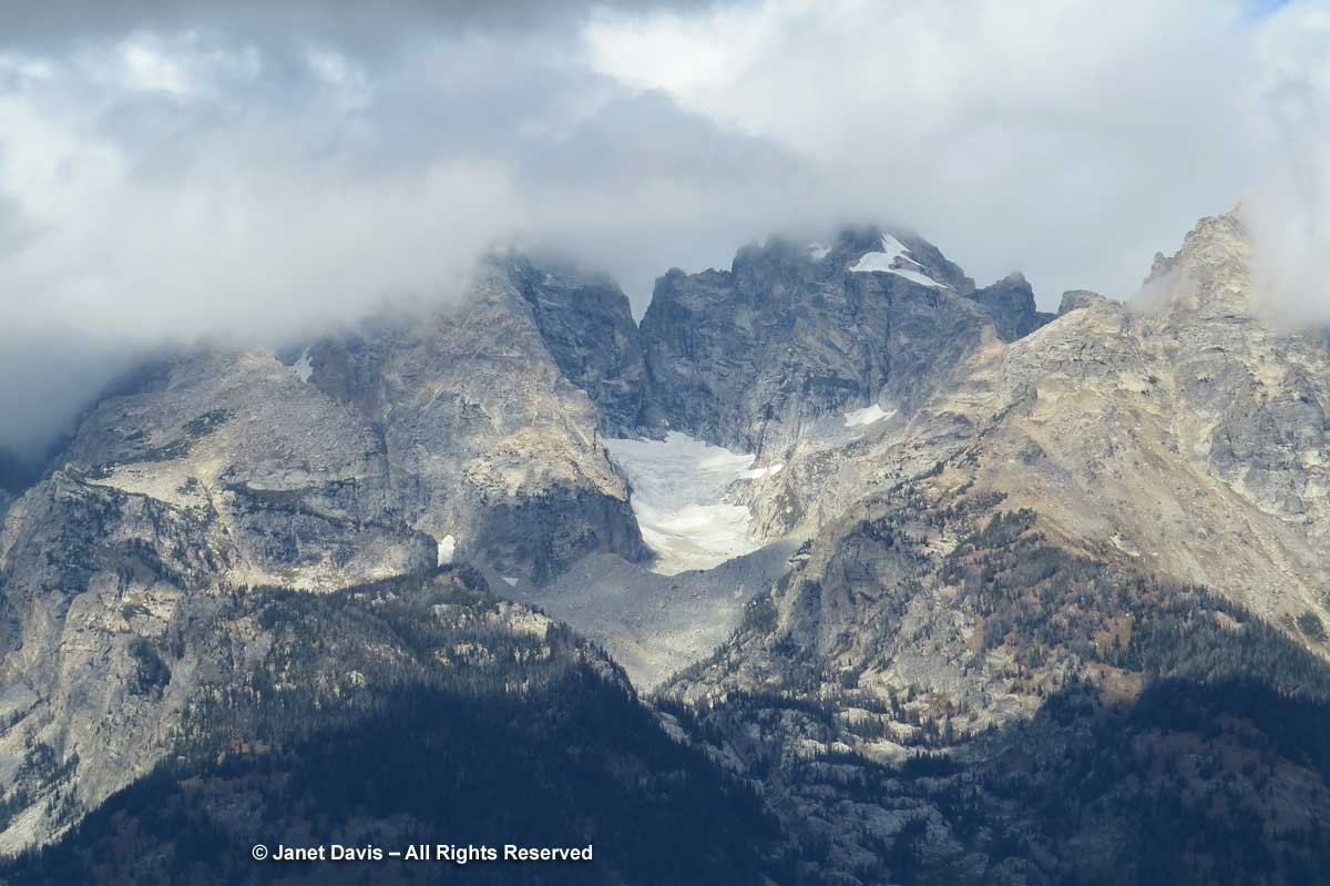
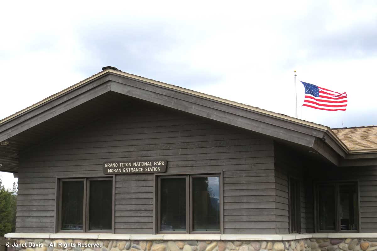
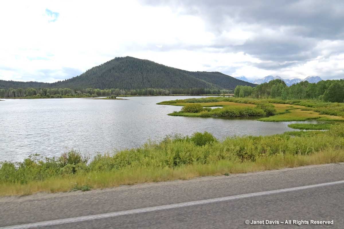
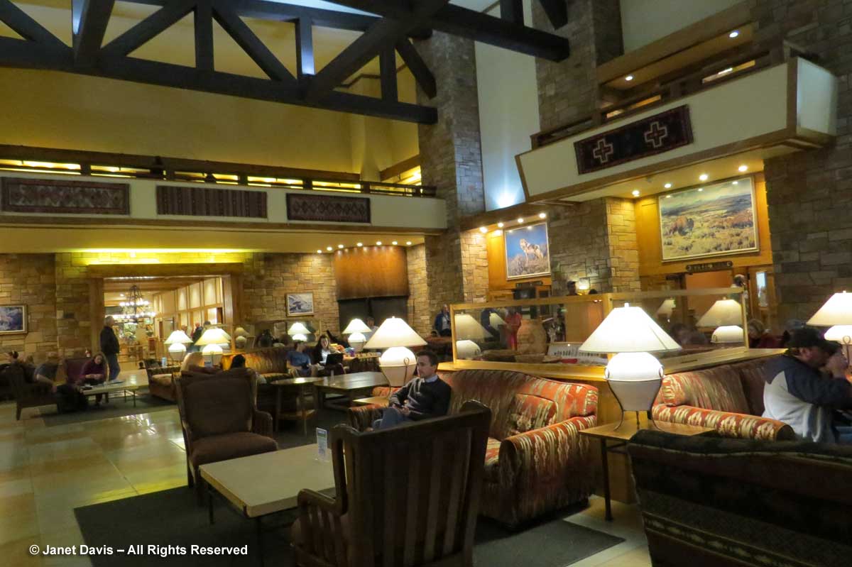
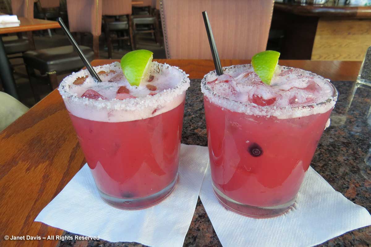
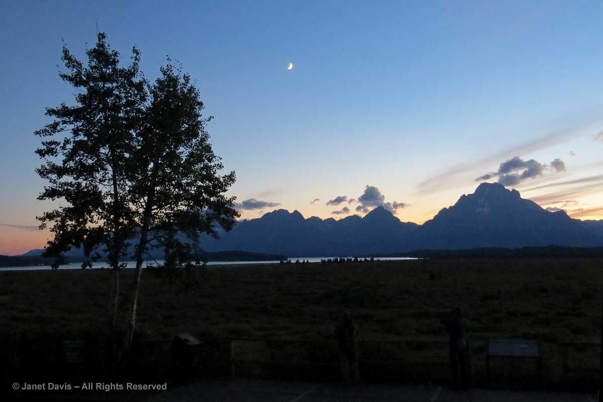
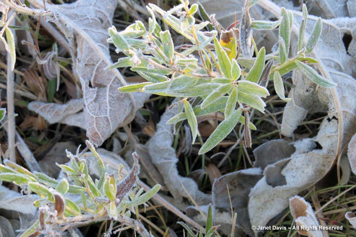
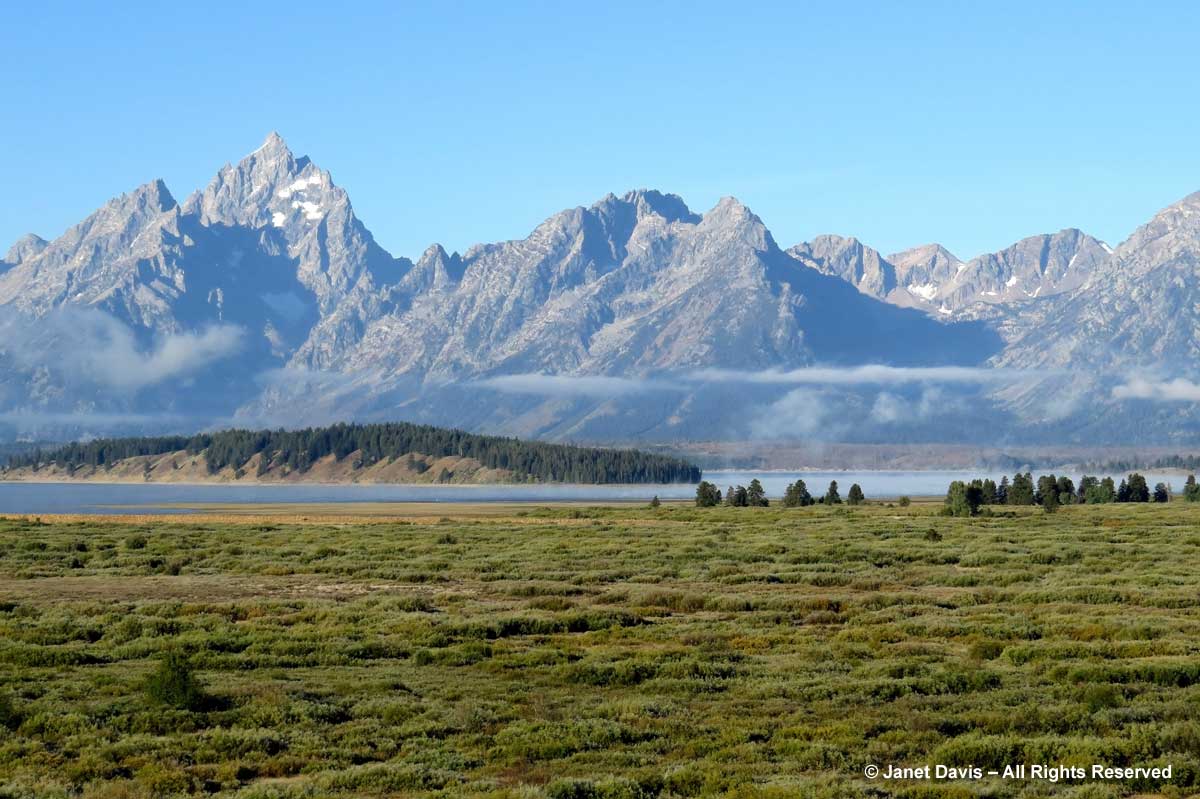
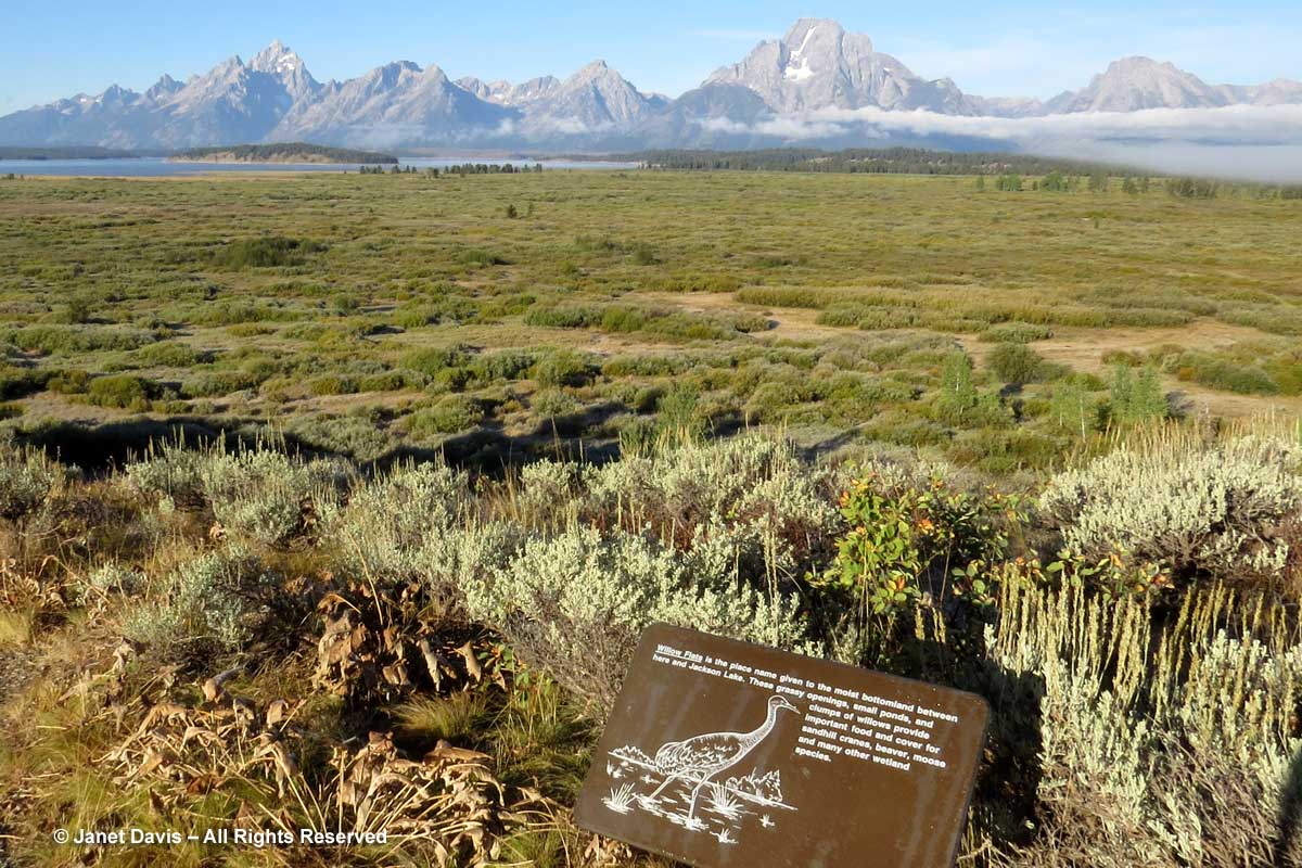
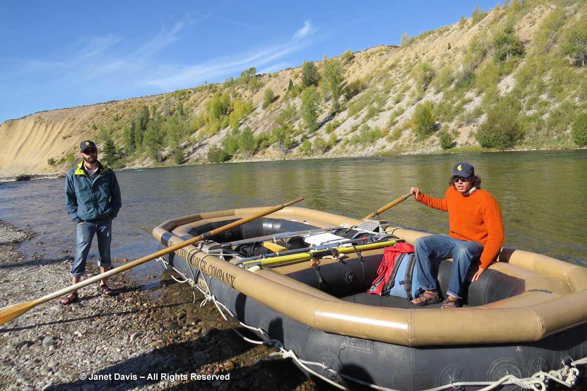
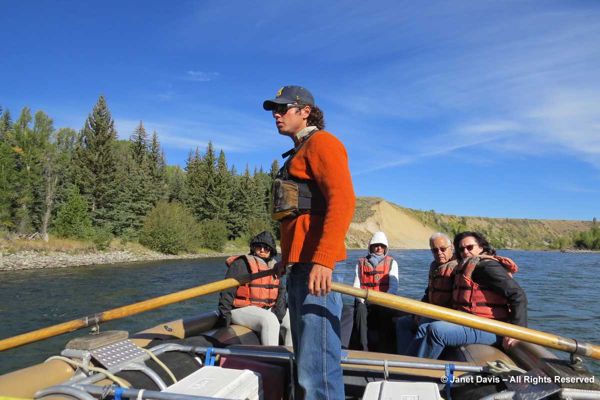
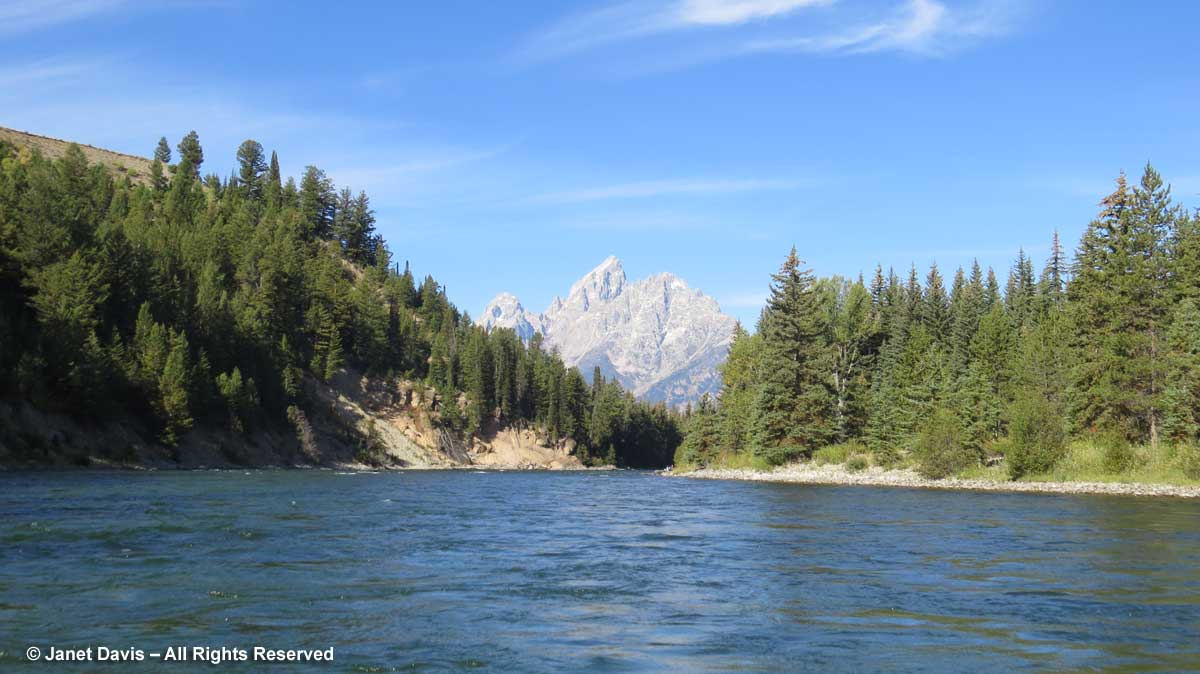
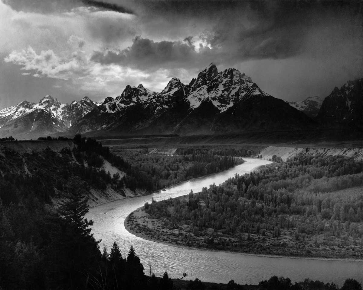
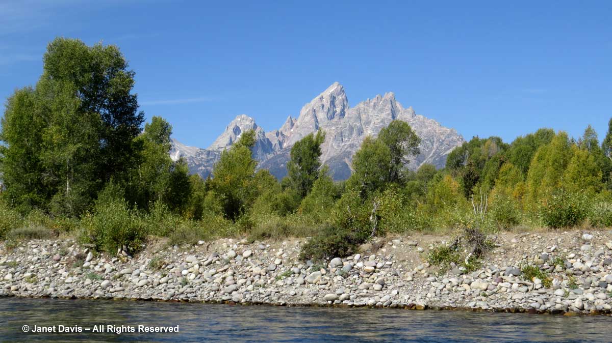
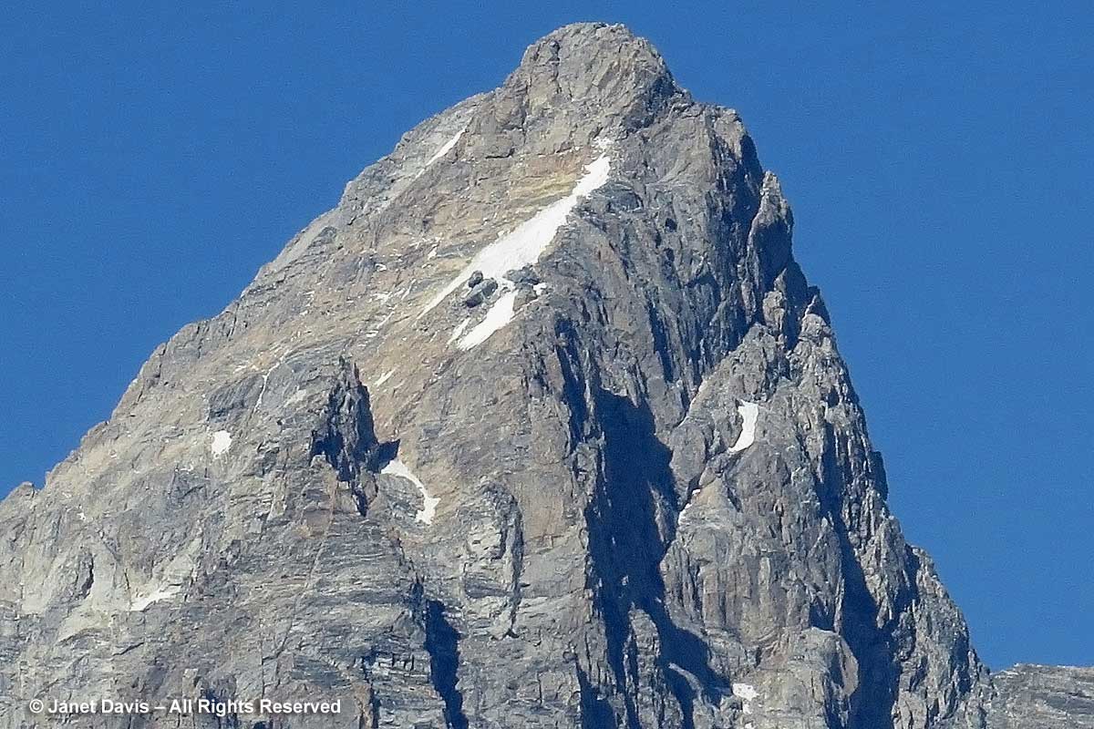
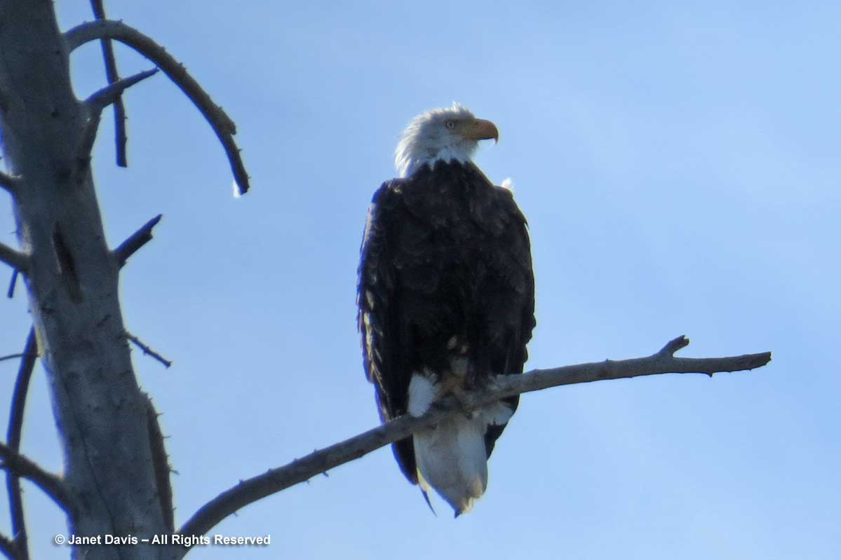
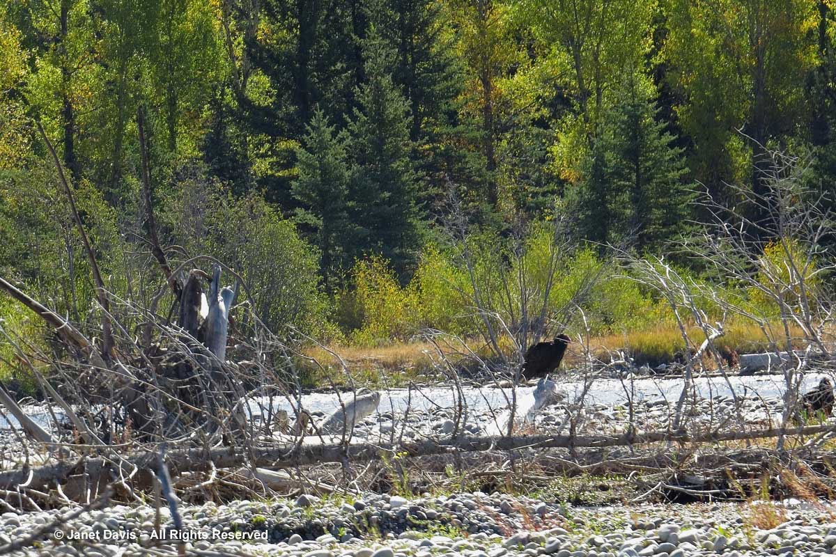
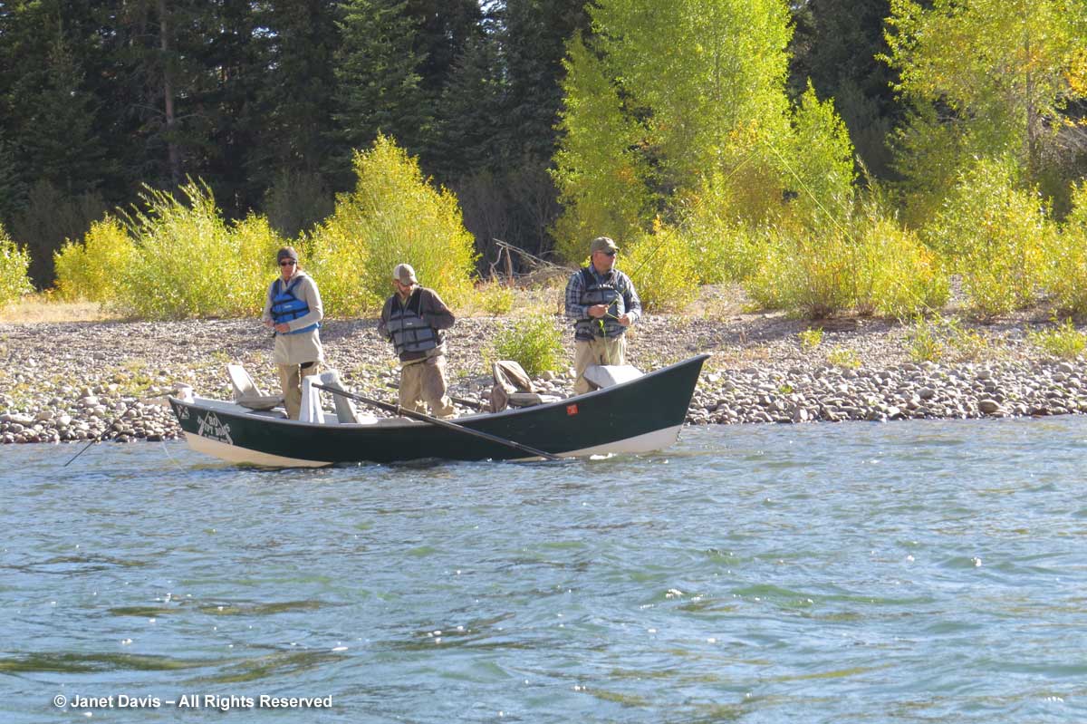
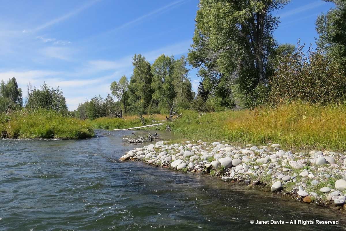
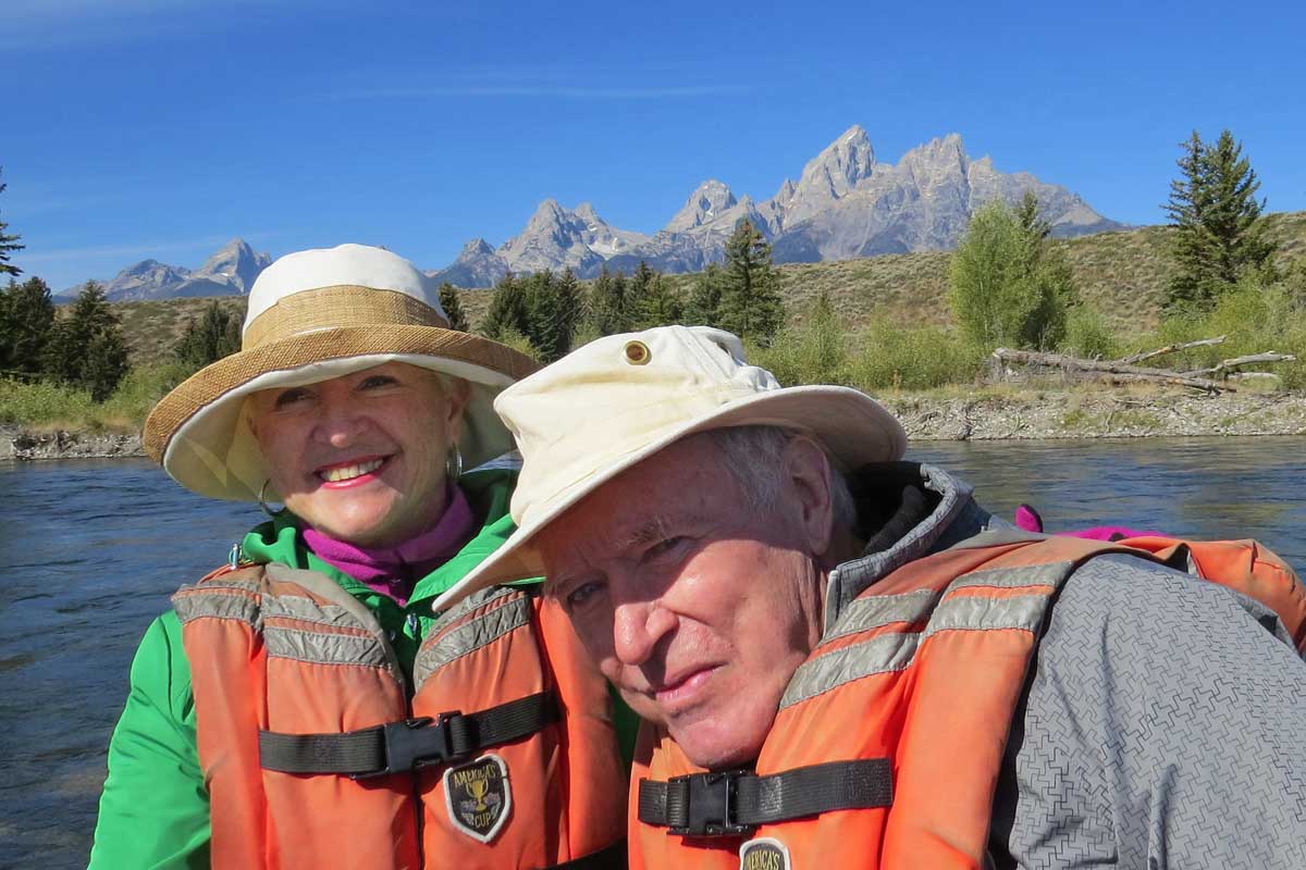
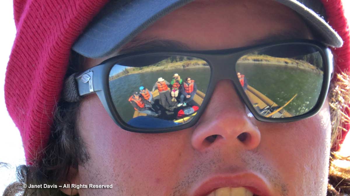
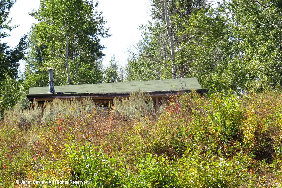
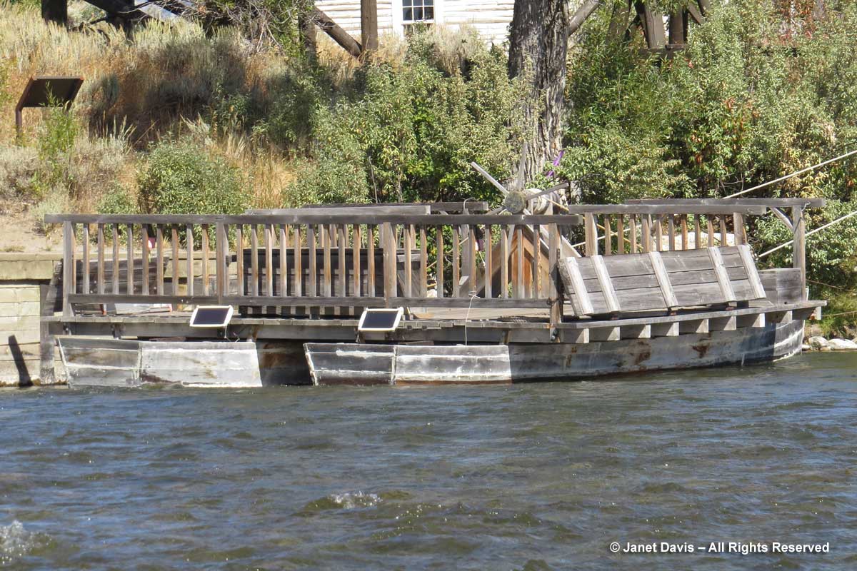
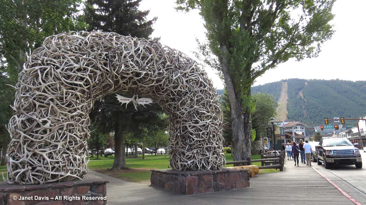
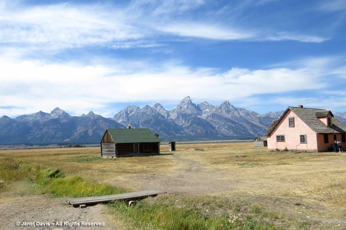
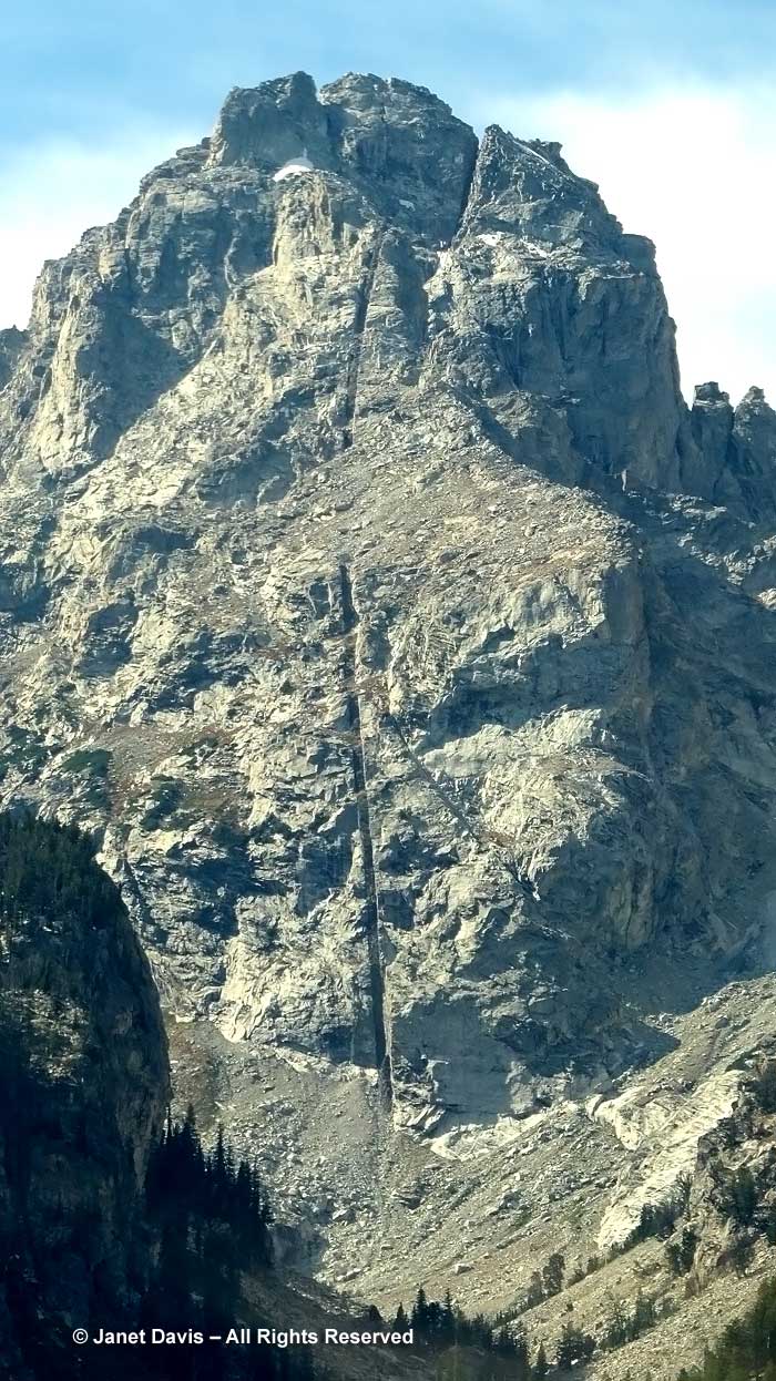
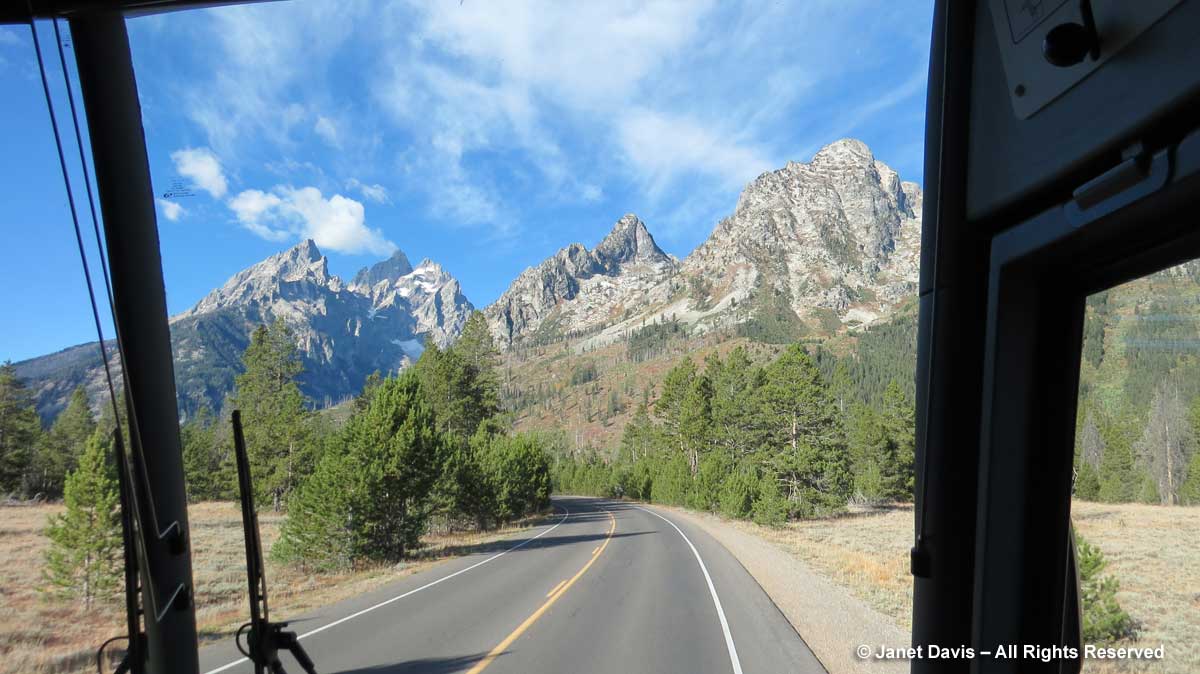
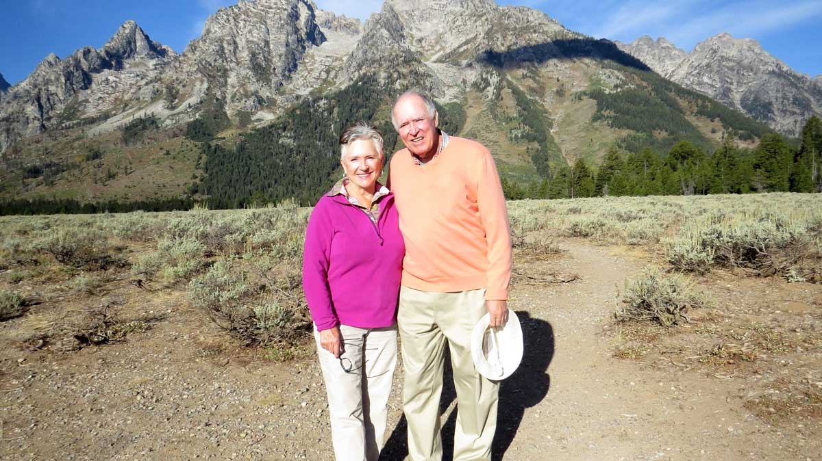
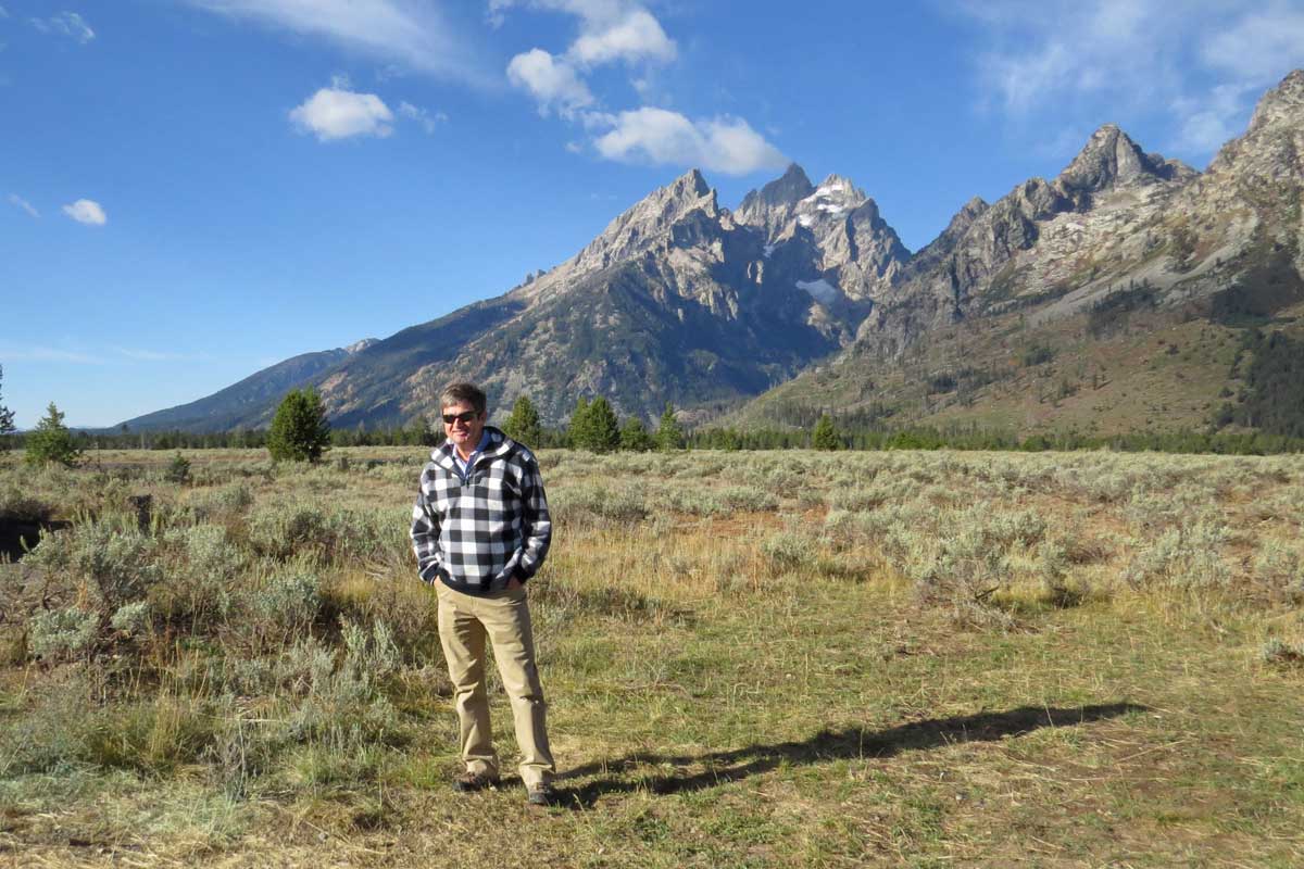
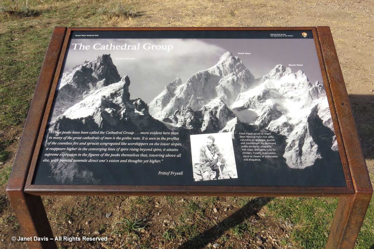
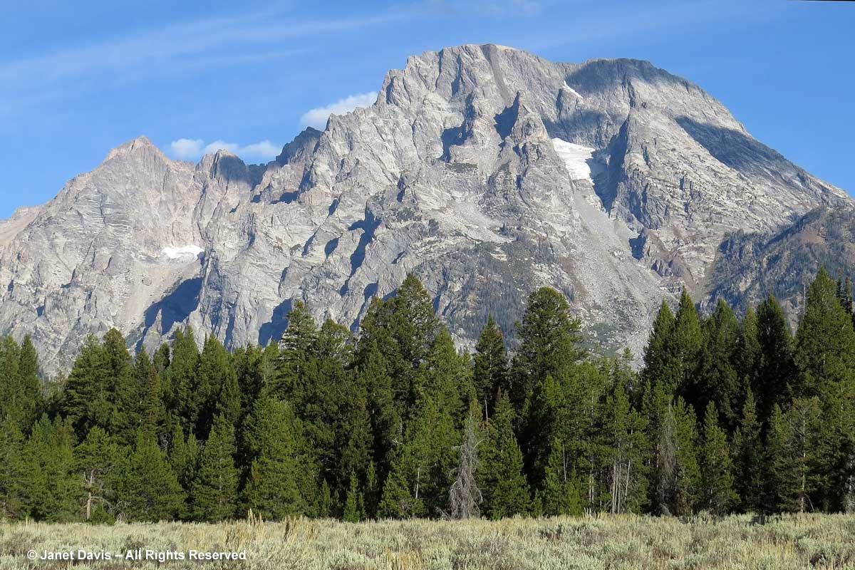
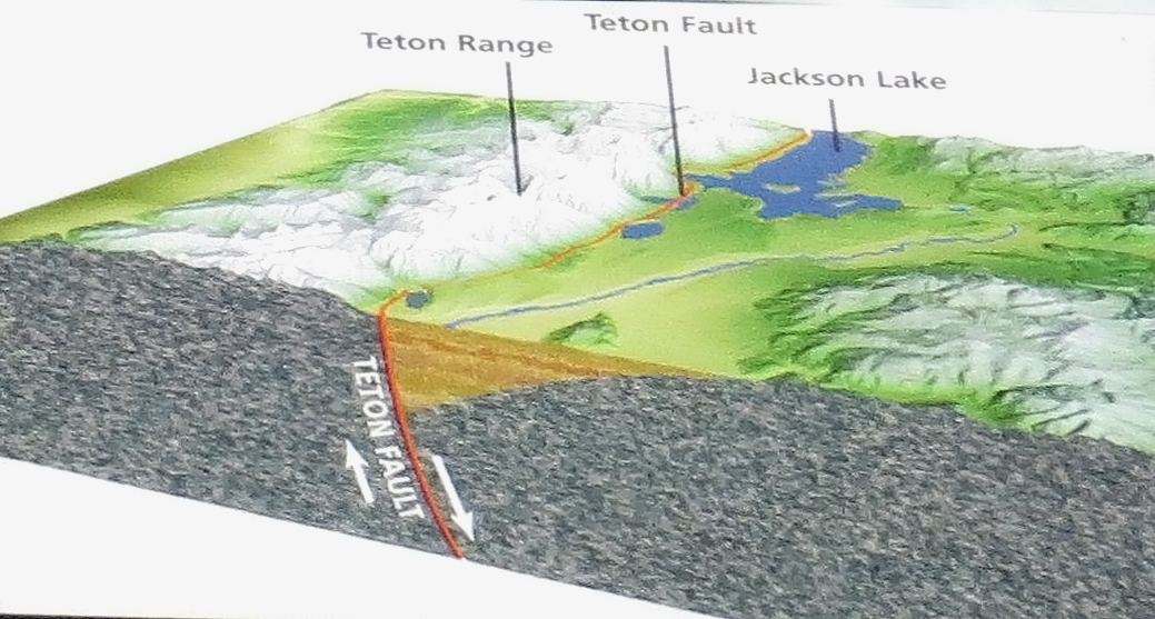
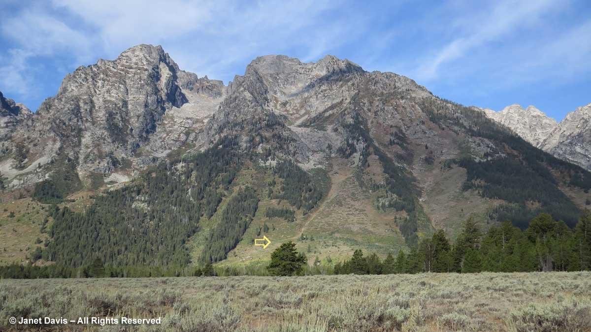
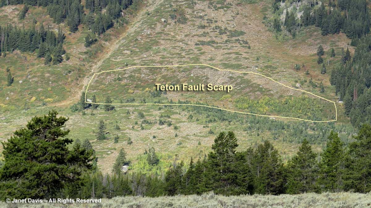
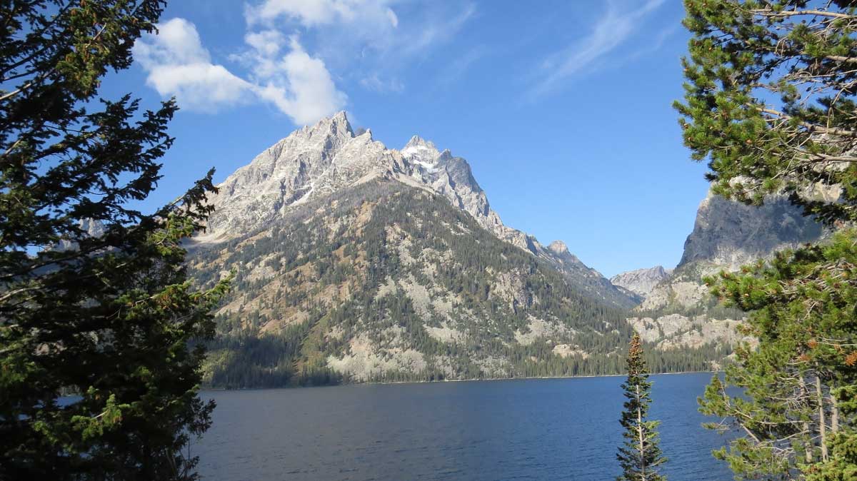
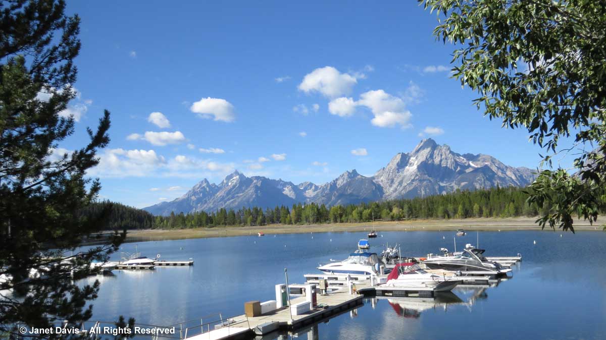
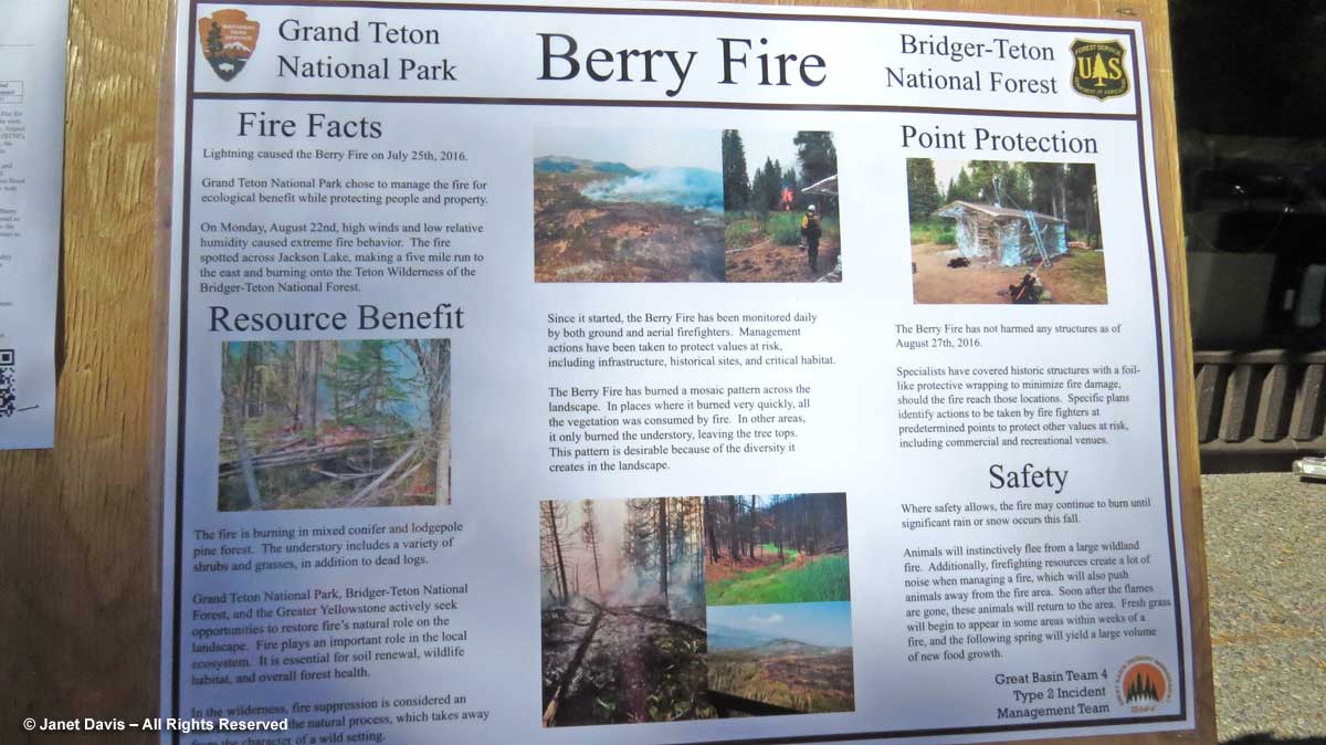
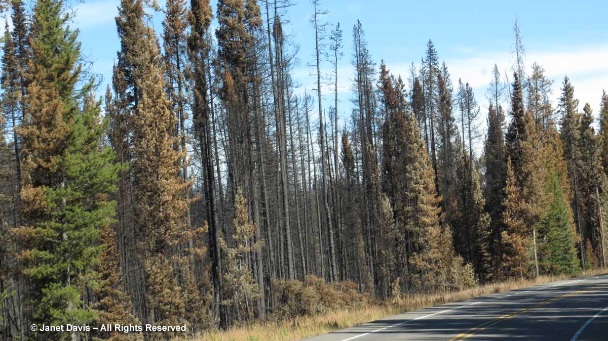
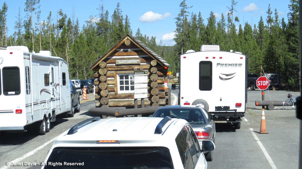
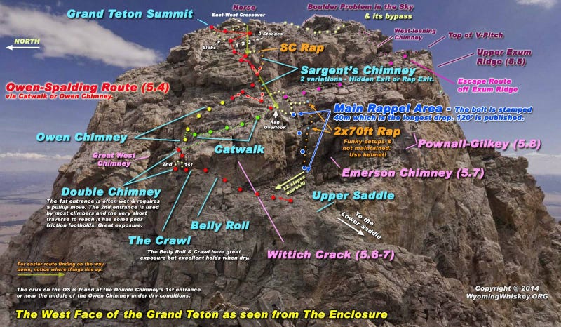