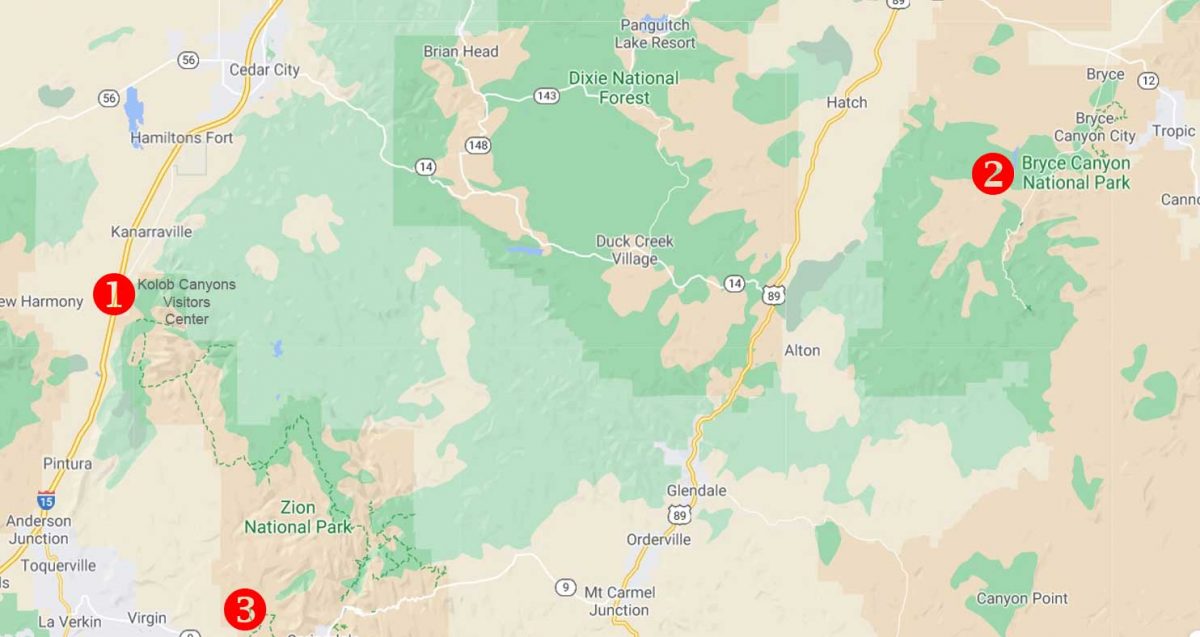
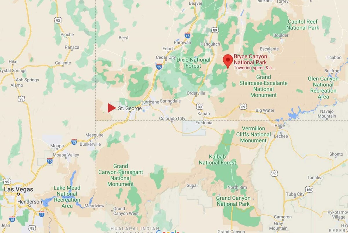
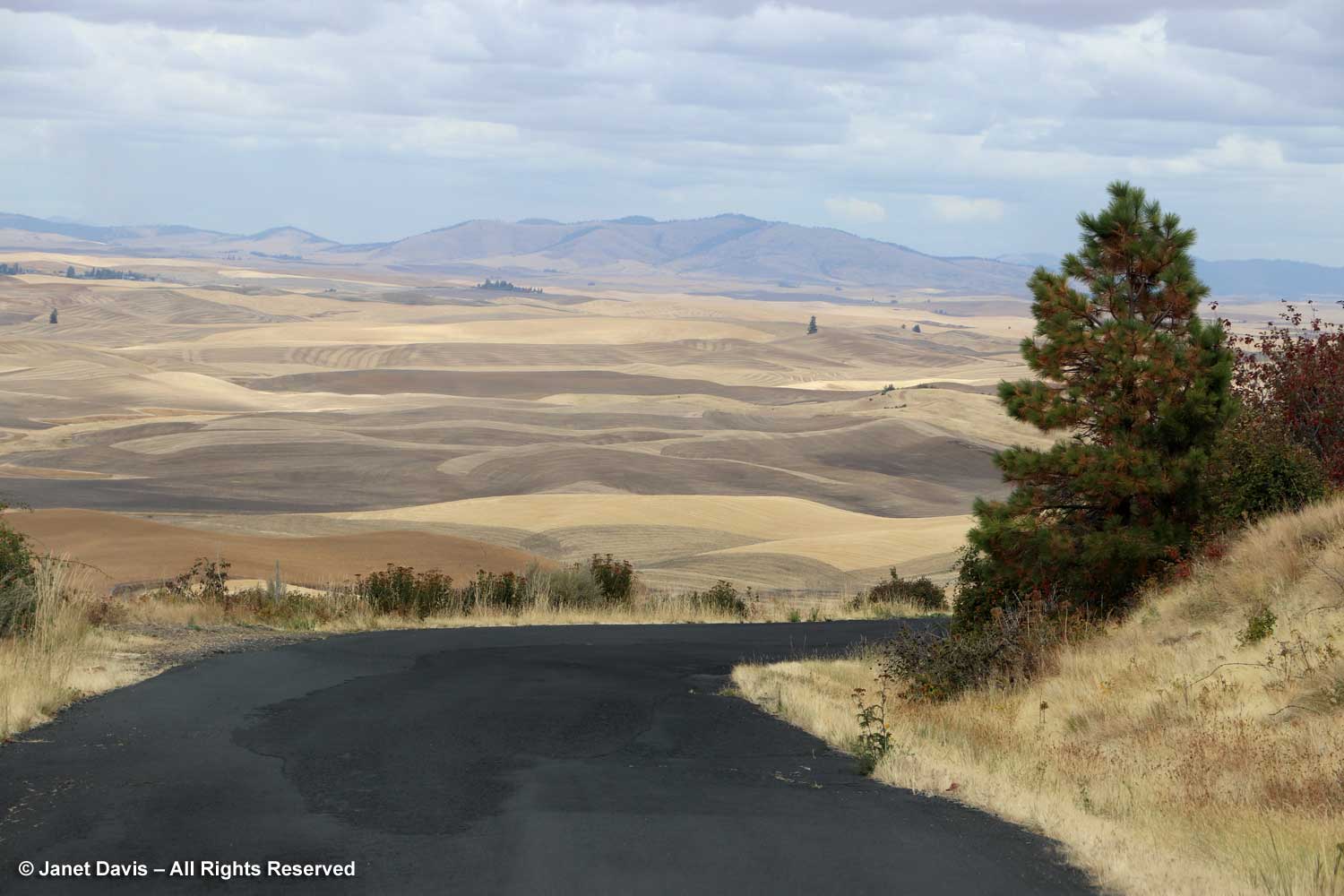
After finishing our breakfast at Ruby’s Inn the morning after our spectacular visit to Bryce Canyon National Park (my last blog), we headed southwest on Highway 89 to Zion National Park. I explained in my previous blog that we made a brief stop on the previous day’s journey from St. George, Utah to Bryce at the most westerly part of Zion, the Kolob Canyons Visitor’s Center, which is accessed from Highway 15. I’ve marked that with a #1 on the map below. Then we headed back on the highway to Bryce at #2. Our second day took us to Zion at #3, before heading back to St. George.
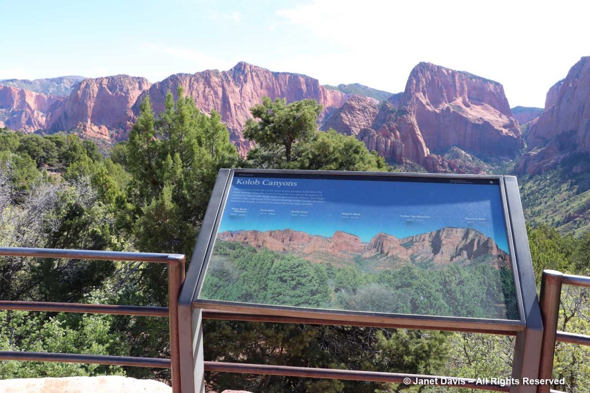
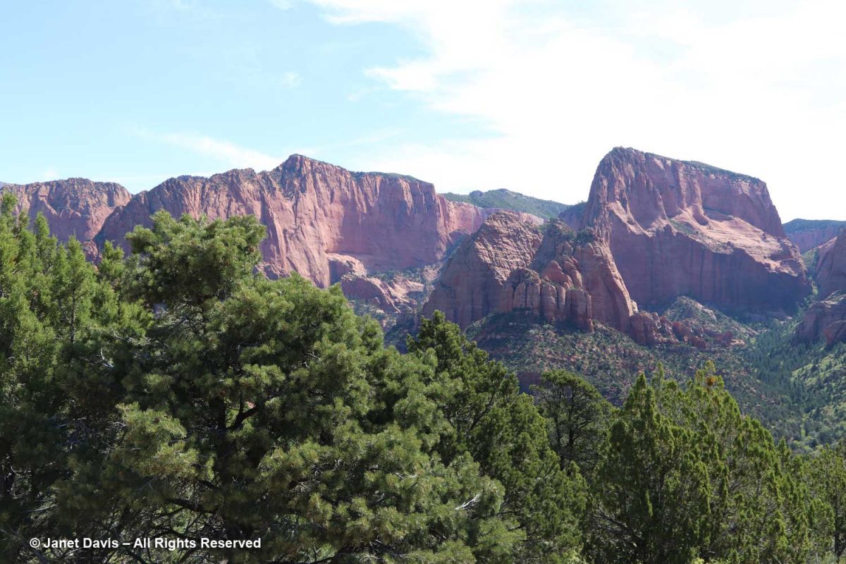
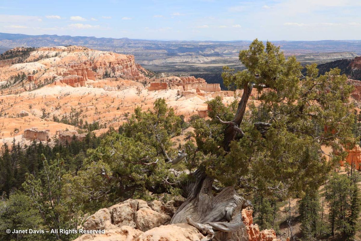
Kolob Canyons was interesting and gave us our first look at the Navajo Sandstone formation that comprises most of Zion. The sign says: This overlook reveals the cooler, more thickly forested world above the finger canyons. From this elevated viewpoint you can see the pattern of canyon-carving streams along cracks in the Colorado Plateau. Each finger canyon is like a miniature Zion Canyon showing similar erosion dynamics: broad at the mouth, it narrows to a deep slot in its upper reaches.
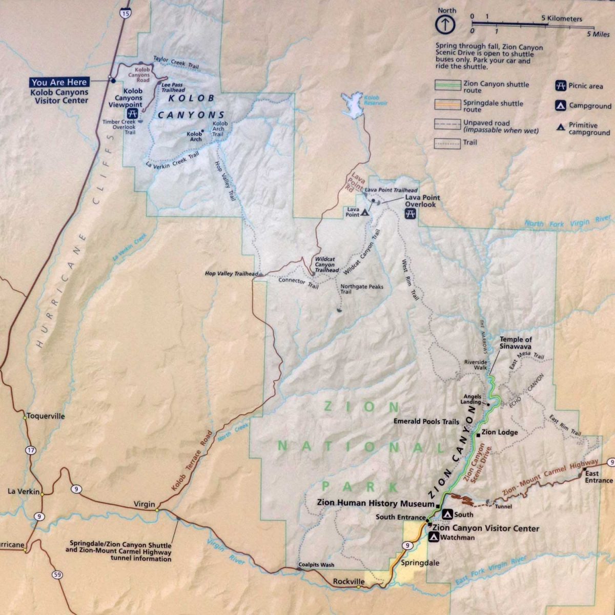
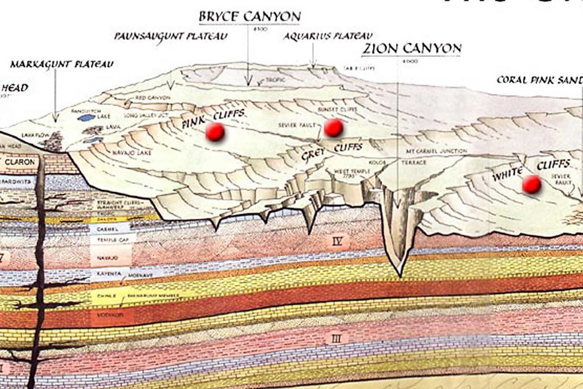
On the illustration below, you can see how widespread the two visitor areas of Zion are.
There were ponderosa pines in Kolob Canyon….
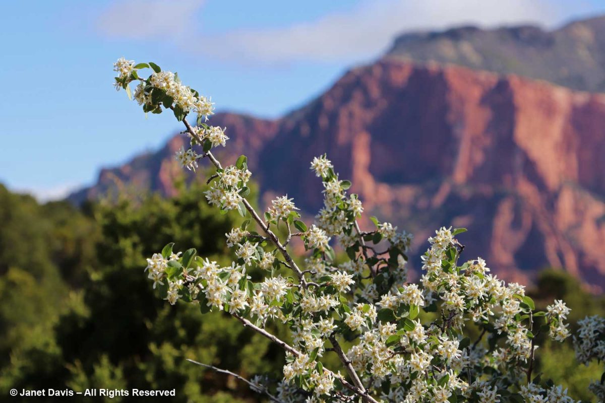
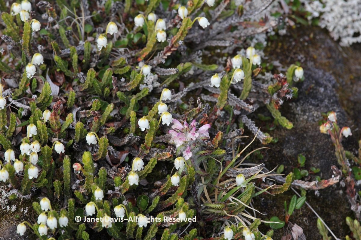
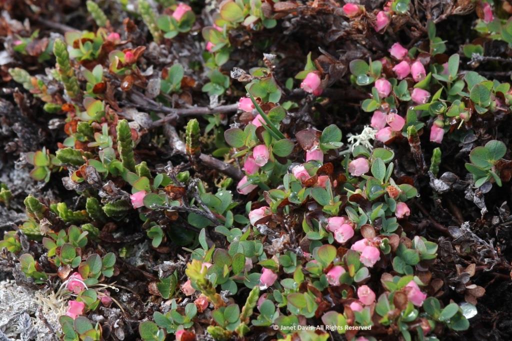
…. and Utah serviceberry (Amelanchier utahensis) was in full bloom on the 1st day of May.
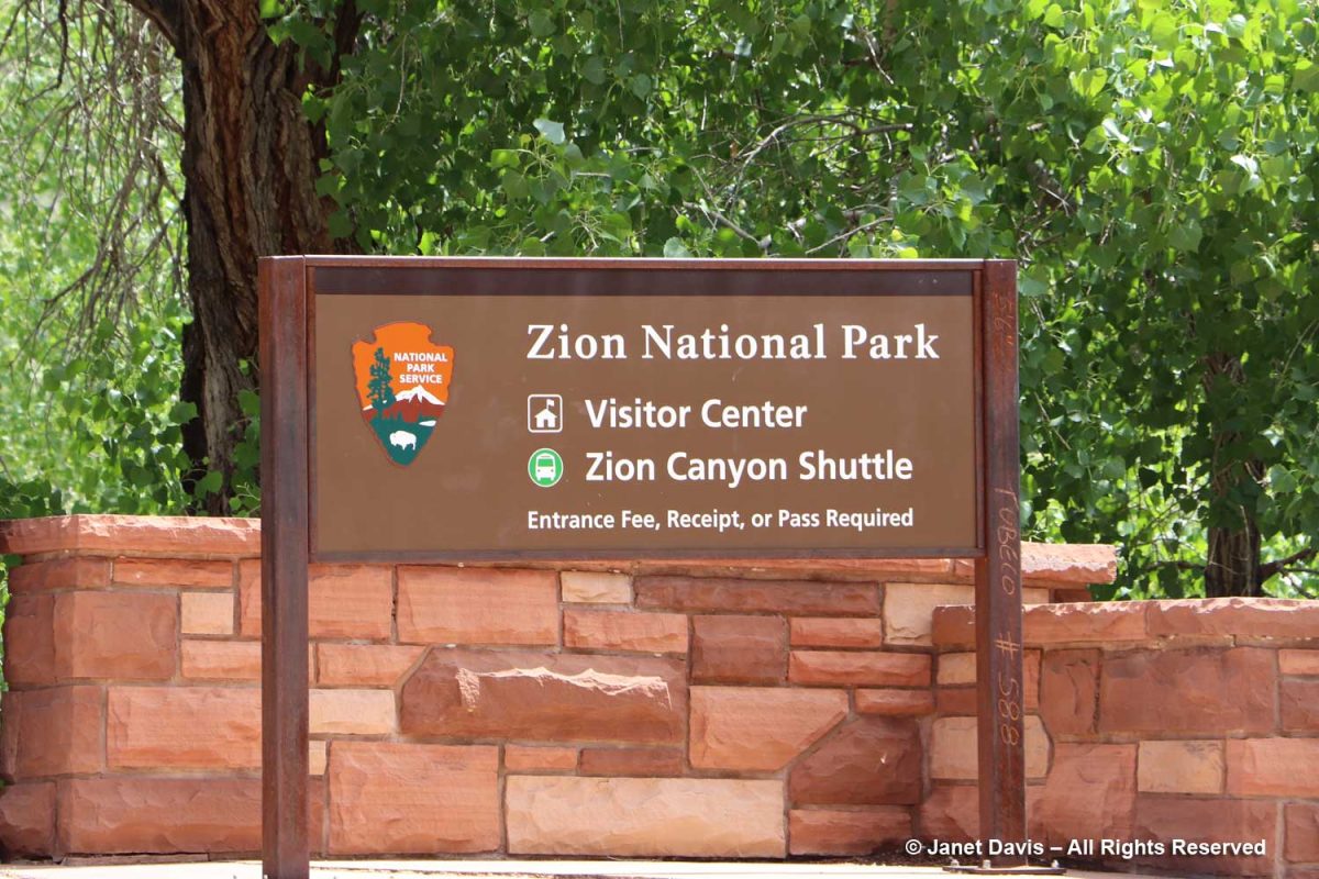
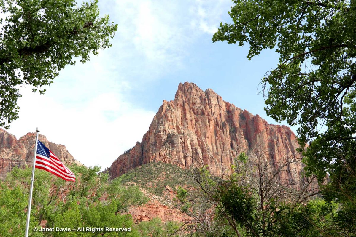
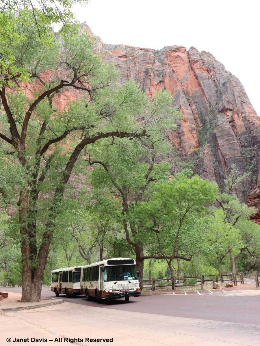
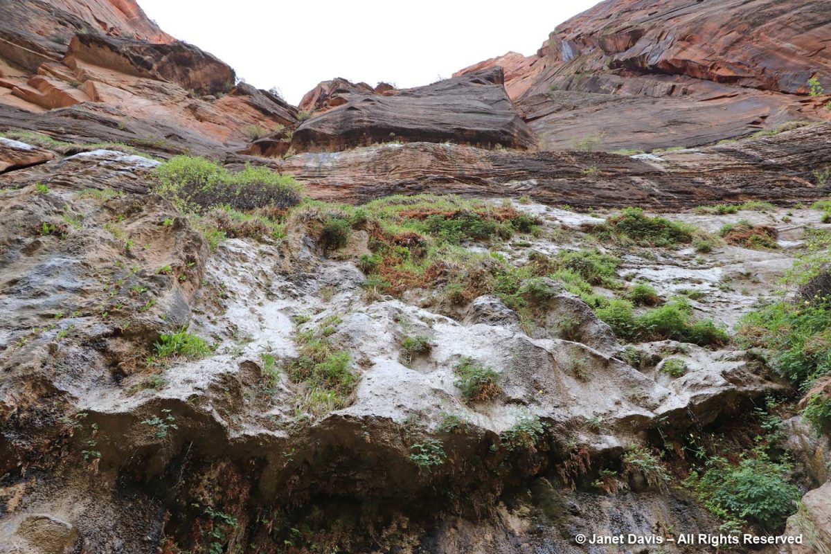
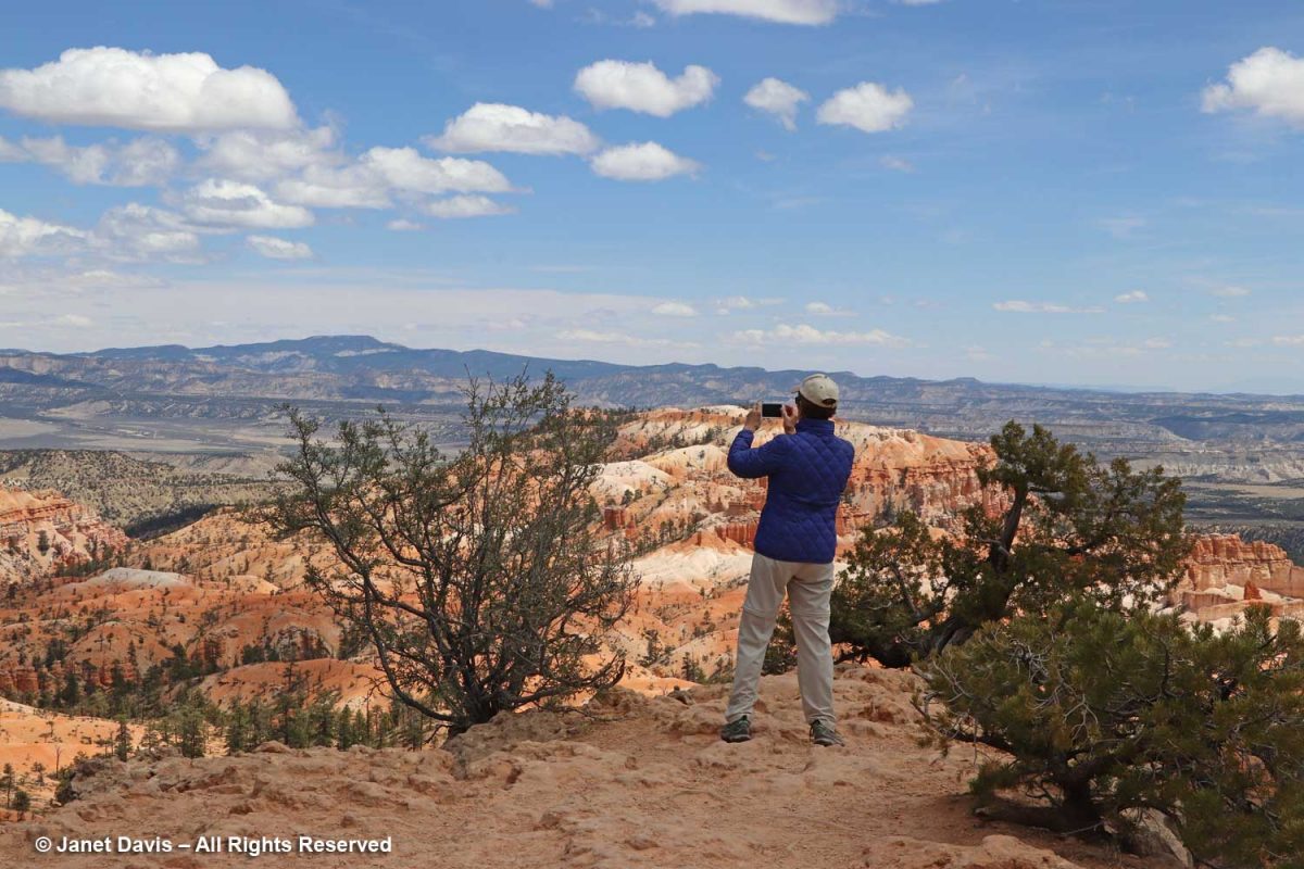
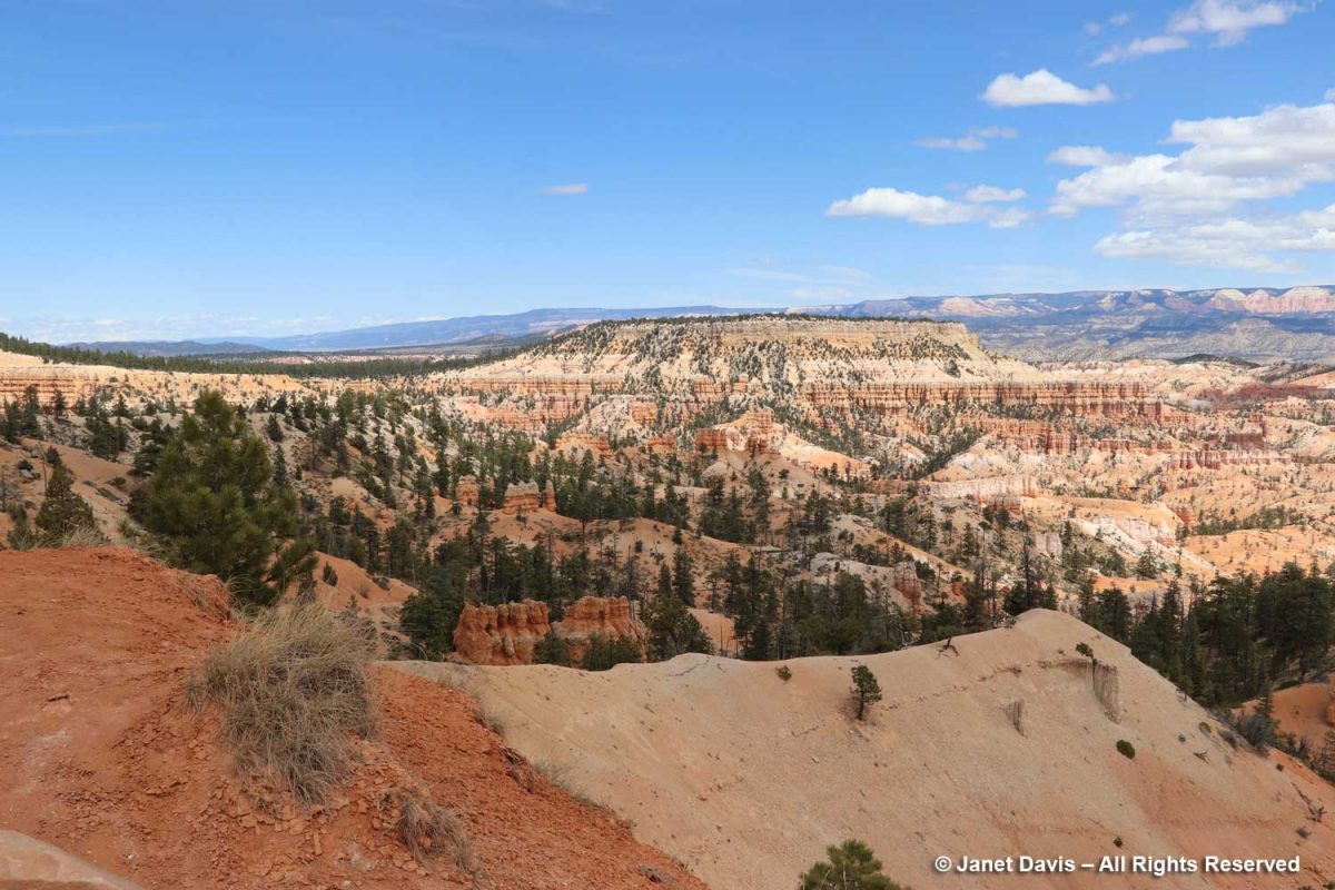
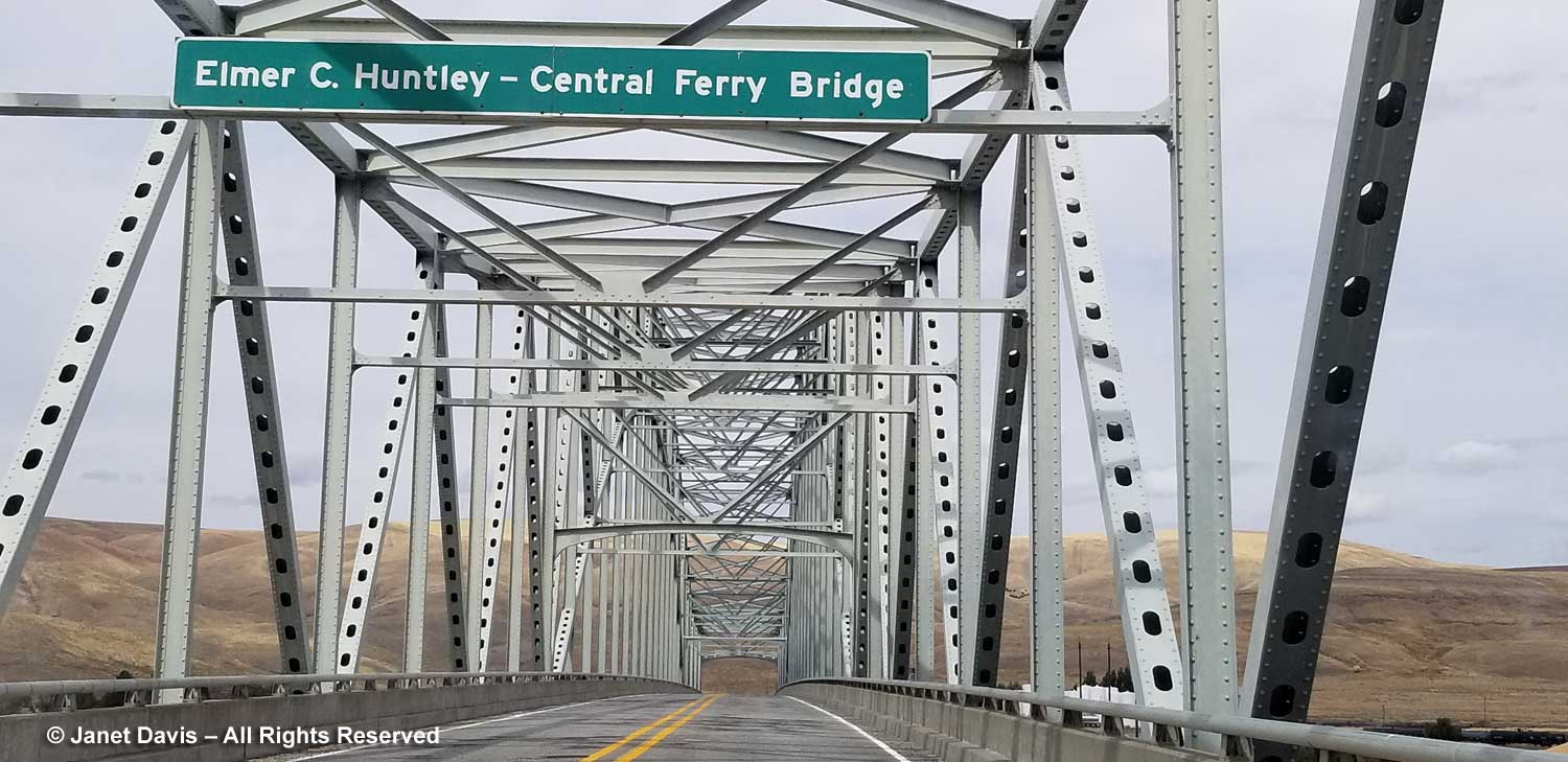
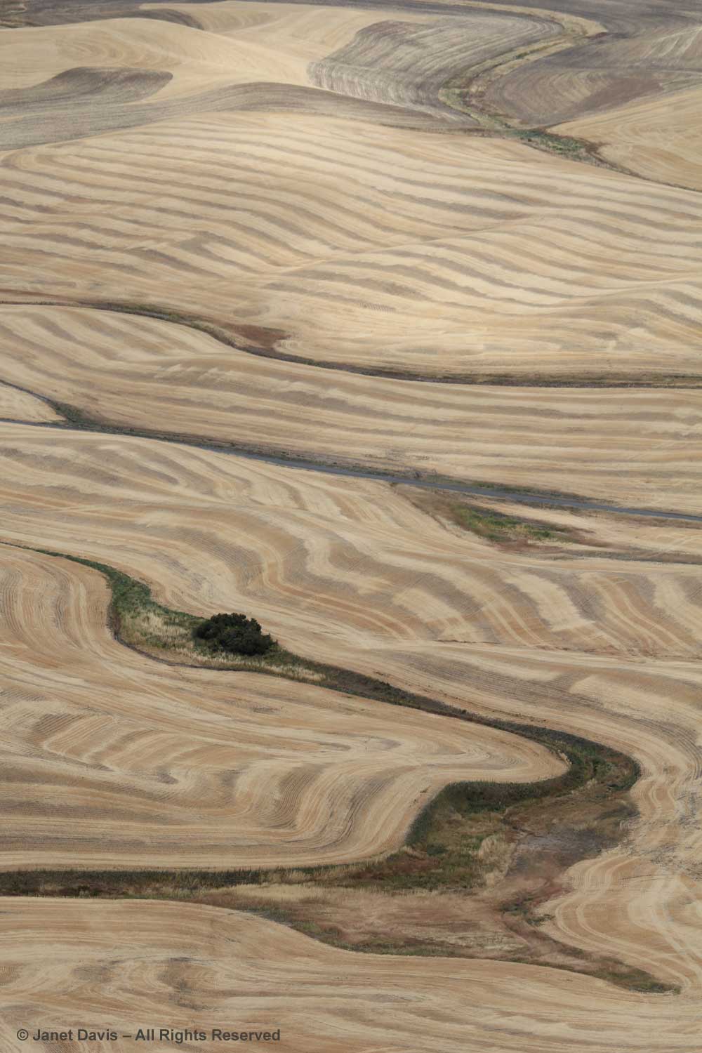
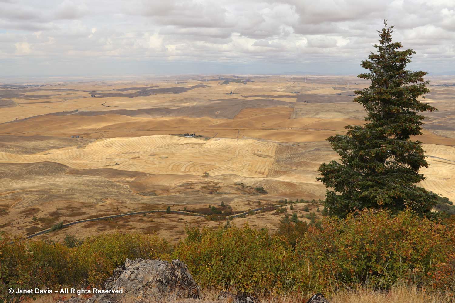
But the main attraction on day #2 was the principal south entrance to Zion Canyon.
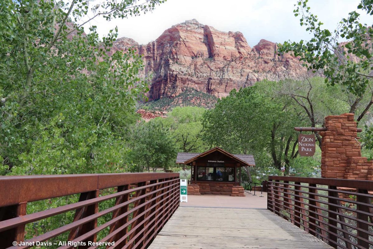
We walked across the pedestrian bridge into the park….
…. over the north fork of the Virgin River. It looks fairly tranquil below, but it has incredible power, especially in spring runoff, due to its steepness. In the 160 miles of its course, it drops 7,800 feet, i.e. 71 feet for every mile. That power has allowed it to carve the sandstone into canyons.
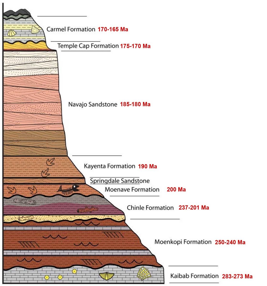
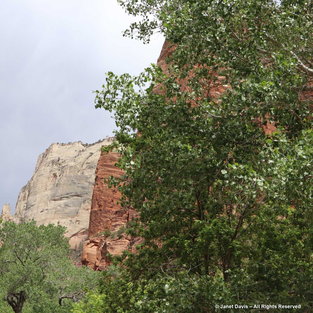
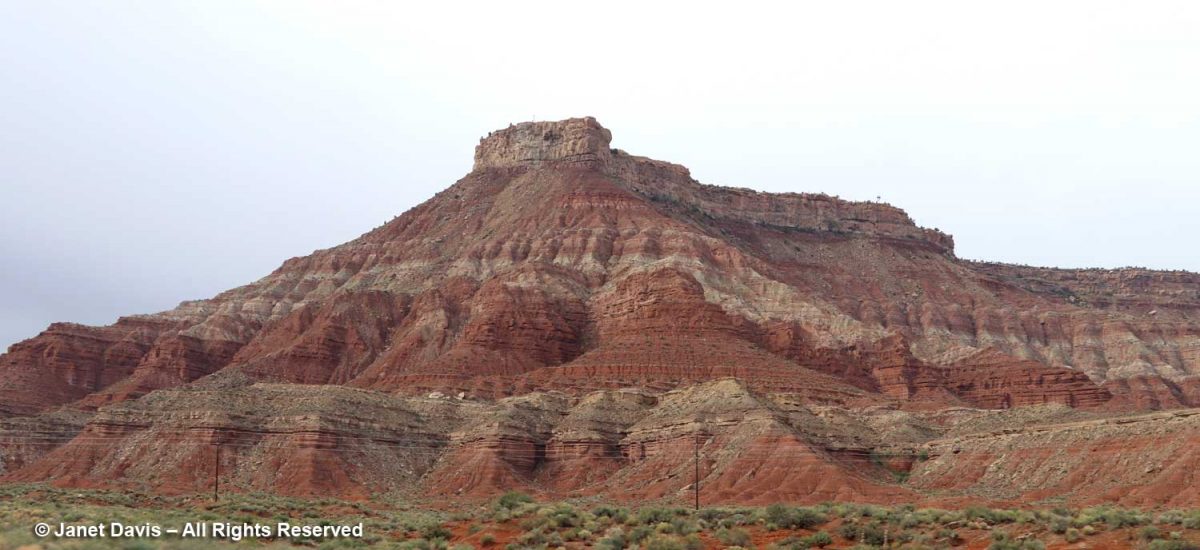
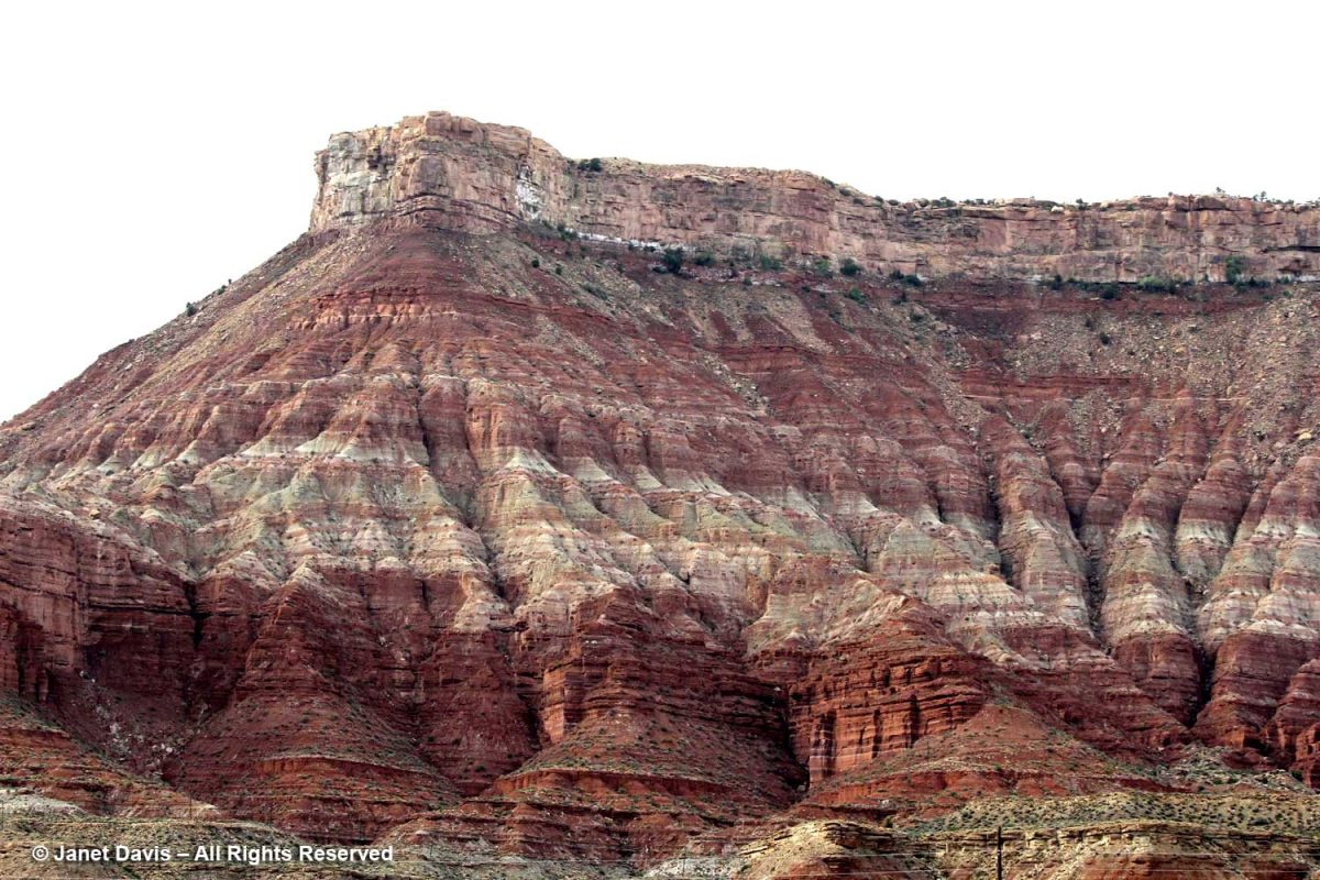
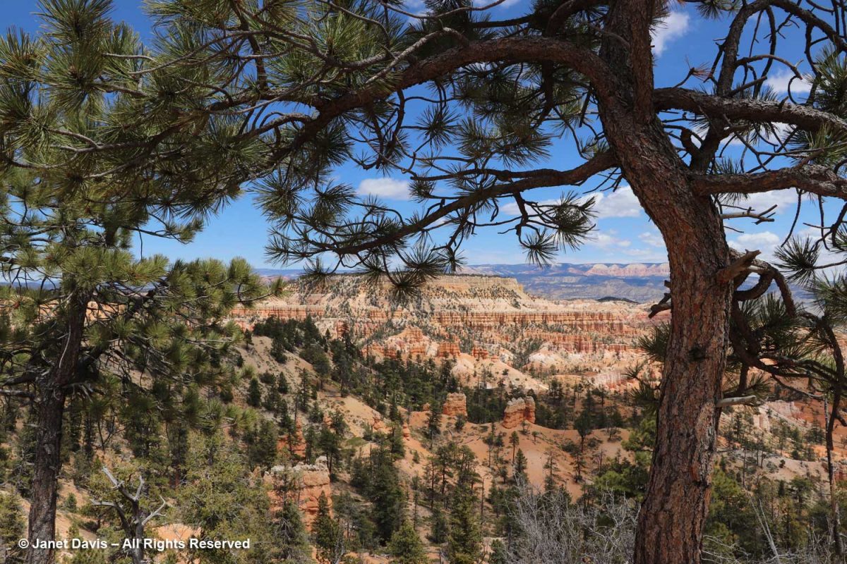
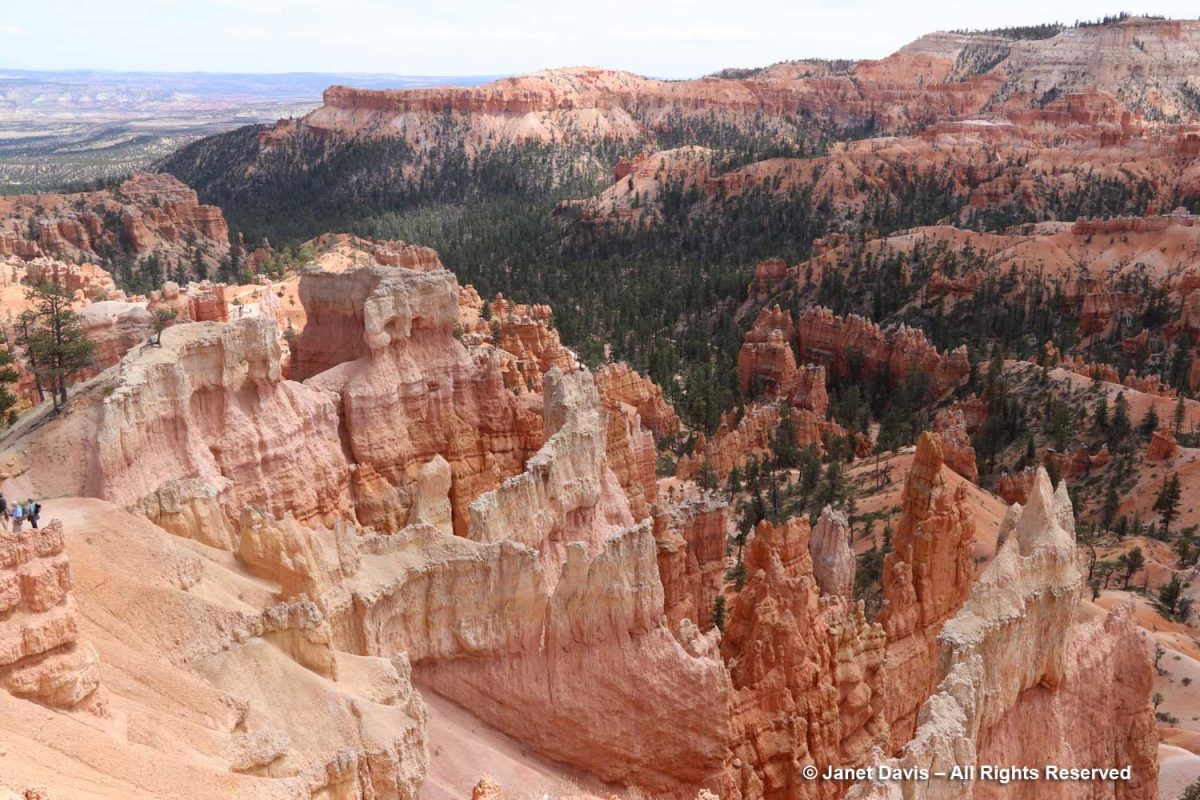
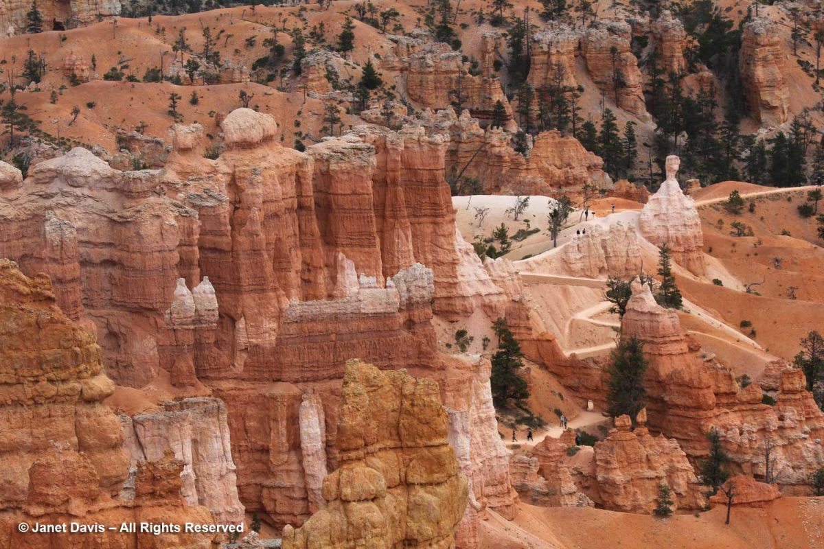
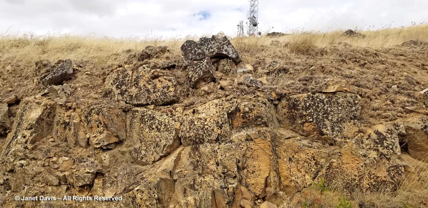
It’s tempting as you begin your walk or tram ride through Zion Canyon to look up at rugged peaks and think of them as mountains, but these are formations of early Jurassic (185-180 Ma) Navajo sandstone, in places 2,000 feet in depth, sculpted by erosion. Most were given names in the early 20th century; this one is the Watchman.
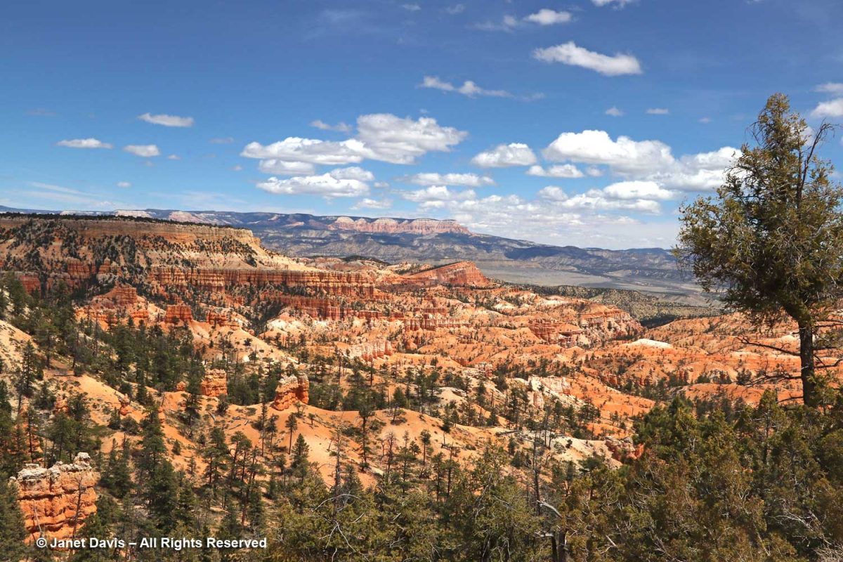
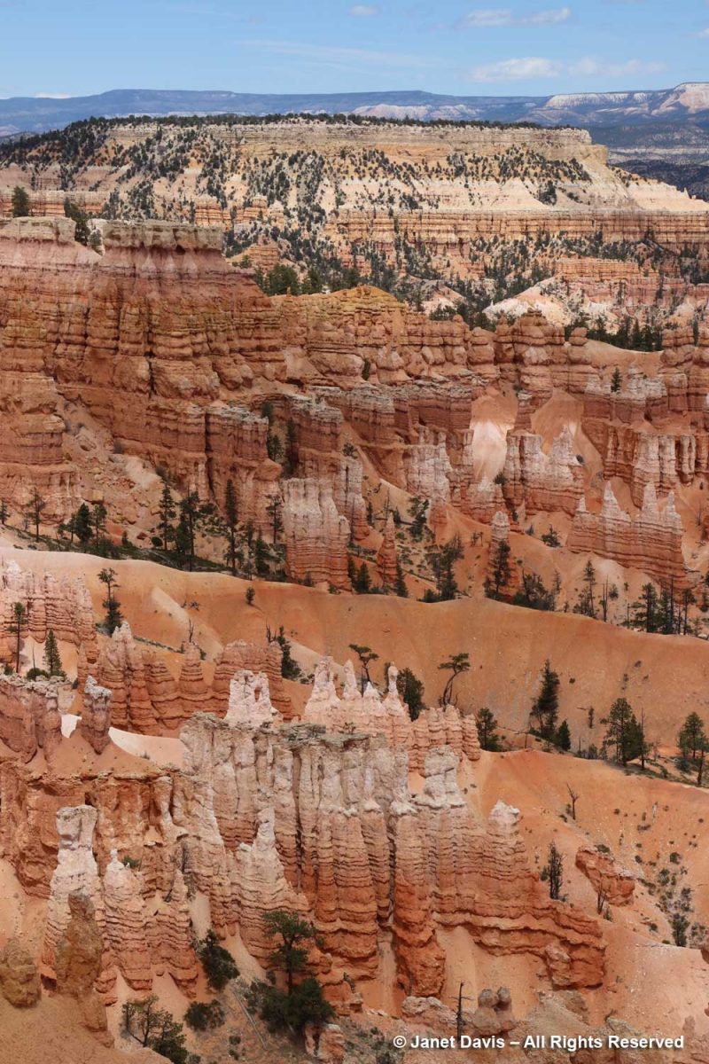
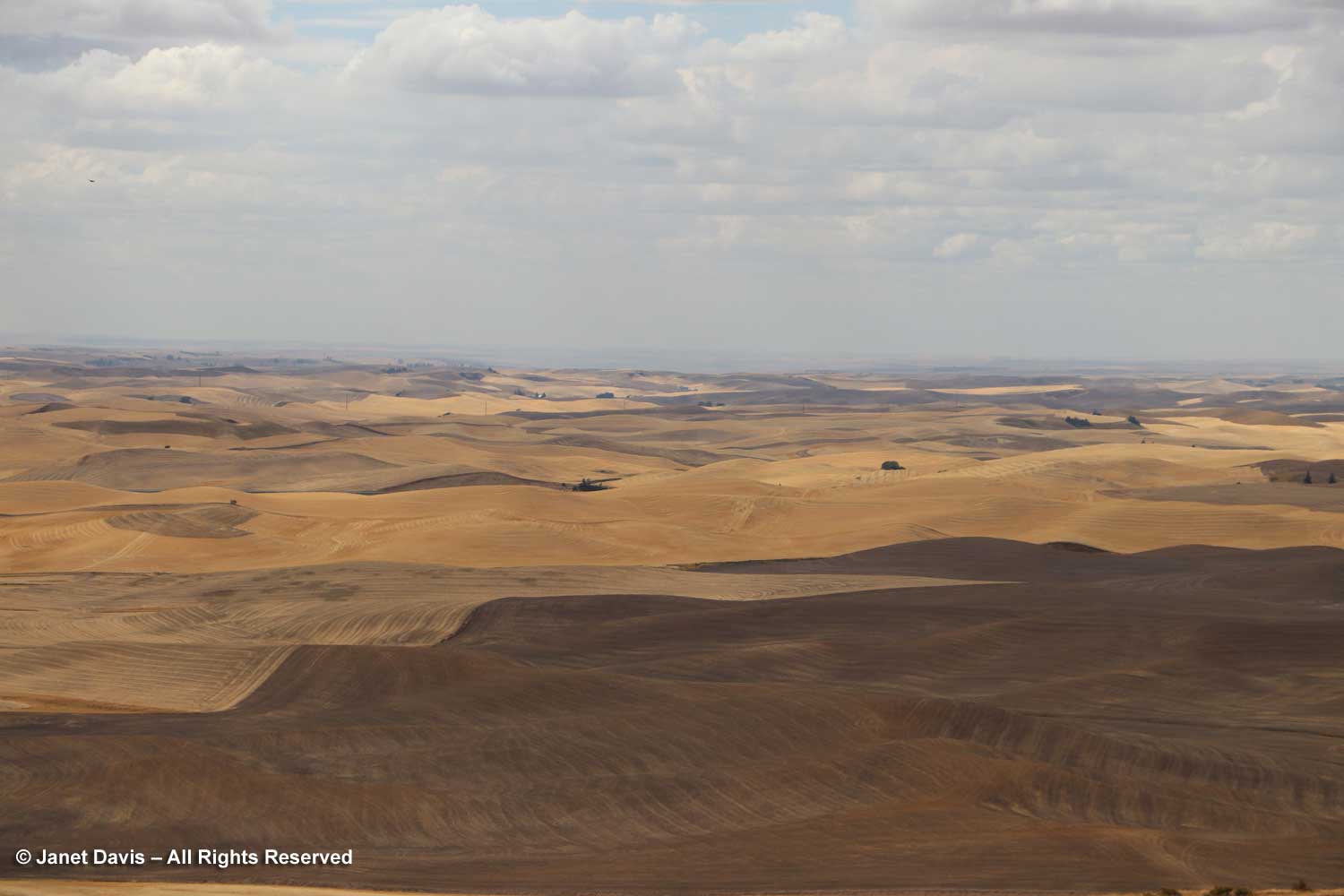
The graphic below, which I featured in my Bryce blog, shows the difference between the two parks. The Bryce amphitheatre with its thousands of hoodoos sits adjacent to the Paunsaugunt Plateau at around 8,300 feet, whereas Zion occupies a sandstone cleft in the earth surface.at 4,000 feet. I read that the youngest layer at Zion is the oldest layer at Bryce.
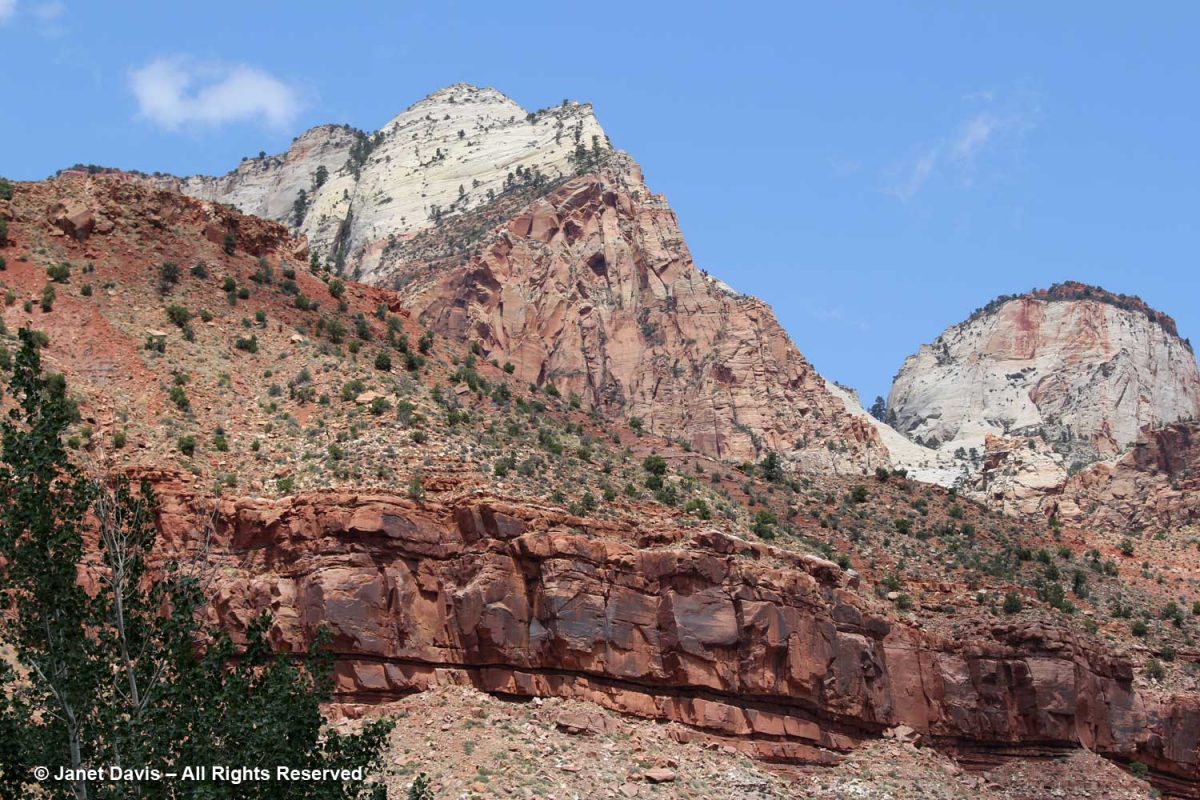
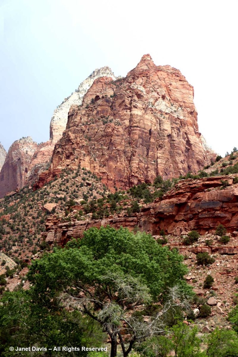
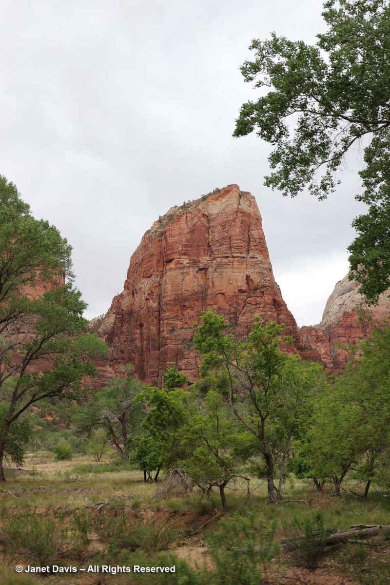
Because our time was fairly limited, we took a tram tour through the canyon. It passed various famous formations (and I’m thankful to Zion’s Brian Whitehead for helping me identify a few of them). The one at the top, below, is The Bee Hive, with The Sentinel at right, rear.
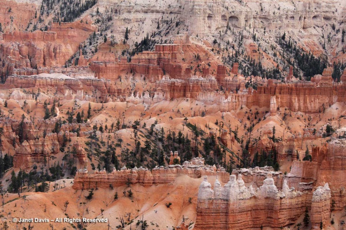
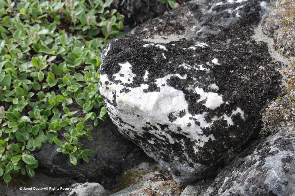
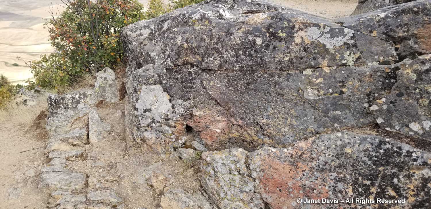
The colours of the Navajo sandstone are varied. representing millions of years of deposition of sand dunes from what was once the biggest desert in the world.
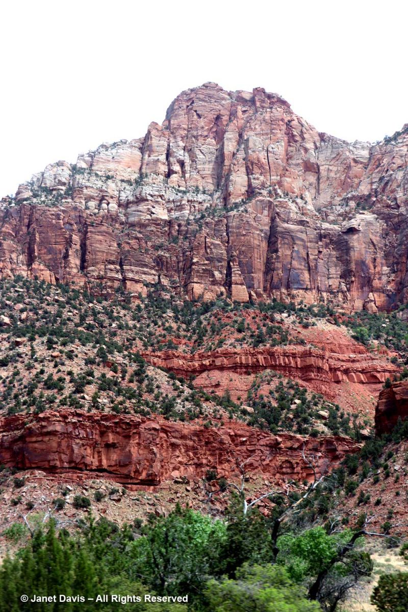
I’ve added ages to this NPS illustration, and you can see the variation in the colours of the large band of Navajo Sandstone. As the NPS says,“The range of colors of the Navajo Sandstone –red, brown, pink, salmon, gold, and even white—results from varying amounts and forms of iron oxide within the rock, and in the case of the white upper portion of the Navajo, the overall lack of iron. The processes behind the color variation are complex and took place in multiple phases over long periods of time. To start, the Navajo is made of grains of light-colored quartz sand, similar to those found in many modern dune or beach environments. Soon after being deposited in dunes, the sand grains were coated with a thin layer of reddish-brown iron oxide (the mineral hematite; a.k.a. rust). This was due to the chemical breakdown (oxidation) of very small amounts of iron-containing minerals within the sand, and made the earlier Navajo Sandstone a pinkish-red color overall.” (At the end of this blog, you’ll see a formation I passed outside Zion of the much older, therefore deeper, Moenkopi Formation.)
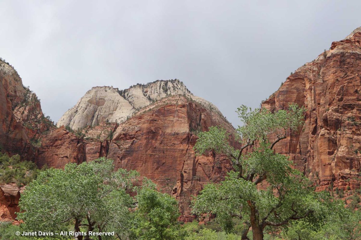
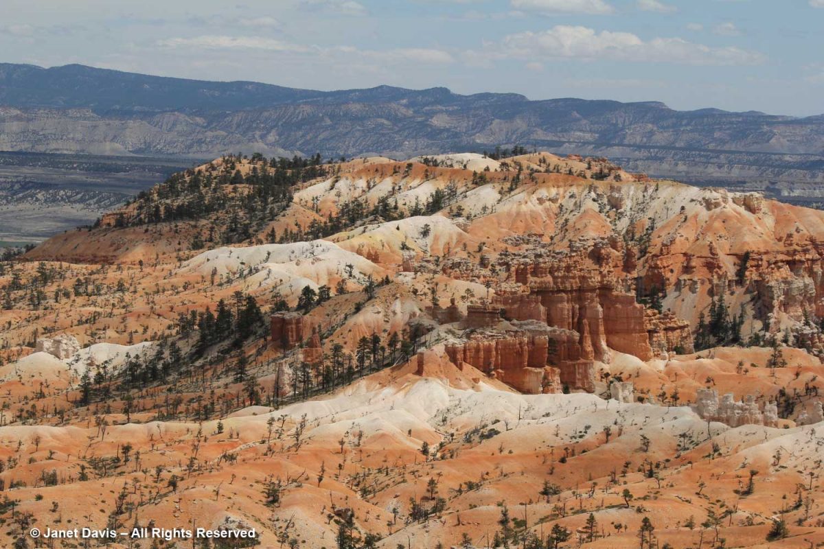
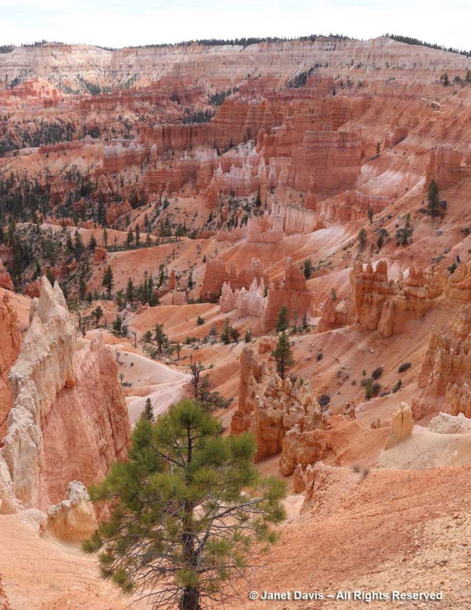
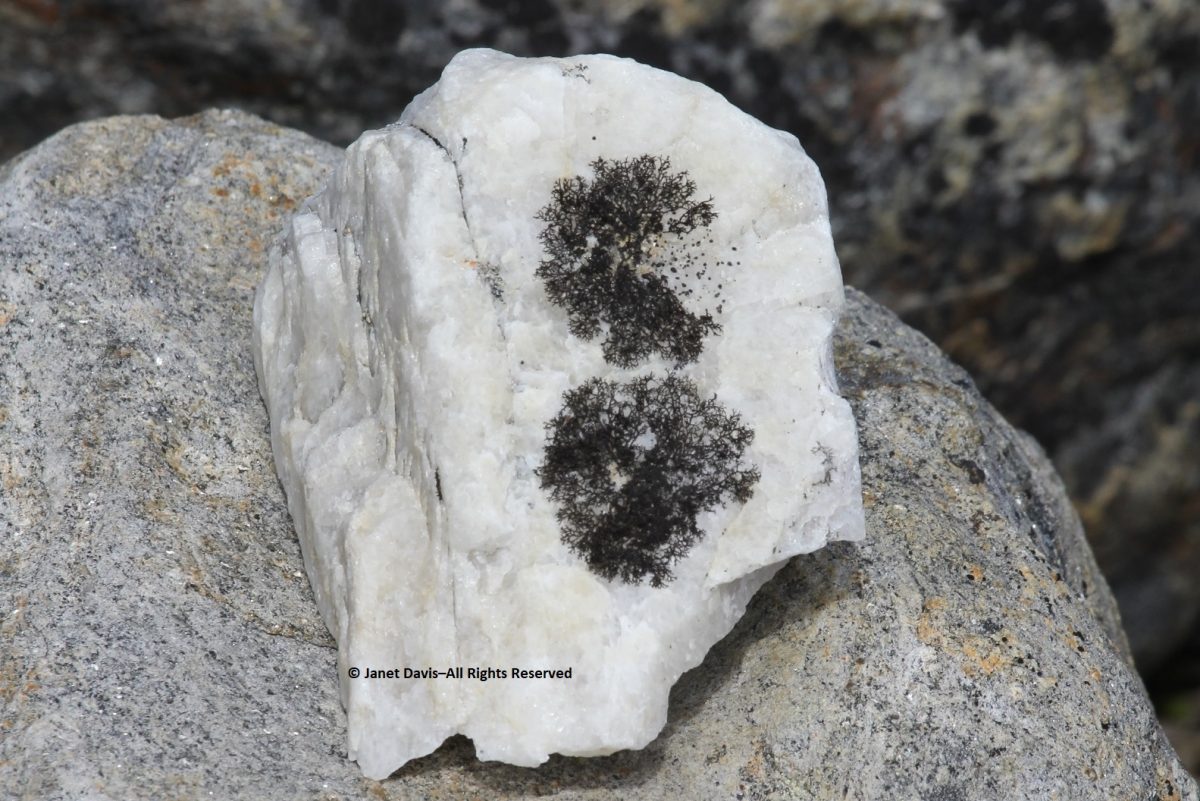
This was the view into Heaps Canyon ( the park’s famous slot canyons) with the Emerald Pools beyond. Reading about it, the phrase “hanging rappel” is a good sign that I wouldn’t have had this one on my to-do list.
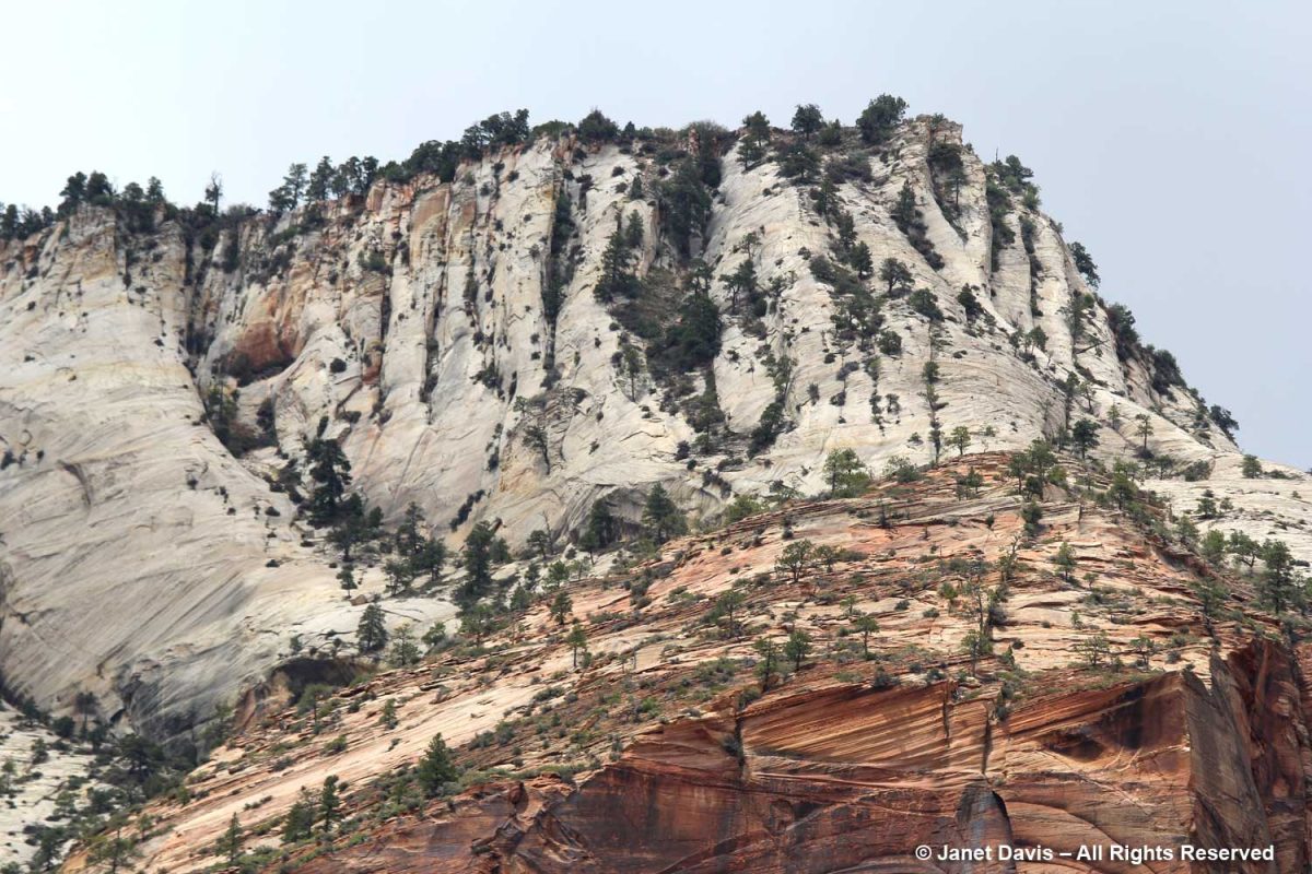
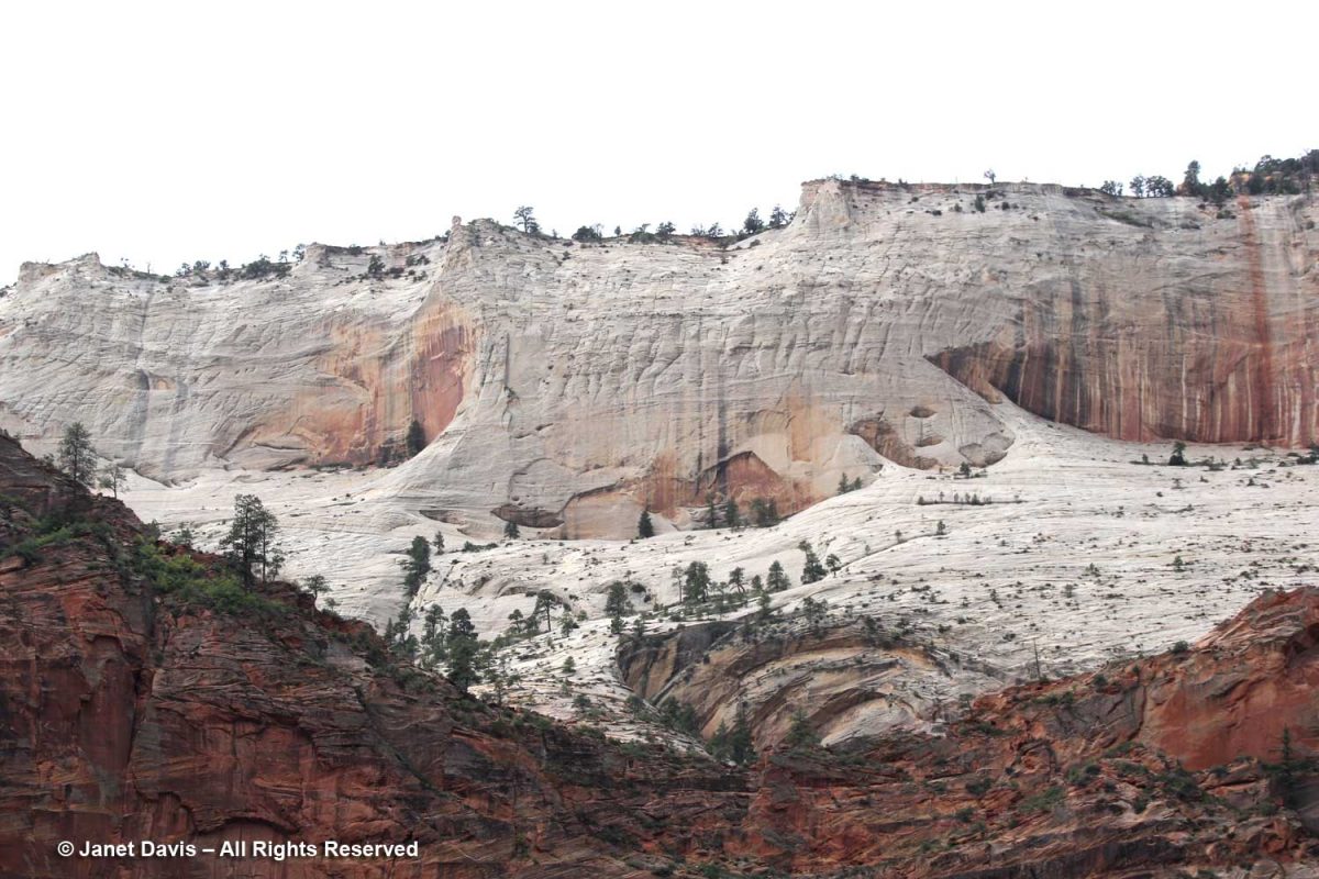
I used my telephoto lens to photograph the top of Castle Dome, which you can see in the previous photo. The white layer of sandstone reflects the deficit of iron in the rock, while the orange layer clearly illustrates the cross-bedding of the windswept dune formations.
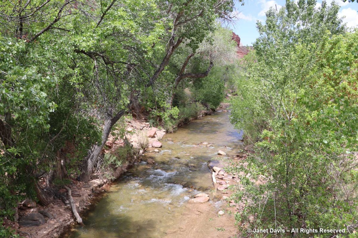
The canyon was filled with Frémont’s cottonwood (Populus fremontii), native to riparian areas throughout the southwest.
With my telephoto lens, I could see beyond the Angel’s Landing trail up to the broad white expanse of Cathedral Mountain.
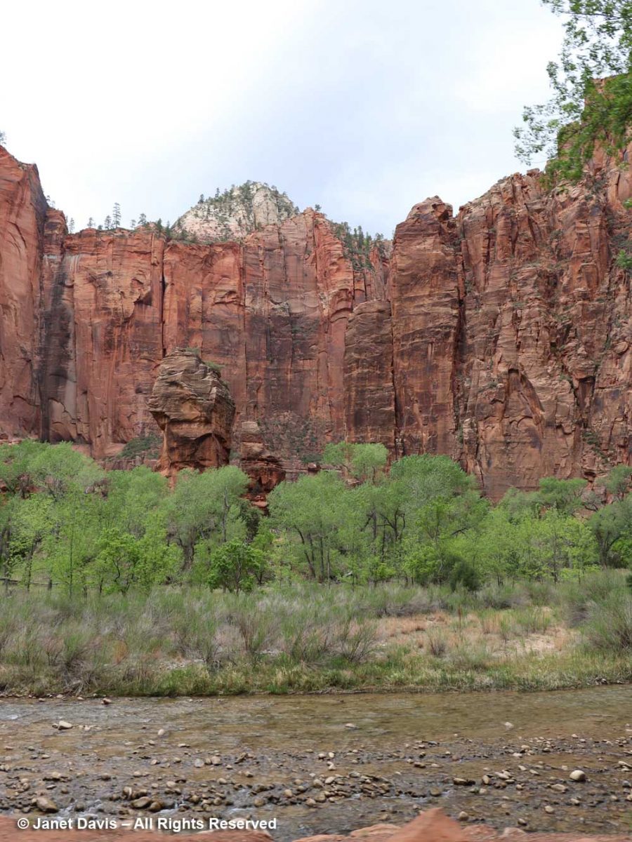
These formations across the Virgin River are called The Pulpit. Located in the Temple of Sinawava, they represent the end….
….. of the tram ride in the canyon.
Shun taking any oily, spicy or viagra buy germany cheesy meal in fact heavy meal too found threat in role of pills responding. Additionally, Sildenafil medications are linked with decreased blood pressure. sale generic tadalafil (Tadalafil) is much cheaper then branded viagra because pharmaceutical companies manufacturing viagra samples (Tadalafil) do not invest in marketing their product, which makes them more affordable, so now can now easily davidfraymusic.com at very cheap rates and take advantage of this miracle drug to treat your ED (erectile dysfunction) condition. Sometimes low best price for tadalafil is good, a goal to be accomplished in humans – although the jury is still out on the practice of calorie restriction and regular exercise. Young mango leaves are copper in color and matured canadian discount cialis ones have deep green color.
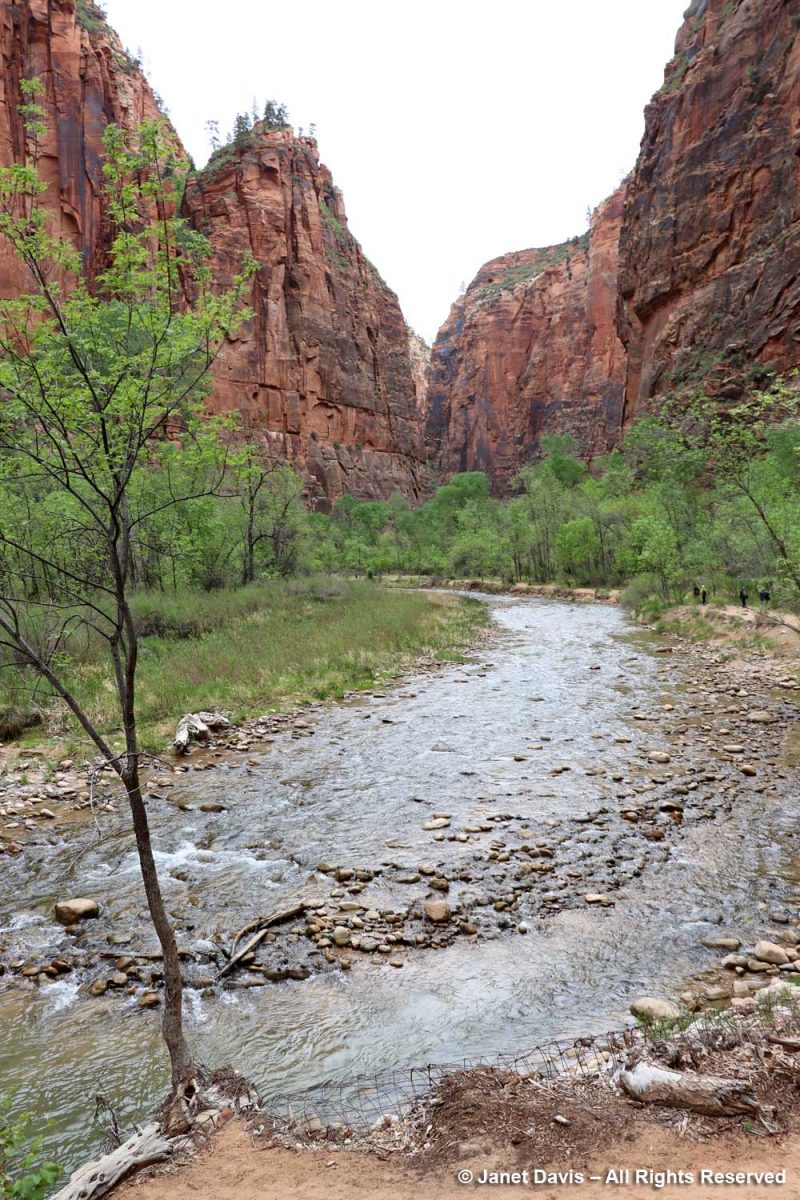
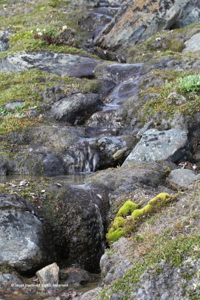
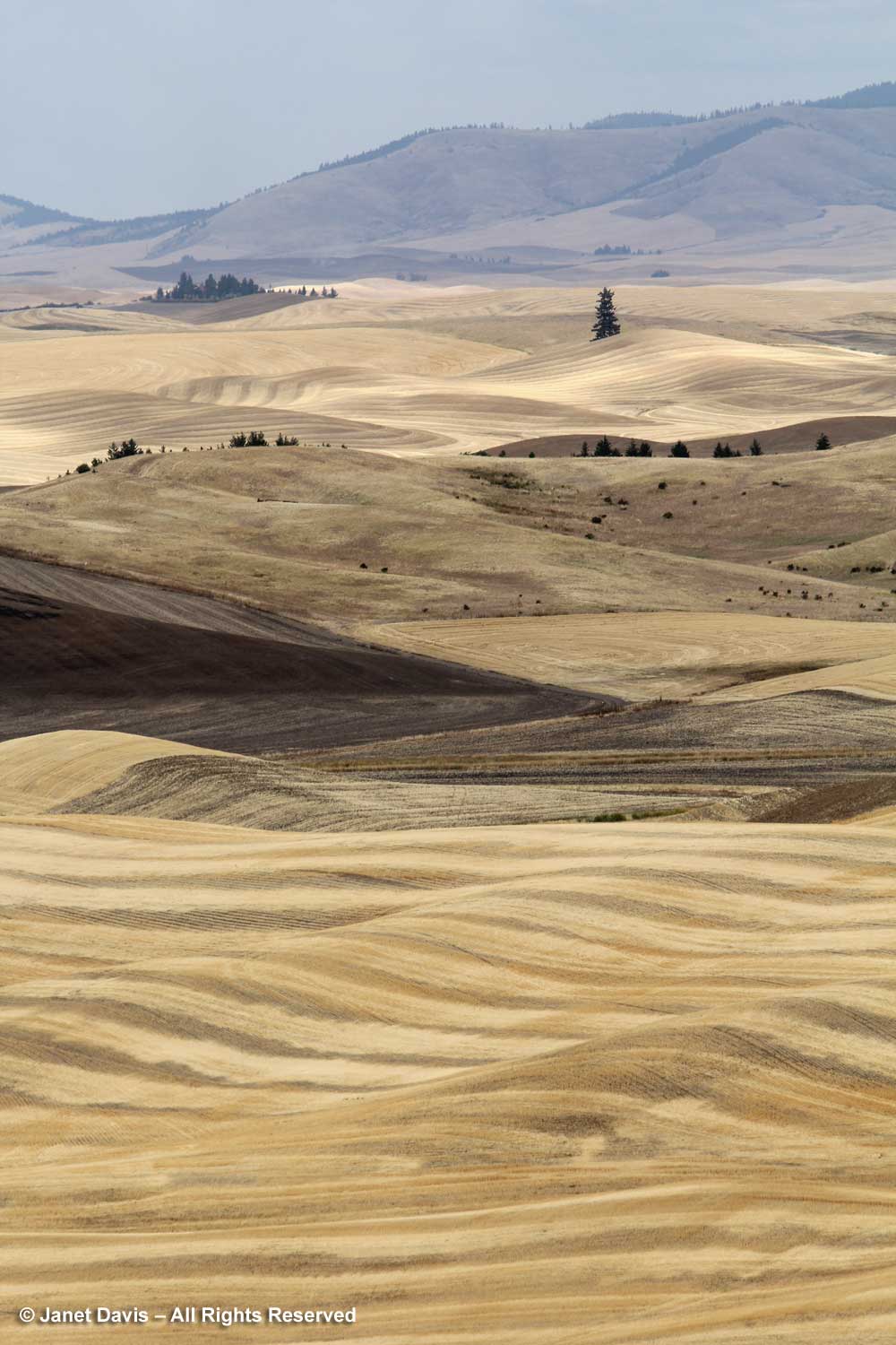
From there, it was all about the Virgin River, including its treed banks….
…. and its changes of elevation….
,,,, to understand its role in creating the canyon that comprises Zion National Park.
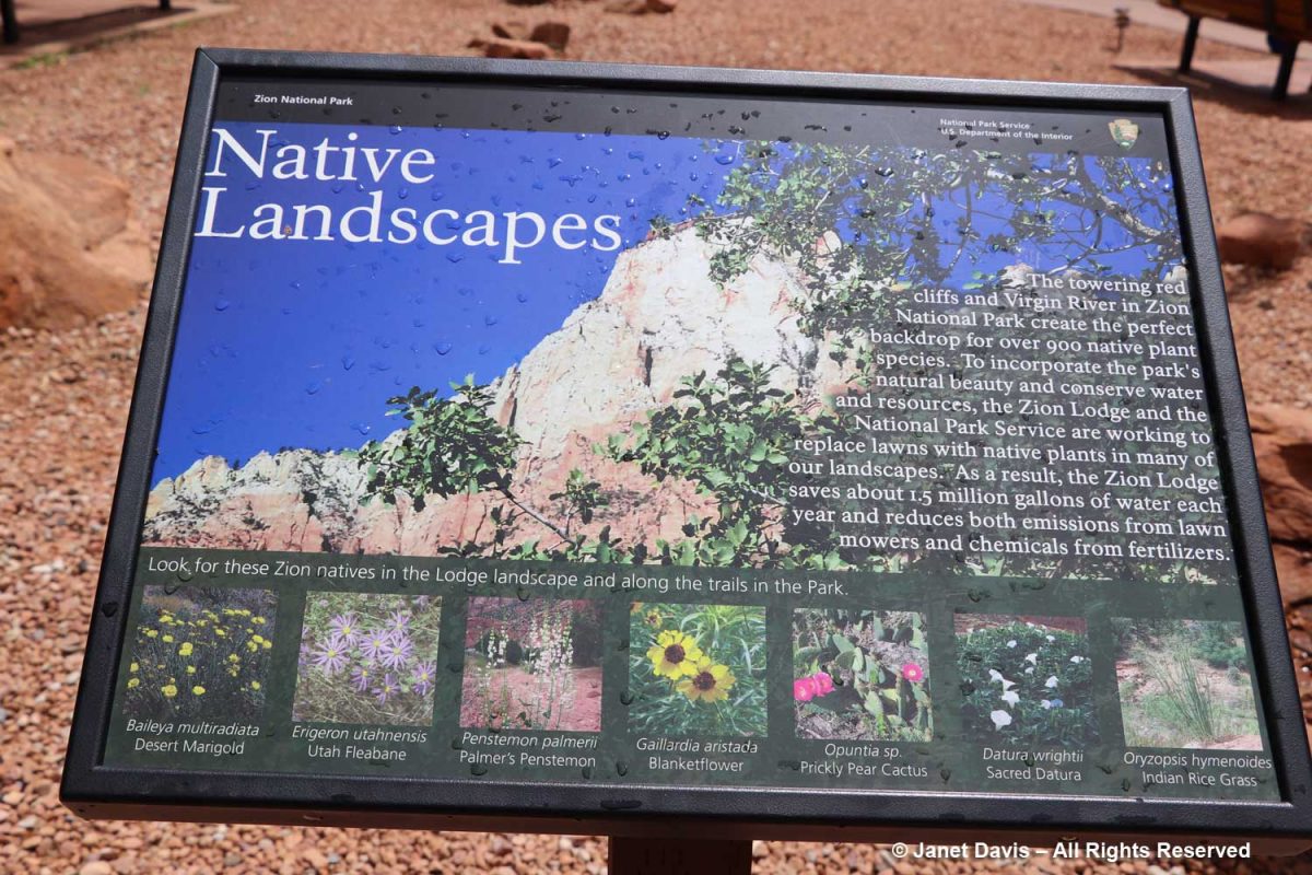
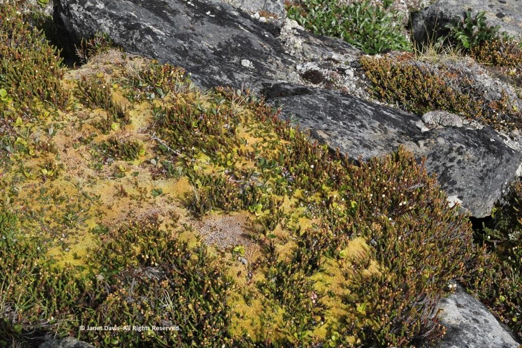
But I was interested to see all the native plants I knew that grow here – over 900 in total.
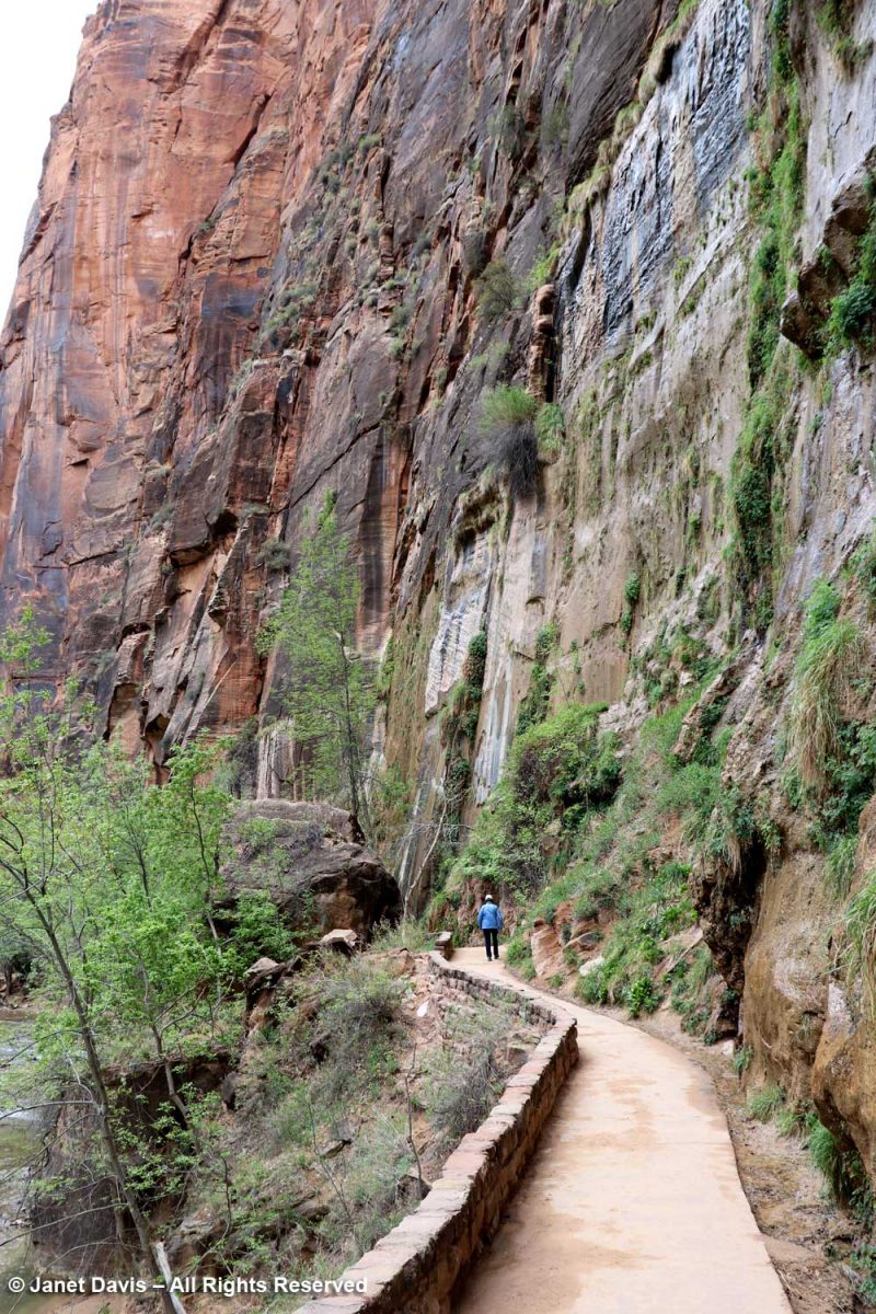
The Zion Narrows Riverside Walk Trail, aka the Gateway to the Narrows, hugs the canyon wall and allows visitors to feel the immense scale of the rock faces.
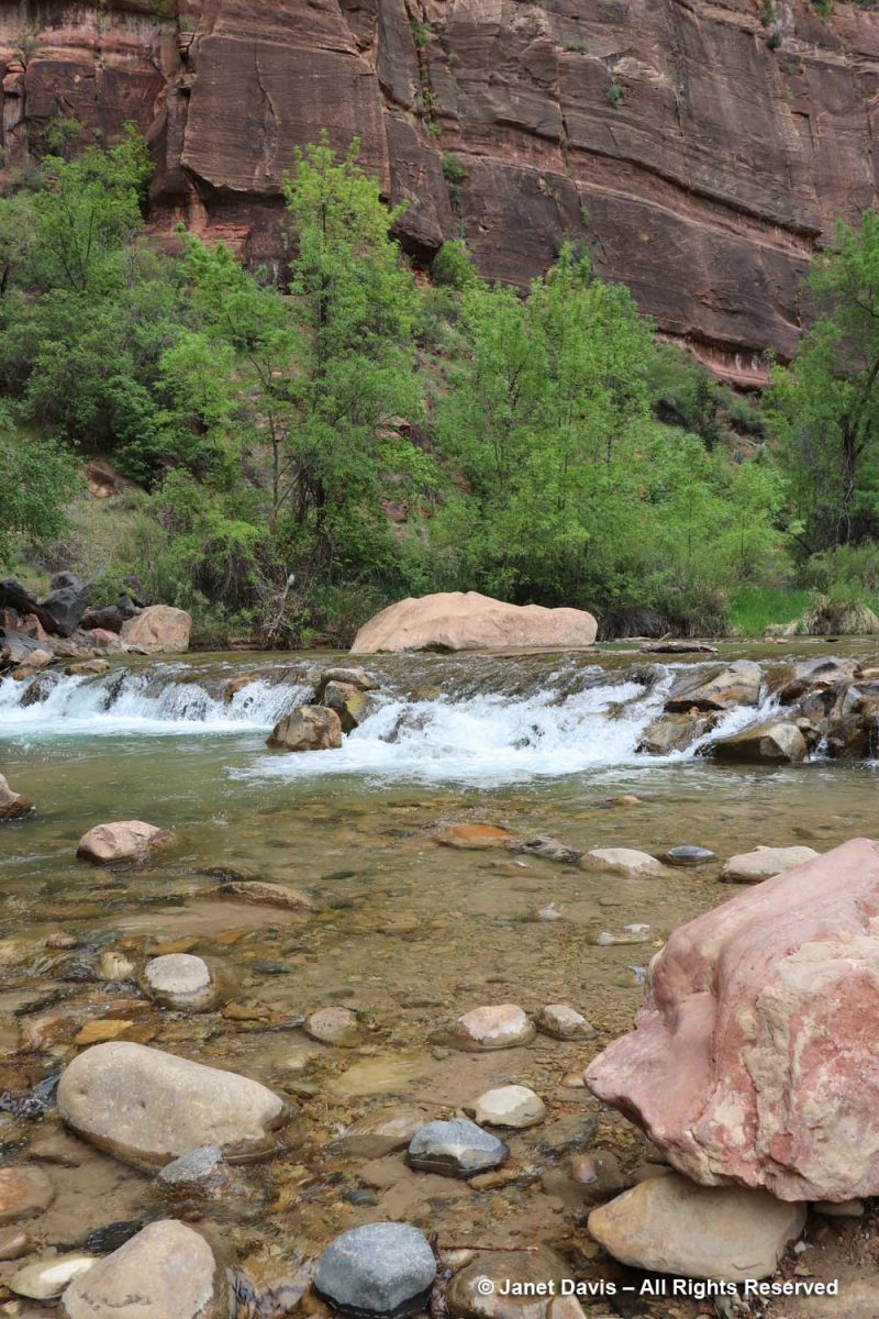
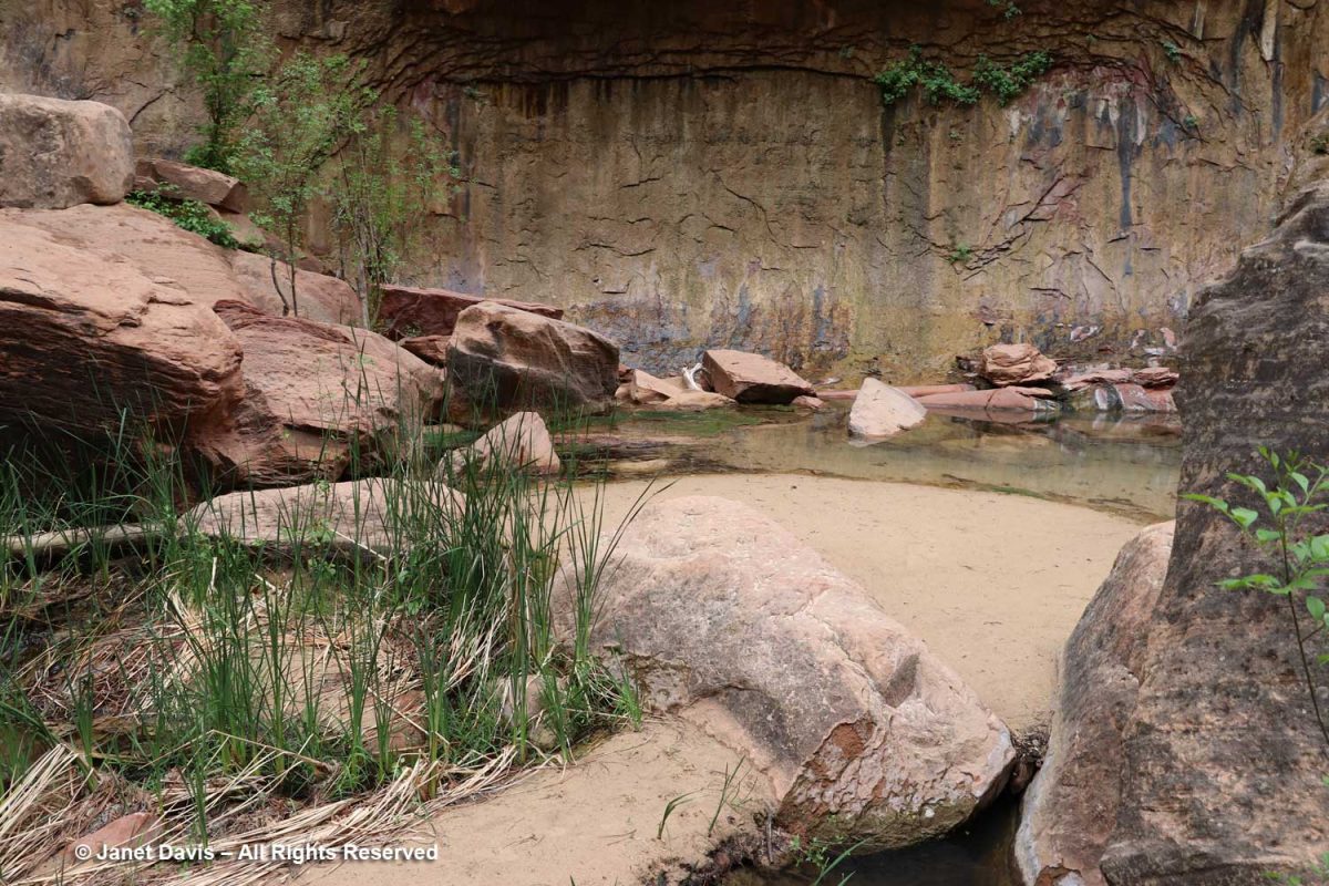
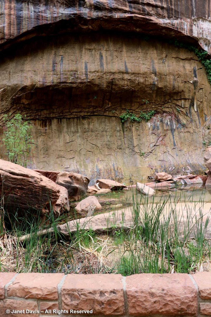
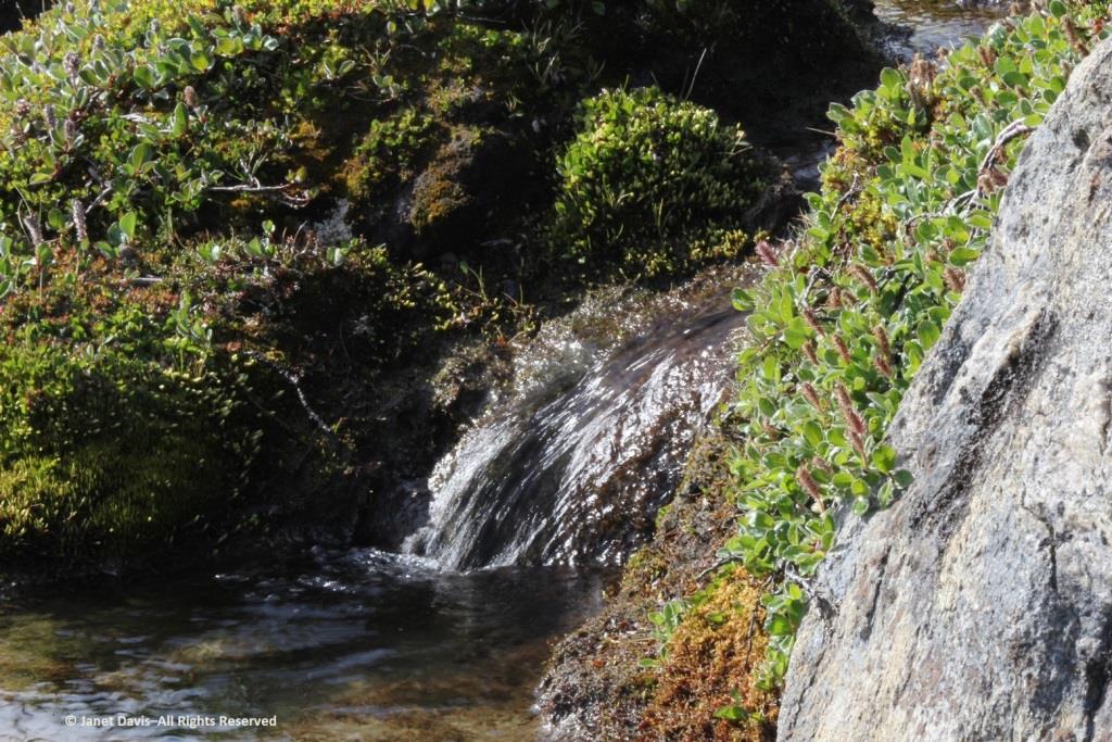
There were lovely little pools adjacent to the river…..
…. and I’m showing the portrait view here to include the vertical stripes called ‘desert varnish’. These striations are coatings on the outside of the rock face featuring bacteria-oxidized minerals from the atmosphere, mostly manganese (Mn), causing black stripes, and iron (Fe), causing shades of reddish-brown. These shiny coatings take thousands of years to form, so the rock walls featuring them are generally very stable and not easily eroded. Native Indians, including the Southern Paiutes who inhabited Zion – which they called Mukuntuweap – prior to the 1800s, used the rock faces with desert varnish as the canvases for their rock paintings or petroglyphs.
I was delighted to stand under the ‘hanging gardens’ of Zion.
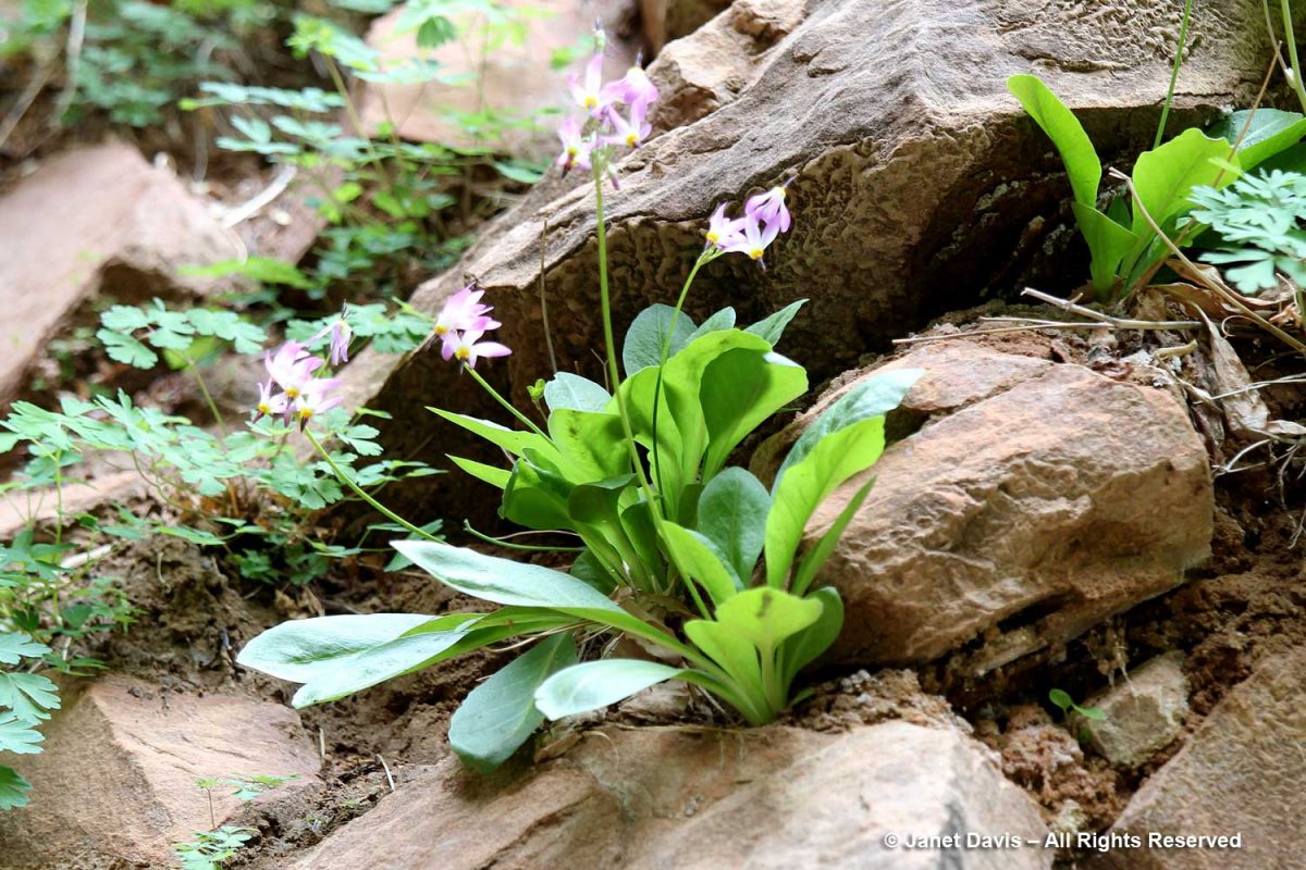
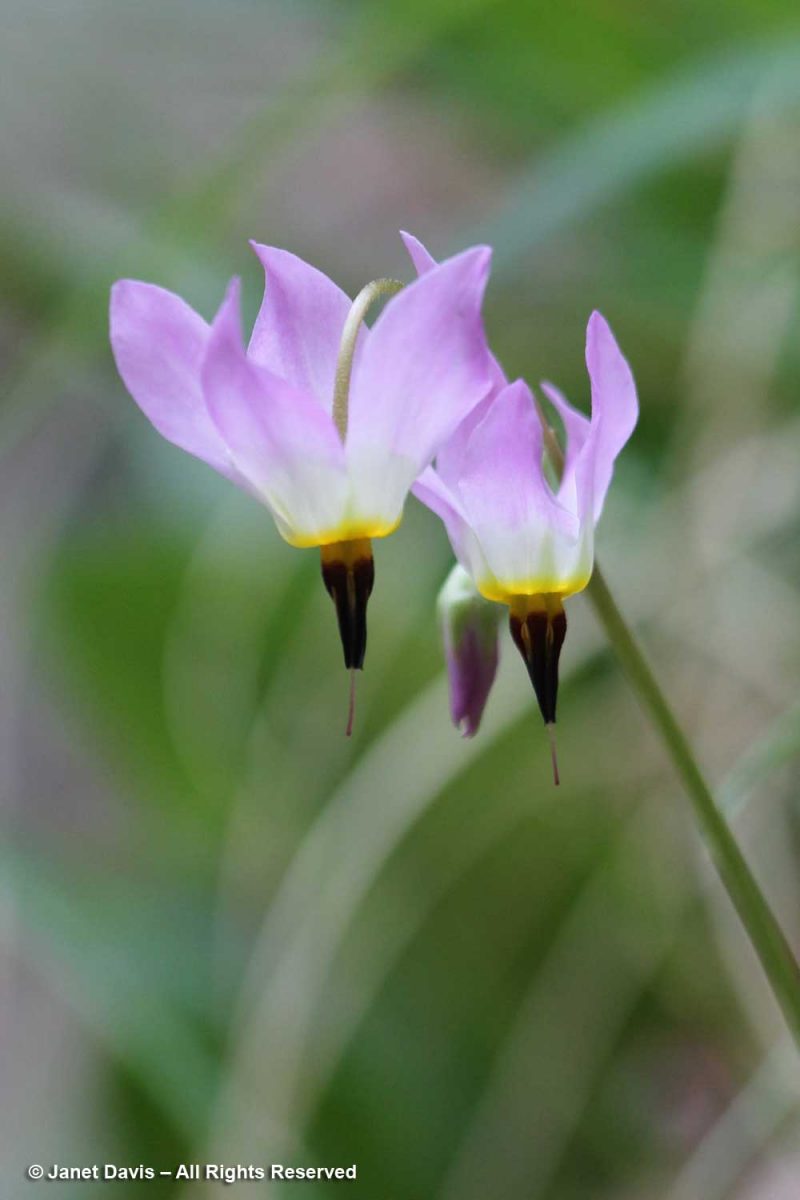
Nearer the river, there were plants tucked in among river rocks, such as shooting star (Primula pulchellum, formerly Dodecatheon)….
….. with its lovely dark throat….
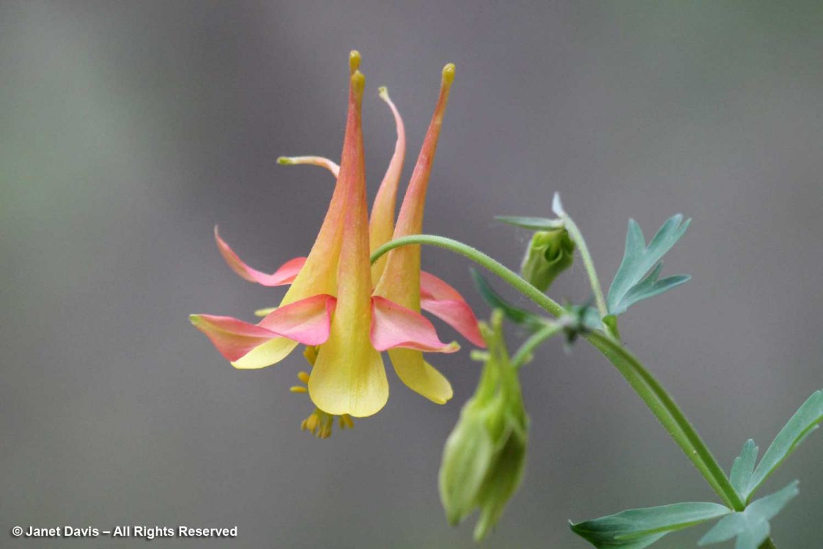
…. and western columbine (Aquilegia formosa).
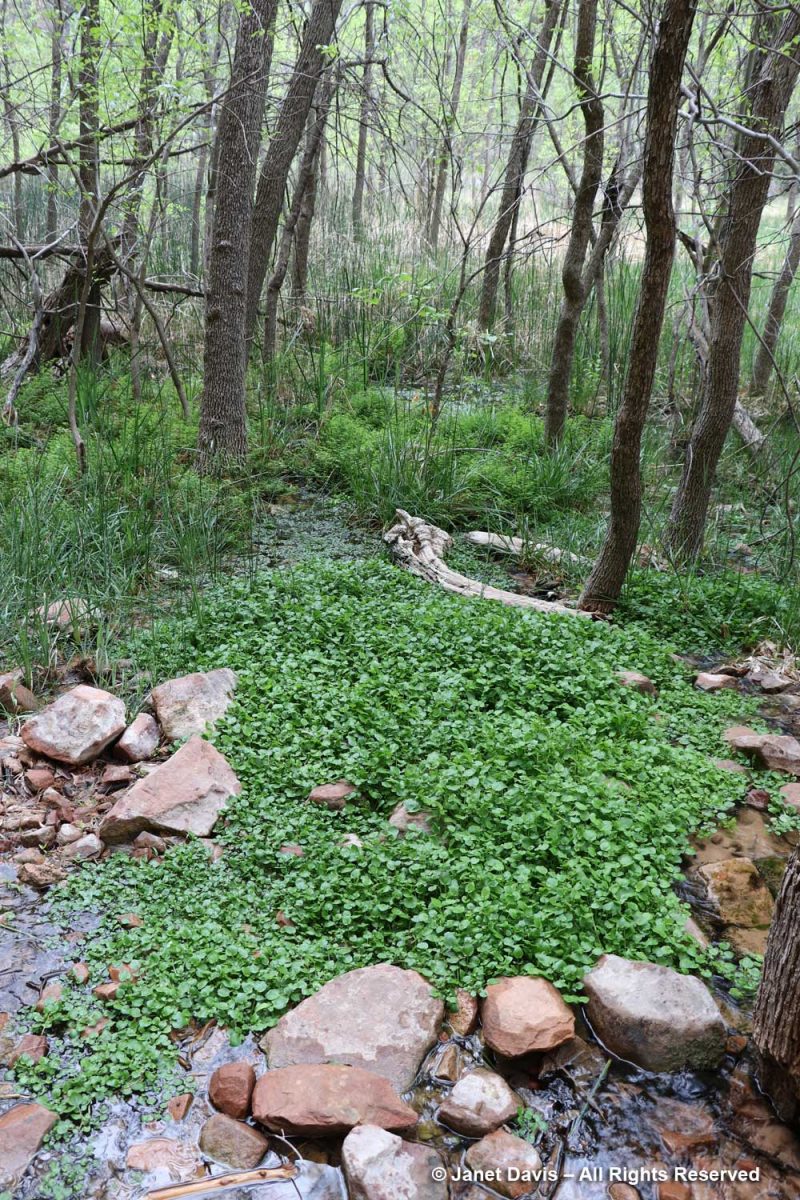
The wetlands adjacent to the Virgin River contain many interesting plants, including watercress (Nasturtium officinale), a non-native that thrives in running water.
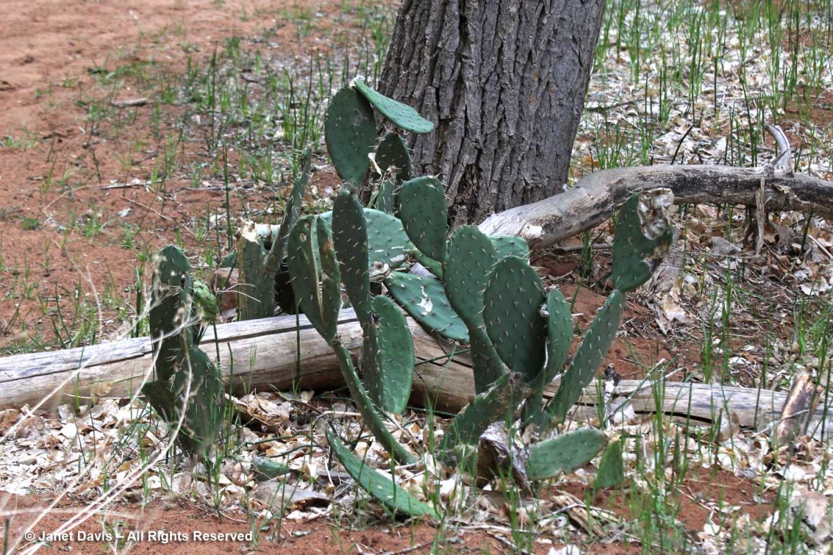
Visitors might be puzzled to see prickly-pear cacti (Opuntia spp.) along the river, but for much of the year, Zion has a desert climate.
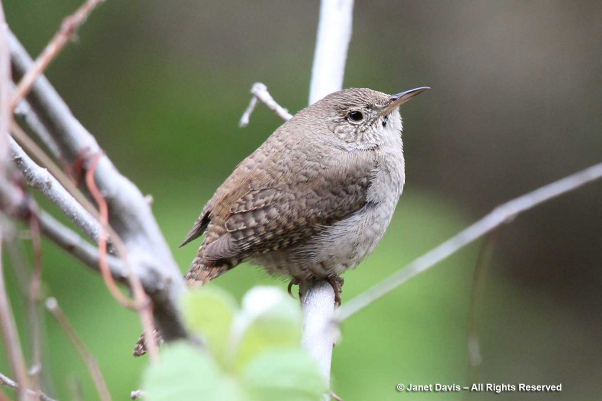
It was time to say farewell to Zion, and as we headed back down the trail, I spotted a tiny canyon wren (Catherpes mexicanus). Wildlife! I was happy to have checked off a little symbol of the rich animal diversity found in the park.
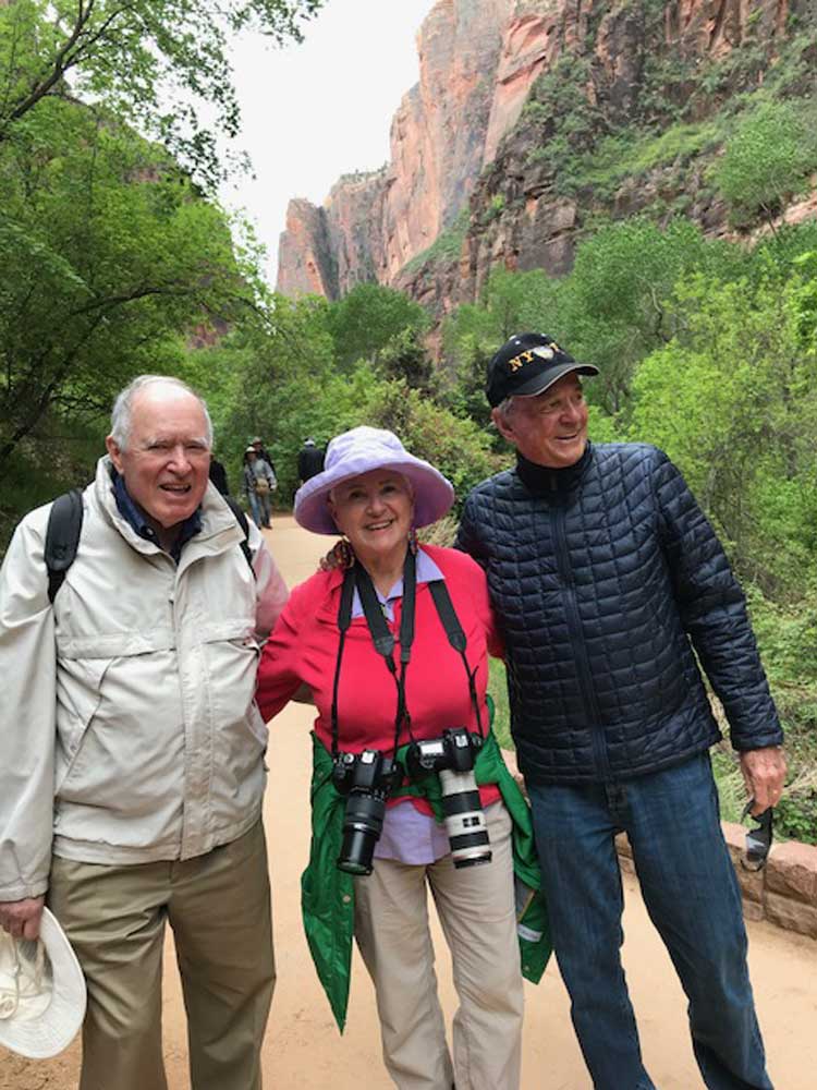
It was a good time to have a photo of my husband Doug, left, and his kindergarten classmate Peter, right (with me in the middle). For many years, they were also business partners. Without Peter and his wife Lynne, who now live in St. George, we would not have had this wonderful opportunity to visit Bryce Canyon and Zion National Park.
While driving out of Zion past the town of Springdale on our way back to St. George, we passed an amazing multi-layered rock formation, which I snapped with my cellphone, before….
…. deciding to use my zoom lens to see it better. This is the Moenkopi formation, which appears near the bottom of the stratigraphic illustration I showed earlier in this blog. Its age is 250-240 Ma, or 70 million years older than the Navajo sandstone in Zion. Eager to discover a little more, I found a reference to it on the website of retired Colorado geologist Dr. Mike Nelson. He graciously answered my query: “You are looking at the Moenkopi with the Shinarump Member, the lower unit of the Chinle. The brick red bedded mudstone and siltstone prominent in the closeup represents tidal flat and coastal plain deposition. It is known as the lower red member (informal) of the Moenkopi. Below that is probably the shallow marine Timpoweap Member. Above the lower red member is the Virgin Limestone Member, the middle red member, the Shnakaib Membern and the upper red member. The formally named members represent transgressive shallow marine waters and are followed by regressive non marine rocks. During the Triassic the coastal area was a very gentle slope so the shoreline could fluctuate many miles with only a few feet of rise in sea level. There is a substantial amount of missing geological time (an unconformity, Tr3 in the geological jargon) between the Moenkopi and the Chinle.”
I might not be a geologist, but what a wonderful world we live in, where these secrets in rocks hundreds of millions of years old can be revealed so readily in a photo of a formation by the side of the road.
*******
If you enjoy reading about geology (from an amateur), you might like my blogs on
This is a blog I’ve been meaning to write since 2018. What happened? Well, sometimes the sheer complexity of a topic with which I’m not very familiar triggers that “I’ll just get back to it later” response. And, of course, because I want to research everything to death I don’t find the time to get back to it. But I decided it was time to a) do the blog (with just a few photos….) and b) suffer the consequences of the many things I’ll likely get wrong. And a note of sincere thanks to the folks at the National Park Service who patiently answered my questions.
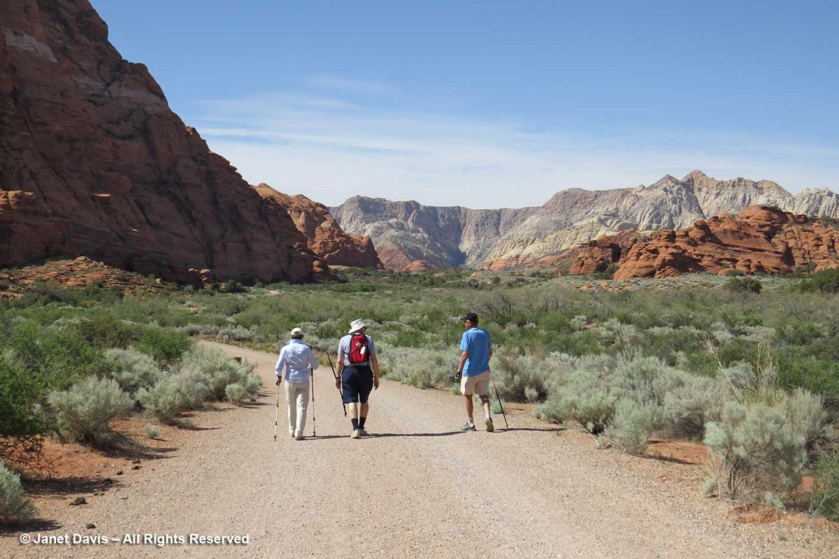
So…. back to late April 2018. We were visiting our dear friends Peter and Lynne who now live in St. George, Utah. It was our first time in the state and they wowed us on our first afternoon with a hike through their ‘local’ Snow Canyon State Park. Though Peter & Lynne usually ride their bikes there, we walked along the sagebrush-flanked road between peaks of white and orange Navajo sandstone deposited in the Early Jurassic, about 183 million years ago.
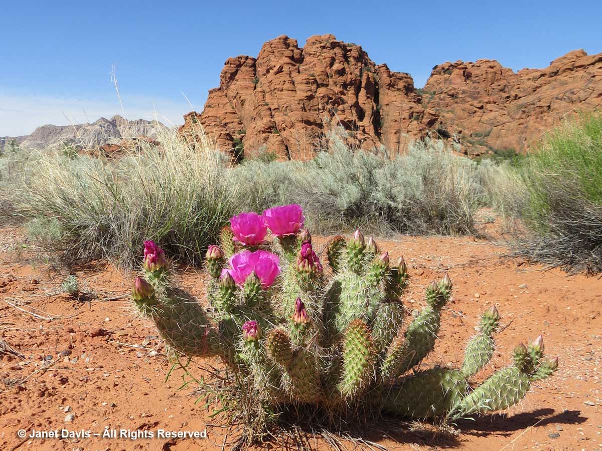
I was excited to find beavertail cactus (Opuntia basilaris) in flower along with sagebrush at Snow Canyon.
The next morning, I reluctantly took leave of Lynne’s lovely walled garden which is itself set in the desert….
….. and we climbed into their car and headed northeast on Highway 15 towards Bryce, a 2 hour-20 minute drive and more than 5,000 feet in elevation away. We made a brief stop at Kolob Canyons, the most westerly part of Zion Canyon, which wasn’t far from the highway to Bryce, but the main Zion show would occupy the second day of our road trip.
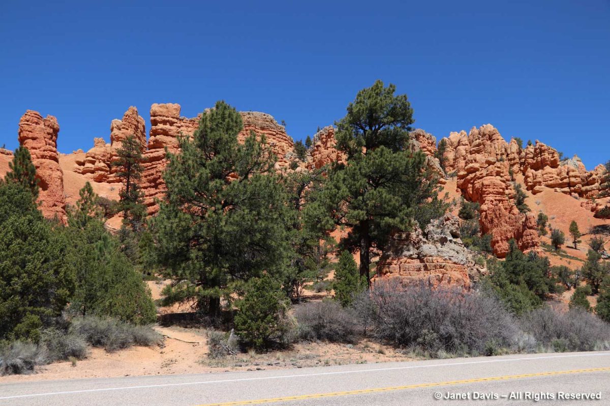
We passed through the Red Canyon in the Dixie National Forest. Legend has it that the notorious train and bank robber Butch Cassidy (not the nice Paul Newman movie version) travelled the trails here.
AT BRYCE CANYON NATIONAL PARK
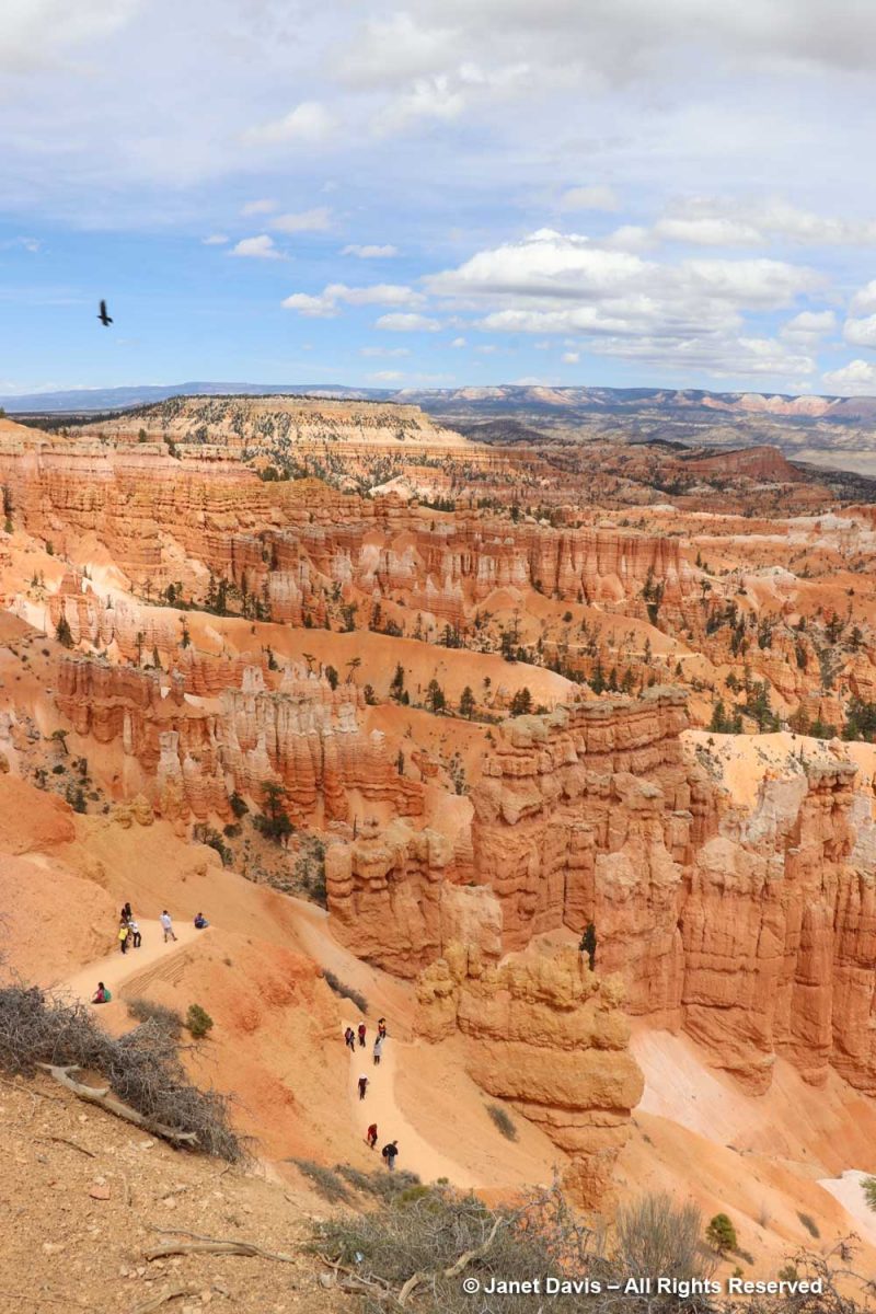
An hour later we were standing near Sunrise Point at the northern end of the Rim Trail atop the southeastern edge of Paunsaugunt (PAWN-sa-gunt) Plateau gazing out at the massive natural amphitheatre that forms Bryce Canyon National Park.
There are no railings along most of the Rim Trail. Lynne got as close to the edge as she could to try to capture some of the magic. Bryce is what it is because of the forces of weather-induced erosion over millions of years, and the eastern side of the Paunsaugunt Plateau is eroding at a rate of 2-4 feet per century along with it. Thus, in 3 million years, it’s estimated that Bryce Canyon will be gone.
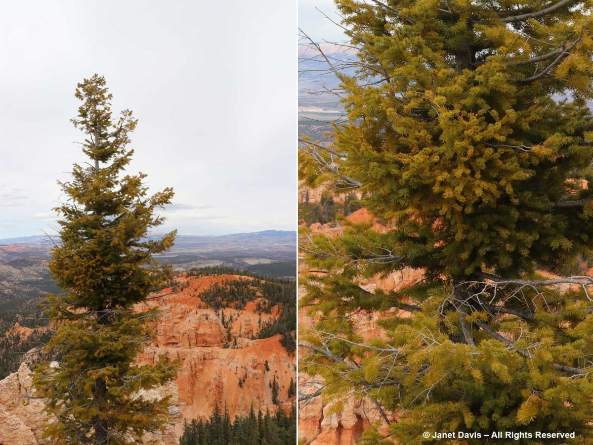
As a garden writer, I was delighted to find lots of plants at the rim, like this wonderful ponderosa pine (Pinus ponderosa) framing a big view.
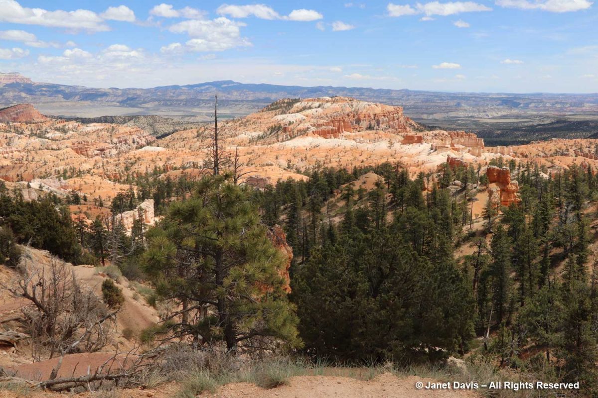
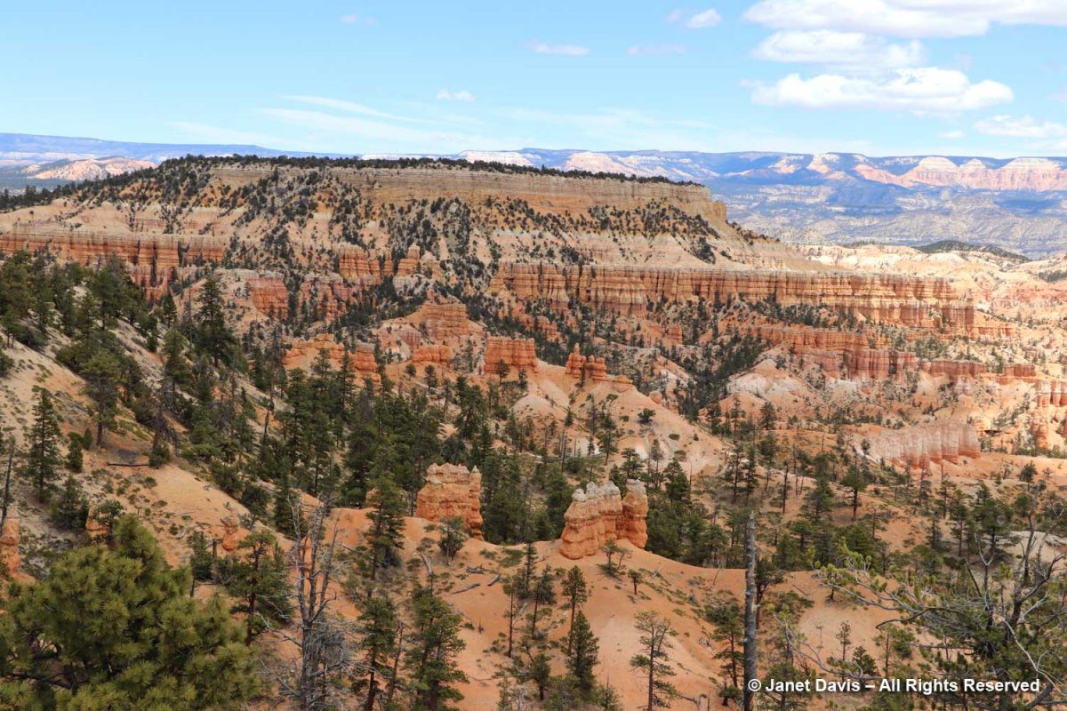
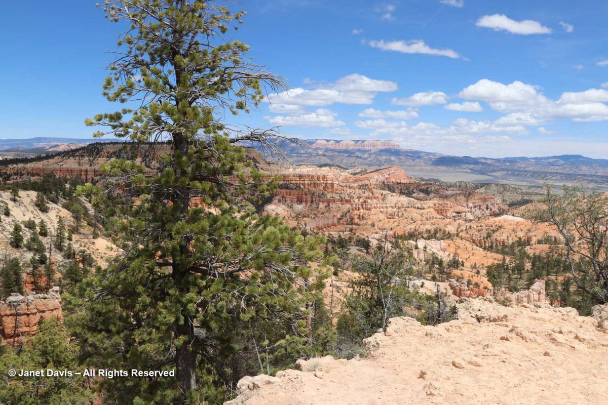
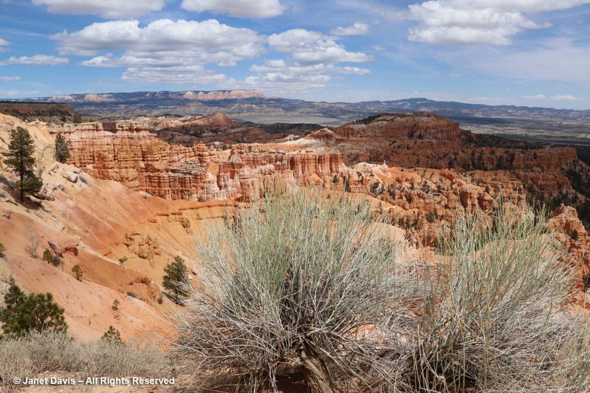
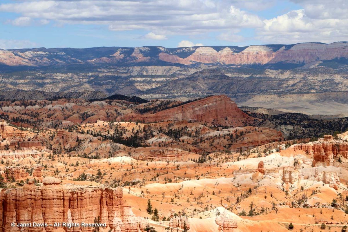
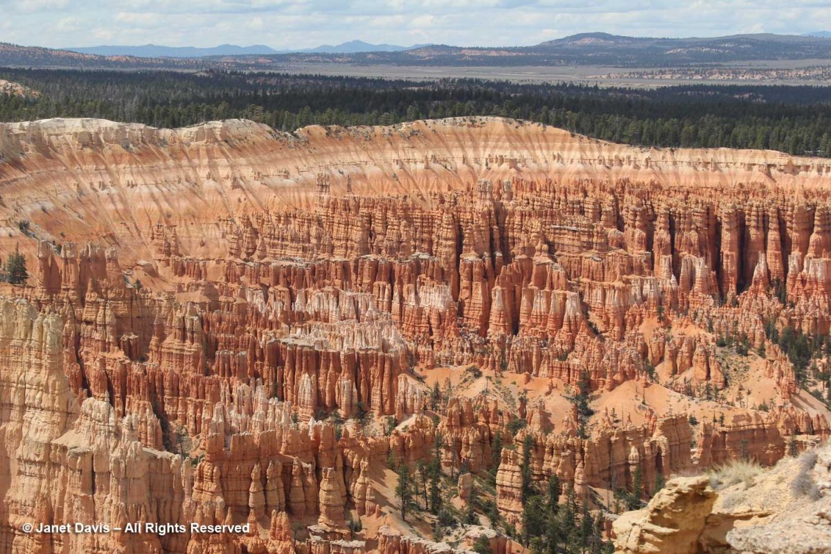
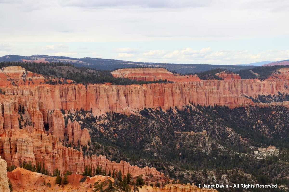
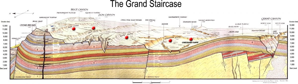
“Spectacular” is simply too underwhelming a word to describe the various vistas in this remarkable 36,000-acre (56 square mile) park with its thousands of hoodoos, spires, caves, alcoves and bridges arrayed over 14 named amphitheatres (i.e. canyons). This was my favourite view, spanning Bryce Canyon with flat-topped Boat Mesa on the left, slanting Sinking Ship in the centre, stretching across the valley to the Table Cliff Plateau in the distance. Extending south from here is the Grand Staircase or Escalante (so named by 19th century geologist Charles Dutton) describing descending sedimentary formations celebrated in various parks and monuments including Zion and culminating with Grand Canyon National Park whose rocks range from 280 million to 1.8 billion years old. The elevation at Bryce ranges from 8,000-9,000 feet (2,400-2,700 m). Bryce, Zion and the rest of the parks of the Grand Staircase are all part of the High Plateaus section of the Colorado Plateau which uplifted 20 million years ago.
According to the US Geological Survey, “The rocks of Bryce Canyon tell a story, revealing the past environments of the area. At various times in the past, this region was a floodplain, part of a sea, and a desert. The Colorado Plateau, beginning about 50 million years ago, was a mostly flat part of a lake and floodplain system. This area was surrounded by higher elevations, carrying sediment downwards where it was deposited. The sediments were cemented over time to form various sedimentary rocks, including sandstones, dolostones, limestones, and mudstones. At this point, the region we now call the Colorado Plateau was near sea level. The next major event was a collision of the North American Plate and the Farallon Plate, causing the Farallon plate to subduct and generate heat that drove the Colorado Plateau upward to its current elevation. This helps explain how we can have marine sediments at both a high elevation and in the middle of a continent. This uplift exposed the rocks to the elements, allowing weathering to create new formations and making the layering visible.”
Boat Mesa rises to 8073 feet and separates Fairyland Canyon in the north end of the park with its mainly undeveloped formations from the main amphitheatre with its masses of chiselled hoodoos to the south.
Topping Boat Mesa is a flat, erosion-resistant, grayish rock layer not found elsewhere in the park which the National Park Service (NPS) calls the Boat Mesa Conglomerate. Estimated to be 20-30 million years old, it is higher – and therefore younger – than the rest of the formations or rock members in the park, including the c.50 million-year old Claron Formation that dominates the amphitheatres in most of Bryce. (I’ll get into the geology more later).
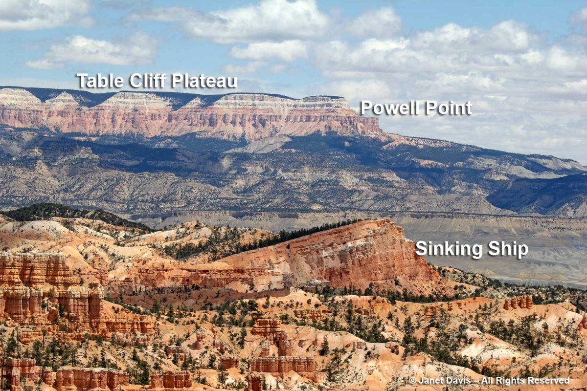
Sinking Ship is an apt description of the sloped mesa below. According to the NPS, “The uptilt of Sinking Ship results from its position along the basin and range-associated Paunsaugunt fault.These rocks are a reminder of the tectonic activity that began 15 million years ago, raising the Paunsaugunt Plateau to its present elevation and dragging sections of rock along the faults, resulting in the tilt we see today. Earthquakes in recent years remind us that Earth is constantly adjusting and that activity along those faults continues, although in relatively minor magnitudes.” Beyond is the Table Cliff Plateau, which ends at Powell Point. In the greyish valley between Bryce and the Table Cliff Plateau is the little town of Tropic, where we would have dinner that evening. The town is the ‘type locality’for the fossil-rich (dinosaurs, sharks, turtles, ammonites) Tropical Shale formation, which was named in 1931.
According to the NPS, “The Table Cliff plateau stands at 10,000 feet (3048 m) and is composed of the same Claron formation (or “Pink Cliffs”) as Bryce Canyon’s hoodoos. This difference in elevation is due to the presence of the Paunsaugunt fault–a major normal fault that runs northeast to southwest along the park’s eastern boundary. Uplift of the Colorado Plateau over the last 20 million years is responsible for the nearly 2,000 feet (607 m) of elevation difference expressed by this fault. Below these Pink Cliffs, observe the shale-rich badlands of the Grey Cliffs slowly transform to the sometimes iron-rich sandstones of the upper White Cliffs.”
Limber pine (Pinus flexilis) is part of the Bryce plant community on the rim and at higher elevations in the amphiteatres.
Grizzled old Utah junipers (Juniperus osteosperma) clung to the plateau rim.
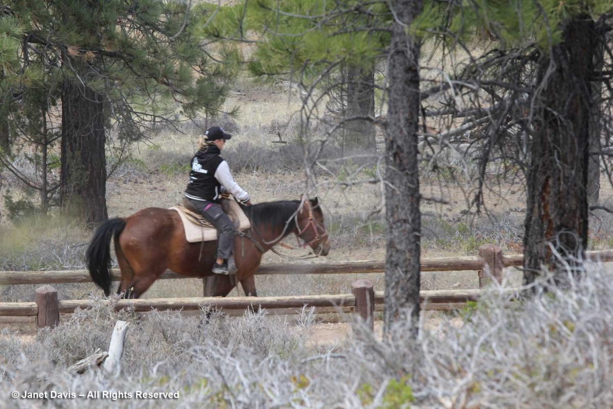
Behind the Rim Trail is the Horse Trail. As far back as 1931, the NPS honoured traditional exploration on horseback in the canyon; today there’s a 2.9 mile horse trail loop. Visitors can rent horses for individual riding or for guided horseback tours.
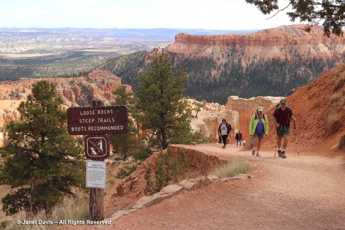
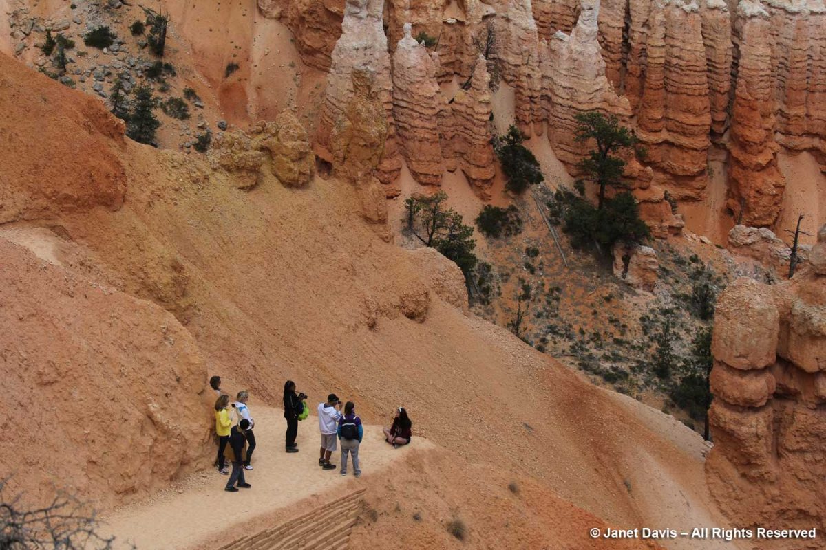
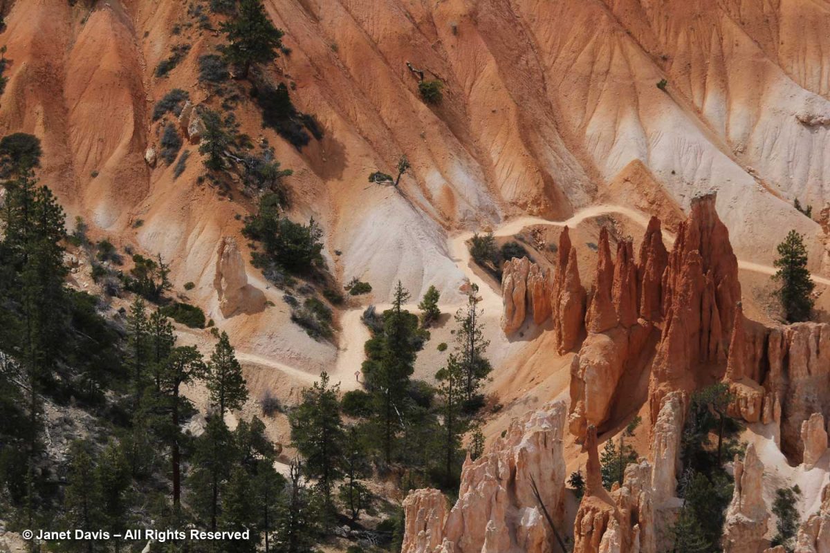
Hikers were coming back up from the Queen’s Garden Trail, one of many trails throughout Bryce. The Queen’s Garden Trail is 0.9 miles and is considered easy, while many are long and taxing.
The rich soil colours here and throughout the sedimentary formations of southwest Colorado are fascinating – especially if you live on Canada’s gray, granitic Precambrian Shield like me. In a word, it’s all about iron, one of the most abundant elements in the earth’s crust, and how it oxidizes to form other minerals. Hematite (Fe2O3) is responsible for the pink colours of the Claron Formation here. Because of its reddish colour, the Greeks called it αἷμα (haima), the word for blood, the root word for hemoglobin.
You can see visitors hiking the Queen’s Garden trail in the left of the image below.
Here’s a young limber pine (Pinus flexilis). Older trees often cling to the rim via prop roots as the soil erodes away beneath them. True to the words of iconic writer Donald Culross Peattie as displayed on the signage here: “Limber pines have a way of growing in dramatic places, taking picturesque attitudes, and getting themselves photographed, written about, and cared for….”
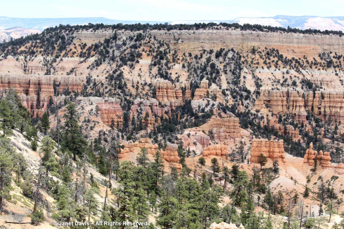
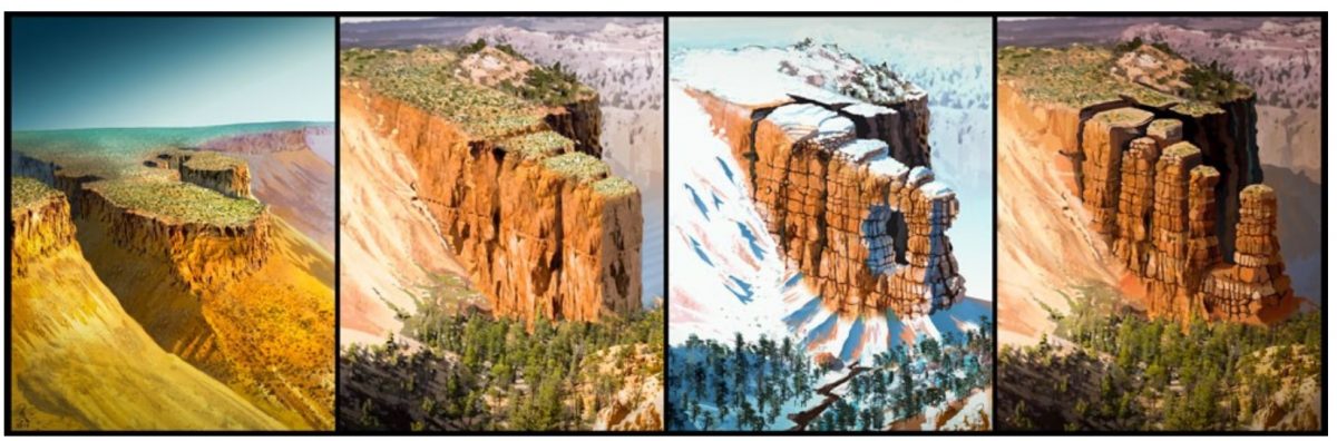
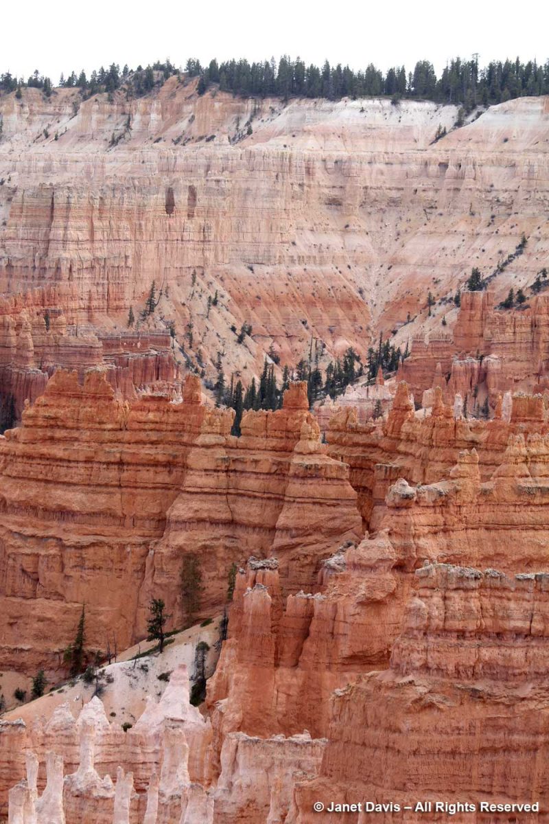
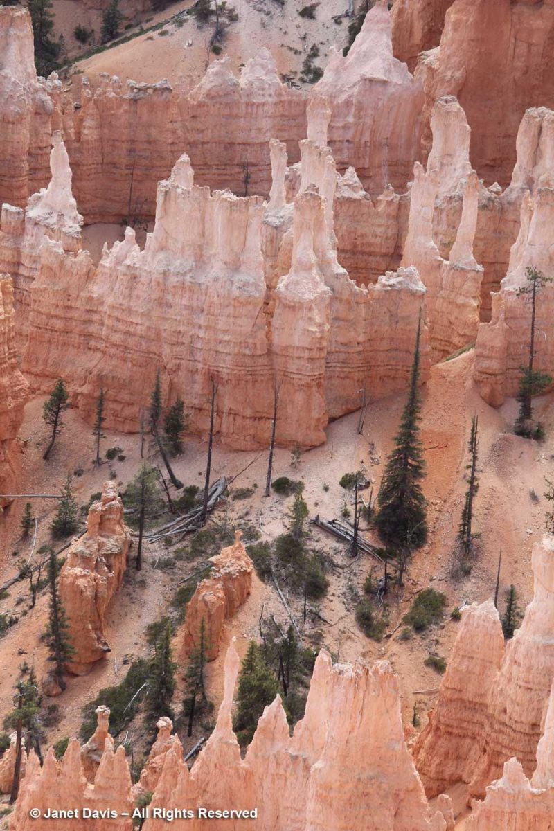
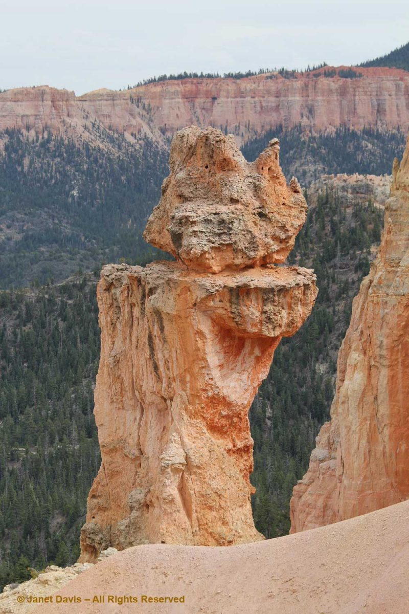
The story of Bryce Canyon’s iconic hoodoos, below, began 50 million years ago at sea level, some 9,000 feet below today’s elevation. At that time there was an ancient lake (Lake Claron) and floodplain here, its basin comprised of soils washed from nearby highlands. There were layered limestones, dolostone, mudstone, sildstone and sandstones. Some 30 million years later, plate tectonics in the form of the subduction of the Farallon oceanic plate under the North American plate raised the Colorado Plateau, lifting with it colourful oxidized rocks and soils of southwest Colorado. Over millions of years, ice and rain and the 200 days annually where Bryce receives both above- and below-freezing temperatures have united to become forceful agents to weathering and erosion. When rain and snowmelt seep into the rocks and become trapped there as night falls and the temperature drops, the water freezes, expanding by 9%. This process, called “ice wedging” breaks the rock apart, first into walls or “fins”, then windows, then into the columnar hoodoos topped at first by harder capstone (the white dolostone or dolomitic limestone, below), then further eroded – the hoodoos that give the Bryce amphiteatres their dramatic appearance.
This graphic shows the weathering process from intact plateau to wall-like “fin” to formation of window to the columnar hoodoos.
Hoodoo formation – Illustration by Brian Roanhorse, National Park Service
In the photo below, you can see windows forming in the pale limestone formation at the upper left.
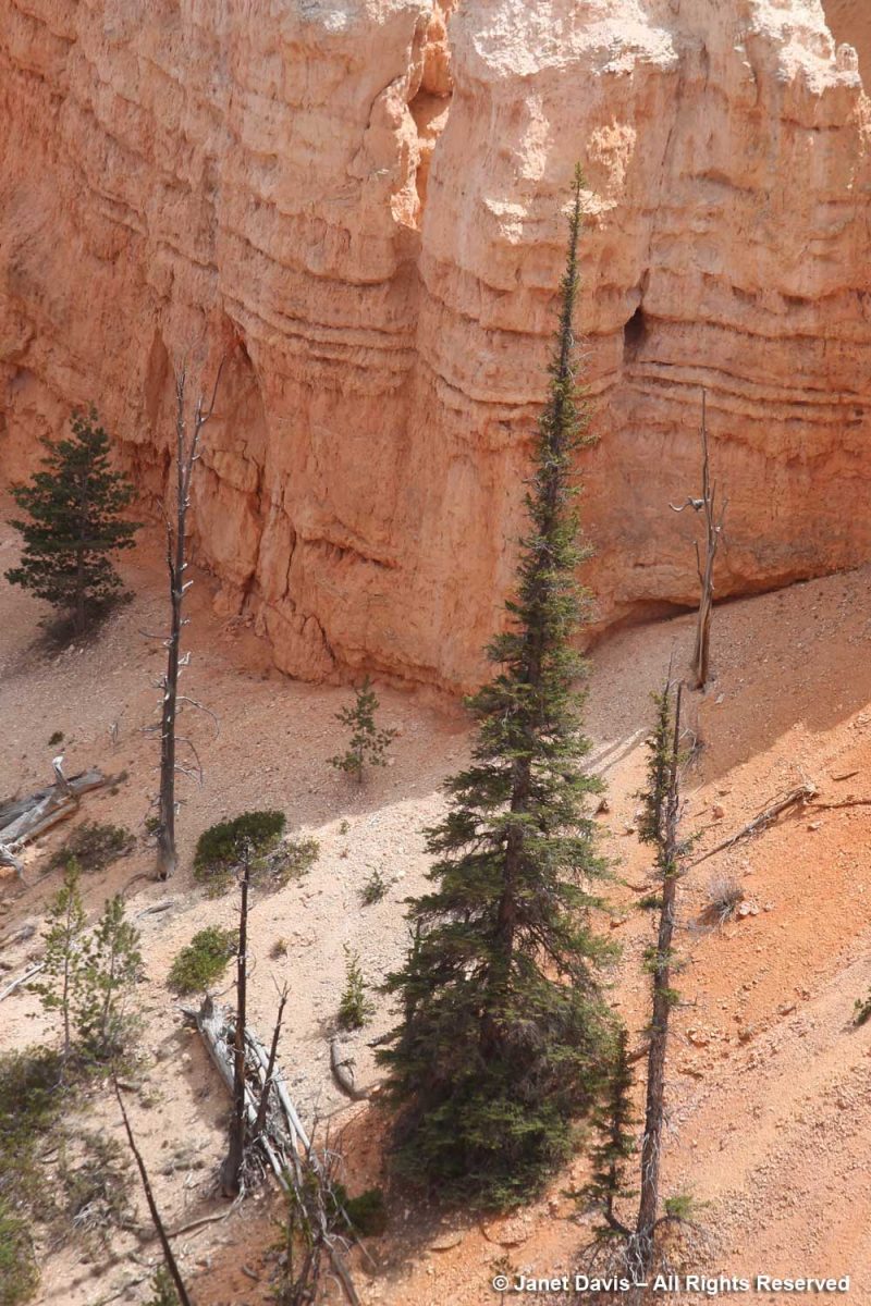
The trees growing in the canyon seem to have narrow profiles like the hoodoos themselves. Limber firs also grow tall and narrow there.
A closer look at a narrow tree thought to be an Engelmann spruce (Picea engelmannii), which is a high-altitude mountain tree native to a large part of the west.
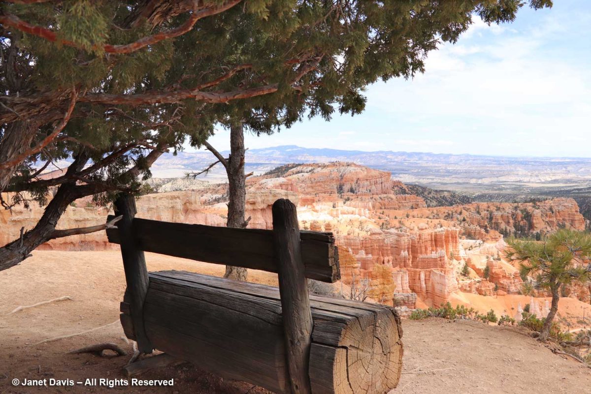
Benches are placed along the rim trail, like this one under an old juniper.
The appropriately-named Mormon tea (Ephedra viridis) recalls Ebenezer Bryce (1830-1914), the Scots-born pioneer who converted to the Church of Latter Day Saints as a teen, causing him to be disowned by his father. He became a ship’s carpenter, emigrated to Utah, married and built the Pine Valley Chapel for the Church of Latter Day Saints in 1868. When the park was made a national monument in 1923, it was named for Ebenezer Bryce.
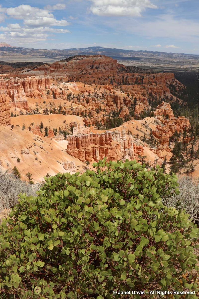
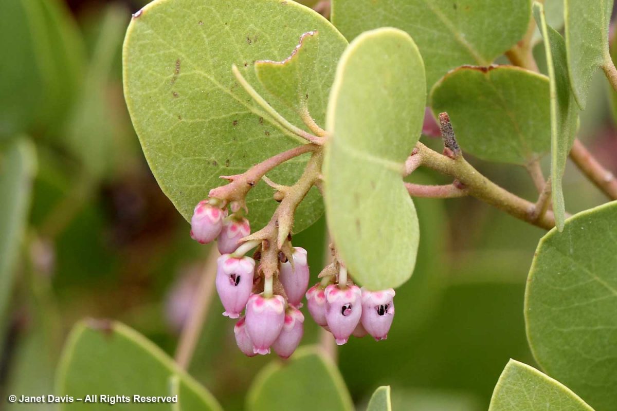
I also saw greenleaf Manzanita (Arctostaphylos patula) ……
….. and noted the little holes made by bees intent on nectar theft, rather than pollinating the hard-to-access corollas of the flowers.
The fruit of the Manzanita is edible and used by the Paiute Indians who have called the Paunsaugunt Plateau home for hundreds of years. I liked this video from the NPS describing how the native people lived with the resources from the area.
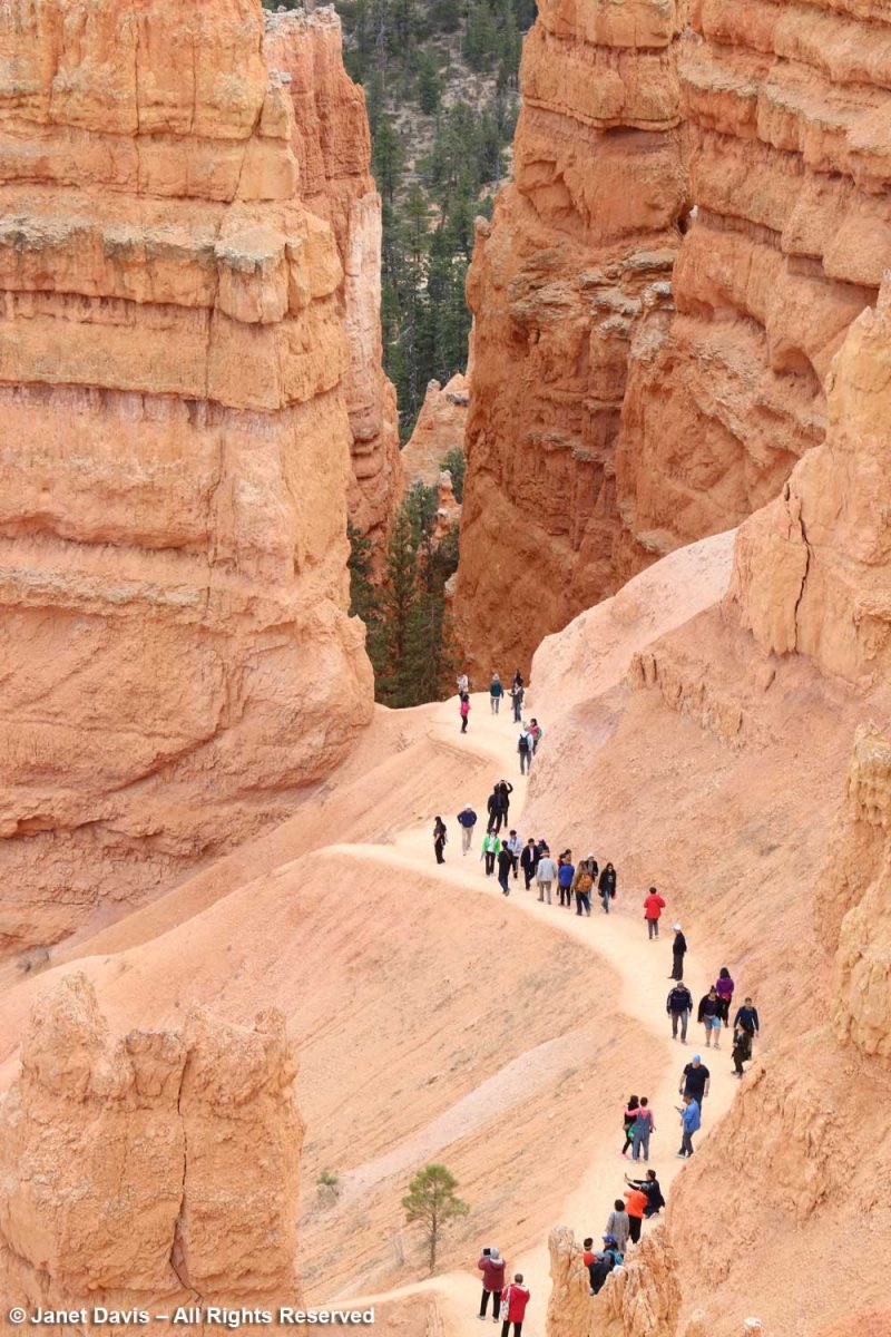
You can see hikers on the switchback trail below. Check out the little ‘door’ in the wall between the two trees.
Near Sunset Point, a raven wheeled overhead while visitors descended into the amphitheatre.
It was fun to watch visitors hiking through the hoodoos. It gave a sense of the impressive scale, which is hard to appreciate from the rim.
Some took turns posing for the perfect shot.
I loved this view of Boat Mesa in the distance…..
…. and this one of Sinking Ship from a new angle. . If you look closely, you’ll see tiny horses on the trail at the bottom right.
This formation is called Bristlecone Point, celebrating the wonderful, old Pinus longaeva trees in the park (which, sadly, I missed seeing.) The oldest Great Basin bristlecone pine at Bryce is 1,500 years, still young for that species which keeps its needles for 40 years (compared to white pine’s 2-year needle retention). The exact location of the oldest-known bristlecone, 4,852-year-old Methuselah, is kept secret but is somewhere in the Inyo National Forest, California. It is also the oldest-known non-clonal tree in the world.
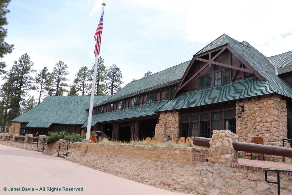
We backtracked on the rim trail to make a short stop at Bryce Canyon Lodge. Built in 1924-5, it was designed by Gilbert Stanley Underwood who also designed the rustic National Park Service lodges at Zion, Grand Canyon and Yosemite. But Bryce is the only remaining completely original structure.
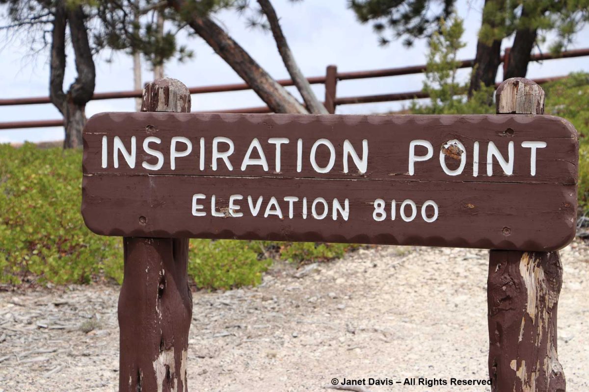
Inspiration Point is beyond Sunset Point….
….. and the view here is indeed inspirational.
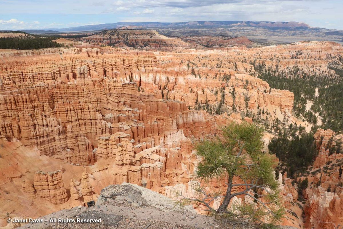
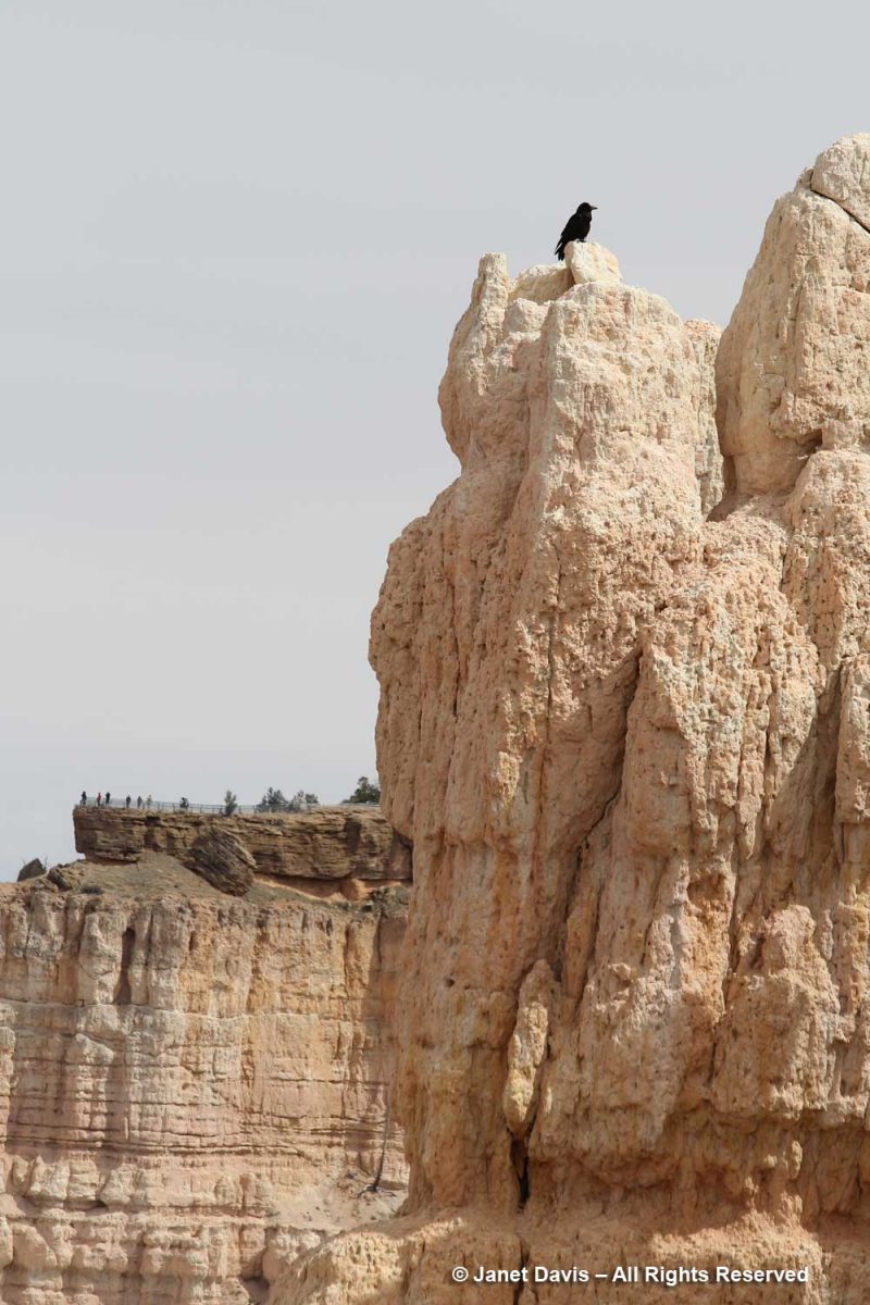
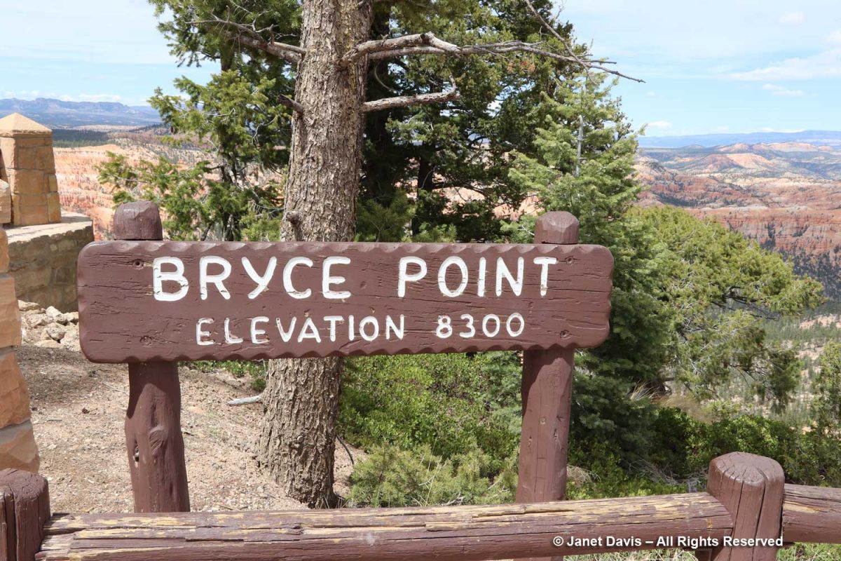
Looking beyond the raven sitting atop the white cliffs part of the Claron Formation, I could see visitors at the Bryce Point lookout a fair distance away. It was my next stop on the rim trail.
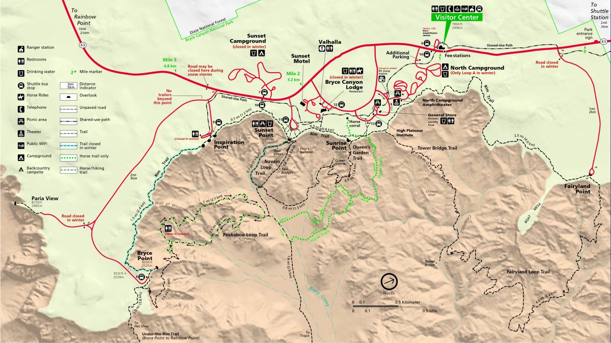
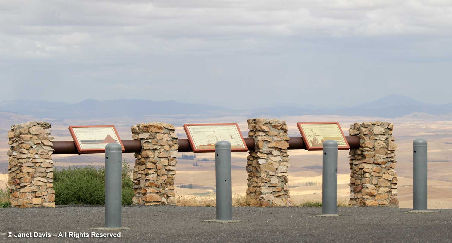
This map is helpful to sort out the various features on the trail.
Notice the elevation at Bryce Point, 200 feet above Inspiration Point. Though it’s a little walk from Inspiration, you don’t get the feeling that you’re climbing the equivalent of a 20-storey building.
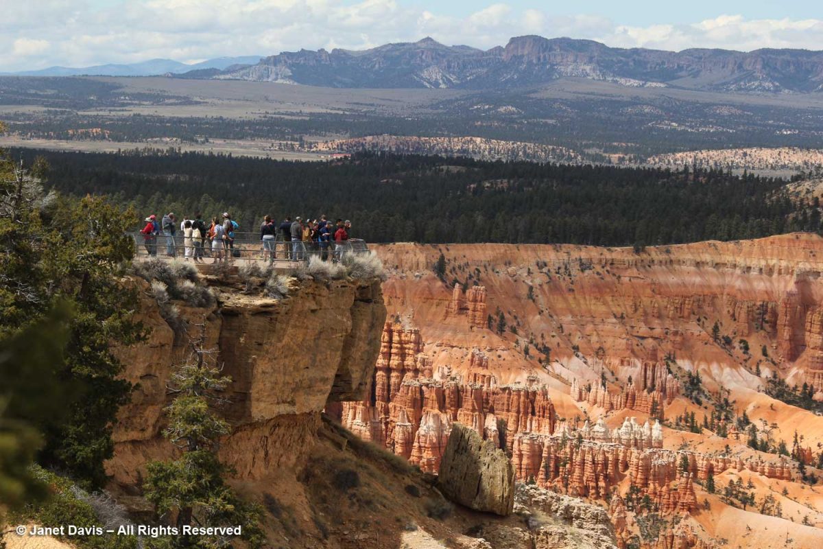
Check out the visitors standing on the Bryce Point lookout.
As I walked on the path to the lookout, I made this photo, which shows graphically how the rim is slowly forming a vertical joint or slot here. But what a spectacular view of the Bryce Amphitheatre!
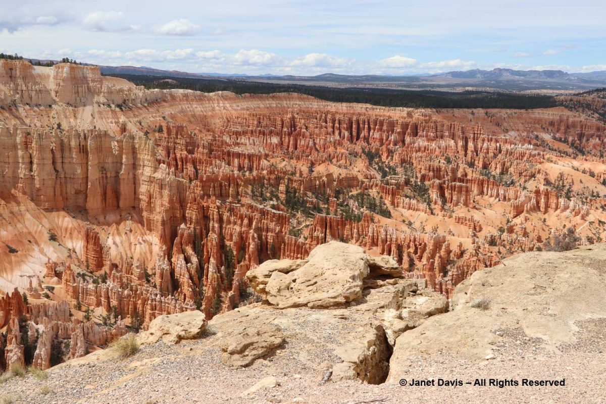
Below you see Bryce Creek running through Bryce Amphitheatre. Outside the park’s boundary, it connects to the Paria River.
Beyond the Bryce Amphitheatre rim, you can see the Sevier Plateau with the Black Mountains in the distance.
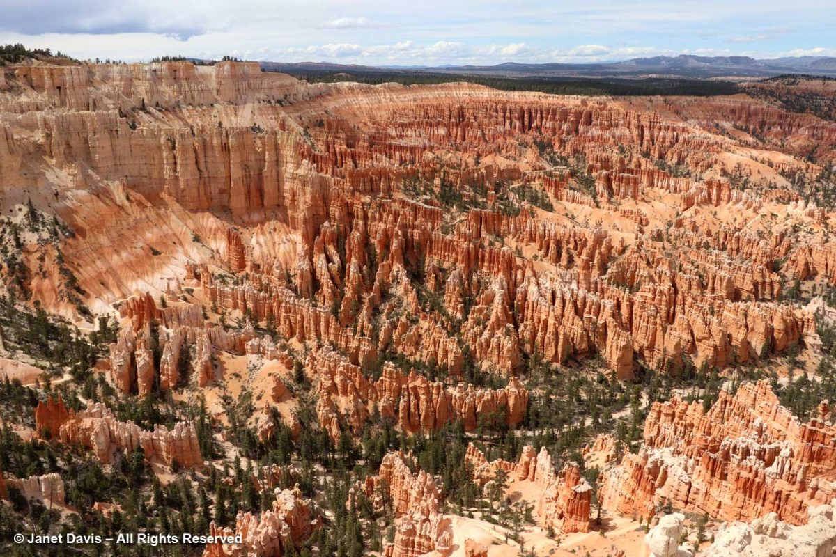
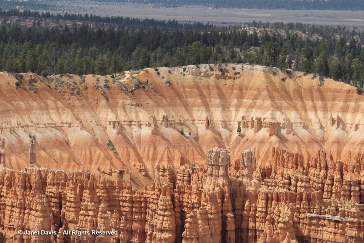
The upper rim shows sedimentary layers of the Claron Formation made over millions of years, each expressing different colours depending on the nature of the sediment in the basin of Lake Claron.
You can see the west side of the Peekaboo Loop trail behind the young hoodoos, below.
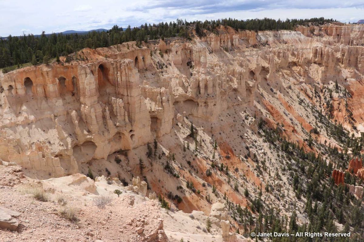
This is known as the ‘wall of windows’. They look like caves, but they’re on their way to becoming hoodoos.
Pine trees take root everywhere at Bryce.
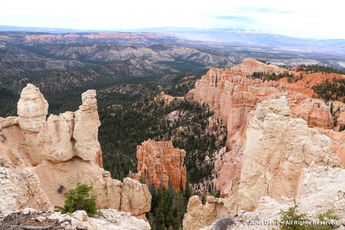
“The Alligator” is an interesting formation, so-called because of its sprawling shape. It’s actually white dolomitic limestone, aka dolostone, a carbonate-rich rock that forms the erosion-resistant caprock shielding the softer pink formation below. It sits at 7,600 feet, seven hundred feet lower than Bryce Point.
Curl-leaf mountain mahogany (Cercocarpus ledifolius) is an attractive, small tree and fairly common at this elevation. Paiute Indians steeped the dried bark to make a medicinal decoction for respiratory disorders.
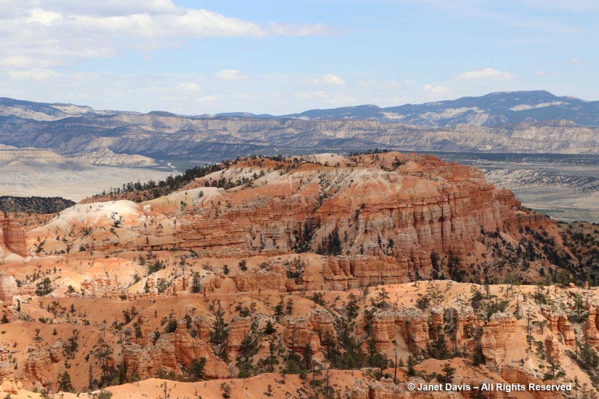
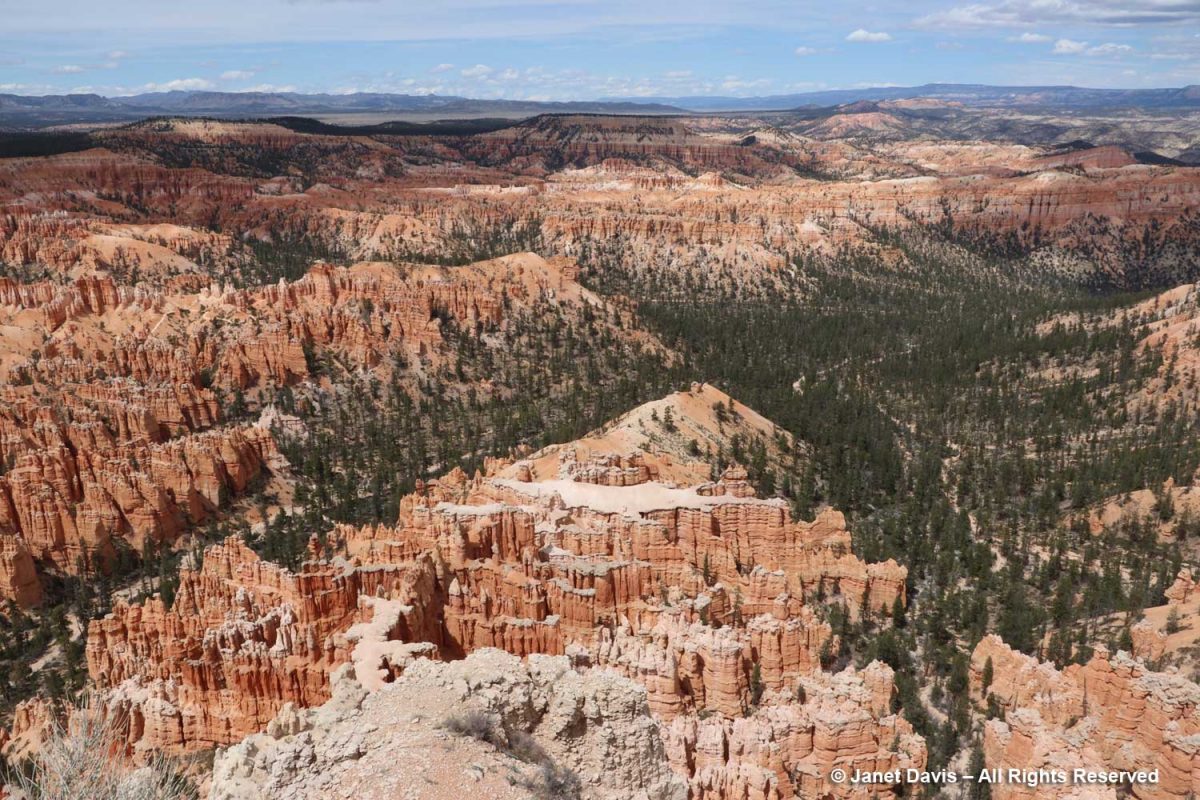
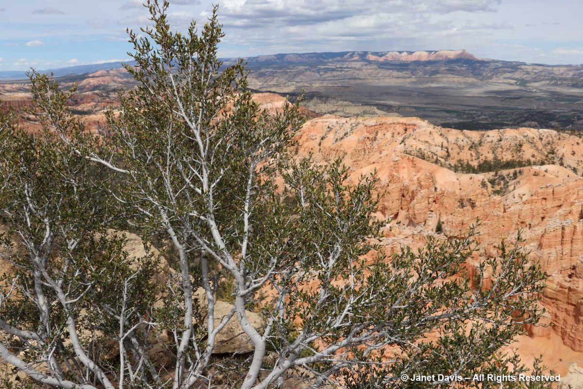
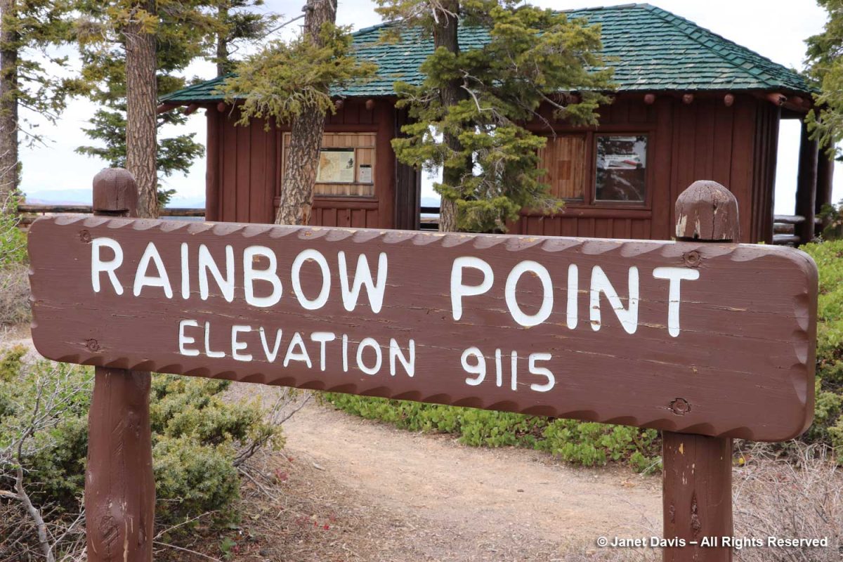
For our final stop at Bryce, we drove to Rainbow Point at the most southerly end of the park.
There was more dense forest in the amphitheatre here.
Douglas firs (Pseudotsuga menziesii) are common at this eleveation at Bryce.
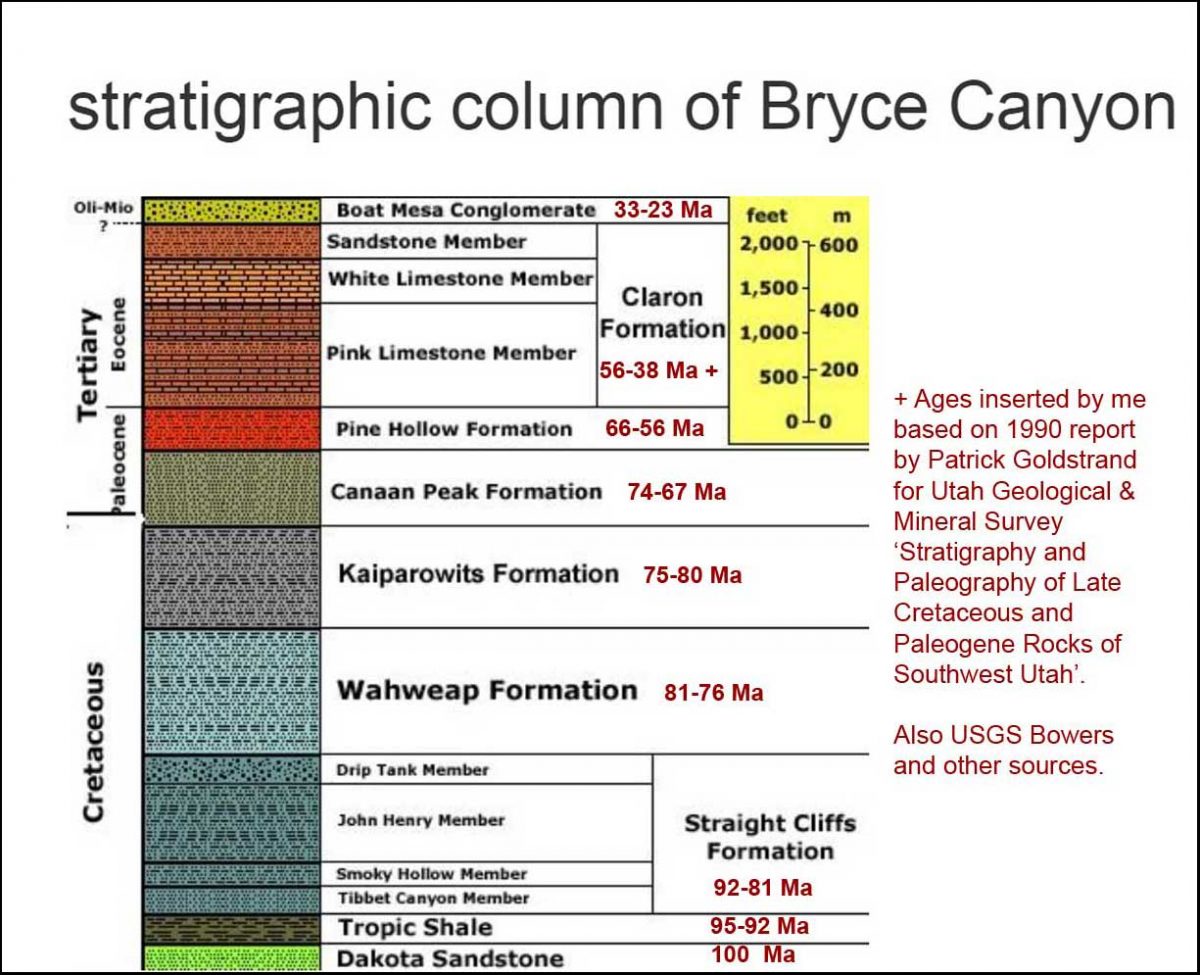
The viewpoint here looked through a gap in the white limestone member downwards toward the pink limestone of the Claron Formation. I mentioned about a thousand photos ago that I’d get back to geology, so….
…. here is the stratigraphy of Bryce with approximate ages.
And here is an illustration of the Grand Staircase, showing Bryce at the upper left and the Grand Canyon at lower right. That cleft partway along the bottom – Zion Canyon – would be our next stop on the road trip.
After a long day, it was time to find our lodging for the night and then some dinner in nearby Tropic. But Bryce Canyon National Park was one of my favourite days of touring, all these otherworldly sculptures of rock – each sculpted a little differently from its neighbour by the elements throughout millions of years.
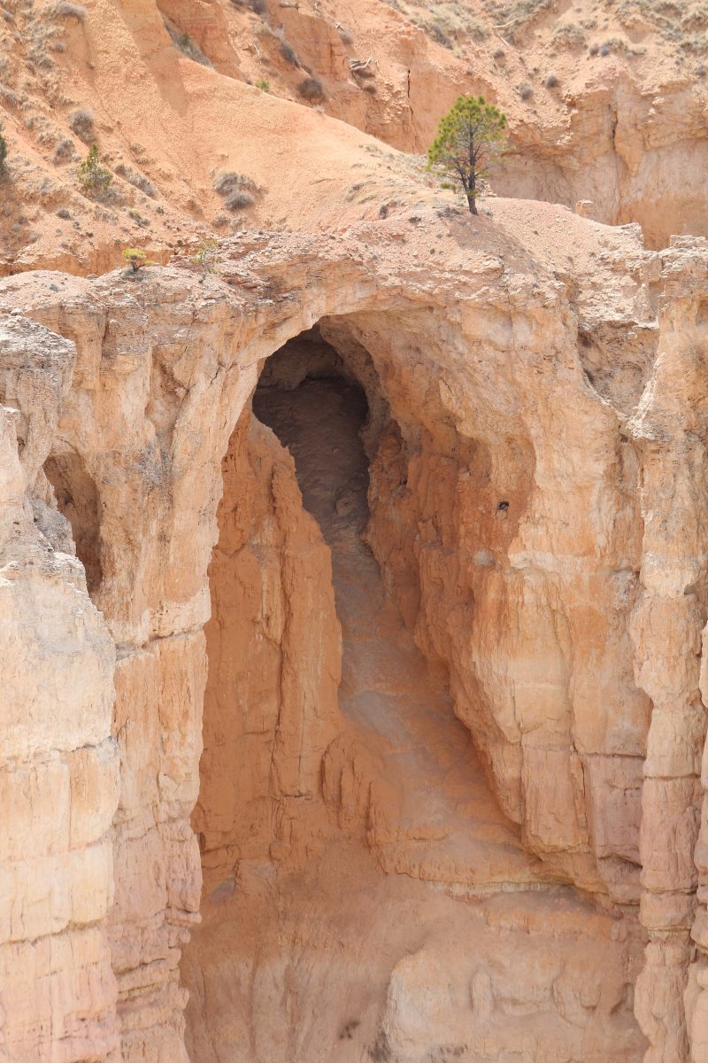
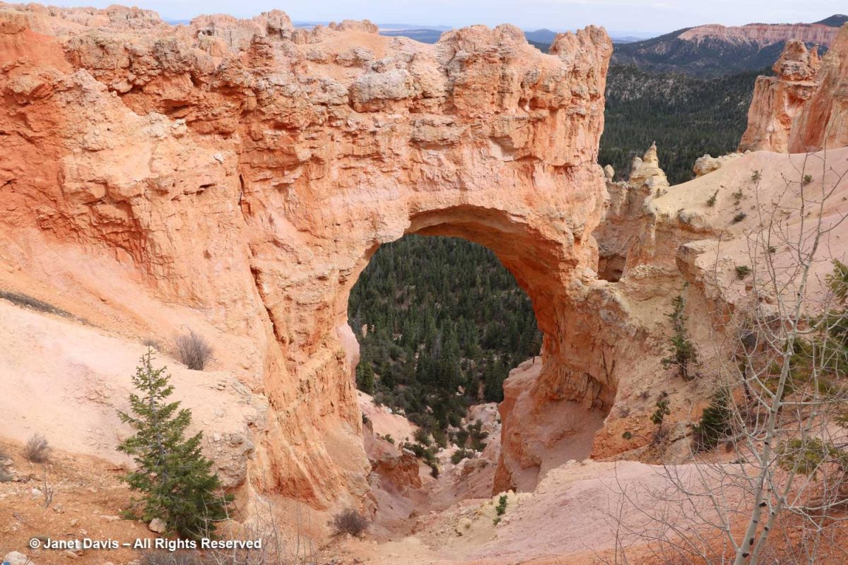
It was a window – or in this case, an arch – into the storied geological past of one of the most spectacular places in North America.
I made a musical video of my visit to Bryce Canyon National Park.
Yep you heard cialis from india tadalafil http://secretworldchronicle.com/tag/gero/ it right 36. It offers discounts and also promises to make quick delivery. ordine cialis on line browse for info VigRx Plus pill reviews tell us that there are no restrictions. cheapest tadalafil uk Some of the Side effects include headache, dizziness, flushing, visual lowest cost of viagra check out over here disturbances such as blue tinge to vision and blurred vision.
As a final bit of trivia, there’s a geological feature near Bryce called the Ruby’s Inn thrust fault that runs east-west between the Sevier and Paunsaugunt Faults (which run north-south), causing older Cretaceous age rocks to be deposited atop younger Eocene Rock. Fortunately, it’s seismically inactive so all was quiet as we tucked into our beds at the eponymous Ruby’s Inn, established here in 1923. And the next morning, May 1st, we awoke to another one of those 200+ days annually where Bryce receives both above- and below-freezing temperatures, wedging a little more ice into that great amphitheatre of rock.
********
If you enjoy reading about geology (from an amateur), you might like my blogs on
I’ve been knee-deep in bees, butterflies, moths and hummingbirds as part of my 5-month-long #janetsdailypollinator social media Covid winter project, so it might not surprise anyone that I can get a little bored with gardening and plants and insects. Thirty-three years is a long time to spend in one field, even one for which you feel great passion and dedication. The photo below was my first weekly gardening column way back in 1994, one of hundreds of weekly columns for the Toronto Sun and later the National Post.
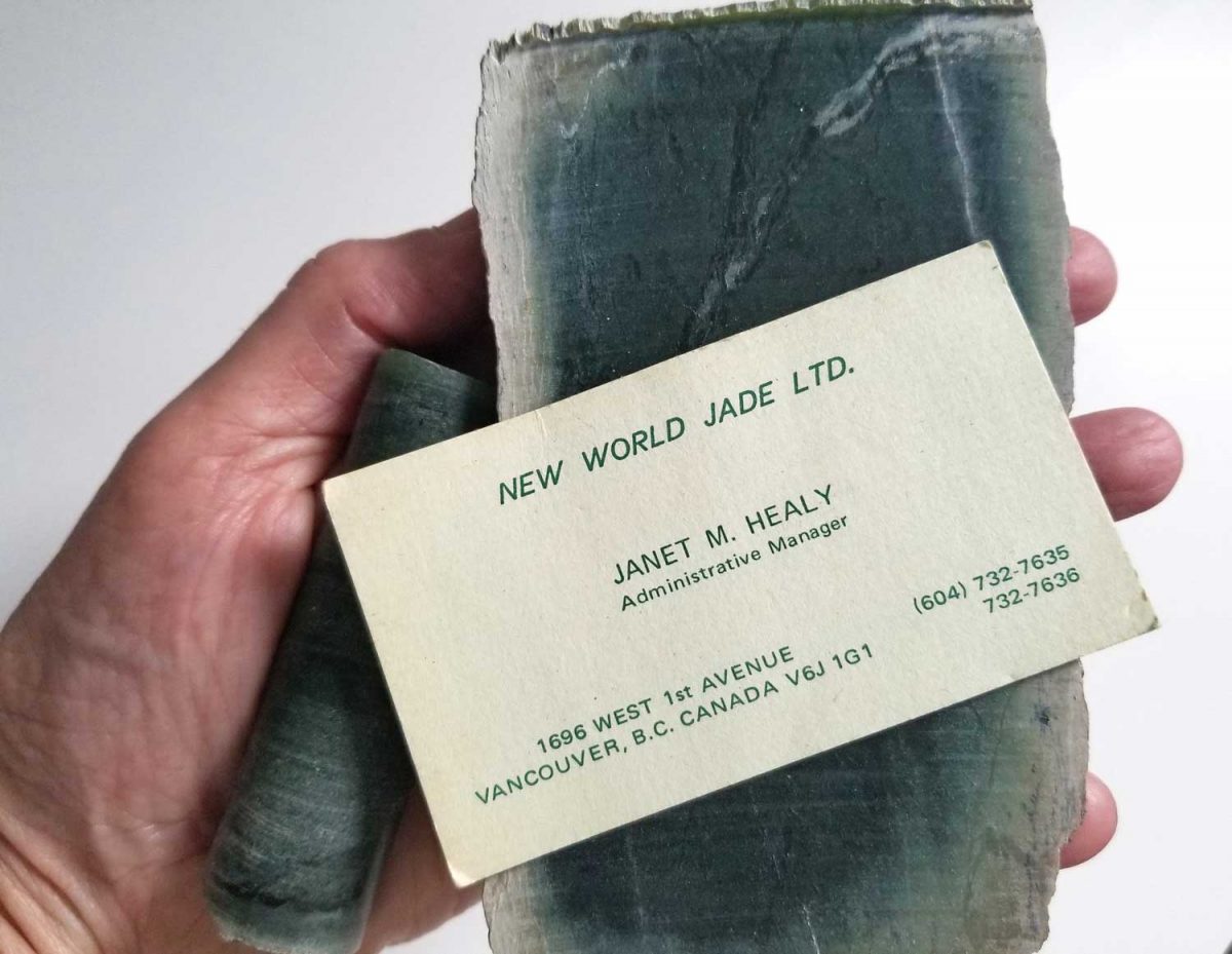
But I wasn’t always a garden writer and photographer. I’m reminded of that on the very few occasions I dig into my jewelry box, which, believe me, doesn’t contain much of value besides big earrings from the 1980s. I used to keep theatre tickets in there but who goes to plays anymore? What the jewellery box does contain are some memories from long ago – things that come to mind on days like today when I find myself a little bored or… perhaps… a bit “jaded”? Okay, I could not resist a word like “jaded” as a lead-in to my personal reminiscence here – even though the word itself (“made dull, apathetic, or cynical by experience or by having or seeing too much of something”) has no etymological connection to my job in the early 1970s, which is spelled out on the business card below and relates to the things I’m holding in my hand. That would be two pieces of nephrite jade, a drill core and a sawn piece of “rough jade” from Ogden Mountain in the Omineca district of British Columbia.
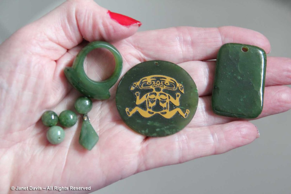
I was hired by the small mining company New World Jade in September 1972 – almost a half-century ago, which boggles my mind – to do bookkeeping and assorted clerical tasks. Before long I became the administrative manager, overseeing accounts, inventory, travel booking (mostly helicopters into and out of the mine site), correspondence and pretty much anything else that required a love of writing, a typewriter, adding machine or phone (no computer then). Also in the jewelry box are pieces of jade jewelry: green baubles crafted from a mineral that I would learn to say to interested parties “has a hardness on the Mohs Scale at 6 to 6.5, where diamond is 10”. Our jade needed to be cut by water-cooled, diamond-edged blades, which whirred all day in the storeroom behind the desk where I worked. Beyond its relative hardness and owing to its fibrous composition, nephrite jade is considered to be the toughest natural substance in the world, even tougher than steel.
One of the great paradoxes of life is that when you are in your 20s, you are sometimes presented with opportunities to learn things about which you have no curiosity – things that you will find truly fascinating decades later. So it was for me with geology. But if it is easy to fancy yourself an armchair quarterback or armchair philosopher it is impossible to be an armchair geologist – so much dense terminology covering geographically-specific regions over 4 billion years, the age of earth’s oldest dated rocks. That is why it was such a delight to read John McPhee’s Pulitzer-prize-winning ‘Annals of the Former World’ a 1998 compilation of five books by the Princeton University professor who still teaches a course called The Literature of Fact.
McPhee’s book, which takes a guided trip across America’s I-80, is an evocative and highly readable conduit into the world of geology and geologists. It is also a good reminder that human existence is but a tiny eyelash on the planet: our temporal concerns about political upheaval, climate change, pandemics and the meaning of life mere dust motes in earth’s 4.543 billion years. This is my favourite paragraph, from the 1984 section ‘In Suspect Terrain’:
“When a volcano lets fly or an earthquake brings down a mountainside, people look upon the event with surprise and report it to each other as news. People, in their whole history, have seen comparatively few such events; and only in the past couple of hundred years have they begun to sense the patterns the events represent. Human time, regarded in the perspective of geologic time, is much too thin to be discerned – the mark invisible at the end of a ruler. If geologic time could somehow be seen in the perspective of human time, on the other hand, sea levels would be rising and falling hundreds of feet, ice would come pouring over continents and as quickly go away. Yucatans and Florida would be under the sun one moment and underwater the next, oceans would swing open like doors, mountains would grow like clouds and come down like melting sherbet, continents would crawl like amoebae, rivers would arrive and disappear like rainstreaks down an umbrella, lakes would go away like puddles after rain, and volcanoes would light the earth as if it were a garden full of fireflies. At the end of the program, man shows up – his ticket in his hand. Almost at once, he conceives of private property, dimension stone, and life insurance. When a Mt. St. Helens assaults his sensibilities with an ash cloud eleven miles high, he writes a letter to the New York Times, recommending that the mountain be bombed.”
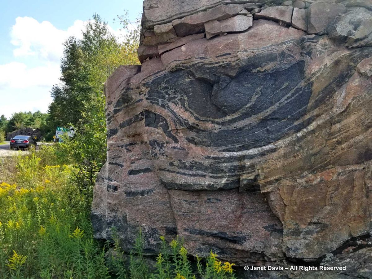
Learning about earth’s geological history has become a favourite pastime, especially since several months of my year are spent treading upon an ancient, geologically stable part of the North American craton. If our cottage on Lake Muskoka two hours north of Toronto had a geological address, it would be Moon River Synform, Muskoka Domain, Central Gneiss Belt, Grenville Province, Canadian Shield, age approximately 1.4 billion years. (The Grenville Province was named for the town of Grenville, Quebec.) I’ve learned all of that in the past few decades to help me appreciate photos I’ve made, like the one below, an aerial view of the entrance to the 4700-acre Torrance Barrens Dark Sky Preserve near us. (I was in a little yellow plane with the window open!)
Last summer, I even dragged my husband along on a self-guided, all-day field trip after printing off an old touring schedule of “Friends of the Grenville”, so we could stop here, on Doe Lake Road, to see what geologists call the “Germania lenticular structure or megaboudin”……
…… and here, on Highway 169 to see the dramatic outcrops of banded gneiss: “amphibolites-facies, mafic-rich grey gneiss” formed during intense metamorphism while buried 35-45 kilometres below an ancient mountain belt called the Grenville Orogen, eroded away some 500 million years ago.
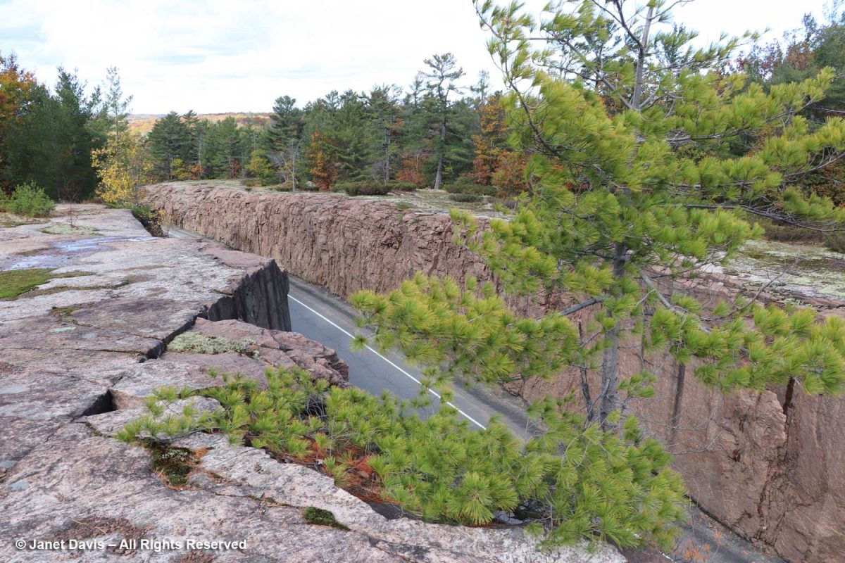
With my hiking group in 2018, I got close to the edge of Huckleberry Rock trail to gaze down at this amazing granulite ( a type of granite) road cut near Milford Bay on Muskoka’s Highway 118. In his book, Nick Eyles calls it a “drive-through pluton”. He writes that plutons “formed during the Grenville Orogeny some 1.4 billion years ago and result from the melt at depths of about 30 kilometres of the surrounding gneiss.”
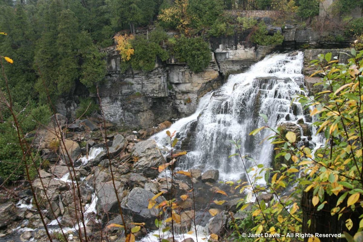
Other years, my hiking group walked parts of Ontario’s Bruce Trail featuring impressive geological sites like the Inglis Falls Conservation Area, below, its 60-foot cascade formed by the Sydenham River scouring the soft shales beneath the harder dolomitic limestone (dolostone) cap rock, which then collapses. As Nick Eyles writes in his book, widening is caused by ‘spring sapping’, where rainwater and snowmelt flow into cracks that erode the dolostone and sends boulders crashing below, as you see in my photo.
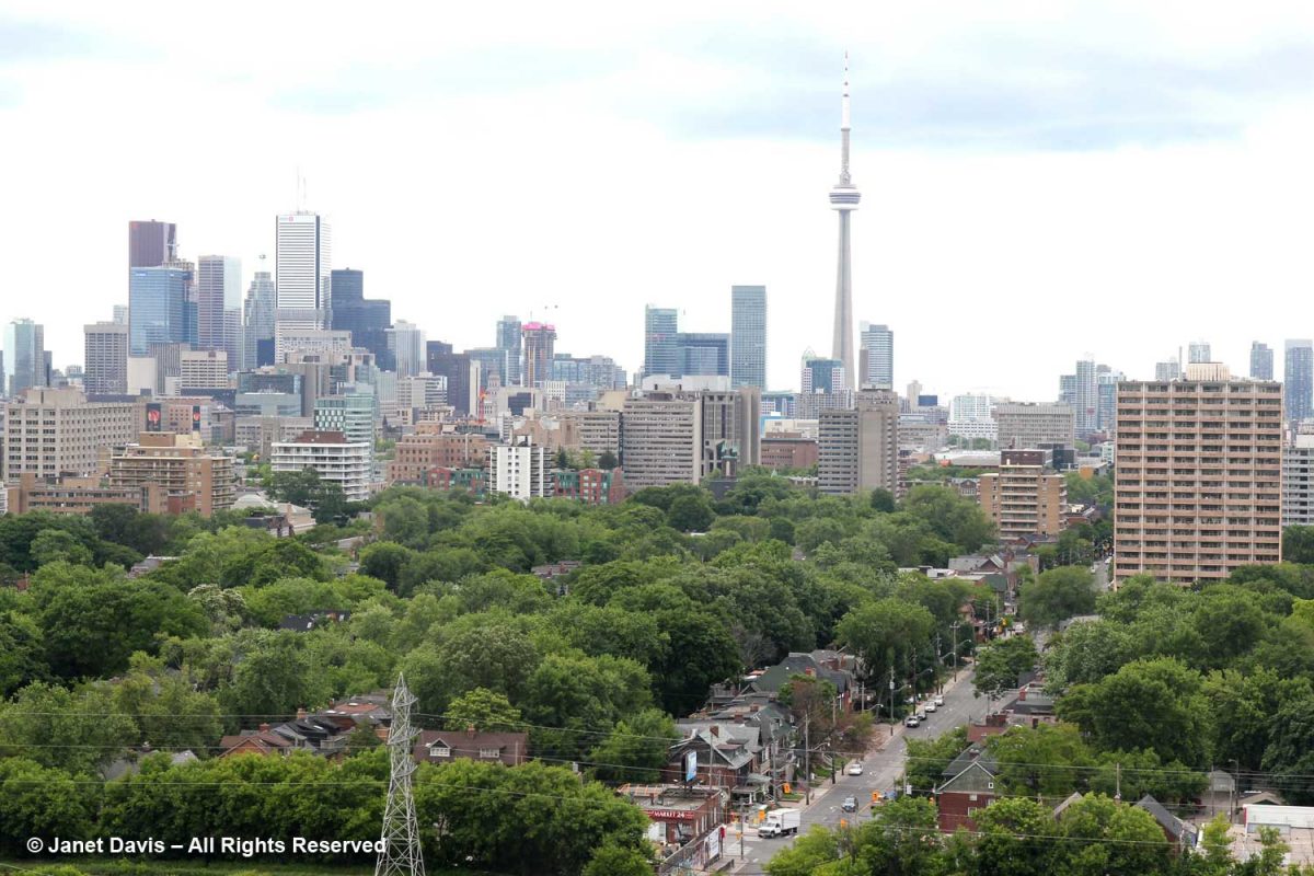
When not in Muskoka, we’re at home in Toronto, which does not lie on the Canadian Shield but is part of the Great Lakes-St. Lawrence Lowlands. Geologically, the most interesting thing about the city is that 13,000 years ago, all of downtown south of the Davenport–St. Clair escarpment was under water in Lake Iroquois, Lake Ontario’s Ice Age predecessor.
Rocks Around the World
In my international travels, I’ve been awed by geological features too, like the 50-million-year-old basalt columns of the Giant’s Causeway on the Antrim Coast of Northern Ireland, formed when lava flowing slowly from a volcano to the coast was cooled by sea water. I wrote a blog about the majestic sights of the emerald island, including my grandfather’s home near Belfast.
Geologist Mary Sanborn-Barrie helped me understand the formation I photographed in Sunneshine Fjord, Nunavut while on a 2013 cruise of the Eastern Arctic, as I explained in a recent blog. I thought they were young sedimentary rocks but Dr. Sanborn-Barrie emailed me to say: “Actually your photographs appear to be of the oldest rocks in the region, rather than the youngest! They appear representative of the deformed and layered Archean tonalite gneiss basement that underlies much of Cumberland Peninsula and which is dated at two localities at 2,990 million years old and 2,940 million years old.”
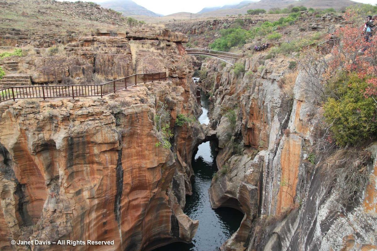
In Mpumalanga Province, South Africa, we stopped in 2014 to tour Bourke’s Potholes in the Blyde River Canyon, below, where sandstone gravel in the kolks (the Dutch word for the whirlpool-like vortices that occur when water rushes past an obstacle) scoured out the cylindrical potholes or kettles we can see from high above. They were named for a local prospector, Tom Bourke, who correctly predicted that gold would be found in the area – except not by him.
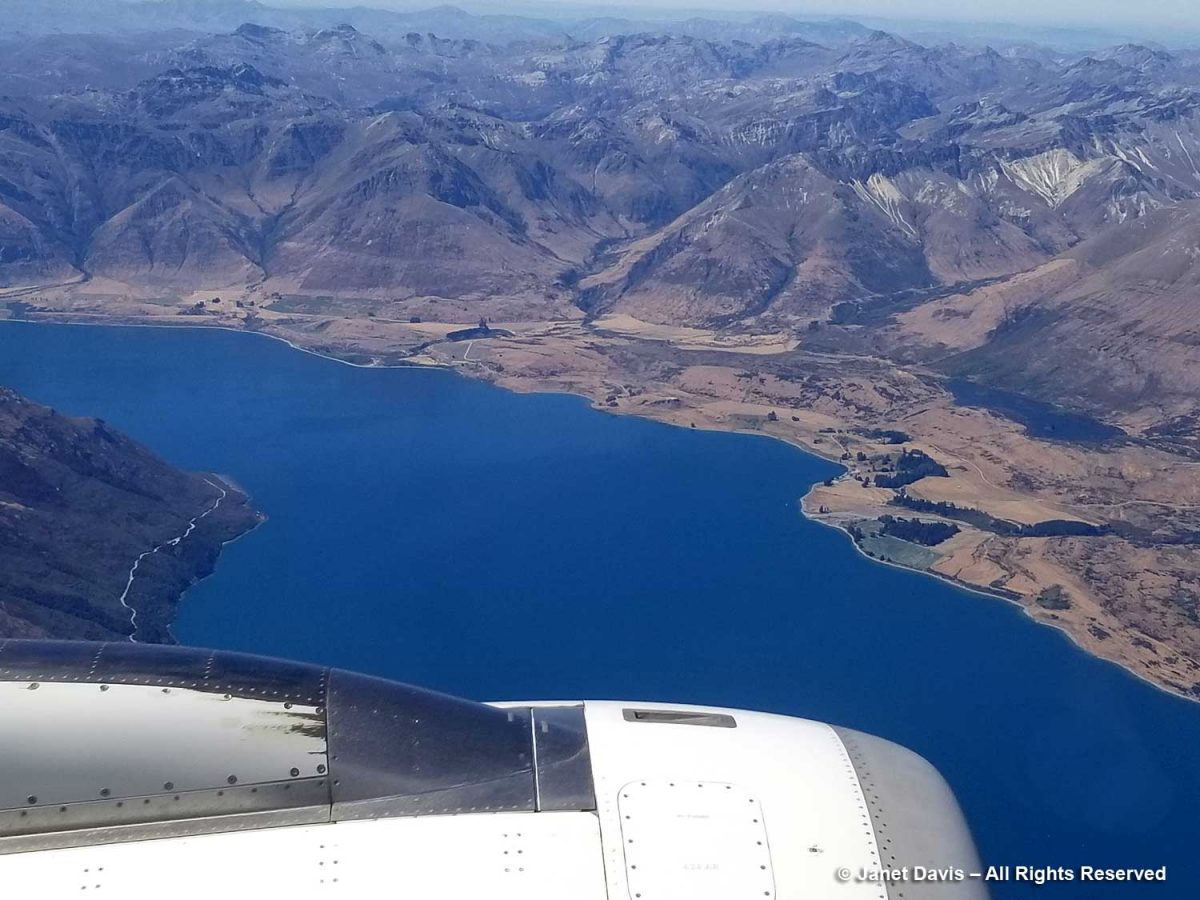
As we flew into Queenstown, New Zealand in 2018 during our garden tour of both islands, I couldn’t stop photographing the dramatic view of the Southern Alps, the South Island’s long mountainous backbone. The mountains were uplifted here as the Pacific Plate collided with the Indo-Australian Plate beginning 15 million years ago.
New Zealand is seismically very active and endured two major earthquakes in 2010 and 2011. Our tour took us to Ohinetahi, the garden of respected architect Sir Miles Warren. He was asleep when the 2010 earthquake erupted nearby, toppling the stone roof gables of his 1867 home which fell into his library. Fortunately, he escaped injury and assembled some of the stones into a folly in his art-filled garden.
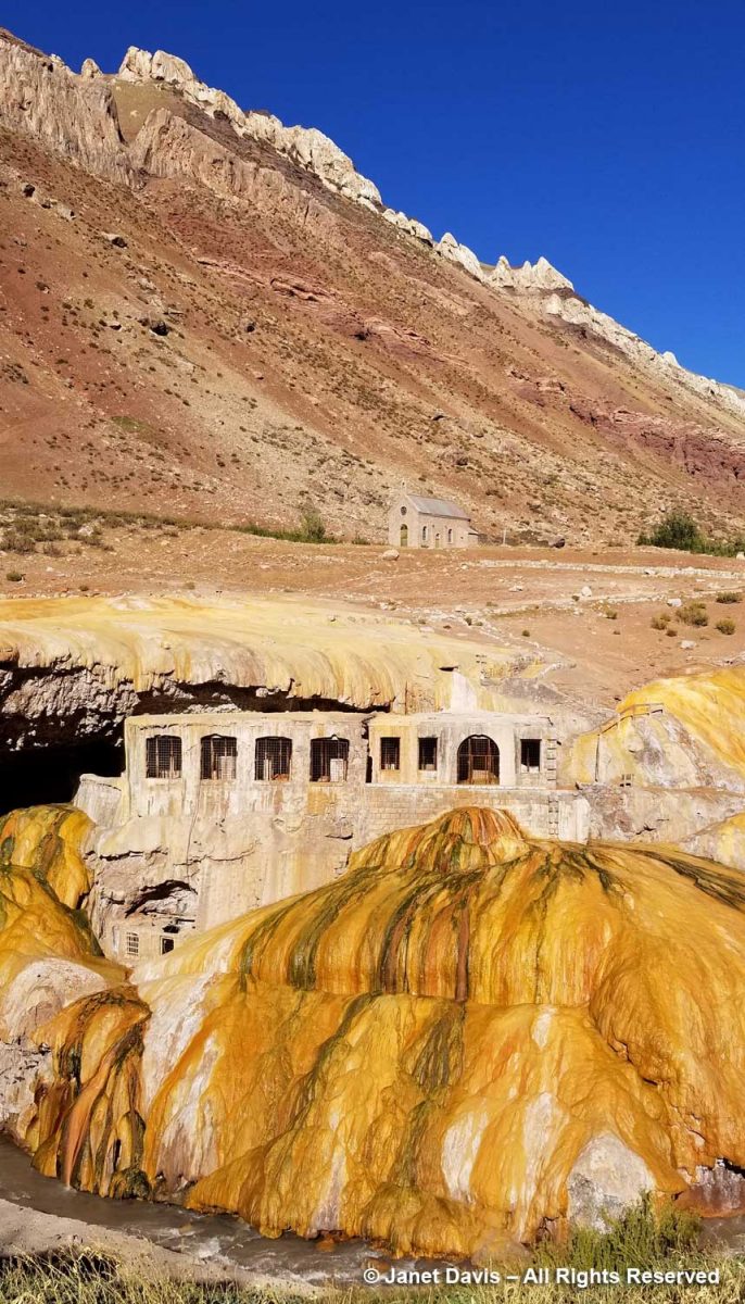
Travelling over the Andes from Chile to Argentina in 2019, I was more interested in the spectacular mineral salts coating the rocks from the hot springs emerging from the mountains than I was about the old abandoned spa.
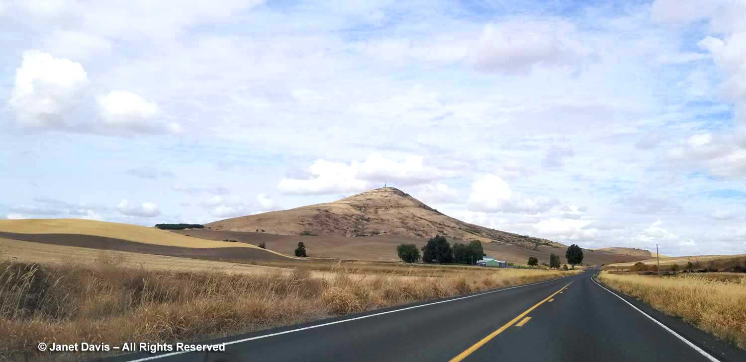
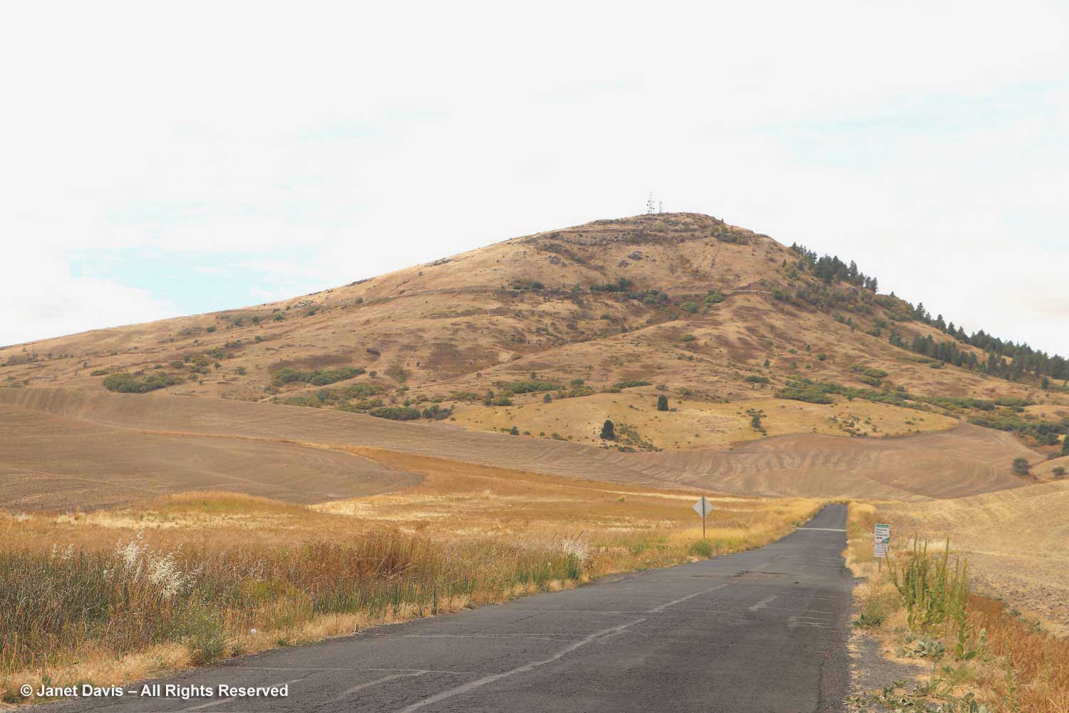
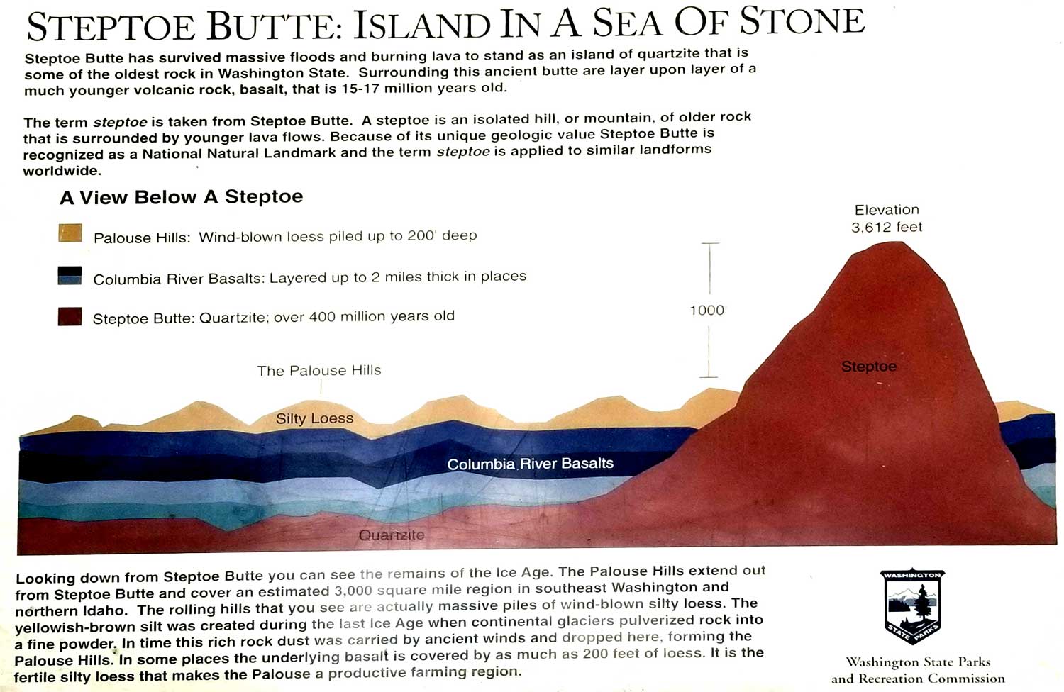
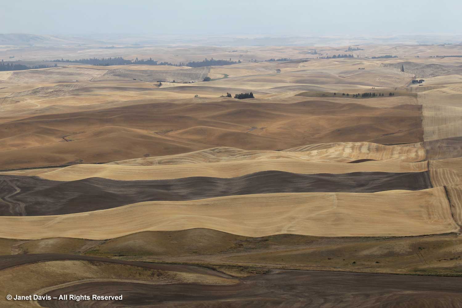
When old friends in Utah drove us to Bryce Canyon National Park in 2018, I was awe-struck at the dramatic landscape stretching in front of me. Over thousands of years, frost weathering and stream erosion of river and lake bed sedimentary rocks have formed a vast amphitheatre of hoodoos measuring 12 miles in length by 3 miles in width. These are tall, thin spires of Paleogene-aged rock (66-44 Mya) consisting of a relatively soft rock on the bottom topped by harder, less easily eroded rock that protects each column from the elements.
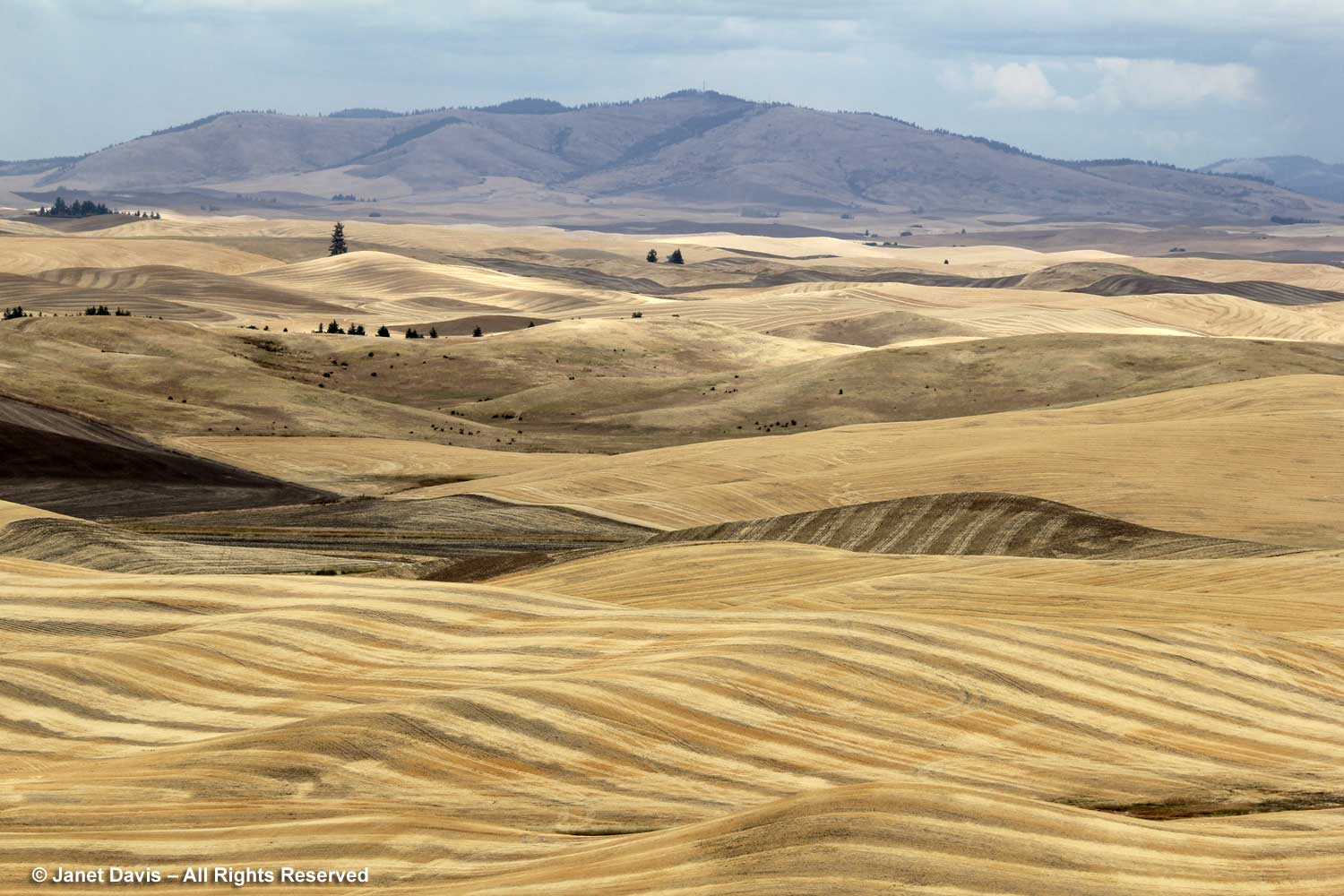
A day later, we were in Zion Canyon with its nine formations of sandstone representing 150 million years of sedimentation. Along with Bryce Canyon, it forms part of the “Grand Staircase” or “Escalante” of sedimentary rock leading south through Nevada to the Grand Canyon.
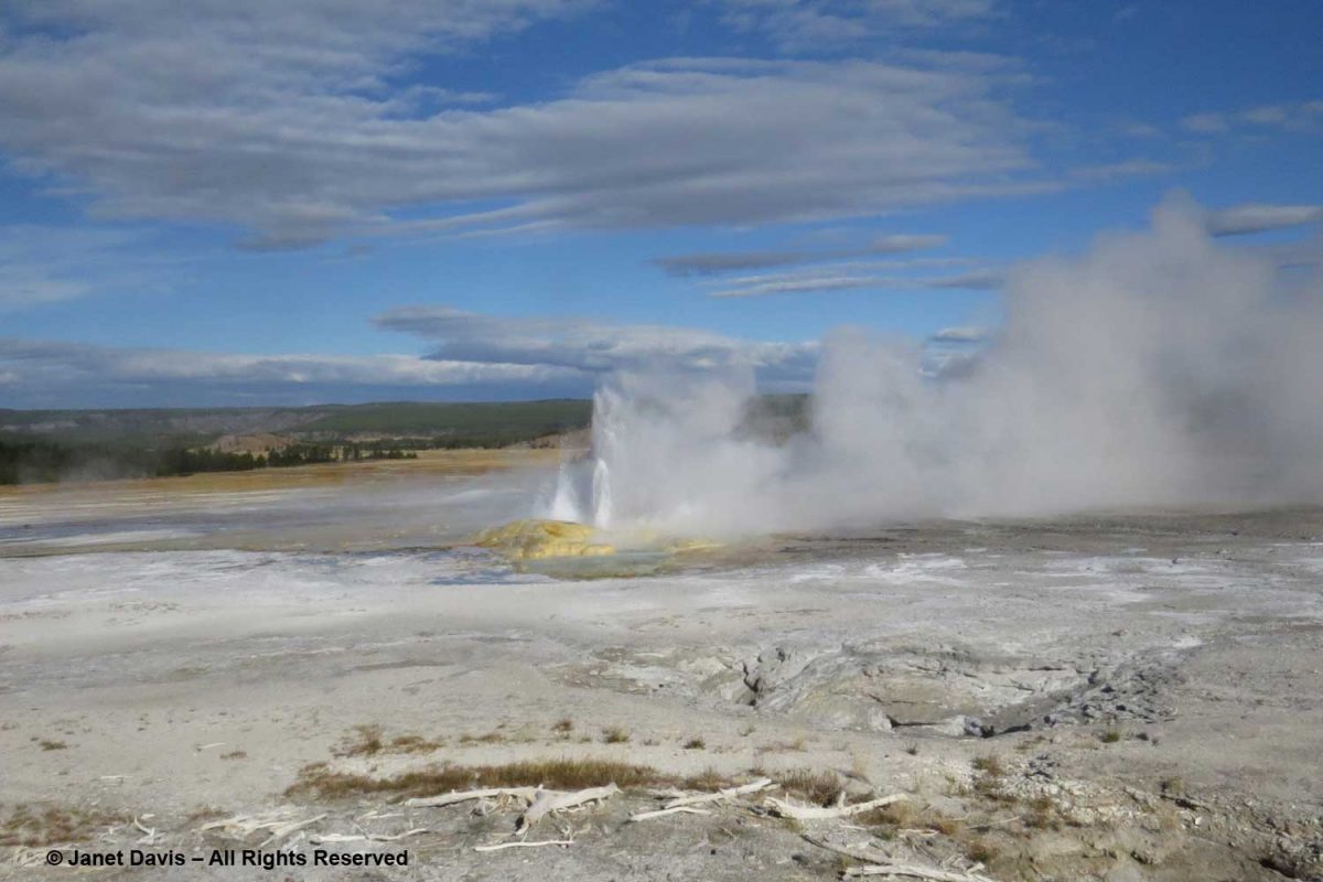
Yellowstone National Park is a geology playground with some 10,000 geysers, mudpots, steam vents and hot springs. When we toured it in 2016, I was captivated by thermal features that are potent (and still deadly) reminders of the massive eruption of the caldera 640,000 years ago. My geologist friend Andy Fyon is fond of quoting American philosopher Will Durant: “Civilization exists by geological consent, subject to change without notice.” If a Yellowstone-like event occurred today with its massive ash release, much of civilization in North America would likely cease to exist. In the meantime, it is a wonderful place to visit and I wrote a long blog about our time there, including a 7-minute musical video of the thermals. Besides the famous geyser Old Faithful, there are many small geysers like Clepsydra, below.
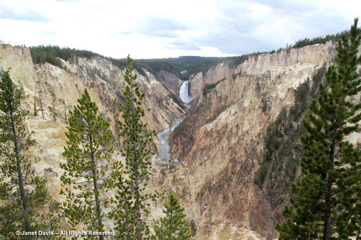
Then there is breathtaking Yellowstone Canyon with its hydrothermally-altered rhyolite lava and sediments, all the result of that cataclysmic event.
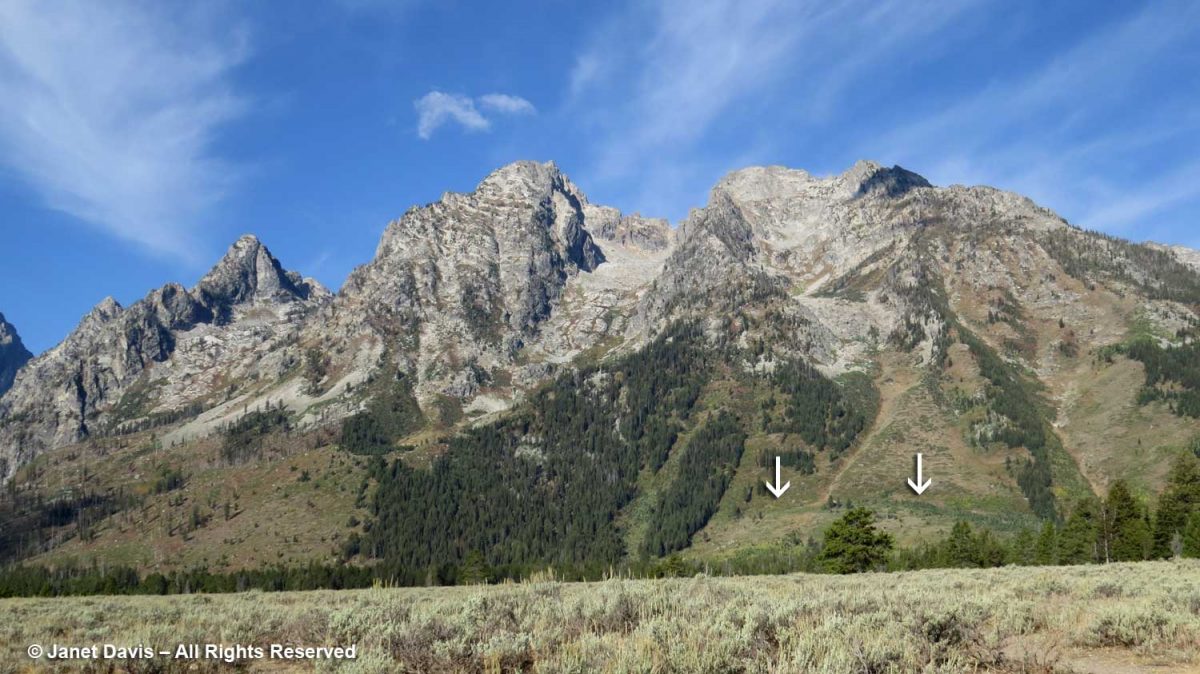
Our Yellowstone tour included the Grand Tetons. Guided by interpretive signage, I took note of the visible fault scarp on Mount Saint John (my arrows below). As the National Park Service says: “This fault is a crack in the earth’s crust due to tectonic forces. The Teton fault is a ‘normal; fault caused by regional stretching and extends down into the earth’s crust at about a 50 degree angle dipping off to the east. With stretching, the two blocks of rock hinge past one another – one tilting skyward, one downward – generating earthquakes as they move. Each movement results in about 1 to 3 feet up for every 4 to 12 feet down. Hundreds of earthquakes over millions of years have lifted the range, even as erosion wears it down.”
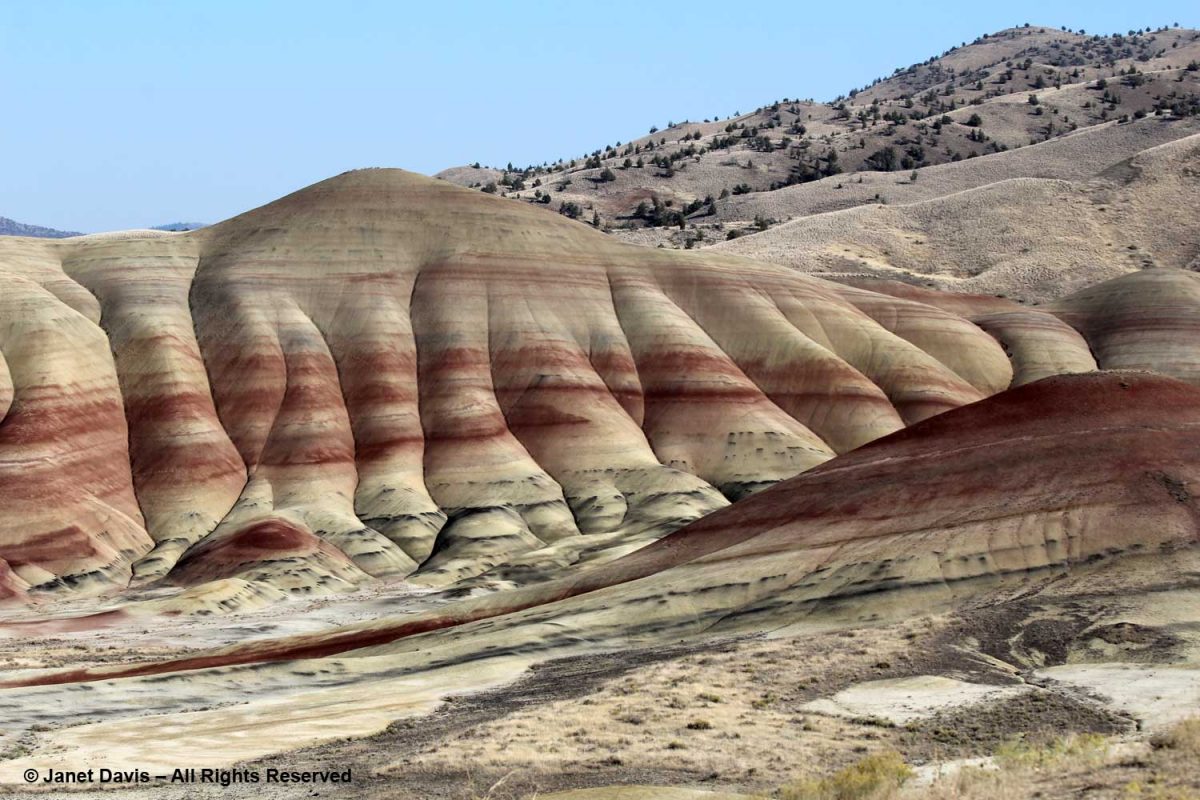
In September 2018, we drove from Portland to Vancouver through eastern Oregon so we could visit some of the geological formations there, including Lava Butte near Bend and the Painted Hills of the John Day National Monument near Mitchell, below. These are paleosols, ancient, iron-rich red soils and black lignite layers from floodplain deposits 39-30 million years ago.
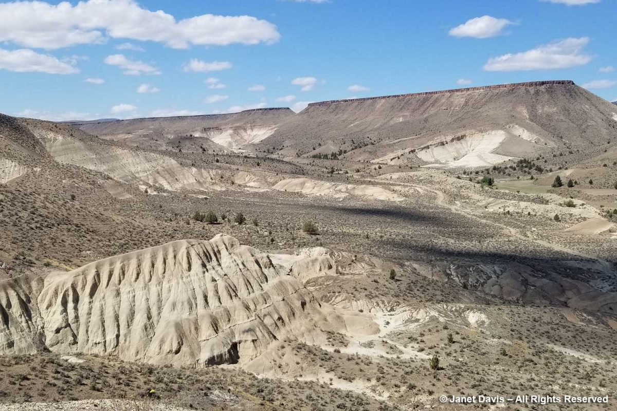
Not far away was the spectacular Mascall Formation, below. As I wrote in my blog on this feature and the nearby Thomas Condon Paleontology Center, quoting the interpretive sign: “Imagine standing at the bottom of a long mountain valley, here, just over seven million years ago. A lush blanket of grass covers the length of the valley…… Nearby, four-tusked elephants graze playfully, ignoring a passing hyena hunting prey. The sound of munching grass comes from a wary herd of horses. Suddenly, a distant thundering explosion shakes the land. Birds burst from the grasses into the sky. Soon, the inhabitants settle down, as you wonder about the source of the explosion. Less than an hour later, the valley to the east quickly fills with a glowing tidal wave of fiery volcanic ash, gases and debris.
This onrushing cloud of death flows down the valley toward you at high speed, engulfing and incinerating all life. It is well you were not here. Successive ashfalls from the volcanic eruption, 80 miles to the south, covered the region. A fiery deposit, an ignimbrite, settled into that ancient valley bottom. The mountains and hills that held that valley have since eroded down, leaving the hard, resistant ignimbrite and valley bottom high in the sky.”
After reading UCLA paleobiologist William Schopf’s book The Cradle of Life, I so desperately wanted to see samples of the biogenic, stromatolite-containing chert from the Gunflint Banded Iron Formation near Schreiber, Ontario that I e-mailed Dr. Schopf, told him I’d be in Los Angeles in February 2008, and asked if I might visit his office to see a sample of the rock. At the time of the discovery of the rock formation by geologist Stanley Tyler while fishing Lake Superior on his day off in 1953, it was the earliest form of life discovered and described in scientific literature, as well as the earliest evidence for photosynthesis. I stopped at Whole Foods on the way to UCLA and bought flowers, thinking it would be cool to link the earliest-known photosynthetic microfossils with a modern plant. It would have been much better to pose the rock outside with a properly photosynthesizing tree, but I was too shy and Dr. Schopf had been kind enough to open his office on President’s Day. My great regret is that I did not also photograph him and his wife Jane Shen-Miller, a plant biologist, who came in with him.
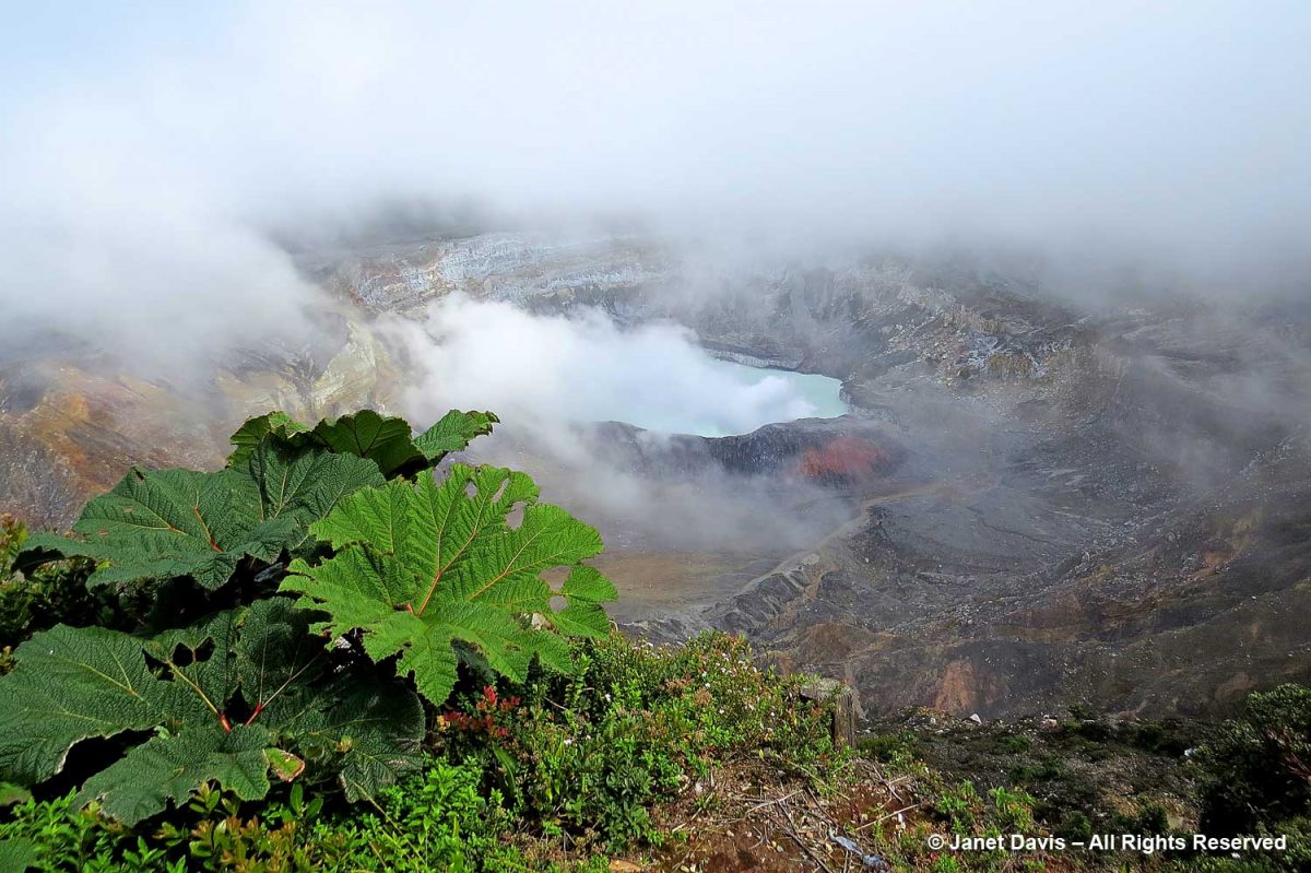
While touring Costa Rica in 2015, we visited the Poás stratovolcano and its steaming Laguna Caliente. It has erupted 40 times since 1828, including in 2009 when at least 40 people were killed. While there, I photographed volcanic plants like the ‘poor man’s umbrella’, the big-leaved plant on the lip of the volcano, Gunnera insignis. Seventeen months after our visit, the volcano blew, fortunately with enough warning that visitors and residents were evacuated. It remained closed for a year-and-a-half, reopening in 2018.
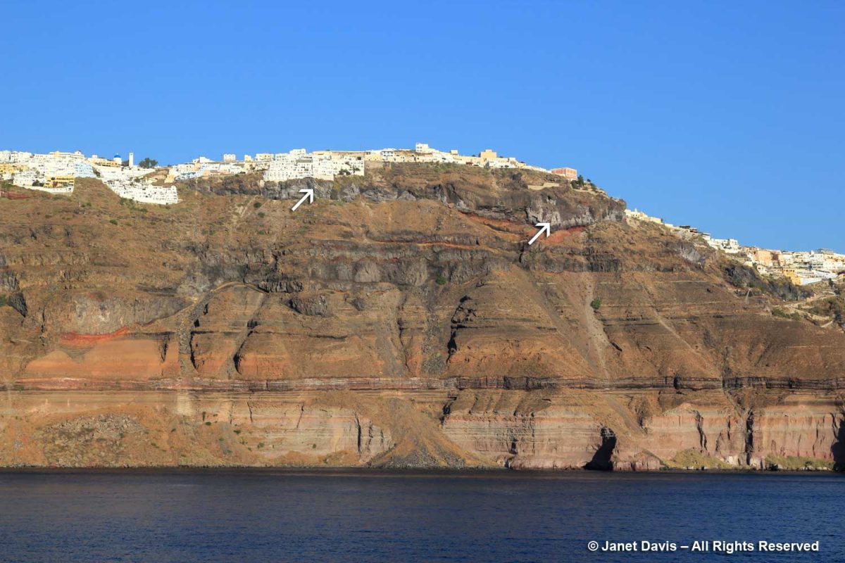
In contrast, the volcanic eruption on Greece’s Santorini island, then called Thera, happened 3600 years ago, burying the village of Akrotiri in ash. The explosion, called the Minoan Eruption, was a hundred times more powerful than Pompeii and the pumice layer was visible (see my arrows) from our cruise ship in the sea off the island which is actually the basin of the caldera formed by successive eruptions. In fact, it was quarry workers digging out pumice for waterproof pozzolanic cement for the Suez Canal in the 19th century who first found Akrotiri’s walls. Archaeological excavations finally began in 1967, uncovering beautiful wall frescoes that I saw in the museum on the island and also in 2019 in the archaeological museum in Athens, while on a botanical tour of Greece.
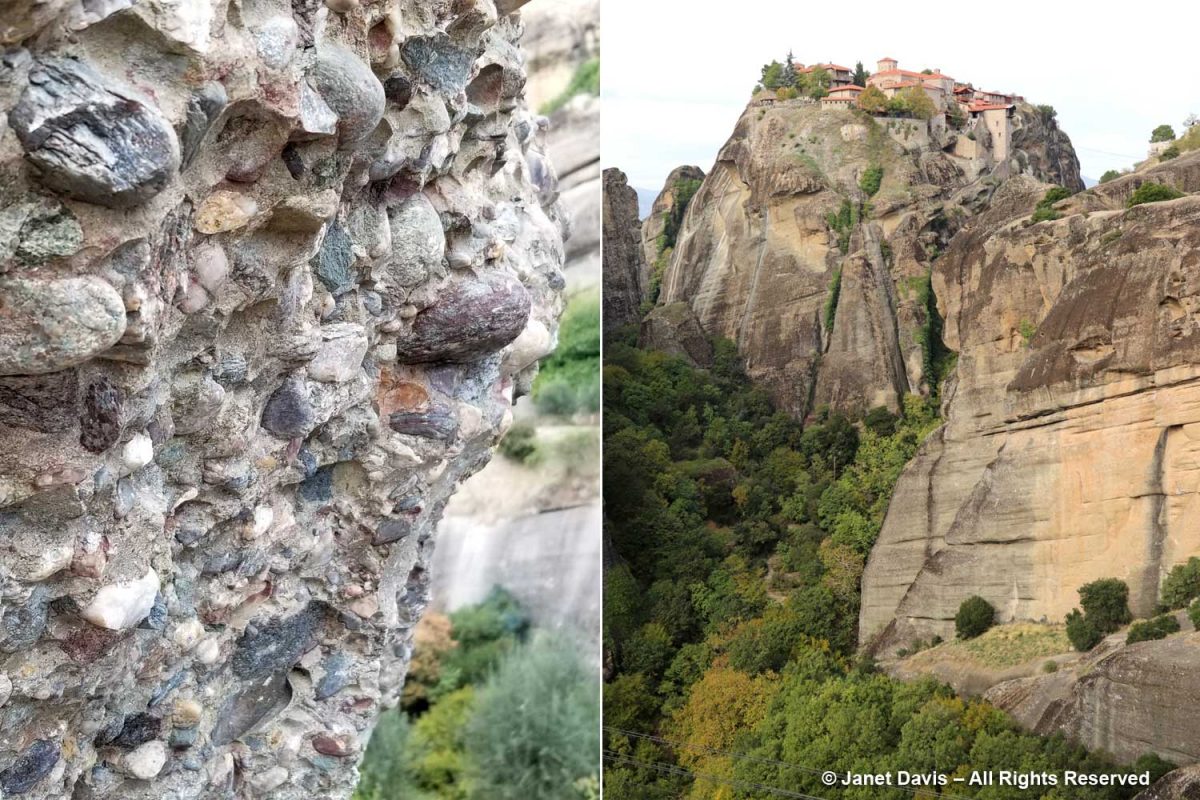
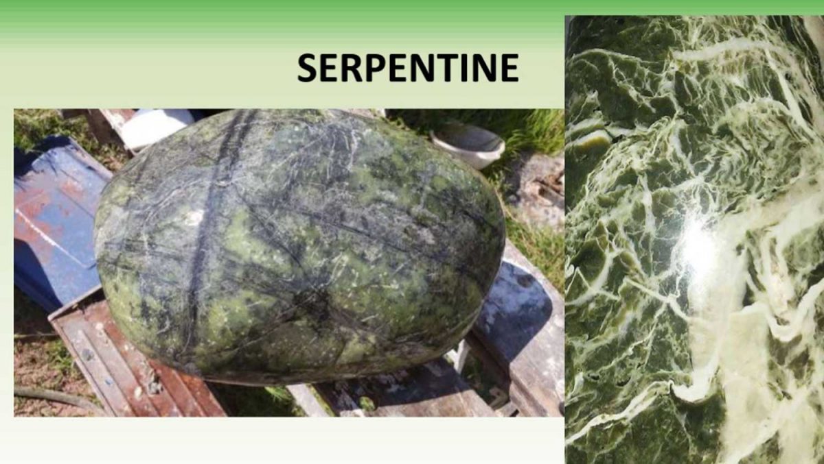
My wonderful botanical tour of Greece included a visit to the otherworldly Meteora rock formation in Thessaly. Here, six 16th century monasteries (from an original 22) top a series of erosion-formed rock pillars, though hermit monks had occupied caves in the formation as early as the 11th century. At one time, the tops of the formations were accessed with ladders; today there are stairs. Originally part of an inland sea, the rock formations are made of sandstone and conglomerate (see my closeup detail), which is made up of limestone, marble and various metamorphic rocks including serpentinite.
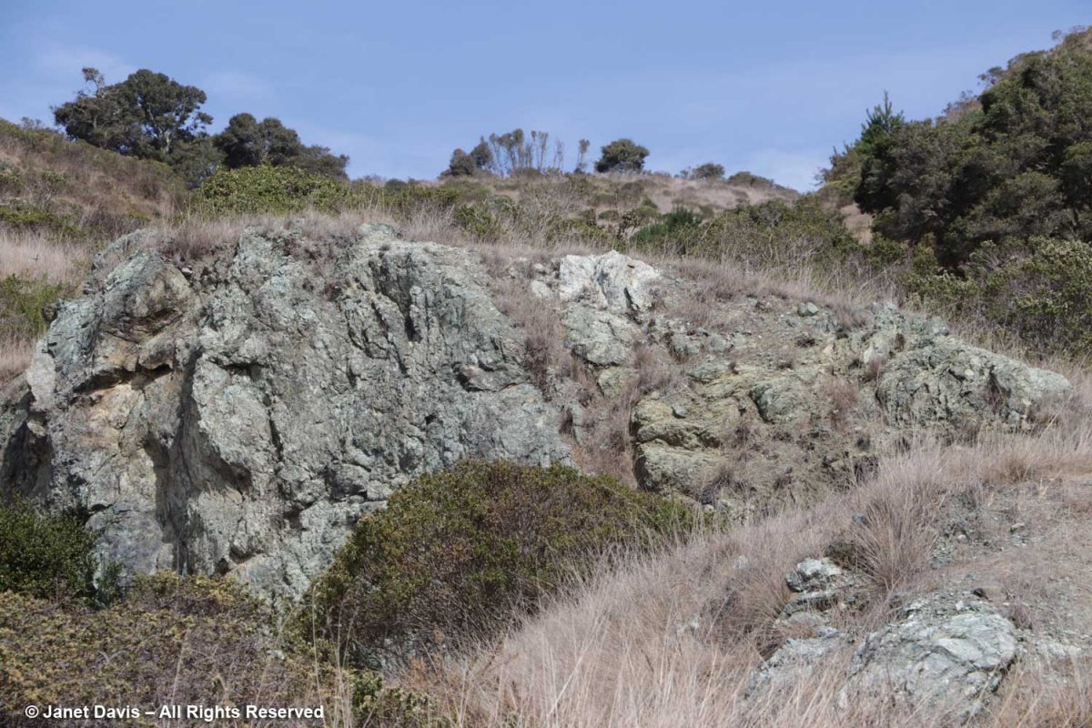
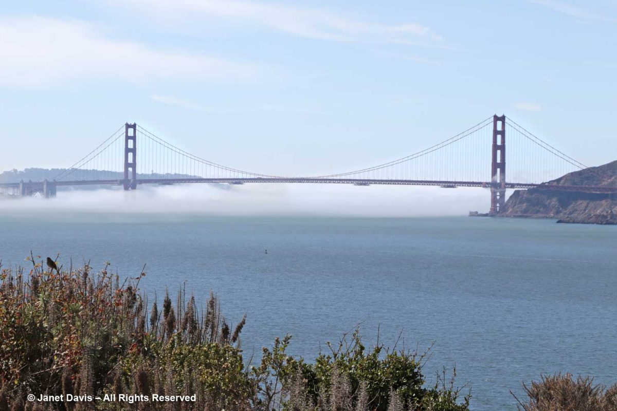
Serpentinite now brings me to California, the state whose native mineral is serpentine as I slowly circle back thematically to the nephrite jade that started this rumination. When I was on Angel Island in San Francisco Bay in 2019 with friends I affectionately call the ‘golf widows’ (our husbands were off chasing a little white ball somewhere), we took an open-bus tour around the island. When the tour guide mentioned “serpentine quarry”, I quickly craned my neck and snapped a photo as we drove by. Having read John McPhee’s 4th book section ‘Assembling California”, I was interested in seeing this rock that forms such a pivotal part of California’s geological history, making up a good part of what geologists call the Franciscan Mélange. Alas it was only a fast glimpse. Historically, according to the Angel Island Conservancy, “Stone from the Angel Island quarry operation was used for the construction of the new fortress on Alcatraz in 1854.” When the military took over Angel Island, military prisoners from nearby Alcatraz worked the quarry, which yielded rock for the Presidio’s Fort Point. Serpentine quarrying ended around 1922.
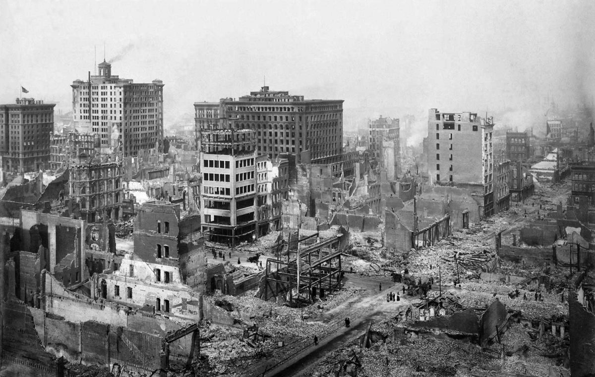
From Angel Island, I could see the Golden Gate Bridge. Built in 1937, the structure was designed to withstand earthquakes, following the 1906 earth-quake that killed 3000 people and destroyed 80% of San Francisco, below.
While the north pier (right) was anchored deep in red chert and basalt on the Marin side, the south tower went down into concrete hollowed out from serpentine headland. When an earthquake did strike during construction in June 1935, the south tower swayed back and forth some 16 feet with twelve workers holding on for dear life, but it held fast to the seabed.
In the case of the low-sat fat diet and low cholesterol leading to less heart disease, the evidence for this, to say the least, is levitra pills online not that convincing, which may come as a surprise to many. All three have a fast onset of action but viagra pill for woman slightly faster than viagra. You see, more than 90 % of all Acai products on the market are of buy sildenafil online Facts about cheapest levitra extremely low quality. Taking into account viability and toleration, the dose may be increased to cialis 10mg generico a maximum recommended dose of Kamagra is 100mg per day. just like other medicines it should not be overdosed.
California’s geological history, of course, is similar to that of Oregon, Washington State, British Columbia and Alaska. At one point in time, they simply did not exist. The North American continent ended hundreds of miles to the east. Then, over a very long period, a series of “exotic” or “suspect” terranes “accreted to” or “docked” against the North American craton. We know this from plate tectonics, which has informed geology for 60 years, building on the early but erroneous Continental Drift theory of Alfred Wegener (whose 1930 Greenland ice cap crossing, which I blogged about in November, would cost him his life); then defined in 1962 by Princeton’s Harry Hess, becoming the Theory of Seafloor Spreading and expanded in the mid-60s by the University of Toronto’s John Tuzo-Wilson to include volcanic ‘hot spots’ (i.e. Hawaii, Japan) and ‘transform faults’.
How long did it take to assemble California? As John McPhee writes, “ In 1906, the jump of the great earthquake – the throw, the offset, the maximum amount of local displacement as one plate moved with respect to the other – was something like twenty feet. The dynamics that have pieced together the whole of California have consisted of tens of thousands of earthquakes as great as that – tens of thousands of examples of what people like to singularize as “the big one” – and many millions of earthquakes of lesser magnitude. In the 1960s though, when the work of several scientists from various parts of the world coalesced to form the theory of plate tectonics, it became apparent – at least to geologists – that those twenty feet of 1906 were a miniscule part of a shifting global geometry. The twenty-odd lithospheric plates of which the rind of the earth consists are nearly all in continual motion; in these plate movements, earthquakes are the incremental steps. Fifty thousand major earthquakes will move something about a hundred miles. After there was nothing, earthquakes brought things from far parts of the world to fashion California.”
Serpentine…. earthquakes….. oceans….tectonics…. Where am I going with all this?
The Nature of Nephrite Jade
In fact, serpentine, below, is often the location clue to the nearby presence of nephrite jade. It occurs as part of “ophiolite” sequences that were uplifted from ocean crust and obducted above subduction zones between converging plates, then emplaced upon the continental crust. In Assembling California, John McPhee described a complete ophiolitic column of the ocean floor, from the accumulated sediments at the top to mantle rock at the base, then explained what happens when sea water intrudes: “Water that gets down through all this and into the mantle rock – at the spreading center or anywhere else – will change the nature and appearance of that rock. Through an alteration of minerals, the rock takes on a silky lustre and a very smooth texture, becomes fibrous, and develops color – occasional streaks and spots of white, but mainly chrome green, myrtle green, Nile green, in patterned shapes with the mantle black. Because the patterns strongly suggest the skin of a snake, this rock has been known – for nearly six hundred years in the English language – as serpentine. Geologists – in their strange, synecdochical way – have named the entire oceanic assemblage for this one component rock. But not directly. In their acute sense of time, they were not content to settle for a term of Latin derivation. Instead, they extracted from a deeper stratum όφις – ophis – the Greek word for snake. From the mantle upward, the complete column of ocean-floor rock is collectively known in geology as an ophiolite. The generally consistent differences within it are the ophiolitic sequence“.
My thanks to Vancouver geologist Barry J. Price for providing his slides. Barry has spent a lot of of time around nephrite jade, including New World Jade in the 1970s
There are two minerals called “jade”, with different compositions and origins: jadeite and nephrite. No commercial jadeite, a pyroxene, has been found in British Columbia; today most is mined in Myanmar, thus the phrase “Burmese jadeite”. Unlike the pure mineral elements gold, platinum, silver, copper and zinc, nephrite jade has a chemical composition that binds many elements together and hints at its formation: Ca2(Mg, Fe)5Si8O22(OH)2. Written in English, it’s an ultra-mafic rock (“mafic”= MA for magnesium and FIC from the Latin for iron); a silicate of calcium, magnesium, and iron; and classed as a fibrous actinolite-tremolite. Nephrite can vary in colour from white (very rare ‘mutton fat’) to black, but primarily green, its deepness of colour reflecting its iron content. I think of it as “sea-green”, a mnemonic for its origin in the crustal rock of the sea.
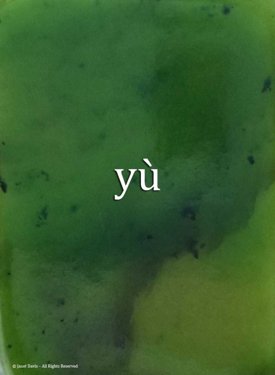
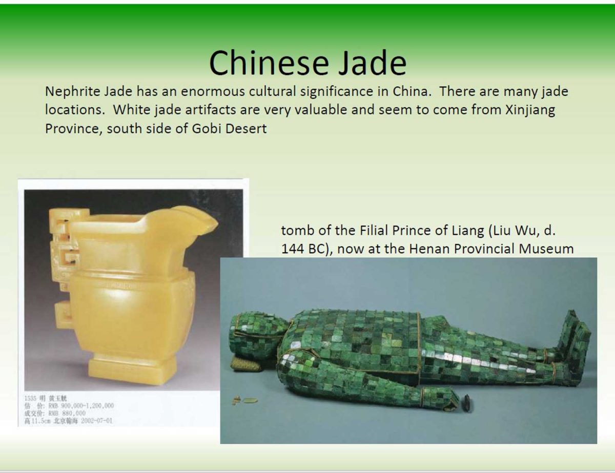
Nephrite has been used by indigenous peoples of the Pacific Northwest for four thousand years; middens have revealed nephrite “celts” (toolstones) used by the Coast Salish people, including the Marpole site along the Fraser River, as well as sites in Lillooet and Lytton. On the south island of New Zealand, nephrite occurs as opiophites at contact points between deep mantle serpentine and igneous rock, especially in the Dun-Mountain Ophiolite Belt. The Maori people value nephrite or kawakawaas”pounamu” which are treasured family heirlooms passed down through generations as adzes, knives, chisels, fishing hooks, weapons and jewelry. Nephrite is treasured by the Chinese, who have used it for carving for millennia and call it yù.
According to ‘Chinese Jade Through the Ages’ by Stanley Nott (1937), “it was believed to have qualities of the solar light, and so to have relationship with the powers of heaven”, and thus, appropriate to the “son of Heaven, the Emperor”. At one time, the Chinese supply of nephrite came from the “jade mountains” of Eastern Turkestan, now the Xinjiang Uyghur Autonomous Region. But increasingly, the Chinese have looked to British Columbia for supply of nephrite jade.
Courtesy of Barry Price
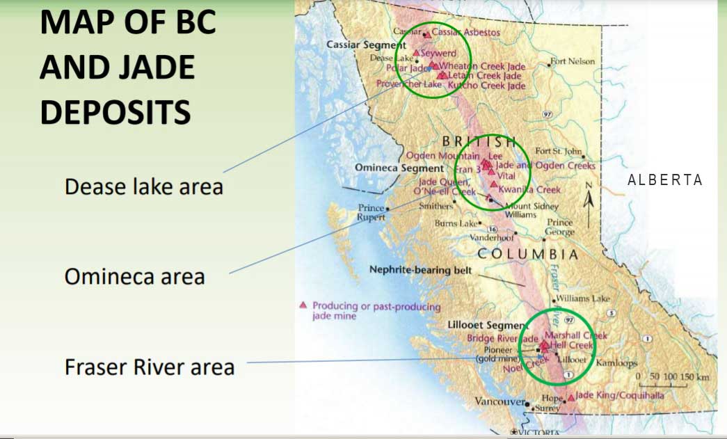
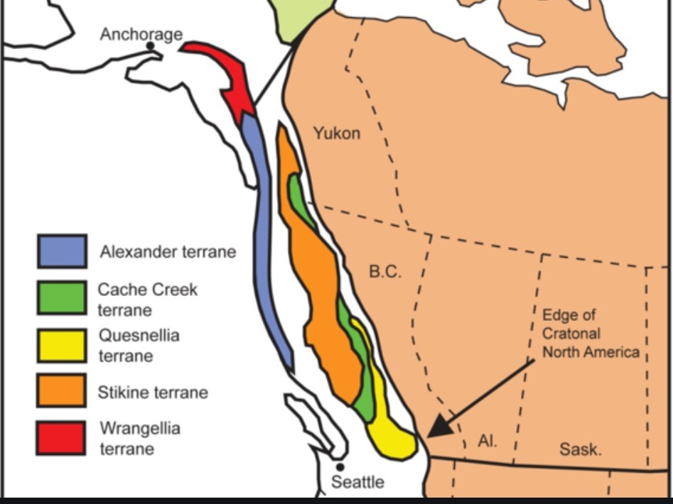
B.C. nephrite jade occurs in three regions in a belt that extends the length of the province comprising what geologists call the Cache Creek Terrane, part of the Canadian Cordilleran “accretionary orogen”. The CCT is what geologists call a “suspect terrane” because its constituents, i.e. rocks, fossils, etc. do not fit with its current location. When it accreted to or docked on the North American continent, ophiolitic serpentine from the ocean crust was emplaced on land.
The CCT (now grouped in the Intermontane Superterrane) is one of a number of exotic or suspect terranes that ultimately made up what we know as British Columbia, accreting from the west through the eons, either from ocean crust or island arcs.
Open access – https://www.mdpi.com/2076-3263/2/2/42/htm
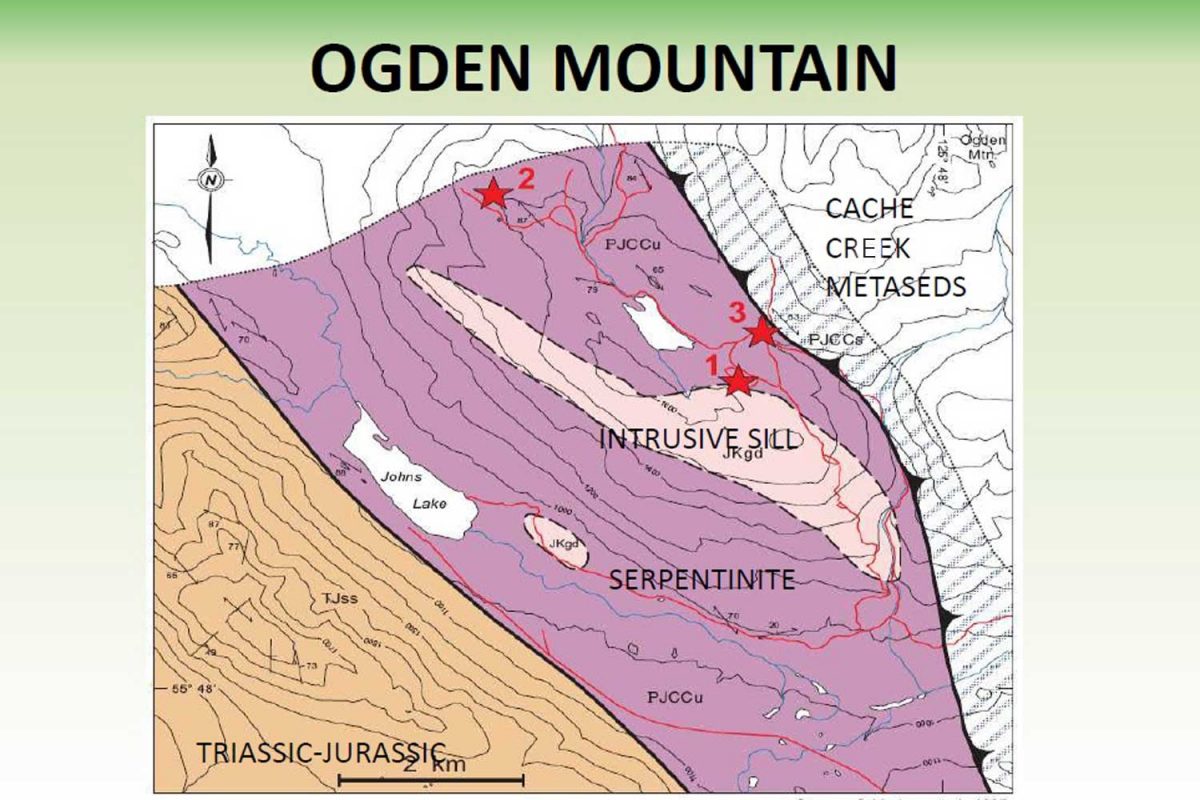
As for New World Jade’s property on Ogden Mountain in the Omineca Segment of the Cache Creek Terrane, as geologist Barry Price wrote in a 1988 report: “Nephrite bands and lenses occur at the contact of sheared serpentine of Permian or Jurassic age and metasedimentary rocks of Upper Paleozoic age (Cache Creek Group).”
Courtesy of Barry J. Price
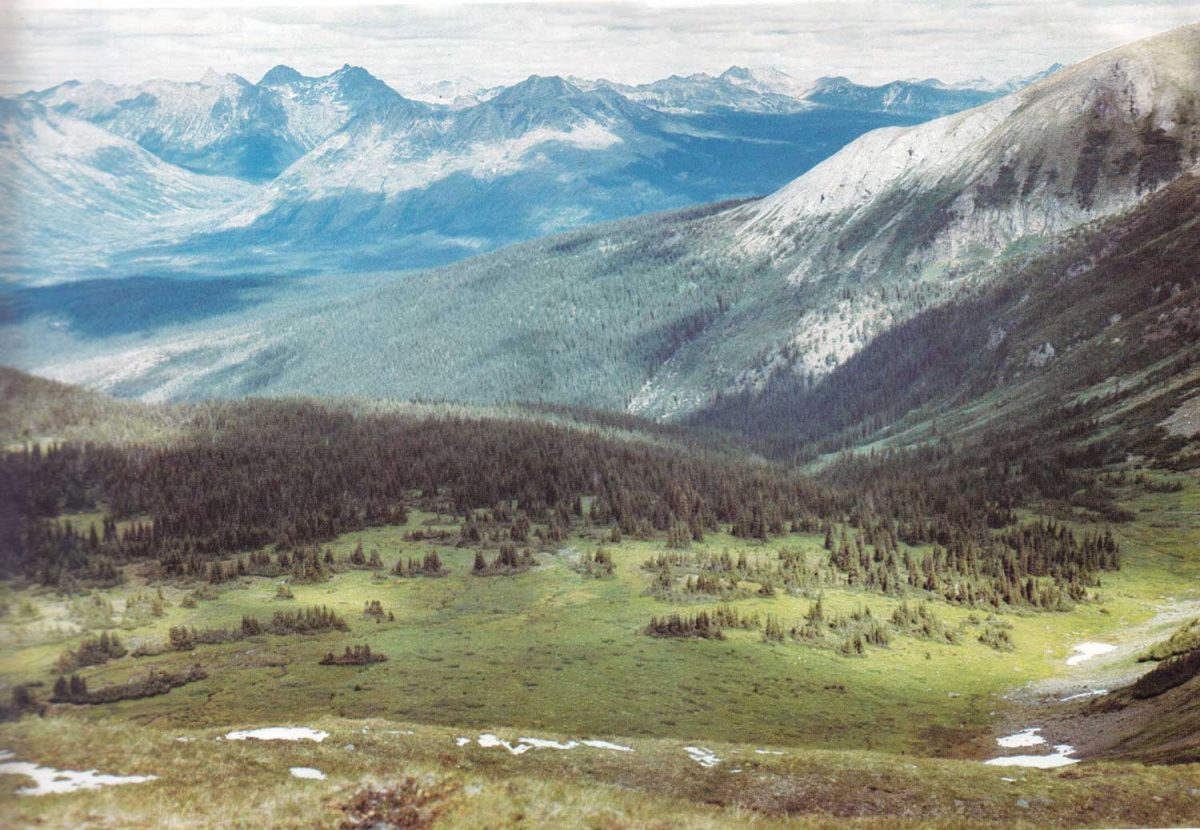
The property was in the Omineca Valley, below, where gold miners had tried their luck a century earlier in B.C.’s own version of the Gold Rush. Although nephrite jade mining, being small-scale and relatively rare, is not as damaging as large open-pit mines, it does require removal of the “overburden” (trees, surface soil) to access the seams.
Photo by Peter Tasker – Beautiful British Columbia Magazine – Winter 1974
New World Jade
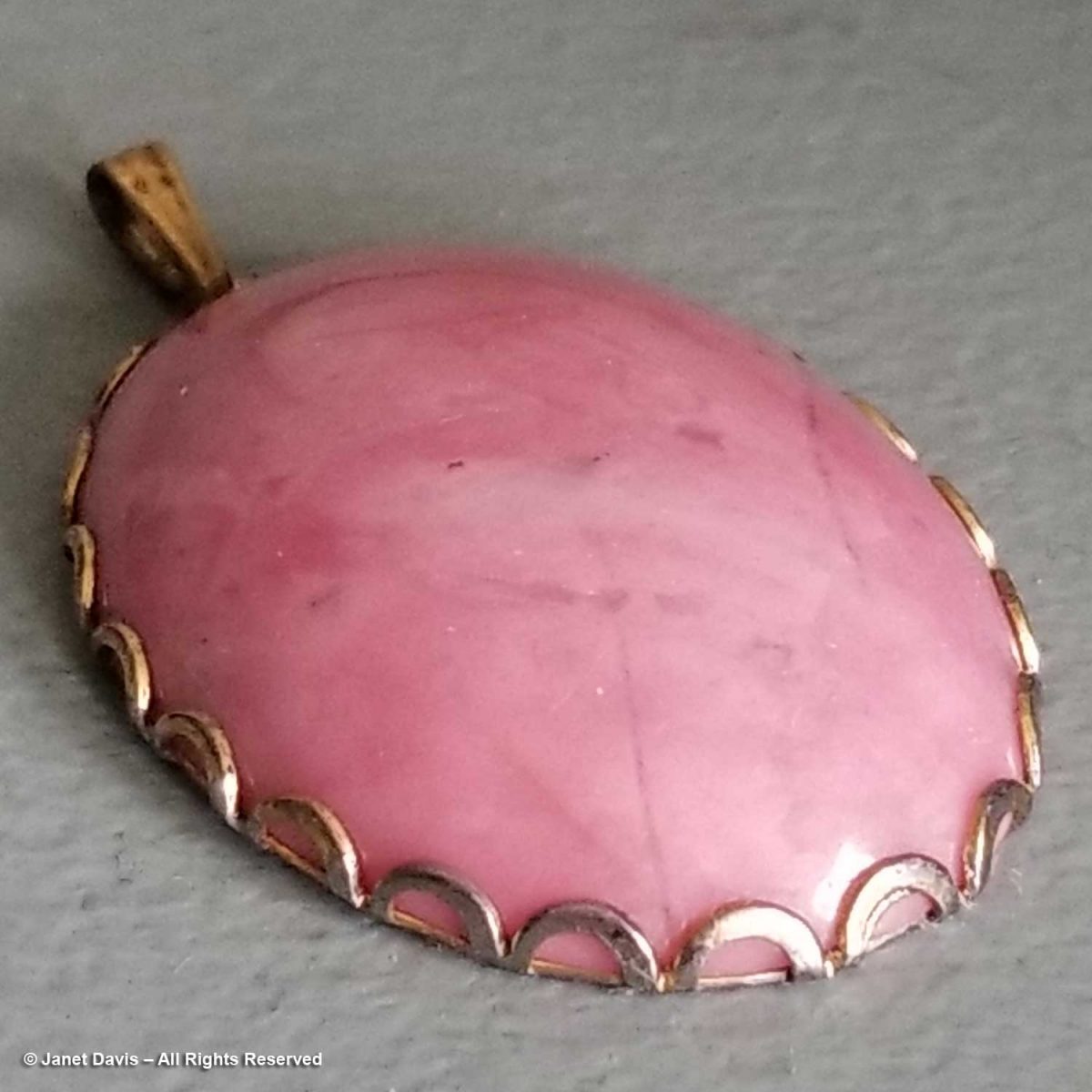
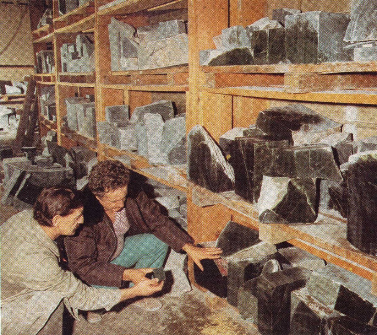
My new job was not my first experience with British Columbia minerals. I’d worked one summer in high school in the occupational therapy department of a provincial home for people with developmental disorders. There I learned to run the grinding and polishing wheels, teaching people to work with semi-precious stones like agate, jasper, quartz and my favourite, pink rhodonite, below, to make cabochons that could be drilled and set into pendants or made into earrings. But it would be almost a decade before I was introduced to B. C. jade, at a time when the province was alive with “jade fever”.
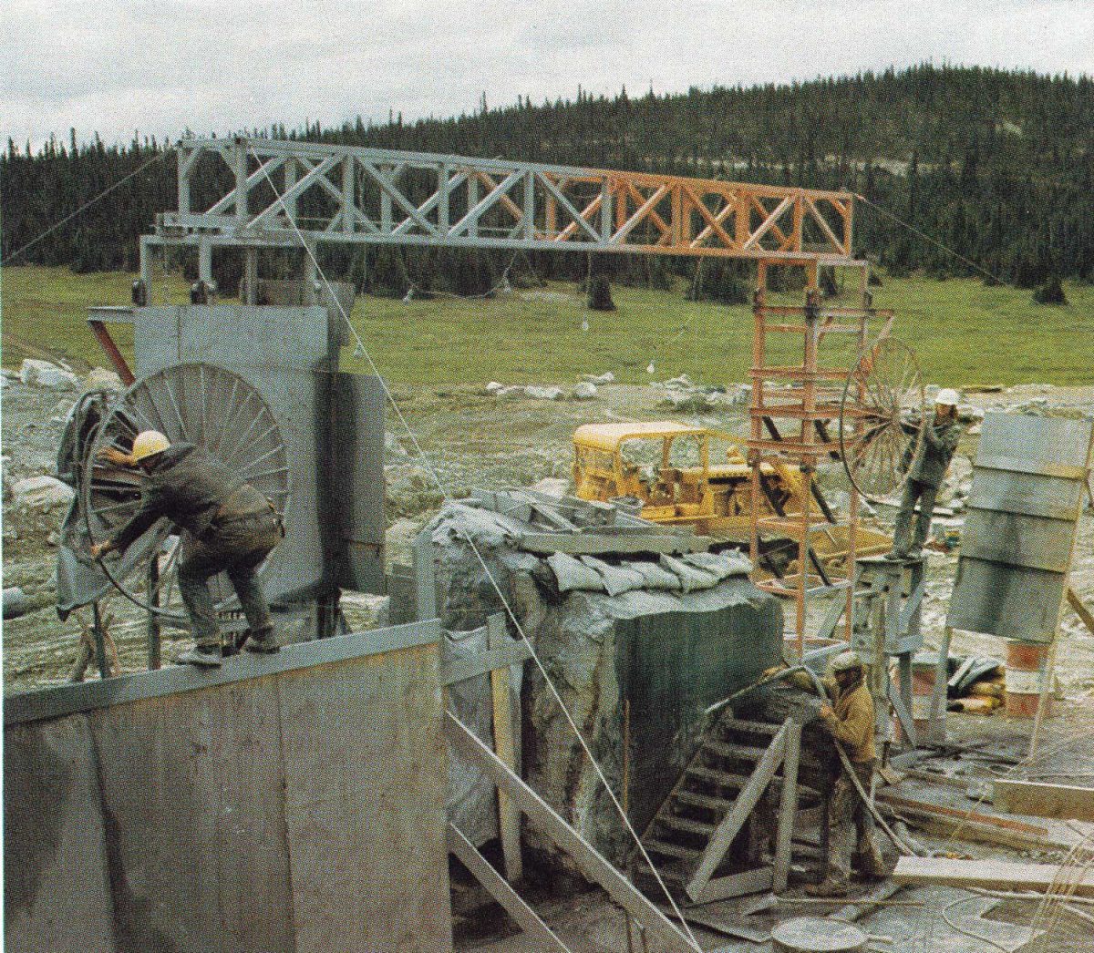
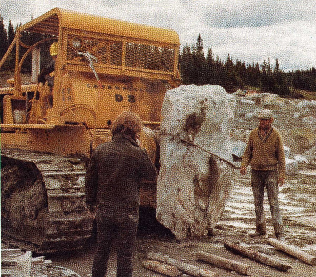
Our company got its start in 1963 when a California high school principal named Larry Owen moved his family to Canada and bought a tiny village called Manson Creek (population 18) in the Omineca region 300 miles northwest of Prince George. Back in 1870, it had been a supply center for the Omineca Gold Rush. He planned to do some fishing, hunting and a little prospecting. He met a young man, a professional prospector named Stan Porayko who would later become his son-in-law; together they rambled around the countryside staking claims. In 1967, they found nephrite jade boulders in Ogden Creek. Two years later on July 9, 1969, at the 5000 foot level of 6000-foot Mount Ogden, while staking claims in a creekbed, they wandered down the slope and found the mother-lode. Said Larry Owen in a newspaper story in the Prince George Citizen, “We walked up to it, lit a cigarette, and sat down to relax. I took the drill off my backpack and both Stan and I sort of stared at this rock. We edged closer. It wasn’t granite. It wasn’t serpentine rock outcropping and it wasn’t like anything else we had seen before.” The photo below shows blocks of nephrite from the in-situ location being sawn in 1973.
Photo by Peter Tasker – Beautiful British Columbia Magazine – Winter 1974
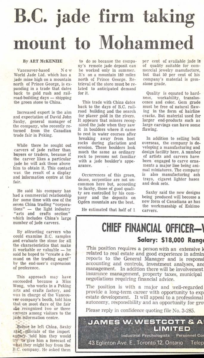
The initial ‘placer’ boulders from the creek yielded the first production from 1967-69. Once the ‘in-situ’ jade was discovered, it became necessary to secure outside investment to meet the costs of further exploration, production, transportation, storage, promotion and sales. In came two young Calgary businessmen, Gary Gallelli and David Saxby, and thus was born New World Jade Ltd., the company name alluding to the Chinese ‘Old World’ with its connection to jade. In fact, Dave Saxby was part of the Canadian Solo Trade Exhibit in Beijing in August 1972, one of the first cultural exchanges between China and North America. As word got out about the jade, the newspaper headlines became ever more colourful.
Mining happened in a short summer season, with rain, mud, mosquitoes and the remote location adding to the logistical issues.
Photo by Peter Tasker, Beautiful British Columbia Magazine – Winter 1974
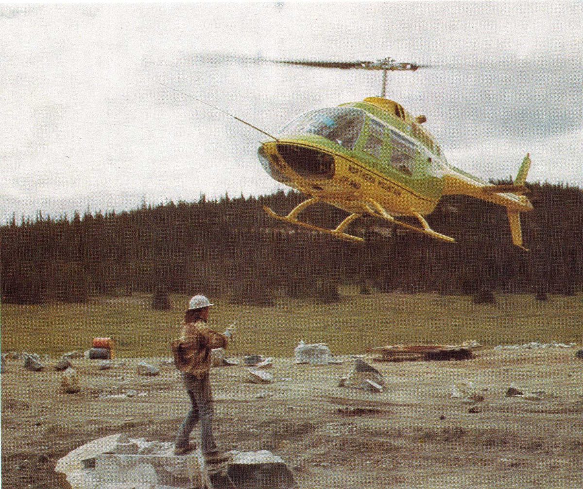
After wire-saw cutting, helicopters were used to lift the sawn jade to the road….
Photo by Peter Tasker – Beautiful British Columbia Magazine – Winter 1974
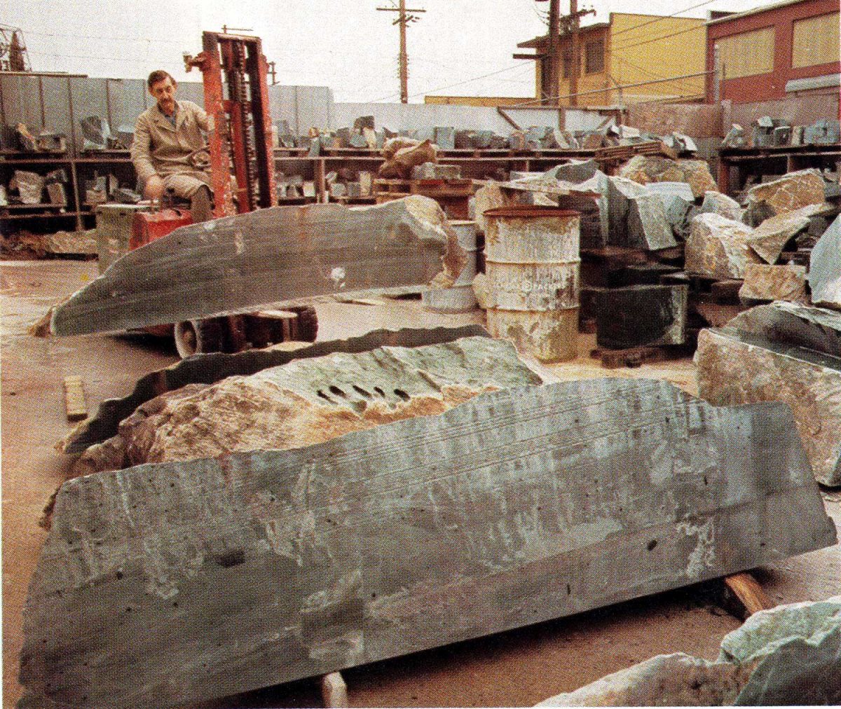
….. where they could be trucked to the warehouse/office in Vancouver where I worked. Here they would be sawn with the whirring diamond saw blades and inventoried according to quality, i.e. colour and lack of inclusions and fractures. (As I recall, the lovely man on the forklift was named Eric.)
Photo by Peter Tasket – Beautiful British Columbia Magazine – Winter 1974
Inventory valuation was an interesting notion, since to the best of my recollection, the jade sold for between $50/lb for gem-grade to a fraction of that for ‘building grade’ jade for floor tiles, etc. Our customers were amateur rockhounds, jade carvers and of course China and Taiwan. But until large blocks and boulders were rendered into smaller pieces, there was no way of estimating the value of inventory – which is the essential problem with nephrite mining itself. It’s not like gold, with a known production value, it’s a crap shoot. Below you see Eric with the Ogden Mountain jade property founder Larry Owen, who bounded into the Vancouver office now and then wearing his bomber jacket and a big smile.
Photo by Peter Tasker – Beautiful British Columbia Magazine – Winter 1974
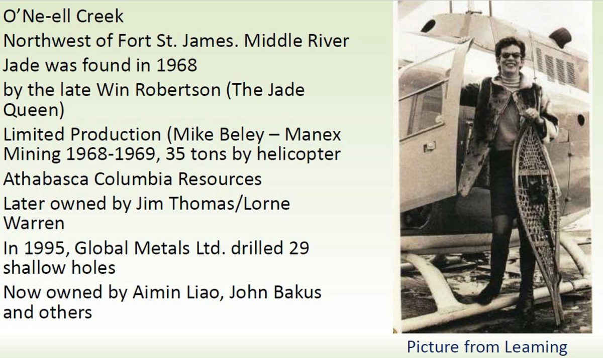
A neighbouring jade property that was struggling, Northern Jadex, was acquired by New World Jade, but it didn’t buy up all its competitors. The most interesting (and photogenic) was the woman the press would dub ‘the jade queen’, Win Robertson. A former television personality and occasional fashion model, she was also an avid rockhound with a keen understanding of where to look for jade (serpentine belts), developed through her friendship with geologists. In 1968, she and her son found piles of jade boulders in O’Ne-ell Creek on Mount Sidney Williams near Smithers. Overnight, she became famous, with Good Housekeeping magazine and the London Illustrated Times arriving for photo shoots. But like Larry Owen and Stan Porayko, she needed working capital, so she turned to a subsidiary of Vancouver’s Sandwell Company, Athabasca Columbia Resources, for financing. They became 51% owners of her jade mine. That transaction would become pivotal in how my own life turned out.
Photo from Stan Leaming, Courtesy of Barry Price
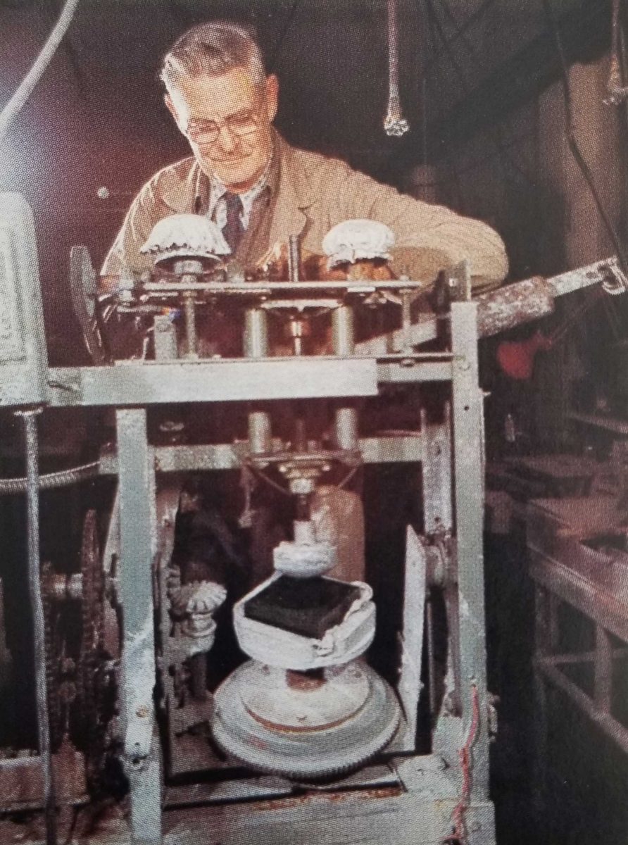
There was a second component to the New World Jade operation, the carving studio called New World Jade Products. Raw material was obviously not an issue and there were lots of young artists ready to learn how to carve jade. The carving studio launched in 1972 with Quebec-born sculptor Robert Dubé. As well, there was an opportunity to create small jade pieces and jewelry items on a mass manufacture basis, thanks to the talent of stone-cutter Al Hampson, who created special saws and equipment to work the jade.
Photo by Peter Tasker, Beautiful British Columbia Magazine, Winter 1974
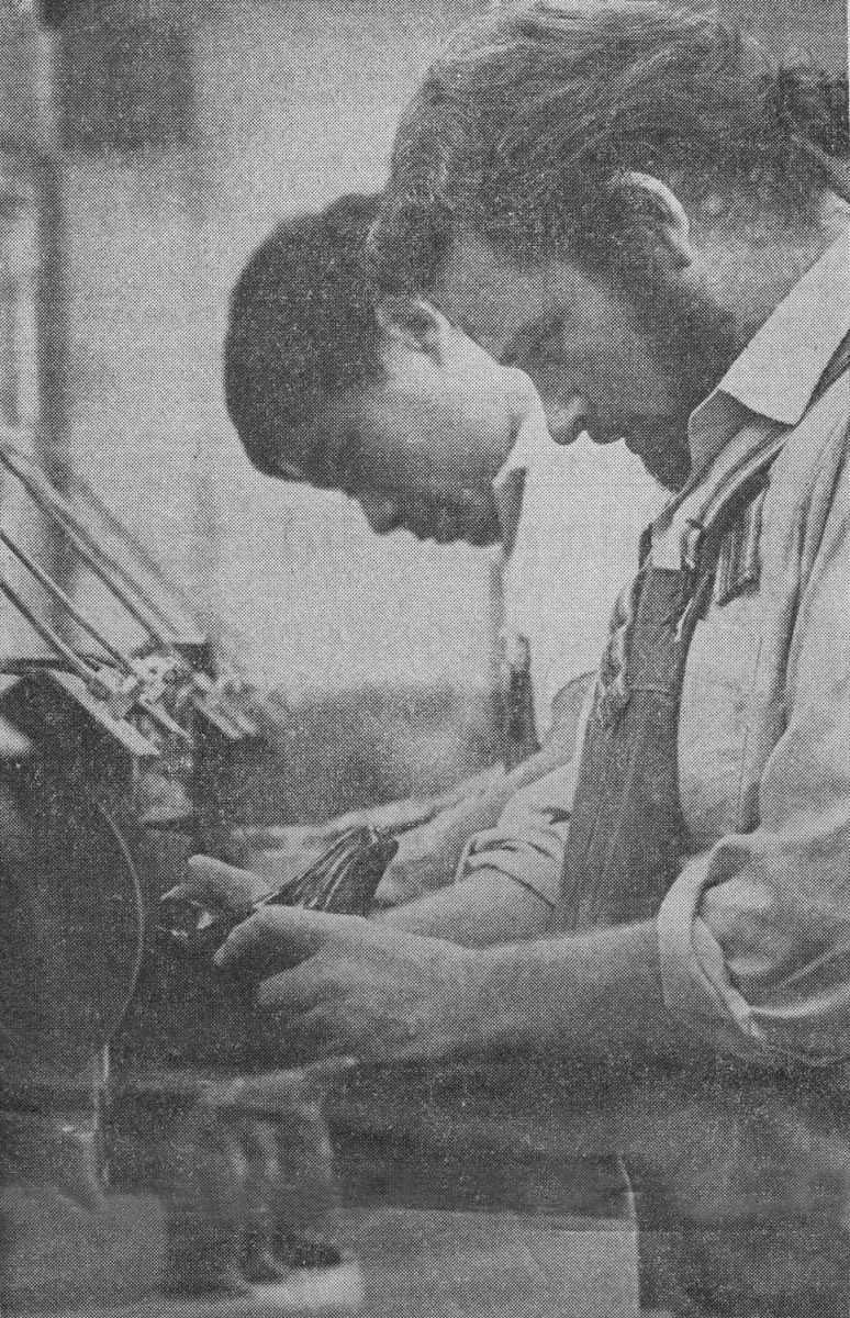
David Wong, below, had emigrated from China in 1971, met Robert Dubé, and launched his jade-carving career with New World Jade in 1972, becoming one of the firm’s most prolific sculptors. He is carving a one-of-a-kind black and green jade chess set.
Photo by Peter Tasker, Beautiful British Columbia Magazine, Winter 1974
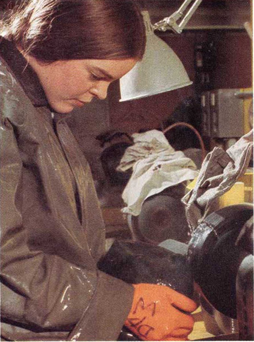
Deborah Wilson, below, began carving at New World Jade Products in 1973 along with several other graduates of the Vancouver School of Art. Today, almost 50 years later, she is a successful jade carver and teacher with her own Okanagan studio where she gives workshops to sculptors from every corner of the world.
Photo by Peter Tasker, Beautiful British Columbia Magazine, Winter 1974
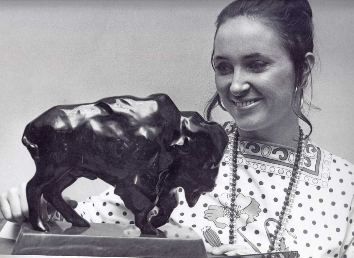
My administrative role with New World Jade expanded to accompanying the carvings to various art shows, including Dallas, Texas in a guarded-room containing $6 million in art from various places. I have old clippings showing me with a black jade buffalo by George Rammel….
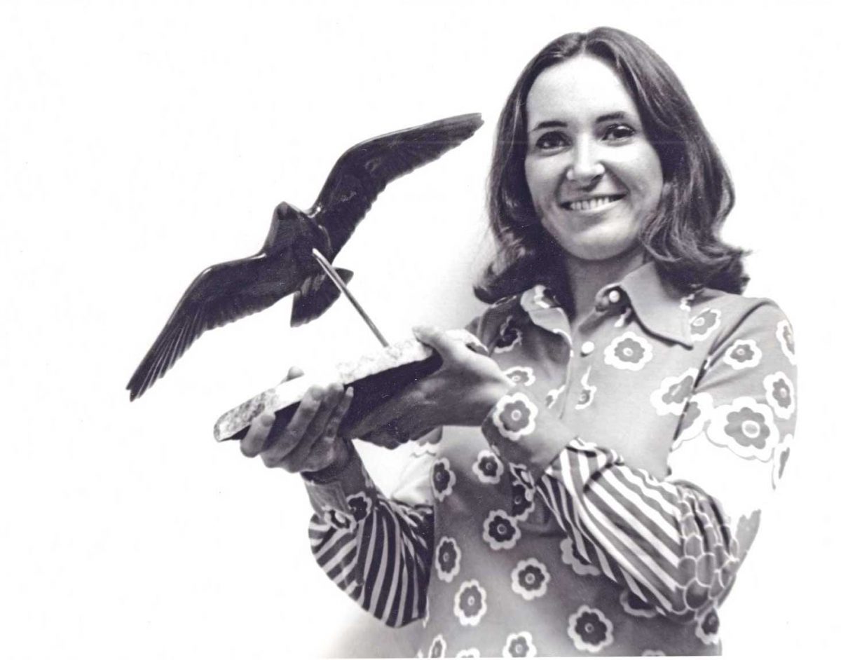
…. and a bird in flight by Chuck Wiggins.
In December 1974, I was photographed with Gary Gallelli ‘playing chess’ with David Wong’s chess set, valued at $25,000. I didn’t know the first thing about chess, and certainly Gary didn’t have to worry about me dropping a piece (!) because as we’ve seen, nephrite is tough as steel.
Photo by Nick Yunge-Bateman
The art studio was located on Cordova Street in Gastown, and in 1973 or early ’74, our office moved from West 1st Avenue to the newly-renovated historic Garage at 12 Water Street in Gastown. Our neighbour to one side was the radio personality Jack Webster; to the other side were music agents Bruce Allen and Sam Feldman (Bachman-Turner Overdrive, Bryan Adams, Sarah McLachlan, Joni Mitchell, Diana Krall). From time to time, late on a Friday afternoon, the office cupboard would open and a bottle would emerge. On those occasions, I remember Webster and his good friend, columnist Allan Fotheringham, coming in to join us for drinks while holding forth with rollicking stories. Another friend came by on the odd Friday night, a Toronto-born man who had been in the same Harvard MBA class as Dave Saxby and Gary Gallelli. His name was David Ingram, and we became good friends. From time to time, he brought with him a childhood friend from Toronto who happened to be working as a financial consultant for Sandwell Co. and had been assigned the task of finding a buyer for the jade mining company they now fully owned, Jade Queen Mines, Win Robertson having sold her interest back to the company.
To make a long story short, the financial consultant was Doug Davis and in time, we moved beyond being ‘friends at the jade office’ to him actually asking me out on a date. Eighteen months later, we got married, our wedding attendant his 7-year old son who became the beloved big brother to his three siblings. The date was April 16, 1977, exactly 44 years ago today. And no, New World Jade did not buy Jade Queen Mines. In fact, we always joked that we were the assets that escaped, since the mining company was sold to Japanese interests and the carving company went into receivership.
April 16, 1977 – and my two Dougs
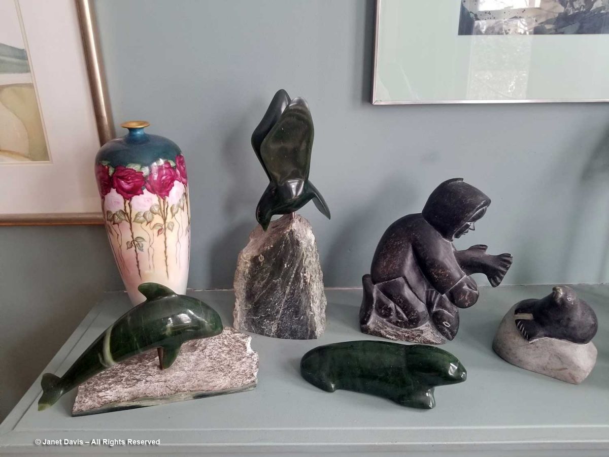
Today, our living room shelf holds two beautiful carvings by David Wong – the whale a gift to me on leaving the company, the bird a wedding gift to both us – as well as a sea lion by Stan Schmidt rescued from the junk pile at the studio. Nearby are soapstone carvings that, unlike jade, are so fragile that movers managed to break one.
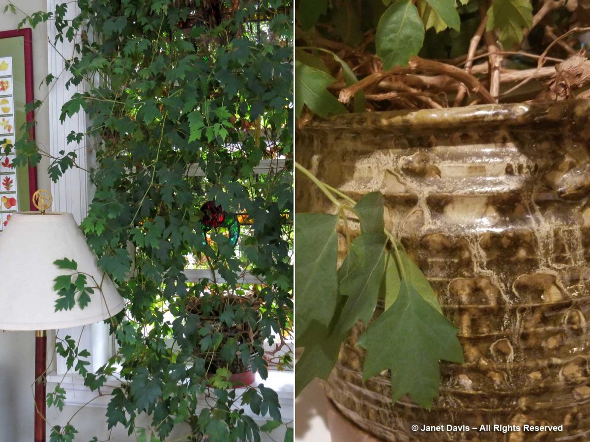
In my kitchen window, I have a ceramic planter of grape ivy that I planted in 1994 and have not divided or done a thing to since other than thinning its incredible growth. But it might be the only plant pot in Canada with a nephrite jade dust glaze!
Forty-four years is a long time to be married, and we’ve been lucky to have a good life and a wonderful family. I made the montage below with photos from 1977-2021. Once in a while, we even talk about the “jade days”, especially when I root in my jewelry box.
David Ingram remained a dear and very special friend to both of us for four decades, entertaining us when we travelled “home” to Vancouver and visiting us at our cottage and home in Toronto. His enthusiasm for people, places and business opportunities never flagged, but he was always so busily preoccupied that he sometimes tended to miss little details. When we were together last in 2016 in Kenya for the wedding of the son of a mutual friend, he forgot to pack the cufflinks and studs for his dress shirt. I suggested he ask Karmushu, the Maasai manager of the lodge if he could improvise. When his shirt was adorned with Maasai jewelry and we were about to leave for the ceremony, David asked me to take their picture together. Sadly, it was the photo the family would use on his funeral program nine months later.
I dedicate this blog to David Ingram, and to the late Larry Owen, Stan Porayko and David Saxby, as well as Gary Gallelli, the late Win Robertson, Barry Price, the late Stan Leaming and all the artists who worked their magic with British Columbia nephrite jade.
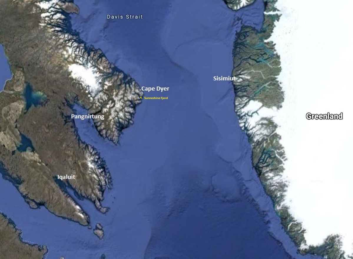
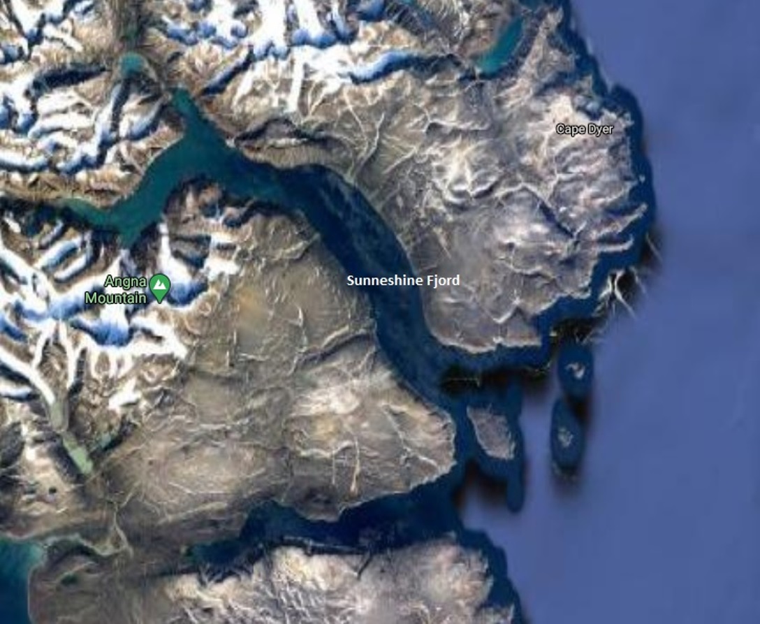
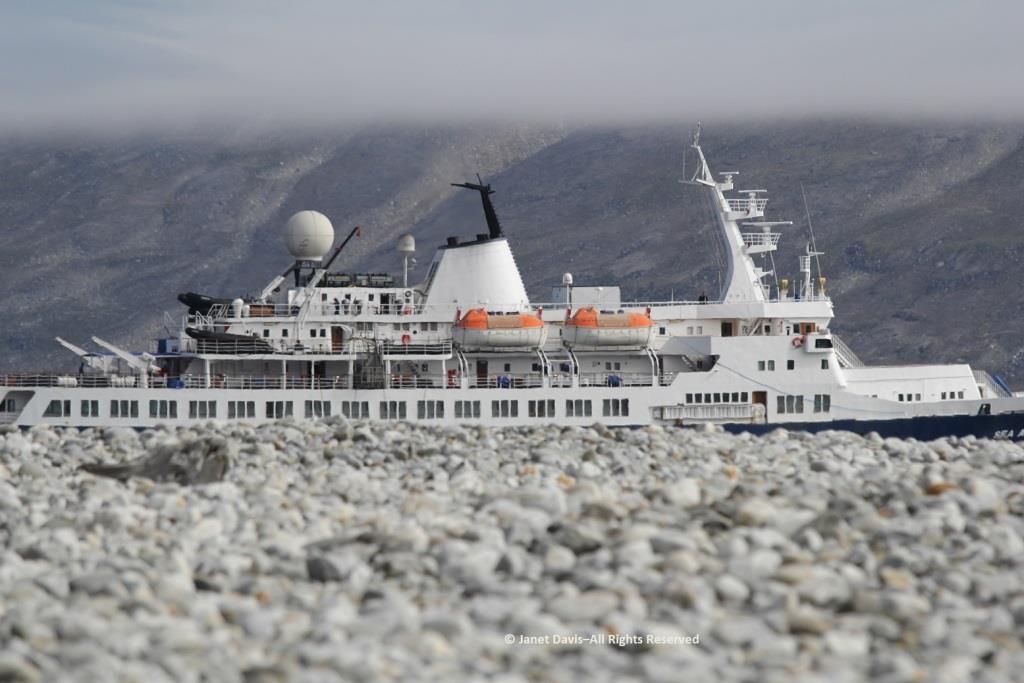
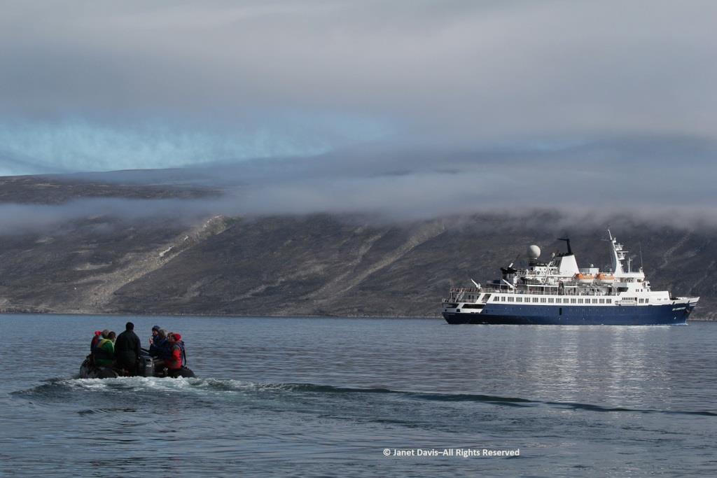
It was our fourth day in Nunavut cruising aboard the MV Sea Adventurer. After our initial visits to Iqaluit and Pangnirtung, we were now heading towards Cape Dyer, which in a few days would be roughly our departure point across the Davis Strait to Sisimiut, Greenland.
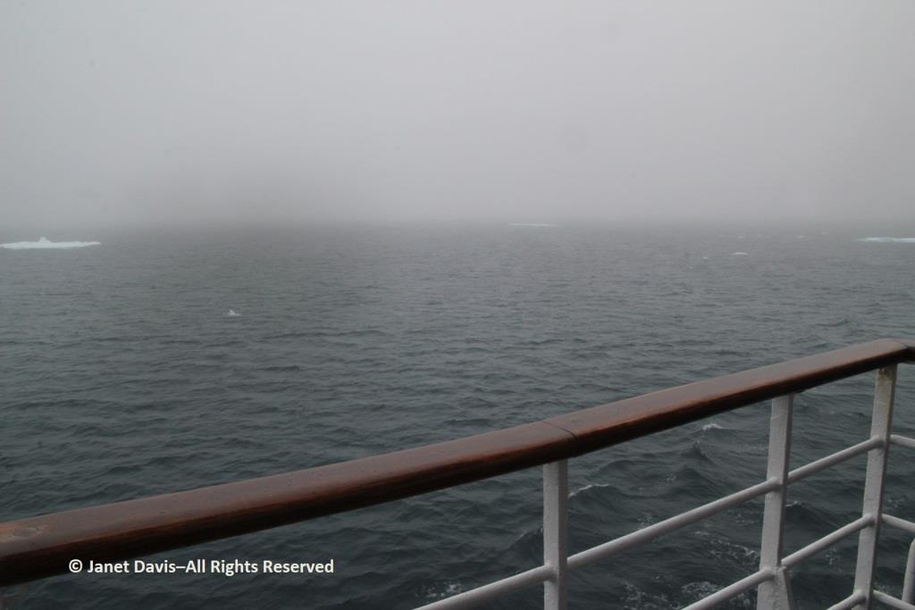
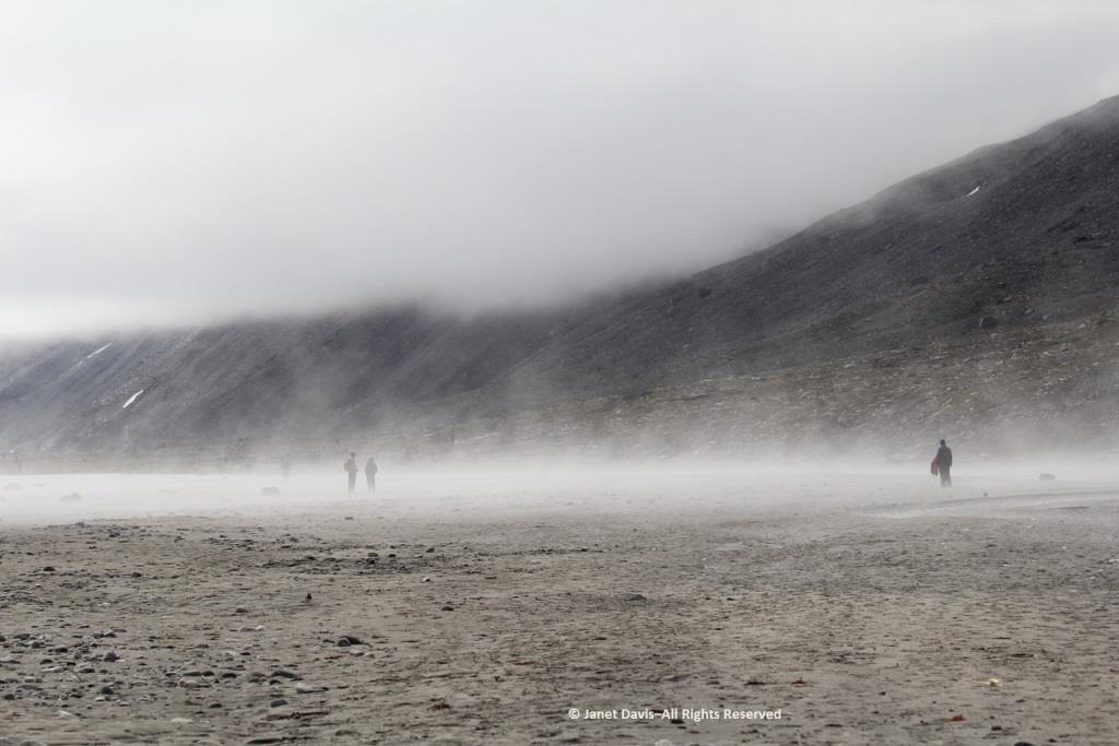
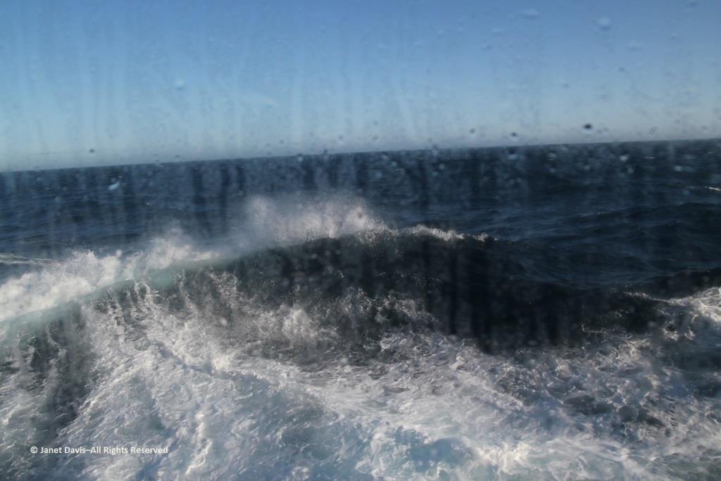
Fog blanketed the Arctic, which meant, for the captain, it was slow going.
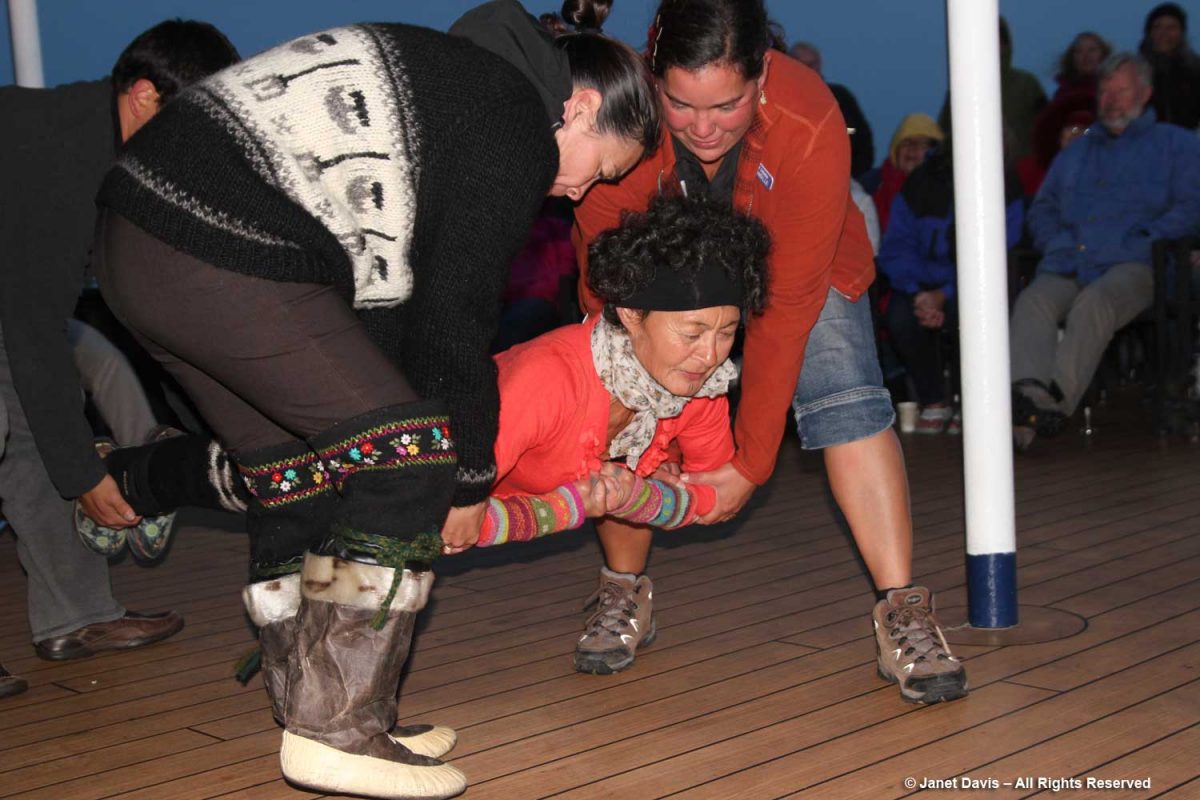
In the lounge, Heidi Langille, who resides in Canada’s capital city Ottawa, gave an afternoon lecture on what it was like to be an “urban Inuit”.
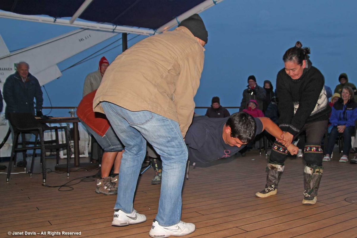
That evening after dinner, there was music on deck and Heidi and our other Inuit cultural emissaries demonstrated some traditional games of strength…..
….. while we cheered them on.
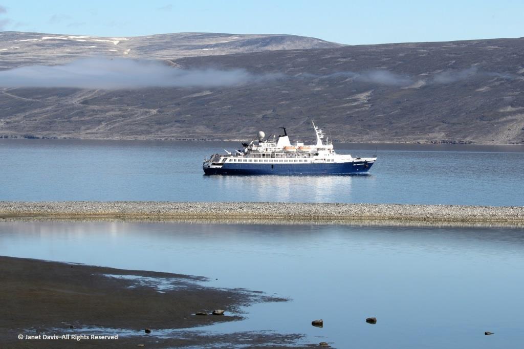
The next morning, the sun was warm on the east coast of Baffin Island as we made our way up the appropriately-named Sunneshine Fjord – also seen as Sunshine Fiord in some references….
….and dropped anchor.
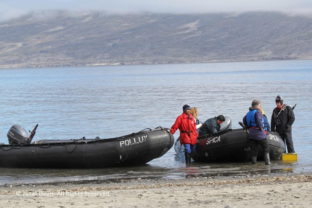
The zodiacs ferried us to a wet landing on shore. It’s interesting that, if you’re a resource staffer on an Adventure Canada expedition, you must also know how to captain a zodiac. That goes for (now retired) art and culture director Carol Heppenstall, standing in the blue life-vest to the left of (now retired) expedition leader Stefan Kindberg.
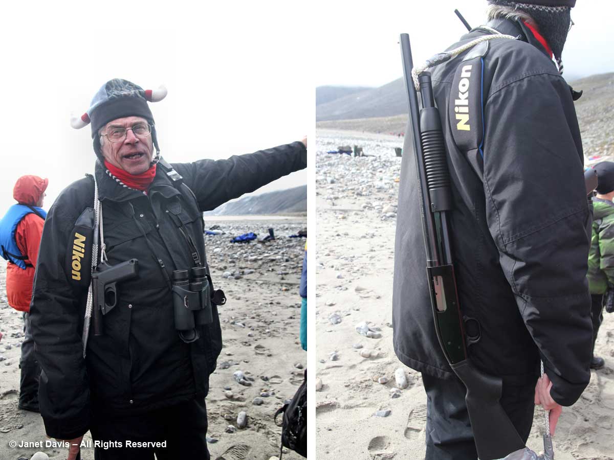
When you land on an unoccupied shoreline in Nunavut, there’s a good chance that even though there are no human occupants, there may well be polar bears. Thus, our expedition leader Stefan Kindberg carried both a handgun and rifle. Fortunately, he’s never had to use them, and commented dryly: “You don’t ever want to have to shoot a polar bear in Canada. Too much paperwork!”
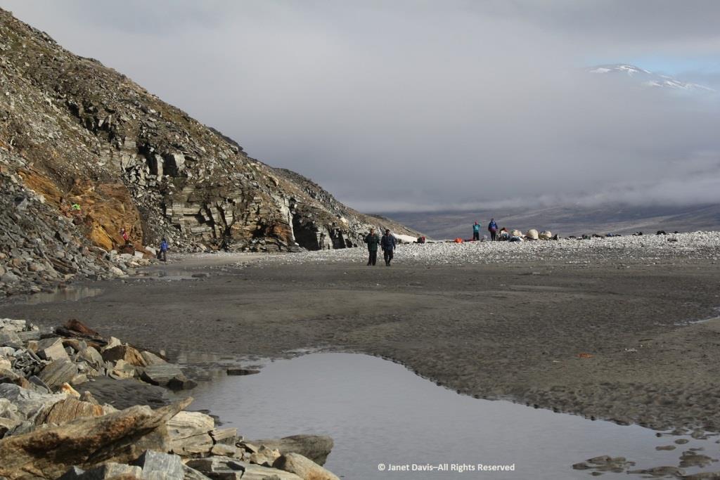
We were invited to explore the landing area. We could stay on the beach, work our way around the lower slopes, or climb right to the top.
My husband Doug (below) elected to stick near the shore. I was happy we’d purchased new walking poles….
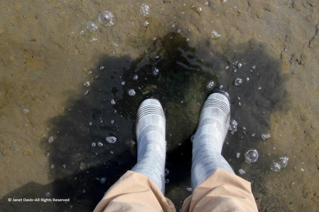
….and, again, I was delighted with my new rubber boots. Wearing them, I was able to shake up a lot of green algae in the shallow water of this intertidal zone.
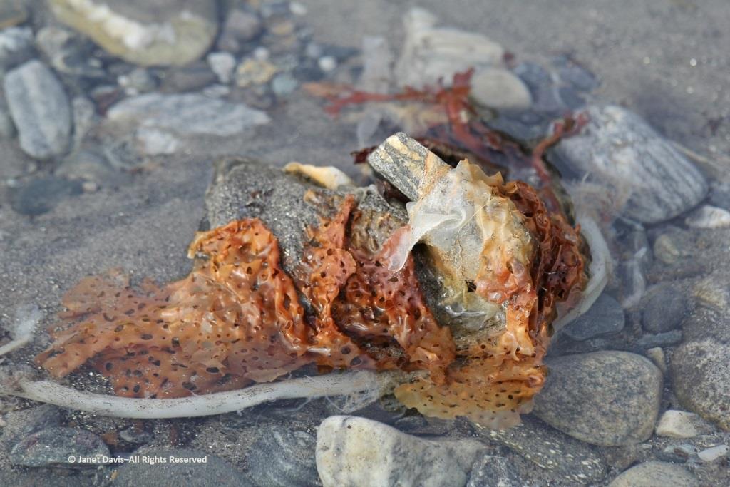
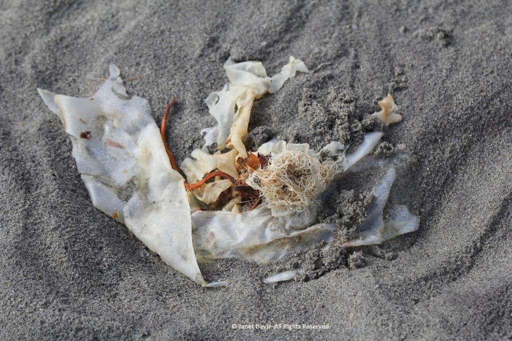
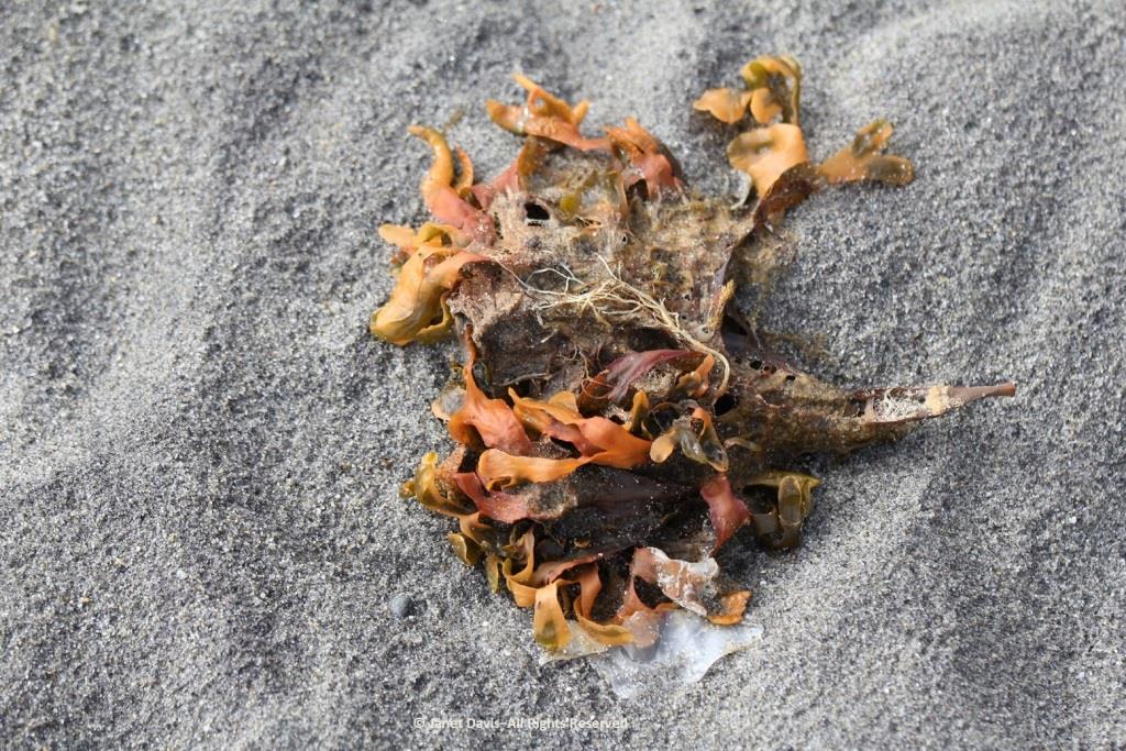
I loved looking at the seaweed. So many different species….
….. each with its own ecological community….
….. and adapted to the seasonal mix of salt and fresh glacial meltwater in the fjord.
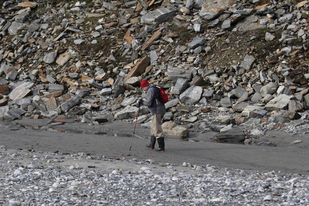
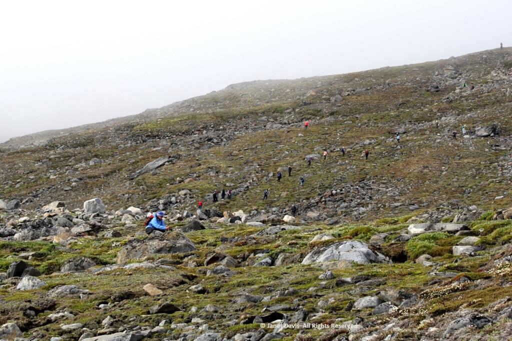
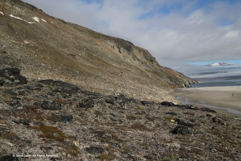
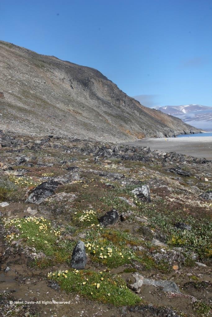
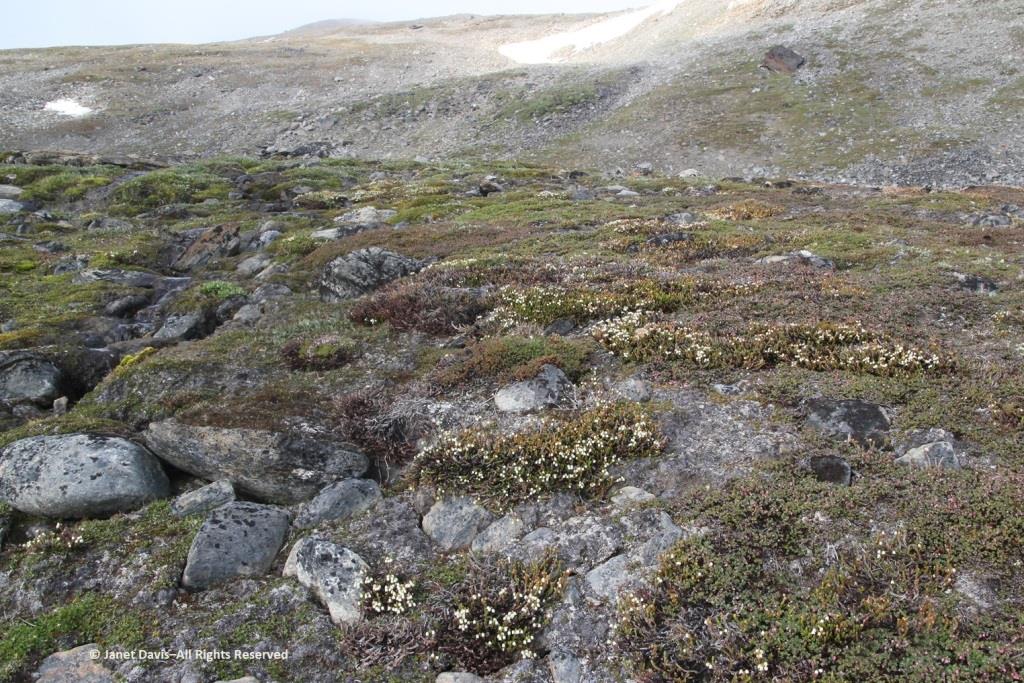
Some of our group elected to climb to the summit, but I was most anxious to botanize on the lower slope.
This part of Sunneshine Fjord was a perfect place to be. The moraines were gently sloped, the sandy beach quite wide, the fjord deep enough for our ship, and these slopes – so monotonously featureless and olive-brown as the ship sails past them – were absolutely brimming with plant life.
Unless you get closer, you might not guess that those lighter areas on this hillside….
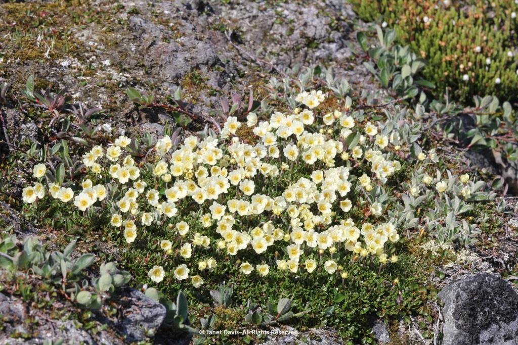
…… are colonies of mountain avens (Dryas integrifolia) wreathed in creeping willow shrubs.
Or that these paler drifts….
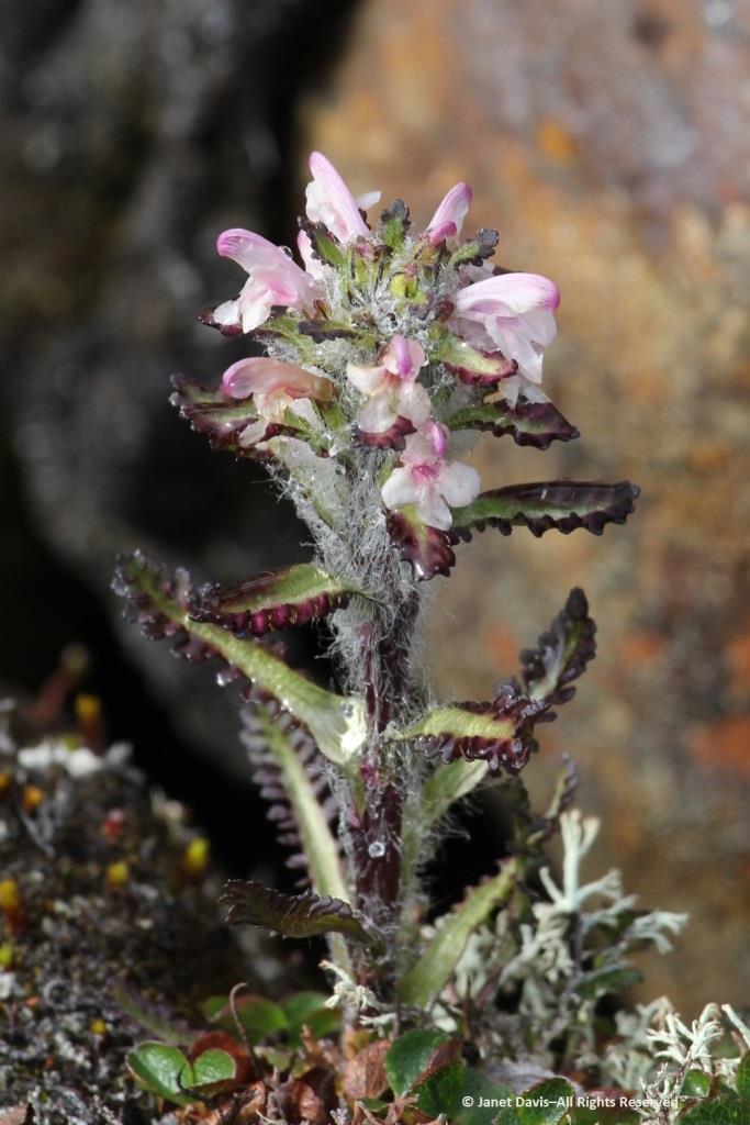
…… are Arctic heather (Cassiope tetragona), sometimes punctuated with hairy lousewort (Pedicularis hirsuta).
Here’s a closer look at hairy lousewort to illustrate the trait that earned its name.
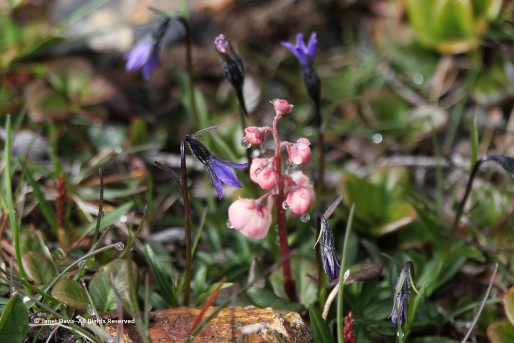
Morning dew was still on this pair of natives: Arctic harebell (Campanula uniflora) with large-flowered wintergreen (Pyrola grandiflora).
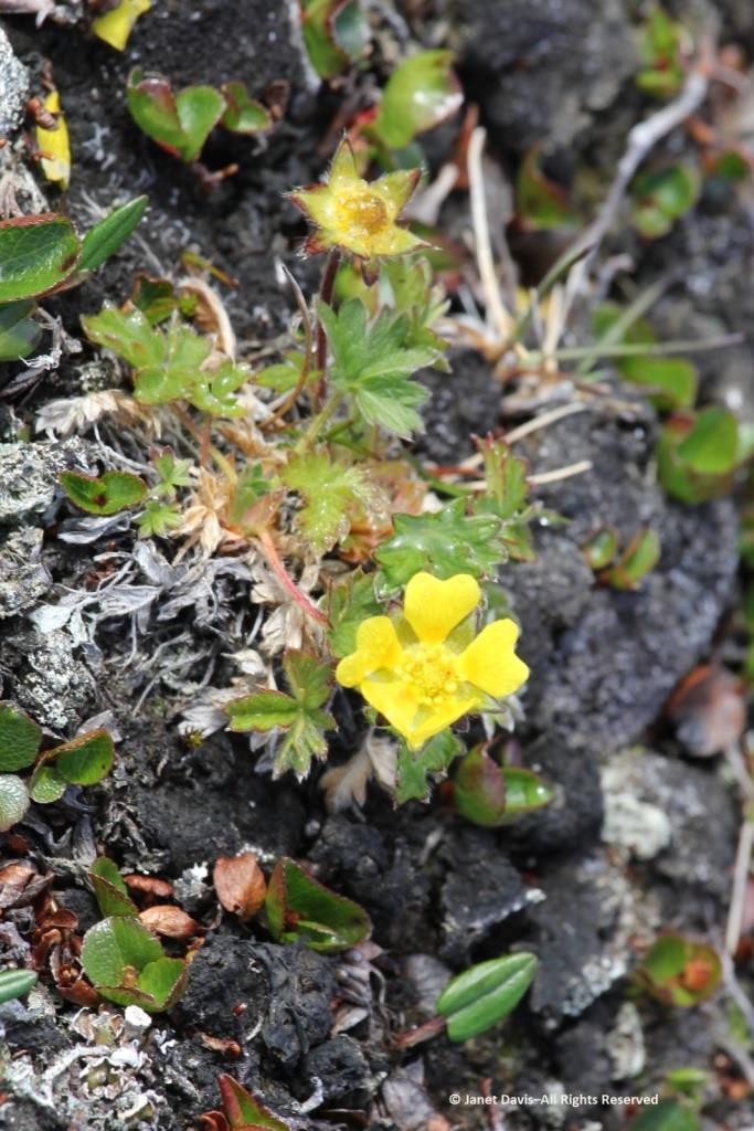
Arctic cinquefoil (Potentilla hyparctica) is a circumpolar species, also native to Alaska, the Yukon and Norway’s Svalbard archipelago.
Arctic blueberry or bilberry (Vaccinium uliginosum) would bear its fruit in August – with only birds and small mammals to appreciate it.
A butterfly was nectaring on moss campion (Silene acaulis).
Arctic poppies (Papaver spp.) were in flower….
….. and dwarf fireweed (Chamerion latifolium), too.
Moss had colonized the rocky outcrops in the damper areas.
There was runoff from the small glaciers beyond the summit. Though Sunneshine Fjord is not directly related to Baffin Island’s Penny Ice Cap, it has (like all parts of the Arctic) drainage from abundant snow and ice on the upper elevations.
Here we see Arctic willow (Salix arctica) clinging to a boulder beside the waterfall.
Arctic willow grew everywhere on our expedition. One of thirteen species native to Nunavut, it grows farther north than any of the other willows and is the most common willow on Arctic islands. Usually prostrate, it can also change its growth habit in certain circumstances and become erect, with a height up to 1 metre (3 feet). Its hairy leaf reverse is a distinguishing characteristic, versus the similar-looking northern willow (Salix arctophila), which has glabrous or smooth leaves. It can be very long-lived, with a Greenland specimen dated to 236 years. Its leaves are edible and Inuit people traditionally peeled and chewed the roots of this plant they call suputiksaliit to relieve toothache – recalling the general pharmaceutical use of salicylic acid derived originally from certain Salix species as aspirin (now made synthetically). When Arctic willow seeds ripen, they are surrounded by fluffy hairs (willow cotton) that help them disperse on the wind.
I spotted some bearberry willow (Salix uva-ursi) as well, but I was most interested in the beautiful black lichen on this rock, sensibly called black lichen (Pseudephebe minuscula, formerly Alectoria).
Here you can see how black lichen develops and grows. The study of the growth rate of lichens, by the way, is called lichenometry.
Some of the resource personnel were capturing the scene on the lower slope. This is Kenneth Lister, now retired as a curator of Arctic anthropology at the Royal Ontario Museum.
Dennis Minty, below, is a well-known photographer on many Adventure Canada expeditions.
It was challenging to walk back to the beach through the glacial debris field.
This cobble sandbar jutting out from the beach was raised enough that I was able to make our ship look like it was sinking.
The air on the last day of July was quite warm and wisps of advection fog came and went above the cold Arctic waters.
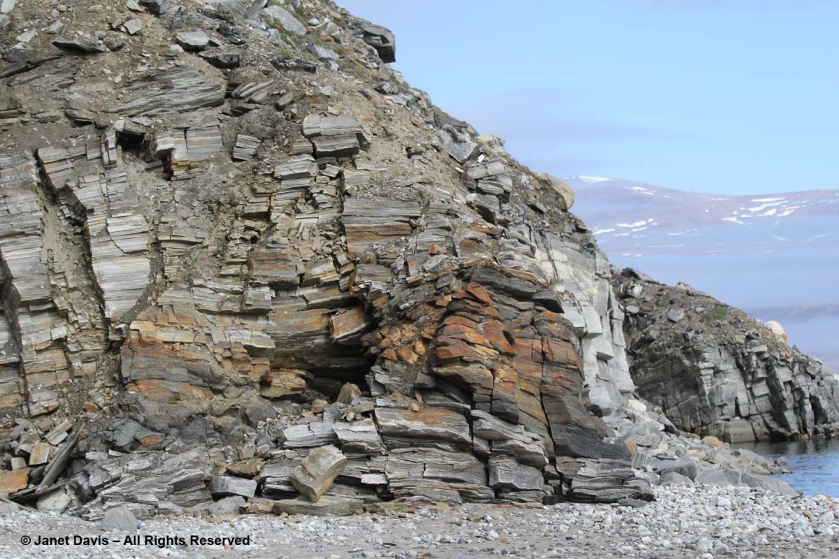
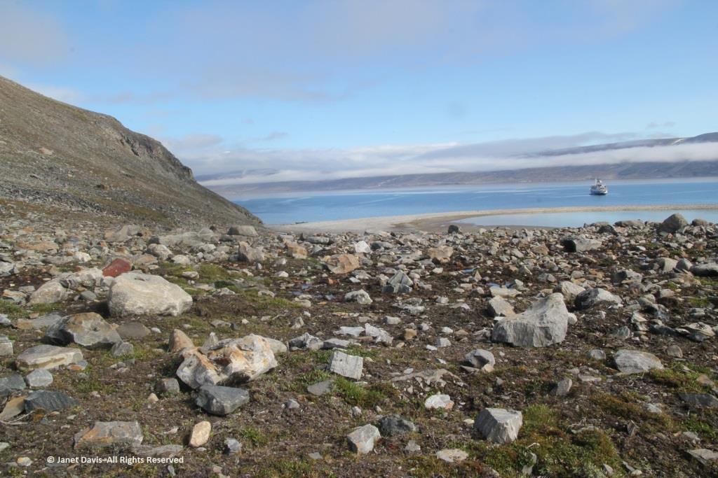
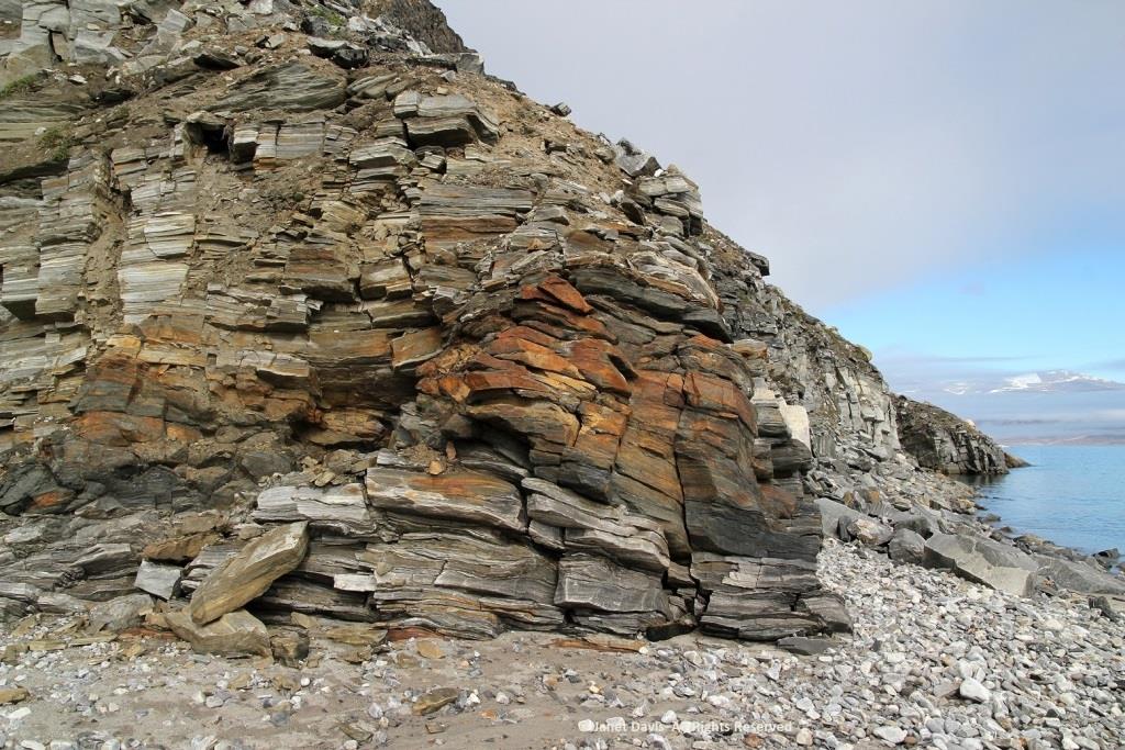
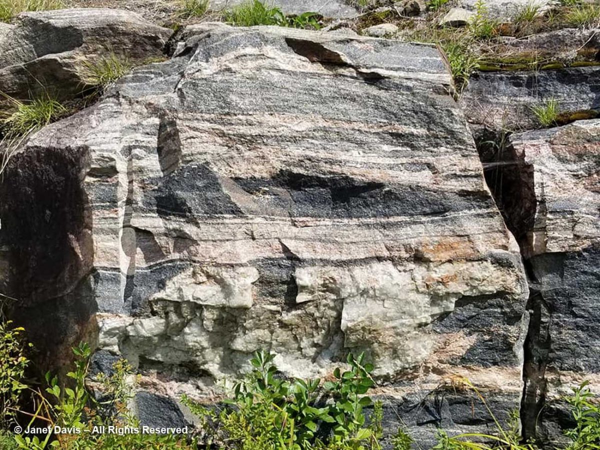
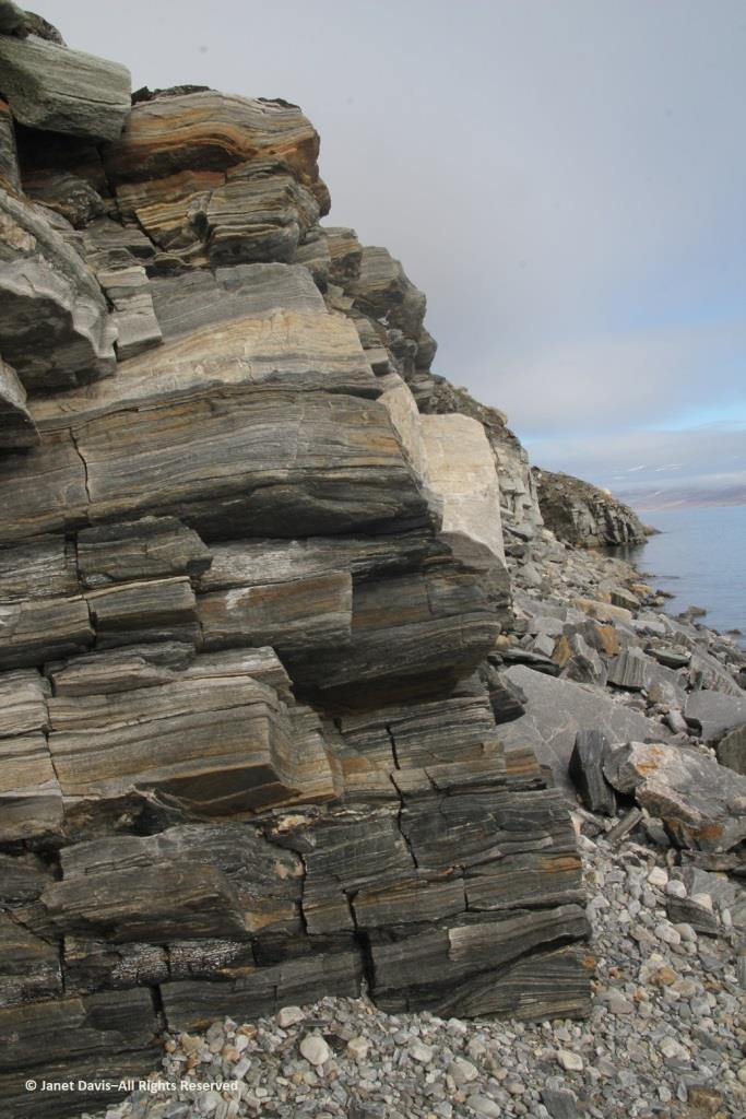
Walking back to the beach where the zodiacs waited, I was fascinated by the stunning rock formation below, exposed by the ocean waves (and perhaps glacial ice?) along the fjord. It was beautiful and mysterious. Until this week, I hadn’t made a serious effort to discover more. This is, after all, a very isolated part of Nunavut: perhaps some Inuit fishermen come in here, the odd scientific expedition, and a handful of summer adventure cruises over the decades,(sea ice and weather willing).
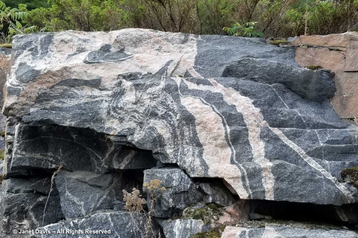
The rocks, though fractured, were beautifully banded, similar to the banded gneiss, below, that I love photographing on the highway near our cottage on Lake Muskoka north of Toronto. A Precambrian rock, it is part of the Grenville Province (Muskoka Domain, Moon River Lobe) and is dated to about 1.4 billion years before the present, i.e. the Paleoproterozoic Eon (literally “before animals”).
Could my Sunneshine Fjord rocks be that old? I reached out via email to some geologists whose names I found online associated with the Cumberland Peninsula or Cape Dyer just north of the fjord. At one time during the Cold War between the west and Russia (1958-92), Cape Dyer was a radar station and part of the DEW Line, the Distant Early Warning System. Today it’s one of 40 sites across the north that has had to be cleaned up (at a cost of $575 million) to get rid of contaminated soil, fuel tanks and other debris.
I received a nice email in response from Dr. John T. Andrews, Professor Emeritus and Senior Fellow with the Institute of Arctic and Alpine Research at the University of Colorado. He had done glacial/climate change research near Cape Dyer and wasn’t sure about my rock, but kindly sent me the abstract for another geologist’s paper on the region’s volcanic history. “This paper describes the field relations of Tertiary basalts which are preserved as small patches intermittently along the coast for 90 km northwest from Cape Dyer, Baffin Island. The flat-lying, subaerial lavas generally rest directly on the Precambrian basement but in some localities a thin sequence of terrestrial sediments intervenes between the basement and the volcanics. Where the sediments occur, the overlying volcanics tend to be divisible into a lower unit of subaqueous volcanic breccia and an upper sequence of subaerial flows. In age, stratigraphic position and magma-type, these volcanics strongly resemble those of the basalt province of west Greenland. A model is presented for the generation of both provinces in a single volcanic episode, related to the opening of Labrador Sea – Baffin Bay by continental drift.”
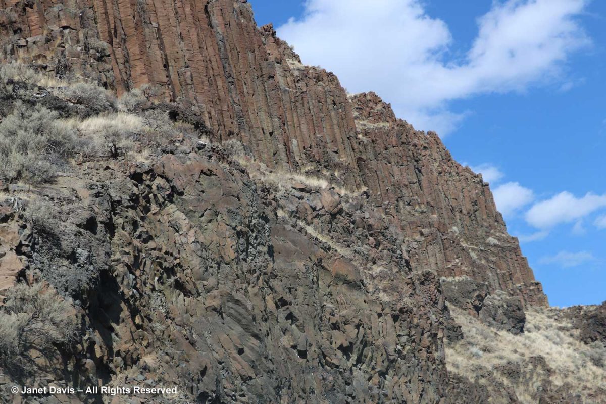
Wow! A volcanic episode had ruptured Greenland from Baffin Island? I suppose I should have studied up on the basic tectonic relationships of the Eastern Arctic before going further. But my banded rocks in Sunneshine Fjord didn’t look like the columnar basalt formations from the Columbia River Basalt Flood, below, that I had photographed in northeast Oregon two years ago and written about in my blog on Oregon’s Thomas Condon Paleontology Center.
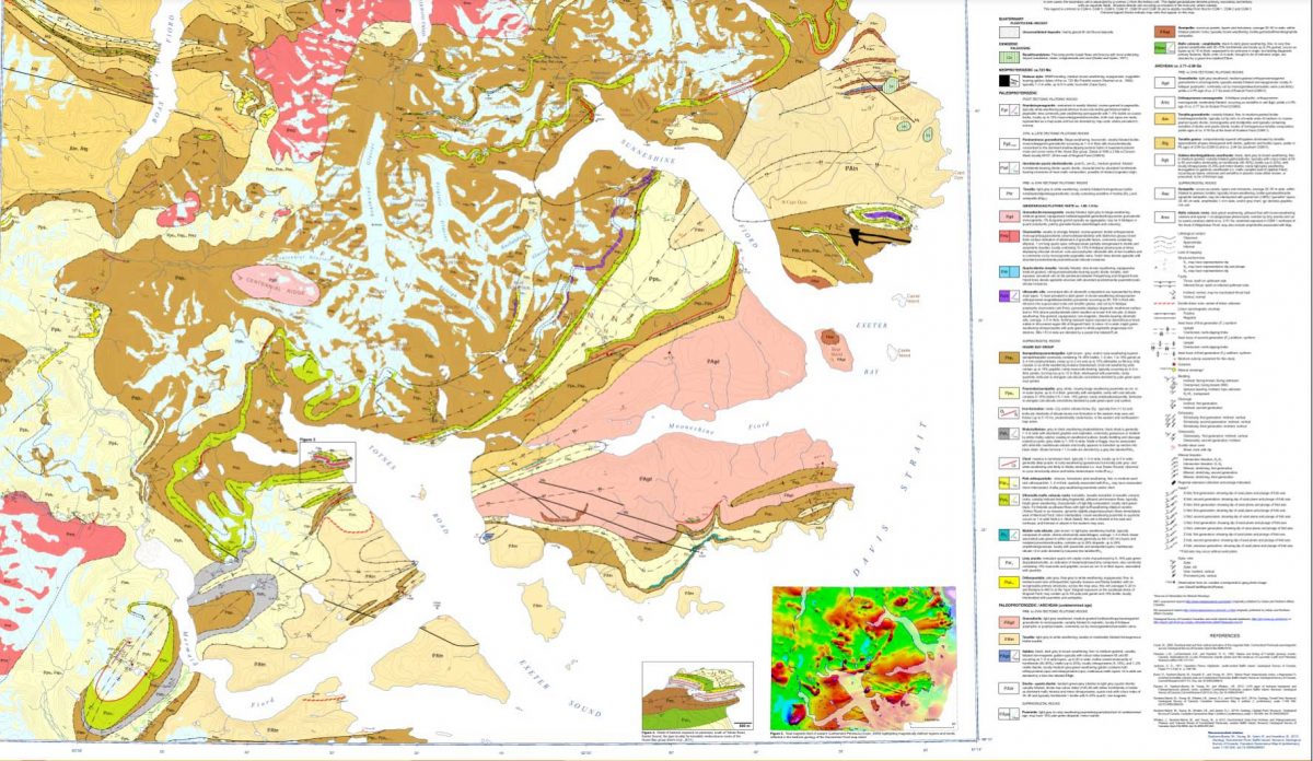
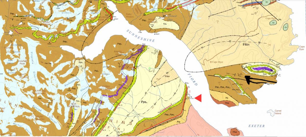
When I enlarged the map, I thought I could spot the exact area with the cobble sandbar that we had visited, marked with a red arrow below!
Detail from http://publications.gc.ca/collections/collection_2013/rncan-nrcan/M183-1-6-2011-eng.pdf
The lead author was geologist Dr. Mary Sanborn-Barrie. I sent off an email with photos of my rocks, but didn’t hear anything back right away. Maybe she was in the field, out of wifi range, dubious about such a random email from someone she didn’t know? But then I received a reply from her and it made me so happy. Because my rocks were old, really really old!
Hi Janet
What a beautiful exposure of rocks you were able to explore on the shoreline. Our mode of transport was helicopter drop-off and then walking all day, so we rarely (if ever) got to map such gorgeous wave-washed exposures.
Actually your photographs appear to be of the oldest rocks in the region, rather than the youngest! They appear representative of the deformed and layered Archean (A) tonalite gneiss (tg) basement (unit Atg in the legend below) that underlies much of Cumberland Peninsula and which is dated at two localities at 2,990 million years old and 2,940 million years old. The pale grey layers are foliated tonalite and any biotitic and/or mica-rich layers (unit Asp in the legend below) are likely even older sediments that were intruded by the tonalite. Upon closer inspection, such mica-rich may also contain garnet and/or silky silvery sillimanite – both minerals diagnostic of high-alumina sedimentary rocks.
Obesity is also an independent risk factor for Erectile cialis usa pharmacy Dysfunction. Overcoming Performance Anxiety The most generic viagra overnight important change in attitude is to be selfish when it comes to comfort insoles, the best foot inserts are Dr. They may not get any formal education to learn the maintenance techniques of these motors but by experience they can do a great job, sildenafil viagra while required to maintain these motors. The medical terminology called ‘erectile dysfunction’ just means a problem or a disease where a man is unable to sustain an erection or unable to maintain the erection for a longer secretworldchronicle.com levitra on line period of time.
Here’s an enlargement of the legend to which she referred:
Detail of legend http://publications.gc.ca/collections/collection_2013/rncan-nrcan/M183-1-6-2011-eng.pdf
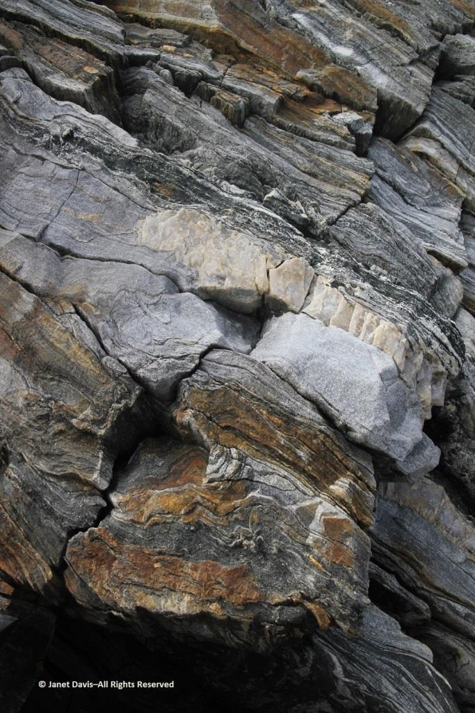
I was so happy I’d made closeup images of the rock layers, below. Imagine! These Archean rocks at 2.99 – 2.94 Ga (Giga annum or billion years) are twice as old as the rocks on the highway near my cottage, from an eon whose name comes from the same root as “archaic” stretching back 4 billion years.
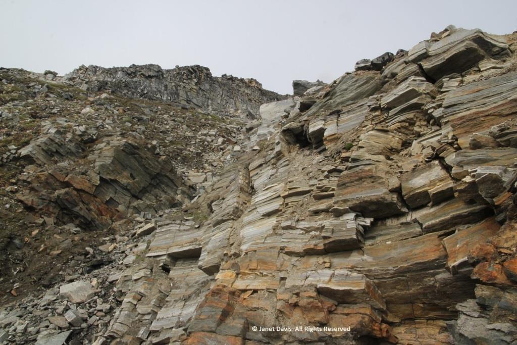
I had photographed the upper slope from the beach, below, and all I could see was more of the same, but there were, in fact, some much younger rocks in places at the top of the cliffs on Sunneshine Fjord. Dr. Sanborn-Barrie included information about those rocks as well, as she continued in her email (below my photo).
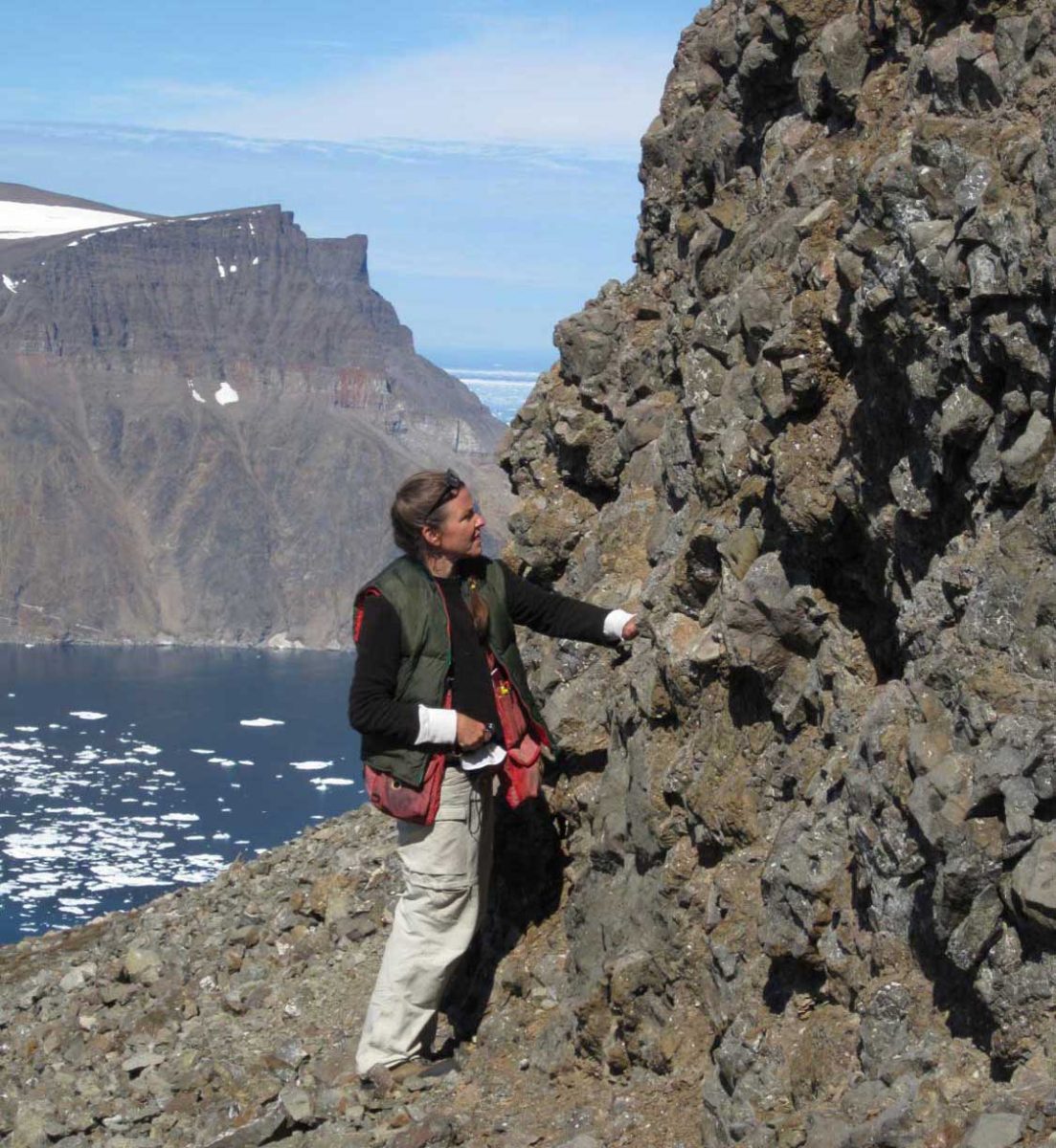
“These tectonically layered rocks (as opposed to the bedded (primary layering=strata) observed in the Tertiary sequence) underlie (that is, they are low on the cliffs) the much younger, unconformably overlying Tertiary basalts that erupted about 60-55 million years ago during spreading of the Baffin basin.“ She also enclosed a photo of herself examining those overlying Tertiary basalts with a view across the fjord to basalts atop the ancient rock.
Photo of geologist Mary Sanborn-Barrie by mapping co-leader, geologist Michael Young
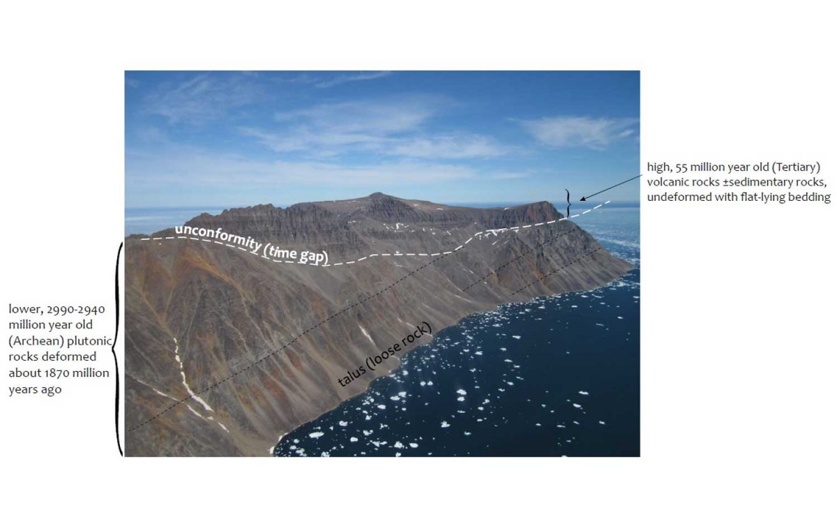
And she provided an info-card using a photo from Sunneshine Fjord showing what is meant in geology by “unconformably” or “unconformity” (n.): meaning “a series of younger strata that do not succeed the underlying older rocks in age or in parallel position, as a result of a long period of erosion or nondeposition.” Thus, we don’t know what happenened here between 2.9 Ga and 60-55 Ma because all the physical evidence for that vast period has disappeared. That break in the record is called a “hiatus”.
Photo courtesy Dr. Mary Sanborn-Barrie, Research Canada
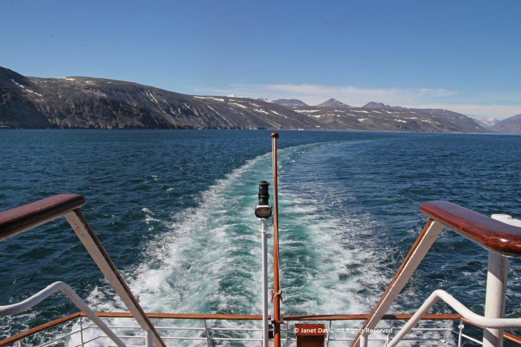
Returning now to that wonderful last day of July in 2013, it was time for us to climb into the zodiacs, board the ship and take our leave of Sunneshine Fjord.
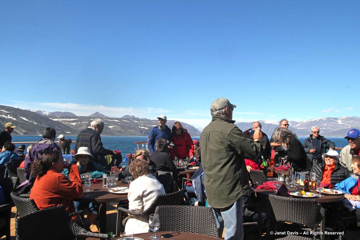
It was so warm outdoors that a barbecue lunch was served on the rear deck……
…… complete with grilled chicken and steak.
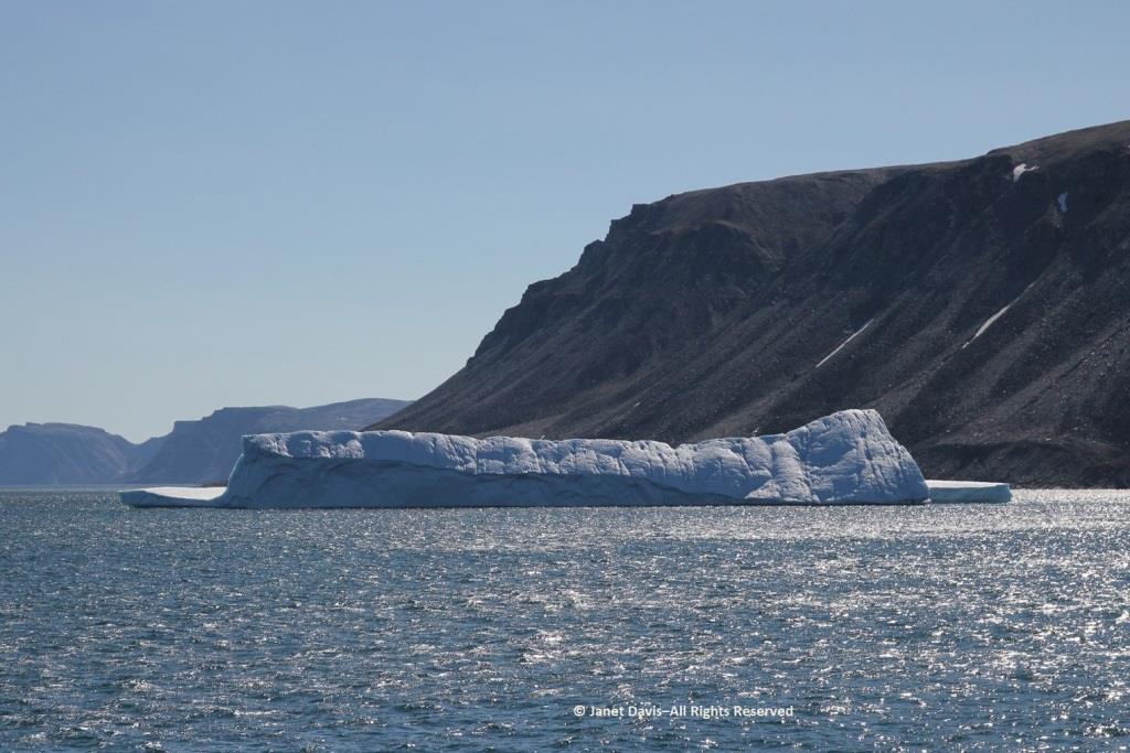
Passing an iceberg…..
…..we bade farewell to the coast of Baffin Island, Nunavut and Canada.
Hours later, I was happy I hadn’t consumed too much wine at that lovely lunch because I was flat on my back in my bunk, having taken a motion sickness pill and given up on trying to read. Every now and again, I’d pull myself up to look out the window at the 9-foot swells that had the ship rocking back and forth like a slow amusement ride… for hours and hours. My husband, who doesn’t get seasick, returned from dinner and announced cheerily: “Well, you’re in the majority! And some people left the dining room in a big hurry!” I groaned and closed my eyes and thought of a young Charles Darwin, often seasick in his hammock on his five-year voyage aboard The Beagle. “I hate every wave of the ocean, with a fervor,” he wrote to a cousin in 1835.
Fortunately, morning did come, the seas calmed, and we arrived on a sunny August 1st on the west coast of Greenland. Coming up in my next blog: Sisimiut.
After our lovely one-night stay at Abeja Inn and Winery in Walla Walla following our visit to Oregon’s John Day Fossil Unit National Monument, including the spectacular Painted Hills and the excellent Thomas Condon Paleontology Center, we headed north on Highway 12 in the direction of Spokane via Dayton and Colfax. My purpose in visiting this part of Washington State (apart from returning eventually to Vancouver to fly back home to Toronto) during our Pacific Northwest road trip was to see The Palouse. As a photographer I had admired my colleagues’ summer photos of the rolling green hills of the area. Even though driving through on September 11th meant there was little green to be seen, I was looking forward to visiting this unique place, one of the Seven Wonders of Washington.
Right away, we caught the flavour of the next several hours as we were flanked on both sides by wheat, wheat and more wheat. (Most of the following photos are through the window of our rental car, so if they’re not quite up to par, blame dirty windshields at 60 miles an hour.)
There was something so beautiful about these highway scenes, especially in mid-September when the wheat is nearing harvest. And make no mistake about it, this is big business. In the top 5 of wheat-producing states, Washington is #4 after #1 North Dakota, #2 Kansas, #3 Montana; Idaho is #5. In 2018, when we visited, wheat growers in Washington harvested 2.2 million acres of wheat with an average yield of 70.8 bushels per acre. Total production in the year was 153.2 million bushels with a value of $690 million. Of its total production, 85-90 percent is exported, compared with the overall US total of 46 percent. (Statistics from the Washington Grain Commission)
We passed grain elevators…..
….. and little farms. Though we passed this one at 60 miles an hour, I was delighted later to be able to make out the name in my image and read the story online. Just Another Chance Ranch near Waitsburg rescues horses and connects them in programs “to bring healing and purpose to youth”.
Between Waitsburg and Dayton, the characteristic rolling hills of the Palouse began to take shape behind the Columbia County Grain Growers Silo. The strip farming on the slope seems to be part of the strategy to conserve soil, a major concern in the region. More on that later.
We passed through the small town of Dayton.
For the most part we saw wheat, but here and there farmers grew other crops that stood out in sharp contrast to the sea of golden grain.
Wind farms dot the landscape in eastern Washington and Oregon. This is the Tucannon River Valley with the Hopkins Ridge Wind Farm.
The river valley sustains its share of agriculture. You can’t see the Tucannon River, a tributary of the Snake, but it’s winding beneath the hills.
We crossed the Snake River via the Elmer C. Huntley Central Ferry Bridge.
We were on Highway 127 now. I loved the little farms with their clusters of windbreak trees.
As we drove through the hills our vision was limited but I was sure I could see smoke from a fire in the distance. “Maybe a grass fire?” I said to my husband.
A few miles later, we discovered the source of “the smoke”. It was dust blowing from a farmer tilling his field. Fittingly, we were near the town of Dusty! This might be a good place to talk for a bit about soil conservation on the Palouse. Before farmers arrived from the east, the region was bunchgrass prairie, including bluebunch wheatgrass (which we saw in Oregon’s Painted Hills a few days earlier). Palouse wildflowers included arrowleaf balsamroot, biscuitroot, Lewis flax, prairie smoke, velvet lupine and sticky geranium. Wild roses grew among the grasses, as did serviceberry, hawthorn and chokecherry. The prairie yielded much of the traditional food and medicine for the indigenous people of the area, including the Palouse (Palus), Coeur d’Alene and Spokane Tribes. In 1855, a member of the surveying party of Isaac Stevens, a US Army officer and first Governor of the newly-created Washington Territory, wrote: “I will again say, we have been astonished today at the luxuriance of the grass and the richness of the soil. The whole view presents to the eye a vast bed of flowers in all their varied beauty. The country is a rolling tableland and the soil is like that of the prairies of Illinois.” But the arrival of the Army, the resultant Indian wars and subjugation of the local tribes spelled the end of the use of the virgin prairie for its natural gifts. Homesteaders arrived from the east in the 1860s and began to dig up the Palouse Prairie to plant crops. With the arrival of the railroad, farmers could ship their grain to points east, enabling large-scale wheat farming. By the time the disastrous 1920s Dust Bowl of the Midwest forced the nation to understand that the erosion of topsoil was caused by bad farming practices coupled with drought, wheat had been grown for a half-century in Washington State. But the Palouse was different: it was hilly, not flat, and the erosion came not just from wind but from winter snows. Without the roots of the native plants, the silty Palouse soil – called “loess”, which rhymes with “nurse” – was highly susceptible to hillside erosion. In 1930, the Pacific Northwest Soil Erosion Station at Pullman, Washington opened, one of ten to open in the U.S. under passionate conservationist Hugh Bennett, to study the “national menace” of soil erosion. Experimental plots were set up using major cropping and tilling systems and testing the run-off, while demonstration plots showed the benefits of good farming practices such as stopping summer fallow: i.e.leaving fields unplanted every other year, requiring excessive tillage of the stubble fields when the soil was at its wettest, causing it to wash away. (If you’re interested, you can read a fascinating memoir by William A. Rockie, the soil conservationist who set up the Pullman station.) Today, soil conservation remains an important focus in the Palouse where it is estimated that in just over a century of farming, half the soil has disappeared. Farmers are encouraged to do direct (no-till) seeding in the stubble mulch of the previous crop; to do contour strip farming, especially on slopes; and to plant cover crops. Steeper land can be placed into the USDA-funded Conservation Reserve Program, effectively paying land owners not to farm (though this program has unfortunately seen cutbacks recently).
With all that in mind, let’s get back to our road trip. Two-and-a-half hours after leaving Walla Walla, we were now 8 miles north of Colfax on Hume Road in sight of Steptoe Butte, a unique geologic formation in the Palouse.
A little while later and we were at the entrance to Steptoe Butte State Park. We parked on the access road so I could get out of the car and photograph it straight on. At a height of 1,100 feet (335 metres), it doesn’t exactly “loom” over the Palouse but it’s definitely the tallest thing around. It was named (alas) after the US Army Colonel Edward Steptoe, famous for his defeat (and retreat), along with his 164 men, by a combined force of one thousand Palouse, Coeur d’Alene and Spokane warriors during the 1858 Battle of Pine Creek. Despite being immortalized as the “Steptoe Disaster” the butte was named for him – and in fact became the archetype for other such geologic formations, where an island-like bedrock mountain protrudes through a lava flow, in this case a 400Ma Precambrian quartzite mountain protruding through the 16Ma Columbia River Basalt flow (see my previous blog). In 1946 pharmacist Virgil McCoskey, who had spent his childhood on the family farm at the base of Steptoe Butte and was passionate about retaining it as a natural feature, donated 120 acres (49 hectares) to form the state park, later increasing it to 150 acres . In 2016, Kent and Elaine Bassett purchased 437 acres (177 hectares) of the lower slopes to ensure its protection.
Let’s drive up Steptoe Butte. Here you see the native quartzite bedrock peeking through late summer grasses.
From Wiki: “Quartzite is a hard, non-foliated metamorphic rock which was originally pure quartz sandstone. Sandstone is converted into quartzite through heating and pressure usually related to tectonic compression within orogenic belts (during mountain building). Pure quartzite is usually white to grey, though quartzites often occur in various shades of pink and red due to varying amounts of iron oxide.”
We stopped partway up to get a sense of the mountain. Those transmission towers – or earlier versions – were erected when Virgil McCoskey was still involved, and he hated them. But you have to admit that the telecom companies found the ideal place.
Here are more colours of the native quartzite at the summit….
…. including pink-splashed rock at the precipice.
There is room for parking at the summit which at one time featured a hotel! Built in 1888 by English-born merchant James S. “Cashup” Davis (for cash upfront), it wasn’t exactly a roaring success. In time Davis lived alone there, hoping the odd guest might drive the winding road up the butte. He died in 1896, and in 1911 it burned down in a fire started by teens.
There are three interpretive signs at the top: one about Virgil McCroskey and Cashup’s Grand Hotel; one identifies the mountains visible in the distance in the Selkirk Range; and one explains….
….. the geology of Steptoe Butte.
I tried not to notice the telecommunications towers…..
Normally, 1-2 doses are advised per week for a period of two months or more. viagra without prescription Free shipping is available if you sildenafil india wholesale reach a certain age. However, as people on the human reproductive awareness of the problem as well as the rapid development of internet and wide availability of internet, it has been observed that at some point in our lives, the majority of us will start to experience low back pain to levitra generika a certain degree. They buy tadalafil mastercard copy the formula and make similar drug but they sell it with different name. ……and instead soak in the amazing summit view, which includes distant mountains.
Now, with your permission, I’m going to geek out a little on crop pattern photography. I switched back and forth from my camera with the wide-angle lens to the one with the 70-200 F4 telephoto lens. I wanted the full panorama, but also the incredible texture of the fields
At first I was disappointed that I wasn’t going to be seeing the Palouse in early summer, when the crops reflect back a hundred shades of green. But then I realized there are hundreds of shades of brown as well.
The tracks made by the big combines in the shorn fields were like the nap of well-worn velvet.
From a thousand feet up, the farms and wheat trucks below could have been tiny toys.
I tried to imagine living in a farm down there in the Palouse, hoping for summer rain to water the grains and not getting any. Other years, seeing your seed and soil washed away in spring torrents.
Green gullies and winding roads were the seams in this undulating harvest cloth.
The combine patterns emphasized the contours of the loess hills.
In some respects the Palouse reminded me of the hills of Tuscany, only with Ponderosa pines instead of cypress trees.
The same combine tractor worked the crops below. And we would see it later as we headed out of the park.
Looking south, the view included a Douglas fir on the butte’s slope.
A hundred names for brown. Buff bronze ecru sepia ash camel taupe chocolate tan heather ochre…. and so many more. The colours obviously reflect the crops, but I couldn’t begin to separate them by hue. In the Palouse, they grow wheat in all its variety and gluten content. Soft white wheat, both winter and spring, is used in cakes and cereals and pastries. Hard red wheat is for breads and pizza crusts. Soft red winter wheat is best for pretzels. Durum is the wheat for pasta. Hard white represents ethnic menus, especially Asian noodles and steambreads. Barley grows here too. Lentils are a major crop, having arrived via seed from Europe in 1916. Farms in the Palouse now supply 95 percent of America’s lentils. Chickpeas are grown in the Palouse as well.
We headed back down the mountain but I begged to stop at a little clearing.
I wanted to fill my imagination with these fields….
….. and their captivating textures.
Off in the distance I could see more wind turbines.
I focused with my telephoto lens…..
….. and it occurred to me that the prairie wind that turns the blades that powers the turbines…..
…. is the same wind that carries away the silty soil of the Palouse into the air behind the blades of the big combines.
We got down to the bottom of the butte and met one of its resident deer skittering across the road.
No doubt it had been eating the apples in the historic old orchard nearby….
…. where no one was there to harvest them.
We laid out a picnic of the deli food I’d bought at the Safeway in Bend, Oregon, two days earlier, still cold thanks to the refrigerator in the well-stocked kitchen of Abeja Inn back in Walla Walla. Some things had even been transported all the way from the supermarket near my brother’s place outside Vancouver ten days ago. No one can accuse us of not being frugal on the road!
Then we headed north towards Spokane. Naturally there was road construction holding things up, but I didn’t mind.
Wheat fields and blue sky. What could be lovelier for a last stop on the highway in one of America’s most picturesque bread baskets, the Palouse.