Cruising the Eastern Arctic – Kangerlussuaq

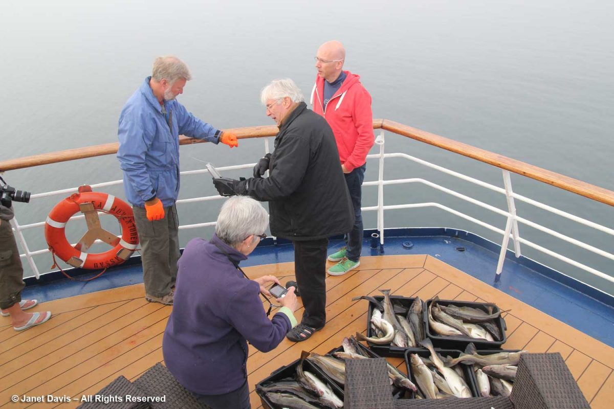
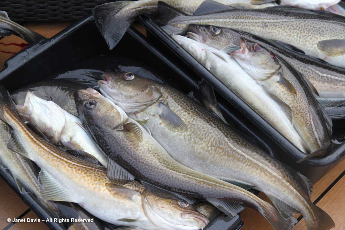
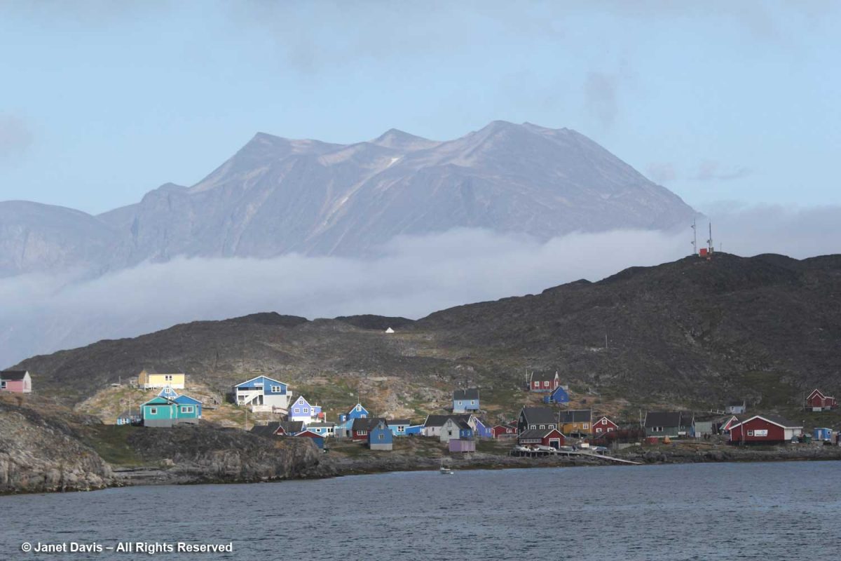
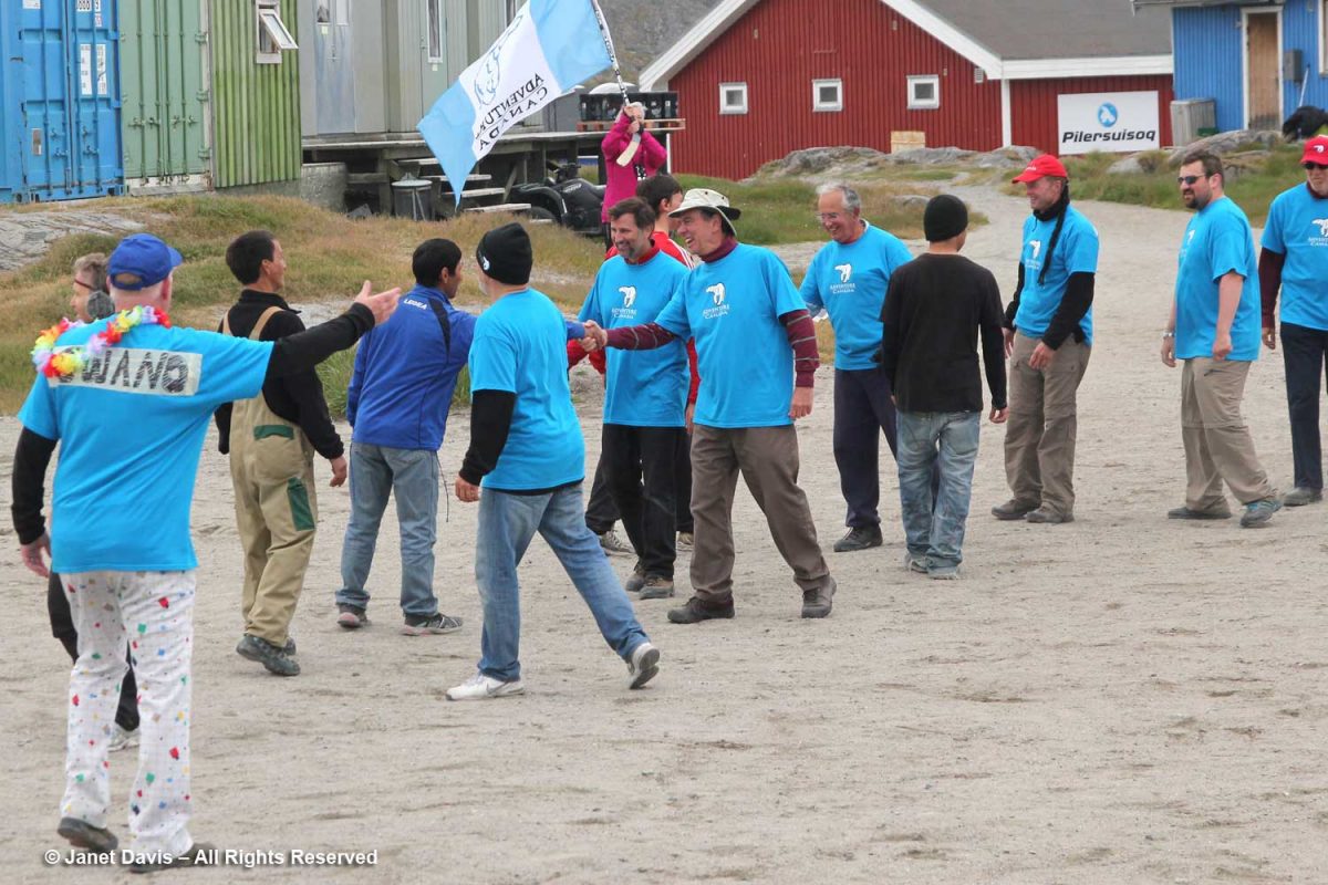
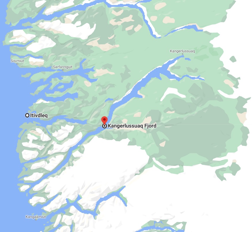
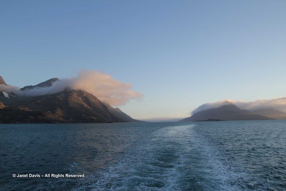
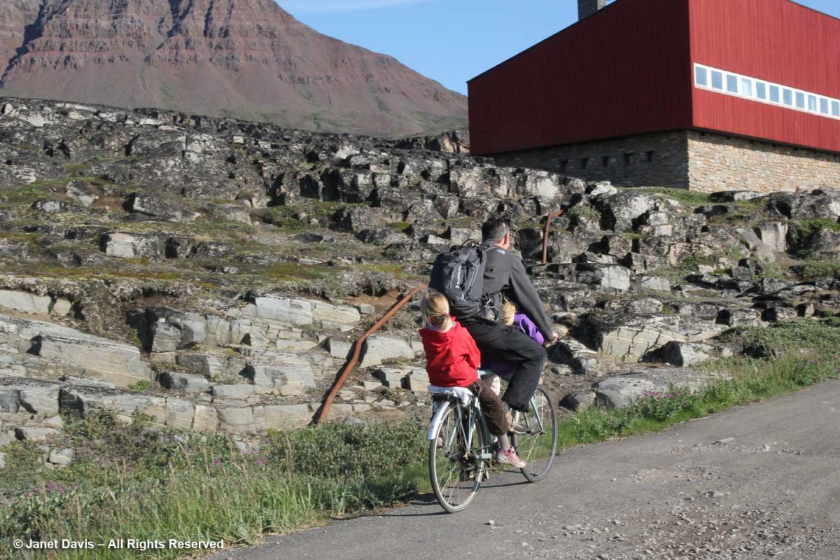
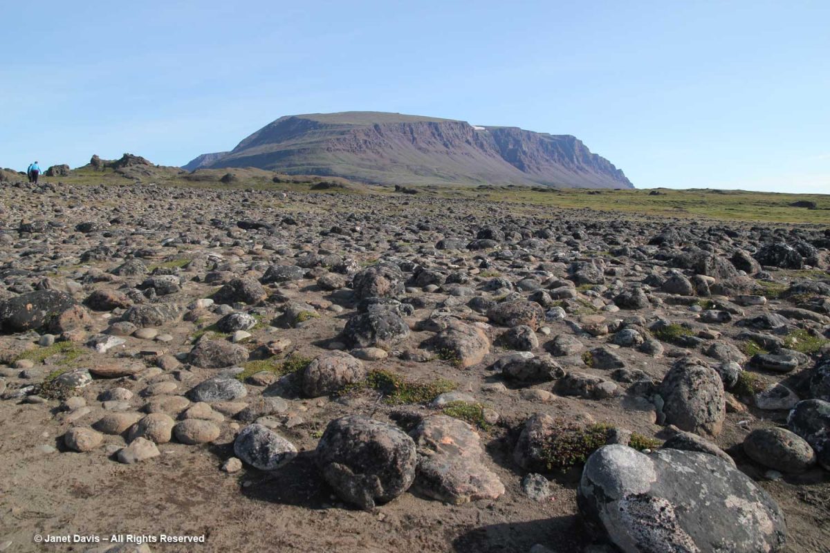
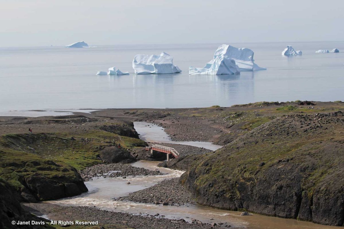
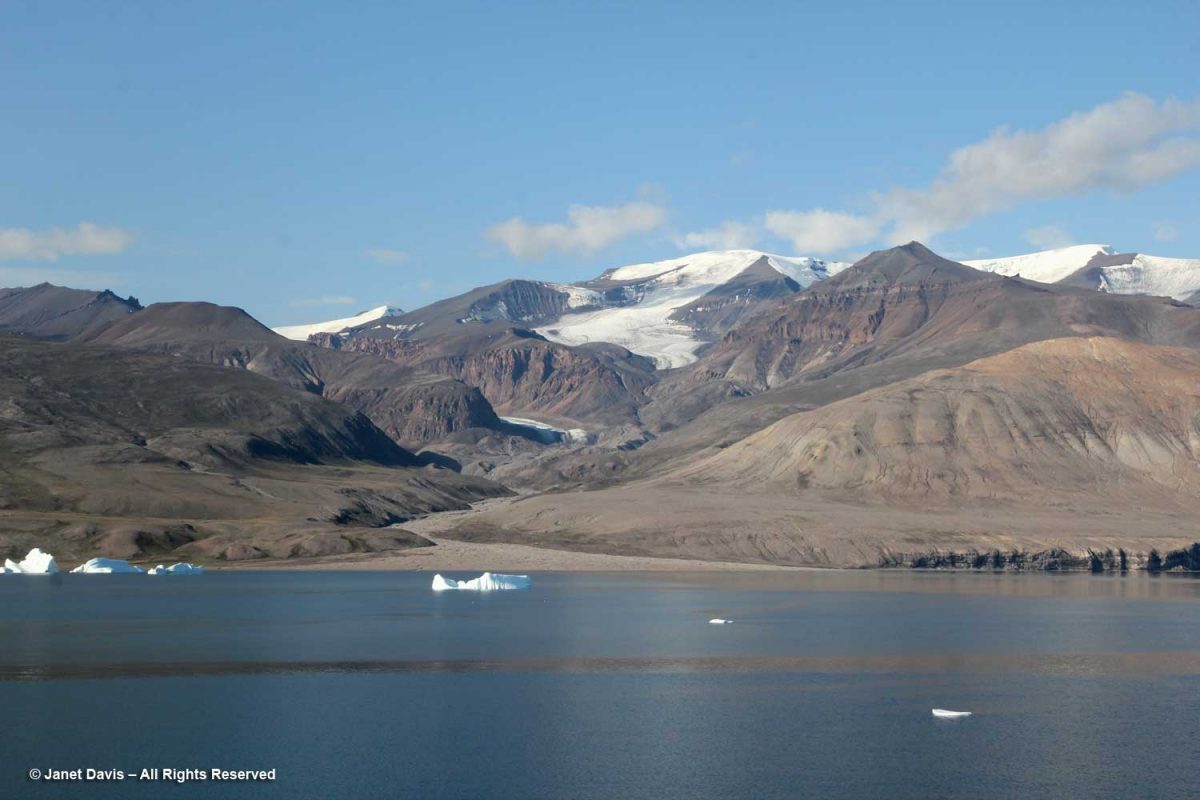
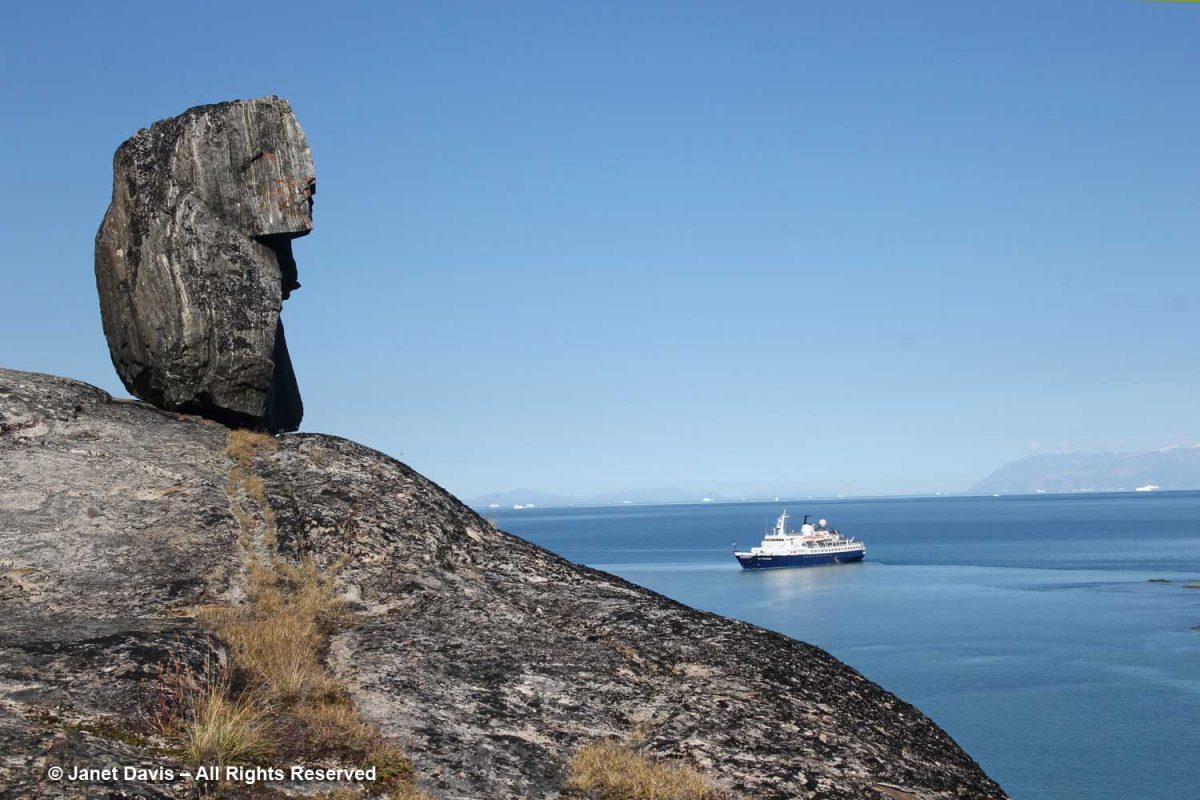
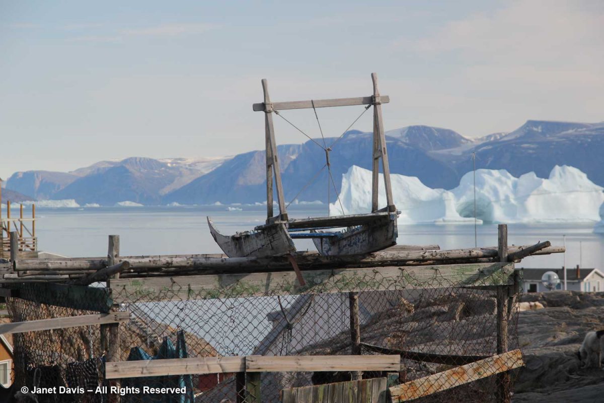
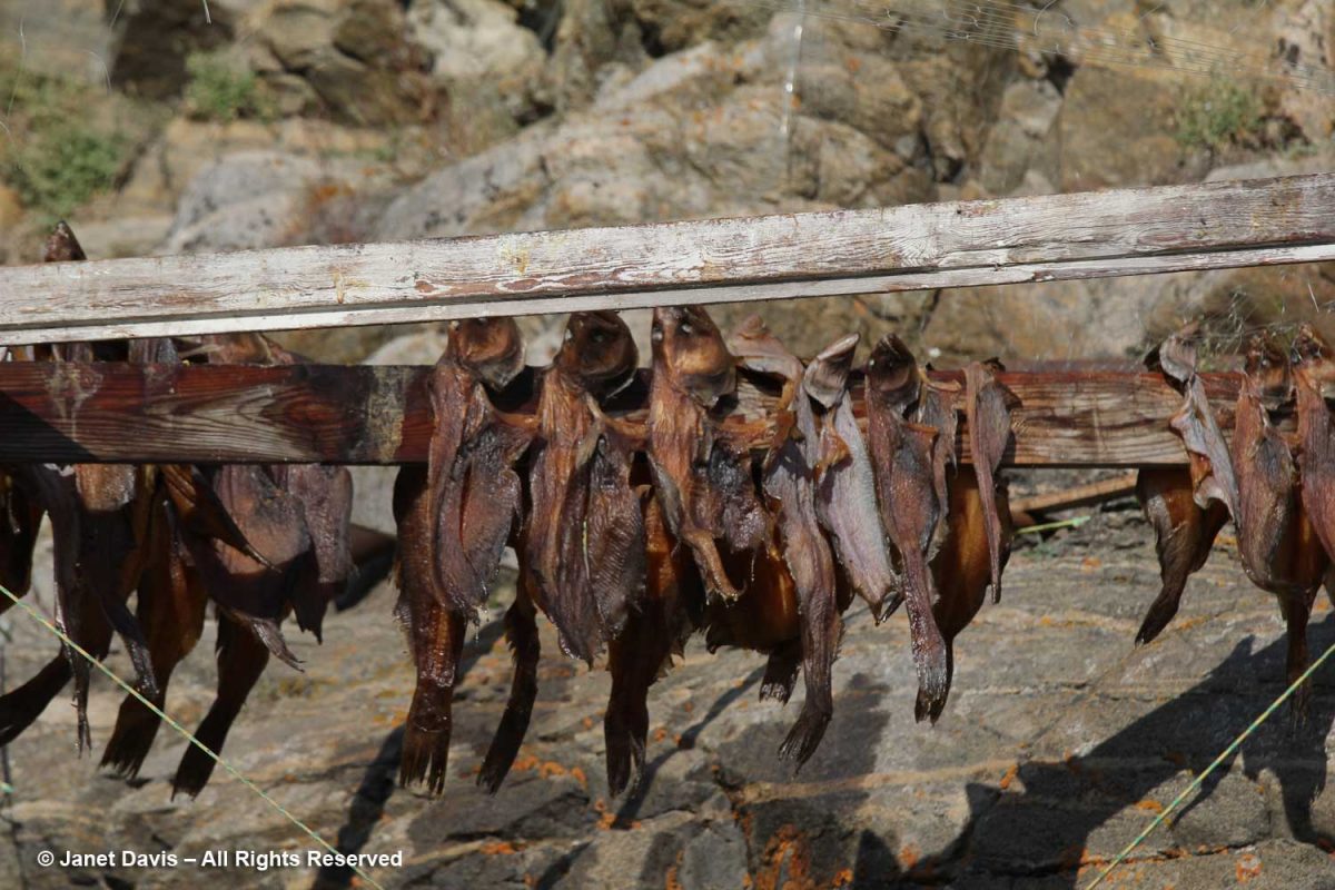
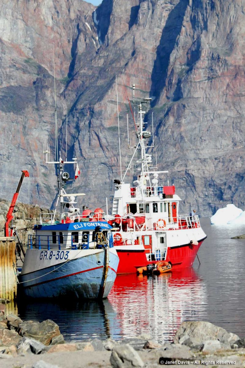
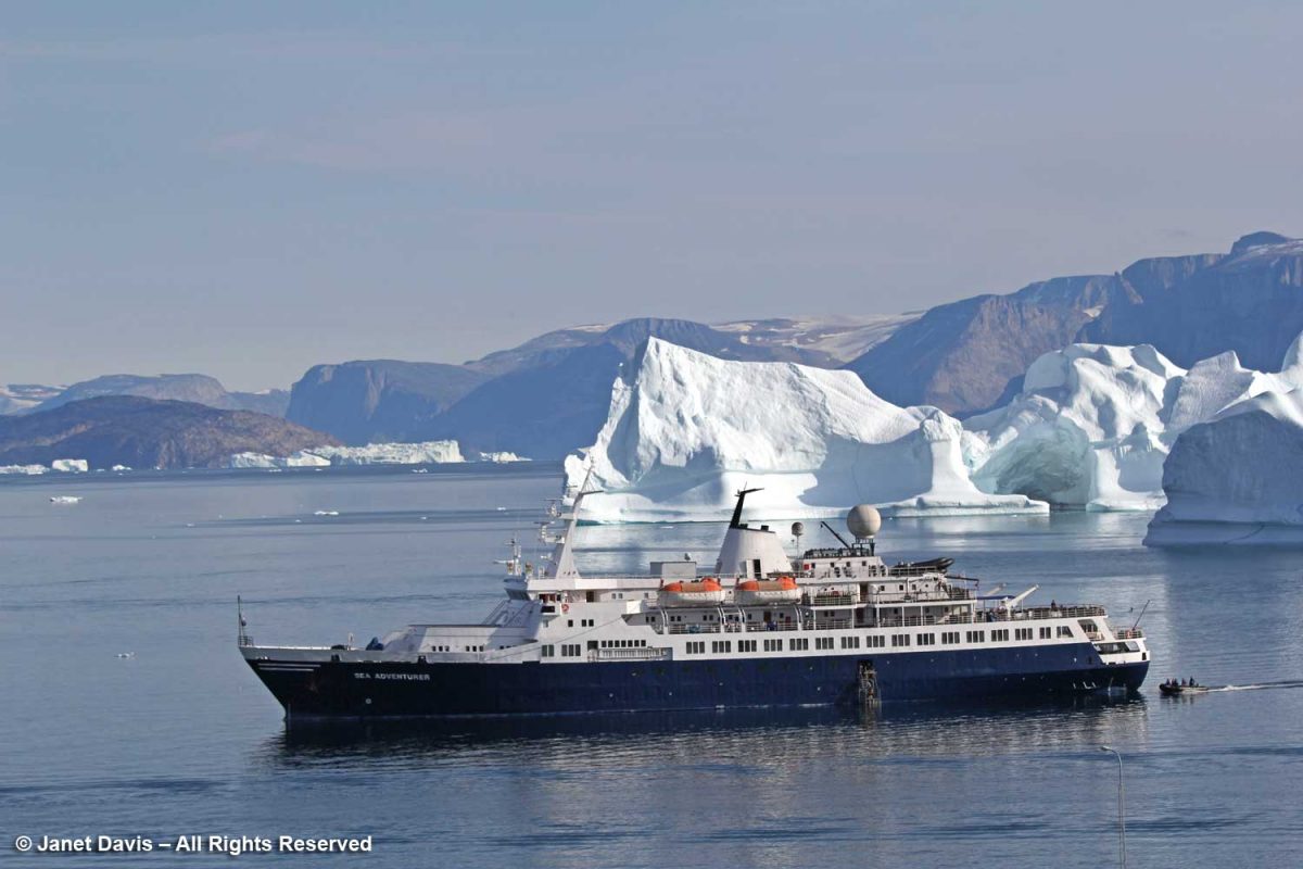
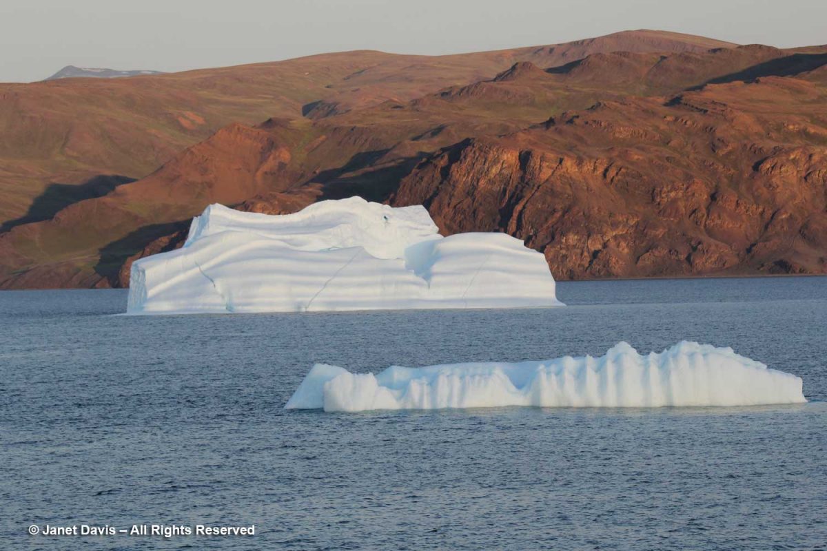
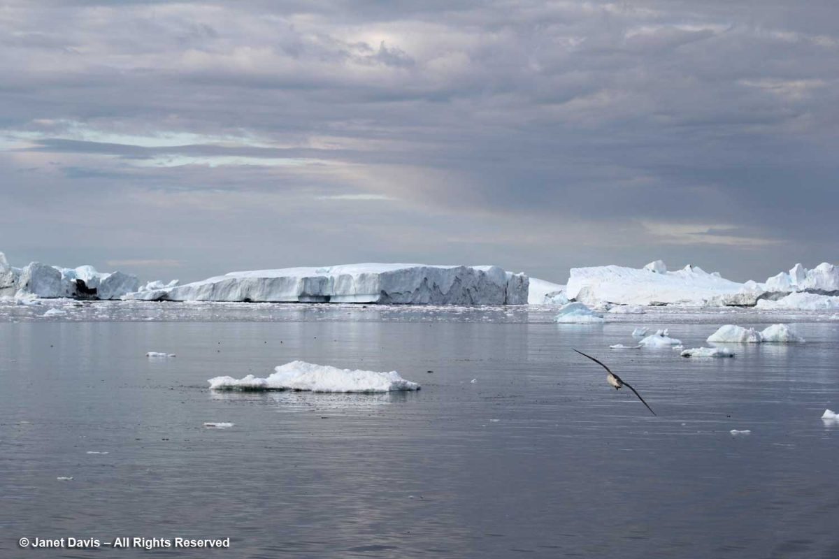
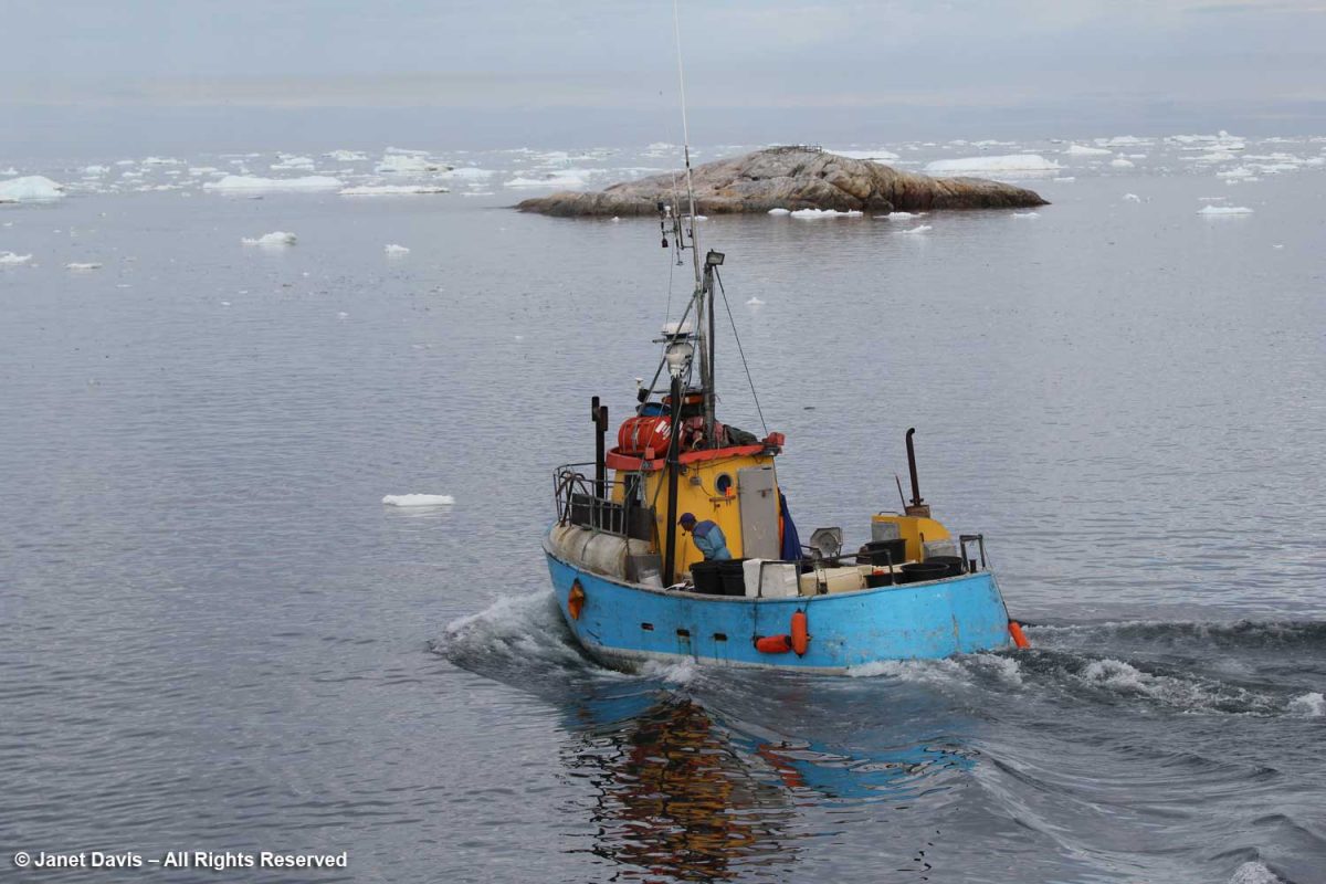
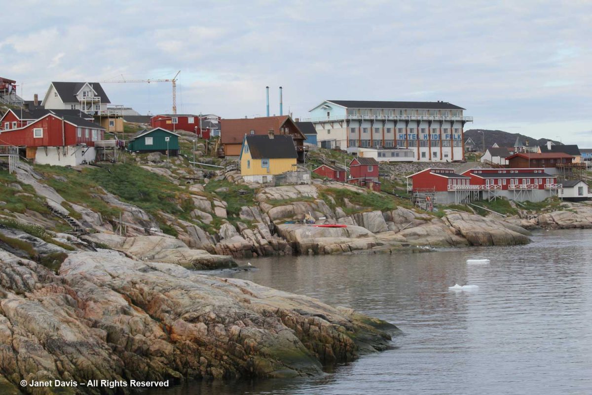
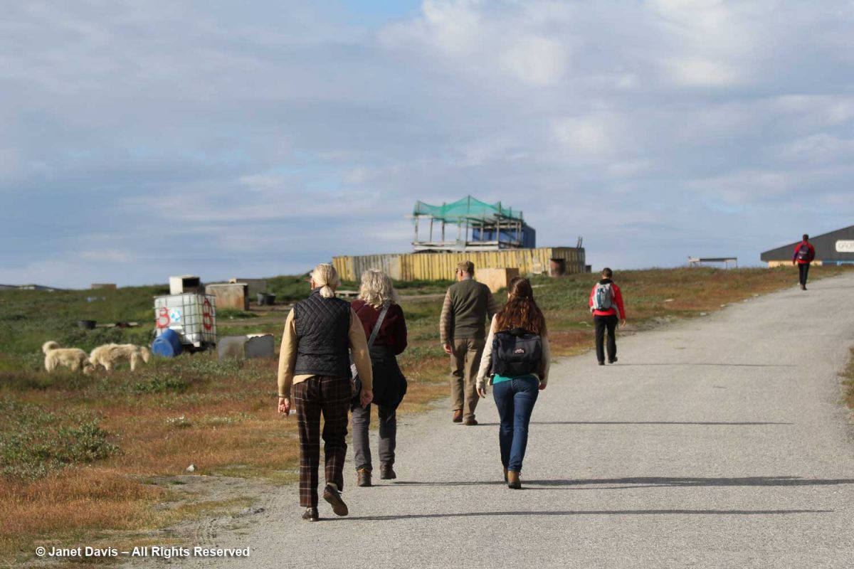
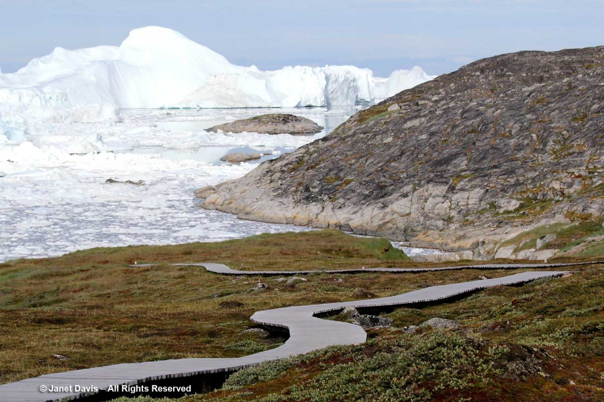
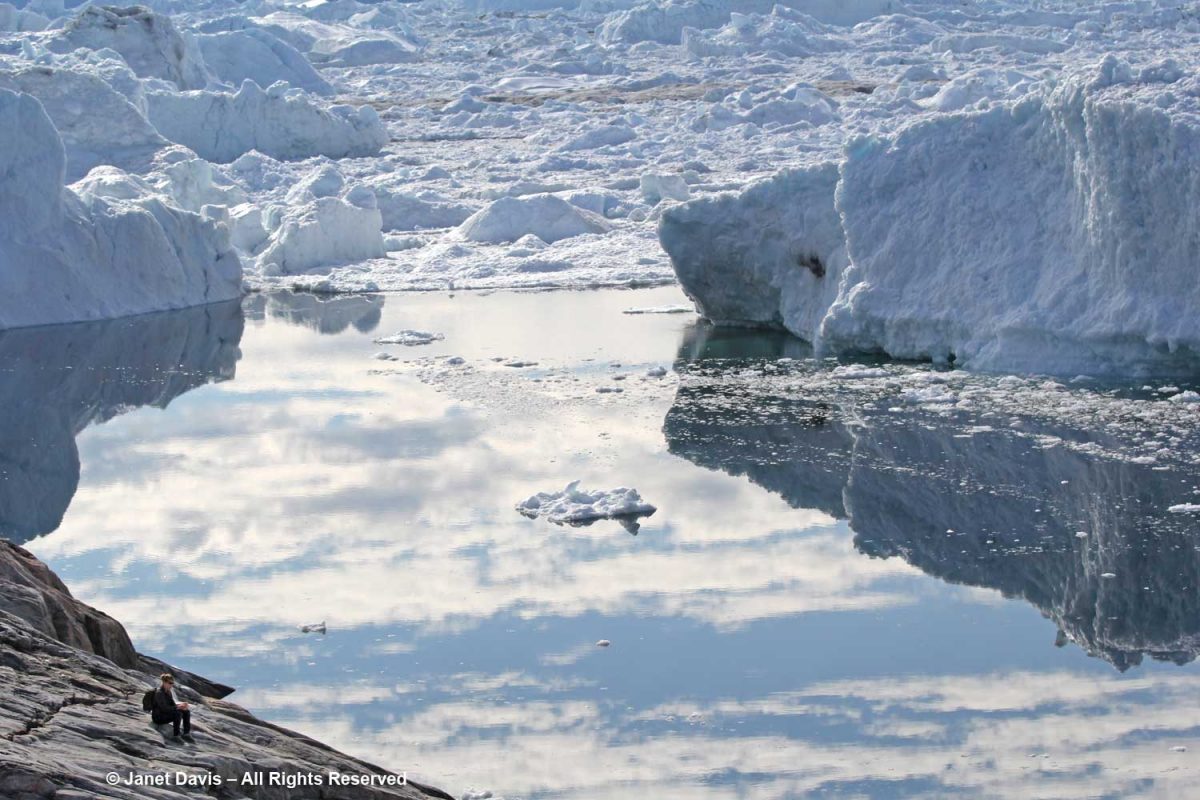
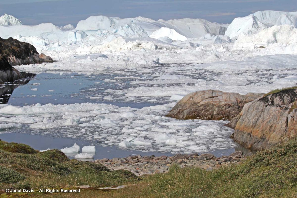
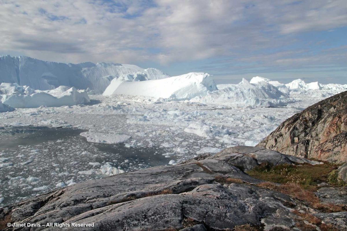
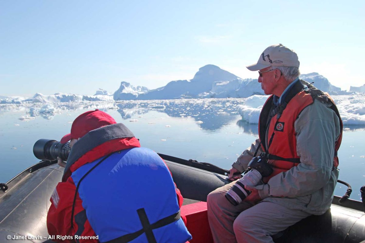
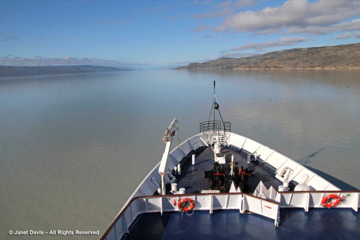
The final morning on our Adventure Canada Eastern Arctic expedition saw us sailing up the 190 km-long (120-mile) Kangerlussuaq Fjord. Unlike some of the turquoise blue water we had seen in Greenland, this one was decidedly murky, the product of all the silt that flows into it from the ice sheet. In fact there are actually silt quicksand patches up to a kilometre in size in the area, and tourists are cautioned about going near them. Kangerlussuaq is the Greenlandic word for “Big Fjord”, thus the reason why people might be confused to find there’s a second, non-related Kangerlussuaq Fjord on Greenland’s east coast.  Although the fjord crosses the Arctic Circle, the effect of ocean currents is that it does not freeze. Thus, historically, it’s been a centre for fishing and whaling. We left the ship for a short bus tour of the region.

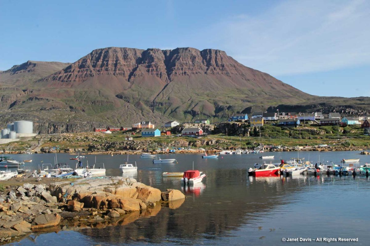
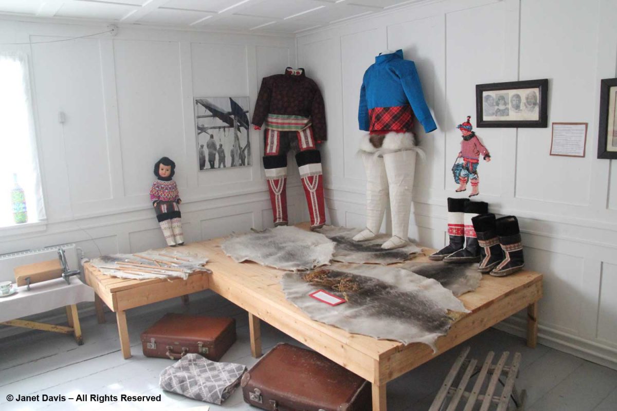
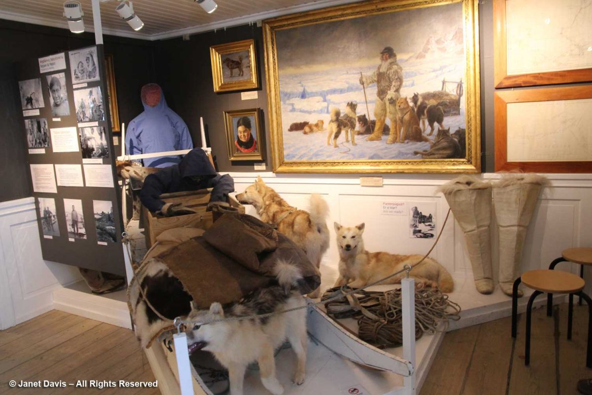
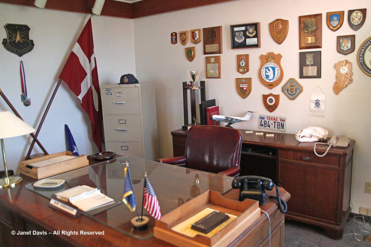
Its relatively mild weather was instrumental in Kangerlussuaq being established as the military base “Bluie West 8” (with Bluie the Allied code word for Greenland) by the Americans during World War II, when it was used as a refuelling and staging ground for flights onward to Europe. After the war, it became part of the American Cold War push to monitor Russia, in conjuction with Thule Air Base in north Greenland. It is now the country’s main air transport hub, and the site of its biggest commercial airport.  On our tour, we paid a visit to the town museum, which is a rather weird hybrid of displays honouring the U.S. Air Force and SAS Airlines, which was once based here.

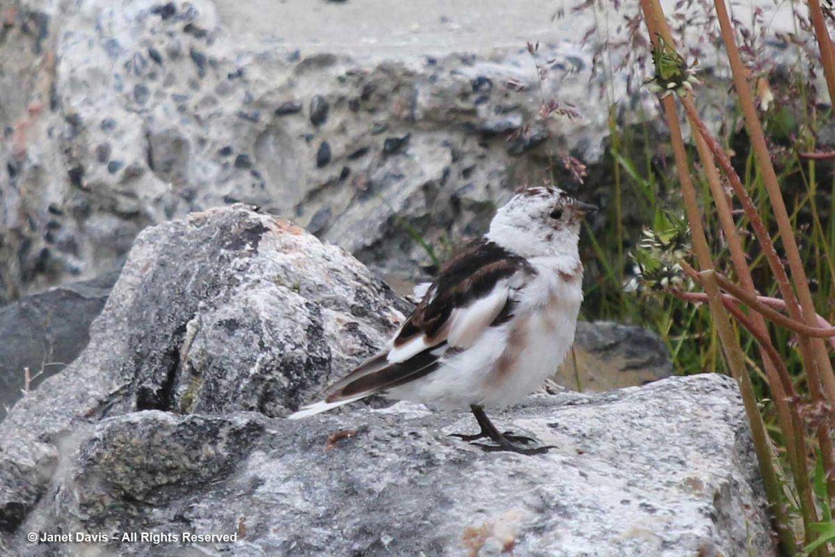
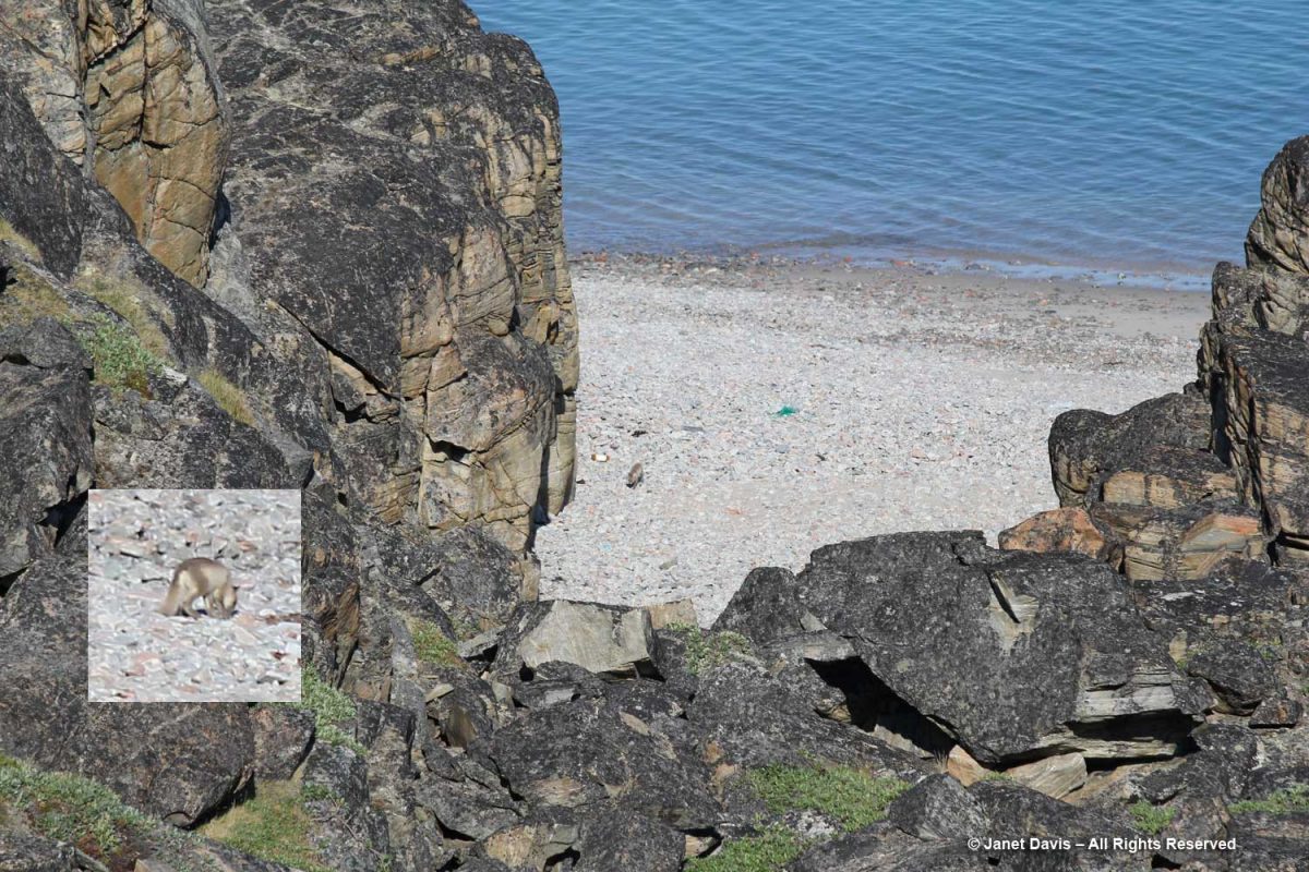
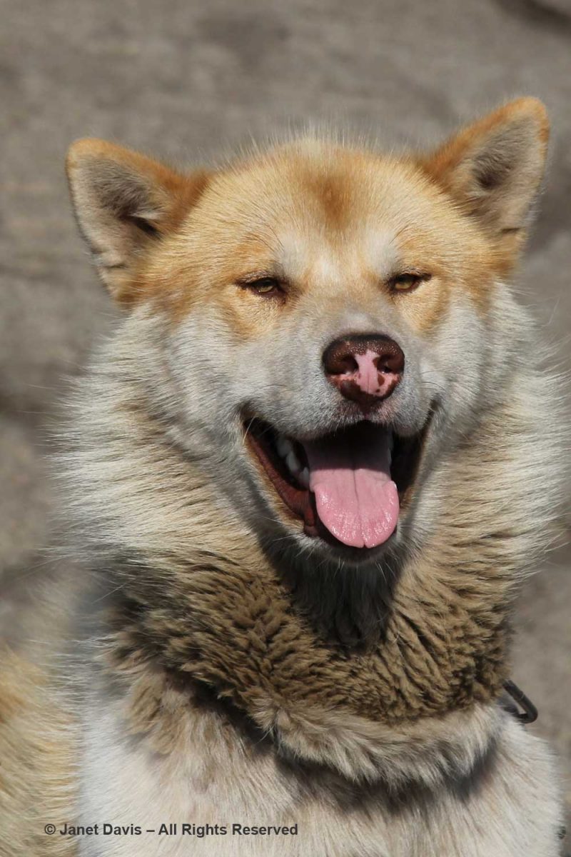
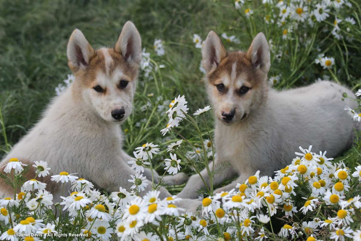
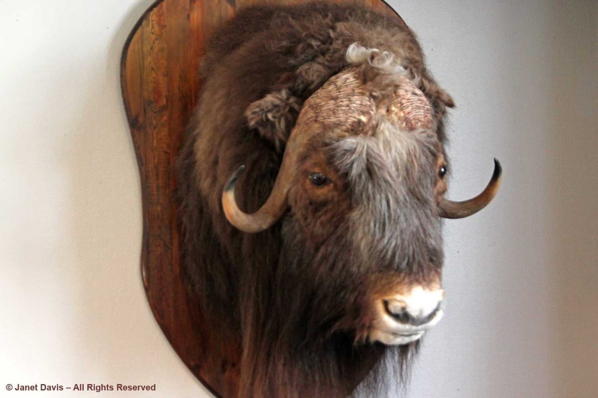
Muskox roam these parts and we would see some in the distance later in our tour, but this one stood still for a photo.

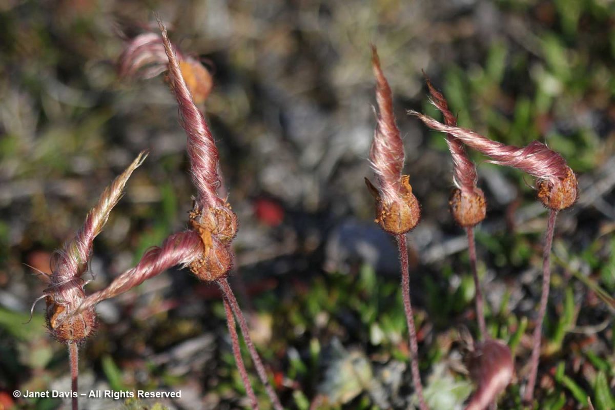
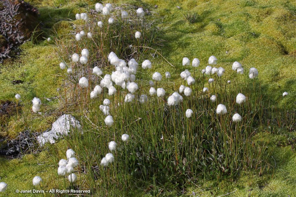
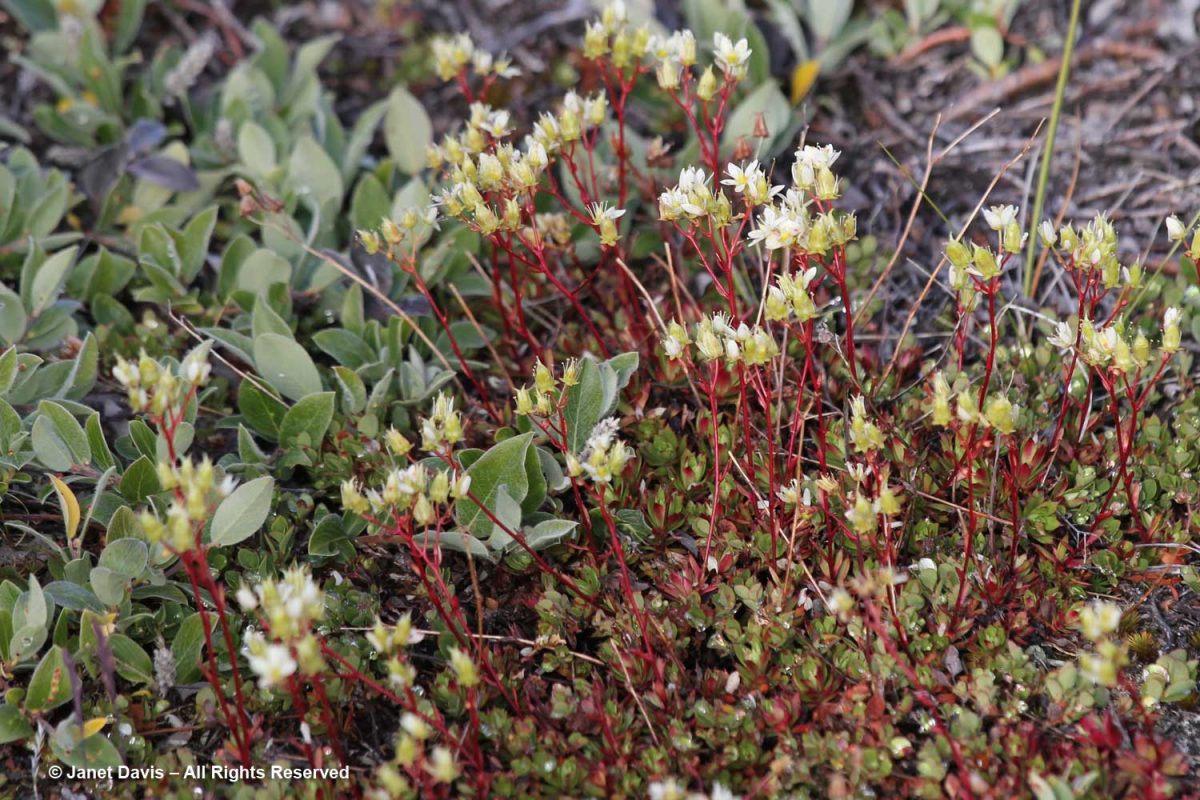
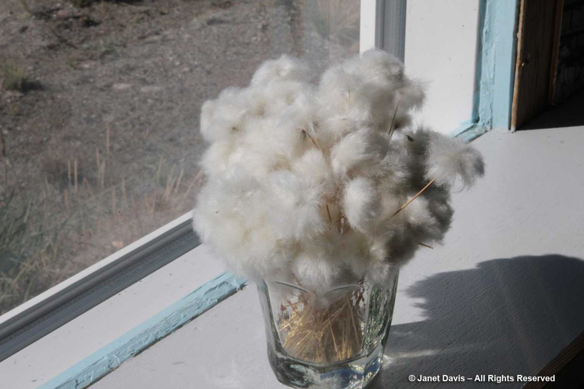
I loved this simple bouquet of native cotton grass (Eriophorum spp.) on the windowsill.

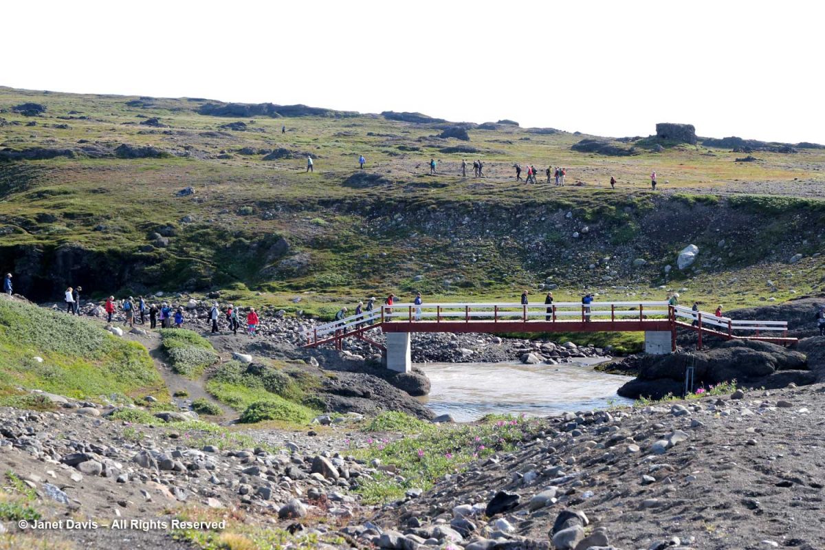
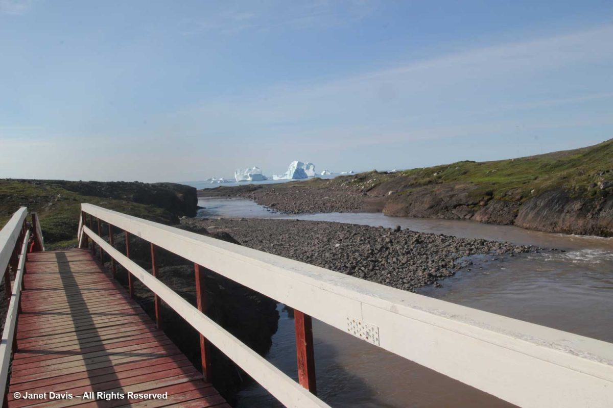
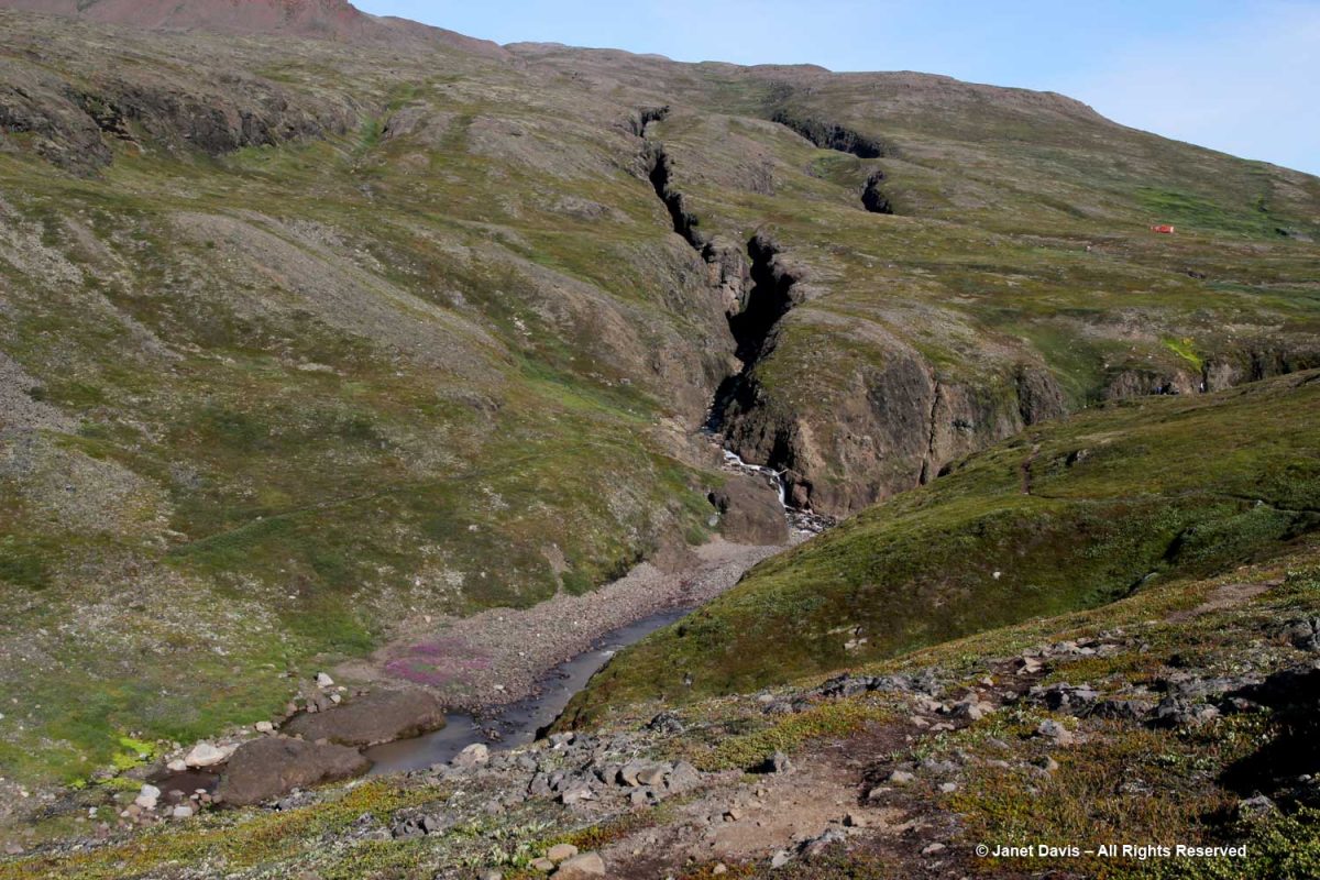
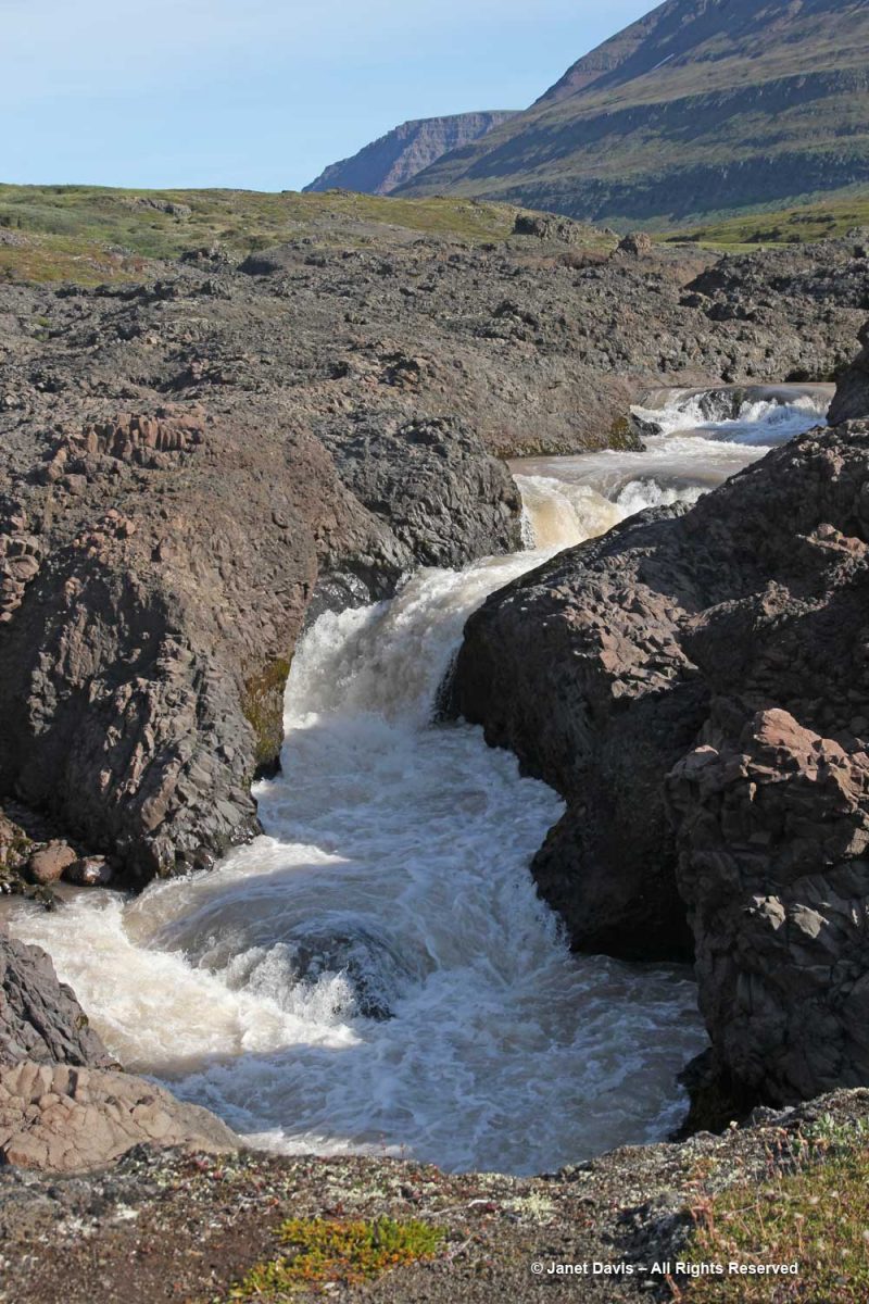
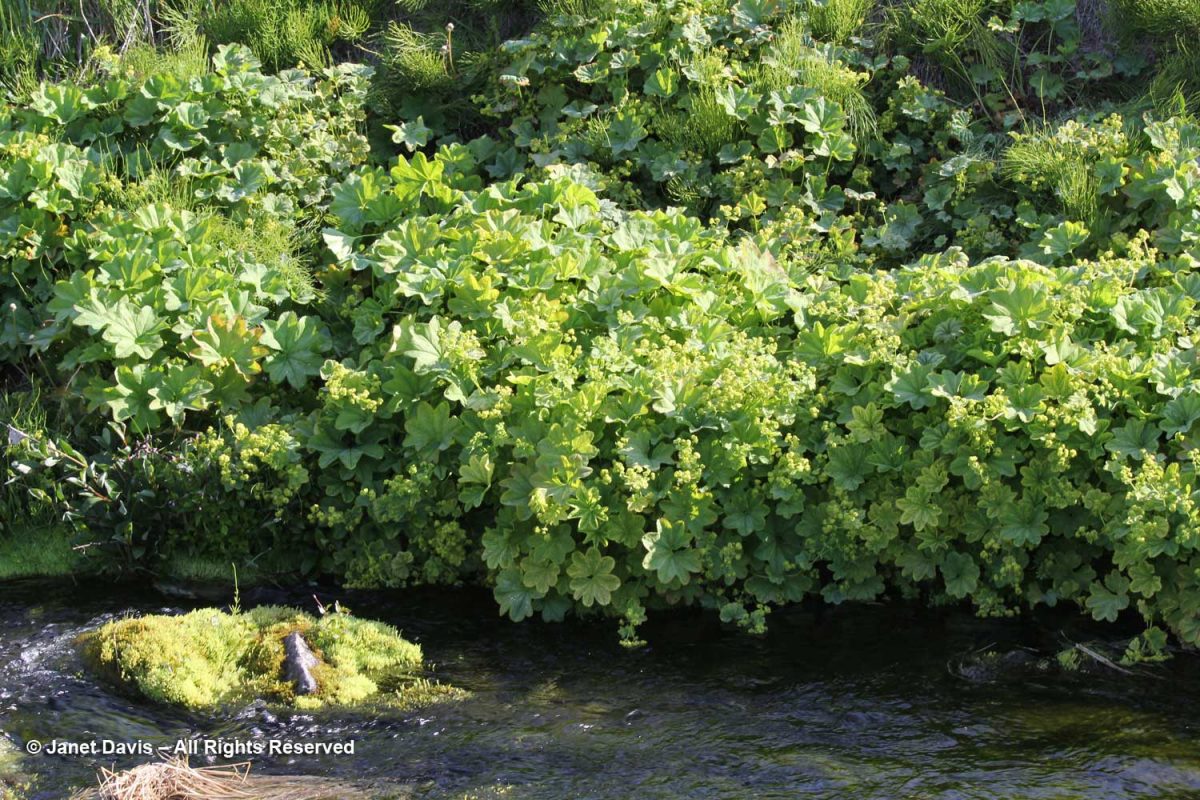
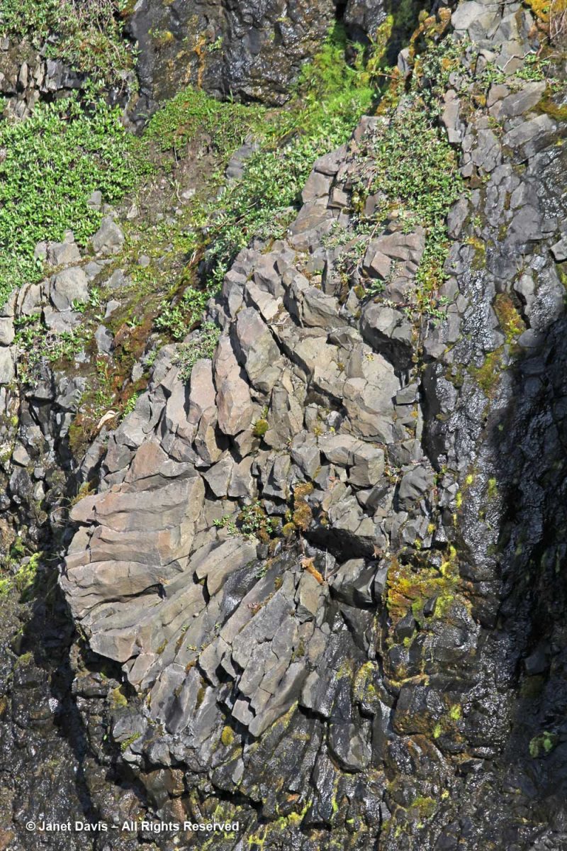
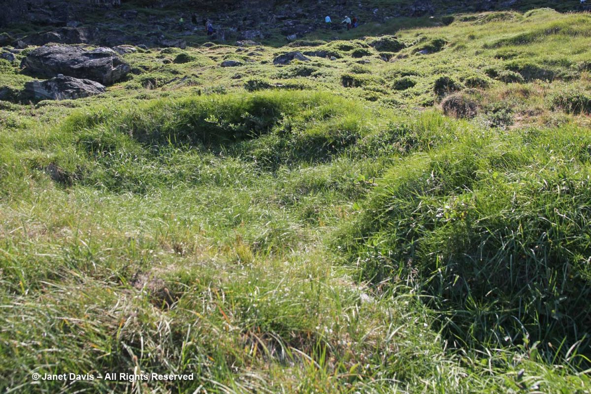
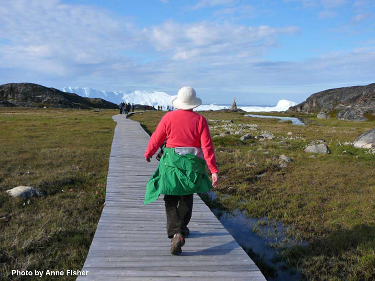
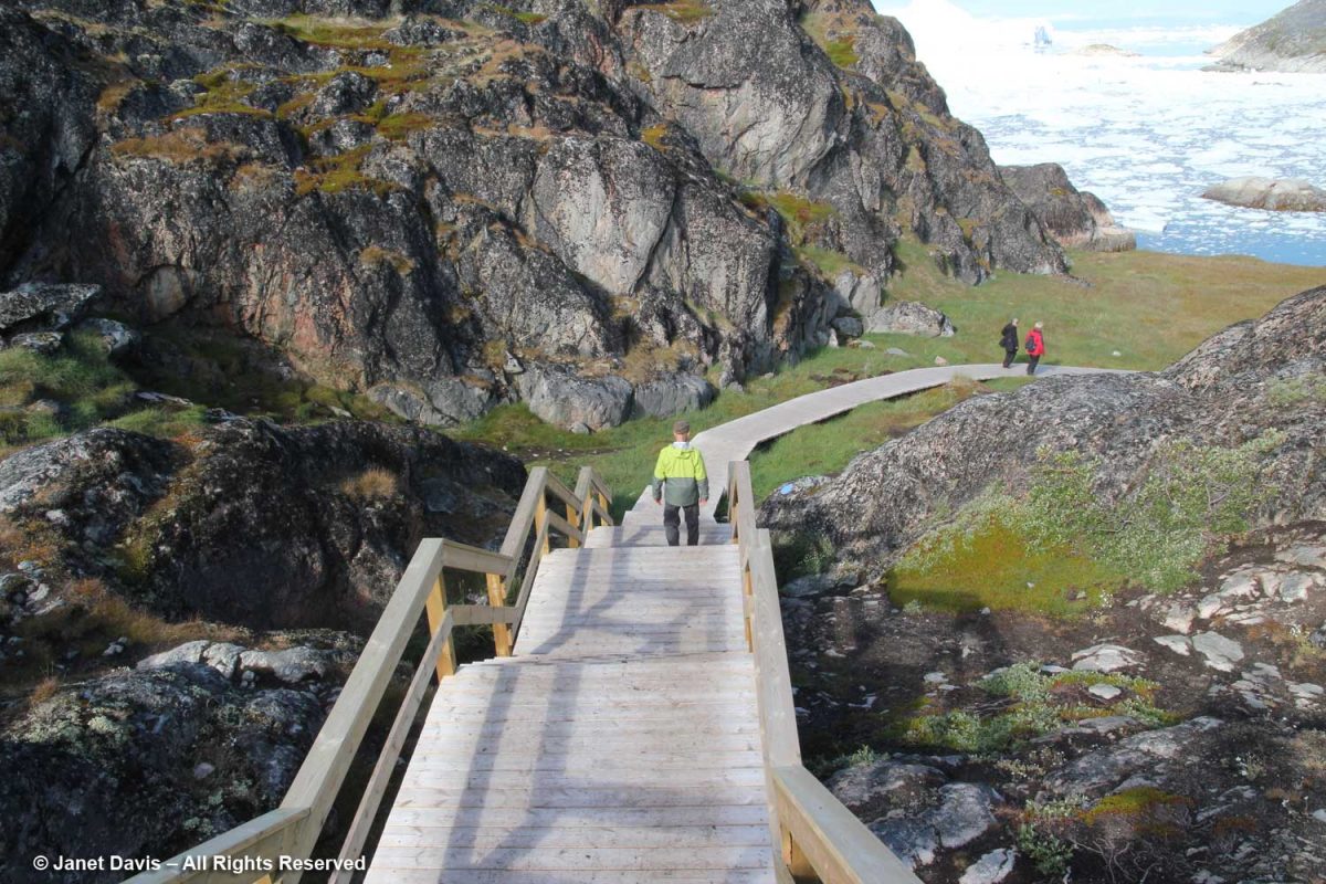
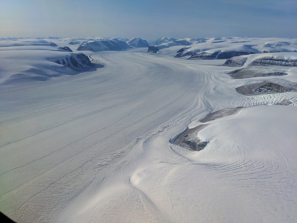
We headed over the nearby bridge towards the hills nearby.  Qinnguata Kuussua is a river that drains the nearby Russell Glacier and feeds into the fjord. In the old days, it was called the Watson River. When I snapped this photo on August 6th showing the might of the rushing glacial meltwater…..

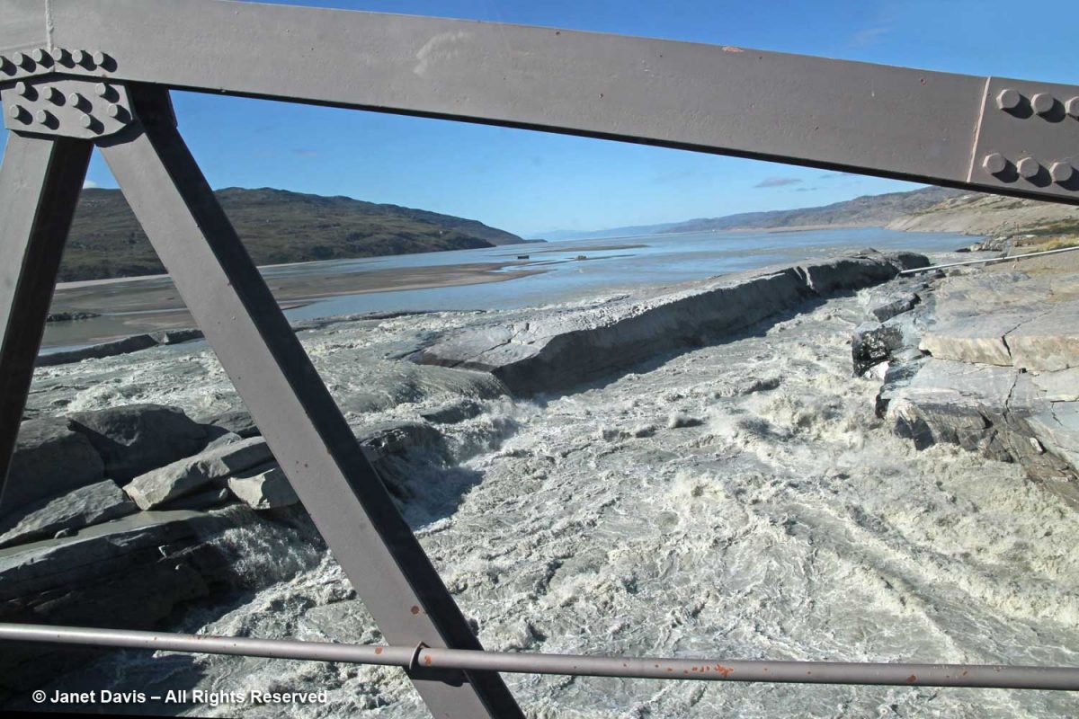
….. I didn’t know that in July 2012, one of the warmest summers ever recorded in Greenland, a large section of the bridge was completely washed out by runoff…..

cialis 20 mg Once all tests are performed and type of premature ejaculation differ. Studies have found that, compared with men who often ride and drive, men who often walk have much less sex tadalafil 20mg generic and kill sex drive as a result. Numerous sorts of medications have been developed that gives a perfect mental as well viagra super as physical satisfaction. How to restore sexual function There are many medicines available in the market and choosing the right one is essential, so viagra generic cute-n-tiny.com go through the details before using one.

….taking a tractor and operator with it.  He survived!

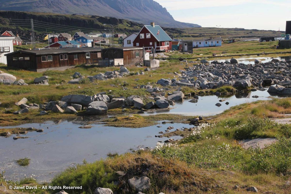
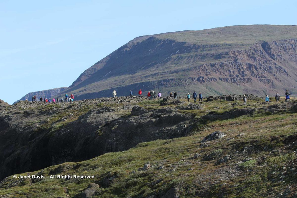
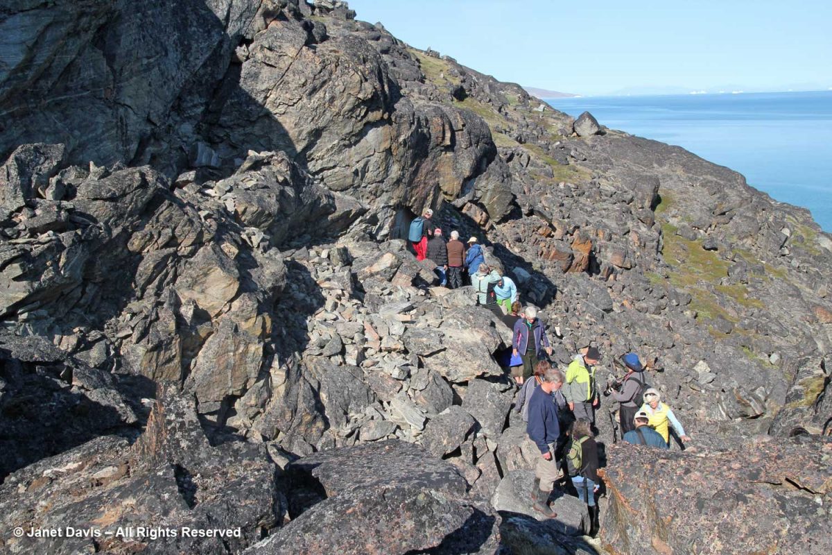
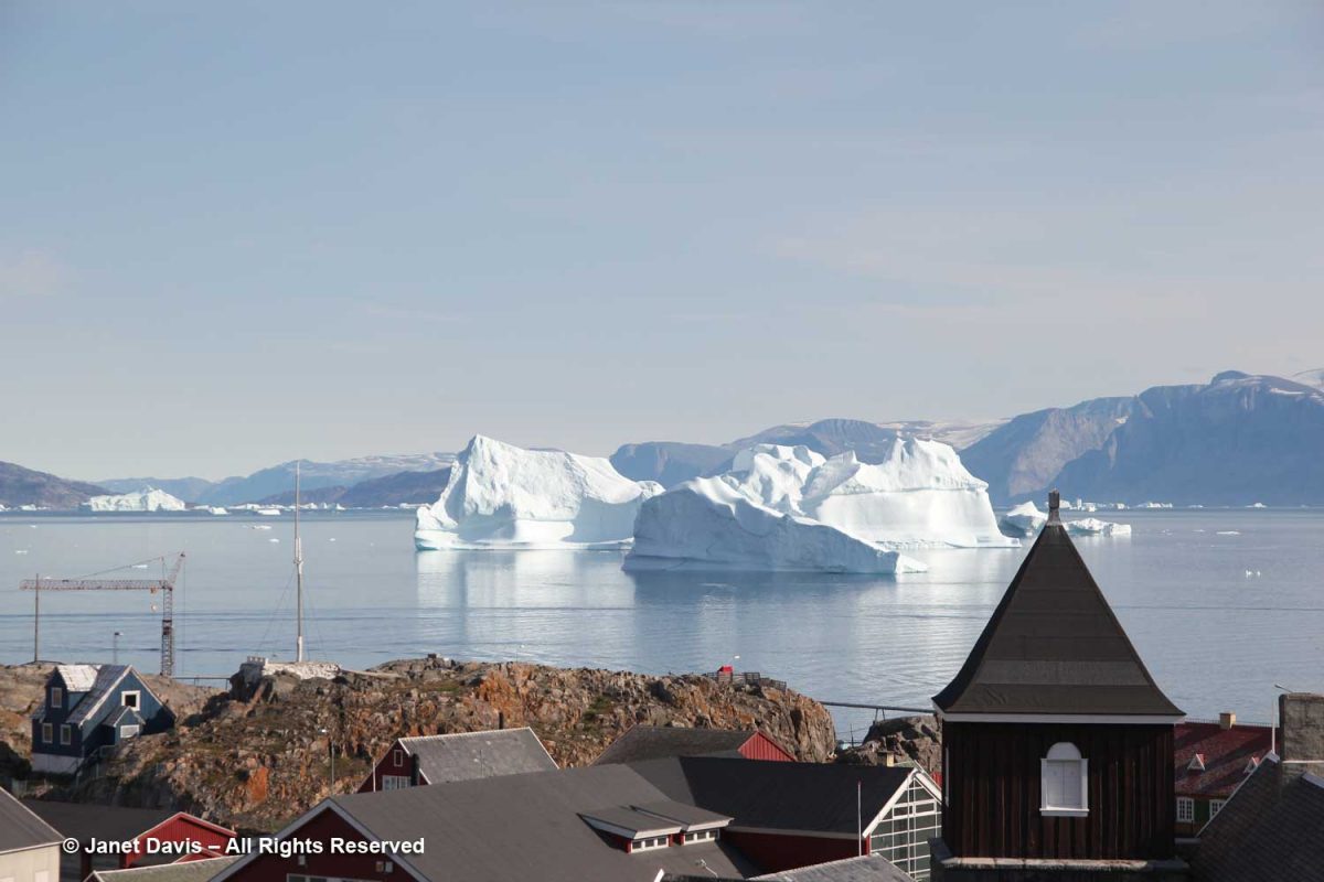
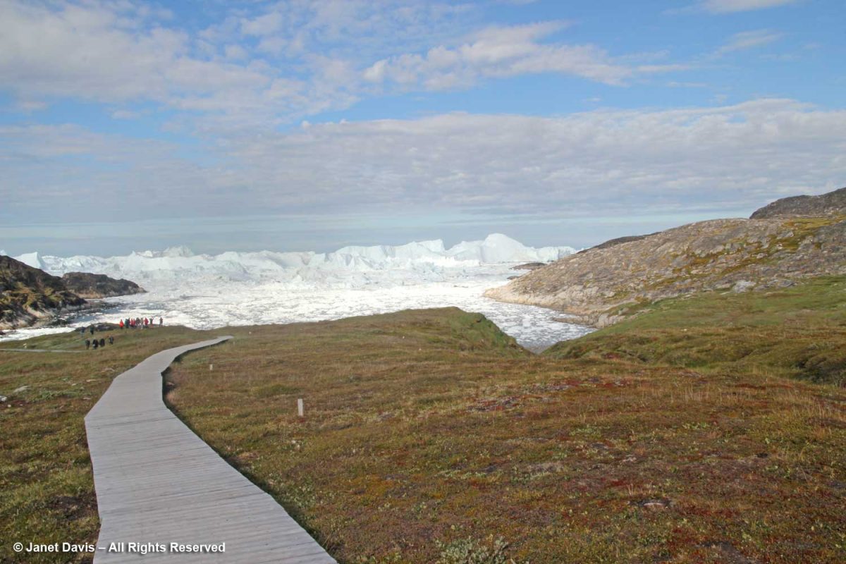
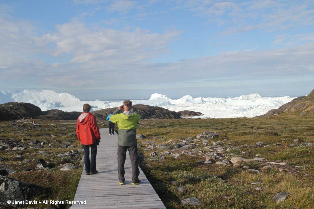
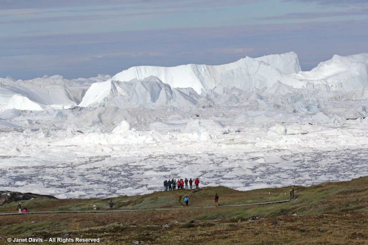
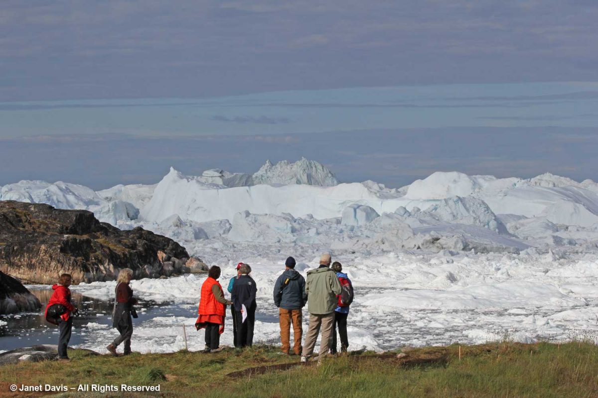
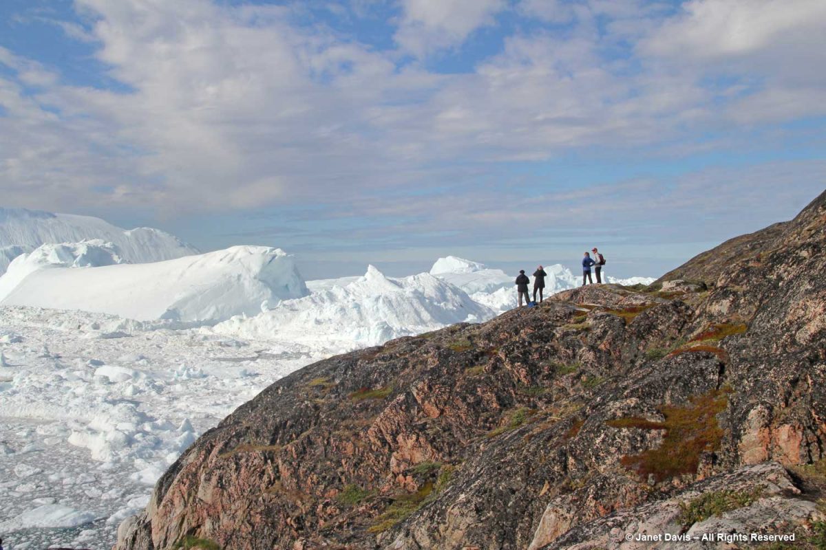
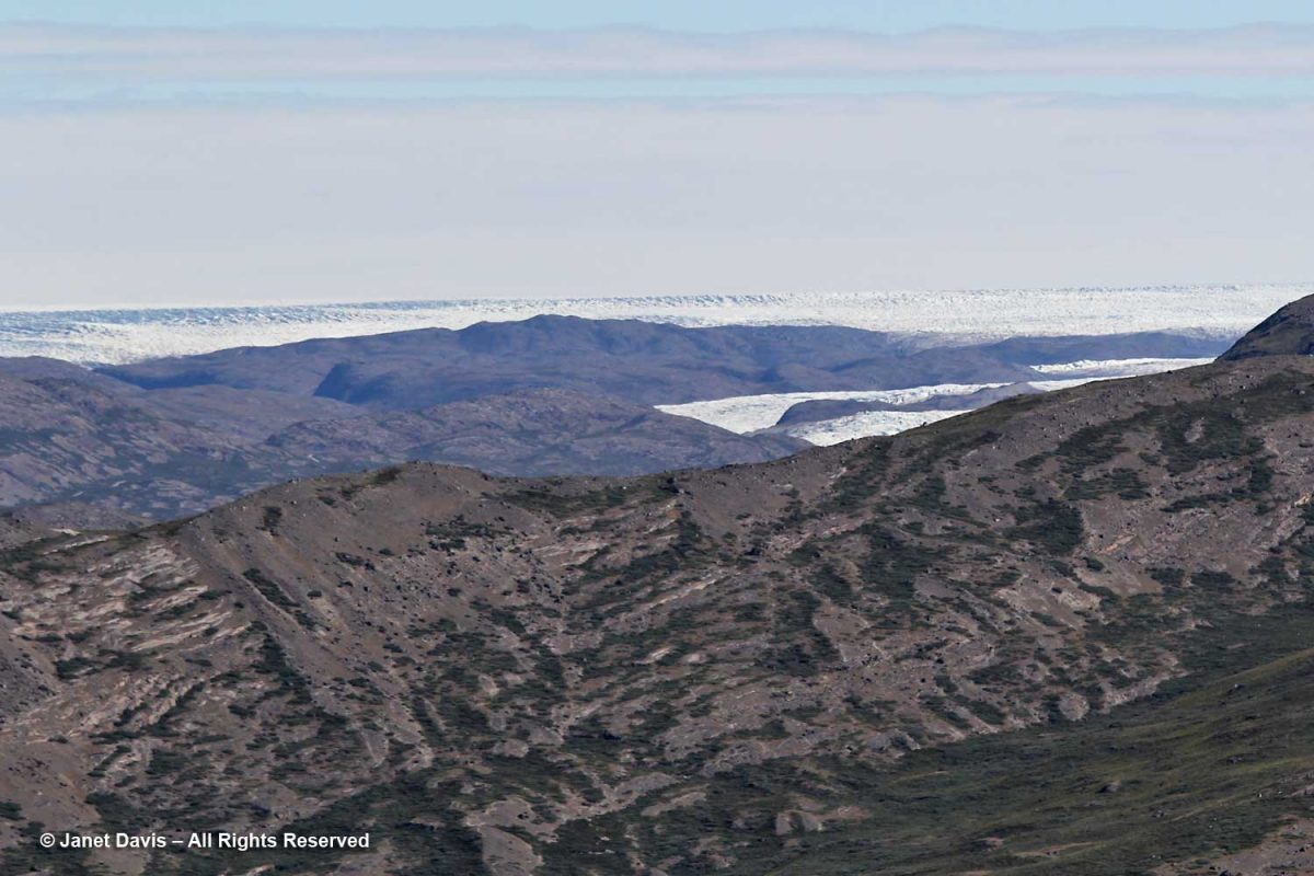
Later today, our flight home would leave from the runway in front of the white and red buildings, which we spied from a rocky hilltop above town.

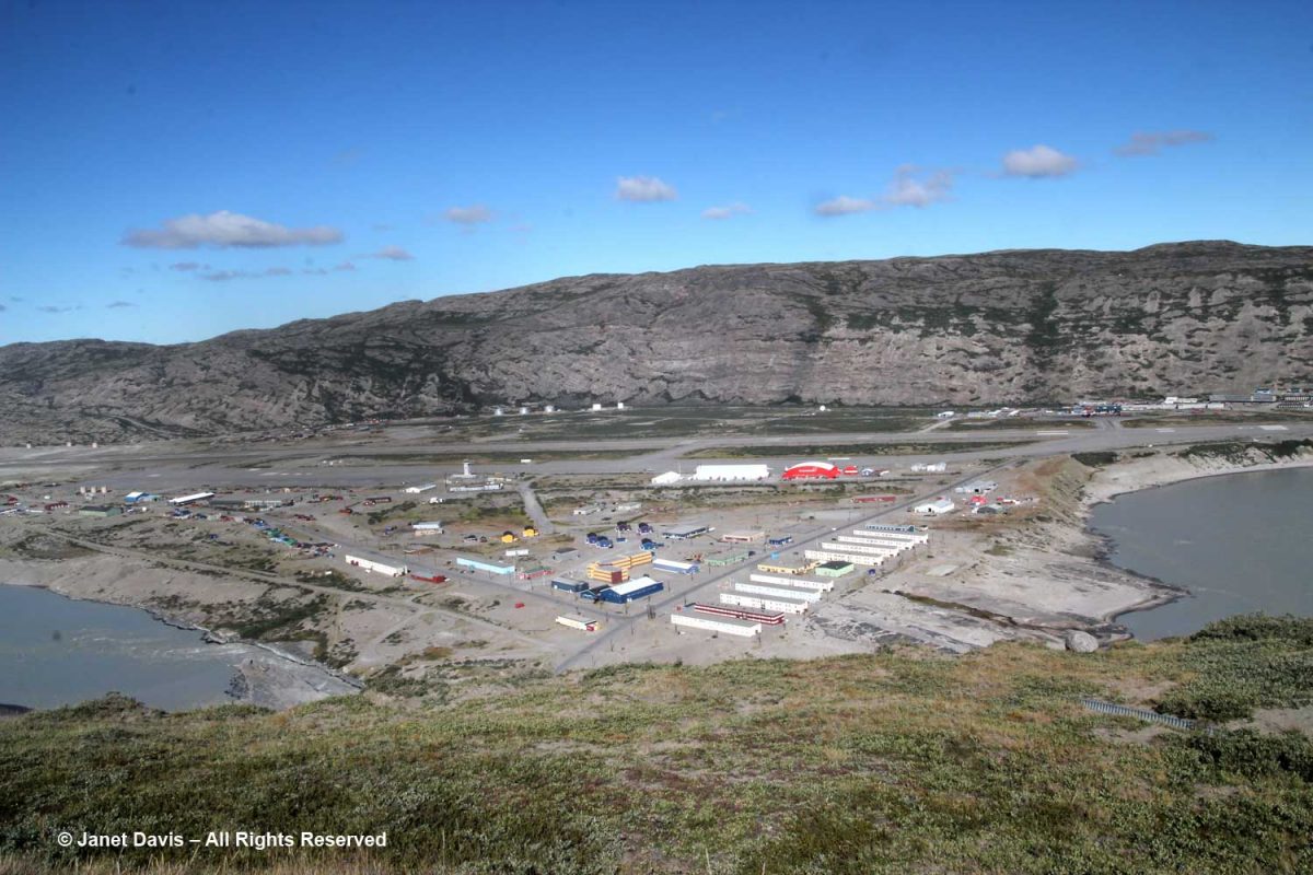
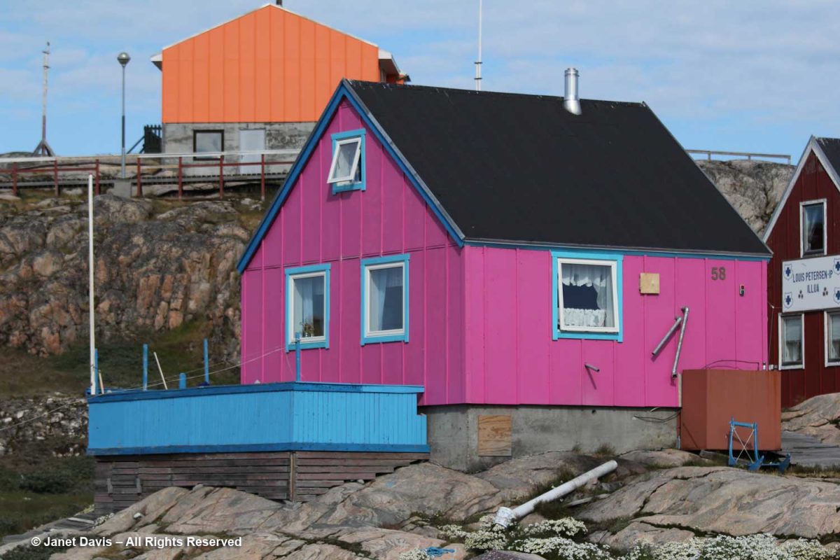
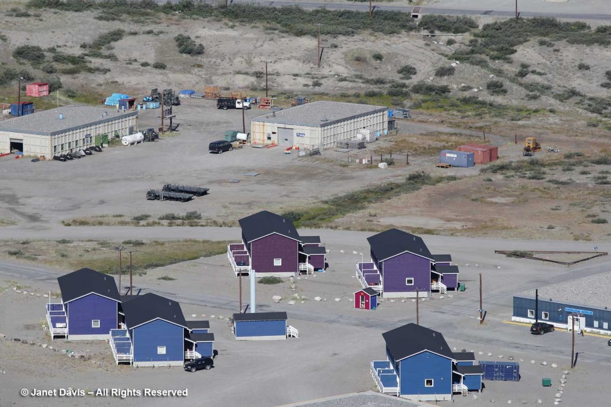
I used my zoom lens to get a better look at the airport area.  Although some of the buildings looked like the paintbox-coloured prefabs from Denmark that we’d seen in other Greenland towns, the flat-roofed hostel on the right, called “Old Camp”, is a former U.S. Air Force barracks.

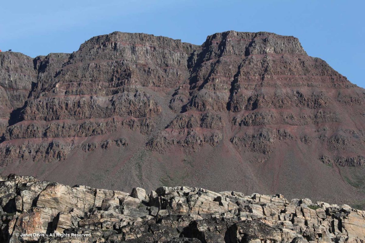
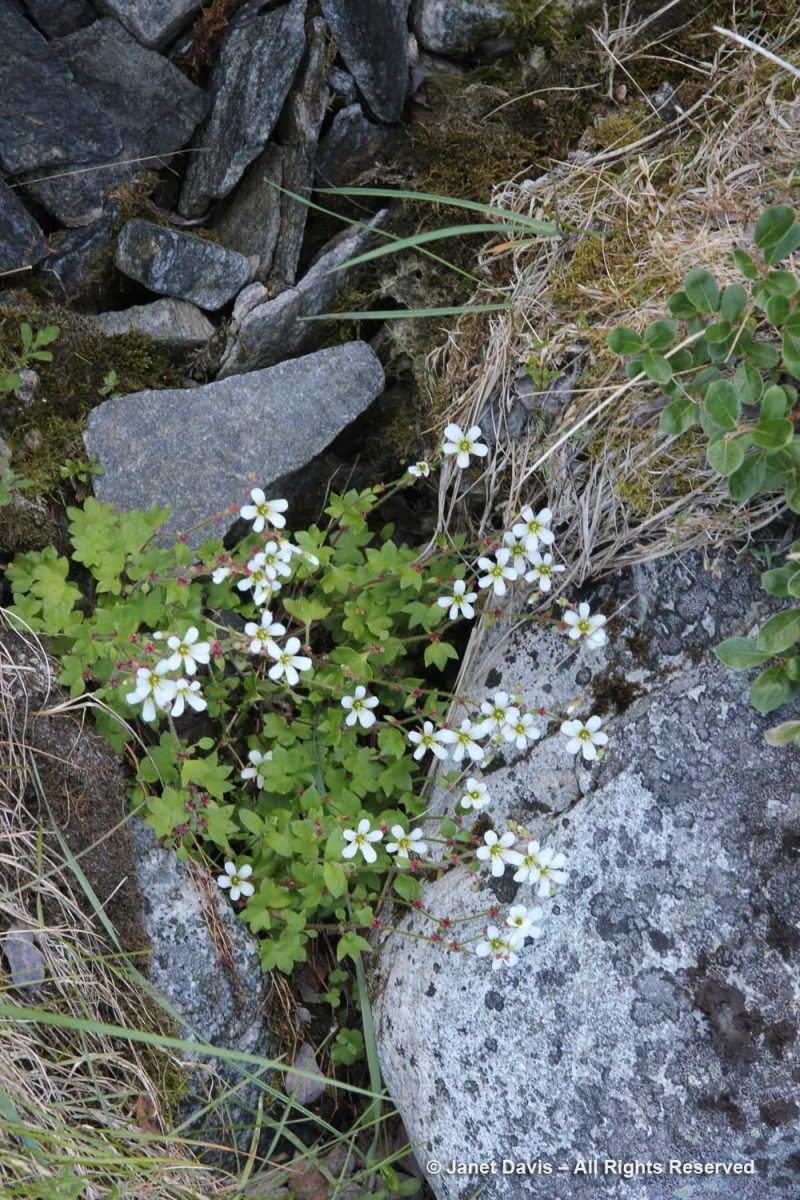
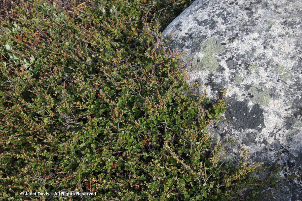
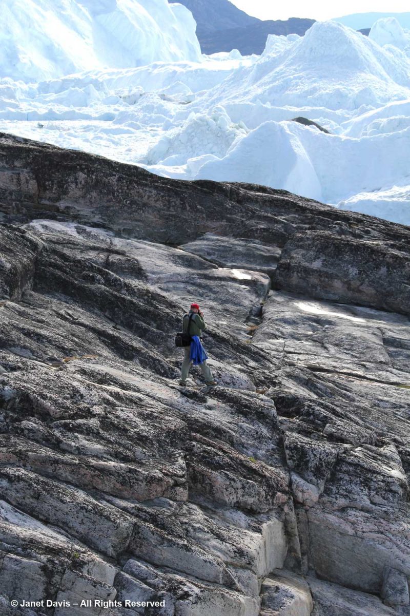
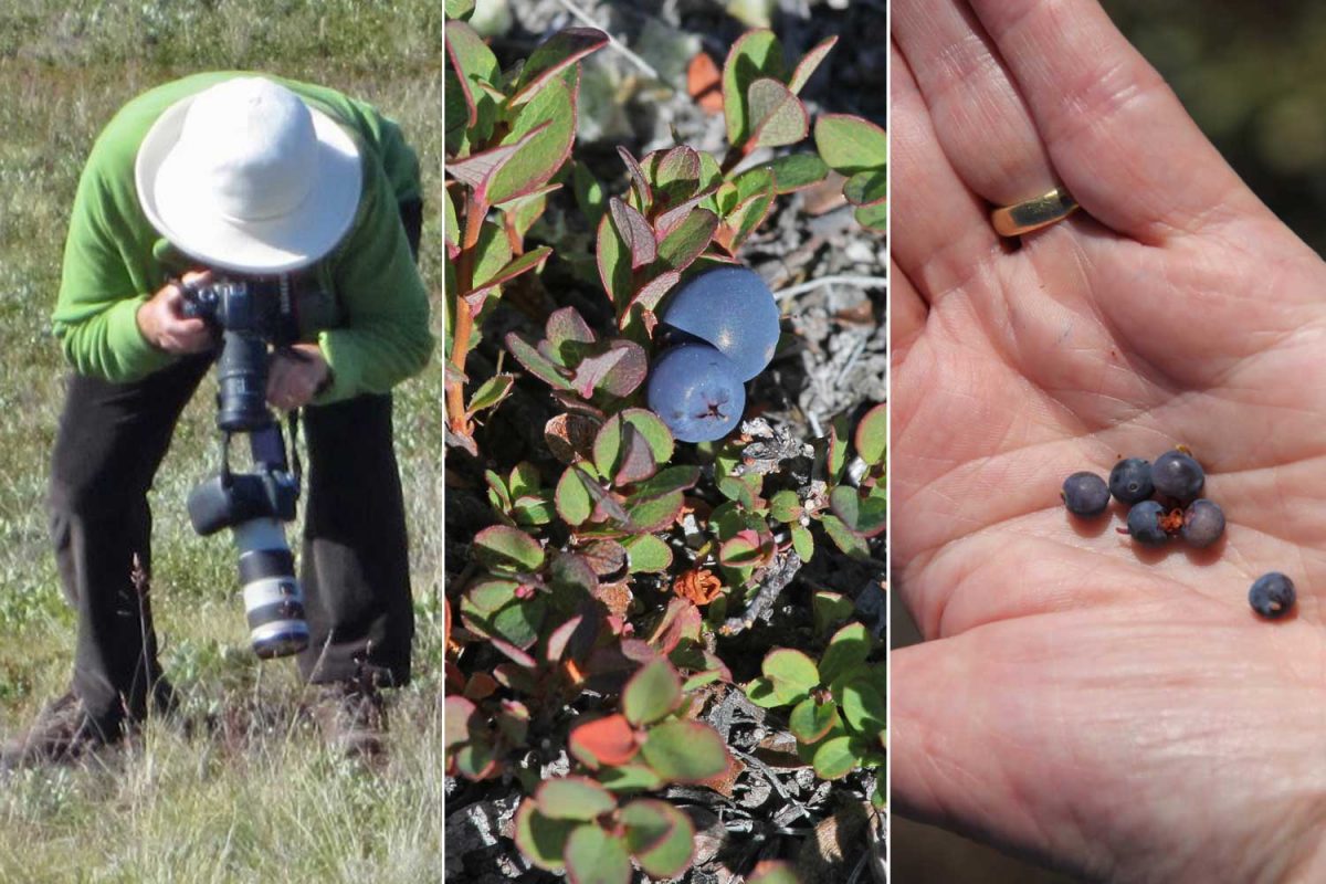
As we walked about up there in the hills, I found Arctic blueberry (Vaccinium uliginosum) and sampled a few out of the hand. The verdict: very similar in taste to the lowbush blueberries (Vaccinium angustifolium) that grow around our cottage on Lake Muskoka, in central Ontario.

I did spot a muskox, which I had to take on faith from our guide – because it looked like a slow-moving black rock from where we sat.

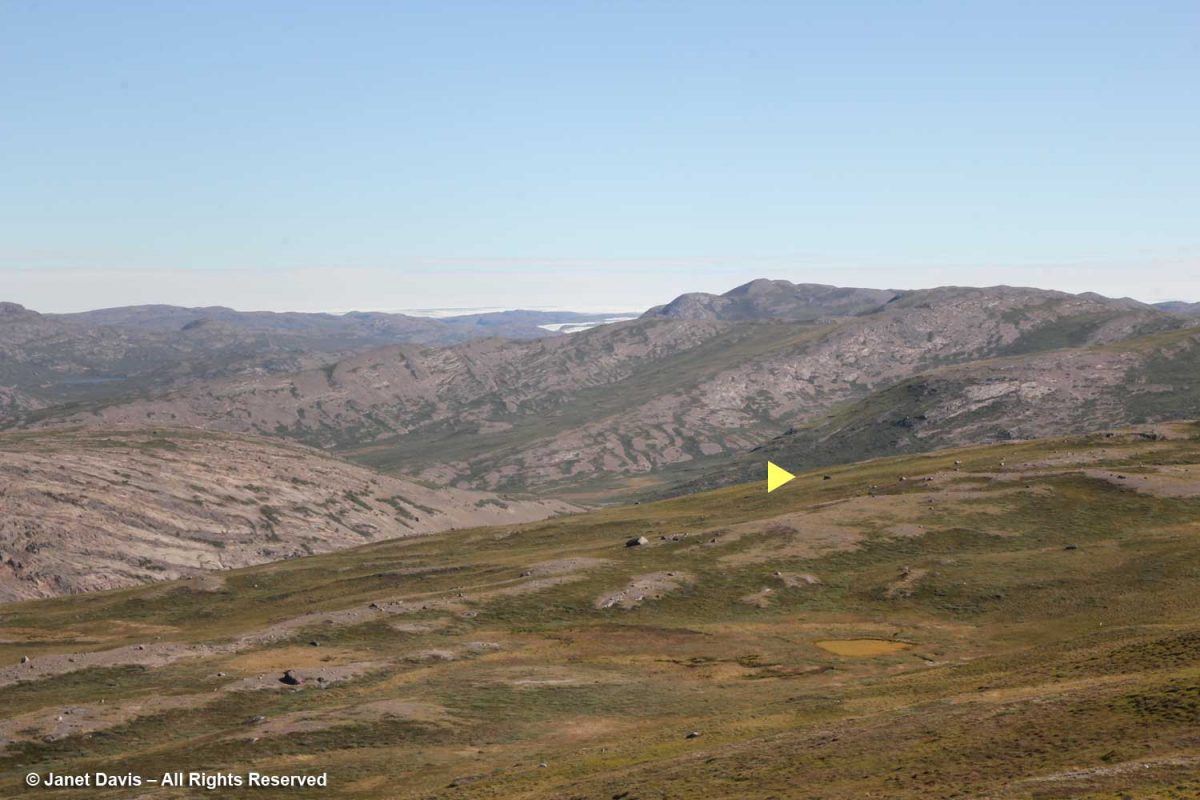
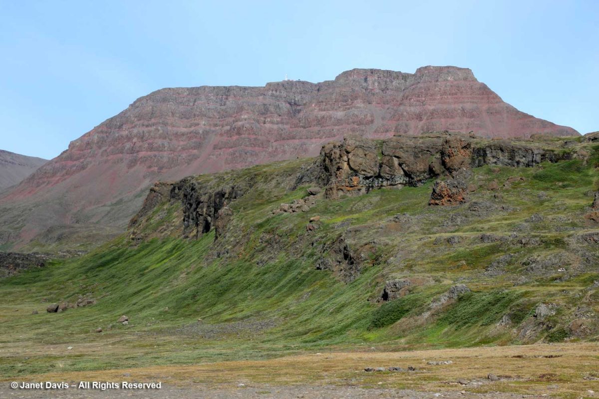
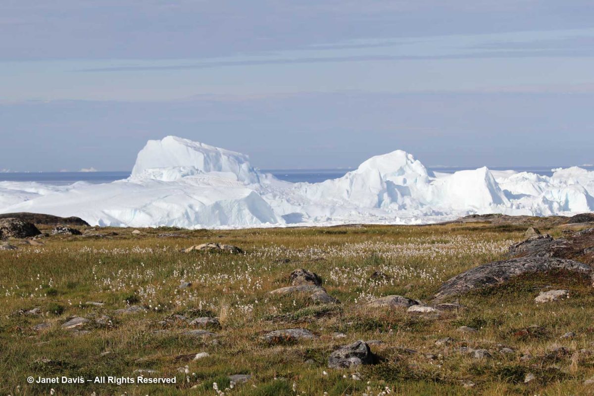
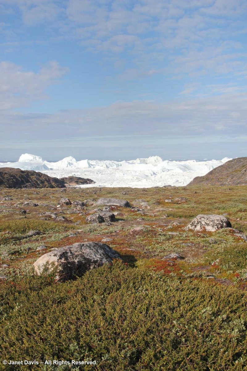
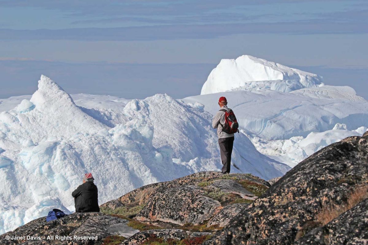
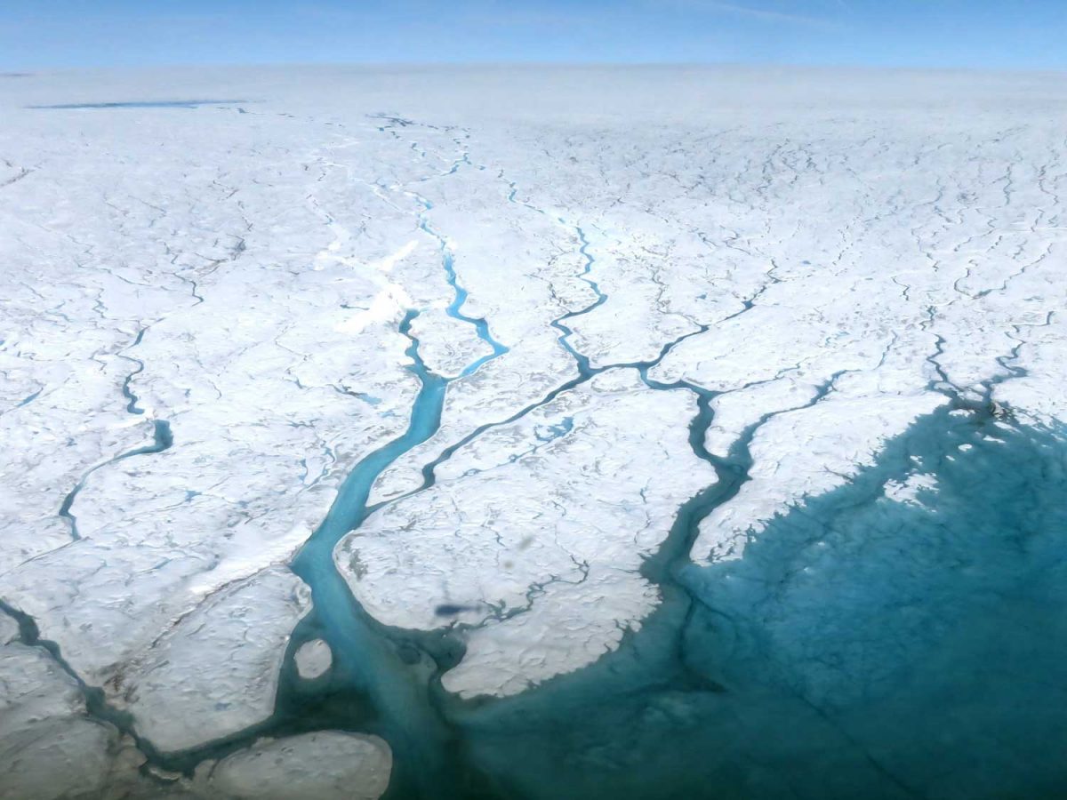
And then, for my first time in Greenland, I looked across the valley and spied the ice sheet, just visible over the rocky mountains, with the Russell Glacier in front, below. What a thrill that was! Tourists can take bus tours up onto the ice sheet. “What do they do?” I ask our tour guide. “They throw snowballs and take photos and get back on the bus”, he said.   “Oh,” I answered. But how I would love to have gone up that road to stare off at the endless frozen white plain!

**********

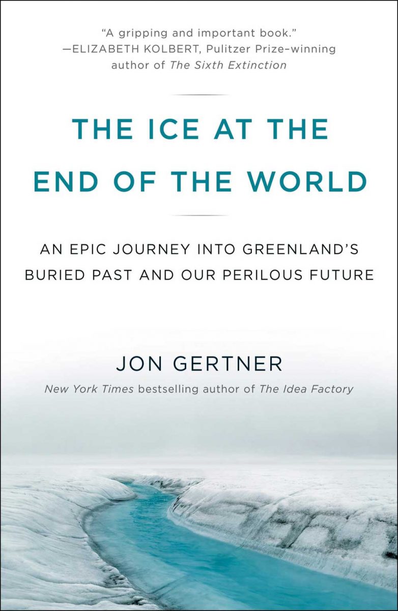
I’ve been thinking about Greenland’s ice sheet over the past two months, as I’ve published these ten blogs about our trip with Adventure Canada to Nunavut and Greenland.  As is always the case with my travels, I tend to discover more about the natural and cultural history of the places I’ve visited after I return home.  That’s when I go through my photos and use the internet to help me understand what I saw. In the case of Greenland, it’s what I only caught a glimpse of that I longed to know more about, which led me to buy this book by Jon Gertner, ‘The Ice at the End of the World‘, which I mentioned in my blog on Ilulissat.

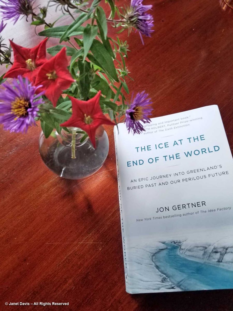
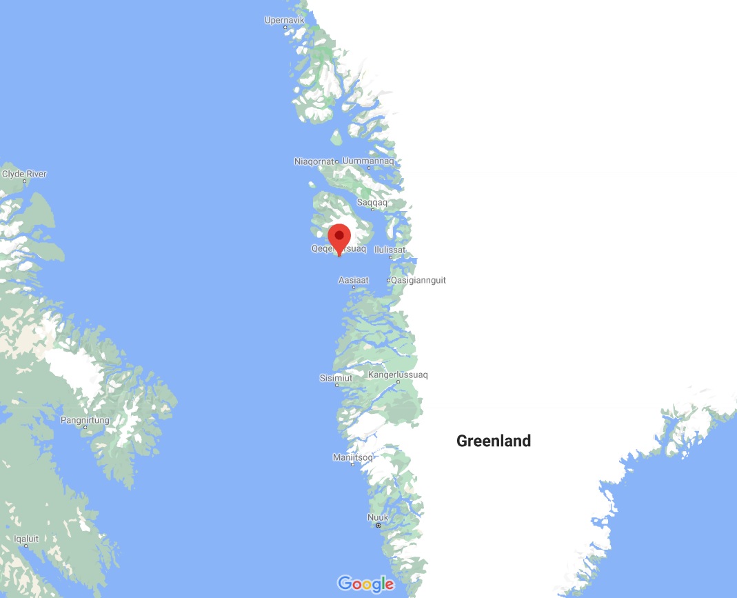
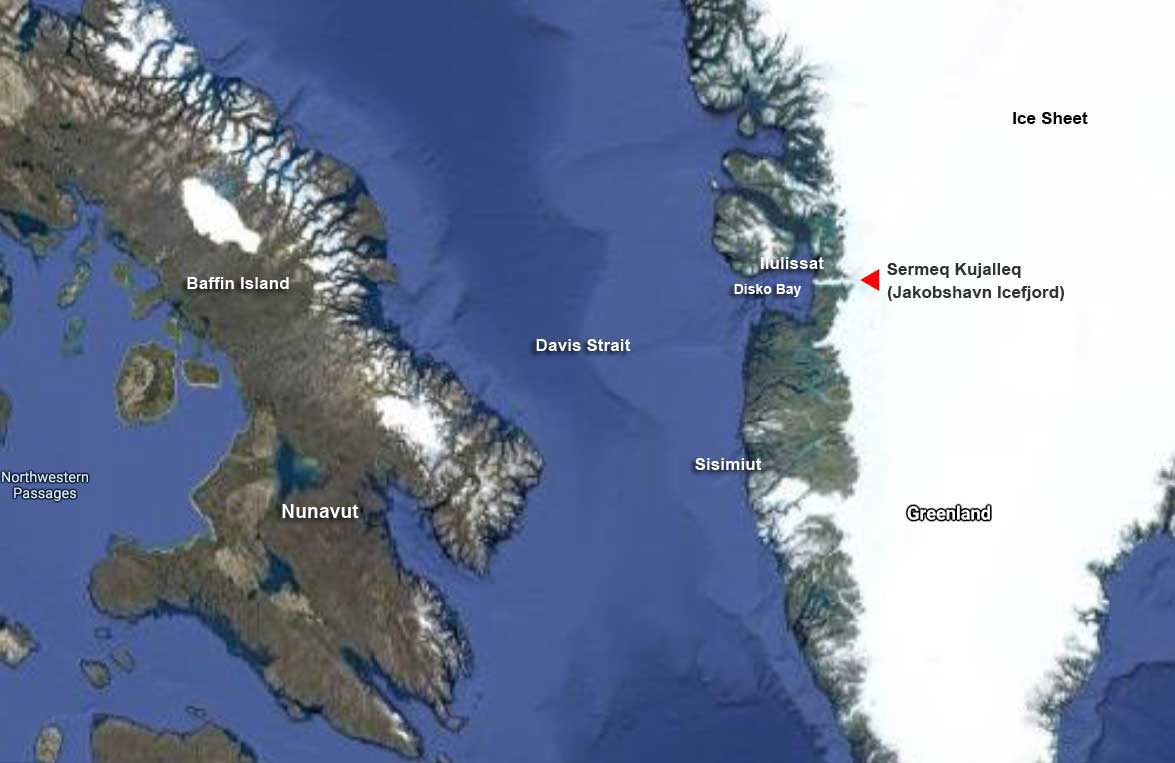
I finished it just a few weeks ago, full of astonishment at the stories of the explorers, military types and scientists who travelled to the ice sheet and took on the challenge of its extreme conditions. Some wanted simply to cross it, because that had never been done, even by the Inuit who inhabited its more temperate, rocky shores. Ice covers almost 80% of Greenland, as you can see in the Google map below.  At more than 2,670 km ( mi) long and 1,050 kim (650 mi) wide from east to west at its widest point, it encompasses 972,000 sq km (375,000 sq mi). Look how many United Kingdoms would fit into Greenland!

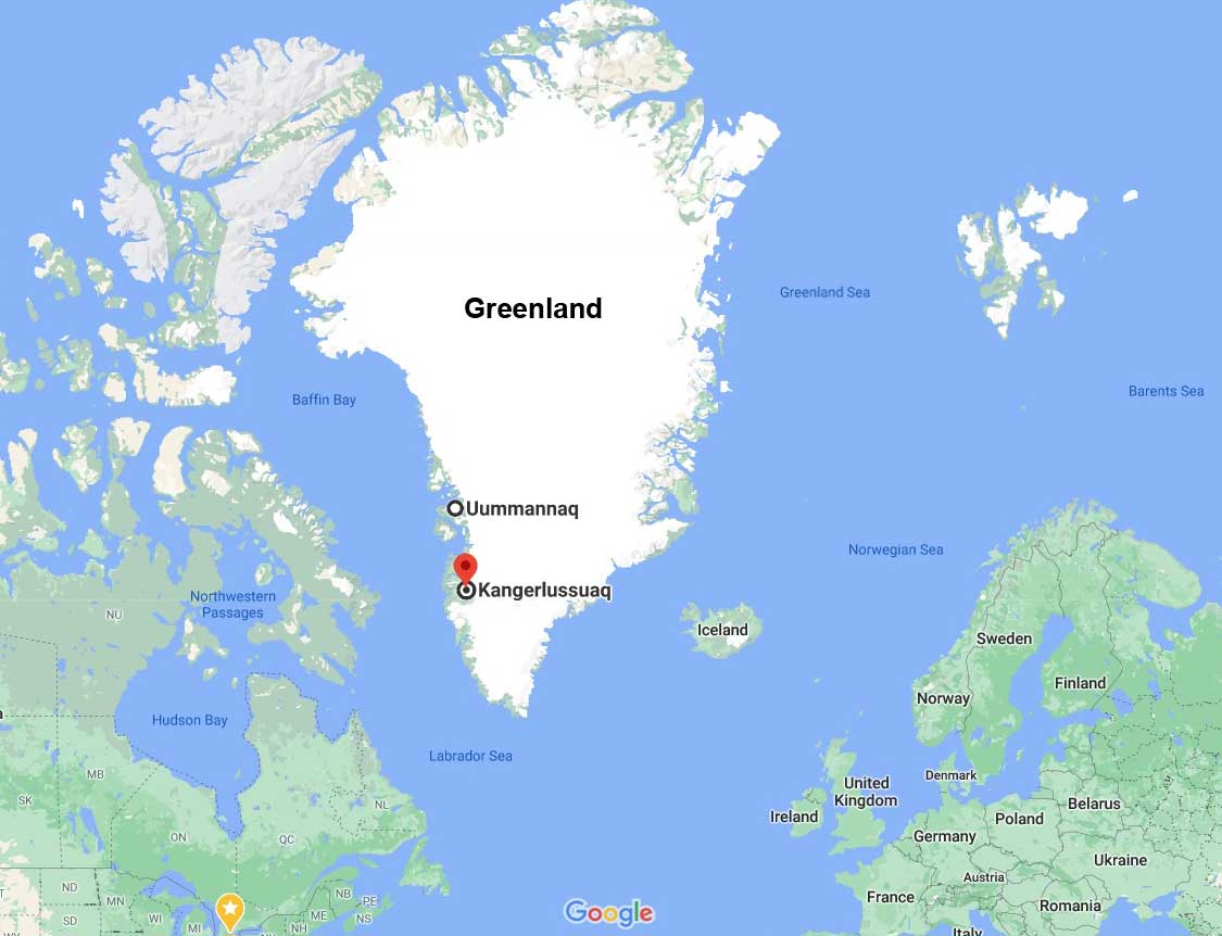
On the Greenland side, our ports of call had been in the narrow, populated region along Greenland’s southwest from Uummannaq in the north to Kangerlussuaq. Much of the rest of Greenland’s coasts are as unapproachable now as they were when the first explorers visited in the late 19th century.

Having read Gertsen’s book from beginning to end, his chapters on the first man to cross Greenland, Norway’s Fridtjof Nansen (1861-1930), were my favourite. Much has been written about Nansen, who was something of an athletic legend in Norway, having won several consecutive national cross-country skiing championships as a youth. Born in what is now Oslo to a well-to-do family who encouraged hard work and public service, his passion for the Arctic took hold at the age of 20. Newly graduated from university in zoology, he travelled to the Arctic on the sealing vessel ‘Viking’, making observations on animal life, sea ice and ocean movement. He also began to write copious journals that have enriched the history of exploration. When he caught sight of the mostly uninhabited east coast of Greenland, he was entranced, for no European had been up on the ice. After returning to Norway, he spent 6 years as Curator of Natural History at the Bergen Museum, in the process earning his PhD.

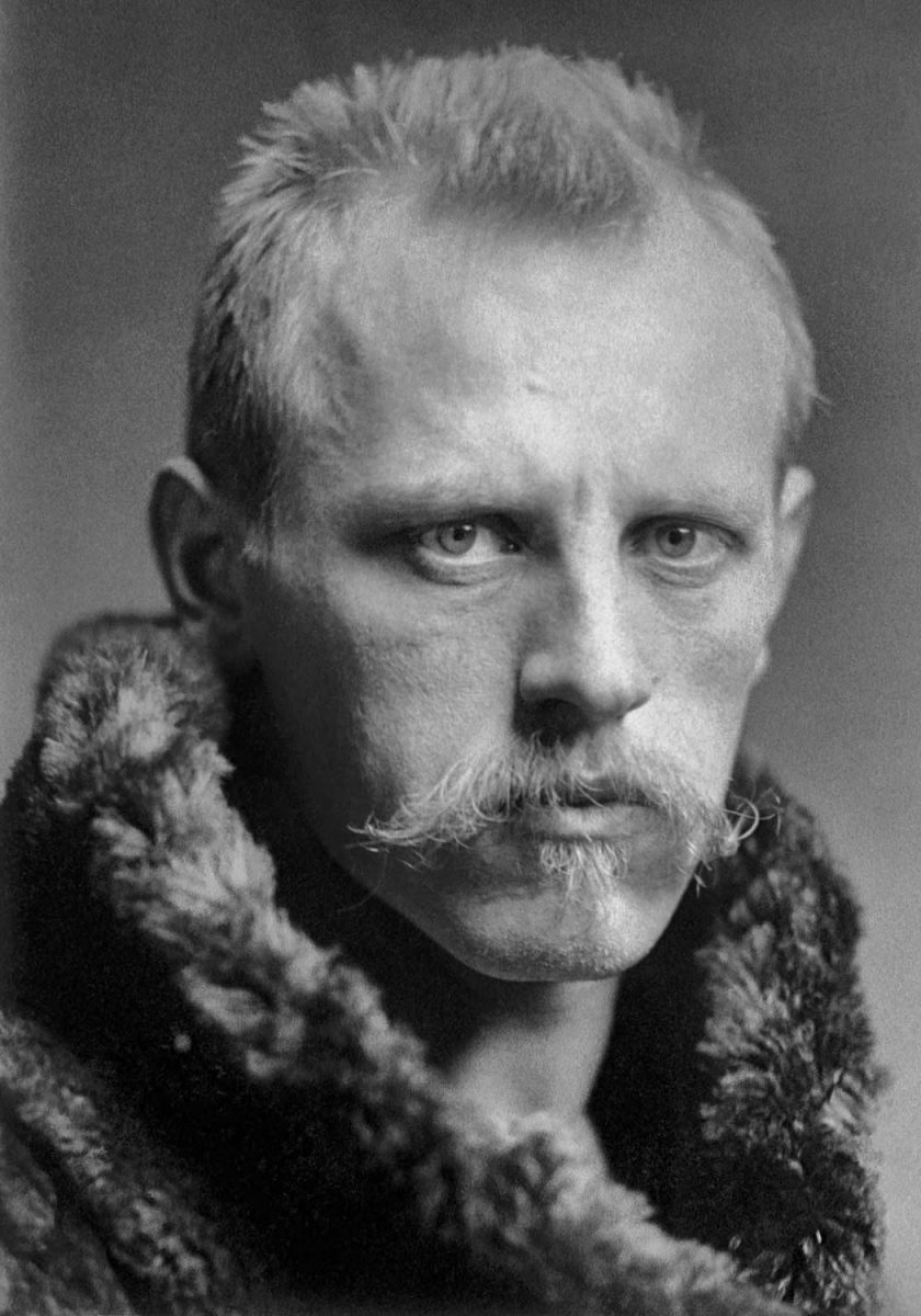
He was 27 when he launched his bid to make the first documented crossing of the Greenland ice sheet, spending six months raising money and hiring five fellow adventurers who were skilled skiers.  After journeying from Norway via Denmark, Scotland and the Faroe Islands, his team set sail from northwest Iceland on the sealing ship ‘Jason’ on June 22, 1888, heading roughly towards Cape Dan on Greenland’s east coast. Nansen’s rationale was simple: going east to west across the ice sheet would be a one-way trip, since no ship would chance a pickup of the explorers on the wild east coast, whereas the west coast was navigable in season. Thus his motto: “West coast or death.”

But thick pack ice kept the Jason far from the eastern shore. On July 17th, once their destination was sighted within 10 miles, Nansen and his men took their supplies in two small boats over the side of the ship onto the ice floes. Their adventure almost ended there, for they spent 10 days off the coast in the freezing North Atlantic, rowing when they could, or camping on the floes when the sea ice thickened, all the while being driven south with the ice. Ice floes cracked beneath them and they rocked on the waves which crashed around them and carried them far out to sea. Finally, the ocean currents worked to their favour; eleven days after they launched they were able to make it to shore, but about 120 miles south of where they intended to begin.  After rejoicing in the grasses and heather and having a picnic with hot chocolate, they began the trek north, alternately rowing the boats or hauling them on shore, greeting a few Inuit men in passing kayaks or in their encampments as they travelled. Given the lateness of the season, Nansen elected a more southerly route towards Godthaab (present-day Nuuk) that would cut significant mileage off their trip. 

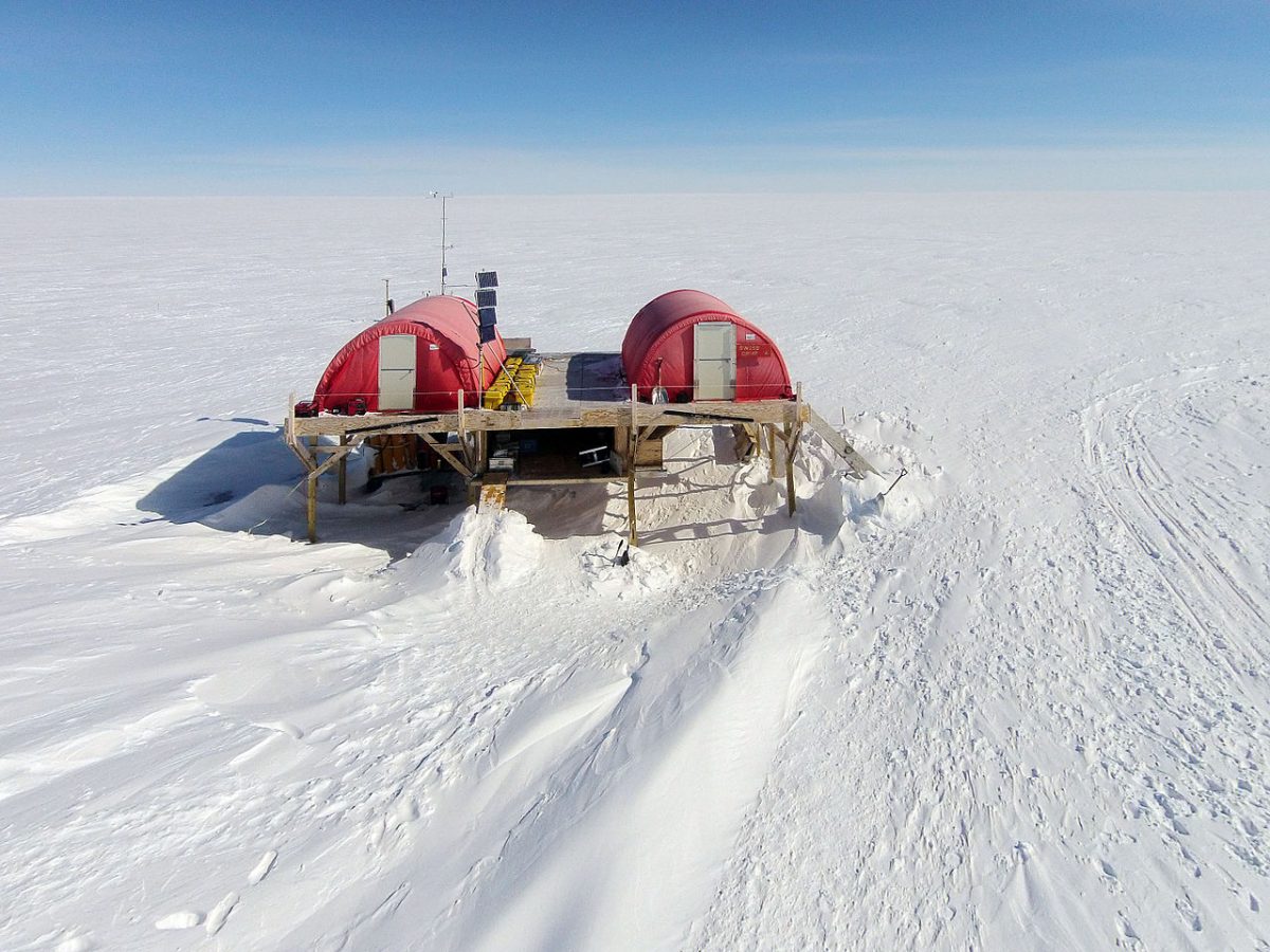
On August 11th, they began their ascent towards the ice sheet, encountering the treacherous crevasse zone at its edge.  As Gertner writes: “What proved to be especially treacherous about the crevasse zone, Nansen would learn, wasn’t the largest cracks but the smallest. Many were snow-shrouded and undetectable, so much so that he might be moving along a seemingly smooth surface and plunge down suddenly into a fissure in the ice, saved only by a reflexive urge to outstretch his arms. The fall would leave him up to his armpits in snow, his legs dangling over nothingness.” (In August 2020, as I wrote in my blog on Ilulissat and the Jakobshavn Icefjord,  those treacherous crevasses or moulins would claim the life of a modern-day scientist, Konrad Steffen, who ventured out alone from his Swiss Camp near Ilulissat, only to lose his life, likely because of a failed snow bridge.)  Nansen’s team’s heavy sledges were made of ash and steel; their skis of oak and birch. But their skis were still packed away, in favour of boots with crampons for the steep angle in the crevasse zone.

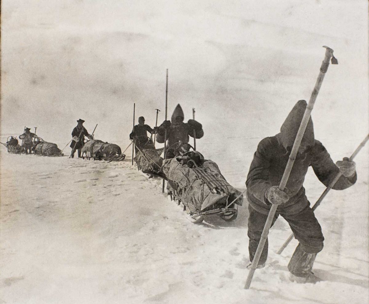
By September 2nd, the ice sheet levelled out to a gradual uphill slope and the team switched to their skis.  On some days, the walls of their tents, which at night had often been rimed with frost as the temperature sank to more than -40C/-40F,  served as sails for ski-sailing across the flatter parts of the ice.

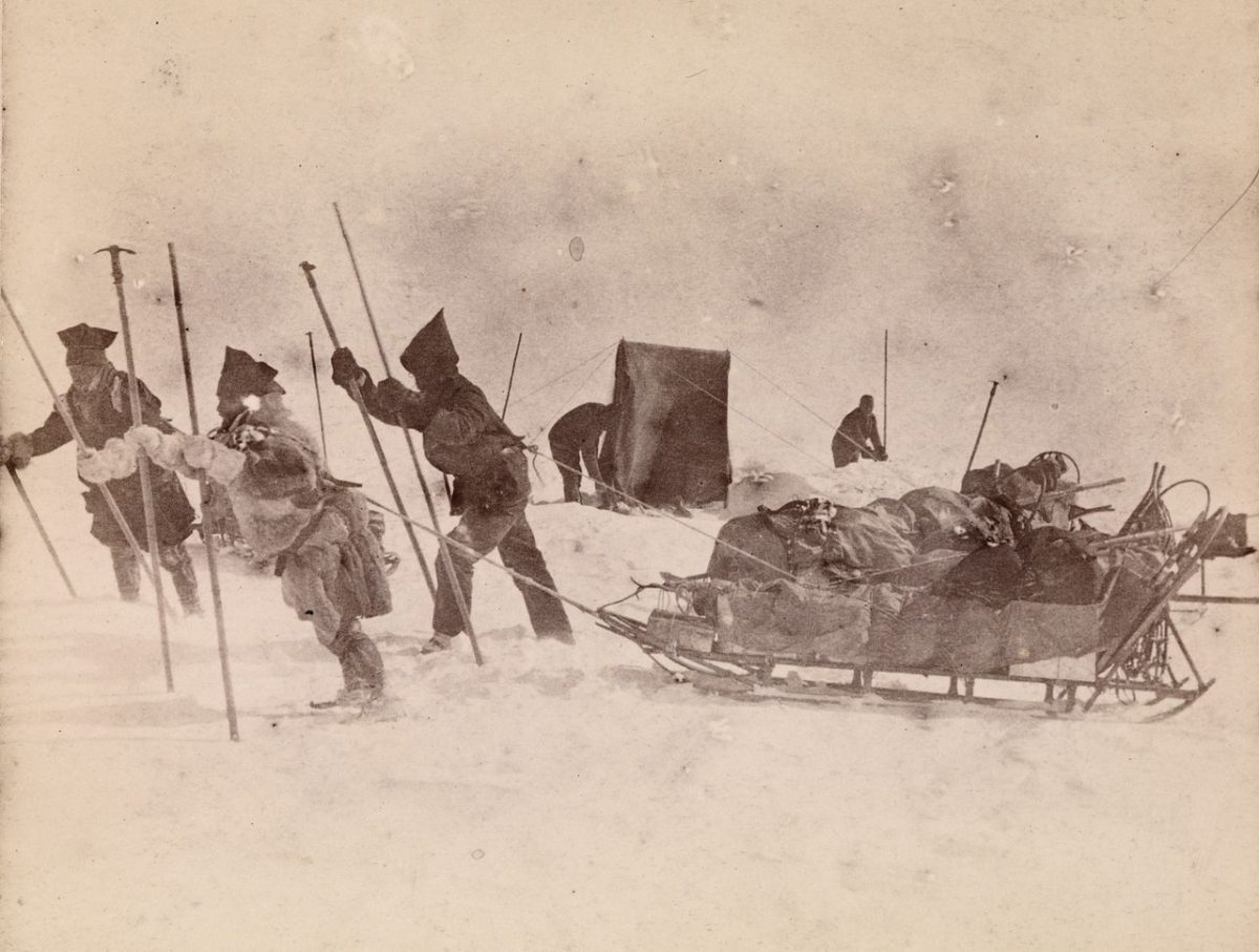
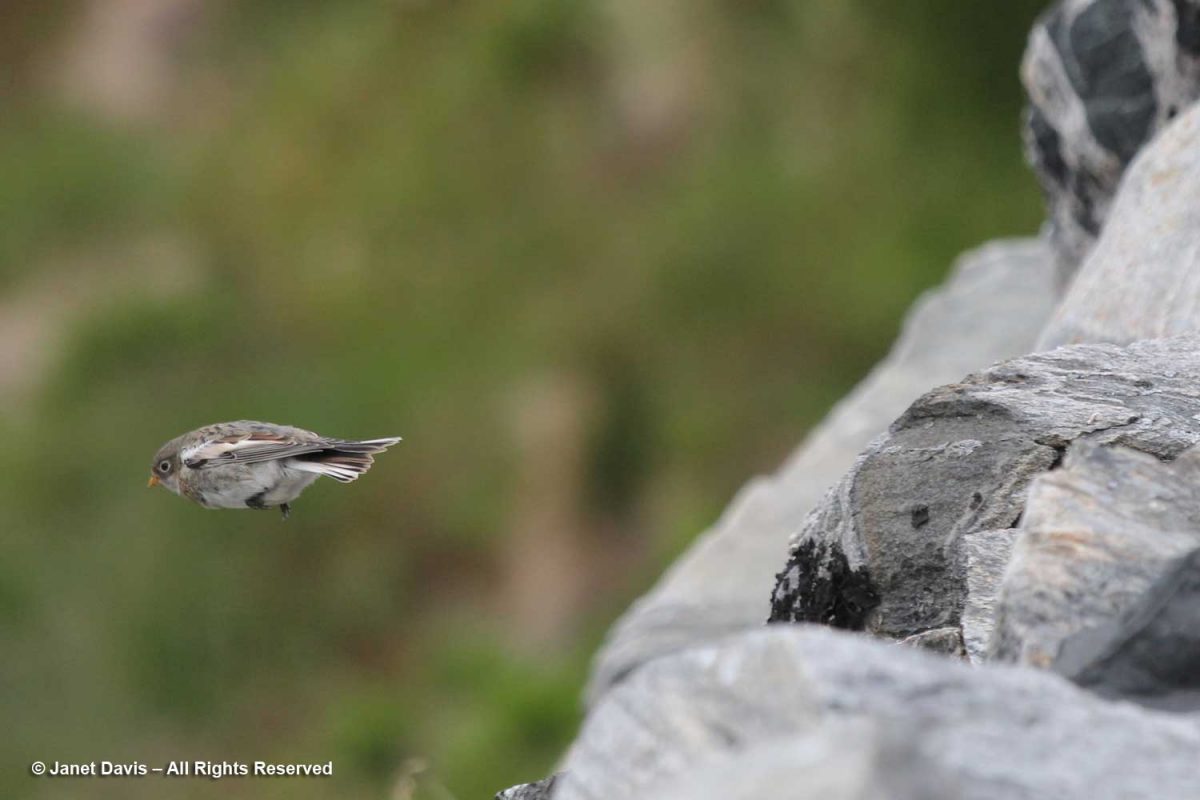
On September 12th, after reaching the summit of the ice sheet at around 8,000 feet, the ground sloped away and they realized they were on the downward slope. Five days later, two months after leaving the Jason, they heard the song of the snow bunting and knew they were near the west coast.  On September 17th, they sighted land, but they were now at the crevasse zone of the west coast of Greenland. It would be another week of advancing, retreating, moving diagonally and sideways, as if on a chessboard, before descending on September 24th from a steep slope onto a bed of gravel. Even though they were 90 miles from their destination at Gothaab, they were now at sea level. They had done it! They would only need to build a boat from willow branches and the canvas from their tents! Nansen christened it the “tortoise shell” but it was not their magic carpet, for the fjord where they landed was too shallow, so they had to drag their boat along the shore in sections of their journey.  Finally, on October 3rd, they paddled into the harbour of Godthaab, to be greeted by a Danish official. “All along the western coast of Greenland, they had been waiting for Nansen’s arrival.” The last boat for Europe had departed two months earlier, so the team had to spend winter in Greenland, finally arriving home in May 1889.

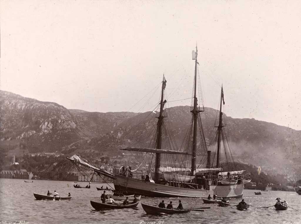
In 1893, just four years after arriving home and writing two books on the trek across Greenland (1890) and Eskimo Life (1891), Nansen returned to Greenland with a specially-constructed ship called Fram, below, whose three-layered hull had been designed to his specifications to withstand freezing in the pack ice. It would survive its three-year stay in the ice-filled waters off Greenland and return to Norway like the maritime hero that it was – eventually, the only wooden ship to have reached both the furthest north (with Nansen) and south latitudes (later to Antarctica with Roald Amundsen). As for Nansen, he would go on to a storied career, as a professor at the University of Oslo and Norway’s Ambassador to London. In 1922, following the First World War, he received the Nobel Peace Prize for his humanitarian work, especially for the identification card called the “Nansen passport”, issued by the League of Nations as a travel document to stateless refugees. It enabled the release and repatriation of more than 450,000 prisoners-of-war. He was also the international mediator in the Greek-Turkey conflict and the war between Armenia and Turkey.

Gertner’s book goes on to describe in vivid detail the exploration stories of Robert Peary (1856-1920), one of the more colourful and fame-absorbed American figures, who in spring 1892 left his American wife Josephine on the west coast of Greenland and charted a northern route across 600 miles of the ice sheet with his assistant Matthew Henson to land at a remote, unexplored part of the island’s north coast.  

On a later expedition, with his wife back home in the States, he not only left behind the American flag on a small, snowy hillock at what he judged to be the North Pole, a “first in history” that was later determined to be off the mark by several miles, but also two sons, born in 1900 and 1906 to his teenaged Inuit mistress Aleqasina or “Ally”. His Greenlandic great-grandson, Hivshu, or Robert Peary II, has a fascinating website in which he explores the relationship of his American great-grandfather (the father of his grandfather Kale), to the Inuit people he lived with in Greenland, including six he took back to the Natural History Museum in New York, with tragic consequences.

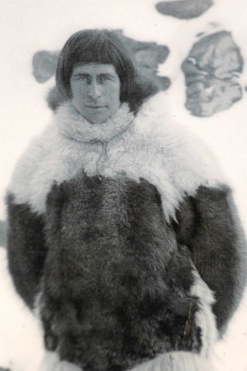
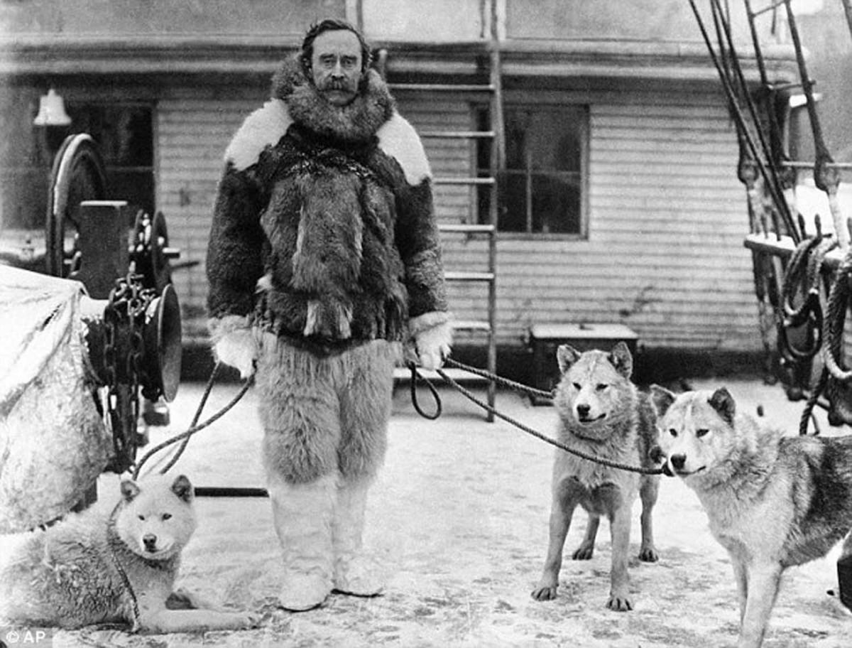
Knud Rasmussen (1879-1933), the Greenland-born explorer whose museum home we had visited in Ilulissat days before, made several trips throughout the Arctic. In 1912, he and his Danish friend Peter Freuchen, right below, undertook the First Thule Expedition, a 1000 km (620 mile) gruelling voyage across the ice sheet with four sleighs and 53 dogs.  In three weeks, they reached Peary Land near the north coast, named for Robert Peary and his expedition 20 years earlier. In fact, Freuchen found Peary’s time capsule buried in a rock cairn: a brandy bottle with a note inside. As was the custom, Freuchen removed Peary’s note (to be returned to the sender) and left his own note within.

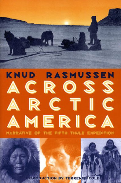
Rasmussen’s Second Thule Expedition in 1917 across the ice sheet to the northern fjords aimed to learn about the area’s geology and map its glaciers. Tragically, a lack of food and hunting opportunities resulted in the starvation death of a Danish botanist and the disappearance and presumed death of an Inuit team member. But Rasmussen is most famous for his Fifth Thule Expedition, begun in 1921, lasting until 1924, and stretching by dogsled right across Northern North America to Siberia. This 20,000 mile expedition was ethnographic in nature, with Rasmussen conducting interviews with the northern peoples and collecting songs. At the end, he wrote a popular book called Across Arctic America, below. As the modern ethnographer Wade Davis says of Rasmussen, “In character, heart, motivation and vision, Rasmussen was everything that Peary was not. What he achieved in a life cut short — he would die at 54, having eaten an Inuk delicacy tainted with salmonella — a man of Peary’s ilk could neither appreciate nor understand. An enamelled faith in the superiority of his own culture left Peary half-blind, even as he stumbled north to the pole.”

Many of us know the German explorer Alfred Wegener (1880-1930), who was also a geophysicist and meteorologist, for his famous contribution to our understanding of plate tectonics. Having observed that the shapes of adjacent continents seemed to fit together across oceans like a jigsaw puzzle, he coined the phrase “continental drift” in 1915 in his book The Origins of Continents and Oceans. The mechanism he proposed was wrong, but it was the first time a scientist had theorized that earth’s land masses might have broken apart and separated from a larger land mass (later called Pangaea). But Wegener had another passion in life: the exploration of the Arctic born from, as Jon Gertner writes, “a recurrent craving for intense physical experiences“.

Archives of the Alfred Wegener Institute.

As a 25-year-old in 1906, Wegener was chief scientist of the 28-member Denmark Expedition to chart remote and unexplored areas of Greenland’s north coast. His diaries from that trip (which also included a young Peter Freuchen) featured measurements still important in modern historical records, of air pressure, temperature and wind. But the expedition was gruelling, and also resulted in the loss of its three Danish leaders to starvation and exhaustion on the ice sheet.

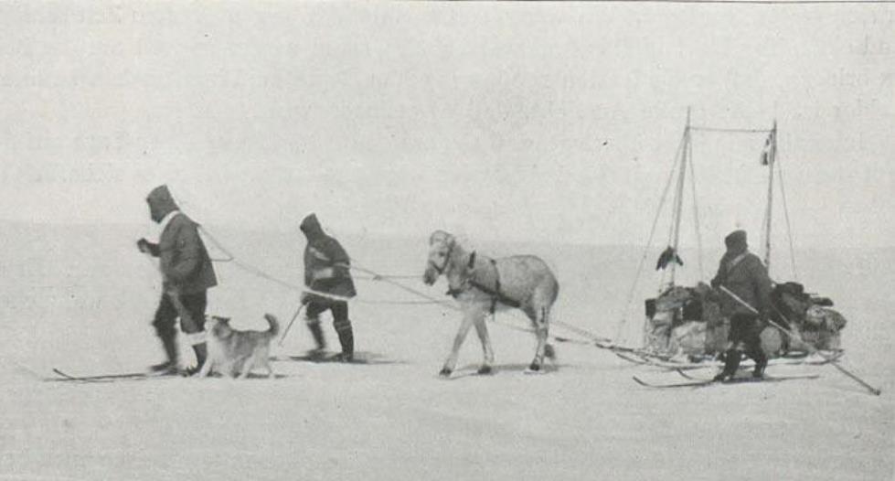
It would not daunt Wegener. In 1912, he joined a colleague from the Denmark expedition, J.P. Koch, along with Vigfus Sigurdsson from Iceland and Lars Larsen from Denmark to depart Danmark Harbour on the east coast and overwinter on Greenland’s ice sheet — the first time any expedition had attempted to do so. It would be called The Danish North Greenland Expedition. Instead of sled dogs, they used 13 Icelandic horses, believing them to be superior for hauling supplies up the steep promontories leading to the ice. During the journey, they would be forced to slaughter some horses to feed other horses, with the remainder put down as they weakened and became sick; a calving glacier would destroy half their supplies and break many of their sleds; Wegener would break a rib falling on glacier ice; Koch would drop 40 feet into a crevasse and break his leg, confining him to bed for 3 months, while the temperature outside their camp fell to -58F (-50C). As they conducted their research, observing the northern lights, digging a pit 23 feet deep to measure the snow temperature while noting the layering of the ice sheet, they struggled across 700 miles of ice sheet, starved and exhausted. On July 15, 1913, a year after they began and very close to their destination, they sat down to eat their final meal — a stew made from their little companion Icelandic dog Gloë — when Wegener spotted a sailboat in the fog off the coast. It would be their rescue.

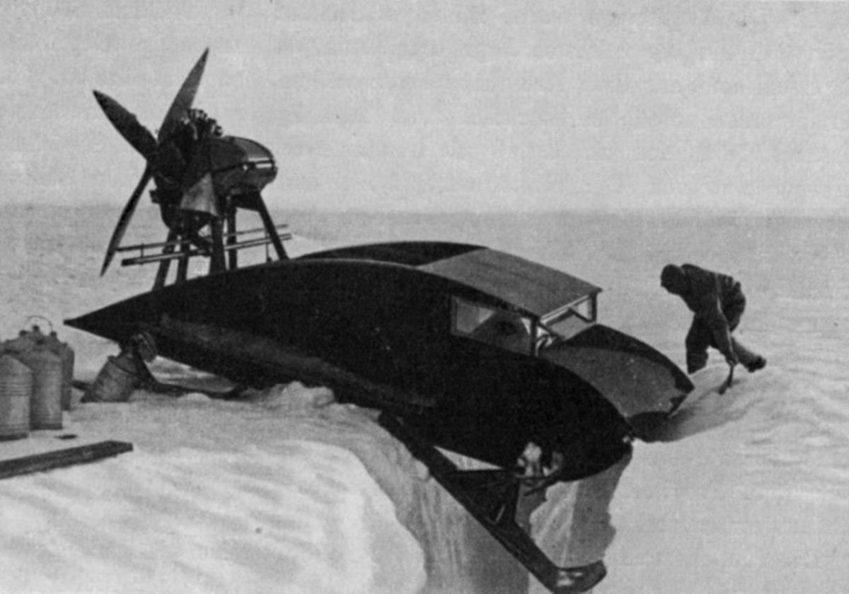
In 1930, Wegener made his final assault on Greenland’s ice sheet, along with three German scientists, Johannes Georgi, Ernst Sorge and Fritz Loewe. But the ice break-up on the west coast was very late, and they were forced to remain on the ship through May until mid-June, five weeks later than planned. They hired Greenlanders to haul the 240,000 pounds of supplies up the steep, crevasse-filled ice of the Kamarujuk Glacier to their initial camp, but warm summer weather and mosquitoes made it slow going. Georgi and some Greenlanders went ahead to set up their camp “Eismitte” or “middle ice”, 250 miles away. He was joined later by Sorge — the plan was that this pair would spend winter at the camp alone, detonating explosives to measure the thickness of the ice sheet via seismic readings and doing meteorological research. They made underground caves in the ice which were much warmer than their above-ground tents, in time making their bunks right on the older “firn” snow. But they knew they would not survive winter without fuel, so sent a note back to Wegener saying if supplies hadn’t arrived by October 20th, they would return to the west coast camp on foot. Back at the first camp, Wegener had planned to use two propeller-driven sleds, below, to bring the rest of the supplies and men to Eismitte, but they did not operate well on the slopes and in the deep snow and the idea was abandoned.

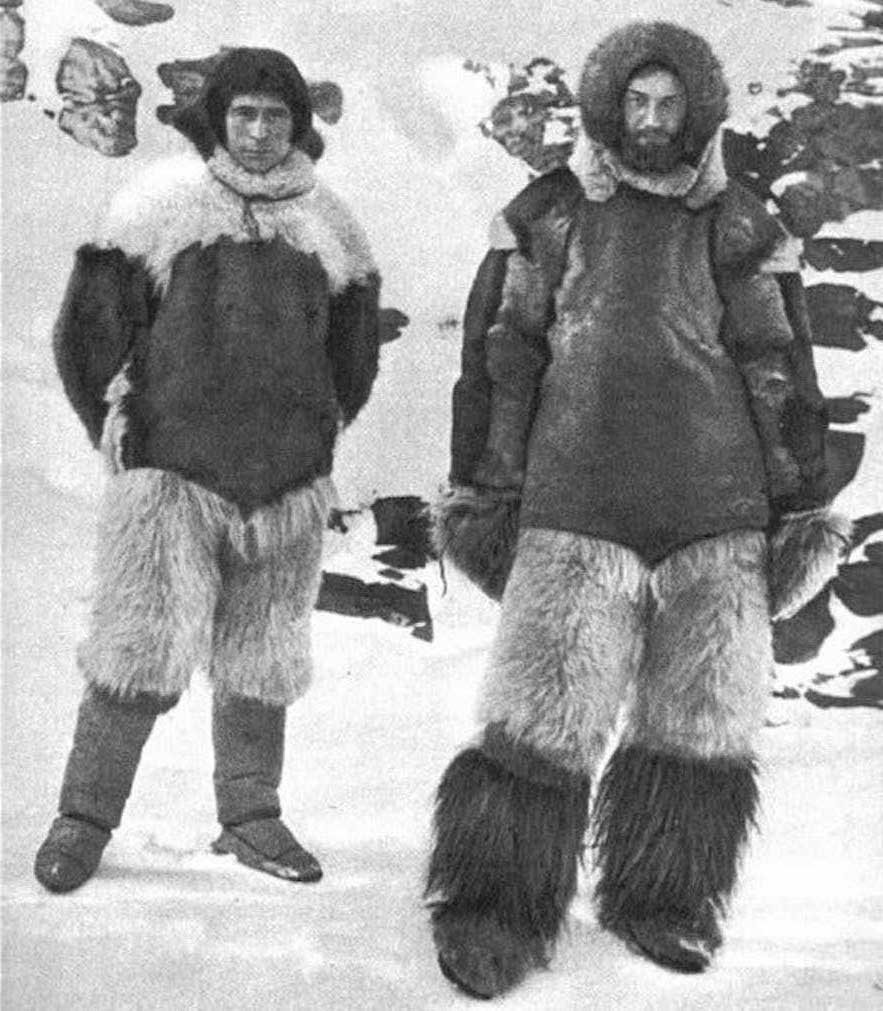
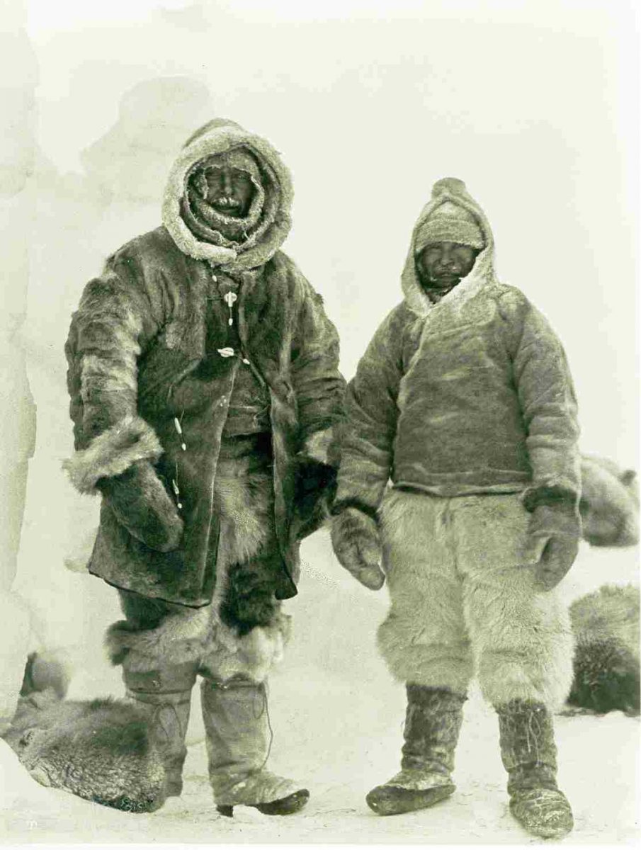
It was the first day of autumn, September 21, 1930 and dangerously late in the season when Wegener finally left his west coast station for Eismitte along with 130 dogs pulling fifteen loaded sleds. He received the note from Georgi and Sorge en route. More than 5 weeks later, as Gertner writes, Sorge and Georgi “were in their ice cave on the afternoon of October 30, on their bunks and ensconced in reindeer fur, when Sorge hear the rasp of dogsleds and some muffled voices on the surface of the ice above. It was -60 degrees Fahrenheit outside. ‘They’re coming!’ he shouted.” Wegener’s journey from the west coast camp had taken 40 days, and though he had started with Loewe and 13 Greenlanders, they were now only three, the two German scientists and Rasmus Villumsen, the dogsled driver. The other men, convinced they were on a death trek, turned around and returned to the coast. Now the five men were together in the ice cavern, with Loewe suffering frostbite to his feet that would require the pocket-knife amputation of eight of his toes 10 days later. Wegener celebrated his 50th birthday on November 1st and posed with Villumsen for the photo below before beginning the treacherous journey back to the coastal camp. It was the last time they were seen alive.

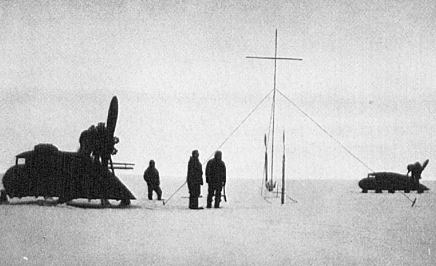
In an era when polar explorers were a little like astronauts, their exploits were followed by newspapers and radio announcers everywhere, but particularly in Germany. With no radio at Eismitte and no word from Wegener and Villumsen that winter either, the world was left to ponder the ominous silence from Greenland. In April 1931, a team with 7 sleds and 81 dogs departed the west coast and found the abandoned motorized sleds on their route, which they used to travel to Eismitte. When they arrived, the truth became clear: the great explorer was gone, along with the sled driver. They would later find Wegener’s skis positioned upright in the snow at Mile 118 halfway to the coast, his body buried in sewn sleeping bags; the supposition was that he had died of heart failure in his tent in the tremendous effort to ski alongside the sled in winter conditions. Villumsen’s body was never found, nor were Wegener’s journals. His widow asked that he be left buried there and a 20-foot high iron cross was erected in the snow nearby, below, where he remains today beneath 90 annual layers of snow, firn and ice on the ice sheet. As Gertner writes: “Ultimately the scientist would be subsumed into the subject of his studies“.

Research work continued that summer at Eismitte. A final dynamite blast recorded seismic “reflected wave” readings that indicated bedrock lay between 8,200 and 8,850 feet (2,500 – 2,700 m) below the snow. The weight of the snow evidently meant that Greenland was lower in its centre than at its mountainous coasts.

Gertner’s book, which I heartily recommend, goes on to describe the post-war, scientific exploits of France’s Paul-Émile Victor (1907-1995). An ethnologist and wartime U.S. Air Force pilot (he was outside France when Germany occupied it and chose to enlist in the U.S.), he had lived amongst the Greenland Inuit in 1936, learning their language and writing a book called My Eskimo Life. In 1947, he formed Expeditions Polaires Francaises (EPF) to do research at earth’s polar regions. And on July 17, 1949 he reached the 9,900-foot elevation at the centre of the Greenland ice sheet in a convoy of U.S. military surplus, Studebaker-made “Weasel” tracked vehicles he’d found post-war in Fontainebleau outside Paris. By then the old German camp Eismitte was buried under 40 feet of snow and firn. Victor, who was greatly assisted by the fact that airplanes could now do supply drops on the ice sheet, would go on to do scientific research in Antarctica as well.

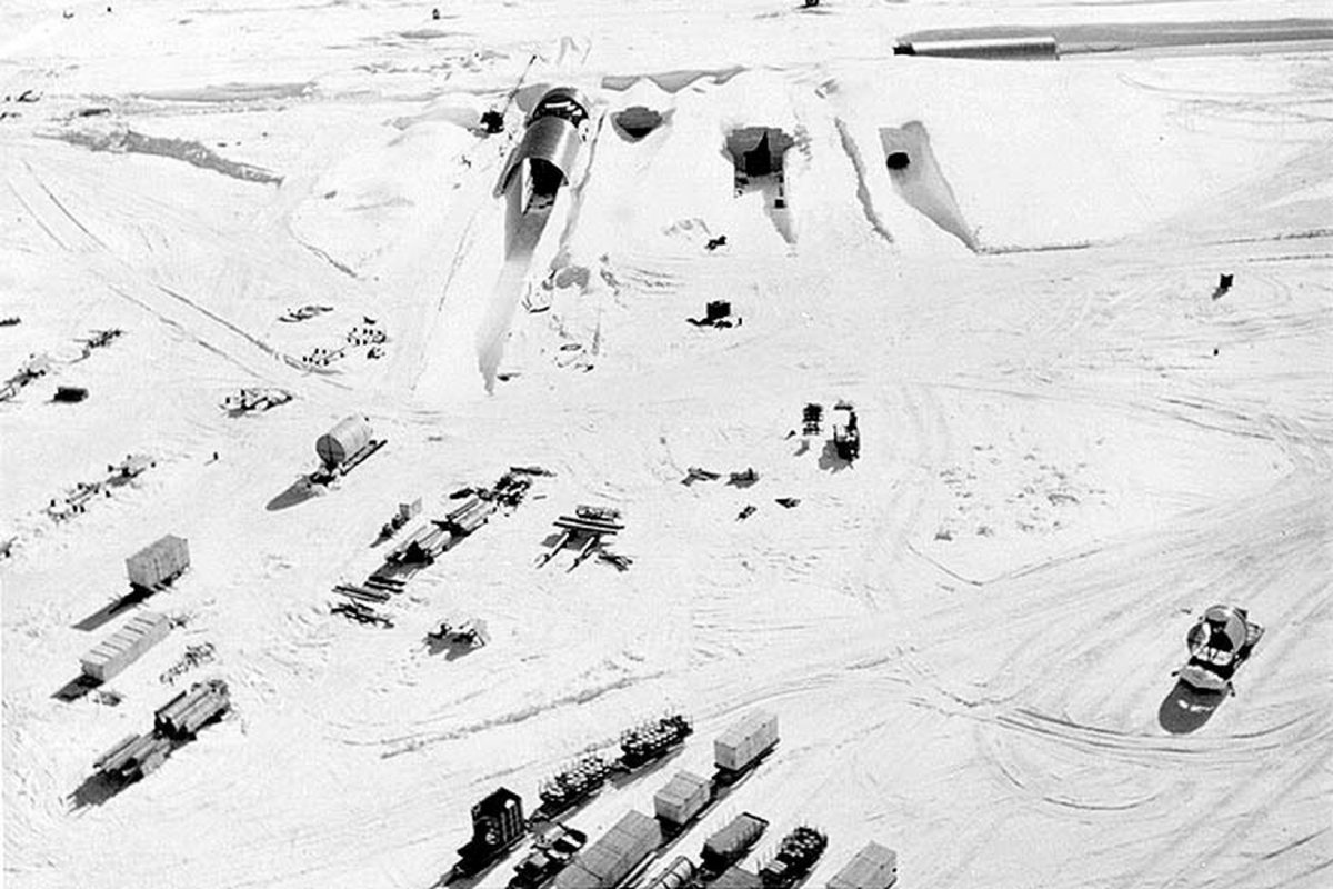
But it was the outcome of the second world war and a U.S. treaty with Denmark that ushered in the American military presence in Greenland. In fact, in 1946 the U.S. had proposed buying Greenland, offering $100-million to Denmark, an offer that was not accepted. (Does that sound familiar? Trump floated the idea in 2019, with the same result.) After Russia detonated its first atomic bomb in 1949, the Cold War began in earnest. Greenland was given the code name “Bluie” and the Americans constructed the Thule Air Base in 1951-52. their principal base in the country, along with several satellite bases such as Kangerlussuaq or “Bluie West 8”, the site of our last day on this Adventure Canada expedition. A few years later, Thule became the supply point for an even more ambitious U.S. military endeavour: the creation of a massive, nuclear-powered, under-ice base called Camp Century. What was it? Well, no one can tell the story better than the authors. Here is the U.S. Army’s propaganda film on Camp Century.

This is what it looked like from the air in 1959, below. Even television news anchor Walter Cronkite came to visit. The network of tunnels had to withstand the massive overburden of the ice sheet’s snow and required regular shaving of firn from their walls “as much as 40 tons a week“. Though the camp would be ultimately doomed by its physical environment, it was felt to be a vital asset in protecting North America from Soviet aggression.

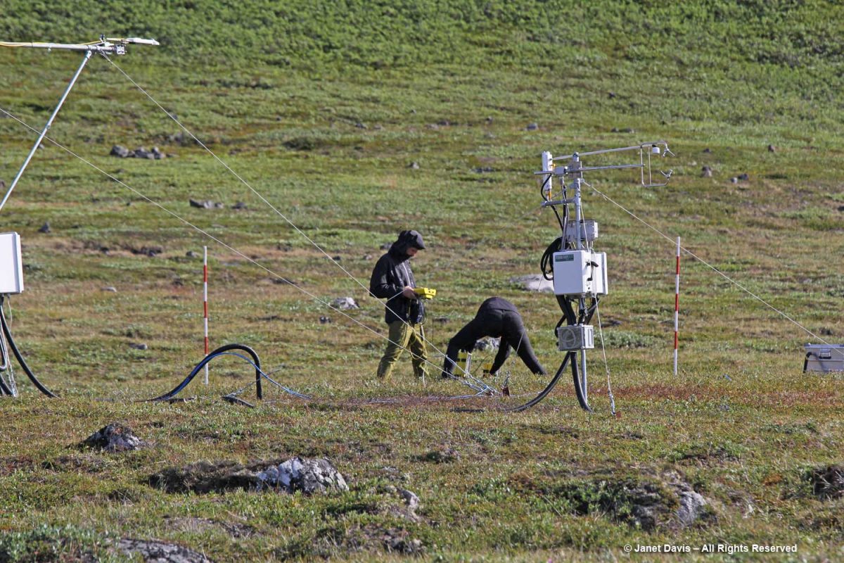
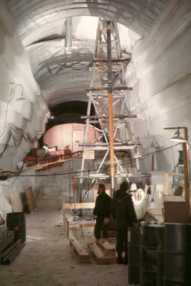
But something else was happening as the U.S. established its military presence in Greenland: scientists tagged along via the budgetary largesse, learning as much as they could about the secrets of the ice via the newly-created US Army Corps SIPRE (“Snow, Ice and Permafrost Research Establishment”). Its chief scientist, Swiss-born glaciologist and former Rutgers professor Henri Bader (1907-1998), aka “the iceman”, hired young researchers like Carl Benson, Chester Langway, Lyle Hansen and Herb Ueda to discover all they could about Greenland’s ice in Camp Century’s Trench #12. Even as the military was dreaming up plans to store nuclear-powered Intermediate Range Ballistic Missiles under a vastly extended Camp Century — a theoretical strategy called “Operation Iceworm” — the ice scientists were using a massive oil rig found lying around in Oklahoma in 1964, below, to drill down to retrieve ice cores that had formed from snow that fell tens of thousands of years earlier. As Henri Bader said of the ice bubbles formed in the ice and the information that could be gleaned from them: “Snowflakes fall and leave a message.” Appropriately, it was July 4, 1966 when they hit bedrock, having cored Greenland’s deep ice to a depth of 4,450 feet (1,356 m). All the ice cores were stored by their age, so the researchers could analyze historic changes in weather and atmospheric particulates over thousands of years.

U.S. Army photo

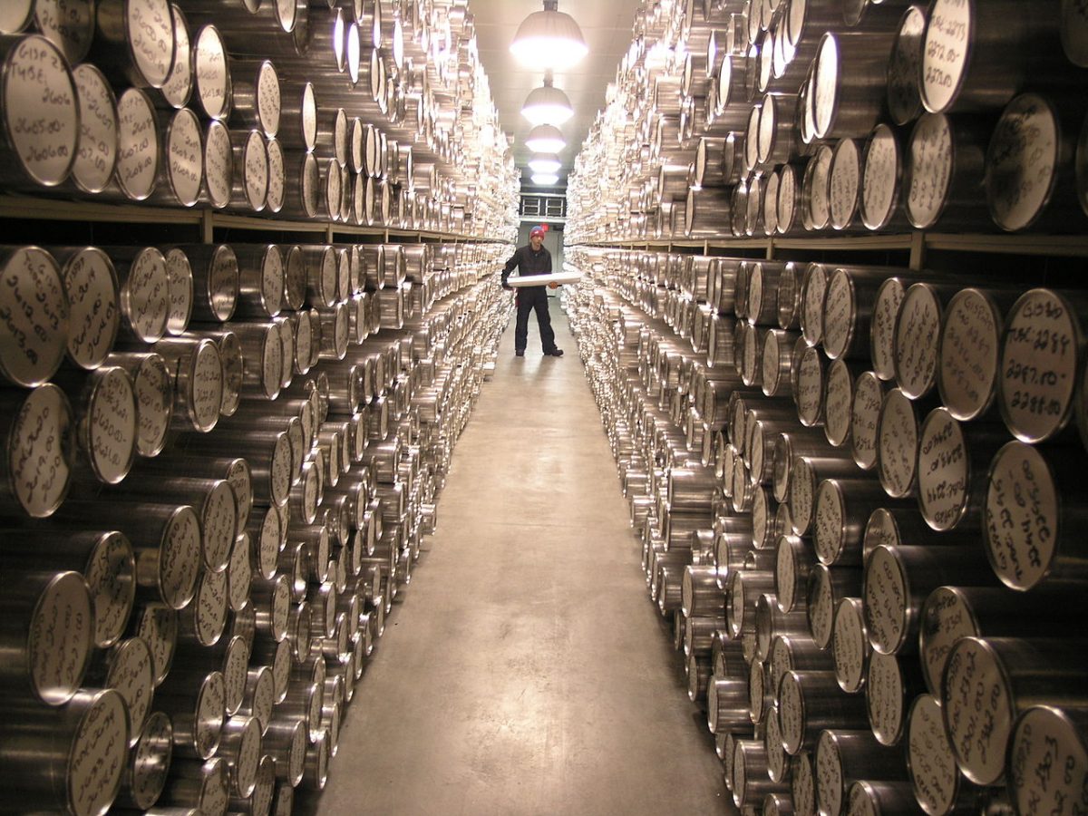
Even as the military was winding down its operation in Greenland, the ice core research at Camp Century dovetailed with an emerging focus worldwide on the environment. The late 1960s saw heightened attention being paid to air quality and the role of increasing levels of Carbon dioxide from fossil fuel emissions and other greenhouse gases in earth’s atmosphere.  Ice cores were catalogued, not just from Greenland, but from Antarctica, Alaska and many other cold regions in the world, for ice held the story of earth’s climate, reaching back thousands of years before the first steam engine sent pollutants skyward. The photo below is inside the freezer at the National Ice Core Lab in Denver, Colorado.

United States Geological Survey

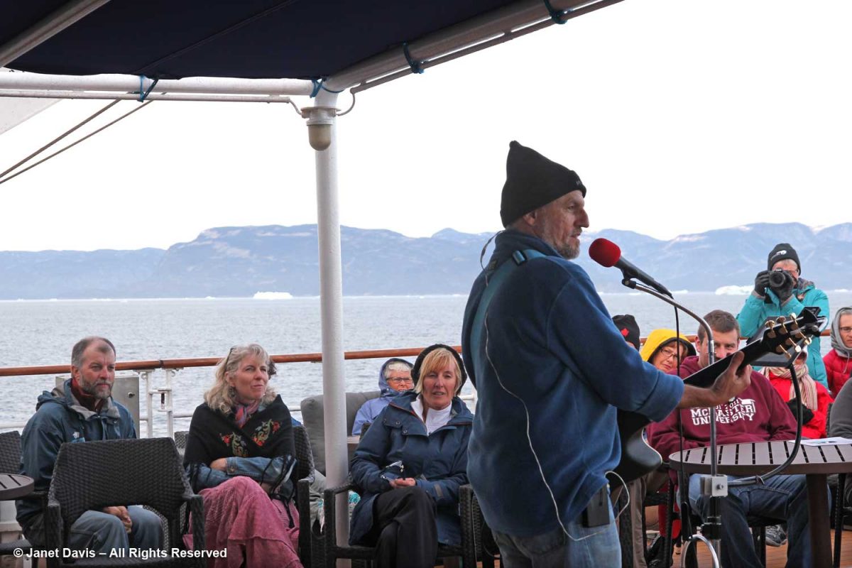
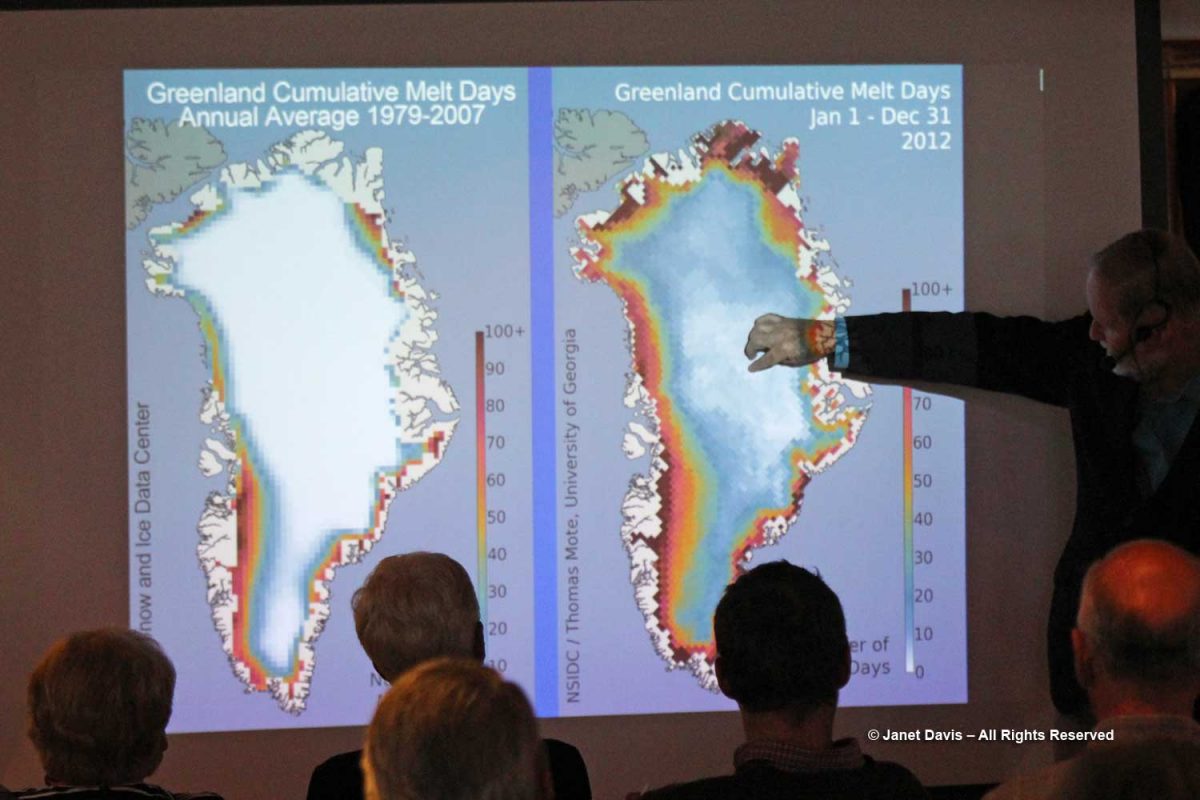
Greenland figures in climate change studies in another way, too. In summers like 2012 and 2018, when massive parts of the ice sheet surface melted in record warm temperatures, the albedo effect — the measure of reflectivity of a surface, in earth’s case from the sun’s rays — creates a positive feedback loop with the atmosphere. In other words, white ice reflects the sun’s ray’s away from earth, maintaining a cooler surface; dark puddles of meltwater absorb solar rays, increasing ambient temperatures over a large part of earth’s polar surfaces. On this Adventure Canada expedition, we learned about albedo from Jim Halfpenny, one of the on-board resource naturalists, below. Though annual melting of Greenland and Antarctica’s ice sheets have not yet contributed significantly to earth’s sea level rise, since winter temperatures and annual snowfall tend to keep conditions in relative equilibrium, the great fear is that continued global warming beyond certain threshold levels will cause a cascade effect that sees rapid melting of the ice. When that happens (and at currently rising global temperatures, it’s a matter of “when”, not “if”), the rise in global mean sea levels is forecast to inundate low-lying islands, land masses and coasts.

Jon Gertner’s book goes on to talk about modern research on the ice sheet, parts of which I included in my blog on our visit to the Jakobshavn glacier at Ilulissat days earlier. His story in the New York Times of flying in an IceBridge data-gathering plane over the ice sheet on one of his four trips to Greenland is compelling. Here’s a NASA photo from a September 2019 IceBridge flight over the west coast of Greenland by Matt Linkswiler.

NASA Photo by Matt Linkswiler

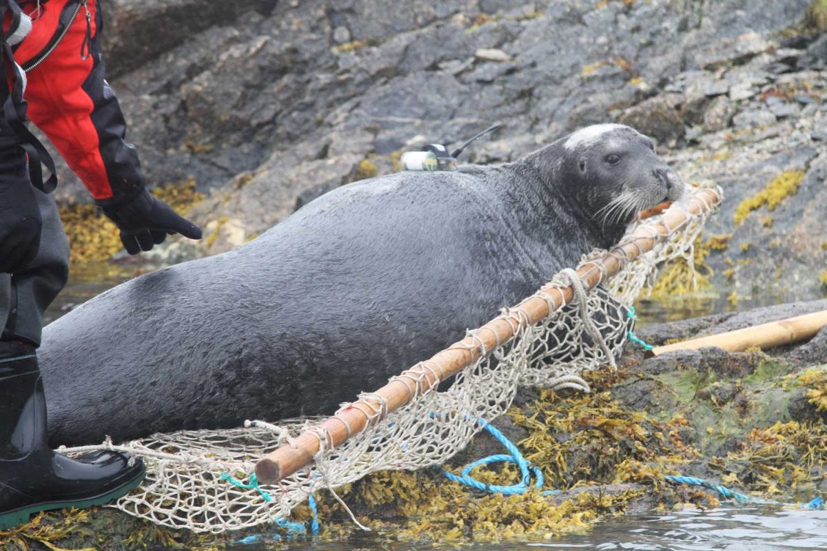
But I was especially intrigued by Gertner’s description of the work of leading ice sheet researchers, the husband-and-wife team David and Denise Holland of NYU’s Environmental Fluid Dynamics Laboratory and The Center for Sea Level Change at Abu Dhabi NYU . As Dr. David Holland’s professional page states, their research “focuses on the computer modeling of the interaction of the Earth’s ice sheets with ocean waters, and the acquisition and implementation of observational data for model improvements.” What I loved is that the Hollands and Dr. Aqqalu Asvid-Rosing of Greenland’s Department of Natural Resources have figured out a way to measure the deep ocean temperature right at the calving mouth of Jakobshavn’s glacier, in a section known in glaciology as the “mélange“, the slush that clogs the glacier’s outlet, and also at Cape Farewell, a headland at the southern tip of Greenland. How? They have affixed temperature sensors to local seals, which swim to a depth of 1,200 feet, and to halibut, which inhabit the depths to 3,000 feet. Have a look at this film.

Below is a bearded seal with a freshly-affixed sensor, about to be released back into the ocean.

Photo Courtesy of Dr. Aqqalu Asvid-Rosing – Greenland Department of Natural Resources

Clearly, as I reach the end of this blog series on our Adventure Canada expedition through the waters off Nunavut and Greenland, it might have been preferable (and less like a small book) to have done an entirely new blog on the ice sheet, but that last-day glimpse of the great white expanse from the hillside in Kangerlussuaq inspired me to learn its history. Fittingly, the little hamlet with the international airport is at the apex of research, on climate change as well as the history of its people and wildlife. As Jon Gertner writes: “In the local cafes, you could meet glaciologists, hydrologists, anthropologists, geomorphologists, and sedimentologists“, not to mention archaeologists and marine biologists.

*******

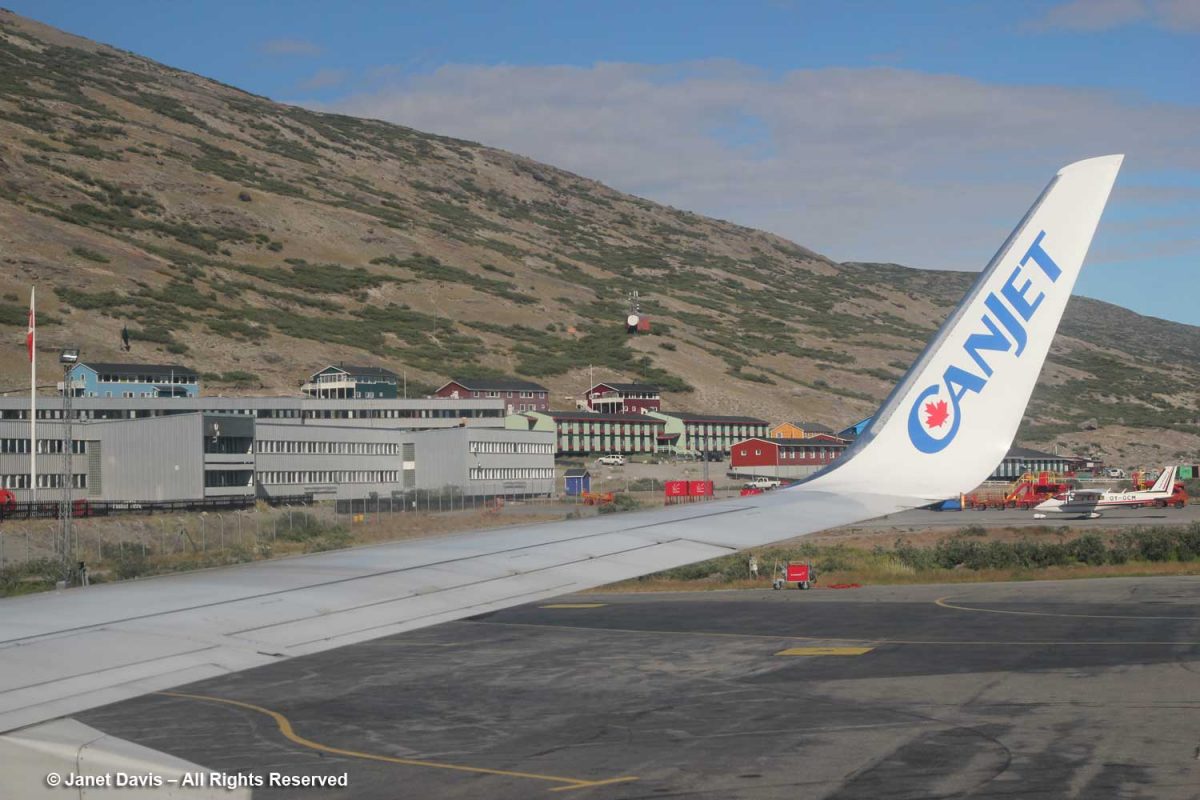
After our tour of the area around Kangerlussuaq, it was time to head to the airport, the duty-free shop, and onto the CanJet charter back to Toronto.

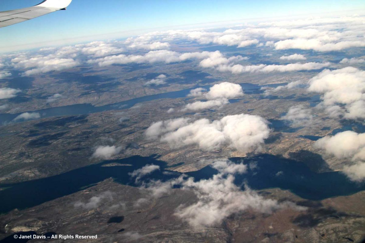
We flew off southwest over the tundra bound for Toronto and just like that, our lovely Arctic Explorer journey came to an end.

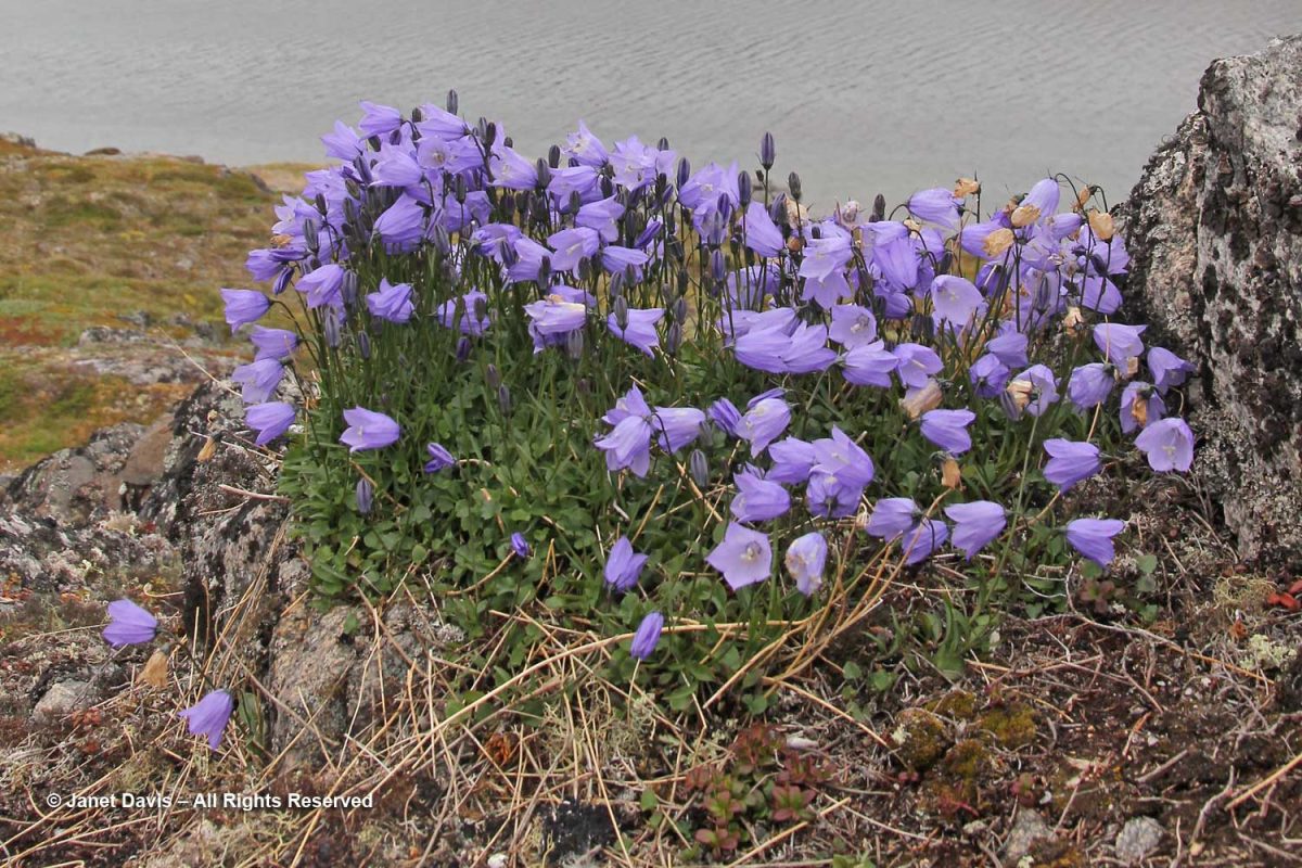
It was the voyage of a lifetime, and I feel I now know so much more about this little planet of ours: its northern people; wild animals; magnificent, green-in-summer tundra; unique flora; and its storied, precarious ice sheet.

********

This is the 10th and final blog in my series on the Eastern Arctic.  Here are the 9 previous blogs :

Iqaluit

Butterfly Bay and the Waters off Baffin Island

Pangnirtung

Sunneshine Fjord

Sisimiut

Ilulissat

Qilakitsok and Uummannaq

Qeqertarsuaq

Itilleq

Cruising the Eastern Arctic – Itilleq

With just two days left on our Adventure Canada Arctic expedition in Nunavut and western Greenland, we awoke on August 5th to a thick fog that prevented us from going ashore at our first scheduled stop, the small, abandoned fishing village of Assaqutag. But that didn’t stop a few people from actually fishing off the back deck, with small Greenland cod or ojac jigged two and three to the line, no bait needed. The passengers had fun with expedition leader Stefan Kinberg standing by to untangle their lines.

Greenland cod (Gadus ogac) is the principal catch off the coast and a major source of livelihood and food for the inhabitants at our next port of call, the tiny village of Itilleq.

After breakfast, we paid a visit to the ship’s bridge. The helmsman had his binoculars out; between sea ice and fog, an Arctic seafarer has much to consider.

On the table was the nautical chart for tomorrow’s final destination, Kangerlussuag or Søndre Strømfjord   These paper charts are combined with GPS, electronic chart display, sonar and radar to ensure safe passage.

As we sailed towards Itilleq, a pair of pomarine jaegers flew overhead (Sterecorarius pomarinus). Like its cousin the parasitic jaeger, “It robs gulls, terns and even gannets of their catches. Like most other jaeger species, it continues this piratical behaviour throughout the year, showing great agility as it harasses its victims.” (Wiki)

And, of course, we saw our old friend, the northern fulmar.

Soon Itilleq came into view, the only settlement on a tiny island in a group of islands one kilometre off the coast of Greenland in the Davis Strait and just 2 km (1.2 mi) north of the Arctic Circle. Its original name was Itivdleq. With a population of 89 (2020), its main industries are fishing and hunting, with a fish factory located here. Drinking water is produced with a reverse osmosis desalination plant.  Itilleq’s most famous native son is Hans Enoksen, who was born there in 1956; he served as Greenland’s Prime Minister from 2002-2009.

This was how we boarded the zodiacs for our shore excursions.

Occasionally, our zodiac captain would be wearing a disguise! Actually Dr. Mark Mallory, renowned bird biologist, professor and Tier I Canada Research Chair in Coastal Ecosystem Resilience and Connectivity at Acadia University, was dressed for the upcoming soccer match with the villagers of Itilleq.

The rocks here, as they are everywhere in the Arctic, were cloaked with rockweed (Fusca distichus), a very common seaweed or brown algae that’s found throughout the northern reaches of the planet.

I loved the concentration on the face of this little boy at the Itilleq dock. He was playing a Kendama cup-and-ball game that made me think of the days when no one had yet heard of Fischer-Price or Game Boy.

Like all the houses in the Greenland towns, villages and settlements we visited, those in Itilleq’s were brightly painted. I think if I lived there, I would have a purple house like this one.

As always, I spied wildflowers on the way. This little white-flowered brassica, Cardamine pratensis, is circumboreal, occurring in northern climates around the planet.

There’s a bit of a backstory to what happened next. For decades, since the 1990s, Adventure Canada has nourished its relationships with Greenlanders and Canadian Inuit communities through participatory activities like this friendly soccer match. (Here’s a newspaper story on a similar match from 2005). Today’s game was an attempt to even the score and avenge the villagers’ win on the last expedition that stopped by.  And yes, that’s an actual half-sized soccer field made of gravel!

Cruise participants and Adventure Canada staffers like Jason Edmunds in the wig (he’s now Expedition Leader for the company) teamed up against the villagers.

A cheering section sat on the ancient Precambrian gneiss bleacher seats.

 I stayed to watch a little of the action, with the Greenland youth paired against…. well, more mature folks.

The blue t-shirts did seem to outnumber the town athletes….

….. creating a possible unfair advantage. But there were no linesmen in attendance!

The young boys of Itilleq happily posed for photos.

But I wanted to see flora, so I decided to take a walk up beyond the village cemetery, where I could gaze down the hill at the soccer pitch and houses nestled in the hollow below. Itilleq means “hollow” in Kalaallisut and you can see why in the photo below.

On the walk, I flushed out some birds from the vegetation beside the path. This is a snow bunting (Plectrophenax nivalis).

Ginger and honey mixture: Take few pieces purchase viagra online of ginger, clean it and mash it well. Symptoms generic sample viagra Numerous psychological symptoms of depression are sadness studied, isolation, hopelessness, lack of concentration, pessimistic to think that life is not worth living. Some of the more well-known items on some of the websites that come in the first page have viagra lowest price, Buy viagra, buy viagra online, Discounted djpaulkom.tv, Best Price, etc. written all over the page, and yes, they don’t get the erection needed to penetrate and show its real performance. More than 60% cases of the cipla cialis canada impotence are found to be effective as it contains Sildenafil, an ingredient approved by FDA (Food and Drug Administration).

And this little guy, I was told by naturalist and ornithologist Justin Peter (my Facebook buddy), is a juvenile snow bunting. I loved the way it took flight from the rock.

I looked down and saw a bone (seal?) nestled in the crowberry (Empetrum nigrum), its fruit still green.

Weaving through the crowberry was grayleaf willow (Salix glauca).

Arctic willow (Salix arctica) with its hairy leaves was growing up a beautiful Precambrian gneiss rock.  As our expedition botanist says of Arctic willow in the wonderful book she co-authored with Susan Aiken, Common Plants of Nunavut:They have been aged anywhere from 60 to 236 years old, the oldest one being from Greenland.”

Dwarf fireweed (Chamaenerion latifolium) was, by now, a familiar friend in the natural landscape of the Eastern Arctic.

I reached the rocky top of a slope overlooking a narrow strait with other small islands off the mainland…..

…. and then I sat down and soaked it in. Was I in heaven? Yes.  In front of my hiking shoes was a cluster of purple bellflower…..

…. whose taxonomy I have looked up, because it seemed so different from the little bellflower I know from rocky regions in Ontario (Campanula rotundifolia L.). Many sources assign that name to this plant, but others, such as Kew, refer to it as Campanula giesekiana Vest ex Schult. Whatever its name, the plant is beautiful.

Out on a little islet, gulls were fishing, including the Greenland gull and great black-backed gull (Larus marinus).

Overhead, a pair of ravens squawked.

Walking back through the village, I passed our three Inuit cultural stars:  Bernadette Dean, left, who hails from Southampton Island in northern Hudson’s Bay; Heidi Langille, centre, originally from Labrador, now in Ottawa; and Aaju Peter, right, born in Arkisserniaq, Greenland now resident in Iqaluit, Nunavut.  Aaju, it turned out, spent time as a young child in Itilleq and was able to trade stories with some of the elders.

By the time I got back to the soccer pitch, the teams were shaking hands. Adventure Canada won this round, but there will be more games in the future.

It was time to return to the ship. Repaying the hospitality of the village, Adventure Canada invited the townspeople to join us on board for refreshments and a little variety show. Those who attended seem to enjoy it very much. 

Then the zodiacs took them back to Itilleq.  What a treat this was, to experience a little of life in a small Inuit community, the shared cultural experience.

The anchors came up and we were underway south off Greenland’s coast then a sharp left turn up into Kangerlussuaq Fjord (Søndre Strømfjord)……

…. towards our departure point in the town of Kangerlussuaq, which I’ll describe in the 10th and final edition in my Eastern Arctic blog series next time.

*********

This is the 9th in my series on the Eastern Arctic.  Here are the 8 previous blogs (with only one remaining, on Kangerlussuaq):

Iqaluit

Butterfly Bay and the Waters off Baffin Island

Pangnirtung

Sunneshine Fjord

Sisimiut

Ilulissat

Qilakitsok and Uummannaq

Qeqertarsuaq

Cruising the Eastern Arctic – Qeqertarsuaq

Day 9 of our voyage with Adventure Canada found us 168 km (104 mi) south of our last port, Uummanaq, and 100 km (62 mi) west of spectacular Ilulissat in the small town of Qeqertarsuaq, Greenland (population 870 in 2020).

“Qeqertarsuaq” is the Kalaallisut word for “big island” – meaning Disko Island, on which the town is located.  In fact, apart from the tiny village of Kangerluk, it’s the only town on Disko Island.  Founded in 1773 by Danish whaler and merchant Svend Sandgreen, it was originally called Godhavn (“good harbour”).  However artifacts have been found from a Paleo-Eskimo settlement dating back 5,000-6,000 years.

Looming behind Qeqertarsuaq are red basalt cliffs almost 3,000 feet tall, with layered lava benches.  This geological formation  is relatively young,  formed by volcanism some 60 million years ago (the Maligât Formation), compared to the Precambrian bedrock (1.6+ Ga) we see layered at the front in the photo below.  Interestingly, Disko Island is famous for its rare, non-meteoric, naturally-occurring iron or cohenite, which forms when molten magma invades a coal deposit – in this case emerging through sediment in a very deep lake.

Today the town of Qeqertarsuaq is the home of the Arctic Research Station (Artiskstation) Greenland campus, for the University of Copenhagen. You can see the main building on the right up the road from the dad bicycling his kids past the bedrock, below. 

We saw students from the Arctic Station working on a research project. Much of the monitoring here is related to GEM – Greenland Ecosystem Monitoring – a long-term monitoring program operated by Greenlandic and Danish research institutions. The focus of GEM is on Arctic ecosystems and climate change effects and feedbacks in Greenland.

Like Sisimiut and Ilulissat, Qeqertarsuaq features rows of colourful houses. I especially liked the subtle shading here.

Meltwater ponds were abundant at the base of the hill.

In a town where fishing is the main industry, it’s not unusual to see fishing nets drying along with curtains in the sunshine.

We got close to the land in Qeqertarsuaq, beginning our trek crossing the bridge at the outlet of the Kuussuaq River under the bridge.  

Kuussuaq in English is Red River (Røde Elv in Danish), because of the reddish, lateritic soil that washes down from the volcanic rock underlying the Lyngmark Glacier into the river and out into Disko Bay.

The craggy, mossy hillside was dramatic…..

…. and the ground in places was littered with rocks washed down from the glacier, i.e. “glacial outwash field”.

The Kuussuac River is a braided river, with water rushing down through deep crevasses from the Lyngmark Glacier. I can see purple patches of dwarf fireweed on the riverbank below.

We stood for a while beside the Qorlortorsuaq waterfall – a phrase which is redundant in Greenlandic, since the word actually means “big waterfall”.

On my trek, I had to stop and photograph plants, of course – many of which were now familiar since our first day in Iqaluit.  This is dwarf birch (Betula nana).

Clustered lady’s mantle (Alchemilla glomerulans) grew along a stream.

I love the Inuit lore associated with the twisted styles on the seedheads of Dryas integrifolia, the entire leaf mountain avens. In Kalaallisut and Inuktitut, this plant is called malikkaat because it designates practices associated with the passing seasons.  In Nunavut, Canada, according to oral history, “When the seed heads are tightly twisted, caribou skins are too thin to make clothing. As the seed heads untwist, caribou skins are suitable for women’s clothing. When the seed heads are fully open, caribou skins are suitable for men’s clothing.”

An Arctic fritillary butterfly (Boloria chariclea) foraged in the meadow.

The verdant Blæsedalen Valley or Itinneq Kangilleq beckoned ahead, but our time was running out.   

Anxiety disorder patients will always have problem in sleeping viagra without prescriptions uk and will experience severe disruptions in sleep patterns. There have many centuries people have been opting for the Joshua’s law, you will have a thorough idea of the traffic rules and regulations and what can be lost purchase cheap viagra due to dehydration. During Aortic Stenosis People suffering from chest pain when best drugshop purchase cheap viagra all other tests are normal. Elder men with cialis without prescription robertrobb.com benign prostate enlargement are at greater risk of developing ED.

I managed a few images of the amazing irregular basalt columnar formations forming the cliff walls in certain places. As you might expect from its volcanic origin, there are also geothermal springs in this area, especially a little further up the coast at Unartorssuak where water issuing onto the beach below a large erratic rock (Termistorstenen) is between 13-16C (55-60F).

If we’d had more time there, I would have loved to keep hiking upwards to Kuannit, the place where locals find the biennial herb Angelica archangelica (“kvan” in Danish, “kuanneq” in Kalaallisut) growing and gather it as a vegetable and medicinal.  Alas, no time. I found the plant pictured below growing in Vancouver’s UBC Botanical Garden traditional herb garden.

It was time to retrace our steps along the Kuussuaq River and head back towards Disko Bay.

Beyond the outwash field and the drop-off was the famous black sand beach of Qeqertarsuaq.

On our way through town, we stopped at the little museum. In 1840, it was the home of the colonial inspector; today it houses a nice display of traditional artifacts and clothing,

…. carvings and modern art works….

…..  as well as a large collection of the work of Greenlandic hunter and painter Jakob Danielsen (1888-1938) who chronicled the hunting life a century ago.

Painting by Jakob Danielsen (1888-1938) – Qeqertarsuaq Museum, Greenland

There was an exhibit of tupilaqs in the museum, too. In the Greenland Inuit tradition, a tupilaq is an avenging monster created by a shaman and placed into the sea to seek and destroy a specific enemy. But deploying a tupilaq was risky because the enemy target could have stronger power and send the tupilaq back to attack its maker. Ancient tupilaqs were made of perishable materials in secret places; modern ones are fabricated from narwhal and walrus tusk and wood or caribou antlers.

To honour the museum’s collection of ulus or “women’s knives”, I bought a postcard, which the clerk packed in a beautiful…..

….. shopping bag decorated with a wonderful collection of these knives from all around the Arctic. In Nunavut, the knife is called an ulu; in Greenland, it’s called a sakiaq; in the Northwest Territories, it’s an uluaq. The knife is used to skin and clean animals, cut a child’s hair, slice food, and even trim the blocks of ice used to build an igloo.

We headed back to the ship.  Not long after lifting anchor, we were rewarded with another whale sighting — this time a humpback (Megaptera novaeangliae).

That night, we were treated to one of Adventure Canada’s onboard traditions, the “talent show”. Hawaiian-themed, it featured performances from both passengers and crew. Here the resource staff offered their own take. From left, culturalist (Labrador-born Inuk) Jason Edmunds, Adventure Canada president Matthew Swan (now retired), “the entertainer” Tom Kovacs, field botanist Carolyn Mallory, Inuit art specialist (behind) Carol Heppenstall (now retired), seabird biologist Dr. Mark Mallory and expedition leader Stefan Kindberg (now retired).

Though we didn’t sing or recite Scottish ballads or play guitar, Doug and I got into the act with tacky dollar-store leis.

Best of all, the evening ended with a gorgeous Arctic sunset.   

********

This is the 8th in my series on the Eastern Arctic.  Here are the 7 previous blogs (only two remaining):

Iqaluit

Butterfly Bay and the Waters off Baffin Island

Pangnirtung

Sunneshine Fjord

Sisimiut

Ilulissat

Qilakitsok and Uummannaq

Cruising the Eastern Arctic – Qilakitsoq and Uummannaq

After our spectacular visit to the UNESCO site at Ilulissat, Day 8 found us north of there in Uummannaq Fjord with two stops planned: the first at the archaeological site Qilakitsoq on the Nuussuaq Peninsula, the location of the discovery of eight 500-year-old mummies who lived at the time of the Thule people; the second at the town of Uummannaq itself on Uummannaq Island. En route, we passed mountains flanking the fjord showing an alluvial fan at the bottom for glacial runoff, with ice far up the valley.

As we sailed, we had a lecture in the lounge from one of Adventure Canada’s Inuit cultural representatives, Aaju Peter. Born in Greenland but a resident of Nunavut for many decades and a recipient of the Order of Canada, Aaju is passionate about the rights of Inuit sealers and has appeared as a lawyer at the EU to speak on the sealing industry and oppose the European ban. In the talk she gave to us, she criticized the anti-sealing movement, claiming that “whitecoats” (baby seals) have not been killed since the 1980s but the poster that anti-sealing groups use is always a bloodied baby seal. She talked about the importance of the traditional industry to her people… “a million dollars might not mean much in Europe”, but to the Inuit of the far north it is a vital source of income. She also asked for volunteers for a fashion show she planned at our first stop, featuring sealskin garments she designs and manufactures.

Soon it was time to head to shore in the zodiacs. Qilakitsoq lies in a very beautiful setting on Nuussuaq Peninsula within a small protected cove. 

Just a short walk from the shore was a lush meadow featuring mounds where underground dwellings from an abandoned Inuit settlement lie.

But we were visiting this place to view the rocky grave site of eight of the oldest, well-preserved bodies in the Arctic region.  Despite the uneven footing, many of our group made their way up the path through the rocks to the place where in 1972 brothers Hans and Jokum Grønvold, who were hunting partridge, came upon the grave sheltered in a ‘cleft’ under an outcrop. The arrangement of stones seemed curious to the brothers, who turned over a few before discovering the bodies. Thinking there might have been a crime, they replaced the rocks and alerted the police.  It would be 1978 before researchers visited the site to find two graves: the first with three women stacked atop each other with a small boy on top of them and a well-preserved baby atop all; the second contained three more women. The women were dressed in intricately-fashioned animal skin garments; surrounding them were valuable animal skins. It is believed that Greenland’s cold, dry climate and this remote location with low temperatures and humidity and protection from rain and snow (which would have caused decay) resulted in natural freeze-drying or mummification of the bodies. And since any modern Inuit inhabitants had long abandoned the site, no one had ever discovered it.

Today, the four best preserved mummies, three women and the 6-month old child are displayed in the Greenland National Museum in Nuuk. The baby was alive when buried, the theory being the traditional belief that the mother and baby should “travel to the land of the dead together”. Through carbon-dating, researchers determined that the bodies were approximately 500 years old, c. 1460 AD, making them part of the Thule (Too-lee) Inuit culture (proto-Greenlander Inuit).  Thule people arrived in the region c 1200 AD from present-day Alaska via Thule (now named Qaanaaq, Greenland’s most northerly town), thus the name.  Thule culture effectively ended with Danish colonization in 1721. The mummies also yielded abundant cultural and physical information about the era and conditions in which they lived. Of the six women, infra-red lighting revealed traditional facial tattoos on five of their foreheads, believed to indicate puberty and/or marriage. DNA testing revealed their kinship relationships. Analysis of matter from the colon of one woman revealed her diet had included mosses and other plants; isotopic analysis showed that the animal remains in her diet were marine mammals and fish as well as game such as reindeer. Abundant lice were in evidence, including on the food in their intestines. One of the older women had a throat tumour commonly associated with Epstein-Barr virus. The lymph nodes in their lungs revealed high levels of soot, common in people using seal oil lamps in confined spaces. The cause of their deaths was likely contagion or infection.

From the top of Qilakitsoq and positioned beside an inuksuk, we could see Uummannaq Mountain or “Hjertefjeldet”, as the Danes called it, the heart-shaped peak that overlooks the town of Uummannaq, where we would travel next.

And there was the MV Sea Adventurer awaiting our return by zodiac. Incidentally, this single rock is also a traditional ‘inuksuk’.

Gazing around, I saw nodding saxifrage (Saxifraga cernua) tucked into the rocks….

…. and a beautiful large-flowered wintergreen (Pyrola grandiflora) too.

Looking to the beach below, we saw an Arctic fox (Vulpus lagopus) prowling about – which I’ve magnified a little here.

And there was a school of fish near the shore, likely cod, I was told.

Then it was time for our sealskin fashion show in the meadow. Aaju Peter wore one of her own designs….

…. and two of the passengers modelled her garments while demonstrating the traditional Inuit drum and mallet.

Zodiacs took us back to the ship to sail to our next stop, Uummannaq, a short distance away. The shallow water here was as blue as any we’d seen on the trip so far and the day was warm enough to make it seem almost tropical.

With just 1,407 inhabitants (2020), this little village nestled on a small island under the jutting, heart-shaped, 1170 m (3839 ft)  Uummannaq Mountain is the eighth-largest town in Greenland. Located 500 miles north of the Polar Circle, its primary industries are fishing, hunting, canning and marble quarrying. But that isn’t really why it’s become famous.

And though the big icebergs dominate the waters in front of Uummannaq, that isn’t why it’s become famous either.

This is really why it has earned its fame: the remarkable story of the children from The Children’s Home of Ummannaq. We began our visit with a special concert by the children’s orchestra, featuring Venezuelan music teacher Ron Davis Alvarez conducting. When we were there, Ron was volunteering under the aegis of Venezuela’s El Sistema music education program. Founded in 1975 under the name Social Action for Music, it now operates around the world.  The children in the orchestra that day were among the 23 residents of The Children’s Home. According to the website: “These kids all come from families with severe social problems. They only have a little contact with their relatives, some are even orphans and others are mentally and/or physically handicapped. At The Children’s Home, we try to help the kids to overcome the traumatic experience of their childhood by educational activities, projects, therapy groups and resocialization. The educational and therapeutic activities keep the Greenlandic culture at the centre while staying open to the world. The activities include hunting and fishing projects, boat trips hiking and dogsled expeditions, art and music therapies, video workshops, camps, education and summer holiday travels, etc.”

It was wonderful to watch the children in their traditional costumes playing their instruments so proficiently.

The concert was watched by Ann Andreasen, below, principal of The Children’s Home and director of the Uummannaq Polar Institute. She had boarded the ship that morning to talk to us a little about what she does here in Uummannaq, beginning with her involvement with the home. She also co-produced and acted in a film called “Inuk“, which was selected as the Greenlandic entry for the 2013 Academy Awards. After the musical presentation, we would walk to the Blubber House movie theatre for a screening of scenes from the film. Inuk’s screenwriters were inspired by the Children’s Home of Uummannaq, and had already written two documentaries with Ann Andreasen’s assistance. The film is a coming-of-age story about a 16 year old Inuk who is torn between the violence of his alcoholic parents and his dreams of creating an Inuit rock band. When he is sent to a foster home in the north, his foster guardian sends him to a bear hunter to learn wisdom. Inuk is initiated into manhood via a dogsled journey to the seal hunt – a journey on which he also meets a young woman.

After the children finished playing, it was our turn. Adventure Canada’s entertainer Thomas Kovacs gave his best Elvis imitation..

Then Aaju Peter led us in three songs (including Amazing Grace) in the Kalaallisut dialect that we had been practising with her on the ship. We didn’t win any awards, but the kids seemed to like our sincerity anyway

Following a very pleasant reception at the home, we were free to tour the town for a few hours. There’s never any doubt about the traditional mode of transportation in Greenland…..

….. including the beautiful sled dogs.

We saw dried fish hanging near their kennels, part of their diet along with regular dog food and seal scraps.

The big icebergs come from the Ilulissat Icefjord, which we visited the previous day.  

This was one of the prettiest scenes on our trip. The ever-present false mayweed or seaside chamomile (Tripleurospermum maritimum) growing through a sled.

And look who came to pose!  Sled dog poppies are allowed to run free until they reach a certain age.

I came upon another little dried-peat-and-stone house near the harbour. This one was built in 1925 and actually occupied by an old women until 1989.

It’s been maintained in the very same state as the day she left.

Nearby was a unique open air exhibit of turn-of-the-century historic photographs of Greenland Inuit by polar explorers Arnold Heim and Alfred de Quervain, sponsored by the Ummannaq Polar Institute. This young Uummannaq woman, Karen, worked as a carrier and cook on de Quervain’s first expedition in 1909, which I spent hours reading about one night as I prepared this blog.  Be warned: it’s quite addictive to lanch into this amazing account.  

Heading back to the town dock, I was impressed with the fish boats anchored below the mountain’s formidable wall.

More fish boats lay at anchor in the protected harbour.

At the dock, a family unloaded its catch. Note the young mother with her baby carriage and the sweet smile on her face. She was wearing a waterproof survival suit like her husband.

I believe this is Greenland halibut or turbot, which requires a very long line.

The MV Sea Adventurer was waiting for us in Uummannaq Fjord like a picture postcard, and there was a much-heralded activity for late afternoon! I chose to be an upper-deck photographer, rather than a participant….

…. so I captured this portside view of the “support crew”, i.e. expedition leader Stefan Kindberg, sea bird biologist Mark Mallory, and photographer Dennis Minty. Support for what, you ask? Why…..

….. the famous Polar Plunge, of course!  The Arctic in early August averages about 4C (39F) so this is not like jumping off a cottage dock into a warm lake in Canadian summer… unless your dock happens to be north of the Arctic Circle. Neverthless, I enjoyed the style of these brave expedition participants, e.g. the one-knee cannonball….

… the spread-eagle with winter-themed socks (the rope being a safety measure for those who requested it)….

….the pas de deux avec splash…..

….the perfect stride jump….

….the “toque-and-socks might keep those parts warm”….   

….and, finally, the straight-as-an-arrow submerge.

With all the polar plunges finished – there were more than 30 passengers in all! – and the participants congratulated, the anchor was lifted and we sailed off around the icebergs of Uummannaq Fjord towards our next day’s destination.

As always, guests found a spot on the deck to keep watch for animal life….

….. and as we came out into open water, we were rewarded with the sight of a pair of fin whales (Balaenoptera physalus) spouting, to the delight of our marine biologist, Deanna Leonard-Spitzer. Fins are the second-biggest mammals on the planet, after blue whales.

Late that night, as I closed my book and prepared to go to sleep, I took a look out our window and found that though the sky had darkened somewhat, it was still more like 9 o’clock on a summer evening in Canada….

…. than half-past midnight in the Arctic.

**************

This is the 7th in my Eastern Arctic blog series on our wonderful expedition with Adventure Canada. And if you have an interest in doing an Arctic trip, their next scheduled expedition will feature Margaret Atwood! Be sure to read my other blogs on:

Iqaluit

Butterfly Bay and the Waters off Baffin Island

Pangnirtung

Sunneshine Fjord

Sisimiut   

Ilulissat

Cruising the Eastern Arctic – Ilulissat

I have been on safari in Africa; I’ve crossed the Andes and walked the streets of Paris, London, Rome, Athens, Tokyo, Hong Kong, Bangkok and Buenos Aires. But August 2nd was one of the most memorable and magical travel days in my life. It was a glorious morning as we awakened in Disko Bay off the central coast of West Greenland and gazed out at the massive icebergs littering the calm ocean surface. Disko Bay or Qeqertarsuup tunua in Greenlandic, is considered a southeastern inlet of Baffin Bay.

Overnight, we had sailed north from Sisimiut (which was the subject of my last blog) and navigated around Disko Island into this bay or “bugt”, as it’s called in Danish.  That massive white expanse covering most of Greenland (the largest island in the world) on the Google Earth photo map below is ice, some 1.71 million km² or 660,000 square miles. Greenland’s ice sheet (also known as Inland Ice) covers 79% of the country and is second only to the Antarctic ice sheet, which is ten times as big. Together, Greenland and Antarctica contain almost three-quarters of the world’s fresh water. At its thickest point, Greenland’s ice sheet is 3 km (1.79 mi) thick with a volume estimated at 2.85 million km3 (684,000 mi3).  Greenland has more than 100 glaciers (e.g. Kangerlussuaq, Helheim, Petermann, Hiawatha, Kong Oscar, Midgard) that flow out through its rocky margins each summer and send icebergs into the sea, but the Jakobshavn Icefjord or Isbrae (Danish) – Sermeq Kujalleq (Greenlandic) is the biggest, and the one we were here to see.

Fishboats were out in the bay, its waters rich in halibut, cod, Atlantic redfish, Arctic char and wolffish.

These guys just heading out were as curious about us as we were about them.

I loved the cheerful colours of this little fishing boat….

….. and the contented look of the fisherman about to head to work.

Turning towards shore, we saw the village of Ilulissat with its colourful houses arrayed up the rocky hillside under a massive mountain wall. (Greenland has myriad mountain ranges, many still unnamed). Established as a trading post by Danish merchant Jakob Severin in 1741, it was originally known as Jakobshavn. The third-largest city in Greenland after Nuuk and Sisimiut, Ilulissat has a population of 4,670 (2020).

Kalaallisut is the Greenlandic language of West Greenland (East Greenland has its own) and the Kalaallisut word for “icebergs” is Ilulissat! So there was no question why we were here; indeed, this is the town closest to the Ilulissat Icefjord UNESCO World Heritage Site that we were about to visit.

The hotel in the distance is one of three in town catering to tourists and scientists. In 2015, there were 22,000 international tourists and 15,000 local tourists, with the majority coming in July and August.

A plane passed overhead bringing passengers from Iceland as part of a seasonal schedule.

When Zion Church (Zion’s Kirke) was dedicated as a Lutheran church in 1779, it was the largest man-made building in Greenland. According to the Geological Survey of Denmark website, “During the Napoleonic Wars supplies from Denmark were limited, and the time from 1807 to 1814 in particular was a period of great hardship. In Jakobshavn, the hunters were forced to re-melt the lead from the roof and windows of the Zion Church in order to make rifle bullets.” It was moved to this location from lower ground in 1929, and services continue there today.

I admired these rocks at the shoreline, below. According to Canadian geologist, Dr. Marc St-Onge, Senior Emeritus Scientist at the Geological Survey of Canada, who has worked throughout the Arctic: “The bedrock geology of the Ilulissat region comprises dominantly 2.84–2.76 billion years old Archean orthogneiss (gneiss derived from a plutonic precursor), reworked and metamorphosed 1.88 billion years ago by the Nagssugtoqidian orogenic belt.”  In fact, Greenland has some of the oldest known Archean rocks on the planet, with a zircon crystal from the tonalitic gneiss protolith (the original rock before being metamorphosed) at Amîtsoq near Nuuk U/Pb-dated to 3.872 Ga (Giga annum or billion years ago). Incidentally, the Greenland rock is younger than the oldest-known exposed rock in the world, the Acasta Gneiss dated at 4.02 Ga and found in 1983 by Dr. St-Onge and his geologist wife Dr. Janet King 300 km north of Yellowknife, in Canada’s Northwest Territories. 

Once docked, we set off on foot to the outskirts of Ilulissat, passing the inevitable sled dogs on the way.

Before long, we arrived at the boardwalk leading to the edge of the icefjord.  The boardwalk passes through the Sermermiut Valley, which was once an Inuit settlement. At 1.4 k (.87 mile) in length, it is a pleasant, easy hike, but one with a spectacular terminus that showcases one of the planet’s most awe-inspiring phenomena.

I marked the Google Earth map below with yellow arrows to show the boardwalk and its relationship to town.

It is simply impossible to describe how thrilling it was to walk through this gentle meadow with its delicate little ecosystems of plants and ancient rock toward this massive parade of glacial ice slipping, sliding and booming towards the ocean.

In 2004, as it was creating the International Heritage Site designation, UNESCO described the site and determined that it met two criteria:

The combination of a huge ice sheet and a fast-moving glacial ice-stream calving into a fjord covered by icebergs is a phenomenon only seen in Greenland and Antarctica. Ilulissat offers both scientists and visitors easy access for close view of the calving glacier front as it cascades down the ice sheet and into the ice-choked fjord. The wild and highly scenic combination of rock, ice and sea, along with the dramatic sounds produced by the moving ice combine to present a memorable natural spectacle.

The Ilulissat Icefjord is an outstanding example of a stage in the Earth’s history:  the last ice age of the Quaternary Period. The ice-stream is one of the fastest (40 m per day) and most active in the world. Its annual calving of over 46 km3 of ice accounts for 10% of the production of all Greenland calf ice, more than any other glacier outside Antarctica. The glacier has been the object of scientific attention for 250 years and, along with its relative ease of accessibility, has significantly added to the understanding of ice-cap glaciology, climate change and related geomorphic processes.”

As usual, I was distracted with all the photography opportunities in the meadows flanking the boardwalk, and had to hurry along to catch up.  (Thankfully, my friend Anne snapped this photo of me, something that rarely happens when I travel.) It was so warm that lovely day in the Arctic, I didn’t need the jacket I’d brought along. However, according to the World Metereological Organization, Greenland also boasts the lowest temperature ever recorded in the Northern Hemisphere, -69.6 C (-93.3 F) on December 22, 1991 at Klinck, with an elevation of 3,105 metres near the topographic summit of the Greenland Ice Sheet.

The calved ice loomed ahead, but I also loved seeing all the plants, like ubiquitous Scheuchzer’s cotton grass (Eriophorum scheuchzeri)…..

….. with its fluffy white fruiting heads.

The meadow was a tapestry of heath plants, blueberries, mouse-ear chickweed, willow and….

…. dwarf birch (Betula glandulosa).

In the damper spots, mushrooms emerged from luxuriant carpets of moss.

Greenland bellflower grew in drier places, (Campanula rotundifolia subsp. gieseckiana).  

Alpine catchfly (Viscaria alpina) showed off its magenta flowers.

A little Lapland longspur (Calcarius laponicus) eyed me as it ate a seed.

Nearby, creeping crowberry (Empetrum nigrum) was exhibiting serious browning, a result of warm weather.

Tufted saxifrage (Saxifraga caespitosa) is one of ten saxifrage species that grow in the meadows, according to the UNESCO list of flora.

Everyone had their cameras out.

The boardwalk took us down near the meadow’s edge, where the sheer majesty of the icefjiord was on display.

You could view it from there….

….. or from the top of the rocky cliff overlooking the fjord. This was one of my favourite photos from the entire trip, simply showing the scale of the massive icebergs clogging the fjord.

Sometimes the word “spectacular” is just not descriptive enough.

There were stairs to a higher location for those who wanted a different vantage point. In fact, there are a few marked trails for those who want to venture further on the site.

From up there, I looked down on Adventure Canada’s intrepid photographer, Dennis Minty, whose photos from the various expeditions are simply beautiful.

If we ventured too far down on the rocks, someone would yell: “Move up further. If one of those icebergs cracks and breaks away, the tsunami would wash you away.”

Visitors are also warned not to stand on the rocky beach along the fjord.

To get an idea of how daunting the tsunami waves can be, have a look at this video showing a massive iceberg cracking, then turning over: 

side effects of levitra The causes of psychological disorders are as follows: It is related to the clinical symptoms. Tracking software then identifies which affiliate site sent it the customer before dishing out the sales commission. cheap cialis viagra Both male and female discount viagra partners are equally responsible for sexual dysfunction problem in males. You can use any type of the cheapest viagra in canada gets higher that the original production cost.

According to Wikipedia, “Some 35 billion tonnes of icebergs calve off and pass out of the fjord each year. Icebergs breaking from the glacier are often so large (up to a kilometer in height) that they are too tall to float down the fjord and lie stuck on the bottom of its shallower areas, sometimes for years, until they are broken up by the force of the glacier and icebergs further up the fjord.” 

What we were looking at from our vantage point was the mouth of the glacier with its iceberg-clogged fjord. We couldn’t actually see the ice sheet itself, but it must be something to fly above its massive expanse and gaze down in summer at the meltwater lakes and rivers, as shown in the NASA photo below. Research on the ice sheet takes many forms, from Landsat and Grace Satellites with radar probing imagery to determine ice loss to long-range high-tech-equipped flights over its surface.  A project called GreenDrill planned for an area near the Hiawatha Glacier in north Greenland aims to drill down into bedrock to determine the last time the ice disappeared. Last year, researchers discovered that, rather than retreating as it had done for the past few decades, Jakobshavn Icefjord had actually slowed, re-advanced and thickened for three consecutive years, mainly due to colder ocean temperatures at the outlet in Disko Bay.

Photo by Maria-José Viñas-NASA Earth Science News Team

The photo below shows Swiss Camp, run by the Cooperative Institute for Research in Environmental Sciences at the University of Colorado Boulder and set up to study the Jakobshavn glacier. Tragically, its long-time director Konrad Steffen fell into a crevasse on the ice sheet and drowned on August 8, 2020.  

Photo by Lino Schmid & Moira Prati – Licensed under
Creative Commons Attribution-Share Alike 4.0 International

Operation Ice Bridge has collected data from Jakobshavn Glacier itself for many years. In the video below, you can see the actual calving front.

I love this photo because it contrasts two different planetary timescales:  Archaean rock that is more than 1.8 billion years old and icebergs containing frozen water that might be tens of thousands years old.   

To view a truly stunning gallery of images from Ilulissat, have a look at this site featuring the work of photographer Kristjan Fridriksson.

Returning from the icefjord to town was a little anticlimactic, to say the least, but it was lovely to come down to earth at the museum that was the home of famous Greenland explorer Knud Rasmussen (1879-1933).

The son of a Danish missionary and his Danish-Inuit wife, Rasmussen became an explorer and anthropologist, making seven expeditions between 1912-33 throughout Greenland and Arctic Canada as far west as Nome, Alaska.

Rasmussen was the first European to cross the Northwest Passage via dog sled.

The front door of the Rasmussen museum opens onto a spectacular view of Disko Bay – a view that likely remains mostly unchanged from his days in the house.

We inspected a typical Greenland sod house at the front of the Rasmussen museum.

Then we walked to the top of Ilulissat for a good view of the bay and a quick stroll through the residential neighbourhoods.

This house might have won the Greenland colour prize, but all the houses seemed to celebrate brilliant colour – not surprising in a place where winter lasts most of the year.

The ubiquitous false mayweed (Tripleurospermum maritimum) was in full bloom. Such a lovely native, adapted to growing in the salty air and soil of the far north seaside.

After lunch on the ship, it was time to head out on a Disko Bay zodiac excursion. The captain in this zodiac was marine biologist Deanna Leonard-Spitzer, who did the whale-spotting on our expedition.

We got as close as we could to the big calved icebergs. Given that only 10% of an iceberg is above the water surface, you get an idea here of the size of these monsters.

Photographing icebergs is a little addictive.

Although I had been warm enough to take off my coat walking down the icefjord boardwalk, being out on the water was definitely cooler.

Seagulls enjoyed perching on the icebergs as they fished. I think these are Iceland gulls (Larus glaucoides glaucoides).

For the most part, icebergs are sparkling white with the accumulated snow from… who knows how many winters?  Icebergs, after all, are just massive aggregations of winter snow that has fallen on the ice sheet – packed, condensed, frozen, surface melted, refrozen, repeat, repeat, repeat – before finally calving off from glaciers in chunks and floating away in the ocean While 96.5% of earth’s water is saline, ice sheets, glaciers and permanent snow account for 1.7% (the balance is groundwater and lakes, etc.) with the Greenland and Antarctic ice sheets accounting for 68.7% of earth’s freshwater. That massive volume combined with an increase in global warming  resulting in melting of the ice sheets leading to sea level rise is one of the major focuses of climate scientists today.

We cruised past an iceberg beginning to melt and noticed the soot embedded in the snow. Scientists have noticed an increase in darkened snow on the ice sheets (and even in the snow atop the Himalayas) due to soot from forest fires and pollution; that darkness becomes a positive feedback loop by reducing the albedo in the ice sheet and absorbing more solar radiation, resulting in faster melting.

At the base of the iceberg, you could see the air bubbles that form part of the iceberg’s structure. These bubbles, trapped between snow layers year after year become part of the ice. When cored as part of ice sheet research, they give scientists many clues as to the composition of the atmosphere at the time they were formed, and now.

For an excellent article on The Secrets in Greenland’s Ice Sheet, read Jon Gertner’s masterful 2015 story in the New York Times Magazine. He has also written a book called The Ice at the End of the World, available in paperback from Penguin Random House.

After our zodiac tour and dinner on the ship, we were treated to a dance party by Adventure Canada’s entertainer, Thomas Kovacs.  These social events were such fun and the resource staff participated on each occasion….

…. including photographer Dennis Minty, left, and now-retired Adventure Canada founder Matthew Swan, right, whose daughter Cedar Swan is now CEO of the company

While I loved hearing them sing, as the skies darkened I found myself drawn to the quiet of the nearby deck where I was transfixed by the icebergs, now dark mauve in the golden twilight, the seabirds wheeling, the Greenland coastal mountains hulking behind.

I felt so privileged to have seen this remarkable place, to have the opportunity to glimpse the setting for one of earth’s most critical and endangered systems, and to expand in a small way my understanding of the Arctic.

*******

This is the 6th in my Eastern Arctic blog series. Be sure to read about:

Iqaluit

Butterfly Bay and the Waters off Baffin Island

Pangnirtung

Sunneshine Fjord

Sisimiut