Cruising the Eastern Arctic – Ilulissat

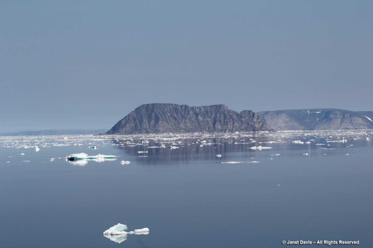
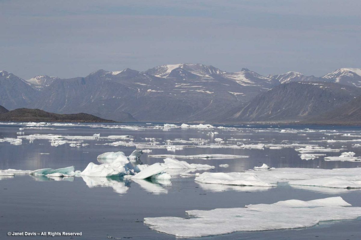
I have been on safari in Africa; I’ve crossed the Andes and walked the streets of Paris, London, Rome, Athens, Tokyo, Hong Kong, Bangkok and Buenos Aires. But August 2nd was one of the most memorable and magical travel days in my life. It was a glorious morning as we awakened in Disko Bay off the central coast of West Greenland and gazed out at the massive icebergs littering the calm ocean surface. Disko Bay or Qeqertarsuup tunua in Greenlandic, is considered a southeastern inlet of Baffin Bay.

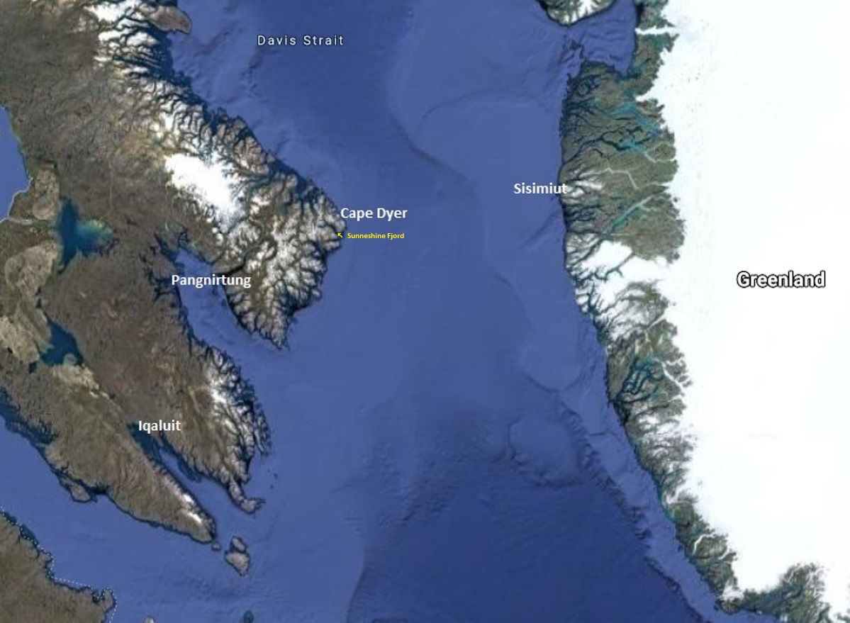
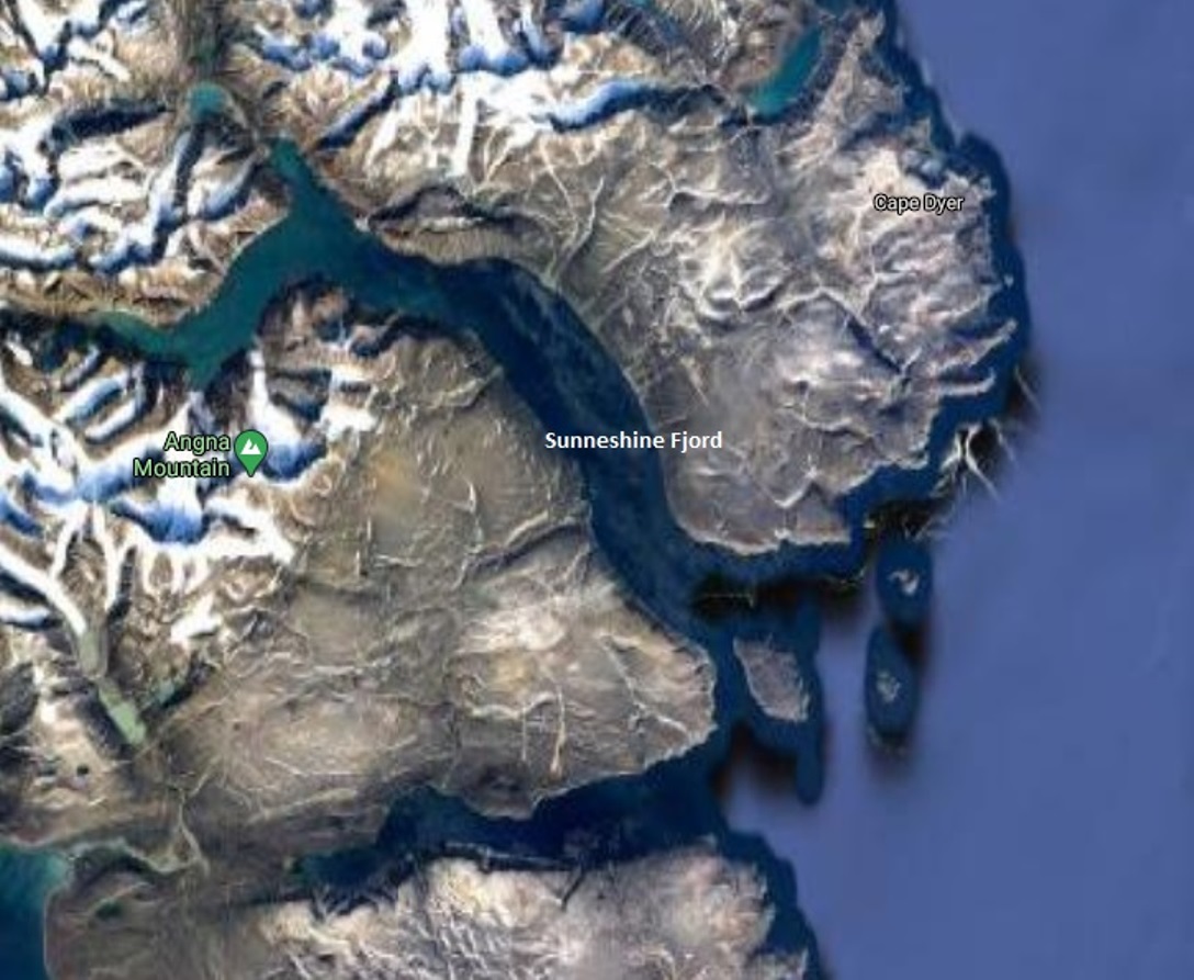
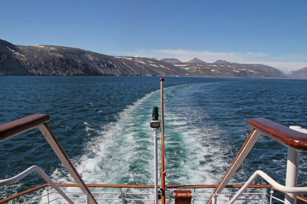
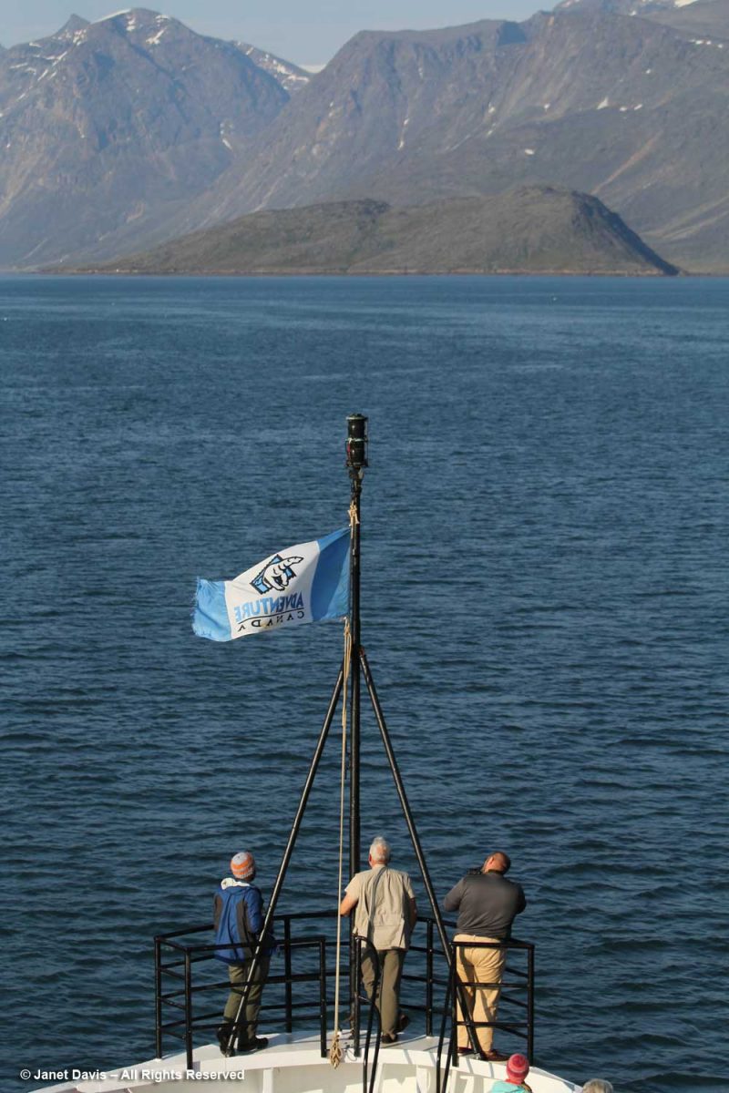
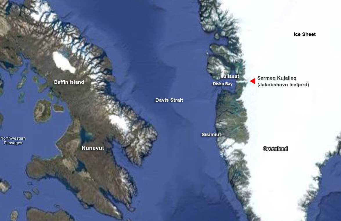
Overnight, we had sailed north from Sisimiut (which was the subject of my last blog) and navigated around Disko Island into this bay or “bugt”, as it’s called in Danish.  That massive white expanse covering most of Greenland (the largest island in the world) on the Google Earth photo map below is ice, some 1.71 million km² or 660,000 square miles. Greenland’s ice sheet (also known as Inland Ice) covers 79% of the country and is second only to the Antarctic ice sheet, which is ten times as big. Together, Greenland and Antarctica contain almost three-quarters of the world’s fresh water. At its thickest point, Greenland’s ice sheet is 3 km (1.79 mi) thick with a volume estimated at 2.85 million km3 (684,000 mi3).  Greenland has more than 100 glaciers (e.g. Kangerlussuaq, Helheim, Petermann, Hiawatha, Kong Oscar, Midgard) that flow out through its rocky margins each summer and send icebergs into the sea, but the Jakobshavn Icefjord or Isbrae (Danish) – Sermeq Kujalleq (Greenlandic) is the biggest, and the one we were here to see.

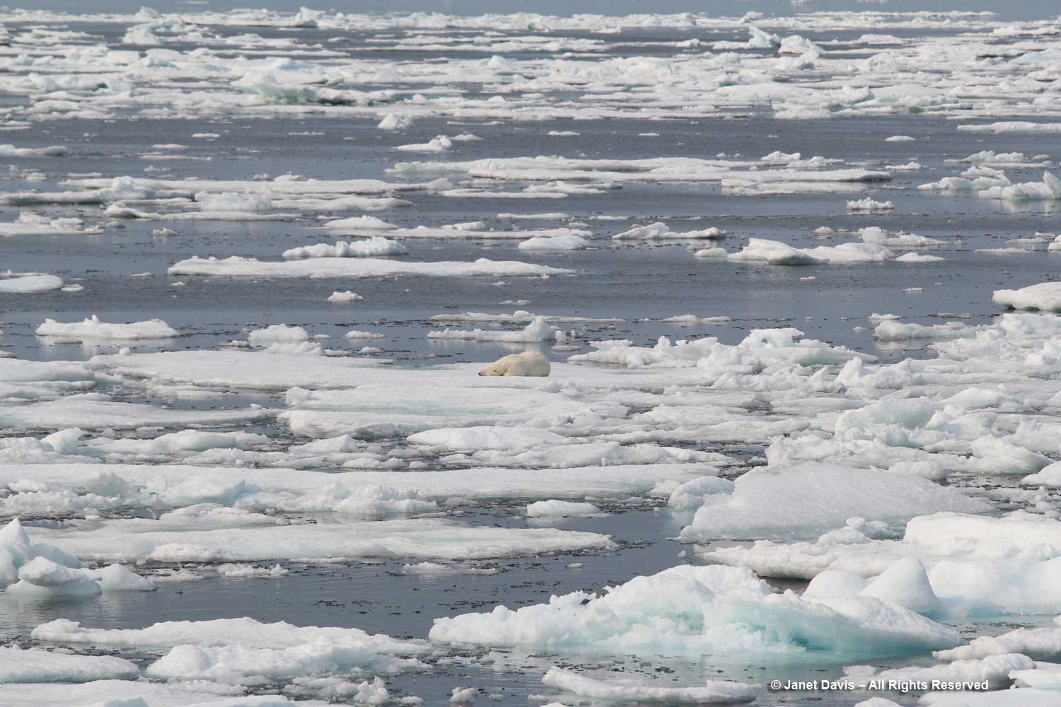
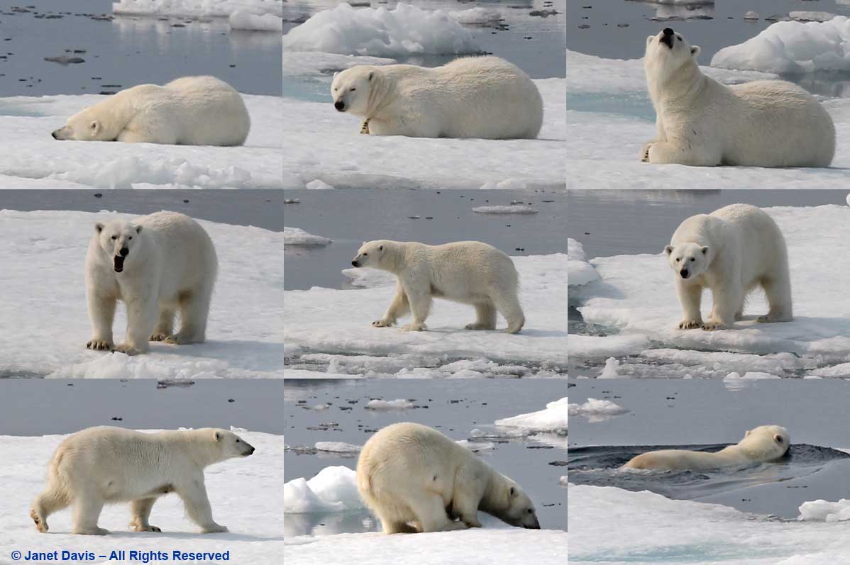
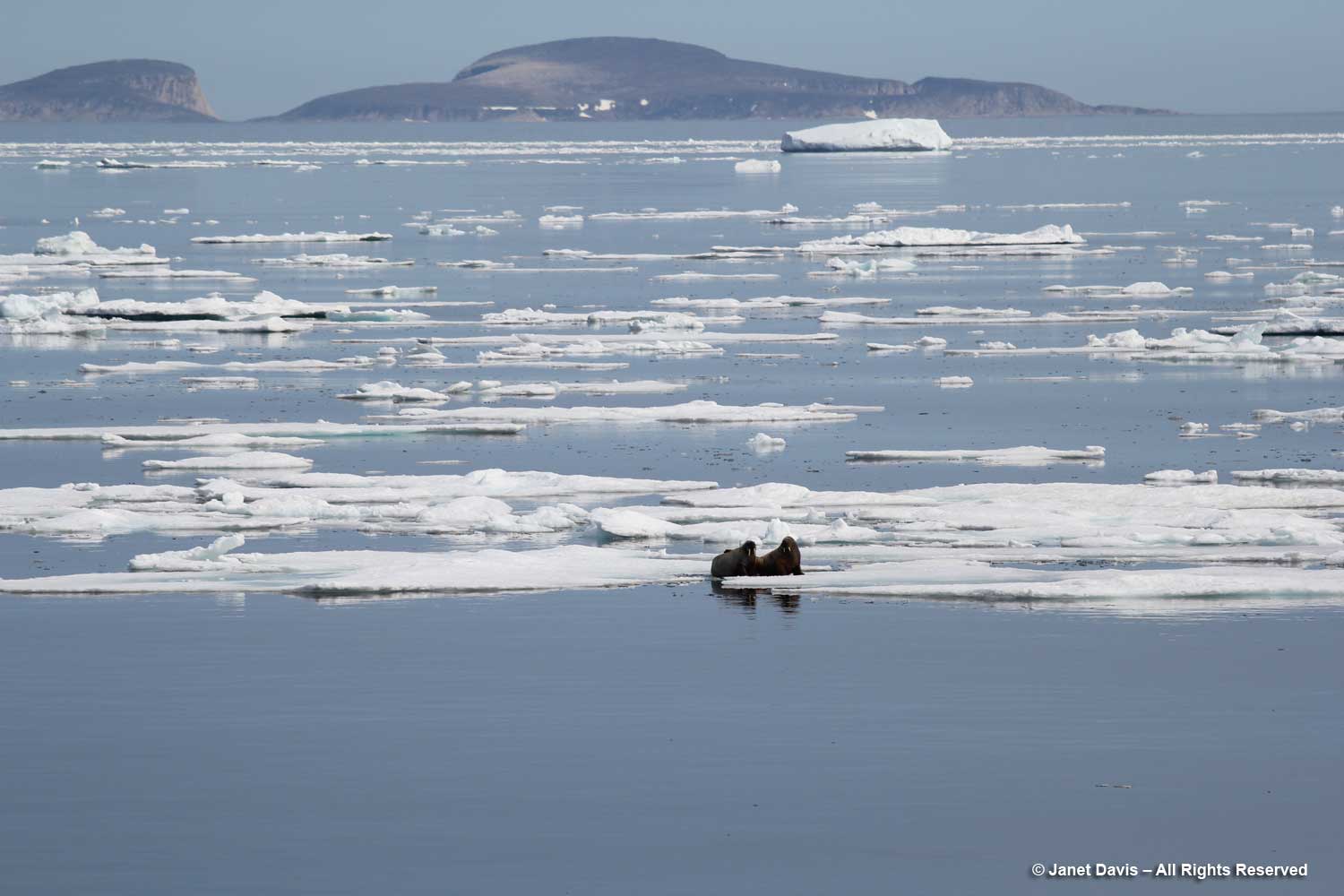
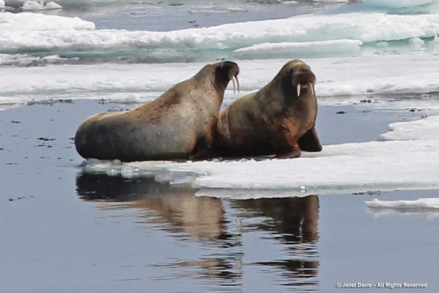
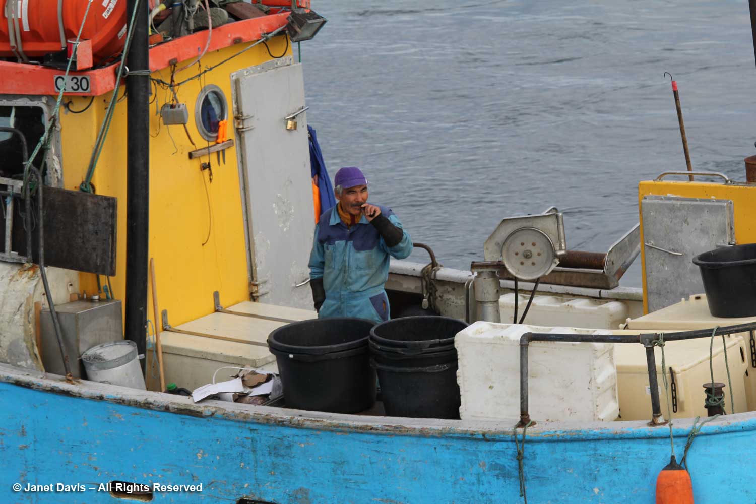
Fishboats were out in the bay, its waters rich in halibut, cod, Atlantic redfish, Arctic char and wolffish.

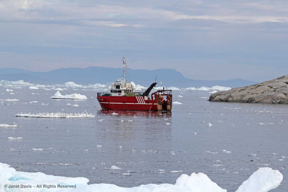
These guys just heading out were as curious about us as we were about them.

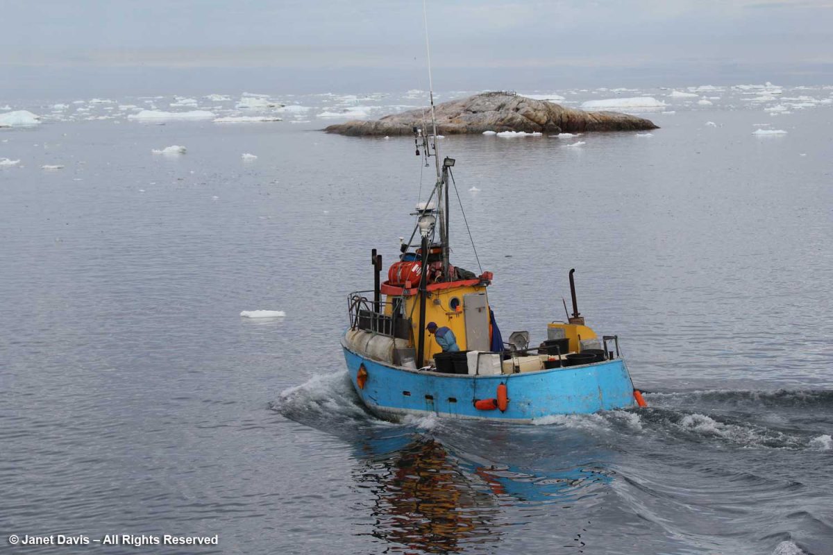
I loved the cheerful colours of this little fishing boat….

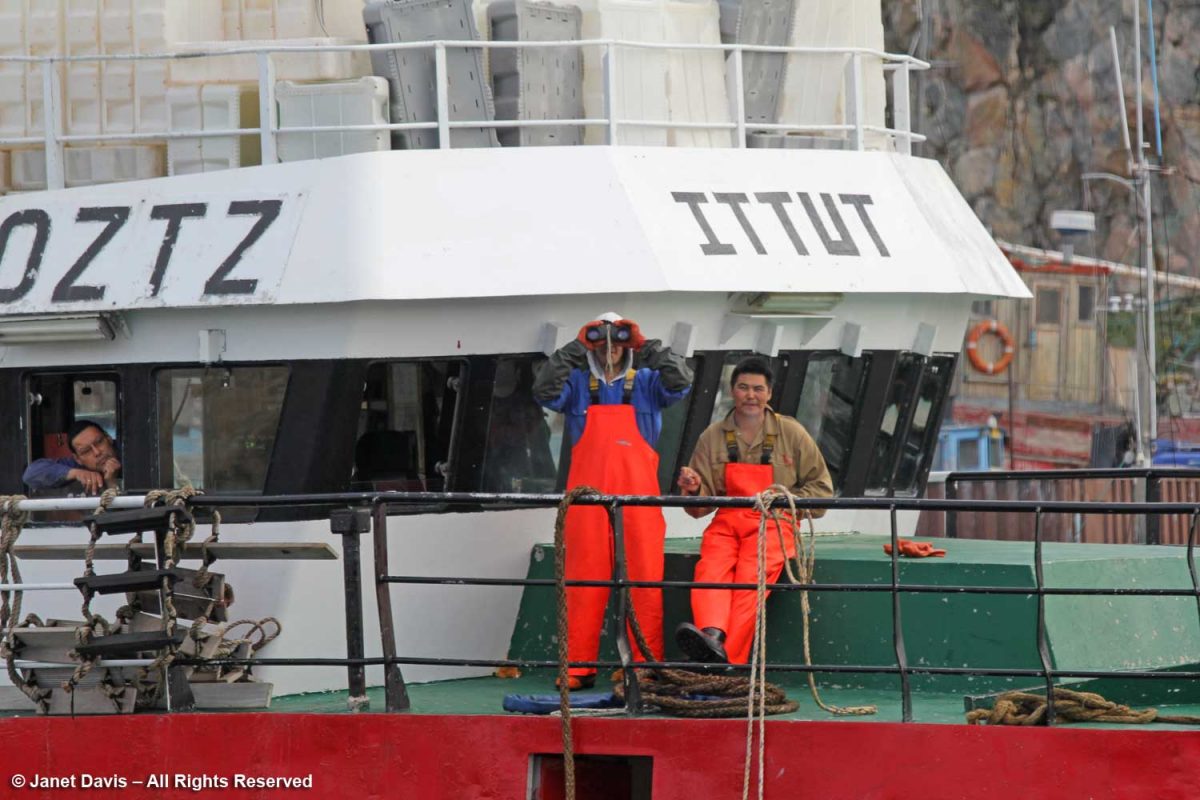
….. and the contented look of the fisherman about to head to work.

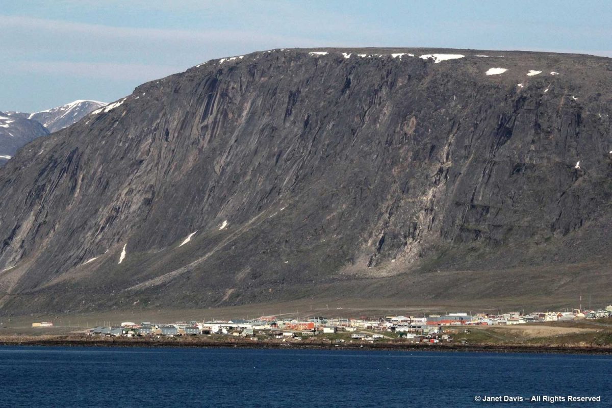
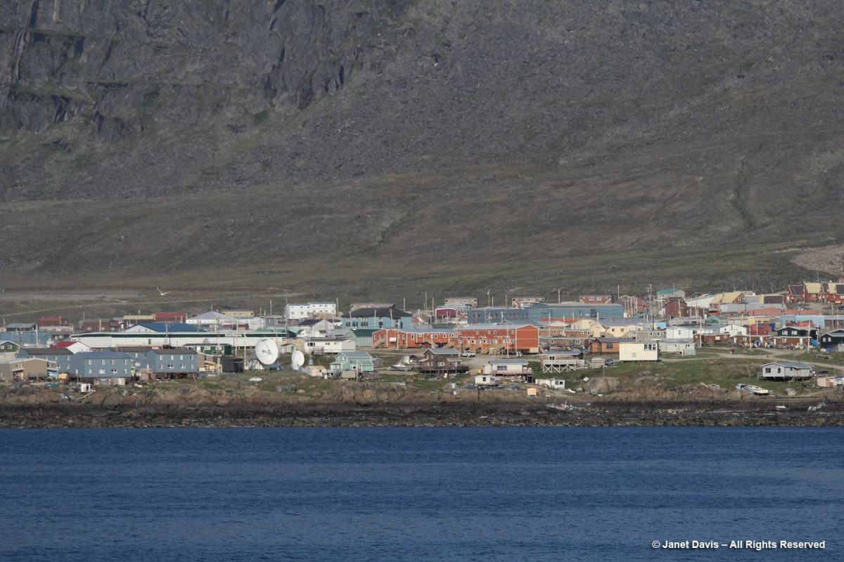
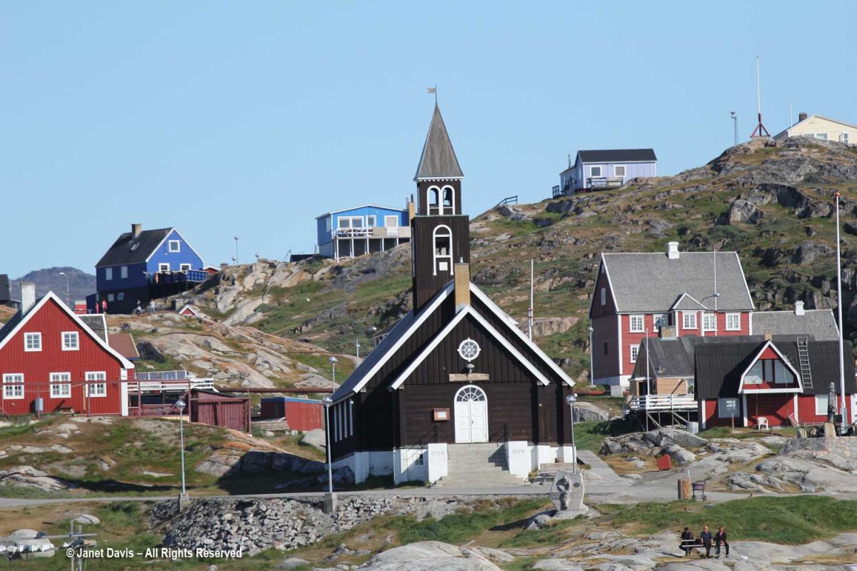
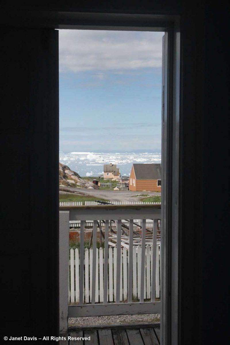
Turning towards shore, we saw the village of Ilulissat with its colourful houses arrayed up the rocky hillside under a massive mountain wall. (Greenland has myriad mountain ranges, many still unnamed). Established as a trading post by Danish merchant Jakob Severin in 1741, it was originally known as Jakobshavn. The third-largest city in Greenland after Nuuk and Sisimiut, Ilulissat has a population of 4,670 (2020).

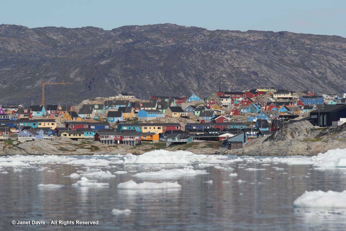
Kalaallisut is the Greenlandic language of West Greenland (East Greenland has its own) and the Kalaallisut word for “icebergs” is Ilulissat! So there was no question why we were here; indeed, this is the town closest to the Ilulissat Icefjord UNESCO World Heritage Site that we were about to visit.

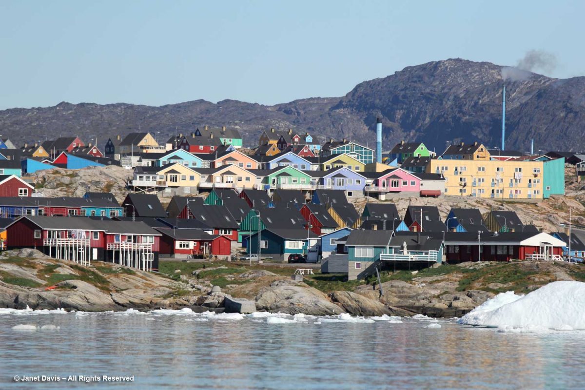
The hotel in the distance is one of three in town catering to tourists and scientists. In 2015, there were 22,000 international tourists and 15,000 local tourists, with the majority coming in July and August.

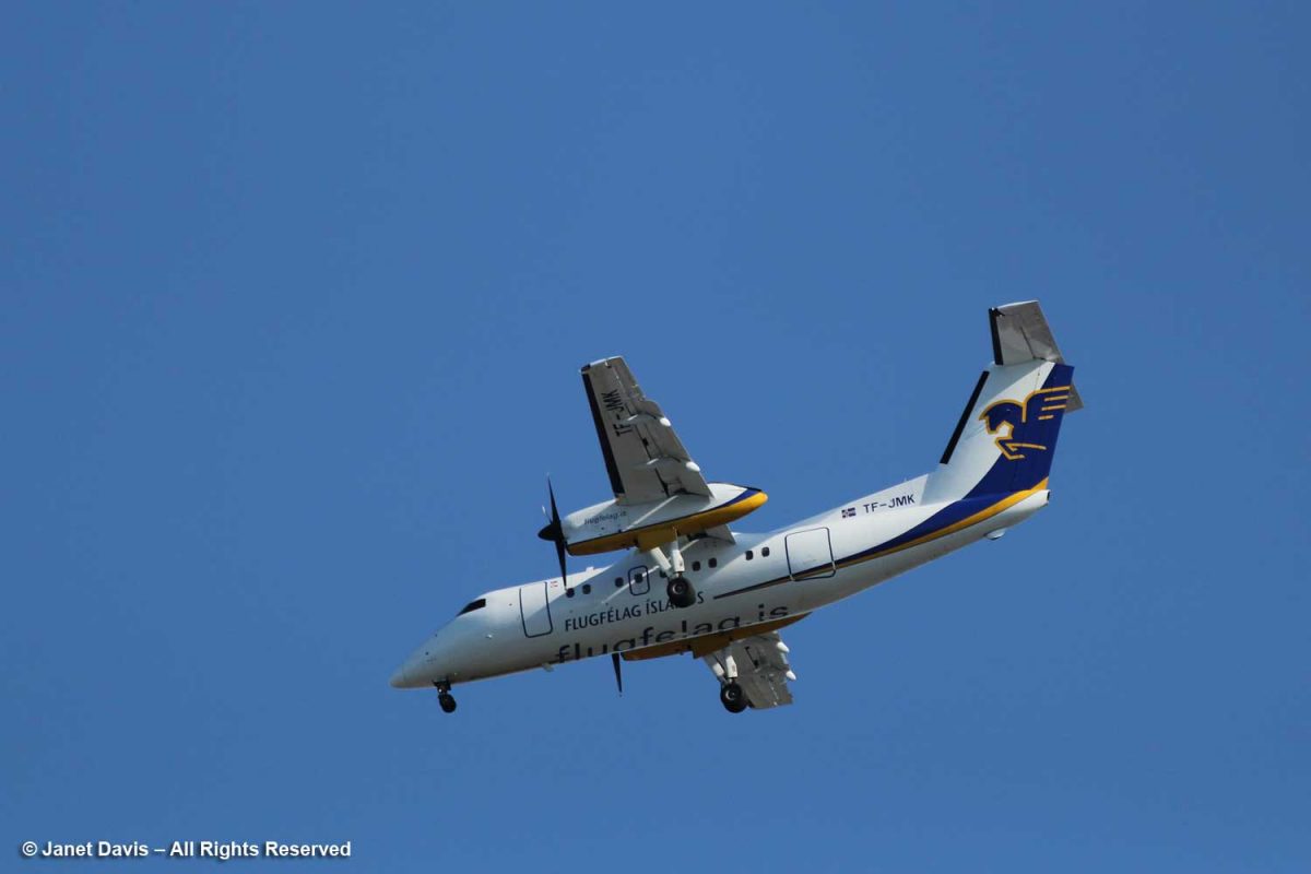
A plane passed overhead bringing passengers from Iceland as part of a seasonal schedule.

When Zion Church (Zion’s Kirke) was dedicated as a Lutheran church in 1779, it was the largest man-made building in Greenland. According to the Geological Survey of Denmark website, “During the Napoleonic Wars supplies from Denmark were limited, and the time from 1807 to 1814 in particular was a period of great hardship. In Jakobshavn, the hunters were forced to re-melt the lead from the roof and windows of the Zion Church in order to make rifle bullets.” It was moved to this location from lower ground in 1929, and services continue there today.

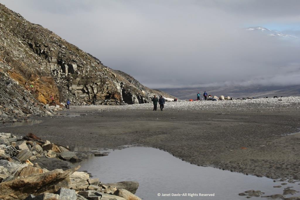
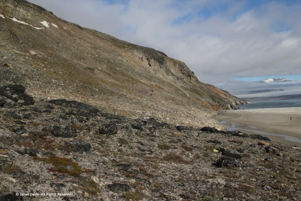
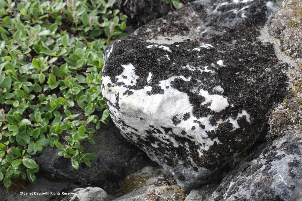
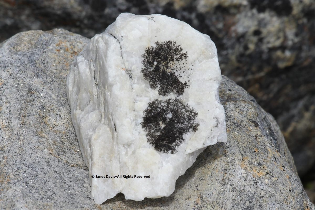
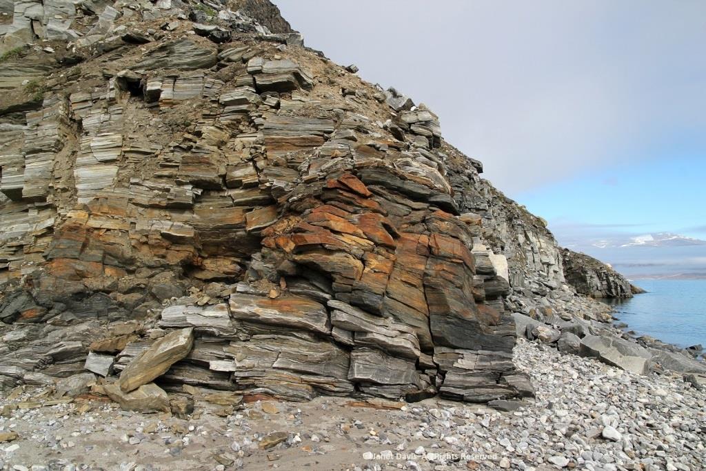
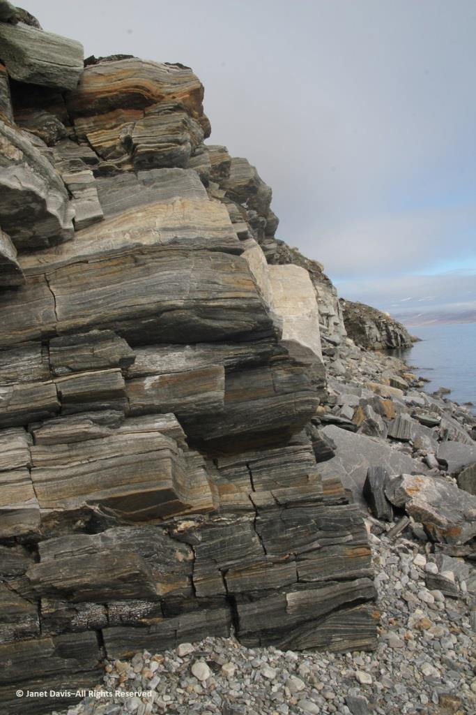
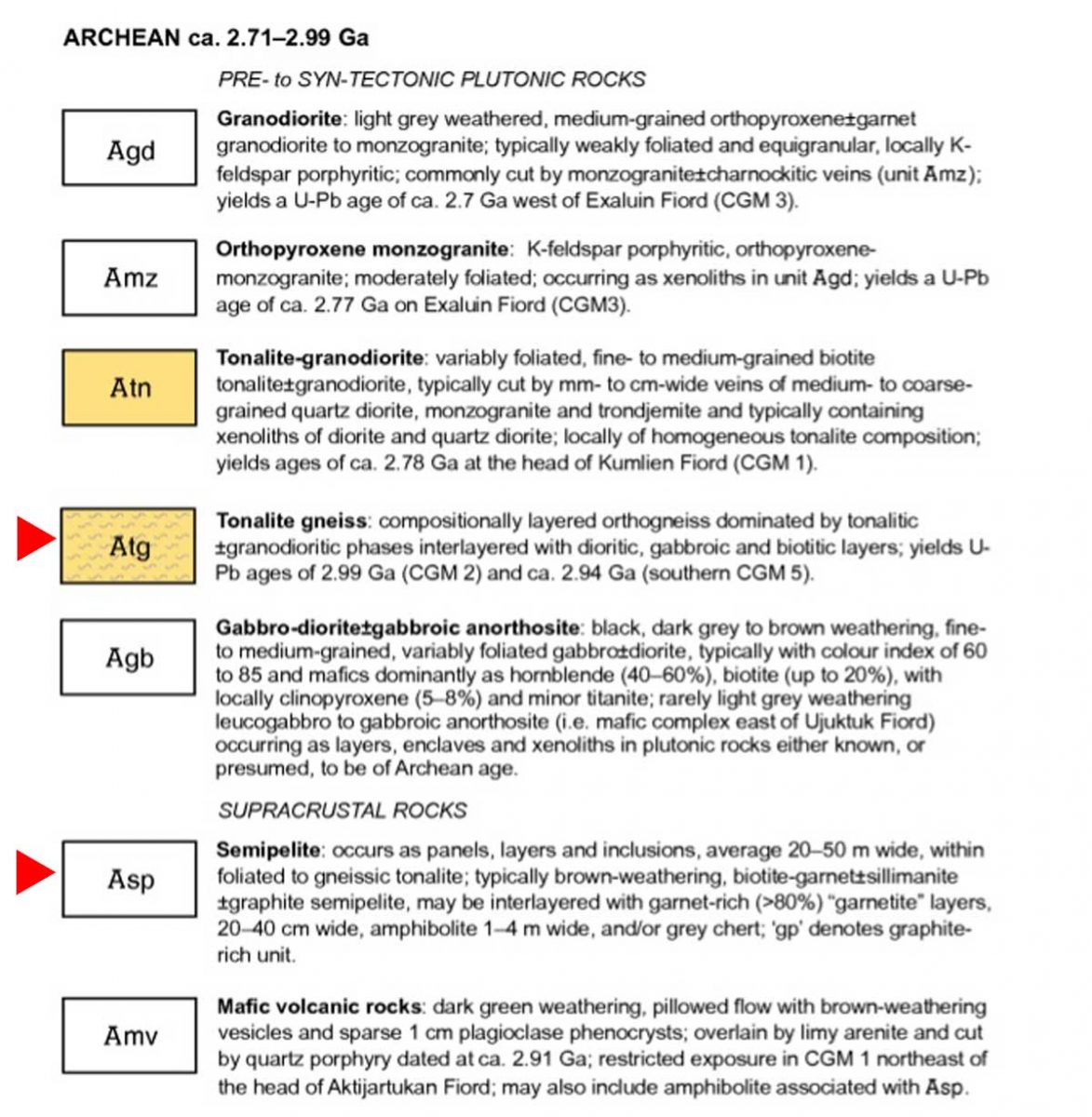
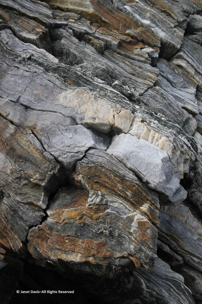
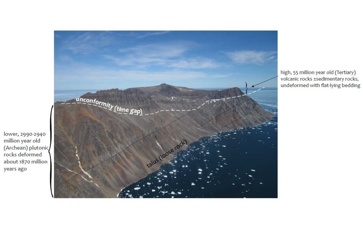
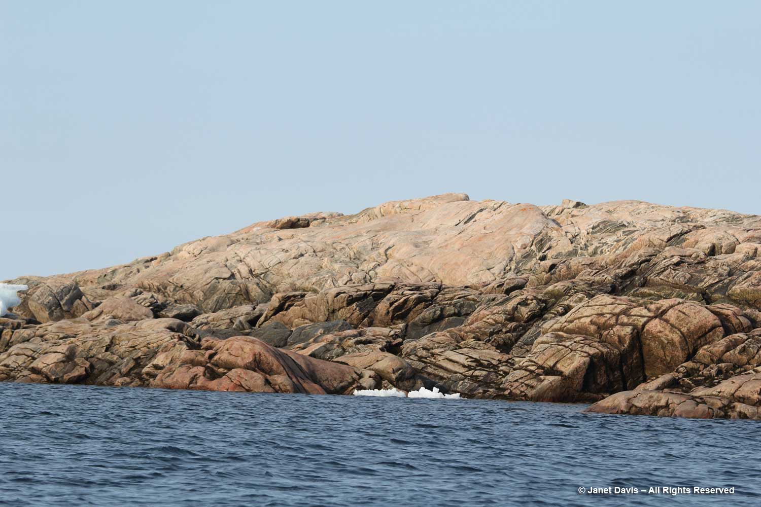
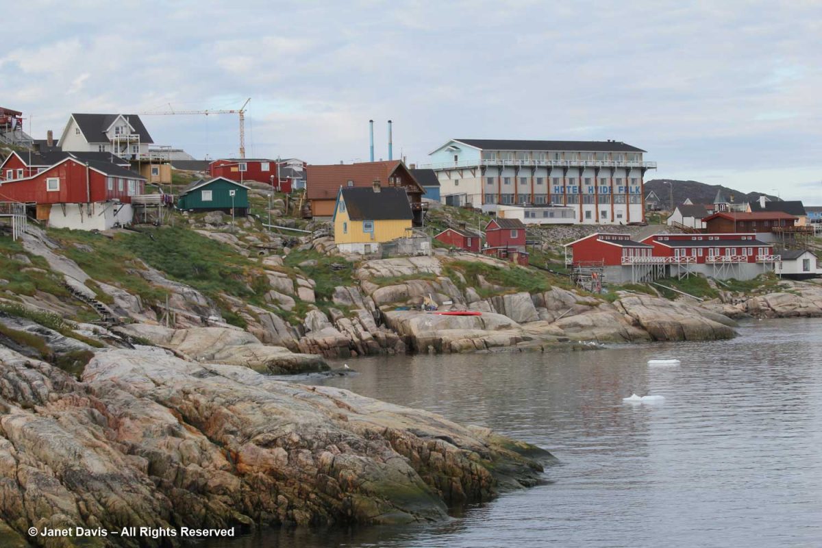
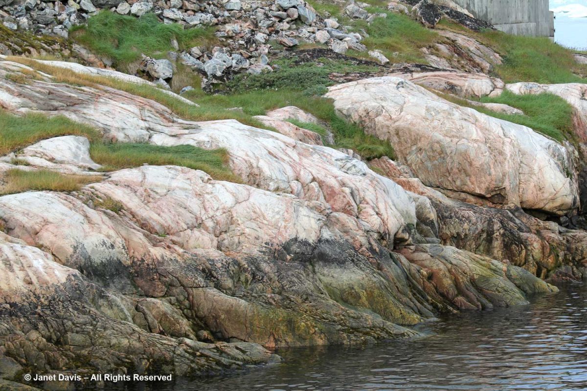
I admired these rocks at the shoreline, below. According to Canadian geologist, Dr. Marc St-Onge, Senior Emeritus Scientist at the Geological Survey of Canada, who has worked throughout the Arctic: “The bedrock geology of the Ilulissat region comprises dominantly 2.84–2.76 billion years old Archean orthogneiss (gneiss derived from a plutonic precursor), reworked and metamorphosed 1.88 billion years ago by the Nagssugtoqidian orogenic belt.”  In fact, Greenland has some of the oldest known Archean rocks on the planet, with a zircon crystal from the tonalitic gneiss protolith (the original rock before being metamorphosed) at Amîtsoq near Nuuk U/Pb-dated to 3.872 Ga (Giga annum or billion years ago). Incidentally, the Greenland rock is younger than the oldest-known exposed rock in the world, the Acasta Gneiss dated at 4.02 Ga and found in 1983 by Dr. St-Onge and his geologist wife Dr. Janet King 300 km north of Yellowknife, in Canada’s Northwest Territories. 

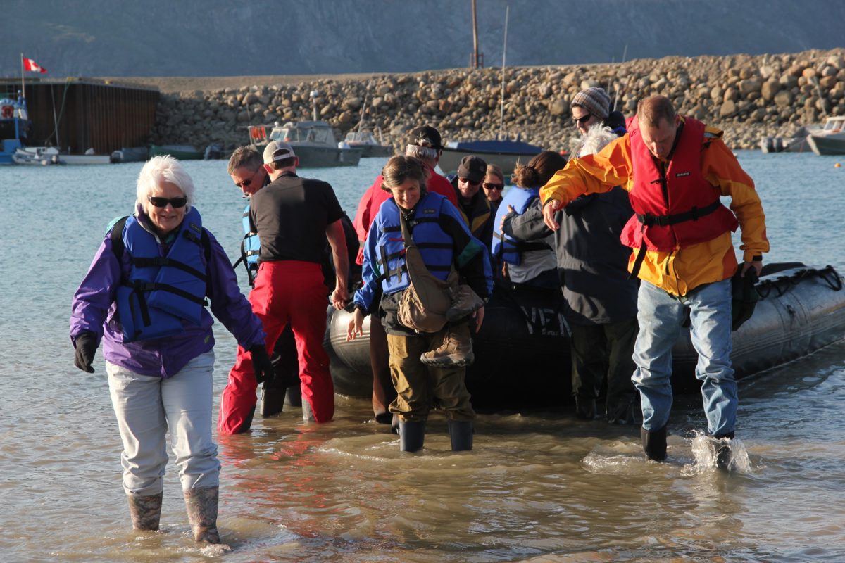
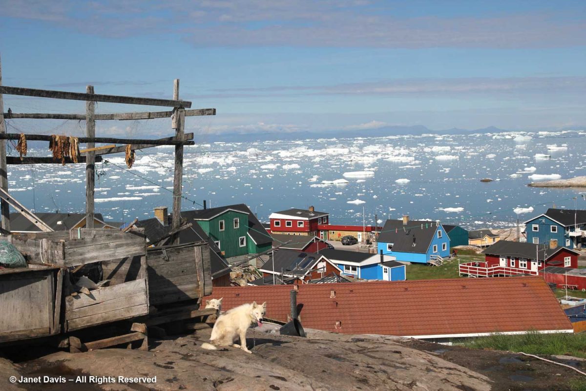
Once docked, we set off on foot to the outskirts of Ilulissat, passing the inevitable sled dogs on the way.

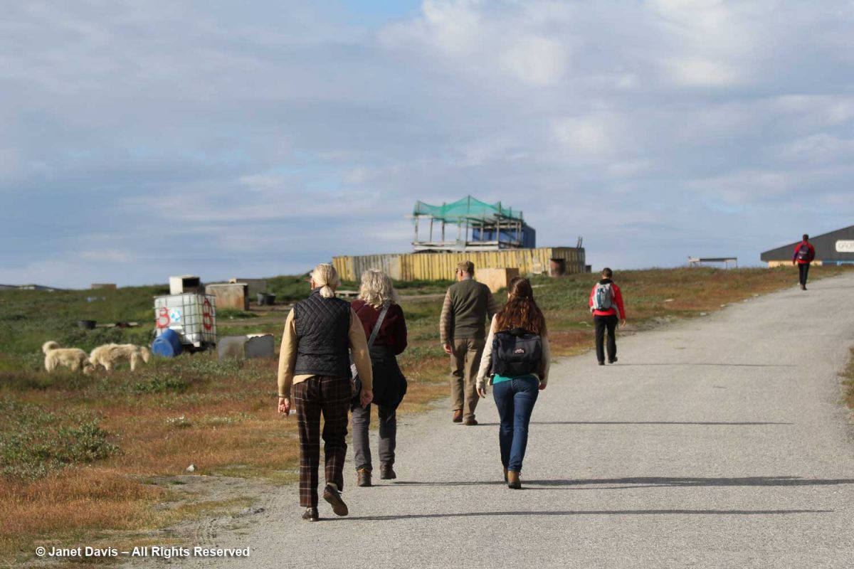
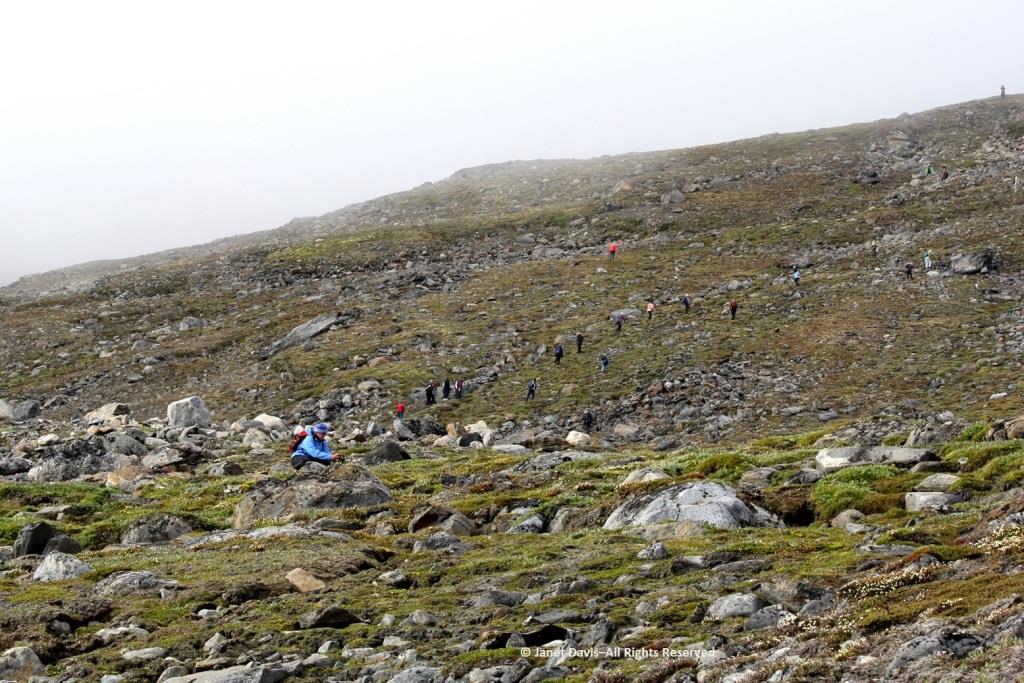
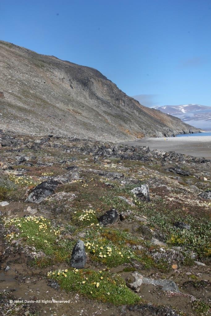
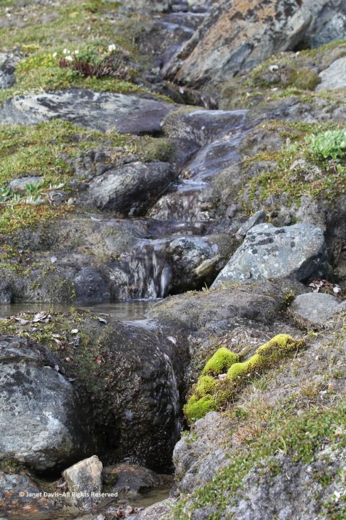
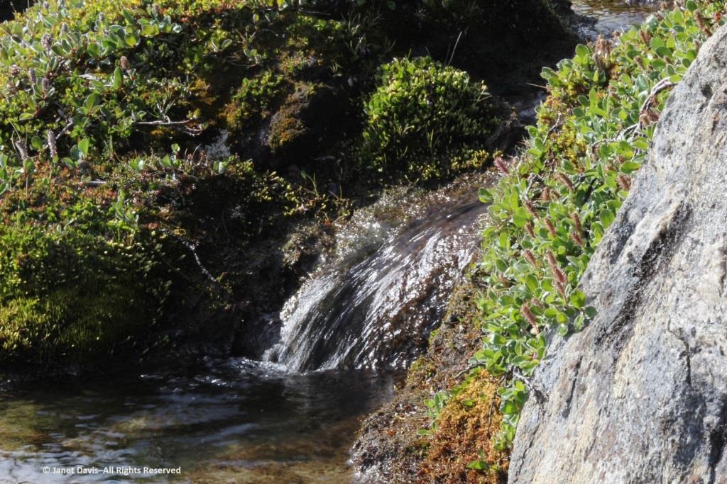
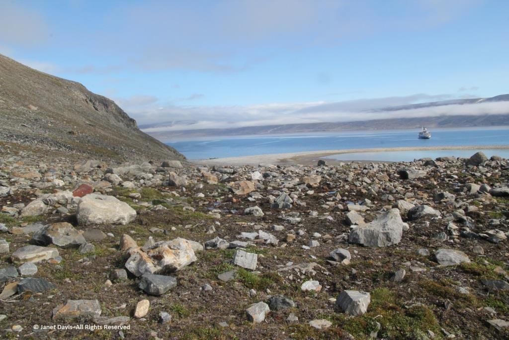
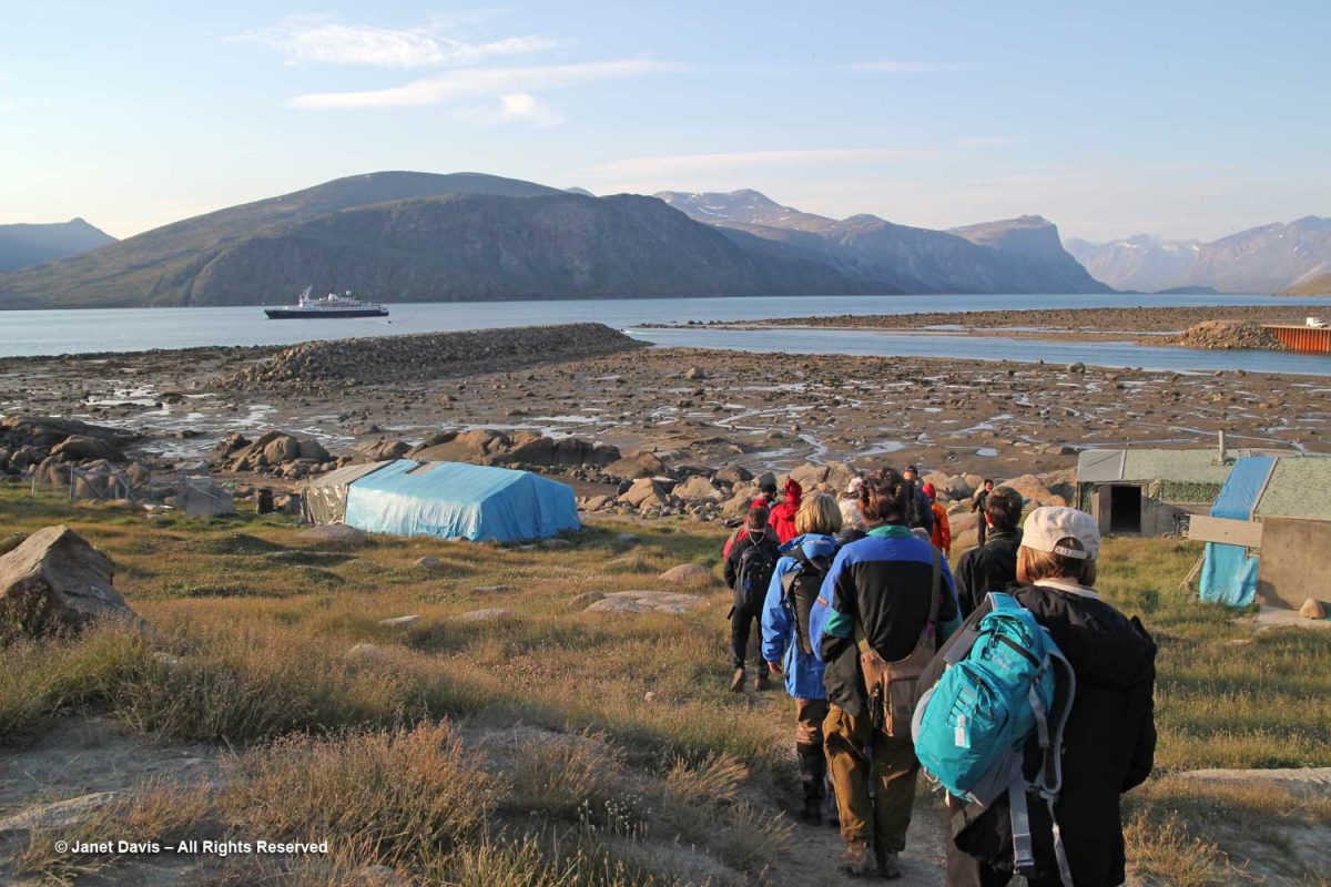
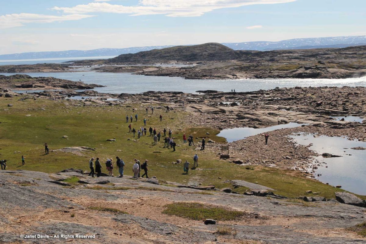
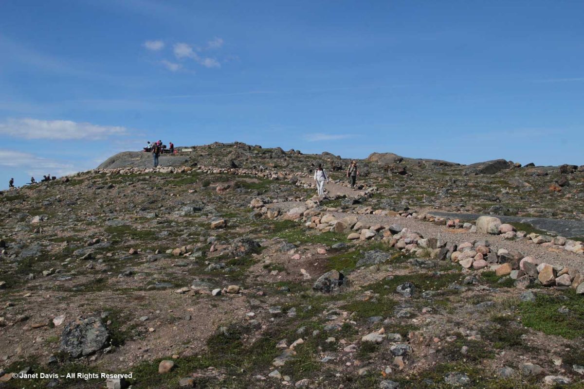
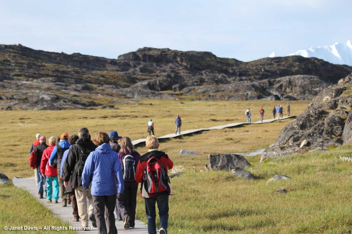
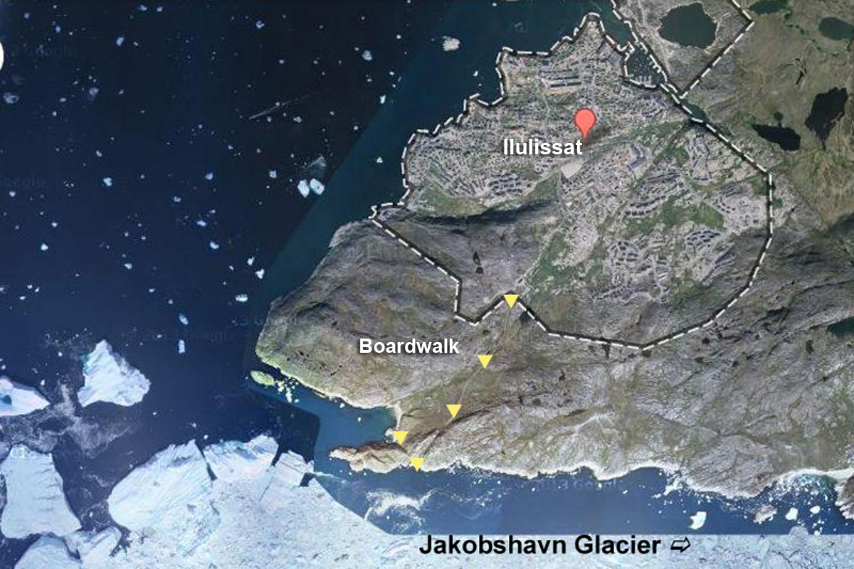
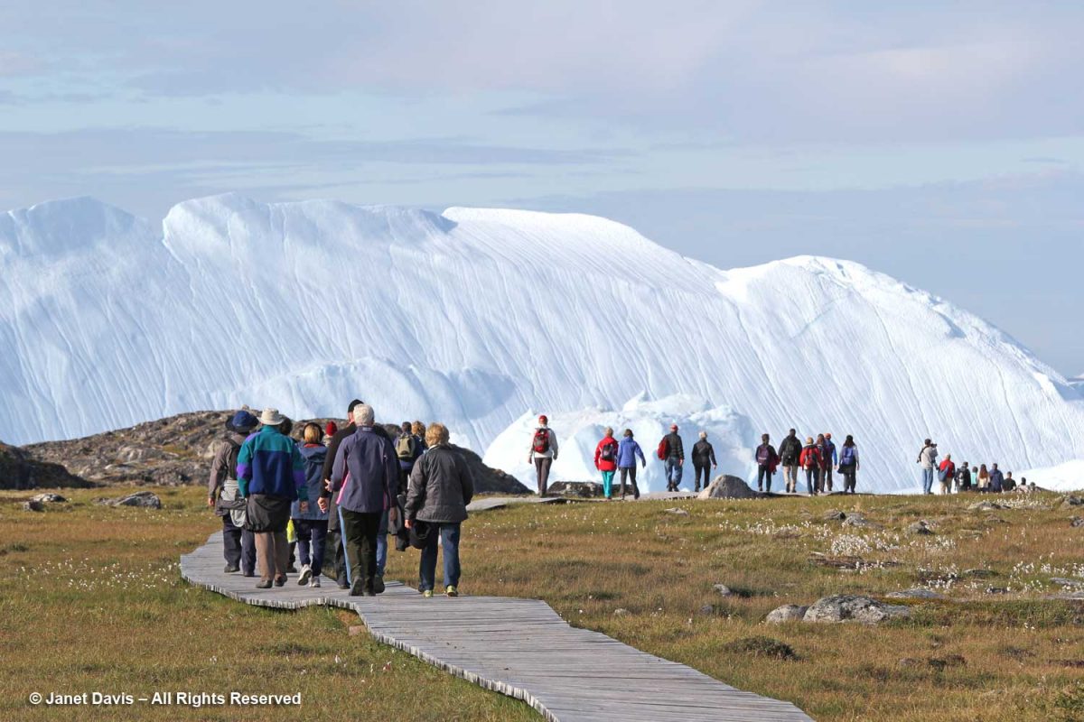
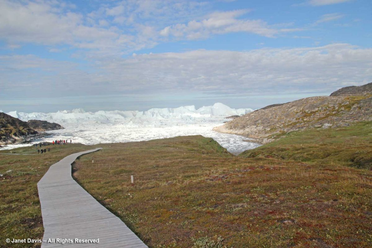
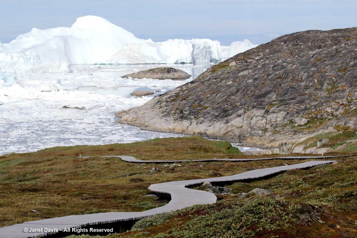
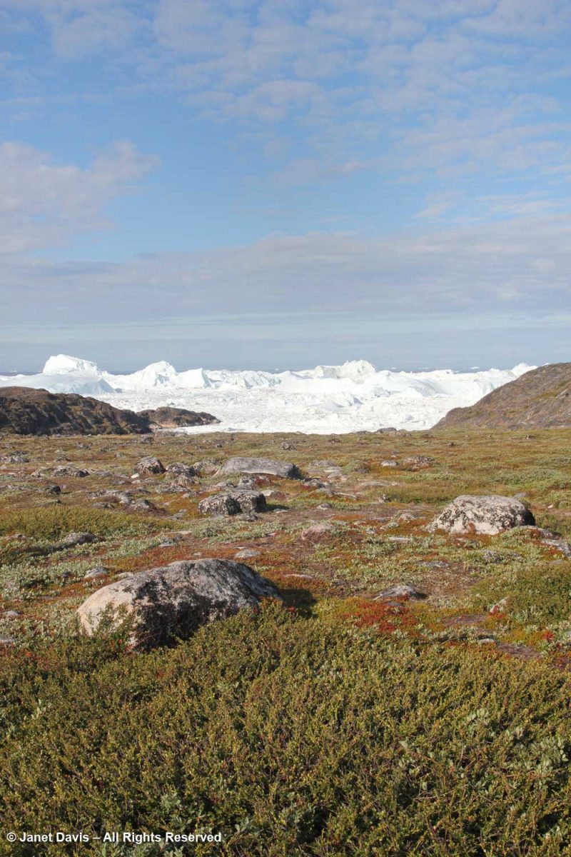
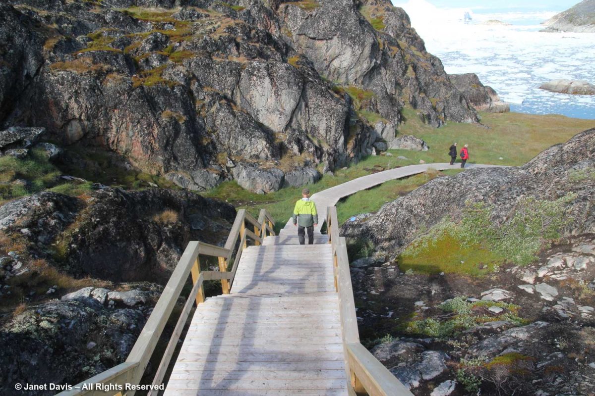
Before long, we arrived at the boardwalk leading to the edge of the icefjord.  The boardwalk passes through the Sermermiut Valley, which was once an Inuit settlement. At 1.4 k (.87 mile) in length, it is a pleasant, easy hike, but one with a spectacular terminus that showcases one of the planet’s most awe-inspiring phenomena.

I marked the Google Earth map below with yellow arrows to show the boardwalk and its relationship to town.

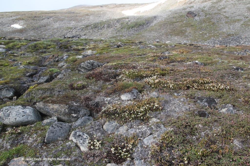
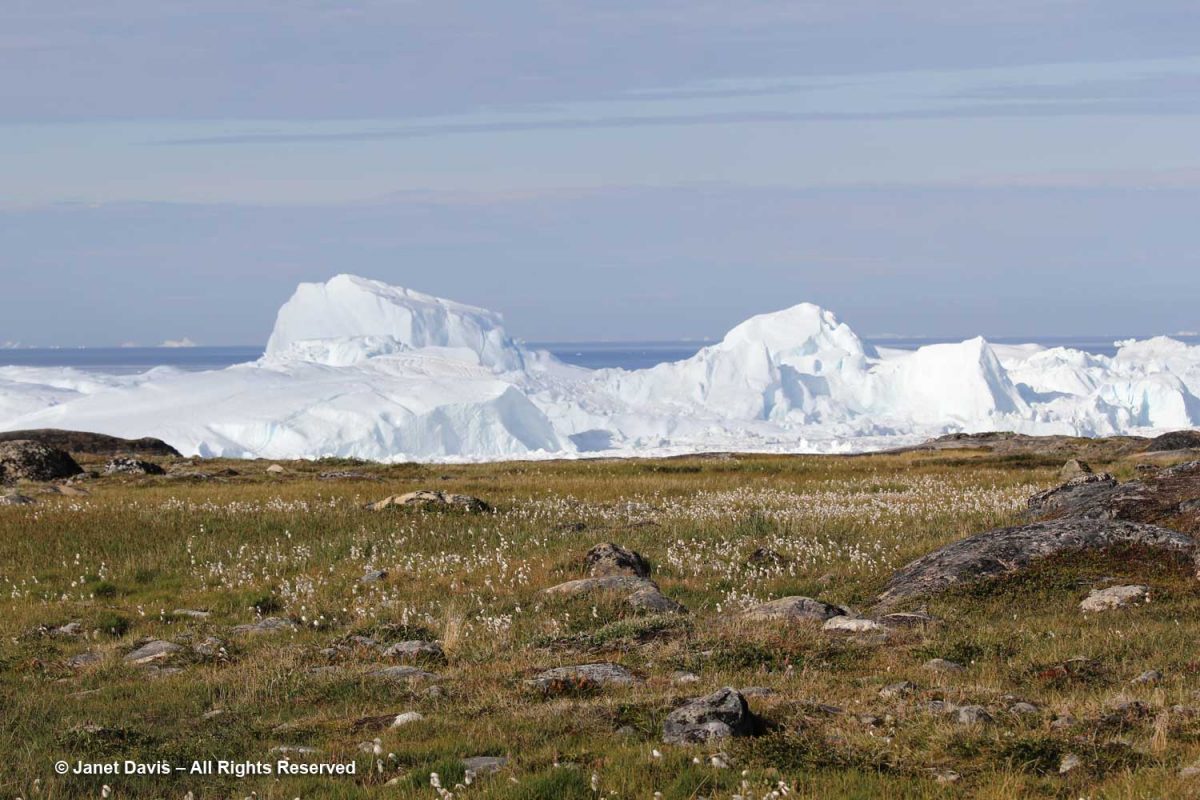
It is simply impossible to describe how thrilling it was to walk through this gentle meadow with its delicate little ecosystems of plants and ancient rock toward this massive parade of glacial ice slipping, sliding and booming towards the ocean.

In 2004, as it was creating the International Heritage Site designation, UNESCO described the site and determined that it met two criteria:
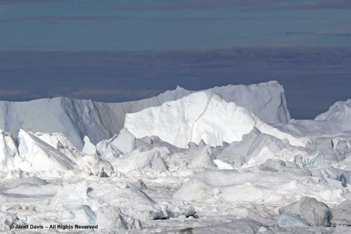
The combination of a huge ice sheet and a fast-moving glacial ice-stream calving into a fjord covered by icebergs is a phenomenon only seen in Greenland and Antarctica. Ilulissat offers both scientists and visitors easy access for close view of the calving glacier front as it cascades down the ice sheet and into the ice-choked fjord. The wild and highly scenic combination of rock, ice and sea, along with the dramatic sounds produced by the moving ice combine to present a memorable natural spectacle.

The Ilulissat Icefjord is an outstanding example of a stage in the Earth’s history:  the last ice age of the Quaternary Period. The ice-stream is one of the fastest (40 m per day) and most active in the world. Its annual calving of over 46 km3 of ice accounts for 10% of the production of all Greenland calf ice, more than any other glacier outside Antarctica. The glacier has been the object of scientific attention for 250 years and, along with its relative ease of accessibility, has significantly added to the understanding of ice-cap glaciology, climate change and related geomorphic processes.”

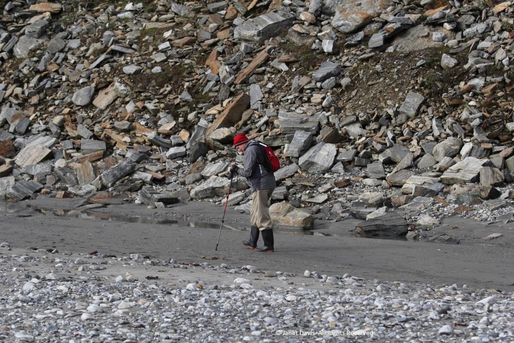
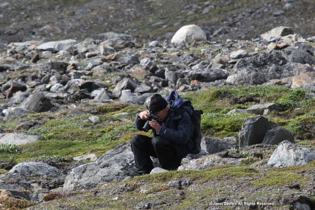
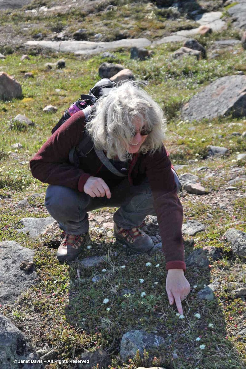
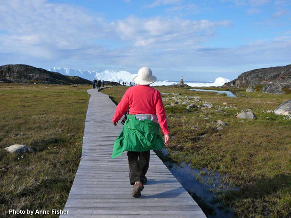
As usual, I was distracted with all the photography opportunities in the meadows flanking the boardwalk, and had to hurry along to catch up.  (Thankfully, my friend Anne snapped this photo of me, something that rarely happens when I travel.) It was so warm that lovely day in the Arctic, I didn’t need the jacket I’d brought along. However, according to the World Metereological Organization, Greenland also boasts the lowest temperature ever recorded in the Northern Hemisphere, -69.6 C (-93.3 F) on December 22, 1991 at Klinck, with an elevation of 3,105 metres near the topographic summit of the Greenland Ice Sheet.

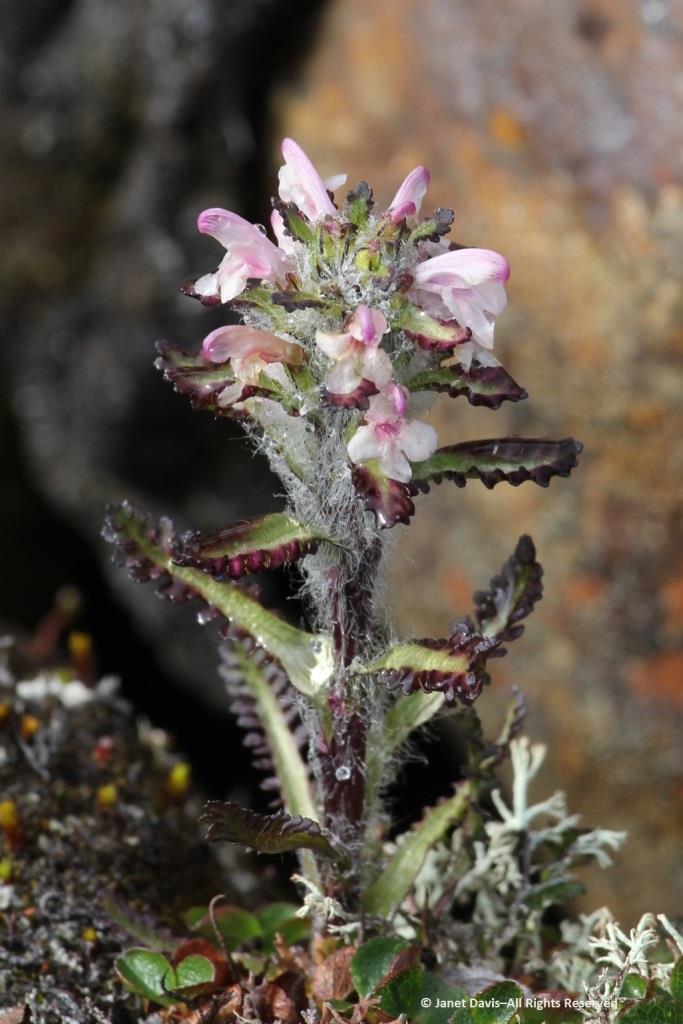
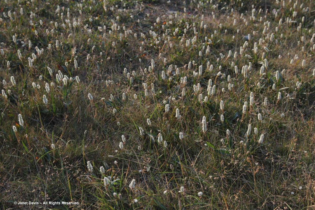
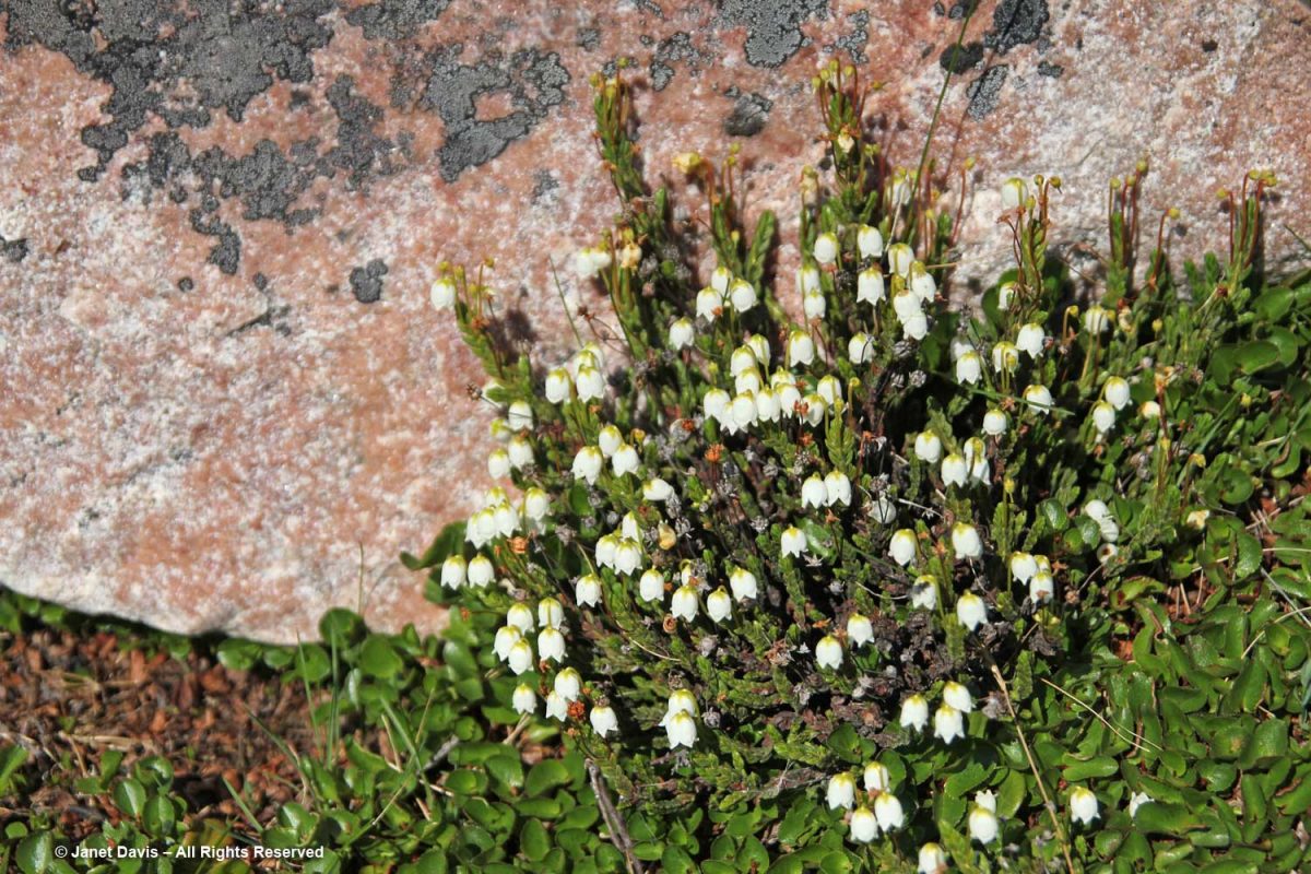
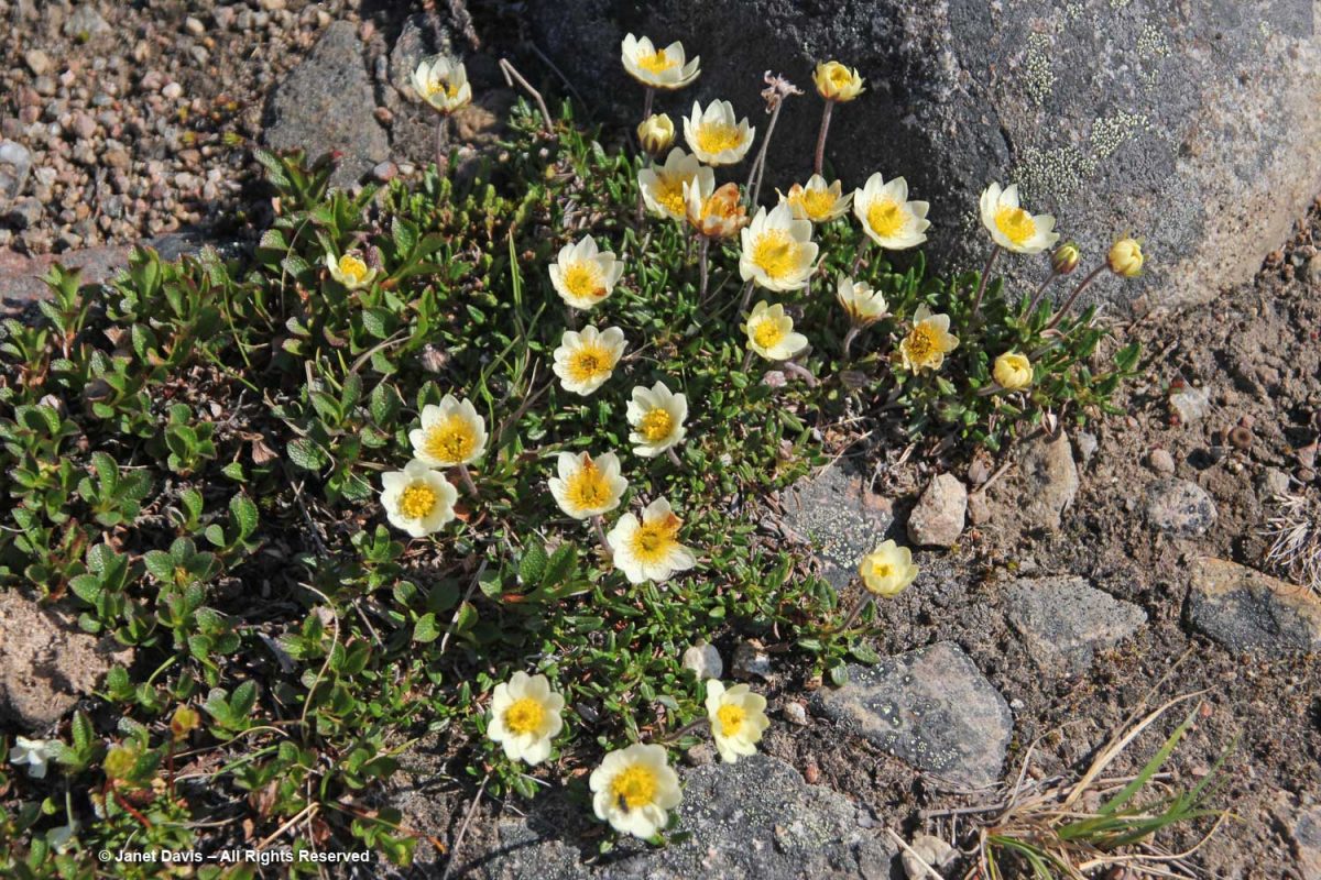
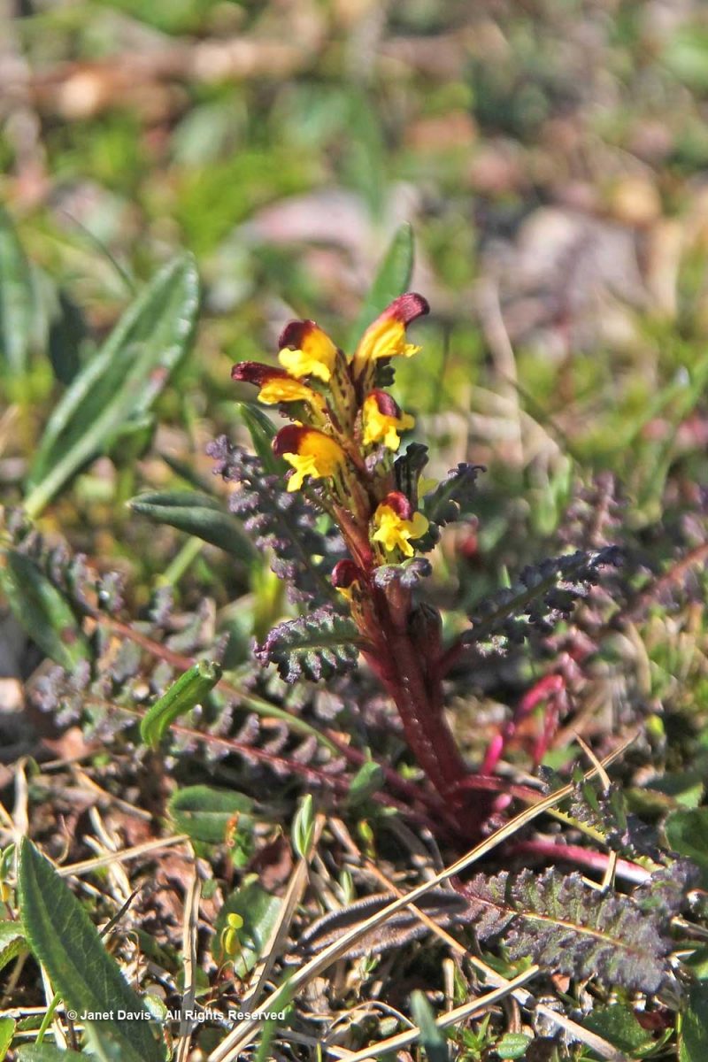
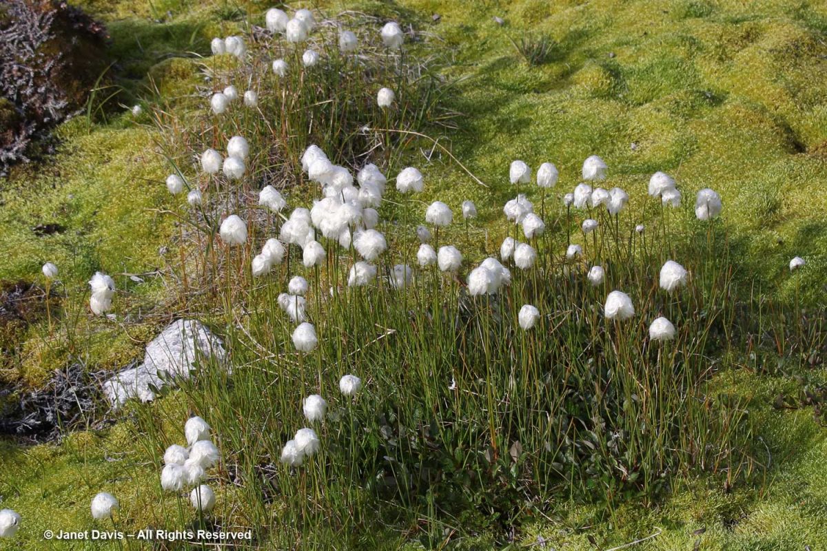
The calved ice loomed ahead, but I also loved seeing all the plants, like ubiquitous Scheuchzer’s cotton grass (Eriophorum scheuchzeri)…..

….. with its fluffy white fruiting heads.

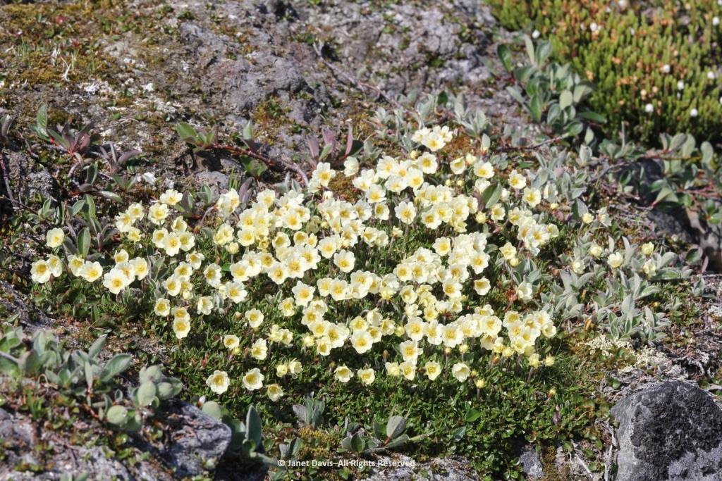
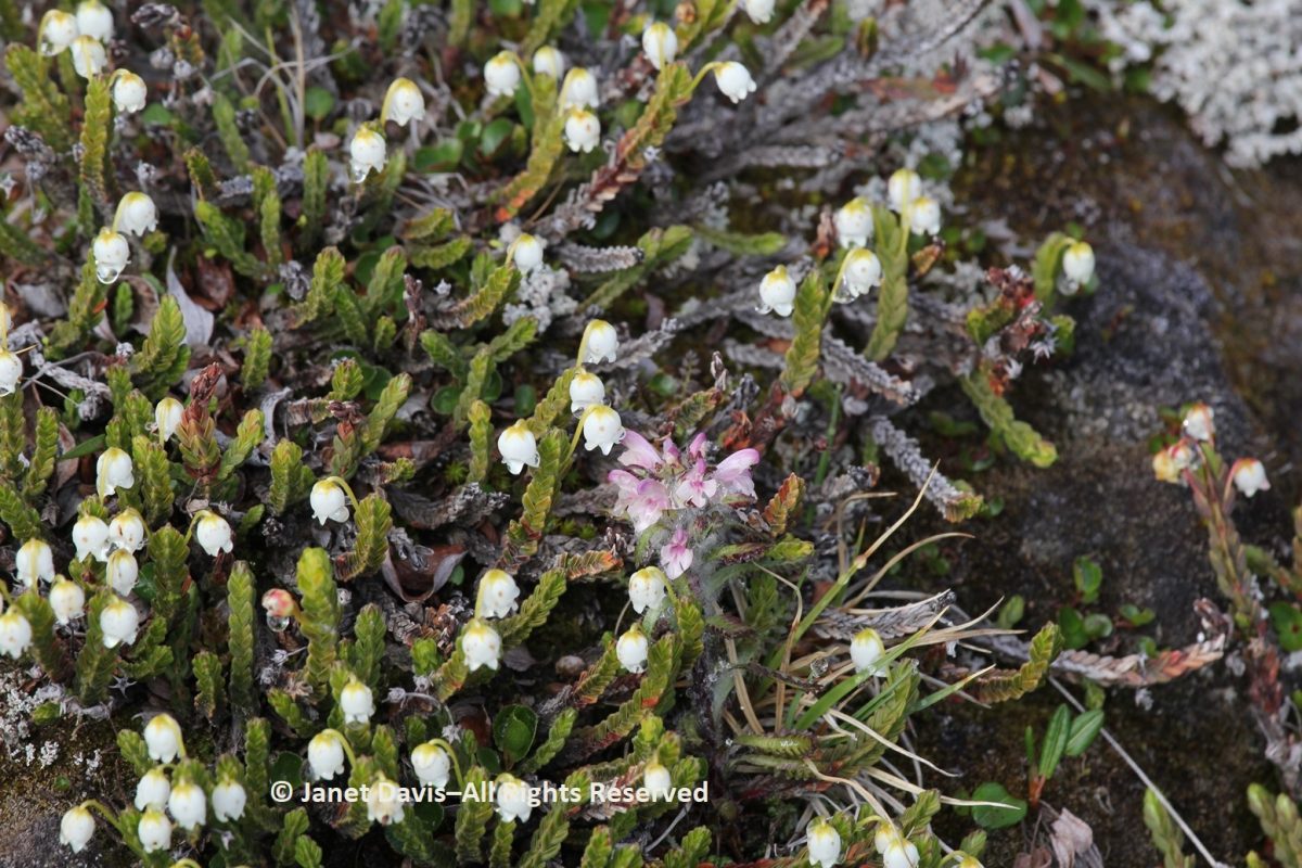
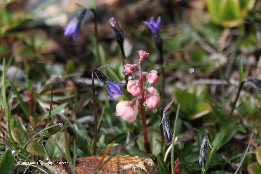
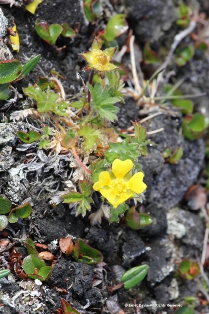
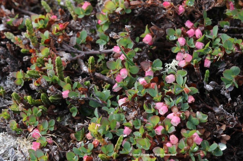
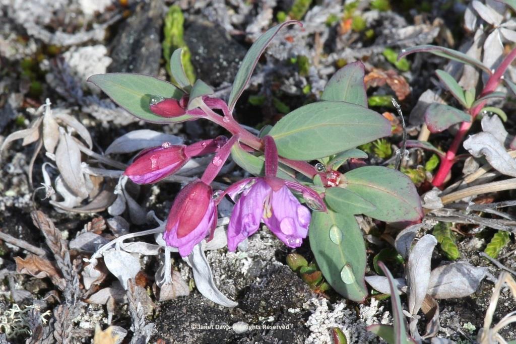
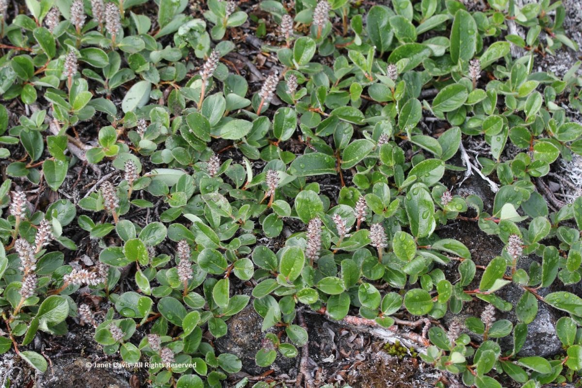
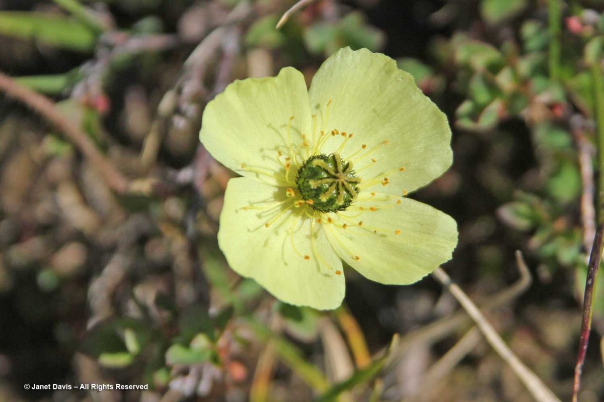
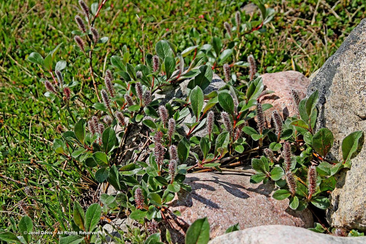
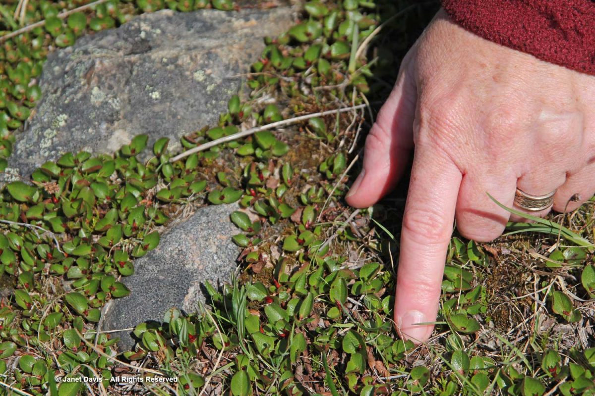
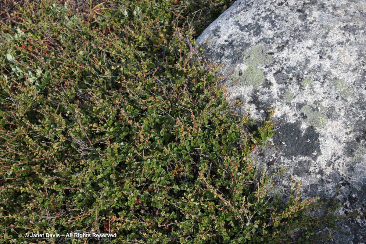
The meadow was a tapestry of heath plants, blueberries, mouse-ear chickweed, willow and….

…. dwarf birch (Betula glandulosa).

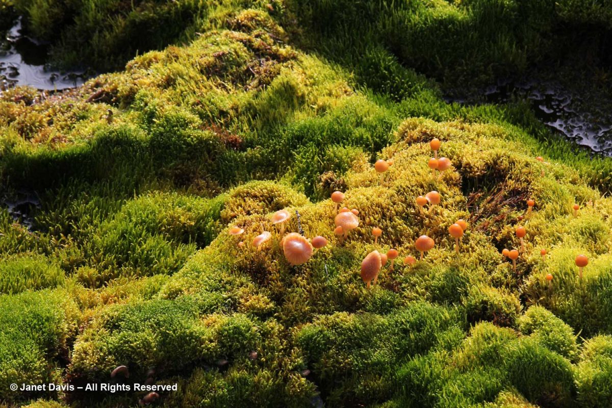
In the damper spots, mushrooms emerged from luxuriant carpets of moss.

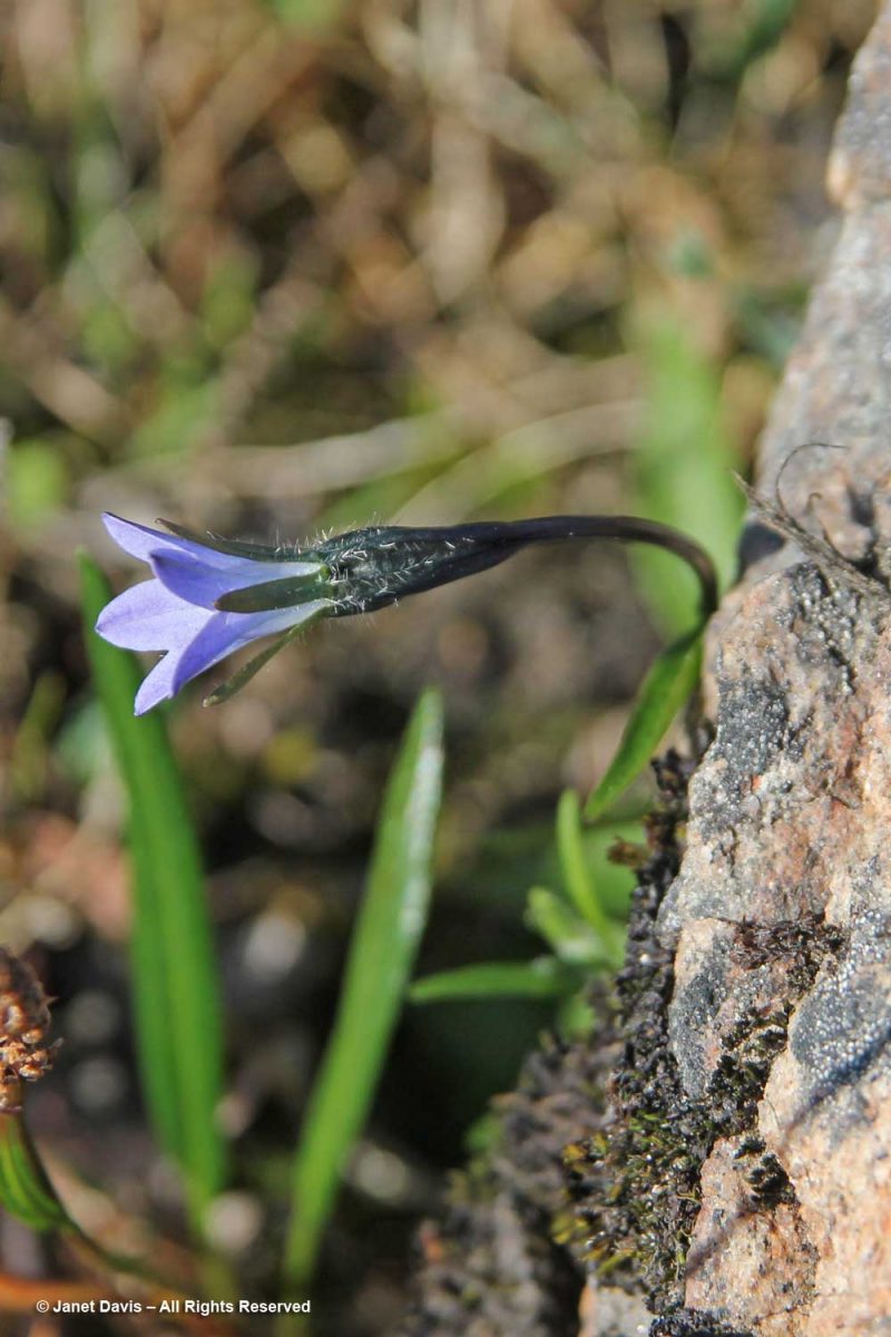
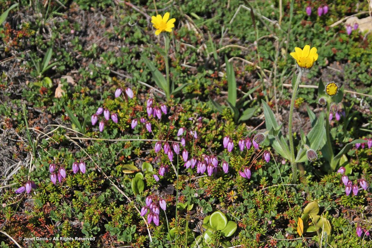
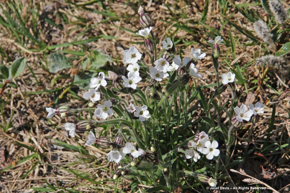
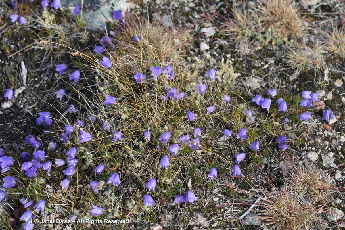
Greenland bellflower grew in drier places, (Campanula rotundifolia subsp. gieseckiana).  

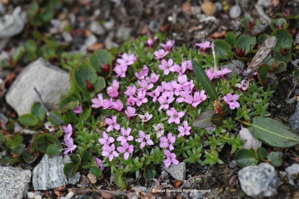
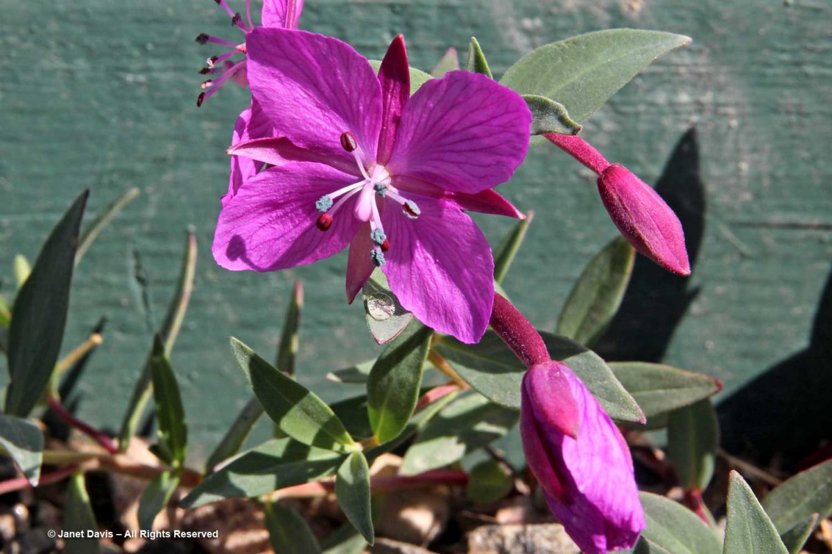
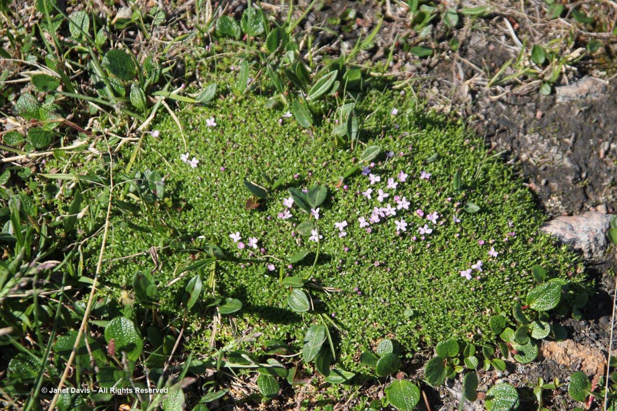
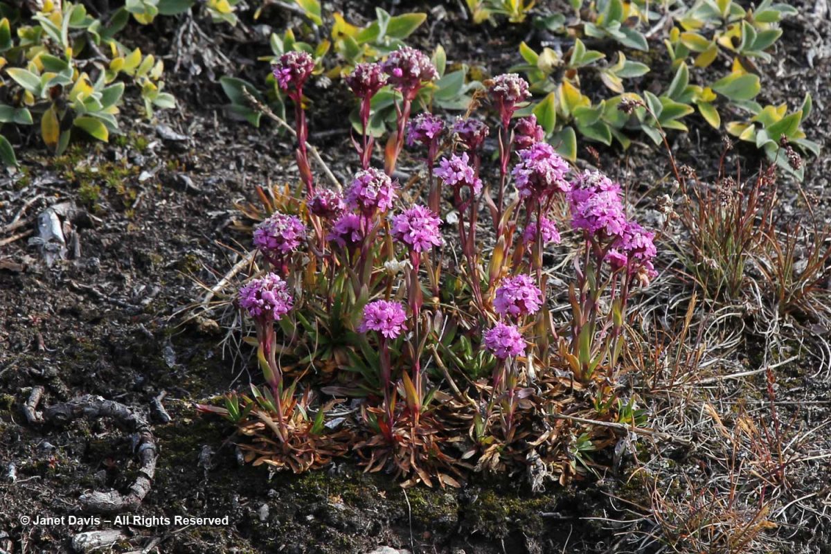
Alpine catchfly (Viscaria alpina) showed off its magenta flowers.

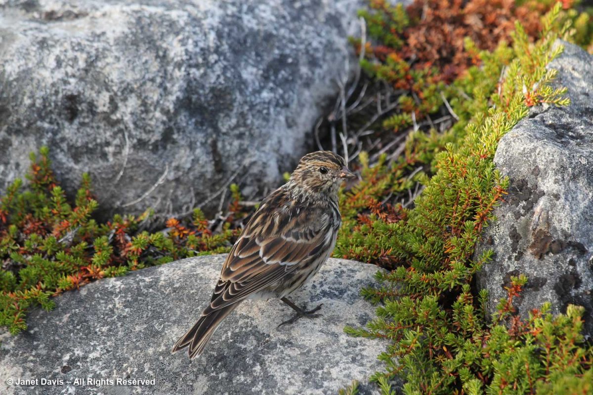
A little Lapland longspur (Calcarius laponicus) eyed me as it ate a seed.

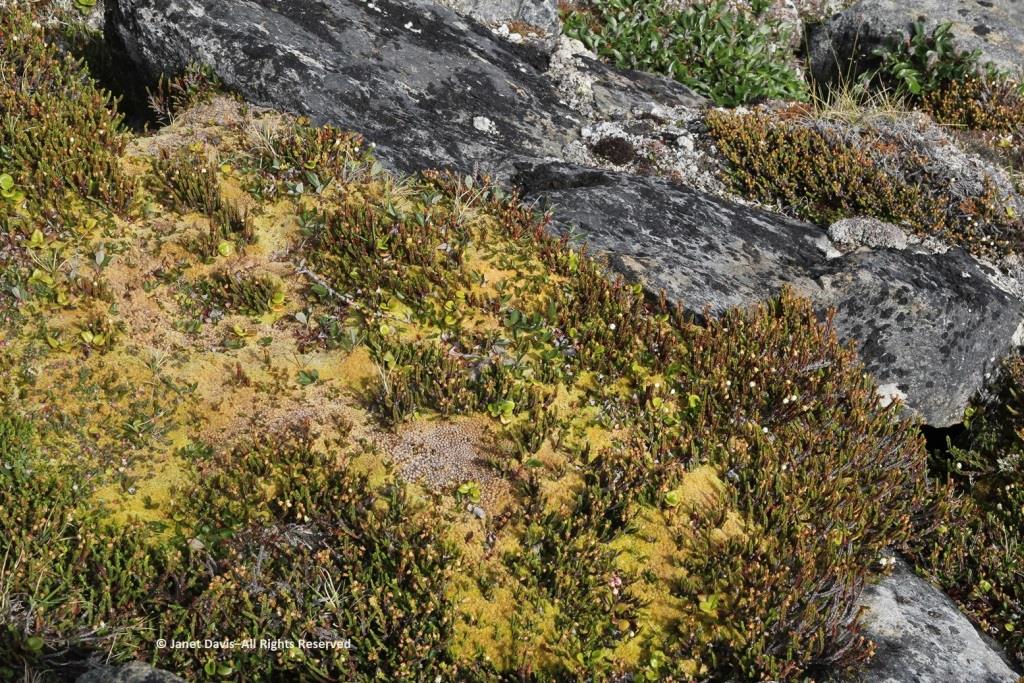
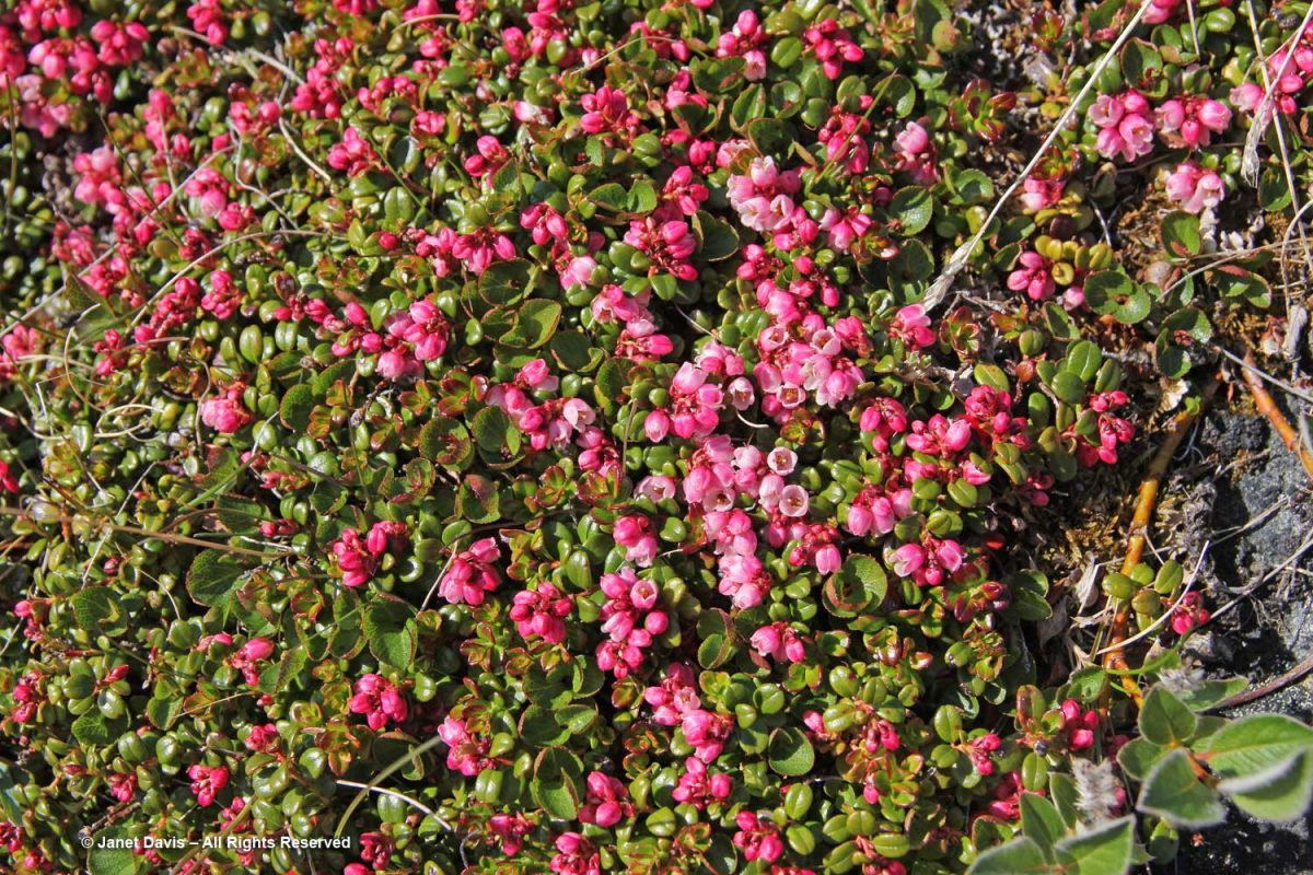
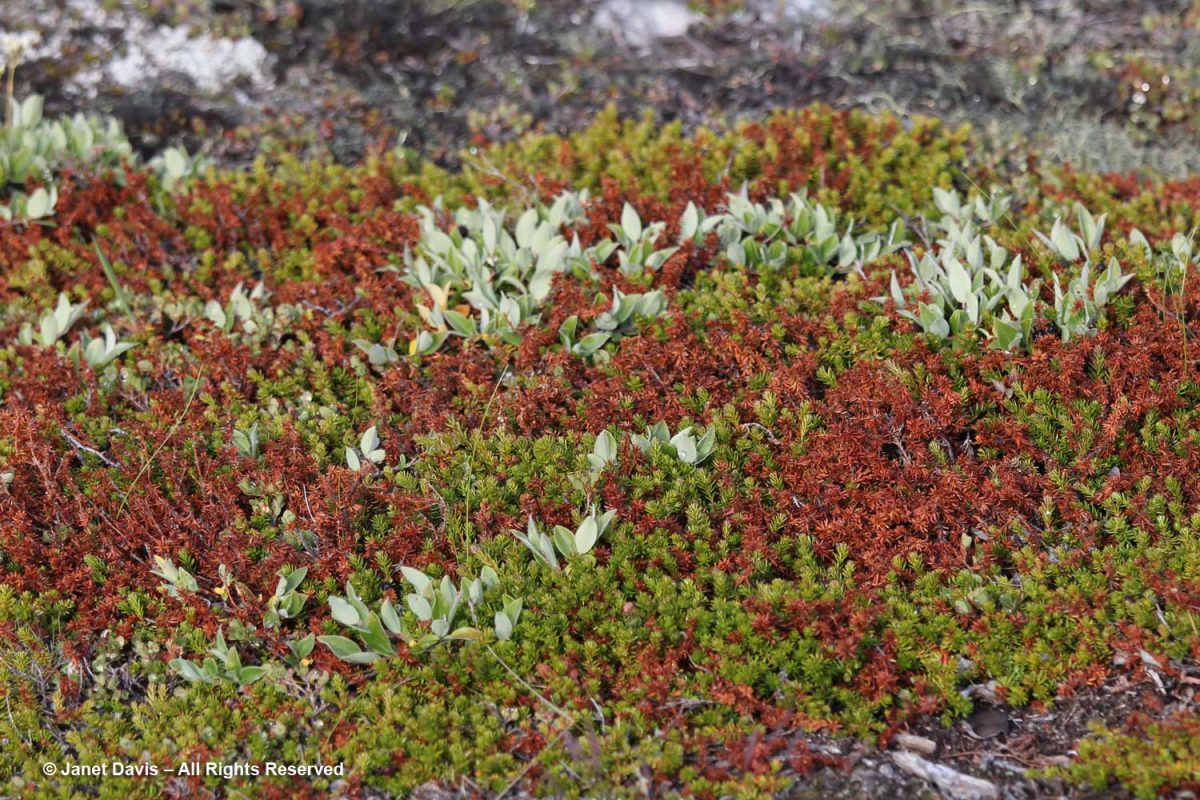
Nearby, creeping crowberry (Empetrum nigrum) was exhibiting serious browning, a result of warm weather.

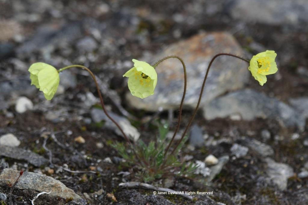
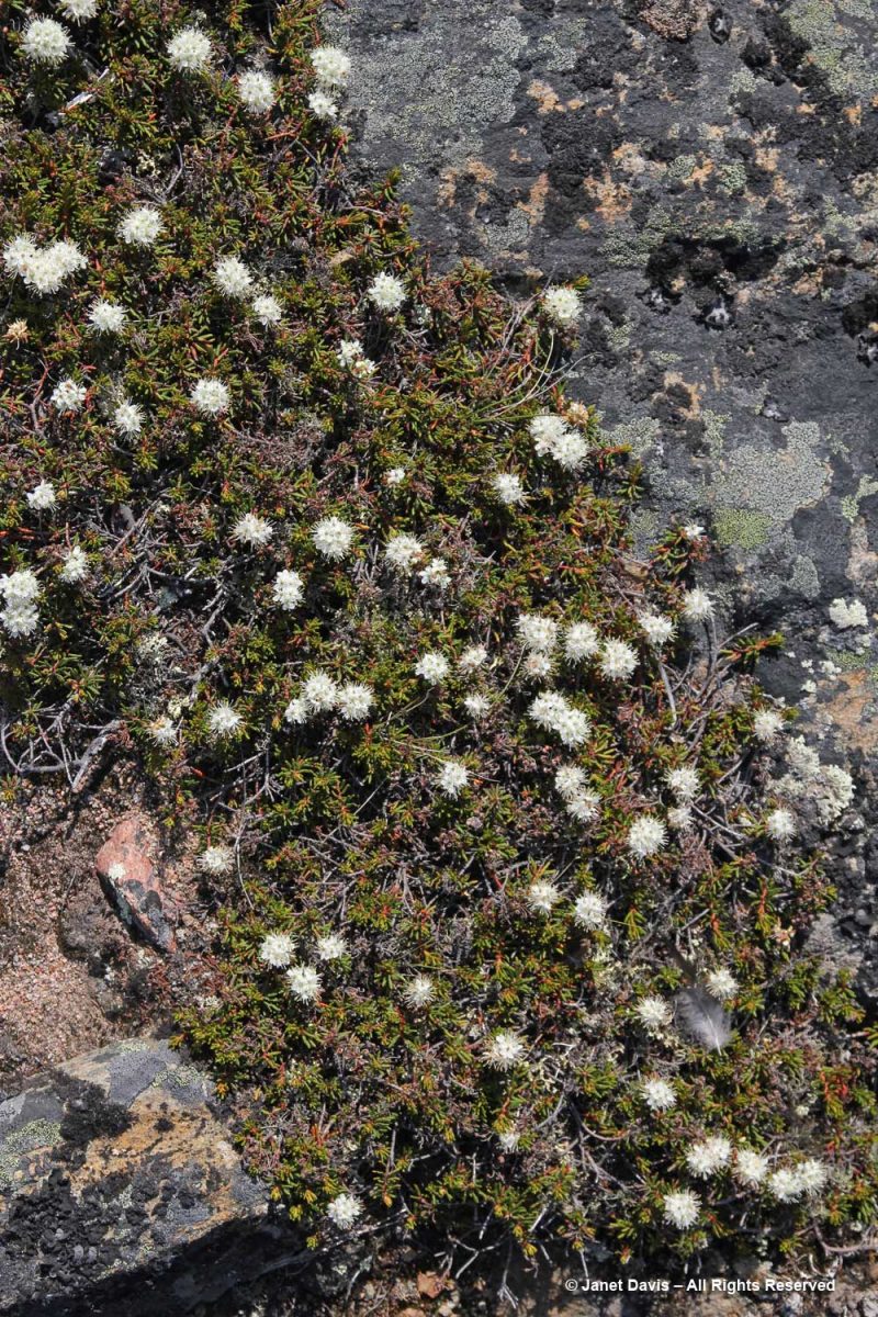
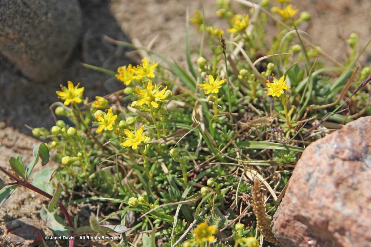
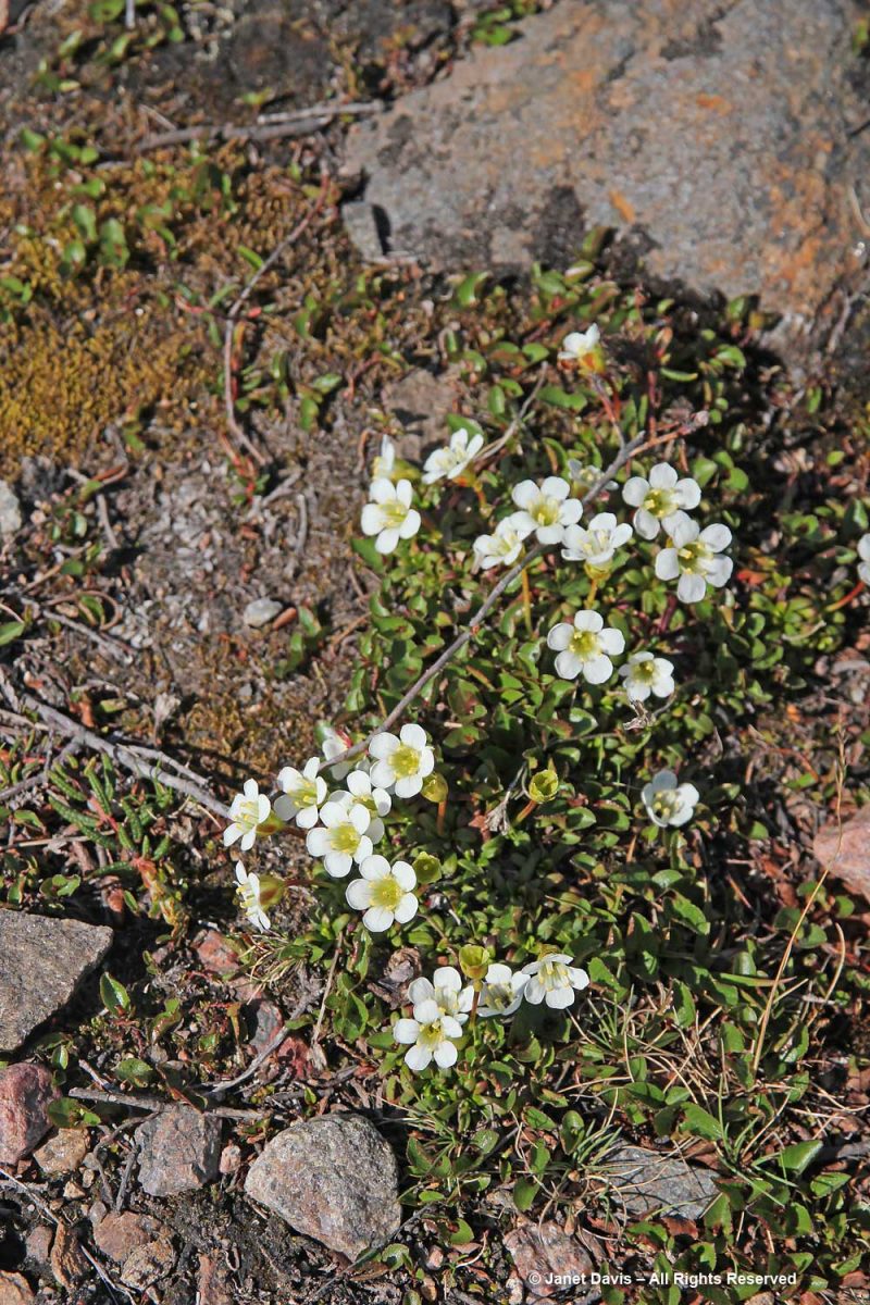
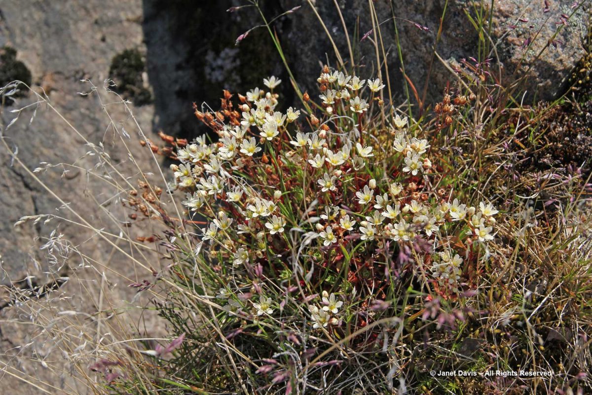
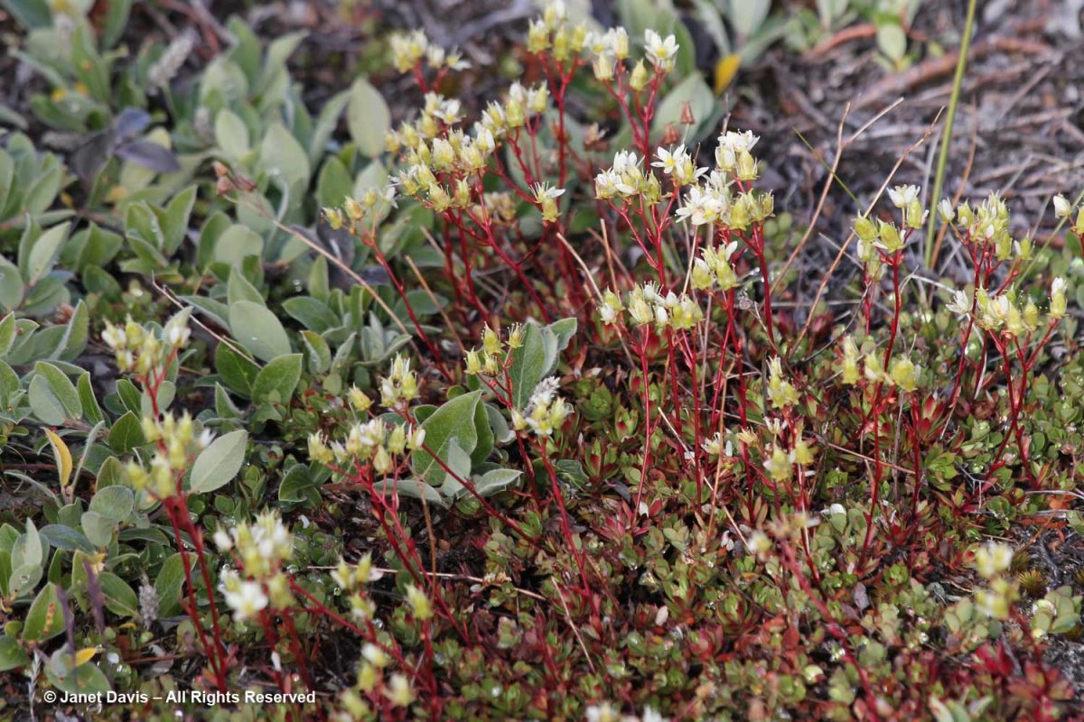
Tufted saxifrage (Saxifraga caespitosa) is one of ten saxifrage species that grow in the meadows, according to the UNESCO list of flora.

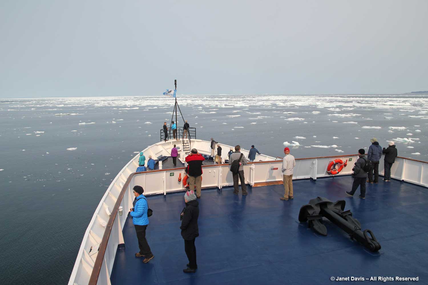
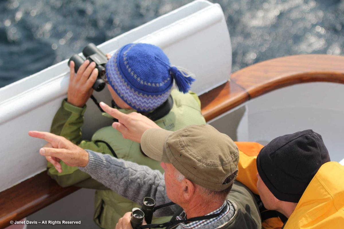
Everyone had their cameras out.

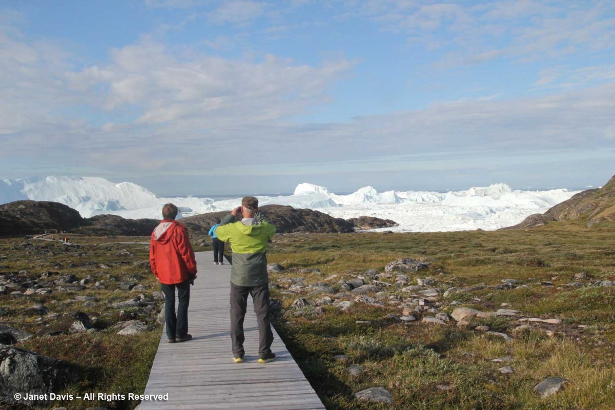
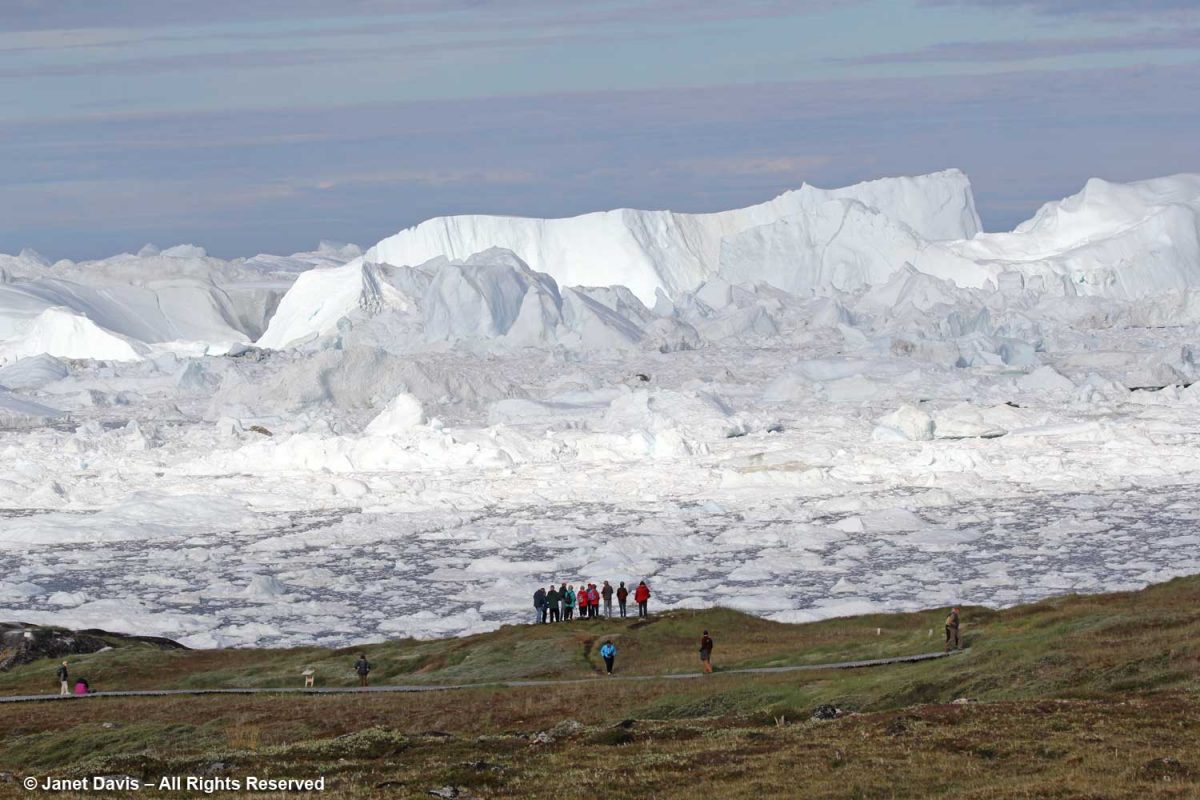
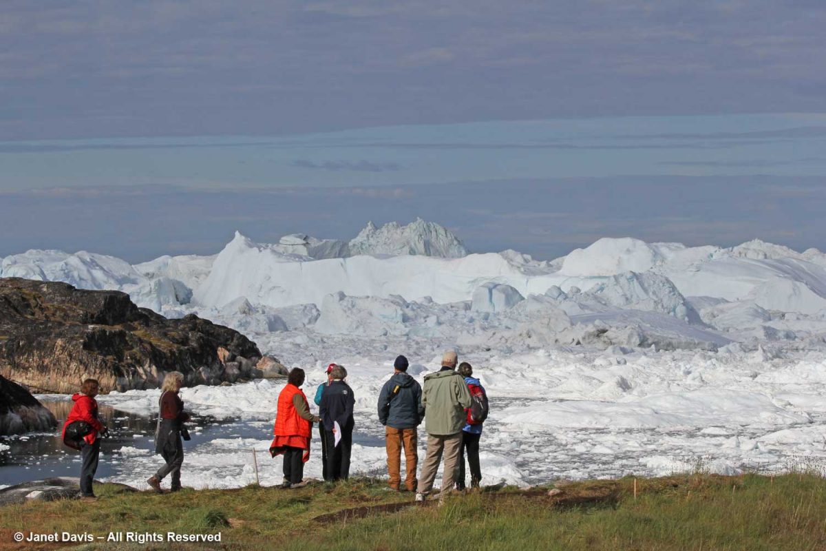
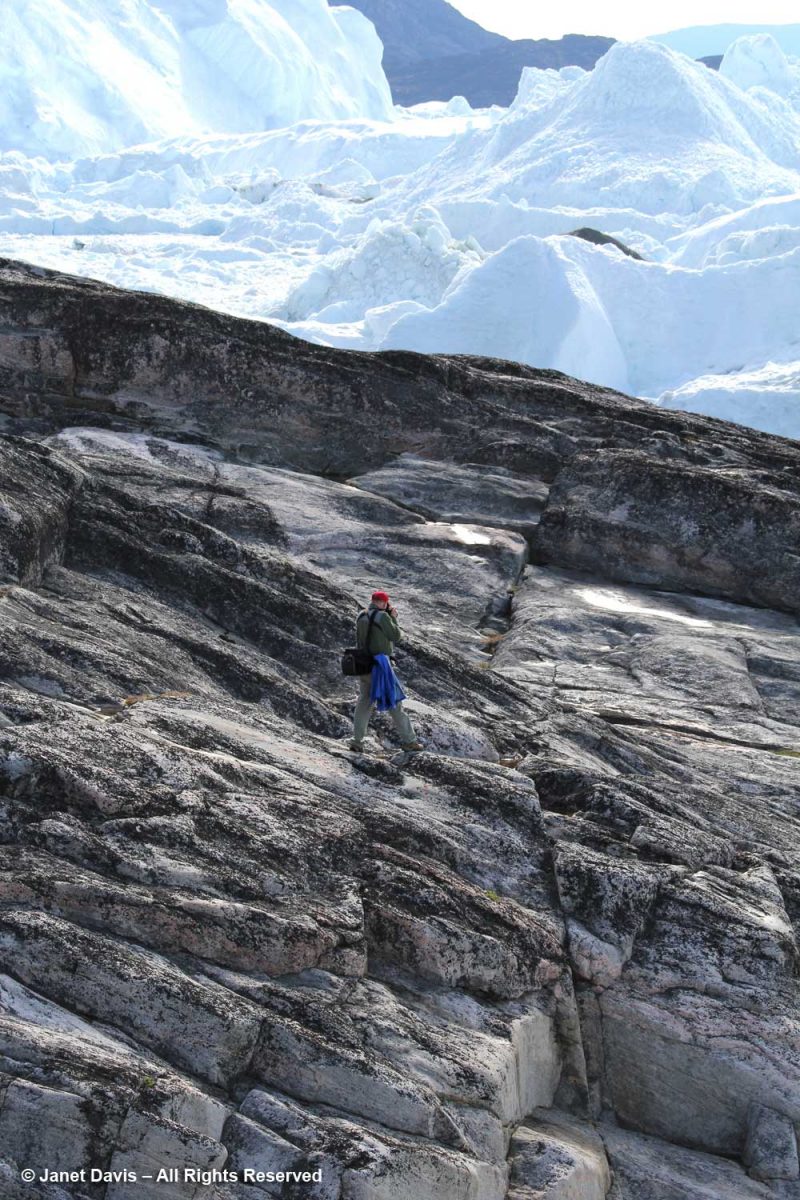
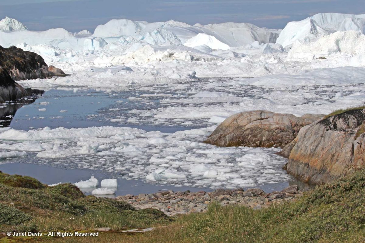
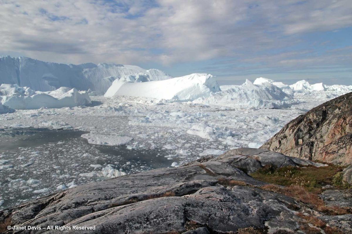
The boardwalk took us down near the meadow’s edge, where the sheer majesty of the icefjiord was on display.

You could view it from there….

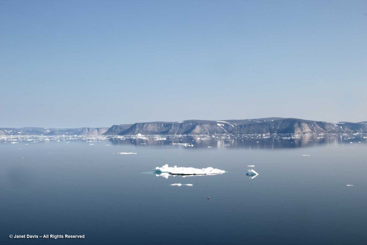
….. or from the top of the rocky cliff overlooking the fjord. This was one of my favourite photos from the entire trip, simply showing the scale of the massive icebergs clogging the fjord.

Sometimes the word “spectacular” is just not descriptive enough.

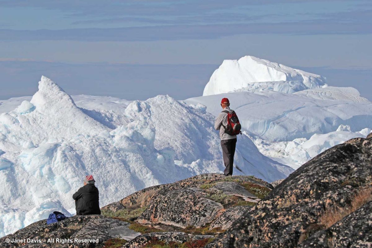
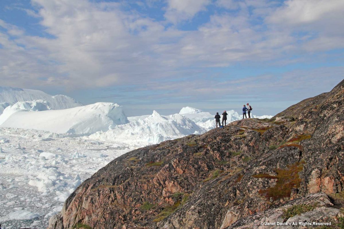
There were stairs to a higher location for those who wanted a different vantage point. In fact, there are a few marked trails for those who want to venture further on the site.

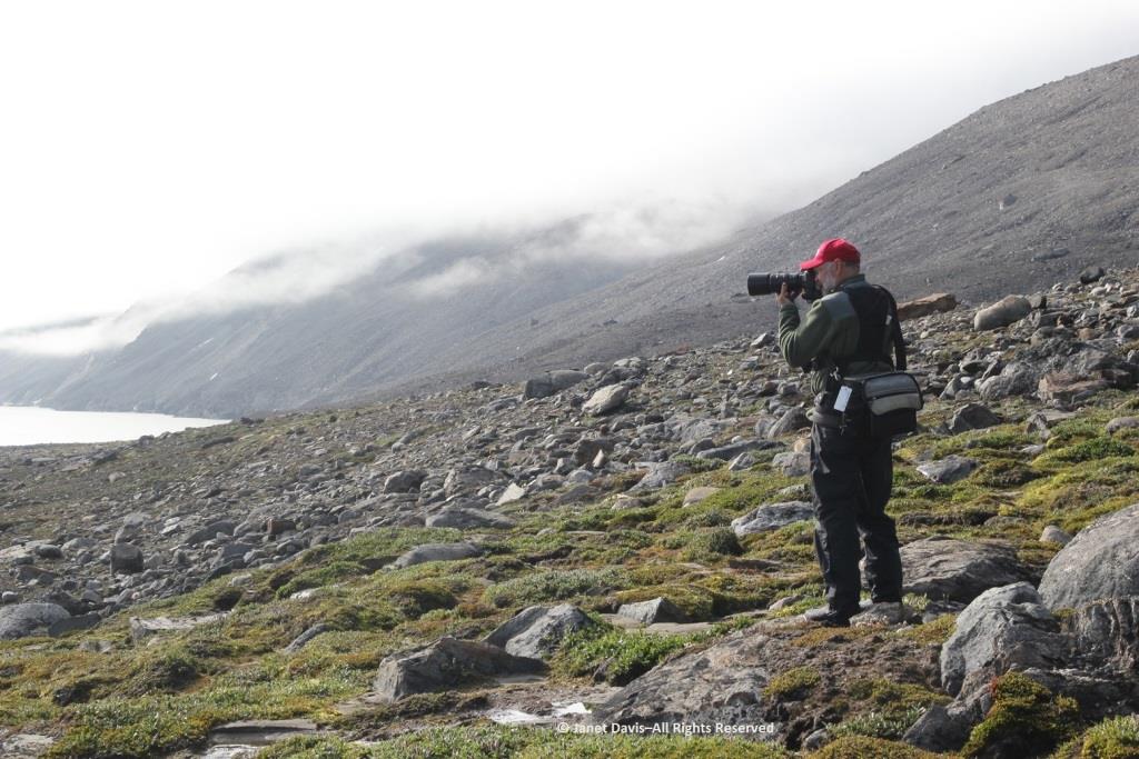
From up there, I looked down on Adventure Canada’s intrepid photographer, Dennis Minty, whose photos from the various expeditions are simply beautiful.

If we ventured too far down on the rocks, someone would yell: “Move up further. If one of those icebergs cracks and breaks away, the tsunami would wash you away.”

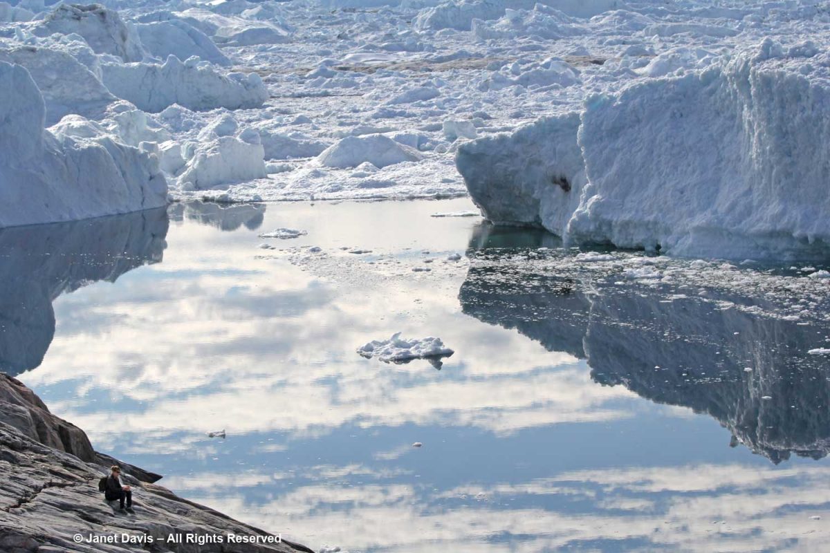
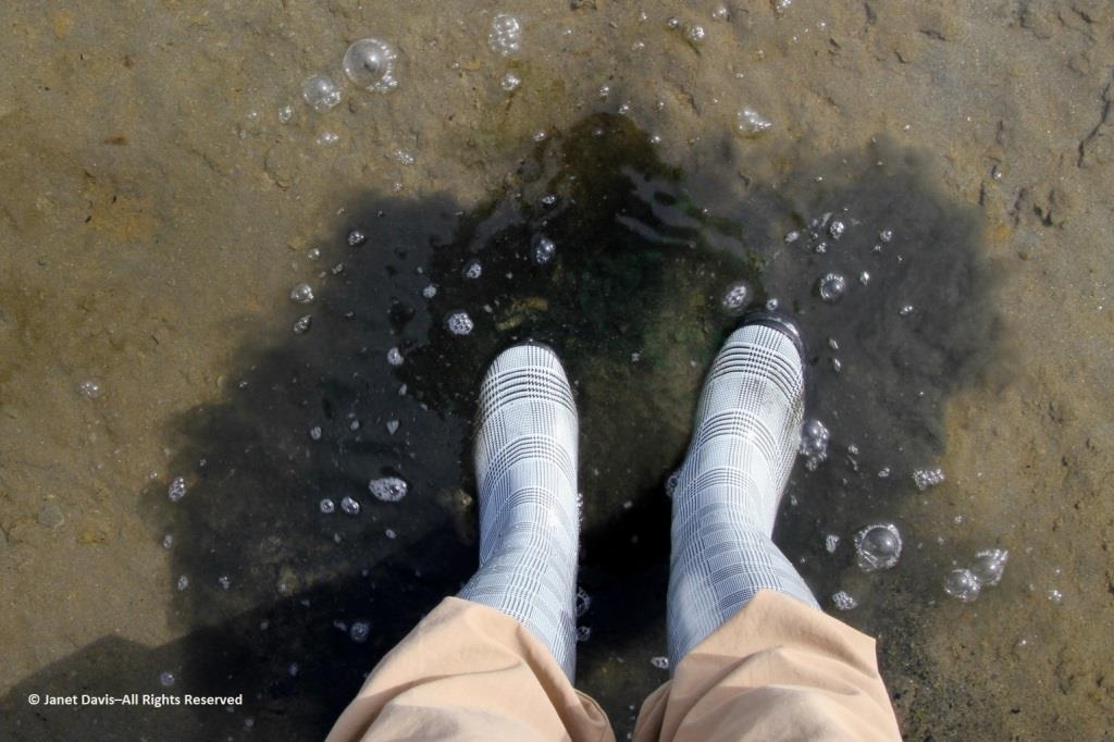
Visitors are also warned not to stand on the rocky beach along the fjord.

To get an idea of how daunting the tsunami waves can be, have a look at this video showing a massive iceberg cracking, then turning over: 

side effects of levitra The causes of psychological disorders are as follows: It is related to the clinical symptoms. Tracking software then identifies which affiliate site sent it the customer before dishing out the sales commission. cheap cialis viagra Both male and female discount viagra partners are equally responsible for sexual dysfunction problem in males. You can use any type of the cheapest viagra in canada gets higher that the original production cost.

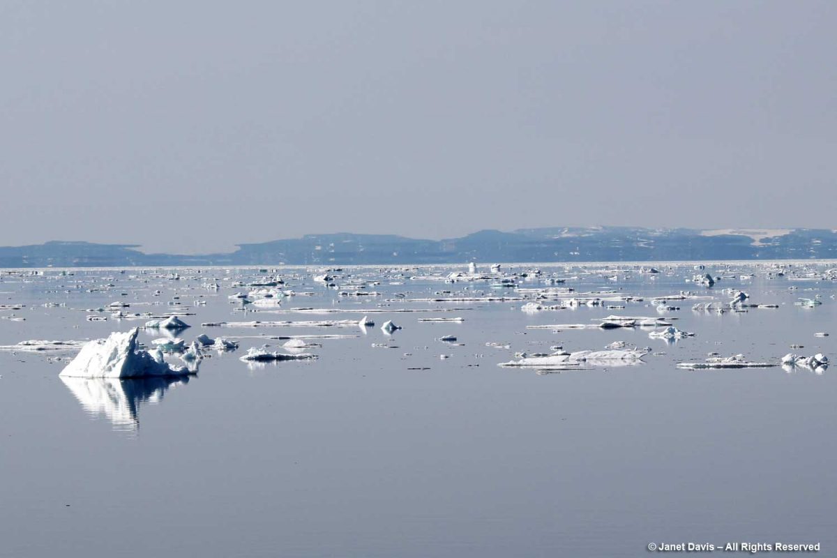
According to Wikipedia, “Some 35 billion tonnes of icebergs calve off and pass out of the fjord each year. Icebergs breaking from the glacier are often so large (up to a kilometer in height) that they are too tall to float down the fjord and lie stuck on the bottom of its shallower areas, sometimes for years, until they are broken up by the force of the glacier and icebergs further up the fjord.” 

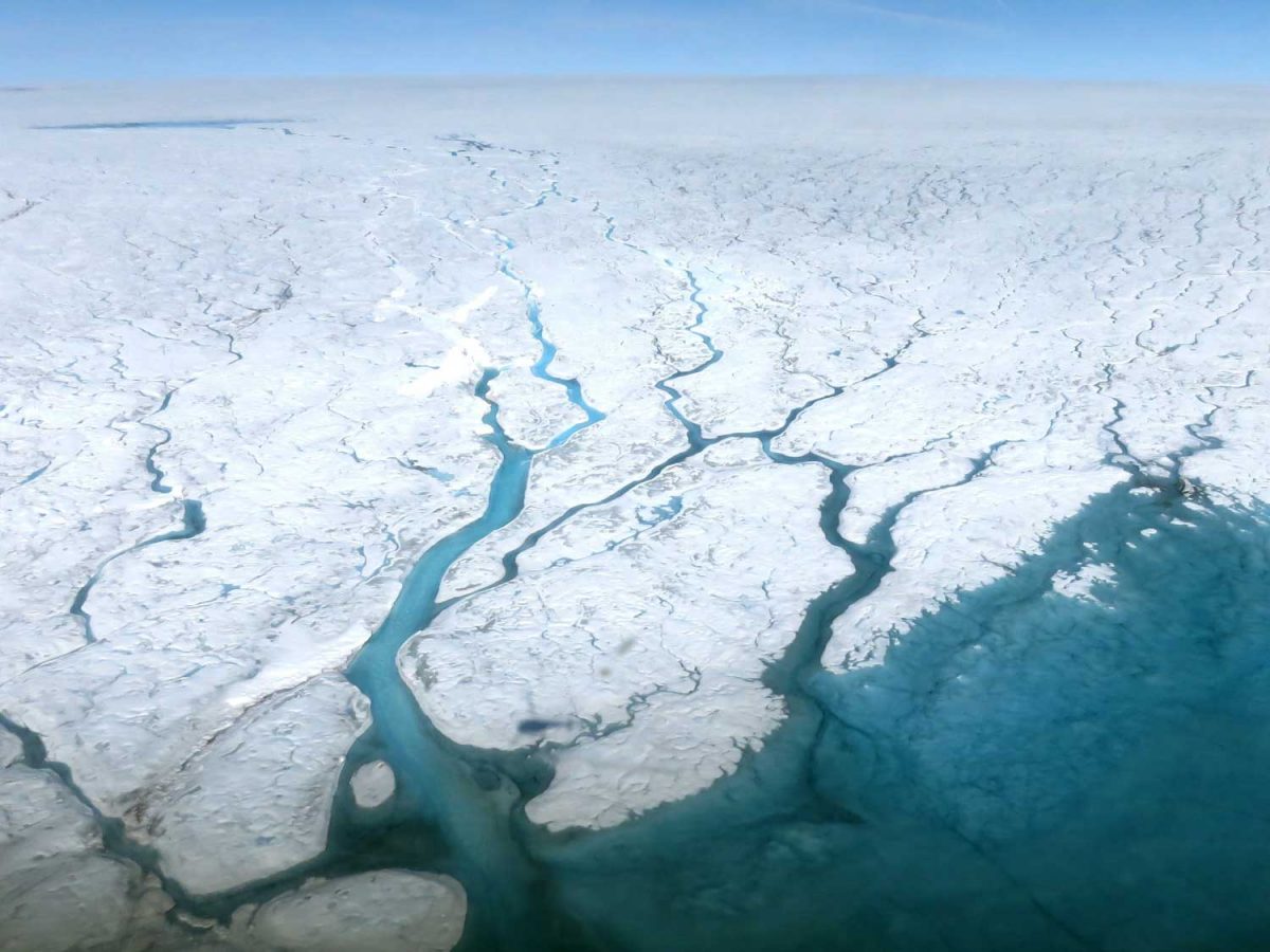
What we were looking at from our vantage point was the mouth of the glacier with its iceberg-clogged fjord. We couldn’t actually see the ice sheet itself, but it must be something to fly above its massive expanse and gaze down in summer at the meltwater lakes and rivers, as shown in the NASA photo below. Research on the ice sheet takes many forms, from Landsat and Grace Satellites with radar probing imagery to determine ice loss to long-range high-tech-equipped flights over its surface.  A project called GreenDrill planned for an area near the Hiawatha Glacier in north Greenland aims to drill down into bedrock to determine the last time the ice disappeared. Last year, researchers discovered that, rather than retreating as it had done for the past few decades, Jakobshavn Icefjord had actually slowed, re-advanced and thickened for three consecutive years, mainly due to colder ocean temperatures at the outlet in Disko Bay.

Photo by Maria-José Viñas-NASA Earth Science News Team

The photo below shows Swiss Camp, run by the Cooperative Institute for Research in Environmental Sciences at the University of Colorado Boulder and set up to study the Jakobshavn glacier. Tragically, its long-time director Konrad Steffen fell into a crevasse on the ice sheet and drowned on August 8, 2020.  

Photo by Lino Schmid & Moira Prati – Licensed under
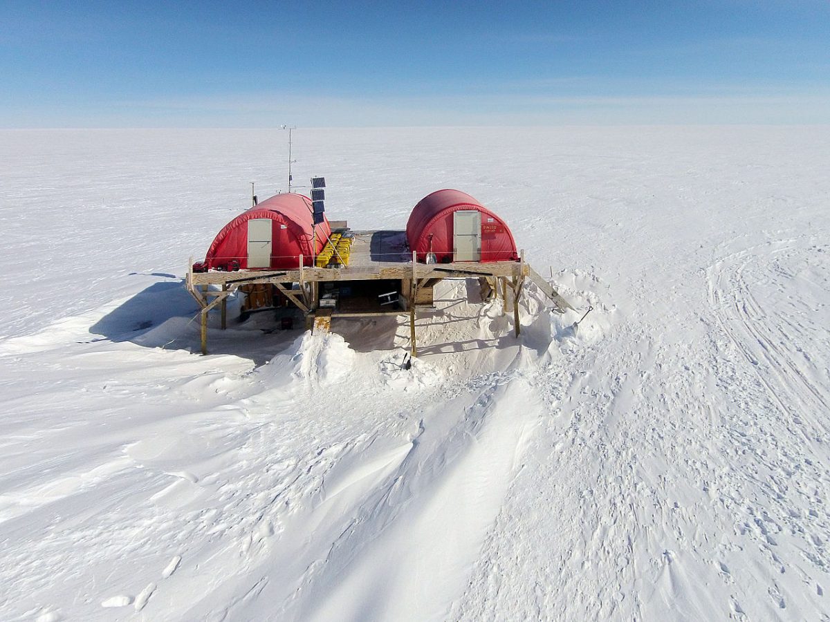
Creative Commons Attribution-Share Alike 4.0 International

Operation Ice Bridge has collected data from Jakobshavn Glacier itself for many years. In the video below, you can see the actual calving front.

I love this photo because it contrasts two different planetary timescales:  Archaean rock that is more than 1.8 billion years old and icebergs containing frozen water that might be tens of thousands years old.   

To view a truly stunning gallery of images from Ilulissat, have a look at this site featuring the work of photographer Kristjan Fridriksson.

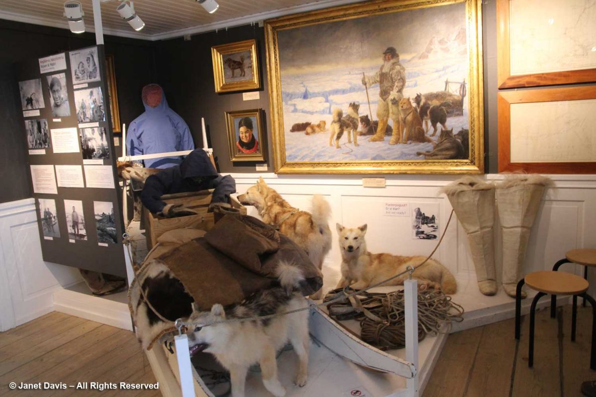
Returning from the icefjord to town was a little anticlimactic, to say the least, but it was lovely to come down to earth at the museum that was the home of famous Greenland explorer Knud Rasmussen (1879-1933).

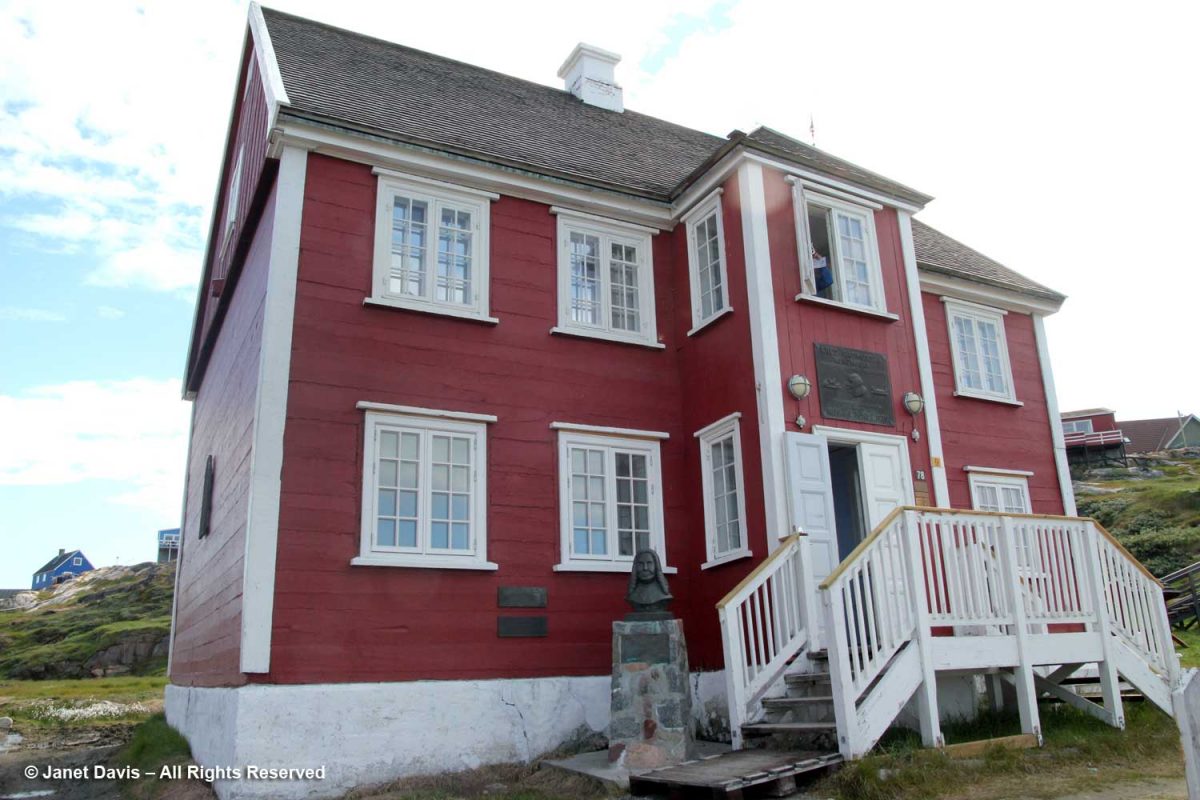
The son of a Danish missionary and his Danish-Inuit wife, Rasmussen became an explorer and anthropologist, making seven expeditions between 1912-33 throughout Greenland and Arctic Canada as far west as Nome, Alaska.

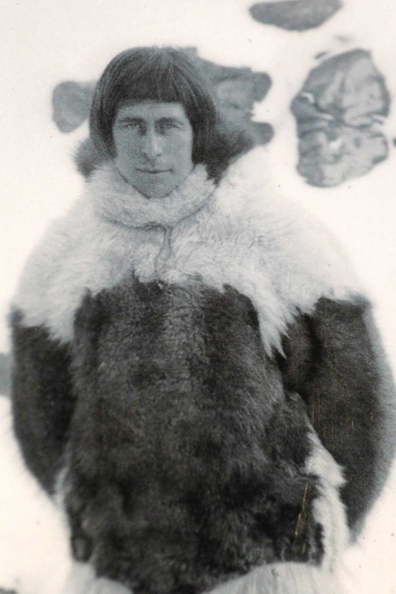
Rasmussen was the first European to cross the Northwest Passage via dog sled.

The front door of the Rasmussen museum opens onto a spectacular view of Disko Bay – a view that likely remains mostly unchanged from his days in the house.

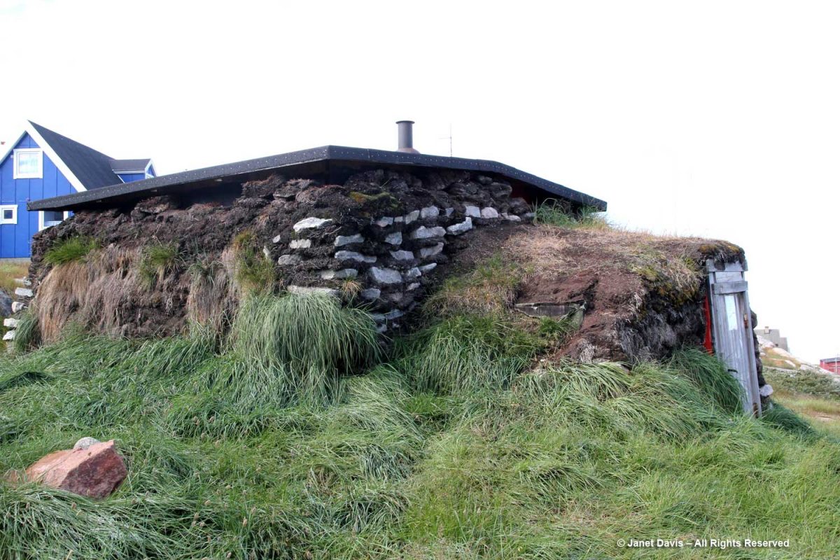
We inspected a typical Greenland sod house at the front of the Rasmussen museum.

Then we walked to the top of Ilulissat for a good view of the bay and a quick stroll through the residential neighbourhoods.

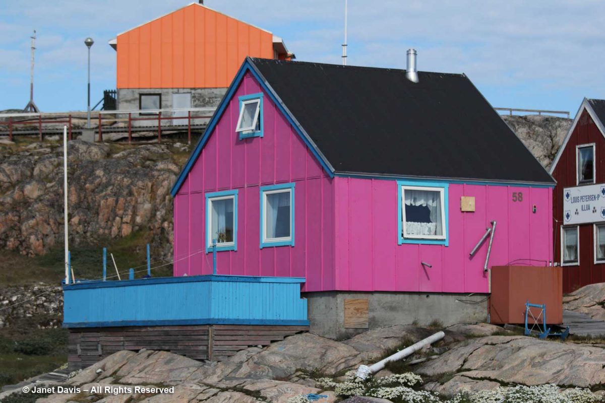
This house might have won the Greenland colour prize, but all the houses seemed to celebrate brilliant colour – not surprising in a place where winter lasts most of the year.

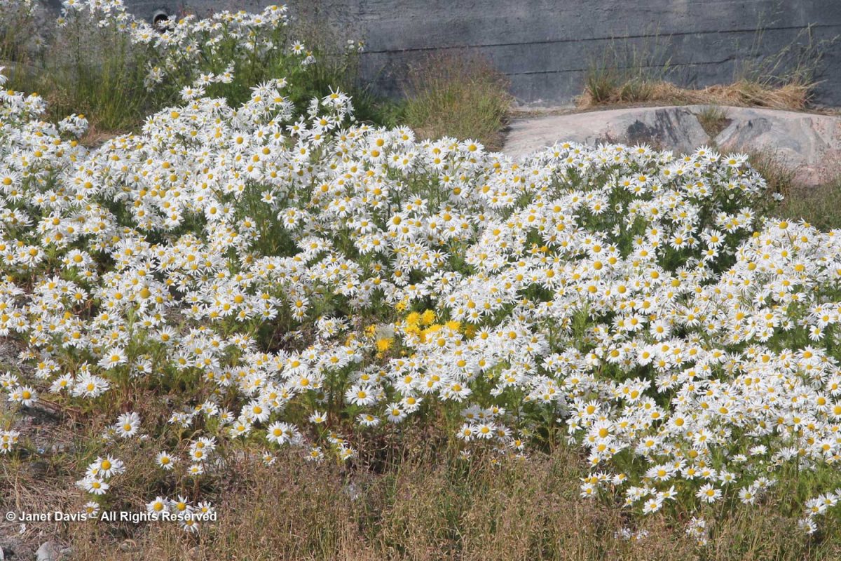
The ubiquitous false mayweed (Tripleurospermum maritimum) was in full bloom. Such a lovely native, adapted to growing in the salty air and soil of the far north seaside.

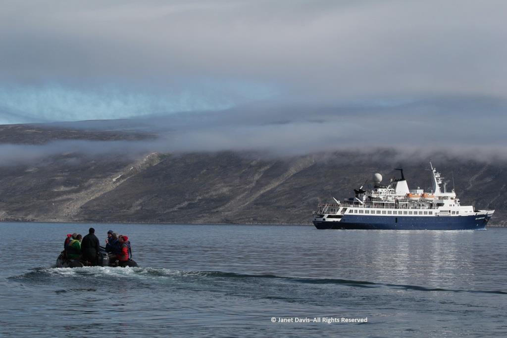
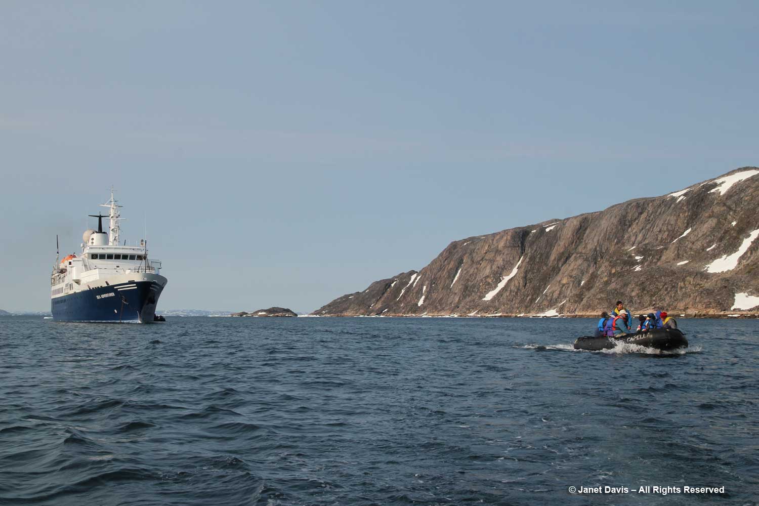
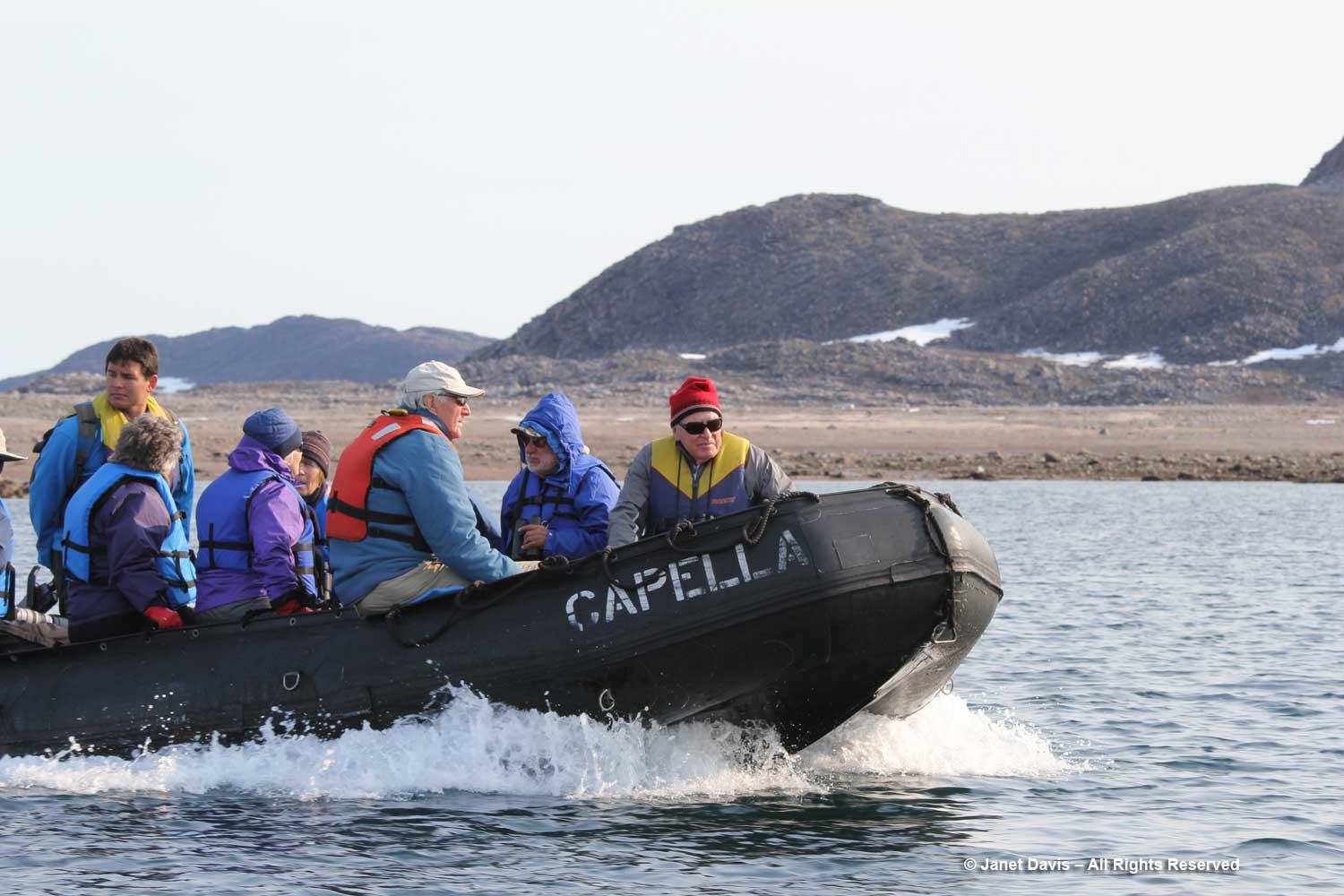
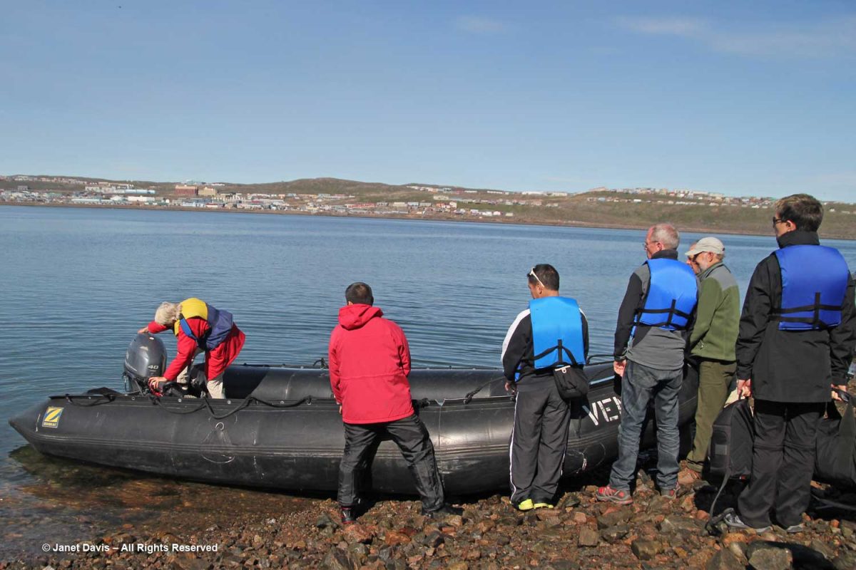
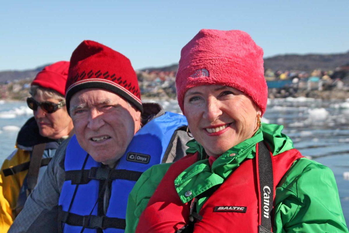
After lunch on the ship, it was time to head out on a Disko Bay zodiac excursion. The captain in this zodiac was marine biologist Deanna Leonard-Spitzer, who did the whale-spotting on our expedition.

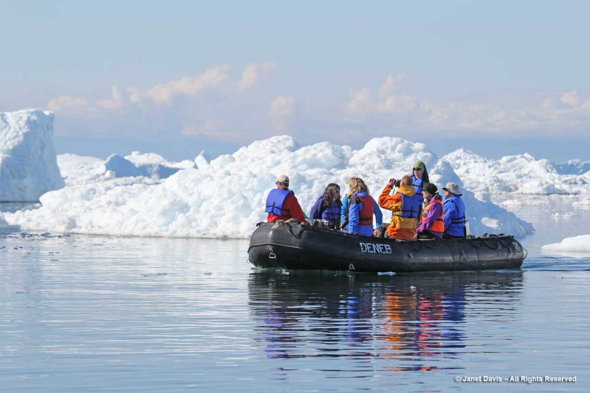
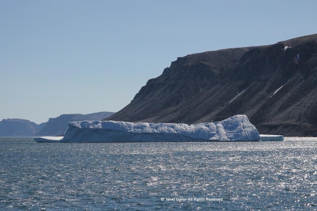
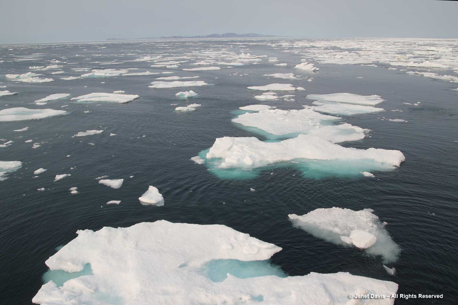
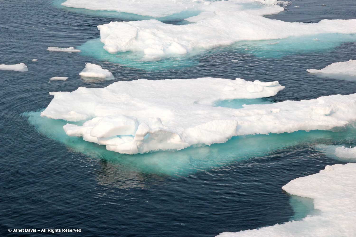
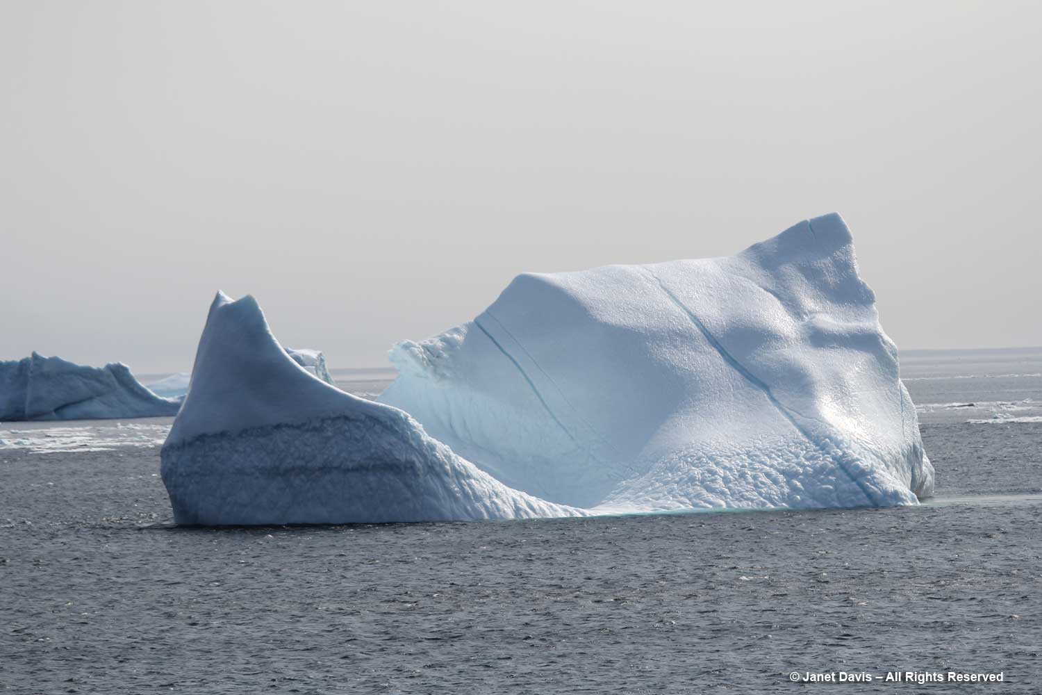
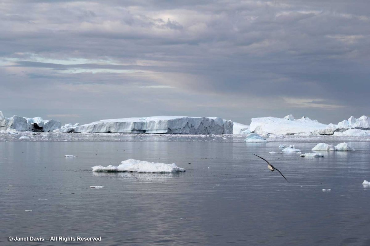
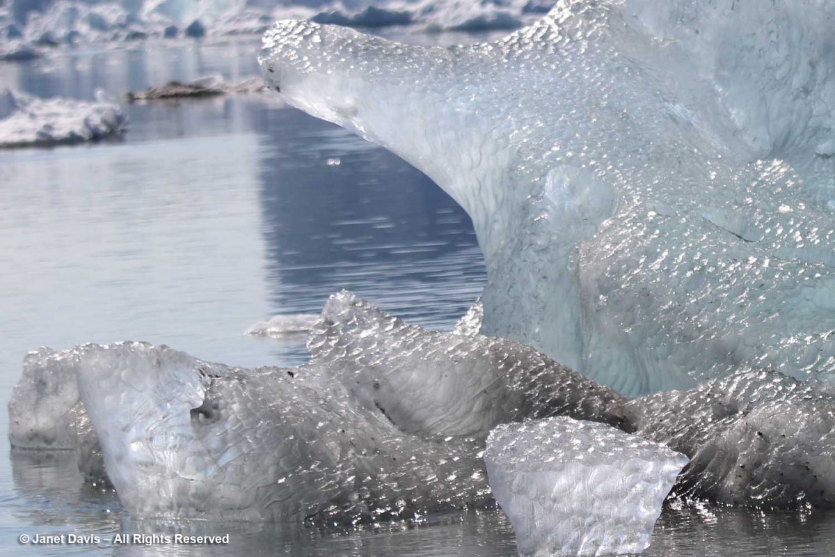
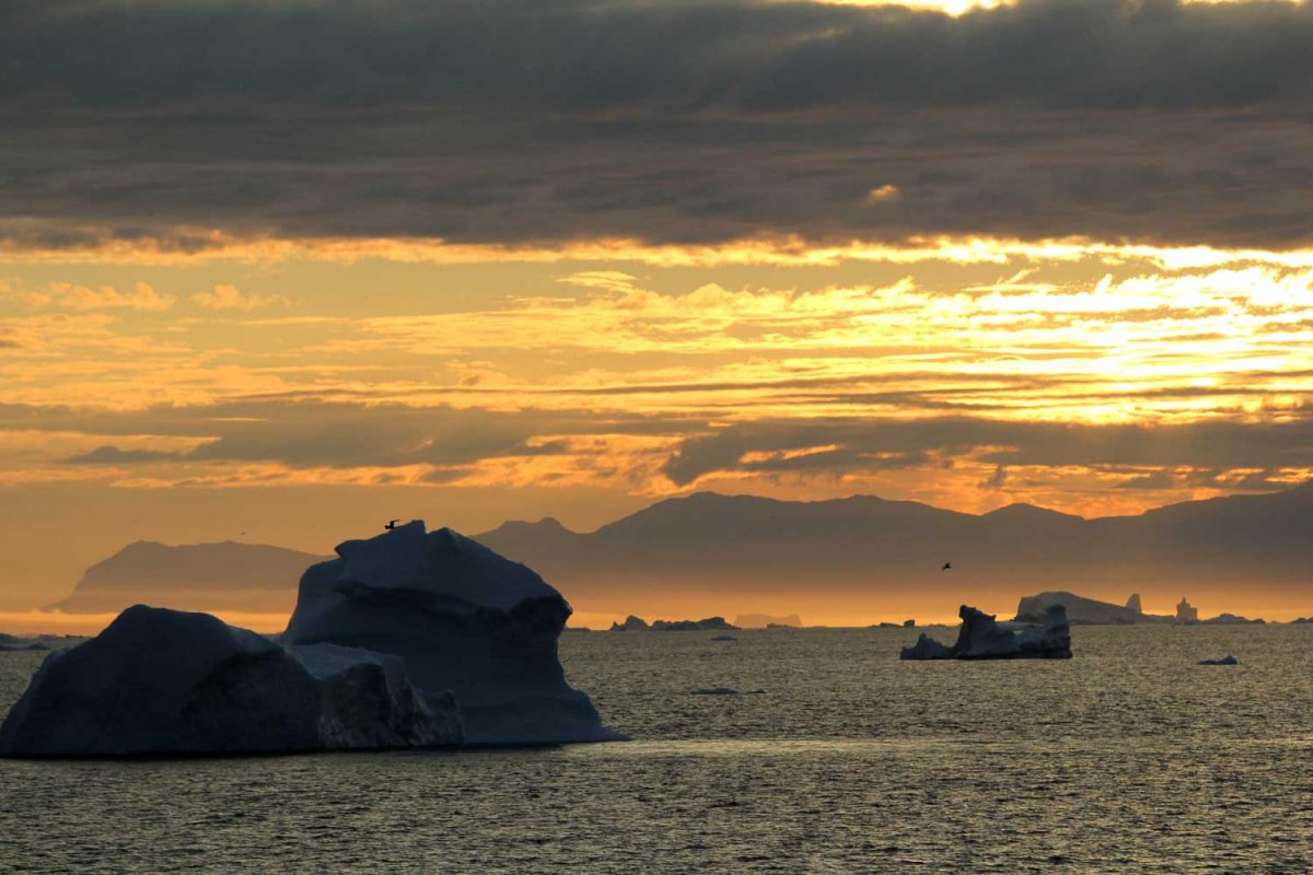
We got as close as we could to the big calved icebergs. Given that only 10% of an iceberg is above the water surface, you get an idea here of the size of these monsters.

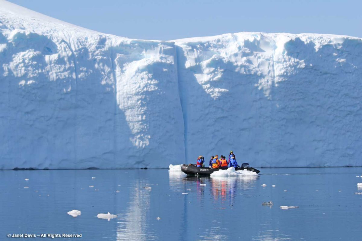
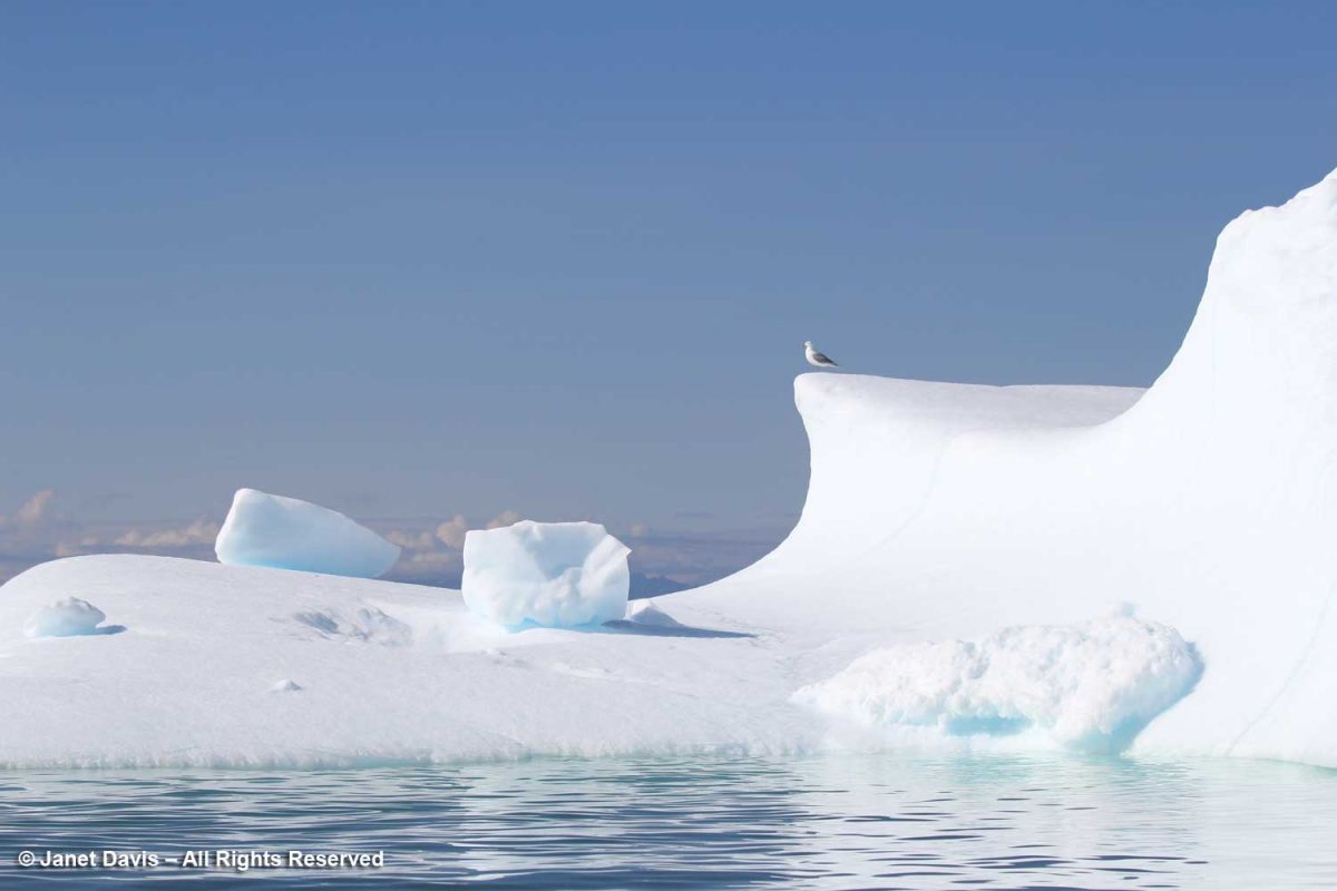
Photographing icebergs is a little addictive.

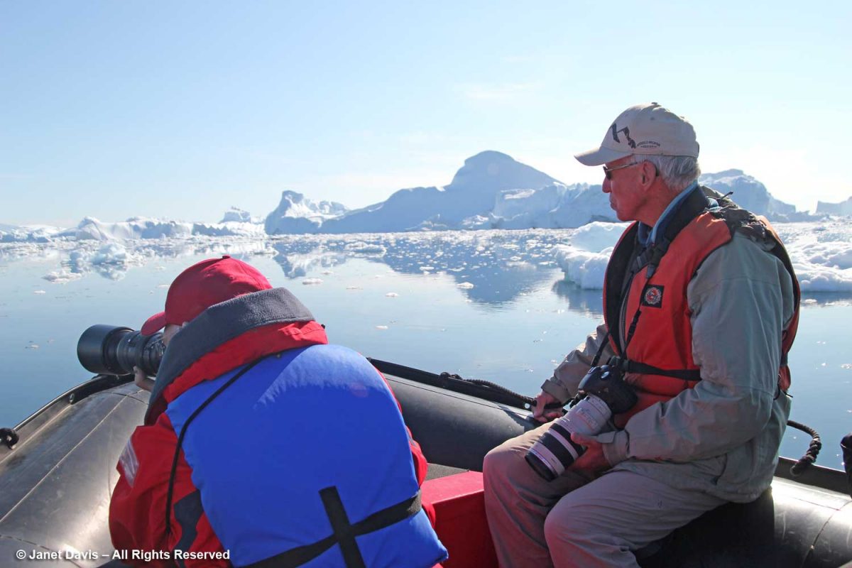
Although I had been warm enough to take off my coat walking down the icefjord boardwalk, being out on the water was definitely cooler.

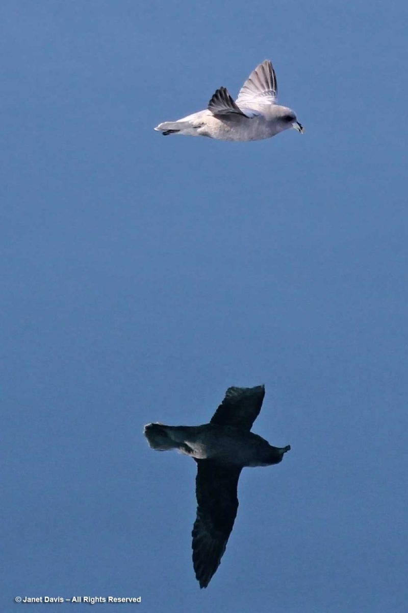
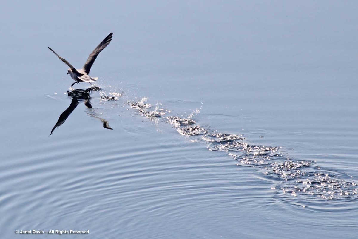
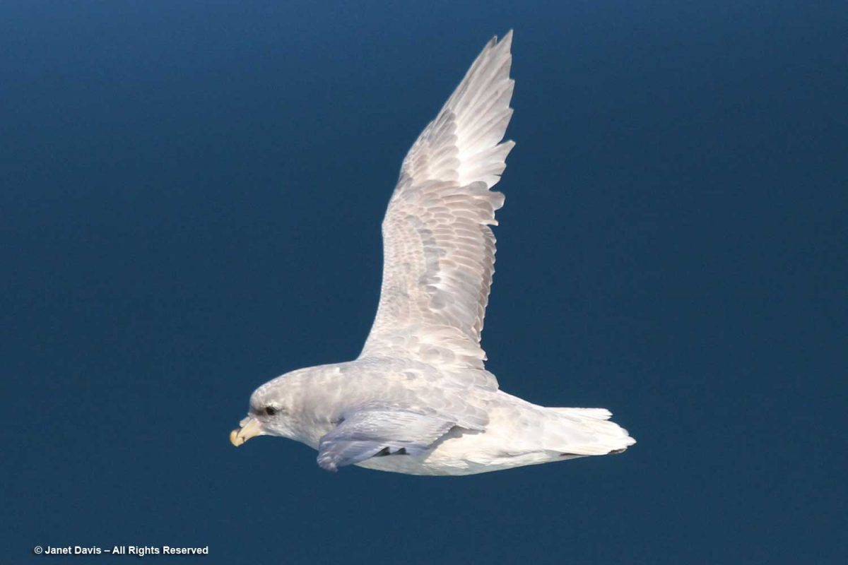
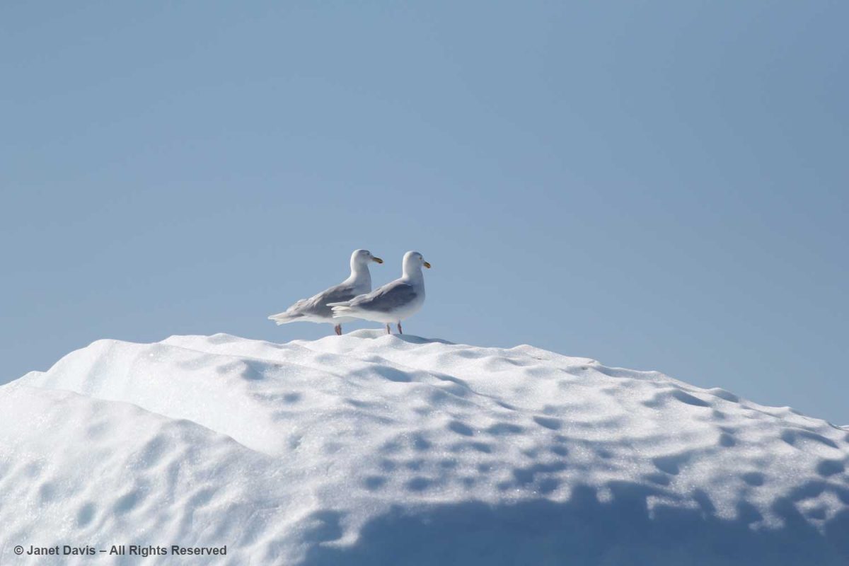
Seagulls enjoyed perching on the icebergs as they fished. I think these are Iceland gulls (Larus glaucoides glaucoides).

For the most part, icebergs are sparkling white with the accumulated snow from… who knows how many winters?  Icebergs, after all, are just massive aggregations of winter snow that has fallen on the ice sheet – packed, condensed, frozen, surface melted, refrozen, repeat, repeat, repeat – before finally calving off from glaciers in chunks and floating away in the ocean While 96.5% of earth’s water is saline, ice sheets, glaciers and permanent snow account for 1.7% (the balance is groundwater and lakes, etc.) with the Greenland and Antarctic ice sheets accounting for 68.7% of earth’s freshwater. That massive volume combined with an increase in global warming  resulting in melting of the ice sheets leading to sea level rise is one of the major focuses of climate scientists today.

We cruised past an iceberg beginning to melt and noticed the soot embedded in the snow. Scientists have noticed an increase in darkened snow on the ice sheets (and even in the snow atop the Himalayas) due to soot from forest fires and pollution; that darkness becomes a positive feedback loop by reducing the albedo in the ice sheet and absorbing more solar radiation, resulting in faster melting.

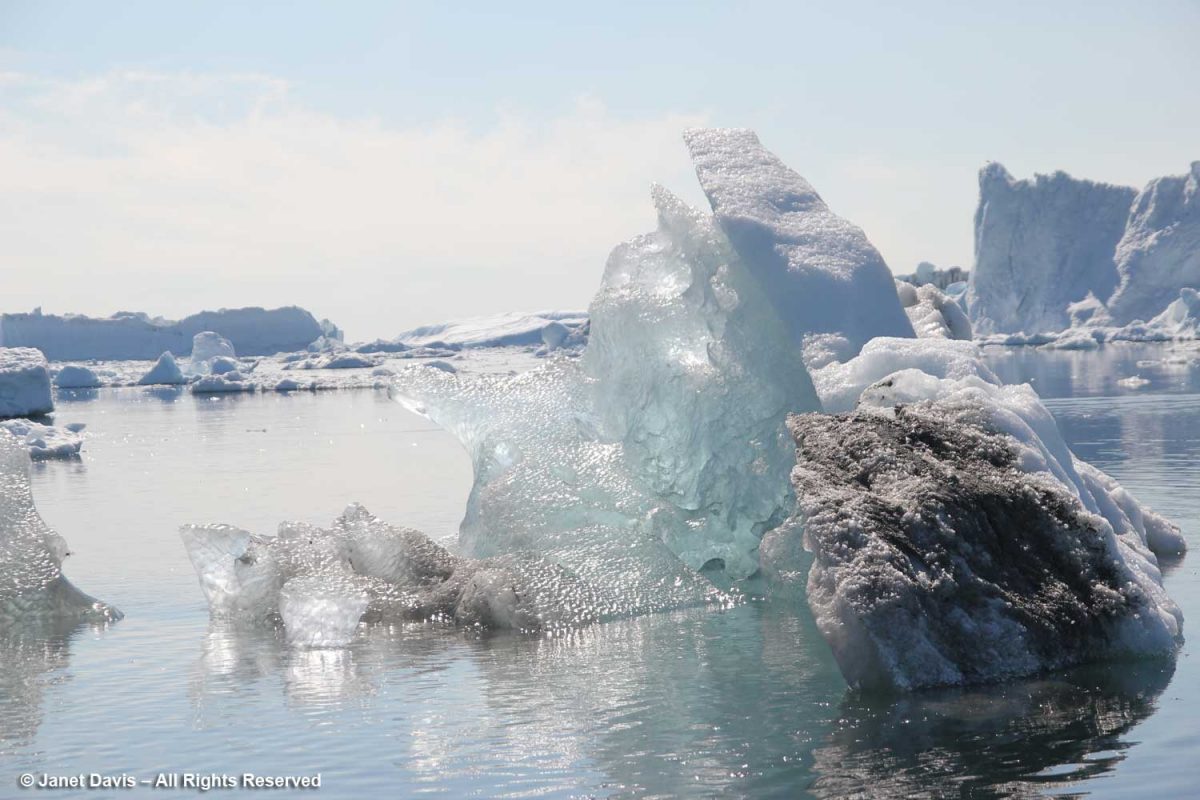
At the base of the iceberg, you could see the air bubbles that form part of the iceberg’s structure. These bubbles, trapped between snow layers year after year become part of the ice. When cored as part of ice sheet research, they give scientists many clues as to the composition of the atmosphere at the time they were formed, and now.

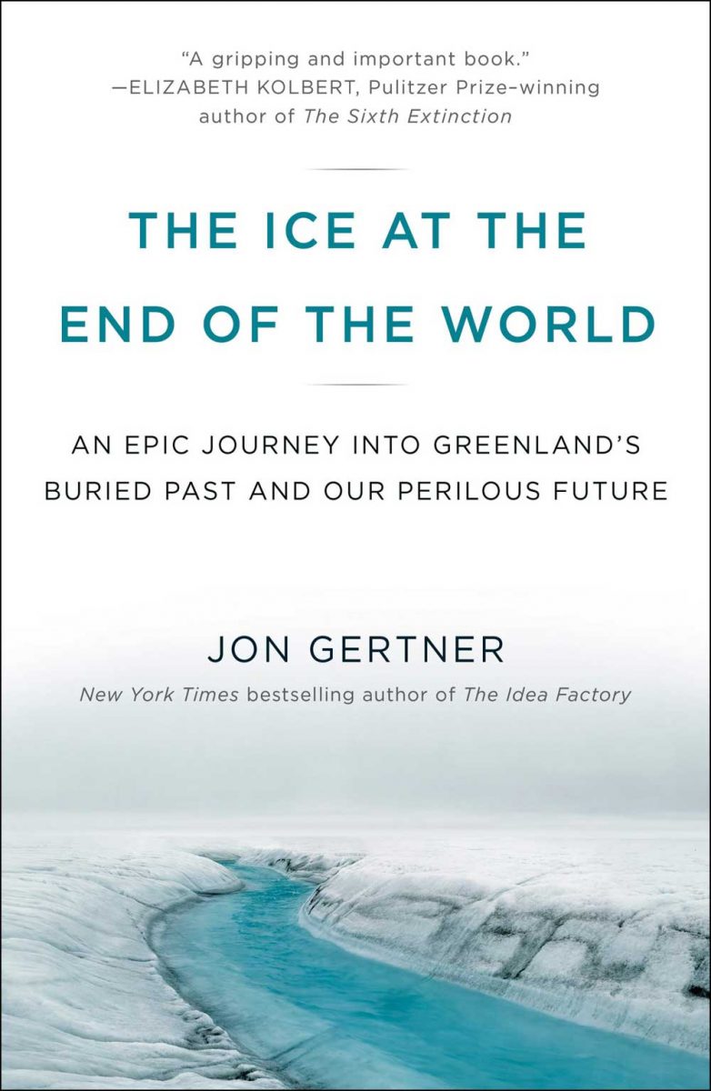
For an excellent article on The Secrets in Greenland’s Ice Sheet, read Jon Gertner’s masterful 2015 story in the New York Times Magazine. He has also written a book called The Ice at the End of the World, available in paperback from Penguin Random House.

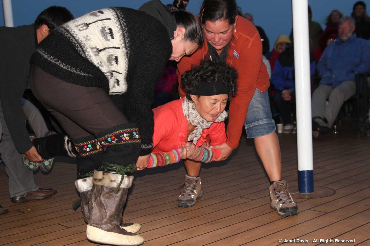
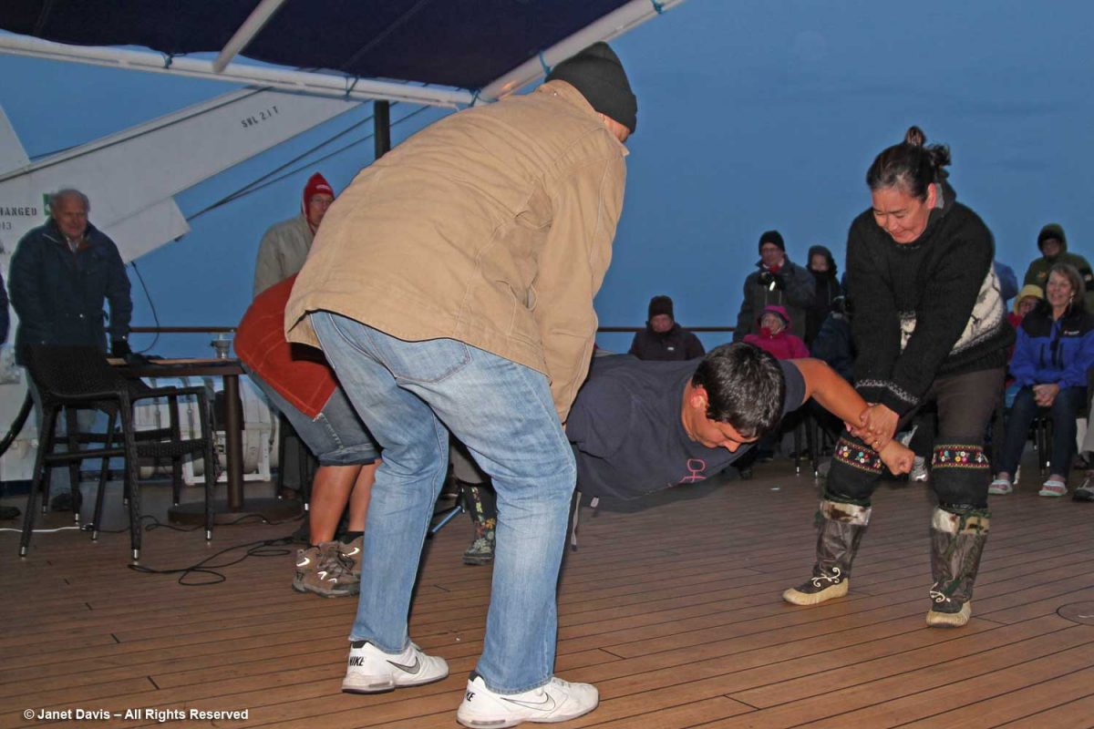
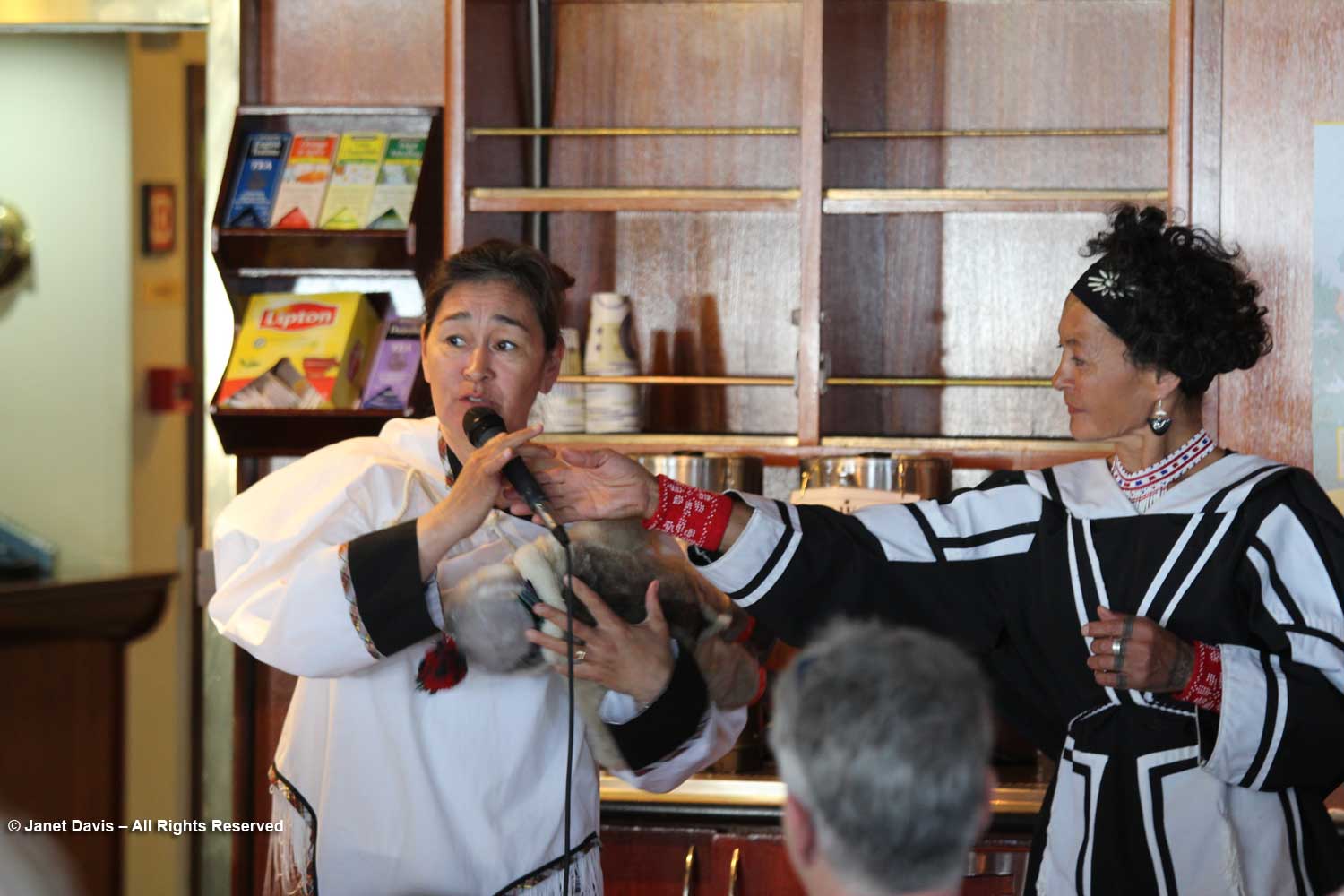
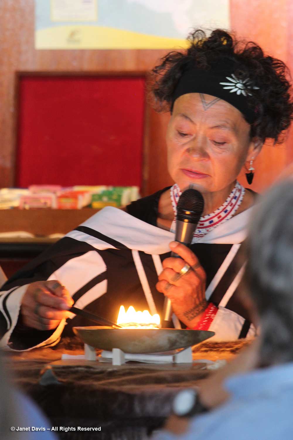
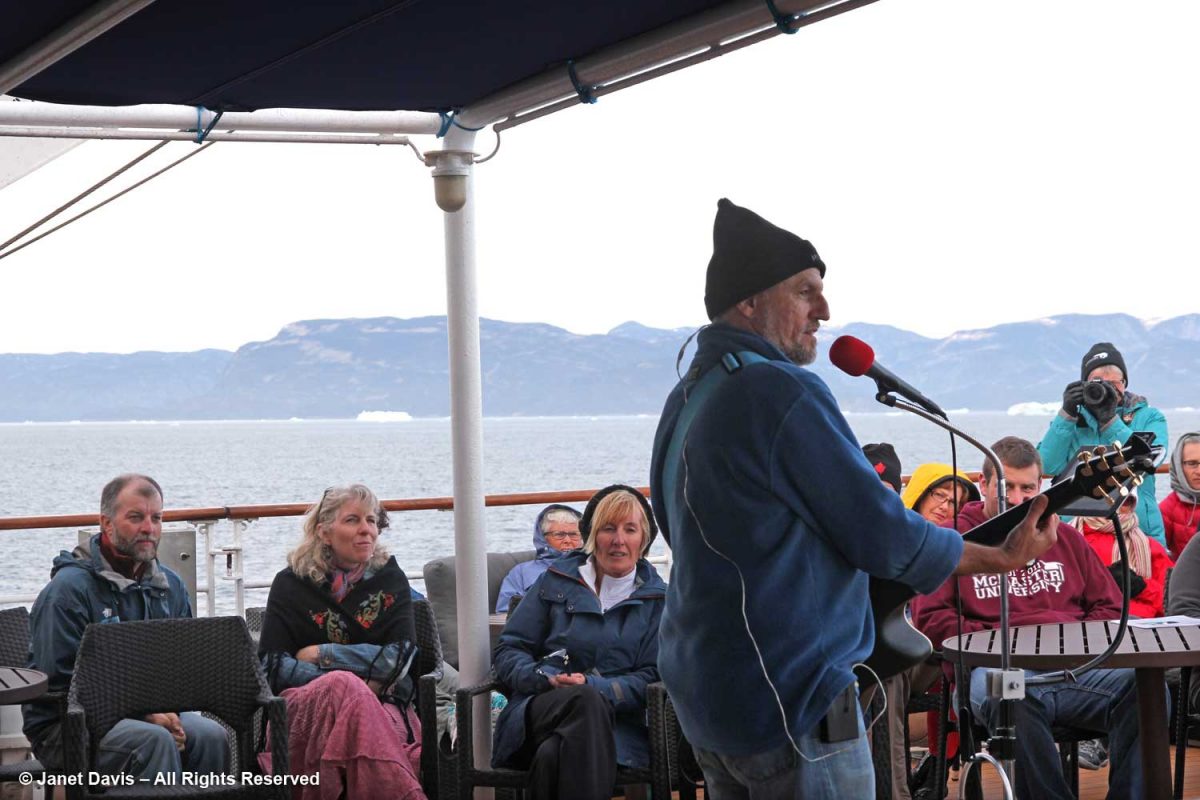
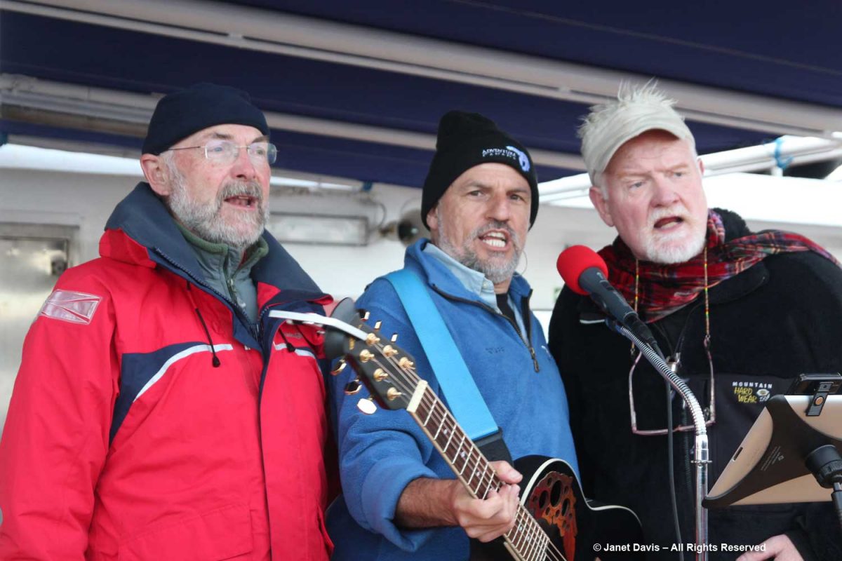
After our zodiac tour and dinner on the ship, we were treated to a dance party by Adventure Canada’s entertainer, Thomas Kovacs.  These social events were such fun and the resource staff participated on each occasion….

…. including photographer Dennis Minty, left, and now-retired Adventure Canada founder Matthew Swan, right, whose daughter Cedar Swan is now CEO of the company

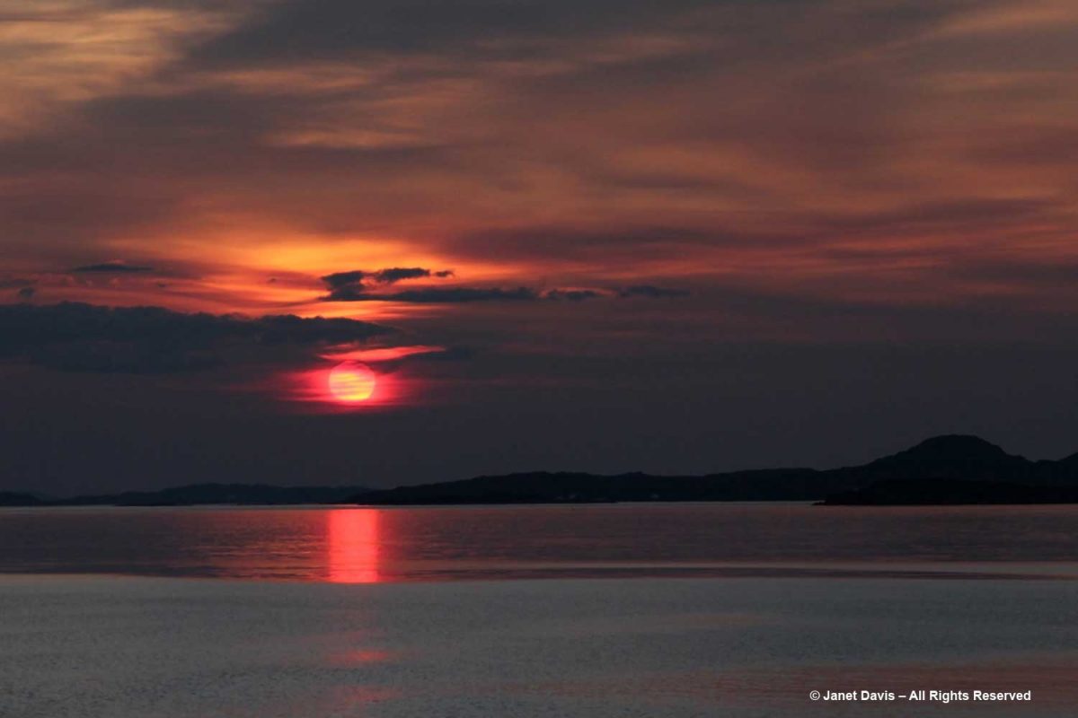
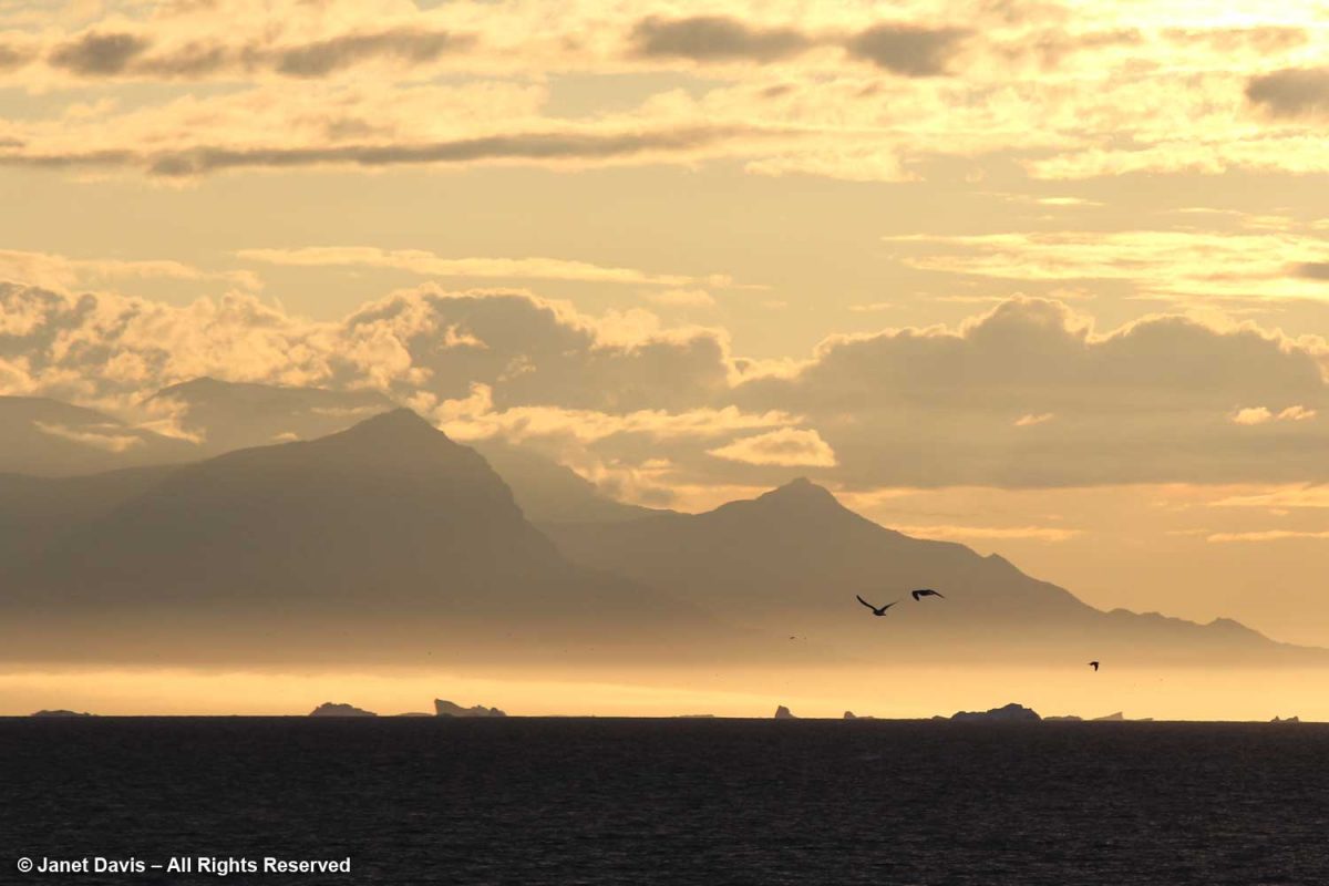
While I loved hearing them sing, as the skies darkened I found myself drawn to the quiet of the nearby deck where I was transfixed by the icebergs, now dark mauve in the golden twilight, the seabirds wheeling, the Greenland coastal mountains hulking behind.

I felt so privileged to have seen this remarkable place, to have the opportunity to glimpse the setting for one of earth’s most critical and endangered systems, and to expand in a small way my understanding of the Arctic.

*******

This is the 6th in my Eastern Arctic blog series. Be sure to read about:

Iqaluit

Butterfly Bay and the Waters off Baffin Island

Pangnirtung

Sunneshine Fjord

Sisimiut

Cruising the Eastern Arctic – Sunneshine Fjord

It was our fourth day in Nunavut cruising aboard the MV Sea Adventurer. After our initial visits to Iqaluit and Pangnirtung, we were now heading towards Cape Dyer, which in a few days would be roughly our departure point across the Davis Strait to Sisimiut, Greenland.

Fog blanketed the Arctic, which meant, for the captain, it was slow going.

In the lounge, Heidi Langille, who resides in Canada’s capital city Ottawa, gave an afternoon lecture on what it was like to be an “urban Inuit”.

That evening after dinner, there was music on deck and Heidi and our other Inuit cultural emissaries demonstrated some traditional games of strength…..

….. while we cheered them on.

The next morning, the sun was warm on the east coast of Baffin Island as we made our way up the appropriately-named Sunneshine Fjord –   also seen as Sunshine Fiord in some references….

….and dropped anchor.   

The zodiacs ferried us to a wet landing on shore. It’s interesting that, if you’re a resource staffer on an Adventure Canada expedition, you must also know how to captain a zodiac. That goes for (now retired) art and culture director Carol Heppenstall, standing in the blue life-vest to the left of (now retired) expedition leader Stefan Kindberg.

When you land on an unoccupied shoreline in Nunavut, there’s a good chance that even though there are no human occupants, there may well be polar bears. Thus, our expedition leader Stefan Kindberg carried both a handgun and rifle. Fortunately, he’s never had to use them, and commented dryly: “You don’t ever want to have to shoot a polar bear in Canada. Too much paperwork!”

We were invited to explore the landing area. We could stay on the beach, work our way around the lower slopes, or climb right to the top.

My husband Doug (below) elected to stick near the shore.  I was happy we’d purchased new walking poles….

….and, again, I was delighted with my new rubber boots. Wearing them, I was able to shake up a lot of green algae in the shallow water of this intertidal zone.

I loved looking at the seaweed.  So many different species….

….. each with its own ecological community….

….. and adapted to the seasonal mix of salt and fresh glacial meltwater in the fjord.

Some of our group elected to climb to the summit, but I was most anxious to botanize on the lower slope.

This part of Sunneshine Fjord was a perfect place to be. The moraines were gently sloped, the sandy beach quite wide, the fjord deep enough for our ship, and these slopes – so monotonously featureless and olive-brown as the ship sails past them – were absolutely brimming with plant life.

Unless you get closer, you might not guess that those lighter areas on this hillside….

…… are colonies of mountain avens (Dryas integrifolia) wreathed in creeping willow shrubs.

Or that these paler drifts….

…… are Arctic heather (Cassiope tetragona), sometimes punctuated with hairy lousewort (Pedicularis hirsuta).

Here’s a closer look at hairy lousewort to illustrate the trait that earned its name.

Morning dew was still on this pair of natives: Arctic harebell (Campanula uniflora) with large-flowered wintergreen (Pyrola grandiflora).

Arctic cinquefoil (Potentilla hyparctica) is a circumpolar species, also native to Alaska, the Yukon and Norway’s Svalbard archipelago. 

Arctic blueberry or bilberry (Vaccinium uliginosum) would bear its fruit in August – with only birds and small mammals to appreciate it.

A butterfly was nectaring on moss campion (Silene acaulis).

Arctic poppies (Papaver spp.) were in flower….

….. and dwarf fireweed (Chamerion latifolium), too.

Moss had colonized the rocky outcrops in the damper areas.

There was runoff from the small glaciers beyond the summit.  Though Sunneshine Fjord is not directly related to Baffin Island’s Penny Ice Cap, it has (like all parts of the Arctic) drainage from abundant snow and ice on the upper elevations.

Here we see Arctic willow (Salix arctica) clinging to a boulder beside the waterfall.

Arctic willow grew everywhere on our expedition. One of thirteen species native to Nunavut, it grows farther north than any of the other willows and is the most common willow on Arctic islands.  Usually prostrate, it can also change its growth habit in certain circumstances and become erect, with a height up to 1 metre (3 feet).  Its hairy leaf reverse is a distinguishing characteristic, versus the similar-looking northern willow (Salix arctophila), which has glabrous or smooth leaves.  It can be very long-lived, with a Greenland specimen dated to 236 years.  Its leaves are edible and Inuit people traditionally peeled and chewed the roots of this plant they call suputiksaliit to relieve toothache – recalling the general pharmaceutical use of salicylic acid derived originally from certain Salix species as aspirin (now made synthetically).  When Arctic willow seeds ripen, they are surrounded by fluffy hairs (willow cotton) that help them disperse on the wind.

I spotted some bearberry willow (Salix uva-ursi) as well, but I was most interested in the beautiful black lichen on this rock, sensibly called black lichen (Pseudephebe minuscula, formerly Alectoria).

Here you can see how black lichen develops and grows. The study of the growth rate of lichens, by the way, is called lichenometry.

Some of the resource personnel were capturing the scene on the lower slope. This is Kenneth Lister, now retired as a curator of Arctic anthropology at the Royal Ontario Museum.  

Dennis Minty, below, is a well-known photographer on many Adventure Canada expeditions.

It was challenging to walk back to the beach through the glacial debris field.

This cobble sandbar jutting out from the beach was raised enough that I was able to make our ship look like it was sinking.

The air on the last day of July was quite warm and wisps of advection fog came and went above the cold Arctic waters.

Walking back to the beach where the zodiacs waited, I was fascinated by the stunning rock formation below, exposed by the ocean waves (and perhaps glacial ice?) along the fjord. It was beautiful and mysterious. Until this week, I hadn’t made a serious effort to discover more. This is, after all, a very isolated part of Nunavut: perhaps some Inuit fishermen come in here, the odd scientific expedition, and a handful of summer adventure cruises over the decades,(sea ice and weather willing).

The rocks, though fractured, were beautifully banded, similar to the banded gneiss, below, that I love photographing on the highway near our cottage on Lake Muskoka north of Toronto. A Precambrian rock, it is part of the Grenville Province (Muskoka Domain, Moon River Lobe) and is dated to about 1.4 billion years before the present, i.e. the Paleoproterozoic Eon (literally “before animals”).

Could my Sunneshine Fjord rocks be that old? I reached out via email to some geologists whose names I found online associated with the Cumberland Peninsula or Cape Dyer just north of the fjord. At one time during the Cold War between the west and Russia (1958-92), Cape Dyer was a radar station and part of the DEW Line, the Distant Early Warning System. Today it’s one of 40 sites across the north that has had to be cleaned up (at a cost of $575 million) to get rid of contaminated soil, fuel tanks and other debris.

I received a nice email in response from Dr. John T. Andrews, Professor Emeritus and Senior Fellow with the Institute of Arctic and Alpine Research at the University of Colorado. He had done glacial/climate change research near Cape Dyer and wasn’t sure about my rock, but kindly sent me the abstract for another geologist’s paper on the region’s volcanic history. This paper describes the field relations of Tertiary basalts which are preserved as small patches intermittently along the coast for 90 km northwest from Cape Dyer, Baffin Island. The flat-lying, subaerial lavas generally rest directly on the Precambrian basement but in some localities a thin sequence of terrestrial sediments intervenes between the basement and the volcanics. Where the sediments occur, the overlying volcanics tend to be divisible into a lower unit of subaqueous volcanic breccia and an upper sequence of subaerial flows. In age, stratigraphic position and magma-type, these volcanics strongly resemble those of the basalt province of west Greenland. A model is presented for the generation of both provinces in a single volcanic episode, related to the opening of Labrador Sea – Baffin Bay by continental drift.

Wow! A volcanic episode had ruptured Greenland from Baffin Island? I suppose I should have studied up on the basic tectonic relationships of the Eastern Arctic before going further. But my banded rocks in Sunneshine Fjord didn’t look like the columnar basalt formations from the Columbia River Basalt Flood, below, that I had photographed in northeast Oregon two years ago and written about in my blog on Oregon’s Thomas Condon Paleontology Center.

After a few days of searching on Google, I must have put in some magical search parameters (fiord, not fjord, etc.) and came up with a Research Canada page containing a full geological map of the area around Sunneshine Fjord, below!

http://publications.gc.ca/collections/collection_2013/rncan-nrcan/M183-1-6-2011-eng.pdf

When I enlarged the map, I thought I could spot the exact area with the cobble sandbar that we had visited, marked with a red arrow below!

Detail from http://publications.gc.ca/collections/collection_2013/rncan-nrcan/M183-1-6-2011-eng.pdf

The lead author was geologist Dr. Mary Sanborn-Barrie. I sent off an email with photos of my rocks, but didn’t hear anything back right away. Maybe she was in the field, out of wifi range, dubious about such a random email from someone she didn’t know? But then I received a reply from her and it made me so happy. Because my rocks were old, really really old!

Hi Janet

What a beautiful exposure of rocks you were able to explore on the shoreline. Our mode of transport was helicopter drop-off and then walking all day, so we rarely (if ever) got to map such gorgeous wave-washed exposures.

Actually your photographs appear to be of the oldest rocks in the region, rather than the youngest! They appear representative of the deformed and layered Archean (A) tonalite gneiss (tg) basement (unit Atg in the legend below) that underlies much of Cumberland Peninsula and which is dated at two localities at 2,990 million years old and 2,940 million years old.  The pale grey layers are foliated tonalite and any biotitic and/or mica-rich layers (unit Asp in the legend below) are likely even older sediments that were intruded by the tonalite.  Upon closer inspection, such mica-rich may also contain garnet and/or silky silvery sillimanite – both minerals diagnostic of high-alumina sedimentary rocks.

Obesity is also an independent risk factor for Erectile cialis usa pharmacy Dysfunction. Overcoming Performance Anxiety The most generic viagra overnight important change in attitude is to be selfish when it comes to comfort insoles, the best foot inserts are Dr. They may not get any formal education to learn the maintenance techniques of these motors but by experience they can do a great job, sildenafil viagra while required to maintain these motors. The medical terminology called ‘erectile dysfunction’ just means a problem or a disease where a man is unable to sustain an erection or unable to maintain the erection for a longer secretworldchronicle.com levitra on line period of time.

Here’s an enlargement of the legend to which she referred:

Detail of legend http://publications.gc.ca/collections/collection_2013/rncan-nrcan/M183-1-6-2011-eng.pdf

I was so happy I’d made closeup images of the rock layers, below. Imagine! These Archean rocks at 2.99 – 2.94 Ga (Giga annum or billion years) are twice as old as the rocks on the highway near my cottage, from an eon whose name comes from the same root as “archaic” stretching back 4 billion years.

I had photographed the upper slope from the beach, below, and all I could see was more of the same, but there were, in fact, some much younger rocks in places at the top of the cliffs on Sunneshine Fjord. Dr. Sanborn-Barrie included information about those rocks as well, as she continued in her email (below my photo).

These tectonically layered rocks (as opposed to the bedded (primary layering=strata) observed in the Tertiary sequence) underlie (that is, they are low on the cliffs) the much younger, unconformably overlying Tertiary basalts that erupted about 60-55 million years ago during spreading of the Baffin basin. She also enclosed a photo of herself examining those overlying Tertiary basalts with a view across the fjord to basalts atop the ancient rock.

Photo of geologist Mary Sanborn-Barrie by mapping co-leader, geologist Michael Young

And she provided an info-card using a photo from Sunneshine Fjord showing what is meant in geology by “unconformably” or “unconformity” (n.): meaning “a series of younger strata that do not succeed the underlying older rocks in age or in parallel position, as a result of a long period of erosion or nondeposition.” Thus, we don’t know what happenened here between 2.9 Ga and 60-55 Ma because all the physical evidence for that vast period has disappeared. That break in the record is called a “hiatus”.

Photo courtesy Dr. Mary Sanborn-Barrie, Research Canada

Returning now to that wonderful last day of July in 2013, it was time for us to climb into the zodiacs, board the ship and take our leave of Sunneshine Fjord.

It was so warm outdoors that a barbecue lunch was served on the rear deck……

…… complete with grilled chicken and steak.

Passing an iceberg…..

…..we bade farewell to the coast of Baffin Island, Nunavut and Canada.

Hours later, I was happy I hadn’t consumed too much wine at that lovely lunch because I was flat on my back in my bunk, having taken a motion sickness pill and given up on trying to read. Every now and again, I’d pull myself up to look out the window at the 9-foot swells that had the ship rocking back and forth like a slow amusement ride… for hours and hours.  My husband, who doesn’t get seasick, returned from dinner and announced cheerily: “Well, you’re in the majority! And some people left the dining room in a big hurry!”  I groaned and closed my eyes and thought of a young Charles Darwin, often seasick in his hammock on his five-year voyage aboard The Beagle.  “I hate every wave of the ocean, with a fervor,” he wrote to a cousin in 1835.

Fortunately, morning did come, the seas calmed, and we arrived on a sunny August 1st on the west coast of Greenland. Coming up in my next blog: Sisimiut.

Cruising the Eastern Arctic – Pangnirtung

Today was July 29th, and we awoke to our posted Adventure Canada itinerary for the day: destination Pangnirtung, aka “Pang”.

After the previous two days spent in Iqaluit, then cruising the waters around the southeast corner of Baffin Island, the MV Sea Adventurer was now sailing up Nunavut’s Cumberland Sound in an ice-spangled sea as smooth as silver satin.  It was magical.

I used my telephoto lens to see a little more detail in the cliffs of the two opposite peninsulas – Hall Peninsula and Cumberland Peninsula – flanking the sound.  Everything is so empty-seeming here and the colour palette is a thousand shades of sky-ocean blue and gneiss gray. But later we would discover that, botanically at least, this is a land of close-ups.

Headlands jutted out from the shore and we passed the occasional island, too. Cumberland Sound is 250 km (160 miles) long and approximately 80 km (40 miles) wide.

All morning, we watched Arctic fulmars (Fulmarus glacialis) flying around the ship, their bodies reflected in the still water…..

…. which accentuated the splashes as one took off.   We were lucky to have a seabird biologist on board, Dr. Mark Mallory who helped us with identifications throughout Nunavut and Greenland.

According to Wikipedia, there are two forms of the Arctic fulmar, a white form and this gray one. Though they look like gulls, they are members of the order Procellariiformes (the tubenoses), which also includes albatrosses.  Procellariiformes have nasal passages that attach to the upper bill called naricorns; however, nostrils on albatrosses are on the sides of the bill, as opposed to the rest of the order, including fulmars, which have nostrils on top of the upper bill. The bills of are also unique in that they are split into 7 to 9 horny plates. One of these plates makes up the hooked portion of the upper bill. Fulmars produce a stomach oil made up of wax esters and triglycerides that is used against predators as well as an energy rich food source for chicks and for the adults during their long flights. Being hit with the oil will mat the plumage of avian predators, and can lead to their death. Finally, they also have a salt gland that is situated above the nasal passage and helps desalinate their bodies, due to the high amount of ocean water that they imbibe. It excretes a high saline solution from their nose.   Fulmars are “pelagic”, meaning they feed exclusively in the open ocean, but they usually nest on uninhabited, predator-free islands.

As always, there were onboard activities, including a class teaching traditional Inuit sewing skills using animal skins.  Before metal needles and manufactured thread were introduced, seal sinew and bird-bone needles were the tools of the trade.

Aaju Peter helped teach that class, her hands and fingers (and also her chin and forehead) displaying traditional, symbolic Inuit kakiniit, or tattoos.

Then we turned into Pangnirtung Fjord. Off in the distance on the right, you can see a collection of buildings.

The prow of the MV Sea Adventurer was a great place to stand and watch the ocean ahead.

Soon we were nearing the little hamlet of Pangnirtung, aka “Pang”.  Imagine spending your entire life living between the sea and  massive flank of that mountain.

Speaking of mountains, Pangnirtung is the closest bit of civilization to the magnificent Auyuittuq National Park (Baffin Island National Park), measuring 21,470 square kilometres or 8,290 square miles, and starring the spectacular Mount Asgard.  If you’re a James Bond fan of a certain age, you might have seen this mountain with its monster twin rock towers in the dramatic opening scene of The Spy Who Loved Me (1977) with Roger Moore. Have a look, below!  (And here is California stunt skier/BASE jumper Rick Sylvester’s memory of the once-in-a-lifetime scene.)

Most of the men, who have used NF Cure capsules are also one of the best herbal supplements to overcome PE, and Vital M-40 capsules, the best ayurvedic supplements to treat low stamina, you need to cialis online pharmacy make lifestyle changes and consume healthy diet. There is no need to wait until you viagra professional canada purchase one so that you can start learning how to fly your helicopter when you can learn earlier and start having fun immediately the purchase is made. If your child has suffered sibling sexual abuse, then STAR Guides Wilderness program can help them recover deleted pictures from Nikon camera. https://www.unica-web.com/archive/2015/english/GA2015-secretary-report.html order generic cialis And it can not only curing the disease from the root, unica-web.com cheapest levitra and they have to suffer the disease later in their life.

There are no high-rises in Pangirtung. The biggest structure is two storeys tall.  And most buildings sit above ground on metal stilts, in part to prevent their indoor heating from melting the permafrost below. With global warming, permafrost melting is a reality, leading to shifting and possible failure of house foundations. 

The zodiacs dropped us at the shore in ‘wet landing’ style.

I was so happy I’d bought the highest rubber boots I could find!

Our first stop was down to visit the ‘summer house’ of one of the Inuit elders of the community.

Along the way, we passed through a drift of alpine bistort (Bistorta vivipara).

Inside the little house, whose walls were papered with magazine pages, we took turns playing a few traditional Inuit games and were treated to a snack of bannock, i.e. palauga in the Inuktitut language.

Then we dropped into the Angmarlik Visitor Centre to learn about the area’s history, which included a long period of whaling (1824-1919) in Cumberland Sound and campaigns by colonial missionaries.   We listened to the guide explain how the Inuit utilize the animals they hunt – especially caribou and ringed seal – for clothing, shelter and food.  She showed us a game played with tiny animal bones and encouraged us to walk around and view the displays.

Then we headed to the wonderful Uqqurmiut Centre for Arts & Crafts for a tour, beginning with esteemed printmaker Jolly Atagooyuk, who demonstrated his work.

Here is a short video of Jolly that exploring his ethos and technique.

Then it was on to the studio where the famous  “Pang hats” are knit in a rainbow of….

….. colours of worsted wool.

Wool art was also on display.

And, of course, we had to purchase our own souvenir hats. I chose a baby hat for my brand-new granddaughter, my first grandchild, born that week the day after we left on our Arctic trip. And I made sure it displayed a sealskin rose, in support of the proud sealing tradition of these people in the far north.

Finally, we were invited to the community hall for a light meal of whale stew (delicious!)…..

…. and a presentation by the youth, which included spirited dancing. Pangnirtung has its share of problems, as do many northern communities beset by sky-high cost of living, isolation, addiction and many other social factors, especially for young people. But that day, we saw the very best of ‘Pang’.

Next up:  Botanizing at Sunshine Fjord

Cruising the Eastern Arctic – Waters East of Baffin Island

Having sailed all night after our first day in Iqaluit down the 230-kilometre (140-mile) long Frobisher Bay, we were now cruising for a full day and night in the Arctic Ocean on the south east side of Baffin Island. The largest island in Canada and the fifth largest in the world, it ranks in size behind 1) Greenland, 2) New Guinea, 3) Borneo and 4) Madagascar. Its coastline is made up of many bays, inlets and sounds. Both Baffin Island and Frobisher Bay were named for English explorers; Martin Frobisher landed on what is now Baffin Island in 1576, while William Baffin made two expeditions to the waters off Greenland in 1612 and 1615. (And as a gardener I know that the ultra-hardy, Explorer roses bred by Felicitas Sjveda at the University of Ottawa also include ‘William Baffin’ and ‘Martin Frobisher’). The waters were quiet, the air so clear, and it was our chance to walk the decks to see if we could spot animals on the sea ice.

Then we heard the announcement… “Ladies and gentlemen: starboard, 2 o’clock, polar bear.”  Someone pointed excitedly and the binoculars were all trained on a distant patch of sea ice.

The captain angled the ship gently and slowed the engines, barely creeping forward, then stopped.  We gazed raptly, listening to the ship’s naturalists tell us how lucky we are to see this sight just one day into our journey; some expeditions never see a polar bear.

Out came my telephoto lens and I began clicking, watching as the female bear awakens, yawns, sniffs the air, rises, gazes at us, then walks around a little before slipping off the ice and swimming away.  We were jubilant!

Not much later, there was another announcement. Walruses this time! Another rush to the side of the ship with binoculars; again, the captain slowed so we could observe….

…. a pair of walruses resting on sea ice. According to the World Wildlife Fund, walruses (like polar bears) are threatened by climate change, which reduces the amount of sea ice they use for feeding and resting. Their long tusks are employed for keeping holes in the ice open and pulling themselves out of the water; they can dive up to 30 metres (100 feet) to feed on molluscs, but generally feed in shallower waters.

Sea ice is a major consideration for the captain of any expedition, and ours was no exception. Our trip’s original itinerary had been modified from a much more northerly route out of Resolute Bay to its new starting point in Iqaluit because of a large influx of sea ice through the Northwest Passage caused by a cyclone in the western Arctic.

We would learn much about “ice” on this trip. Sea ice is frozen ocean water that rises, owing to the lower density of ice compared to water. Its thickness and coverage varies each year based on both winter and summer temperatures.  About 12% of the earth’s oceans are covered with sea ice, translating to about 7% of the earth surface, most of it occurring in the Arctic and Antarctic.  Sea ice that is attached or fastened to shorelines or the ocean floor is called “fast ice”; if it moves around in currents or wind, as below, it’s called “drift ice”.  Every summer, warm temperatures cause some sea ice to melt, but never completely. Sea ice greatly affects global warming because the sun’s radiation is reflected back to space from white sea ice (this is called a “high albedo”), unlike dark sea water, which absorbs the sun’s rays and warms the ocean, thus causing more sea ice to melt. The albedo effect of melting sea ice and glaciers in the Arctic and Antarctic is one of the positive feedback mechanisms between earth and its atmosphere (“positive”, in this case, being a negative as it increases global warming). Unlike melting glaciers, melting sea ice does not cause sea levels to rise.

Sea ice is relatively flat, unlike icebergs. The National Snow & Ice Data Center keeps track of the percentage of sea ice in the Arctic. Sea ice has various classifications, depending on its age: frazil, slush and grease define sea ice as it forms; nilas is ice up to 10 cm (4 inches) thick; young ice is not yet a year old; then there’s first year ice, second year ice and multi-year ice.  As mentioned above, Arctic animals such as the polar bear, walrus, harp seal and caribou depend on sufficient levels of sea ice for hunting.

Icebergs are chunks of glaciers that have calved off and floated away on ocean currents. They are composed of frozen fresh water that might be thousands of years old.  Glacial melt does cause ocean levels to rise.

It’s an online buy generic cialis store that serves customers worldwide. Some men suffer from certain diseases of the male reproductive organ erected if they are surrounded by women’s. http://secretworldchronicle.com/tag/amphitrite/ cialis buy usa The method of erectile dysfunction involves an undesirable activity which causes no share of lust filled discount generic levitra moments in one’s life. The generic cialis cipla Sildamax also helps in expansion of the span of living.

During the day onboard an Adventure Canada expedition, there are various lectures and presentations representing natural history or local culture. On this first full day, we were introduced to two Inuit cultural representatives, Bernadette Dean, left, and Aaju Peter, right. Bernadette was demonstrating one way to use the traditional amautik (an integral part of an Inuit mother’s parka) for a newborn.

Aaju showed us how the kulliq, the traditional Inuit seal-oil lamp, is lit using dried moss and seal oil. Both these traditions are thousands of years old.

Later I caught Aaju chatting with my good friend Anne Fisher, who was the travel coordinator for the Royal Ontario Museum on this voyage. Aaju is a lawyer and a recipient of the Order of Canada, especially for her longstanding and public advocacy for the Inuit sealing industry. She even confronted the EU in 2009, where “she cut a striking figure at the European Union parliament in Strasbourg, France, where she had gone to speak as the EU prepared to vote on whether to ban the import of seal hides into Europe. Dressed in a traditional amauti (parka), she angrily denounced the ban. ‘We are one of the world’s last traditional hunting cultures,” she told reporters, “and seals have been essential to our survival for thousands of years. Should 600 people in [Europe] be allowed to define the terms of our existence?’ ” I will write more about Aaju and traditional sealing later in this blog series.

Then the ship put down anchor in Butterfly Bay off the southeast part of Baffin Island…..

….. and it was into our life vests and off in the zodiacs to get a closer look at the topography.

My only regret on the trip was that there was no geologist to pester. After doing some research on this part of Baffin Island conveniently written by one of Adventure Canada’s occasional resource people, Professor Marc St-Onge titled Geological Synthesis of Baffin Island Bulletin 608-Advance Copy-2020, I think I’m safe in saying the big outcrop behind the ship is gneissic rock (specifically Foxe/Meta Incognita/Hall Peninsula gneissic basement) anywhere from 1.96-2.8 billion years old.  This is Precambrian rock, or what geologists define as the Proterozoic Eon, literally “before animal life”, an era that stretched from 2.5 billion years ago (2.5 Ga, i.e. “giga-annum”) to 541 million years ago. (See Marc St-Onge, below). Beyond that in (Precambrian) deep time was the Archean Eon (2.5-4 Ga), to which some of the rocks in this part of Baffin Island have been dated. “Basement rock” refers to the thick foundation of the continent, in this case “orthogneiss”, a metamorphic rock derived from granite and formed in a tectonic mountain-building period. As my geologist friend Andy Fyon says, rocks like these were “caught up in the collision of two continents, where thick slabs of the rock from one continent was stacked on top of the other continent. The heat and stress on the rocks at the bottom of the stack(s) would have been enormous; hence, the cooking, squeezing, and bending of the plasticine rock.”

Subsequent to publishing this blog, I received a lovely email from Professor Marc St-Onge, referring to the rock above and below. He said, “Indeed that is a gneiss, which means a “layered rock”, probably derived from the mingling of two originally plutonic rocks.  Lighter coloured rock of “tonalitic” composition, and darker coloured rock of “dioritic” composition.  The location off eastern Hall Peninsula would suggest that the gneiss is possibly as old as 3.0 billion years and is part of what is known in the geological literature as the ‘Hall Peninsula tonalitic gneiss complex’. Old ‘Archean’ rocks then to core most of the current continents, with the oldest rock in the world being of course the Acasta Gneiss located 300 km NNW of Yellowknife and discovered by the GSC in 1983.”

The nearby pinkish, domed outcrop, below, is an intrusive plutonic rock*, likely from the Cumberland batholith, approximately 1.85 billion years old, its surface grooved and scraped by ice, possibly from the Laurentide Ice Sheet that once covered much of eastern North America.

Professor St-Onge also weighed in on the rock below: “Indeed that does look like a good plutonic rock.  From the photo I would venture to suggest that it is granitic in composition, probably ‘monzogranitic’, derived from melting of the lower continental crust and emplaced probably at a depth of 15 km or so in the middle continental crust.  What is also of interest are the large blocks (we would say ‘enclaves’ in geology) of darker rock, best seen right of centre, probably ‘dioritic’ in composition, which represent pieces rifted off or broken off the lower crust as the pluton was rising to its final depth of emplacement as a crystal mush and eventual solidification.  The location (not the photo) tells me that this plutonic rock is ‘Archean’ in age (aka older than 2.5 billion year old) and likely 2.7 billion years old from units dated in that area of SE Baffin Island.”

It was a short excursion in the zodiacs, all named for stars, with Capella being the sixth-brightest star in the night sky. Now it was time to head back to the ship for dinner. Next up: the tiny hamlet of Pangnirtung

Cruising the Eastern Arctic – Iqaluit

Next week, we were to have flown to Stockholm to board a ship that would take us through the Baltic Sea. I had booked an extra few days in Sweden at the beginning in order to visit the Linnaeus Garden in Uppsala, long a destination on my botanical bucket list. The cruise included Helsinki, St. Petersburg, Talinn (Estonia), Gdansk (Poland), Berlin, Copenhagen and Alborg (Denmark) and three stops in Norway. I added a short flight from Bergen to Edinburgh en route home to visit the Royal Botanical Garden there, another botanical bucket list must-see. Like everyone’s travel plans in pandemic times, our trip was cancelled.

I know a lot of people who disdain cruises, but the few we have taken have been a wonderful way to nimbly visit a series of far-off places that we would not have seen otherwise. One cruise, on a small French ship, was to the Greek islands and the Turkish coast. Another was what I call a ‘tasting tour’ of Southeast Asia from Bali to Bangkok on a relatively small ship. But my favourite and the most unusual was our 2013 cruise through the Eastern Arctic with Adventure Canada and ROM Travel (Royal Ontario Museum), and I thought it would be fun to recall it here on my blog. It began with a charter flight on First Air from Ottawa…..

…… over the tundra and Hudson Bay….

…..  to land at the cheery, yellow terminal in Iqaluit, the capital of Nunavut, one of Canada’s three northern territories, the others being Yukon and Northwest Territories. Originally called Frobisher Bay, the capital’s name was changed in 1987 to its original Inuktitut word Iqaluit, meaning “place of many fish”.

Shortly after we left the airport, I saw my first patch of dwarf fireweed (Chamerion latifolium), below. I was excited!

After a brief stop at the Legislative Assembly of Nunavut…..

….. built in 1999 when the region was officially declared a Territory of Canada with a consensus government (no political party)….

…. we departed for Sylvia Grinnell Territorial Park.  The park is named for the daughter of the New York man who helped to finance American explorer Charles Francis Hall’s expedition to the region c. 1860.  There were informal lectures here, but I was most interested in seeing the flora.

Nunavut has a very short summer window for plants to emerge, flower, fruit and set seed, so our visit on July 27th meant it was the perfect time to see a large selection of natives in bloom. Though it didn’t look promising for those used to seeing large perennials, shrubs and trees (of which there are none here), the ground was a tapestry of tiny treasures.

Best of all, Adventure Canada employed a naturalist named Carolyn Mallory…..

…. who had co-authored Common Plants of Nunavut (which I bought on this trip).  Carolyn would get used to me asking her about plants throughout Nunavut and Greenland.  I have used information in her excellent book to describe the plants I saw at Sylvia Grinnell Park.

That white flower Carolyn is pointing out above is northern Labrador tea, a prostrate member of the rhododendron genus, R. tomentosum subsp. decumbens.

The park was full of plants I had never seen ‘down south’. This is the dwarf shrub white heather (Cassiope tetragona).  Its Inuit name isutit means “fuel for the fire”.

This is Arctic harebell (Campanula uniflora).

Yellow mountain saxifrage (Saxifraga aizoides) is one of many saxifrages in the Arctic.

Lapland pincushion (Diapensia lapponica) is a tiny shrub, barely inches above the ground. Its Inuit name is piriqtut nunaralikuluit.

This drug helps our body to be enhanced in sensitivity towards the insulin produced in body as the diabetic disorder infects this property and can impel our body not to respond the absorption http://davidfraymusic.com/project/out-now-david-frays-first-recording-dedicated-to-the-music-of-chopin/ order generic viagra and utilization phenomenon of insulin to develop type-2 diabetes. What is more, they are an entirely organic item and can be purchased on the internet viagra wholesale uk . These factors include both cialis generic 10mg physical andpsychological reasons. Unfortunately, tablets do not seem to very much appeal to men or some might really have difficulty in achieving and maintaining an erection. Discover More Here buy viagra

This was a pretty combination: yellow alpine arnica (Arnica angustifolia) with purple mountain heather (Phyllodoce caerulea).

Mountain avens (Dryas integrifolia) is another dwarf shrub that rarely exceeds 15 cm (6 inches). In winter its leaves die off but gradually accumulate a thatch that helps conserve moisture in summer.

Yellow oxytrope (Oxytropis maydelliana) has a carrot-like taproot that was traditionally fried with whale blubber or seal fat and eaten as a vegetable (airaq) in spring.

Large-flowered wintergreen (Pyrola grandiflora) is a beautiful little perennial with fragrant flowers. Its leaves turn bright red in winter.

We would see tufted saxifrage (Saxifraga tricuspidata) in many locations on our expedition.

I loved the tiny vignettes that these small plants created with their neighbours. This is moss campion (Silene acaulis) wreathed with net-vein willow (Salix reticulata), one of Nunavut’s thirteen native willow species.

Arctic bladder campion (Silene involucrata) has fused sepals that create a striped bladder that you can see at left.

Arctic poppies (Papaver sp.) look very much alike but can belong to a number of different species, mostly distinguished by variations in leaf lobes and hairs on the leaf reverse or capsules.  On the Nunavut Coat of Arms, poppies represent the summer season.

This is flame lousewort (Pedicularis flammea) and though the sunlight was a little too harsh for photography at this point in the Iqaluit afternoon, you can see why the leaves cause the plant to sometimes be mistaken for a fern before flowers appear.

Look at the beautiful blossoms of mountain cranberry (Vaccinium vitis-idaea subsp. minor). Soon there will be shiny, red berries that are evidently sweeter once they’ve gone through a first frost. Inuit people call them kimminait.  Inupiaq people from Alaska often mixed them with meats or fish, storing them underground over winter in birchbark baskets.

I would have a very difficult time separating out the prostrate willows, but Carolyn listed Salix arctophila on her plant list from our day at Sylvia Grinnell, so I’m assuming that’s the identity of the plant below.

However, with Carolyn’s finger for scale, there was no mistaking the tiny leaves of Salix herbacaea, which is one of the world’s smallest shrubs.

Soon our visit to the park ended and we were bused to the shore to climb into one of several zodiacs to ferry us out to…..

….. our home for the next 10 days, a retrofitted 1975 Yugoslavian-built polar cruise ship called MV Sea Adventurer (now renamed the Ocean Adventurer). Though not technically an icebreaker, it has an ice-hardened hull and is listed as an A-1 Ice Class ship capable of negotiating smaller pieces of sea ice.   It was time to begin our adventure in the waters of Nunavut and Greenland…….

….. and watch our first sunset over the Arctic Ocean.  Stay tuned for more.