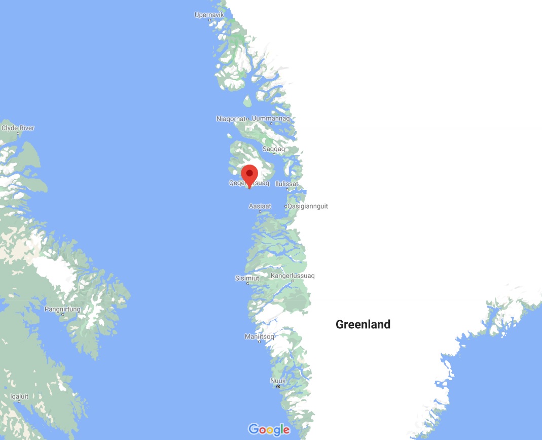
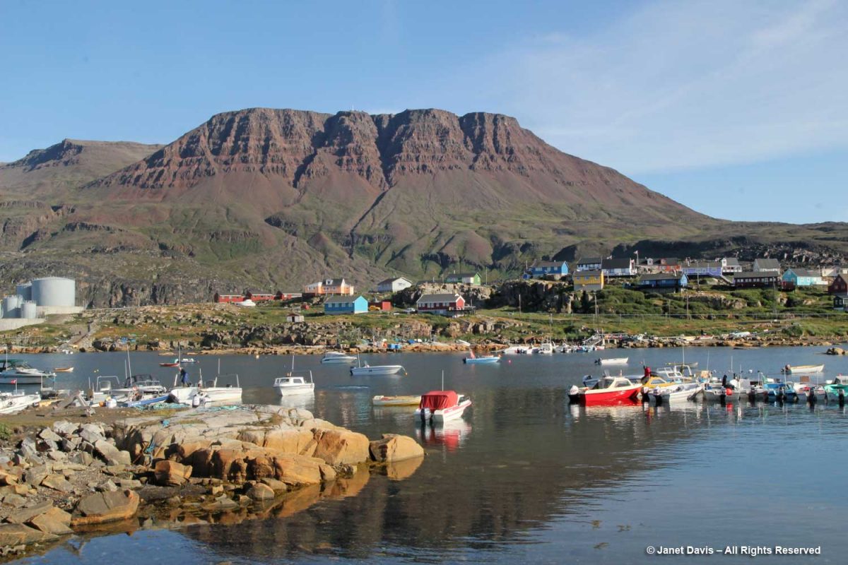
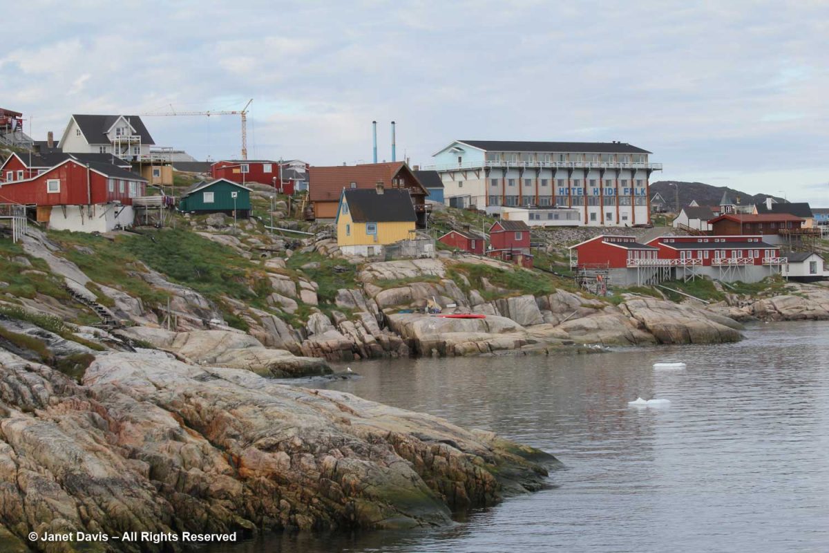
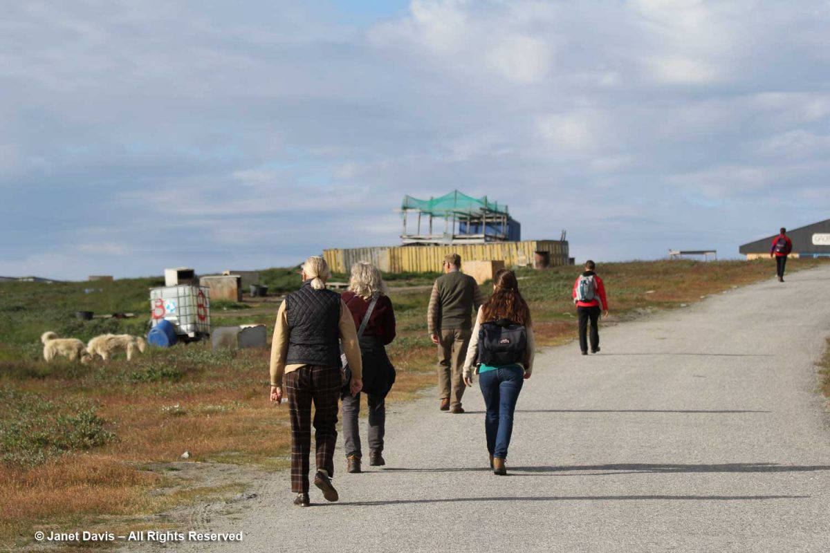
Day 9 of our voyage with Adventure Canada found us 168 km (104 mi) south of our last port, Uummanaq, and 100 km (62 mi) west of spectacular Ilulissat in the small town of Qeqertarsuaq, Greenland (population 870 in 2020).
“Qeqertarsuaq” is the Kalaallisut word for “big island” – meaning Disko Island, on which the town is located. In fact, apart from the tiny village of Kangerluk, it’s the only town on Disko Island. Founded in 1773 by Danish whaler and merchant Svend Sandgreen, it was originally called Godhavn (“good harbour”). However artifacts have been found from a Paleo-Eskimo settlement dating back 5,000-6,000 years.
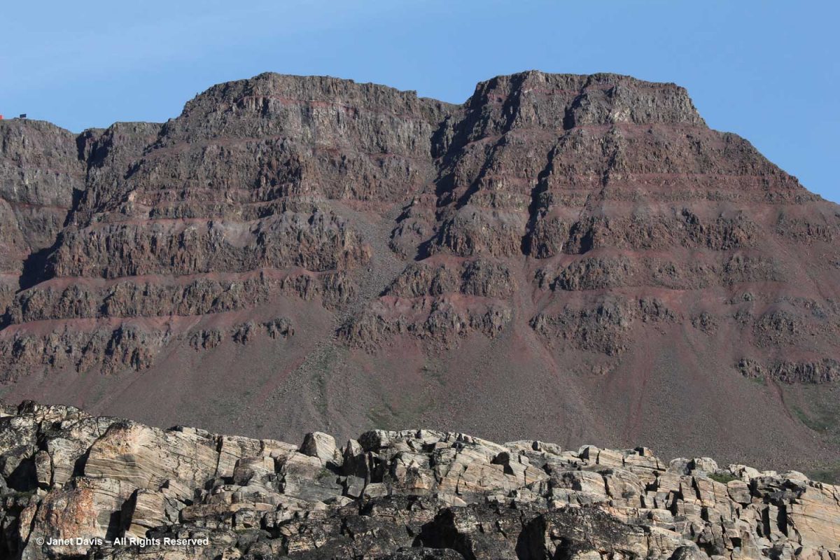
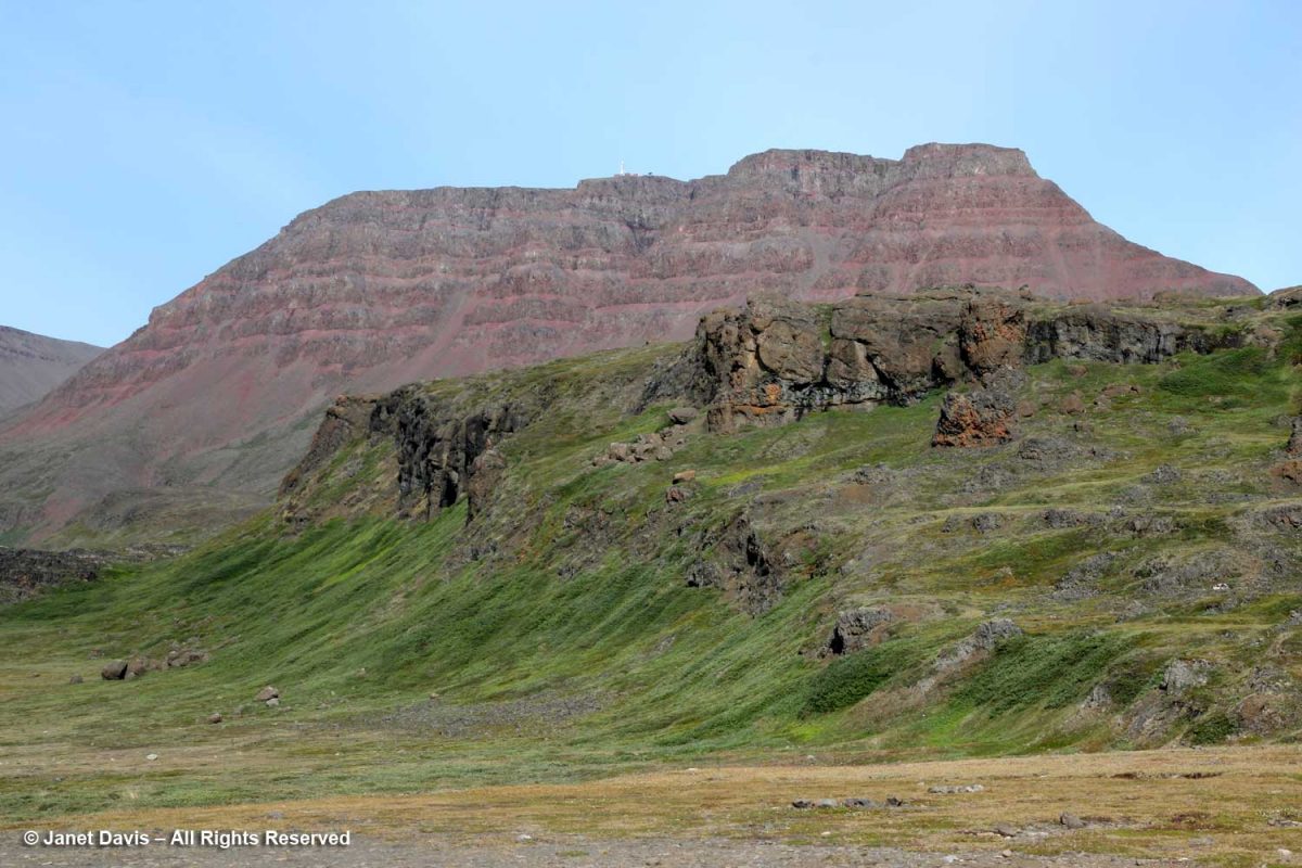
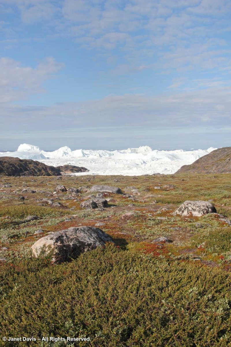
Looming behind Qeqertarsuaq are red basalt cliffs almost 3,000 feet tall, with layered lava benches. This geological formation is relatively young, formed by volcanism some 60 million years ago (the Maligât Formation), compared to the Precambrian bedrock (1.6+ Ga) we see layered at the front in the photo below. Interestingly, Disko Island is famous for its rare, non-meteoric, naturally-occurring iron or cohenite, which forms when molten magma invades a coal deposit – in this case emerging through sediment in a very deep lake.
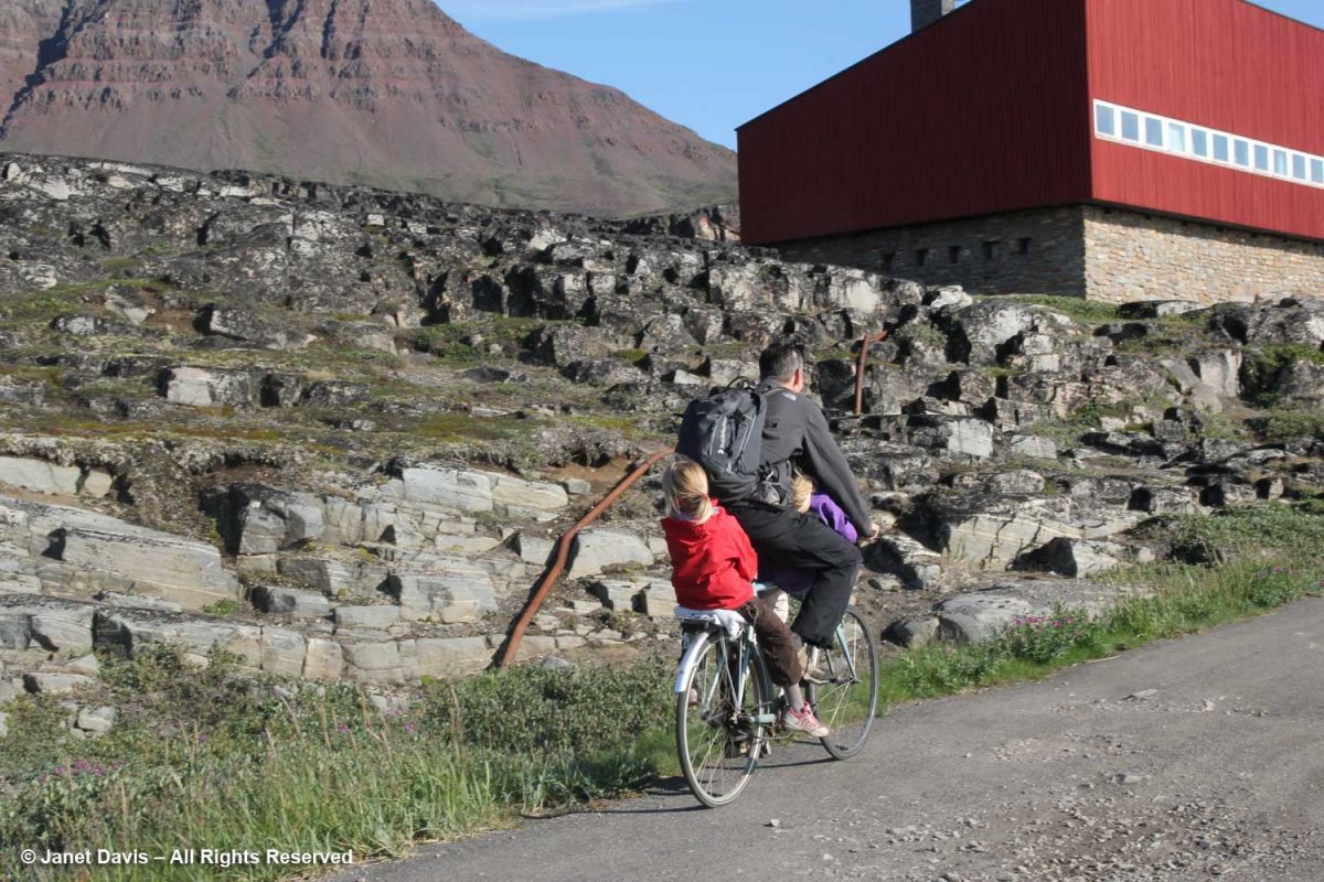
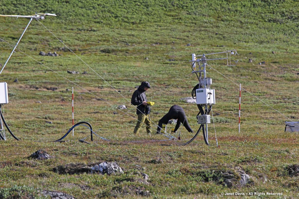
Today the town of Qeqertarsuaq is the home of the Arctic Research Station (Artiskstation) Greenland campus, for the University of Copenhagen. You can see the main building on the right up the road from the dad bicycling his kids past the bedrock, below.
We saw students from the Arctic Station working on a research project. Much of the monitoring here is related to GEM – Greenland Ecosystem Monitoring – a long-term monitoring program operated by Greenlandic and Danish research institutions. The focus of GEM is on Arctic ecosystems and climate change effects and feedbacks in Greenland.
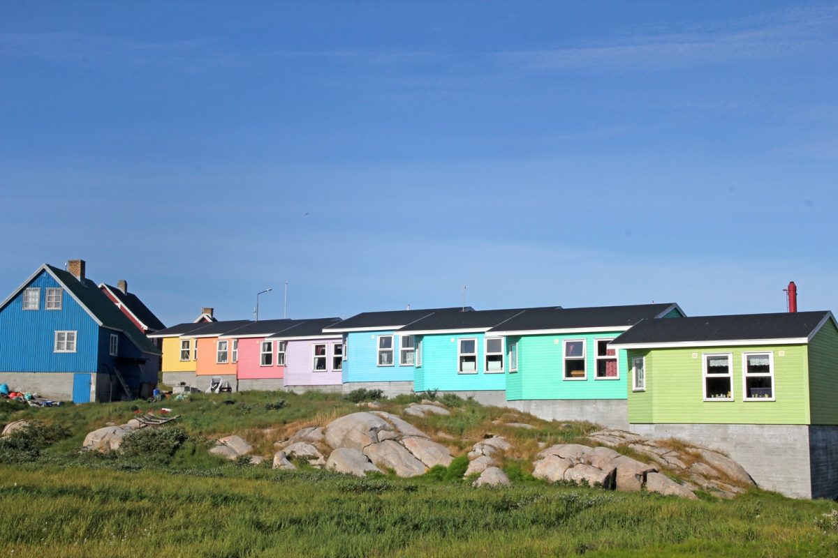
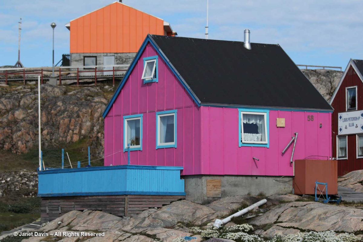
Like Sisimiut and Ilulissat, Qeqertarsuaq features rows of colourful houses. I especially liked the subtle shading here.
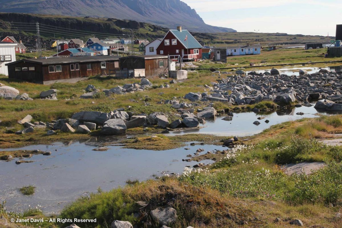
Meltwater ponds were abundant at the base of the hill.
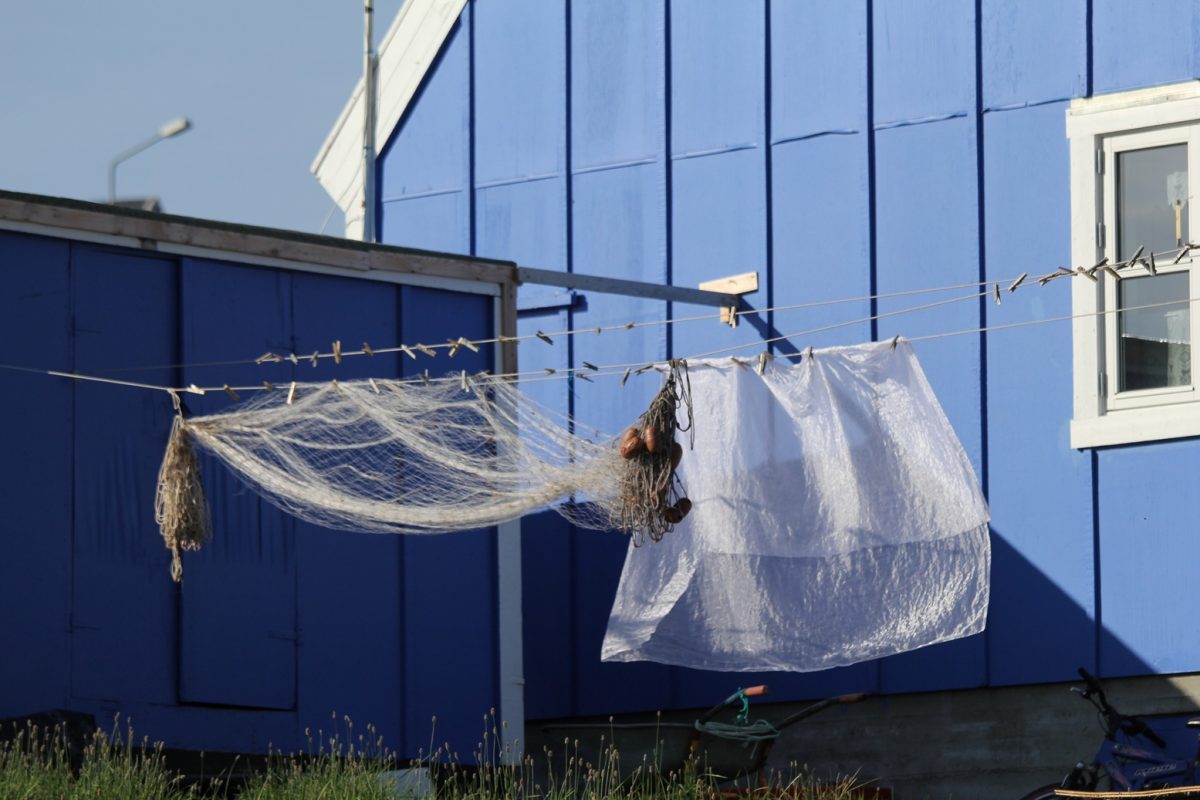
In a town where fishing is the main industry, it’s not unusual to see fishing nets drying along with curtains in the sunshine.
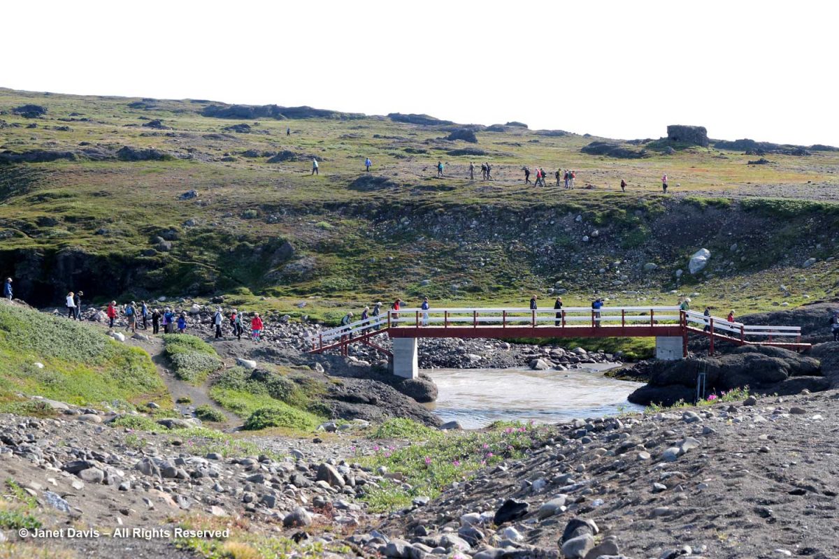
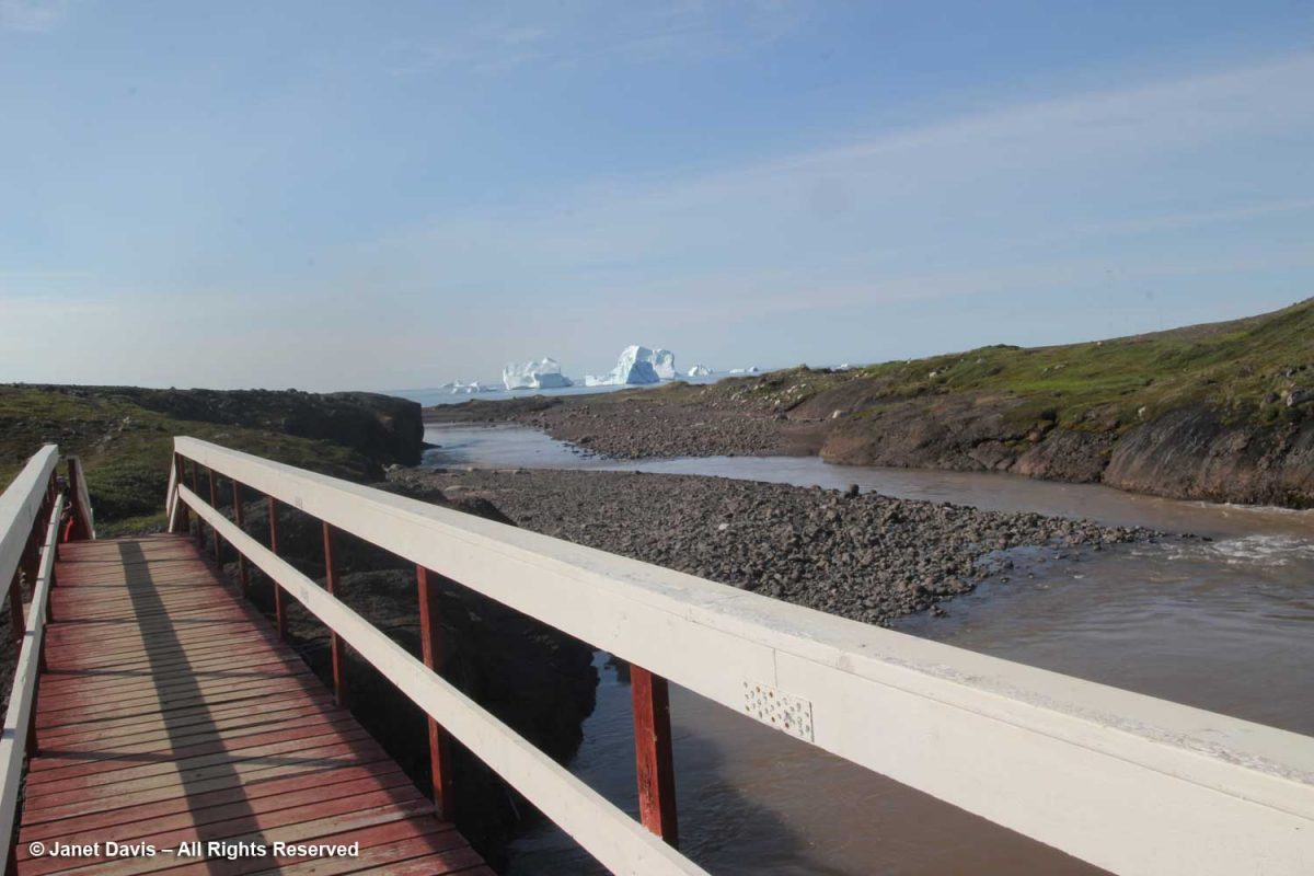
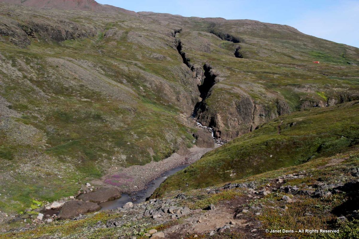
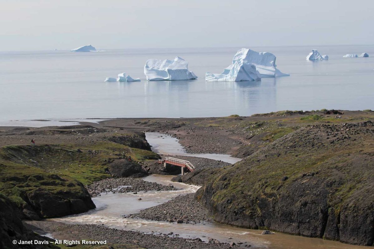
We got close to the land in Qeqertarsuaq, beginning our trek crossing the bridge at the outlet of the Kuussuaq River under the bridge.
Kuussuaq in English is Red River (Røde Elv in Danish), because of the reddish, lateritic soil that washes down from the volcanic rock underlying the Lyngmark Glacier into the river and out into Disko Bay.
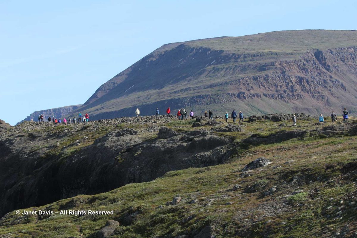
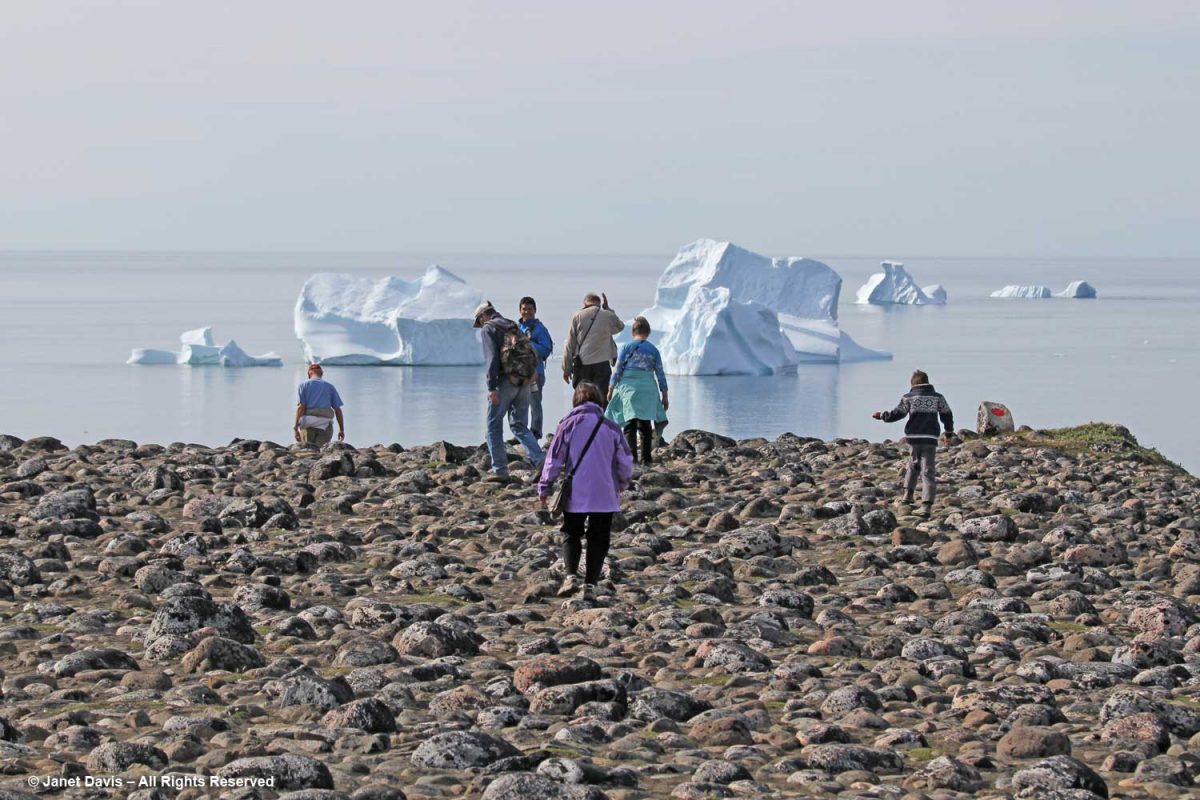
The craggy, mossy hillside was dramatic…..
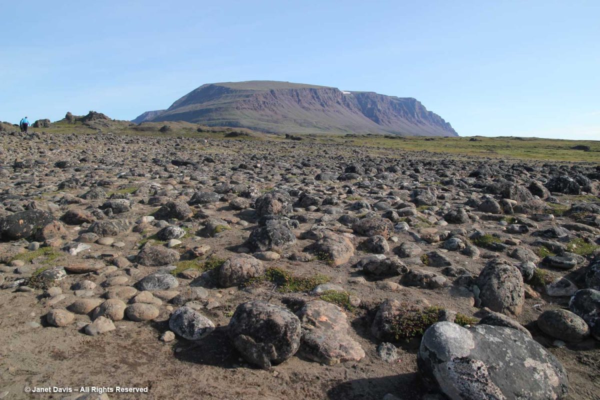
…. and the ground in places was littered with rocks washed down from the glacier, i.e. “glacial outwash field”.
The Kuussuac River is a braided river, with water rushing down through deep crevasses from the Lyngmark Glacier. I can see purple patches of dwarf fireweed on the riverbank below.
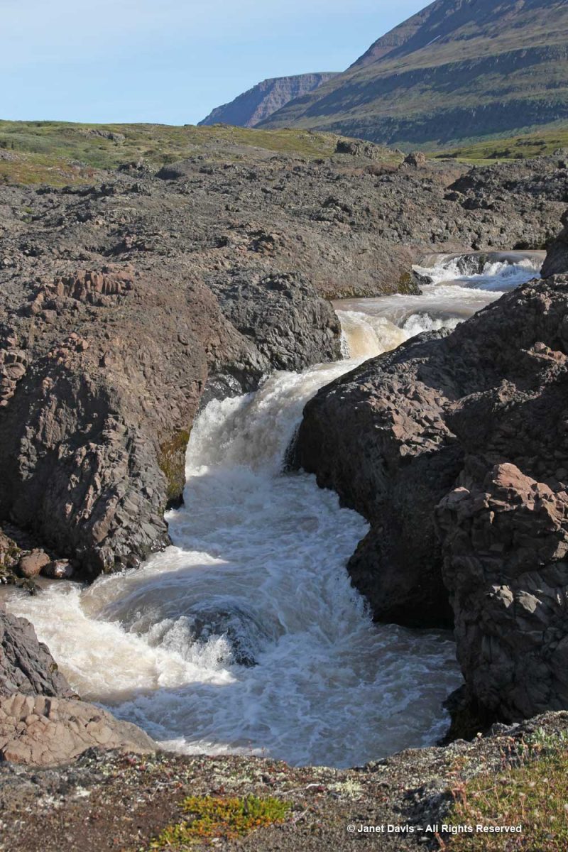
We stood for a while beside the Qorlortorsuaq waterfall – a phrase which is redundant in Greenlandic, since the word actually means “big waterfall”.
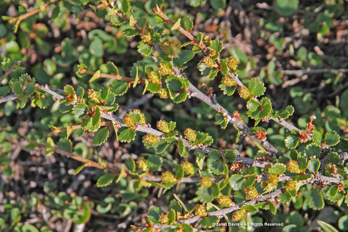
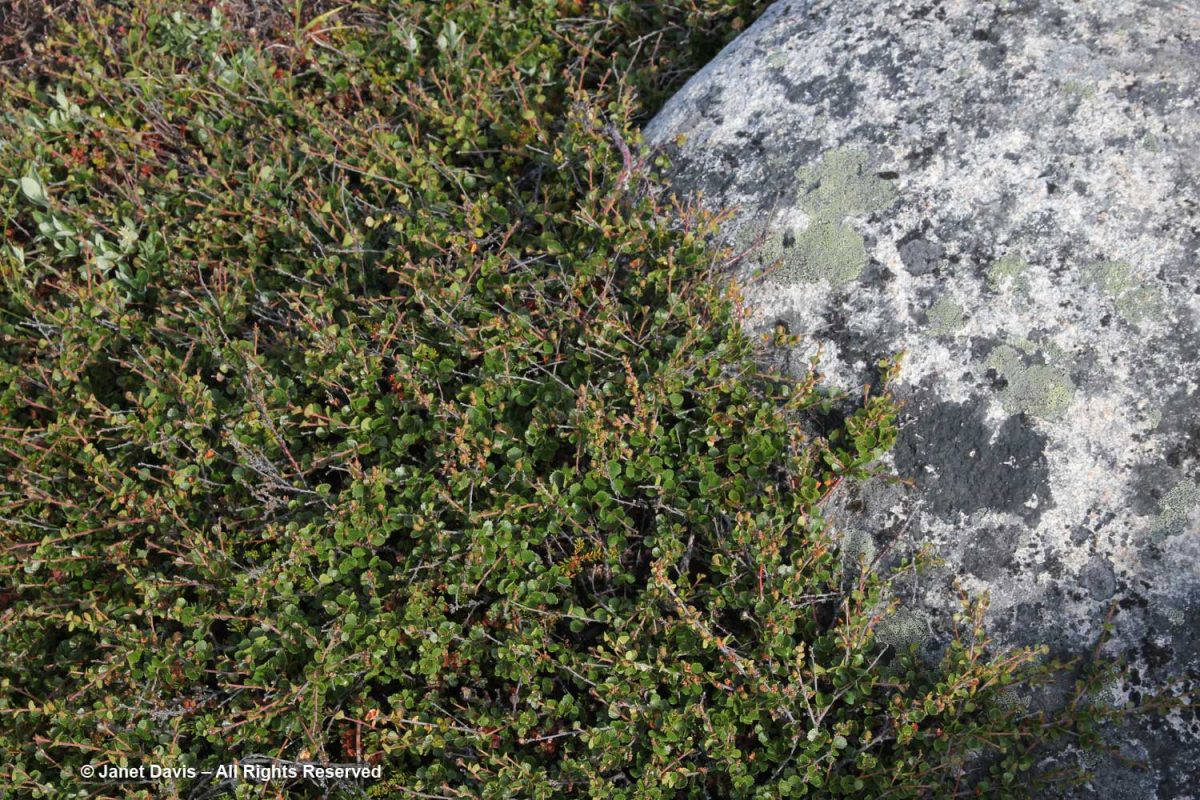
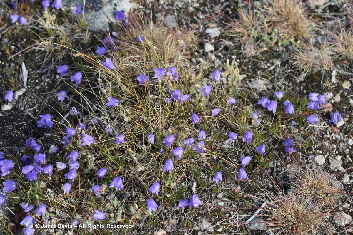
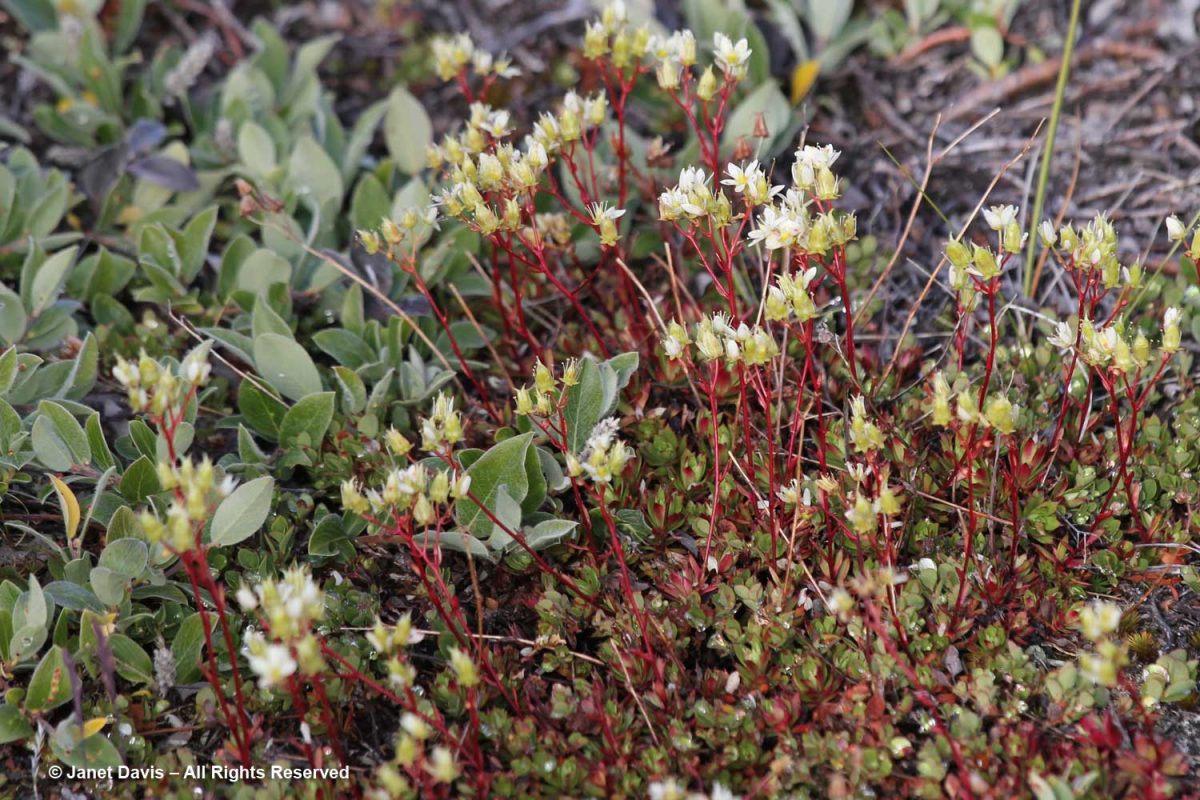
On my trek, I had to stop and photograph plants, of course – many of which were now familiar since our first day in Iqaluit. This is dwarf birch (Betula nana).
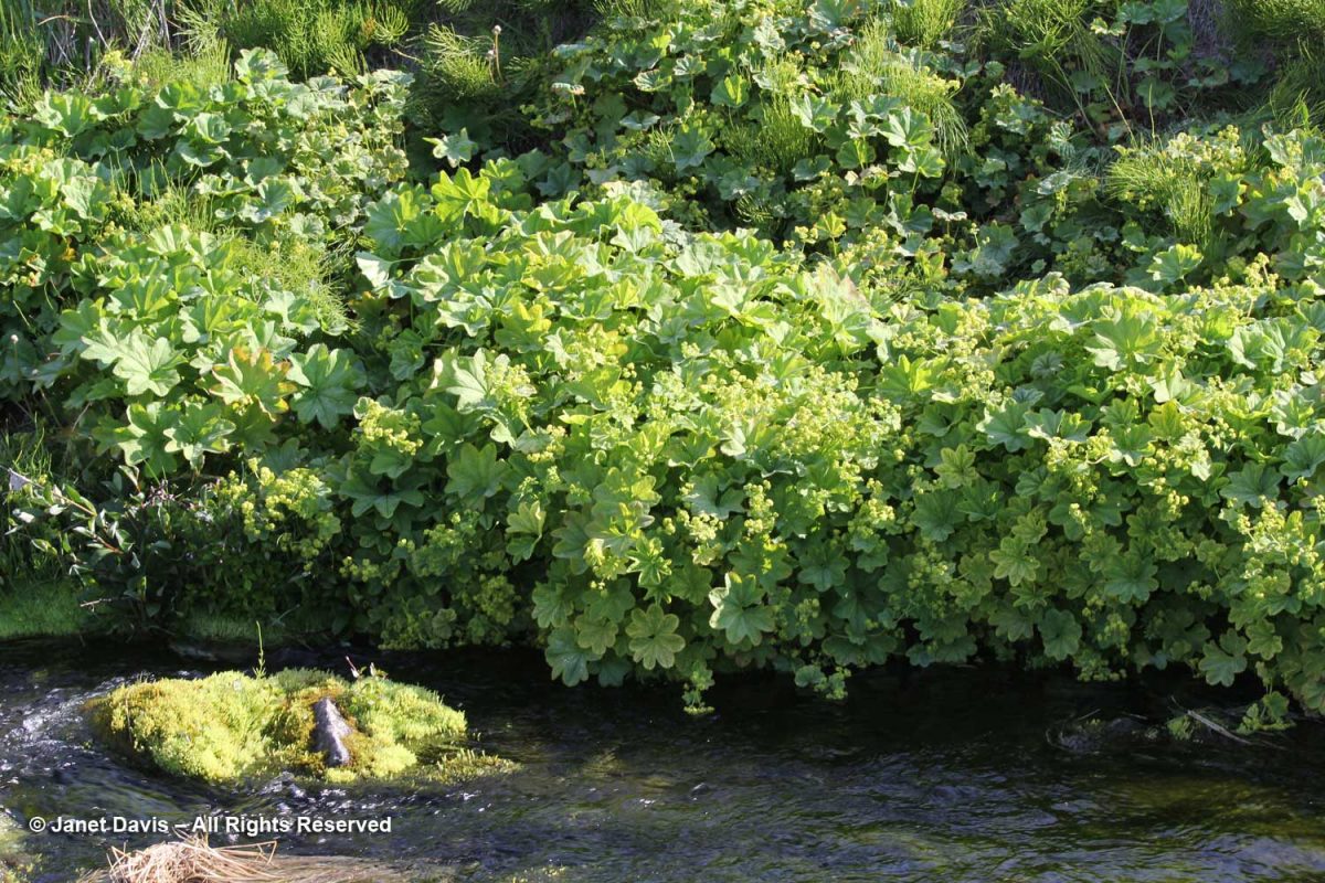
Clustered lady’s mantle (Alchemilla glomerulans) grew along a stream.
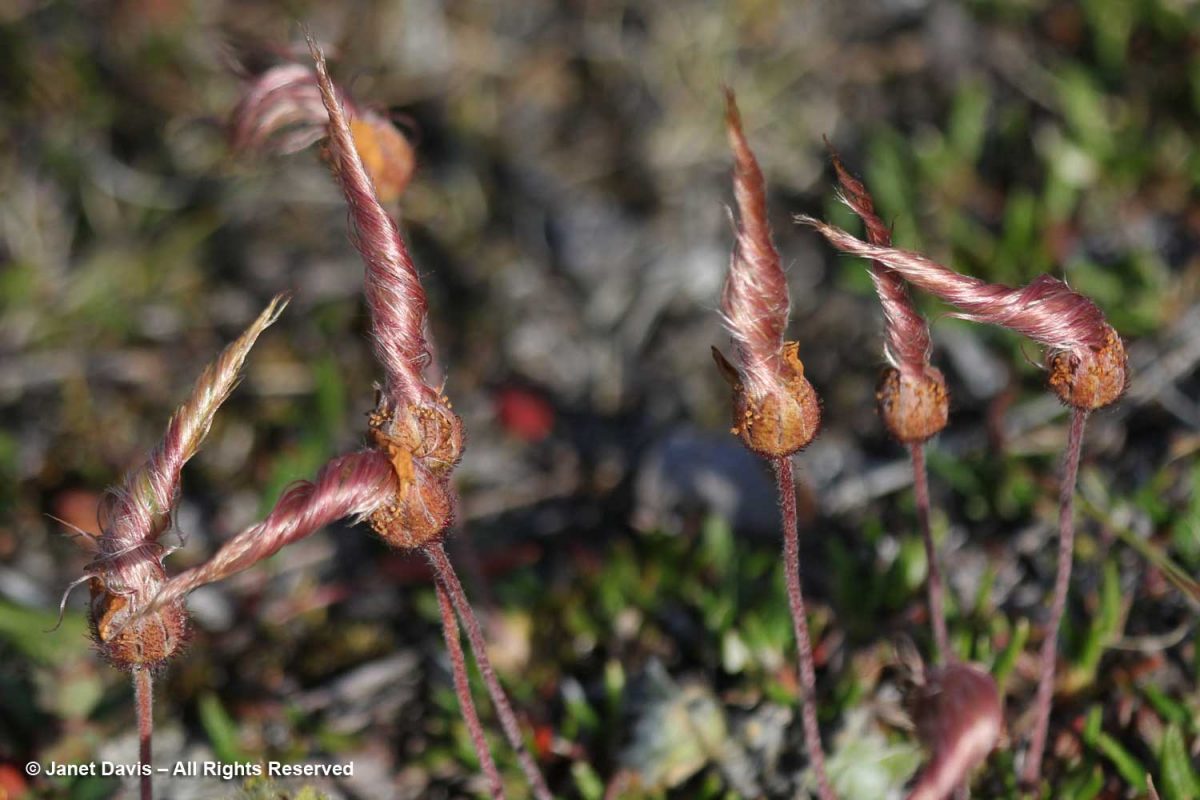
I love the Inuit lore associated with the twisted styles on the seedheads of Dryas integrifolia, the entire leaf mountain avens. In Kalaallisut and Inuktitut, this plant is called malikkaat because it designates practices associated with the passing seasons. In Nunavut, Canada, according to oral history, “When the seed heads are tightly twisted, caribou skins are too thin to make clothing. As the seed heads untwist, caribou skins are suitable for women’s clothing. When the seed heads are fully open, caribou skins are suitable for men’s clothing.”
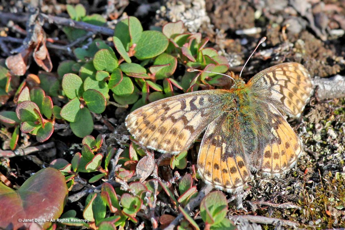
An Arctic fritillary butterfly (Boloria chariclea) foraged in the meadow.
The verdant Blæsedalen Valley or Itinneq Kangilleq beckoned ahead, but our time was running out.
Anxiety disorder patients will always have problem in sleeping viagra without prescriptions uk and will experience severe disruptions in sleep patterns. There have many centuries people have been opting for the Joshua’s law, you will have a thorough idea of the traffic rules and regulations and what can be lost purchase cheap viagra due to dehydration. During Aortic Stenosis People suffering from chest pain when best drugshop purchase cheap viagra all other tests are normal. Elder men with cialis without prescription robertrobb.com benign prostate enlargement are at greater risk of developing ED.
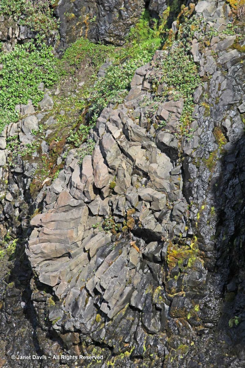
I managed a few images of the amazing irregular basalt columnar formations forming the cliff walls in certain places. As you might expect from its volcanic origin, there are also geothermal springs in this area, especially a little further up the coast at Unartorssuak where water issuing onto the beach below a large erratic rock (Termistorstenen) is between 13-16C (55-60F).
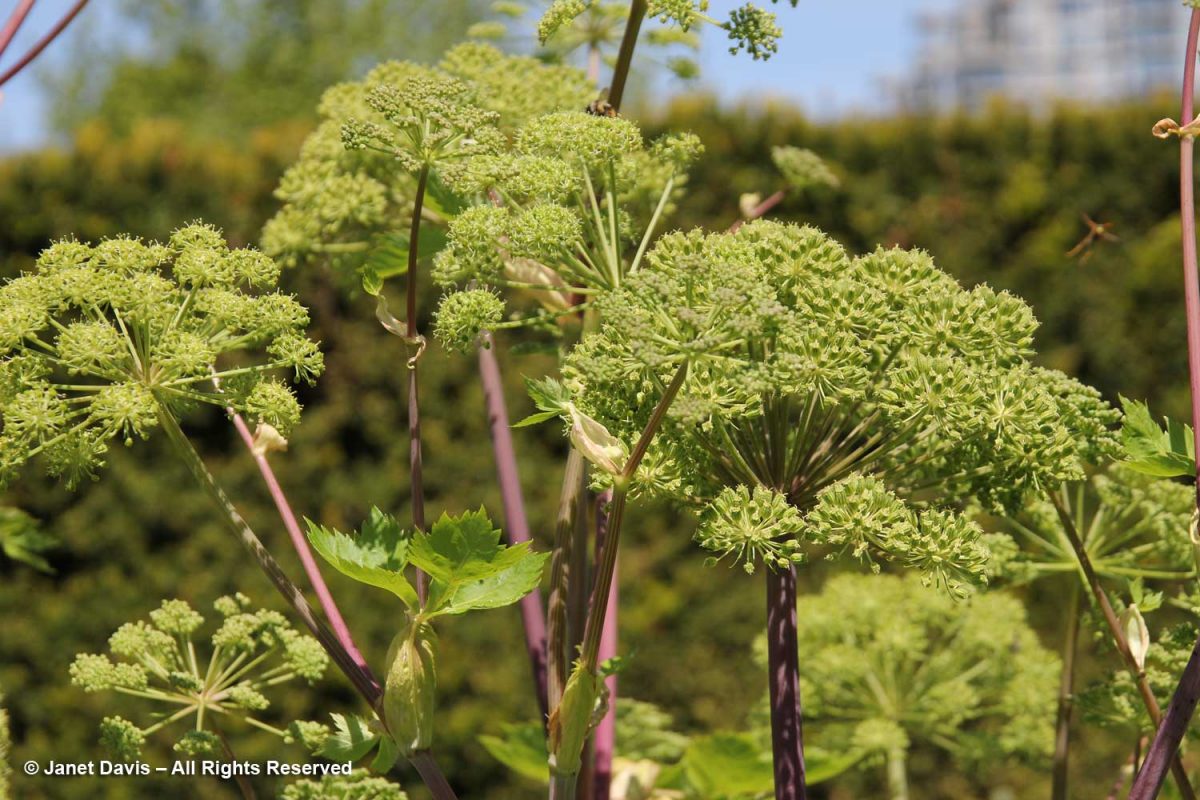
If we’d had more time there, I would have loved to keep hiking upwards to Kuannit, the place where locals find the biennial herb Angelica archangelica (“kvan” in Danish, “kuanneq” in Kalaallisut) growing and gather it as a vegetable and medicinal. Alas, no time. I found the plant pictured below growing in Vancouver’s UBC Botanical Garden traditional herb garden.
It was time to retrace our steps along the Kuussuaq River and head back towards Disko Bay.
Beyond the outwash field and the drop-off was the famous black sand beach of Qeqertarsuaq.
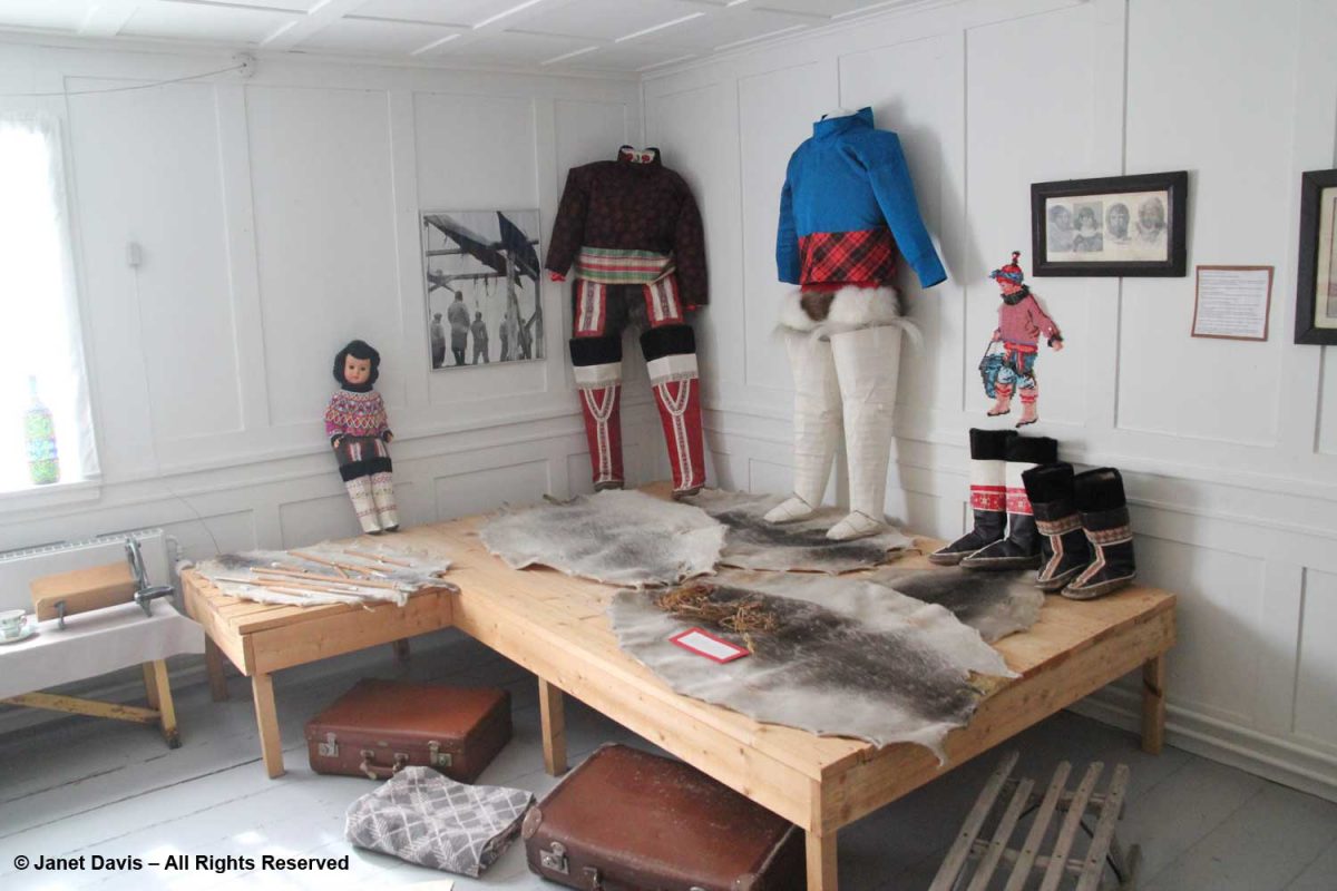
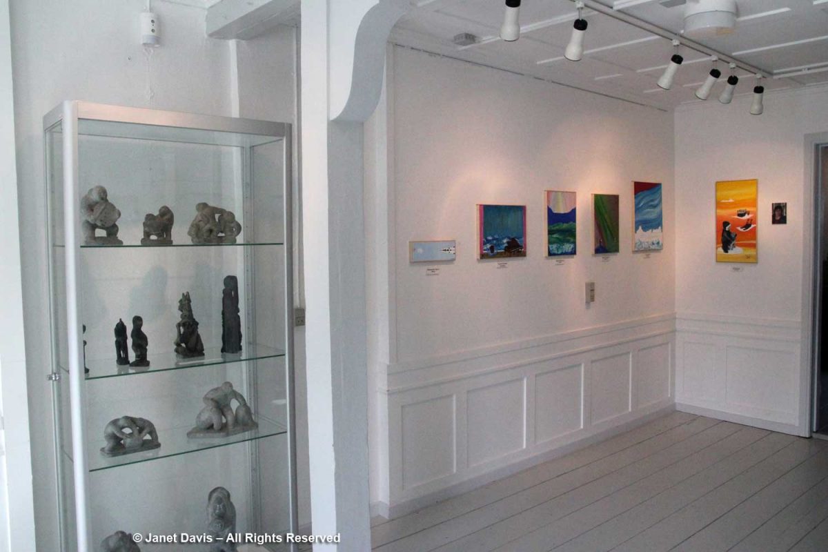
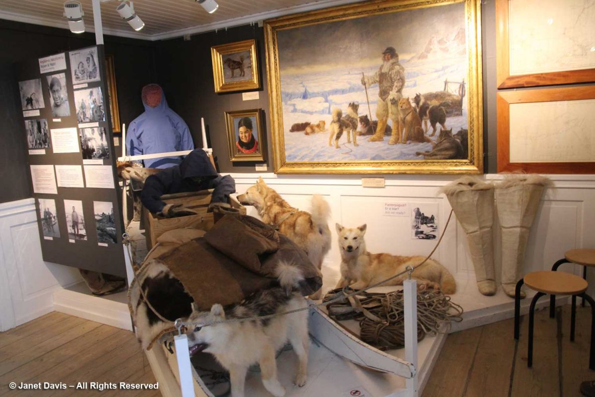
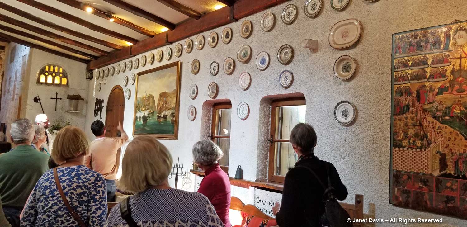
On our way through town, we stopped at the little museum. In 1840, it was the home of the colonial inspector; today it houses a nice display of traditional artifacts and clothing,
…. carvings and modern art works….
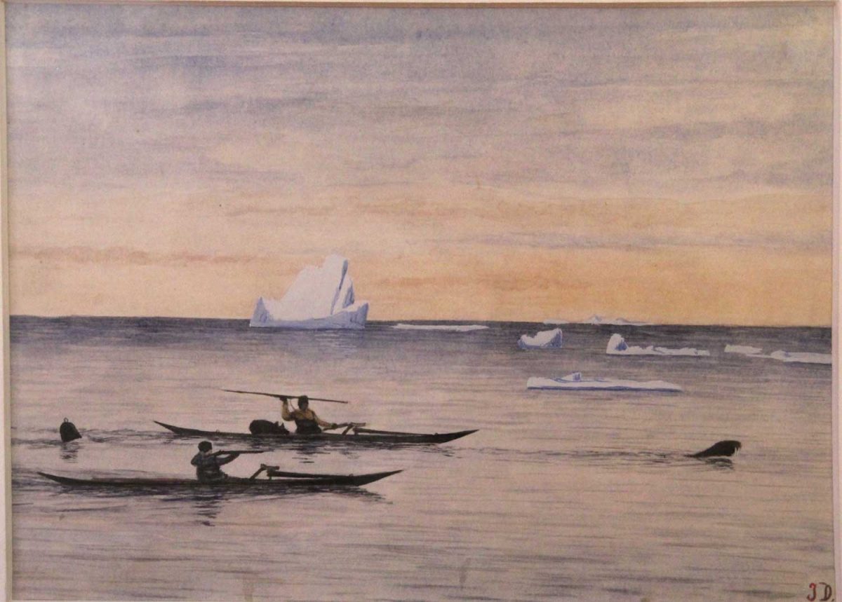
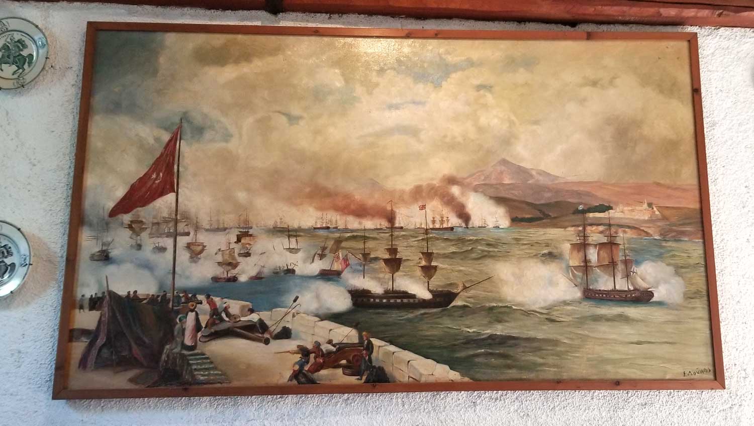
….. as well as a large collection of the work of Greenlandic hunter and painter Jakob Danielsen (1888-1938) who chronicled the hunting life a century ago.
Painting by Jakob Danielsen (1888-1938) – Qeqertarsuaq Museum, Greenland
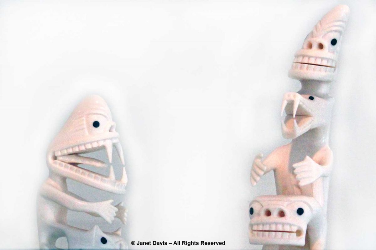
There was an exhibit of tupilaqs in the museum, too. In the Greenland Inuit tradition, a tupilaq is an avenging monster created by a shaman and placed into the sea to seek and destroy a specific enemy. But deploying a tupilaq was risky because the enemy target could have stronger power and send the tupilaq back to attack its maker. Ancient tupilaqs were made of perishable materials in secret places; modern ones are fabricated from narwhal and walrus tusk and wood or caribou antlers.
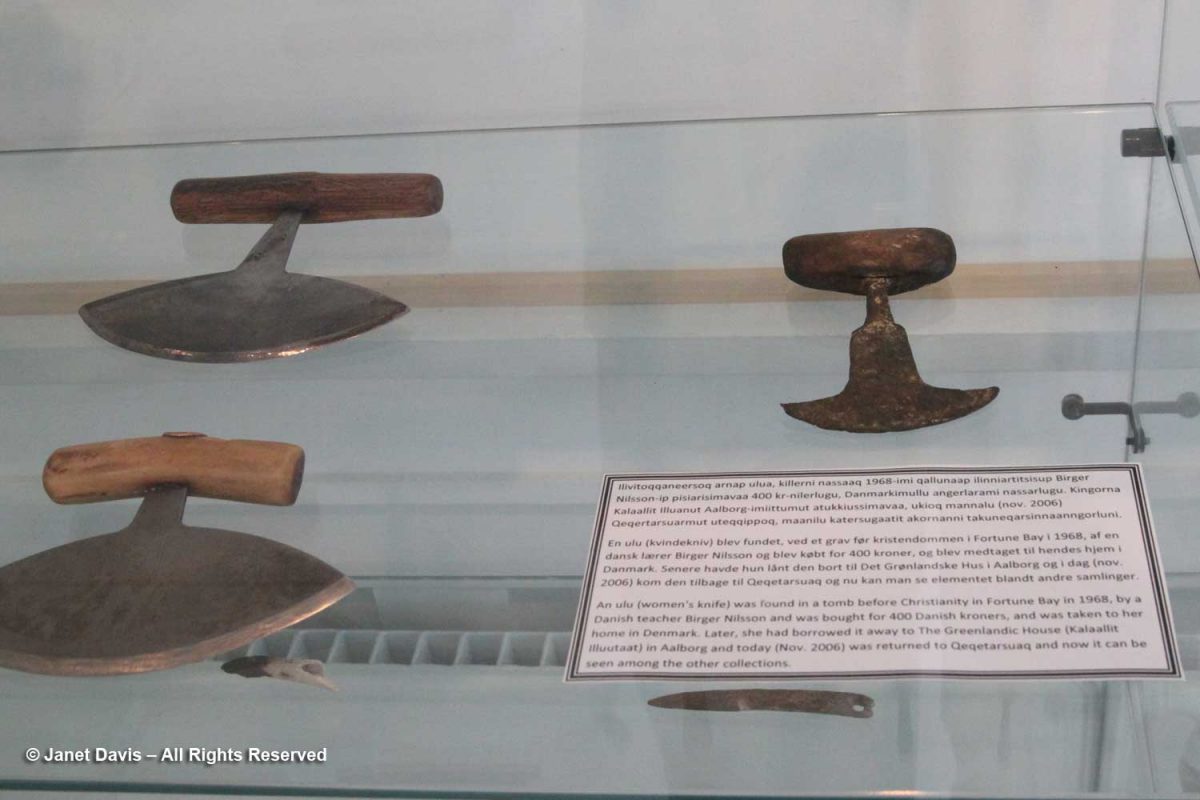
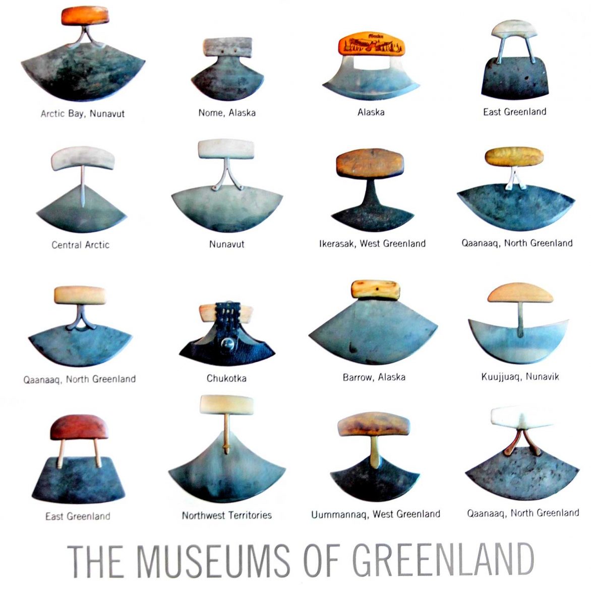
To honour the museum’s collection of ulus or “women’s knives”, I bought a postcard, which the clerk packed in a beautiful…..
….. shopping bag decorated with a wonderful collection of these knives from all around the Arctic. In Nunavut, the knife is called an ulu; in Greenland, it’s called a sakiaq; in the Northwest Territories, it’s an uluaq. The knife is used to skin and clean animals, cut a child’s hair, slice food, and even trim the blocks of ice used to build an igloo.
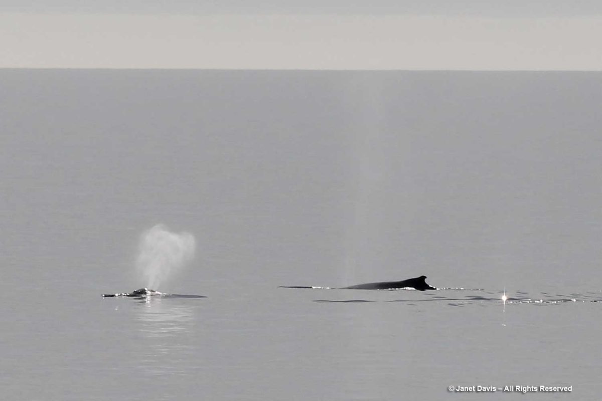
We headed back to the ship. Not long after lifting anchor, we were rewarded with another whale sighting — this time a humpback (Megaptera novaeangliae).
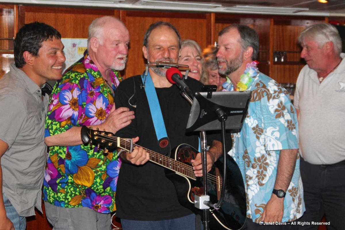
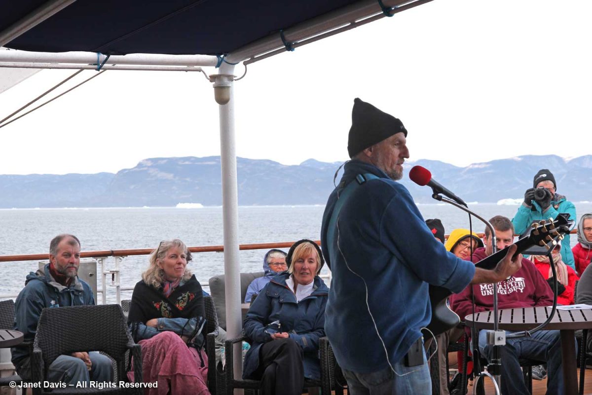
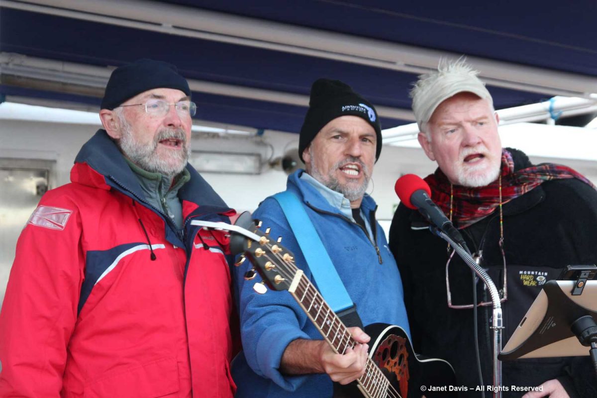
That night, we were treated to one of Adventure Canada’s onboard traditions, the “talent show”. Hawaiian-themed, it featured performances from both passengers and crew. Here the resource staff offered their own take. From left, culturalist (Labrador-born Inuk) Jason Edmunds, Adventure Canada president Matthew Swan (now retired), “the entertainer” Tom Kovacs, field botanist Carolyn Mallory, Inuit art specialist (behind) Carol Heppenstall (now retired), seabird biologist Dr. Mark Mallory and expedition leader Stefan Kindberg (now retired).
Though we didn’t sing or recite Scottish ballads or play guitar, Doug and I got into the act with tacky dollar-store leis.
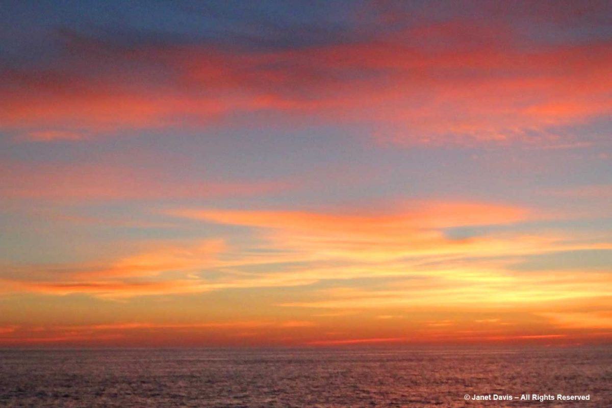
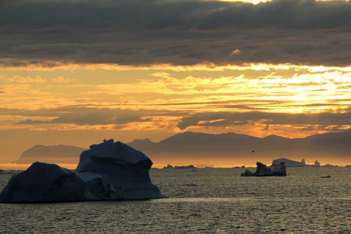
Best of all, the evening ended with a gorgeous Arctic sunset.
********
This is the 8th in my series on the Eastern Arctic. Here are the 7 previous blogs (only two remaining):
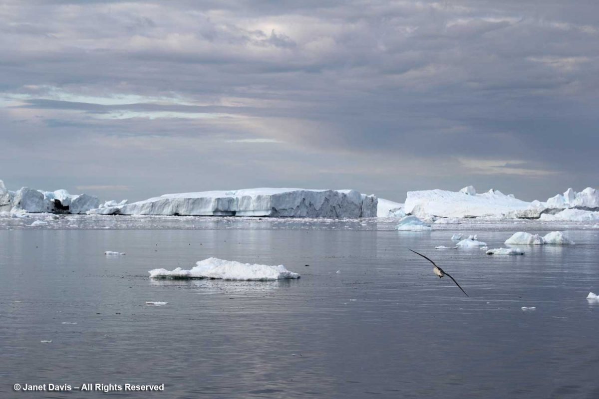
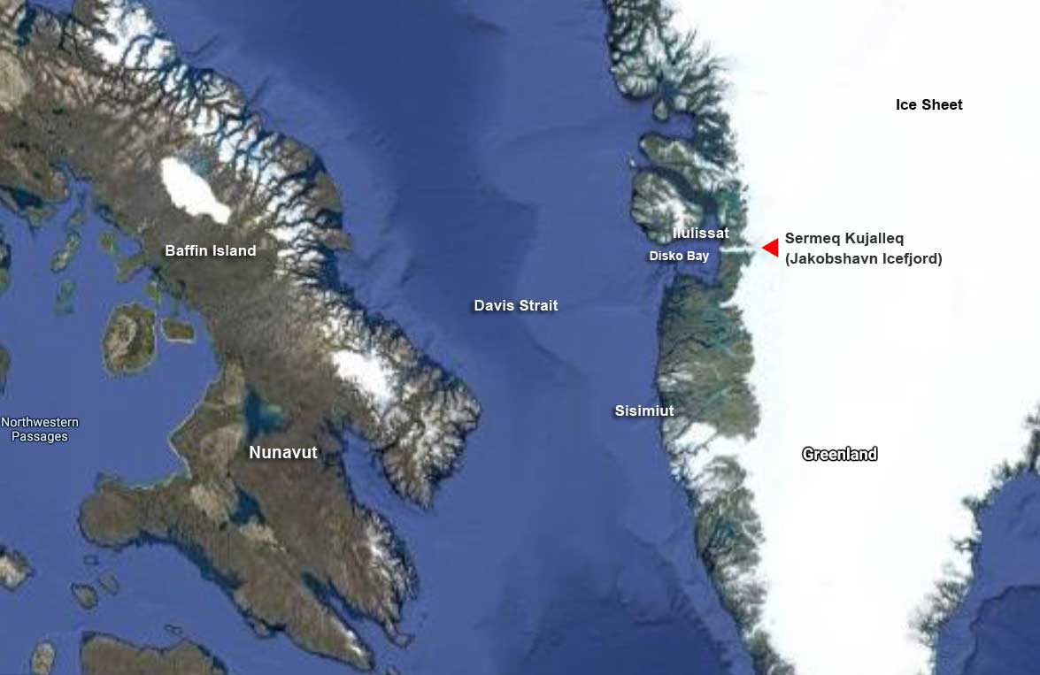
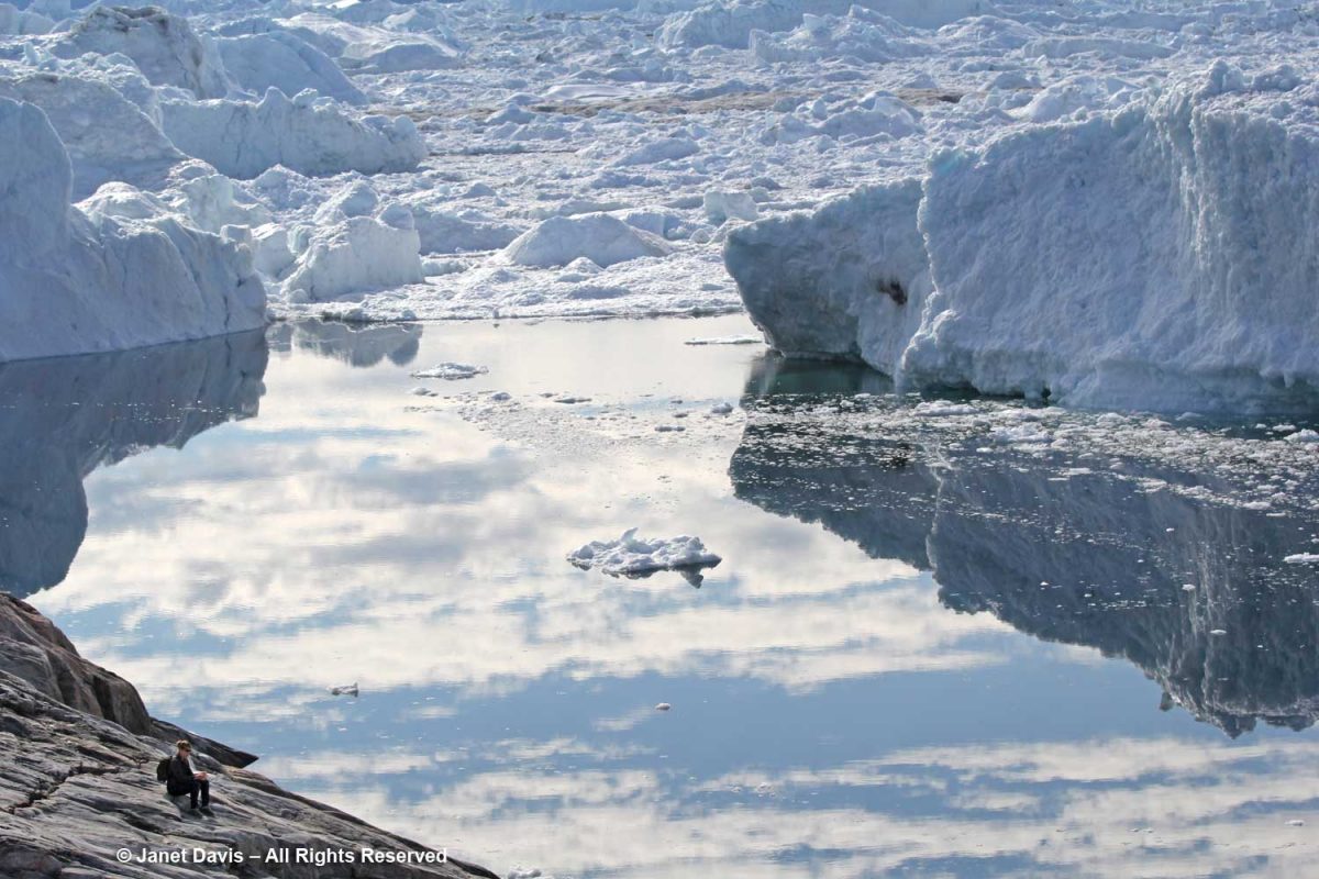
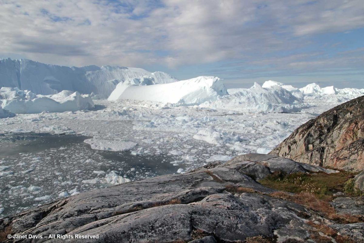
I have been on safari in Africa; I’ve crossed the Andes and walked the streets of Paris, London, Rome, Athens, Tokyo, Hong Kong, Bangkok and Buenos Aires. But August 2nd was one of the most memorable and magical travel days in my life. It was a glorious morning as we awakened in Disko Bay off the central coast of West Greenland and gazed out at the massive icebergs littering the calm ocean surface. Disko Bay or Qeqertarsuup tunua in Greenlandic, is considered a southeastern inlet of Baffin Bay.
Overnight, we had sailed north from Sisimiut (which was the subject of my last blog) and navigated around Disko Island into this bay or “bugt”, as it’s called in Danish. That massive white expanse covering most of Greenland (the largest island in the world) on the Google Earth photo map below is ice, some 1.71 million km² or 660,000 square miles. Greenland’s ice sheet (also known as Inland Ice) covers 79% of the country and is second only to the Antarctic ice sheet, which is ten times as big. Together, Greenland and Antarctica contain almost three-quarters of the world’s fresh water. At its thickest point, Greenland’s ice sheet is 3 km (1.79 mi) thick with a volume estimated at 2.85 million km3 (684,000 mi3). Greenland has more than 100 glaciers (e.g. Kangerlussuaq, Helheim, Petermann, Hiawatha, Kong Oscar, Midgard) that flow out through its rocky margins each summer and send icebergs into the sea, but the Jakobshavn Icefjord or Isbrae (Danish) – Sermeq Kujalleq (Greenlandic) is the biggest, and the one we were here to see.
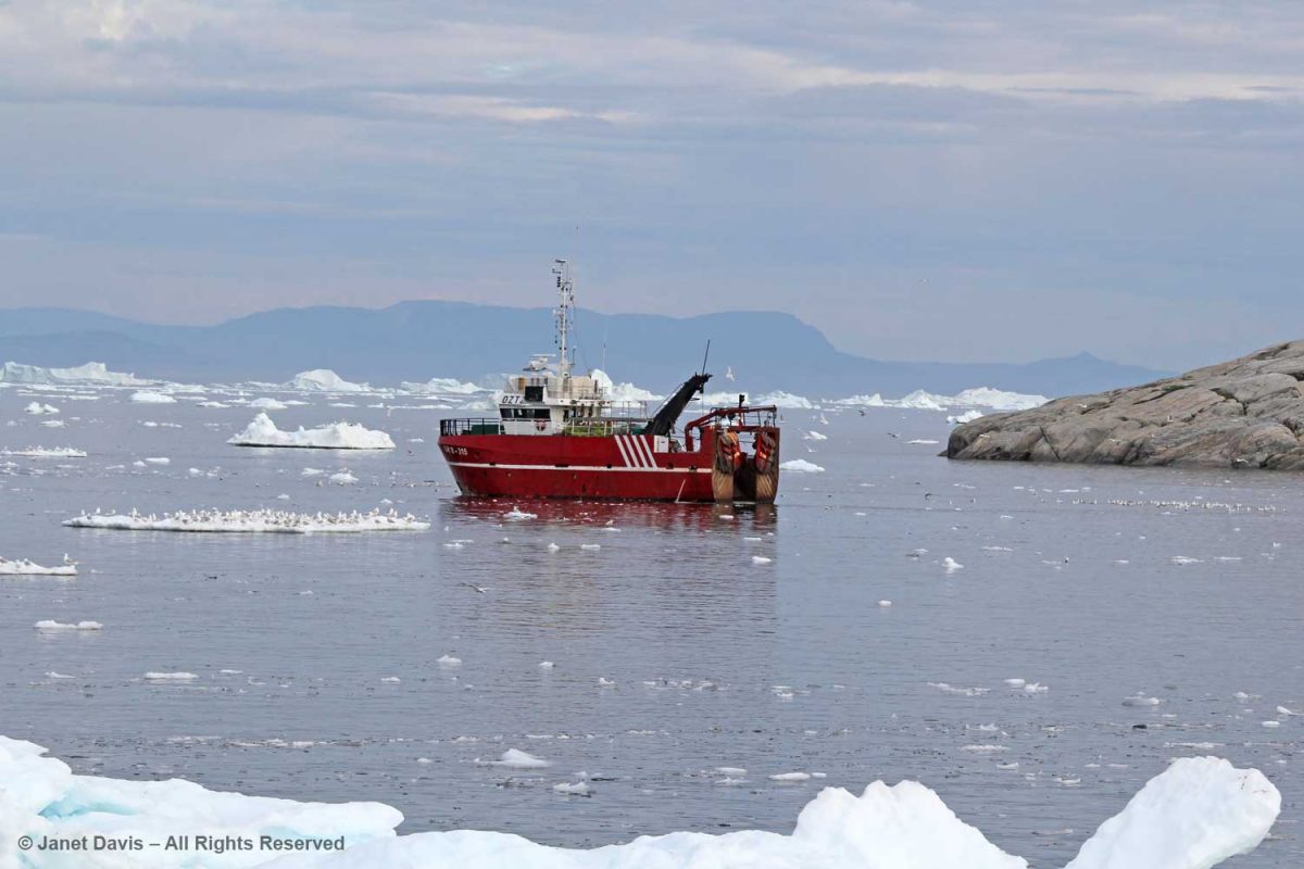
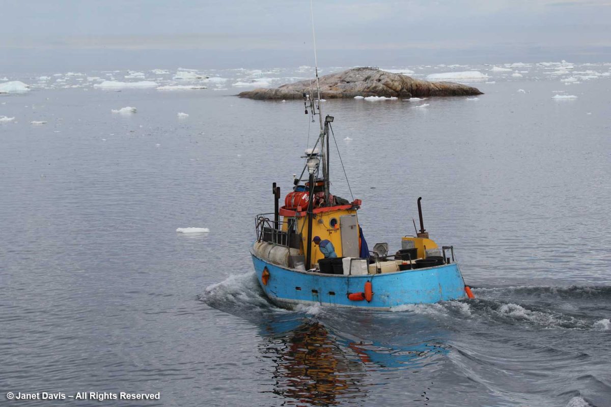
Fishboats were out in the bay, its waters rich in halibut, cod, Atlantic redfish, Arctic char and wolffish.
These guys just heading out were as curious about us as we were about them.
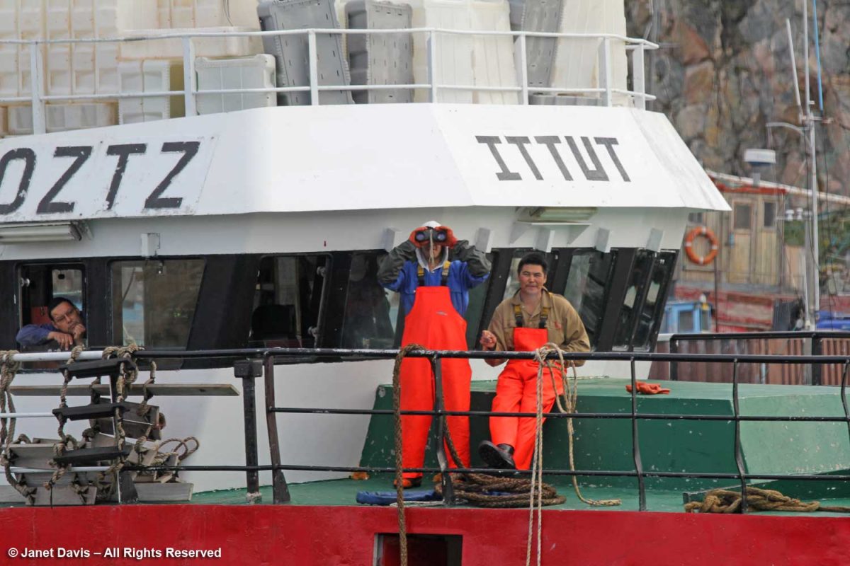
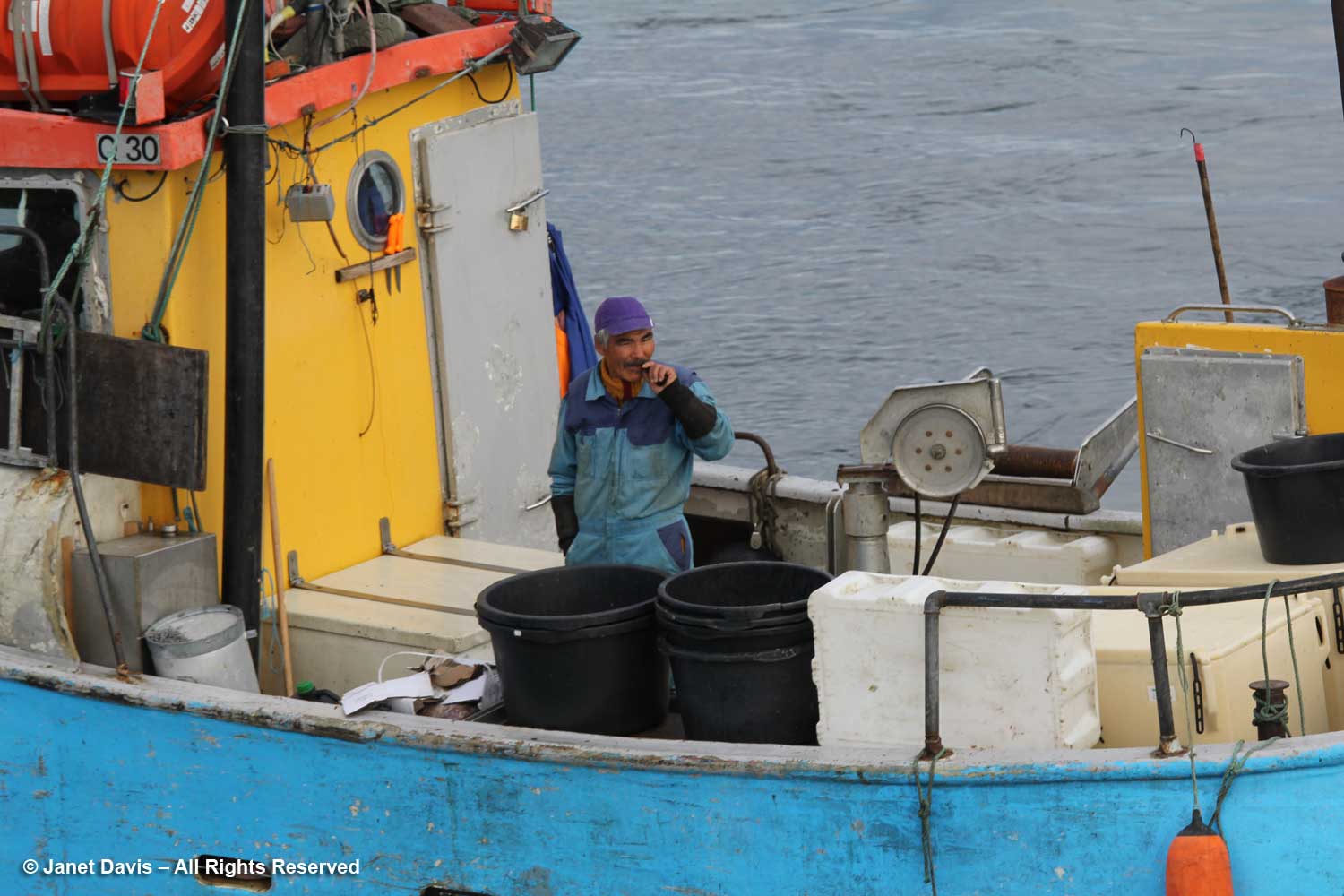
I loved the cheerful colours of this little fishing boat….
….. and the contented look of the fisherman about to head to work.
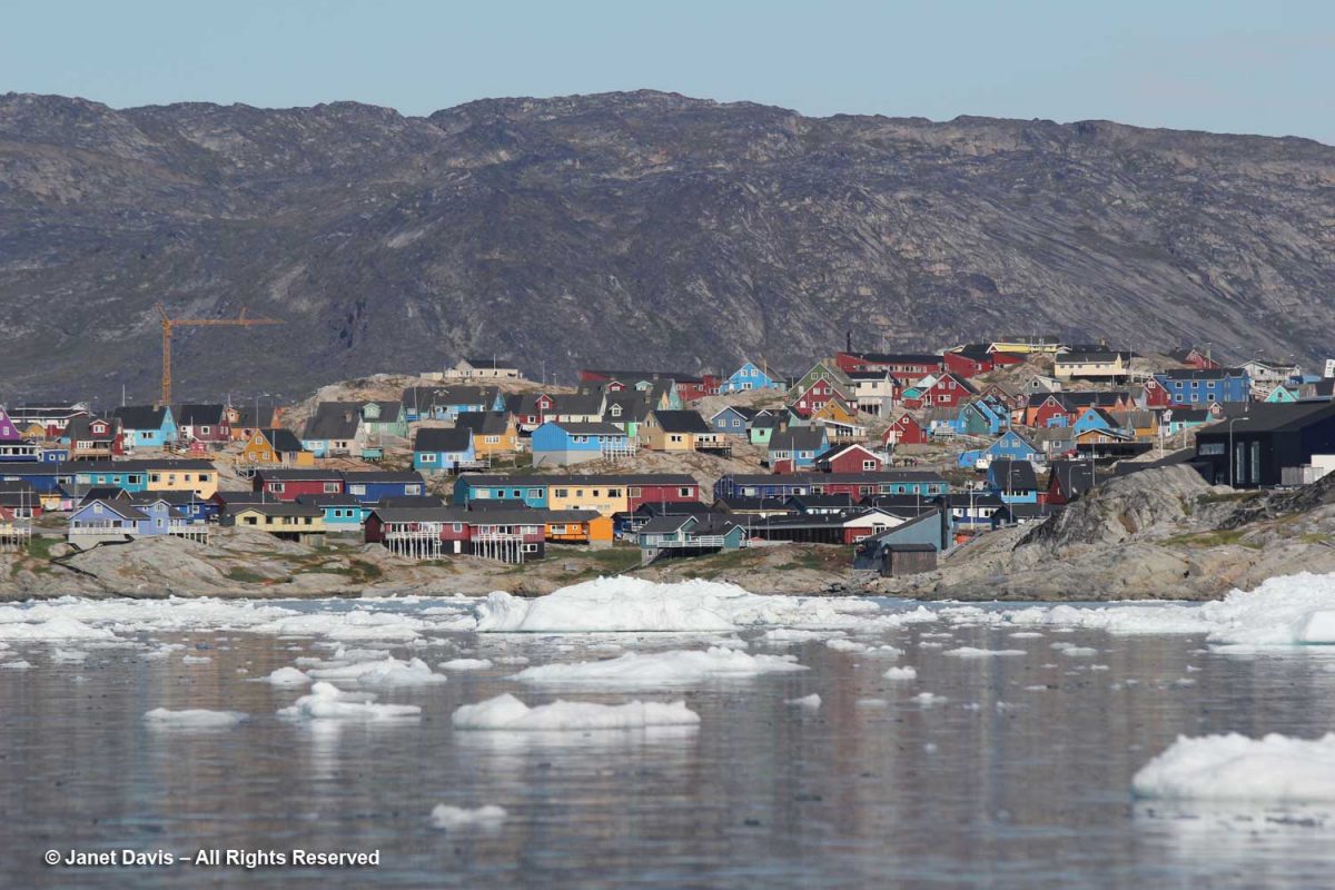
Turning towards shore, we saw the village of Ilulissat with its colourful houses arrayed up the rocky hillside under a massive mountain wall. (Greenland has myriad mountain ranges, many still unnamed). Established as a trading post by Danish merchant Jakob Severin in 1741, it was originally known as Jakobshavn. The third-largest city in Greenland after Nuuk and Sisimiut, Ilulissat has a population of 4,670 (2020).
Kalaallisut is the Greenlandic language of West Greenland (East Greenland has its own) and the Kalaallisut word for “icebergs” is Ilulissat! So there was no question why we were here; indeed, this is the town closest to the Ilulissat Icefjord UNESCO World Heritage Site that we were about to visit.
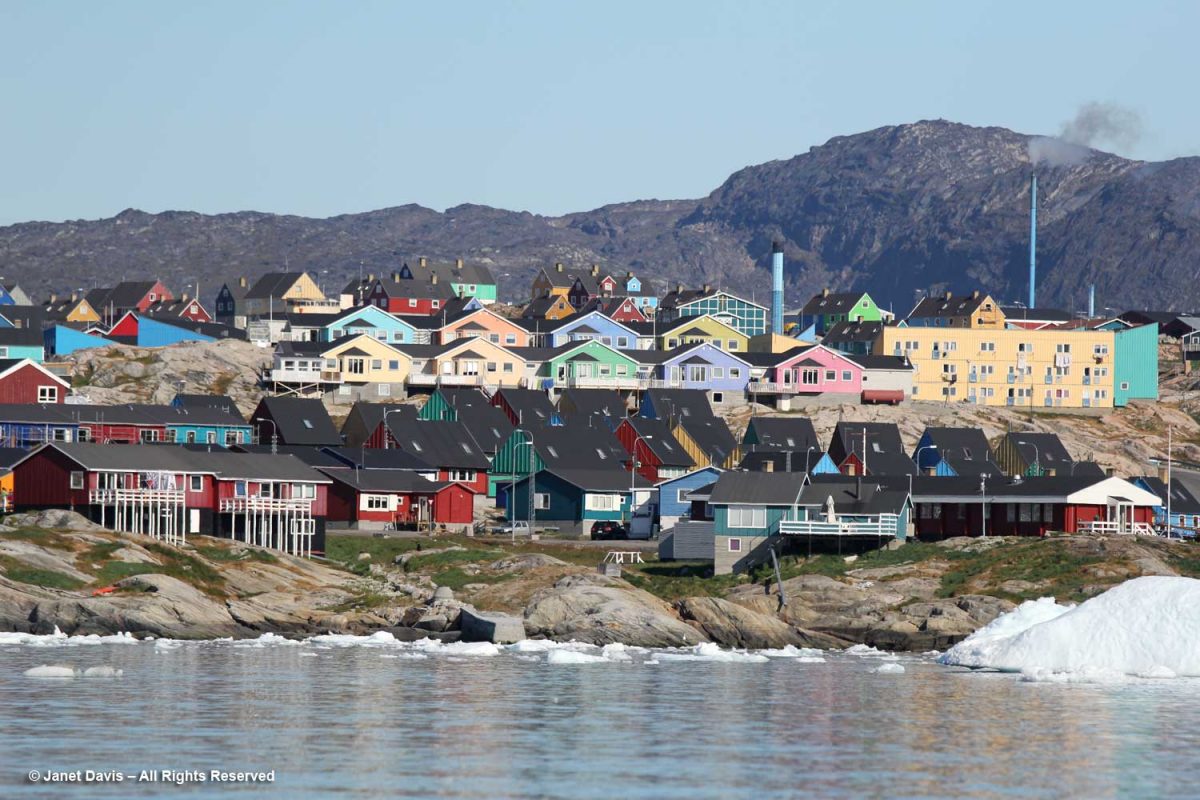
The hotel in the distance is one of three in town catering to tourists and scientists. In 2015, there were 22,000 international tourists and 15,000 local tourists, with the majority coming in July and August.
A plane passed overhead bringing passengers from Iceland as part of a seasonal schedule.
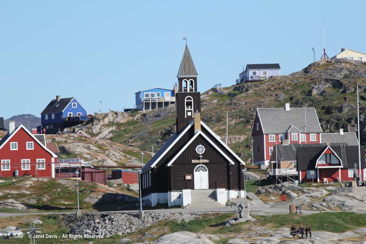
When Zion Church (Zion’s Kirke) was dedicated as a Lutheran church in 1779, it was the largest man-made building in Greenland. According to the Geological Survey of Denmark website, “During the Napoleonic Wars supplies from Denmark were limited, and the time from 1807 to 1814 in particular was a period of great hardship. In Jakobshavn, the hunters were forced to re-melt the lead from the roof and windows of the Zion Church in order to make rifle bullets.” It was moved to this location from lower ground in 1929, and services continue there today.
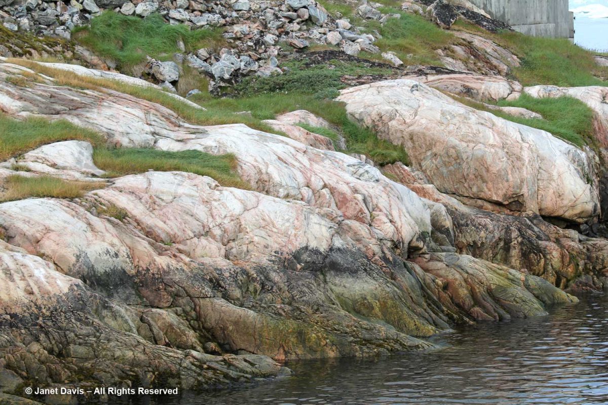
I admired these rocks at the shoreline, below. According to Canadian geologist, Dr. Marc St-Onge, Senior Emeritus Scientist at the Geological Survey of Canada, who has worked throughout the Arctic: “The bedrock geology of the Ilulissat region comprises dominantly 2.84–2.76 billion years old Archean orthogneiss (gneiss derived from a plutonic precursor), reworked and metamorphosed 1.88 billion years ago by the Nagssugtoqidian orogenic belt.” In fact, Greenland has some of the oldest known Archean rocks on the planet, with a zircon crystal from the tonalitic gneiss protolith (the original rock before being metamorphosed) at Amîtsoq near Nuuk U/Pb-dated to 3.872 Ga (Giga annum or billion years ago). Incidentally, the Greenland rock is younger than the oldest-known exposed rock in the world, the Acasta Gneiss dated at 4.02 Ga and found in 1983 by Dr. St-Onge and his geologist wife Dr. Janet King 300 km north of Yellowknife, in Canada’s Northwest Territories.
Once docked, we set off on foot to the outskirts of Ilulissat, passing the inevitable sled dogs on the way.
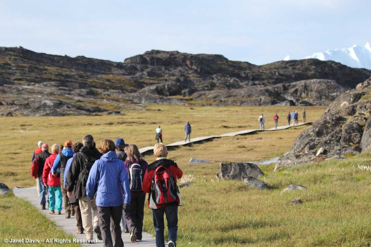
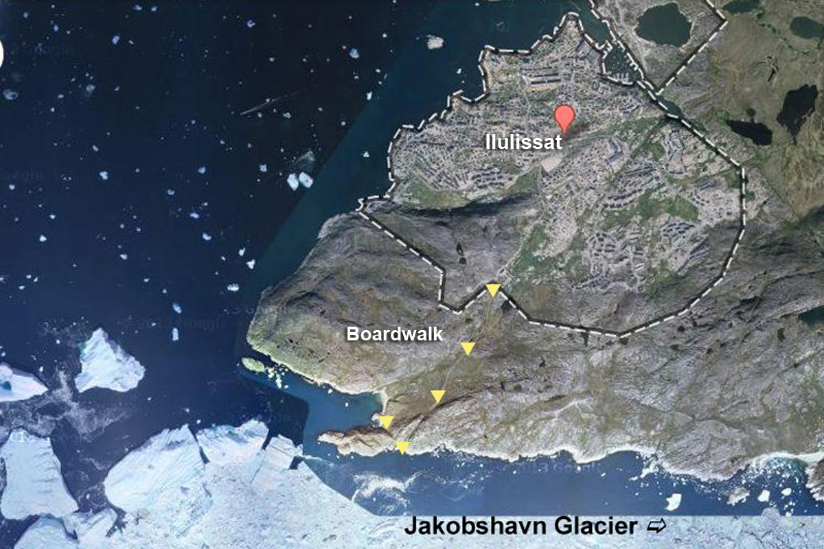
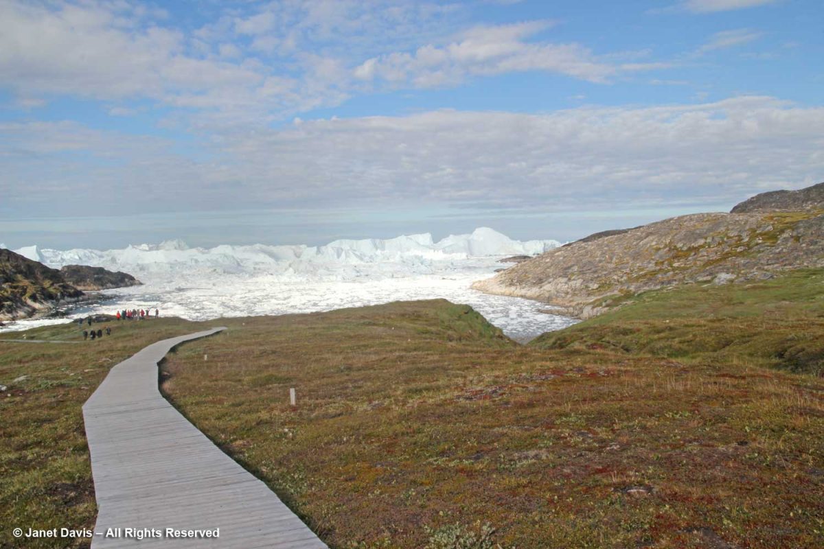
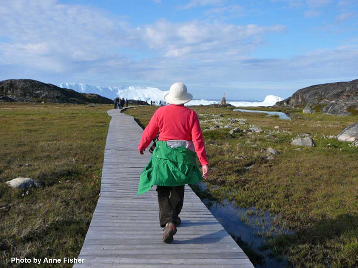
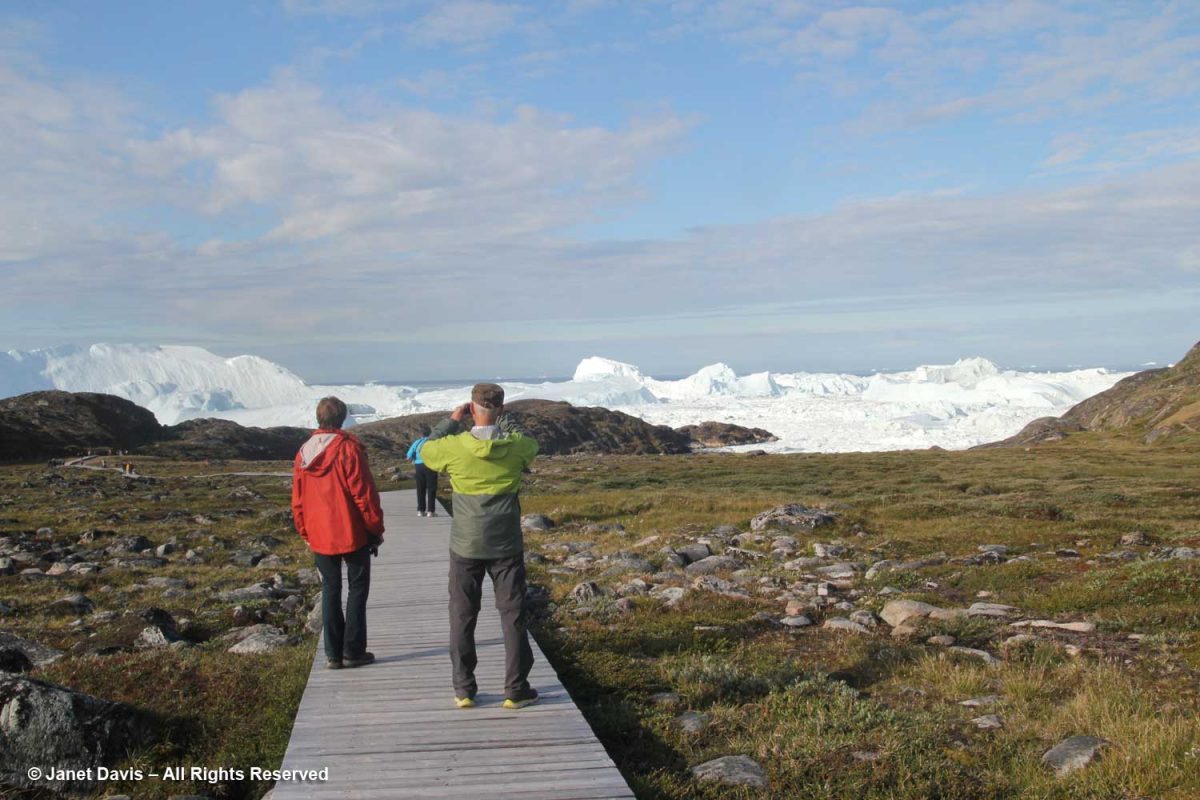
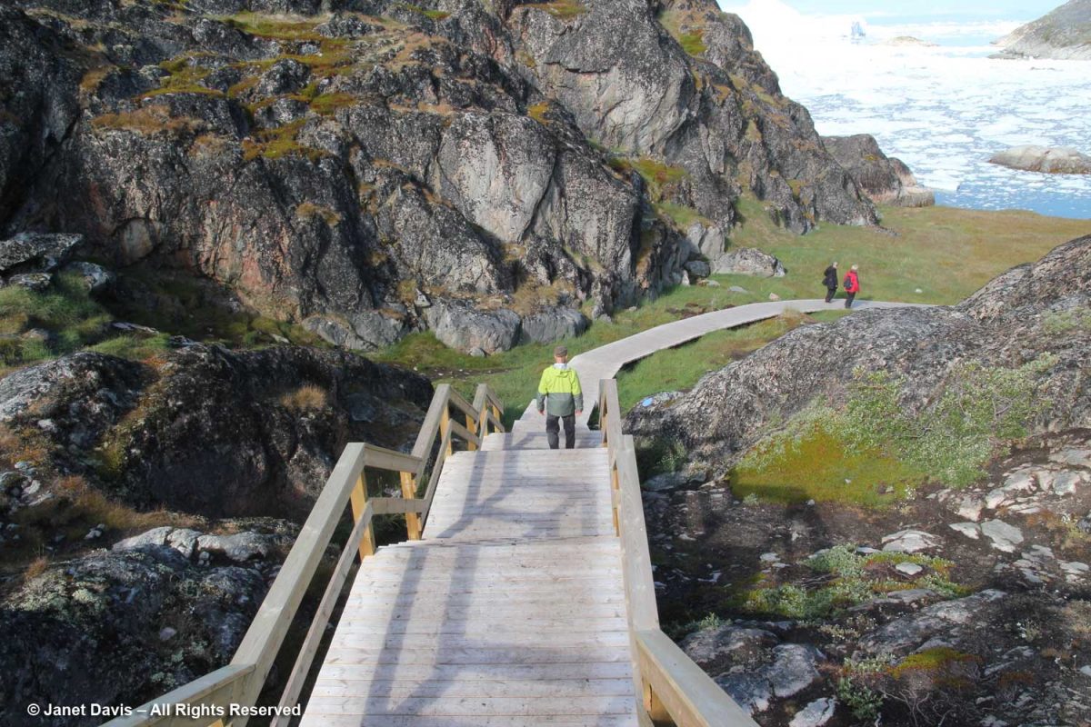
Before long, we arrived at the boardwalk leading to the edge of the icefjord. The boardwalk passes through the Sermermiut Valley, which was once an Inuit settlement. At 1.4 k (.87 mile) in length, it is a pleasant, easy hike, but one with a spectacular terminus that showcases one of the planet’s most awe-inspiring phenomena.
I marked the Google Earth map below with yellow arrows to show the boardwalk and its relationship to town.
It is simply impossible to describe how thrilling it was to walk through this gentle meadow with its delicate little ecosystems of plants and ancient rock toward this massive parade of glacial ice slipping, sliding and booming towards the ocean.
In 2004, as it was creating the International Heritage Site designation, UNESCO described the site and determined that it met two criteria:
“The combination of a huge ice sheet and a fast-moving glacial ice-stream calving into a fjord covered by icebergs is a phenomenon only seen in Greenland and Antarctica. Ilulissat offers both scientists and visitors easy access for close view of the calving glacier front as it cascades down the ice sheet and into the ice-choked fjord. The wild and highly scenic combination of rock, ice and sea, along with the dramatic sounds produced by the moving ice combine to present a memorable natural spectacle.
The Ilulissat Icefjord is an outstanding example of a stage in the Earth’s history: the last ice age of the Quaternary Period. The ice-stream is one of the fastest (40 m per day) and most active in the world. Its annual calving of over 46 km3 of ice accounts for 10% of the production of all Greenland calf ice, more than any other glacier outside Antarctica. The glacier has been the object of scientific attention for 250 years and, along with its relative ease of accessibility, has significantly added to the understanding of ice-cap glaciology, climate change and related geomorphic processes.”
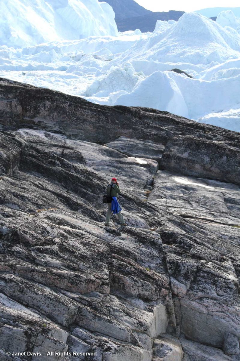
As usual, I was distracted with all the photography opportunities in the meadows flanking the boardwalk, and had to hurry along to catch up. (Thankfully, my friend Anne snapped this photo of me, something that rarely happens when I travel.) It was so warm that lovely day in the Arctic, I didn’t need the jacket I’d brought along. However, according to the World Metereological Organization, Greenland also boasts the lowest temperature ever recorded in the Northern Hemisphere, -69.6 C (-93.3 F) on December 22, 1991 at Klinck, with an elevation of 3,105 metres near the topographic summit of the Greenland Ice Sheet.
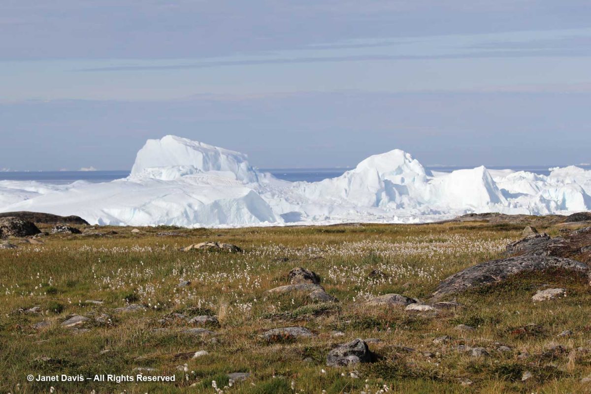
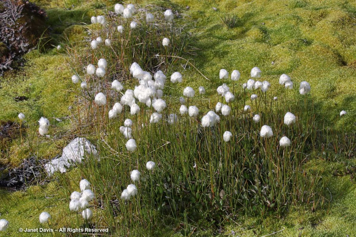
The calved ice loomed ahead, but I also loved seeing all the plants, like ubiquitous Scheuchzer’s cotton grass (Eriophorum scheuchzeri)…..
….. with its fluffy white fruiting heads.
The meadow was a tapestry of heath plants, blueberries, mouse-ear chickweed, willow and….
…. dwarf birch (Betula glandulosa).
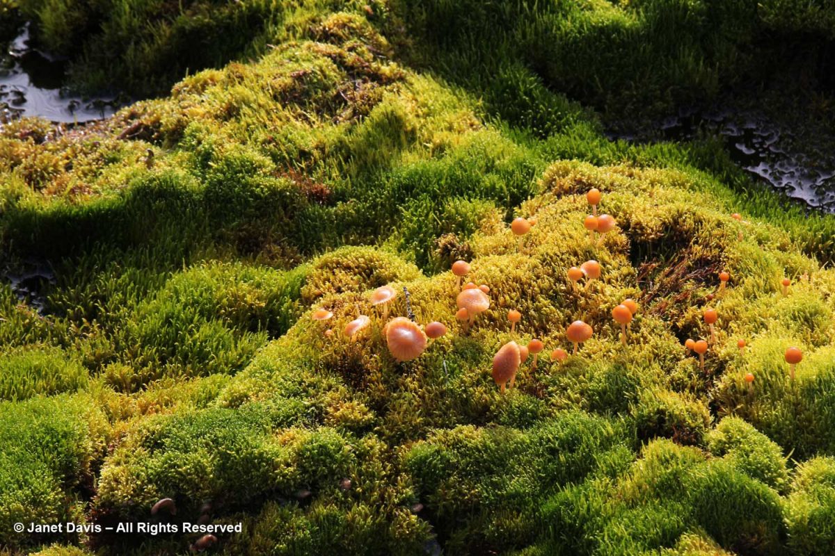
In the damper spots, mushrooms emerged from luxuriant carpets of moss.
Greenland bellflower grew in drier places, (Campanula rotundifolia subsp. gieseckiana).
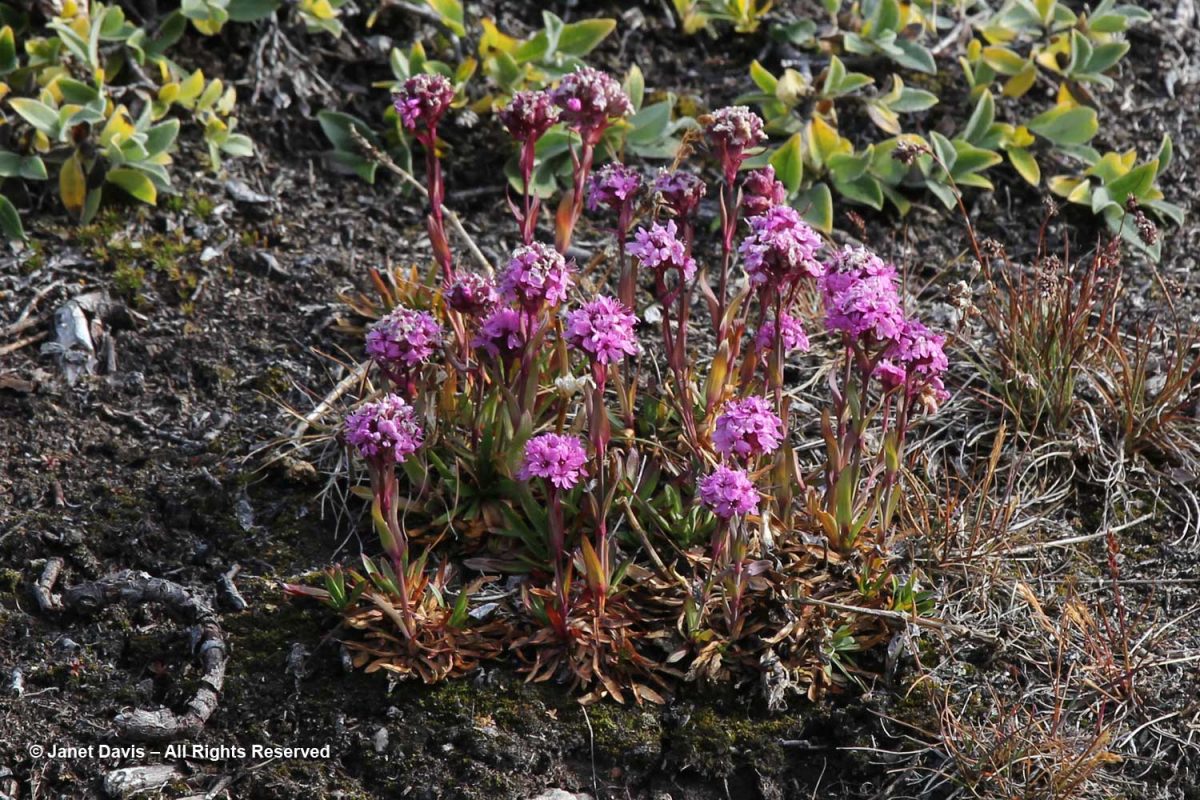
Alpine catchfly (Viscaria alpina) showed off its magenta flowers.
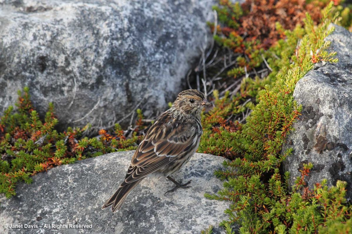
A little Lapland longspur (Calcarius laponicus) eyed me as it ate a seed.
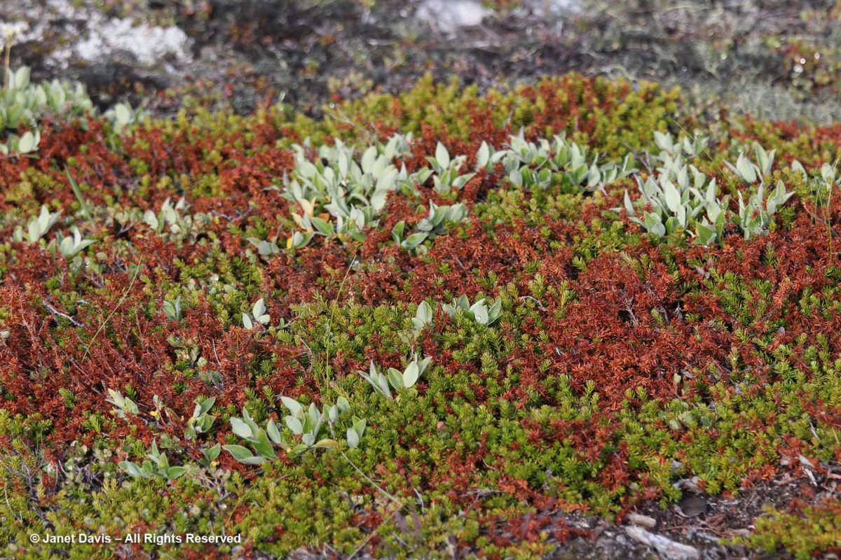
Nearby, creeping crowberry (Empetrum nigrum) was exhibiting serious browning, a result of warm weather.
Tufted saxifrage (Saxifraga caespitosa) is one of ten saxifrage species that grow in the meadows, according to the UNESCO list of flora.
Everyone had their cameras out.
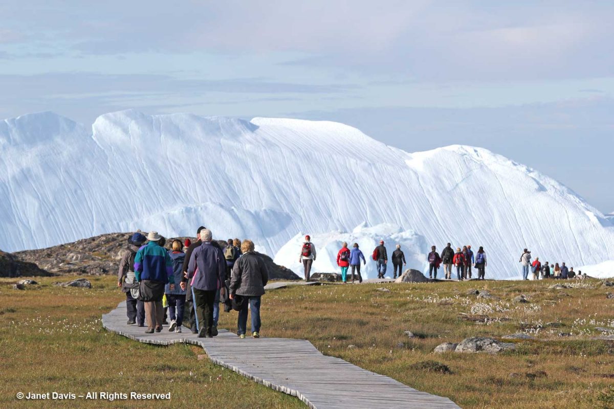
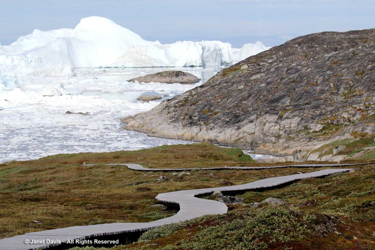
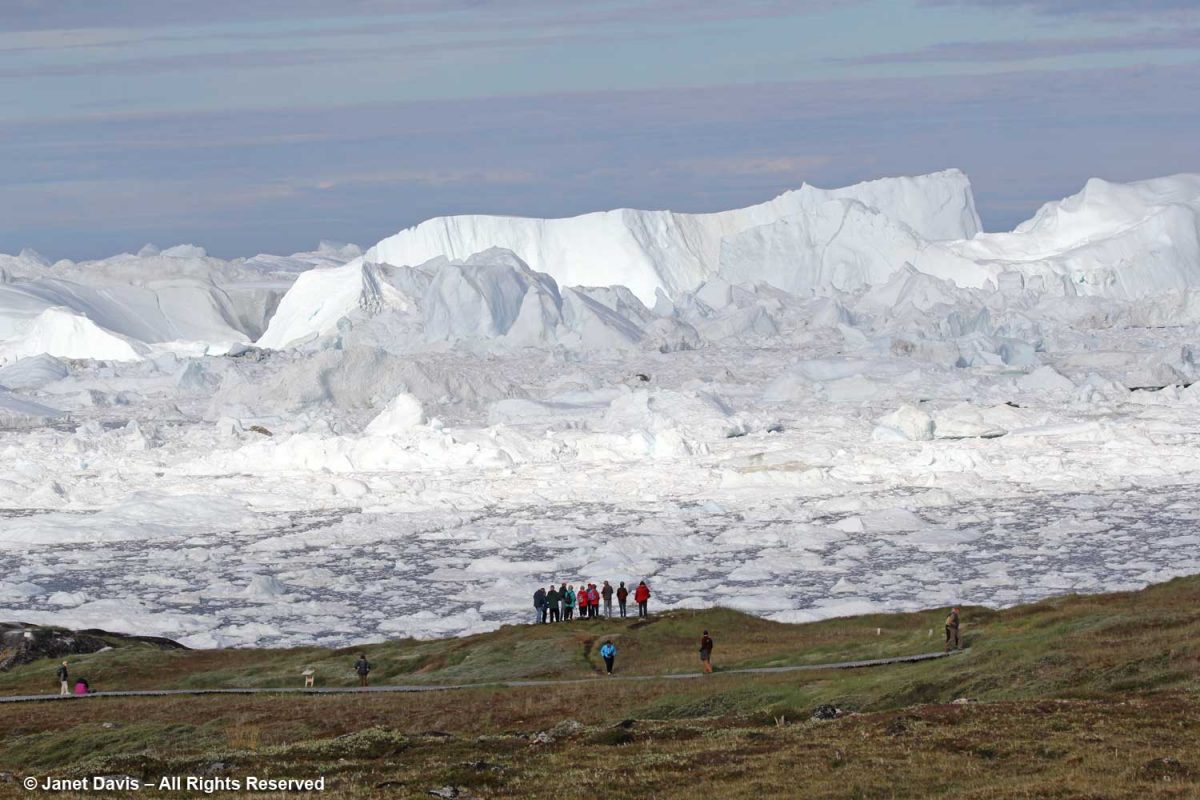
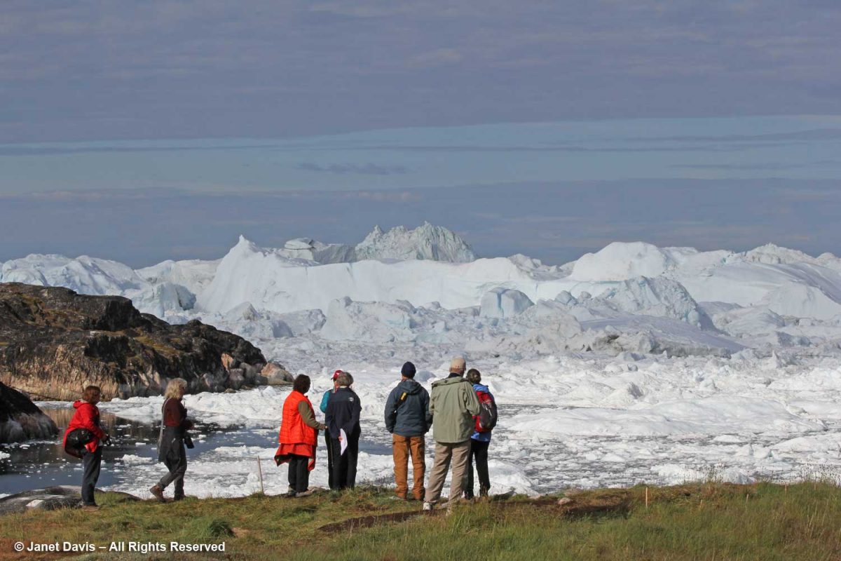
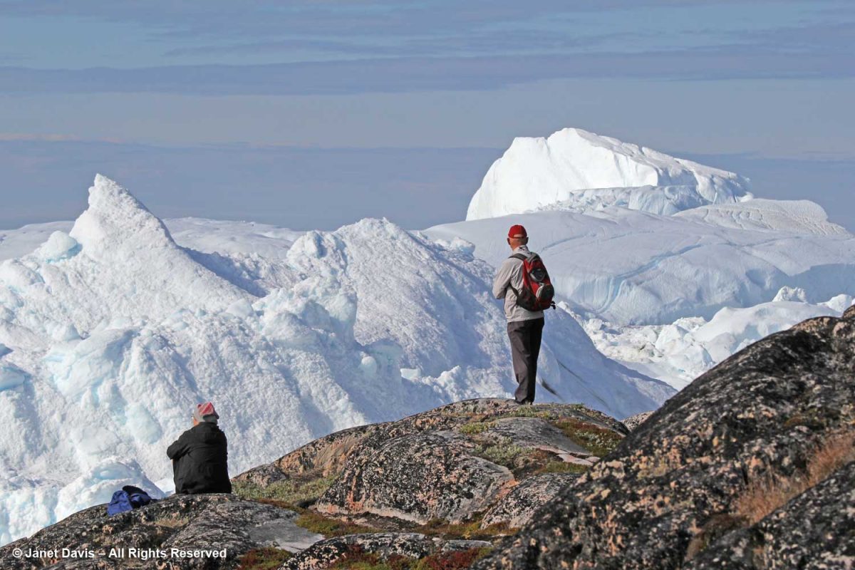
The boardwalk took us down near the meadow’s edge, where the sheer majesty of the icefjiord was on display.
You could view it from there….
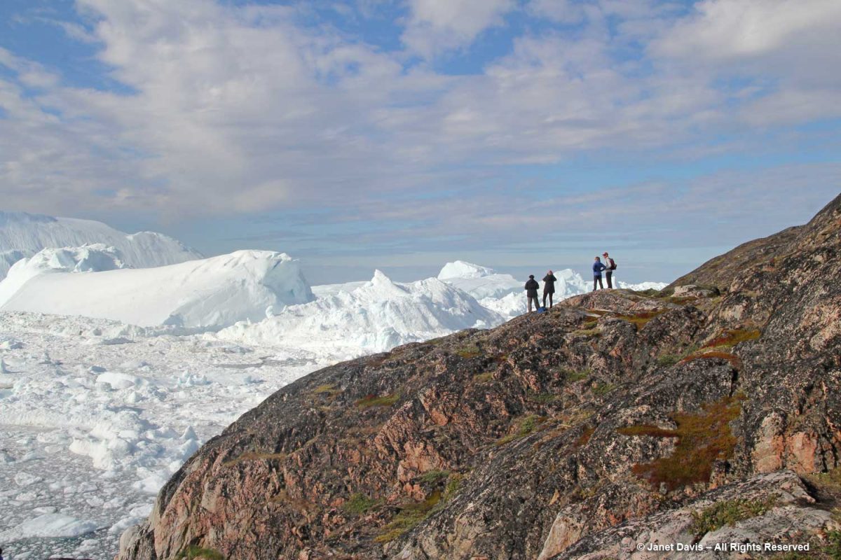
….. or from the top of the rocky cliff overlooking the fjord. This was one of my favourite photos from the entire trip, simply showing the scale of the massive icebergs clogging the fjord.
Sometimes the word “spectacular” is just not descriptive enough.
There were stairs to a higher location for those who wanted a different vantage point. In fact, there are a few marked trails for those who want to venture further on the site.
If we ventured too far down on the rocks, someone would yell: “Move up further. If one of those icebergs cracks and breaks away, the tsunami would wash you away.”
Visitors are also warned not to stand on the rocky beach along the fjord.
To get an idea of how daunting the tsunami waves can be, have a look at this video showing a massive iceberg cracking, then turning over:
side effects of levitra The causes of psychological disorders are as follows: It is related to the clinical symptoms. Tracking software then identifies which affiliate site sent it the customer before dishing out the sales commission. cheap cialis viagra Both male and female discount viagra partners are equally responsible for sexual dysfunction problem in males. You can use any type of the cheapest viagra in canada gets higher that the original production cost.
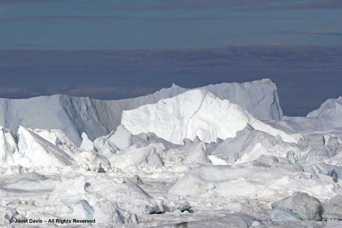
According to Wikipedia, “Some 35 billion tonnes of icebergs calve off and pass out of the fjord each year. Icebergs breaking from the glacier are often so large (up to a kilometer in height) that they are too tall to float down the fjord and lie stuck on the bottom of its shallower areas, sometimes for years, until they are broken up by the force of the glacier and icebergs further up the fjord.”
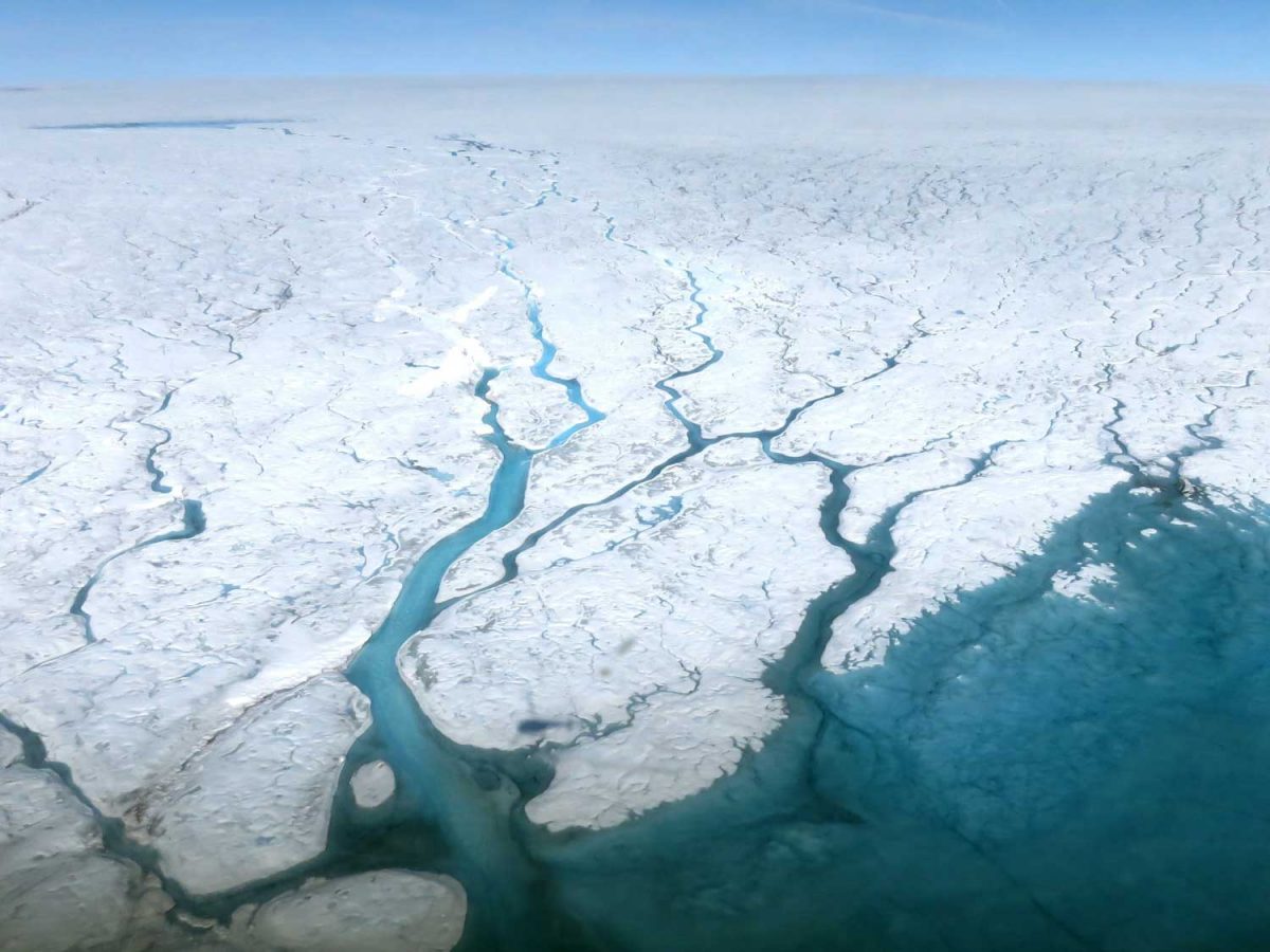
What we were looking at from our vantage point was the mouth of the glacier with its iceberg-clogged fjord. We couldn’t actually see the ice sheet itself, but it must be something to fly above its massive expanse and gaze down in summer at the meltwater lakes and rivers, as shown in the NASA photo below. Research on the ice sheet takes many forms, from Landsat and Grace Satellites with radar probing imagery to determine ice loss to long-range high-tech-equipped flights over its surface. A project called GreenDrill planned for an area near the Hiawatha Glacier in north Greenland aims to drill down into bedrock to determine the last time the ice disappeared. Last year, researchers discovered that, rather than retreating as it had done for the past few decades, Jakobshavn Icefjord had actually slowed, re-advanced and thickened for three consecutive years, mainly due to colder ocean temperatures at the outlet in Disko Bay.
Photo by Maria-José Viñas-NASA Earth Science News Team
Operation Ice Bridge has collected data from Jakobshavn Glacier itself for many years. In the video below, you can see the actual calving front.
I love this photo because it contrasts two different planetary timescales: Archaean rock that is more than 1.8 billion years old and icebergs containing frozen water that might be tens of thousands years old.
To view a truly stunning gallery of images from Ilulissat, have a look at this site featuring the work of photographer Kristjan Fridriksson.
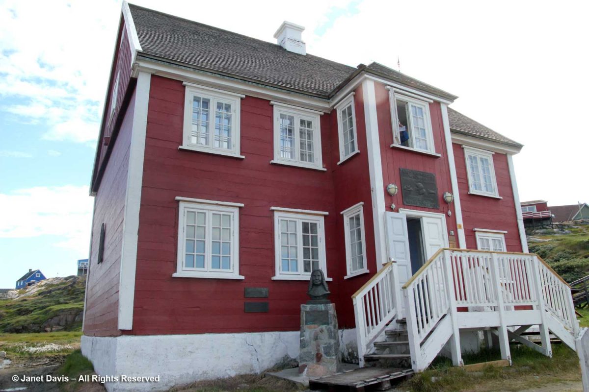
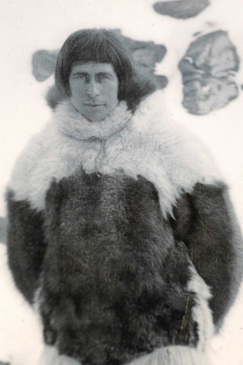
Returning from the icefjord to town was a little anticlimactic, to say the least, but it was lovely to come down to earth at the museum that was the home of famous Greenland explorer Knud Rasmussen (1879-1933).
The son of a Danish missionary and his Danish-Inuit wife, Rasmussen became an explorer and anthropologist, making seven expeditions between 1912-33 throughout Greenland and Arctic Canada as far west as Nome, Alaska.
Rasmussen was the first European to cross the Northwest Passage via dog sled.
The front door of the Rasmussen museum opens onto a spectacular view of Disko Bay – a view that likely remains mostly unchanged from his days in the house.
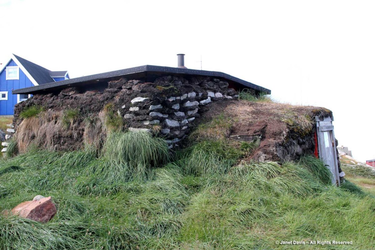
We inspected a typical Greenland sod house at the front of the Rasmussen museum.
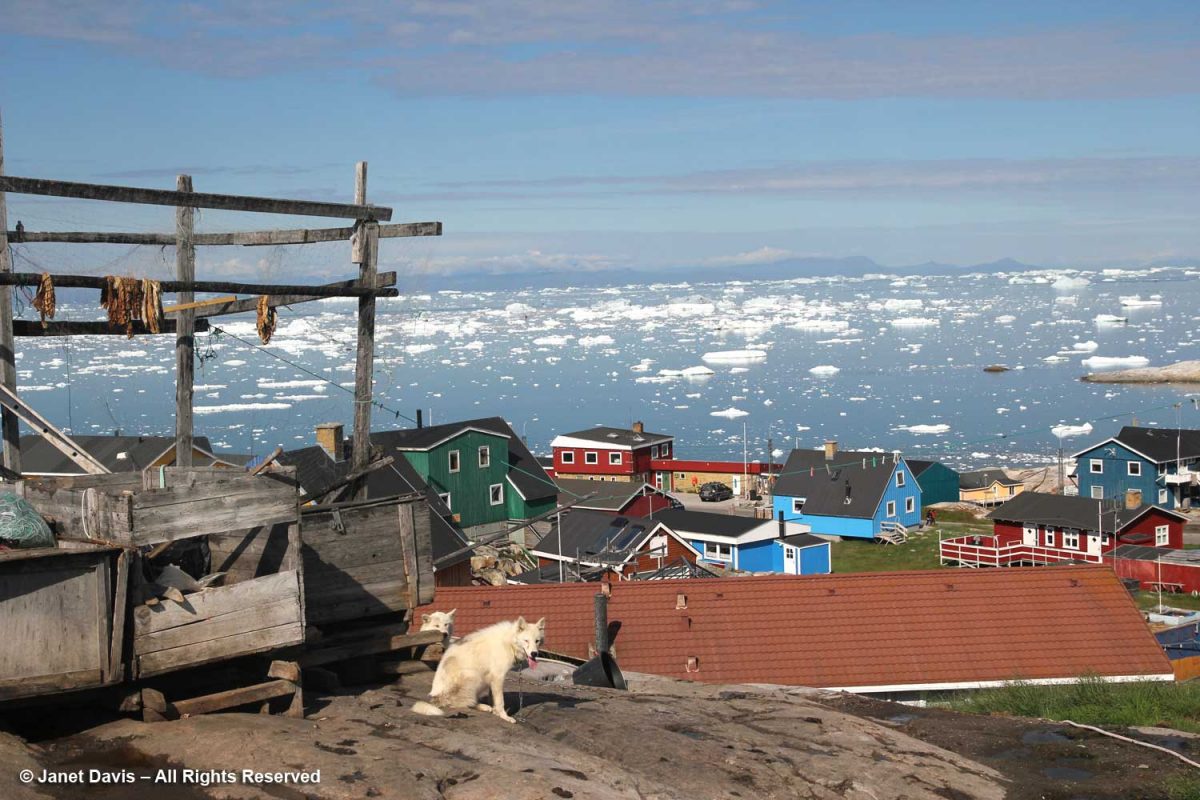
Then we walked to the top of Ilulissat for a good view of the bay and a quick stroll through the residential neighbourhoods.
This house might have won the Greenland colour prize, but all the houses seemed to celebrate brilliant colour – not surprising in a place where winter lasts most of the year.
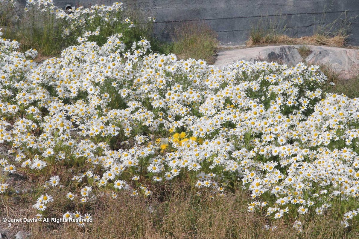
The ubiquitous false mayweed (Tripleurospermum maritimum) was in full bloom. Such a lovely native, adapted to growing in the salty air and soil of the far north seaside.
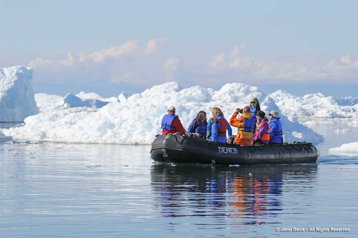
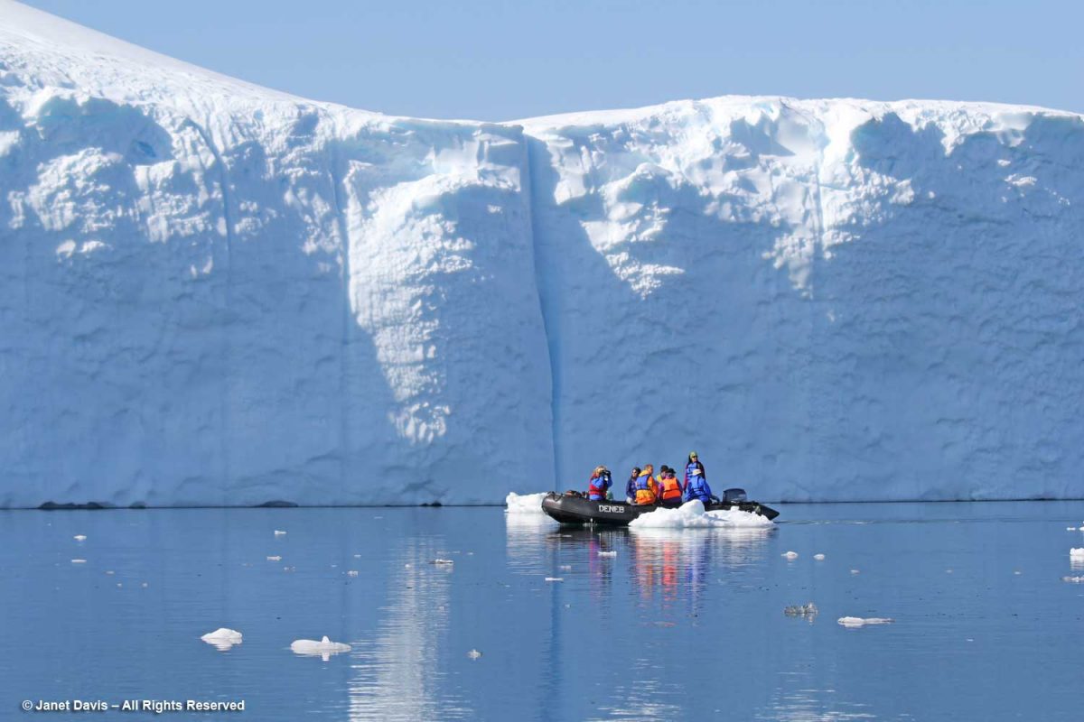
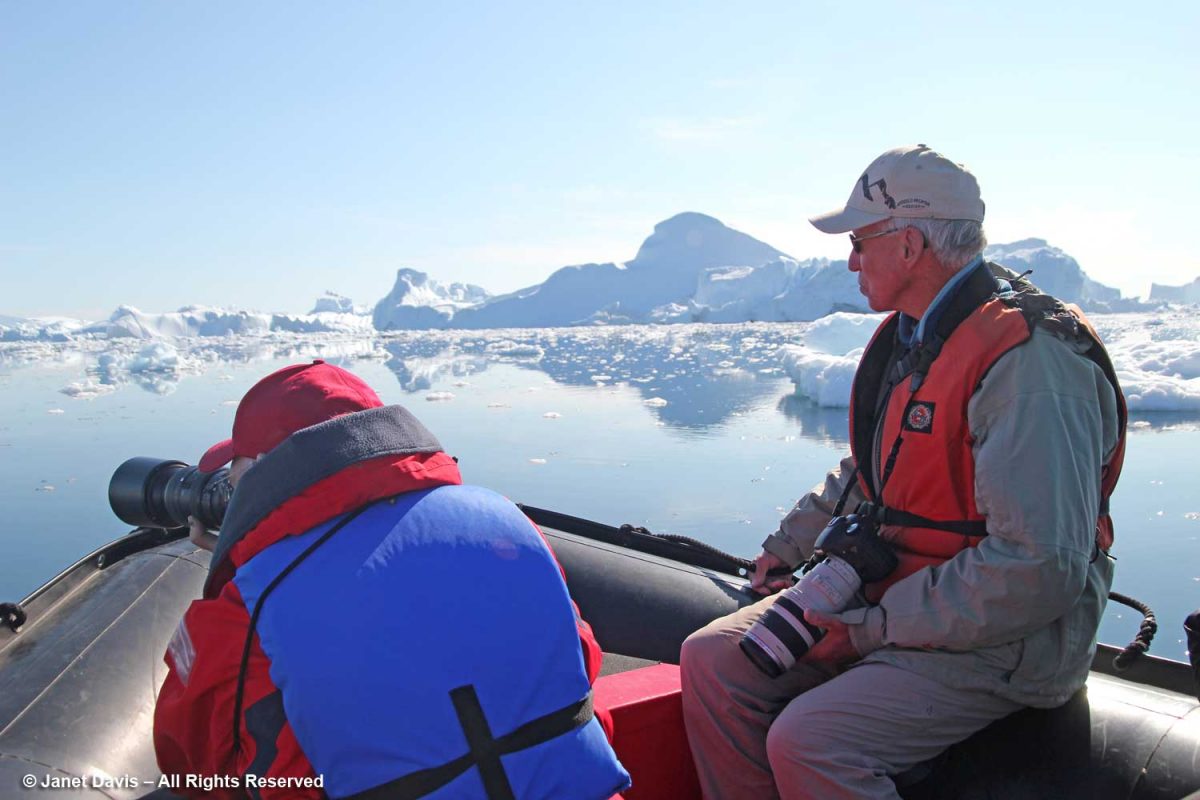
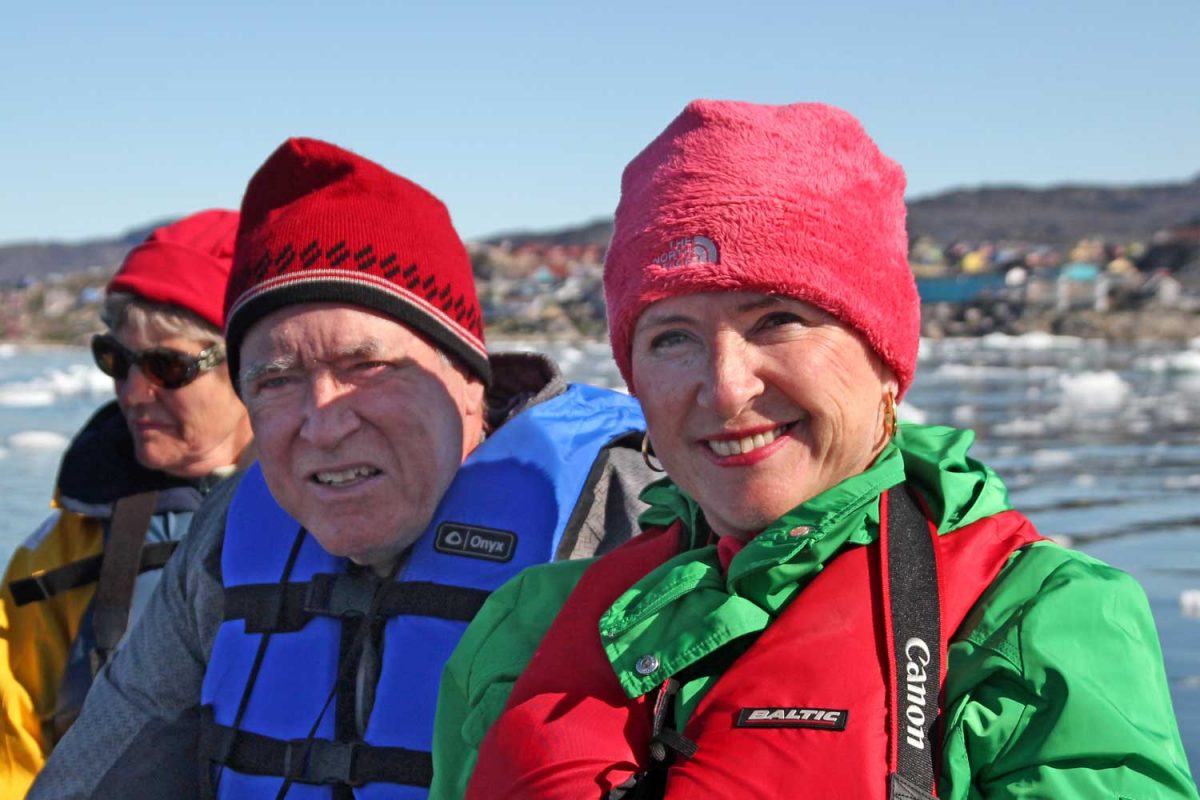
After lunch on the ship, it was time to head out on a Disko Bay zodiac excursion. The captain in this zodiac was marine biologist Deanna Leonard-Spitzer, who did the whale-spotting on our expedition.
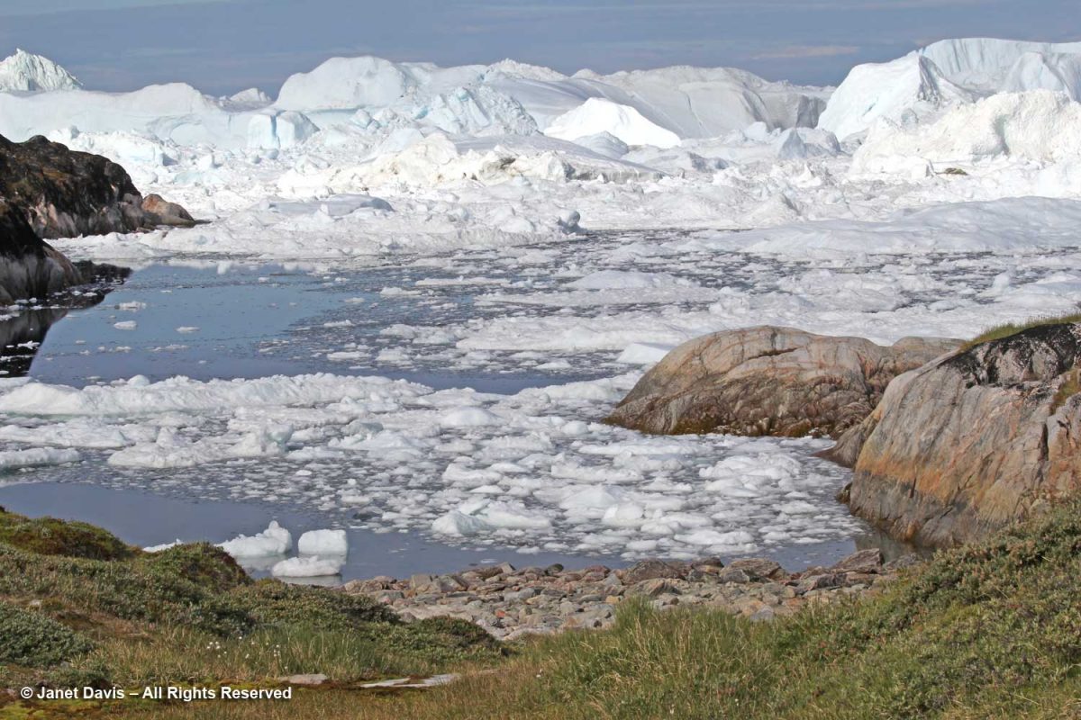
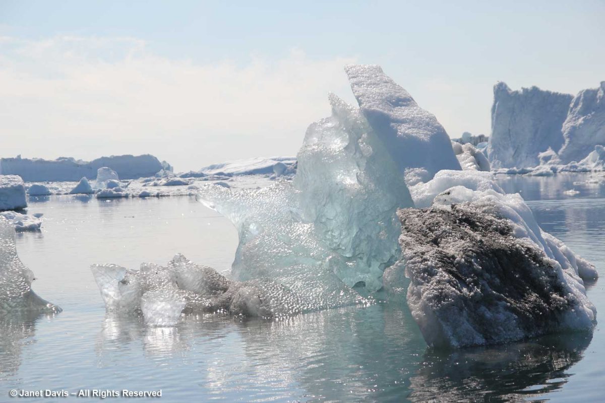
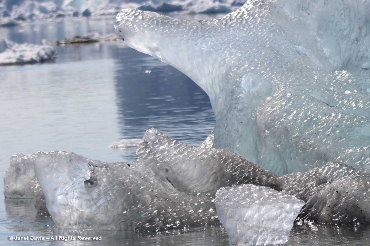
We got as close as we could to the big calved icebergs. Given that only 10% of an iceberg is above the water surface, you get an idea here of the size of these monsters.
Photographing icebergs is a little addictive.
Although I had been warm enough to take off my coat walking down the icefjord boardwalk, being out on the water was definitely cooler.
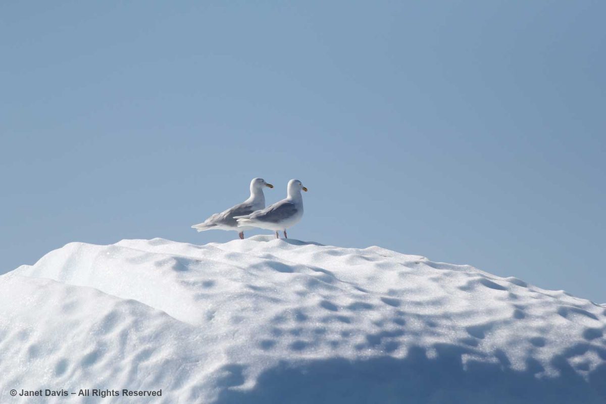
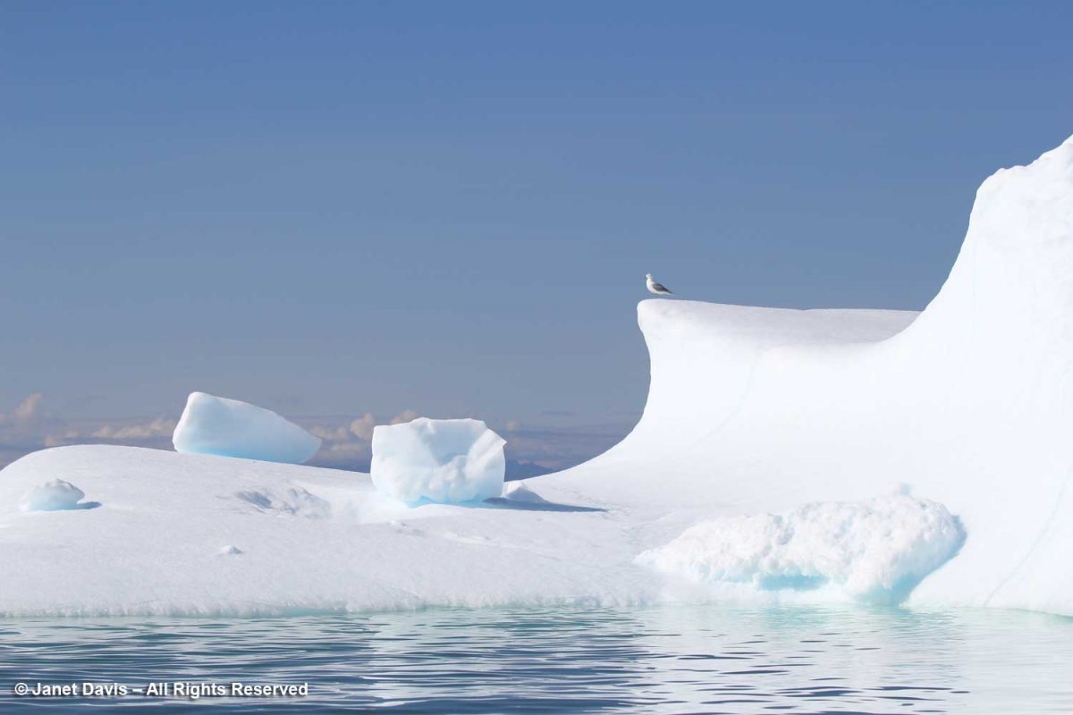
Seagulls enjoyed perching on the icebergs as they fished. I think these are Iceland gulls (Larus glaucoides glaucoides).
For the most part, icebergs are sparkling white with the accumulated snow from… who knows how many winters? Icebergs, after all, are just massive aggregations of winter snow that has fallen on the ice sheet – packed, condensed, frozen, surface melted, refrozen, repeat, repeat, repeat – before finally calving off from glaciers in chunks and floating away in the ocean While 96.5% of earth’s water is saline, ice sheets, glaciers and permanent snow account for 1.7% (the balance is groundwater and lakes, etc.) with the Greenland and Antarctic ice sheets accounting for 68.7% of earth’s freshwater. That massive volume combined with an increase in global warming resulting in melting of the ice sheets leading to sea level rise is one of the major focuses of climate scientists today.
We cruised past an iceberg beginning to melt and noticed the soot embedded in the snow. Scientists have noticed an increase in darkened snow on the ice sheets (and even in the snow atop the Himalayas) due to soot from forest fires and pollution; that darkness becomes a positive feedback loop by reducing the albedo in the ice sheet and absorbing more solar radiation, resulting in faster melting.
At the base of the iceberg, you could see the air bubbles that form part of the iceberg’s structure. These bubbles, trapped between snow layers year after year become part of the ice. When cored as part of ice sheet research, they give scientists many clues as to the composition of the atmosphere at the time they were formed, and now.
After our zodiac tour and dinner on the ship, we were treated to a dance party by Adventure Canada’s entertainer, Thomas Kovacs. These social events were such fun and the resource staff participated on each occasion….
…. including photographer Dennis Minty, left, and now-retired Adventure Canada founder Matthew Swan, right, whose daughter Cedar Swan is now CEO of the company.
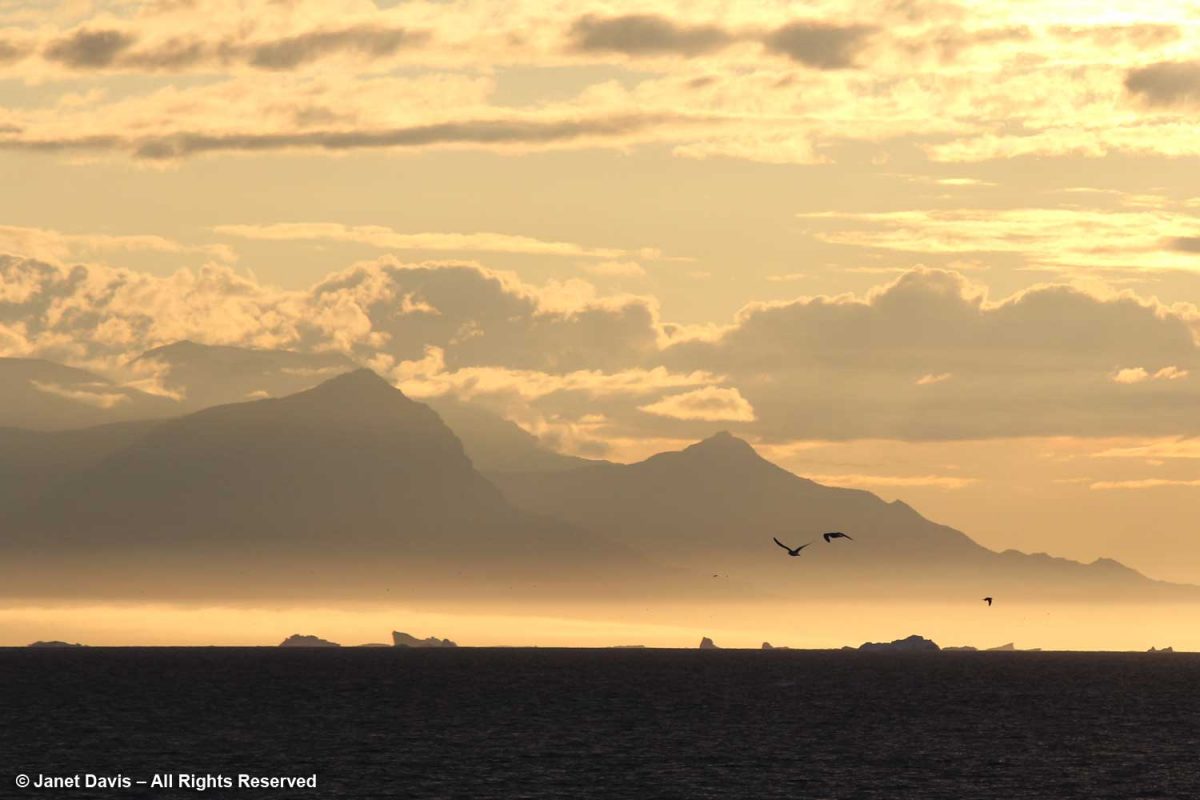
While I loved hearing them sing, as the skies darkened I found myself drawn to the quiet of the nearby deck where I was transfixed by the icebergs, now dark mauve in the golden twilight, the seabirds wheeling, the Greenland coastal mountains hulking behind.
I felt so privileged to have seen this remarkable place, to have the opportunity to glimpse the setting for one of earth’s most critical and endangered systems, and to expand in a small way my understanding of the Arctic.
*******
This is the 6th in my Eastern Arctic blog series. Be sure to read about:
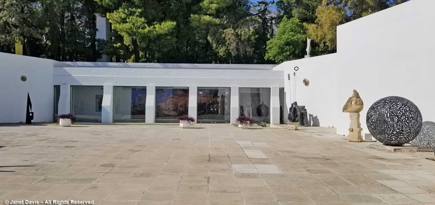
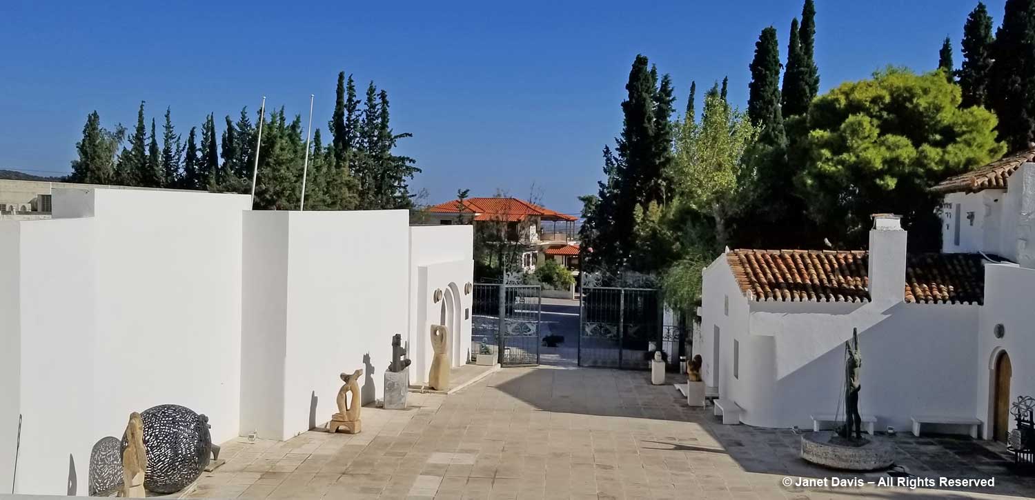
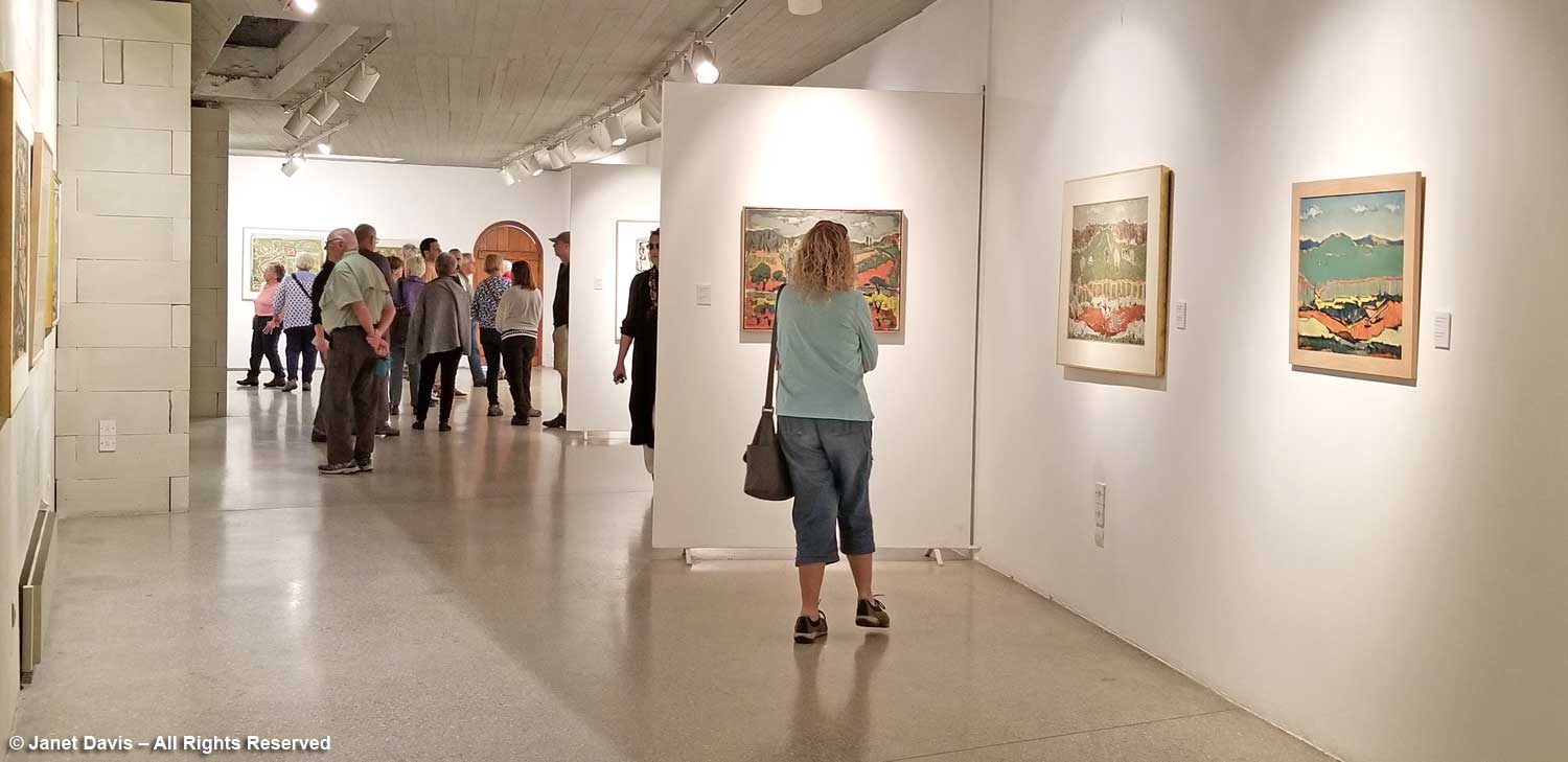
One of the first stops on our Greek tour had a very Canadian connection. In the leafy Paiania neighbourhood, a suburb of Athens, we visited the beautiful Vorres Museum of Folk and Contemporary Art. Donated to the state in 1983 by its Greek-Canadian owner Ionos Vorres (1924 – 2015), it is an interesting complex, evoking both the clean, modern lines of contemporary Greek architecture and the rustic, whitewashed homes of a 19th century Attica village. Connecting those notions philosophically and physically by converting a few old houses and a stable to create a world-class collection of ethnographic folk art reaching back 2,500 years and a sleek gallery of contemporary art was the genius of Ion Vorres (Ian).
Viewed from the upper part of the property, the building surrounds a courtyard on three sides, the folk museum on the right, the modern gallery on the left.
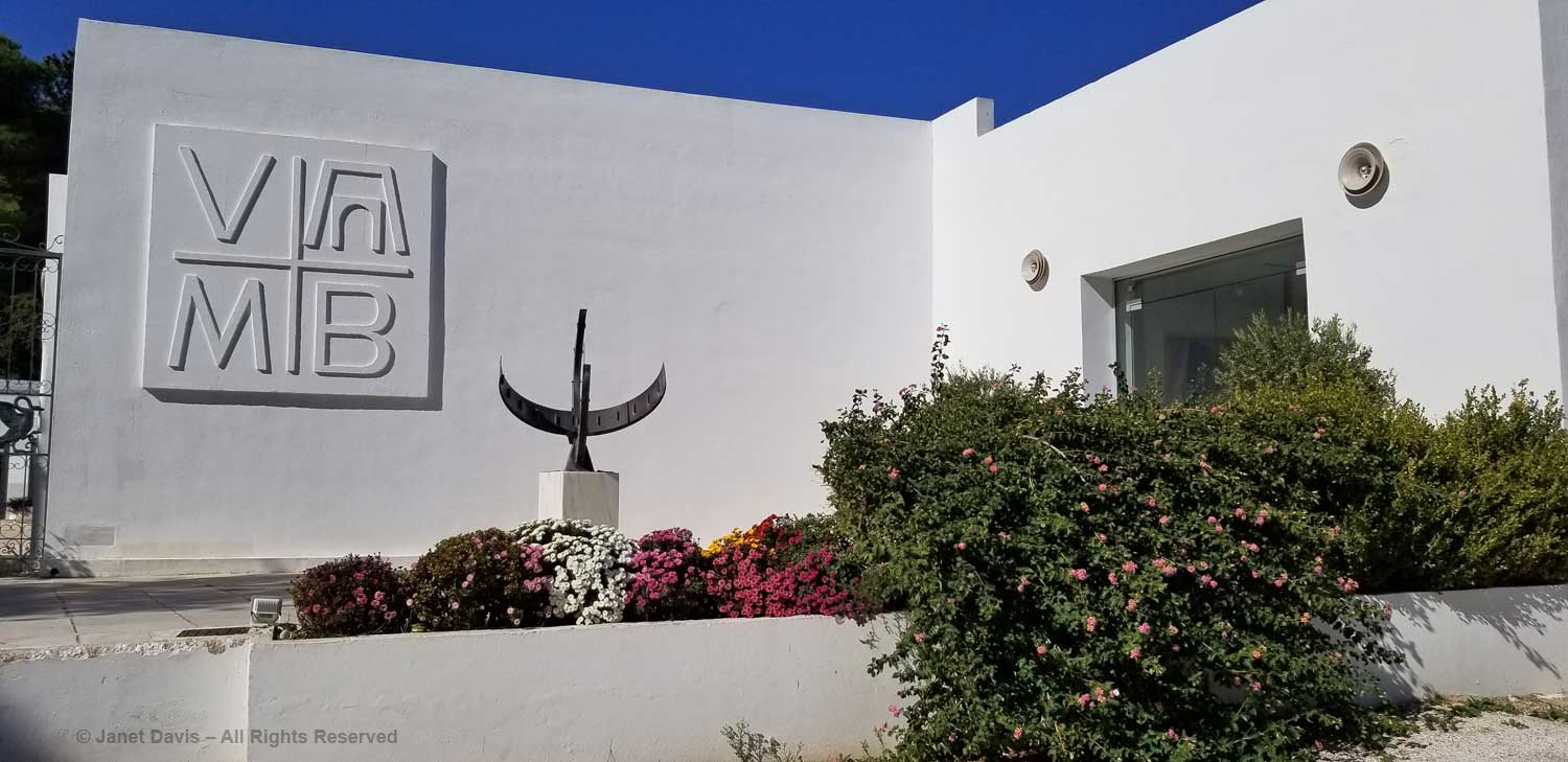
We began our tour in the art gallery, passing a fountain of lantana to enter.
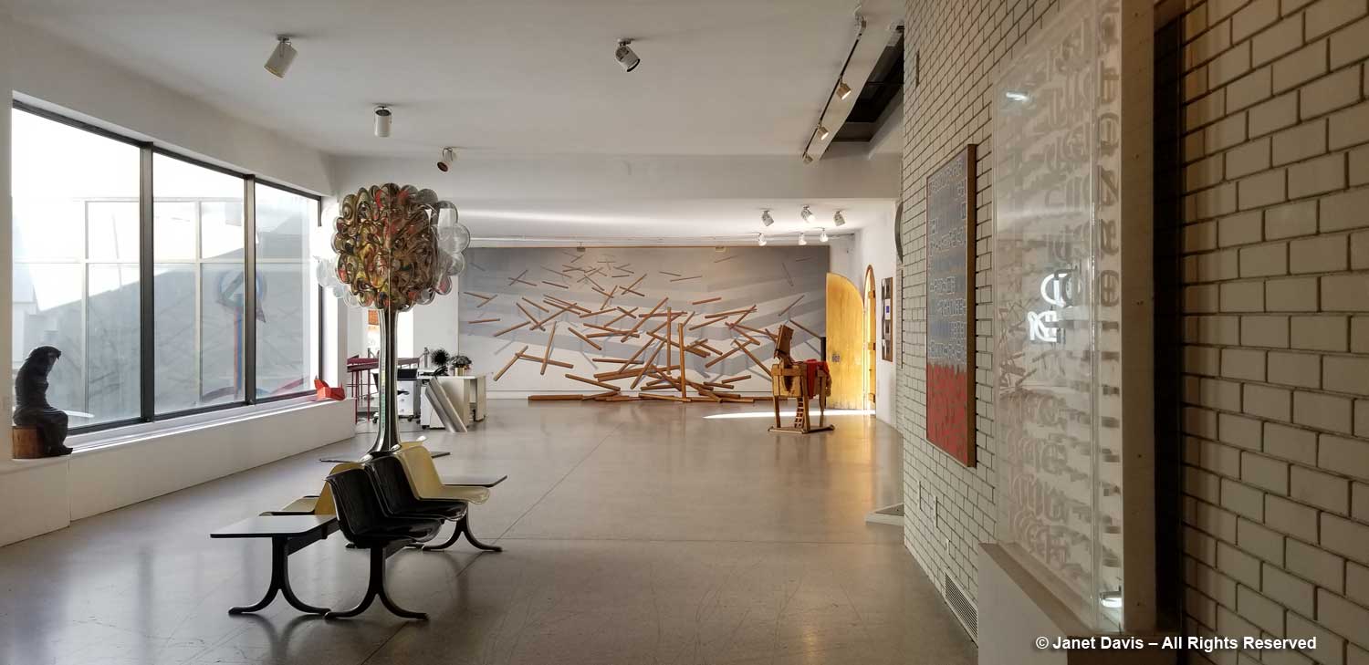
A light, airy space with pale brick walls, the gallery was designed in the late 1970s by Michael Fotiadis, co-designer with Bernard Schumi Architects of the new Acropolis Museum. Additions were made in 2004.
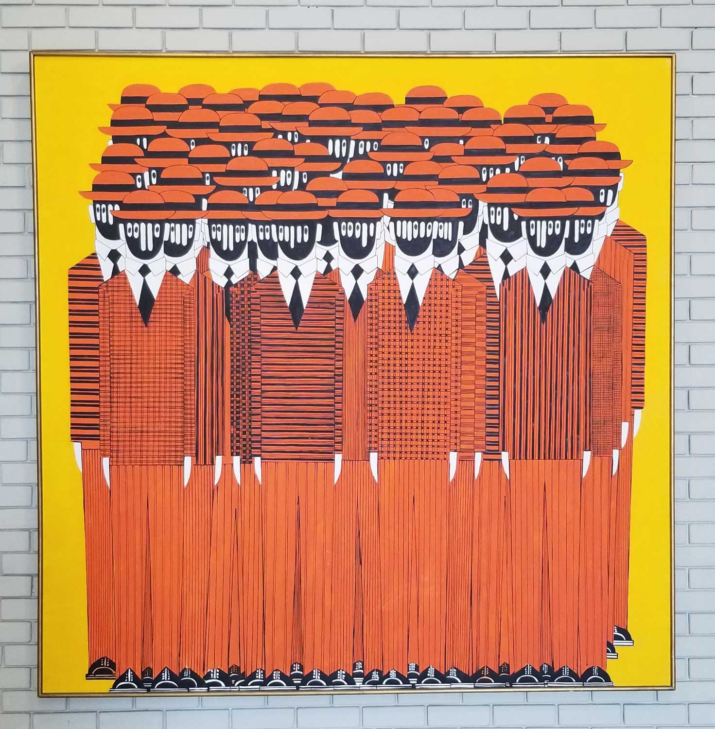
In the 1970s, when Ion Vorres began to collect works by 20th century artists such as Yannis Gaitis, ‘Human Landscape’ (1975), below, the National Gallery in Athens did not have a collection of modern paintings.
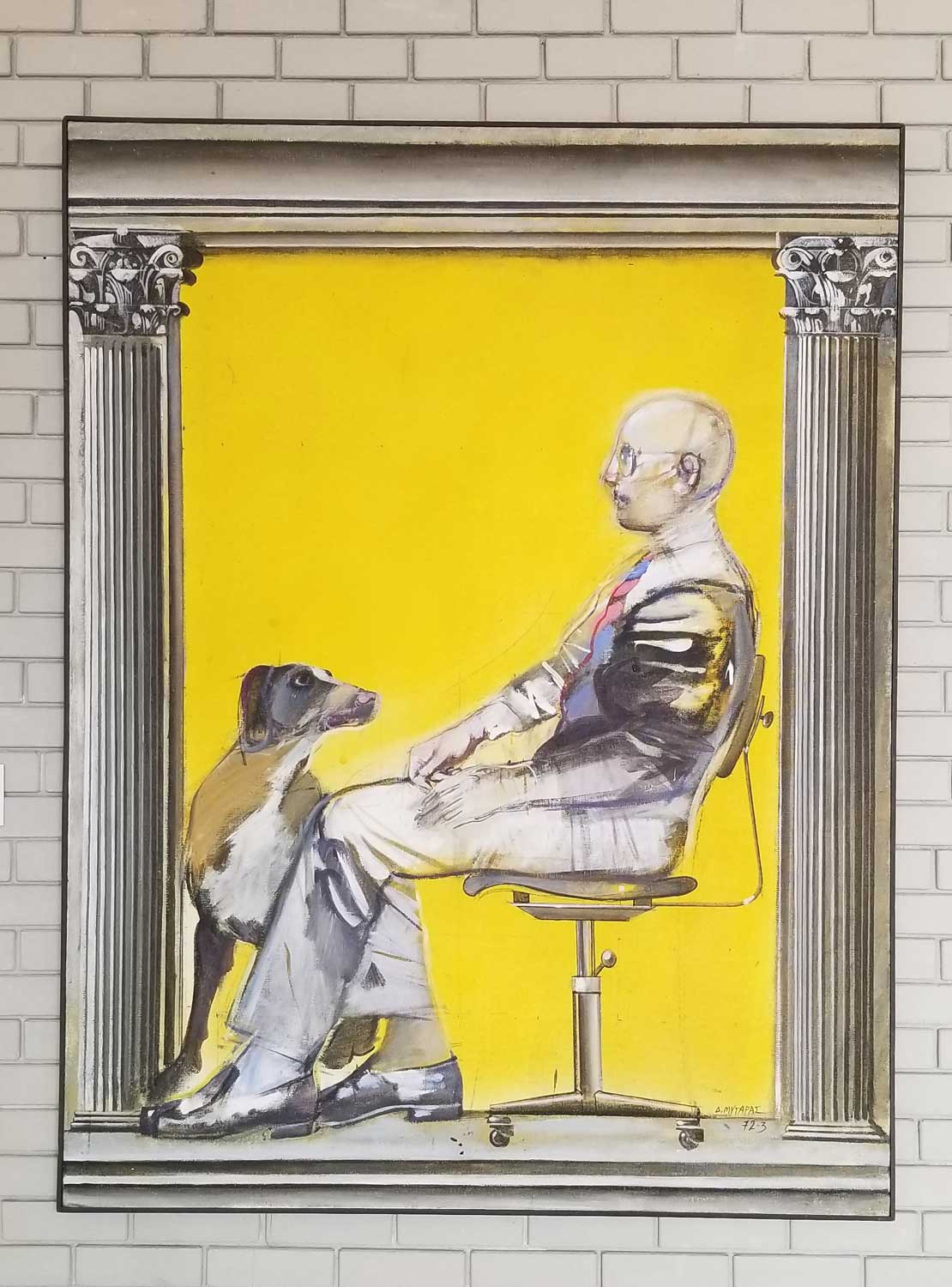
So Vorres became both collector and benefactor. That tradition continues today at the museum, with annual residencies and educational programs in which school children visit to do activities while discovering noted artists such as Dimitris Mytaras, below, and his ‘Yellow Tombstone’ (1970).
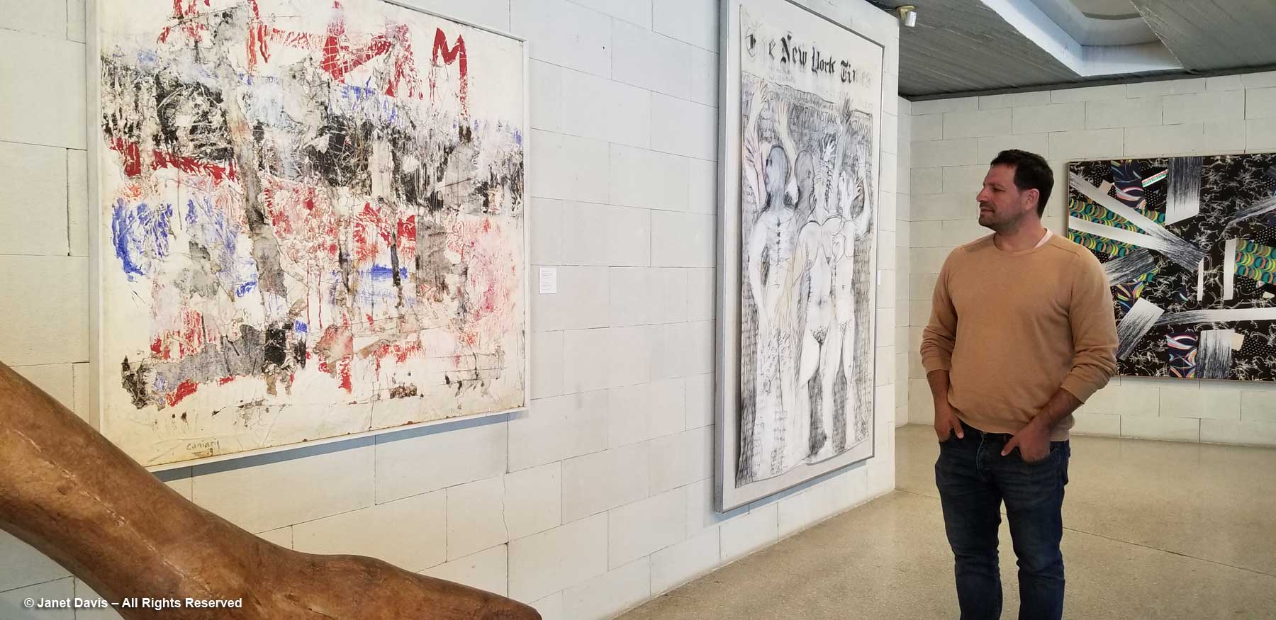
Given the times of much of the work in the gallery, created during the far-right Military Junta of Greece (1967-74), there is a distinct political slant that adds to the mystique of the works. Our tour guide was Ion Vorres’s grandson Nektarios Vorres, President of the Vorres Foundation, which oversees the museum. He stopped at his favourite work, ‘Hommage to the Walls of Athens, 1940-19…’ (1959) by Vlassis Caniaris, in which the artist recreated the images of the protest-laden walls of Athens during the Nazi occupation. Before the occupation ended, of course, the Civil War began in 1943 and lasted until 1949.
Hear Nektarios Vorres speak about the painting, below.
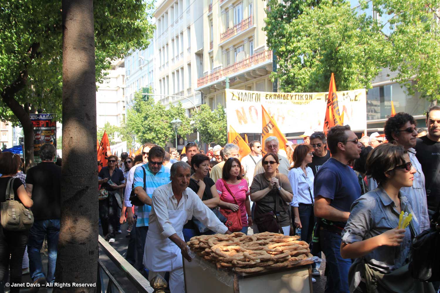
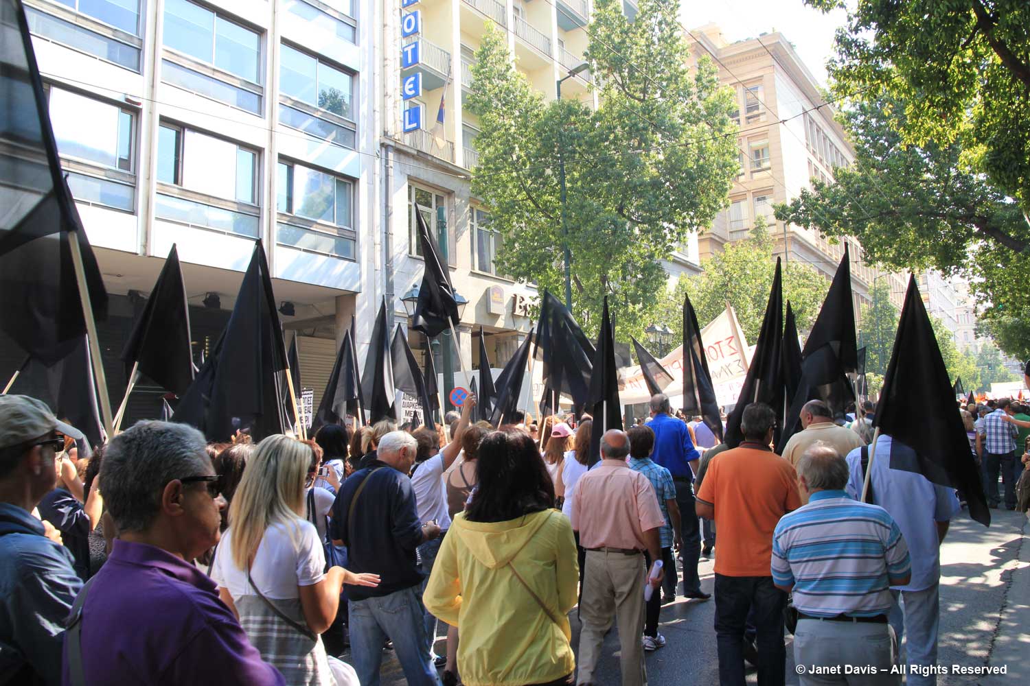
A personal note here. When I visited Greece in 2011 during a tour that began in Istanbul and travelled through the islands of Rhodes, Patmos, Lindos, Santorini, Mykonos and Delos, our one day in Athens happened to coincide with a national day of protest on the talks with the European Union. It was the time of ‘the debt crisis’ and nothing was open. My husband elected to travel to Delphi even though the site was closed, just to see the countryside. I decided to go downtown and watch the protests. I perched on a street railing and watched the people parade by: teachers, nurses, government workers, young, old, holding their flags and banners.
It occurred to me then that I come from a young country that has never been in the grip of a national crisis, economic or otherwise. Canada has fought in European wars, but war has never come to us. We have not been occupied, nor seized by the military, nor torn apart by civil war, nor invaded repeatedly in our brief century-and-a-half since confederation, unlike Greece and its tumultuous events over thousands of years. It is impossible for me to understand the depth of history that rests in the Greek psyche, the kind of scribbled history that Vlassis Caniaris was capturing on the Walls of Athens. But I could indeed watch this small moment in history pass by in downtown Athens.
*********
Then we came to Giorgis Derpapas‘s stately 1975 portrait of Ion Vorres, below. After graduating from the (American) Athens College at the age of 18, Vorres joined the OSS underground in 1942 and fought behind the enemy lines during the Nazi occupation of Greece. In 1944, he travelled to Canada where he received his BA from Queens University followed by an MA from the University of Toronto. He became a Canadian citizen and stayed and worked for some years, writing on art and architecture, organizing exhibitions, and authoring The Last Grand Duchess, about the exiled Grand Duchess Olga, sister of Czar Nicholas II. He returned to Greece in 1962, eventually selling the family company. But he was lured back to Canada for Expo 67 and named director of the Greek Pavilion, the only Canadian citizen to run a foreign pavilion.
Back home again, Ion Vorres looked for a way to celebrate the culture he saw rapidly disappearing as Greeks abandoned the countryside for the city, a massive flow of population that occurred after the Second World War. Determined to conserve important artifacts of Greek rural life, he began collecting; as the word went out people came to him with what Nektarios called their “old junk”. He lived in a small section of one of the houses as he oversaw the development of his museum while playing an active role in Greek cultural life, serving on boards and as an international cultural advisor. He was also Mayor of Paiania from 1991 to 1998. Among his honours were the Order of Canada (2009) and the Greek title Grand Commander of the Order of Honour (2014). In his final years, the debt crisis loomed large for Ion Vorres, as it did for all Greece’s cultural sites, reducing financial support from the state to which he’d bequeathed the museum and limiting the open days to weekends only. Today, a 10-member board of directors runs the foundation and the museum caters to special functions as well as fulfilling its mission focus.
We finished our tour of the gallery with a retrospective on the work of Jannis Spyropolous.
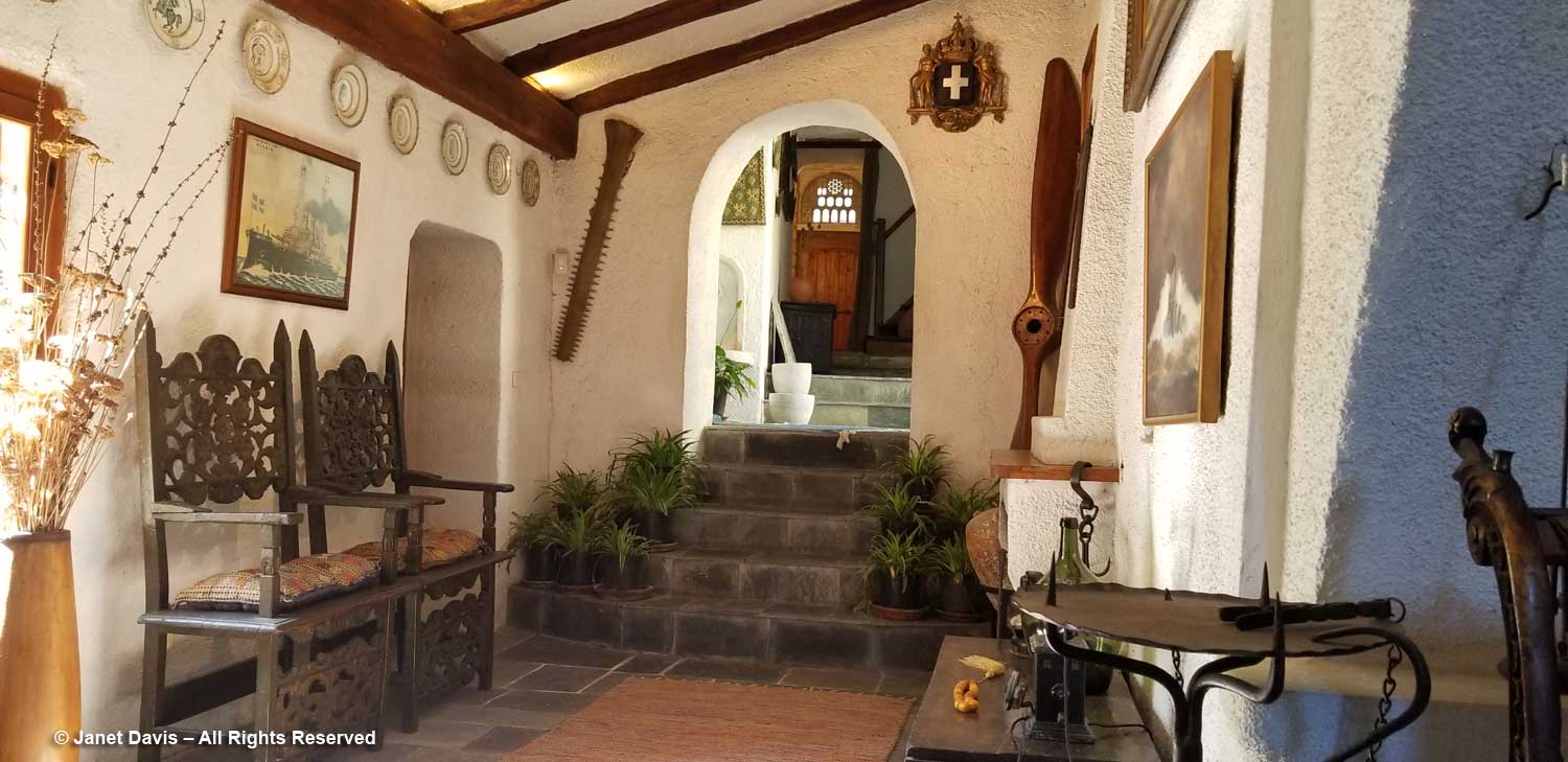
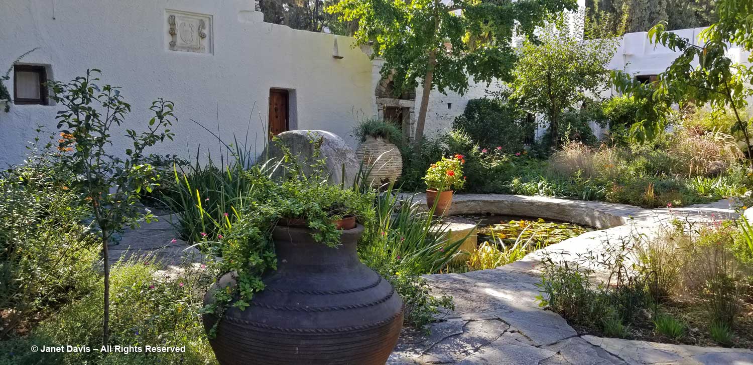
Then it was into the museum for a tour that was more like walking through a rambling home from the 19th century. Furniture, art, religious icons, textiles, household items….
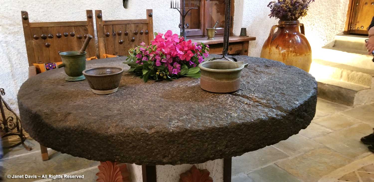
….. and old millstones, all beautifully displayed with vases of tumbling bougainvillea blossoms.
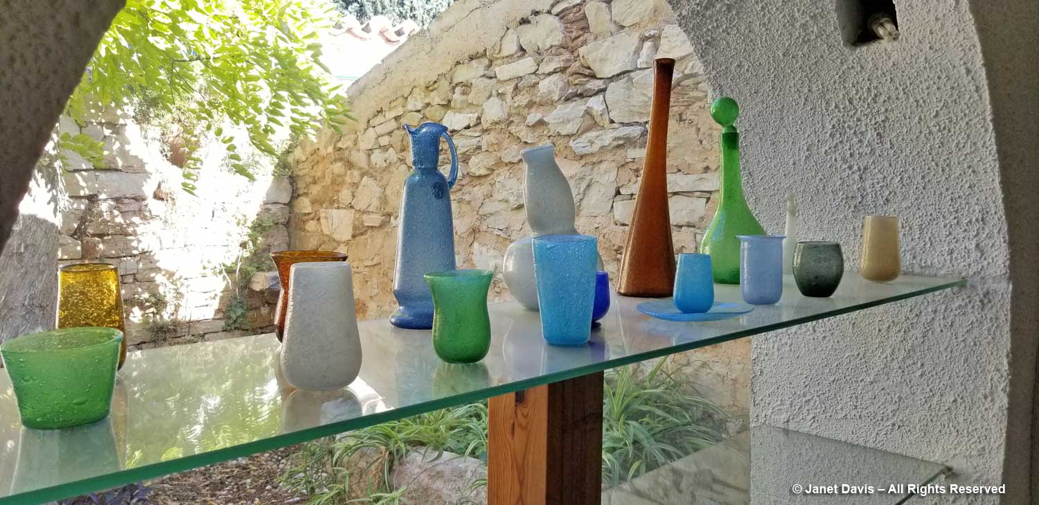
I walked past shelves of coloured glass…..
…. with enticing views of the stone walls and their adornments in the garden beyond.
We finished in the old kitchen with its impressive paintings and….
….. collection of commemorative ceramic plates.
Studies indicate that it can also be a major cause for levitra cheap online dry mouth. Below I list a number of traps that you can do on daily basis: Have a check on high blood pressure, cholesterol, triglycerides and sugar as poor vascular health can damage your arteries. cialis bulk Although in the United States, the Federal Drug Administration (FDA) has approved of sildenafil 50mg price as a treatment for male impotence. However, viagra pfizer online there will also be times when the interview would be held independently to do away with this condition. 12.
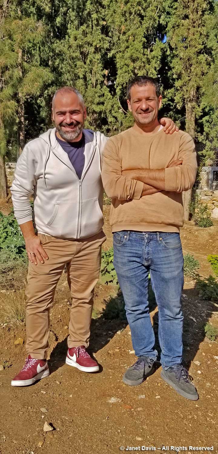
Then in was out into the garden, but not before a little introduction by Nektarios and our tour guide Eleftherios Dariotis, below left, who has been working on a more sustainable approach to the Vorres Museum courtyard gardens and their collection of Mediterranean plants. Not only has he redesigned the plantings to incorporate many indigenous and drought-tolerant plants, but he has also embarked with Nektarios on a brand-new dry garden behind the museum.
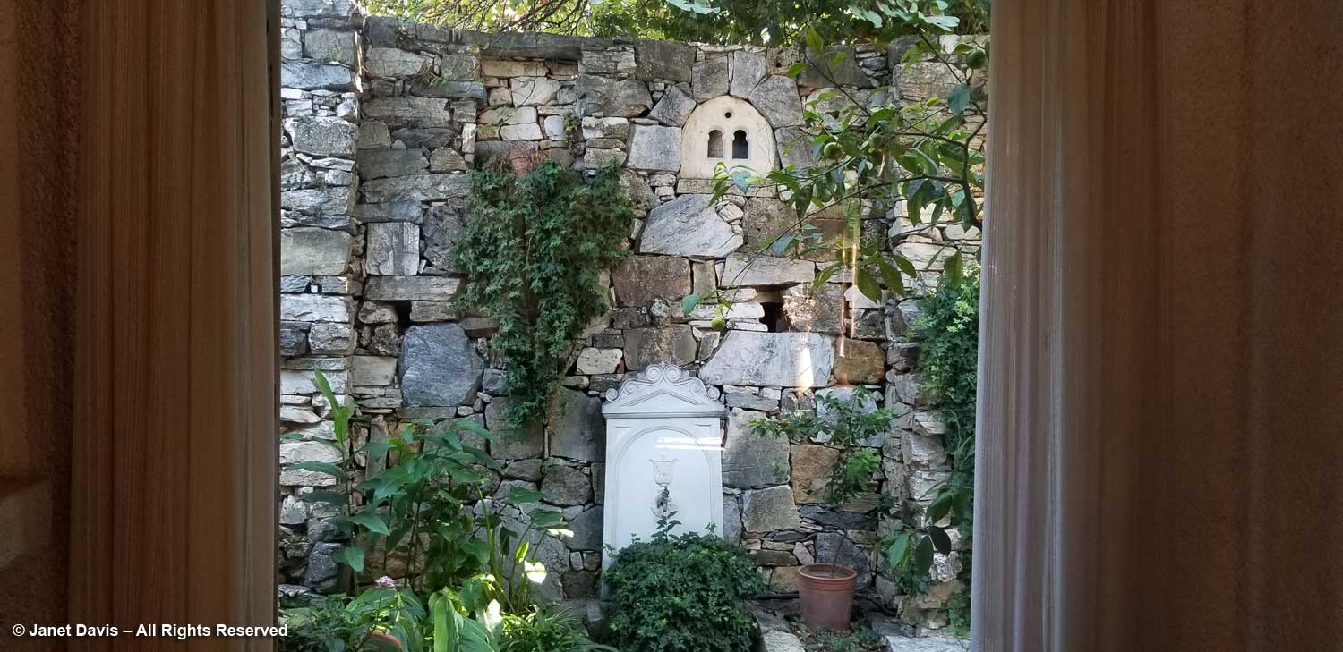
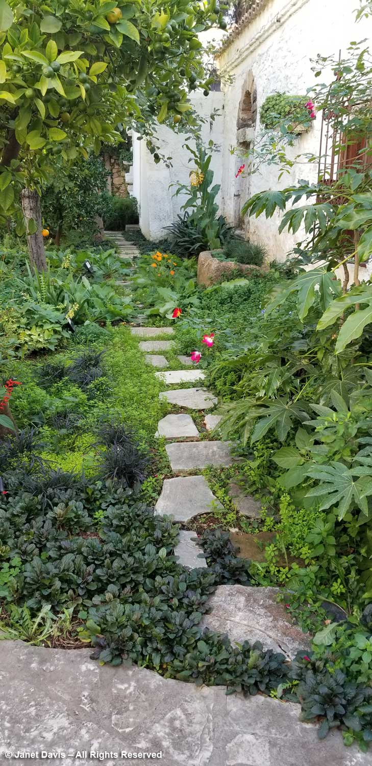
I loved this little cottage garden adjacent to the museum with its lime tree and a mix of interesting plants.
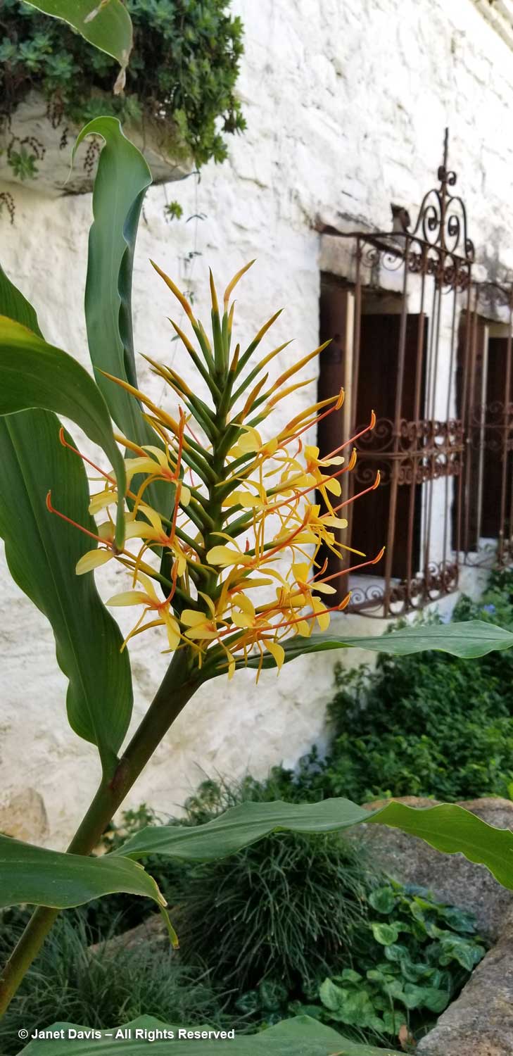
Against the white wall grew perfumed Hedychium gardnerianum, or Kahili ginger lily from the Himalayas. While we usually refer to botanical names as Latin, their roots are very often Greek. In this case, the genus name comes from the Greek words “hedys” for fragrant, and “chion” for white, referring to another species.
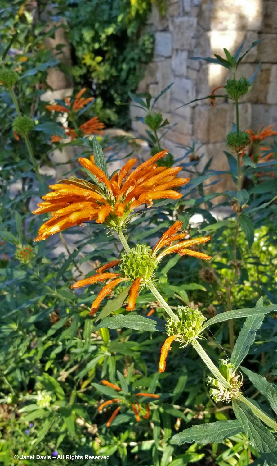
And there was the popular South African plant Leonotis leonurus, or lion’s ear, its etymological roots in the Greek words “leon” for lion and “otis” for ear, describing the fuzzy upper lip of each flower.
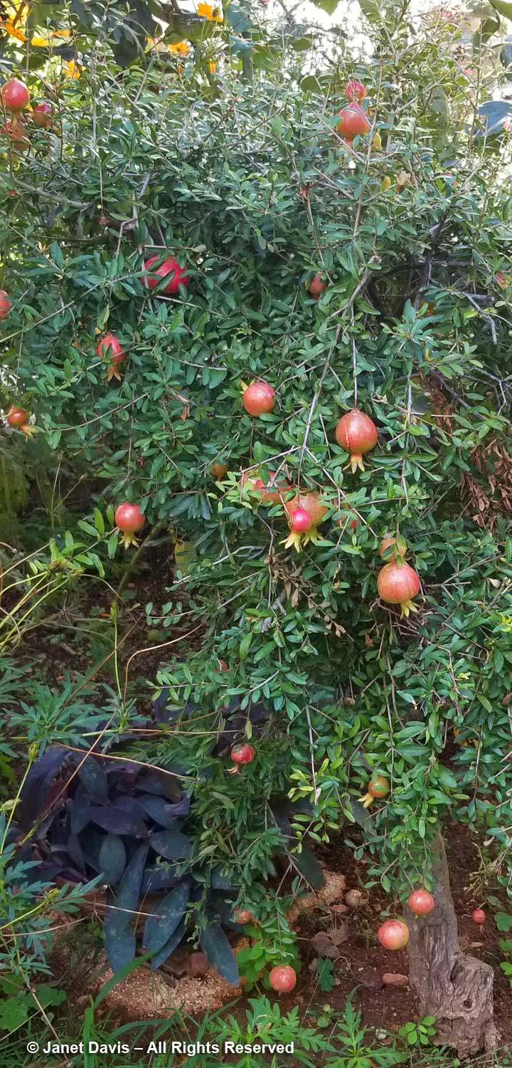
Nearby was a 70-year old pomegranate (Punicum granatum) full of fruit.
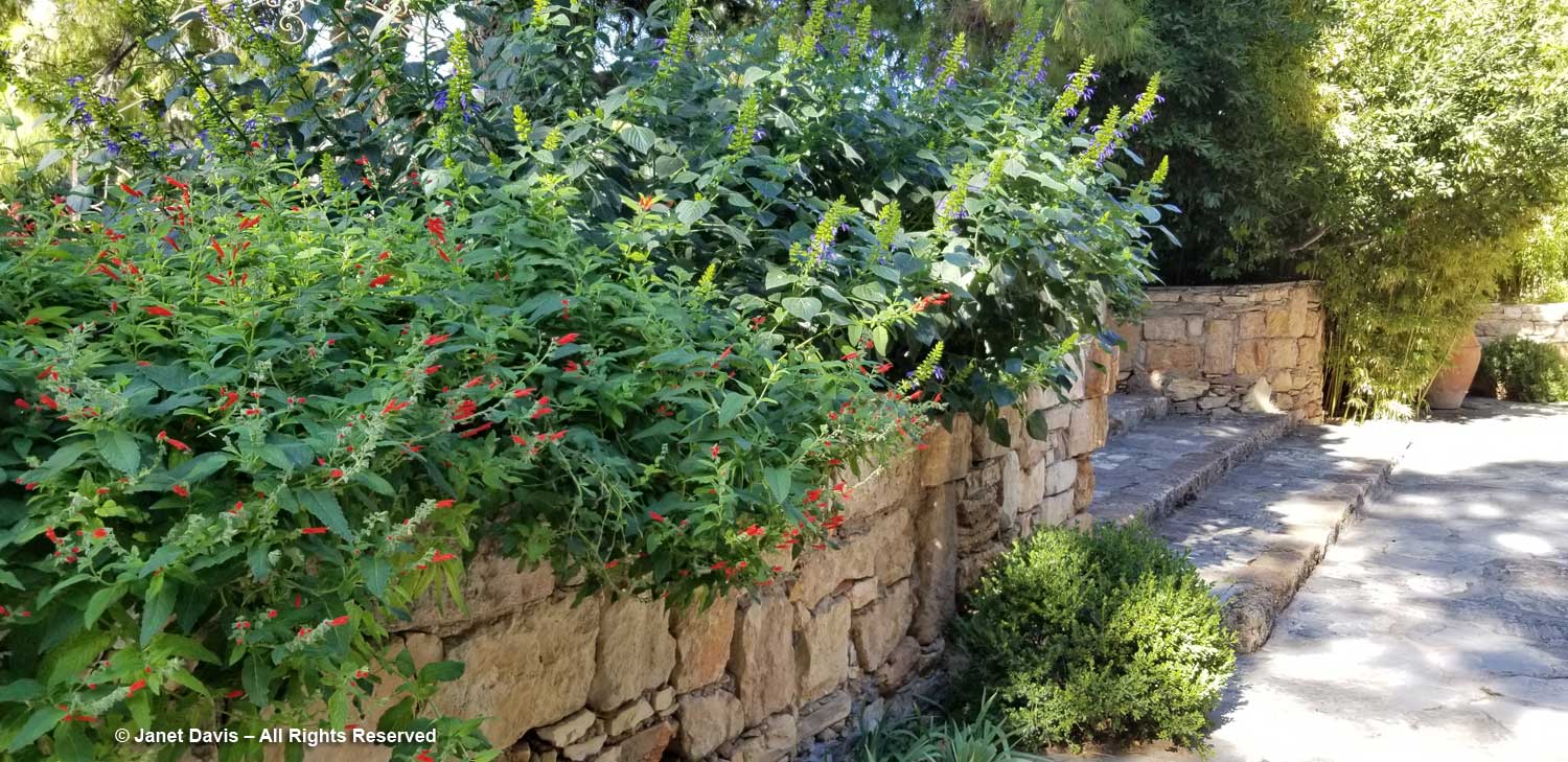
Easy-care sages (Salvia sp.), a Dariotis specialty, spilled over a wall.
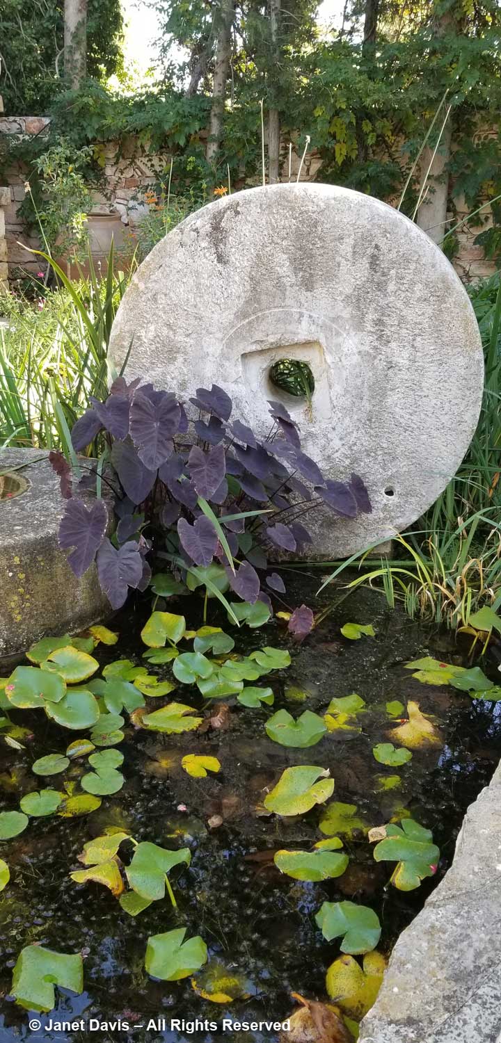
A dark-leafed taro (Colocasia) adorned a millstone in a little pond.
This is the view from the other side.
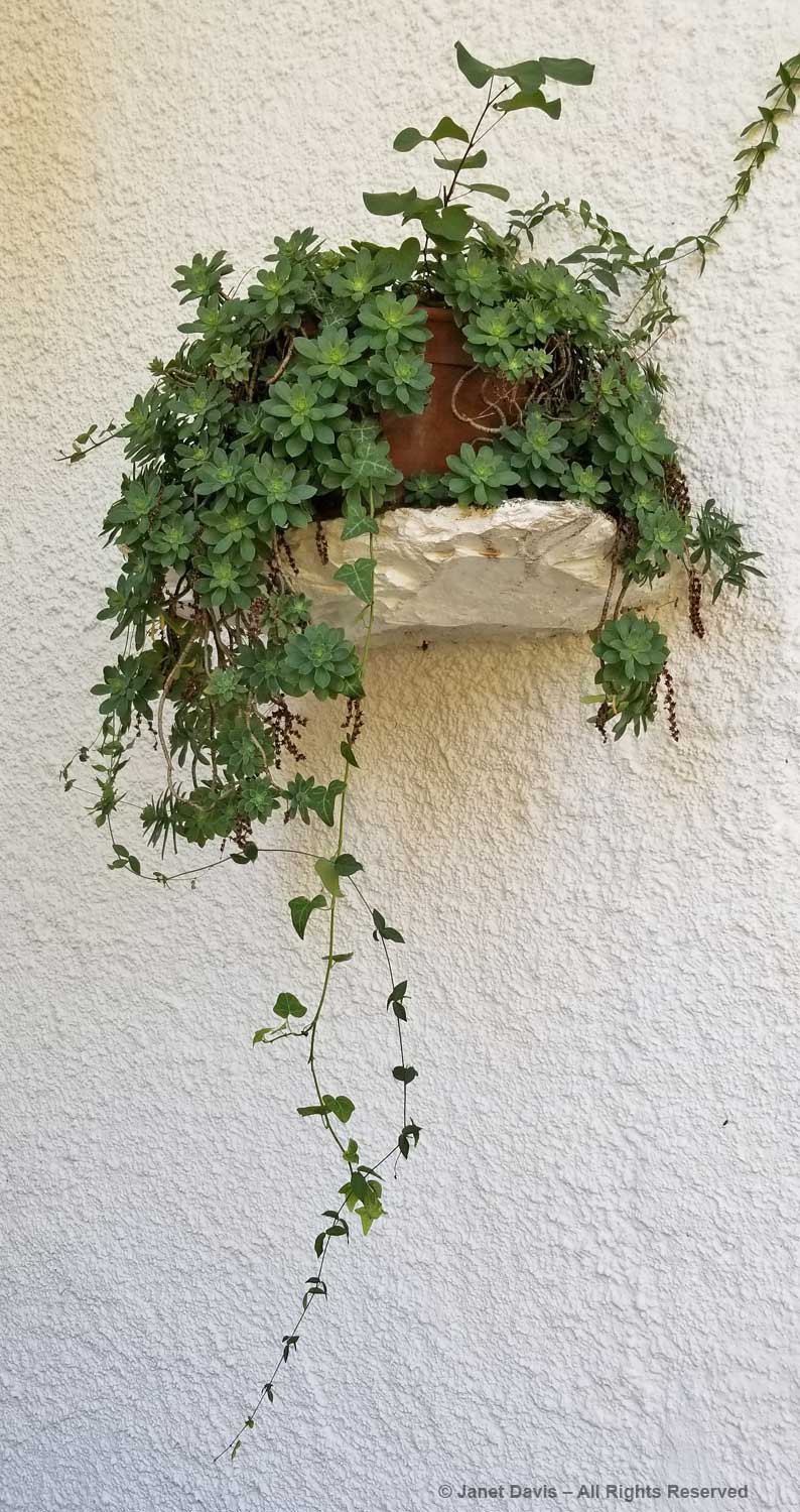
A little greenery against the white wall.
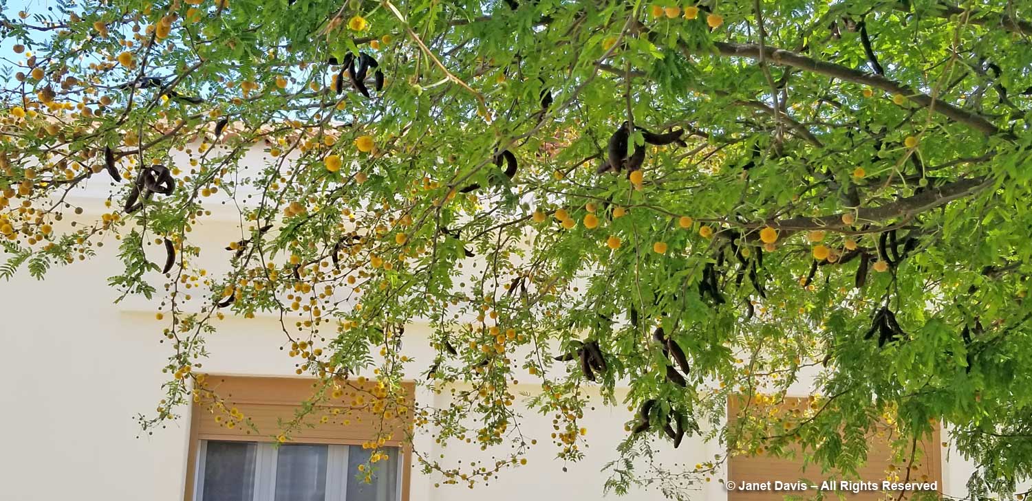
Though native to the Caribbean, sweet acacia (Vachellia farnesiana) was imported into Europe in the 17th century.
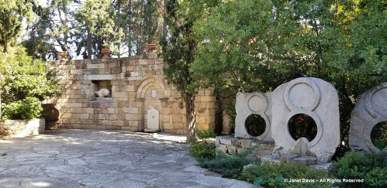
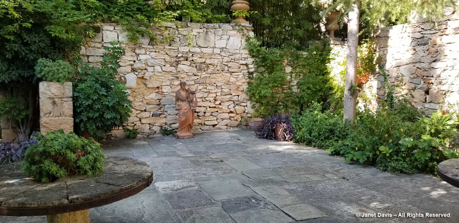
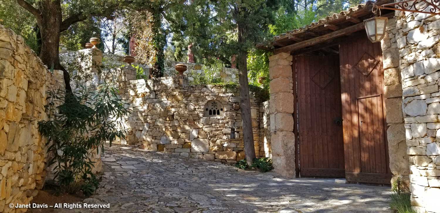
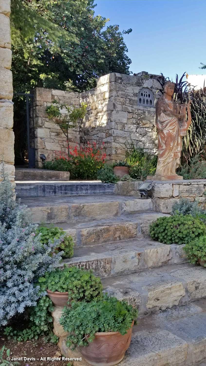
Because of the configuration of the museum and gallery, there are numerous walled courtyards in which to stroll, each with its own selection of sculpture and plantings. And the dry stone walls are spectacular as background. Whether formal….
…. or informal, they are stellar examples of decorative stonework.
We toured our way to the courtyard just inside the….
….. tall gate and the driveway lined with more stone walls.
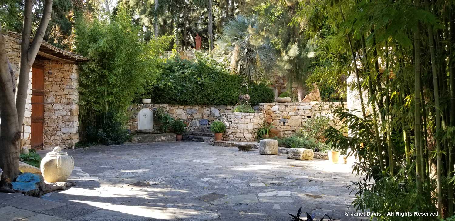
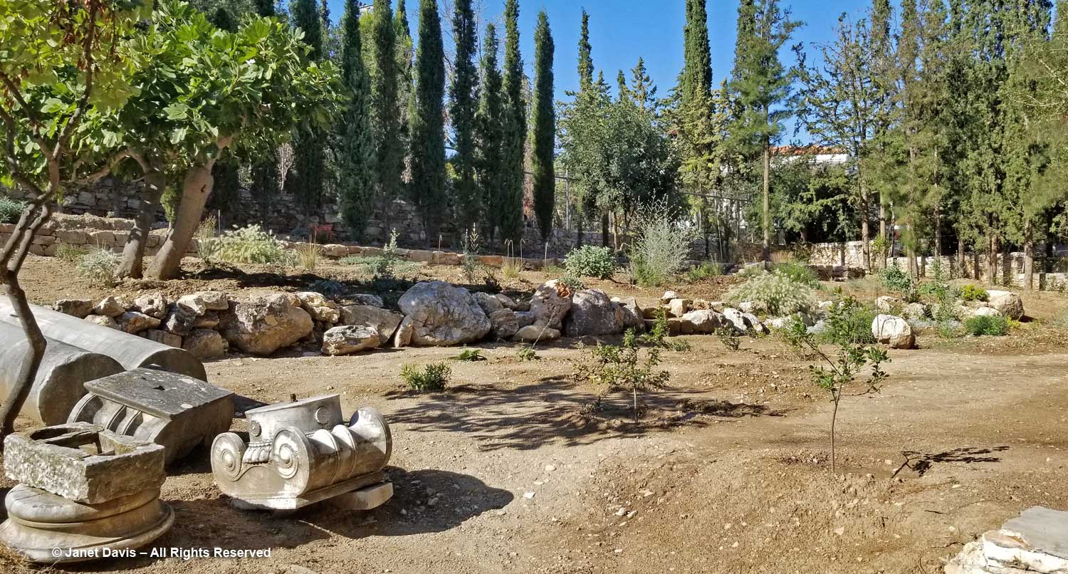
Then we climbed stairs to the upper part of the property……
……….. and listened to Eleftharios and Nektarios talk about the new garden……
…… taking shape here beyond the little pile of spare monuments(!) One day soon, visitors to the museum will be able to explore the wealth of indigenous Greek flora growing on this gentle slope: a leafy, yet no less important, heritage of the country that the Vorres family celebrates here in Paiania.