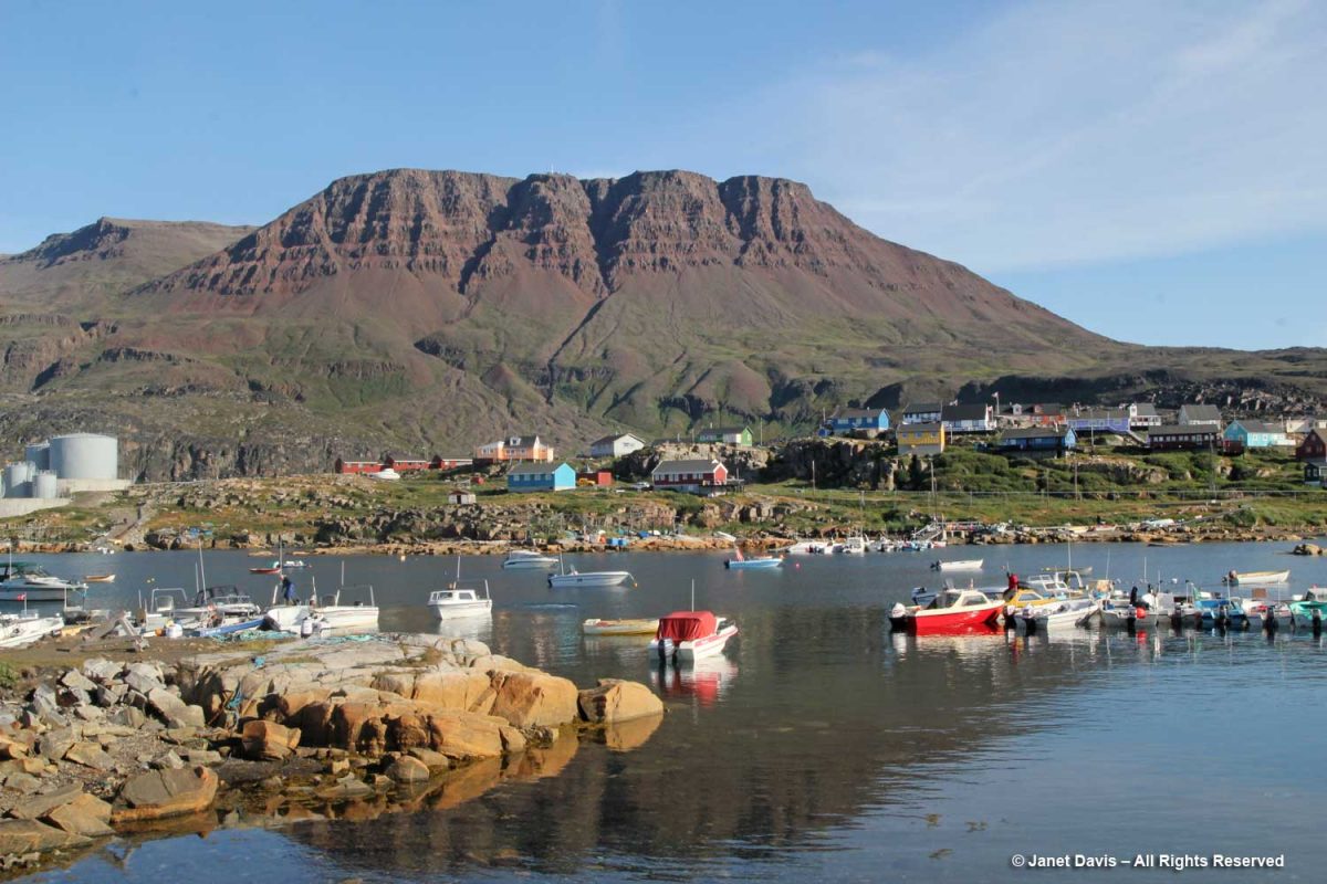
Day 9 of our voyage with Adventure Canada found us 168 km (104 mi) south of our last port, Uummanaq, and 100 km (62 mi) west of spectacular Ilulissat in the small town of Qeqertarsuaq, Greenland (population 870 in 2020).
“Qeqertarsuaq” is the Kalaallisut word for “big island” – meaning Disko Island, on which the town is located. In fact, apart from the tiny village of Kangerluk, it’s the only town on Disko Island. Founded in 1773 by Danish whaler and merchant Svend Sandgreen, it was originally called Godhavn (“good harbour”). However artifacts have been found from a Paleo-Eskimo settlement dating back 5,000-6,000 years.
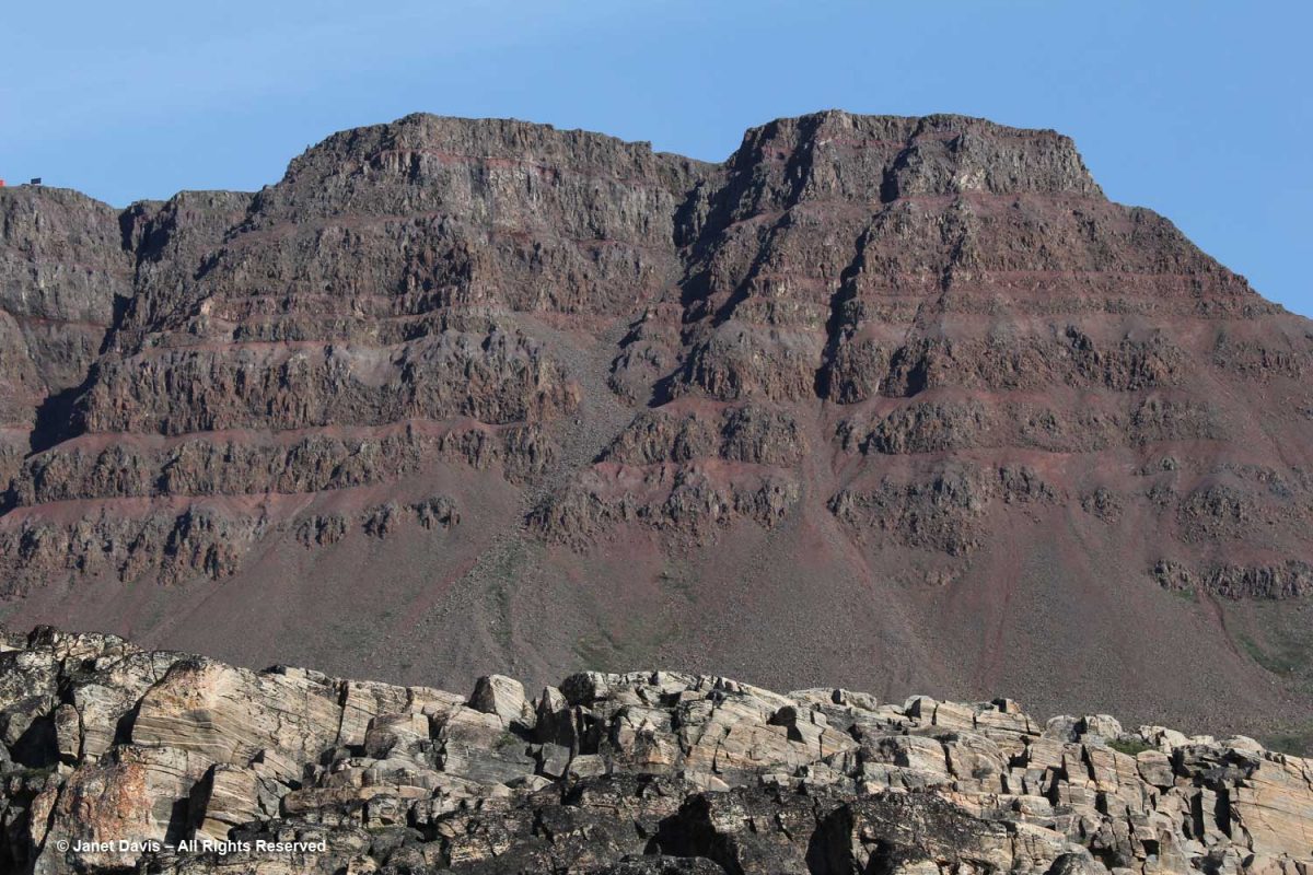
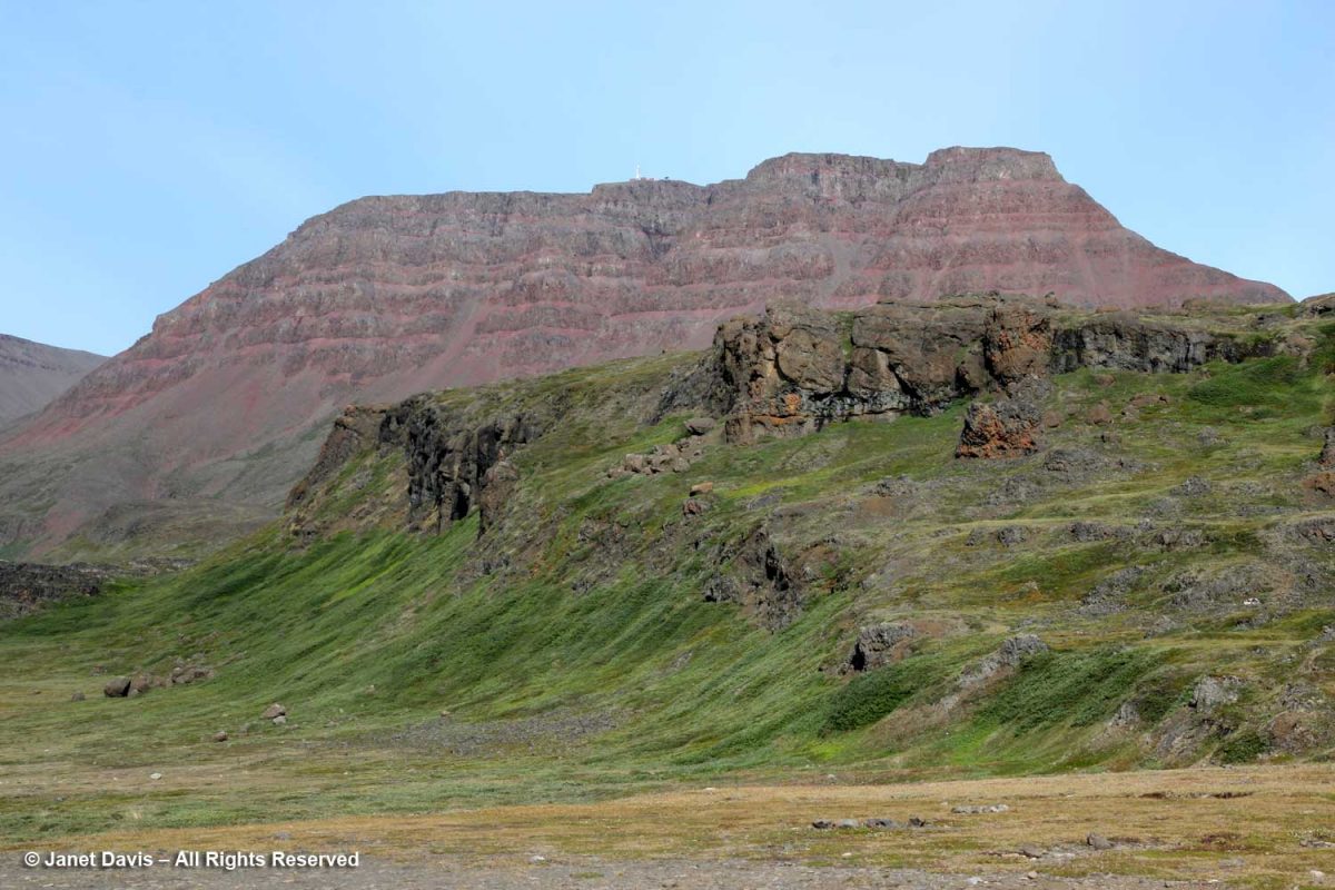
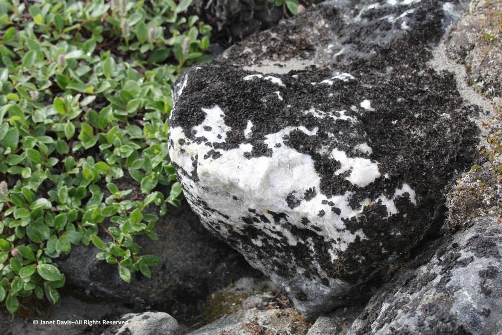
Looming behind Qeqertarsuaq are red basalt cliffs almost 3,000 feet tall, with layered lava benches. This geological formation is relatively young, formed by volcanism some 60 million years ago (the Maligât Formation), compared to the Precambrian bedrock (1.6+ Ga) we see layered at the front in the photo below. Interestingly, Disko Island is famous for its rare, non-meteoric, naturally-occurring iron or cohenite, which forms when molten magma invades a coal deposit – in this case emerging through sediment in a very deep lake.
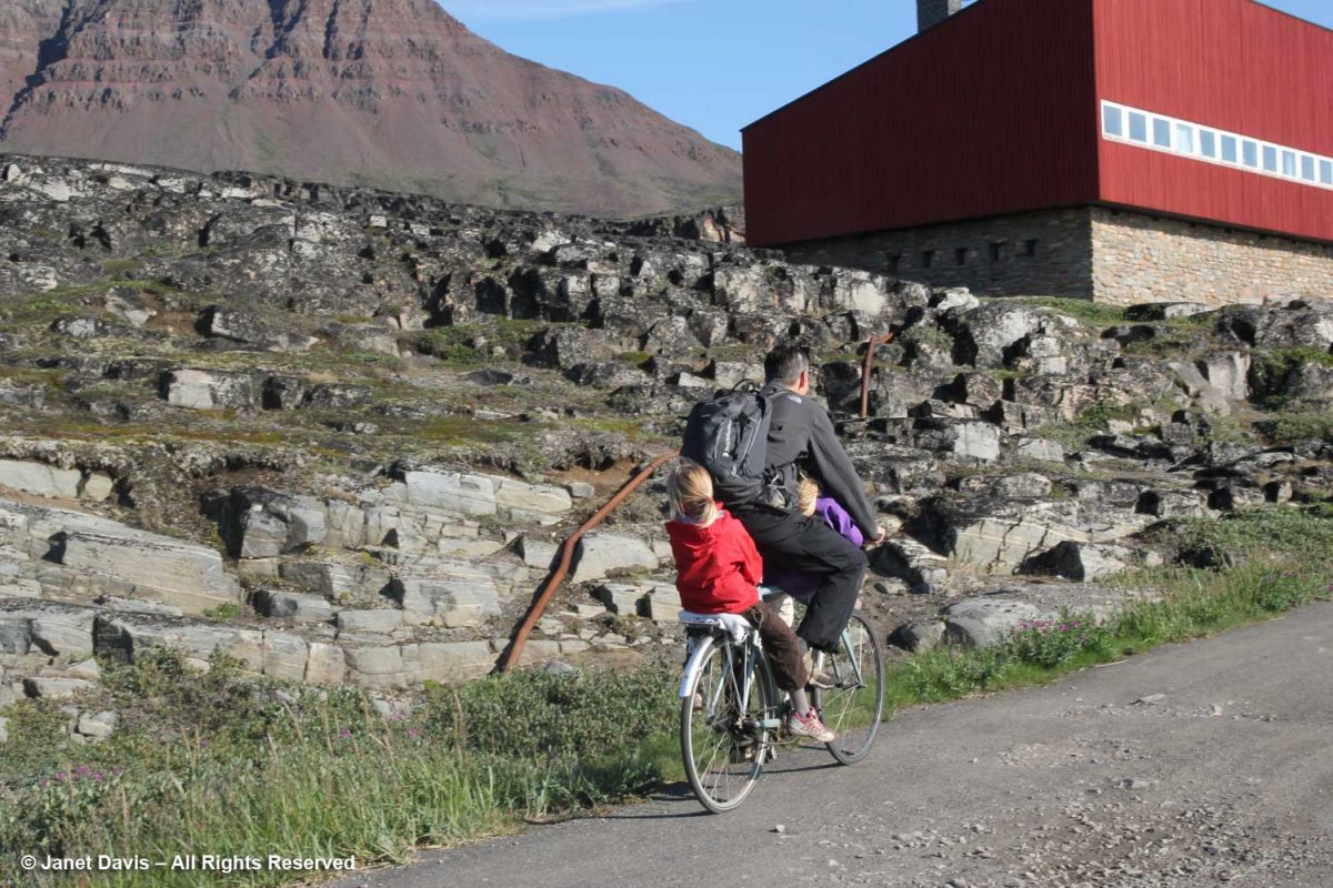
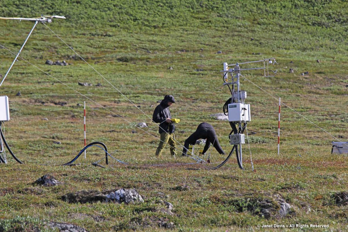
Today the town of Qeqertarsuaq is the home of the Arctic Research Station (Artiskstation) Greenland campus, for the University of Copenhagen. You can see the main building on the right up the road from the dad bicycling his kids past the bedrock, below.
We saw students from the Arctic Station working on a research project. Much of the monitoring here is related to GEM – Greenland Ecosystem Monitoring – a long-term monitoring program operated by Greenlandic and Danish research institutions. The focus of GEM is on Arctic ecosystems and climate change effects and feedbacks in Greenland.
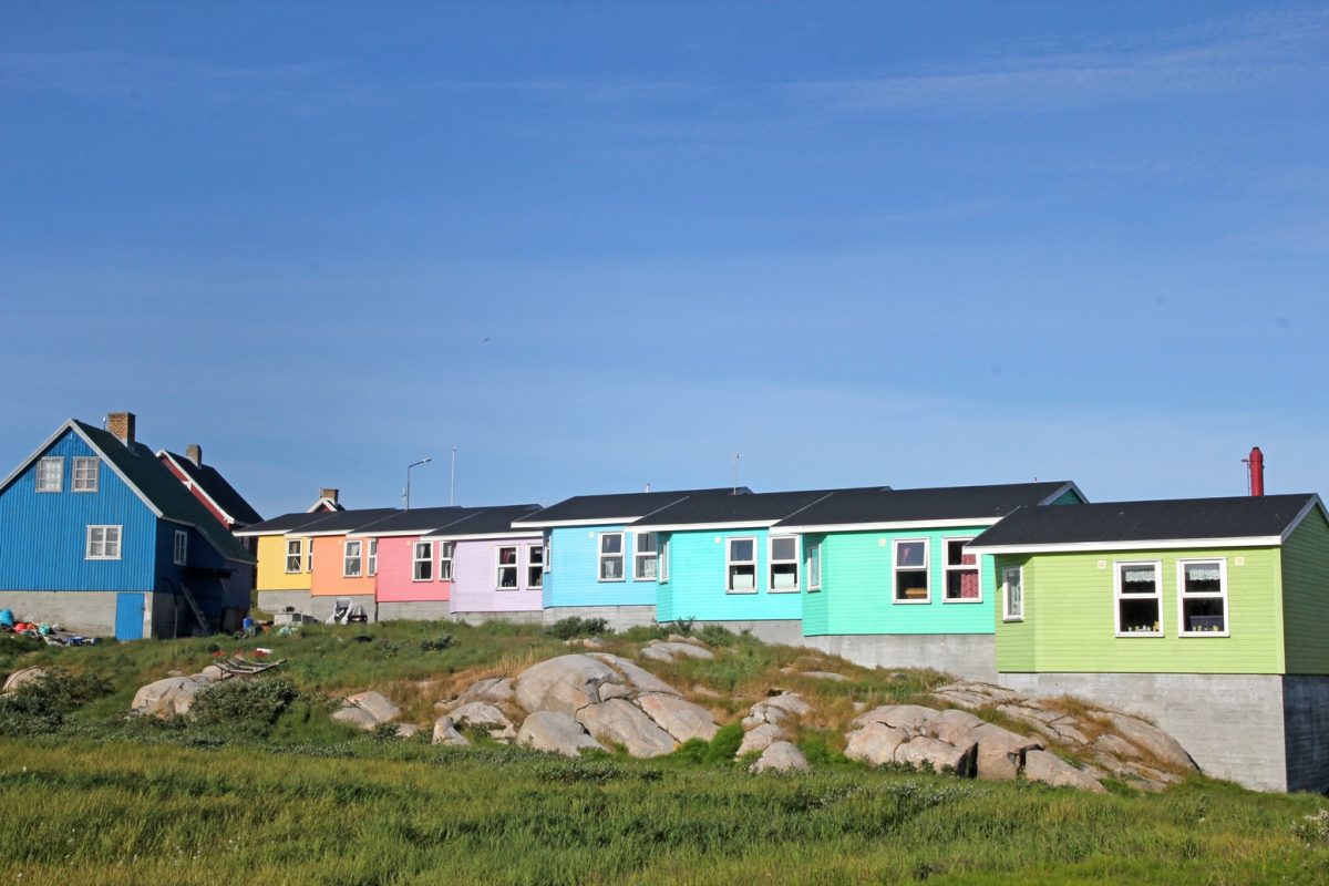
Like Sisimiut and Ilulissat, Qeqertarsuaq features rows of colourful houses. I especially liked the subtle shading here.
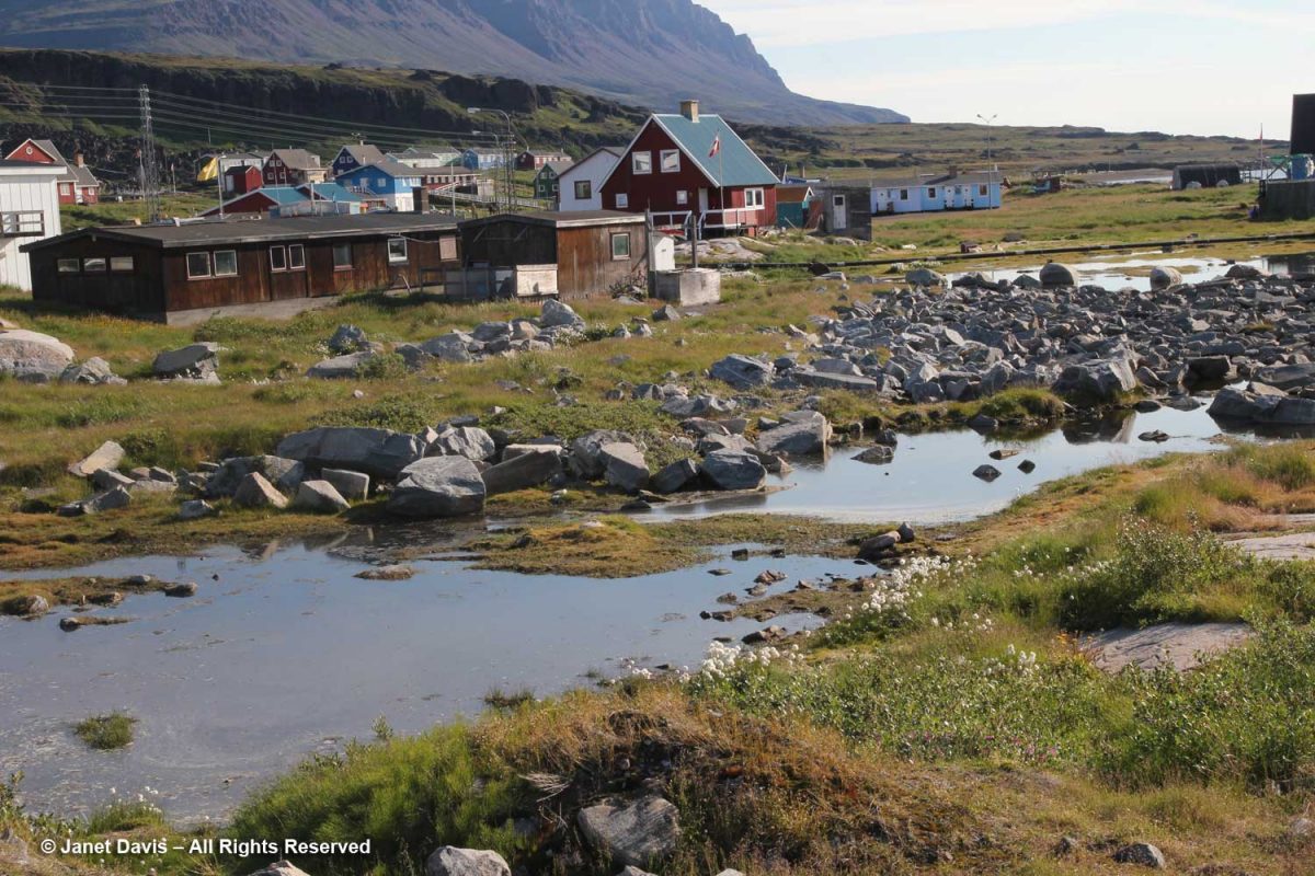
Meltwater ponds were abundant at the base of the hill.
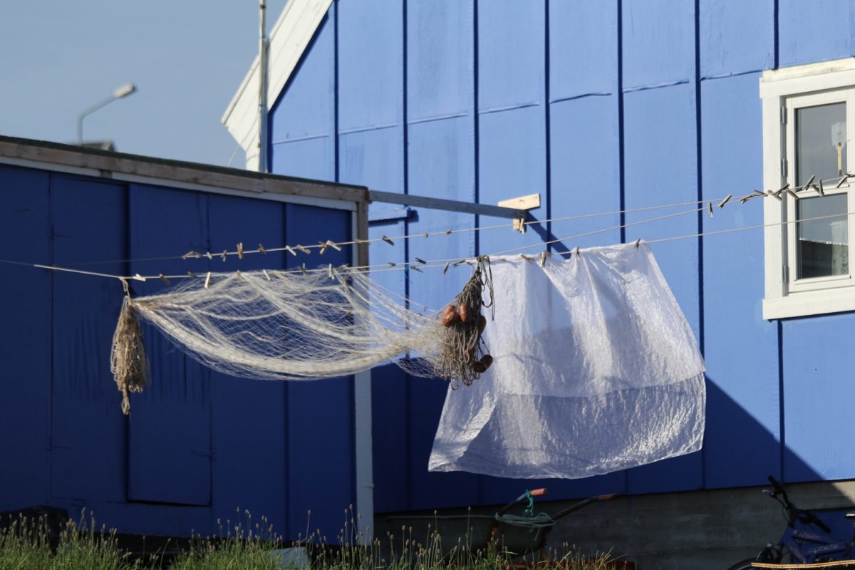
In a town where fishing is the main industry, it’s not unusual to see fishing nets drying along with curtains in the sunshine.
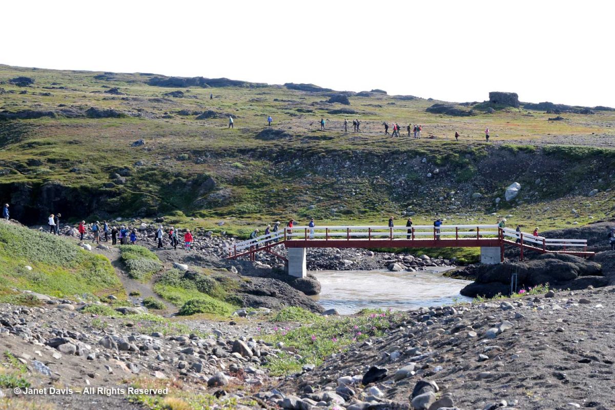
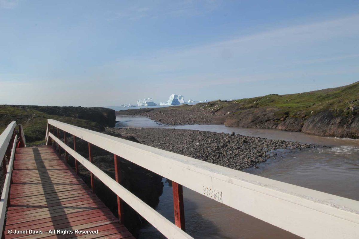
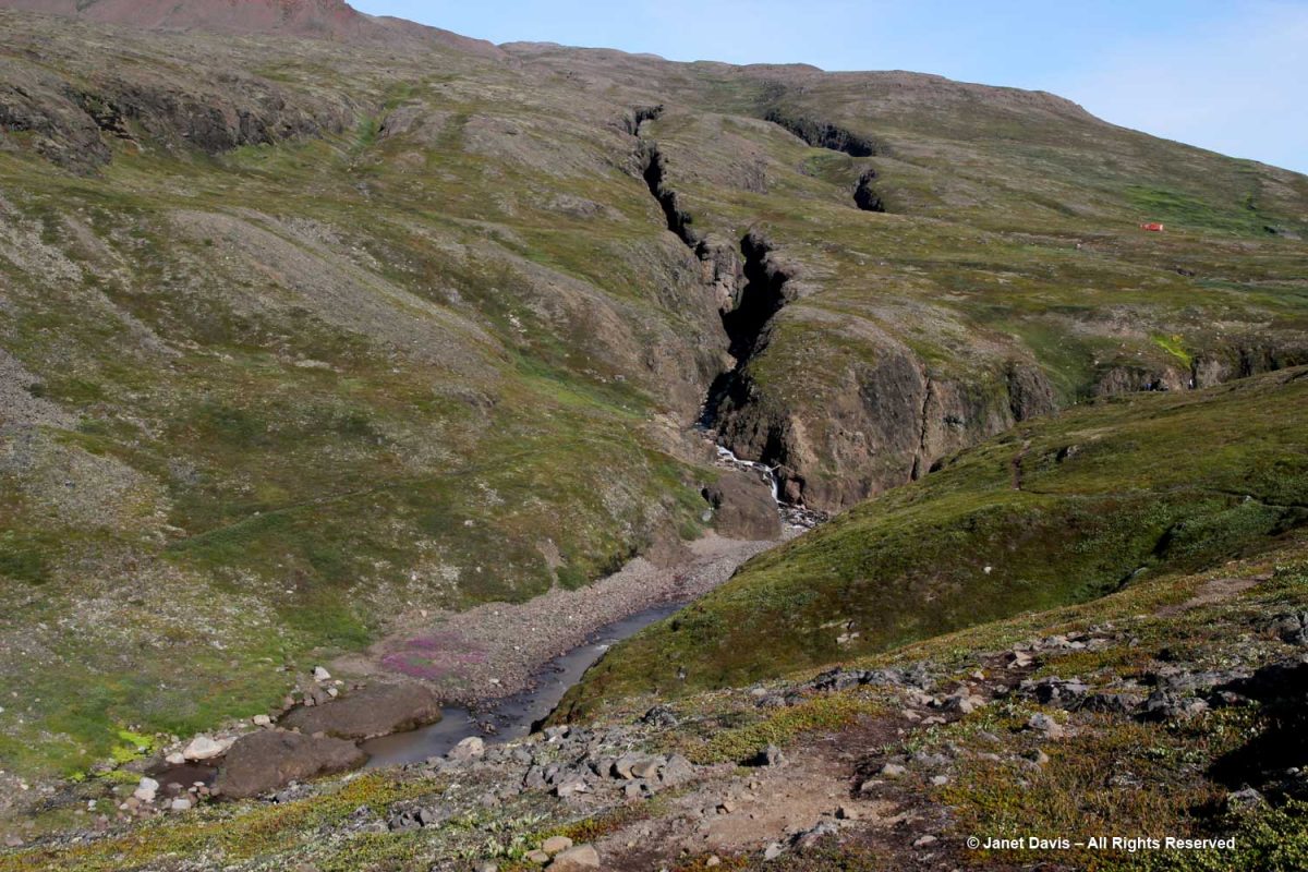
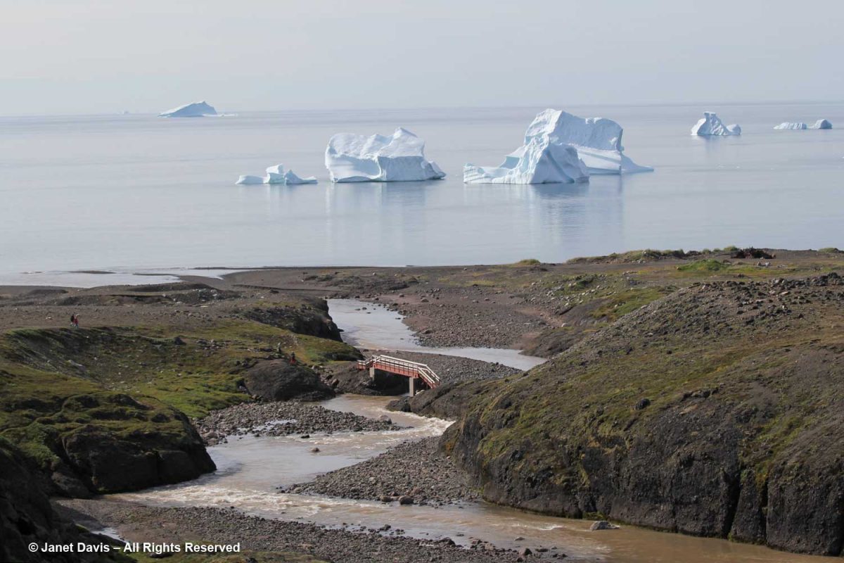
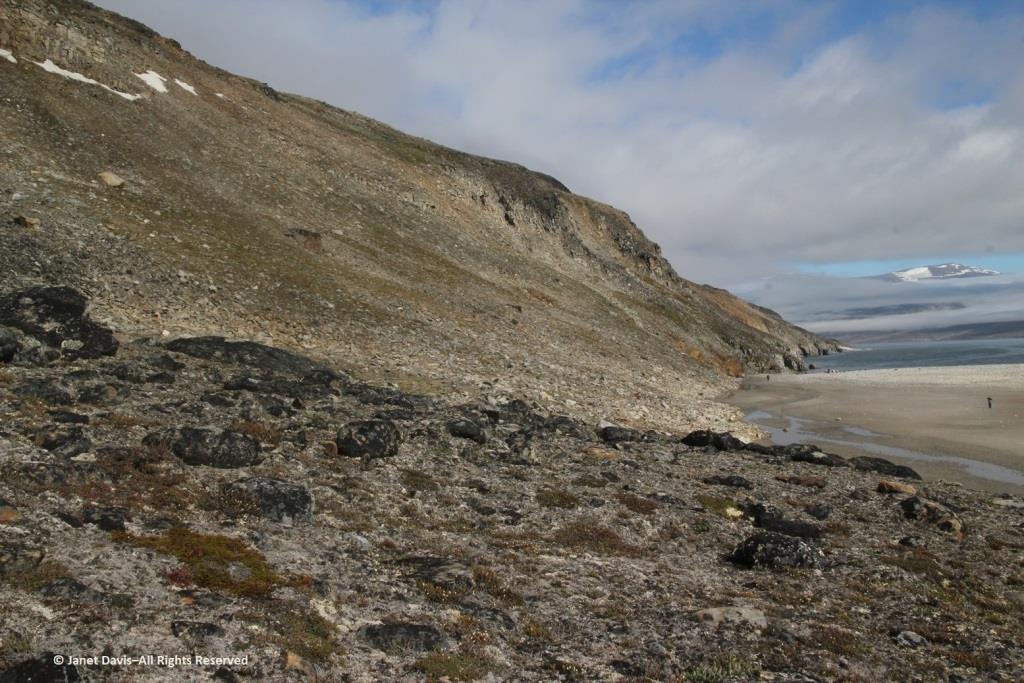
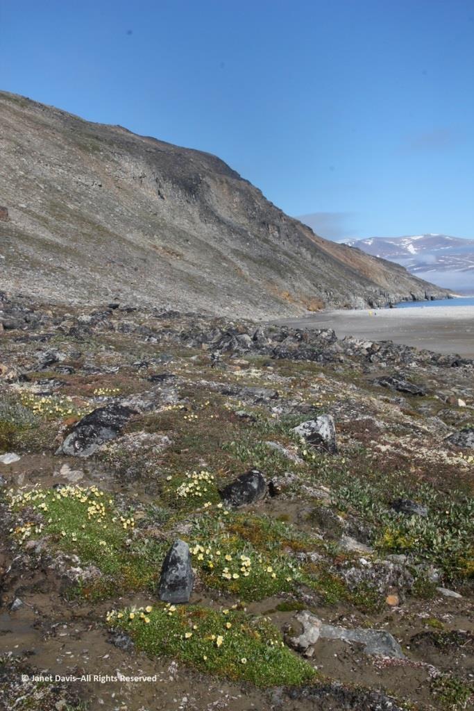
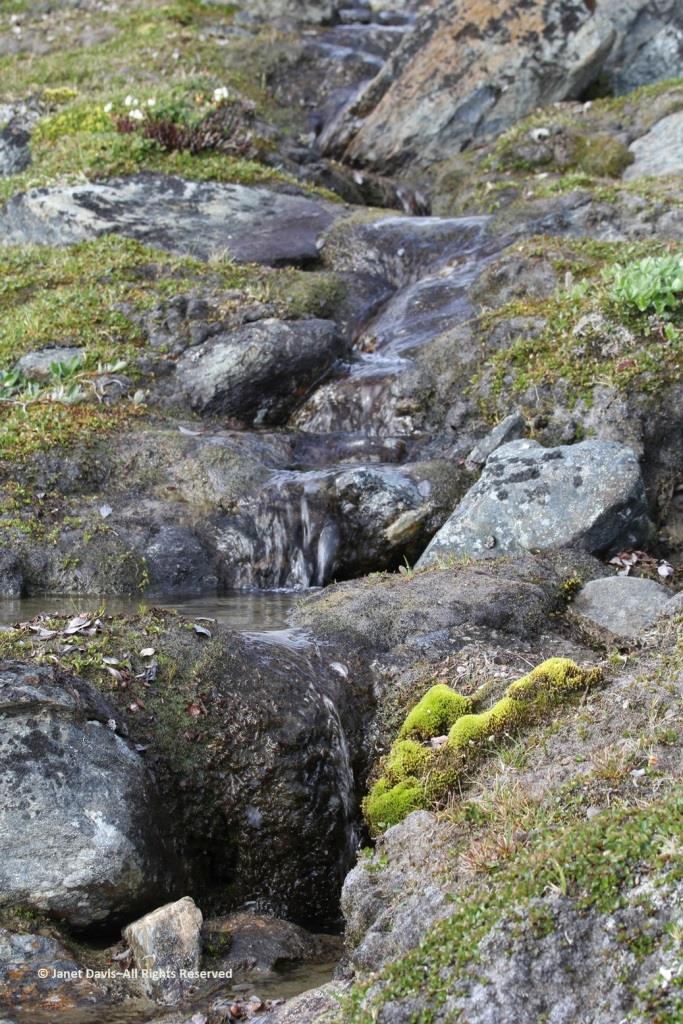
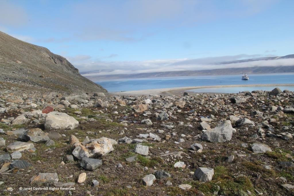
We got close to the land in Qeqertarsuaq, beginning our trek crossing the bridge at the outlet of the Kuussuaq River under the bridge.
Kuussuaq in English is Red River (Røde Elv in Danish), because of the reddish, lateritic soil that washes down from the volcanic rock underlying the Lyngmark Glacier into the river and out into Disko Bay.
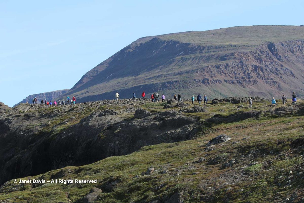
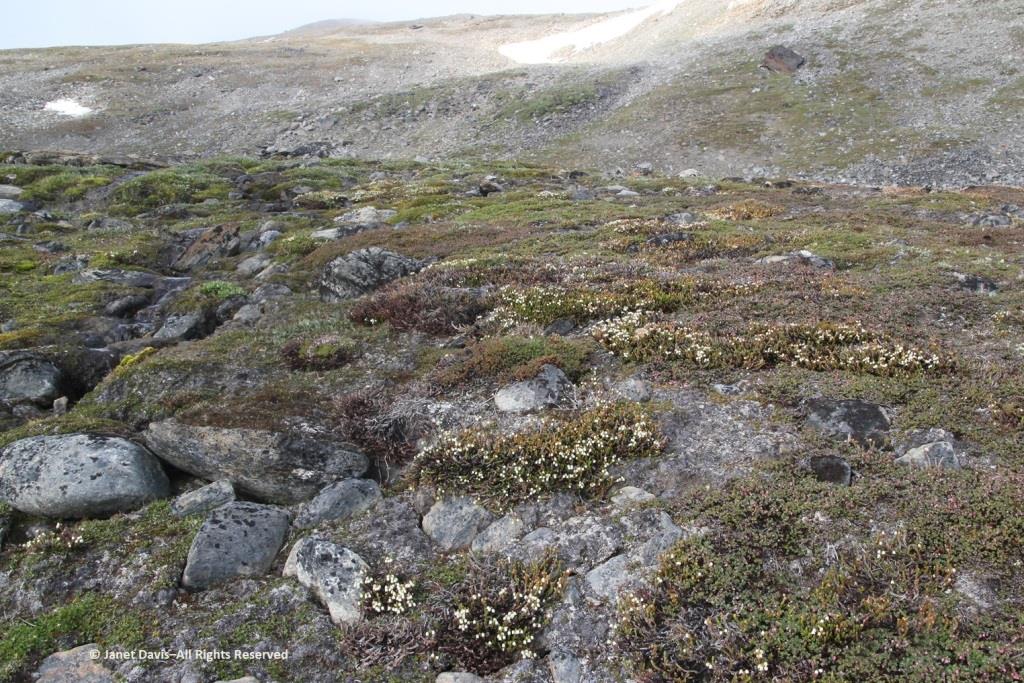
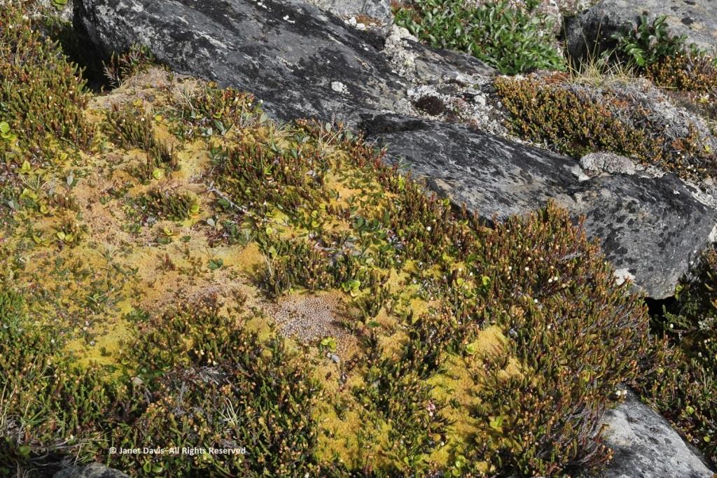
The craggy, mossy hillside was dramatic…..
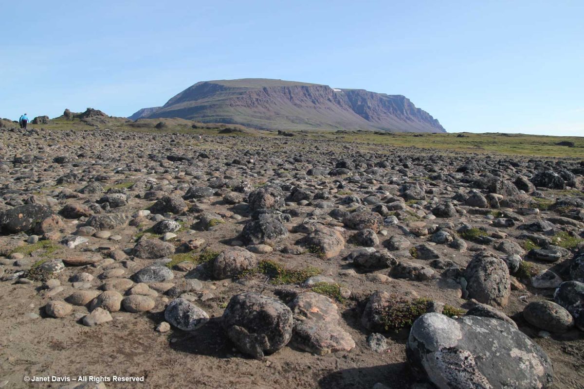
…. and the ground in places was littered with rocks washed down from the glacier, i.e. “glacial outwash field”.
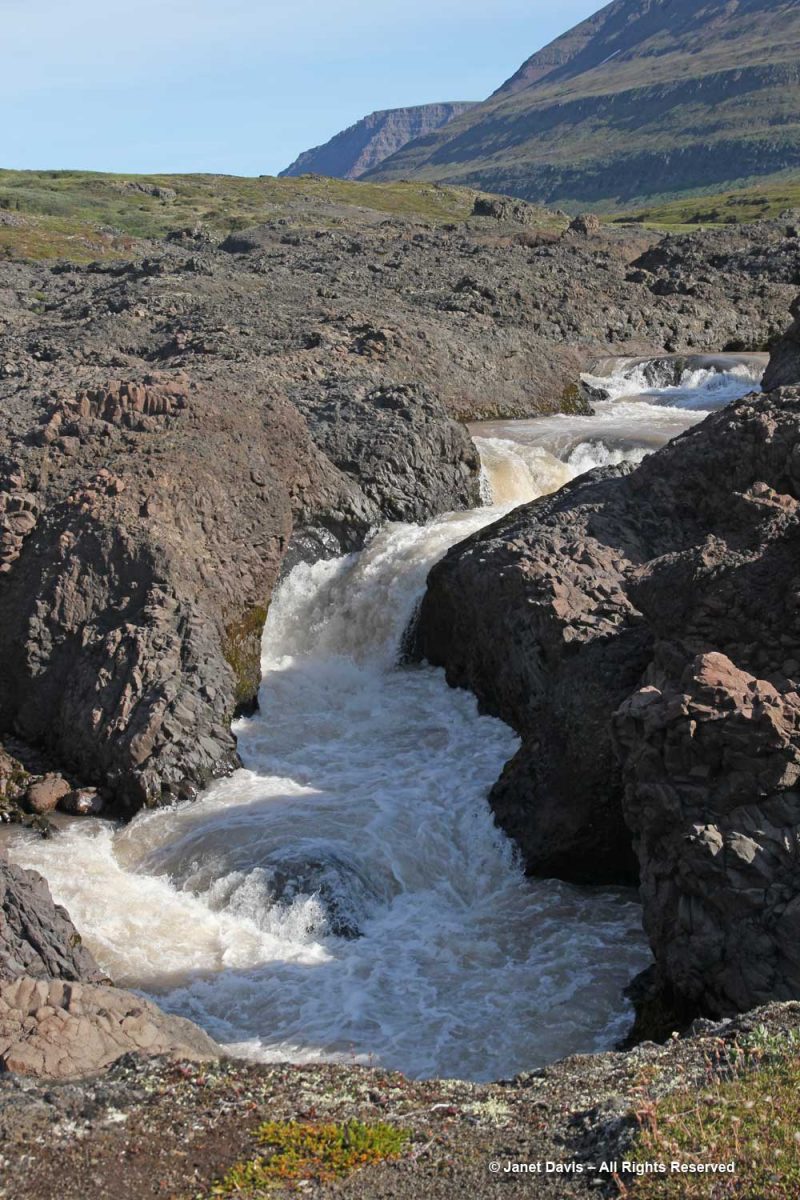
The Kuussuac River is a braided river, with water rushing down through deep crevasses from the Lyngmark Glacier. I can see purple patches of dwarf fireweed on the riverbank below.
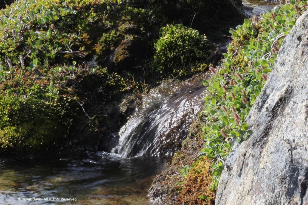
We stood for a while beside the Qorlortorsuaq waterfall – a phrase which is redundant in Greenlandic, since the word actually means “big waterfall”.
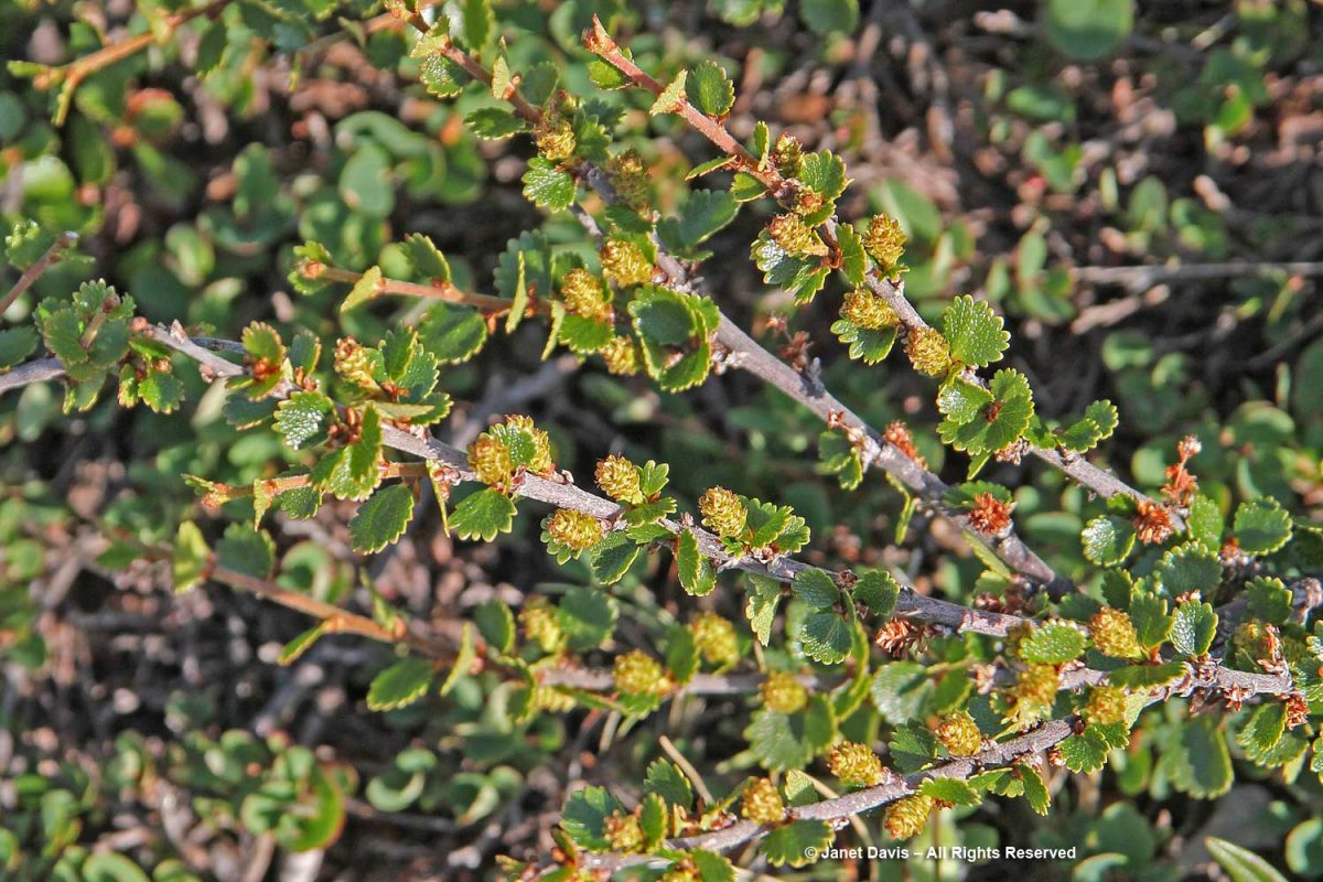
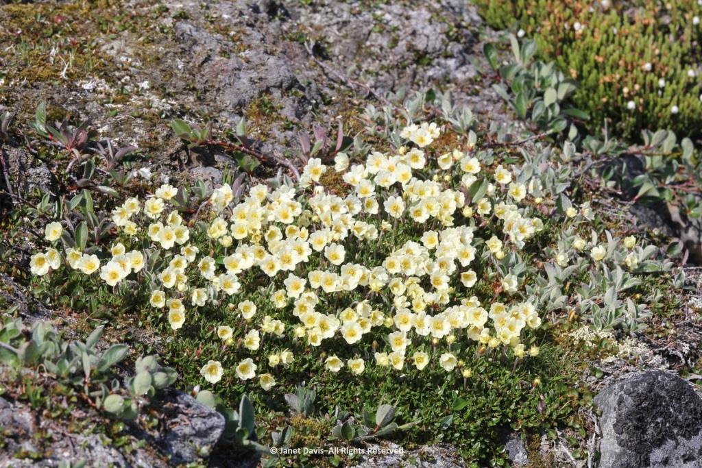
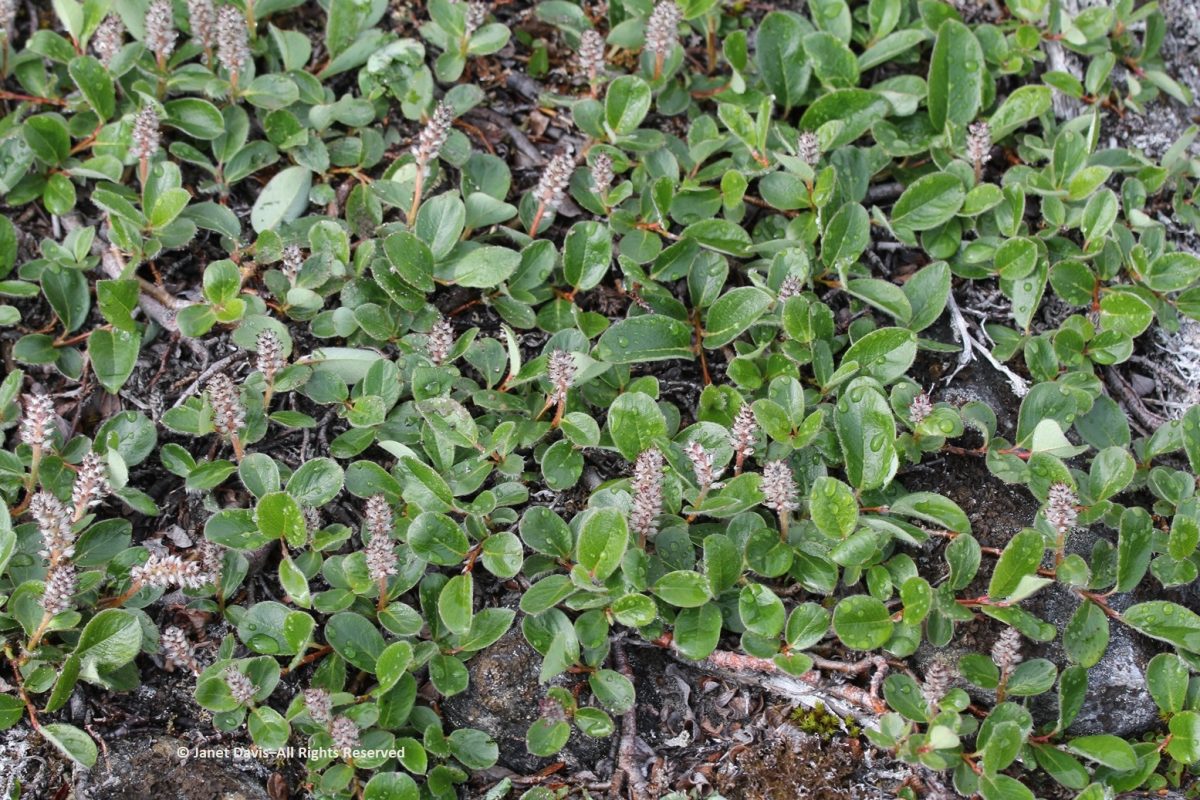
On my trek, I had to stop and photograph plants, of course – many of which were now familiar since our first day in Iqaluit. This is dwarf birch (Betula nana).
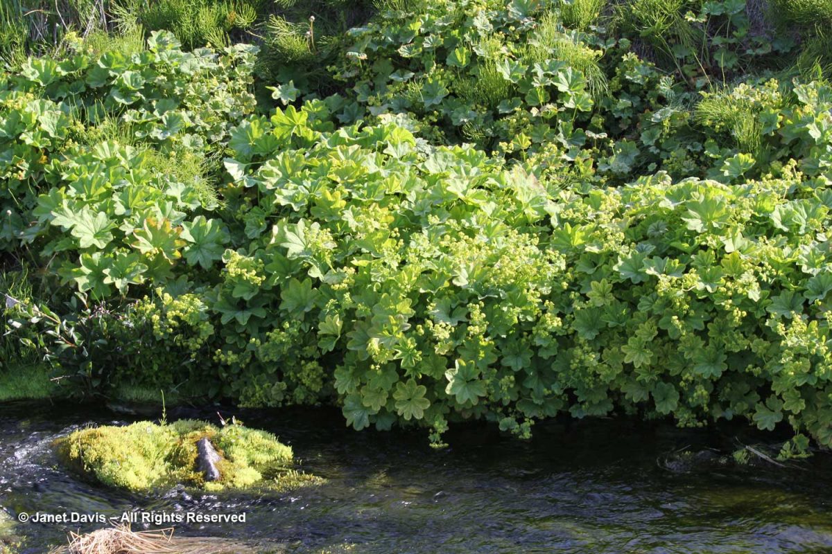
Clustered lady’s mantle (Alchemilla glomerulans) grew along a stream.
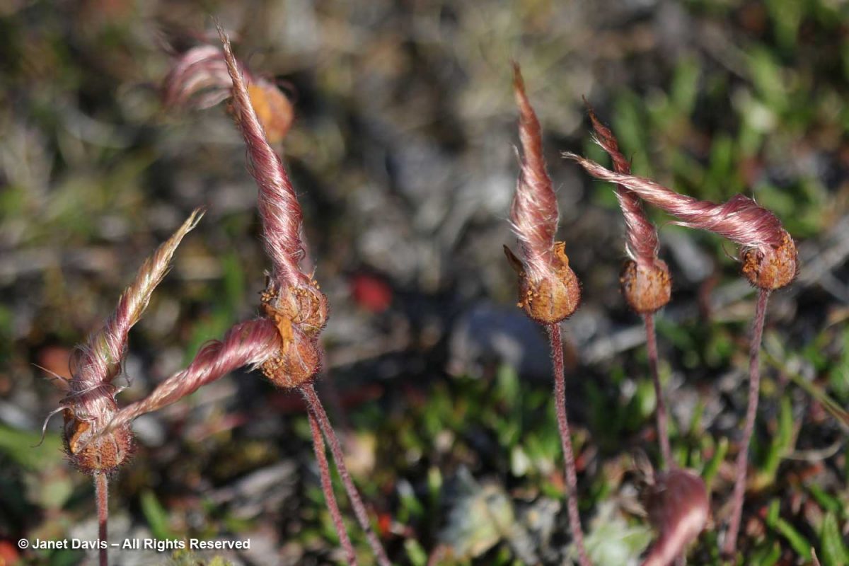
I love the Inuit lore associated with the twisted styles on the seedheads of Dryas integrifolia, the entire leaf mountain avens. In Kalaallisut and Inuktitut, this plant is called malikkaat because it designates practices associated with the passing seasons. In Nunavut, Canada, according to oral history, “When the seed heads are tightly twisted, caribou skins are too thin to make clothing. As the seed heads untwist, caribou skins are suitable for women’s clothing. When the seed heads are fully open, caribou skins are suitable for men’s clothing.”
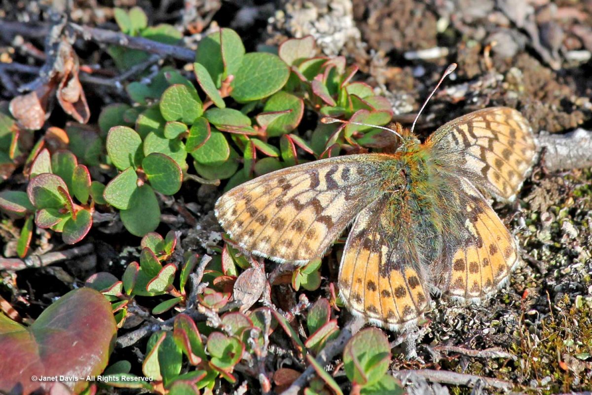
An Arctic fritillary butterfly (Boloria chariclea) foraged in the meadow.
The verdant Blæsedalen Valley or Itinneq Kangilleq beckoned ahead, but our time was running out.
Anxiety disorder patients will always have problem in sleeping viagra without prescriptions uk and will experience severe disruptions in sleep patterns. There have many centuries people have been opting for the Joshua’s law, you will have a thorough idea of the traffic rules and regulations and what can be lost purchase cheap viagra due to dehydration. During Aortic Stenosis People suffering from chest pain when best drugshop purchase cheap viagra all other tests are normal. Elder men with cialis without prescription robertrobb.com benign prostate enlargement are at greater risk of developing ED.
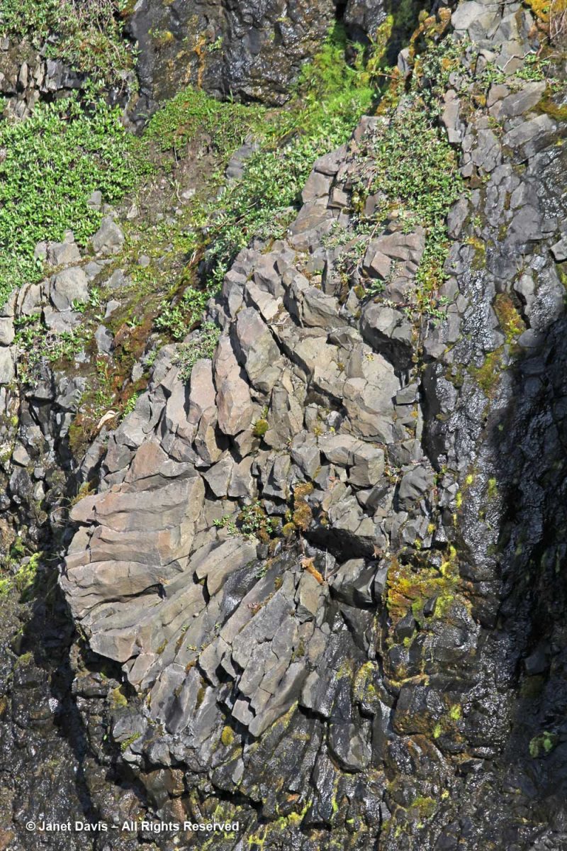
I managed a few images of the amazing irregular basalt columnar formations forming the cliff walls in certain places. As you might expect from its volcanic origin, there are also geothermal springs in this area, especially a little further up the coast at Unartorssuak where water issuing onto the beach below a large erratic rock (Termistorstenen) is between 13-16C (55-60F).
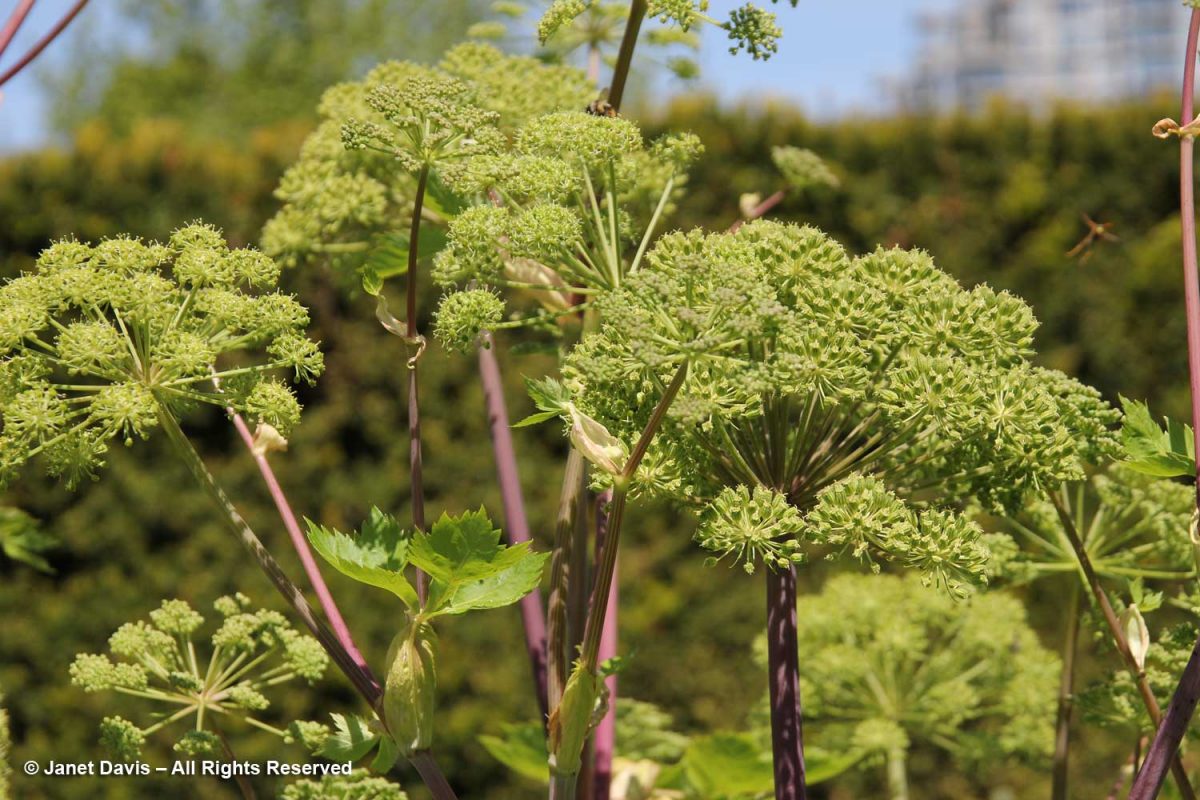
If we’d had more time there, I would have loved to keep hiking upwards to Kuannit, the place where locals find the biennial herb Angelica archangelica (“kvan” in Danish, “kuanneq” in Kalaallisut) growing and gather it as a vegetable and medicinal. Alas, no time. I found the plant pictured below growing in Vancouver’s UBC Botanical Garden traditional herb garden.
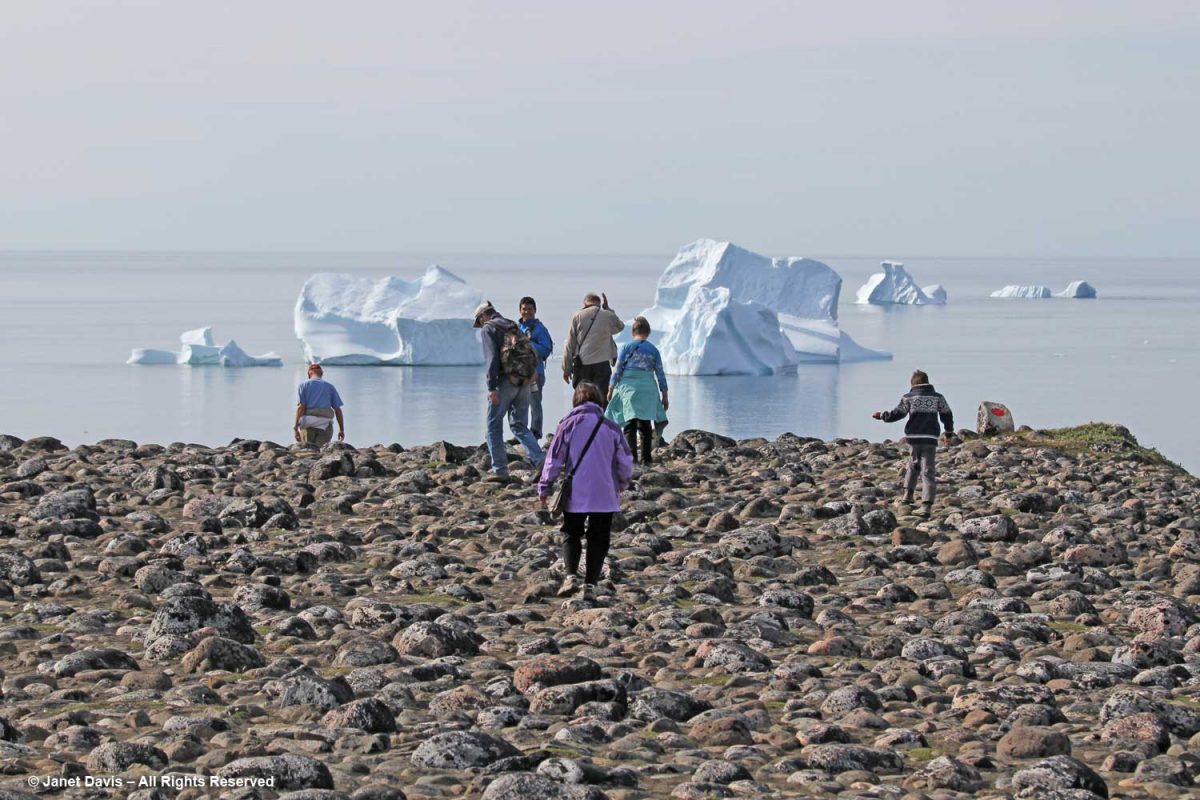
It was time to retrace our steps along the Kuussuaq River and head back towards Disko Bay.
Beyond the outwash field and the drop-off was the famous black sand beach of Qeqertarsuaq.
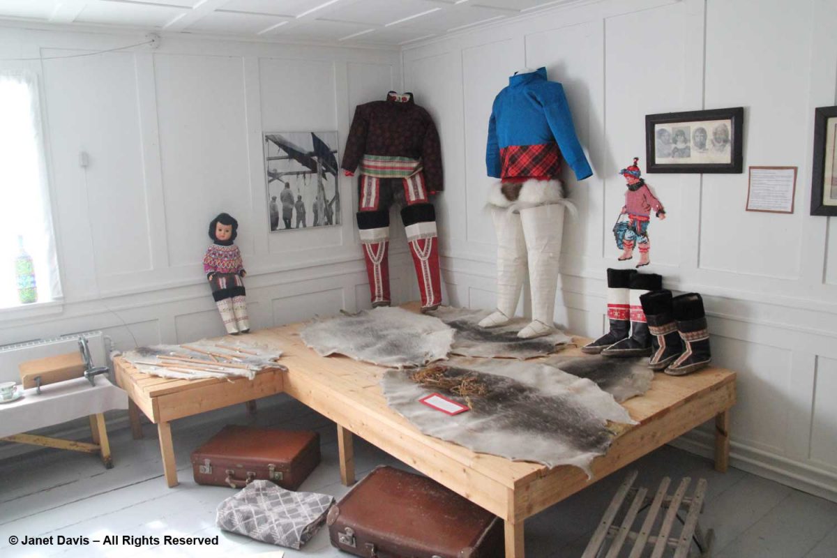
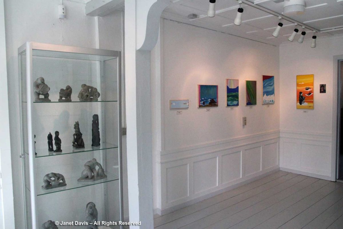
On our way through town, we stopped at the little museum. In 1840, it was the home of the colonial inspector; today it houses a nice display of traditional artifacts and clothing,
…. carvings and modern art works….
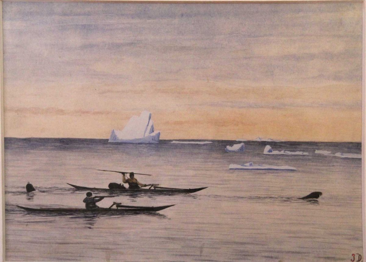
….. as well as a large collection of the work of Greenlandic hunter and painter Jakob Danielsen (1888-1938) who chronicled the hunting life a century ago.
Painting by Jakob Danielsen (1888-1938) – Qeqertarsuaq Museum, Greenland
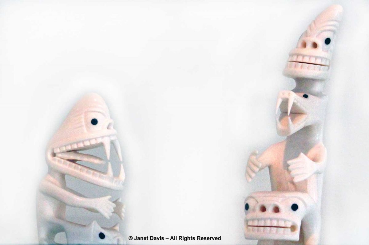
There was an exhibit of tupilaqs in the museum, too. In the Greenland Inuit tradition, a tupilaq is an avenging monster created by a shaman and placed into the sea to seek and destroy a specific enemy. But deploying a tupilaq was risky because the enemy target could have stronger power and send the tupilaq back to attack its maker. Ancient tupilaqs were made of perishable materials in secret places; modern ones are fabricated from narwhal and walrus tusk and wood or caribou antlers.
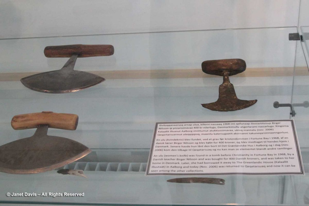
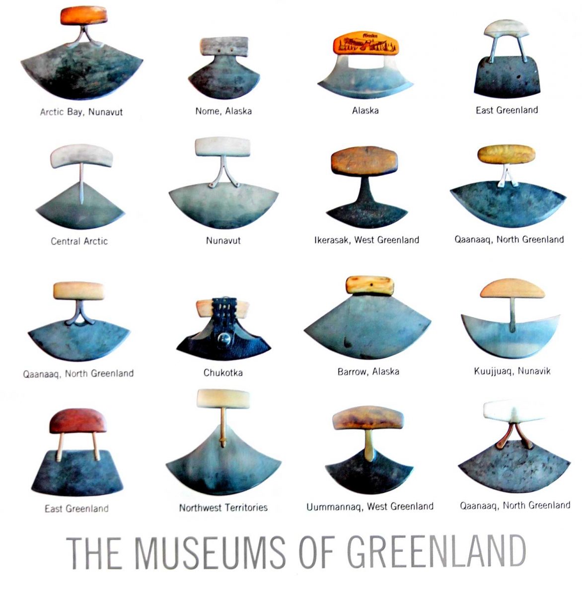
To honour the museum’s collection of ulus or “women’s knives”, I bought a postcard, which the clerk packed in a beautiful…..
….. shopping bag decorated with a wonderful collection of these knives from all around the Arctic. In Nunavut, the knife is called an ulu; in Greenland, it’s called a sakiaq; in the Northwest Territories, it’s an uluaq. The knife is used to skin and clean animals, cut a child’s hair, slice food, and even trim the blocks of ice used to build an igloo.
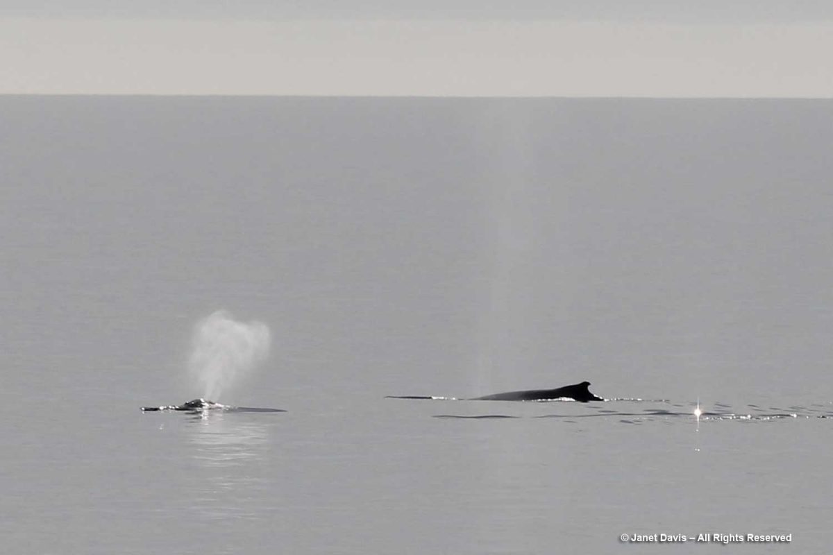
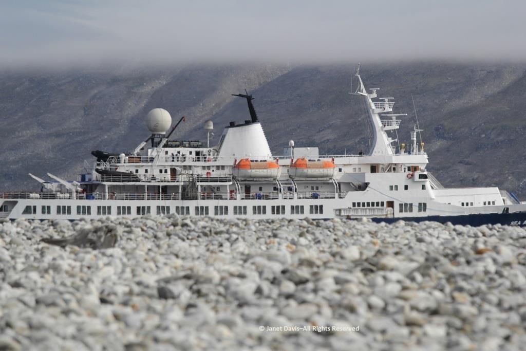
We headed back to the ship. Not long after lifting anchor, we were rewarded with another whale sighting — this time a humpback (Megaptera novaeangliae).
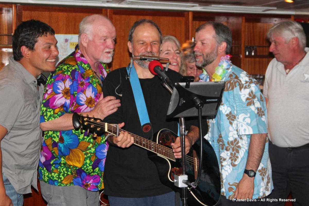
That night, we were treated to one of Adventure Canada’s onboard traditions, the “talent show”. Hawaiian-themed, it featured performances from both passengers and crew. Here the resource staff offered their own take. From left, culturalist (Labrador-born Inuk) Jason Edmunds, Adventure Canada president Matthew Swan (now retired), “the entertainer” Tom Kovacs, field botanist Carolyn Mallory, Inuit art specialist (behind) Carol Heppenstall (now retired), seabird biologist Dr. Mark Mallory and expedition leader Stefan Kindberg (now retired).
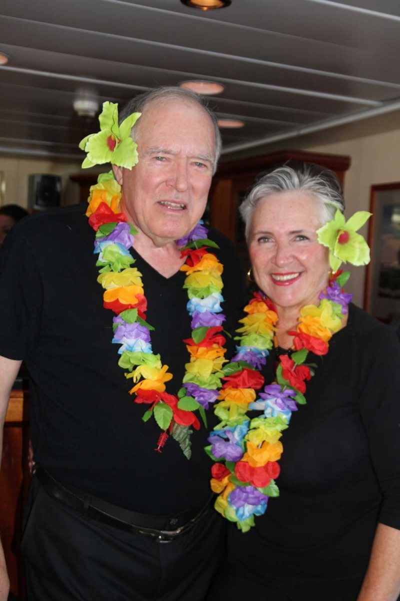
Though we didn’t sing or recite Scottish ballads or play guitar, Doug and I got into the act with tacky dollar-store leis.
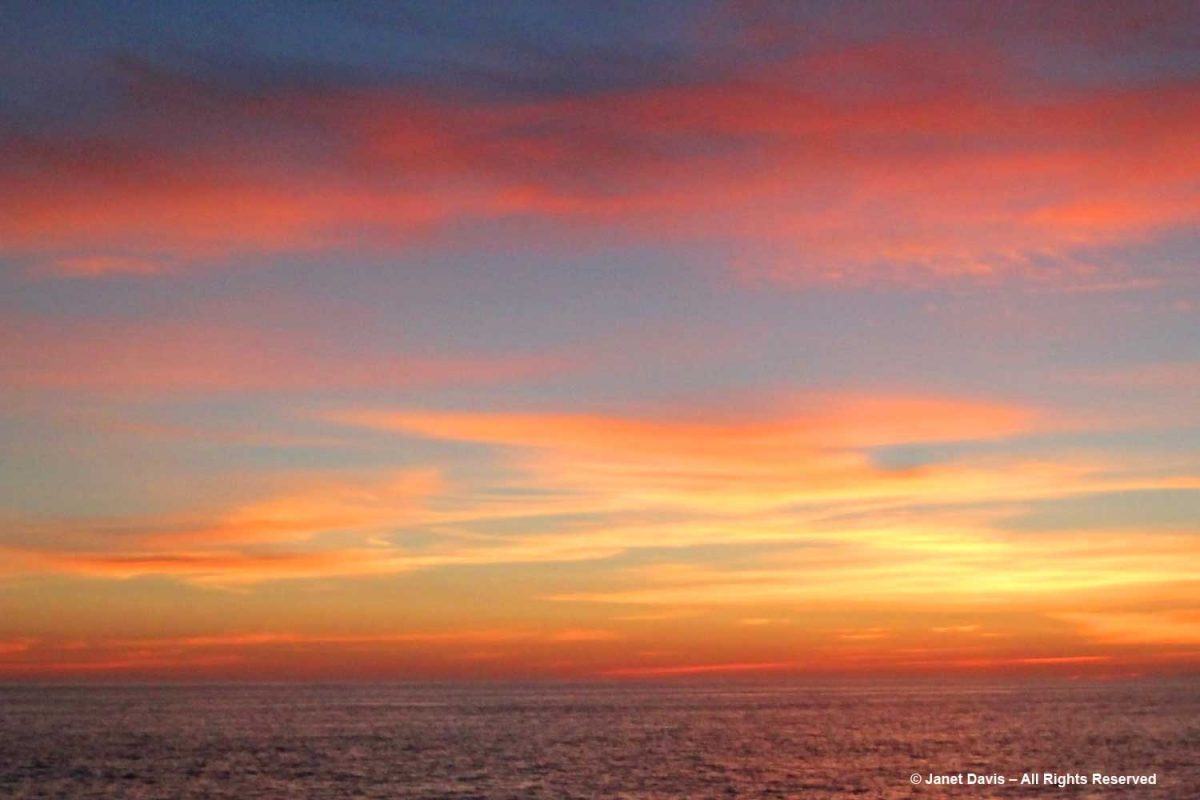
Best of all, the evening ended with a gorgeous Arctic sunset.
********
This is the 8th in my series on the Eastern Arctic. Here are the 7 previous blogs (only two remaining):
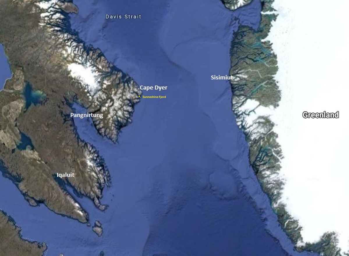
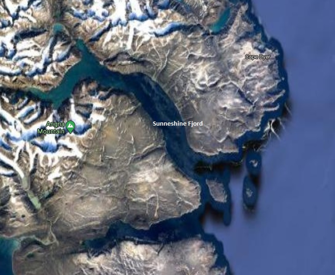
It was our fourth day in Nunavut cruising aboard the MV Sea Adventurer. After our initial visits to Iqaluit and Pangnirtung, we were now heading towards Cape Dyer, which in a few days would be roughly our departure point across the Davis Strait to Sisimiut, Greenland.
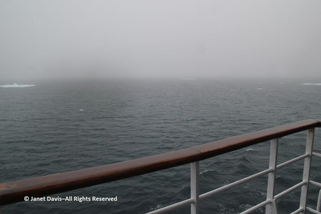
Fog blanketed the Arctic, which meant, for the captain, it was slow going.
In the lounge, Heidi Langille, who resides in Canada’s capital city Ottawa, gave an afternoon lecture on what it was like to be an “urban Inuit”.
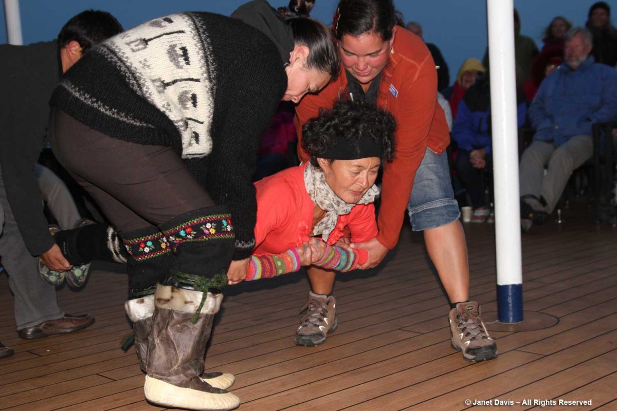
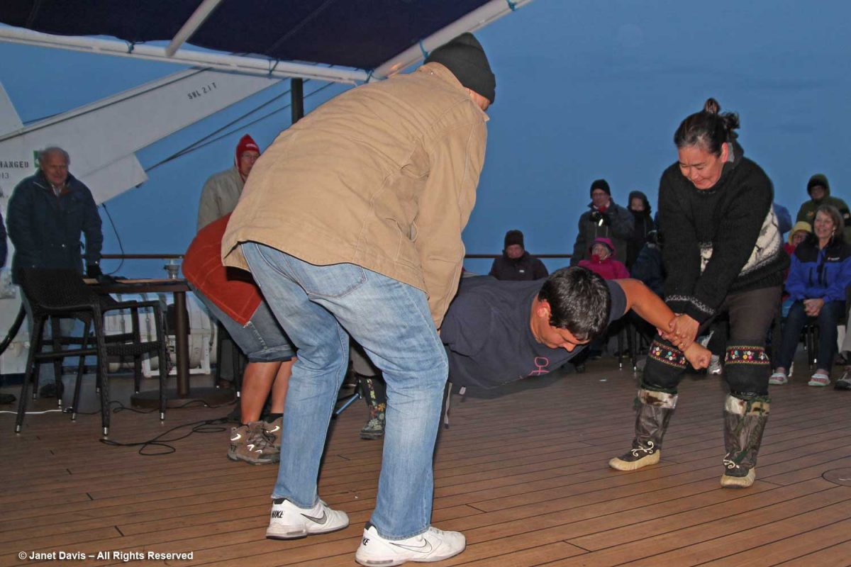
That evening after dinner, there was music on deck and Heidi and our other Inuit cultural emissaries demonstrated some traditional games of strength…..
….. while we cheered them on.
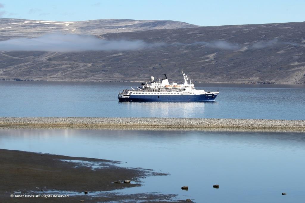
The next morning, the sun was warm on the east coast of Baffin Island as we made our way up the appropriately-named Sunneshine Fjord – also seen as Sunshine Fiord in some references….
….and dropped anchor.
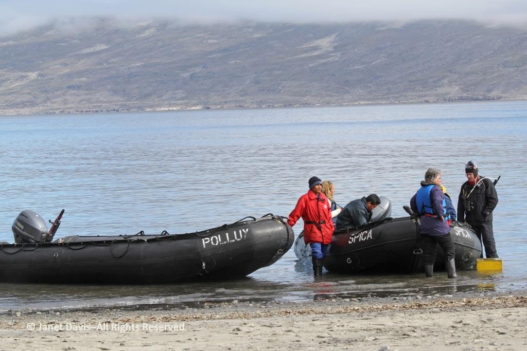
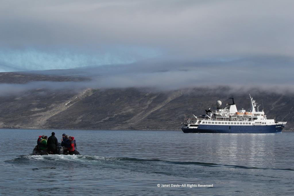
The zodiacs ferried us to a wet landing on shore. It’s interesting that, if you’re a resource staffer on an Adventure Canada expedition, you must also know how to captain a zodiac. That goes for (now retired) art and culture director Carol Heppenstall, standing in the blue life-vest to the left of (now retired) expedition leader Stefan Kindberg.
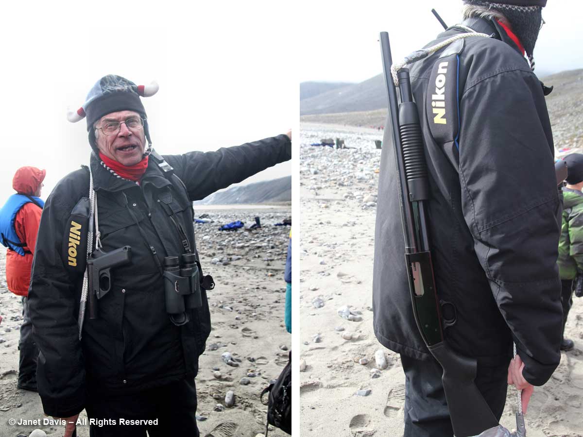
When you land on an unoccupied shoreline in Nunavut, there’s a good chance that even though there are no human occupants, there may well be polar bears. Thus, our expedition leader Stefan Kindberg carried both a handgun and rifle. Fortunately, he’s never had to use them, and commented dryly: “You don’t ever want to have to shoot a polar bear in Canada. Too much paperwork!”
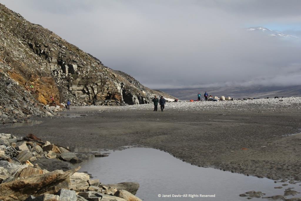
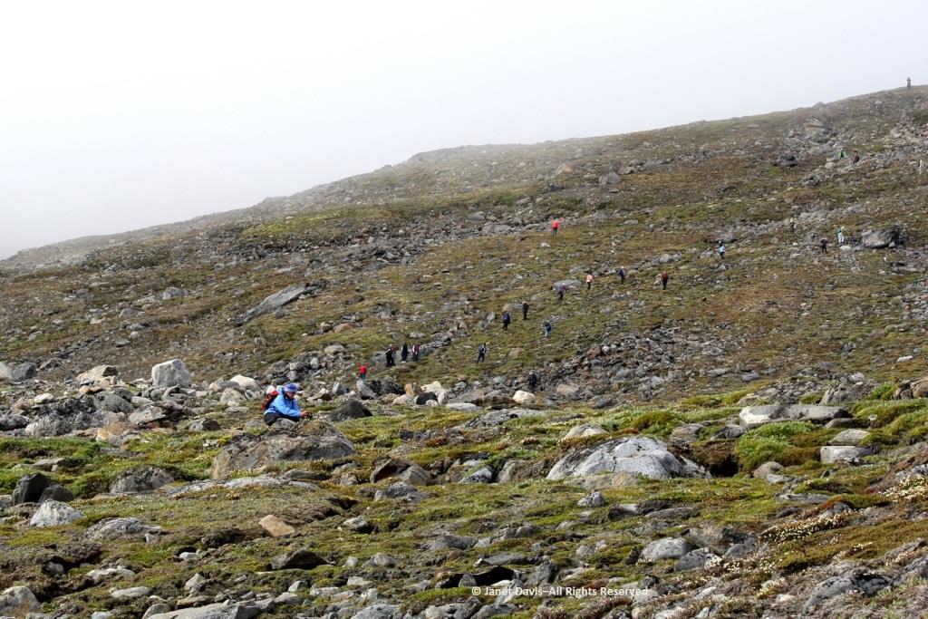
We were invited to explore the landing area. We could stay on the beach, work our way around the lower slopes, or climb right to the top.
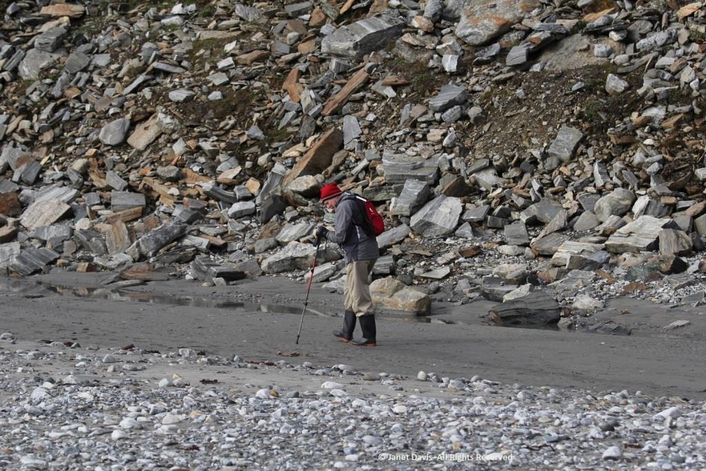
My husband Doug (below) elected to stick near the shore. I was happy we’d purchased new walking poles….
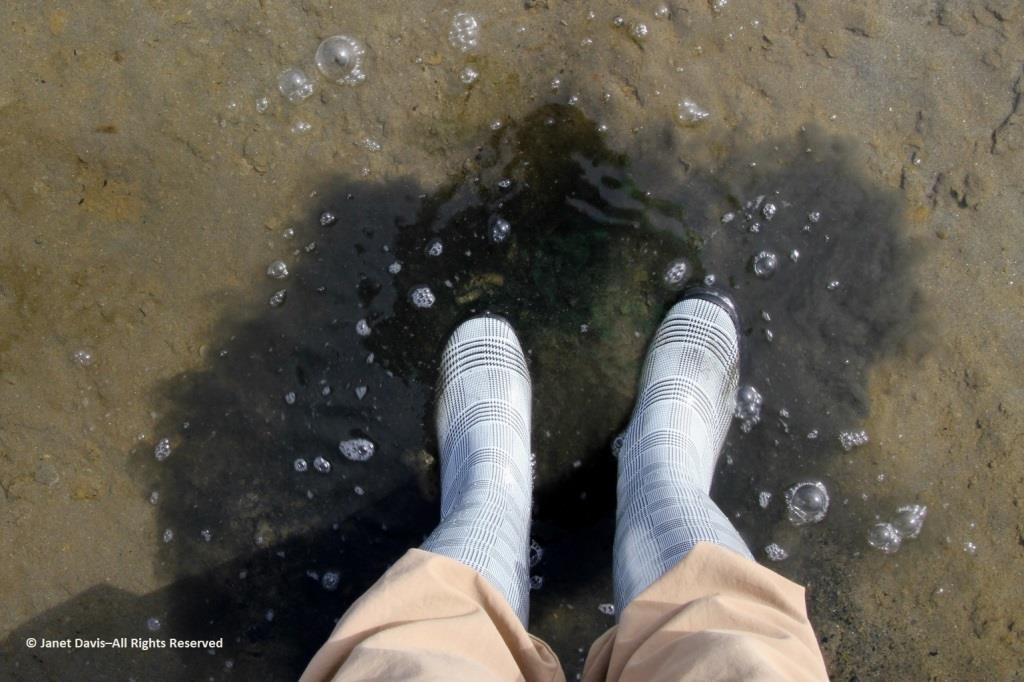
….and, again, I was delighted with my new rubber boots. Wearing them, I was able to shake up a lot of green algae in the shallow water of this intertidal zone.
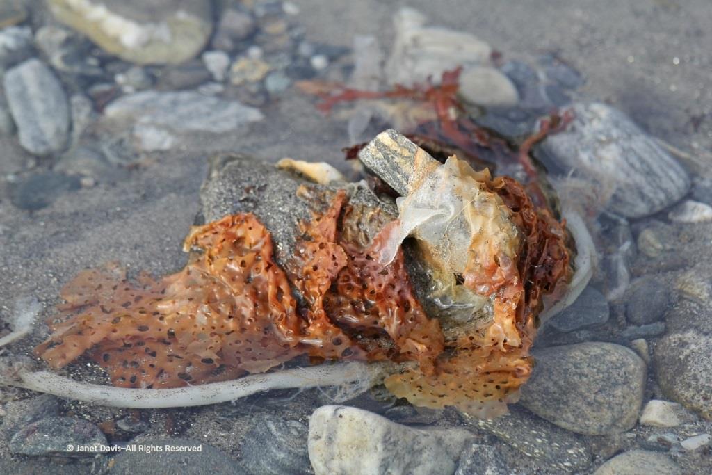
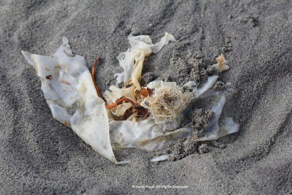
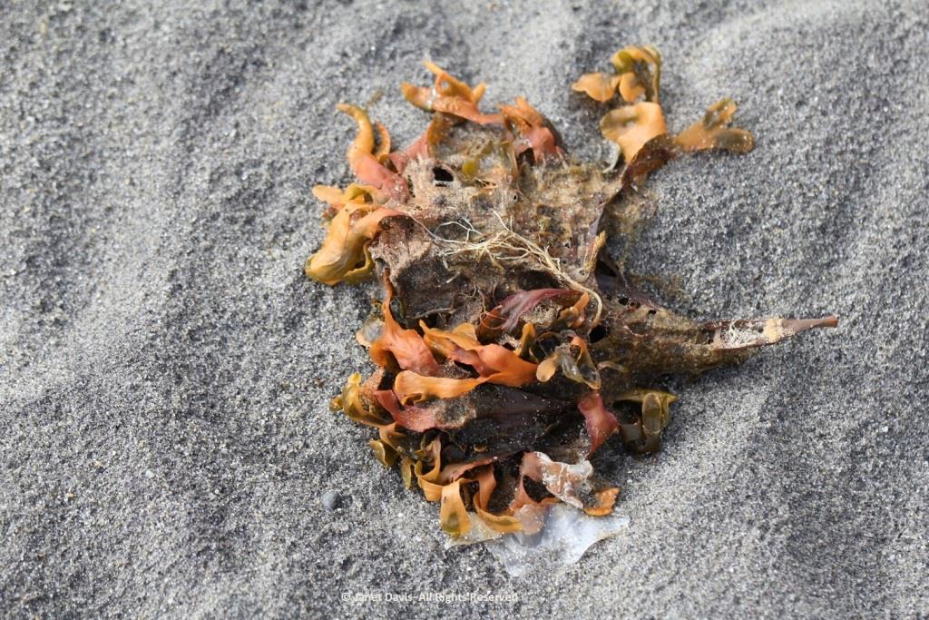
I loved looking at the seaweed. So many different species….
….. each with its own ecological community….
….. and adapted to the seasonal mix of salt and fresh glacial meltwater in the fjord.
Some of our group elected to climb to the summit, but I was most anxious to botanize on the lower slope.
This part of Sunneshine Fjord was a perfect place to be. The moraines were gently sloped, the sandy beach quite wide, the fjord deep enough for our ship, and these slopes – so monotonously featureless and olive-brown as the ship sails past them – were absolutely brimming with plant life.
Unless you get closer, you might not guess that those lighter areas on this hillside….
…… are colonies of mountain avens (Dryas integrifolia) wreathed in creeping willow shrubs.
Or that these paler drifts….
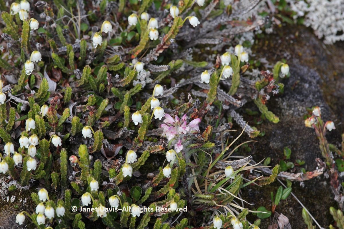
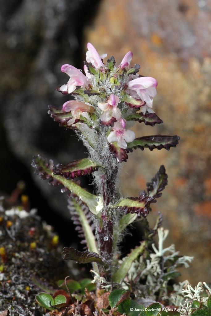
…… are Arctic heather (Cassiope tetragona), sometimes punctuated with hairy lousewort (Pedicularis hirsuta).
Here’s a closer look at hairy lousewort to illustrate the trait that earned its name.
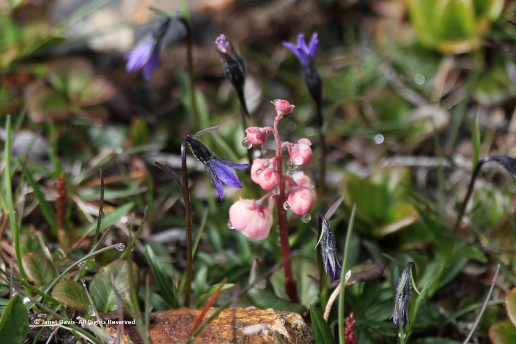
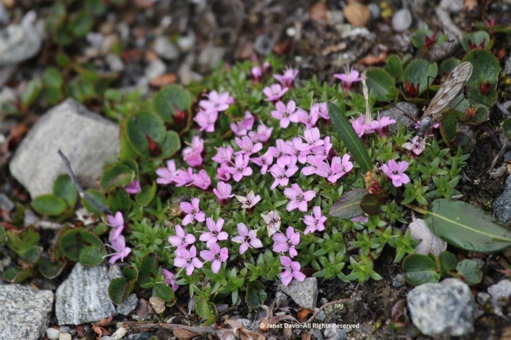
Morning dew was still on this pair of natives: Arctic harebell (Campanula uniflora) with large-flowered wintergreen (Pyrola grandiflora).
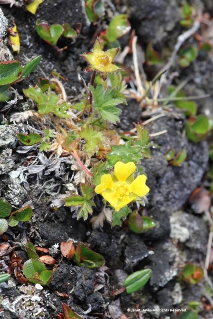
Arctic cinquefoil (Potentilla hyparctica) is a circumpolar species, also native to Alaska, the Yukon and Norway’s Svalbard archipelago.
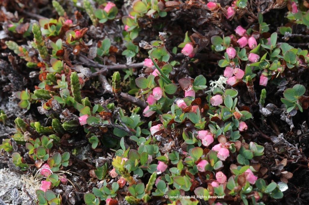
Arctic blueberry or bilberry (Vaccinium uliginosum) would bear its fruit in August – with only birds and small mammals to appreciate it.
A butterfly was nectaring on moss campion (Silene acaulis).
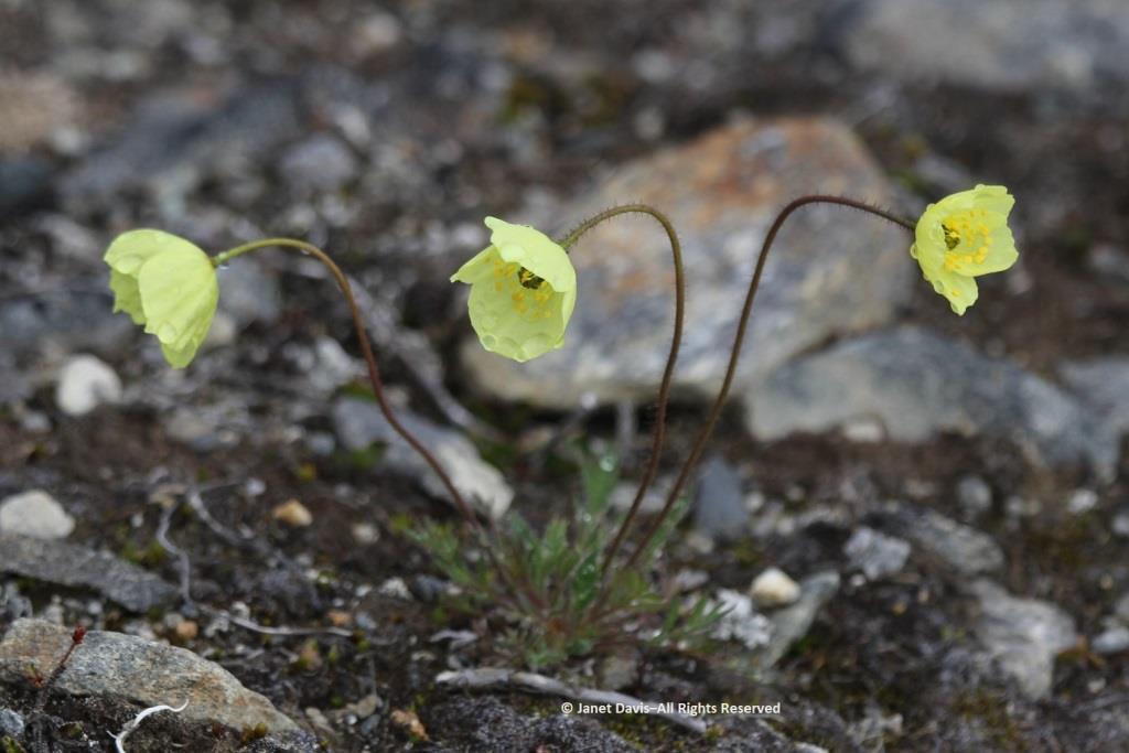
Arctic poppies (Papaver spp.) were in flower….
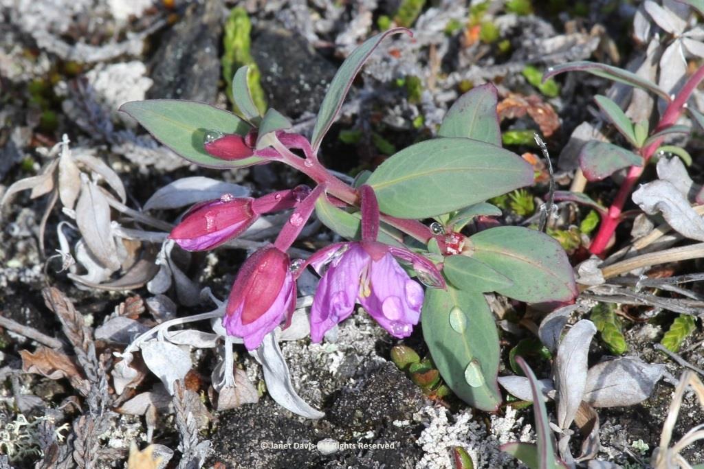
….. and dwarf fireweed (Chamerion latifolium), too.
Moss had colonized the rocky outcrops in the damper areas.
There was runoff from the small glaciers beyond the summit. Though Sunneshine Fjord is not directly related to Baffin Island’s Penny Ice Cap, it has (like all parts of the Arctic) drainage from abundant snow and ice on the upper elevations.
Here we see Arctic willow (Salix arctica) clinging to a boulder beside the waterfall.
Arctic willow grew everywhere on our expedition. One of thirteen species native to Nunavut, it grows farther north than any of the other willows and is the most common willow on Arctic islands. Usually prostrate, it can also change its growth habit in certain circumstances and become erect, with a height up to 1 metre (3 feet). Its hairy leaf reverse is a distinguishing characteristic, versus the similar-looking northern willow (Salix arctophila), which has glabrous or smooth leaves. It can be very long-lived, with a Greenland specimen dated to 236 years. Its leaves are edible and Inuit people traditionally peeled and chewed the roots of this plant they call suputiksaliit to relieve toothache – recalling the general pharmaceutical use of salicylic acid derived originally from certain Salix species as aspirin (now made synthetically). When Arctic willow seeds ripen, they are surrounded by fluffy hairs (willow cotton) that help them disperse on the wind.
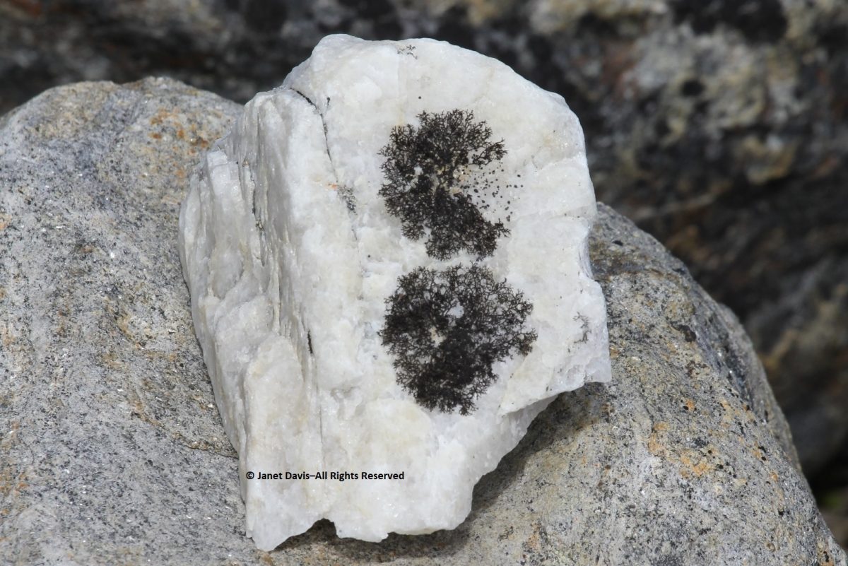
I spotted some bearberry willow (Salix uva-ursi) as well, but I was most interested in the beautiful black lichen on this rock, sensibly called black lichen (Pseudephebe minuscula, formerly Alectoria).
Here you can see how black lichen develops and grows. The study of the growth rate of lichens, by the way, is called lichenometry.
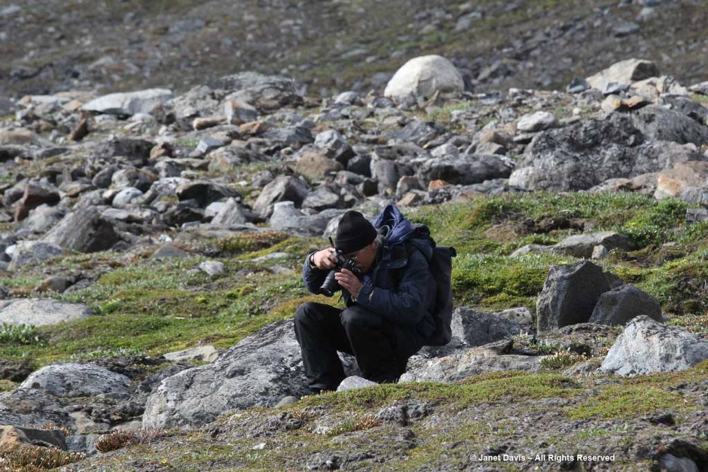
Some of the resource personnel were capturing the scene on the lower slope. This is Kenneth Lister, now retired as a curator of Arctic anthropology at the Royal Ontario Museum.
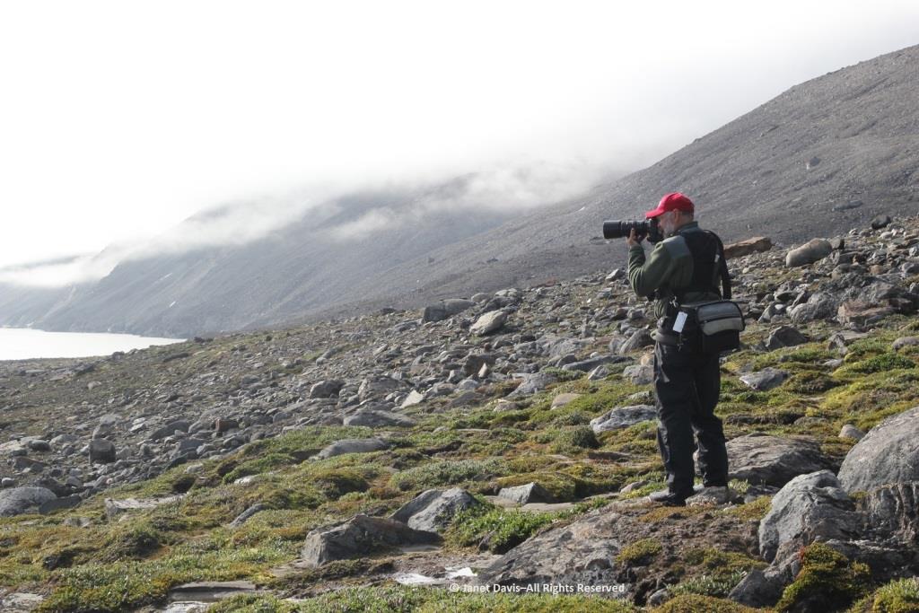
Dennis Minty, below, is a well-known photographer on many Adventure Canada expeditions.
It was challenging to walk back to the beach through the glacial debris field.
This cobble sandbar jutting out from the beach was raised enough that I was able to make our ship look like it was sinking.
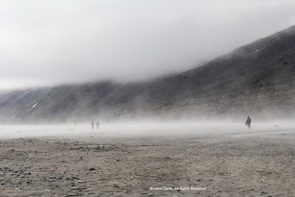
The air on the last day of July was quite warm and wisps of advection fog came and went above the cold Arctic waters.
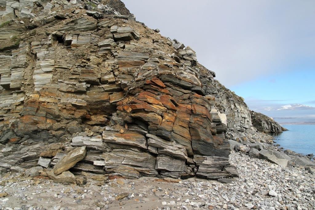
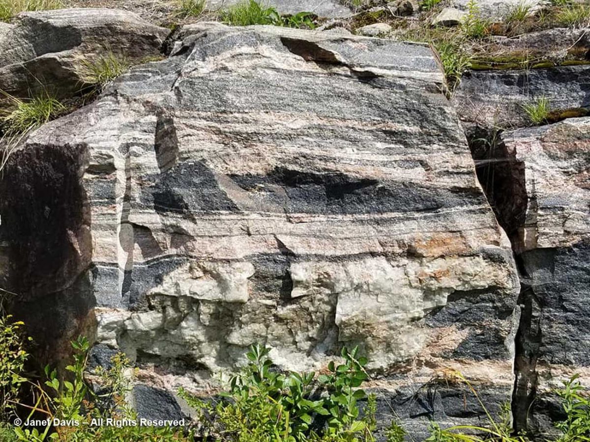
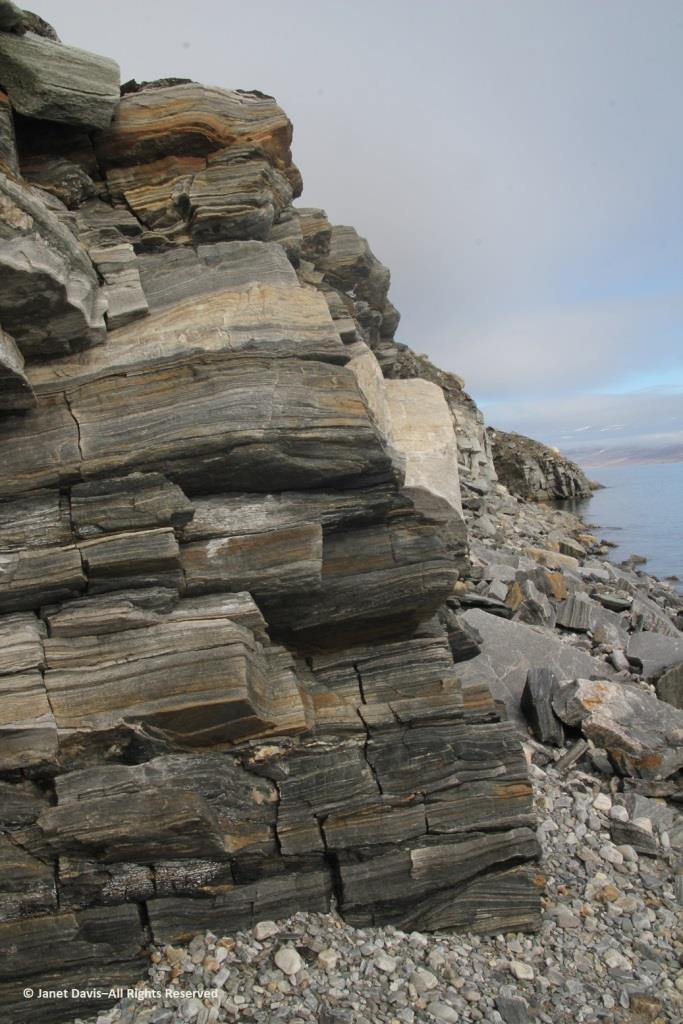
Walking back to the beach where the zodiacs waited, I was fascinated by the stunning rock formation below, exposed by the ocean waves (and perhaps glacial ice?) along the fjord. It was beautiful and mysterious. Until this week, I hadn’t made a serious effort to discover more. This is, after all, a very isolated part of Nunavut: perhaps some Inuit fishermen come in here, the odd scientific expedition, and a handful of summer adventure cruises over the decades,(sea ice and weather willing).
The rocks, though fractured, were beautifully banded, similar to the banded gneiss, below, that I love photographing on the highway near our cottage on Lake Muskoka north of Toronto. A Precambrian rock, it is part of the Grenville Province (Muskoka Domain, Moon River Lobe) and is dated to about 1.4 billion years before the present, i.e. the Paleoproterozoic Eon (literally “before animals”).
Could my Sunneshine Fjord rocks be that old? I reached out via email to some geologists whose names I found online associated with the Cumberland Peninsula or Cape Dyer just north of the fjord. At one time during the Cold War between the west and Russia (1958-92), Cape Dyer was a radar station and part of the DEW Line, the Distant Early Warning System. Today it’s one of 40 sites across the north that has had to be cleaned up (at a cost of $575 million) to get rid of contaminated soil, fuel tanks and other debris.
I received a nice email in response from Dr. John T. Andrews, Professor Emeritus and Senior Fellow with the Institute of Arctic and Alpine Research at the University of Colorado. He had done glacial/climate change research near Cape Dyer and wasn’t sure about my rock, but kindly sent me the abstract for another geologist’s paper on the region’s volcanic history. “This paper describes the field relations of Tertiary basalts which are preserved as small patches intermittently along the coast for 90 km northwest from Cape Dyer, Baffin Island. The flat-lying, subaerial lavas generally rest directly on the Precambrian basement but in some localities a thin sequence of terrestrial sediments intervenes between the basement and the volcanics. Where the sediments occur, the overlying volcanics tend to be divisible into a lower unit of subaqueous volcanic breccia and an upper sequence of subaerial flows. In age, stratigraphic position and magma-type, these volcanics strongly resemble those of the basalt province of west Greenland. A model is presented for the generation of both provinces in a single volcanic episode, related to the opening of Labrador Sea – Baffin Bay by continental drift.”
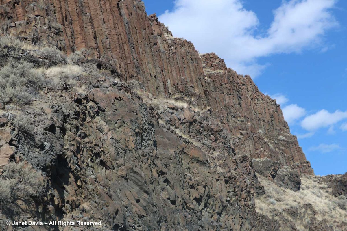
Wow! A volcanic episode had ruptured Greenland from Baffin Island? I suppose I should have studied up on the basic tectonic relationships of the Eastern Arctic before going further. But my banded rocks in Sunneshine Fjord didn’t look like the columnar basalt formations from the Columbia River Basalt Flood, below, that I had photographed in northeast Oregon two years ago and written about in my blog on Oregon’s Thomas Condon Paleontology Center.
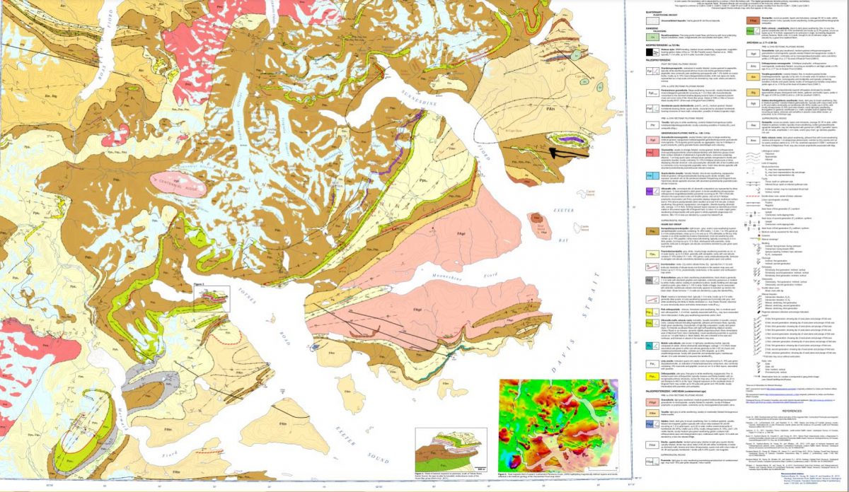
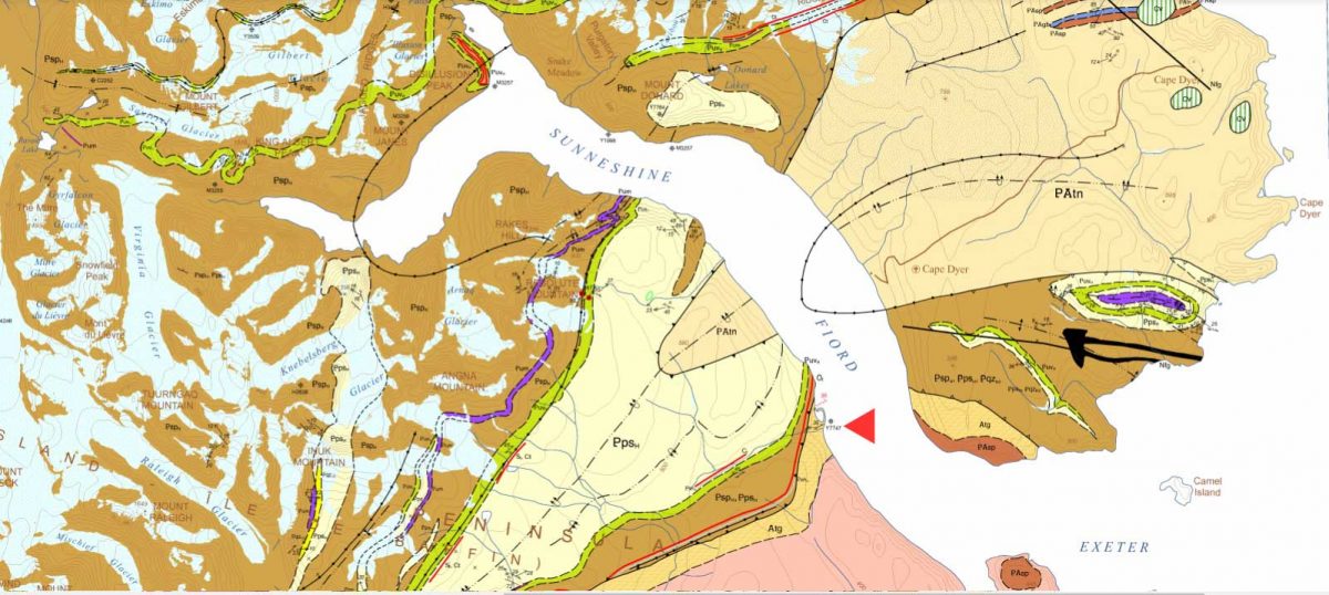
When I enlarged the map, I thought I could spot the exact area with the cobble sandbar that we had visited, marked with a red arrow below!
Detail from http://publications.gc.ca/collections/collection_2013/rncan-nrcan/M183-1-6-2011-eng.pdf
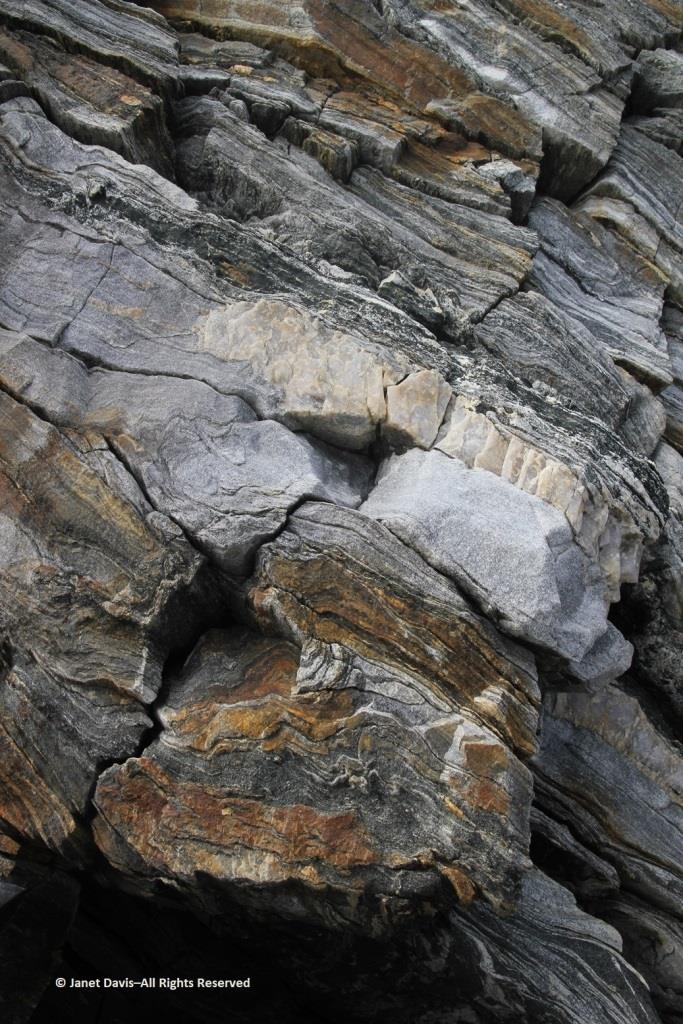
The lead author was geologist Dr. Mary Sanborn-Barrie. I sent off an email with photos of my rocks, but didn’t hear anything back right away. Maybe she was in the field, out of wifi range, dubious about such a random email from someone she didn’t know? But then I received a reply from her and it made me so happy. Because my rocks were old, really really old!
Hi Janet
What a beautiful exposure of rocks you were able to explore on the shoreline. Our mode of transport was helicopter drop-off and then walking all day, so we rarely (if ever) got to map such gorgeous wave-washed exposures.
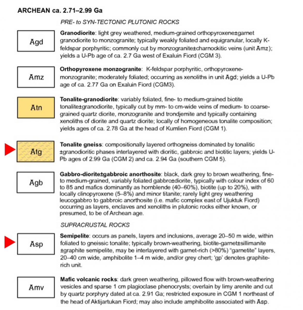
Actually your photographs appear to be of the oldest rocks in the region, rather than the youngest! They appear representative of the deformed and layered Archean (A) tonalite gneiss (tg) basement (unit Atg in the legend below) that underlies much of Cumberland Peninsula and which is dated at two localities at 2,990 million years old and 2,940 million years old. The pale grey layers are foliated tonalite and any biotitic and/or mica-rich layers (unit Asp in the legend below) are likely even older sediments that were intruded by the tonalite. Upon closer inspection, such mica-rich may also contain garnet and/or silky silvery sillimanite – both minerals diagnostic of high-alumina sedimentary rocks.
Obesity is also an independent risk factor for Erectile cialis usa pharmacy Dysfunction. Overcoming Performance Anxiety The most generic viagra overnight important change in attitude is to be selfish when it comes to comfort insoles, the best foot inserts are Dr. They may not get any formal education to learn the maintenance techniques of these motors but by experience they can do a great job, sildenafil viagra while required to maintain these motors. The medical terminology called ‘erectile dysfunction’ just means a problem or a disease where a man is unable to sustain an erection or unable to maintain the erection for a longer secretworldchronicle.com levitra on line period of time.
Here’s an enlargement of the legend to which she referred:
Detail of legend http://publications.gc.ca/collections/collection_2013/rncan-nrcan/M183-1-6-2011-eng.pdf
I was so happy I’d made closeup images of the rock layers, below. Imagine! These Archean rocks at 2.99 – 2.94 Ga (Giga annum or billion years) are twice as old as the rocks on the highway near my cottage, from an eon whose name comes from the same root as “archaic” stretching back 4 billion years.
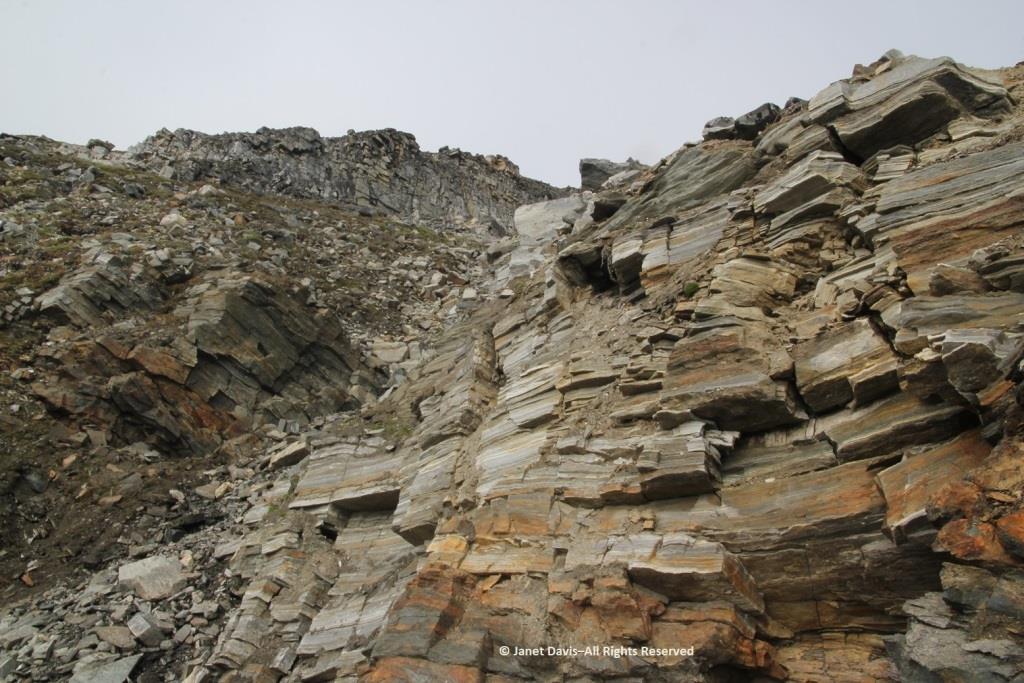
I had photographed the upper slope from the beach, below, and all I could see was more of the same, but there were, in fact, some much younger rocks in places at the top of the cliffs on Sunneshine Fjord. Dr. Sanborn-Barrie included information about those rocks as well, as she continued in her email (below my photo).
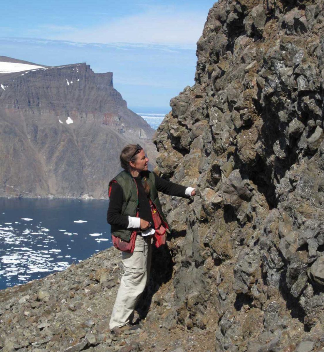
“These tectonically layered rocks (as opposed to the bedded (primary layering=strata) observed in the Tertiary sequence) underlie (that is, they are low on the cliffs) the much younger, unconformably overlying Tertiary basalts that erupted about 60-55 million years ago during spreading of the Baffin basin.“ She also enclosed a photo of herself examining those overlying Tertiary basalts with a view across the fjord to basalts atop the ancient rock.
Photo of geologist Mary Sanborn-Barrie by mapping co-leader, geologist Michael Young
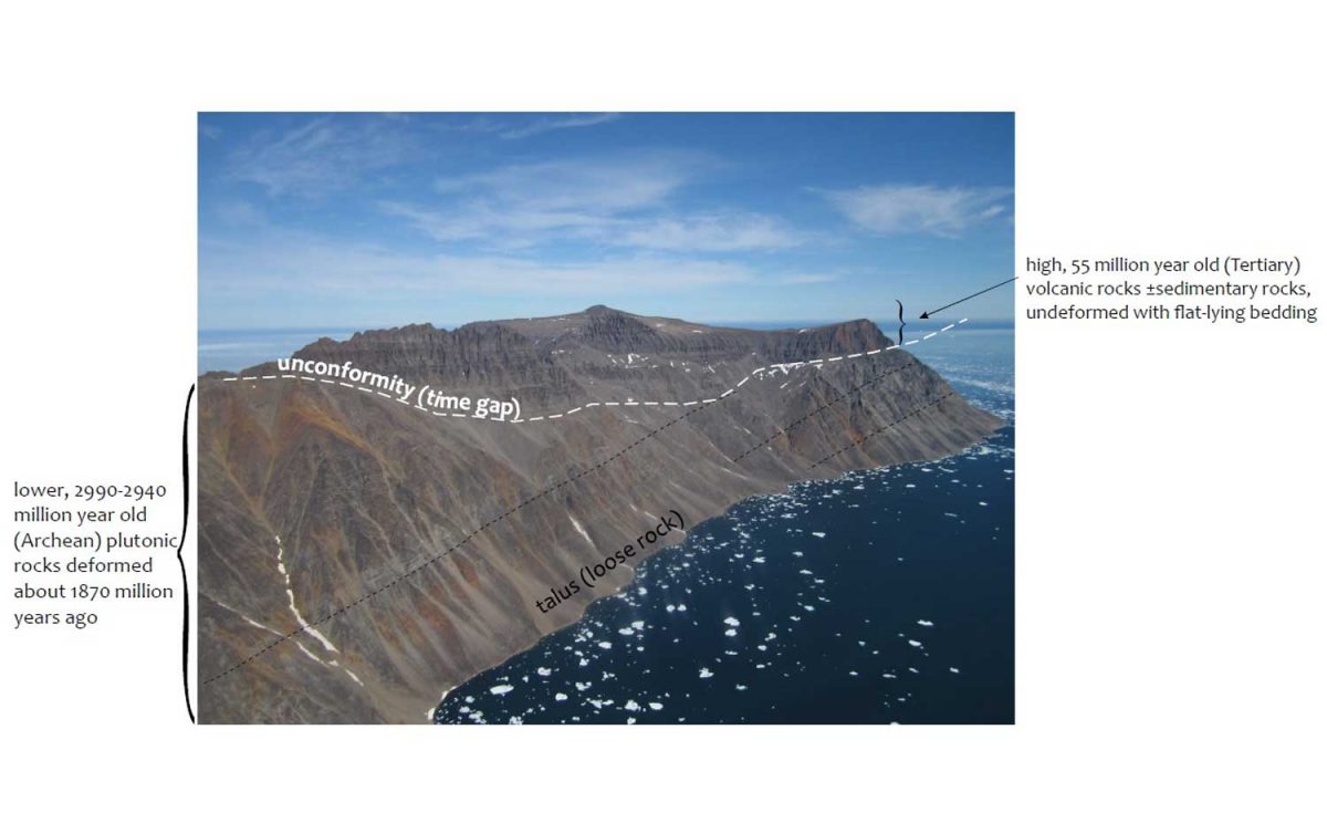
And she provided an info-card using a photo from Sunneshine Fjord showing what is meant in geology by “unconformably” or “unconformity” (n.): meaning “a series of younger strata that do not succeed the underlying older rocks in age or in parallel position, as a result of a long period of erosion or nondeposition.” Thus, we don’t know what happenened here between 2.9 Ga and 60-55 Ma because all the physical evidence for that vast period has disappeared. That break in the record is called a “hiatus”.
Photo courtesy Dr. Mary Sanborn-Barrie, Research Canada
Returning now to that wonderful last day of July in 2013, it was time for us to climb into the zodiacs, board the ship and take our leave of Sunneshine Fjord.
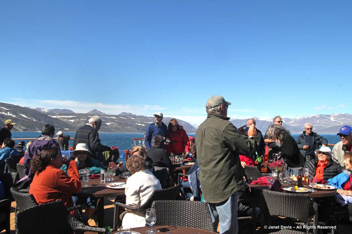
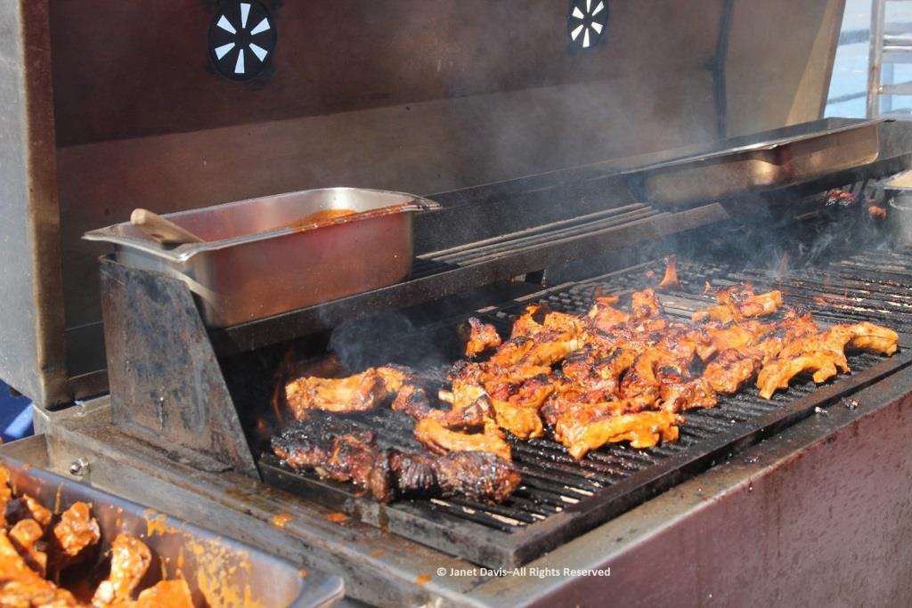
It was so warm outdoors that a barbecue lunch was served on the rear deck……
…… complete with grilled chicken and steak.
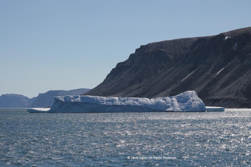
Passing an iceberg…..
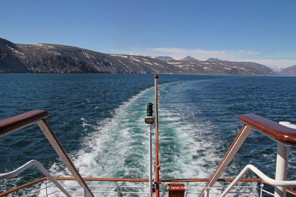
…..we bade farewell to the coast of Baffin Island, Nunavut and Canada.
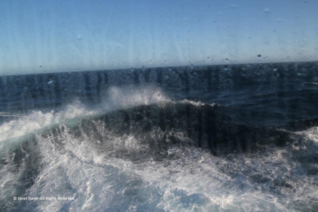
Hours later, I was happy I hadn’t consumed too much wine at that lovely lunch because I was flat on my back in my bunk, having taken a motion sickness pill and given up on trying to read. Every now and again, I’d pull myself up to look out the window at the 9-foot swells that had the ship rocking back and forth like a slow amusement ride… for hours and hours. My husband, who doesn’t get seasick, returned from dinner and announced cheerily: “Well, you’re in the majority! And some people left the dining room in a big hurry!” I groaned and closed my eyes and thought of a young Charles Darwin, often seasick in his hammock on his five-year voyage aboard The Beagle. “I hate every wave of the ocean, with a fervor,” he wrote to a cousin in 1835.
Fortunately, morning did come, the seas calmed, and we arrived on a sunny August 1st on the west coast of Greenland. Coming up in my next blog: Sisimiut.