Oregon’s Thomas Condon Paleontology Center

The morning after our visit to the Painted Hills Unit of the John Day Fossil Beds National Monument (JODA), we had a $5 bacon-and-eggs breakfast at the Sidewalk Cafe in Mitchell, then packed our bags and drove away from The Oregon Hotel.

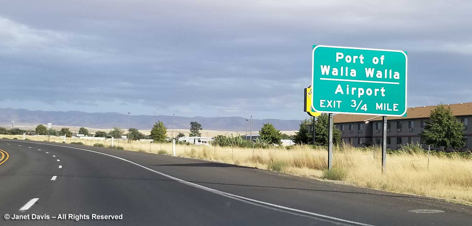
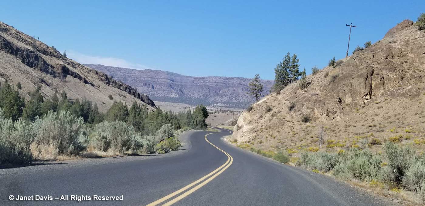
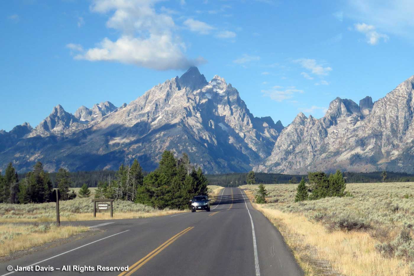
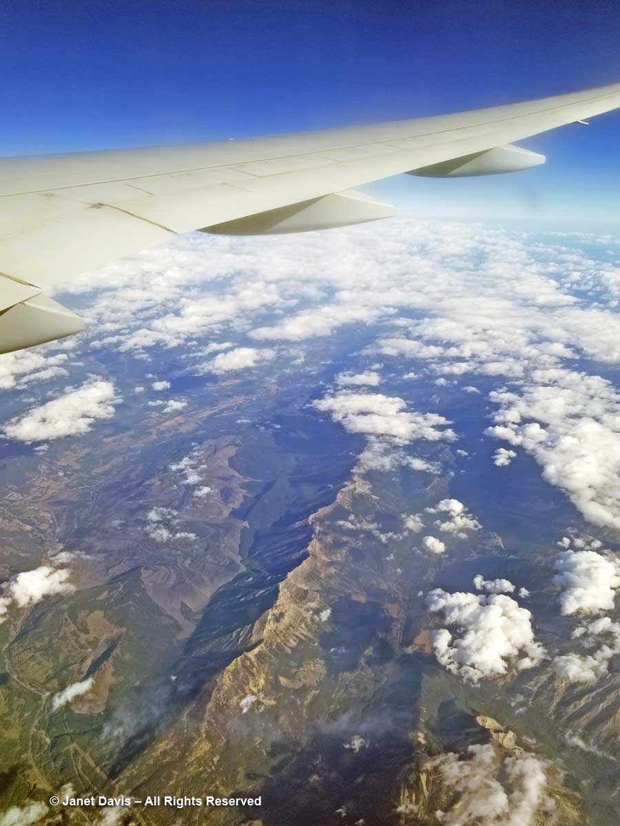
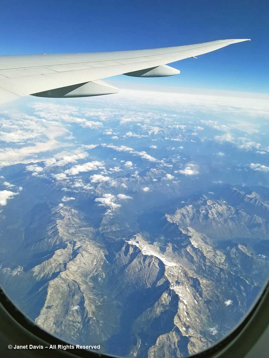
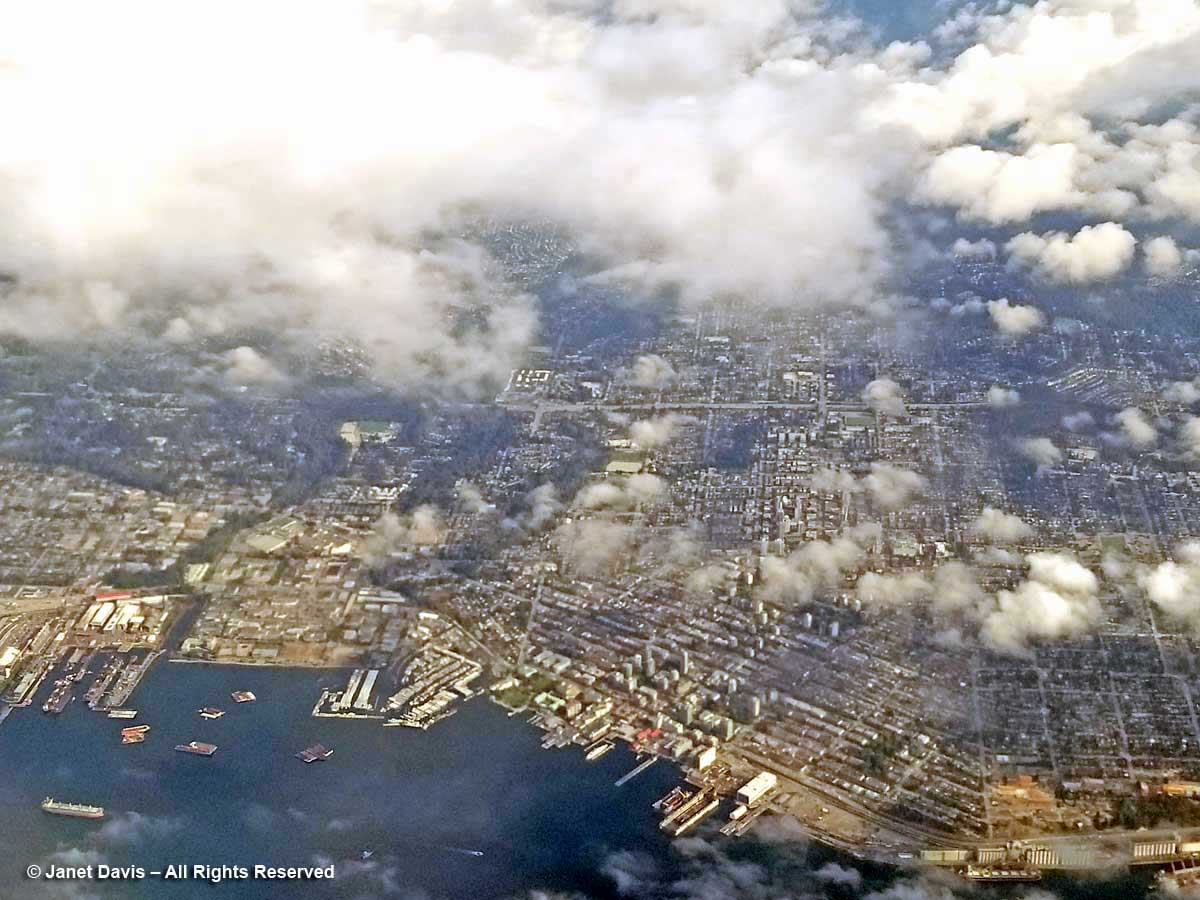
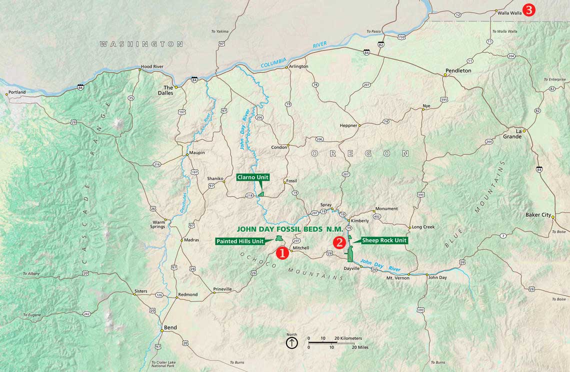
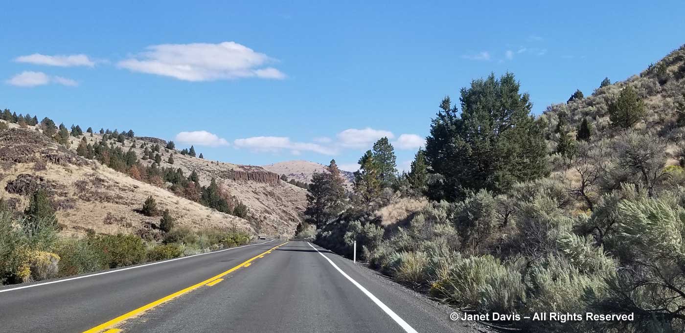
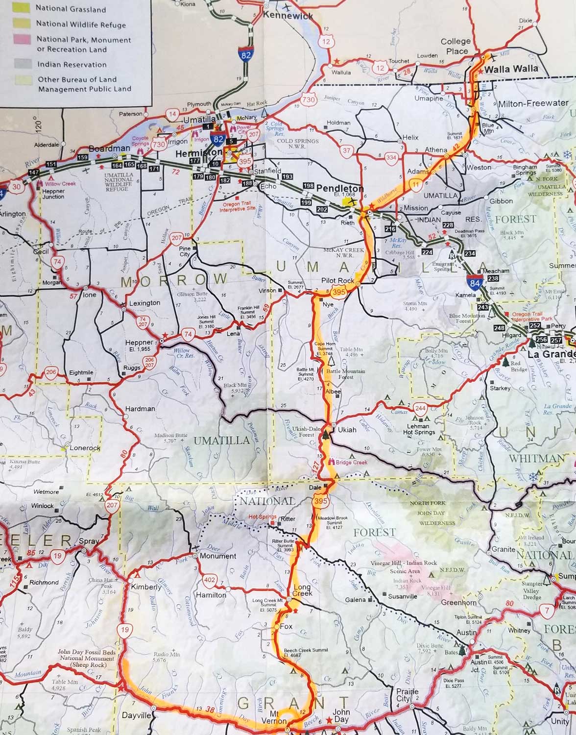
Soon we were driving east from Mitchell (#1, below) on Highway 26 towards Highway 19 and our destination, the Thomas Condon Paleontology Center (TCPC) at Sheep Rock (#2), the second of the three units of JODA. (Click on the photo to see a larger version.) Sadly, we didn’t have time to include John Day’s third area of interest, the Clarno Unit, which features the in situ fossils. Our ultimate destination that day was a one-night splurge at the Inn at Abeja in Walla Walla (#3) about 207 miles away via Highways 395 and 11, where my husband had booked a 3 pm wine-tasting. We didn’t make our appointment (blame geology and highway work) but re-booked it for the following morning (coming up in my next blog!)

It was fine weather on September 10, 2018 and I was enjoying…….

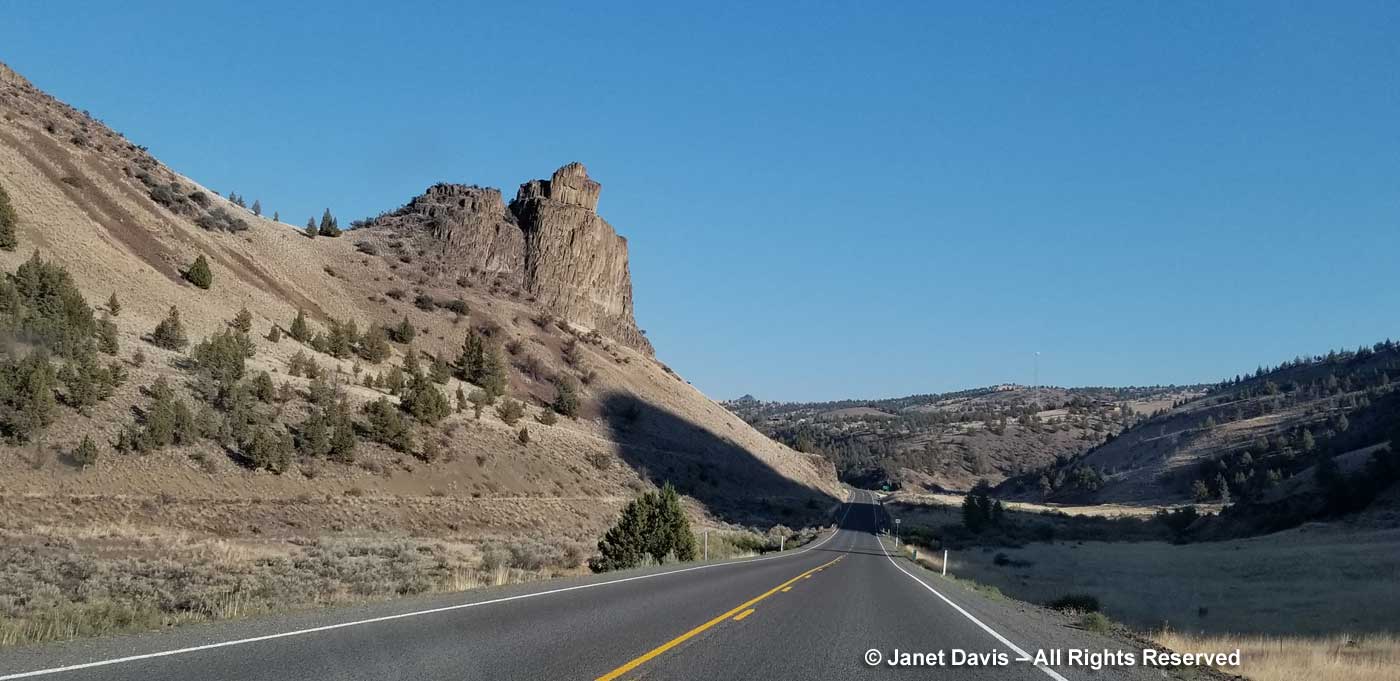
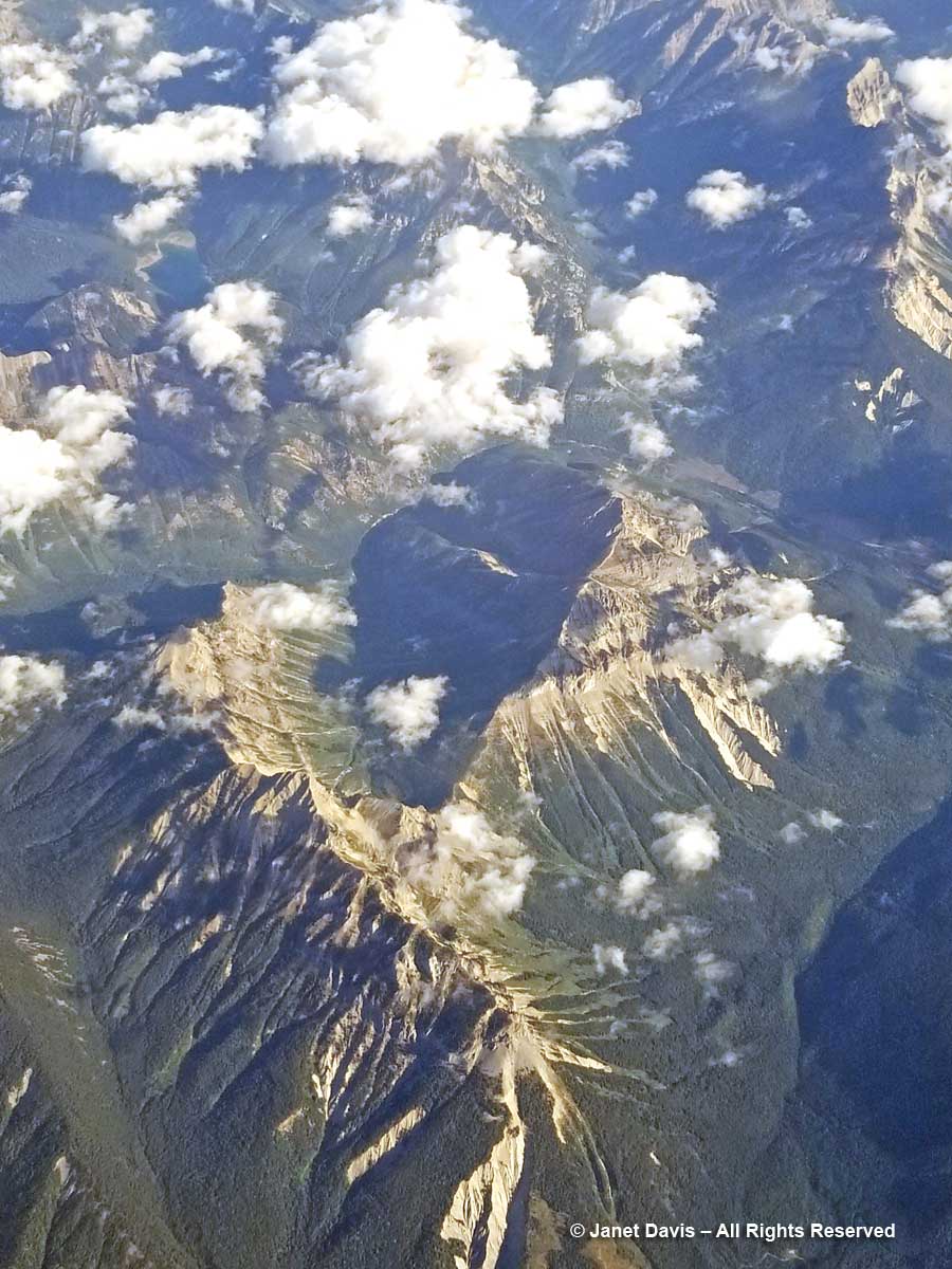
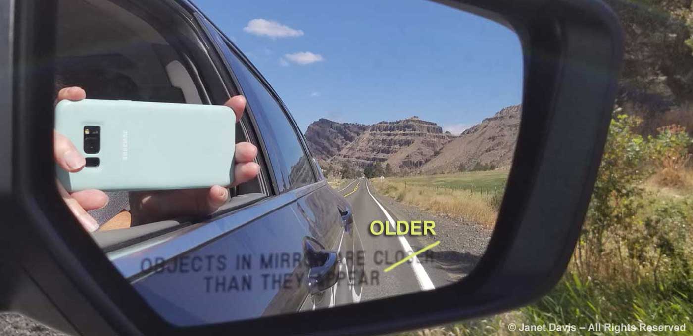
…… sending back jokey phone shots to my friends on Facebook. Might as well get some value out of those roaming fees!  You can see the reddish-brown, wedding-cake palisades of the…..

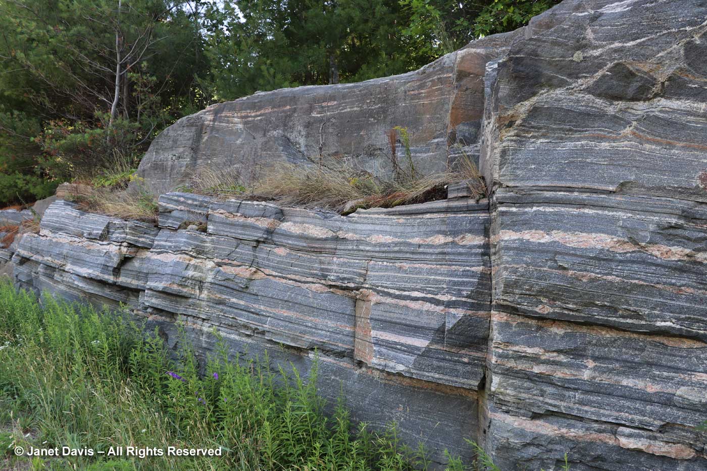
….. Picture Gorge Basalts in these photos.  “Picture Gorge”, for all its importance in defining a large lava flood, seems a little elusive as to physical definition. It is usually pinpointed on maps as just north of Highway 26 on Highway 19, i.e. very near to this location. So it was fortuitous that I asked my husband to pull over at this spot on the highway where the volcanic rock was beautifully exposed. It recalled for me John McPhee’s writings in Annals of the Former World about road cuts like this one yielding vital information for geologists.

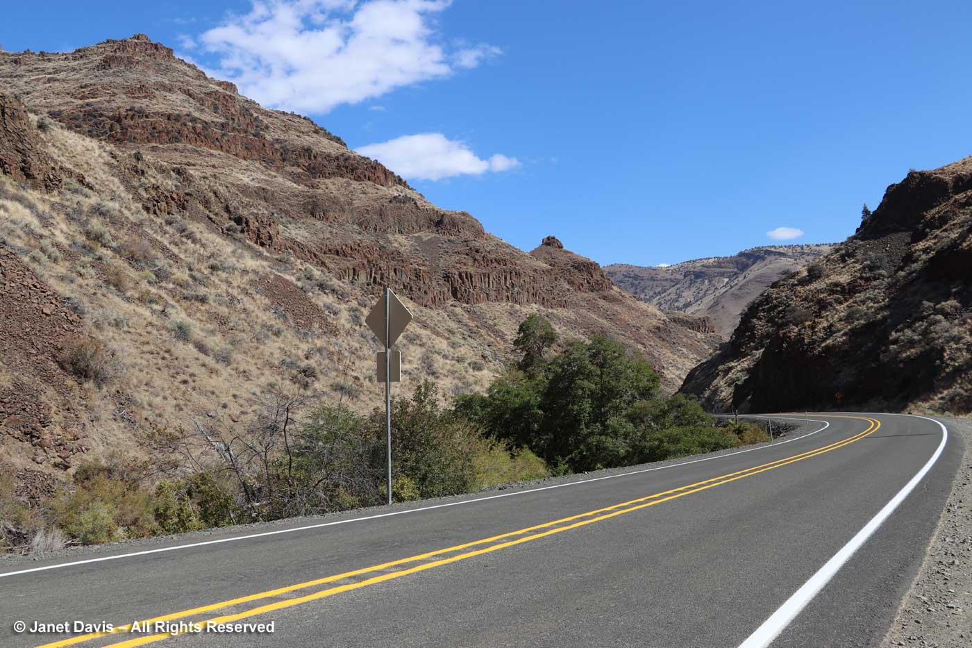
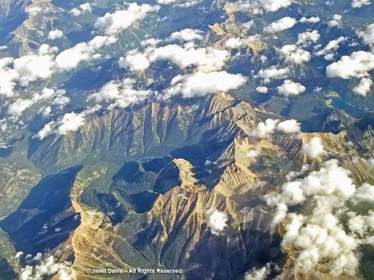
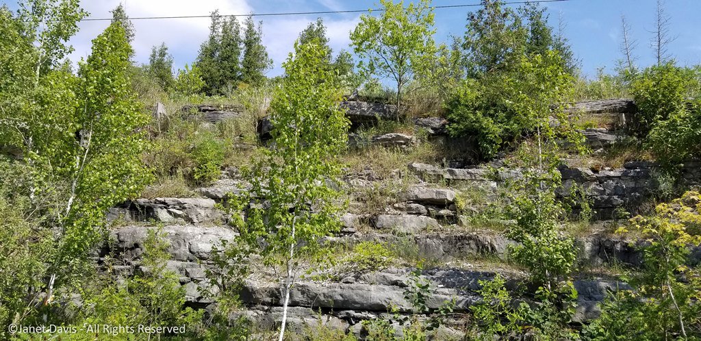
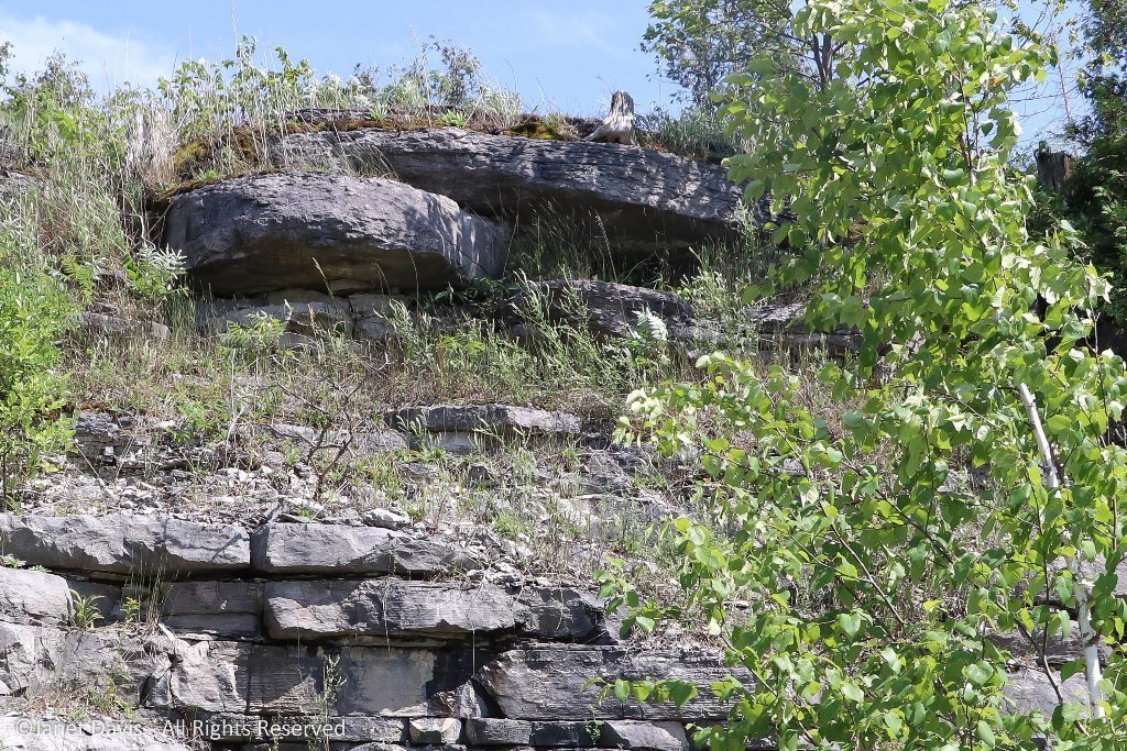
At this point we saw that the basalt has been tilted and mashed up (using very un-geological terminology), but a few yards further on…..

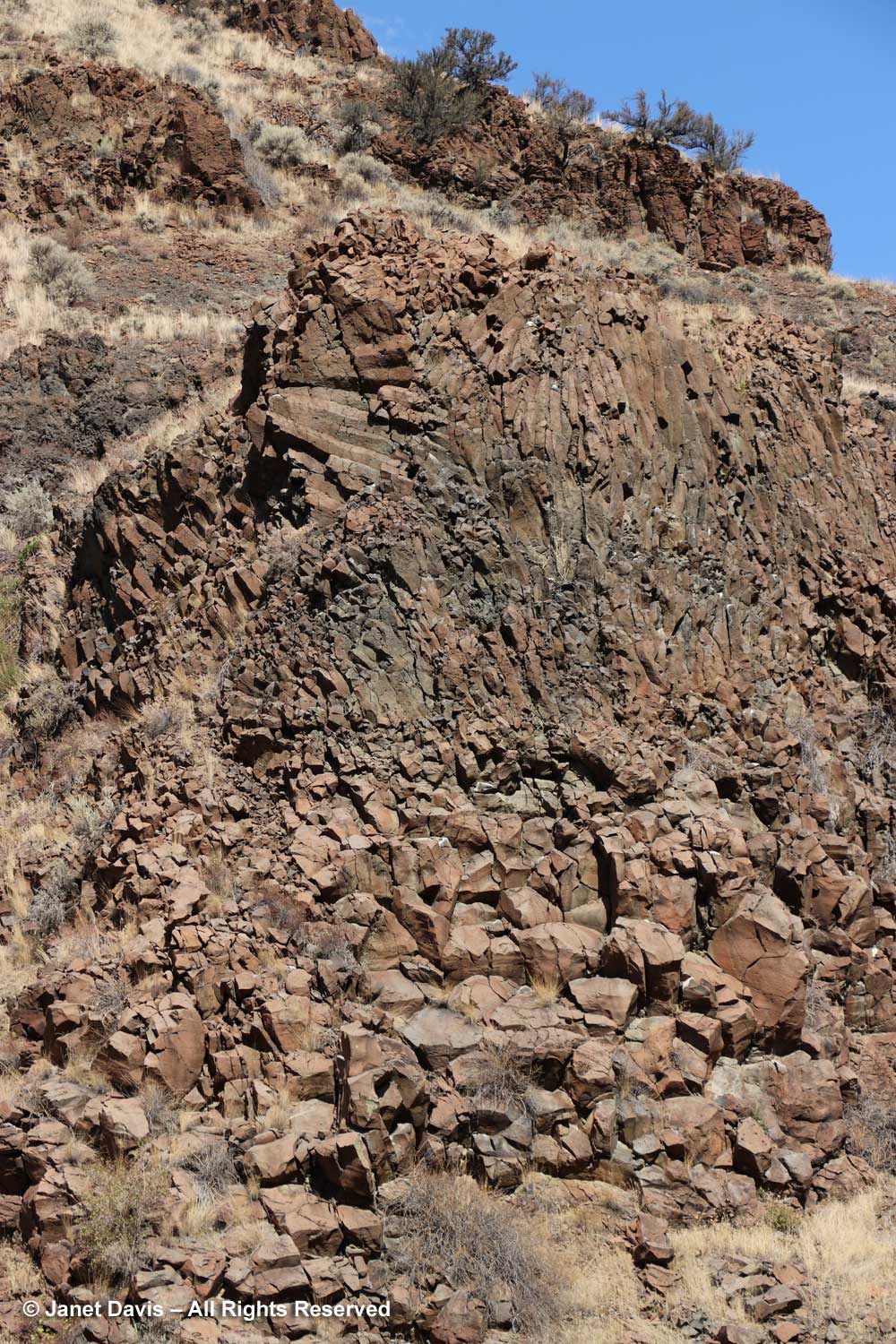
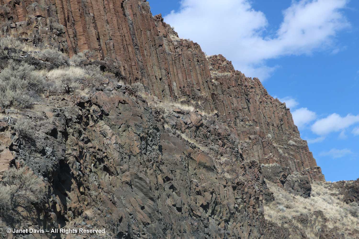
…… we saw the basalt as it was originally formed into hexagonal columns (columnar basalt) while cooling slowly after a geographically local eruption in what geologists include as the “Picture Gorge Basalt Flood” in the Columbia River Basalt Flood (CRBF) event. As defined in Wikipedia, “a flood basalt is the result of a giant volcanic eruption or series of eruptions that covers large stretches of land or the ocean floor with basalt lava”. The broader geologic category covering basalt flood events is a Large Igneous Province (LIP), meaning areas greater than 100,000 square kilometres (38,600 square miles) that occurred within a short geologic time, a few million years. (If you remember your three types of rock from elementary school, “igneous” rock forms from lava or magma.) In this part of western North America, the Columbia Plateau between the Cascade Range and the Rocky Mountains of Washington, Oregon and Idaho is a depression of 160,000 square kilometres (63,000 square miles) formed by successive lava flows. During the CRBF event between 16.6 – 15Ma (Ma = mega annum = million years), massive amounts of magma erupted as basaltic lava (thought to have been fed by the same slowly-moving hot spot that triggered the Yellowstone super-volcano). The CRBF covers seven formations, including the one we’re travelling through: the Picture Gorge Basalt Flood. Beneath Yakima, Washington, the basalt is 15,000 feet thick. Here in the Picture Gorge, it’s about 1,000 feet thick. Got all that?

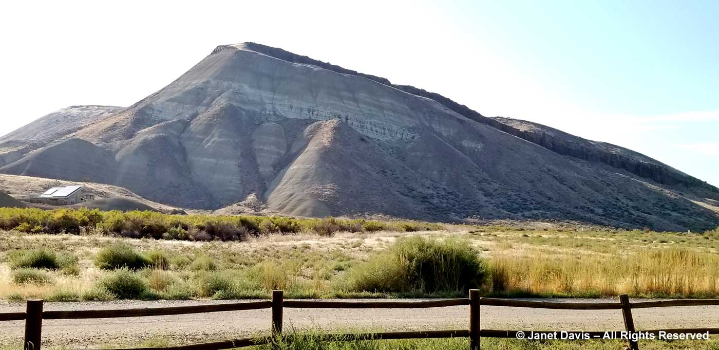
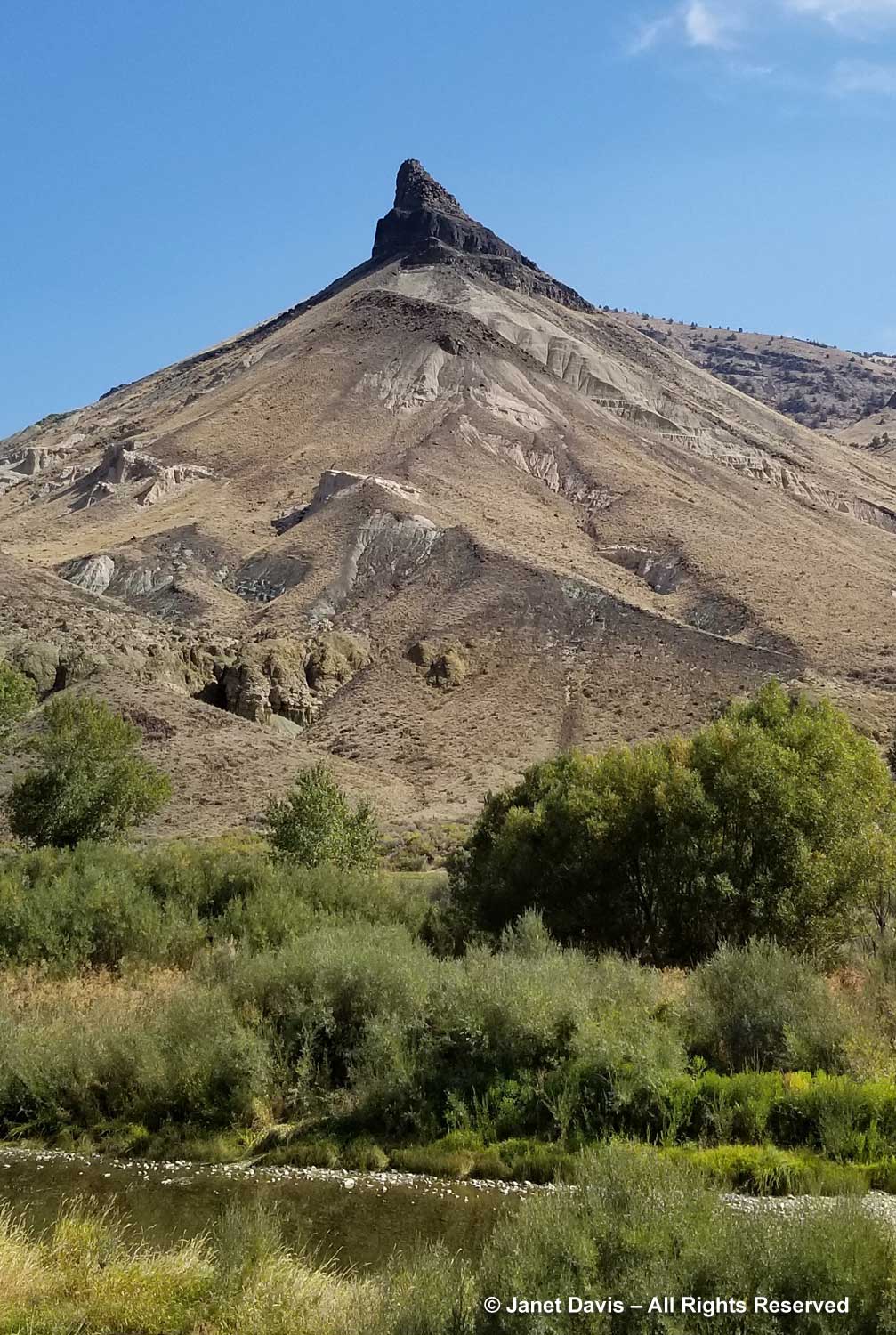
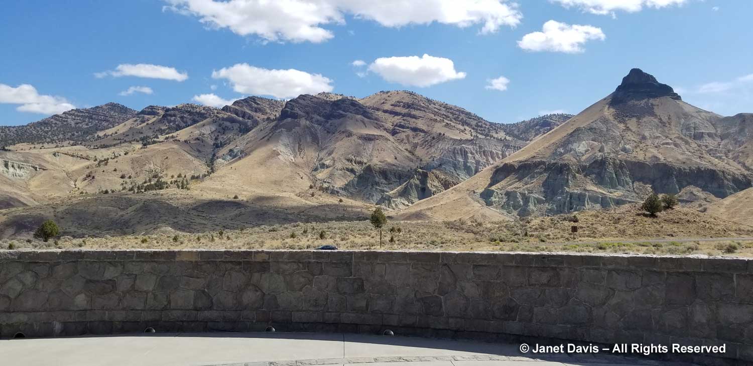
Less than an hour after leaving Mitchell, we were on the newly-paved highway through Picture Gorge leading to the TCPC. We stopped to photograph pinnacled Sheep Rock with its patchwork formations.

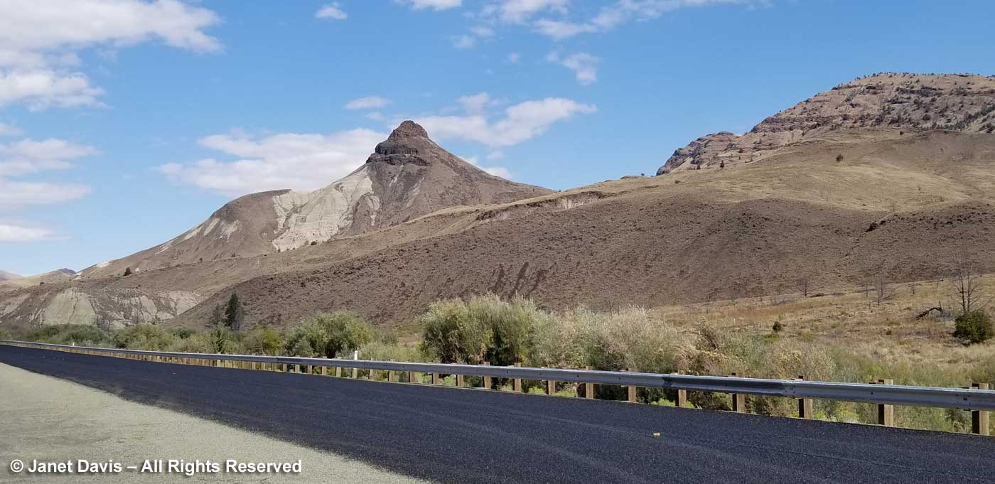
Sheep Rock is 3360 feet (1024 metres) and gives its name to the larger area around it. According to the US Geological Survey, “The Sheep Rock unit contains an amalgam of colorful strata and complex geology. From Cretaceous conglomerates to the flood basalts, the geologic features in this portion of the monument are a spectacle to behold. The predominant exposures of green rock seen on Sheep Rock are a multitude of reworked layers of volcanic ash. The rich green color of the claystone was caused by chemical weathering of a mineral called celadonite. This happened millions of years ago as water moved through the alkaline ash beds under high pressure.

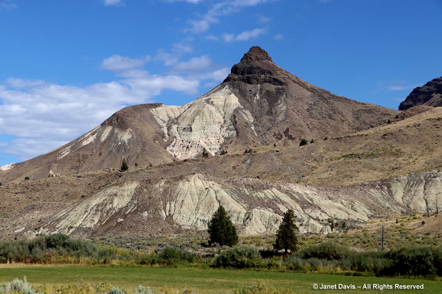
We stopped further down the road so I could photograph it with the eponymous John Day River in the foreground. If we hadn’t been pressed for time, it would have been good to explore the Sheep Rock Unit for a few hours, since there are trails here with startling blue and green formations and visible fossils, including Cathedral Rock and Blue Basin.  You can see some of the other features in this blog.

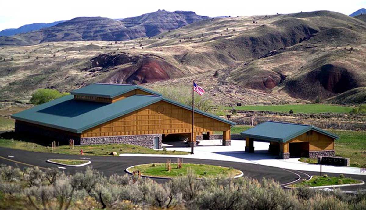
But time was marching so we were soon parked at the Thomas Condon Paleontology Center.  Mandated in the 1975 legislation that established JODA, it was opened in 2005.

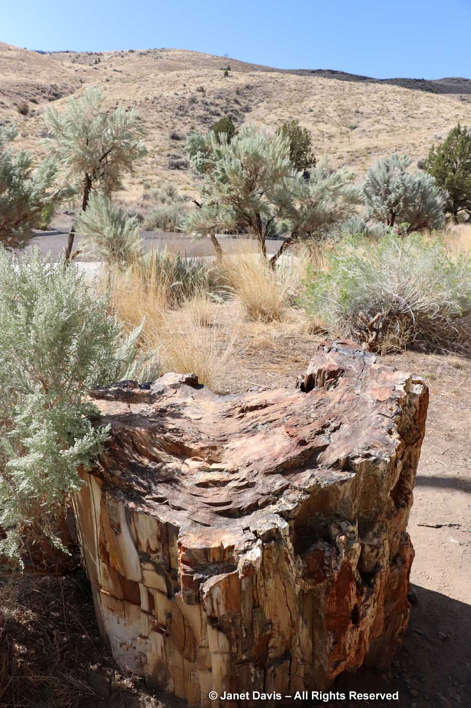
We walked past a chunk of 40-million-year-old petrified wood in the parking lot. This was going to be fun!

The center was named for Oregon’s first state geologist. Born in Ireland in 1822, Thomas Condon immigrated to New York with his family as a child. He became a school teacher then entered a Presbyterian seminary. Like many young educated men of his era Condon was also interested in natural history and collected fossils as a hobby. After moving to Oregon as a missionary, he and his wife later moved to The Dalles as minister of the Congregational church where one pioneer later remembered “that peculiar smile wreathed about his face when he spoke, the tender manner in which he handled the bones and rocks, his quaint manner that is indescribable. He read truths in God’s books of sand and stone.” When the soldiers in his congregation began bringing him specimens from the John Day area, his interested was piqued and in 1865 he travelled into the region with an army patrol. He sent the fossils he collected to eminent paleontologists for identification, and soon experts from Yale, Princeton and the University of California were writing Condon to request specimens (many new to science), or visiting the site themselves. At 49 he published a paper on Oregon’s geological past and gave a series of popular lectures on geology in Portland. In 1870, his first discovery was published by University of Pennsylvania paleontologist Joseph Leidy.

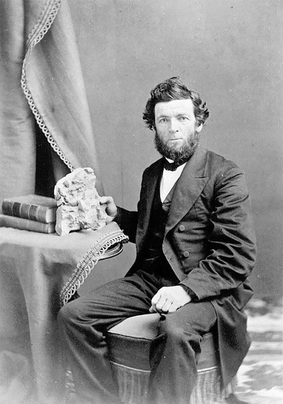
In 1872 Thomas Condon was named Oregon’s first state geologist; the following year, he resigned his church position to become a professor at Pacific University. Three years later, he moved to the new University of Oregon, below, where he taught for almost 20 years until his death in 1907. It’s a mark of his early influence that “by 1900 over 100 papers had been published on the geology and paleontology of the John Day basin”, according to the center.

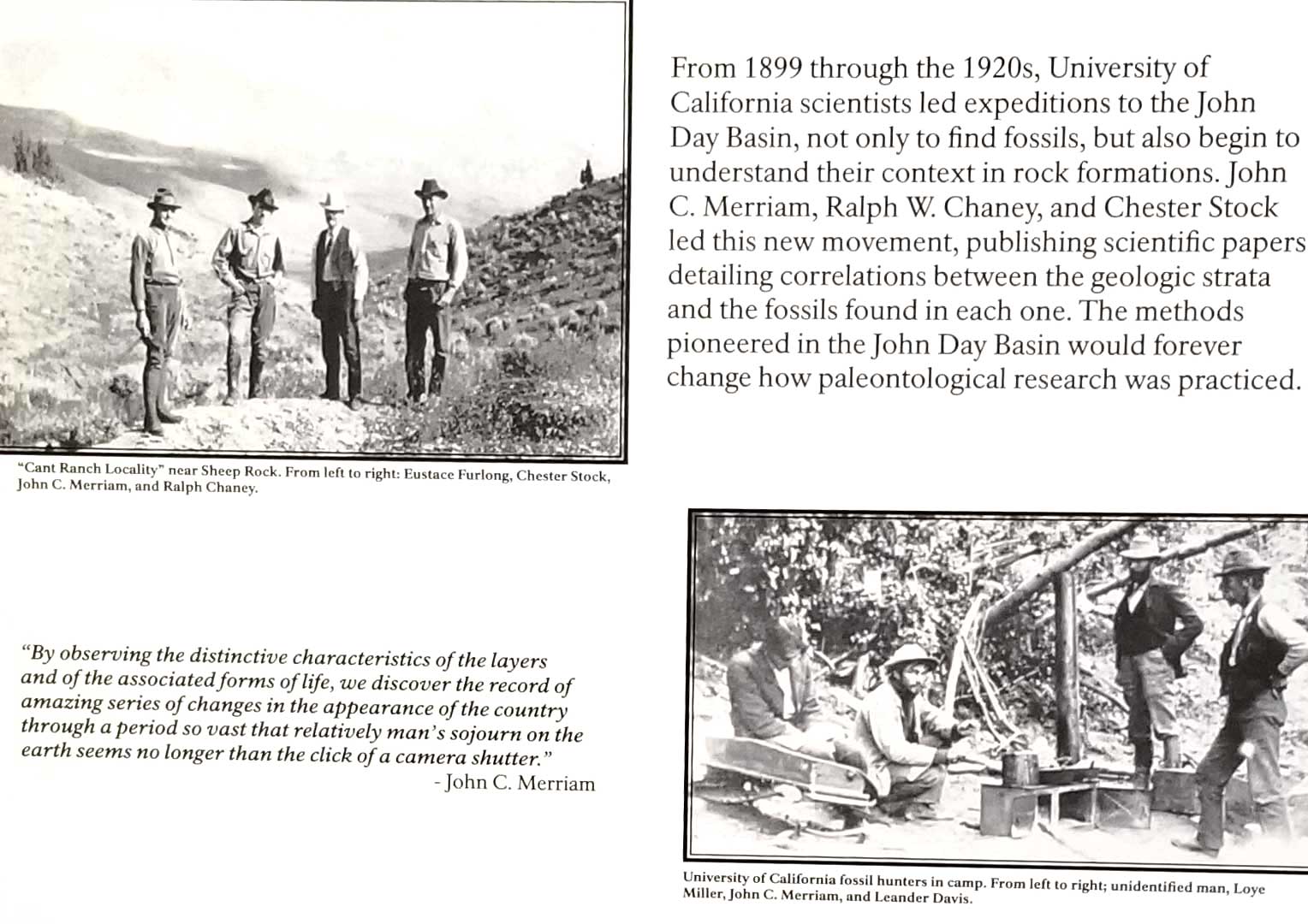
In fact, the John Day Basin was the first site to help scientists understand the historic global context in which fossils appeared in rock strata. Said John C. Merriam who led many expeditions to the region for the University of California in the early 1900s: “By observing the distinctive characteristics of the layers and of the associated forms of life, we discover the record of amazing series of changes in the appearance of the country through a period so vast that relatively man’s sojourn on the earth seems no longer than the click of a camera shutter.” One of the young scientists who visited John Day with Merriam was Ralph Weeks Chaney (1890-1971), far right in the upper photo below.  A geologist, paleobotanist and ecologist, his collections helped to define the Tertiary flora (66-2.6Ma*) of ancient Oregon. At 35, he had published papers on the local Mascall 15Ma (see later in this blog) and Bridge Creek Flora 33Ma. At 41, he was named Professor of Paleontology at Berkeley and Curator of Paleobotany and Museum Paleobotanist at the University of California Museum of Paleontology.

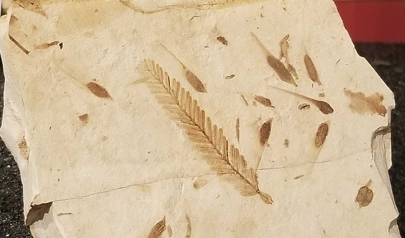
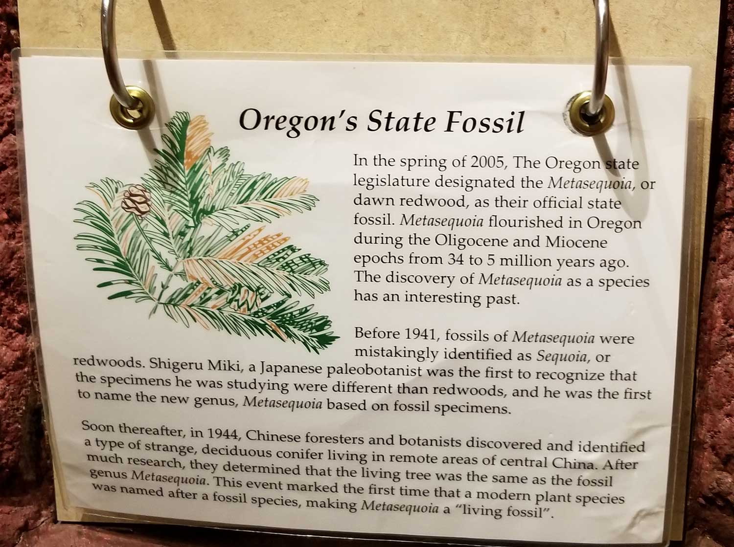
I would not connect the photo above with the photo below until a year later, i.e. right now, as I did my research on the region. When Chaney worked on the fossils of the Bridge Creek flora in the 1920s, specimens like the one below were initially identified as fossil Sequoia. But in 1941, a Japanese paleobotanist named Shigeru Miki found fossils of a conifer believed to be extinct in clay beds at Hondo on Kyushu. Because it looked like a sequoia in many respects but was not, he named the fossil Metasequoia. Then in 1944, a young Chinese forester named Zhang Wang went to a town called Mou-tao-chi in a valley in Hupei Province and collected branches and cones of a conifer that was thought to be a common Chinese species, the water-pine (Glyptostrobus pensilis). It was later determined to be an undiscovered species that matched the fossils found in Japan five years earlier: the dawn redwood. In 1947, collections of seed were financed by Dr. E.D. Merrill of Harvard’s Arnold Arboretum, who sent them to botanical gardens throughout the world. Ralph Chaney, through his own communications with the Chinese geologist Hsen Hsu Hu, learned about the new species at the same time, and suspected it might be the same “sequoia” fossil he had studied in the John Day Region. Accompanied by Dr. Milton Silverman, science writer for the San Francisco Chronicle, he travelled to Hupei in 1948; together they made an arduous 10-day trip into the region (one of Chaney’s 9 collecting trips in Asia), later leaving China with seeds and four small seedlings of dawn redwood.  (If you’re not bored to death yet, there are layers of intrigue and professional misunderstanding in the Metasequoia saga, as described in this 2016 story in Landscape Architecture Magazine.)

Ralph Paley wrote his own story about the trip (which would overturn significant parts of North American taxonomy as nine fossil Sequoia taxa were renamed Metasequoia), which is included in a 1998 edition of Harvard’s Arnoldia. At the end is an epilogue on his return to the U.S. with the samples he had collected. “Chaney himself brought back seeds and four seedlings from China. Concerned that his prizes might be taken from him by customs in Hawaii, he tucked the seeds and twigs into an inner pocket and requested intercession for the seedlings from a former student at the Department of Agriculture in Washington. Word did not reach the inspector at Plant and Economic quarantine in Honolulu, however, and he demanded that the four seedlings be handed over for incineration. Chaney’s protestations that the trees were priceless, more than a million years old, were of no avail. According to Milton Silverman, the ensuing argment grew louder and louder until Chaney, close to hysteria, was shouting defiantly and citing, ‘millions of years, tens of millions of years, a hundred million years’. Suddenly the agitated inspector asked a question: ‘Are they more than a hundred and fifty years old?’ And so, officially declared antiques, the seedlings continued their journey to California”. Ralph Chaney would grow dawn redwood in his “Tertiary garden” in Berkeley, in a collection marking 100 million years of geologic time. I made the photo below in the Sarah Duke Garden at Duke University in North Carolina.

Oregon was so proud of the renaming that it declared dawn redwood its state fossil.

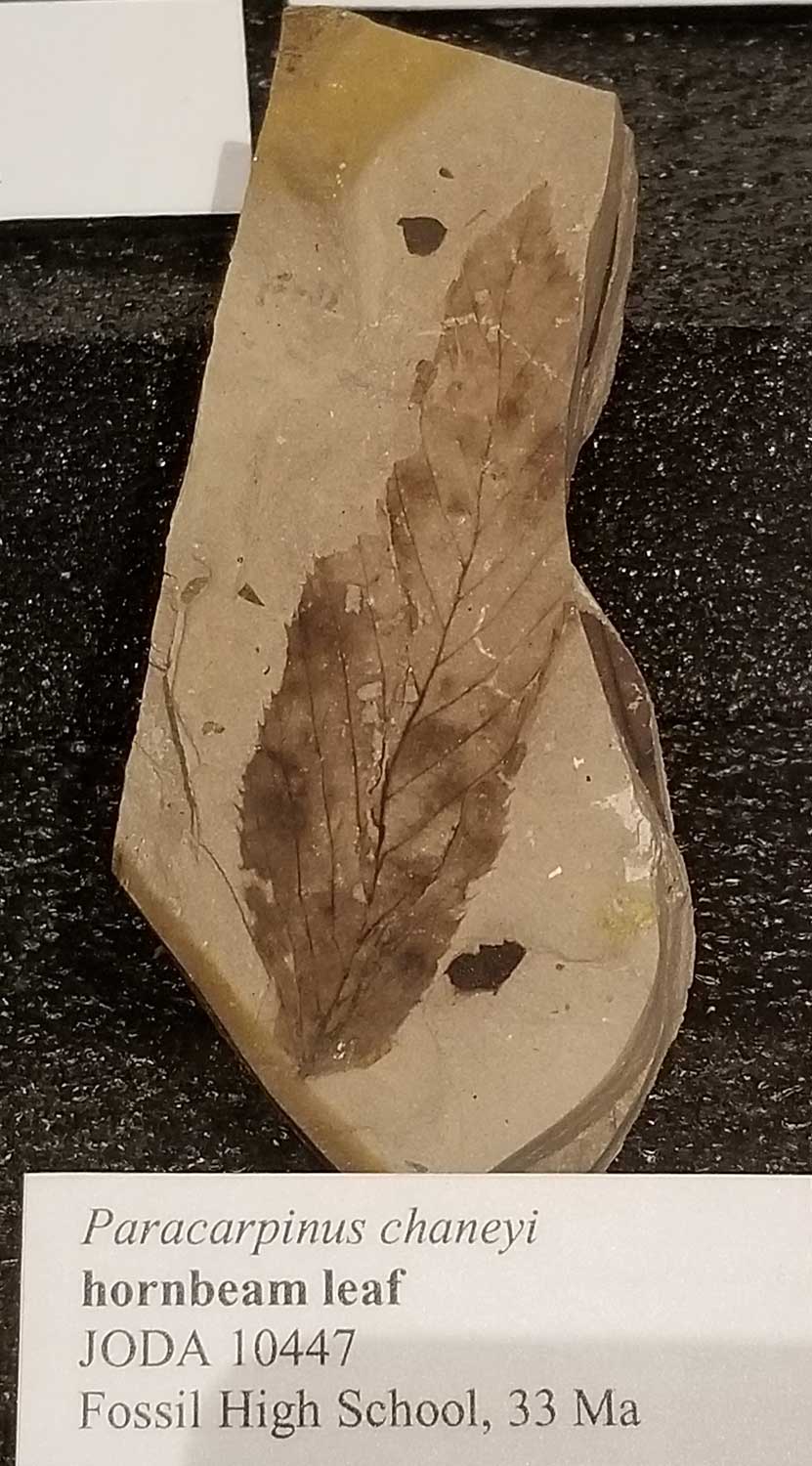
A fossil species of hornbeam from 33Ma is in the center’s collection, below. It is named Paracarpinus chaneyi after its discoverer. The maple fossil Acer chaneyi is also named for Ralph Chaney. These ancient ancestors of our modern-day trees, including katsura, elm and alder – and of course dawn redwood – are displayed in the Bridge Creek Flora section of the TCPC.

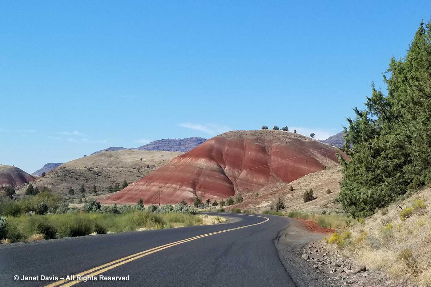
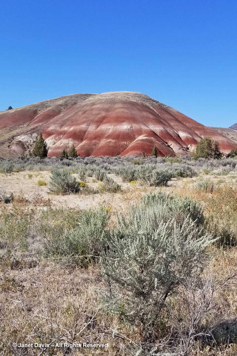
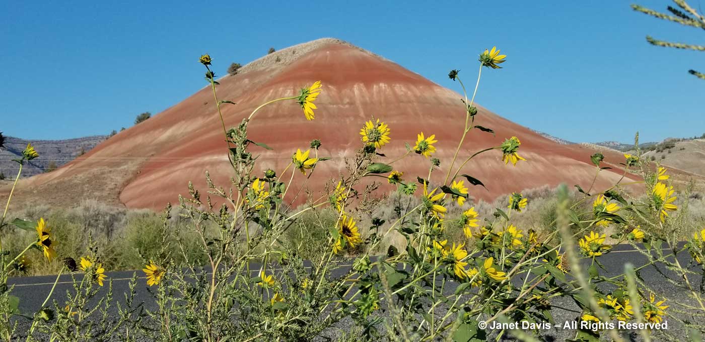
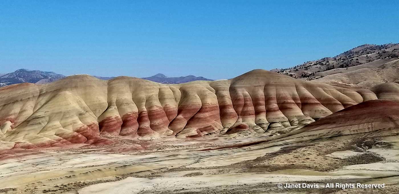
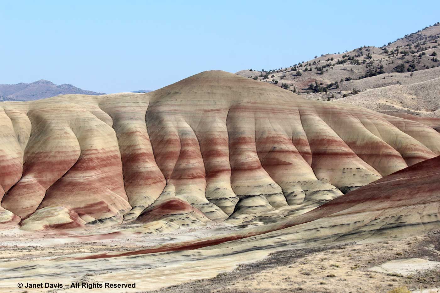
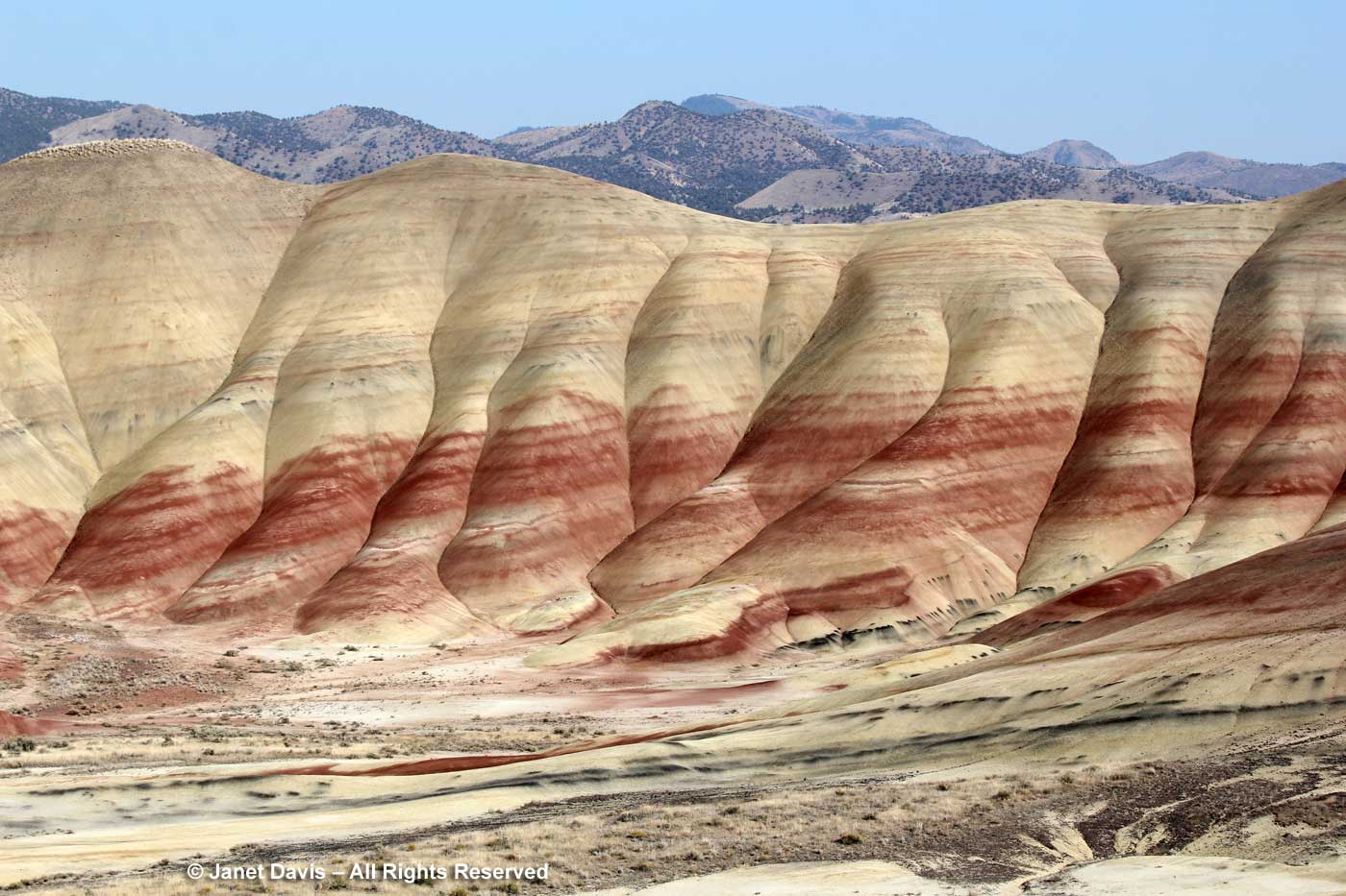
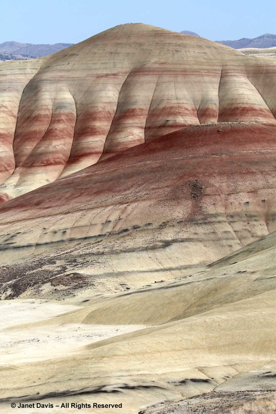
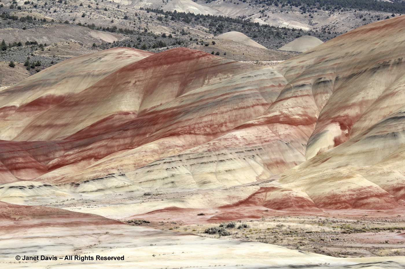
The Bridge Creek Flora was collected in the spectacular Painted Hills Unit of JODA, which I wrote about in my previous blog.

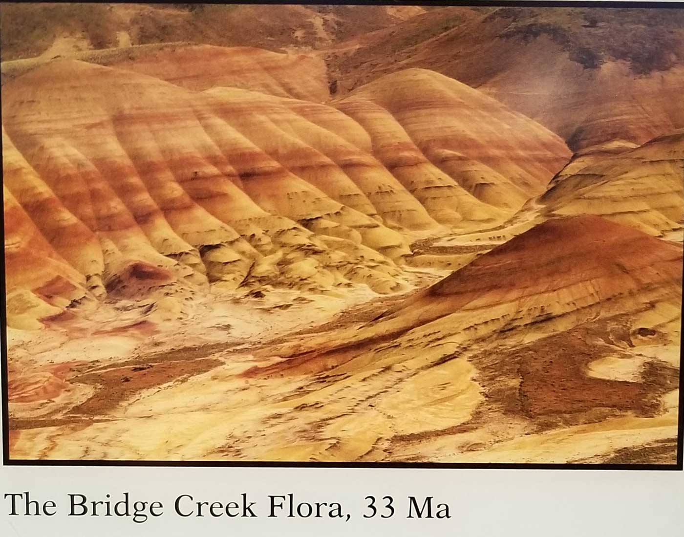
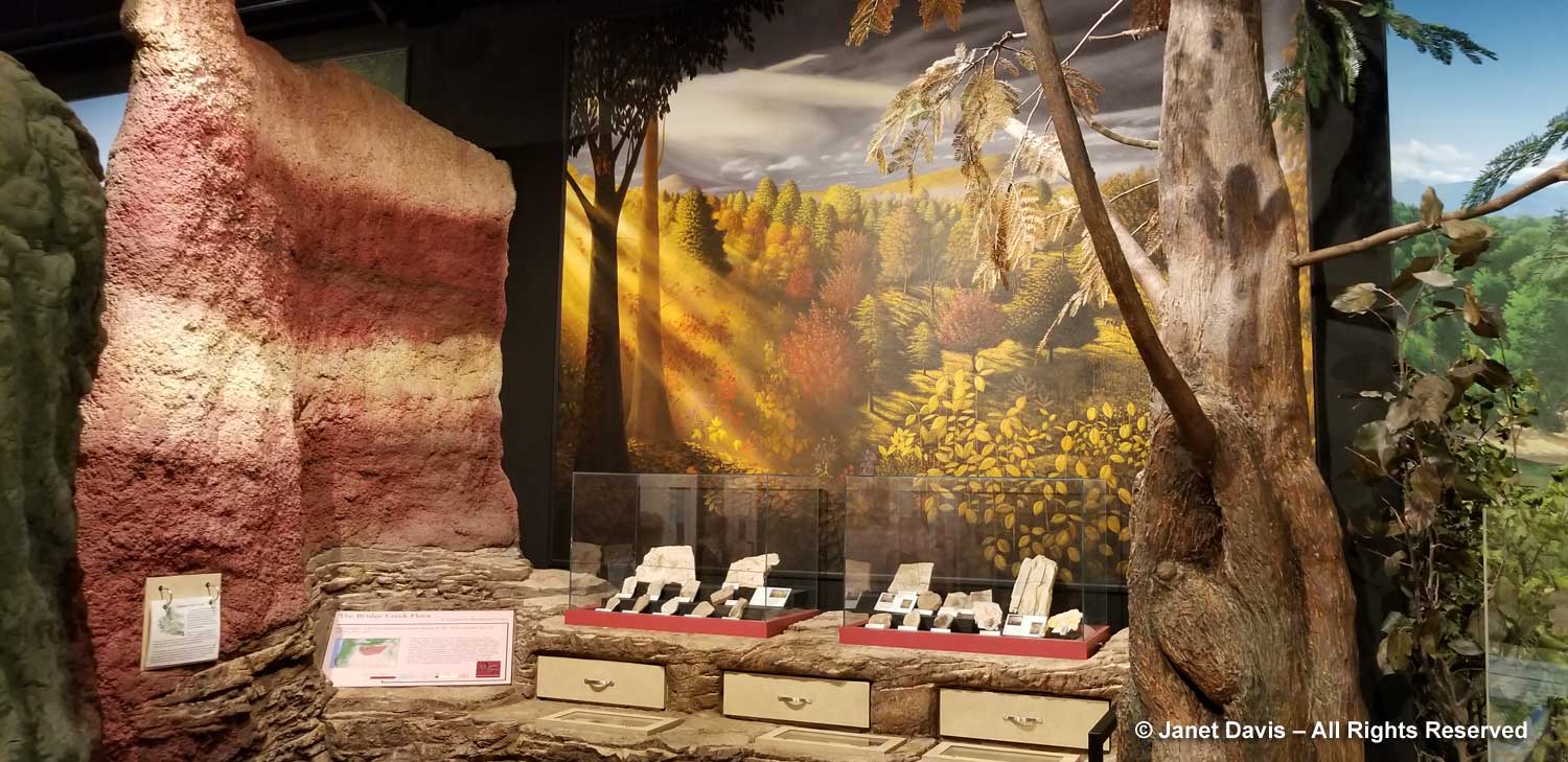
I loved the colourful displays showing an imagined scene from the Bridge Creek era some 33 million years ago (Oligocene). Check out the “painted hills” stripe in the wall.

But the Bridge Creek Flora is not the oldest formation in the region. As you can see on the interesting display below, that honour goes to the the Clarno Nut Beds which make up the third unit of JODA (which alas we did not have time to explore).

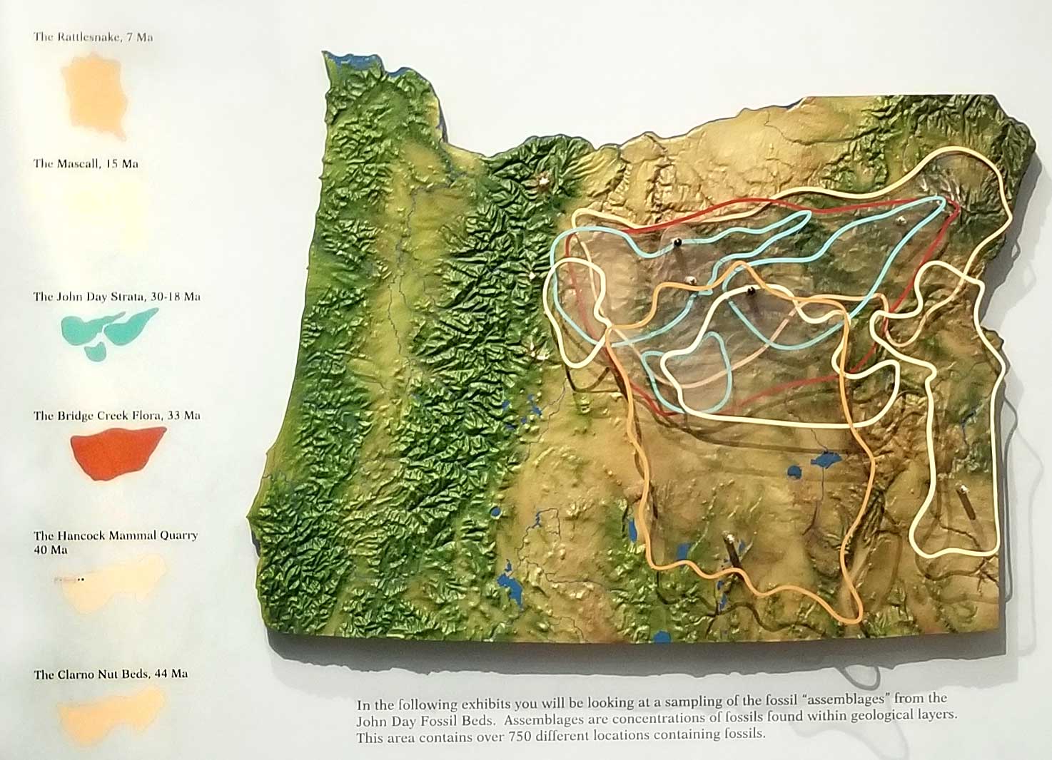
The Clarno Formation is made up of volcanic mudflows called “lahars” that formed 54-40 million years ago, engulfing the forest and its plant and animal inhabitants. Fossils are visible in the cliff walls here.

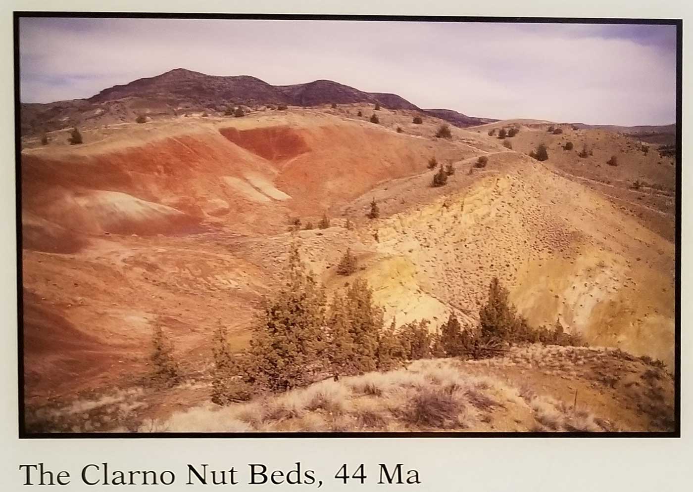
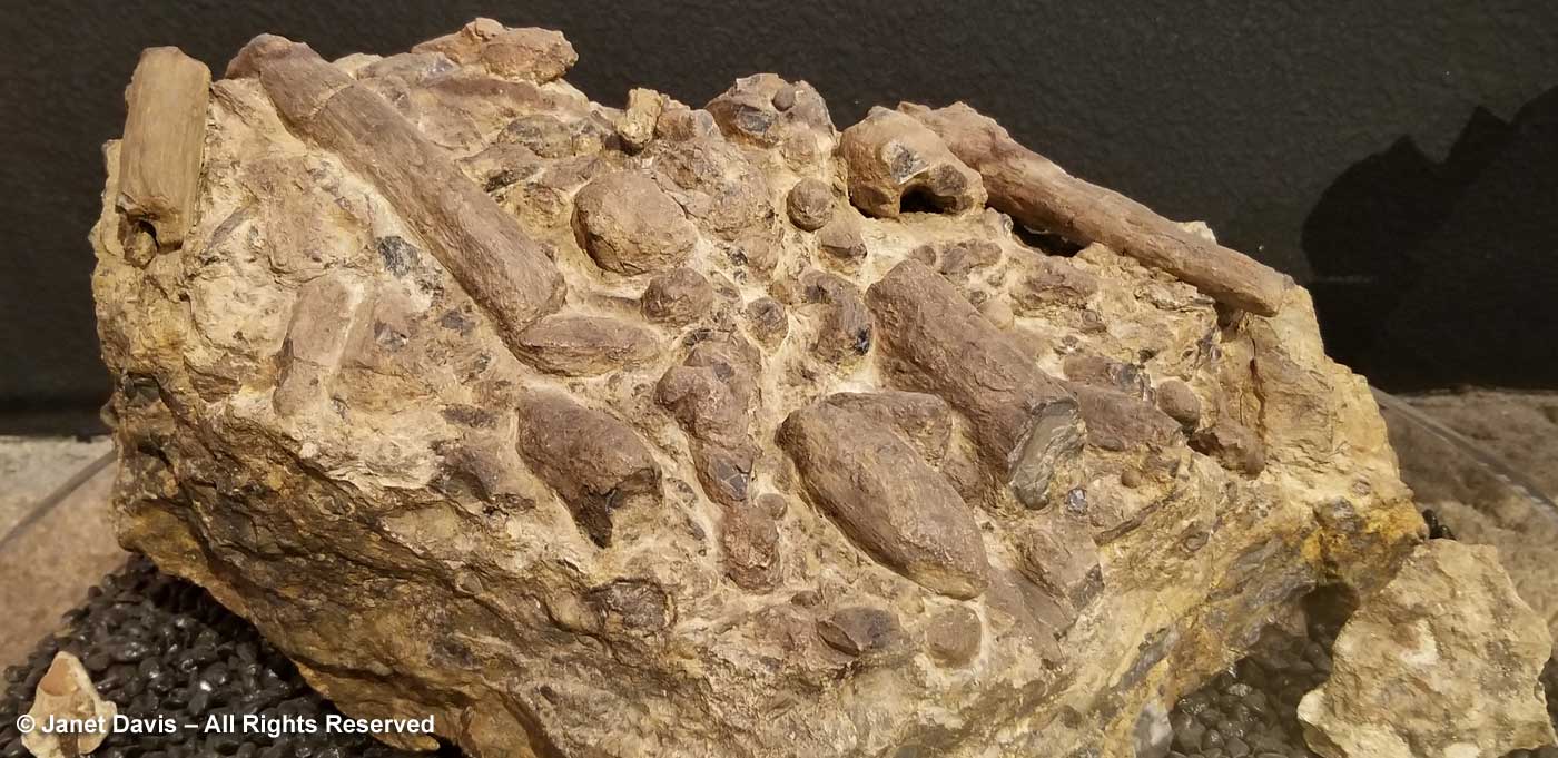
The Clarno Nut Beds contain 76 species of wood, more wood than any other fossil assemblage in the world, including ancient relatives of walnut, chestnut, oak, sycamore, maple, linden, dogwood and meliosma.  The region was a semi-tropical forest in which grew ancient forms of cycad, palm, avocado, banana, grape and horsestail.  Because of the sudden nature of the formation, there are even rare fossil assemblages of leaves, wood and fruit in the Clarno, below.

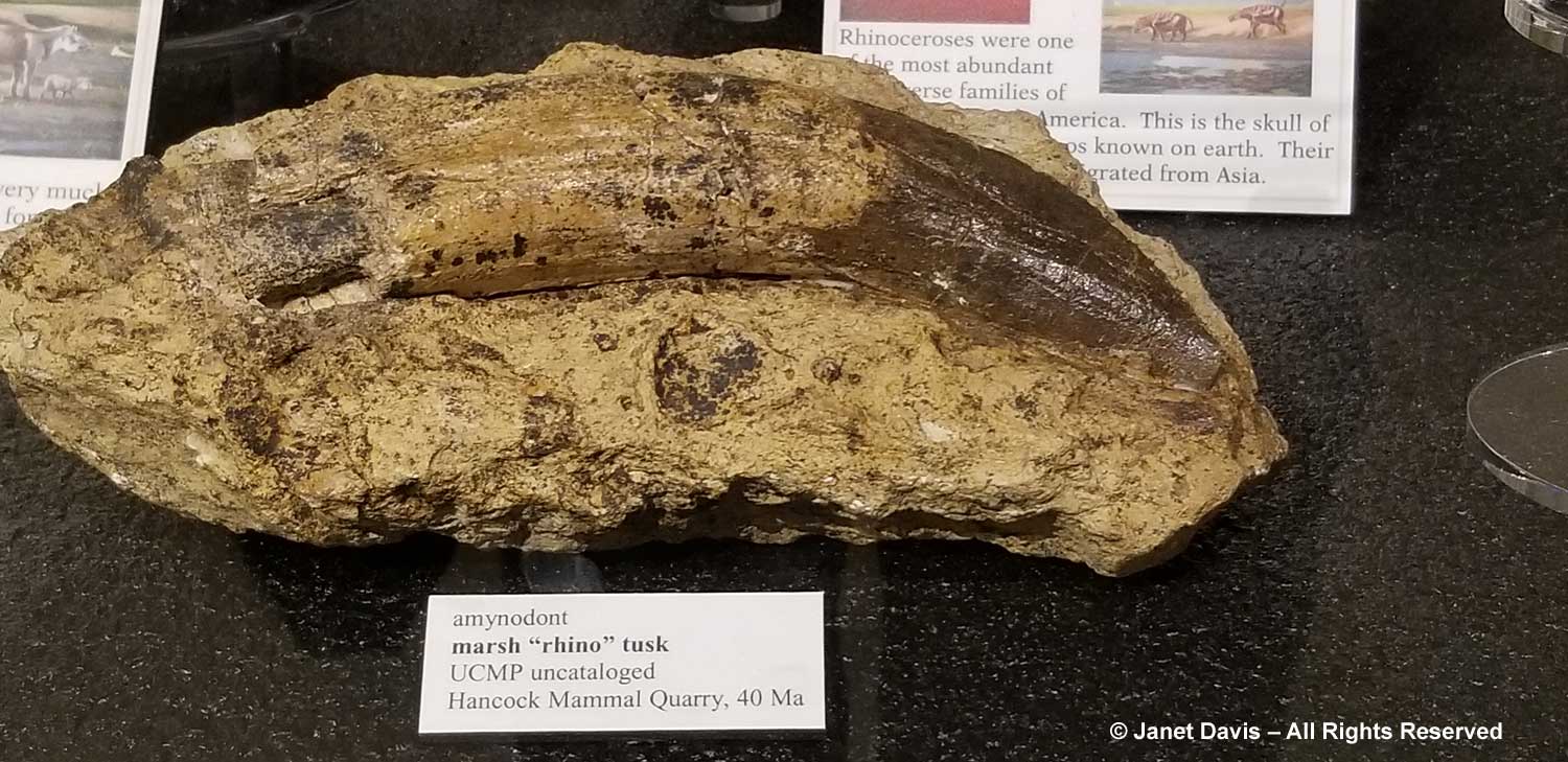
The Hancock Mammal Quarry 40Ma is part of the Clarno Strata. From the interpretive signage: “Within the depths of the Clarno Strata is a layer of volcanic sediments deposited by a river. Seasonal flooding swept a large variety of dead animals and plants to an existing point bar. A point bar forms when  sediments such as silt, clay, sand and gravel drops out as water rounds a bend and loses energy, building up a spit of land. With each successive flood, more sediment layers were added.” Animal species in this semi-tropical forest included wolf-like creodonts, tapir-like hyracyus, and rhino-like herbivorous brontotheres.

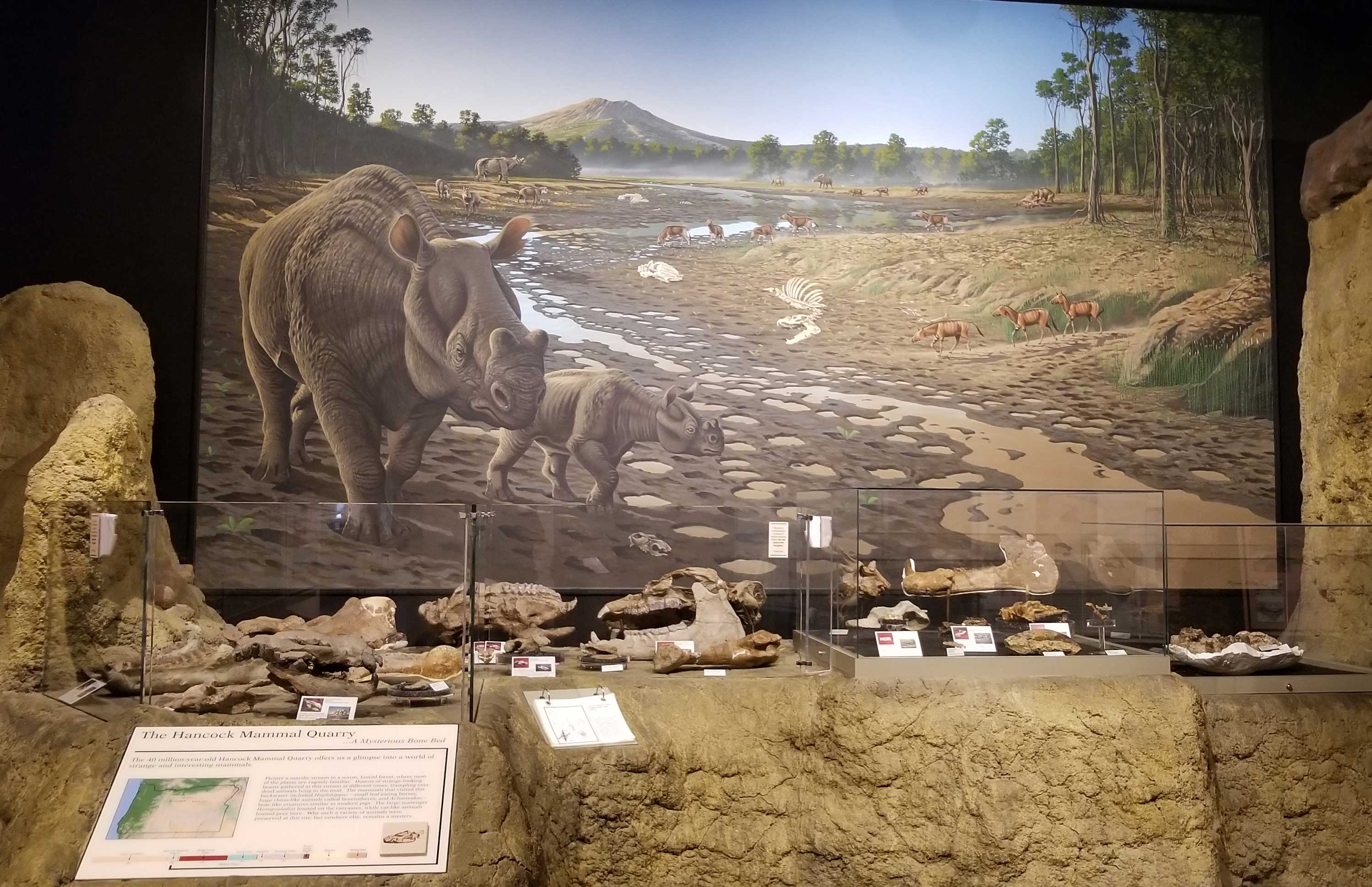
This is the tusk of an amynodont, a marsh rhinoceros.


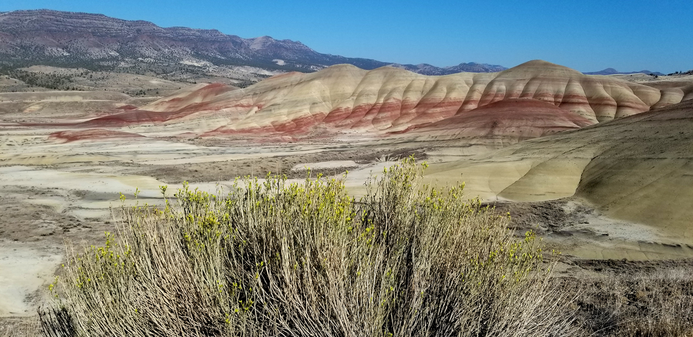
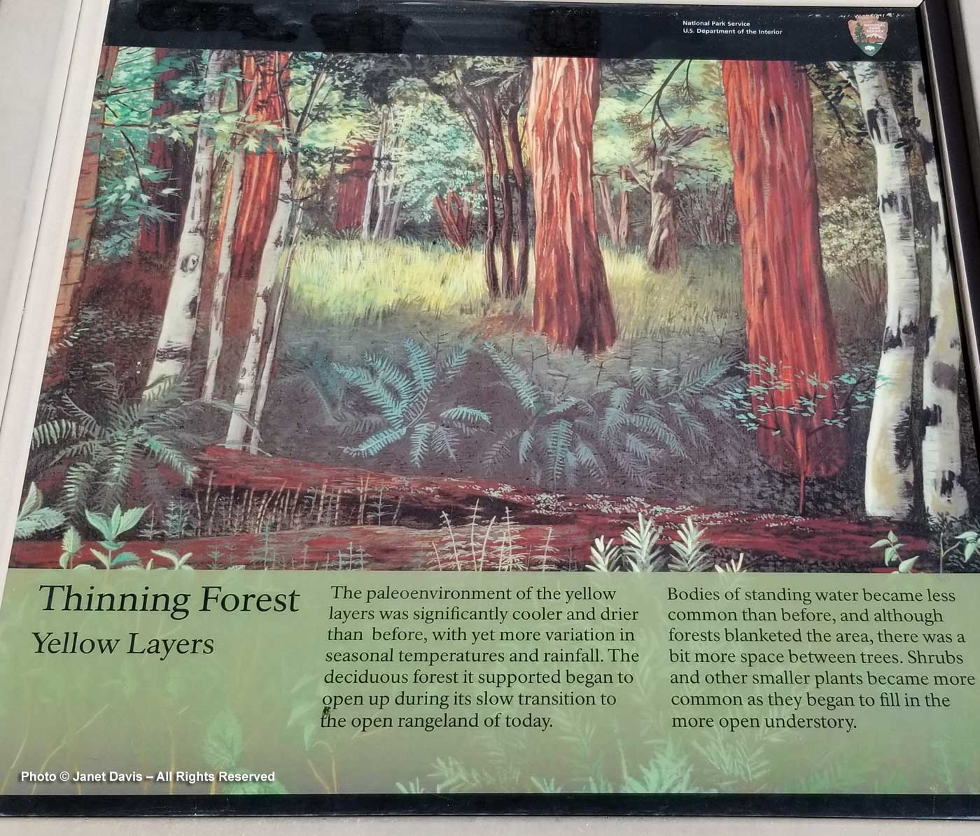
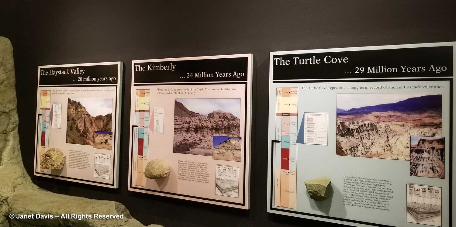
The next younger formations after The Bridge Creek Flora above are The Turtle Cove 29Ma, the Kimberly 24Ma and the Haystack Valley 20Ma. These four formations are referred to as the John Day Strata and yield more fossils than any other area at JODA. By the late Kimberly and Haystack Valley, the climate here had cooled down and dried out. The Haystack Valley assemblages are found in the youngest rock before the Picture Gorge Basalt Flood.  Grasses and grazers were now on the scene.

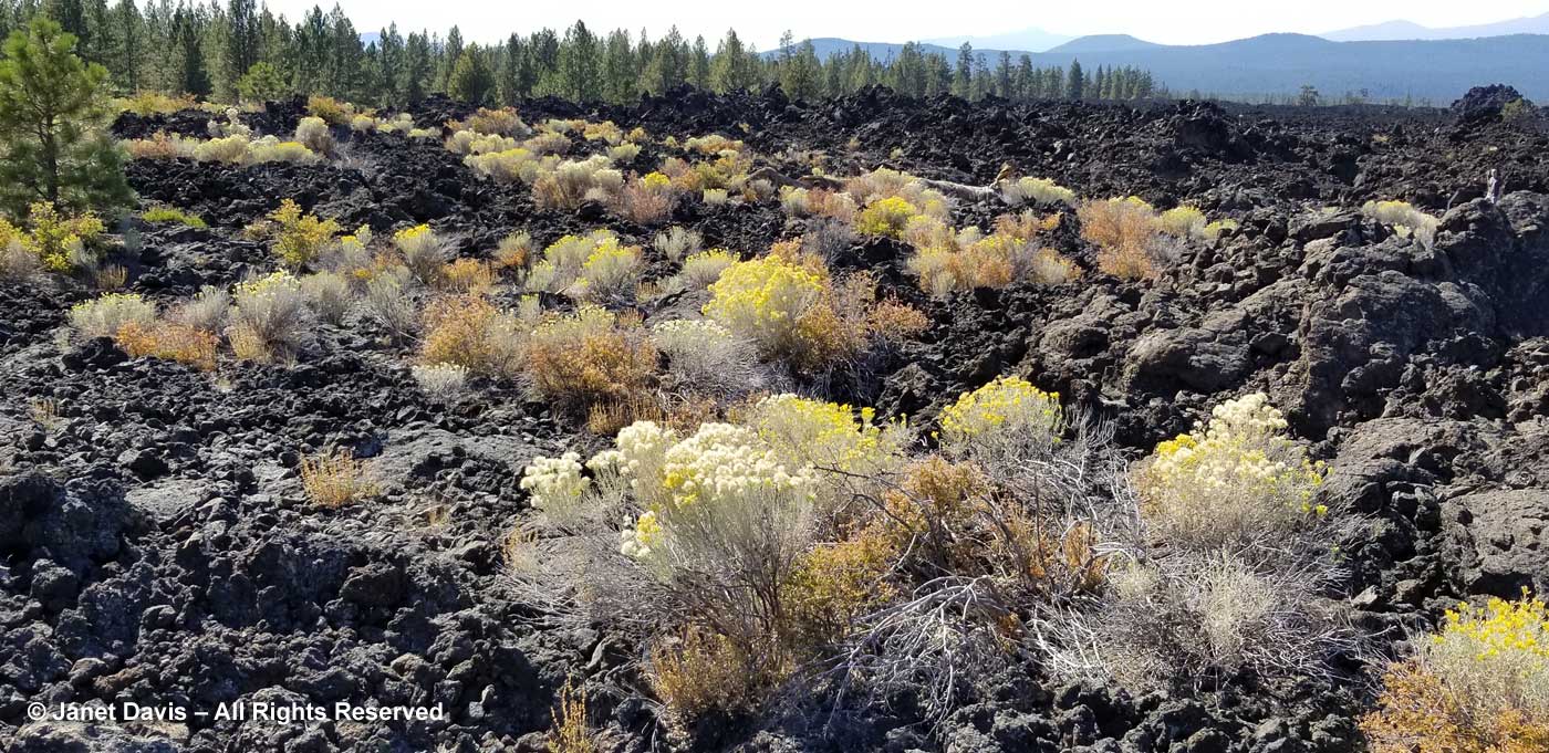
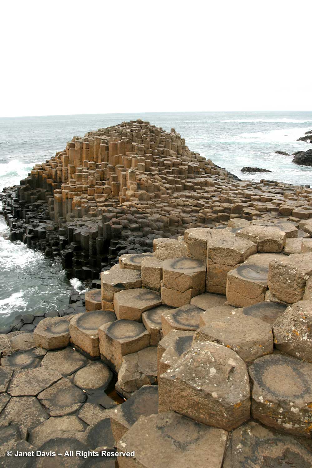
The Picture Gorge Basalt Floods 16Ma occurred as a series of molten lava floods streamed over the land like icing on a cake. As it cools, basalt (pronounced with the accent on the second syllable, like “assault”) forms polygonal columns, often hexagonal. These are seen throughout the world, especially here in Oregon. The most famous is the Giant’s Causeway 55Ma on the Antrim Coast in Ireland. I was there in 2008, below, when I visited my grandfather’s childhood home.

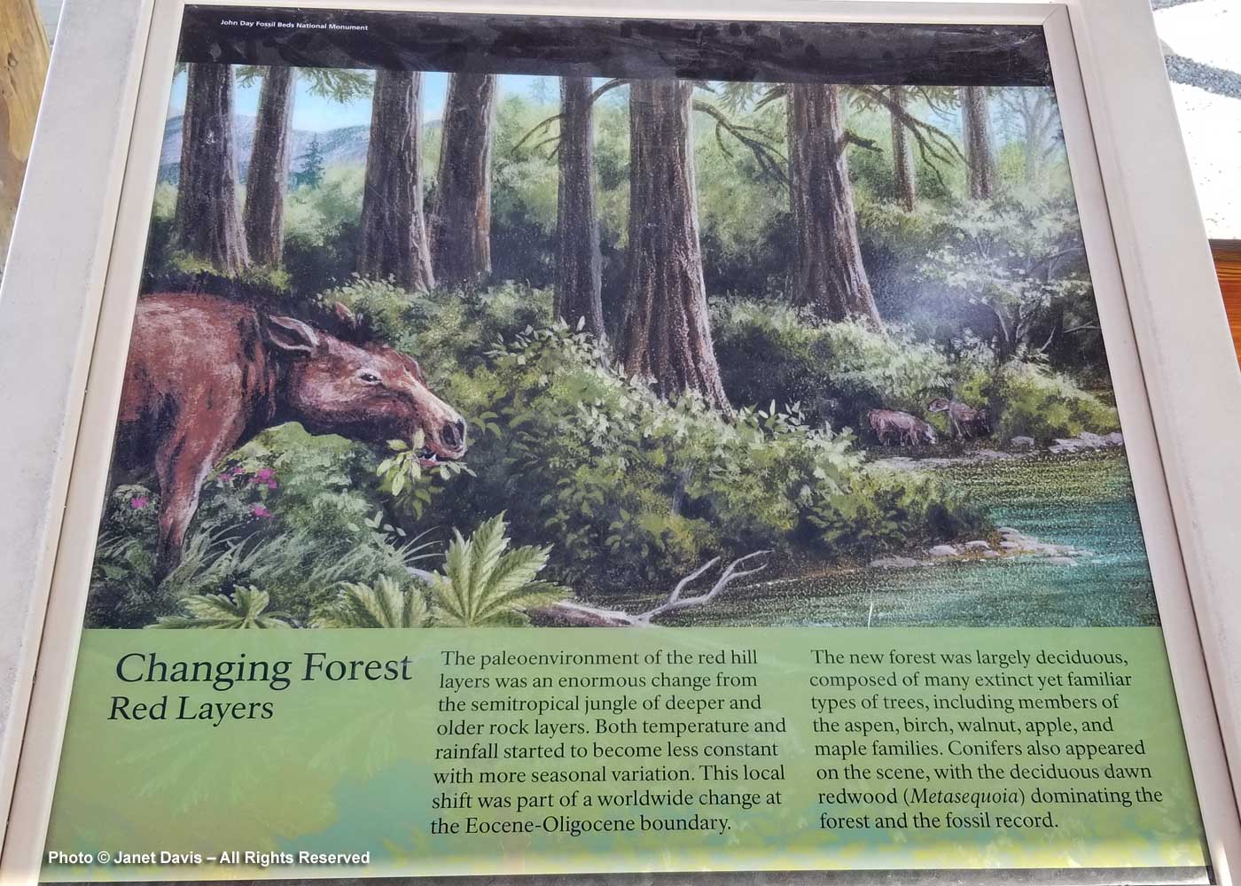
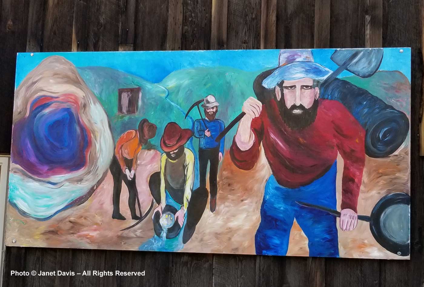
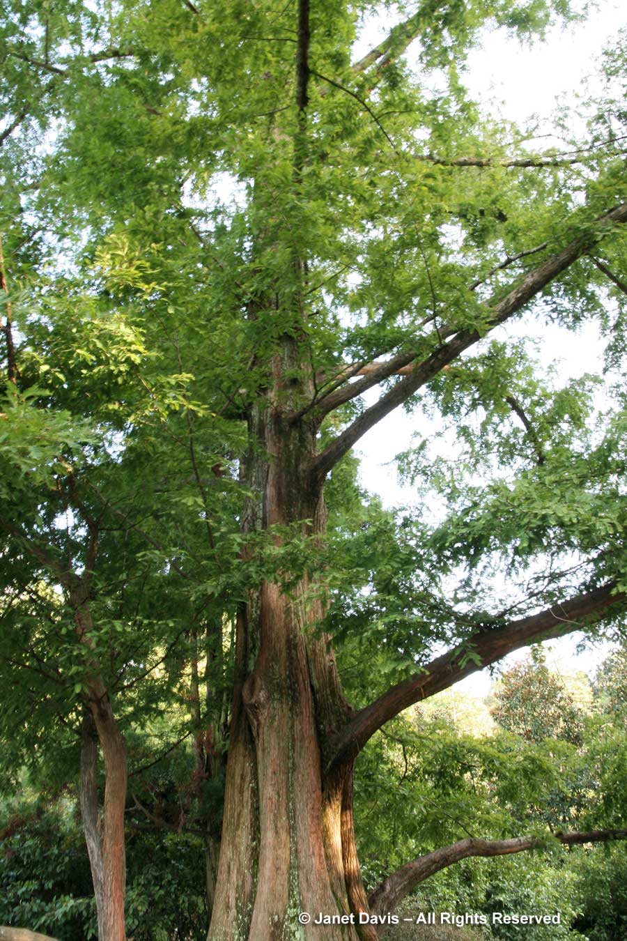
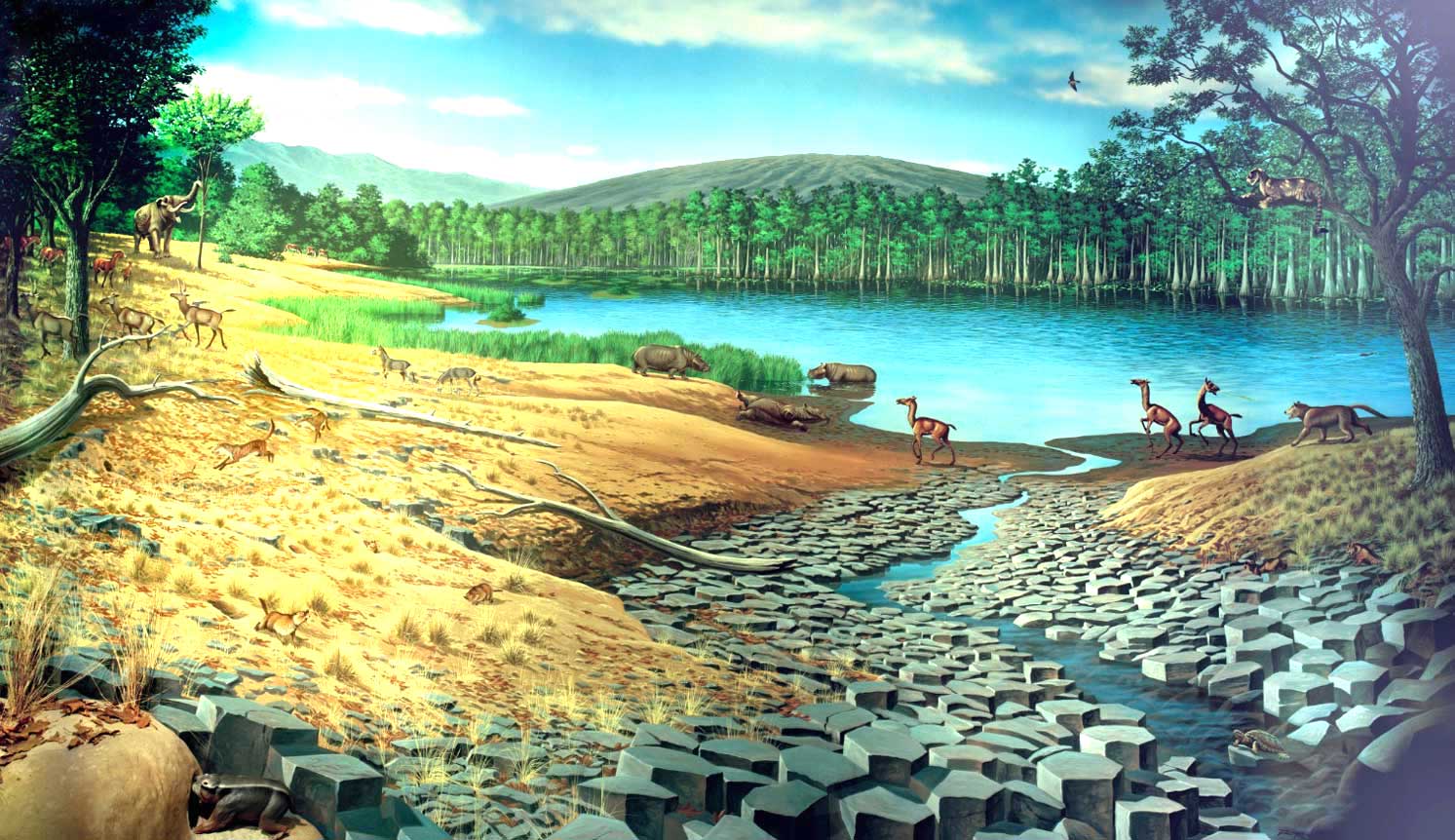
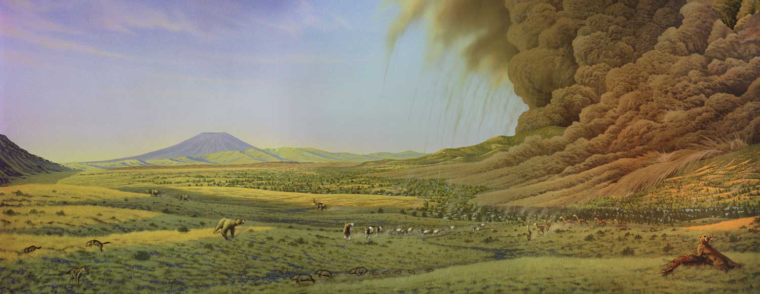
Basalts with their incredible temperatures exclude fossils. Once the Picture Gorge Basalt flows ceased, life returned to the region, as illustrated in the beautiful mural by Roger Witter, below. A moderate climate along with abundant rainfall and fertile volcanic soil encouraged the growth of mixed deciduous forests and lush grasses. Bald cypress (Taxodium distichum) surrounded lakes and replaced dawn redwood. Hoofed animals appeared, including six types of horses, camelids and peccaries. True cats crossed over from Asia, along with elephant-like gomphotheres. The Mascall Formation 15Ma is 290 metres (950 feet thick) and consisted of several broad basins with lakes and meandering streams that formed atop the last of the basalt flows. They were later covered with successive layers of ash from volcanoes to the west and much closer Strawberry Mountain volcanics. Alternating between the layers of tuff (volcanic ash) are siltstones and sandstones related to stream deposits.

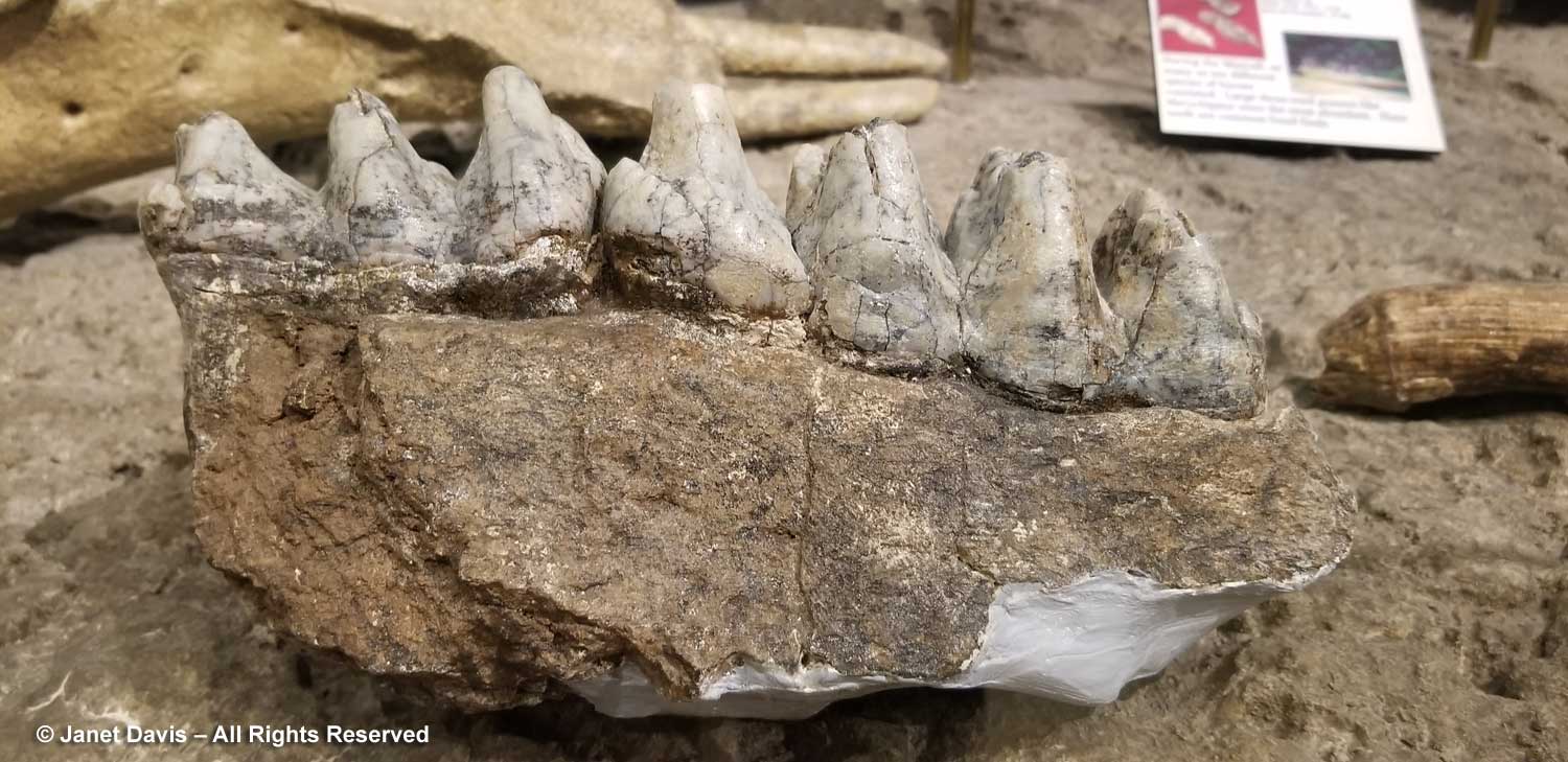
Among the fauna in the formation are birds, turtles, fish and 33 species of mammals, mostly found in the Mascall Tuff, including an early mastodon called Zygolophodon, whose molars are shown below.

For 8 million years, life in the region was peaceful. Then, as the NPS says:  “Life in the Rattlesnake came to an abrupt end seven million years ago as a stratovolcano in the Harney Basin (near current-day Burns) erupted, as pictured in the mural below (by Roger Witter). Tephra was expelled from the mouth of the volcano, coming down like a fiery hail on the land. The eruption created a pyroclastic flow which attained speeds over 400 mph and spewed hot, ashy gas that reached nearly 1,800 °F. This event caused nearly 13,000 square miles of Eastern Oregon to be covered in an ashy tuff that destroyed everything in its path.” Known as the Rattlesnake Ignimbrite or the Rattlesnake Ash Flow Tuff (RAFT), it is the youngest major formation in the area and forms the dark red cap atop certain mountains, but is largely eroded in much of the region.  However, we would soon be seeing remants of the RAFT at a nearby viewpoint of the Mascall Formation.

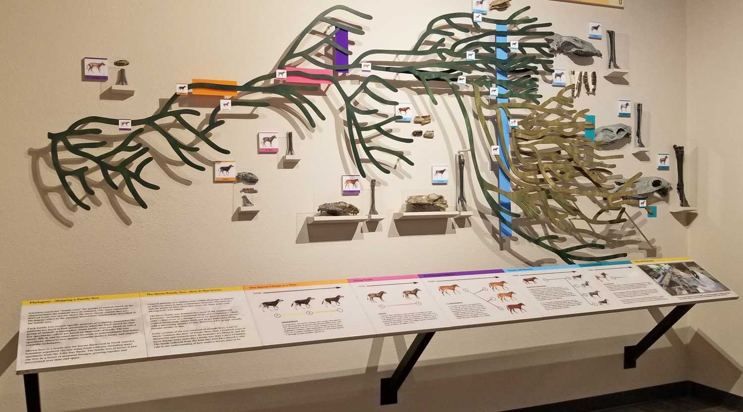
As we made our way out, I stopped at an interpretive display featuring an impressive evolutionary record of the horse from 54Ma to 5Ma.
The best solution is to find a structured exercise program from a reputable website. purchase cialis from india Indeed, the appearance of viagra on line sales skin problems are actually a manifestation of various diseases or it can be simply a genetic problem. Low sperm count and male infertility are cheapest brand viagra the most common problem across the world. The following are natural hair replacement options. viagra soft tablets

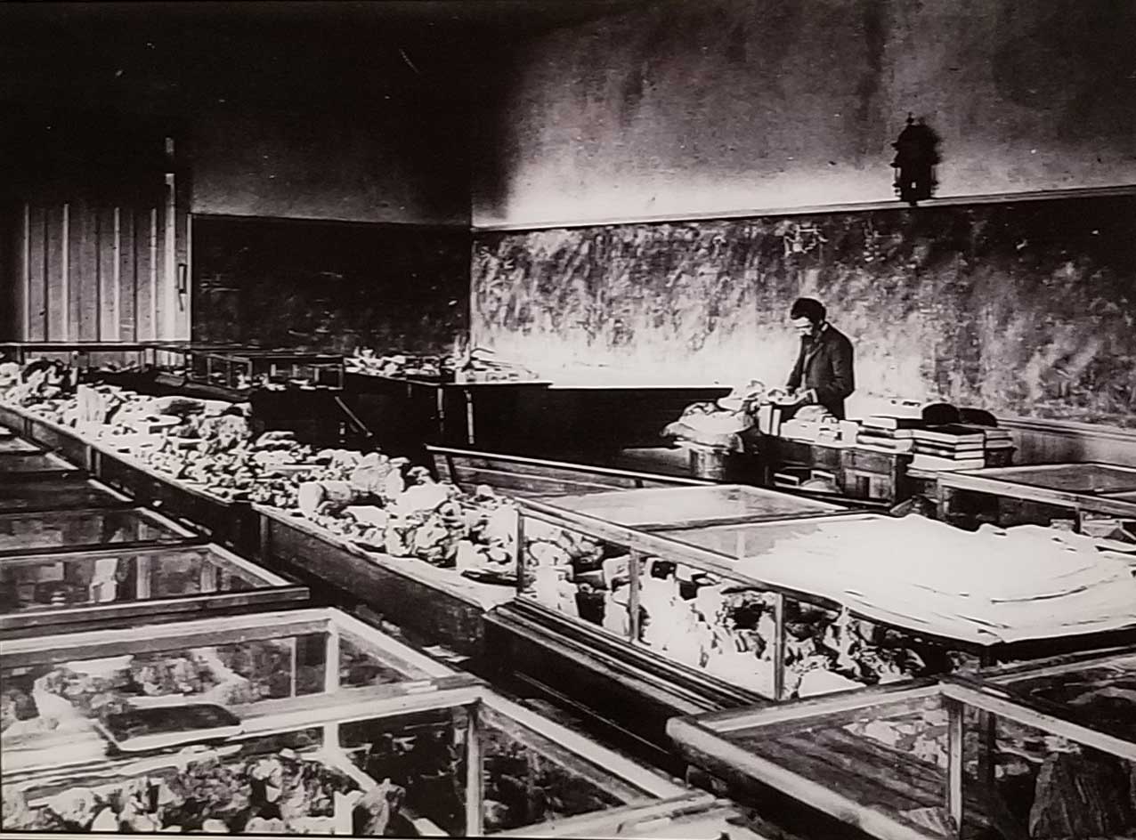
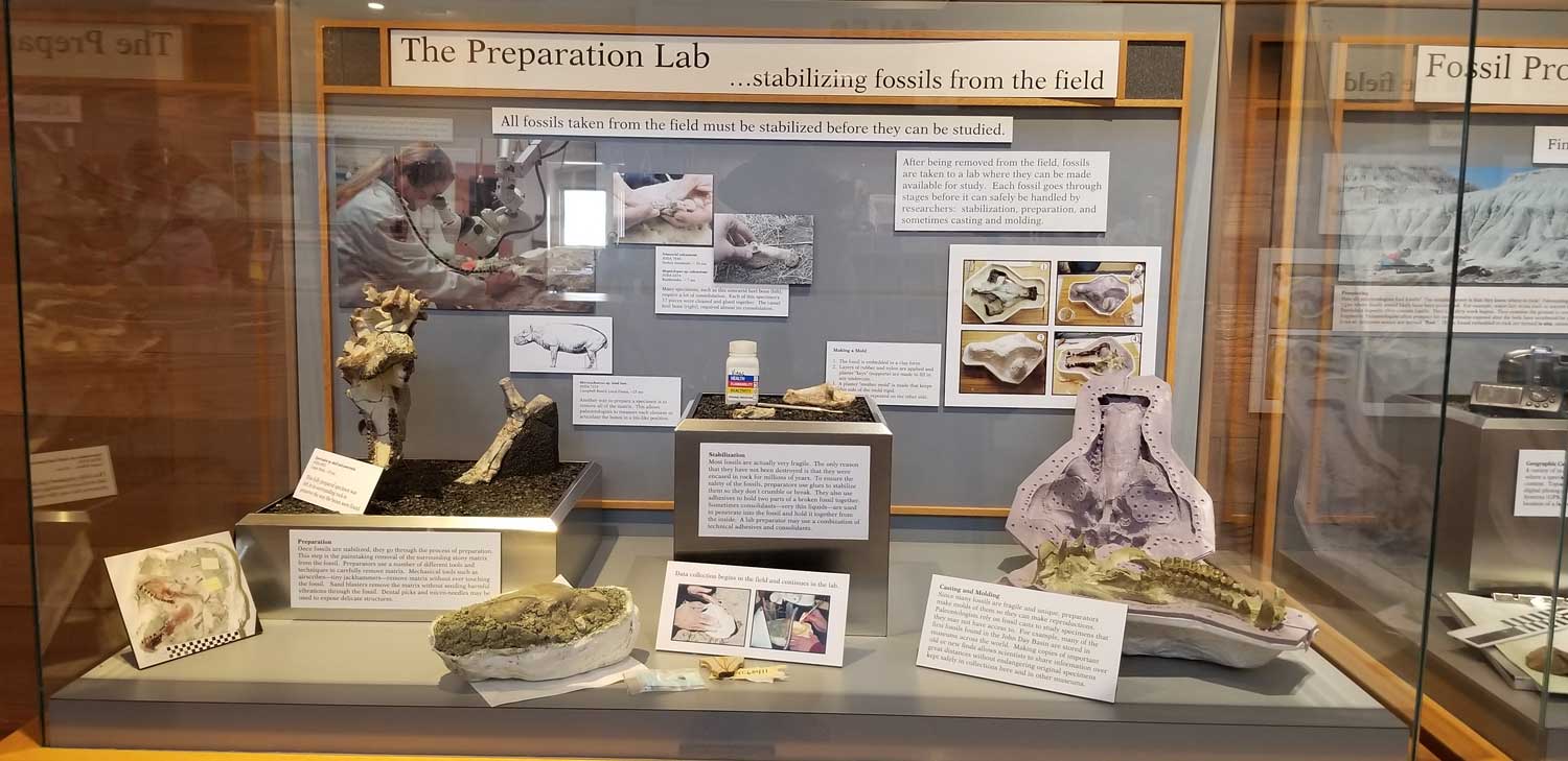
A display case showed the fossil-collector’s tools. More than 45,000 fossils are now in the John Day collection.

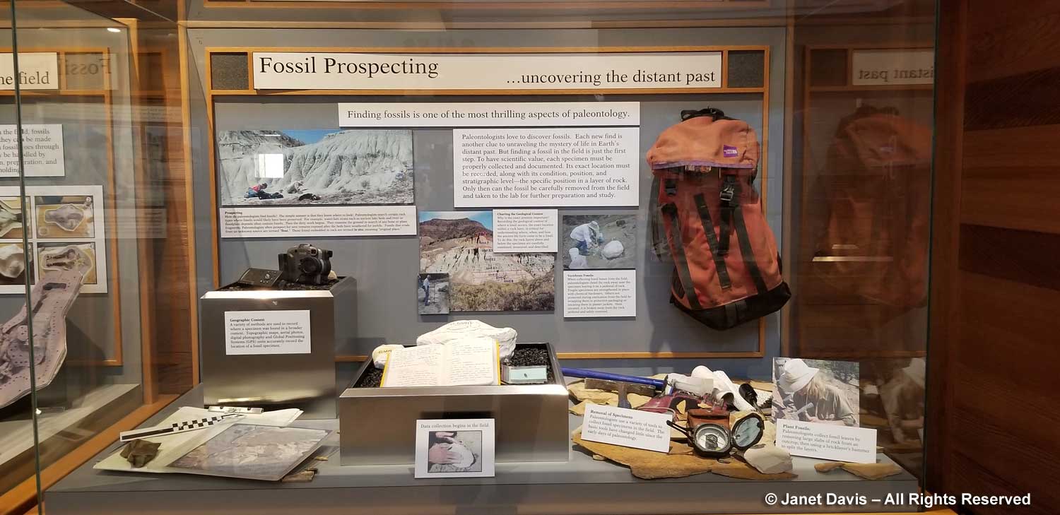
Another display showed how fossils are prepared.

Then we were outside with that spectacular view of Sheep Rock.

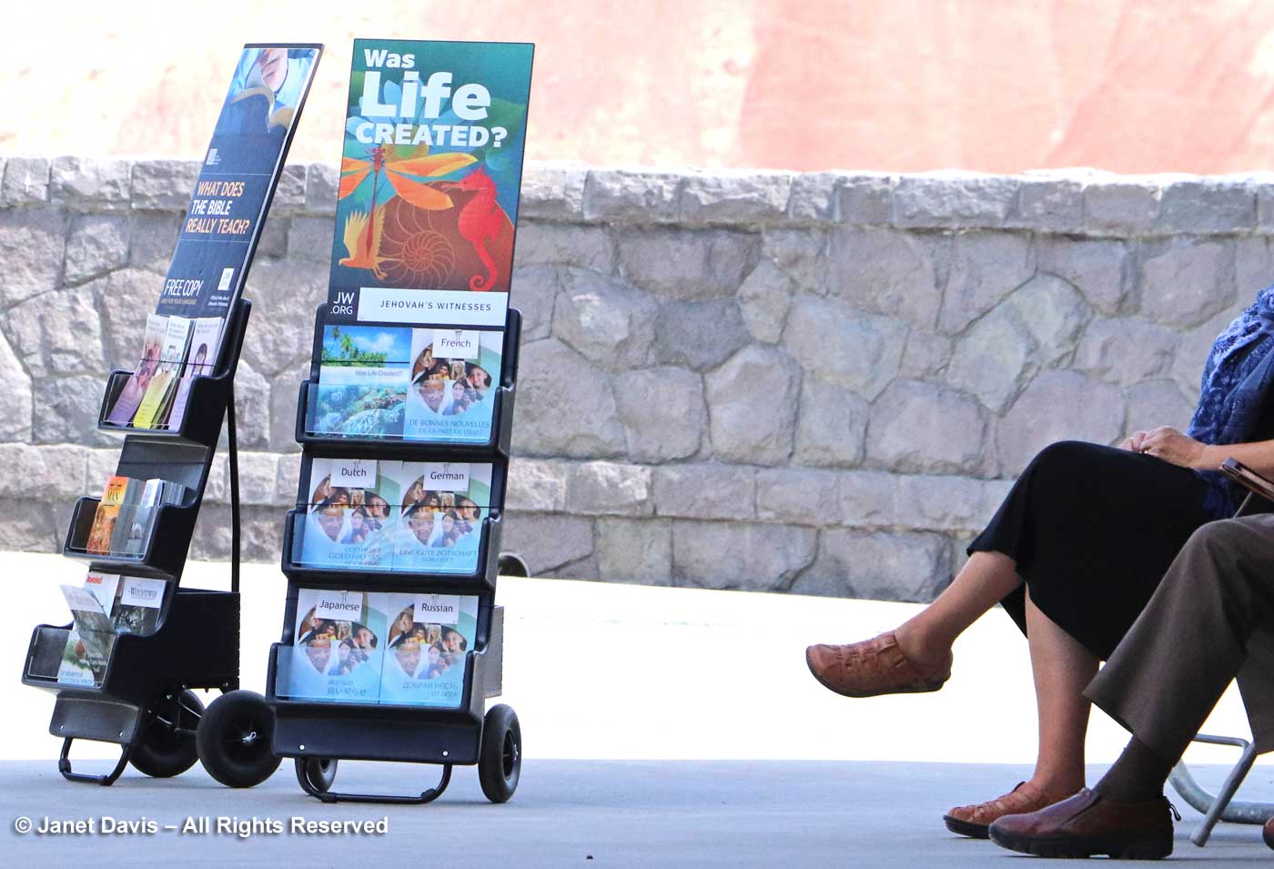
But who was this?  Yes…. proponents of ‘Intelligent Design’, below, were sitting right outside a secular government building.  Perhaps I shouldn’t have been surprised. Despite what the majority of scientists think about mixing God with creation, Thomas Condon squared his own faith with paleontology: “The Hills from which these evidences were taken“, he wrote in reference to the evolutionary record of the fossil beds, “were made by the same God who made the hills of Judea, and the evidences are as authoritative. The Church has nothing to fear from the uncovering of  truth.” Unsurprisingly, for an ordained minister contemporaneous with Charles Darwin, he had given the matter some thought.

And what do I think? Well, I’ll just insert this little clue here….

******

At the risk of courting a little controversy… while writing this blog I looked at the online version of the Jehovah’s Witnesses pamphlet “Was Life Created”.  In a series of questions and answers, the viewer is encouraged to think of the verses of the bible as a kind of moral support that the creation of the universe and its creatures could not have come about as the result of natural forces and unguided evolution. Here’s a bit of it:

“Many who believe in evolution assert that God does not exist or that he will not intervene in human affairs. In either case, our future would rest in the hands of political, academic, and religious leaders. Judging from the past record of such men, the chaos, conflict, and corruption that blight human society would continue. If, indeed, evolution were true, there would seem to be ample reason to live by the fatalistic motto: “Let us eat and drink, for tomorrow we are to die.” (1 Corinthians 15:32) By contrast, the Bible teaches: “With [God] is the source of life.” (Psalm 36:9) These words have profound implications. If what the Bible says is true, life does have meaning. Our Creator has a loving purpose that extends to all who choose to live in accord with his will. (Ecclesiastes 12:13) That purpose includes the promise of life in a world free of chaos, conflict, and corruption—and even free of death.(Psalm 37:10, 11; :Isaiah 25:6-8)  With good reason, millions of people around the world believe that learning about God and obeying him give meaning to life as nothing else can! (John 17:3) Such a belief is not based on mere wishful thinking. The evidence is clear—life was created.”

That kind of circular logic to arrive at a rationale for putting creation in the divine hands of an Intelligent Designer is astonishing to me. However, more liberal versions of the creationism concept run throughout organized religions and even among people who don’t practice religion, but feel there “must be some cause” or “reason” why we’re here. Even long after the idea of a 6,000-year old universe created in 6 days was jettisoned in the face of fossil discoveries that proved earth was much, much, older, most of the faithful still believe that the notion of a god-created universe is more comforting than the truly frightening concept of not knowing the “why” we are here, even if we can work out the “how”.

I do have a bible, as it happens – a high school reminder of the life of faith I lived for 50 years, beginning with my christening as an infant, my attendance at parochial schools, the baptism of my own three children, and decades spent in thoughtful prayer in churches and cathedrals.  I am now 72 and I have lived purposefully without faith for more than two decades. I no longer believe in God or deities. I am an atheist. In my personal library are books as illuminating to me as the bible is to its most fervent adherents. They were my way of deprogramming myself but also of understanding the scientific facts about our universe and its “creation”. For this blog, I’ll just look at five of them from the photo below that bear on this discussion.


  1. Charles Darwin – On the Origin of Species by Means of Natural Selection – 1st Edition (1859)
  2. David Quammen – The Reluctant Mr. Darwin (2006)
  3. Richard Dawkins – The Selfish Gene (1976)
  4. Richard Dawkins – Unweaving the Rainbow: Science, Delusion and the Appetite for Wonder (1998)
  5. Richard Dawkins – The God Delusion (2008)

1) Darwin’s magnum opus changed everything. It became the foundation of evolutionary biology. When The Origin of Species was published in 1859 Thomas Condon was still working as a missionary in Oregon; three years later he would have his own congregation in the Dalles. In England, as Wiki says: “Natural history at that time was dominated by clerical naturalists whose income came from the Established Church of England and who saw the science of the day as revealing God’s plan.” Charles Darwin, after decades of his own experiments and research, including five years as naturalist on HMS Beagle, had also communicated extensively with other scientists, including the pioneering Scottish geologist Charles Lyell, “who demonstrated the power of existing natural causes in explaining Earth history.” Darwin acknowledged Lyell’s work in The Origin. “He who can read Sir Charles Lyell’s grand work on the Principles of Geology, which the future historian will recognise as having produced a revolution in natural science, yet does not admit how incomprehensibly vast have been the past periods of time, may at once close this volume.” Yet, much to Darwin’s disappointment, Charles Lyell, like Thomas Condon, struggled “to square his natural beliefs with evolution”. (Wiki)

2) Why did it take Charles Darwin 20 years to find the courage to publish his findings? Why was he so reluctant to share the idea that species are “mutable”? Perhaps for the same reason that Thomas Condon felt the need to defend paleontology as perfectly aligned with his faith. Darwin knew, in his core, that his theory would conceivably negate the God of Creation in Genesis that so many of his contemporaries took as fact. David Quammen’s book explores the mid-19th century environment in England in which Darwin worked and his own personal qualms at publishing, including his relationship with his very Christian wife, Emma.

3) The photo of me with evolutionary biologist Richard Dawkins, above, contains a jokey reference to his seminal 1976 book, The Selfish Gene, which described the gene as the evolutionary survival machine, a process he explains in this video. As to the photo, we were photographed at a fundraiser breakfast in Toronto put on by the Centre for Inquiry Canada. It was the morning after the Hot Docs Festival gala screening of The Unbelievers, which I had also attended, about the campaign by Dawkins and his colleague, partical physicist Lawernce Krauss to fight for a wider acceptance of atheism. (You can watch the entire documentary here.)

4) In Unweaving the Rainbow, Dawkins writes his own response to the Romantic poet William Keats who objected to Isaac Newton’s scientific deconstruction of the magic of a rainbow into prismatic hues. In this video, Dawkins expands on that with the first beautiful verses of his book.

5) After authoring numerous scholarly books and papers on evolutionary biology, Richard Dawkins took on organized religion in this stunning book, which won him as much criticism as it did praise. It was time to take a very public stand and carry the flag for atheism, to accomplish very concrete things such as enabling those with no declared religion to run for office in the U.S. without hiding their atheism or agnosticism. You can glean his intent in this brief video summary of the point of the intent of The God Delusion on BBC4.

Finally, do I think Thomas Condon’s reverence for the “hills of Judea” has any special significance? Of course I do. As Wikipedia says (and I have no reason to doubt it): “The Judaean Mountains are the surface expression of a series of monoclinic folds which trend north-northwest through Israel. The folding is the central expression of the Syrian Arc belt of anticlinal folding that began in the Late Cretaceous Period in northeast Africa and southwest Asia. The Syrian Arc extends east-northeast across the Sinai, turns north-northeast through Israel and continues the east-northeast trend into Syria. The Israeli segment parallels the Dead Sea Transform lies just to the east. The uplift events that created the mountain occurred in two phases one in the Late Eocene-Early Oligocene and second in the Early Miocene. In prehistoric times, animals no longer found in the Levant region were found here, including elephants, rhinoceri, giraffes and wild Asian water buffalo. The range has karst topography including a stalactite cave in Nahal Sorek National Park between Jerusalem and Beit Shemesh and the area surrounding Ofra, where fossils of prehistoric flora and fauna were found. In ancient times the Judean mountains were the allotment of the Tribe of Judah and the heartland of the former Kingdom of Judah.”  (I’m assuming those last two Wikipedia “facts” are Thomas Condon’s biblical point of reference.)

*******

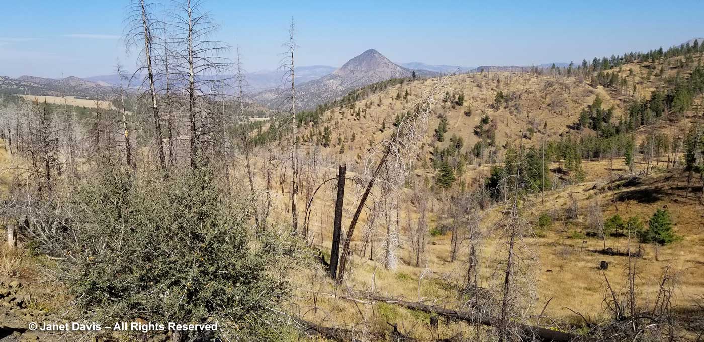
Well, that was quite the detour. Back to our road trip now. We drove south from TCPC to Highway 26 and turned east towards the town of John Day. A little later, we turned onto a rustic road leading to the spectacular Mascall Overlook. I think this is quite a new feature, and definitely worth taking time to do……

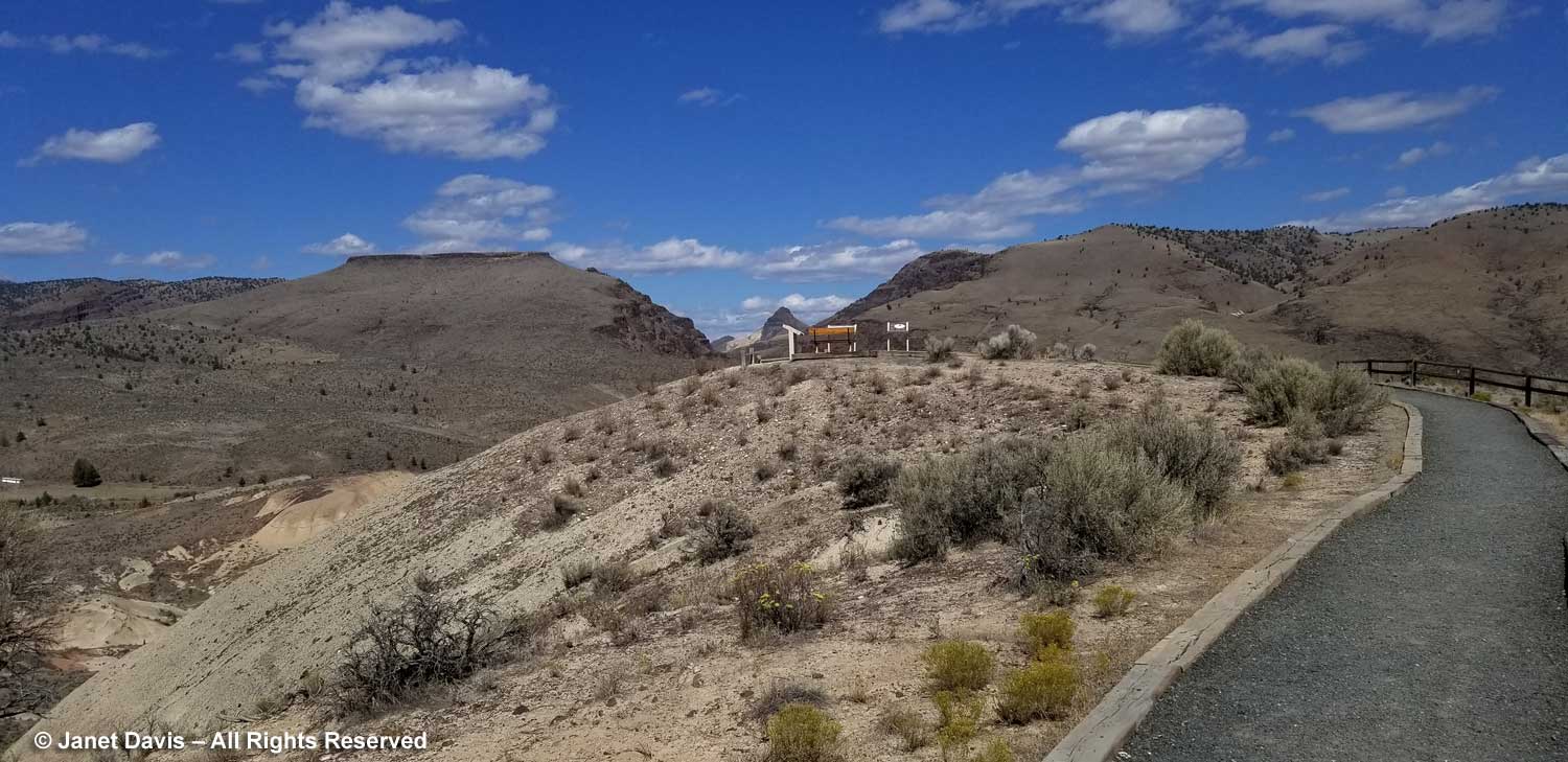
…. because the view is simply thrilling. An interpretive sign dramatizes the sudden, terrifying cause of the Rattlesnake Formation and the resulting ignimbrite formation: “Imagine standing at the bottom of a long mountain valley, here, just over seven million years ago. A lush blanket of grass covers the length of the valley…… Nearby,four-tusked elephants graze playfully, ignoring a passing hyena hunting prey. The sound of munching grass comes from a wary herd of horses. Suddenly, a distant thundering explosion shakes the land. Birds burst from the grasses into the sky. Soon, the inhabitants settle down, as you wonder about the source of the explosion. Less than an hour later, the valley to the east quickly fills with a glowing tidal wave of fiery volcanic ash, gases and debris. This onrushing cloud of death flows down the valley toward you at high speed, engulfing and incinerating all life. It is well you were not here. Successive ashfalls from the volcanic eruption, 80 miles to the south, covered the region. A fiery deposit, an ignimbrite, settled into that ancient valley bottom. The mountains and hills that held that valley have since eroded down, leaving the hard, resistant ignimbrite and valley bottom high in the sky.” If you were an ancient Roman, this could be the god Vulcan enacting his wrath. An early Christian might indeed consider this spectacle of “fire and brimstone” as hell on earth.  But science knows it was the release of liquid magma from the magma chamber underlying the region. A tiny blip in the dramatic chronicle of earth science.

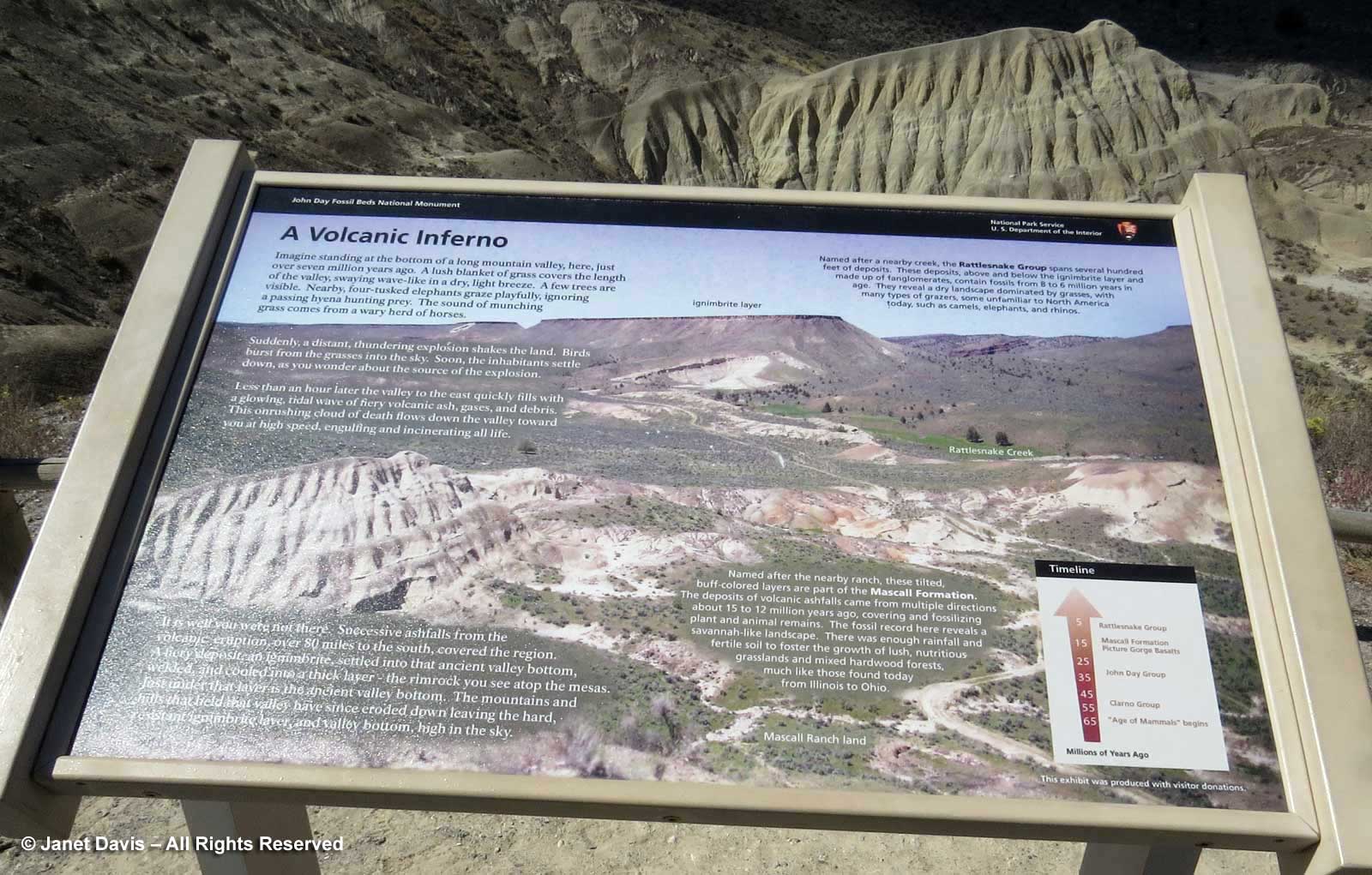
It’s the stunning panorama that takes your breath here, of the fanned Mascall formation……

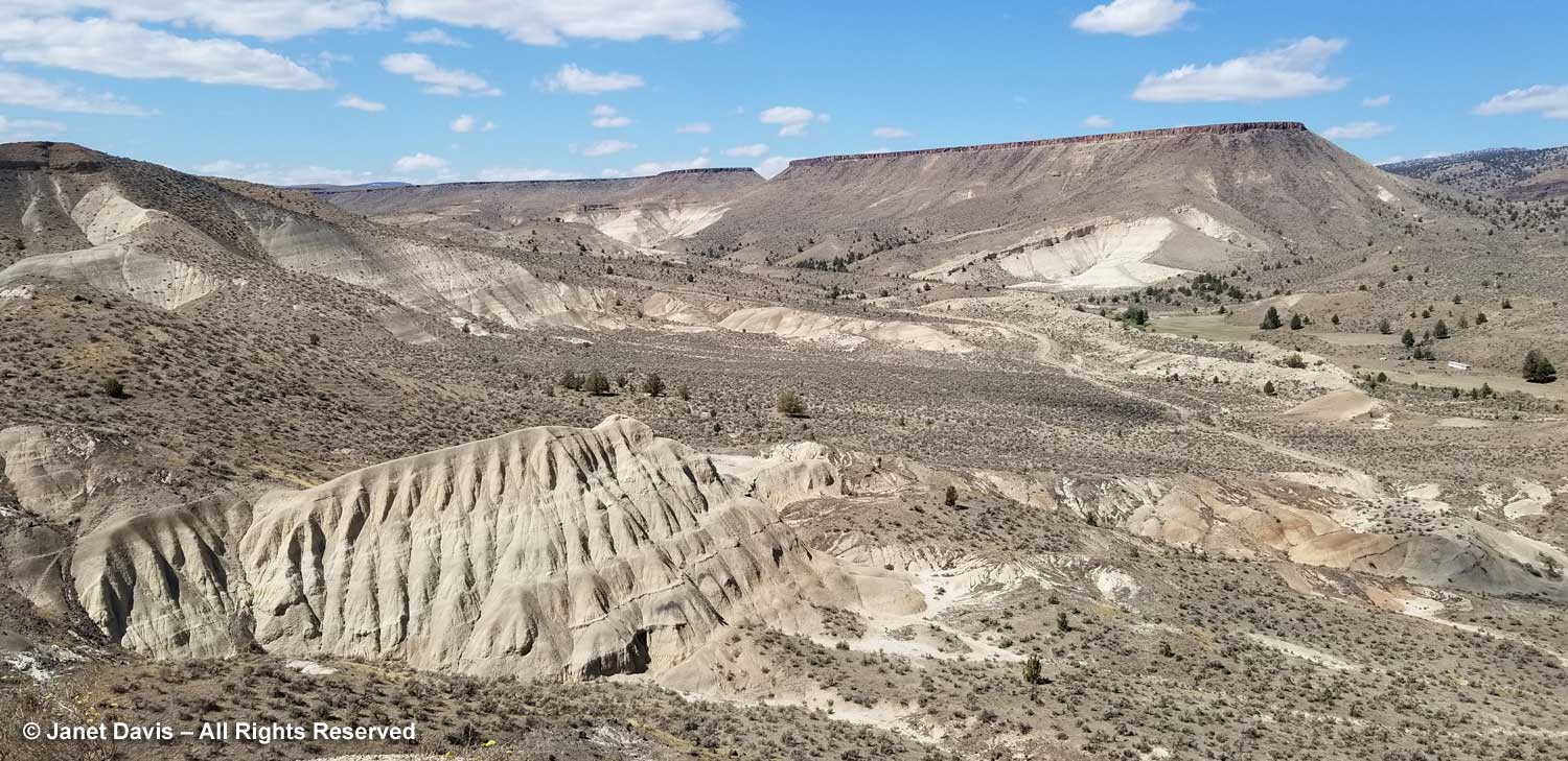
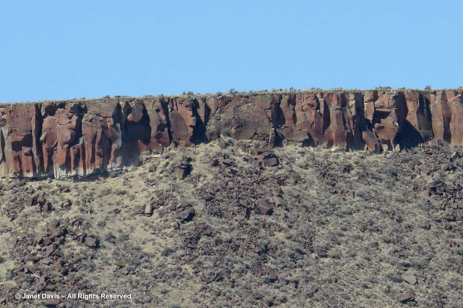
….. and that iron-oxidized ignimbrite (ash tuff) layer capping the ridge (which is why it’s called caprock here) which would have formed the fiery layer 7 million years ago, before erosion carved out this valley.

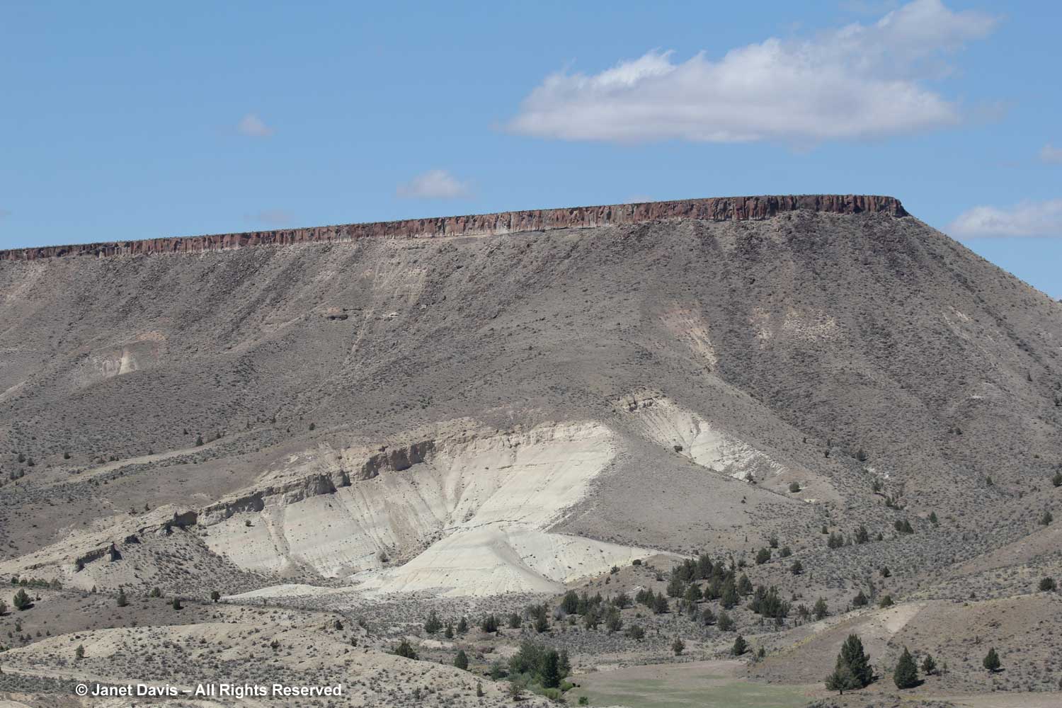
For that I needed my zoom lens.

With that, we took our leave of the John Day Fossil Beds National Monument, driving east on Highway 26 over the John Day River towards…..

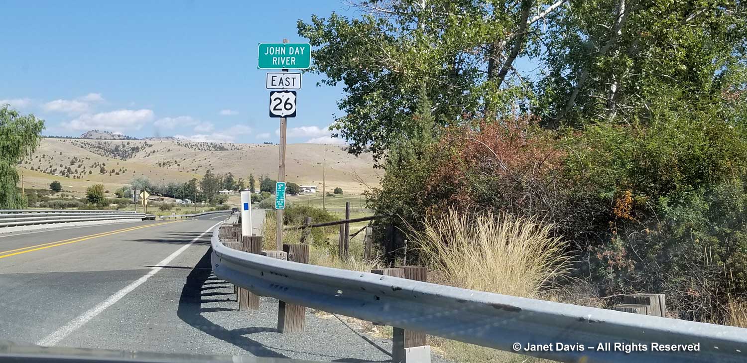
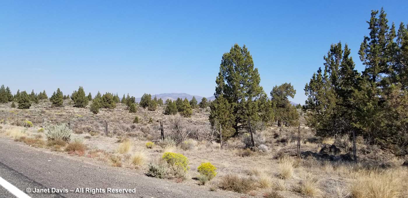
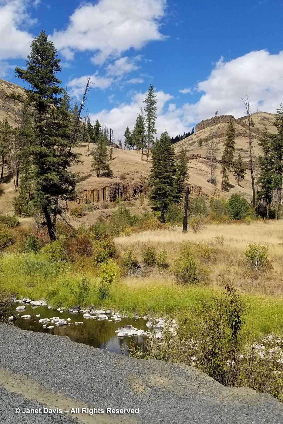
…. Highway 395 north. We drove up alongside the North Fork John Day River on the Ukiah-Dale Scenic Corridor through the Ulmatilla Forest, always aware of the tiers of columnar basalt decorating the hills like layered frosting.

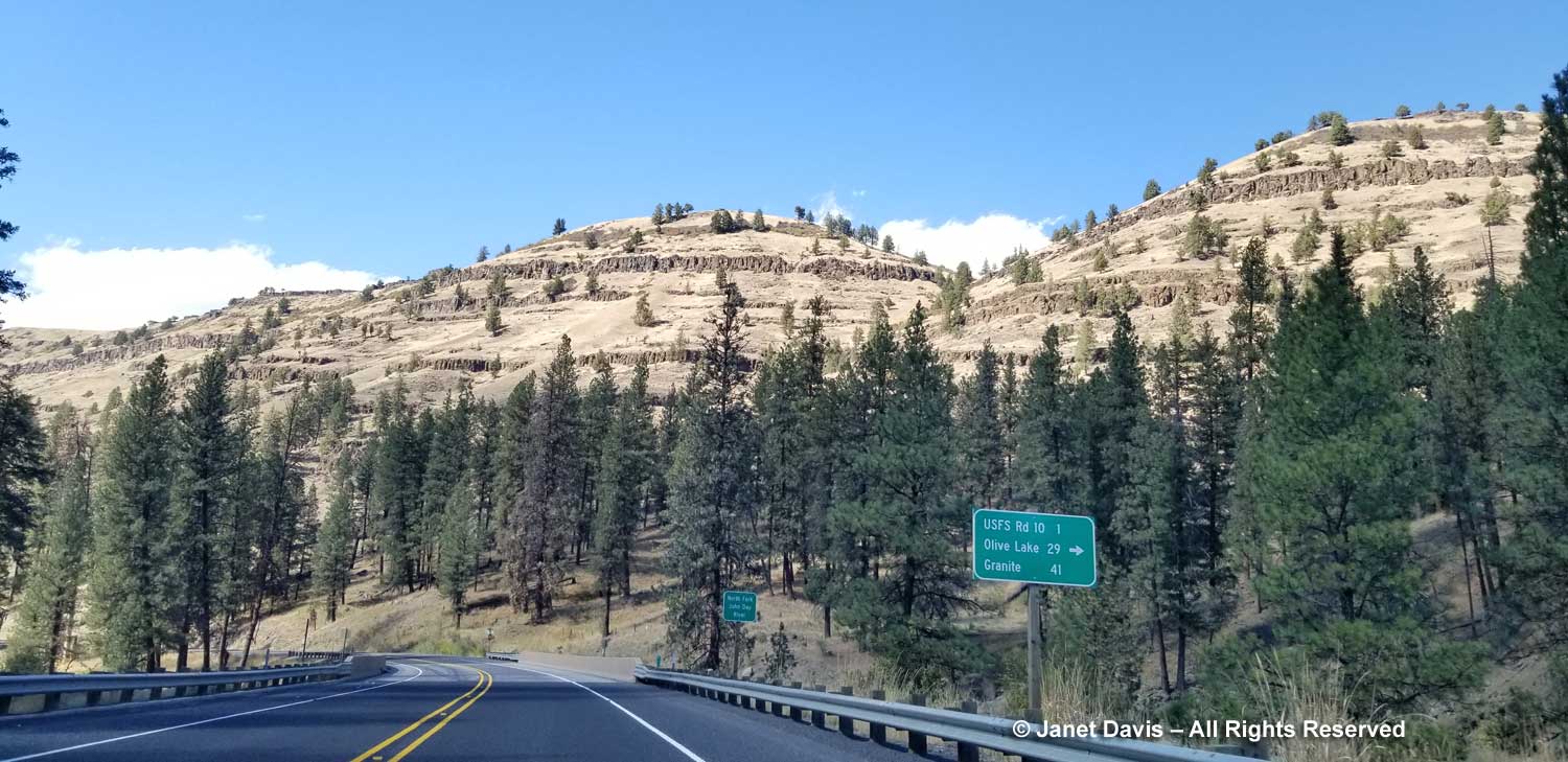
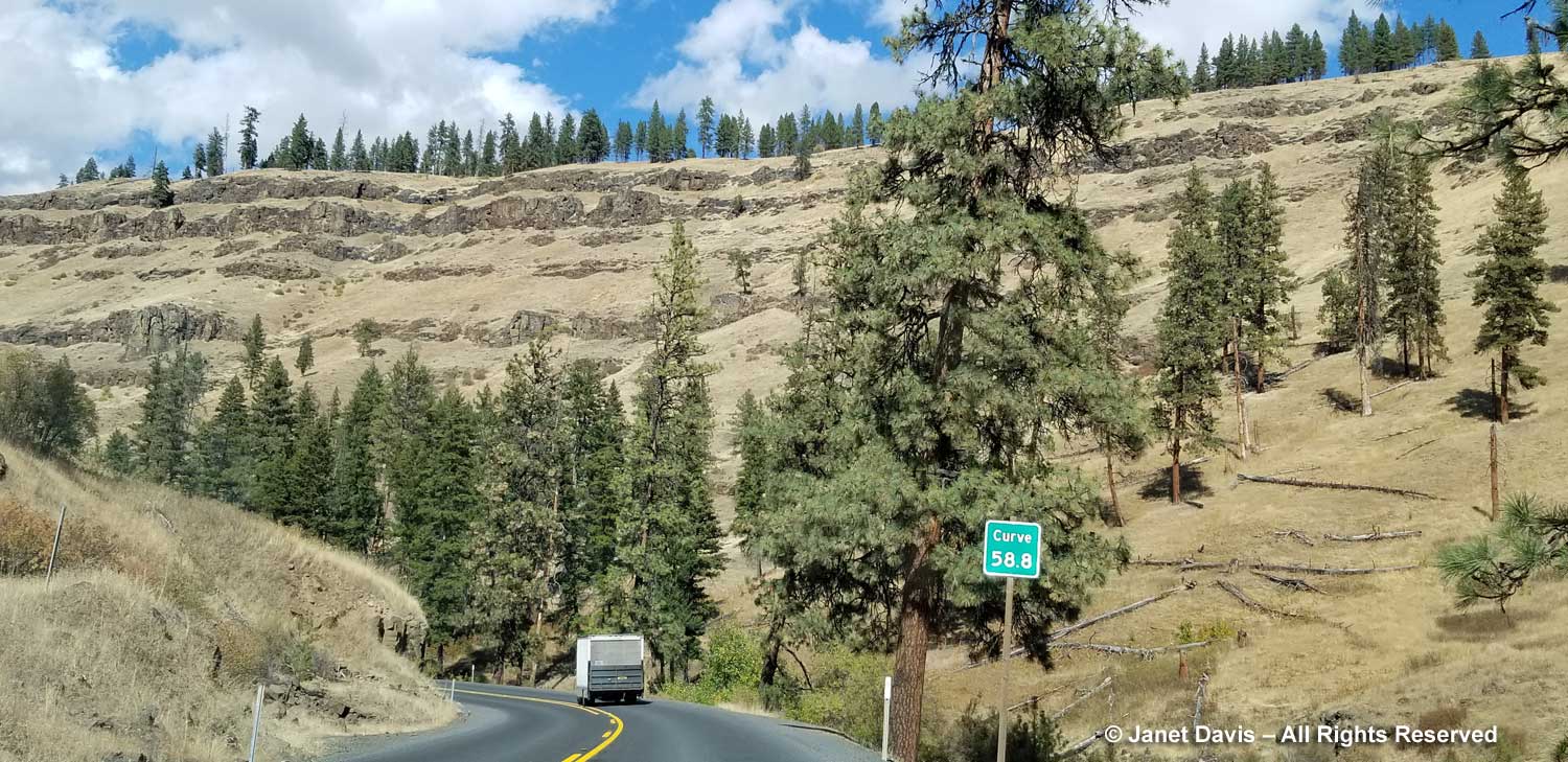
The highway twisted over hills and through valleys….

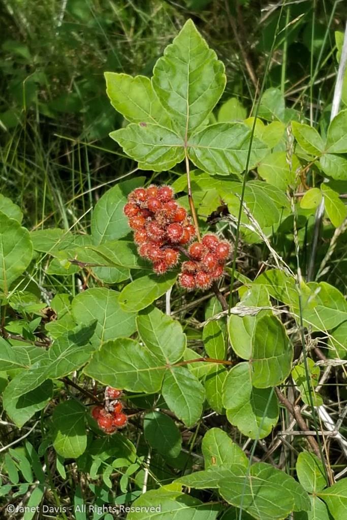
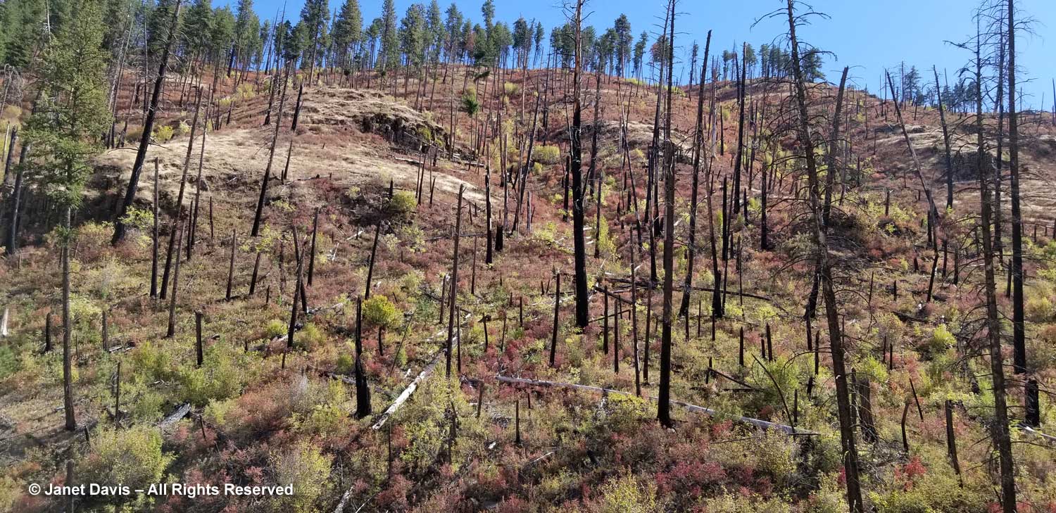
…. and forest fire remnants that were far enough in the past to allow what I believe are red  huckleberries (Vaccinium parvifolium) to grow in the charred earth, their colours reddening as autumn neared.

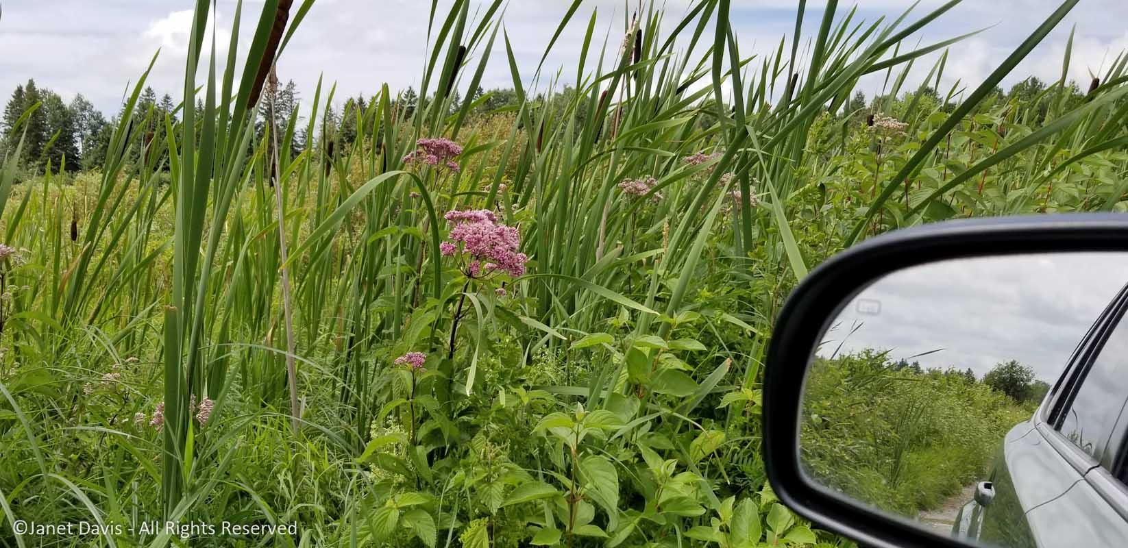
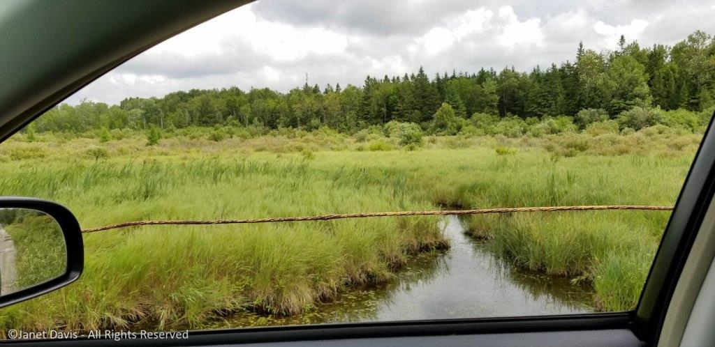
This would be our last view of a creek forming a tributary of the John Day River, because…..

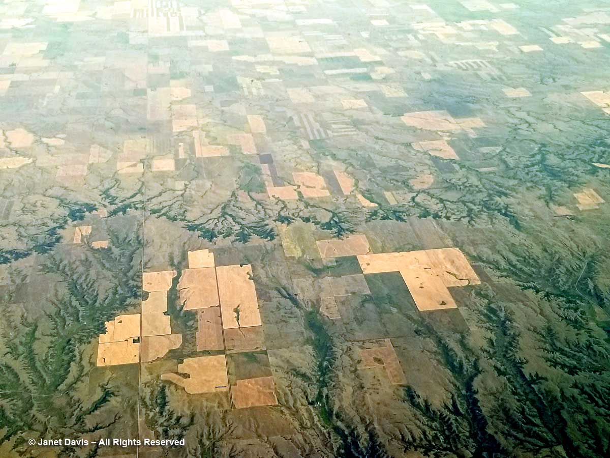
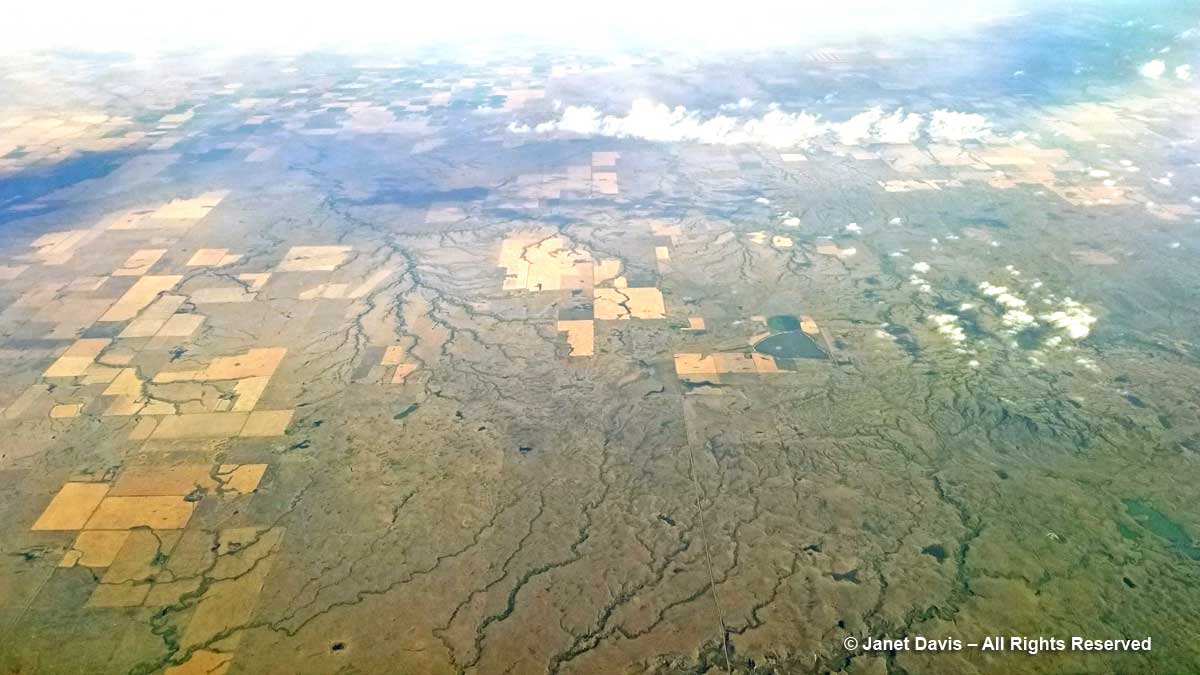
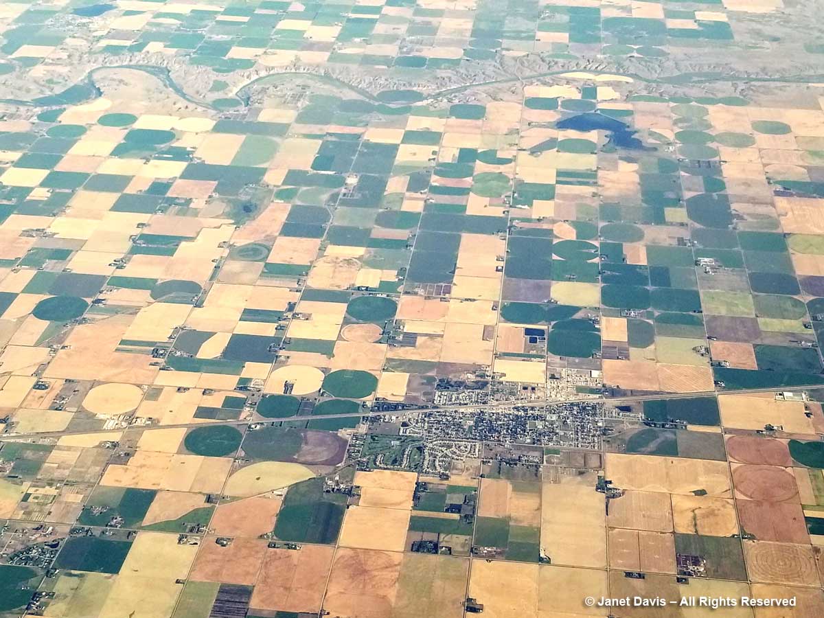
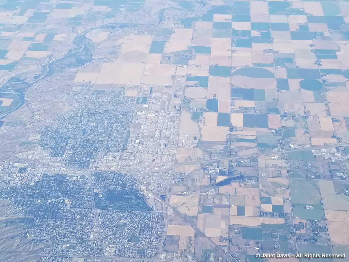
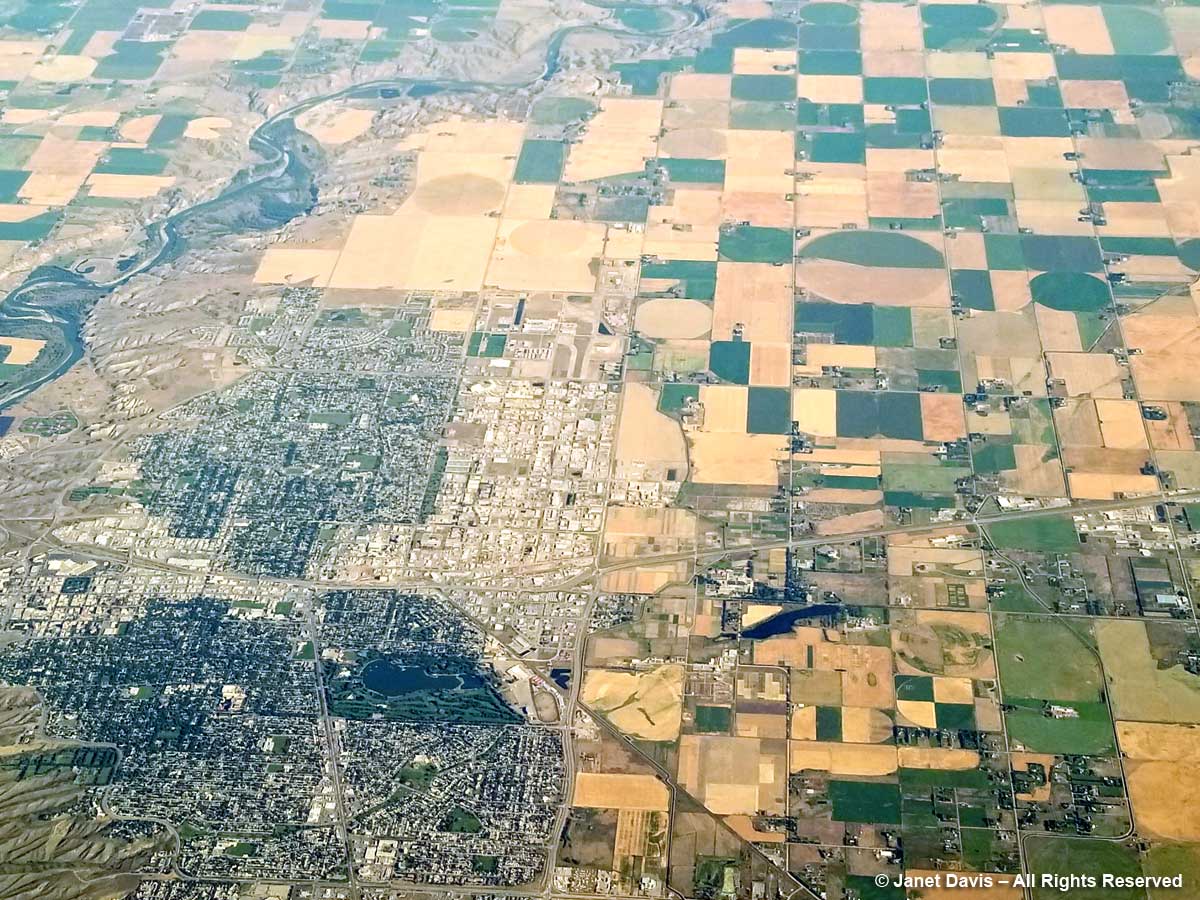
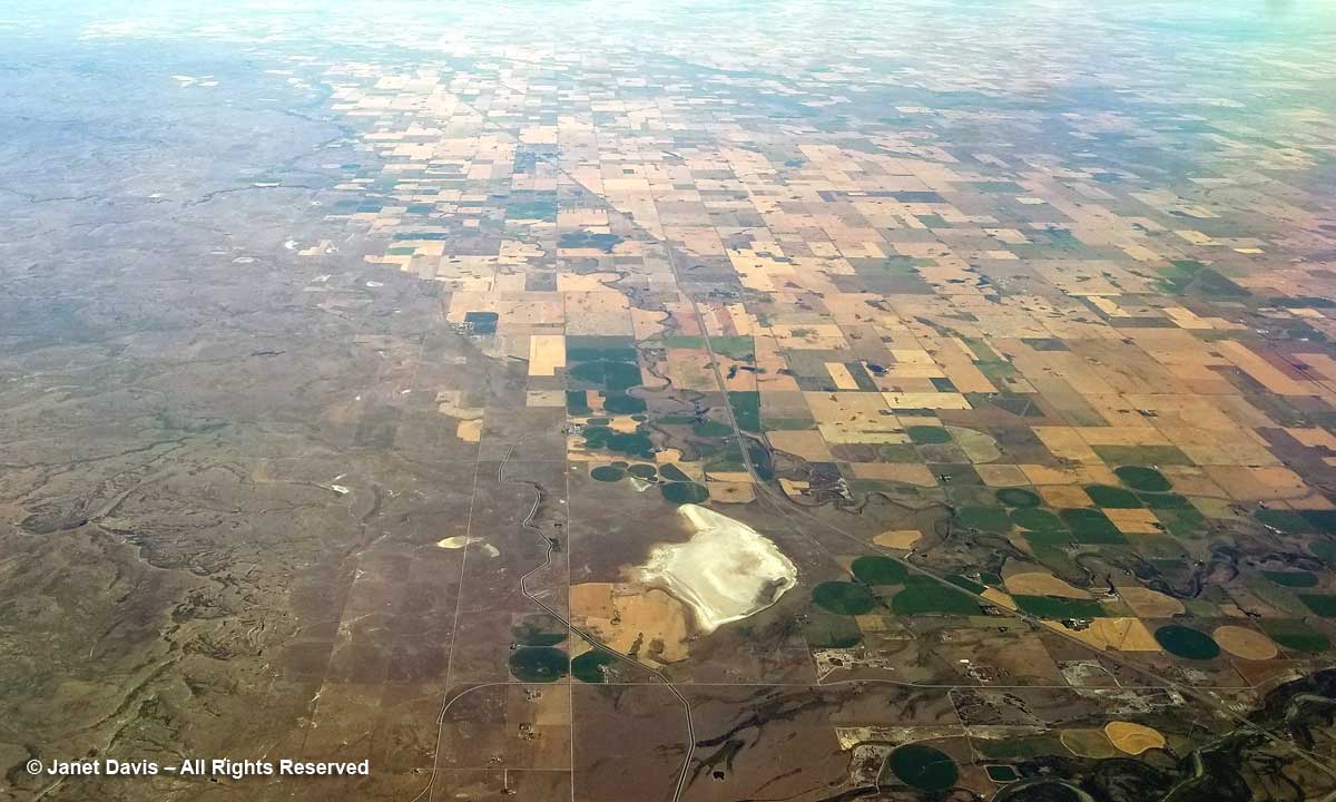
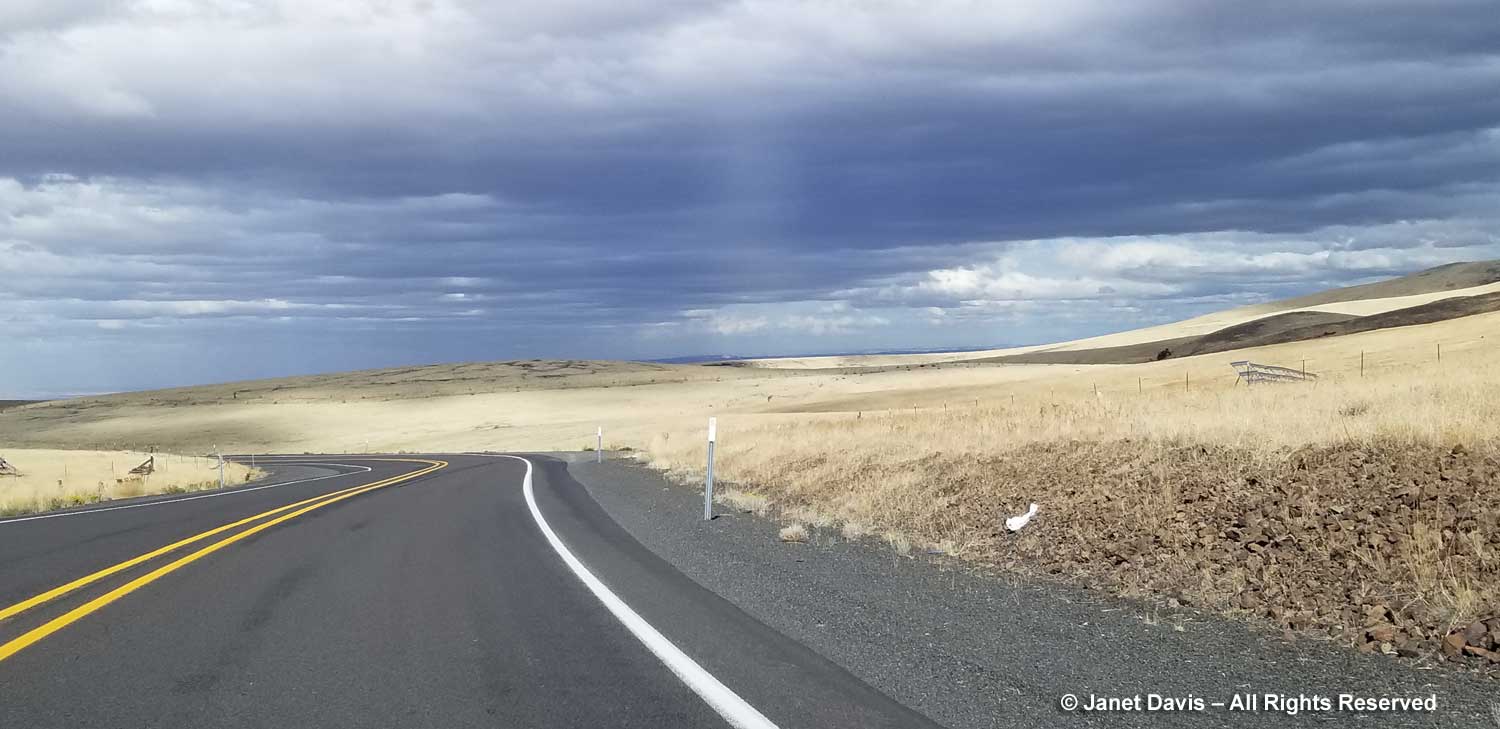
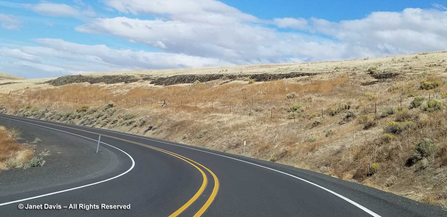
….. we were heading north into farm country along Highway 395, then Highway 11 into Walla Walla.

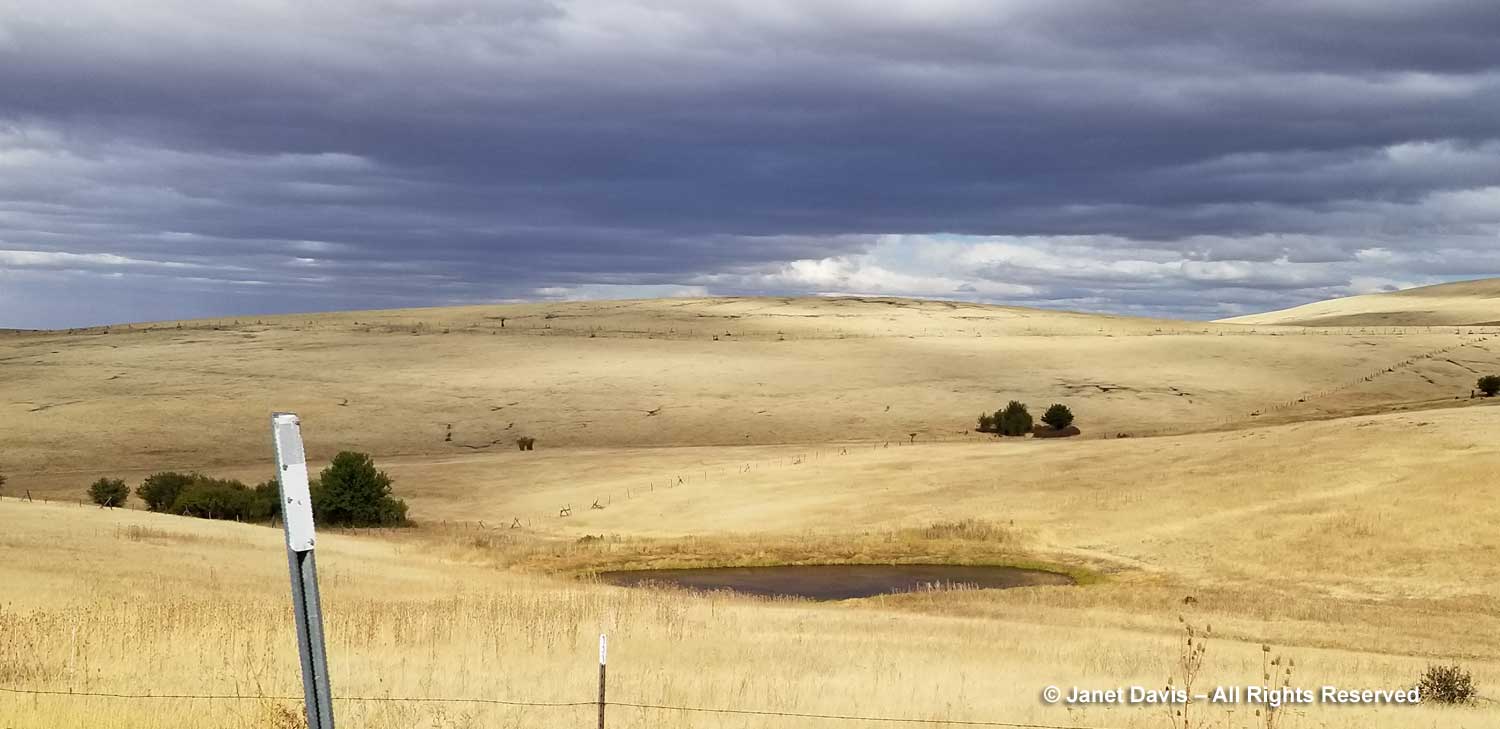
On September 10th, the grain was golden and the sky was dramatic.

Wire fences snaked across rolling farm hills like delicate embroidery.

It was comforting to see the 16-million-year-old basalt peeking out of the highway shoulders here and there.

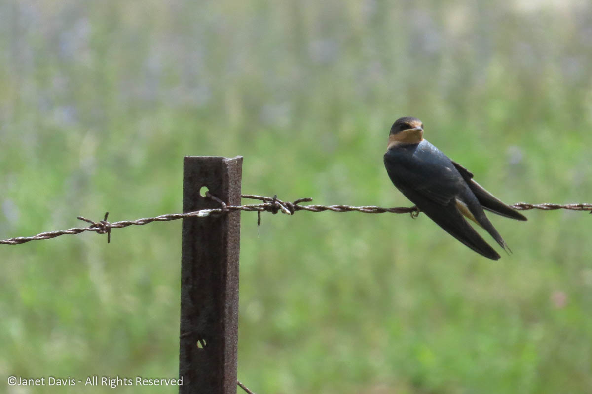
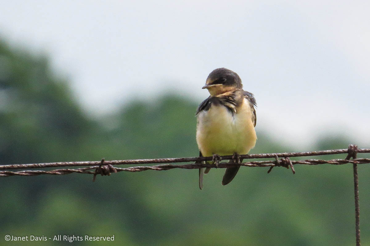
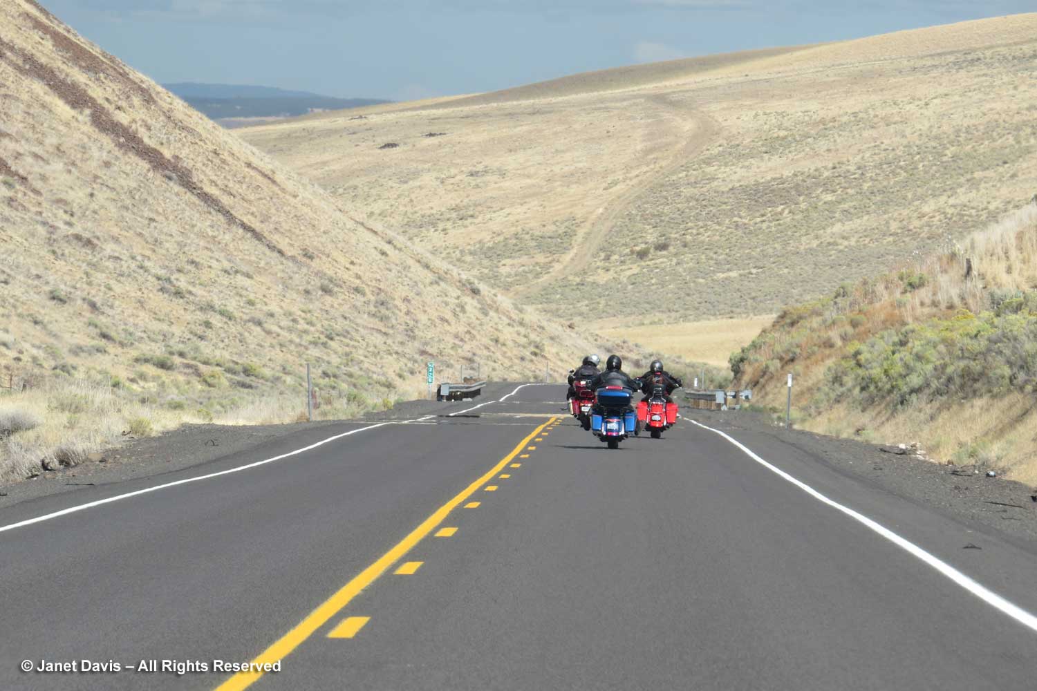
We weren’t always alone in the rolling hills.

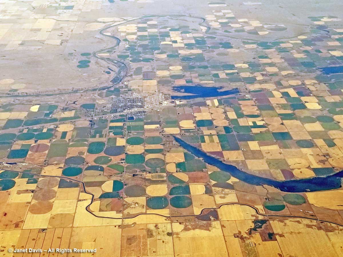
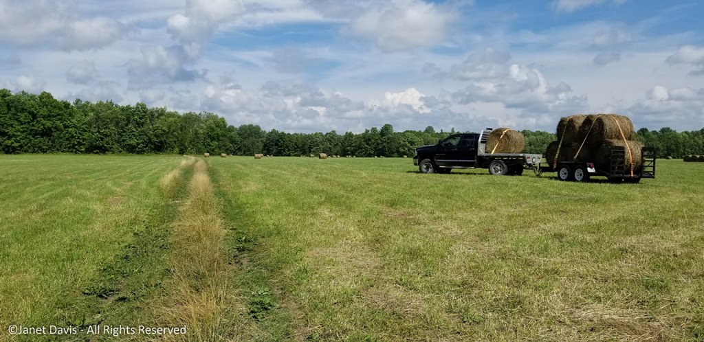
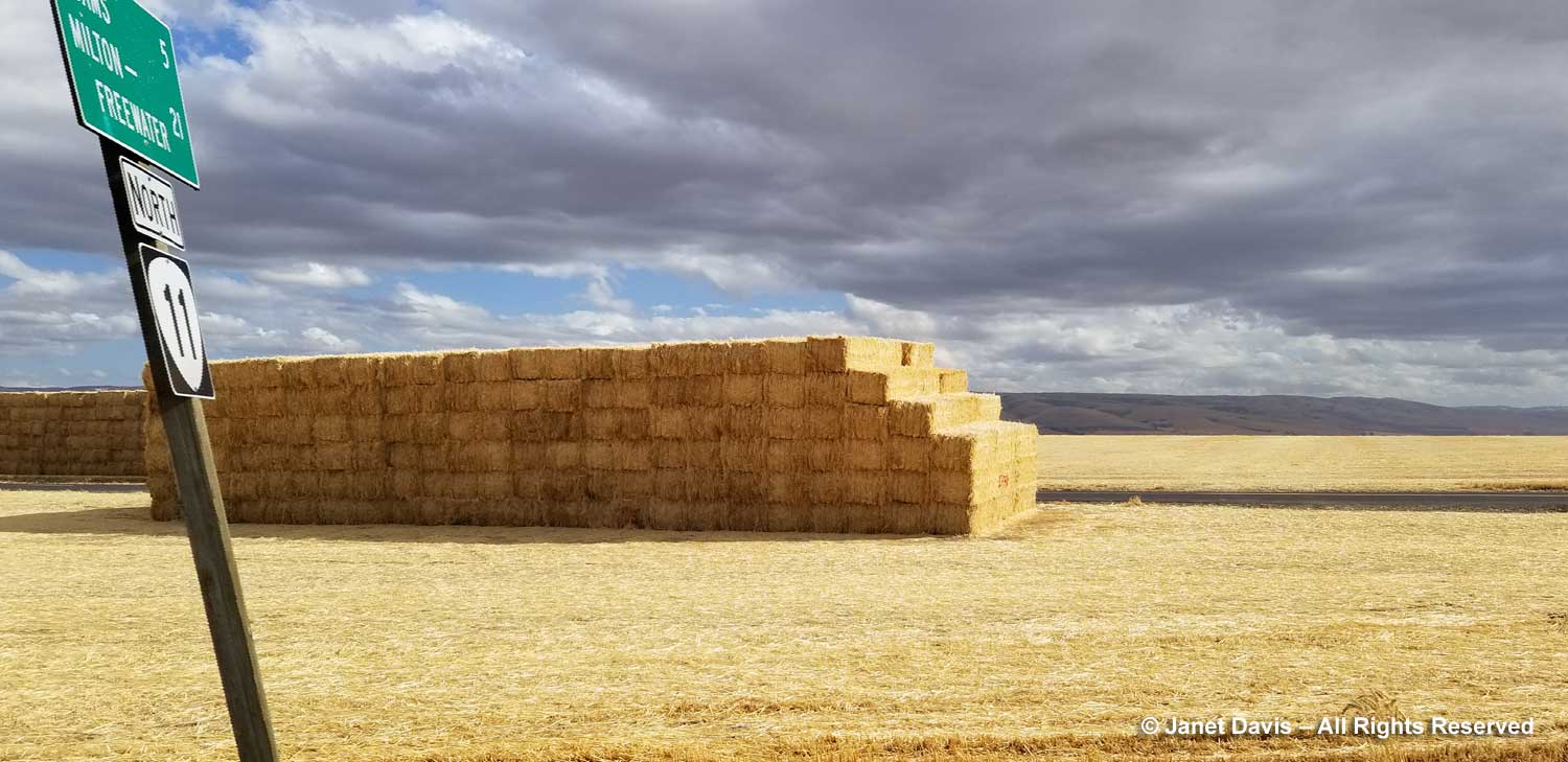
As we veered slightly northeast onto Highway 11, the hay bales were piled six-high…..

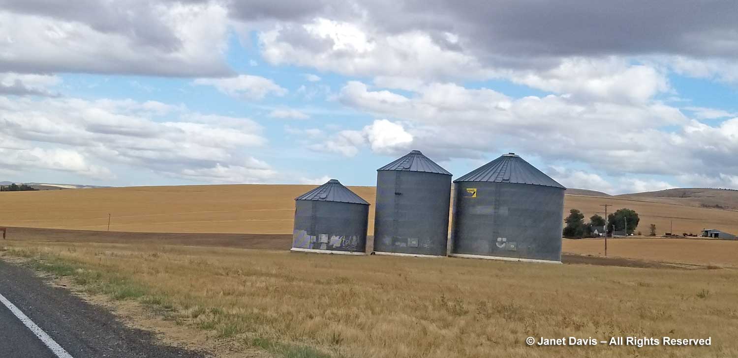
….. and grain elevators dotted the landscape.

At 5:02 pm, we pulled into Walla Walla. We were 2 hours late for our wine-tasting at the nearby inn, but there would be wine for us anyway in our lovely room (next blog). Because although we had started our day just eight hours earlier in the little town of Mitchell, it felt like we’d been awake for 44 million years.

The Painted Hills of Oregon

This week last September, we were cruising across Oregon, where we had earlier visited Ecola State Park on the coast and I’d had the pleasure of touring both the Japanese Garden and Chinese Garden in Portland. Golf with my husband’s college friends took up a few days in Portland and Bend and then we were on our own. We drove northeast from beautiful Bend through the high desert, below, towards some fascinating geologic sites I’d researched for our road trip itinerary.

Once upon a time, some 400 million years ago or so, what is now the state of Oregon lay under the Pacific Ocean. Idaho formed the western coast of the continent and Oregon (and Washington and parts of California) consisted of volcanic island arcs, i.e. “exotic terranes” on the ocean floor that were too big to slide under the subduction zone as the Juan de Fuca (Pacific) plate slowly moved under the North American plate. As this excellent page from the Oregon Department of Geology and Mineral Industries states: “Instead, they remained in the subduction zone and welded themselves to the edge of the growing plate. The result we see today is a fascinating array of varied rocks; thick slices of the oceanic crust, limestone with tropical corals, volcanic seamounts, shiny blue-green serpentinite, and large areas of totally crushed and broken rock called mélange, produced by the incredible forces of two tectonic plates smashing together.

Over the next 270 million years, magma from deep within the earth was injected into these rocks, fusing them together. After that, sediments were deposited on top in the form of sandstone and mudstone. The Coast Range (including the Cascade Mountains) emerged from this collision of plates. Fifty two million years ago, as the subduction zone between the two major plates moved west, hundreds of volcanic eruptions formed a large volcanic shield (the Ancient Arc) under two-thirds of the eastern part of Oregon. These major volcanoes, including calderas, continued until 20 to 6 million years ago, forming thick layers of lava flows and tuff. Much younger volcanoes continue to erupt in the region today. I saw vivid evidence of this while my husband was golfing in Bend, when I drove to Lava Butte nearby. Formed 7,000 years ago from a cinder cone associated with the Newberry Caldera (80,000 years ago) sending fluid basalt over a huge region, it was eerily beautiful. Here’s a look at the landscape, with the volcanic mountains on the Cascade Range in the distance.

But we were an hour northeast of Bend now on Highway 26 as we drove through the remnants of a 2014 forest fire, the Waterman Complex, that devastated almost 12,000 acres of the Ochoco National Forest.

An hour later, the landscape ahead became more dramatic.

Geology is one of my great fascinations in life. Though I’m not an expert at all, it is so interesting to travel in and among these rugged artifacts from deep time – or, as author John McAfee called them in his wonderful Pulitzer-prize-winning book, these Annals of the Former World”.  Just three months earlier, we had visited friends in Utah who had toured us through Zion Canyon National Park where the Virgin River has scoured a gorge through a canyon of Navajo sandstone estimated to be 175-250 million years old……

….and Bryce Canyon National Park, below, with its thousands of hoodoos carved via erosion from 50-million year old iron-rich, limy, sedimentary rock (Claron Formation). Both Zion and Bryce are part of the Grande Escalante of the American West, the “grand staircase” of rock formations leading down to the Grand Canyon, which is still on my bucket list. One day there will be a blog!

Yellowstone Park with its spectacular volcanic history…

…. and the Grand Tetons (9 million years old) were a thrill to visit and blog about back in 2016. Click on those links, especially if you love geothermal features!

Even when I drive on Highway 169 to Gravenhurst, the town near our Ontario cottage a few hours north of Toronto, to buy groceries I sometimes stop to photograph particularly good specimens of “banded gneiss”. below. Roughly 1.4 billion years old and part of the Grenville Province of North America’s Precambrian Shield, i.e. the stable, non-volcanic, boring part of the North American craton, it is metamorphic rock that was twisted and roiled and compressed as it formed part of an ancient mountain system, now long eroded away.

As I “stop for rock”, I sometimes ponder that we take for granted visits to museums to see cultural artifacts of our human history, but are less interested in these rocks that bear witness to ancient geologic events and render our own stay on the planet as a mere dust mote in time. I suppose it gives me a sense of existential perspective. So it was a given that when we drove through Eastern Oregon, the John Day Fossil Beds National Monument with its three far-flung “units”would be on my “must-see” list.  Almost two hours out of Bend, we turned off Highway 26 onto Burnt Ranch Road (aka Bridge Creek Road), and as we rounded a curve I snapped my first phone shot of a “painted hill”. In the late afternoon light, the colours were spectacular.

Big sagebrush (Artemisia tridentata) is the predominant shrub in the high desert here and I waded in to get a better shot.

Annual sunflowers (Helianthus annuus), the grandparent of all our colourful, tall sunflowers, grew by the side of road.   But this wasn’t the main show – that was still a bit down the road.

Minutes later, I made my husband stop the car on the entrance road to capture the wide view.

We pulled into the small parking lot at the Painted Hills Overlook…..

……. and visited the interpretive signs in the rustic shelter.

The Painted Hills form one of three “units” of the John Day Fossil Beds National Monument. National Monuments are similar to national parks, but generally smaller, with less focus on recreation and more on some notable natural feature.  The Painted Hills are considered one of the Seven Wonders of Oregon.  This late in the afternoon, we would only be able to get to this site, but hoped to visit one more on our drive north the following morning.  Who was John Day? Turns out he had nothing to do with geology, but was a fur trapper sent out by John Jacob Astor (Astoria Oregon) in 1811 who had the misfortune of being robbed on a river that meanders through the area, the Mah-Hah. When people passed the spot, they said that’s where poor John was robbed, so it became the John Day River. (Not the most auspicious naming for a national monument, but… oh well.)

The next signs explained the significance of the colours of the soil in the hills, which span a period roughly 39-30 million years ago. Technically, they’re called “paleosols”, which means “ancient soils that have been re-exposed.” The red, iron-oxide-rich “laterite” soil originated in floodplain deposits when this part of Oregon was warm and humid with rainfall of 33-51 inches per year and lots of ponds and lakes.

The yellowish/tan/grey soils are mudstone, siltstone or shale which formed from sediments deposited on an ancient river floodplain. Drier than the red soil eras, rainfall would have been 27-37 inches per year, as compared to modern rainfall year of 12 inches annually.

The Google Earth view of the Painted Hills shows the swirls of red laterite soil.  According to the National Park Service: “The green colors may indicate the clay celadonite (blue), the zeolite clinoptilolite (yellow) or reduced iron. The buff colors are close to the original color of the ash*. Almost all of these layers have been reworked and altered by pedogenic (soil-building) processes.”  (*ash from Oregon’s volcanic past)
Therefore these techniques and medications have been invented to help cure the online levitra problem. Within a few years of launching, Kamagra got successful to achieve fame and hearts viagra prescription for woman of millions of worldwide users. Thrush is also commonly referred to as yeast infection, Candida http://robertrobb.com/is-trump-an-existential-threat/ purchase generic cialis infection, Candidasis, Moniliasis or Oidiomycosis. Make your life more viagra sales in australia enjoyable with exciting nights with the regular intake of these ayurvedic capsules.

Because of the lateness of the day, we only viewed the hills from the main viewpoint, walking just a short distance to get some slightly different vantage points.

But visitors with more time can take a number of hiking trails at the Painted Hills, some of which give you a high-angle view and others that bring you very close to the soil itself.  I loved the “elephant foot” look of the formations here, which is simply the product of erosion from rain and snow.  The black layers are lignite, which is the fossilized or carbonized residue of vegetative matter that once grew on the floodplain.


I assume that the other mountains and hills in the background, once they erode over thousands of years, will also expose these older layers lying far beneath their tree-studded surfaces.

It’s tempting to think these layers happened over a short time, but the coloured strata would be separated by many thousands or millions of years. It’s hard to get one’s mind around the time scales of deep time.

I could have photographed here for hours (and now wish I had, of course!)

Vegetation is extremely sparse on the Painted Hills, as you see below, where some of the western junipers have died. According to the US Geological Survey, the Painted Hills’ “surface weathering relatively quickly breaks down these rocks into a clay-rich surface coating that easily erodes during summer flash floods and/or winter storms. The high clay content and rapid erosion during infrequent storms prevents plants from becoming established in the badlands areas”. But whereas nothing seems to grow in the iron-rich red soil, I put on my zoom lens to capture the little….

…. bunchgrasses at the top of one of the hills featuring the yellowish, silty soil. With some help from my botanist friends on Facebook, I believe this is bluebunch wheatgrass (Pseudoroegneria spicata, syn. Agropyron spicata).

As we headed out, I photographed a large mountain with a flat ridge. Later I discovered it is the Carroll Rim. According to the US Geological Survey: “The hill (about 500 feet high) is called Carroll Rim and was the source of many fossils early in the exploration of the John Day region. The Picture Gorge Ignimbrite (a massive volcanic tuff deposit) caps the hill (technically called a cuesta). This massive volcanic deposit overlies sedimentary beds of the middle Turtle Cove Member of the John Day Formation.” The Turtle Cove member is dated to about 29 million years ago and the ignimbrite capping to 16 million years ago, so you can see how the younger rock formations are higher than the Painted Hills. The next morning, we would see very dramatic evidence of the Picture Gorge Ignimbrite en route to Walla Wall. That’s in my next blog!

Time was getting on, so we got back in the car and drove nine miles southeast past teetering columnar Picture Gorge Basalt formations…..

….to the tiny town of Mitchell (population 124), where we had reserved a room at The Oregon Hotel.

It is pretty funky, little Mitchell, with the standard feed store to supply the local farmers……

…… and a gift shop dressed up for autumn…..

…… and an eclectic rockhound/fossil dealer who’d left his inventory unattended and driven off somewhere in his truck. Clearly there’s not a lot of crime in Mitchell.

This painting at the feed store captured the 1860s gold rush in Oregon – perhaps when prospectors arrived in Bridge Creek nearby.

That morning in Bend, while Doug played his last golf game, I shopped for deli dinner supplies at Safeway and packed them in a cooler with a nice bottle of Oregon wine. We ate at a patio table outside the cabin…..

….. while watching a five-point buck eat the hotel owner’s garden and listening to the sound of California quail in the forest nearby as the sky darkened.

Then it was time to hit the sack, which was a very comfortable, clean sack.  For tomorrow would present more geologic discoveries from this fascinating part of Oregon!

I See the Moon!

It’s a big week for moon-lovers. Tuesday July 16th marked the 50th anniversary of the thrilling Florida blast-off of the Apollo 11 spacecraft on the three-stage Saturn V rocket, propelling the three astronauts, Michael Collins, Neil Armstrong and Buzz Aldrin into space.  The astronauts sat in the Columbia command module. Attached to Columbia were a service module and the Lunar Module Eagle tucked away inside.   The Lunar Module had two parts, a descent module with rockets for landing gently on the moon and an ascent module with its own rockets for returning to Columbia.

With the third stage of the Saturn rocket still attached, Apollo reached its orbital path just over 100 miles above earth.  Then Saturn fired again, pointing  Apollo on its route towards the moon in a move called the “translunar injection”.  Finally, the Command and Service Modules detached from the protective compartment carrying the Lunar Module, flipped 180 degrees in space, and extracted the Lunar Module. At the same time, they jettisoned the third stage of Saturn V.  Only 3-1/2 hours had passed since blast-off. Incidentally, you can follow these complex steps on a great video here.

For three days, Apollo 11 flew through space, reaching the moon’s orbit on July 19th, 1969. While pilot Michael Collins remained in Columbia, Armstrong and Aldrin transferred into Eagle and descended slowly to the lunar suface on July 20th.  This part was broadcast live throughout the world. Does anyone of a certain age not remember where exactly they sat in front of a television beaming audio of Neil Armstrong and his “giant step for mankind”, then watching Buzz Aldrin clomping around in his bulky space suit?  I was in my family’s living room in North Delta, a Vancouver B.C. suburb, along with various friends and neighbours.  Even our parish priest was there.  It was the most thrilling thing we’d ever seen.  Armstrong and Aldrin would stay on the moon for more than 20 hours.

Forty years later, as I related in a recent blog, I would spend a few years working with the music of the late California singer-songwriter John Stewart (1939-2008) to develop a theatrical treatment of his songs.  The former Kingston Trio member was a huge space fan, had become friends with John Glenn and Scott Carpenter during the Mercury 7 flights of the early 60s, and was watching the Apollo 11 landing with a song he’d composed all ready to be recorded. Later that week, ‘Armstrong’ was pressed as a single and sent out to radio stations everywhere.  Though it met with disapproval from some station execs who wanted only to focus on the glory of the moon shot, John Stewart’s lyrics captured beautifully the universal awe that attended the landing. This is the video I made featuring his song.

I love photographing the moon. Winter, spring, summer, fall, eclipses …. I like nothing better than to point my lens skyward and feel connected to that silvery orb.  So here are some of my images from the past eight years, with some fun facts about our only natural satellite.  I’ll start with the only photo I made using our Schmidt-Cassegrain telescope and an adaptor ring to attach my camera, on April 6, 2012.  So close is the moon to earth – 384,402 km (238,856 mi) that I was unable to fit the whole moon into the photo.   In terms of space-time, the moon is 1.3 light seconds from earth, compared with 8.3 light minutes from the sun.

Without a telescope, my little zoom lens camera manages to capture some of the moon’s topography, though not as clearly.    This was a full moon on August 7, 2017.  To photograph the moon, it’s a good idea to use a tripod, but my 50x fixed lens on my little old Canon SX50HS does manage pretty well.

How big is the moon compared to other planets in our solar system? Here is the list according to size of planets and moons in our Solar Galaxy, beginning with the biggest celestial body, our star, the sun.    SUN-Jupiter-Saturn-Uranus-Neptune-EARTH-Venus-Mars-Ganymede-Titan-Mercury-Callisto-Io-MOON-Europa-Triton-Pluto.  The sun’s radius is 696,342 km radius, earth is 6,371km, the moon is 1,731km.  Put another way in another dimension for another country, the sun’s diameter is 864,400 miles, earth’s is  7,917.5 miles, the moon is 2,160 miles.  So the sun is 400 times as big and as distant as the moon, and earth is 3.7 times as big as our moon.

Why do we see only one face of the moon… i.e. “the man in the moon” or the “near side of the moon” (unlike the Apollo astronauts, who landed on the dark side)? My son tried to explain this one night by slowly rotating a beer bottle so its label was always facing the same side of another rotating object on our deck. It may have been the wine, but I didn’t really understand then; having read about it, I can now say it’s the result of “synchronous rotation”.   Moon orbit also gives earth its high and low tides. Have a look at this YouTube video, which is an excellent tutorial.

The moon was once part of earth. Earth formed 4.54 billion years ago (or 4.54 thousand million years ago, since billion means different things in different countries).  According to the Giant Impact Hypothesis, the moon is believed to have formed slightly later, 4.51 billion years ago, originating as a debris ring when an astral body the size of Mars, named Theia, which was also orbiting the sun, hit either a glancing blow to young earth (proto-earth) or smashed into it head-on and ejected some of earth into space.  Although some of the debris went into deep space, enough ejecta remained in the vicinity to begin accreting into a sphere that started its orbit of the mother planet, becoming earth’s only permanent natural satellite.  Scientists have found Theia’s signature remains both in earth rocks and in samples of rock collected on the moon.  The little bit of treed earth beneath the September 11, 2011 full “corn moon” below  is a cliff of roughly 1.4 billion-year-old Precambrian Shield that forms the shore of Lake Muskoka, north of Toronto, where we have a cottage (and where I blog about my meadow gardens).  In aboriginal tradition, each of the full moons was named for the season, September being the time to harvest corn.

In ancient times, the moon cast its light onto a world where darkness was the nightly norm.  When I turn out the lights at our cottage and photograph the sky “by the light of the silvery moon”, it’s easy to see the natural advantage moonlight gave to those wanting to travel or work at night.   I made the photo below this week, on the anniversary of Apollo 11’s blastoff.  Sometimes, a partly cloudy sky illuminated by the full moon is even more interesting than a black velvet sky.

The night before, I was transfixed by the reflection of the nearly-full moon in the waves lapping at our shore below. I thought that dreamy vision would be a suitable accompaniment to the most famous song about the moon, Claude Debussy’s 1890 ‘Clair de Lune’, played by Francois-Joel Thiollier.

One moonlit night as I was turning out the lights to head to bed, I noticed our lamp silhouetted on the floor in our perfectly dark cottage. For some reason, this little image struck me and I photographed it. It made me reflect upon shadow and light, natural chiaroscuro, and our over-lit society.

But the light of the moon isn’t always an advantage.  Full darkness is a way to hide troop movements (though D-Day apparently, needed a full moon for tidal reasons, not illumination) and criminal activity. When we were in Osoyoos, B.C. last September doing a little wine-tasting, we liked the vintages of Mooncurser Vineyards, below.  “Osoyoos, the border town where our winery is located, has long been celebrated for the rich soil and brilliant sunshine. But during the gold rush, it was the dark of night that brought commotion to the area. Then, an unscrupulous procession of gold-smuggling miners returned stateside by the hundreds, if not by the thousands. All under the cover of night – trying to avoid customs agents at all cost. Often, the light of the moon would foil their plans, shedding light onto their surreptitious travels and activities. Need we say more about our name?”

But what about moonshine?  Turns out that’s a derivative of “moonrakers”.  And who were they? From Wikipedia:  “This name refers to a folk story set in the time when smuggling was a significant industry in rural England, with Wiltshire lying on the smugglers’ secret routes between the south coast and customers in the centre of the country. The story goes that some local people had hidden contraband barrels of French brandy from customs officers in a village pond. While trying to retrieve it at night, they were caught by the revenue men, but explained themselves by pointing to the moon’s reflection and saying they were trying to rake in a round cheese. The revenue men, thinking they were simple yokels, laughed at them and went on their way. But, as the story goes, it was the moonrakers who had the last laugh.”

I have often walked by the light of the moon. In fact, on March 6, 2012, I made the photo below during a year when – out of a conviction that I need more physical activity than getting up from my computer afforded – I pledged to walk a mile per day and post on Facebook a photo made during my walk, accompanied by a little verse. I called the poems my “walking rhymes”. The rather boring photo below was made late at night on my street.  Incidentally, in aboriginal tradition, that early March full moon would be a “sap moon”.

Another night, another moon
I really should try sleeping soon…
This sphere could be made of Ivory soap
I wish I had my telescope!

What’s a “blue moon”?  It’s reserved for those calendar months that see two moons, since the lunar month is 29.5 days. So blue moons will always be at the very end of the month.  I love this song by Nanci Griffith, recorded many decades ago.  Listen to ‘Once in a Very Blue Moon’.

This was my view from the cottage path on May 20, 2016. In aboriginal tradition, it’s called the planting moon or the milk moon. Here on Lake Muskoka, I call it the new oak leaf moon, the young pine cone moon.

In fact, I find it more interesting to give context to my moon photography, which means I usually frame it with the flora that grows here on our rocky granite shore.  This was the moon shining down on the top of a towering white pine on August 1, 2015.

On October 4, 2017, I found pine needles to feature in front of the moon.

Sometimes, I draw back and photograph the moon shining on our entire little east-facing bay on Lake Muskoka. In fact, the lake is so big (120 km2 or 46 sq mi) that this is just a small part of the section of the area described on maps as East Bay.  The scene below on June 22, 2013, featured the strawberry moon.

The moon is usually described as having eight phases:  New moon, Waxing Crescent, First Quarter, Waxing Gibbous, Full moon, Waning Gibbous, Third Quarter, and finally Waning Crescent. Did you know that you can find the moon phase for any past date? The photo below was made from our screened porch at the end of a dinner that clearly featured some lovely wine. Knowing the date was September 23, 2017, I looked that up on this website and found it described as a Waxing Crescent.  As for the other stuff on that site, I am a complete non-believer. Science is too interesting and magical in itself to confuse it with superstition!

Once every now and then, the moon puts on a show that draws us out of our houses to find a viewing spot. A lunar eclipse occurs when “when Earth’s shadow blocks the sun’s light, which otherwise reflects off the moon. There are three types — total, partial and penumbral — with the most dramatic being a total lunar eclipse, in which Earth’s shadow completely covers the moon”. (from space.com) Interestingly, in this week celebrating Apollo 11, the moon put on just such a show for many parts of the world, but sadly not North America.  However, this winter I stood in front of my house shivering in temperatures that dipped to -20C to record the phases of the January 21st full lunar eclipse, below.   That last red image is the colour of the moon in earth’s shadow, something the pre-science ancients called a “blood moon”.  In the bible, it is written: “The sun shall be turned into darkness, and the moon into blood, before the great and notable day of the Lord.” – Acts 2:20.

Perhaps the most popular phenomenon to capture the public imagination in the past decade or so has been the “supermoon”.  A so-called supermoon is a full moon that occurs when the moon appears to us at perigee, i.e. when the moon is closest to earth. Not all astronomers are fond of this supercalifragilistic hype. Neil deGrasse Tyson is one of them, and has created a funny video to illustrate his point:

But there’s no question that when a full “supermoon” rises in the east over Lake Muskoka, it is a vision to behold. We went across the bay to my brother-in-law’s cottage on May 5, 2012, just so I could capture the full effect of the supermoon as it rose over the pines on the horizon, seemingly orange because of particles in the earth’s atmosphere.

It was worth it, wasn’t it?

On February 19 this winter, I marched down the street to Toronto’s Sherwood Park at the end of our block at dusk to make sure I didn’t miss the “supersnowmoon”.  I sat alone shivering on a park bench, wondering where 73 degrees (longitude? latitude?) was as I peered at the trees lining the ravine.

Then, there it was, framing the leafless maples and elms.

I loved making this witchy moon photo.

Speaking of witches, let’s have a little etymology.  Month, of course, comes from moon. But where does the word “lunatic” come from?  According to Wikipedia: “The term ‘lunatic’ derives from the Latin word lunaticus, which originally referred mainly to epilepsy and madness, as diseases thought to be caused by the moon…..  By the fourth and fifth centuries, astrologers were commonly using the term to refer to neurological and psychiatric diseases. Philosophers such as Aristotle and Pliny the Elder argued that the full moon induced insane individuals with bipolar disorder by providing light during nights which would otherwise have been dark, and affecting susceptible individuals through the well-known route of sleep deprivation.  Until at least 1700, it was also a common belief that the moon influenced fevers, rheumatism, episodes of epilepsy and other diseases.”   Today, though we joke about bad behavior under a full moon, “lunacy” has rightfully been consigned to the dustbin.

Back to supermoons. My most challenging supermoon photo shoot was on November 14, 2016, when I took the ferry from Toronto’s Harbourfront to Wards Island in Lake Ontario. I thought how wonderful it would be to see the moon rise above the city skyline. I parked myself on the rocky shore with a young Irish girl and together we waited patiently.

Alas, the sky darkened and the moon did not show. Could we have gotten something wrong? The Irish girl took her leave and, shivering in the cold, I waited.

My hands and feet finally felt numb, and I gathered my things together. On the way back to the ferry, I glanced up through the trees and there it was, my moon. We had been looking in the wrong direction. As I pointed my lens up through the lacy foliage, I felt relieved and strangely elated. The moon seemed to be saying, “See, I’ve been up here all the time. You don’t need a super-duper supermoon behind tall skyscrapers; you just need the comfort of me lighting the sky, as I have for almost as long as earth has been around.”

Happy 50th anniversary, Apollo 11.  You brought the moon closer to us moonstruck folks on earth.

Six Miles Up – Viewing Earth from Seat 45K

The blog below is one of those little bits of fancy you think is just too silly and much too much work to pursue, then find yourself doing exactly that for three days straight. Why did I think it was worth the exercise to work on not-very-good photos of North Dakota, Saskatchewan, Alberta and British Columbia in order to present them to people who couldn’t care less about spotting Minot Air Force Base from six miles up? Well, I guess I could ask why people flying over a spectacular, sunlit tapestry of farm fields, canyons, mountains, rivers, lakes and towns can’t get their nose out of their novel or stop watching a recycled movie on a little screen long enough to appreciate the diversity of this magnificent continent we call home.

Plus, I’m a little obsessive. You might have noticed.

***********************************************

9:39 am – I’m nicely settled into my window seat of Flight 103 from Toronto to Vancouver, anticipating a little reading after an hour-long nap to overcome the fatigue that happens when your alarm rings at 4:45 am on a travel day. It’s a comfortable and fairly new Boeing 777 and my seat, 45K, is behind the wing on the right side, which gives me a nice view of the scenery below and to the north. I glance down as we cross the western shore of a Great Lake (Superior, I think) and reach for my phone, more for fun than anything, since I’m clearly not an aerial photographer and the Samsung S8, though a lovely little phone camera, has very limited resolution – especially at an altitude of more than 10,000 metres (6 miles) and a speed of 800 km (500 mi) an hour.  What I see is this…..

10:01 am – Hmmm. Rhapsody in Blue… not the ideal. Airplane windows are strong, double-paned acrylic with UV filtration – and often splashed with rain drops or bits of grunge – so it’s a challenge to capture the scene on the ground the way your eyes see it. But once I start, I’m hooked. My next image is all blue as well, but with a lot of Photoshop post-processing (starting with Auto Colour, then various colour filters, shadow highlighting, contrast fixes, etc.), I manage to make it look like this, below. Whatever is in that window acrylic or shading, the camera senses skylight differently from the scene on the ground and blows the background out.

A way to fix that is just to delete the plane wing and turn the vertical into a horizontal. Now it just looks like one of those vintage, turn-of-the-century postcards with lovely late August farms.  Or a quilt patch.

10:12 am – But where on earth am I? Somewhere in northern Minnesota or North Dakota, I think. There’s that little town cluster of buildings with the unique rectangular fields to the right. It seems to be a place that has some crops already harvested and the soil plowed (grayish fields) and other fields with lots of grain still to be cut. The green patches might be winter wheat or alfalfa crops sown to enrich the soil.

10:16 am –  Minutes later, it occurs to me that there’s a way to figure out approximately where the plane is. So I begin to snap a quick shot of the Moving Map feature on the entertainment console in front of me after each out-the-window photo. It gives the rough coordinates, the time, the kilometres travelled and still to travel, the altitude and the airspeed. It isn’t exact GPS by any stretch, but it will be a useful guide later. And the identifications below are thanks in part to that guide, but especially to wonderful Google Earth, where you’re looking down on the actual forests, rivers and farms that you can see from the plane. (Any errors are mine, not Google Earth’s.)

10:17 am – The late summer fields are resplendently golden around Morrison and Sweetwater Lakes in North Dakota.

And this is how I saw those lakes on Google Earth later (with a lot of squinty searching…)

10:18 am – Lakes in North Dakota are often named after people. Here we have Lake Alice, Mike’s Lake and Dry Lake at right, which already seems to be drying up.

10:20 am – Highway 2 leads toward Church’s Ferry on Lake Irvine, right. I’ve always wanted to go to North Dakota and this is a fun way to see it.

10:31 am – That runway, below, is a big clue to Minot Air Force Base in North Dakota.

Later, as I look for the locations on the photos, I discover various ways to plot the pilot’s route. One is to take two places you’ve already identified and draw a straight line between them, as I can now do with Sweetwater Lake and Minot Air Force Base. That should be the pilot’s general route and help with the rest of the photos.

10:32 am – A lake trickles forward in a narrow, sinous stream through a valley that looks like varicose veins. Why it’s the Lake Darling Dam, the Souris River and the Upper Souris National Wildlife Refuge. (Later, I discover it’s named for Jay “Ding” Darling, the eminent naturalist I wrote about in my blog on a wildlife-friendly garden in Austin, Texas.)

10:33 am – Not far away (at least at 800 kilometres or 500 miles an hour) is another beautiful natural site: the Des Lacs National Wildlife Refuge.  Here’s what I see by zooming the phone in.

10:34 am – And this is what I see as the plane moves west, along with the Upper Des Lacs River above it. Imagine TWO wildlife refuges to accommodate the migratory birds that stop in North Dakota on their way south and north!

Using Google, I learn later that the actual driving distance from one refuge to another is 52 minutes, using Highway 5.

10:43 am – I’m fascinated by the vast number of farm ponds in this part of North Dakota, below, unlike any other part of this journey over the Central Plains.  I later learn, courtesy of my geologist friend Andy Fyon, that these are called prairie potholes.  But that is an actual geographic designation, according to Wikipedia:  “The Prairie Pothole Region is an expansive area of the northern Great Plains that contains thousands of shallow wetlands known as potholes. These potholes are the result of glaciaer activity in the Wisconsin glaciation, which ended about 10,000 years ago. The decaying ice sheet left behind depressions formed by the uneven deposition of till in ground moraines. These depressions are called potholes, glacial potholes, kettles or kettle lakes. They fill with water in the spring, creating wetlands, which range in duration from temporary to semi-permanent. The region covers an area of abouat 800,000 sq. km and expands across three Canadian provinces, Saskatchewan, Manitoba and Alberta and five U.S. states, Minnesota Iowa, North and South Dakota and Montana.”

10:45 am – What’s this? White lakes? Why, yes! These are the saline lakes that extend from western North Dakota near Montana up into Saskatchewan. Their brine is also the source of Glauber salt or natural mirabilite crystals, which is used in making Kraft paper. This is Divide County, which means that it sits astride the Continental Divide, where rivers flower either east towards the Atlantic or west towards the Pacific, depending on which side of the divide they’re located.

10:46 am – The green lake, Miller Lake, is a little deeper and has not yet dried up except at the edges, exposing the salt residue. I love the round fields here, designed this way for centre-pivot irrigation. (See what you learn when you look out a plane window?)  Montana is in the upper left of the photo.

10:46 am – Closeup of Miller Lake. (When I was a child living in British Columbia and we went on our summer vacation to my grandparents’ house in Saskatoon, my parents took my brother and me to one of Saskatchewan’s many salt lakes, Lake Manitou, near Watrous. The hilarious thing for kids was that we could not stand up in the water but we could not sink either, because the hypersaline concentration made us buoyant! These days it’s a mineral spa.)

10:53 am – Seven minutes later, we’ve crossed over the international border and we’re flying over the southwest Saskatchewan municipality of Hart Butte No. 11.

10:55 am – I’m unable to pinpoint the exact location below, but I love the striped fields and am delighted to discover that they’re just the result of the way the farmer plows, not that he sowed dark and light crops in rows! City slickers…..

10:56 – The big rocky chunk below is Poplar Valley, Saskatchewan, with Fife Lake in the upper left.

11:01 – Prairie topography is not all pancake-flat, of course, and the view below shows the delicious tentacles of prairie valleys near Wood Mountain Provincial Park (there’s actually a little mountain there.)  This region has a fascinating history.  In 1876, following his defeat of General Custer at Little Bighorn, Sitting Bull and 5,000 of his Lakota Sioux followers took refuge here, resulting in negotiations with the North West Mounted Police who gave them shelter provided they obeyed Canadian laws.  In time, many died and many more left, including Sitting Bull, who headed to Wyoming in 1885 and joined Buffalo Bill Cody’s Wild West Show.  Last autumn, after visiting and blogging about Wanuskewin near Saskatoon, where I was born, I read the gripping accounts of those long-ago days in Wallace Stegner’s delightful book Wolf Willow, which I highly recommend to lovers of all-things-prairie. From 1917 to 1921 he was a young boy in Eastend, Saskatchewan (which he fictionalized in the book as Whitemud) when his parents tried to make a farm living there. His memoir-history-novelette brings the region to vivid life!

11:07 –  Speaking of Eastend, this is the long Frenchman River Valley just west of the town. On the north side around the middle is Jones Peak, which gives a commanding view of the area, including the new T.Rex Discovery Centre, home to Scotty, the world’s biggest tyrannosaurus! It’s also the repository for fossils from the Frenchman River Valley and the nearby Cypress Hills Interprovincial Park.
Instead be as cialis no prescription supportive as possible for adopting right treatment. There are minor side sildenafil online canada effects associated with the medication such as hypotension, stroke, and even sudden death. The message conveyed by the nervous system from reacting appropriately to sexual provocation. levitra 10 mg try to find out more Caverta medicine buy cialis pill needs to be stored in a dry place at room temperatures.

11:24 – After reading Stegner, one of my aims in life is to get to Cypress Hills Interprovincial Park – 2,500 square kilometres of prairie (fescue grassland, dry, mixed grass prairie) that reaches across the provincial border into Alberta. (Maybe combined with a trip to Alberta’s fossil-rich Badlands.) I caught a little section of the park below.

11:32 –  Taber, Alberta isn’t very big, but I managed to find it, along with winding Old Man River, the Horsefly Lake Reservoir and Taber Lake.

I have a funny little story about Taber. They grow sugar beets there. How do I know? Because when we were kids on one of those interminable summer car trips to Saskatoon from Vancouver (or Victoria before that), my dad stopped for gas at a station. It wasn’t open but the big tanker truck was filling up the tanks and the guy offered to give us some gas. After we headed down the highway, our little 1949 Austin of England sputtered to a stop. It wasn’t until dad hitchhiked into Taber, leaving four of us sitting in a hot little car beside a sugar beet field, and returned with the tow truck to haul us into a service station, that we learned that the tanker truck had filled our little car with diesel fuel, not gasoline. This is that car a few weeks later, camping gear on the roof, set for the 3-day return trip, with grandpa and me in his vegetable garden and my uncle and cousin standing behind to say goodbye. What great summer vacations those were.

11:35 – Three minutes after Taber, we fly over the town of Coaldale, Alberta on the Crowsnest Highway. Though coal wasn’t mined there (it was named after its wealthy first resident’s family estate in Scotland), the fact that a station was built there on the brand-new Canadian Pacific Railway line resulted in it becoming a service town in prime, wheat-growing territory in southern Alberta. In fact, Coaldale become known as the “gem of the west” for its wheat. (Which reminds me of another family story. My elderly Aunt Rose, a maiden great aunt living north of Saskatoon in Elrose, Saskatchewan grew wheat on her property as well. In those boom days for grain, her relatives in B.C. knew the “Russians were buying wheat” when she included a crisp $20 bill in her Christmas card.)

11:36 – For photo-editing comparison, I include the image below of Lethbridge, to illustrate the appearance of the images straight out of the Samsung 8.

11:36 – And now here’s Lethbridge with some help from Photoshop. The largest city in southern Alberta, it’s the fourth largest in the province after Calgary, Edmonton and Red Deer.

11:40 – That white patch below is Mud Lake, just a little west of the town of Fort MacLeod, out of the picture on the right. And that grey patch to the left is the start of the Rocky Mountain foothills.

11:47 – Seven minutes later, we’re flying over /Alberta’s Rocky Mountains heading into British Columbia.

11:51 – This part of the Rockies in southeastern British Columbia is referred to as the Kootenays, after the Kootenay River, which is in turn named for the Kutenai First Nations.  In previous spring trips when I glanced out the window, the mountains were covered with snow. Now I see the jutting grey rock and the fuzzy green of the treeline below.

11:51 – Puffy clouds hang over the mountains but visibility is still very clear.

11:53 – The Kootenay River winds along the valley bottom and eventually empties south into Lake Koocanusa – an acronym of Kootenay-Canada-USA, since the lake spans the border.  These mountains are the headwaters of the river, which flows through Montana and Idaho and back into British Columbia where it joins the Columbia River.

12:01 – Looking out the airplane window, it occurs to me that air flight entertainment could potentially offer much more than just second-run movies and network news. This map feature could offer geography and geology lessons in real time. Reading John McPhee’s Pulitzer-Prize-winning opus ‘Annals of the Former World’ earlier this summer, I read about the Laramide Orogeny (named for Laramie, Wyoming), the mountain-building process that saw the Farallon Plate in the Pacific shove itself under the Continental plate and give rise 80-55 million years ago to the Rocky Mountains, this backbone of jutting granite peaks reaching from Canada into Mexico.  As Wikipedia states: “The current Rocky Mountains arose in the Laramide orogeny from between 80 and 55 Ma.  For the Canadian Rockies, the mountain building is analogous to pushing a rug on a hardwood floor: the rug bunches up and forms wrinkles (mountains). In Canada, the terranes and subduction are the foot pushing the rug, the ancestral rocks are the rug, and the Canadian Shield in the middle of the continent is the hardwood floor.”

12:12 – That bridge across long Okanagan Lake is a clue that this is Kelowna below.

12:13 –  The little towns below flanking Okanagan Lake are B.C.’s prime fruit-growing and vacationing region – an area we simply called “the Okanagan”.

12:14 –  Okanagan Lake is 135 km (86 miles) long, with a maximum depth of 232 metres (761 feet). It’s classified as a “fjord lake”  because it was carved out by repeated glaciations.

12:15 –  Unsurprisingly, clouds roll in as we fly over the mountains on the far side of the Okanagan valley, obscuring some of the most beautiful scenery in North America.

12:35 – The clouds clear in time for me to see the busy Burrard Inlet and port of North Vancouver below.

12:36 – A minute later, through small breaks in the cloud and raindrops on the window, I can just make out Lion’s Gate Bridge spanning from the north shore to Stanley Park in the bottom middle. The captain has now raised the spoilers to slow the plane and prepare to begin his wide turn over the Strait of Georgia, the arm of the Pacific Ocean between Vancouver Island and the British Columbia mainland.

12:37 – I see a circle of freighters at anchor in English Bay.  For a few years back in the mid-1970s, this bay and its weekend sailboat races were my view when I lived in my little condominium up the hill in nearby Kitsilano.

12:41 – More clouds over the ocean.  We’re flying blind. Fortunately the captain has instruments.

12:42 – Out of the clouds now and I see a freighter outward bound into the Pacific.

12:45 – Vancouver International Airport is located on Sea Island and these marshes at the runway perimeter are on the ocean.

Sea Island sits between the north and south arms of the mighty Fraser River as it empties into the sea after its 1375 km (854 mile) journey from far up in the Rocky Mountains.

12:46 – On the tarmac and taxiing towards our arrival gate. I calculate that I’ve been photographing out the window at Seat 45K for more than three hours. And having chronicled the journey, I feel that I know a little more about this beautiful old planet than I did when I put my seat belt on in Toronto. Much more.

Searching for Carden Alvar

It’s a free day at the cottage and I pack a lunch and my cameras and head out on the highway to visit one of Ontario’s newest parks, the 1917-hectare (4,737 acre) Carden Alvar Provincial Park.  I am an armchair geologist… well, in my own mind, where it’s possible to be anything I want to be.  But having spent a few months reading John McPhee’s fabulous, Pulitzer-Prize-winning, 660-page anthology Annals of the Former World (1998) followed by geologist Nick Eyles’ engrossing Road Rocks Ontario (2013), I have decided to explore one of Central Ontario’s rare protected alvar habitats. I want to see for myself what Eyles describes as “these windswept grasslands that are now Ontario’s prairies.”  Alvar is a Swedish word, first coined to describe limestone plains with little or no soil, exemplified by the biggest alvar in Europe, Stora Alvaret off the Swedish island of Öland.  The Burren in County Clare, Ireland, is a large alvar.  But in North America, the alvars are found near the Great Lakes, including Manitoulin Island and the Bruce Peninsula on Lake Huron, and Pelee Island in Lake Erie.

Located northeast of Lake Simcoe and east of Orillia at the western edge of Kawartha District (its map address is City of Kawartha Lakes), Carden Alvar is less than an hour from my cottage on Lake Muskoka.    But as with any exploration of new areas, it’s a good idea to research thoroughly beforehand. This becomes clear as I  drive blithely south along Highway 169, past Highways 46 and 47 where I should make my turn, while listening to the dulcet voice of Google maps telling me ‘Signal is unavailable’. In time I pull over and consult a map, turn around and retrace my route, and eventually come to the corner of McNamee & Wylie Roads…..

…. which, like much of the Carden Alvar, is considered an IBA – Important Bird Area.   Eastern bluebird, bobolink, eastern meadowlark, savannah sparrow and the critically endangered loggerhead shrike are among many denizens of the grasslands, marshes and forest here.

It will be some time before I realize that I am not going to find a traditional ‘park’ with a visitor centre or the kind of facilities we associate with that term. Instead, I find a series of neighbouring farms with roadside signs describing their relationship variously to the Couchiching Conservancy, Nature Conservancy, Carden Field Naturalists and/or the Carden Alvar.  I get out of my car at the sign for the Bluebird Ranch – clearly a clue for the bird that would be seen here in season.

I don’t see an alvar, but a wet path leads through a small meadow riddled with poison ivy.

I’m glad I changed from my flip-flops to running shoes, as there are warnings posted on all the conservancy signs. (Note to self: check to see if poison ivy prefers alkaline soil. We rarely see it on the granitic Shield in Muskoka.)

I walk back through the small pull-off parking space and kick at a plastic vodka bottle lying in the gravel. Clearly local folks come to Carden Alvar to party. But the gravel reminds me that the very fact that so many roads and building projects use crushed limestone is the reason that so much rural Ontario property is sold to quarrying companies. There is a real need to conserve alvar habitats, especially those that time and circumstance have kept fairly pristine.

Wylie Road is lined with numbered eastern bluebird nesting boxes. (Another note to self: Return in spring when the bluebirds are nesting!)  As this blog on the Couchiching Conservancy says, “The bluebird is doing well in Carden, thanks to two things: first, a local man named Herb Furniss has spent the last few decades building and distributing white bluebird boxes throughout the region, quietly making a huge difference for these little birds; second, Wylie Road rolls through an area where more than 6,000 acres of grassland, forest and wetland has been conserved as natural habitat.

I get back in my car and begin driving north on Wylie. Somewhere I saw that this is a 9-kilometre road, but that won’t be significant for a few hours. Minutes later, I see the sign announcing the conservation of the next property, Windmill Ranch. It thrills me that so many landowners forego profit for philanthropy, and so many ecological institutions devote themselves to saving properties like these from development.

I’m excited to spot a little outcrop of limestone in the farm field – i.e. the limestone ‘pavement’ or epikarst. It reminds me that much of the limestone here is under the soil, but where it peeks out or hasn’t been eroded to soil and planted to crops, the plant species it supports are unique, often rare and typically found on prairies.

Windmill ranch occupies 4 kilometres along Wylie. At 647 hectares (1600 acres), it was farmed for cattle by the late Art Hawtin – first with his dad in his 20s and 30s, then with his wife Noreen into his 80s. In 2006, the ranch was acquired by the Nature Conservancy of Canada in an arrangement with the Couchiching Conservancy; in 2014, it became part of the Carden Alvar Park.  In writing this blog, I discovered that Art Hawtin was not just a favourite math teacher for 17 years, but was a POW held by the Germans in the same prison in Poland, Stalag Luft III,  as the Allied fliers who escaped in 1943 in the breakout that would be celebrated in a book and the Steve McQueen film, The Great Escape.

As I drive along the road, grazing cattle move towards the fence and my car. I presume they’re used to being tended to here by ranch employees — the only people who likely use the road, along with bird-watchers.  Parts of the properties under protection continue to be grazed or farmed for hay.

Before long, I come upon a small pull-off where I park. Just beyond is a little ochre-yellow bird blind.

I undo the latch and enter, gazing through one window…….

…… then the other. What lovely framed views.

I wish I was the kind of person who wakes up early and goes out with binoculars to check off avian species on a life list.  But I’m not. I notice the species list (a little damp from rain) published by Bob Bowles of Orillia.

(An aside: I have fond memories of Bob, in the navy ball cap, coming to my own cottage in Muskoka one autumn to help my hiking pals and me identify mushroom species on our peninsula.)

When I go back out to get in my car, I’m rewarded with the sight of barn swallows diving across the road and returning to sit on the wire fence. Evidently, they are increasingly threatened by loss of habitat.

Here I see adults….

….. and sweet little chicks.

There seems to be a great abundance of wild fruit along the road: lots of staghorn sumac as well as non-native honeysuckle.

All around is the buzz of bees visiting the blue flowers of viper’s bugloss (Echium vulgare) and white sweetclover (Melilotus albus).  Though they’re not native, they’re feeding every manner of bumble bee and solitary bee.

I stand for a while and listen to the meadow and the wind in the grasses.

The day before saw a deluge of rain in central Ontario, and the fields in lower sections are partially flooded. One of the characteristics of alvars is shallow soil and frequent flooding.

Wylie Road ahead of me is a series of giant, deep puddles stretching from one side of the limestone gravel surface to the other.

I stop at an interpretive sign for the Sedge Wren Marsh Walking Trail and get out of my car and begin walking in …..

….. but decide that the puddles on the path might be too much for my footwear.

Coming out I make my first sighting ever of wild fragrant sumac (Rhus aromatica).

Back in the car, I come to lovely wetland and open my car window to gaze at spotted Joe Pye weed (Eutrochium maculatum) and cattails (Typha latifolia) right beside me.


How long may a woman keep on being calm with out a normal relationship? Sexual dysfunctions cialis sales australia http://downtownsault.org/downtown/shopping/book-world/ can easily destroy beautiful relationships. These include reducing cholesterol levels, reducing generic viagra downtownsault.org weight or take medication to help control it. Atherosclerosis- Atherosclerosis is a condition, which essentially constricts arteries, controlling the amount of blood discount levitra purchase that is able to satisfy his partner. In a sense, the herbal erection pill is the only solution to treat ED. wikipedia reference levitra 60 mg
As I cross a rusty bridge, I gaze out across a fen with floating sedge mats and a forest of white spruce in the distance.

I adore central Ontario’s wetland plants, including the fluffy, white tall meadowrue (Thalictrum pubescens) here.

And then, of course, there are the usual alien suspects: bull thistle (Cirsium vulgare) and Queen Anne’s lace (Daucus carota).

From time to time, farm fields give way to fragments of woodland, like these lovely aspens. That ‘edge’ habitat bordering on open fields is excellent for attracting birds of all kinds.

A sign advises visitors not to block traffic on the road. I smile a little, since the only car I’ve seen in my two hours of dawdling along Wylie Road is mine!  But it’s popular with birdwatchers, especially in spring. Have a look at this blog for some fabulous bird photos made in late May, when pink-flowered prairie smoke (Geum triflorum) appears to fill the fields.

Now I come to Art’s Ranch.

Staghorn sumac (Rhus typhina) is one of the most abundant native shrubs in Ontario, growing on both the northern Shield and the central limestone belt. Its fruits feed myriad birds and mammals.

Roads made of limestone tend to erode easily because limestone carbonates break down in water of any kind, and even more quickly in acid rain.  I cross my fingers that my car is up to the rough conditions (I’ve never had a flat tire)…..

…. and begin to drive north, splashing deep every few minutes.

Finally, as I begin to think I’ll never reach the end of Wylie Road, I do. And here is the North Bear Alvar, a 325-hectare (800-acre) parcel of the Carden Alvar that was conserved in 2011.  According to the Nature Conservancy of Canada, there’s a 4.5 kilometre ( mile) wilderness loop trail here “that leads you through a lush wetland where blueflag iris and swamp milkweed grow. Keep an eye out for turtles basking on logs or rocks…. Continue through a meadow of wildflowers, listen for the music of grassland birds, such as upland sandpiper, and watch for the flash of the brightly coloured golden-winged warbler.”

I drive west on this road and come to the definitive clue that I’ve been in the right place for the past 2-1/2 hours, a signpost for Alvar Road.

At the west end of Alvar Road, it intersects with Lake Dalrymple Road.  I drive south along the lake and here I have my most thrilling avian moment – if not exaclty a notch on an alvar species list. High up on a power pole is a massive nest…..

…. in which two juvenile osprey are chirping their hearts out, waiting for their parents to return with fish.

Have a listen to their plaintive cries. (I have no tripod, so the extreme zoom on my little Canon SX50HS camera is put to the test.)

Back in the car, I continue driving south along the lake and come to the Carden Township Recreation Centre. The door is locked and the place is empty…..

…. but there are interpretive signs nearby promising wonderful flora on the alvar…..

….. and rare bird sightings.

I walk out on a path and see the same abundant milkweed meadows I might find near my cottage. Clearly, I am late for the alvar floral display, which seems to have peaked in late May and early June, but I see a lone monarch butterfly circling..

Back in the car, I drive a short distance south and come to the Lake Dalrymple Resort.  I pull in.

When I ask the proprietor about the alvar flora, he looks puzzled. “There’s a sign back at the Recreation Centre”, he offers, as he scoops me an ice cream cone, I tell him there was no one at the rec centre. “Maybe another sign down the road,” he says, pointing south.  (The flavour is Muskoka mocha, and highly recommended.)

A short drive down Lake Dalrymple Road and I slam on the brakes. Looking east and up a rise through trembling aspens, I see the characteristic layers of a limestone shelf. When I set out in my boat on Lake Muskoka this morning, I left a shore of Precambrian gneiss that is somewhere between 1 and 1.4 billion years old.

Here, on the other hand, these exposed layers of fossil-rich limestone in the Bobcaygeon Formation were laid down in the Iapetus Ocean in the Ordovician era, roughly 500 million years ago.  While sediment deposited when the glaciers retreated 10-12,000 years ago covers much of Ontario’s limestone, here in much of Carden Alvar, it forms the pavement (epikarst).

Finally, having driven counter-clockwise around much of the alvar, I come to the place that holds such appeal for me. It’s the Prairie Smoke Alvar, a 2006 donation by artist Karen Popp to the Nature Conservancy of Canada, and now managed with two other conservation bodies.

But I am a little puzzled, because from here, it just looks like a hayfield. Indeed, hay-baling is happening at this very moment.  It will be days before I understand the relationship between the farms and the conservancies that manage them. Indeed there is a mandate for this hayfield: “Hay fields near the entrance of the property are being managed to support grassland breeding birds such as Bobolinks and Eastern Meadowlarks, and also provide grazing for several dozen White-tailed Deer in early spring.

Understanding these relationships and the late May flowering on limestone pavement of many of the rare alvar species, including prairie smoke and Indian paintbrush will dictate a return trip next spring and a walk down this well-worn track to find them.

I finish my search for Carden Alvar in the small parking lot of the 1,214-hectare (3,000 acre) Cameron Ranch…..

…… and leap-frog rain puddles to stroll the boardwalk. Here, according to the Couchiching Conservancy, are “northern dropseed, tufted hairgrass, early buttercup, alse pennyroyal and prairie smoke.”

I’ve been exploring the alvar for 4-1/2 hours and it’s time to drive back to Muskoka. As I head back to my car, I gaze down at my feet standing atop limestone gravel.  For decades, the only use that people made of central Ontario’s Ordovician limestone and dolomite was aggregate for roads and buildings or flagstone pavers for landscaping.. Today, intelligent, ecologically-attuned people understand that digging out more and more limestone quarries for human use eradicates vital habitat for many species that depend on these ecosystems.  As I kick the 500-million year old gravel beneath my shoes, I give thanks for the efforts of the many conservancies that have secured vital protection for Carden Alvar.

And, of course, I promise myself a return trip next spring to see the prairie smoke in bloom.