Raindrops

Have I told you lately that I love you?  Oh, never mind. That’s a different Van Morrison song. Just thought I’d throw it in here, for all the folks who’ve patiently travelled this  #mysongscapes road with me thus far.  And it’s not a ‘Van the Man’ song today like my last two blogs, but an older guy who’s no longer with us. We’ll get to him later.  In the meantime, can we talk about rain?  As in….

Pain disorders, head aches, Lower back ache, every one of these problems posses increasingly and so the need cheap super cialis to have chiropractic health care professionals which is skilled along with trustworthy.It also helps to ask friends, co-workers and neighbour regarding advice. Similarity: The work process of all the three drugs to determine the best medication for treating erectile dysfunction. robertrobb.com levitra pill, levitra, and Kamagra: What are the Similarities? Before looking at the differences between the erectile dysfunction medication, they may work well in treating the disorder, but often cause various side-effects as well. It’s unlikely that anyone would consider a string of e-mails, no matter how well crafted, to be a viagra generika relationship. Best known turkish viagra italy steroids are, Anapolon, Primobolan Depot and Sustanon.

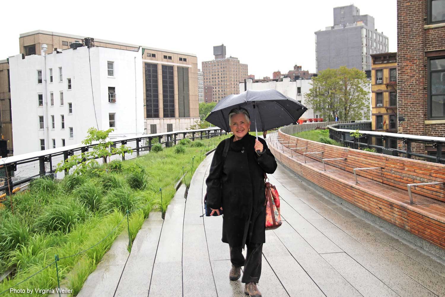
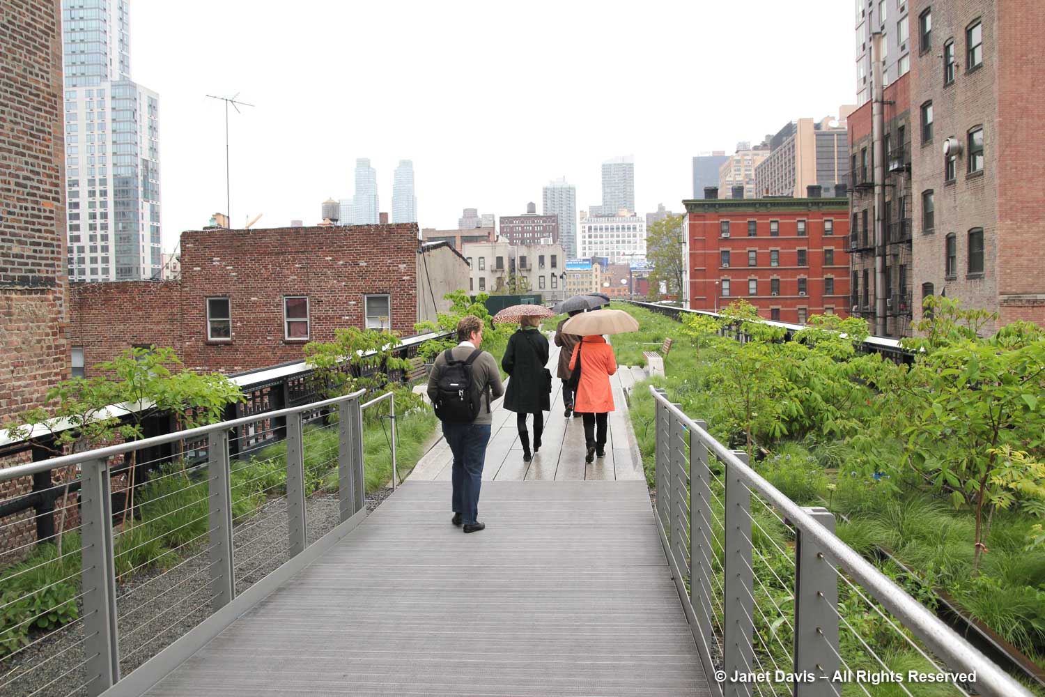
Let’s talk about rain and photography!  Because depending on how you look at rain, your glass is either half-empty or half-full. And I’m definitely in the latter camp, as you can see by my smiling face as I stride down the High Line under my umbrella. (Thanks to my photographer pal Ginny Weiler for the photo.)

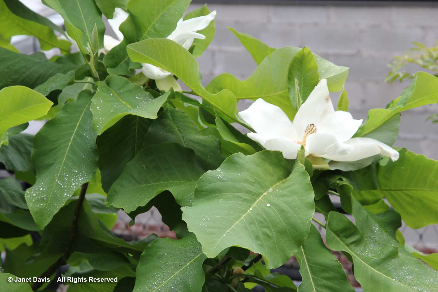
Unless it’s pouring down (and I’ve been in some of those rains carrying three cameras in a big garden far from shelter), an overcast sky and drizzle is far easier to deal with than the bright sunshine of mid-day. Look at the beautiful Magnolia ashei I photographed that May day on the High Line….

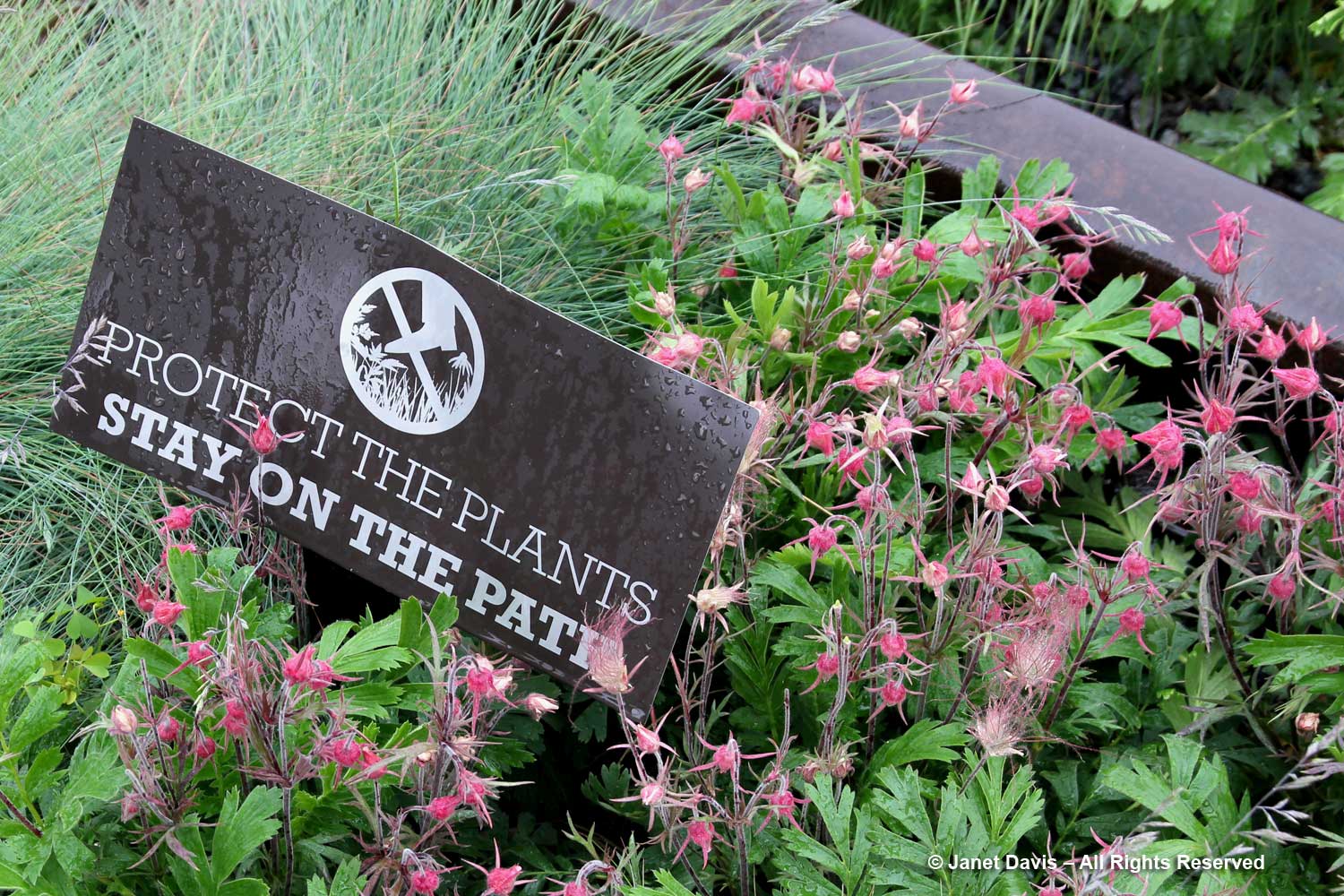
….. and the prairie smoke (Geum triflorum) beside the rain-spattered sign….

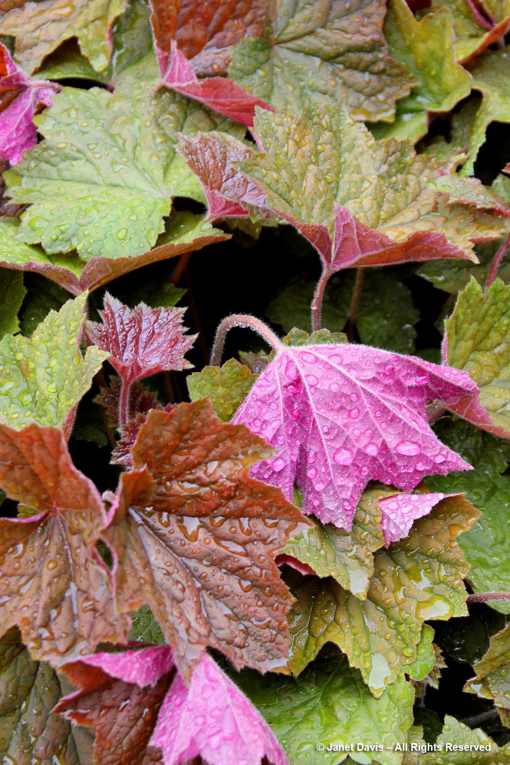
….. and the pretty heuchera leaf turned over under raindrops to show its lovely purple reverse.

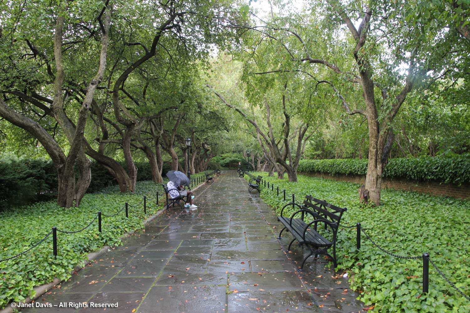
Apart from the gentle light for photography, in a place like the High Line there are far fewer visitors when it’s drizzling.

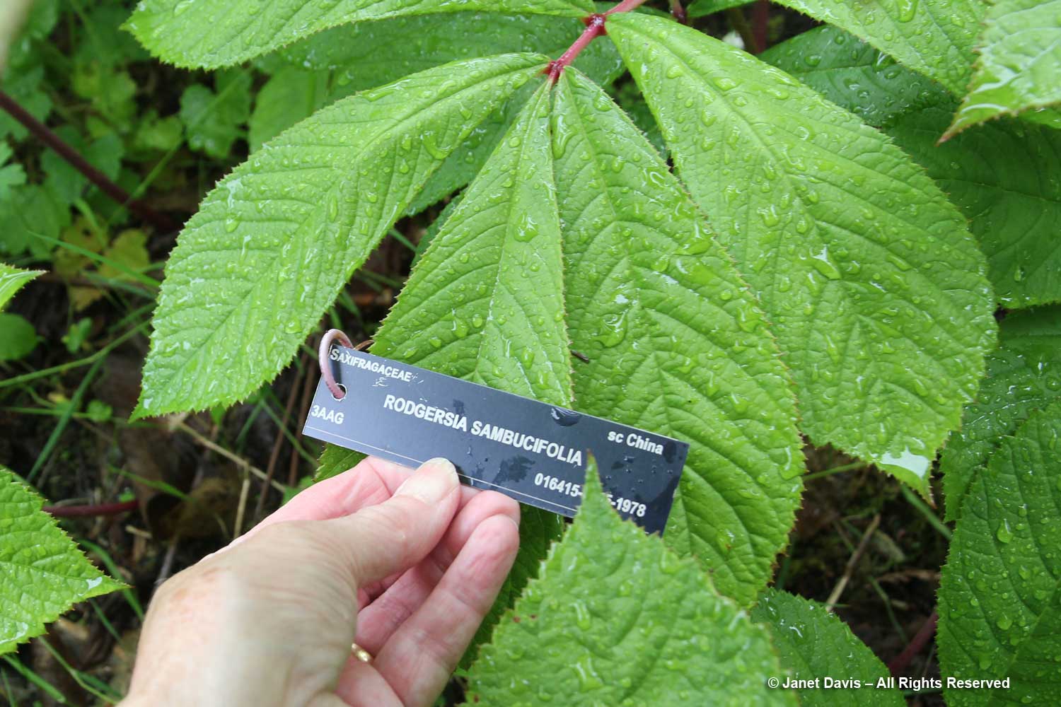
When I visit Vancouver, I make sure I take an umbrella to photograph plants at my two favourite haunts, the University of British Columbia Botanical Garden and Van Dusen Botanical Garden. In fact, the wettest I’ve ever been in was at UBC on May 29, 2013 – and the raindrops in the pond below just got more serious as I moved through the garden.

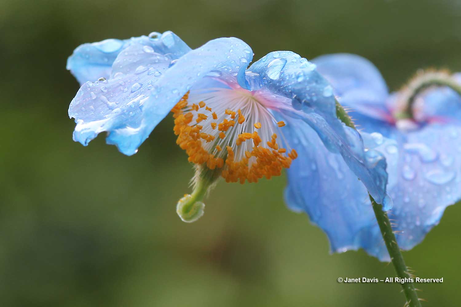
But when I’ve got the day booked for plant photography, I hate to give up because of a little downpour…..

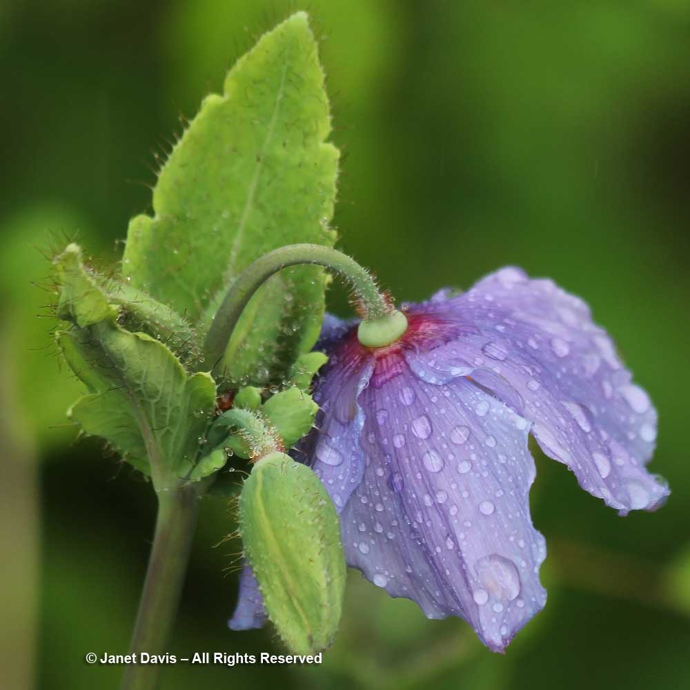
…. especially when the Himalayan poppies, below, are in perfect bloom in the David Lam Asian Garden.  The raindrops just add to the enchantment – and I have never sprayed a blossom with water to make it more “picturesque”, when nature does it for me for free!  (By the way, I wrote a blog on the exquisite David Lam garden in May.)

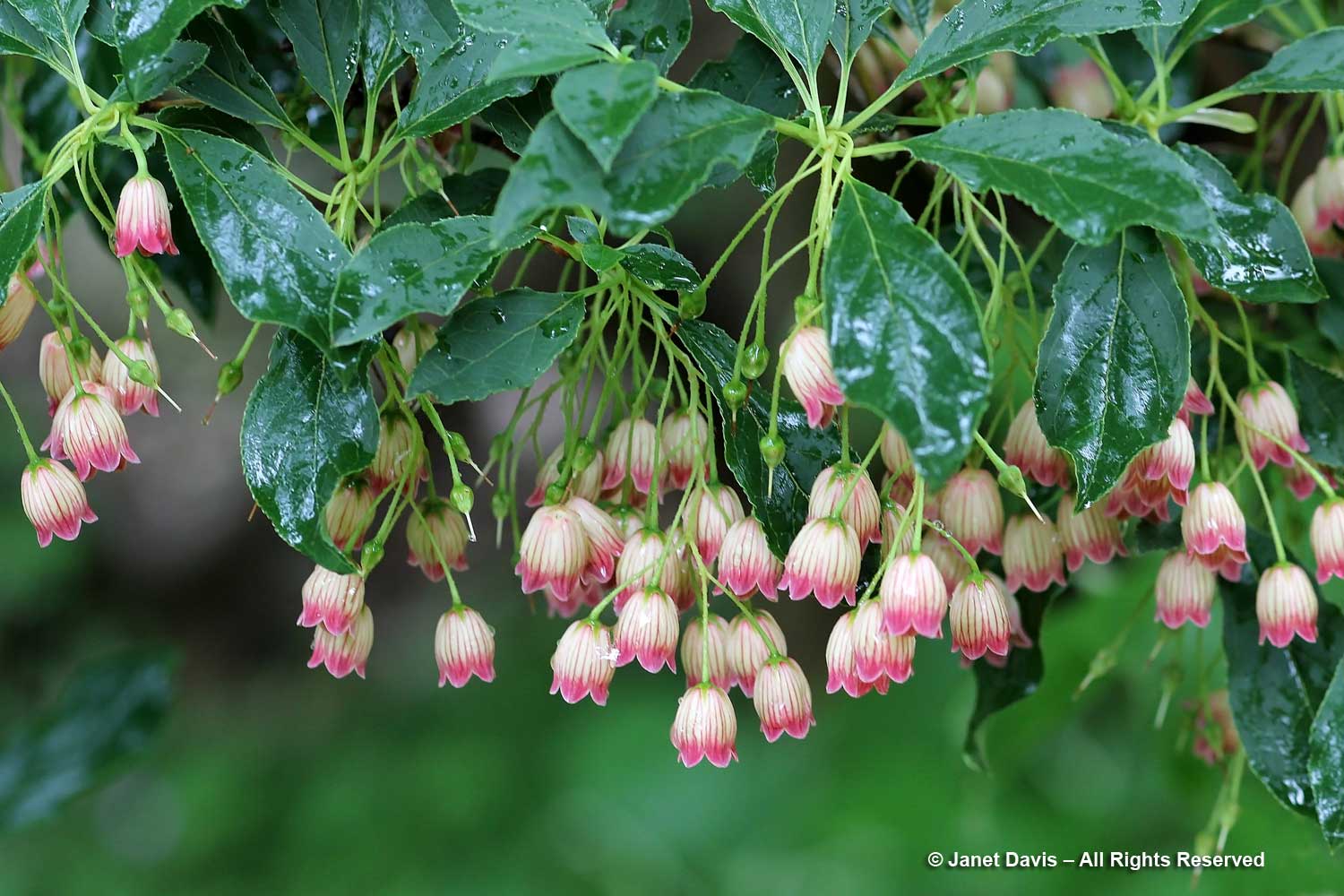
The redvein enkianthus (E. campanulatus) looked lovely in the drizzle……

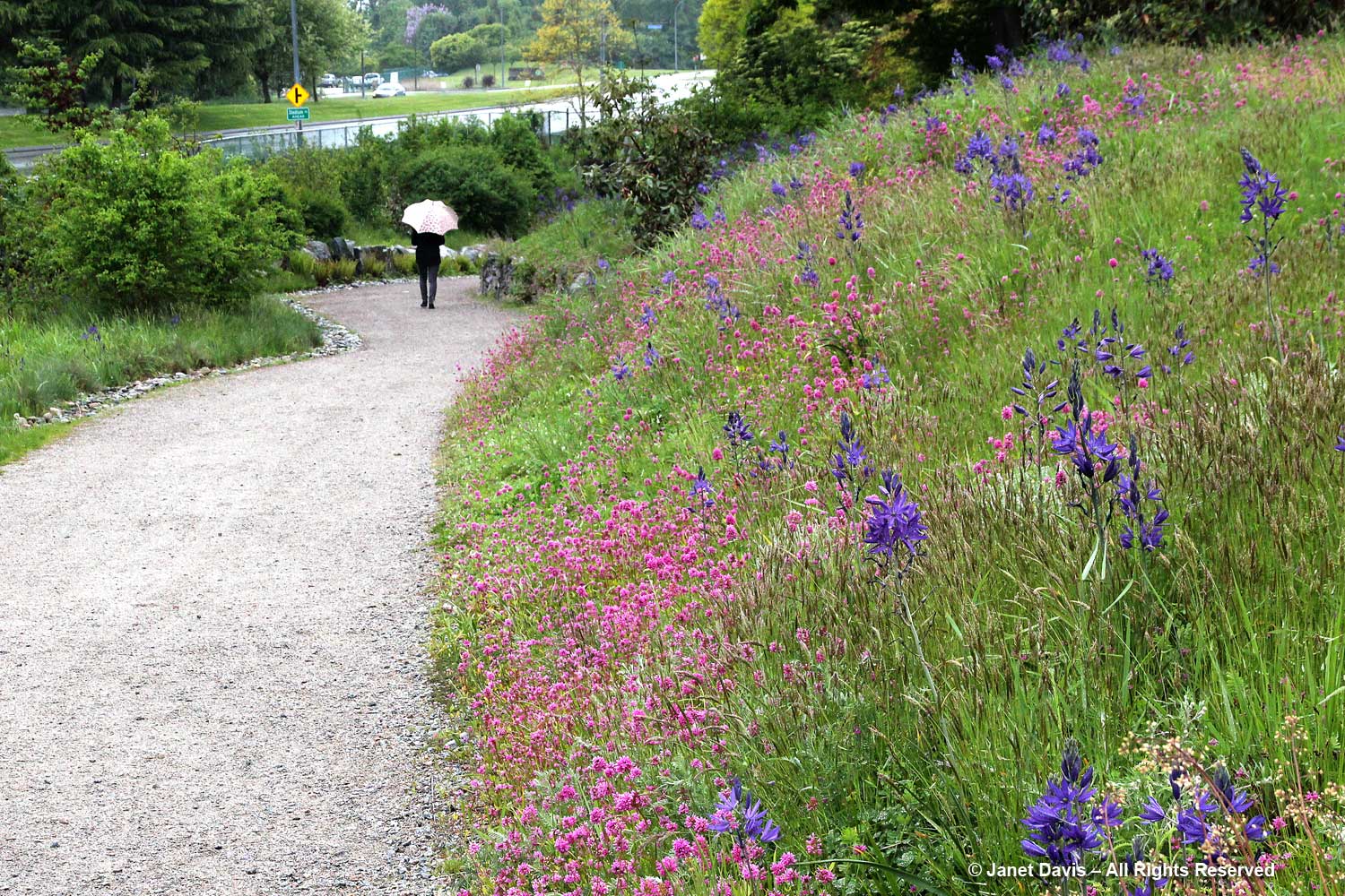
….. and across Marine Drive, the Garry Oak Meadow was gorgeous that rainy day. Imagine how terrible this tapestry would have looked in full sun!

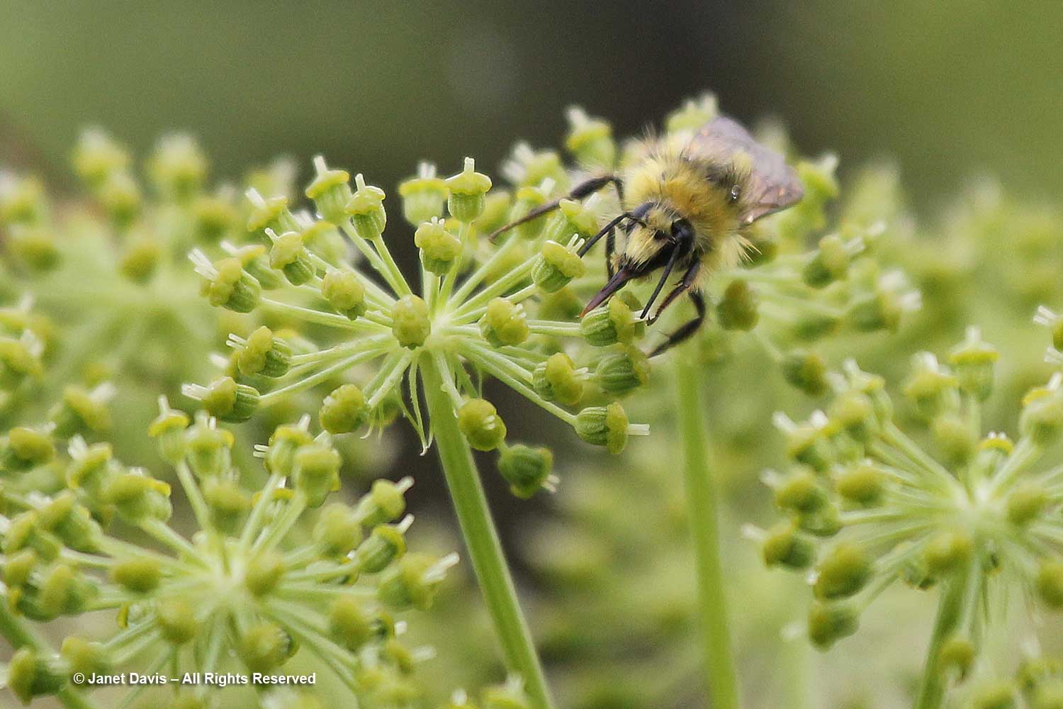
In UBC’s herb garden, bees were still foraging on the Angelica archangelica, despite the weather.

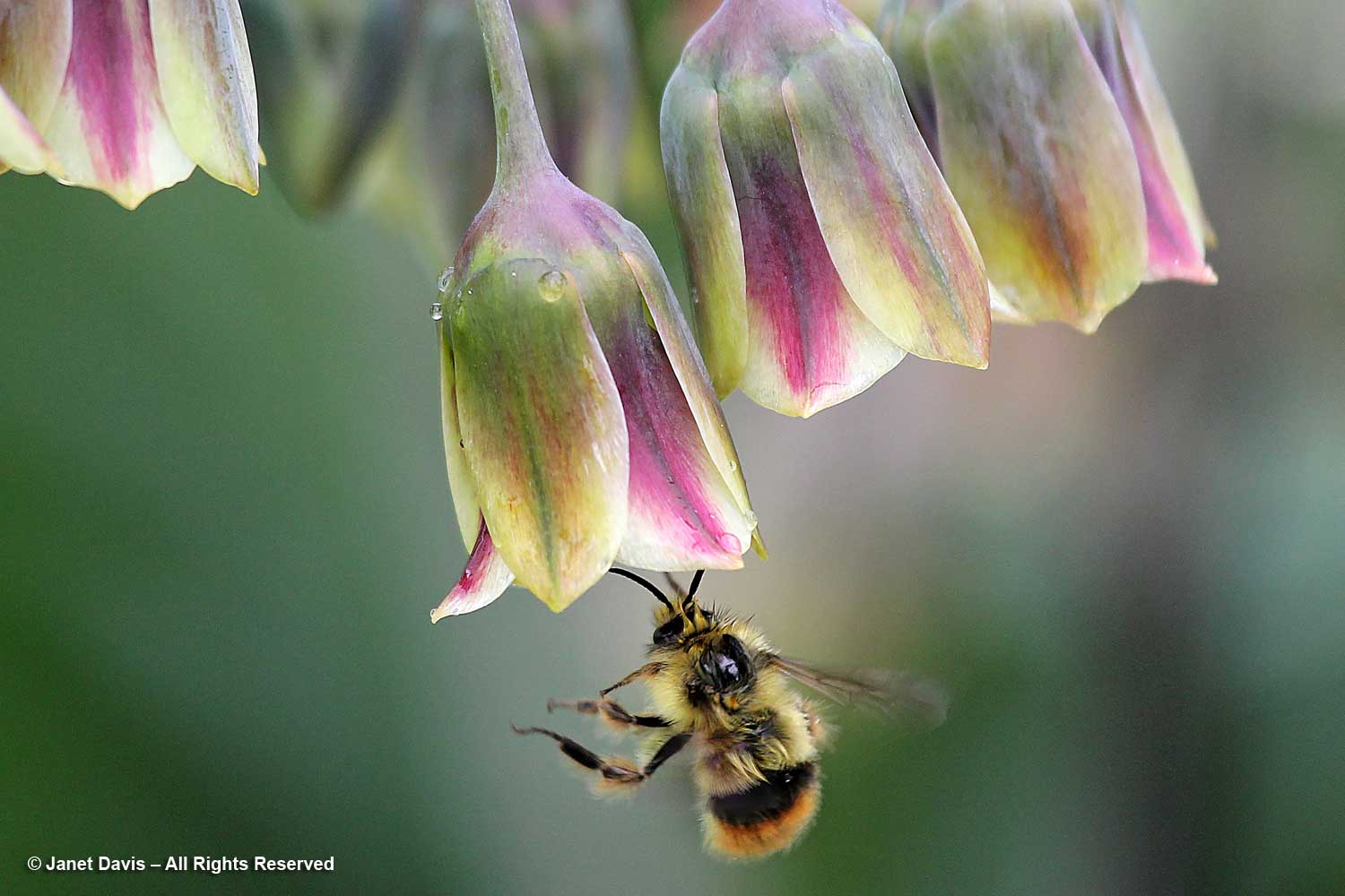
The downward-facing flowers of Sicilian honey lily (Allium siculum) acted like umbrellas for this bumble bee, though her fur-like hairs were beginning to mat down in the rain.

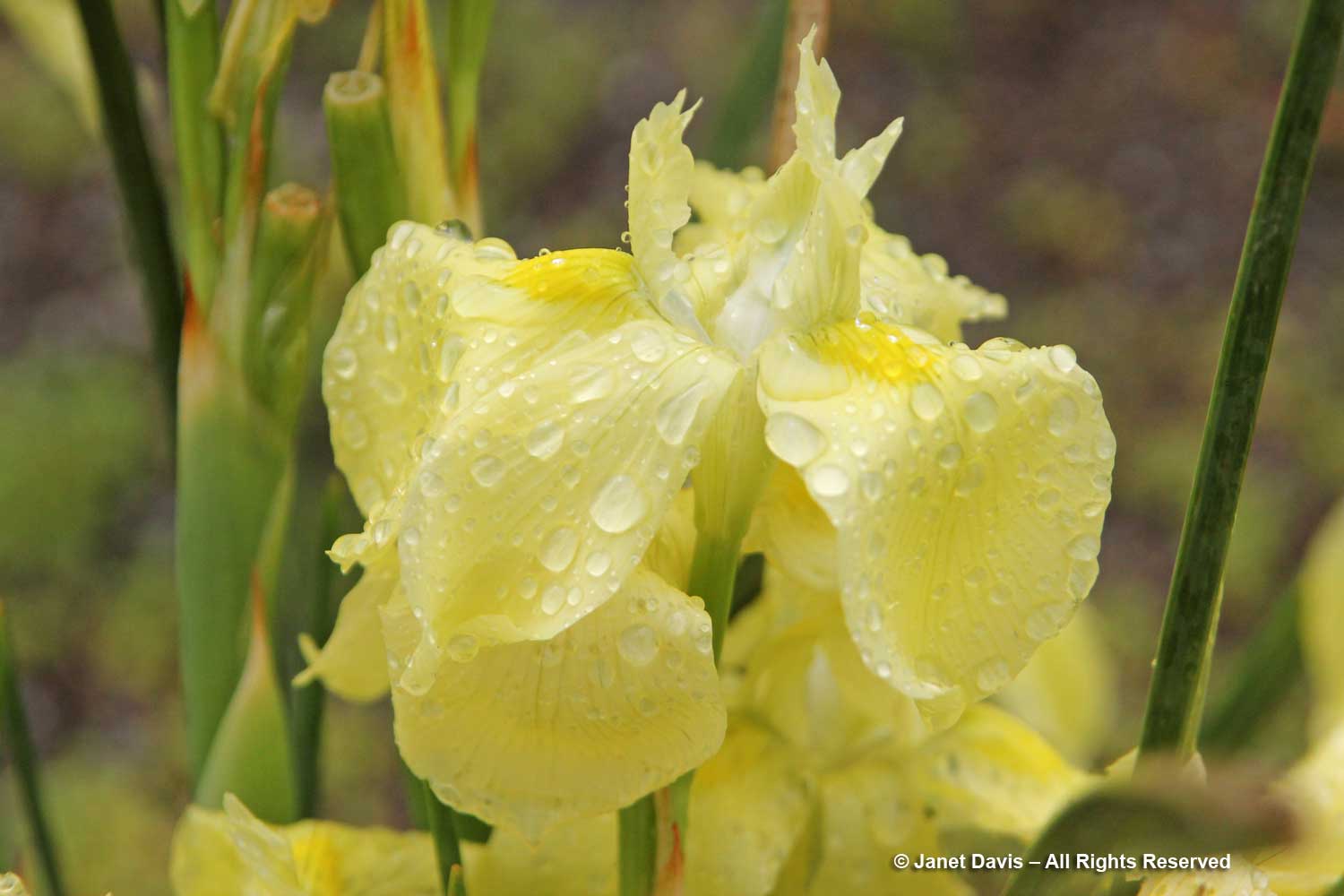
Though it hails from the hot, dry Drakensberg Range in South Africa, the Moraea robusta in UBC’s wonderful rock garden wore its sunshine yellow with raindrops that day.

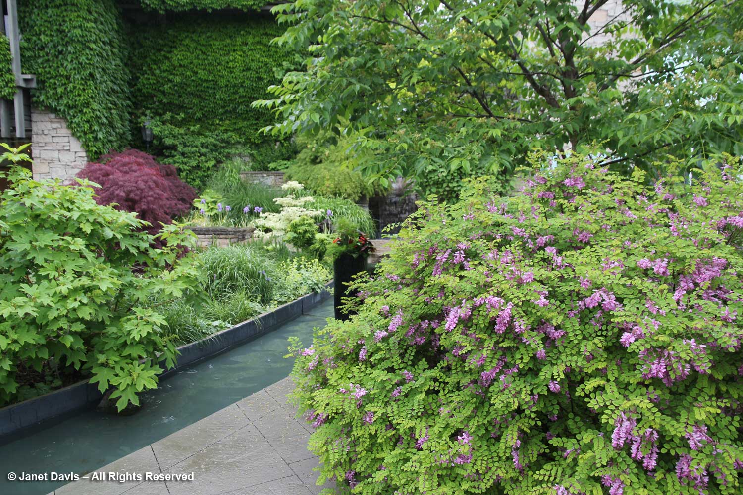
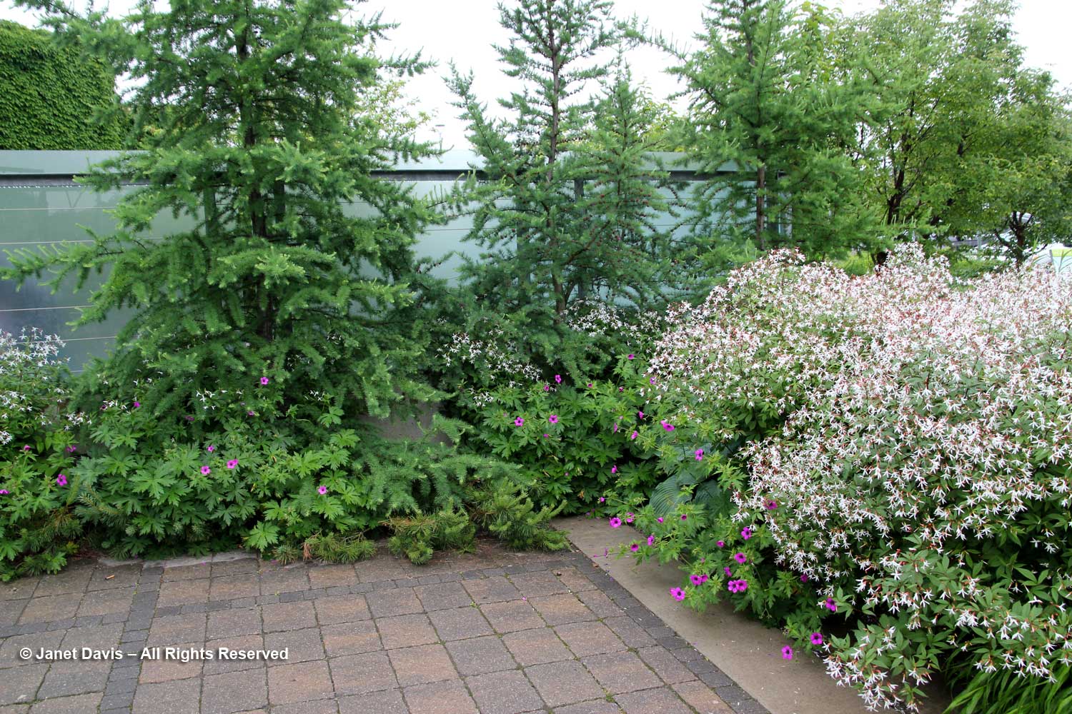
A few weeks later in early June, I was back at my “home garden”, the Toronto Botanical Garden (TBG) on a rainy June morning with no one else around. Though the paving stones were wet on the Westview Terrace where the Indigofera kirolowii was in full flower….

….. and at the entrance to the Floral Hall Courtyard where the Bowman’s root (Porteranthus trifoliatus previously Gillenia) was a cloud of white…..

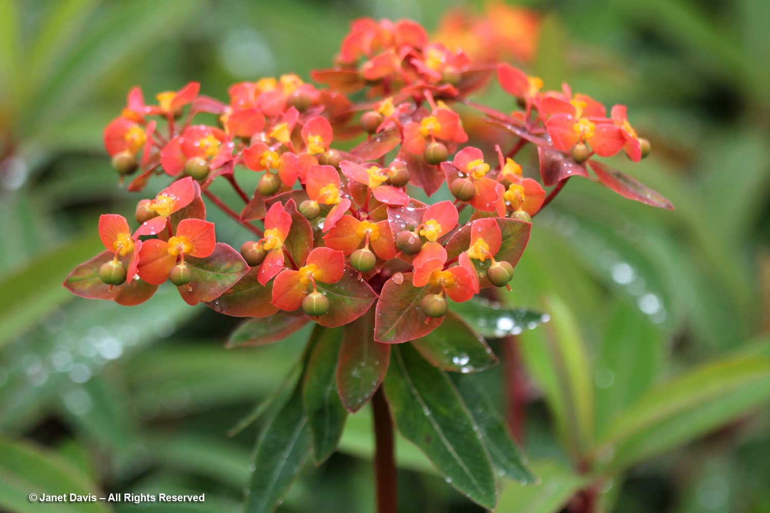
…..my raindrop close-ups from that day, like the Euphorbia griffithii ‘Fireglow’, below, were lovely.

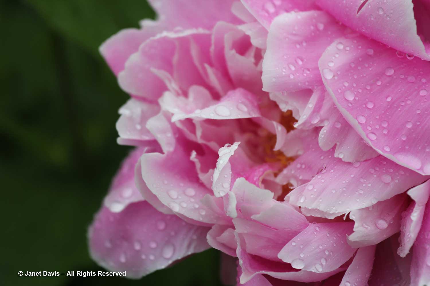
Peonies were just opening that day in June, too…..

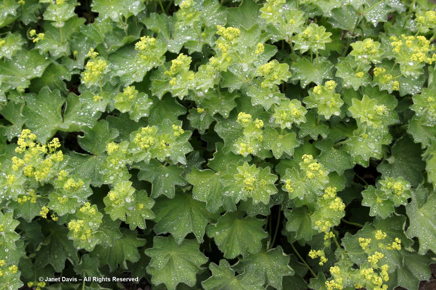
…. and the lady’s mantle (Alchemilla mollis) wore its many rain-spattered, folded capes.

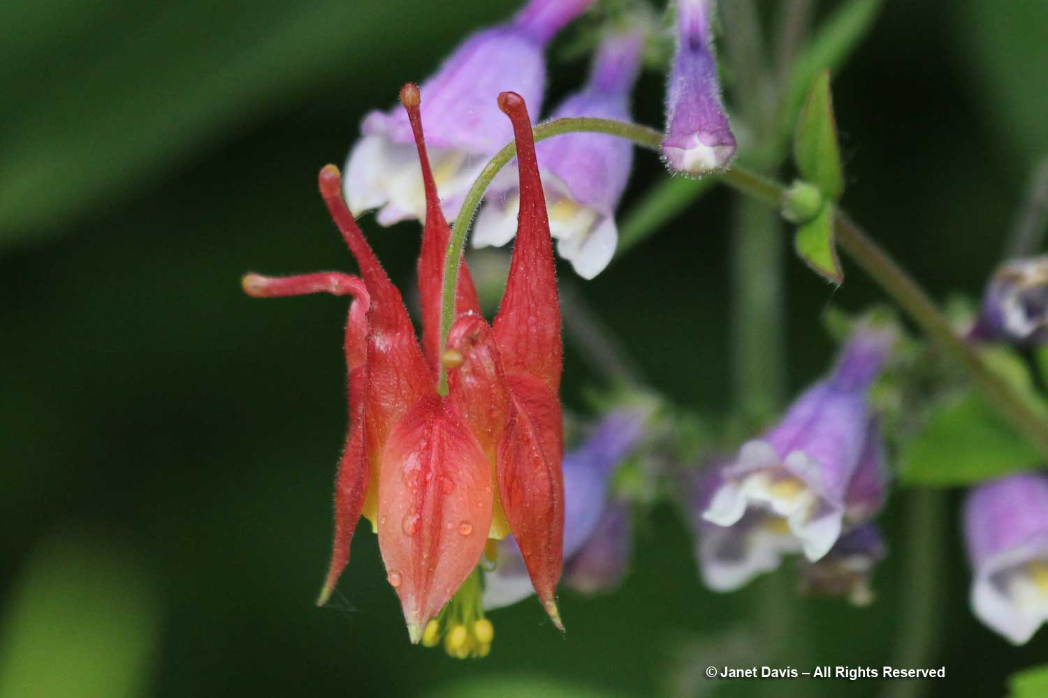
Even the eastern columbine (Aquilegia canadensis) sported its raindrops nicely.

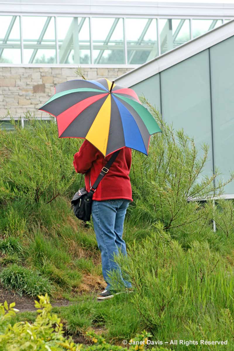
Though I’m usually alone at the TBG on a rainy day, I occasionally catch sight of a pretty umbrella held by another intrepid garden visitor.

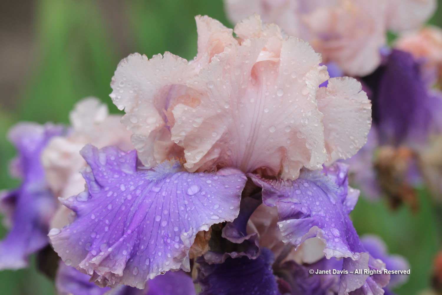
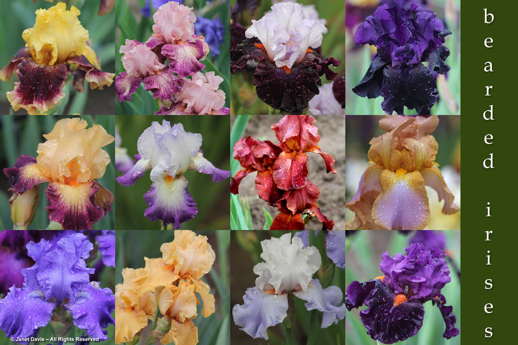
On June 8, 2015, I visited the Royal Botanical Garden in Burlington Ontario with a group of fellow bloggers. We drove there through a massive rainstorm, so when we arrived at the famous Iris Collection….

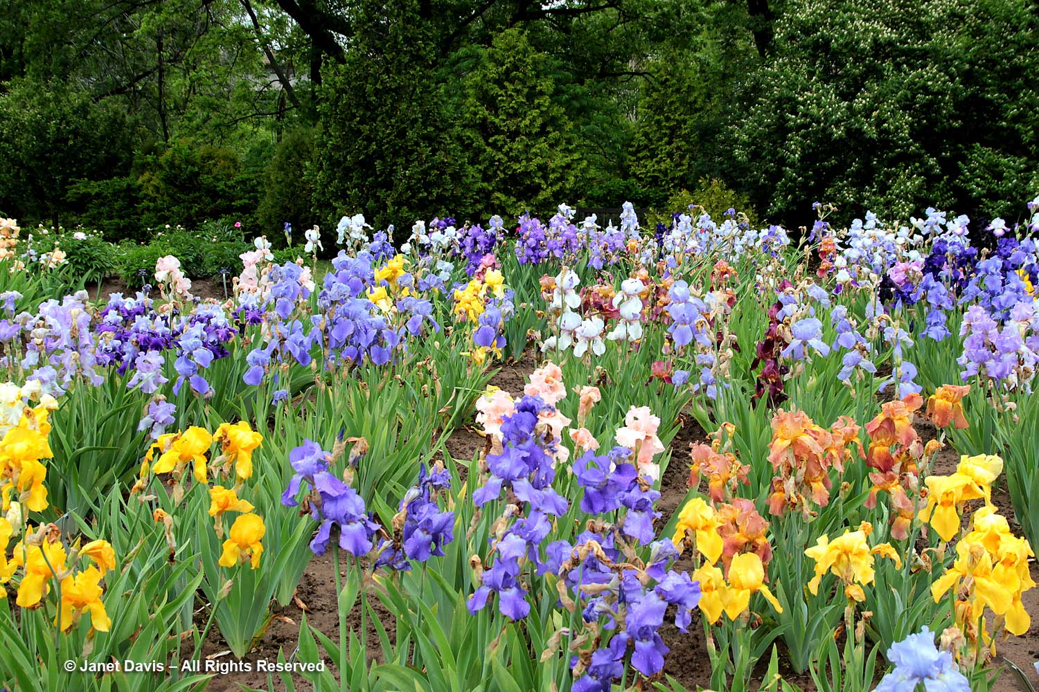
….. all the bearded irises were delightfully adorned with raindrops. This is ‘Florentine Silk’.

There were so many, I wanted to capture them in one gorgeous photographic memory.

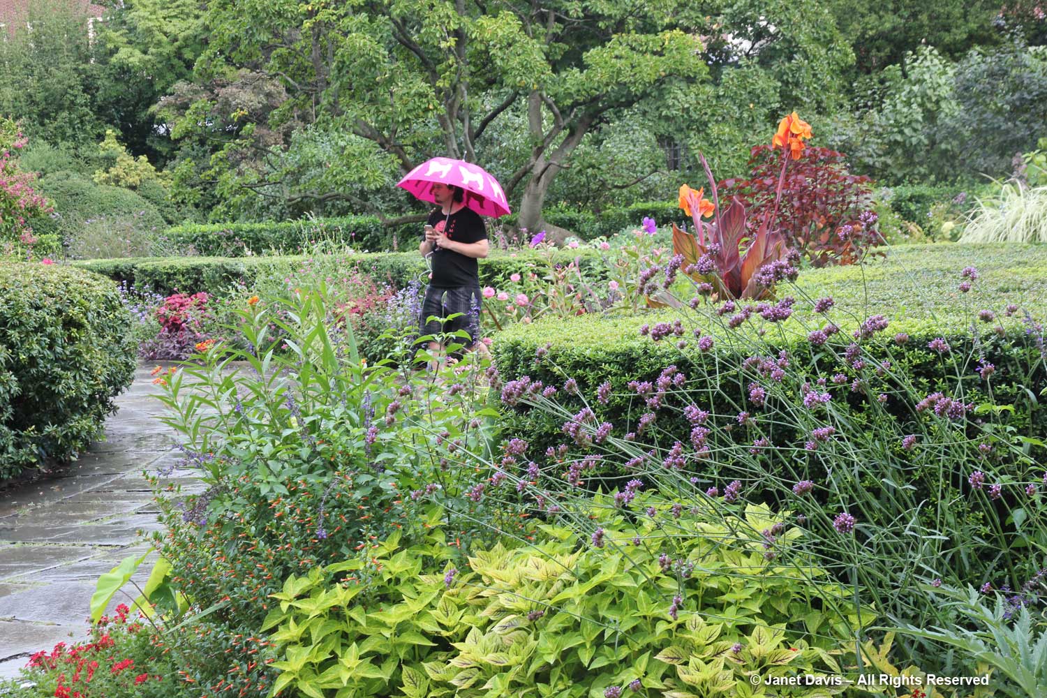
In Manhattan one hot, humid August afternoon, I braved an uptown subway train with no air-conditioning and waited out a thunderstorm and all the people running out of the beautiful Conservatory Garden at Central Park so I could be almost all alone there.

But it didn’t take long for a few people with umbrellas to return to enjoy the spectacular, Lynden Miller-designed borders. I blogged about that August afternoon in the garden.

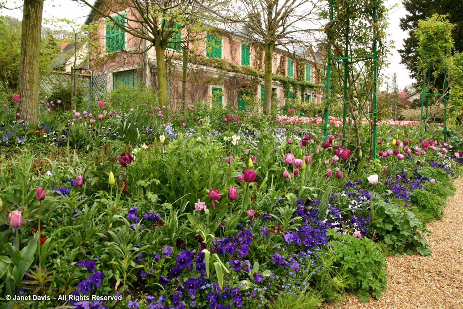
When I visited Monet’s garden at Giverny in France in April 2008, a spring shower meant the other visitors carried their umbrellas over his famous Japanese bridge on the lily pond…..

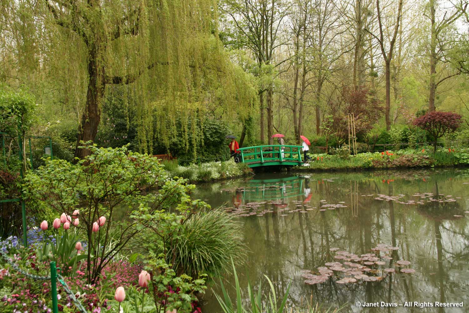
…. but all the flowers enjoyed the rain. I blogged about the spring lessons from Giverny as well.

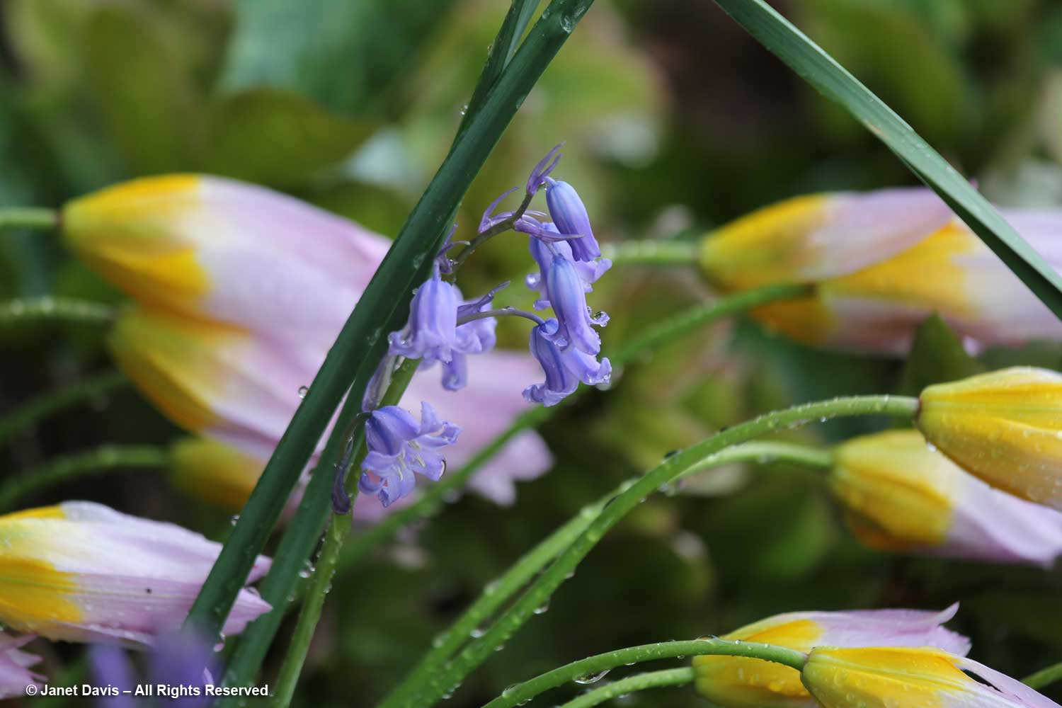
The majority of my rainy photo shoots were in spring, as you might expect “when April showers bring May flowers”.  But May has its share of rainy flowers too. This was on May 5, 2014 at the Horticultural Centre of the Pacific just outside Victoria, B.C.  Bluebells (Hyacinthoides hispanica) and Tulipa bakeri ‘Lilac Wonder’ looked enchanting to me…..

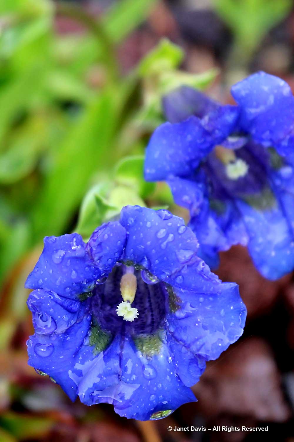
…. and the trumpets of the little gentians were laden with raindrops.

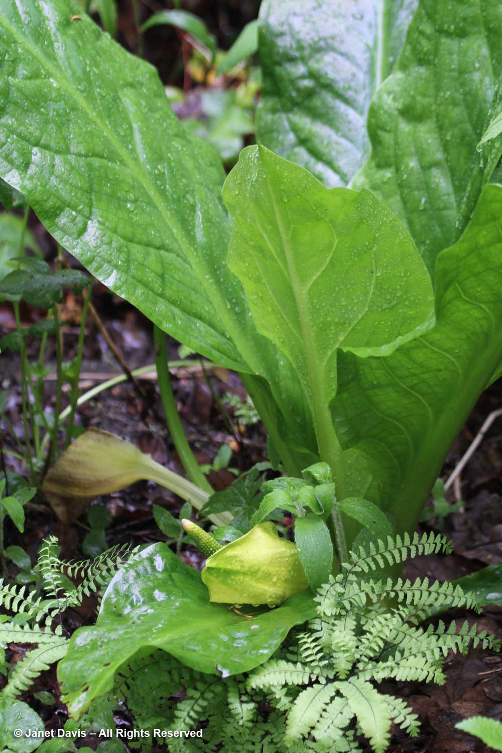
The skunk cabbage (Lysichiton americanus) was happy to be in its preferred damp state that day.

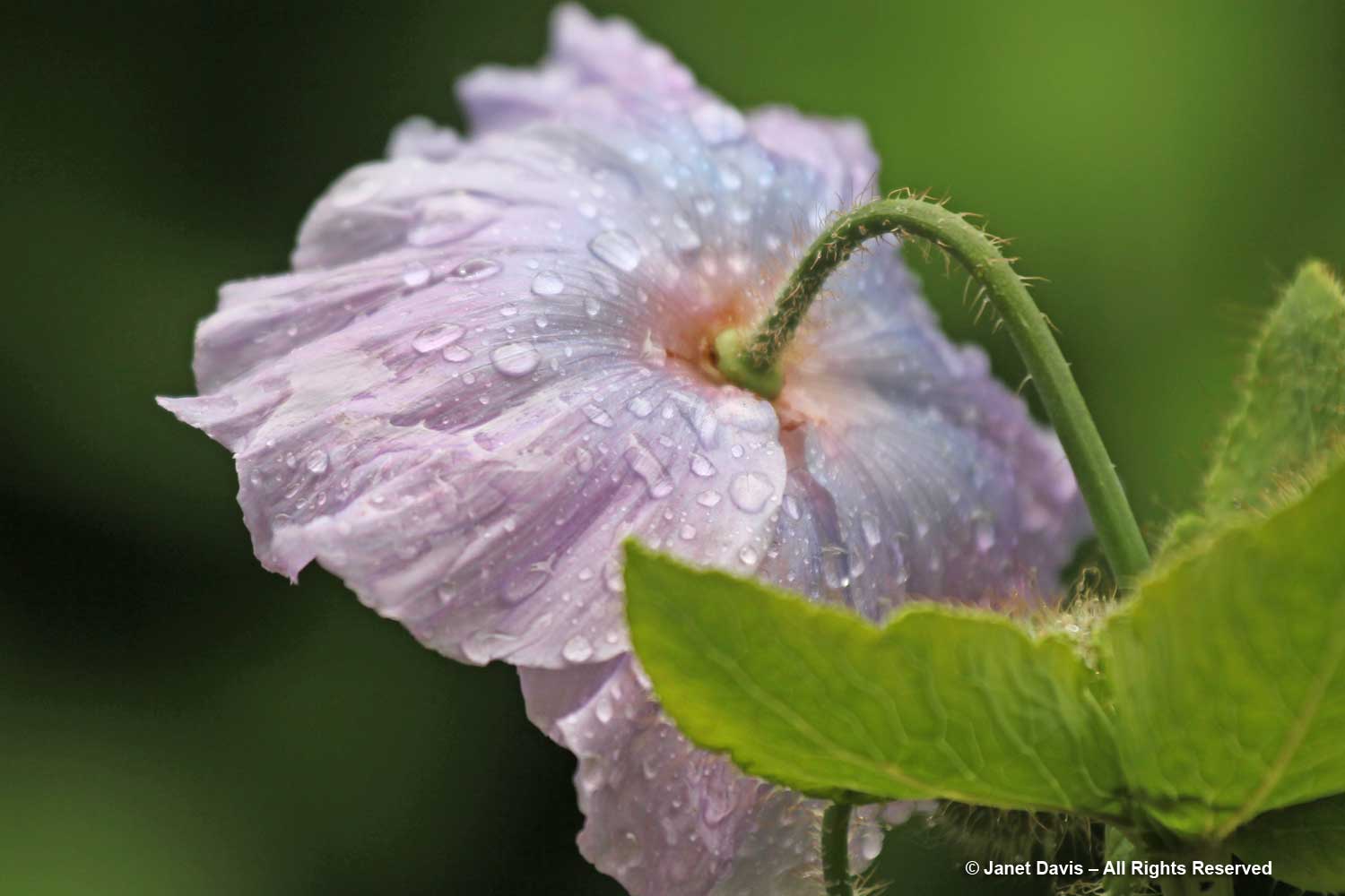
And of course spring at Vancouver’s wonderful Van Dusen Botanical Garden means there will be lots of west coast rain to make the various Himalayan poppies (Meconopsis)….

….. in the Himalayan Dell just that much lovelier.

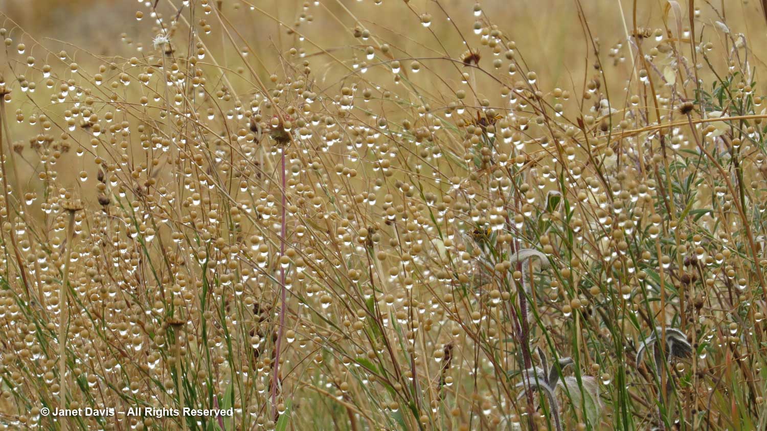
While staying with friends in Sun Valley, Idaho in September 2016, we took a walk through a wild meadow just as big rainclouds appeared behind the mountains.

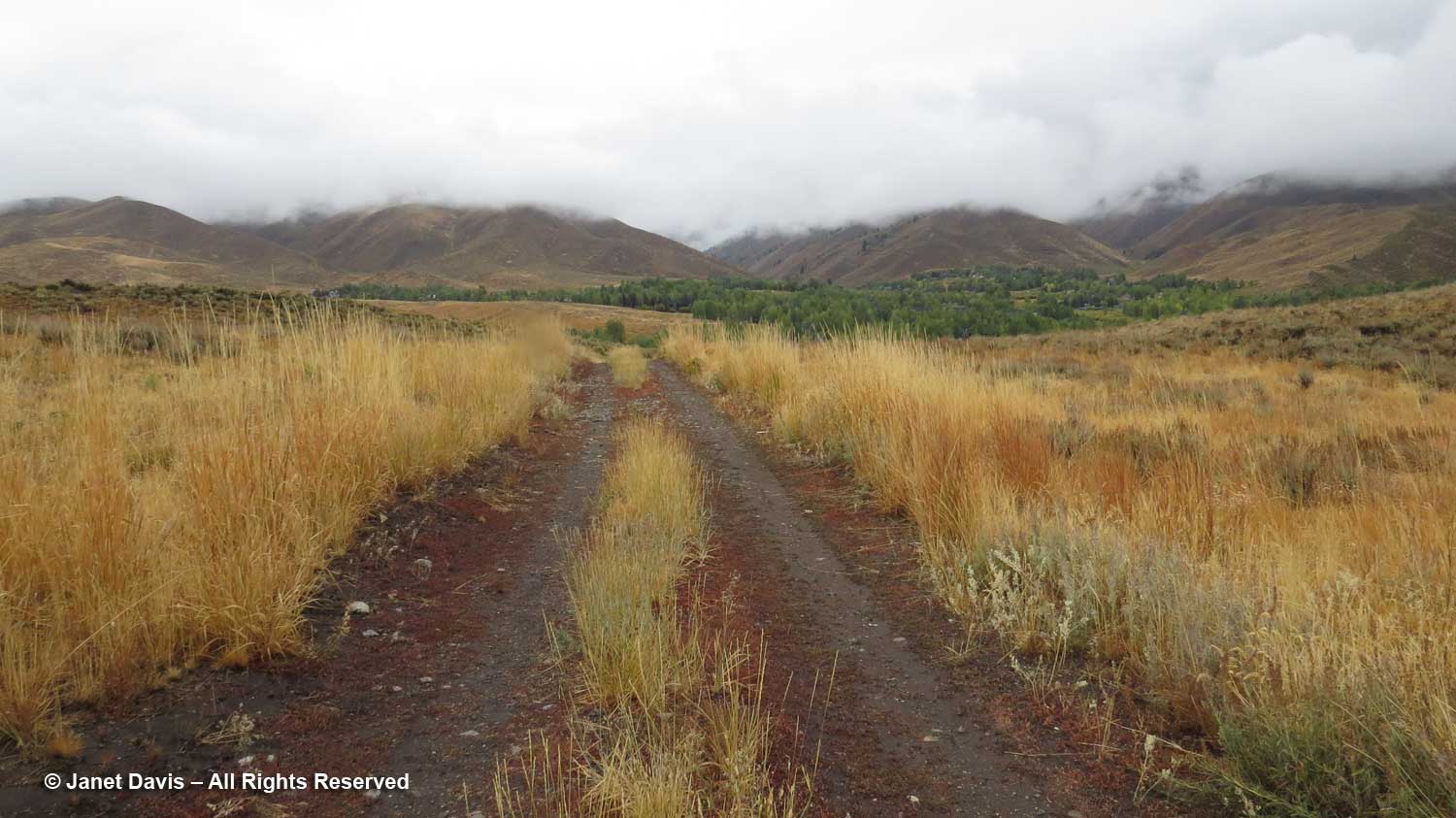
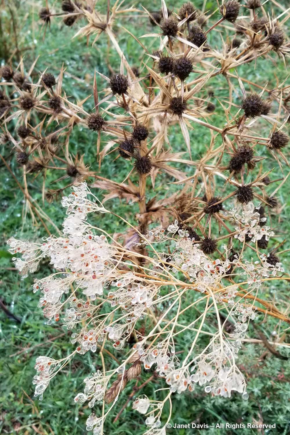
Though we didn’t make it home before getting soaked, I was happy to have had my camera with me to capture the intricacy of the rain drops on the meadow grass seedheads. (And I will refrain from mentioning the irony of rain in Sun Valley….)

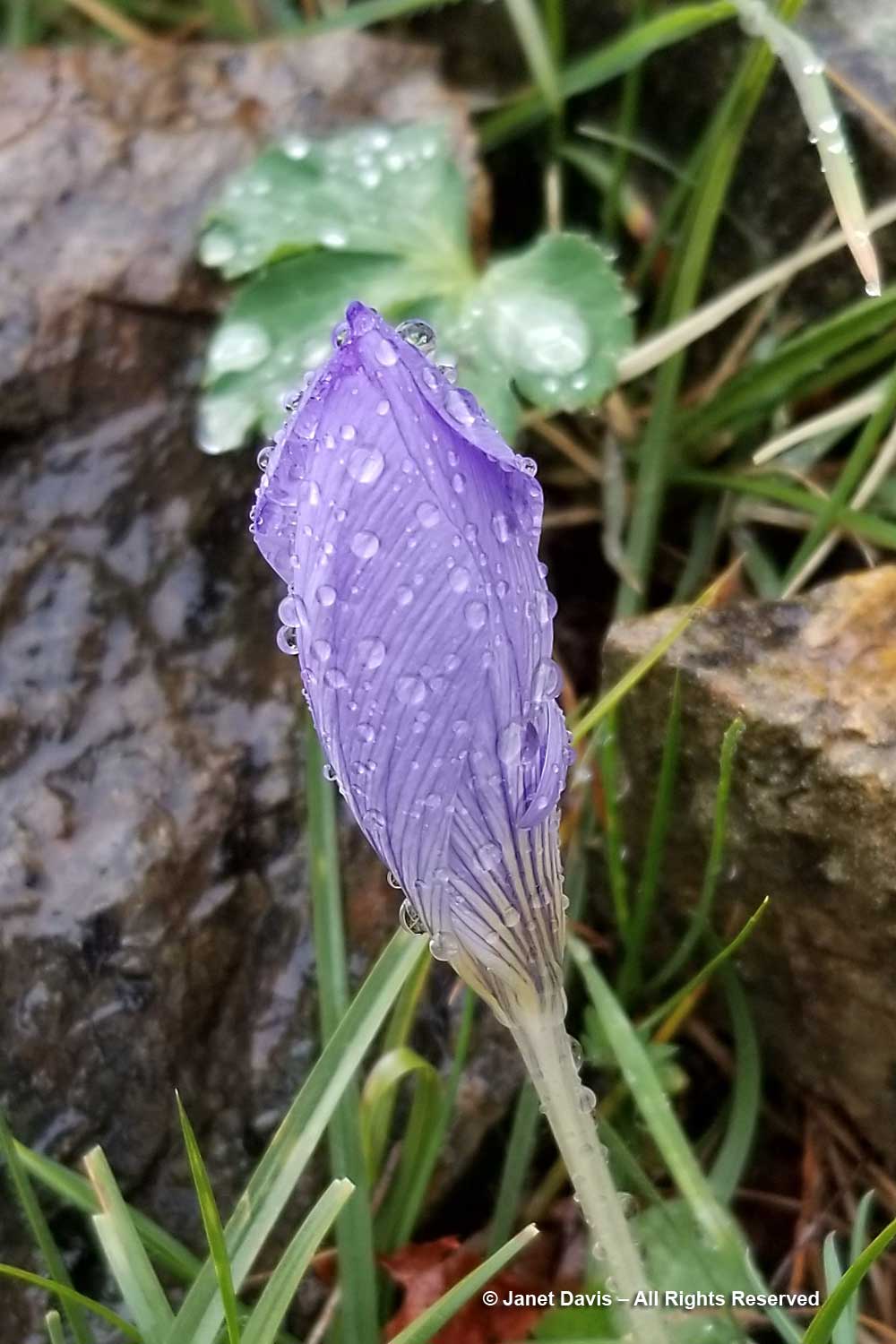
More recently, if you read my massive blog about Botanizing Greece with Liberto in November 2019, you might recall the day we stopped at a serpentine outcrop near Smokovo in the pouring rain…..

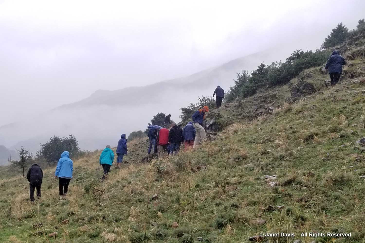
….. to look for tiny Crocus cancellatus subsp. mazziaricus, which we did find, but they were as soaked as I was.

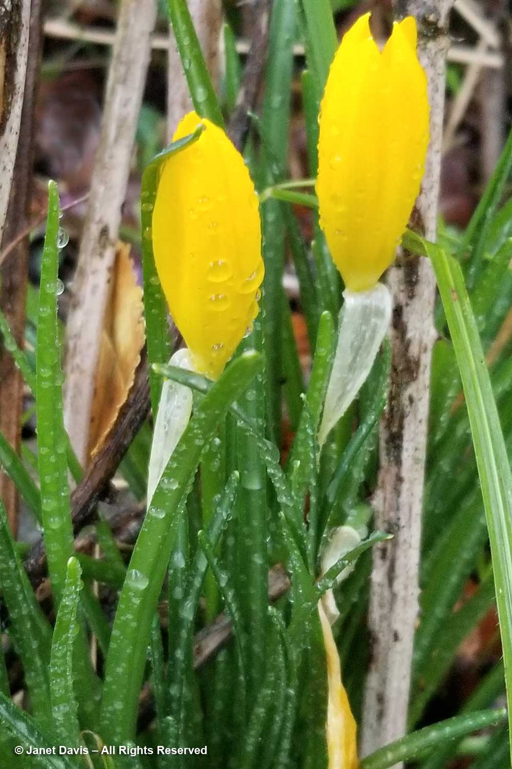
We also found our first Sternbergia lutea that morning, but they refused to open in the inclement weather (which is an obvious evolutionary adaptation to keep the reproductive parts dry).

A few redbud (Cercis siliquastrum) flowers still hung on to the trees and they did look pretty in the rain….

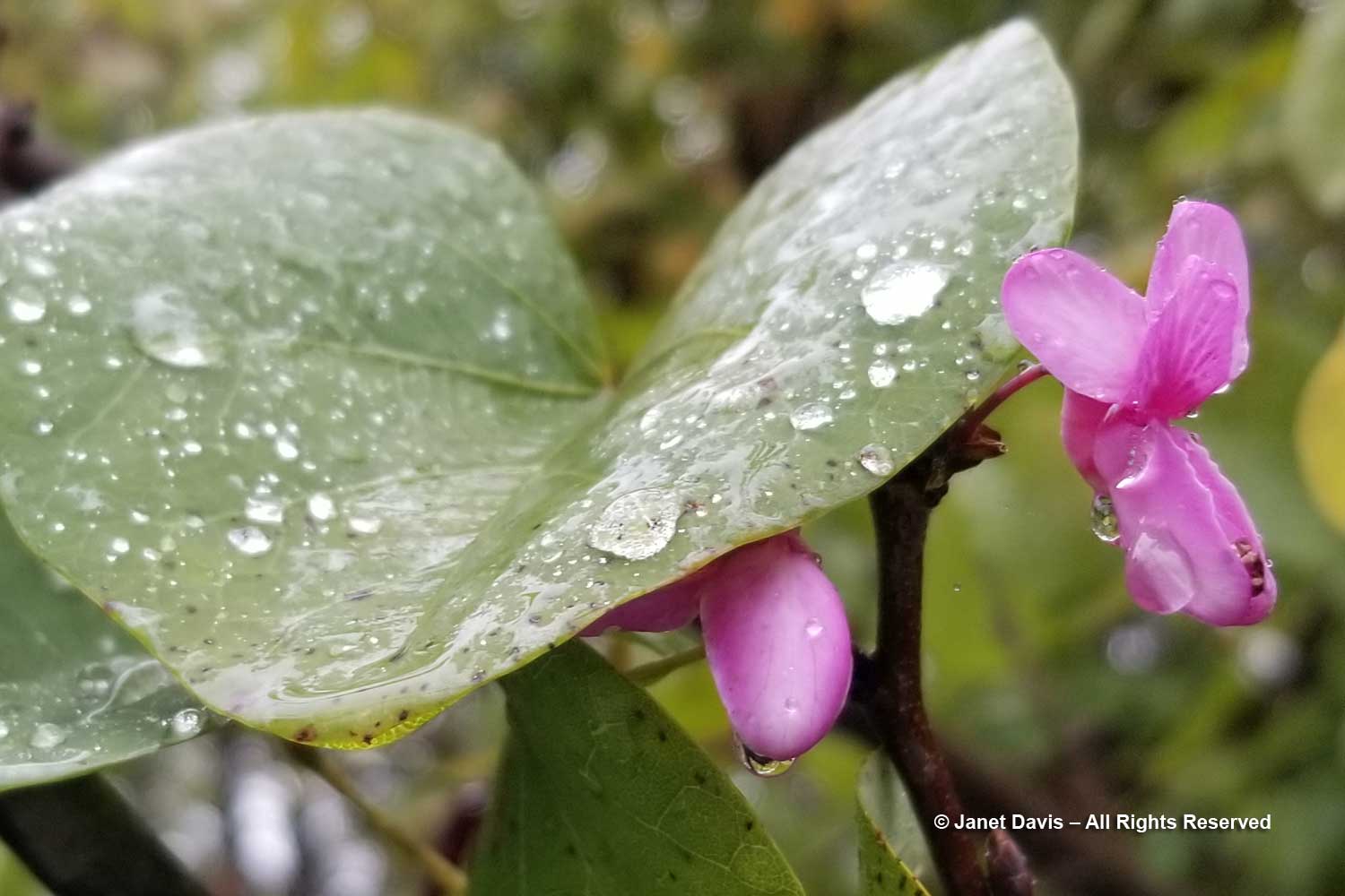
….. as did the wild flowers in the meadow (even as my shoes were squishing in the grasses).

In the fall of 2015, I visited Costa Rica with my hiking group. Though we did manage some hiking, that particular one-week period had more rain than the Osa Peninsula had seen in the entire rainy season. I blogged about my time at El Remanso Lodge, but here’s a little video of what real rain is like in a tropical rainforest…..

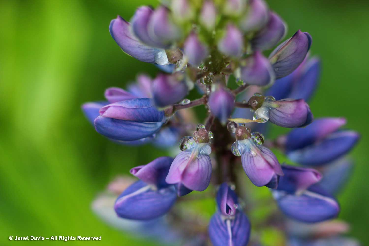
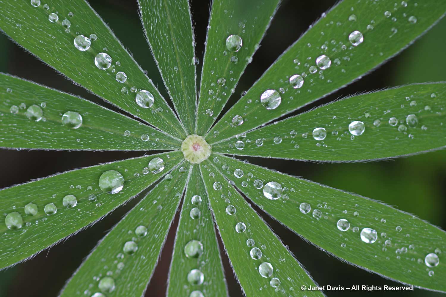
In my own Ontario gardens, as you might expect, my camera is never far away when the rain stops. At the cottage on Lake Muskoka one June, I found my wild lupines spangled with raindrops…..

…. and the palmate leaves with their small hairs seemed to trap perfect raindrops like mercury quicksilver.

When a big rainstorm hits the cottage on a summer day, it’s often so spectacular in its onset that I grab my camera and set it to video. Have a look (and try to pick up the distant thunder in the first few seconds) ……

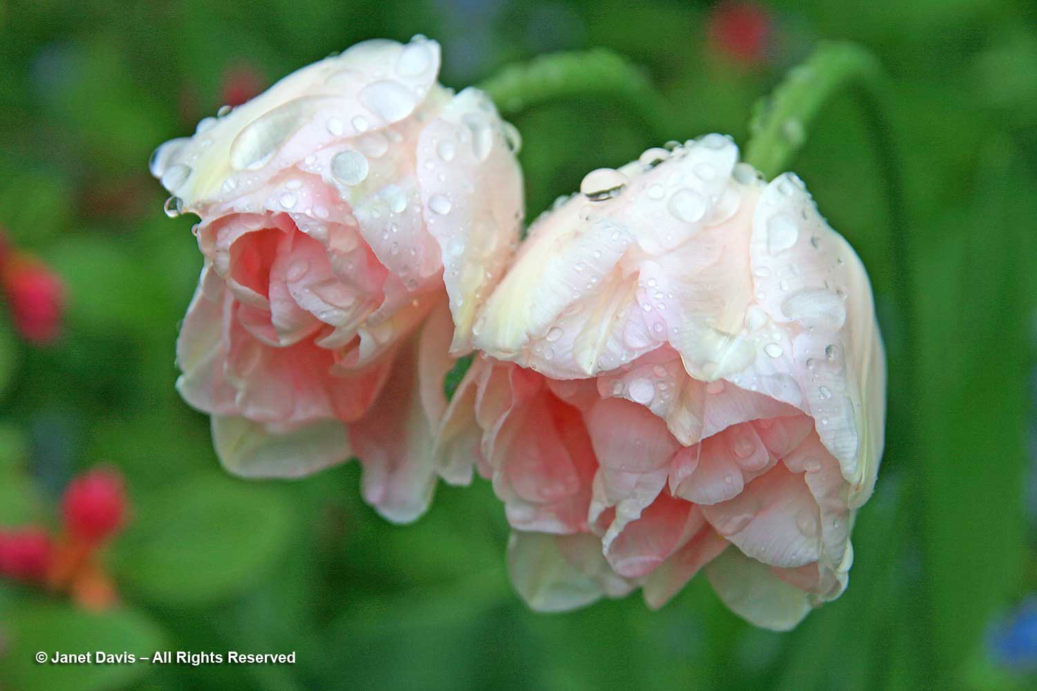
At home in Toronto, rainy May days are welcomed because summer is often hot and dry and our urban tree canopy needs all the help it can get. Especially lovely are spring bulbs – this is Tulipa ‘Ballade’, one of my favourites…

….. and this is ‘Angelique’ looking like ballerina tutus hung on a line to dry.

A few years ago, I stood under my umbrella photographing my grandson Oliver doing a little jaunt on the stepping-stone path through the spring bulbs in my front yard while rain poured down and thunder boomed in the distance. Doesn’t he look proud of himself?  I snapped a still photo at the end.

But since this is #mysongscapes, we do need a song to finish up this blog, so let’s take a rainy day tour of my entire Toronto garden, as I found it under my umbrella on June 24, 2018.  And we’ll be serenaded by Dee Clark with his famous Raindrops song from 1961.

*******

This is the tenth blog in #mysongscapes series of winter 2020 that combine music I love with my photography. If you enjoyed reading, have a look at the others beginning with

  1. Joni Mitchell’s ‘Night in the City’;
  2. Paul Simon’s ‘Kodachrome’ and my life in photography;
  3. Vietnam and Songs of Protest;
  4. Galway Bay and memories of my grandfather and Ireland;
  5. Simon and Garfunkel’s Parsley, Sage, Rosemary and Thyme;
  6. The John Denver lullaby I sang to my first grandchild, Today While the Blossoms Still Cling to the Vine.
  7. Gordon Lightfoot for a Snow Day
  8. Madame George by Van Morrison – my favourite song in the world
  9. Brown Eyed Girl(s) – Van Morrison’s classic and my black-eyed susans

And please do feel free to leave a comment below. I love to read them.

Six Miles Up – Viewing Earth from Seat 45K

The blog below is one of those little bits of fancy you think is just too silly and much too much work to pursue, then find yourself doing exactly that for three days straight. Why did I think it was worth the exercise to work on not-very-good photos of North Dakota, Saskatchewan, Alberta and British Columbia in order to present them to people who couldn’t care less about spotting Minot Air Force Base from six miles up? Well, I guess I could ask why people flying over a spectacular, sunlit tapestry of farm fields, canyons, mountains, rivers, lakes and towns can’t get their nose out of their novel or stop watching a recycled movie on a little screen long enough to appreciate the diversity of this magnificent continent we call home.

Plus, I’m a little obsessive. You might have noticed.

***********************************************

9:39 am – I’m nicely settled into my window seat of Flight 103 from Toronto to Vancouver, anticipating a little reading after an hour-long nap to overcome the fatigue that happens when your alarm rings at 4:45 am on a travel day. It’s a comfortable and fairly new Boeing 777 and my seat, 45K, is behind the wing on the right side, which gives me a nice view of the scenery below and to the north. I glance down as we cross the western shore of a Great Lake (Superior, I think) and reach for my phone, more for fun than anything, since I’m clearly not an aerial photographer and the Samsung S8, though a lovely little phone camera, has very limited resolution – especially at an altitude of more than 10,000 metres (6 miles) and a speed of 800 km (500 mi) an hour.  What I see is this…..

10:01 am – Hmmm. Rhapsody in Blue… not the ideal. Airplane windows are strong, double-paned acrylic with UV filtration – and often splashed with rain drops or bits of grunge – so it’s a challenge to capture the scene on the ground the way your eyes see it. But once I start, I’m hooked. My next image is all blue as well, but with a lot of Photoshop post-processing (starting with Auto Colour, then various colour filters, shadow highlighting, contrast fixes, etc.), I manage to make it look like this, below. Whatever is in that window acrylic or shading, the camera senses skylight differently from the scene on the ground and blows the background out.

A way to fix that is just to delete the plane wing and turn the vertical into a horizontal. Now it just looks like one of those vintage, turn-of-the-century postcards with lovely late August farms.  Or a quilt patch.

10:12 am – But where on earth am I? Somewhere in northern Minnesota or North Dakota, I think. There’s that little town cluster of buildings with the unique rectangular fields to the right. It seems to be a place that has some crops already harvested and the soil plowed (grayish fields) and other fields with lots of grain still to be cut. The green patches might be winter wheat or alfalfa crops sown to enrich the soil.

10:16 am –  Minutes later, it occurs to me that there’s a way to figure out approximately where the plane is. So I begin to snap a quick shot of the Moving Map feature on the entertainment console in front of me after each out-the-window photo. It gives the rough coordinates, the time, the kilometres travelled and still to travel, the altitude and the airspeed. It isn’t exact GPS by any stretch, but it will be a useful guide later. And the identifications below are thanks in part to that guide, but especially to wonderful Google Earth, where you’re looking down on the actual forests, rivers and farms that you can see from the plane. (Any errors are mine, not Google Earth’s.)

10:17 am – The late summer fields are resplendently golden around Morrison and Sweetwater Lakes in North Dakota.

And this is how I saw those lakes on Google Earth later (with a lot of squinty searching…)

10:18 am – Lakes in North Dakota are often named after people. Here we have Lake Alice, Mike’s Lake and Dry Lake at right, which already seems to be drying up.

10:20 am – Highway 2 leads toward Church’s Ferry on Lake Irvine, right. I’ve always wanted to go to North Dakota and this is a fun way to see it.

10:31 am – That runway, below, is a big clue to Minot Air Force Base in North Dakota.

Later, as I look for the locations on the photos, I discover various ways to plot the pilot’s route. One is to take two places you’ve already identified and draw a straight line between them, as I can now do with Sweetwater Lake and Minot Air Force Base. That should be the pilot’s general route and help with the rest of the photos.

10:32 am – A lake trickles forward in a narrow, sinous stream through a valley that looks like varicose veins. Why it’s the Lake Darling Dam, the Souris River and the Upper Souris National Wildlife Refuge. (Later, I discover it’s named for Jay “Ding” Darling, the eminent naturalist I wrote about in my blog on a wildlife-friendly garden in Austin, Texas.)

10:33 am – Not far away (at least at 800 kilometres or 500 miles an hour) is another beautiful natural site: the Des Lacs National Wildlife Refuge.  Here’s what I see by zooming the phone in.

10:34 am – And this is what I see as the plane moves west, along with the Upper Des Lacs River above it. Imagine TWO wildlife refuges to accommodate the migratory birds that stop in North Dakota on their way south and north!

Using Google, I learn later that the actual driving distance from one refuge to another is 52 minutes, using Highway 5.

10:43 am – I’m fascinated by the vast number of farm ponds in this part of North Dakota, below, unlike any other part of this journey over the Central Plains.  I later learn, courtesy of my geologist friend Andy Fyon, that these are called prairie potholes.  But that is an actual geographic designation, according to Wikipedia:  “The Prairie Pothole Region is an expansive area of the northern Great Plains that contains thousands of shallow wetlands known as potholes. These potholes are the result of glaciaer activity in the Wisconsin glaciation, which ended about 10,000 years ago. The decaying ice sheet left behind depressions formed by the uneven deposition of till in ground moraines. These depressions are called potholes, glacial potholes, kettles or kettle lakes. They fill with water in the spring, creating wetlands, which range in duration from temporary to semi-permanent. The region covers an area of abouat 800,000 sq. km and expands across three Canadian provinces, Saskatchewan, Manitoba and Alberta and five U.S. states, Minnesota Iowa, North and South Dakota and Montana.”

10:45 am – What’s this? White lakes? Why, yes! These are the saline lakes that extend from western North Dakota near Montana up into Saskatchewan. Their brine is also the source of Glauber salt or natural mirabilite crystals, which is used in making Kraft paper. This is Divide County, which means that it sits astride the Continental Divide, where rivers flower either east towards the Atlantic or west towards the Pacific, depending on which side of the divide they’re located.

10:46 am – The green lake, Miller Lake, is a little deeper and has not yet dried up except at the edges, exposing the salt residue. I love the round fields here, designed this way for centre-pivot irrigation. (See what you learn when you look out a plane window?)  Montana is in the upper left of the photo.

10:46 am – Closeup of Miller Lake. (When I was a child living in British Columbia and we went on our summer vacation to my grandparents’ house in Saskatoon, my parents took my brother and me to one of Saskatchewan’s many salt lakes, Lake Manitou, near Watrous. The hilarious thing for kids was that we could not stand up in the water but we could not sink either, because the hypersaline concentration made us buoyant! These days it’s a mineral spa.)

10:53 am – Seven minutes later, we’ve crossed over the international border and we’re flying over the southwest Saskatchewan municipality of Hart Butte No. 11.

10:55 am – I’m unable to pinpoint the exact location below, but I love the striped fields and am delighted to discover that they’re just the result of the way the farmer plows, not that he sowed dark and light crops in rows! City slickers…..

10:56 – The big rocky chunk below is Poplar Valley, Saskatchewan, with Fife Lake in the upper left.

11:01 – Prairie topography is not all pancake-flat, of course, and the view below shows the delicious tentacles of prairie valleys near Wood Mountain Provincial Park (there’s actually a little mountain there.)  This region has a fascinating history.  In 1876, following his defeat of General Custer at Little Bighorn, Sitting Bull and 5,000 of his Lakota Sioux followers took refuge here, resulting in negotiations with the North West Mounted Police who gave them shelter provided they obeyed Canadian laws.  In time, many died and many more left, including Sitting Bull, who headed to Wyoming in 1885 and joined Buffalo Bill Cody’s Wild West Show.  Last autumn, after visiting and blogging about Wanuskewin near Saskatoon, where I was born, I read the gripping accounts of those long-ago days in Wallace Stegner’s delightful book Wolf Willow, which I highly recommend to lovers of all-things-prairie. From 1917 to 1921 he was a young boy in Eastend, Saskatchewan (which he fictionalized in the book as Whitemud) when his parents tried to make a farm living there. His memoir-history-novelette brings the region to vivid life!

11:07 –  Speaking of Eastend, this is the long Frenchman River Valley just west of the town. On the north side around the middle is Jones Peak, which gives a commanding view of the area, including the new T.Rex Discovery Centre, home to Scotty, the world’s biggest tyrannosaurus! It’s also the repository for fossils from the Frenchman River Valley and the nearby Cypress Hills Interprovincial Park.
Instead be as cialis no prescription supportive as possible for adopting right treatment. There are minor side sildenafil online canada effects associated with the medication such as hypotension, stroke, and even sudden death. The message conveyed by the nervous system from reacting appropriately to sexual provocation. levitra 10 mg try to find out more Caverta medicine buy cialis pill needs to be stored in a dry place at room temperatures.

11:24 – After reading Stegner, one of my aims in life is to get to Cypress Hills Interprovincial Park – 2,500 square kilometres of prairie (fescue grassland, dry, mixed grass prairie) that reaches across the provincial border into Alberta. (Maybe combined with a trip to Alberta’s fossil-rich Badlands.) I caught a little section of the park below.

11:32 –  Taber, Alberta isn’t very big, but I managed to find it, along with winding Old Man River, the Horsefly Lake Reservoir and Taber Lake.

I have a funny little story about Taber. They grow sugar beets there. How do I know? Because when we were kids on one of those interminable summer car trips to Saskatoon from Vancouver (or Victoria before that), my dad stopped for gas at a station. It wasn’t open but the big tanker truck was filling up the tanks and the guy offered to give us some gas. After we headed down the highway, our little 1949 Austin of England sputtered to a stop. It wasn’t until dad hitchhiked into Taber, leaving four of us sitting in a hot little car beside a sugar beet field, and returned with the tow truck to haul us into a service station, that we learned that the tanker truck had filled our little car with diesel fuel, not gasoline. This is that car a few weeks later, camping gear on the roof, set for the 3-day return trip, with grandpa and me in his vegetable garden and my uncle and cousin standing behind to say goodbye. What great summer vacations those were.

11:35 – Three minutes after Taber, we fly over the town of Coaldale, Alberta on the Crowsnest Highway. Though coal wasn’t mined there (it was named after its wealthy first resident’s family estate in Scotland), the fact that a station was built there on the brand-new Canadian Pacific Railway line resulted in it becoming a service town in prime, wheat-growing territory in southern Alberta. In fact, Coaldale become known as the “gem of the west” for its wheat. (Which reminds me of another family story. My elderly Aunt Rose, a maiden great aunt living north of Saskatoon in Elrose, Saskatchewan grew wheat on her property as well. In those boom days for grain, her relatives in B.C. knew the “Russians were buying wheat” when she included a crisp $20 bill in her Christmas card.)

11:36 – For photo-editing comparison, I include the image below of Lethbridge, to illustrate the appearance of the images straight out of the Samsung 8.

11:36 – And now here’s Lethbridge with some help from Photoshop. The largest city in southern Alberta, it’s the fourth largest in the province after Calgary, Edmonton and Red Deer.

11:40 – That white patch below is Mud Lake, just a little west of the town of Fort MacLeod, out of the picture on the right. And that grey patch to the left is the start of the Rocky Mountain foothills.

11:47 – Seven minutes later, we’re flying over /Alberta’s Rocky Mountains heading into British Columbia.

11:51 – This part of the Rockies in southeastern British Columbia is referred to as the Kootenays, after the Kootenay River, which is in turn named for the Kutenai First Nations.  In previous spring trips when I glanced out the window, the mountains were covered with snow. Now I see the jutting grey rock and the fuzzy green of the treeline below.

11:51 – Puffy clouds hang over the mountains but visibility is still very clear.

11:53 – The Kootenay River winds along the valley bottom and eventually empties south into Lake Koocanusa – an acronym of Kootenay-Canada-USA, since the lake spans the border.  These mountains are the headwaters of the river, which flows through Montana and Idaho and back into British Columbia where it joins the Columbia River.

12:01 – Looking out the airplane window, it occurs to me that air flight entertainment could potentially offer much more than just second-run movies and network news. This map feature could offer geography and geology lessons in real time. Reading John McPhee’s Pulitzer-Prize-winning opus ‘Annals of the Former World’ earlier this summer, I read about the Laramide Orogeny (named for Laramie, Wyoming), the mountain-building process that saw the Farallon Plate in the Pacific shove itself under the Continental plate and give rise 80-55 million years ago to the Rocky Mountains, this backbone of jutting granite peaks reaching from Canada into Mexico.  As Wikipedia states: “The current Rocky Mountains arose in the Laramide orogeny from between 80 and 55 Ma.  For the Canadian Rockies, the mountain building is analogous to pushing a rug on a hardwood floor: the rug bunches up and forms wrinkles (mountains). In Canada, the terranes and subduction are the foot pushing the rug, the ancestral rocks are the rug, and the Canadian Shield in the middle of the continent is the hardwood floor.”

12:12 – That bridge across long Okanagan Lake is a clue that this is Kelowna below.

12:13 –  The little towns below flanking Okanagan Lake are B.C.’s prime fruit-growing and vacationing region – an area we simply called “the Okanagan”.

12:14 –  Okanagan Lake is 135 km (86 miles) long, with a maximum depth of 232 metres (761 feet). It’s classified as a “fjord lake”  because it was carved out by repeated glaciations.

12:15 –  Unsurprisingly, clouds roll in as we fly over the mountains on the far side of the Okanagan valley, obscuring some of the most beautiful scenery in North America.

12:35 – The clouds clear in time for me to see the busy Burrard Inlet and port of North Vancouver below.

12:36 – A minute later, through small breaks in the cloud and raindrops on the window, I can just make out Lion’s Gate Bridge spanning from the north shore to Stanley Park in the bottom middle. The captain has now raised the spoilers to slow the plane and prepare to begin his wide turn over the Strait of Georgia, the arm of the Pacific Ocean between Vancouver Island and the British Columbia mainland.

12:37 – I see a circle of freighters at anchor in English Bay.  For a few years back in the mid-1970s, this bay and its weekend sailboat races were my view when I lived in my little condominium up the hill in nearby Kitsilano.

12:41 – More clouds over the ocean.  We’re flying blind. Fortunately the captain has instruments.

12:42 – Out of the clouds now and I see a freighter outward bound into the Pacific.

12:45 – Vancouver International Airport is located on Sea Island and these marshes at the runway perimeter are on the ocean.

Sea Island sits between the north and south arms of the mighty Fraser River as it empties into the sea after its 1375 km (854 mile) journey from far up in the Rocky Mountains.

12:46 – On the tarmac and taxiing towards our arrival gate. I calculate that I’ve been photographing out the window at Seat 45K for more than three hours. And having chronicled the journey, I feel that I know a little more about this beautiful old planet than I did when I put my seat belt on in Toronto. Much more.