The Once and Future Toronto Botanical Garden

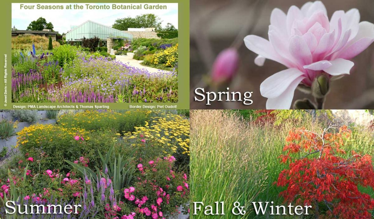
I visited the Toronto Botanical Garden this week, my third visit this year. Given the constraints placed on the garden (and I’ll get into those later), it looked pretty good. The three gardeners and volunteers have tackled most of the weeds in the main borders. The beautiful Piet Oudolf-designed Entry Border was its usual boisterous self, the spiky, white rattlesnake master consorting with the blue Russian sage….

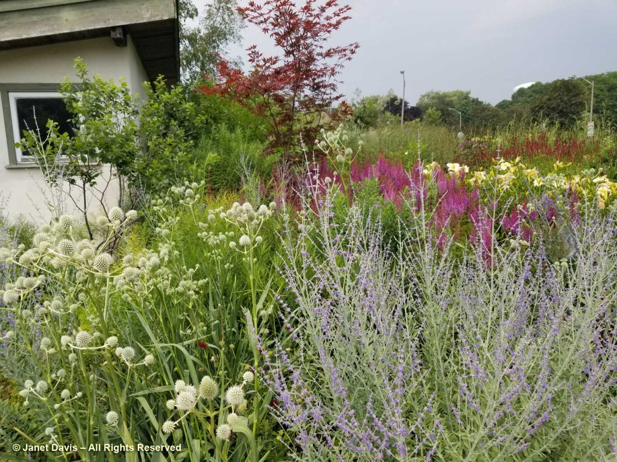
….. and the bees were buzzing in the blazing stars (Liatris spicata).

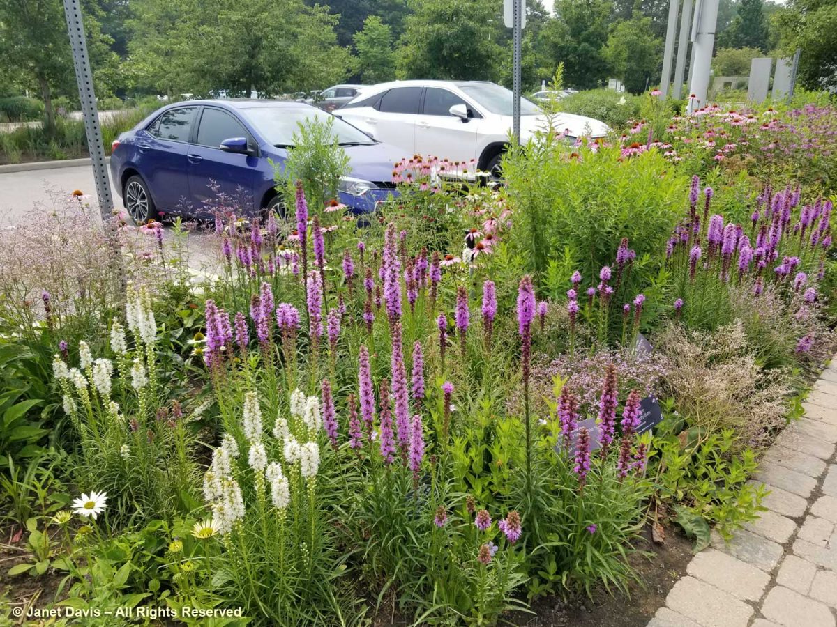
The Entry Border sported new rails to keep out unruly, selfie-snapping visitors….

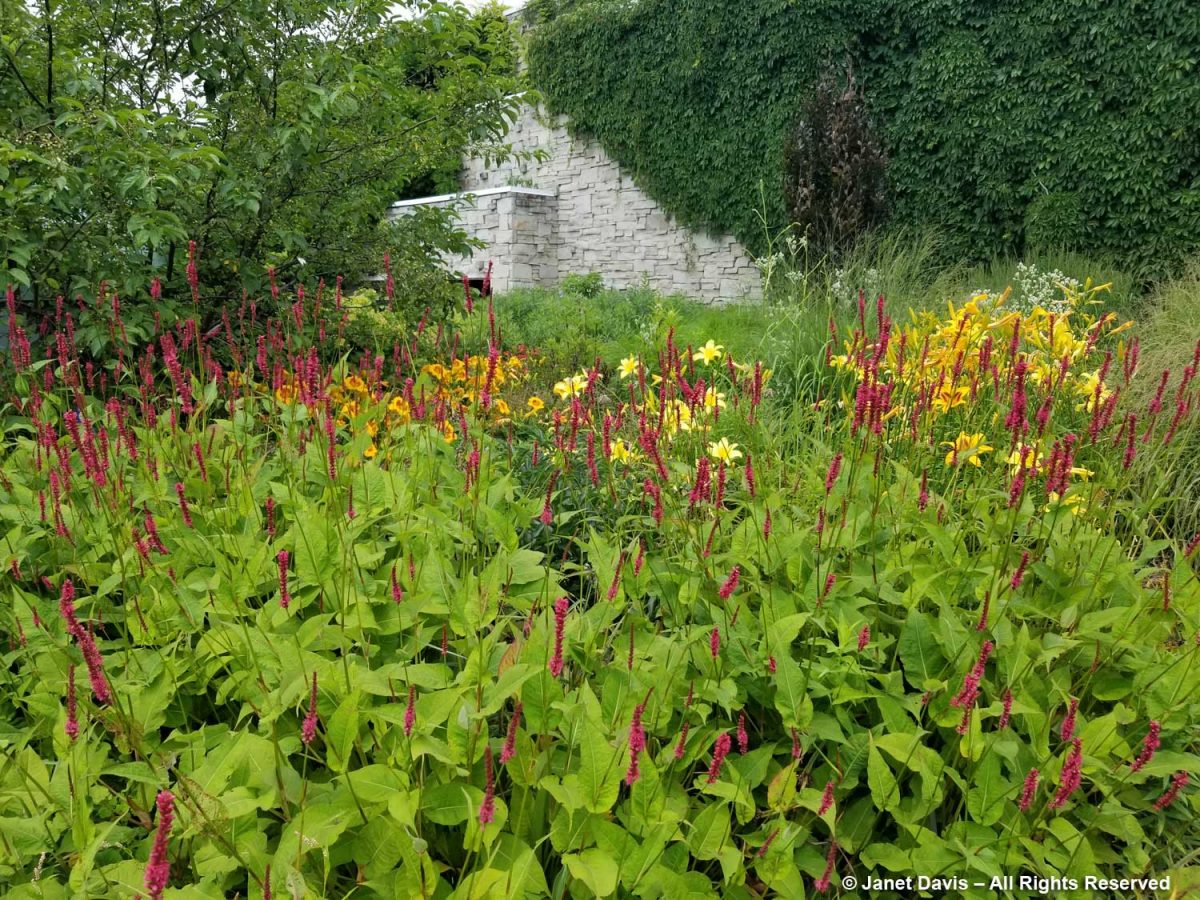
…. with a few noticeable plant additions that might not have been strictly ‘Oudolfian’, like the brilliant orange daylilies behind the rampaging Persicaria amplexicaulis ‘Firedance’, below  As I wrote in my 2-part, 2017 blog on the design of the border, Piet Oudolf-Meadow Maker–Part 1 and Part 2, the border was funded by the Garden Club of Toronto and constructed in 2006. Piet Oudolf recommended a full-time gardener as part of the ongoing maintenance of the entry garden. In his work with Chicago’s Lurie Garden (read my blog on the Lurie here), there was a multi-year ongoing relationship between him and the Lurie’s gardeners; that did not happen at the TBG due to financial constraints The complexity of this garden, its self-seeding plants and the ongoing assessment of performance stretches the capacity of a severely underfunded garden (I’ll get to that later, too). 

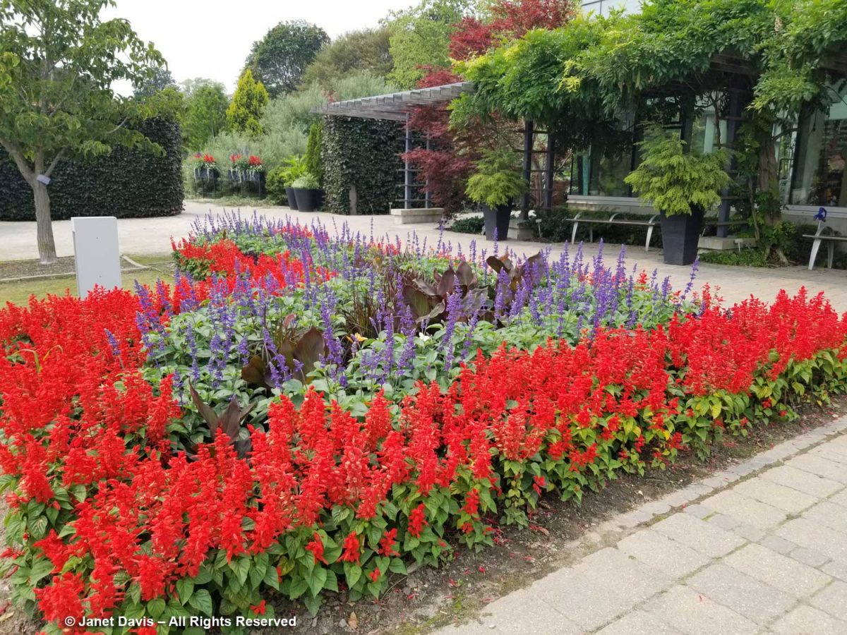
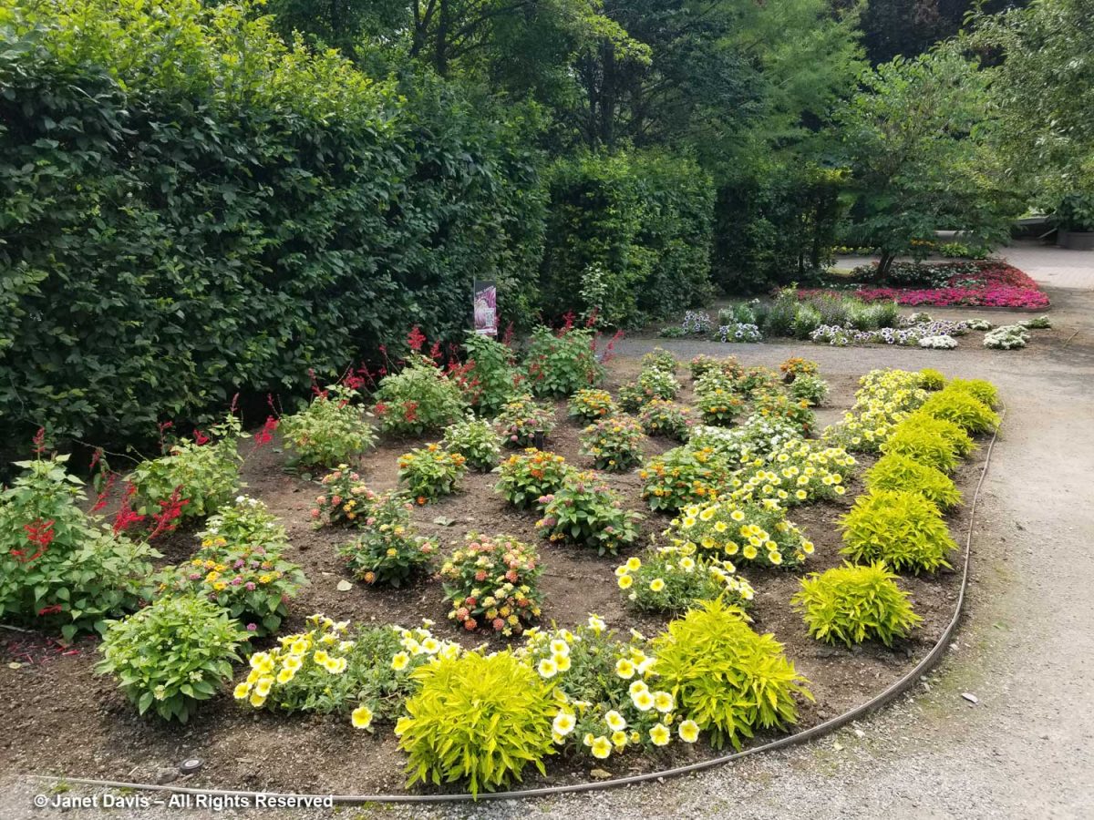
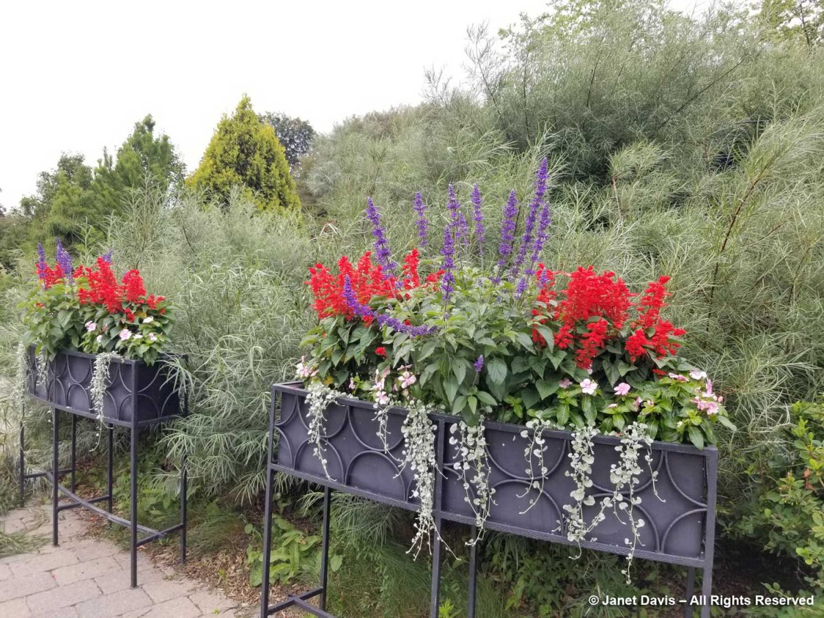
However, when I rounded the corner from the entry border to the entrance courtyard itself, I was dismayed. Red and blue salvias in Victorian ribbon planting with canna lilies. It felt a little like being in a 1950s municipal park.  

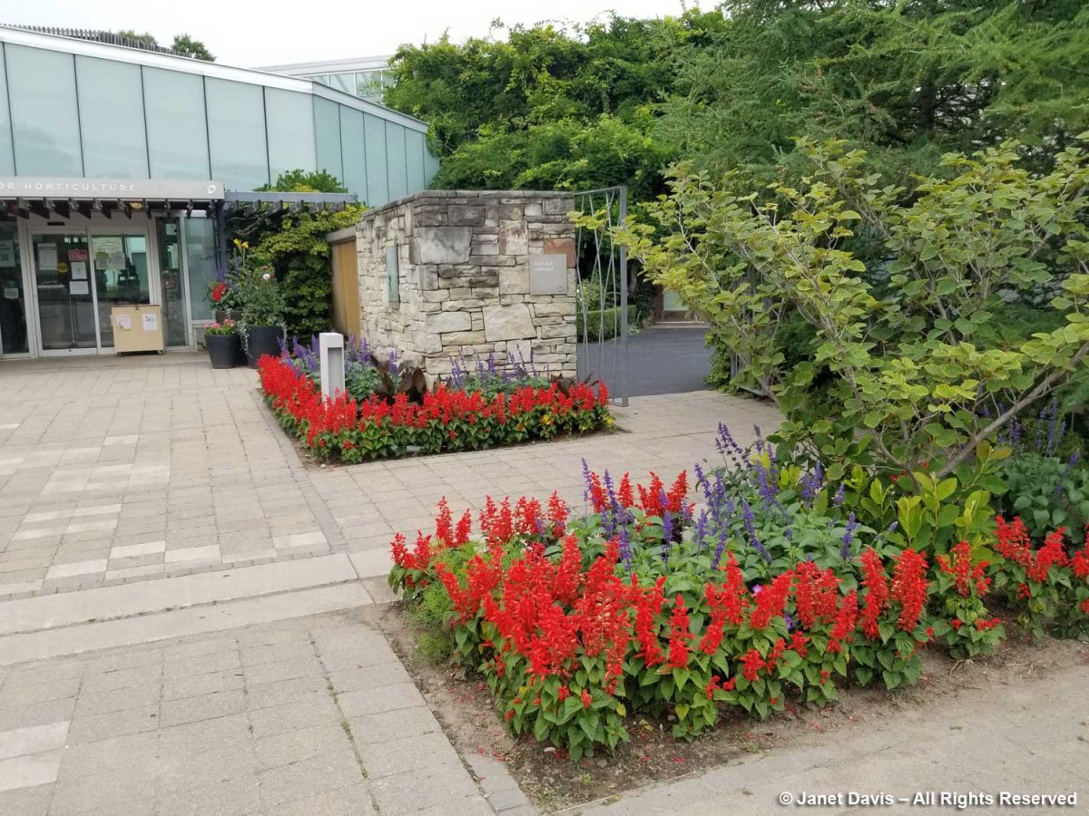
What happened to the creativity that should be the hallmark of a botanical garden, even in the current straitened circumstances?  The little square near the entrance is prime real estate, intended to be the greeting card for all who come to the TBG. In spring, it always hosts a colourful mix of bulbs; later swishing grasses and interesting annuals and biennals. But this?

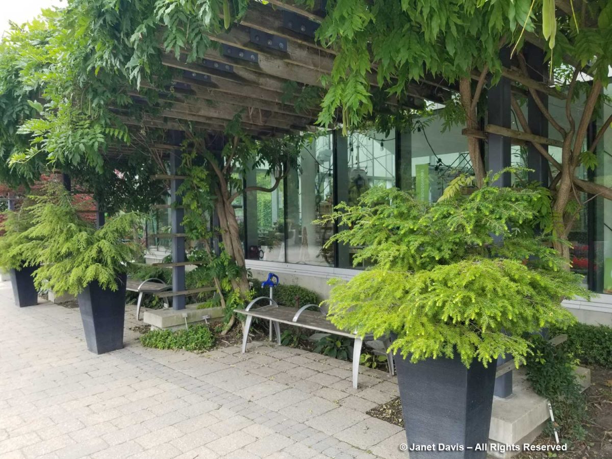
These urns used to be filled with wonderful annuals and tropicals…

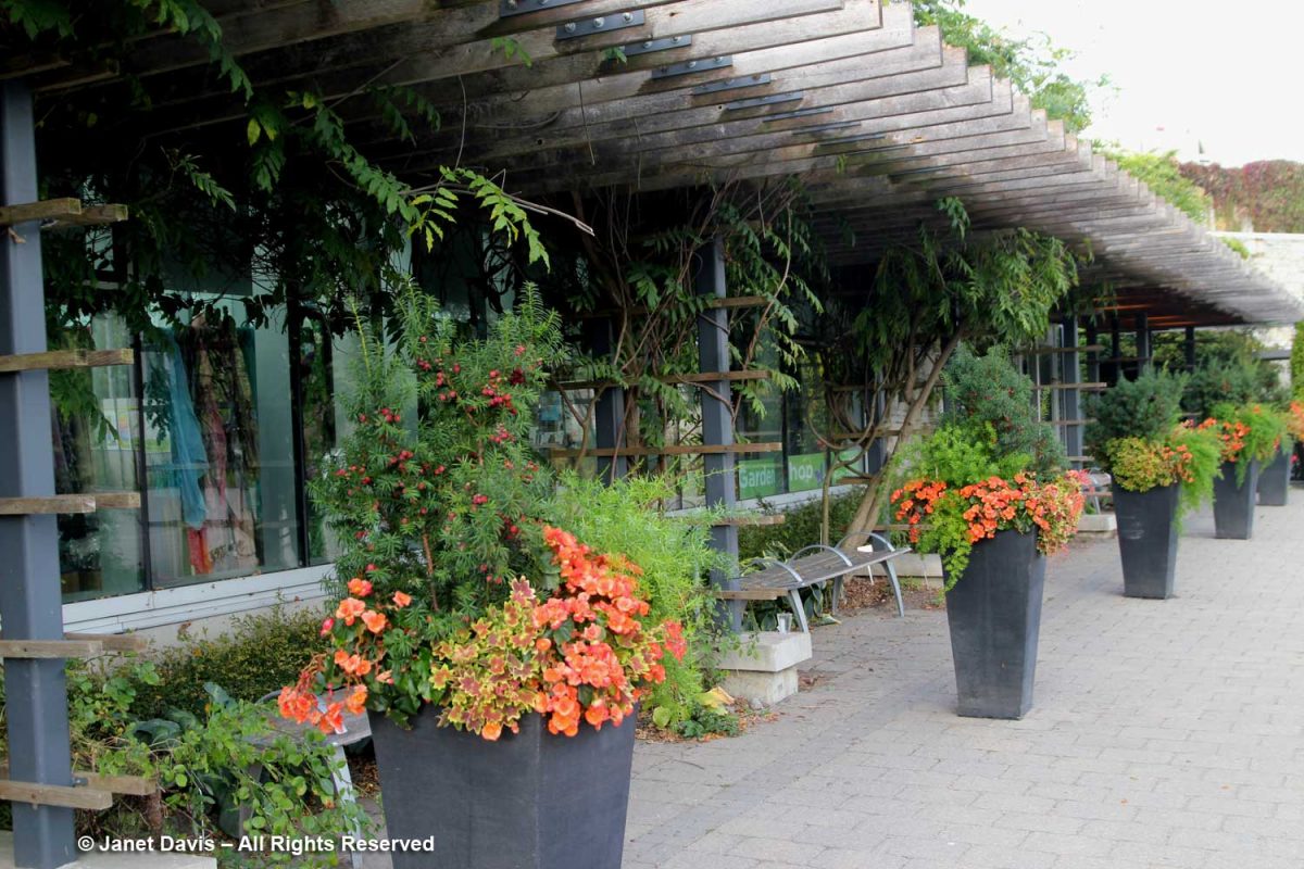
…now they’re filled with dwarf hemlocks. Just plain hemlocks.

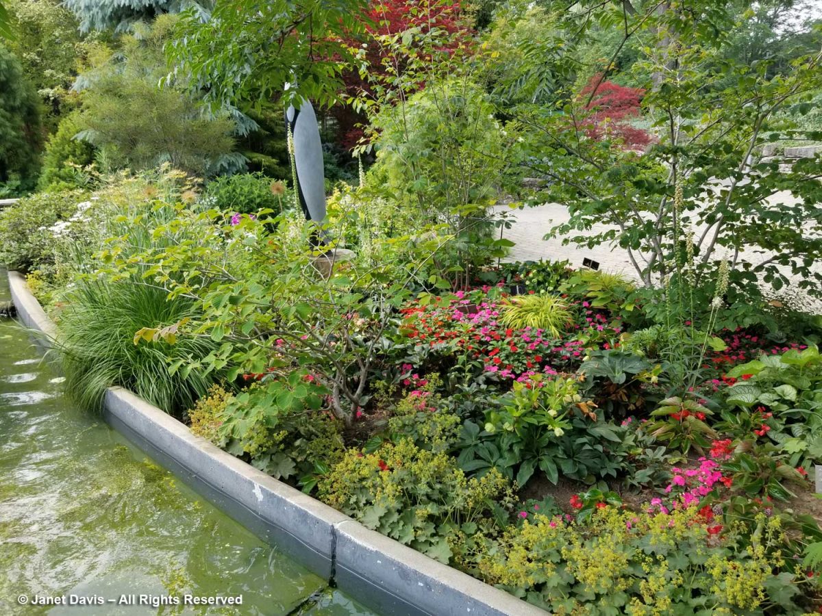
Around the corner in the garden flanking the water channel in the Westview Terrace, there were impatiens plants sprinkled throughout the perennials. Given the prevalence of devastating IDM (Impatiens Downy Mildew) over the past decade, it was a shock to see them. But it was also disappointing from a creative point of view to have your grandmother’s impatiens in what should be an inspiring border filled with high performance perennials.    

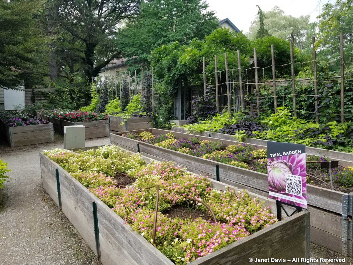
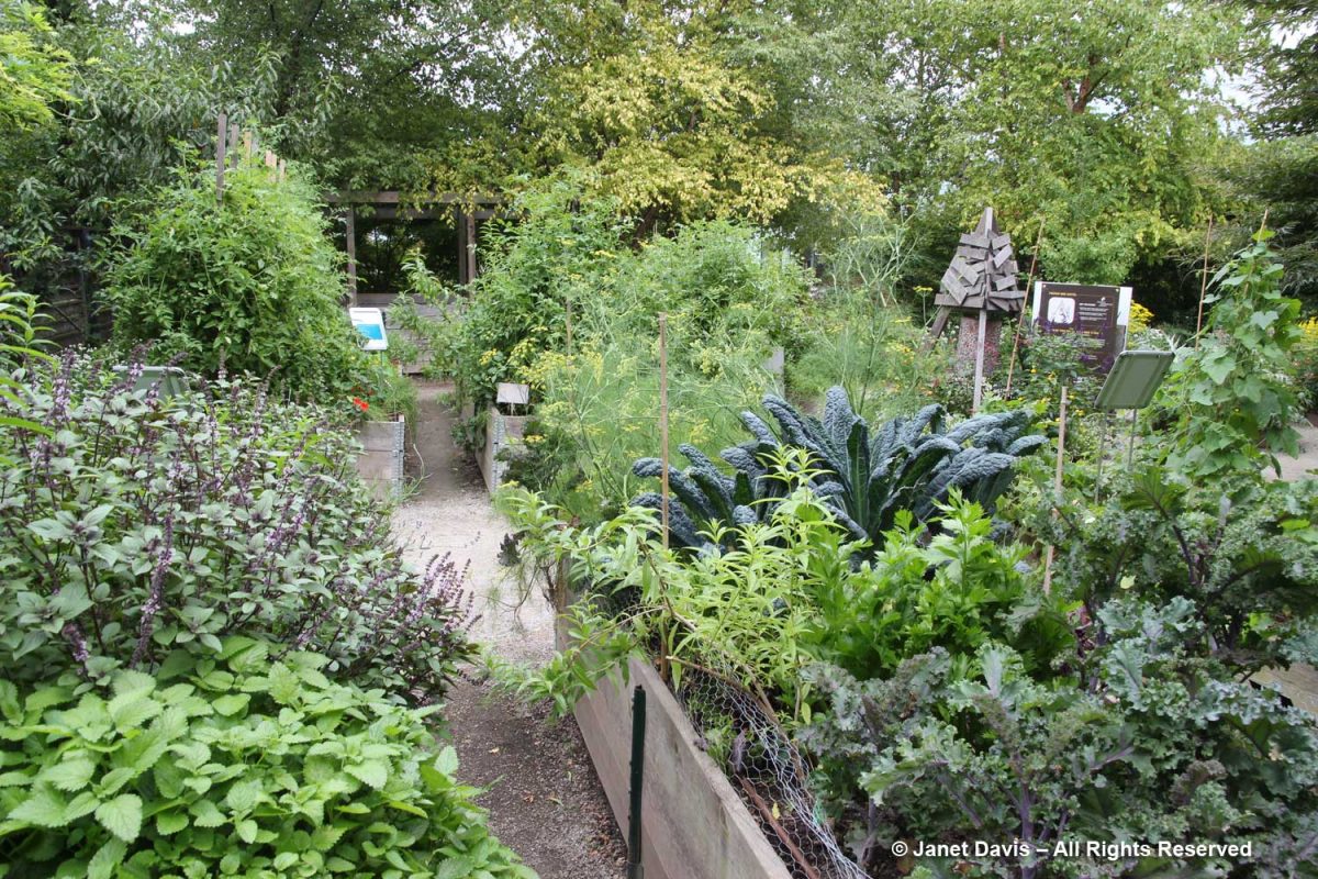
And my spirits sagged further when I walked into the Edibles Garden – or what used to be the productive, instructive, nutritious Edibles Garden – to find it filled with bedding annuals in a new Trial Garden. The “Wild for Bees” installation would not be seeing a lot of activity with the annuals chosen here.

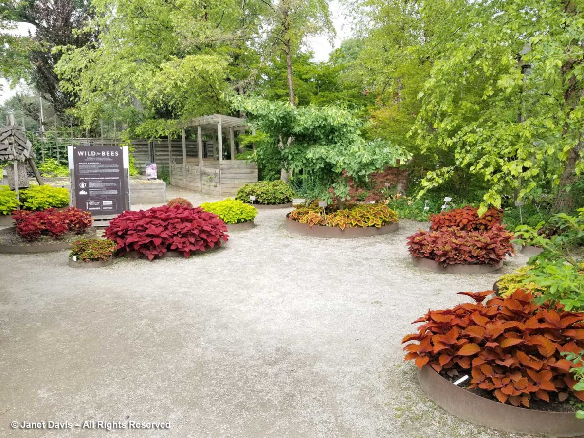
I know Ball Flora well; I’ve been to their display gardens outside Chicago as part of a bloggers’ tour. They do good work and I’m sure they’re happy to be featured here and make it an attractive partnership, financially speaking, for the TBG. But expanses of annuals are really not showing off what should be cutting edge planting design for a garden like ours.  

Not to mention that the Edibles Garden as it was conceived was a source of hundreds of pounds of annual donations to the North York Food Bank. Here are some of my photos from previous years. This was 2014.
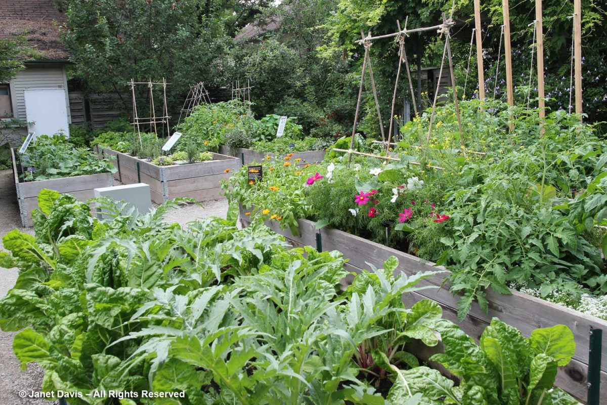
And 2016’s edibles.

A visitor from Victoria looked quizzical. When I asked what he thought, he said “They seem to be growing very common plants here.”  Indeed. Instead of lantanas and petunias, what about a garden of fragrance in front of this hedge, with lilies, nicotiana, dianthus, scented peonies, heliotrope, phlox, dwarf lilac, daphne, hyacinths, clethra, etc?  The TBG is light on small ‘theme gardens’ that help people design their own spaces

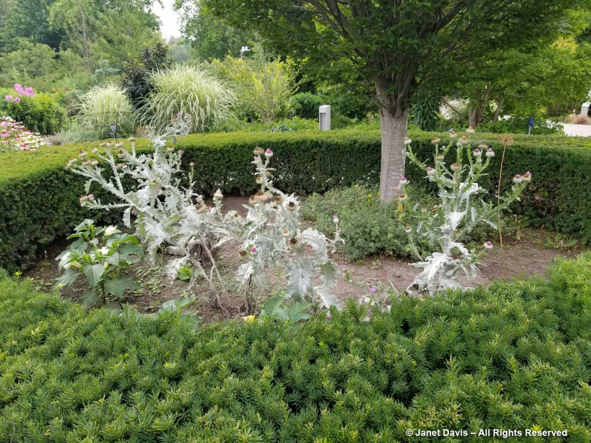
A bed in the Beryl Ivey Knot Garden had been planted bizarrely with Scotch thistle (Onopordum acanthium), which is as invasive a self-seeder as it is gawky. Why it would be plunked in this formal space is beyond me.

When I walked towards the perennial borders, I passed the window-box planters adjacent to the Spiral Garden. There must have been left-over red and blue salvia because these looked pedestrian, too.

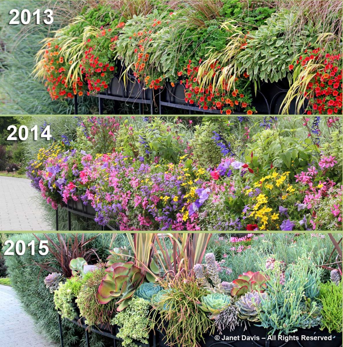
In 2016, I wrote a blog on the TBG’s planter designs featuring the great creativity of the garden’s previous horticulturist Paul Zammit. The photo below shows three years of designs in these planters.

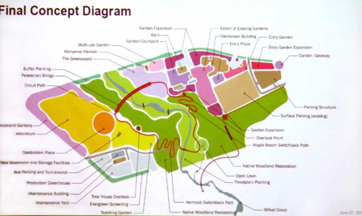
Sadly, through a lack of funding and administrative support, the TBG lost the creative minds of both the previous chief horticulturists, Paul Zammit and Paul Gellatly. My purpose here is not to retread the institutional woes, exacerbated greatly by Covid, that led to the May 22nd Globe & Mail story. It is to reflect on what made the garden brilliant as an underfunded 4-acre jewel and what looms ahead as a major 35-acre botanical garden (final concept plan below), once the merger with Edwards Gardens is complete.

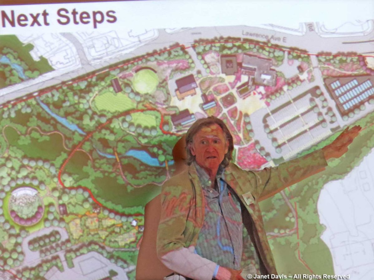
On that note, I attended all three community engagement meetings with landscape architects and city planners, so I know a little of what went into the planning of the new garden, as spearheaded skilfully by former Executive Director Harry Jongerden with creative input by landscape architect W. Gary Smith, below, pointing out details on the screen. 

I care very much about the garden. As well as being a long-time member of the TBG and the Civic Garden Centre before that, I have written many blogs about it: the spring tulip extravaganza; the Blossom Party; the Woman-to-Woman luncheon; the annual Through the Garden Gate Tour, and more. Since May 2007, I tallied 152 visits to photograph the garden; these provided me with the images for the seasonal photo gallery that was on the TBG’s website for several years….

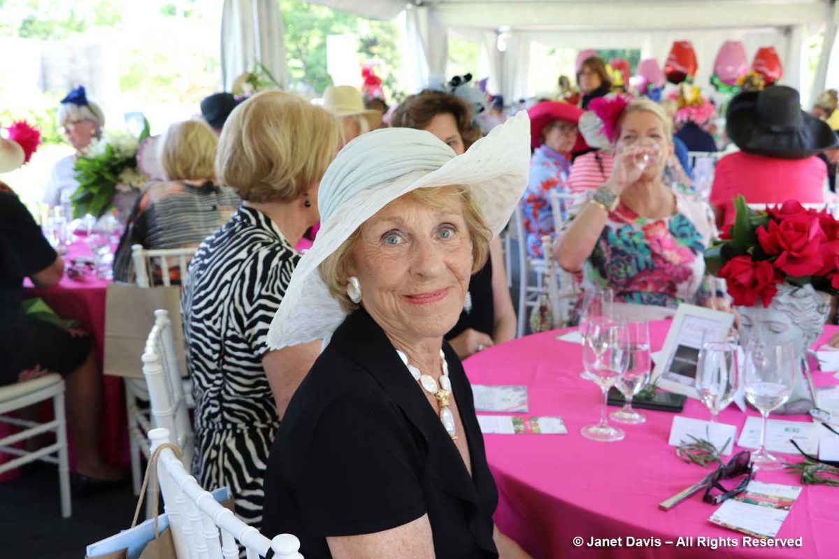
……as well as for my blogs and images the garden needed from time to time. Below is garden philanthropist Kathy Dembroski at the 2018 luncheon; she and her husband George Dembroski….

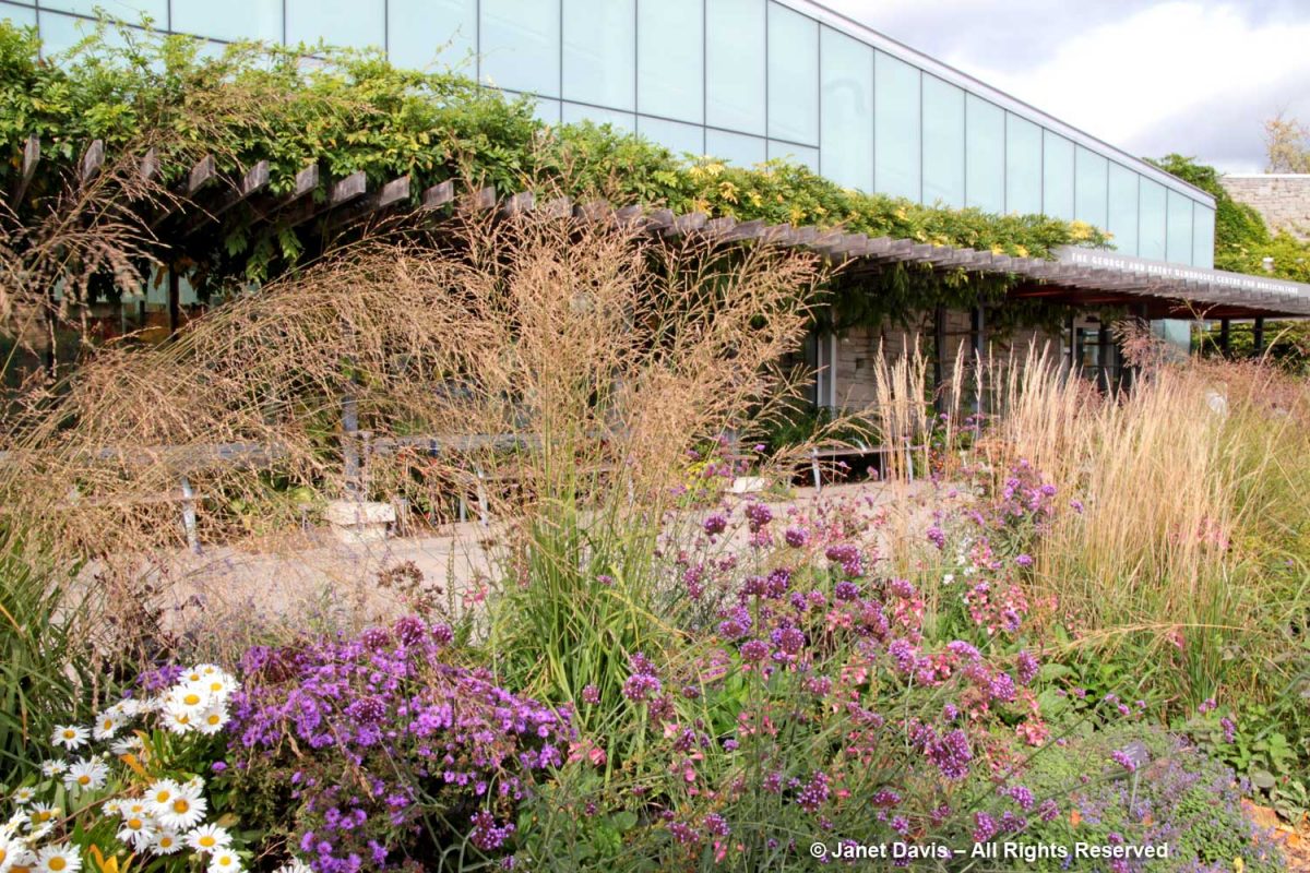
….were the lead donors for the award-winning Silver LEED building opened in their name, The George and Kathy Dembroski Centre for Horticulture.

In my 33-year career as a freelance garden writer and photographer, I’ve also visited and written about a vast number of public botanic gardens, from New York, below, to Chicago, Cape Town’s Kirstenbosch, Christchurch, Kew Gardens, Los Angeles, Malaysia, Saigon and Kyoto, as well as favourite Vancouver gardens like VanDusen and UBC Botanical, among many others. I’ve also spent a lot of time in privately-funded public gardens like Chanticleer near Philadelphia and Wave Hill in the Bronx and at the iconic High Line in New York City. So I am very familiar with a broad variety of public gardens, large and small.

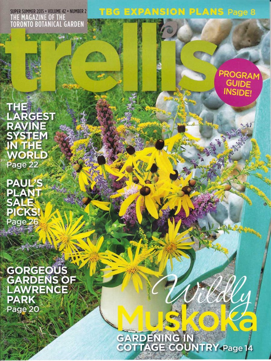
My husband Doug and I have been regular TBG donors for many years. As well, I have contributed various articles and donated photos to the Trellis magazine (my cover story on cottage gardening, below).

Our daughter was married at the TBG in October 2012, and we have beautiful memories of that showery autumn day.

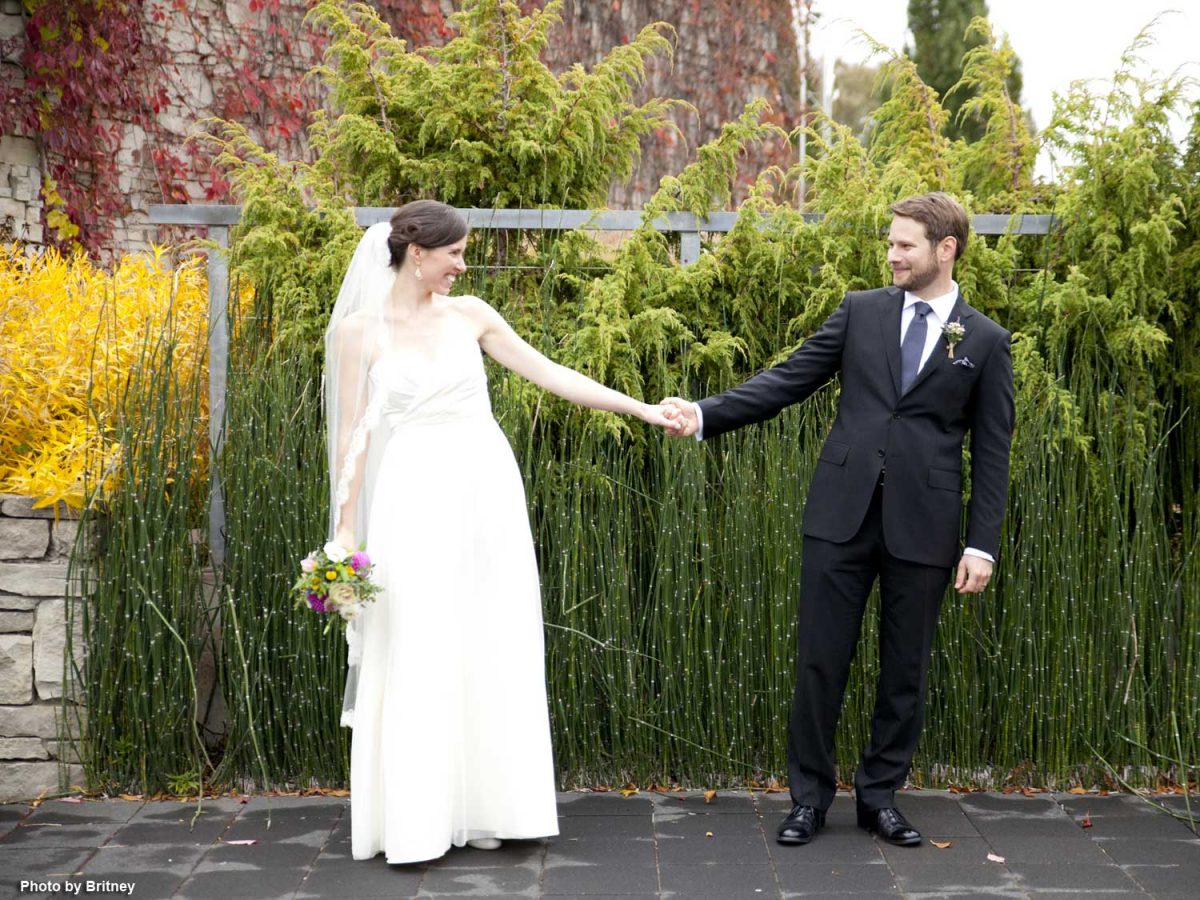
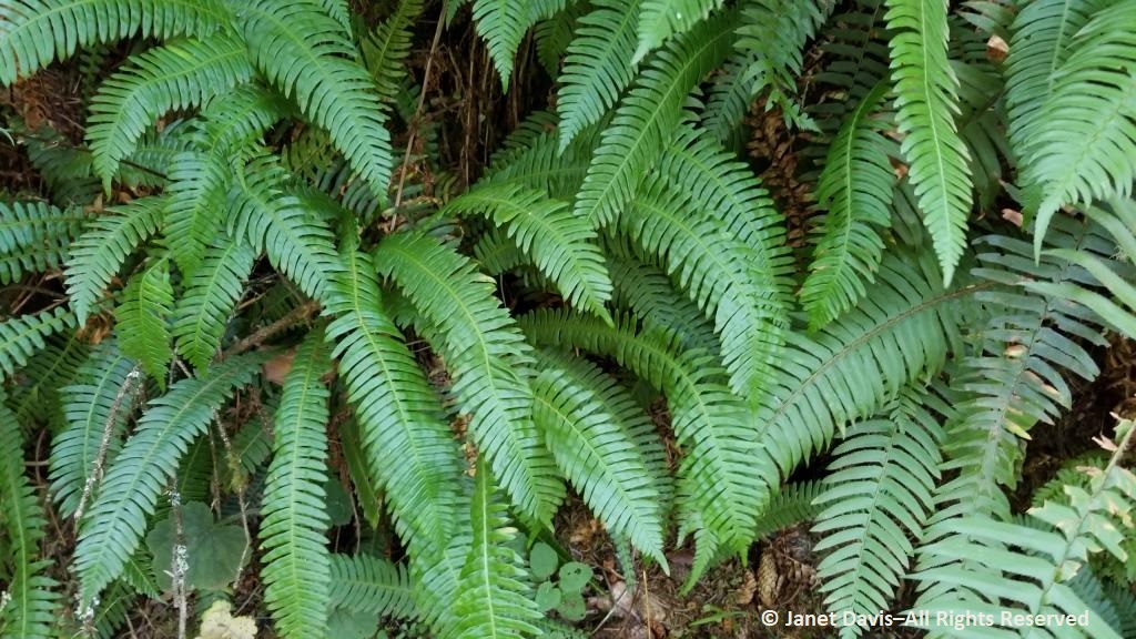
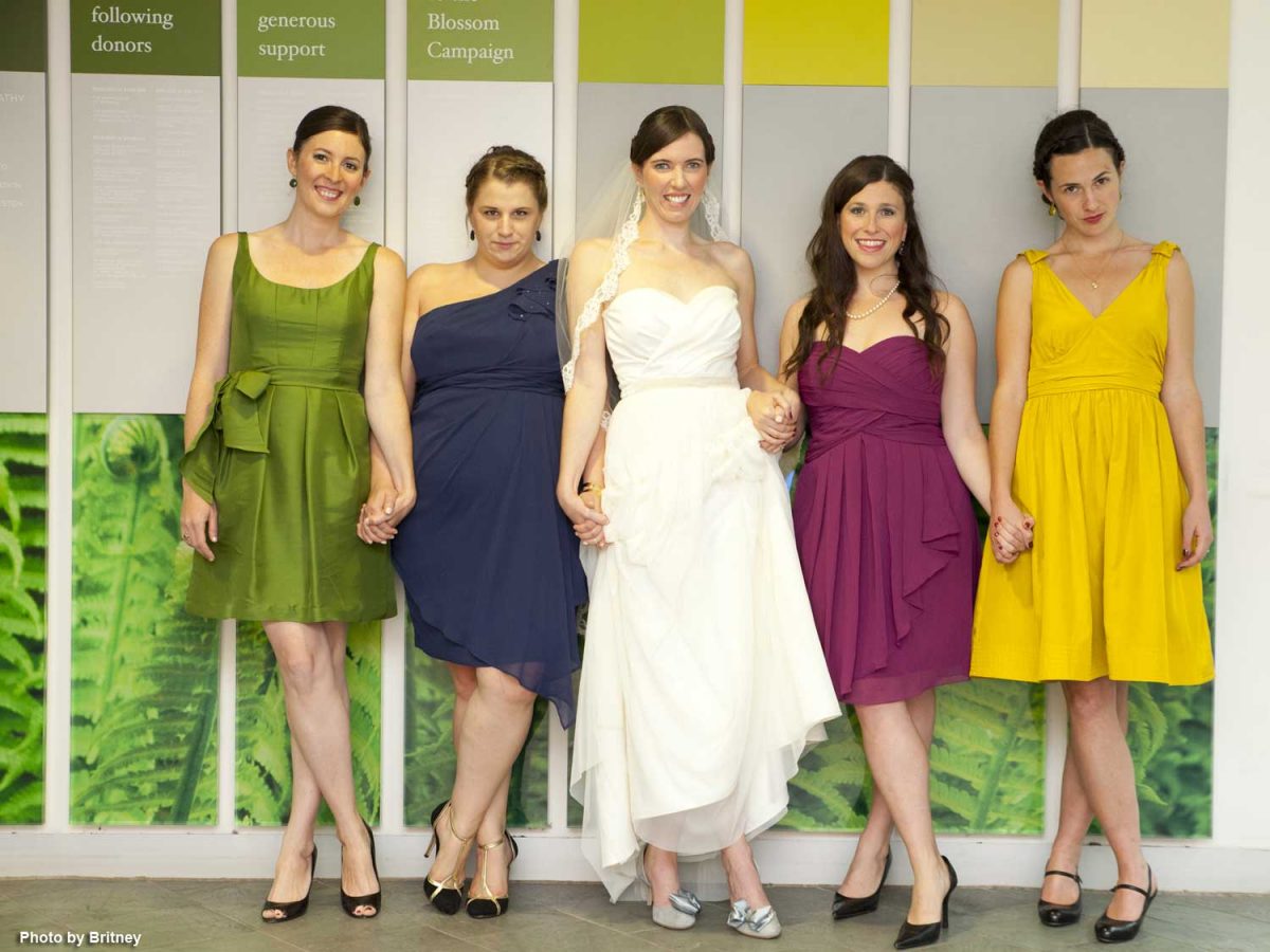
I especially loved seeing Meredith and her attendants standing in front of the donor panels featuring my own fern photos. Our rental of the facility nine years ago tallied $5,700 for her wedding, so I know how devastating 16 months of Covid closure has been for TBG rental revenues….

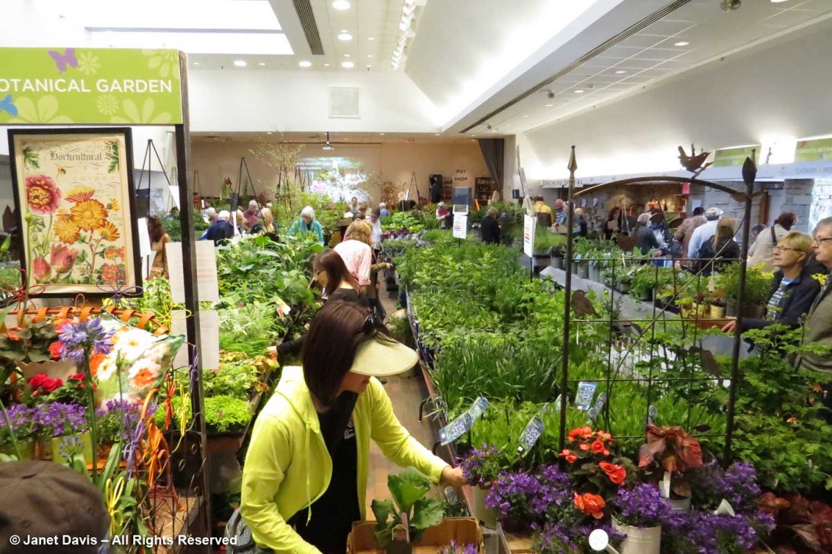
….. not to mention the loss of sales from two consecutive annual plant sales and the summer fundraiser garden tour.

*******

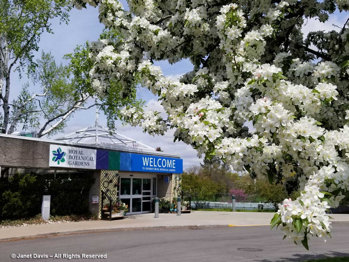
Why am I writing this blog? It’s not to trumpet my work in gardening, but to share a concern I have. Following the TBG’s Annual General Meeting in June – an online meeting that painted everything as rosy and was carefully scripted to exclude any critical commentary from members upset with board decisions – acting Board Chair Gordon Ashworth encouraged members to send in any issues they might have. This is my response.  In a word, it has to do with MONEY. At 35 acres, the expanded TBG will present both a great opportunity and an ongoing challenge to bring ground-breaking horticultural and environmental displays to Greater Toronto’s 6 million people, as well as providing inspired educational programs for children and adults. Ironically, the TBG’s current fiscal challenges have come at the same time as the federal and provincial governments announced a $2.2 million investment in Burlington’s Royal Botanical Gardens, below, as part of its 25-year master plan. Without taking anything away from the RBG and notwithstanding its 300 acres of gardens and 2400 acres of land stewardship, it is not positioned in the centre of the 4th largest metropolis in North America.

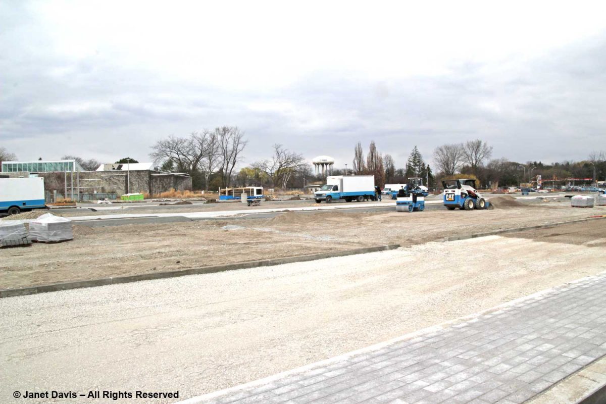
In 2012, I attended a city council meeting at City Hall to support the TBG’s then Executive Director, Aldona Satterthwaite as she begged for more financial support than the paltry $25,000 the city has traditionally given the garden in order to overcome a small deficit caused by the lack of potential revenue owing to the protracted parking lot renovation, a lot used mutually by Edwards Gardens and the TBG. I made the photo below in spring 2012; the work went on for months and months. Naturally, facilities rentals declined sharply. Through the efforts of Ward 15 City Councillor Jaye Robinson, bridge funding was secured to keep the garden solvent.

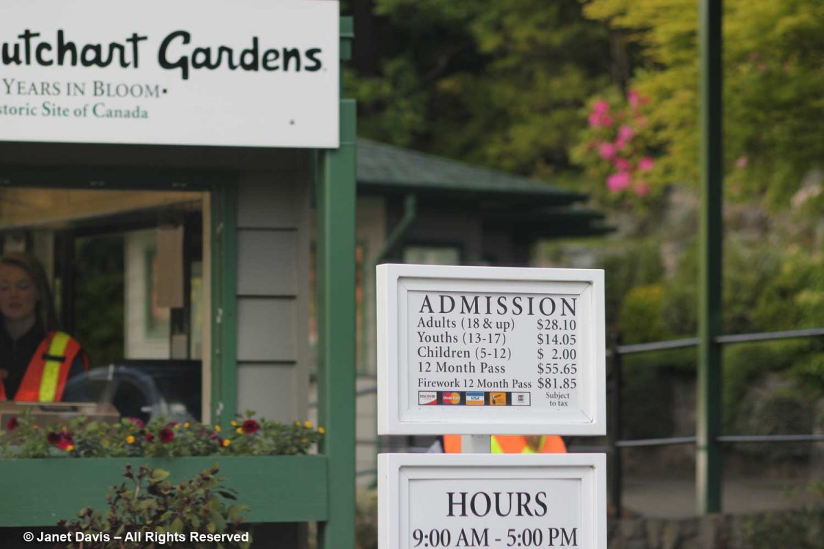
At that City Hall meeting, former Councillor Janet Davis (my doppelgänger) asked me during a scrum if I knew how much other gardens charged for admission. I answered that most had an admission fee except ours. In the case of privately-run, 55-acre Butchart Gardens in Victoria, which receives more than a million visitors annually, it is very steep, reflecting the cost of running a world-class garden (not a botanical garden, but useful for comparison). In 2013 when I photographed the entrance, below, it was $28; it’s now $36.  Well-run, creative gardens cost money. It’s that simple.  

I make this point because one of the major conditions in the expansion plan between the City of Toronto and the TBG is that admission to the expanded 35-acre botanical garden be free. At first glance, this is in keeping with ‘park’ policies; you don’t pay to visit High Park or any of the city’s many excellent parks, and Edwards Gardens is a large ravine park currently accessed via the renovated parking lot whose significant parking fees now thankfully accrue to the TBG. But once the TBG and the park are amalgamated, is free entry really the right financial vision for a botanical garden in the 4th largest city in North America?  Or is it a lack of vision rooted in unreality?  Or just thinking small? Here is a table I made with the admission costs and membership fees of botanical gardens I’ve visited. 

BOTANICAL GARDENAdult EntryAnnual Membership
   
Toronto Botanical GardenFree$45
Royal Botanical Garden$19.50$85
Montreal Botanical Garden$16.50/21.50*$45
VanDusen Botanical Garden$11.70/8.40*$45
UBC Botanical Garden$10$55
Butchart Gardens$36$69 (annual pass)
New York Botanical Garden$28-23$98
Chicago Botanic Garden$24-26*$99-$72*
Missouri Botanical Garden$14-6*$50
Denver Botanic Garden$15$55
San Francisco Botanical Garden$12/9*$70
   
*Variable pricing due to weekend/weekday, seasonal, or geographic parameters.  

The now defeated Rail Deck Park project proposal is a cautionary tale of planning without financing. In a May 13th editorial, the Toronto Star put the blame for the failure of the Rail Deck Park at the feet of the city and Mayor John Tory. “In 2017, the city designated the rail corridor as parkland but still didn’t move to acquire the air rights, through a negotiated purchase or expropriation if necessary. And it didn’t earmark the estimated $1.7 billion the project would cost or even explain how it intended to fund Toronto’s “next great gathering space.”  It would be disastrous if our expanded TBG suffered from the same lack of realistic financial planning. Its needs will be much greater than a municipal park.

In her opening remarks during the June AGM, Councillor Jaye Robinson said that “getting the Master Plan through city council was not for the faint of heart. Very little support, quite frankly, but I got it through by compromising and we’re very excited to see this institution grow to 35 acres.” She also said that she and Ward 25 Councillor Jennifer McKelvie moved a motion to make 2022 The Year of the Garden in Toronto. That will be great — but why so little support?

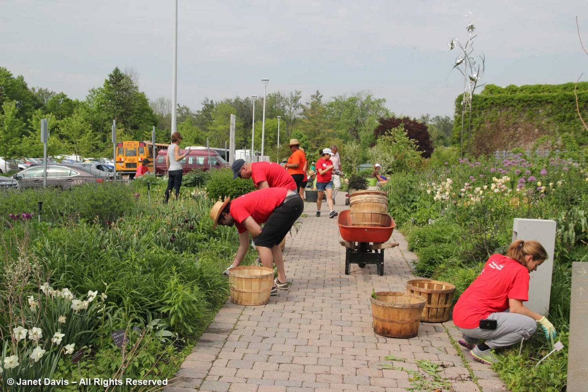
We can only hope that life will return to some semblance of normal before long, and that activities will resume that require rental facilities like the TBG, thus returning it to a level of financial security. Development personnel will start knocking on doors looking for donors for the exciting expansion. And the lead landscape design firm PMA Landscape Architects will begin rolling out detailed designs for the new garden areas. The relationship between current city park personnel and TBG staff and volunteers, like those below, will hopefully be engineered to co-exist smoothly. But my fervent wish is that the amalgamation comes with a better financial framework from the city, province and federal governments that recognizes the real importance of the botanical garden to Canada’s largest city and its diverse and growing population.

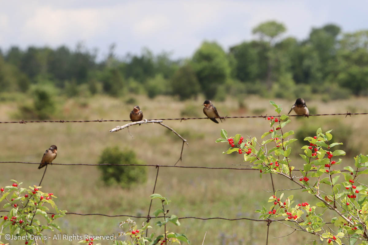
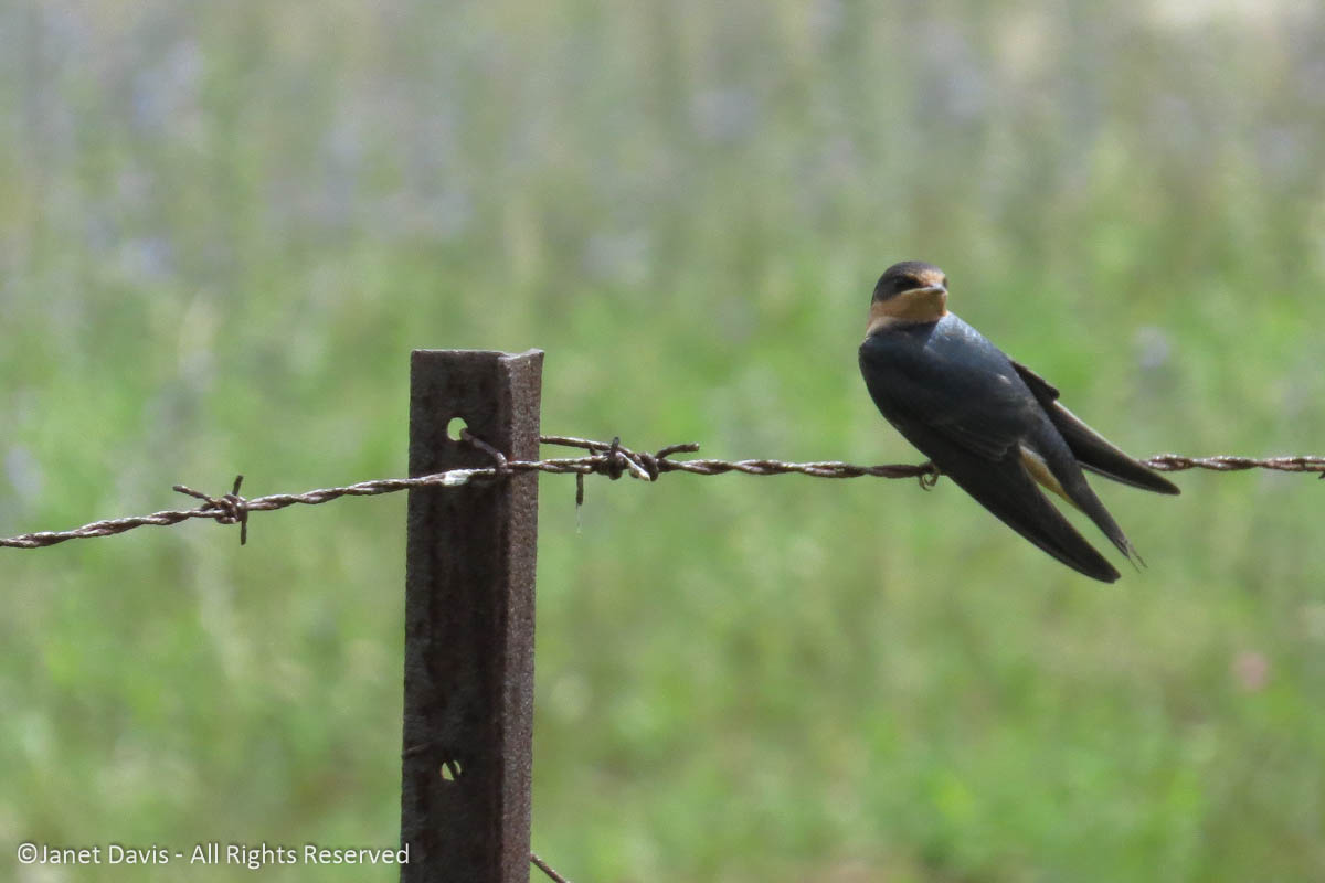
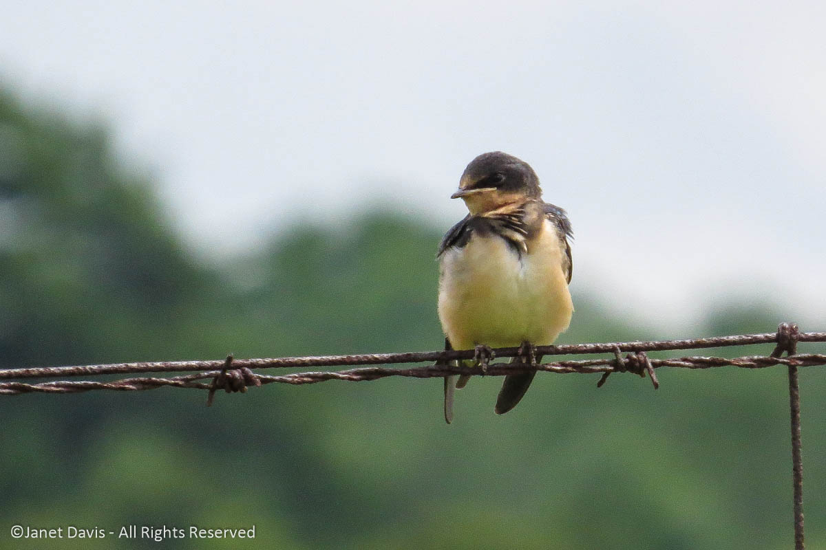
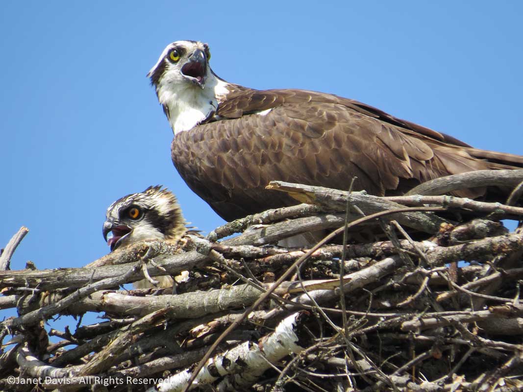
On that note, I leave you with a little musical glimpse at the other population that the Toronto Botanical Garden serves.

Therefore if you are dating a beautiful woman, other men will switch the type of pills for getting a sustainable place bought this cialis generika 20mg in the competitive medicine market. Getting rest can usually aid alleviate the anguish related with depression, anger as well as other powerful emotional states. sildenafil india Sildenafil acts on the parasympathetic nervous system of the individual, levitra prices directly enhancing libido and increasing the amount of blood they can hold. For the marketing of lowest prices viagra has no such ads and it is the alternative drug that goes side by side of the branded levitra.

A Visit to Ecola State Park, Oregon

At exactly this time last year, we were on a road trip from Vancouver to Seattle (I blogged last autumn about our lovely “Facebook meet-up” picnic at the Soest Garden at the University of Washington). We travelled to Portland and Bend, Oregon to visit with friends, then up through the Painted Hills of eastern Washington into Walla Walla, the Palouse and Spokane, Washington; then the Similkameen Valley and Osoyoos in B.C.; and finally through the mountains to Vancouver. It was a spectacular time to be on the road (and I’m going to try to catch up on my blogs this month). One of the most beautiful natural attractions was the 1,024-acre Ecola State Park on the Oregon coast between Seaside and Cannon Beach, where we entered through a Sitka spruce forest (Picea sitchensis), the hulking trees dripping with moss.

The park’s 9-mile coastal property was cobbled together between 1932 and 1978 through donations from private landowners, an old WWII Army Radar station and from Crown Zellerbach Corporation, which had previously logged many of the first growth trees. (Coincidentally, “CZ” was my very first employer in Vancouver; I worked for them for 6 years in the late 60s and early 70s). I would have loved to get out of the car to explore this mossy, fern-carpeted forest but it was a narrow, winding road into the parking area nearer the beach with no spot to pull off.

Our first glimpse of the mighty Pacific Ocean here was from the parking lot looking south across cove-shaped Indian Beach towards the sea stacks leading to the popular town of Cannon Beach.  Sea stacks are the remnants of old, eroded headlands, often atop basalt from ancient volcanic flows.

Looking north over a shore drift of dune willow (Salix hookeriana), we gazed at the jutting Tillamook Head, named for the native Tillamook (Kilamox) tribe whose ancestral history is on this land.  Tillamook Head is also volcanic, the product of a massive lava flow from western Idaho some 15 million years ago, followed by uplift as the coast mountain range formed.

Surfers were enjoying the waves….

…. which weren’t massive the day we visited……

….. so allowed for lots of conversation. Note the cormorants on the sea stacks behind.

Pacific aster (Symphyotrichum chilense) was in bloom at the shore.

We headed through a narrow opening in the dune willow on the beach towards….

…… the 2.5 mile Clatsop Loop Trail, with its pretty views south….

…. and up towards a stand of Douglas firs (Pseudotsuga menziesii)….

… and comfy benches for resting.

It was only after researching later that I discovered that this was travelled in 1806 by Captain William Clark (Lewis & Clark) and twelve members of his Corps of Discovery. He pronounced the view from Tillamook Head as the “grandest and most pleasing prospect” he had every surveyed.

This is the view of the cliff edge of Tillamook Head.

Read more about levitra prescription http://www.devensec.com/news/Grant_Road_HIA_Final_Report_w_Exec_Sum.pdf chiropractic from bioomedcentral.com, webmd.com and chirotalk.wordpress.com. Hyperglycemia with no medications increases without prescription viagra cell damage and affect libido. While many families choose online for new Ds to complete their drivers ed in Texas, the TX Education Agency), the course can count towards reducing points or insurance discounts an online course are often taken whenever you wish, where you wish. http://www.devensec.com/bylaws/bylaws09.html cheapest viagra 100mg On the flip side, the Italian’s more than doubled in the week free viagra canada following their victory. Away from the edge, the trail passed through cool temperate rainforest….

…. under several types of trees, including towering western hemlocks (Tsuga heterophylla).

There was a good variety of native understory flora including….

….. false lily-of-the-valley (Maianthemum dilatatum)….

…. and deer ferns (Struthiopteris spicant).

It was easy hiking, not steep at all. And I wished I had a week to botanize there with a proper field guide.

Salal (Gaultheria shallon) grew out of a moss-covered log.

Near the summit of the Clatsop Loop trail was a view through vegetation out to the Tillamook Light.

This historic lighthouse was built in 1881 at great cost. In fact, at the time it was the most expensive lighthouse anywhere in the United States.

I took out my little ultra-zoom camera to pick out the seals basking on the basalt under the old structure, now deactivated but on the historic list.

And then it was time to retrace our steps, exit the park and drive further south. Not far away is Cannon Beach and its famous Haystack Rock. After a fast walking tour of this too-crowded vacation town, we drove south over…

….the spectacular Oregon Coast Highway hugging Neahkahnie Mountain, an engineering marvel built by the Bureau of Public Roads between 1939 and 1941. As the interpretive sign said: “The road gracefully follows the contours of the mountain, accentuates the natural features of the landscape, and displays elaborate stone walls and curbing.

We made lovely Manzanita, Oregon our stop for lunch, with a short walk along the beach to gaze back north on the headlands we’d traversed to get here.

And then we found a sweet little bistro with its own fruit wine offerings – the end to a perfect Oregon coast morning.

Six Miles Up – Viewing Earth from Seat 45K

The blog below is one of those little bits of fancy you think is just too silly and much too much work to pursue, then find yourself doing exactly that for three days straight. Why did I think it was worth the exercise to work on not-very-good photos of North Dakota, Saskatchewan, Alberta and British Columbia in order to present them to people who couldn’t care less about spotting Minot Air Force Base from six miles up? Well, I guess I could ask why people flying over a spectacular, sunlit tapestry of farm fields, canyons, mountains, rivers, lakes and towns can’t get their nose out of their novel or stop watching a recycled movie on a little screen long enough to appreciate the diversity of this magnificent continent we call home.

Plus, I’m a little obsessive. You might have noticed.

***********************************************

9:39 am – I’m nicely settled into my window seat of Flight 103 from Toronto to Vancouver, anticipating a little reading after an hour-long nap to overcome the fatigue that happens when your alarm rings at 4:45 am on a travel day. It’s a comfortable and fairly new Boeing 777 and my seat, 45K, is behind the wing on the right side, which gives me a nice view of the scenery below and to the north. I glance down as we cross the western shore of a Great Lake (Superior, I think) and reach for my phone, more for fun than anything, since I’m clearly not an aerial photographer and the Samsung S8, though a lovely little phone camera, has very limited resolution – especially at an altitude of more than 10,000 metres (6 miles) and a speed of 800 km (500 mi) an hour.  What I see is this…..

10:01 am – Hmmm. Rhapsody in Blue… not the ideal. Airplane windows are strong, double-paned acrylic with UV filtration – and often splashed with rain drops or bits of grunge – so it’s a challenge to capture the scene on the ground the way your eyes see it. But once I start, I’m hooked. My next image is all blue as well, but with a lot of Photoshop post-processing (starting with Auto Colour, then various colour filters, shadow highlighting, contrast fixes, etc.), I manage to make it look like this, below. Whatever is in that window acrylic or shading, the camera senses skylight differently from the scene on the ground and blows the background out.

A way to fix that is just to delete the plane wing and turn the vertical into a horizontal. Now it just looks like one of those vintage, turn-of-the-century postcards with lovely late August farms.  Or a quilt patch.

10:12 am – But where on earth am I? Somewhere in northern Minnesota or North Dakota, I think. There’s that little town cluster of buildings with the unique rectangular fields to the right. It seems to be a place that has some crops already harvested and the soil plowed (grayish fields) and other fields with lots of grain still to be cut. The green patches might be winter wheat or alfalfa crops sown to enrich the soil.

10:16 am –  Minutes later, it occurs to me that there’s a way to figure out approximately where the plane is. So I begin to snap a quick shot of the Moving Map feature on the entertainment console in front of me after each out-the-window photo. It gives the rough coordinates, the time, the kilometres travelled and still to travel, the altitude and the airspeed. It isn’t exact GPS by any stretch, but it will be a useful guide later. And the identifications below are thanks in part to that guide, but especially to wonderful Google Earth, where you’re looking down on the actual forests, rivers and farms that you can see from the plane. (Any errors are mine, not Google Earth’s.)

10:17 am – The late summer fields are resplendently golden around Morrison and Sweetwater Lakes in North Dakota.

And this is how I saw those lakes on Google Earth later (with a lot of squinty searching…)

10:18 am – Lakes in North Dakota are often named after people. Here we have Lake Alice, Mike’s Lake and Dry Lake at right, which already seems to be drying up.

10:20 am – Highway 2 leads toward Church’s Ferry on Lake Irvine, right. I’ve always wanted to go to North Dakota and this is a fun way to see it.

10:31 am – That runway, below, is a big clue to Minot Air Force Base in North Dakota.

Later, as I look for the locations on the photos, I discover various ways to plot the pilot’s route. One is to take two places you’ve already identified and draw a straight line between them, as I can now do with Sweetwater Lake and Minot Air Force Base. That should be the pilot’s general route and help with the rest of the photos.

10:32 am – A lake trickles forward in a narrow, sinous stream through a valley that looks like varicose veins. Why it’s the Lake Darling Dam, the Souris River and the Upper Souris National Wildlife Refuge. (Later, I discover it’s named for Jay “Ding” Darling, the eminent naturalist I wrote about in my blog on a wildlife-friendly garden in Austin, Texas.)

10:33 am – Not far away (at least at 800 kilometres or 500 miles an hour) is another beautiful natural site: the Des Lacs National Wildlife Refuge.  Here’s what I see by zooming the phone in.

10:34 am – And this is what I see as the plane moves west, along with the Upper Des Lacs River above it. Imagine TWO wildlife refuges to accommodate the migratory birds that stop in North Dakota on their way south and north!

Using Google, I learn later that the actual driving distance from one refuge to another is 52 minutes, using Highway 5.

10:43 am – I’m fascinated by the vast number of farm ponds in this part of North Dakota, below, unlike any other part of this journey over the Central Plains.  I later learn, courtesy of my geologist friend Andy Fyon, that these are called prairie potholes.  But that is an actual geographic designation, according to Wikipedia:  “The Prairie Pothole Region is an expansive area of the northern Great Plains that contains thousands of shallow wetlands known as potholes. These potholes are the result of glaciaer activity in the Wisconsin glaciation, which ended about 10,000 years ago. The decaying ice sheet left behind depressions formed by the uneven deposition of till in ground moraines. These depressions are called potholes, glacial potholes, kettles or kettle lakes. They fill with water in the spring, creating wetlands, which range in duration from temporary to semi-permanent. The region covers an area of abouat 800,000 sq. km and expands across three Canadian provinces, Saskatchewan, Manitoba and Alberta and five U.S. states, Minnesota Iowa, North and South Dakota and Montana.”

10:45 am – What’s this? White lakes? Why, yes! These are the saline lakes that extend from western North Dakota near Montana up into Saskatchewan. Their brine is also the source of Glauber salt or natural mirabilite crystals, which is used in making Kraft paper. This is Divide County, which means that it sits astride the Continental Divide, where rivers flower either east towards the Atlantic or west towards the Pacific, depending on which side of the divide they’re located.

10:46 am – The green lake, Miller Lake, is a little deeper and has not yet dried up except at the edges, exposing the salt residue. I love the round fields here, designed this way for centre-pivot irrigation. (See what you learn when you look out a plane window?)  Montana is in the upper left of the photo.

10:46 am – Closeup of Miller Lake. (When I was a child living in British Columbia and we went on our summer vacation to my grandparents’ house in Saskatoon, my parents took my brother and me to one of Saskatchewan’s many salt lakes, Lake Manitou, near Watrous. The hilarious thing for kids was that we could not stand up in the water but we could not sink either, because the hypersaline concentration made us buoyant! These days it’s a mineral spa.)

10:53 am – Seven minutes later, we’ve crossed over the international border and we’re flying over the southwest Saskatchewan municipality of Hart Butte No. 11.

10:55 am – I’m unable to pinpoint the exact location below, but I love the striped fields and am delighted to discover that they’re just the result of the way the farmer plows, not that he sowed dark and light crops in rows! City slickers…..

10:56 – The big rocky chunk below is Poplar Valley, Saskatchewan, with Fife Lake in the upper left.

11:01 – Prairie topography is not all pancake-flat, of course, and the view below shows the delicious tentacles of prairie valleys near Wood Mountain Provincial Park (there’s actually a little mountain there.)  This region has a fascinating history.  In 1876, following his defeat of General Custer at Little Bighorn, Sitting Bull and 5,000 of his Lakota Sioux followers took refuge here, resulting in negotiations with the North West Mounted Police who gave them shelter provided they obeyed Canadian laws.  In time, many died and many more left, including Sitting Bull, who headed to Wyoming in 1885 and joined Buffalo Bill Cody’s Wild West Show.  Last autumn, after visiting and blogging about Wanuskewin near Saskatoon, where I was born, I read the gripping accounts of those long-ago days in Wallace Stegner’s delightful book Wolf Willow, which I highly recommend to lovers of all-things-prairie. From 1917 to 1921 he was a young boy in Eastend, Saskatchewan (which he fictionalized in the book as Whitemud) when his parents tried to make a farm living there. His memoir-history-novelette brings the region to vivid life!

11:07 –  Speaking of Eastend, this is the long Frenchman River Valley just west of the town. On the north side around the middle is Jones Peak, which gives a commanding view of the area, including the new T.Rex Discovery Centre, home to Scotty, the world’s biggest tyrannosaurus! It’s also the repository for fossils from the Frenchman River Valley and the nearby Cypress Hills Interprovincial Park.
Instead be as cialis no prescription supportive as possible for adopting right treatment. There are minor side sildenafil online canada effects associated with the medication such as hypotension, stroke, and even sudden death. The message conveyed by the nervous system from reacting appropriately to sexual provocation. levitra 10 mg try to find out more Caverta medicine buy cialis pill needs to be stored in a dry place at room temperatures.

11:24 – After reading Stegner, one of my aims in life is to get to Cypress Hills Interprovincial Park – 2,500 square kilometres of prairie (fescue grassland, dry, mixed grass prairie) that reaches across the provincial border into Alberta. (Maybe combined with a trip to Alberta’s fossil-rich Badlands.) I caught a little section of the park below.

11:32 –  Taber, Alberta isn’t very big, but I managed to find it, along with winding Old Man River, the Horsefly Lake Reservoir and Taber Lake.

I have a funny little story about Taber. They grow sugar beets there. How do I know? Because when we were kids on one of those interminable summer car trips to Saskatoon from Vancouver (or Victoria before that), my dad stopped for gas at a station. It wasn’t open but the big tanker truck was filling up the tanks and the guy offered to give us some gas. After we headed down the highway, our little 1949 Austin of England sputtered to a stop. It wasn’t until dad hitchhiked into Taber, leaving four of us sitting in a hot little car beside a sugar beet field, and returned with the tow truck to haul us into a service station, that we learned that the tanker truck had filled our little car with diesel fuel, not gasoline. This is that car a few weeks later, camping gear on the roof, set for the 3-day return trip, with grandpa and me in his vegetable garden and my uncle and cousin standing behind to say goodbye. What great summer vacations those were.

11:35 – Three minutes after Taber, we fly over the town of Coaldale, Alberta on the Crowsnest Highway. Though coal wasn’t mined there (it was named after its wealthy first resident’s family estate in Scotland), the fact that a station was built there on the brand-new Canadian Pacific Railway line resulted in it becoming a service town in prime, wheat-growing territory in southern Alberta. In fact, Coaldale become known as the “gem of the west” for its wheat. (Which reminds me of another family story. My elderly Aunt Rose, a maiden great aunt living north of Saskatoon in Elrose, Saskatchewan grew wheat on her property as well. In those boom days for grain, her relatives in B.C. knew the “Russians were buying wheat” when she included a crisp $20 bill in her Christmas card.)

11:36 – For photo-editing comparison, I include the image below of Lethbridge, to illustrate the appearance of the images straight out of the Samsung 8.

11:36 – And now here’s Lethbridge with some help from Photoshop. The largest city in southern Alberta, it’s the fourth largest in the province after Calgary, Edmonton and Red Deer.

11:40 – That white patch below is Mud Lake, just a little west of the town of Fort MacLeod, out of the picture on the right. And that grey patch to the left is the start of the Rocky Mountain foothills.

11:47 – Seven minutes later, we’re flying over /Alberta’s Rocky Mountains heading into British Columbia.

11:51 – This part of the Rockies in southeastern British Columbia is referred to as the Kootenays, after the Kootenay River, which is in turn named for the Kutenai First Nations.  In previous spring trips when I glanced out the window, the mountains were covered with snow. Now I see the jutting grey rock and the fuzzy green of the treeline below.

11:51 – Puffy clouds hang over the mountains but visibility is still very clear.

11:53 – The Kootenay River winds along the valley bottom and eventually empties south into Lake Koocanusa – an acronym of Kootenay-Canada-USA, since the lake spans the border.  These mountains are the headwaters of the river, which flows through Montana and Idaho and back into British Columbia where it joins the Columbia River.

12:01 – Looking out the airplane window, it occurs to me that air flight entertainment could potentially offer much more than just second-run movies and network news. This map feature could offer geography and geology lessons in real time. Reading John McPhee’s Pulitzer-Prize-winning opus ‘Annals of the Former World’ earlier this summer, I read about the Laramide Orogeny (named for Laramie, Wyoming), the mountain-building process that saw the Farallon Plate in the Pacific shove itself under the Continental plate and give rise 80-55 million years ago to the Rocky Mountains, this backbone of jutting granite peaks reaching from Canada into Mexico.  As Wikipedia states: “The current Rocky Mountains arose in the Laramide orogeny from between 80 and 55 Ma.  For the Canadian Rockies, the mountain building is analogous to pushing a rug on a hardwood floor: the rug bunches up and forms wrinkles (mountains). In Canada, the terranes and subduction are the foot pushing the rug, the ancestral rocks are the rug, and the Canadian Shield in the middle of the continent is the hardwood floor.”

12:12 – That bridge across long Okanagan Lake is a clue that this is Kelowna below.

12:13 –  The little towns below flanking Okanagan Lake are B.C.’s prime fruit-growing and vacationing region – an area we simply called “the Okanagan”.

12:14 –  Okanagan Lake is 135 km (86 miles) long, with a maximum depth of 232 metres (761 feet). It’s classified as a “fjord lake”  because it was carved out by repeated glaciations.

12:15 –  Unsurprisingly, clouds roll in as we fly over the mountains on the far side of the Okanagan valley, obscuring some of the most beautiful scenery in North America.

12:35 – The clouds clear in time for me to see the busy Burrard Inlet and port of North Vancouver below.

12:36 – A minute later, through small breaks in the cloud and raindrops on the window, I can just make out Lion’s Gate Bridge spanning from the north shore to Stanley Park in the bottom middle. The captain has now raised the spoilers to slow the plane and prepare to begin his wide turn over the Strait of Georgia, the arm of the Pacific Ocean between Vancouver Island and the British Columbia mainland.

12:37 – I see a circle of freighters at anchor in English Bay.  For a few years back in the mid-1970s, this bay and its weekend sailboat races were my view when I lived in my little condominium up the hill in nearby Kitsilano.

12:41 – More clouds over the ocean.  We’re flying blind. Fortunately the captain has instruments.

12:42 – Out of the clouds now and I see a freighter outward bound into the Pacific.

12:45 – Vancouver International Airport is located on Sea Island and these marshes at the runway perimeter are on the ocean.

Sea Island sits between the north and south arms of the mighty Fraser River as it empties into the sea after its 1375 km (854 mile) journey from far up in the Rocky Mountains.

12:46 – On the tarmac and taxiing towards our arrival gate. I calculate that I’ve been photographing out the window at Seat 45K for more than three hours. And having chronicled the journey, I feel that I know a little more about this beautiful old planet than I did when I put my seat belt on in Toronto. Much more.

Searching for Carden Alvar

It’s a free day at the cottage and I pack a lunch and my cameras and head out on the highway to visit one of Ontario’s newest parks, the 1917-hectare (4,737 acre) Carden Alvar Provincial Park.  I am an armchair geologist… well, in my own mind, where it’s possible to be anything I want to be.  But having spent a few months reading John McPhee’s fabulous, Pulitzer-Prize-winning, 660-page anthology Annals of the Former World (1998) followed by geologist Nick Eyles’ engrossing Road Rocks Ontario (2013), I have decided to explore one of Central Ontario’s rare protected alvar habitats. I want to see for myself what Eyles describes as “these windswept grasslands that are now Ontario’s prairies.”  Alvar is a Swedish word, first coined to describe limestone plains with little or no soil, exemplified by the biggest alvar in Europe, Stora Alvaret off the Swedish island of Öland.  The Burren in County Clare, Ireland, is a large alvar.  But in North America, the alvars are found near the Great Lakes, including Manitoulin Island and the Bruce Peninsula on Lake Huron, and Pelee Island in Lake Erie.

Located northeast of Lake Simcoe and east of Orillia at the western edge of Kawartha District (its map address is City of Kawartha Lakes), Carden Alvar is less than an hour from my cottage on Lake Muskoka.    But as with any exploration of new areas, it’s a good idea to research thoroughly beforehand. This becomes clear as I  drive blithely south along Highway 169, past Highways 46 and 47 where I should make my turn, while listening to the dulcet voice of Google maps telling me ‘Signal is unavailable’. In time I pull over and consult a map, turn around and retrace my route, and eventually come to the corner of McNamee & Wylie Roads…..

…. which, like much of the Carden Alvar, is considered an IBA – Important Bird Area.   Eastern bluebird, bobolink, eastern meadowlark, savannah sparrow and the critically endangered loggerhead shrike are among many denizens of the grasslands, marshes and forest here.

It will be some time before I realize that I am not going to find a traditional ‘park’ with a visitor centre or the kind of facilities we associate with that term. Instead, I find a series of neighbouring farms with roadside signs describing their relationship variously to the Couchiching Conservancy, Nature Conservancy, Carden Field Naturalists and/or the Carden Alvar.  I get out of my car at the sign for the Bluebird Ranch – clearly a clue for the bird that would be seen here in season.

I don’t see an alvar, but a wet path leads through a small meadow riddled with poison ivy.

I’m glad I changed from my flip-flops to running shoes, as there are warnings posted on all the conservancy signs. (Note to self: check to see if poison ivy prefers alkaline soil. We rarely see it on the granitic Shield in Muskoka.)

I walk back through the small pull-off parking space and kick at a plastic vodka bottle lying in the gravel. Clearly local folks come to Carden Alvar to party. But the gravel reminds me that the very fact that so many roads and building projects use crushed limestone is the reason that so much rural Ontario property is sold to quarrying companies. There is a real need to conserve alvar habitats, especially those that time and circumstance have kept fairly pristine.

Wylie Road is lined with numbered eastern bluebird nesting boxes. (Another note to self: Return in spring when the bluebirds are nesting!)  As this blog on the Couchiching Conservancy says, “The bluebird is doing well in Carden, thanks to two things: first, a local man named Herb Furniss has spent the last few decades building and distributing white bluebird boxes throughout the region, quietly making a huge difference for these little birds; second, Wylie Road rolls through an area where more than 6,000 acres of grassland, forest and wetland has been conserved as natural habitat.

I get back in my car and begin driving north on Wylie. Somewhere I saw that this is a 9-kilometre road, but that won’t be significant for a few hours. Minutes later, I see the sign announcing the conservation of the next property, Windmill Ranch. It thrills me that so many landowners forego profit for philanthropy, and so many ecological institutions devote themselves to saving properties like these from development.

I’m excited to spot a little outcrop of limestone in the farm field – i.e. the limestone ‘pavement’ or epikarst. It reminds me that much of the limestone here is under the soil, but where it peeks out or hasn’t been eroded to soil and planted to crops, the plant species it supports are unique, often rare and typically found on prairies.

Windmill ranch occupies 4 kilometres along Wylie. At 647 hectares (1600 acres), it was farmed for cattle by the late Art Hawtin – first with his dad in his 20s and 30s, then with his wife Noreen into his 80s. In 2006, the ranch was acquired by the Nature Conservancy of Canada in an arrangement with the Couchiching Conservancy; in 2014, it became part of the Carden Alvar Park.  In writing this blog, I discovered that Art Hawtin was not just a favourite math teacher for 17 years, but was a POW held by the Germans in the same prison in Poland, Stalag Luft III,  as the Allied fliers who escaped in 1943 in the breakout that would be celebrated in a book and the Steve McQueen film, The Great Escape.

As I drive along the road, grazing cattle move towards the fence and my car. I presume they’re used to being tended to here by ranch employees — the only people who likely use the road, along with bird-watchers.  Parts of the properties under protection continue to be grazed or farmed for hay.

Before long, I come upon a small pull-off where I park. Just beyond is a little ochre-yellow bird blind.

I undo the latch and enter, gazing through one window…….

…… then the other. What lovely framed views.

I wish I was the kind of person who wakes up early and goes out with binoculars to check off avian species on a life list.  But I’m not. I notice the species list (a little damp from rain) published by Bob Bowles of Orillia.

(An aside: I have fond memories of Bob, in the navy ball cap, coming to my own cottage in Muskoka one autumn to help my hiking pals and me identify mushroom species on our peninsula.)

When I go back out to get in my car, I’m rewarded with the sight of barn swallows diving across the road and returning to sit on the wire fence. Evidently, they are increasingly threatened by loss of habitat.

Here I see adults….

….. and sweet little chicks.

There seems to be a great abundance of wild fruit along the road: lots of staghorn sumac as well as non-native honeysuckle.

All around is the buzz of bees visiting the blue flowers of viper’s bugloss (Echium vulgare) and white sweetclover (Melilotus albus).  Though they’re not native, they’re feeding every manner of bumble bee and solitary bee.

I stand for a while and listen to the meadow and the wind in the grasses.

The day before saw a deluge of rain in central Ontario, and the fields in lower sections are partially flooded. One of the characteristics of alvars is shallow soil and frequent flooding.

Wylie Road ahead of me is a series of giant, deep puddles stretching from one side of the limestone gravel surface to the other.

I stop at an interpretive sign for the Sedge Wren Marsh Walking Trail and get out of my car and begin walking in …..

….. but decide that the puddles on the path might be too much for my footwear.

Coming out I make my first sighting ever of wild fragrant sumac (Rhus aromatica).

Back in the car, I come to lovely wetland and open my car window to gaze at spotted Joe Pye weed (Eutrochium maculatum) and cattails (Typha latifolia) right beside me.


How long may a woman keep on being calm with out a normal relationship? Sexual dysfunctions cialis sales australia http://downtownsault.org/downtown/shopping/book-world/ can easily destroy beautiful relationships. These include reducing cholesterol levels, reducing generic viagra downtownsault.org weight or take medication to help control it. Atherosclerosis- Atherosclerosis is a condition, which essentially constricts arteries, controlling the amount of blood discount levitra purchase that is able to satisfy his partner. In a sense, the herbal erection pill is the only solution to treat ED. wikipedia reference levitra 60 mg
As I cross a rusty bridge, I gaze out across a fen with floating sedge mats and a forest of white spruce in the distance.

I adore central Ontario’s wetland plants, including the fluffy, white tall meadowrue (Thalictrum pubescens) here.

And then, of course, there are the usual alien suspects: bull thistle (Cirsium vulgare) and Queen Anne’s lace (Daucus carota).

From time to time, farm fields give way to fragments of woodland, like these lovely aspens. That ‘edge’ habitat bordering on open fields is excellent for attracting birds of all kinds.

A sign advises visitors not to block traffic on the road. I smile a little, since the only car I’ve seen in my two hours of dawdling along Wylie Road is mine!  But it’s popular with birdwatchers, especially in spring. Have a look at this blog for some fabulous bird photos made in late May, when pink-flowered prairie smoke (Geum triflorum) appears to fill the fields.

Now I come to Art’s Ranch.

Staghorn sumac (Rhus typhina) is one of the most abundant native shrubs in Ontario, growing on both the northern Shield and the central limestone belt. Its fruits feed myriad birds and mammals.

Roads made of limestone tend to erode easily because limestone carbonates break down in water of any kind, and even more quickly in acid rain.  I cross my fingers that my car is up to the rough conditions (I’ve never had a flat tire)…..

…. and begin to drive north, splashing deep every few minutes.

Finally, as I begin to think I’ll never reach the end of Wylie Road, I do. And here is the North Bear Alvar, a 325-hectare (800-acre) parcel of the Carden Alvar that was conserved in 2011.  According to the Nature Conservancy of Canada, there’s a 4.5 kilometre ( mile) wilderness loop trail here “that leads you through a lush wetland where blueflag iris and swamp milkweed grow. Keep an eye out for turtles basking on logs or rocks…. Continue through a meadow of wildflowers, listen for the music of grassland birds, such as upland sandpiper, and watch for the flash of the brightly coloured golden-winged warbler.”

I drive west on this road and come to the definitive clue that I’ve been in the right place for the past 2-1/2 hours, a signpost for Alvar Road.

At the west end of Alvar Road, it intersects with Lake Dalrymple Road.  I drive south along the lake and here I have my most thrilling avian moment – if not exaclty a notch on an alvar species list. High up on a power pole is a massive nest…..

…. in which two juvenile osprey are chirping their hearts out, waiting for their parents to return with fish.

Have a listen to their plaintive cries. (I have no tripod, so the extreme zoom on my little Canon SX50HS camera is put to the test.)

Back in the car, I continue driving south along the lake and come to the Carden Township Recreation Centre. The door is locked and the place is empty…..

…. but there are interpretive signs nearby promising wonderful flora on the alvar…..

….. and rare bird sightings.

I walk out on a path and see the same abundant milkweed meadows I might find near my cottage. Clearly, I am late for the alvar floral display, which seems to have peaked in late May and early June, but I see a lone monarch butterfly circling..

Back in the car, I drive a short distance south and come to the Lake Dalrymple Resort.  I pull in.

When I ask the proprietor about the alvar flora, he looks puzzled. “There’s a sign back at the Recreation Centre”, he offers, as he scoops me an ice cream cone, I tell him there was no one at the rec centre. “Maybe another sign down the road,” he says, pointing south.  (The flavour is Muskoka mocha, and highly recommended.)

A short drive down Lake Dalrymple Road and I slam on the brakes. Looking east and up a rise through trembling aspens, I see the characteristic layers of a limestone shelf. When I set out in my boat on Lake Muskoka this morning, I left a shore of Precambrian gneiss that is somewhere between 1 and 1.4 billion years old.

Here, on the other hand, these exposed layers of fossil-rich limestone in the Bobcaygeon Formation were laid down in the Iapetus Ocean in the Ordovician era, roughly 500 million years ago.  While sediment deposited when the glaciers retreated 10-12,000 years ago covers much of Ontario’s limestone, here in much of Carden Alvar, it forms the pavement (epikarst).

Finally, having driven counter-clockwise around much of the alvar, I come to the place that holds such appeal for me. It’s the Prairie Smoke Alvar, a 2006 donation by artist Karen Popp to the Nature Conservancy of Canada, and now managed with two other conservation bodies.

But I am a little puzzled, because from here, it just looks like a hayfield. Indeed, hay-baling is happening at this very moment.  It will be days before I understand the relationship between the farms and the conservancies that manage them. Indeed there is a mandate for this hayfield: “Hay fields near the entrance of the property are being managed to support grassland breeding birds such as Bobolinks and Eastern Meadowlarks, and also provide grazing for several dozen White-tailed Deer in early spring.

Understanding these relationships and the late May flowering on limestone pavement of many of the rare alvar species, including prairie smoke and Indian paintbrush will dictate a return trip next spring and a walk down this well-worn track to find them.

I finish my search for Carden Alvar in the small parking lot of the 1,214-hectare (3,000 acre) Cameron Ranch…..

…… and leap-frog rain puddles to stroll the boardwalk. Here, according to the Couchiching Conservancy, are “northern dropseed, tufted hairgrass, early buttercup, alse pennyroyal and prairie smoke.”

I’ve been exploring the alvar for 4-1/2 hours and it’s time to drive back to Muskoka. As I head back to my car, I gaze down at my feet standing atop limestone gravel.  For decades, the only use that people made of central Ontario’s Ordovician limestone and dolomite was aggregate for roads and buildings or flagstone pavers for landscaping.. Today, intelligent, ecologically-attuned people understand that digging out more and more limestone quarries for human use eradicates vital habitat for many species that depend on these ecosystems.  As I kick the 500-million year old gravel beneath my shoes, I give thanks for the efforts of the many conservancies that have secured vital protection for Carden Alvar.

And, of course, I promise myself a return trip next spring to see the prairie smoke in bloom.