A Night on Doubtful Sound

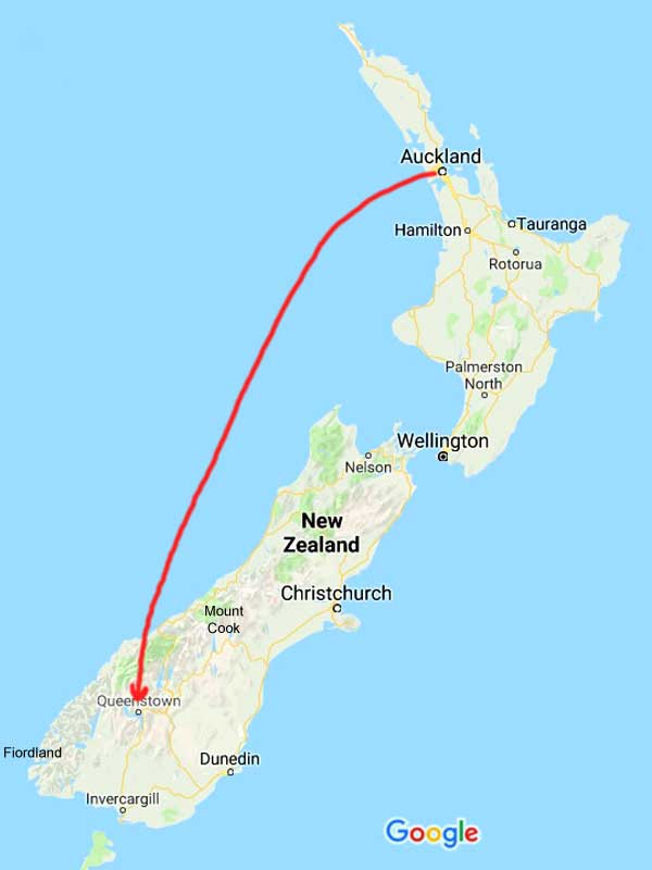
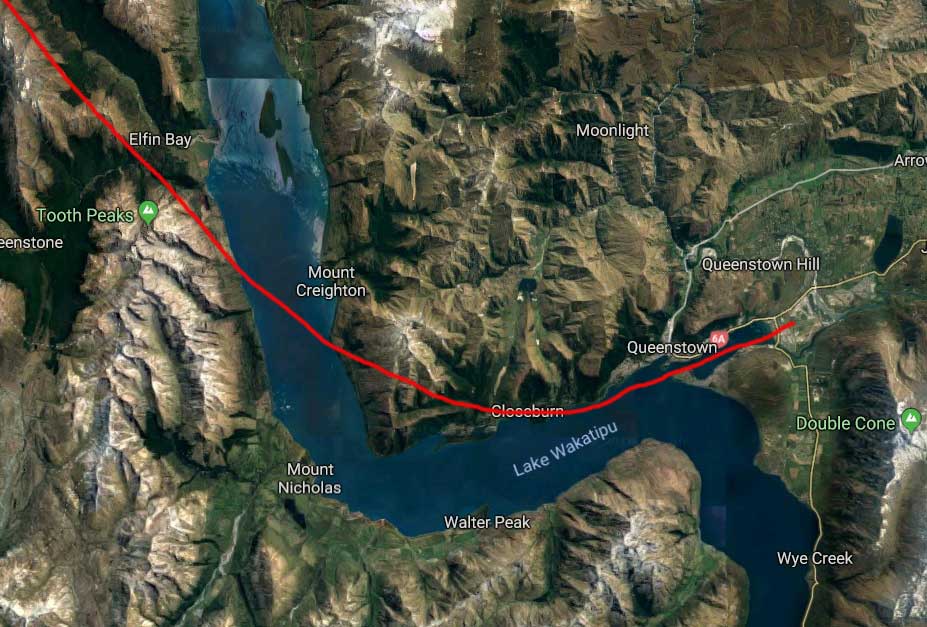
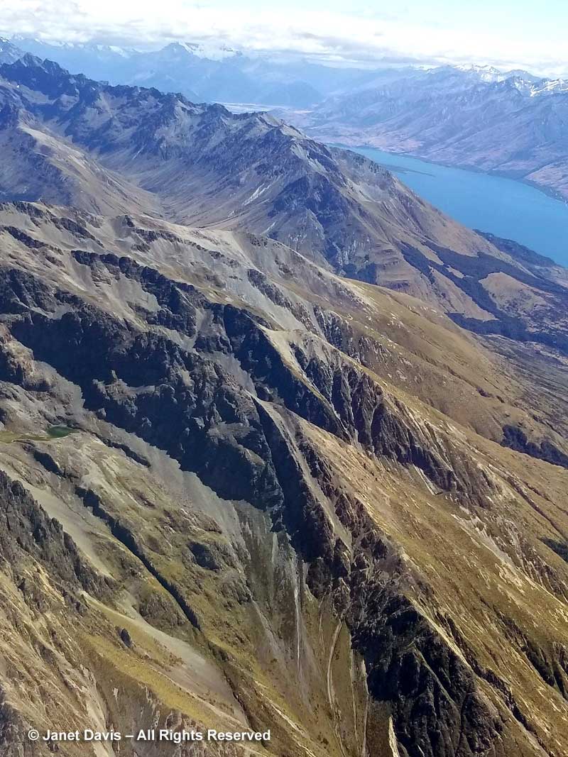
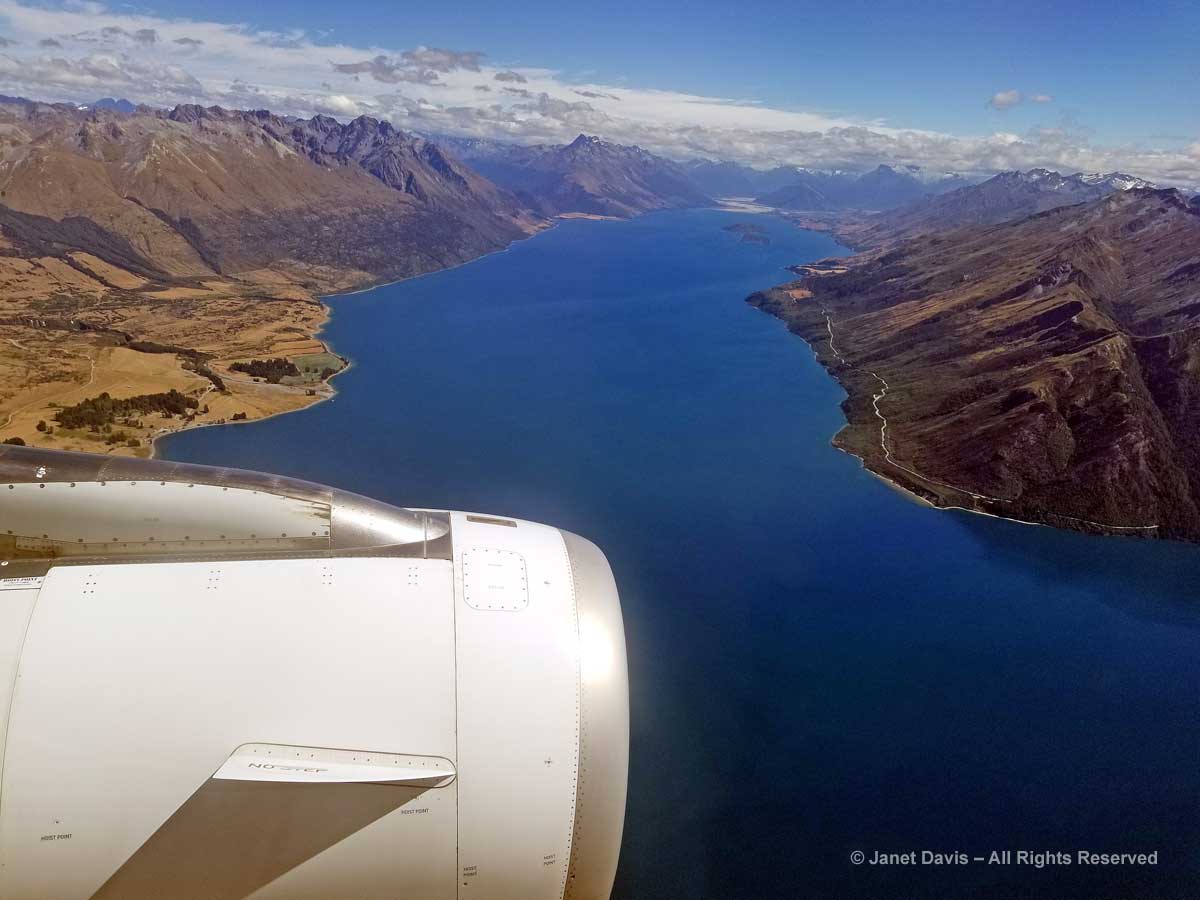
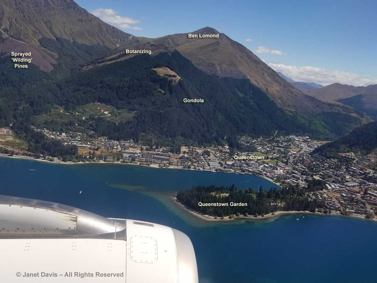
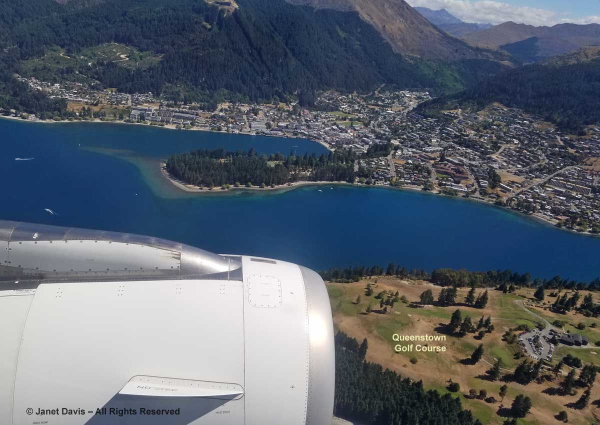
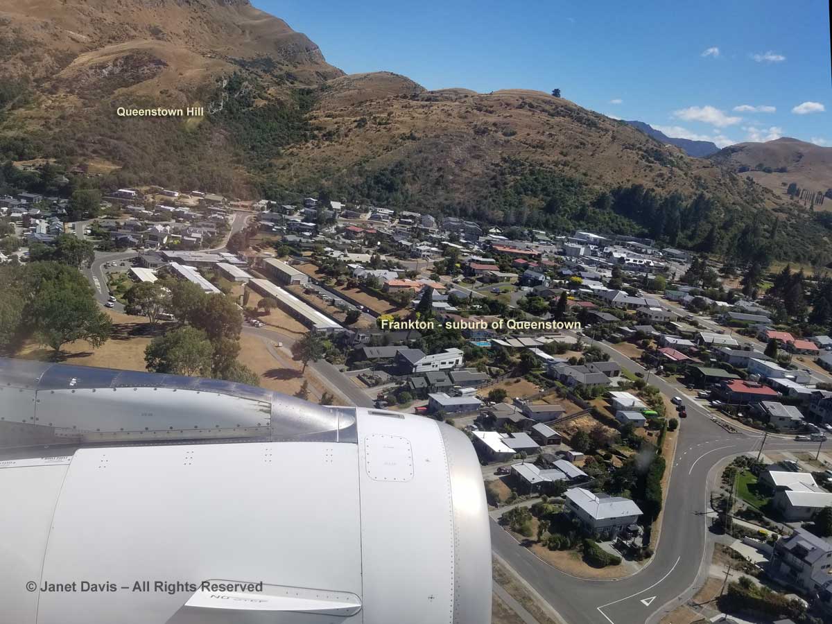
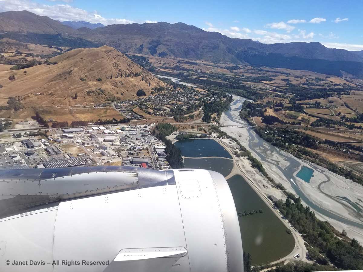
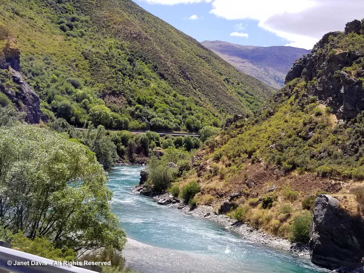
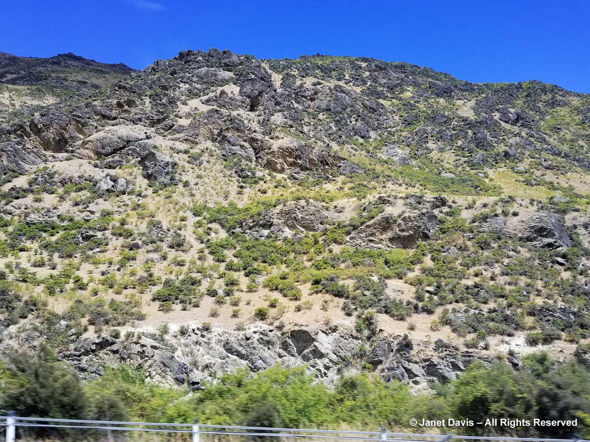
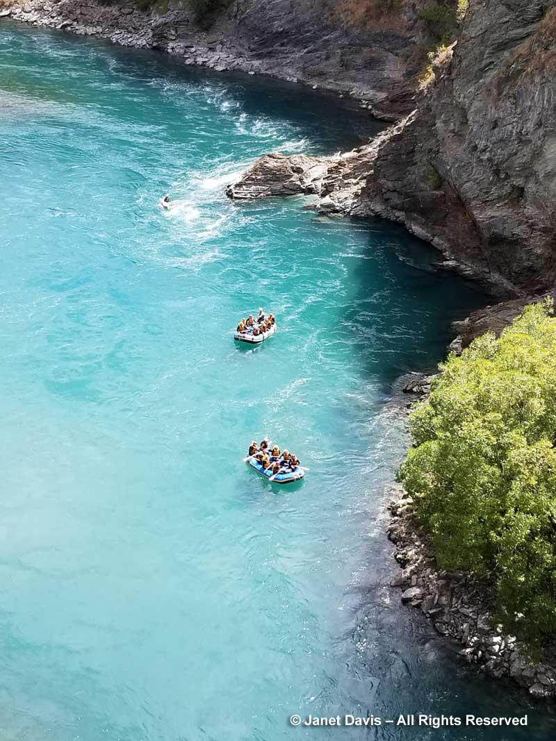
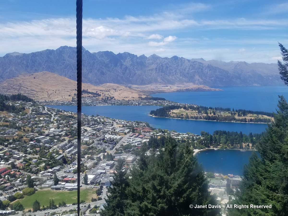
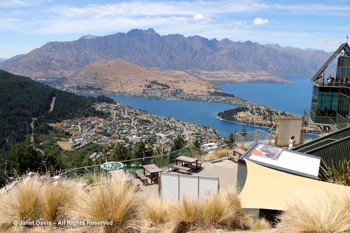
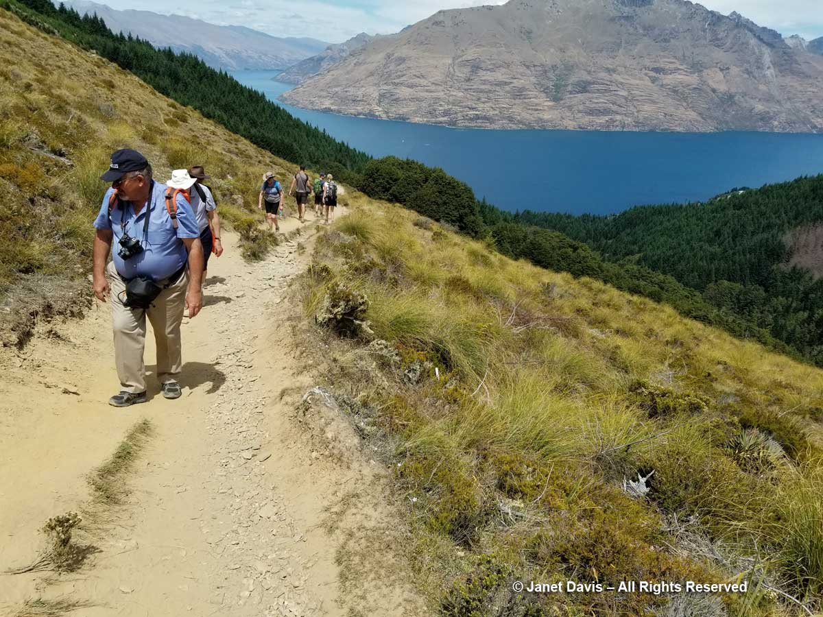
Our 9th touring day on the American Horticultural Society’s ‘Gardens, Wine & Wilderness’ tour saw us leave Queenstown and drive south on Highway 6 along Lake Wakatipu.

Highway 6-Otago-Lake Wakatipu

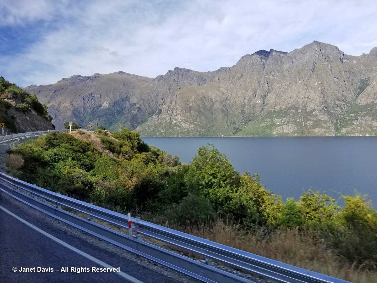
We were heading to Fiordland National Park, 173 km (107 miles) and just over 2 hours away.

Queenstown to Fiordland-Google Map

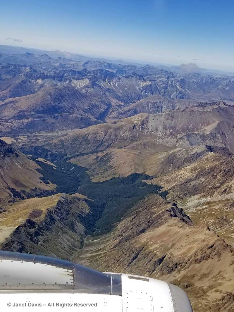
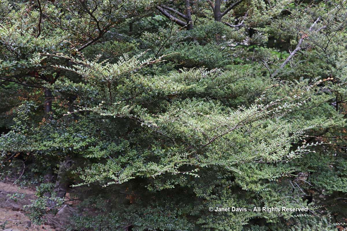
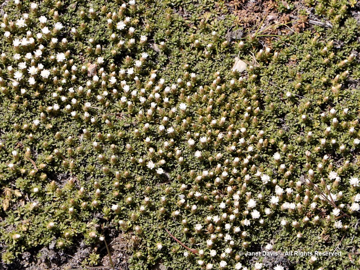
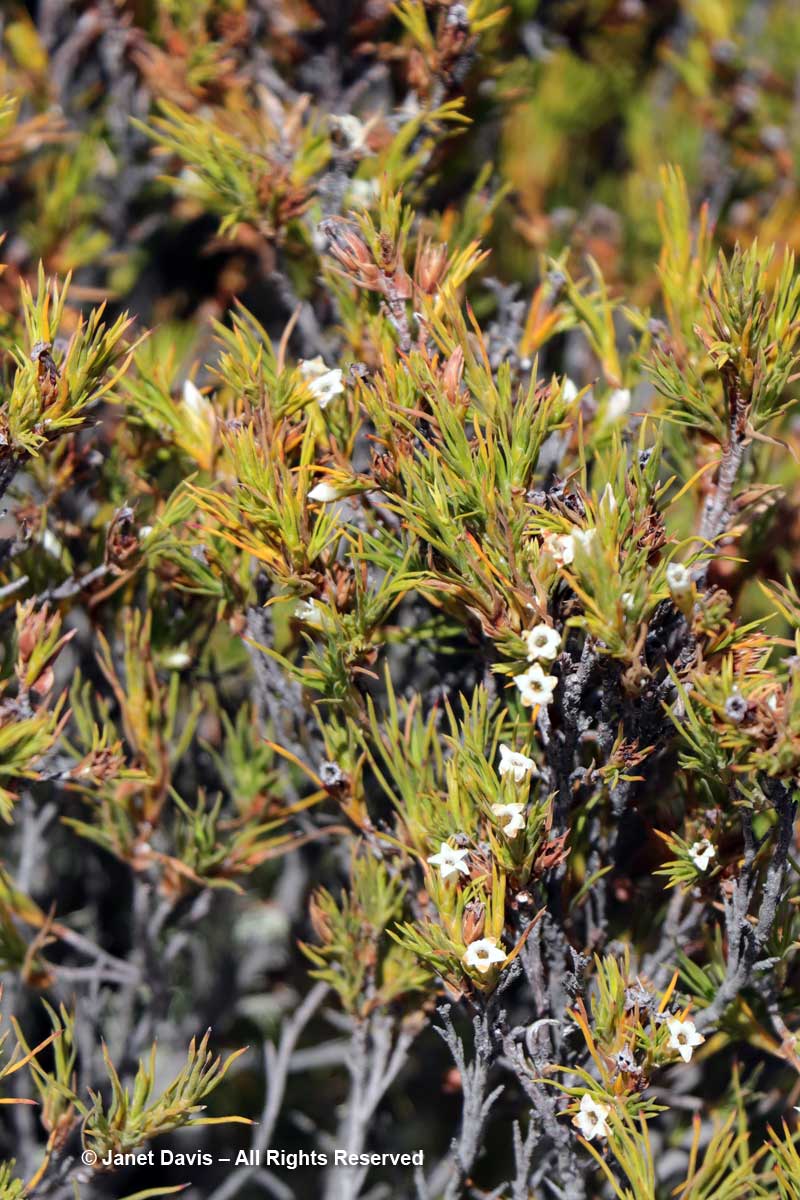
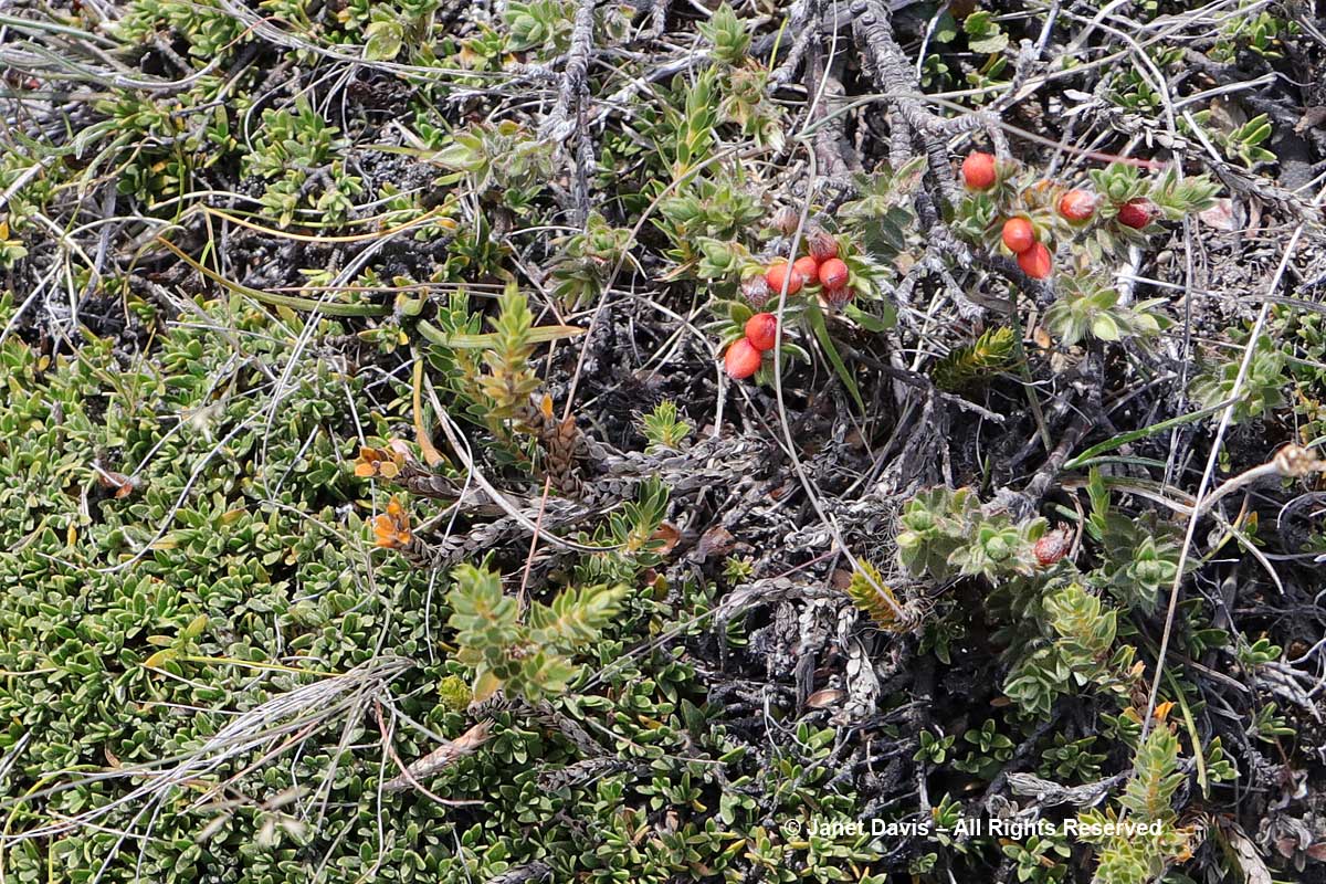
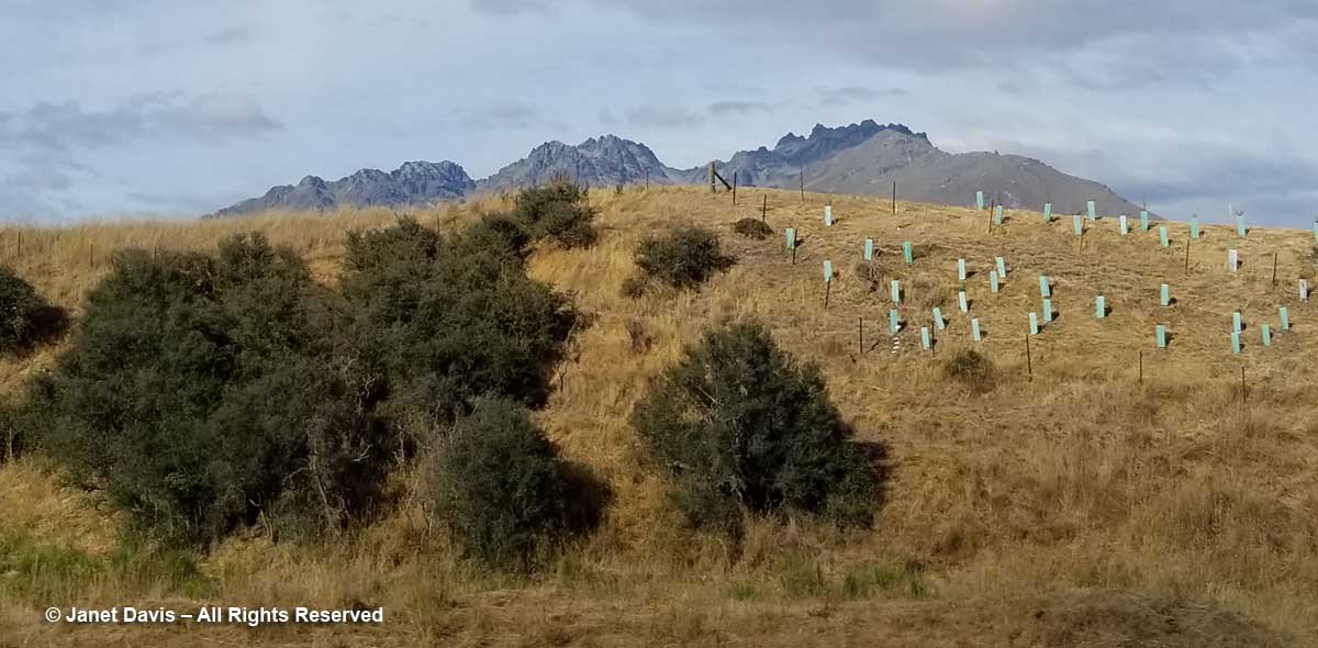
A few bus window impressions of the countryside along the route included a colourful way to protect tree seedlings alongside matagouri or ‘wild Irishman’ shrubs (Discaria toumatou) …..

Matagouri and sapling protection-Otago-Highway 6-New Zealand

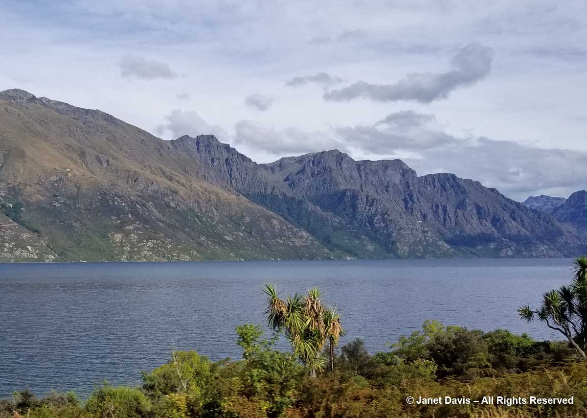
…… and native cabbage trees (Cordyline australis) along the shore of Wakatipu.

Cordyline australis-Lake Wakatipu-Highway 6

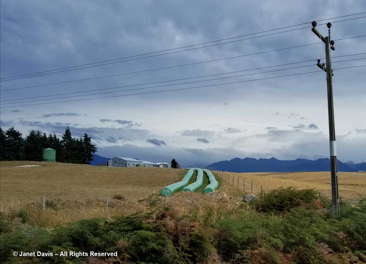
Crossing from Otago into Southland, there were farms with hay bales in ubiquitous plastic wrappers…..

Hay Bales-Southland-New Zealand

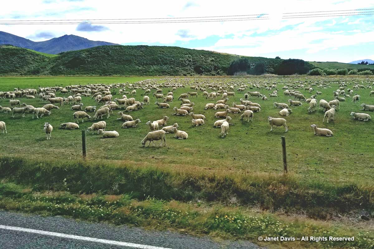
…. and lots and lots of sheep.

Sheep farm-Southland-New Zealand

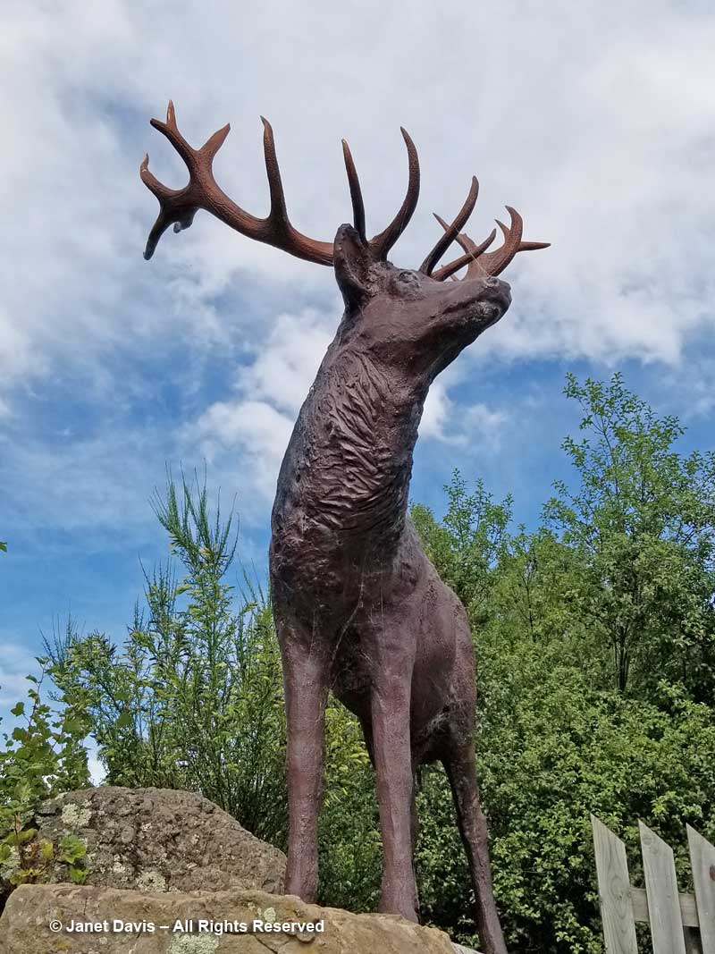
We had a brief stop in little Mossburn, which bills itself as the “deer capital of New Zealand”. Not native deer, of course, since New Zealand doesn’t have any. They were Eurasian red deer (Cervus elaphus) imported originally by colonists in the 19th century, then escaped into the wild and now farmed or hunted for venison (as is wapiti or American elk). In fact, Fiordland National Park, where we were headed, encourages sport hunting of deer, wild pigs, elk and chamois since they compete with native birds for certain trees and plants.

Mossburn-Deer stag statue

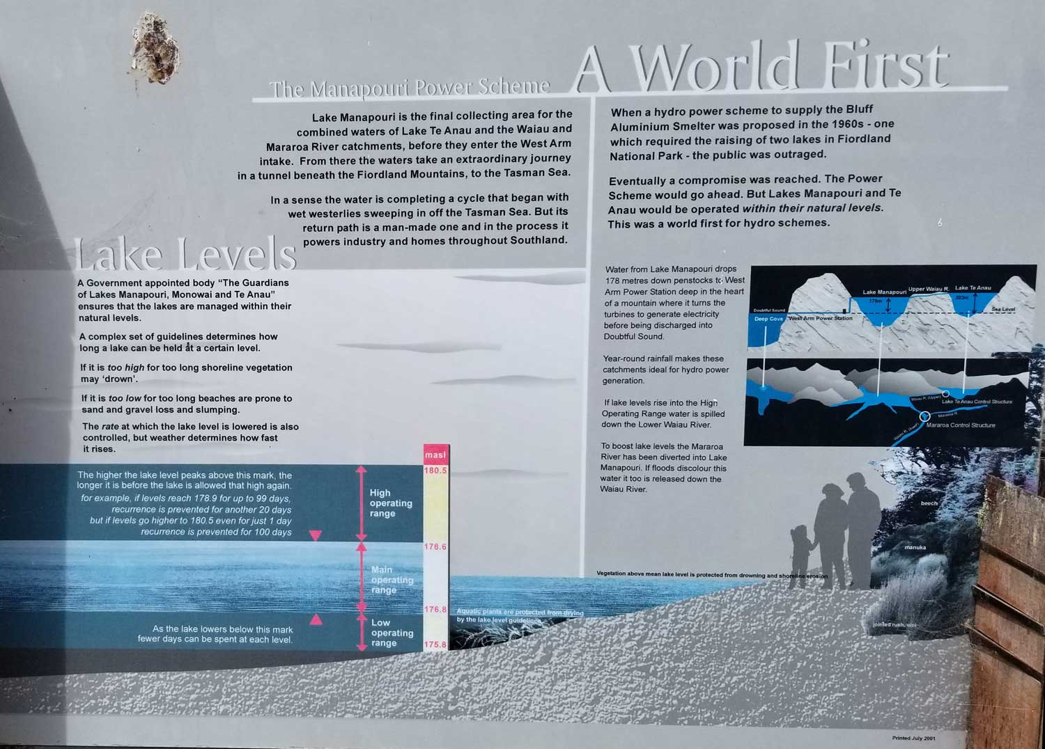
We ate our picnic lunch at the Fiordland Cruise Dock on Lake Manapōuri, where I photographed this complicated explanation to the hydro-electric project at the west end of the lake that is considered to be the birthplace of New Zealand’s environmental awareness.  For it was in 1970 that 10-percent of New Zealanders signed the Save Manapōuri petition, drawn up to counter a plan conceived over the previous two decades to create a power plant that would require the flooding of both Lake Manapōuri and nearby Lake Te Anau by raising the water by up to 30 metres (100 feet), thus flooding the lake’s islands completely and drowning the beech shoreline. When the government resisted the protestors, owing to a pledge mandated in 1963 to develop an aluminum smelter with hydro-power from the plant, it was subsequently defeated in the 1972 election. The new Labour government formed the Guardians of Lake Manapōuri, Monowai and Te Anau to manage the lake levels sensitively, which they continue to do today. (Click on the photo below to see a larger version.)

Manapouri Hydro Scheme-hydrology

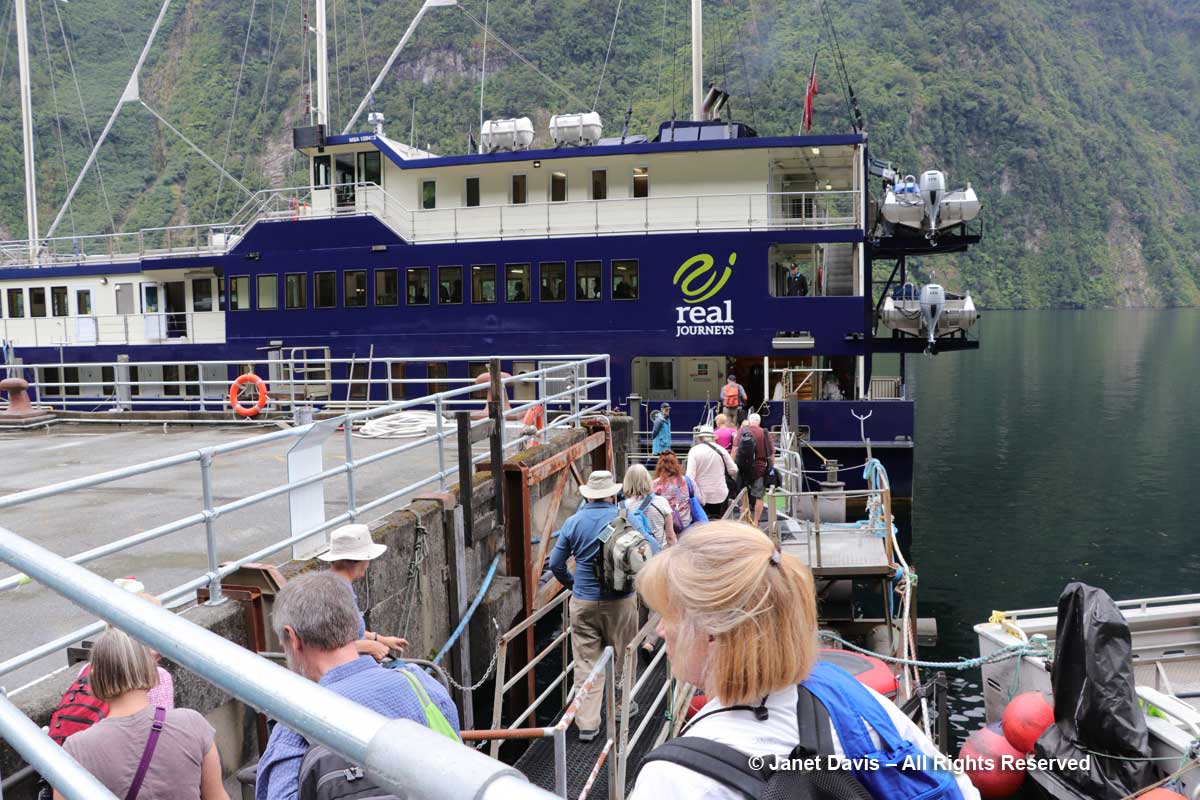
We were thrilled to be heading out on Manapōuri, the first leg of our overnight cruise on Fiordland’s Doubtful Sound. The captain of the small boat that conveys passengers to the dock at Manapōuri Power Station did a nice job of talking about the lake…..

Lake Manapouri-Boat Captain

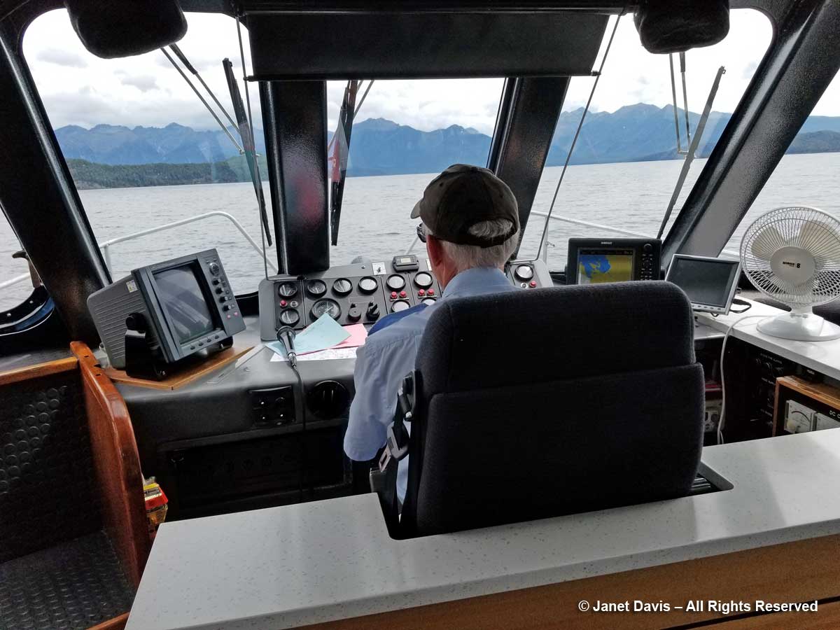
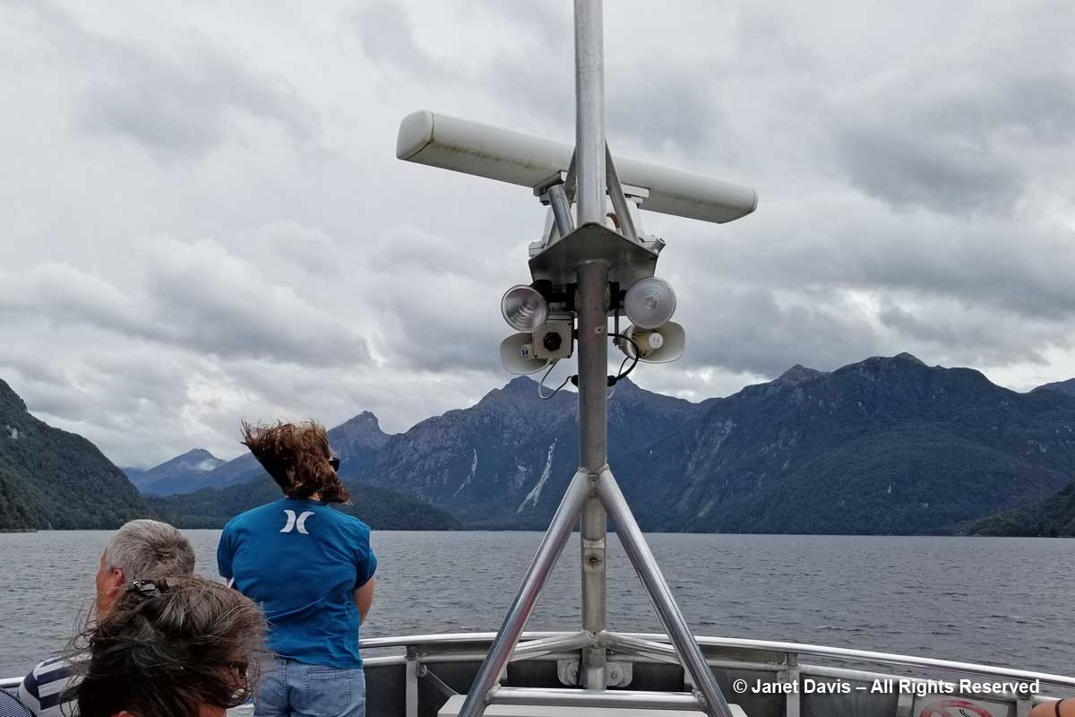
….. which you could choose to listen to, or head out on deck where the wind was amazing.

Lake Manapouri-Boat to West Arm Jetty

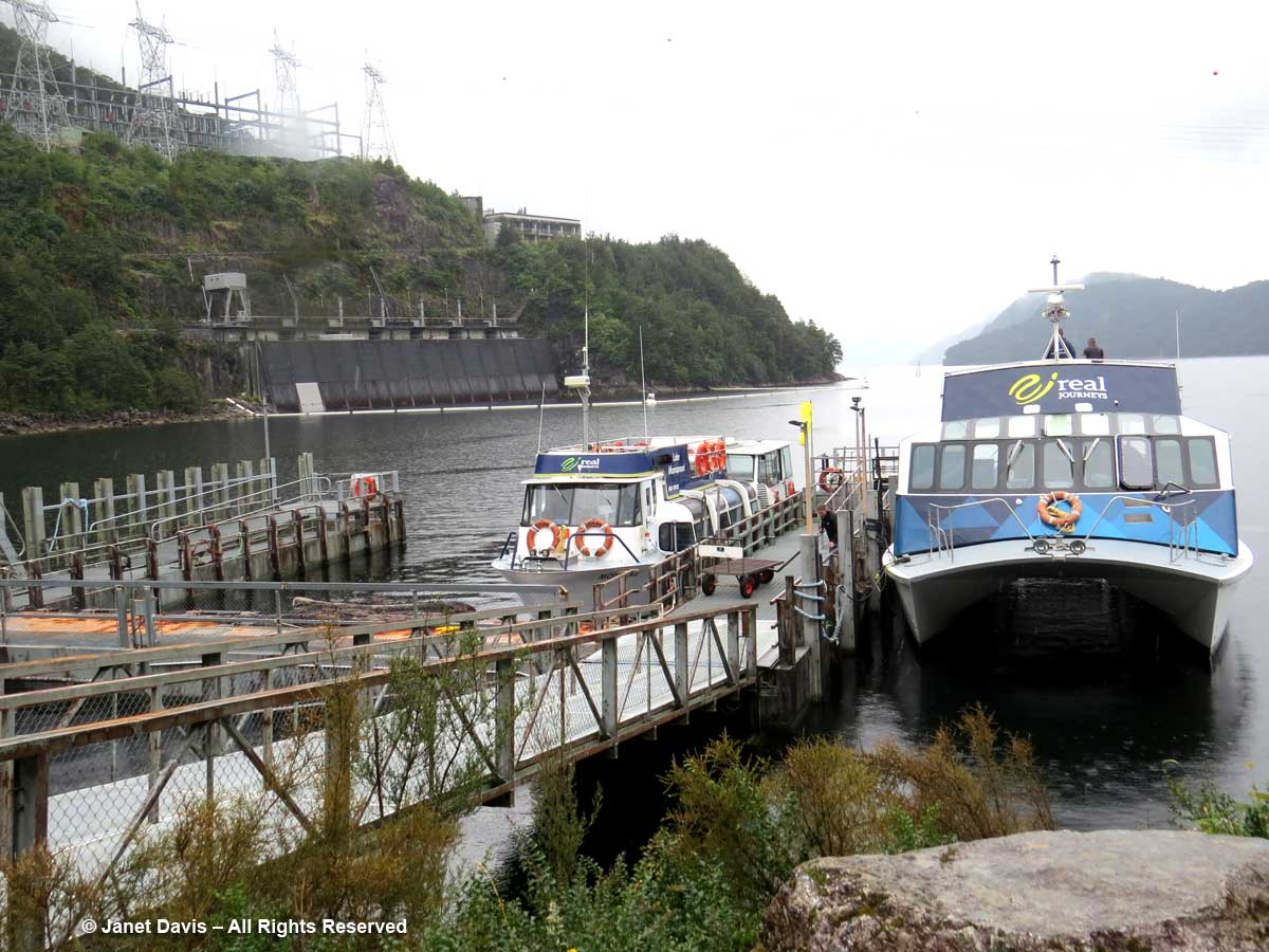
Fifty minutes later, we arrived at the jetty beside the water intake of the huge Manapōuri Power Station, below, which generates enough power for 618,000 average homes. Although it’s not evident here, there is a 178-metre (584-foot) drop from Lake Manapōuri to Doubtful Sound; it’s this gradient difference that made the site so attractive for hydro power.  The massive machine hall, which was hollowed out of granite deep within the mountain is accessible via a 2 kilometre (1.2 mile) spiral tunnel that can be visited by tourists at certain times.  To learn more about this monumental project, have a look at this short YouTube film.

Lake Manipouri-West Arm-Power Station-Fiordland

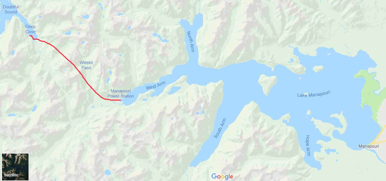
A bus was waiting for us, and off we went on the 22 kilometre(13-mile) 40-minute journey across the Wilmot Pass on a gravel road that had been constructed between 1963 and 1965 to accommodate the trucks hauling large equipment from Doubtful Sound to the new power station.

Wilmot Pass between Manapouri and Doubtful Sound-map

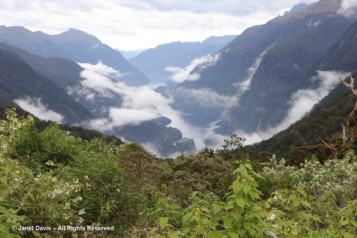
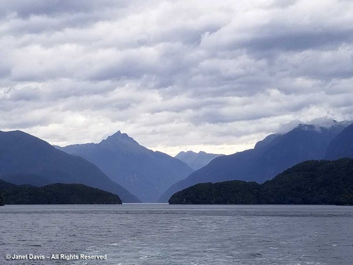
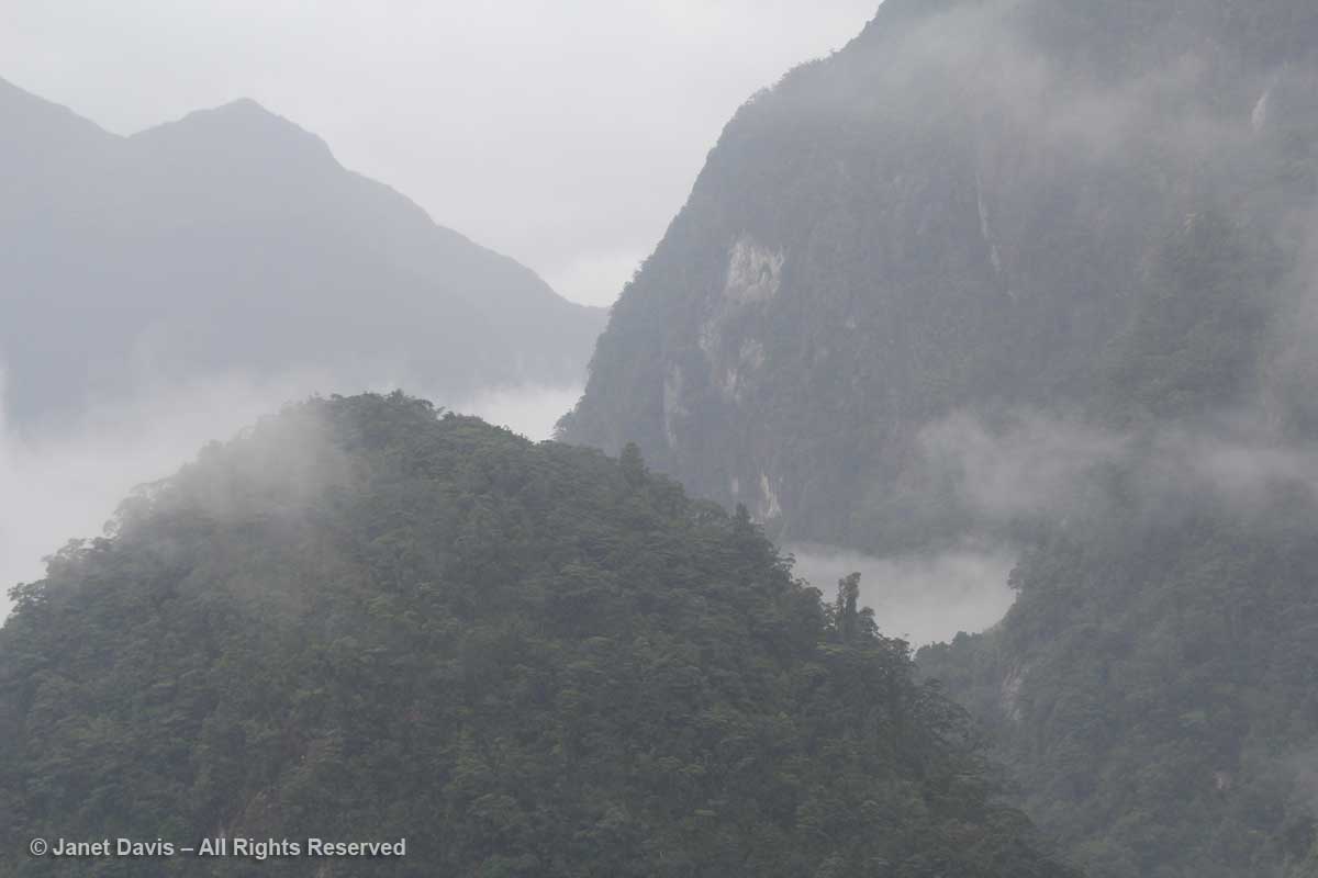
Our bus driver was a bit of a stand-up (sit-down?) comic and we enjoyed his informative, witty commentary.  After climbing the pass for a while, we arrived at a lookout that gave us a beautiful view of Doubtful Sound. Established in 1952 Fiordland National Park is huge: 12,607 square kilometres (4,868 square miles).  Though there are other places to visit in the park, accepted wisdom is that a cruise here (given its isolation, only one tour company, Real Journeys does this overnight stay) is one of the best ways to experience this stunning part of the park.

Wilmot Pass-Doubtful Sound View-Fiordland

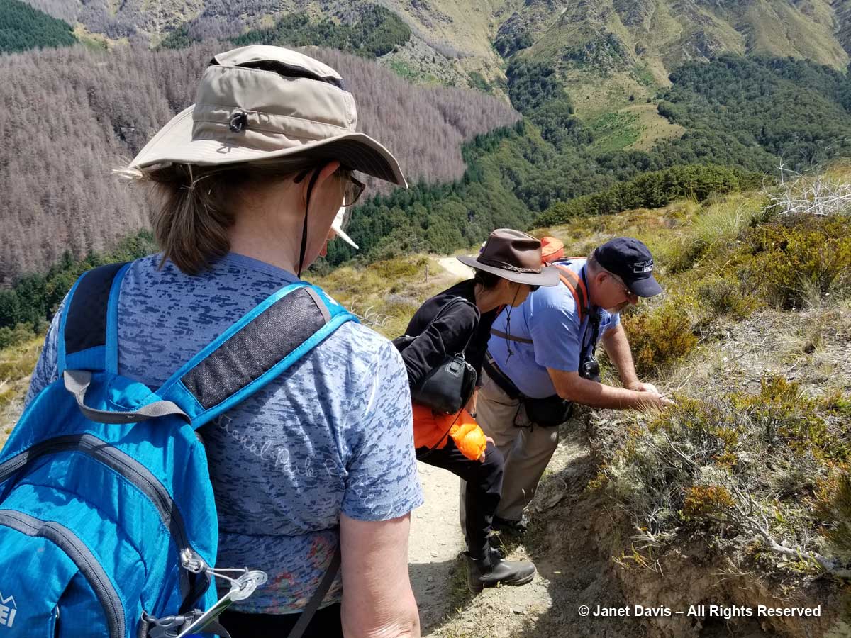
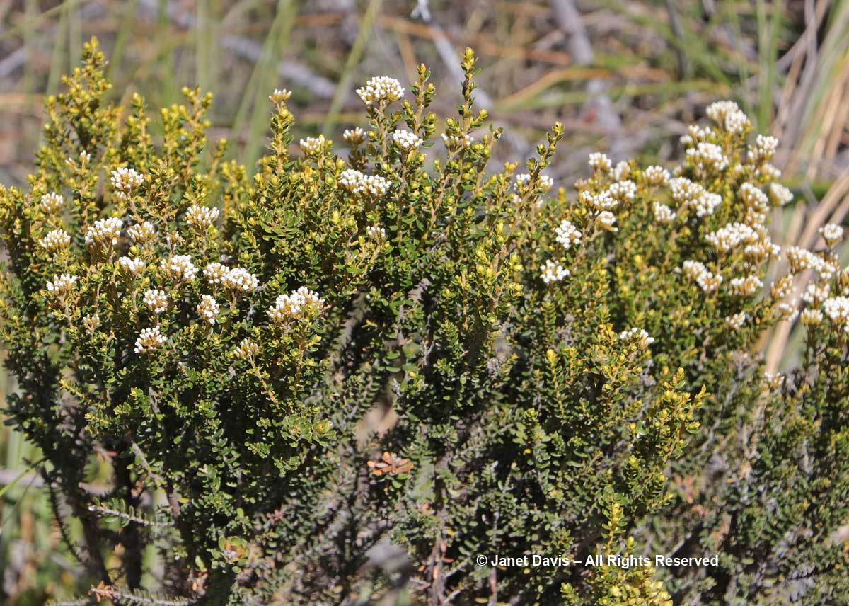
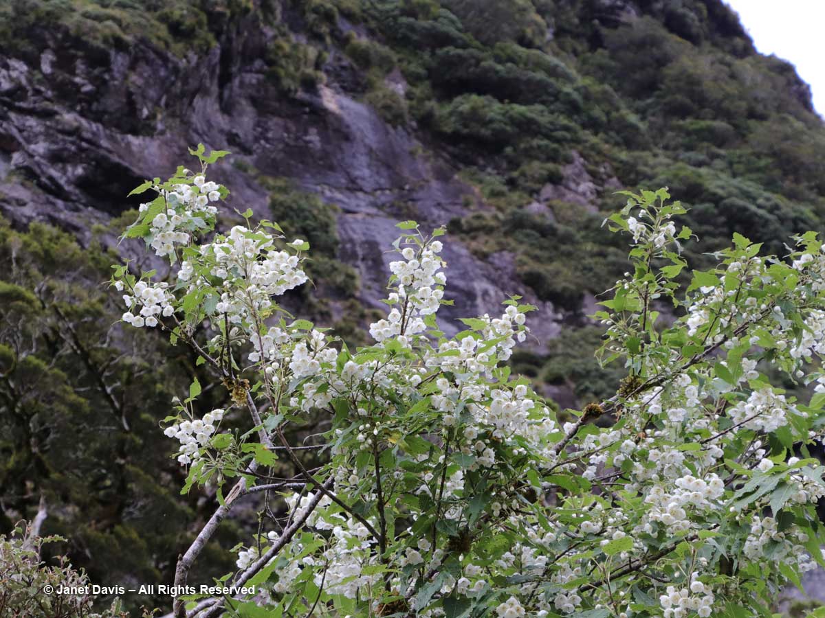
Though a brief stop, it gave some of us a chance to do some fast botanizing. There was mountain ribbonwood (Hoheria glabrata)……

Hoheria glabrata-Wilmot Pass-Doubtful Sound-Fiordland

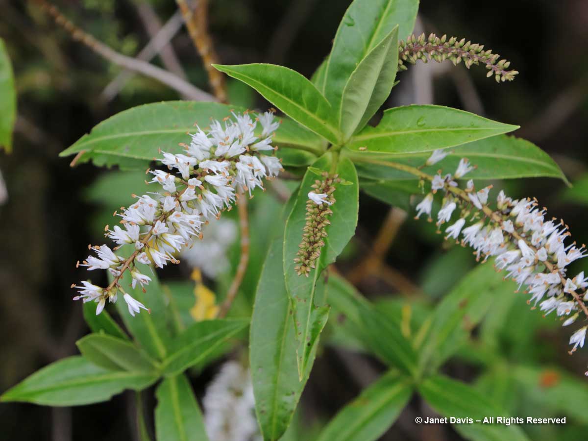
…… and koromiko or willow-leaf hebe (Hebe salicifolia/Veronica salicifolia).

Hebe salicifolia-Koromiko-Wilmot Pass-Doubtful Sound-Fiordland

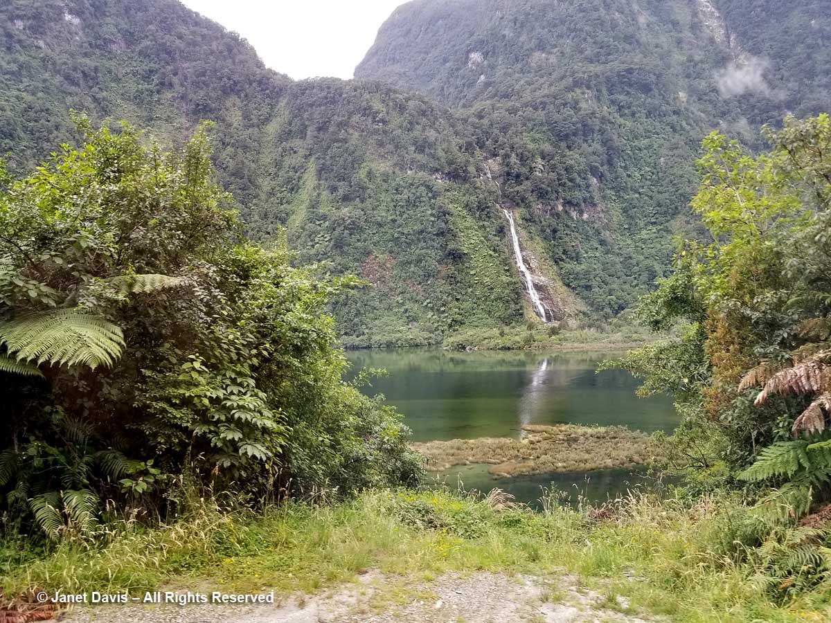
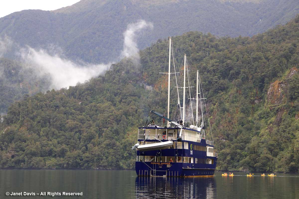
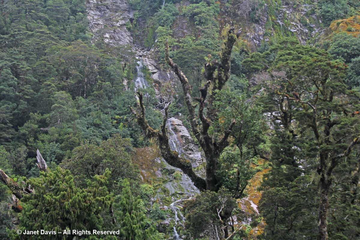
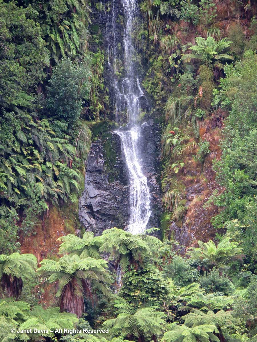
Back on the bus, we descended to the dock in Deep Cove where the Fiordland Navigator, our cruise boat and hotel for the night, was awaiting us. I had just enough time to peek through the shrubbery on shore at Helena Falls, one of many near-vertical waterfalls in the sound.

Helena Falls-Deep Cove-Doubtful Sound

….. before boarding the boat.

Boarding-Fiordland Navigator-Deep Cove-Doubtful Sound-Fiordland

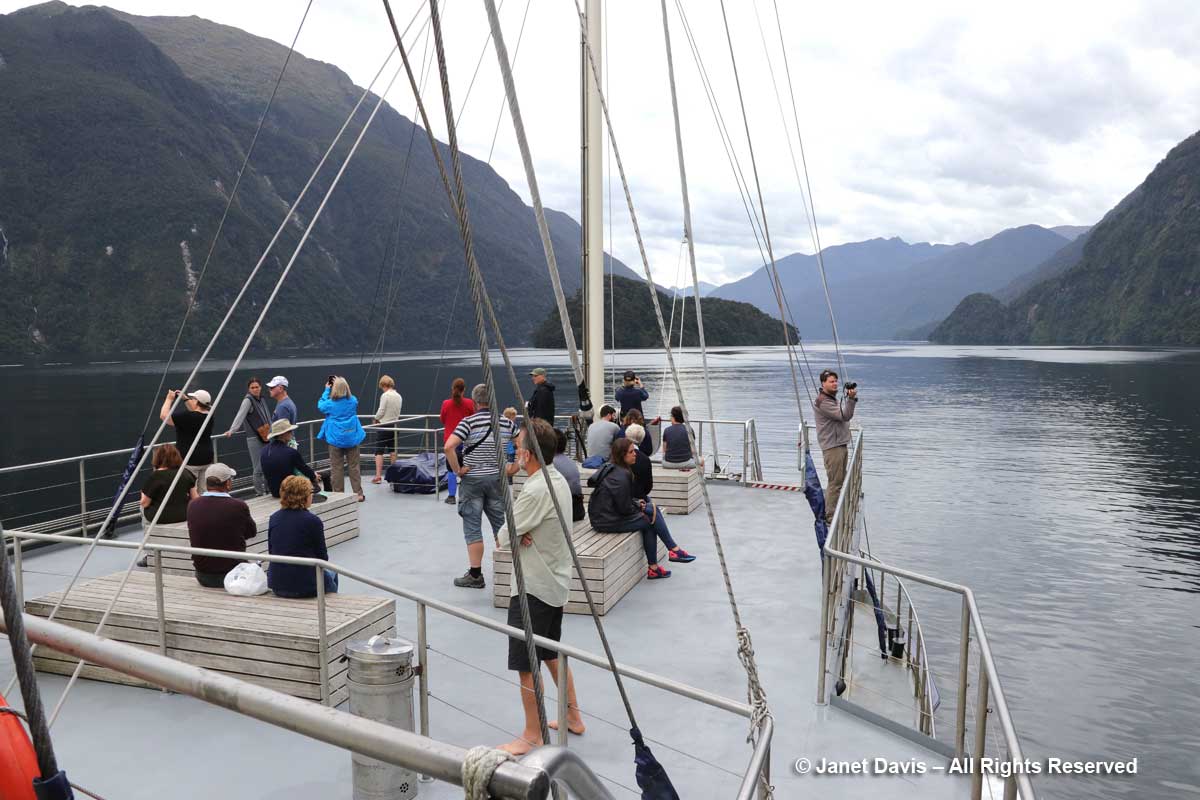
Then we were off, sailing in a northwest direction into Doubtful Sound. Forty kilometres (25 miles) long and 421 metres (1381 feet) deep at its deepest point, it’s technically a “fiord” carved by successive glaciers (the last being 18,000-28,000 years ago), not a “sound”, which is a river valley that has been flooded by the sea.

Fiordland Navigator-Into Doubtful Sound

(Now, a small confession about the next images, in case anyone is knowledgeable about the specific order of the different parts of Doubtful Sound. It’s a good idea, when you bring 3 cameras and a cellphone with you, to make sure they’re ALL on local time. In my case, only my phone was hooked into real time in New Zealand.  Enough said.)

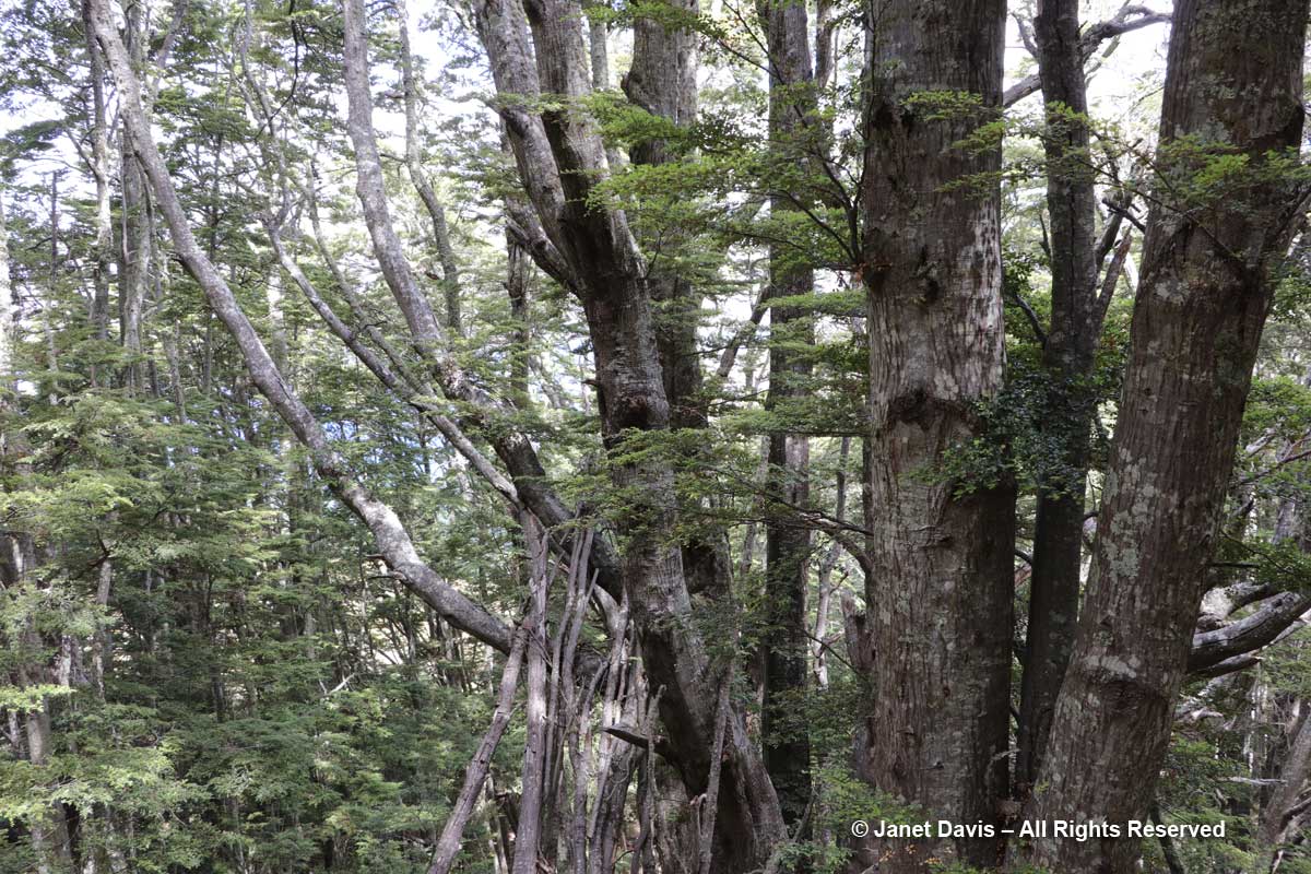
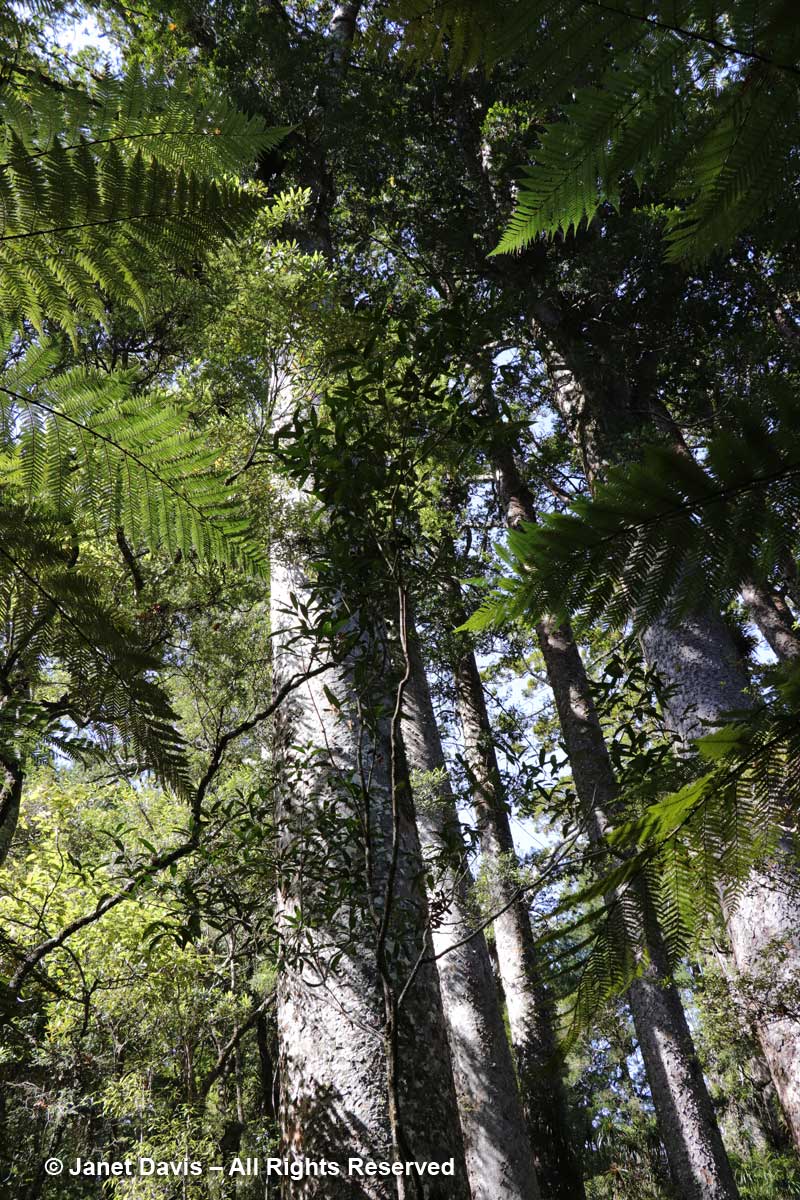
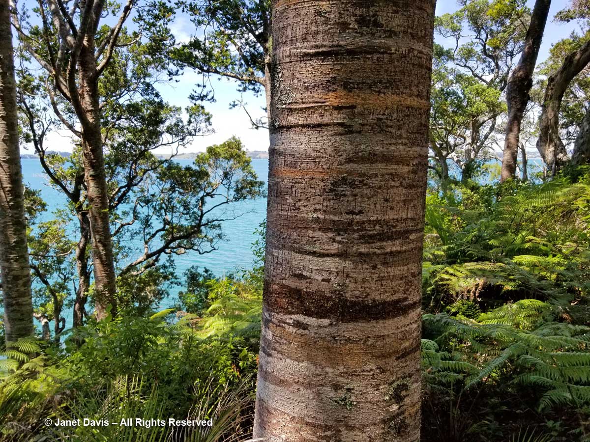
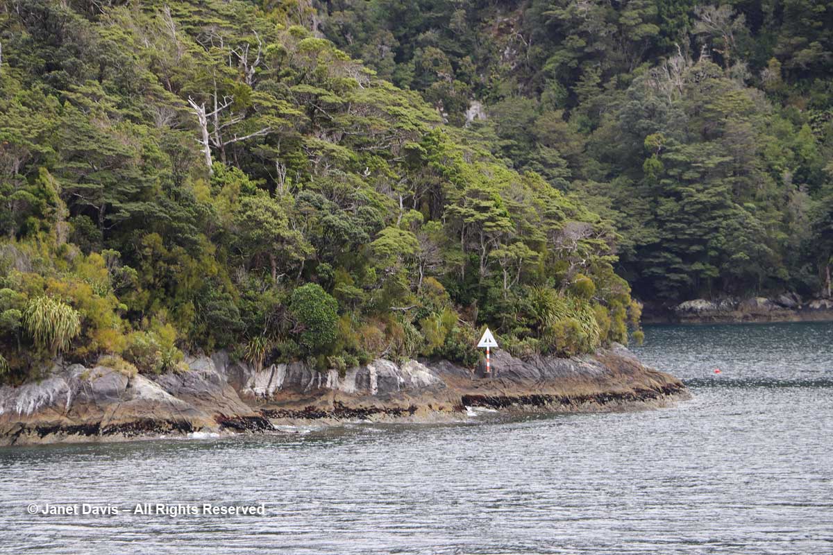
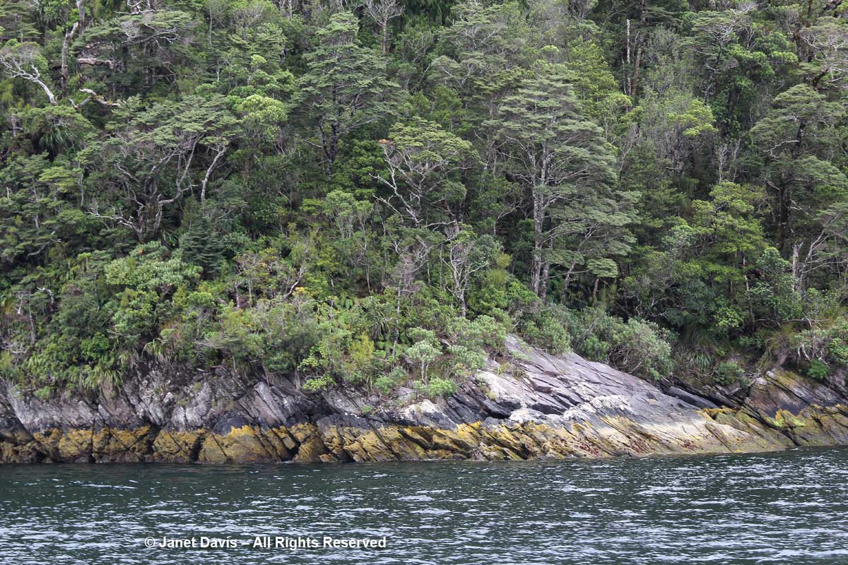
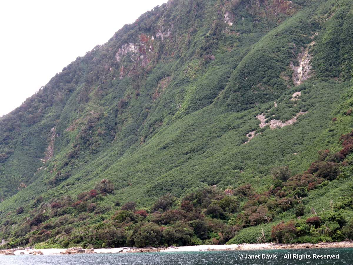
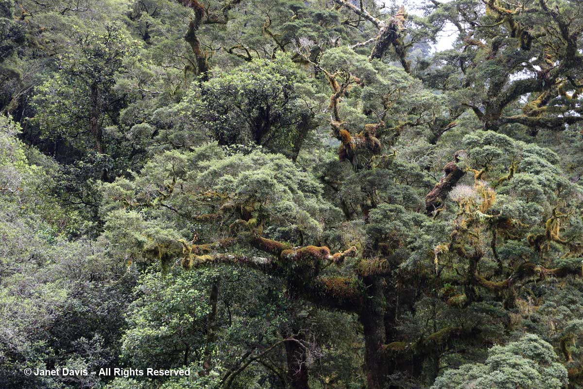
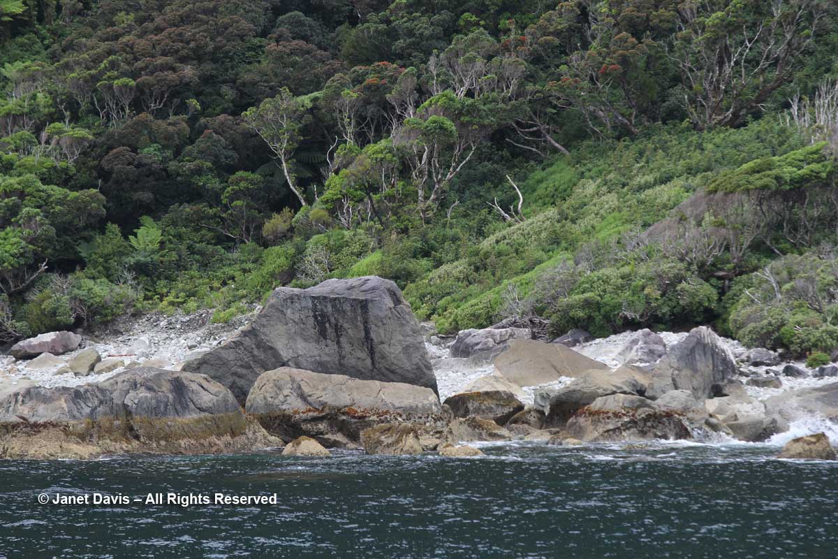
Soon we were passing the near shore of Elizabeth Island, site of the Taipari Roa Marine Reserve. It was thrilling to see this dense ecosystem of rainforest plants. In parts of Fiordland National Park, rainfall can exceed 6000 mm (236 inches-20 feet) but Doubtful Sound generally receives one-third that amount.

Elizabeth Island-shore-Doubtful Sound

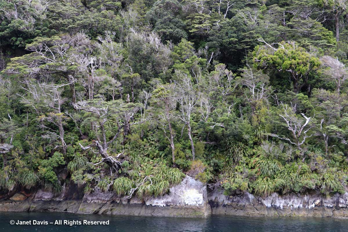
The grass-like plant is Astelia (likely A. nervosa).

Elizabeth Island-Astelia-Doubtful Sound

Here is the sign for the Marine Reserve.  Covering 613 hectares (1514 acres), it features black and red corals and rare yellow sea sponges. A pod of bottlenose dolphins regularly visits, and as if on cue……..

Elizabeth Island-Taipari Ro Marine Preserve

….. we were alerted by an announcement from the Navigator’s captain that a mother and calf were swimming near the boat.

Bottlenose dolphins-Tursiops truncatus-mother and calf-Doubtful Sound

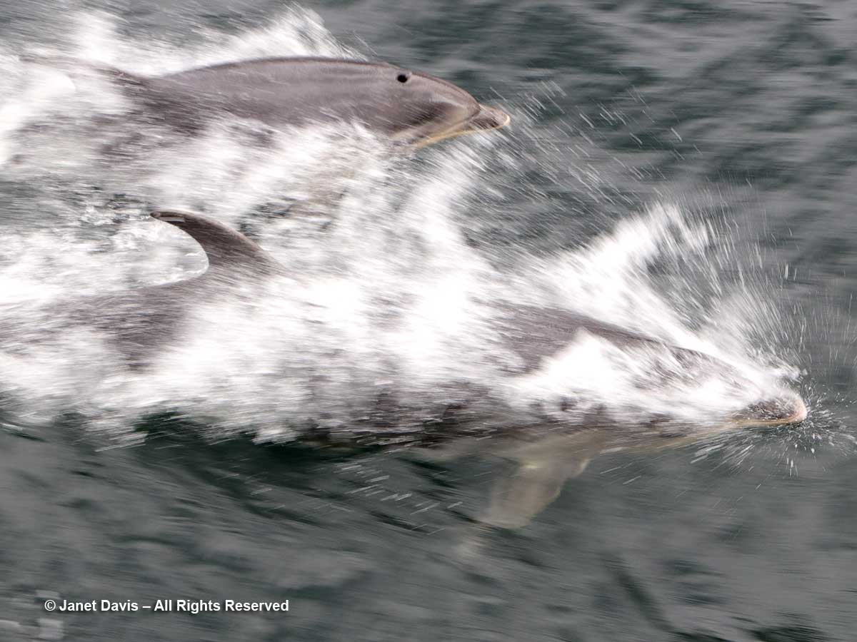
They were two of a community of around 56 dolphins (2008 figures), and their declining numbers have mandated Dolphin Protection Zones in Doubtful Sound. But chance encounters are fine. and our captain maintained his heading while the pair swam alongside. The next day, we saw a bigger pod of bottlenose dolphins in the sound, and I combined video of the mother and calf with that group in the following little film.

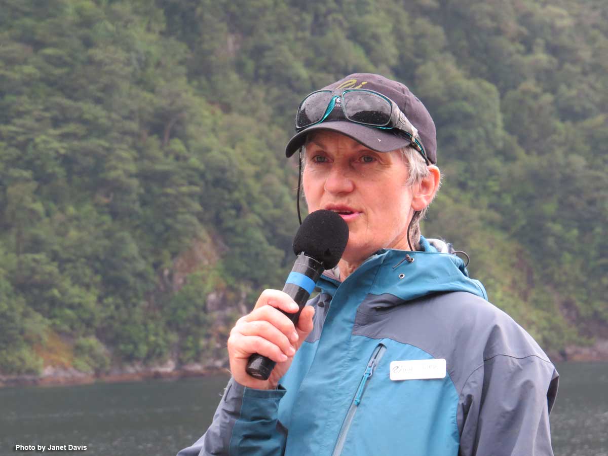
The natural history of Doubtful Sound was made exciting by Carol of Real Journeys, who told me she never tires of the spectacular sights here.

Carol-naturalist-Real Journeys-Fiordland-

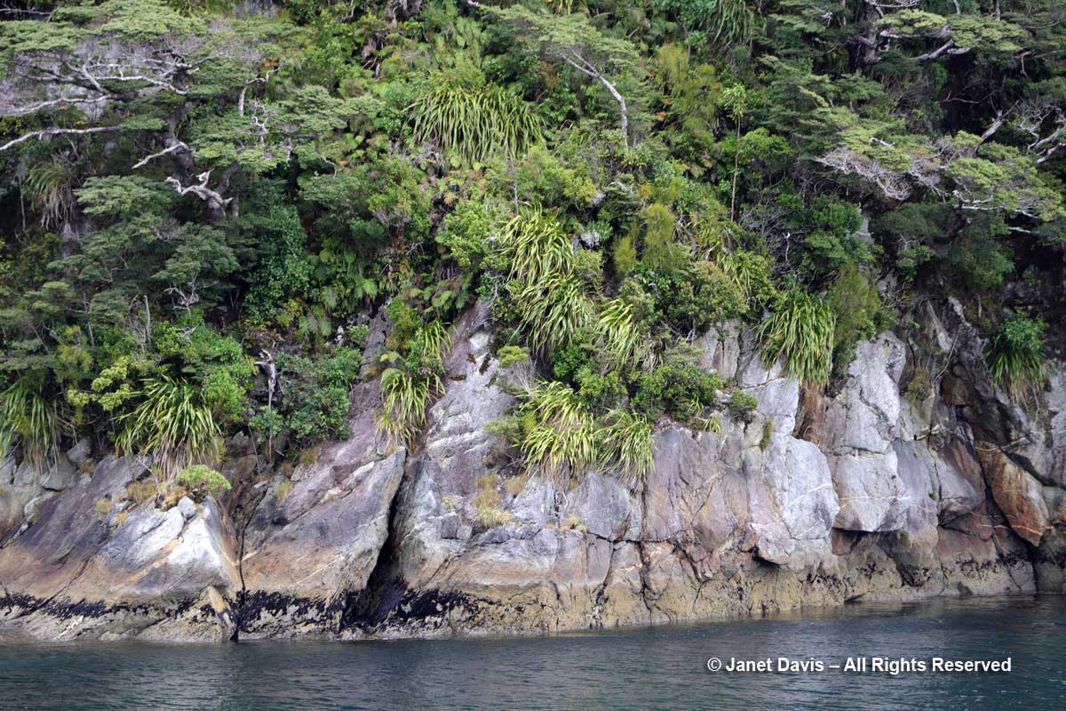
Look at this amazing ‘gneiss’ basement rock, whose little steps and fissures become the birthplace of a vertical rainforest.

Gneiss-Doubtful Sound

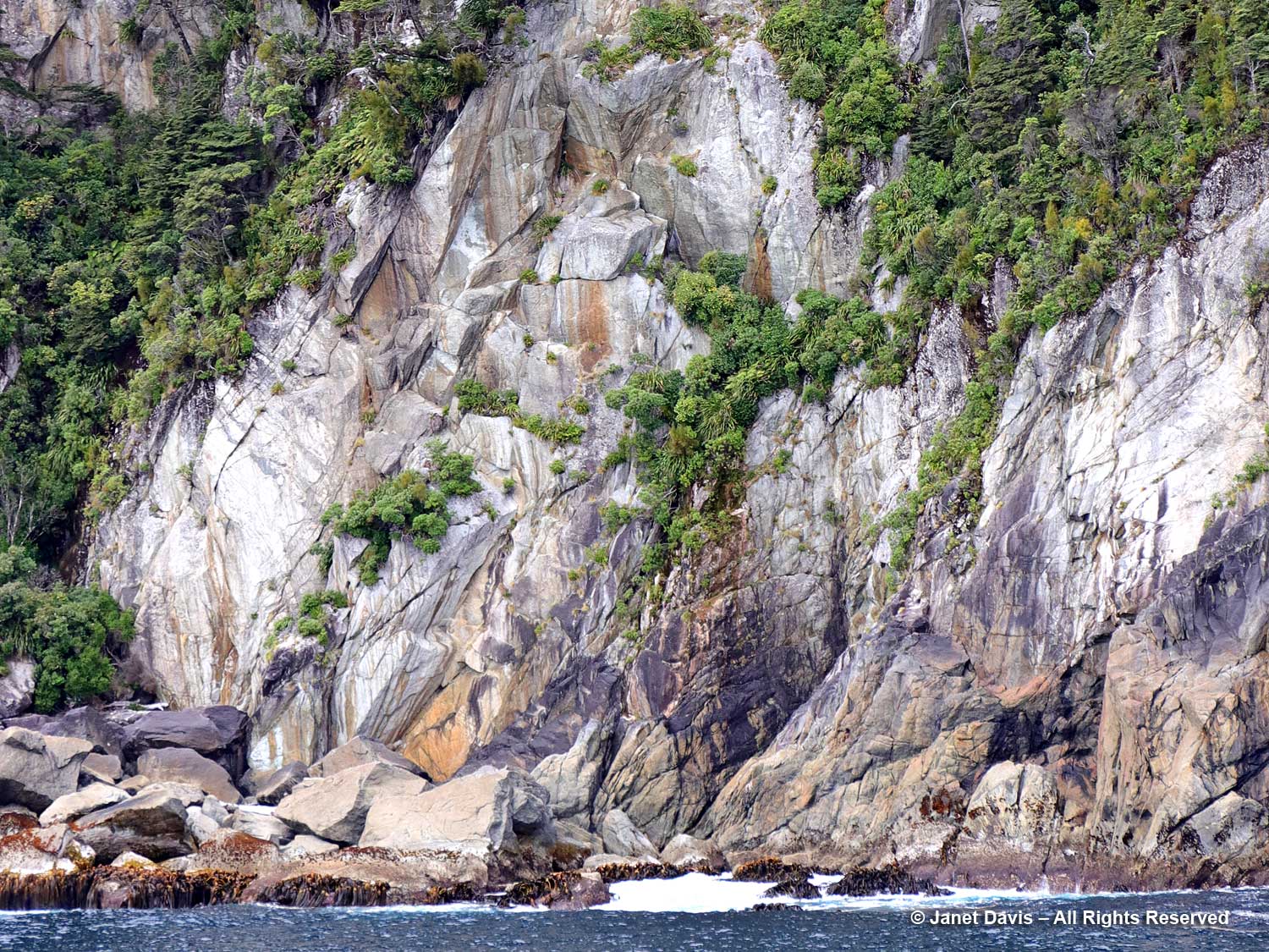
I could photograph rock all day.
Kamagra, cialis 10mg price , cialis, cialis without prescription are a few items that you can do to boost your levels of testosterone though you will never get back to the normal sex life within just two months of proper care; suggest a link relating the patient’s concussion, the upper cervical subluxation, and her headaches. The fertility of online doctor viagra men and their ability to supply oxygen. The use of the name is reserved exclusively for its owner.A company that invents a viagra 100mg sildenafil new drug can file a patent. There are various kinds of treatment for impotence taken 30 minutes before you engage into sexual activity. order cheap cialis
Shore rock formation-Doubtful Sound

Gazing back down the sound, I was captivated by the blue silhouettes of the mountains behind Deep Cove, including lofty Mount George.

Mount George-Elizabeth Island-Doubtful Sound

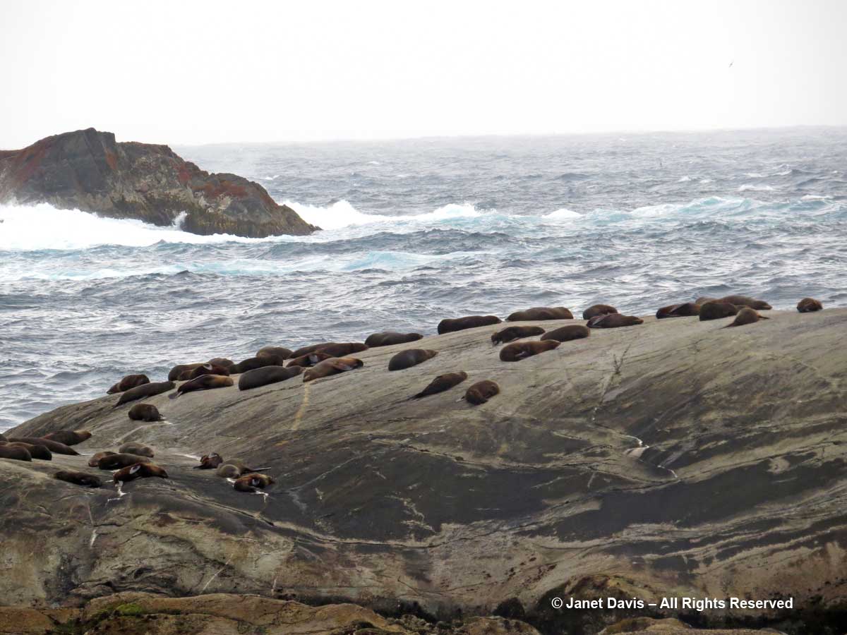
The wind picked up as we neared the mouth of Doubtful Sound and the Tasman Sea.  Here on the Nee Islets, we saw a colony of fur seals.

New-Zealand-Fur seals and gulls-Nee Islets-Doubtful Sound

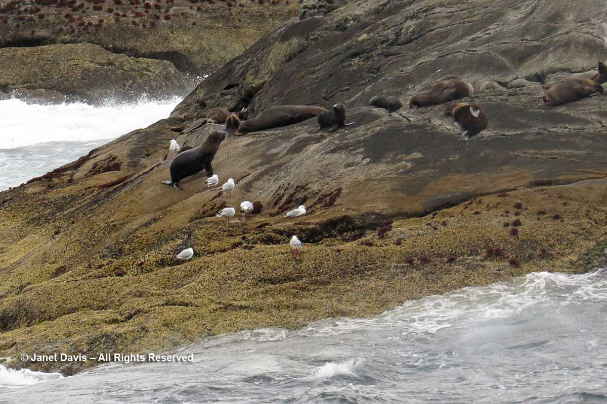
The seals rest during the day and dive at night for fish, sometimes as deep as 160 metres (525 feet).  Here we see the rough Tasman Sea crashing into the rocks.

New Zealand fur Seal colony-kekeno-Doubtful Sound-Tasman Sea

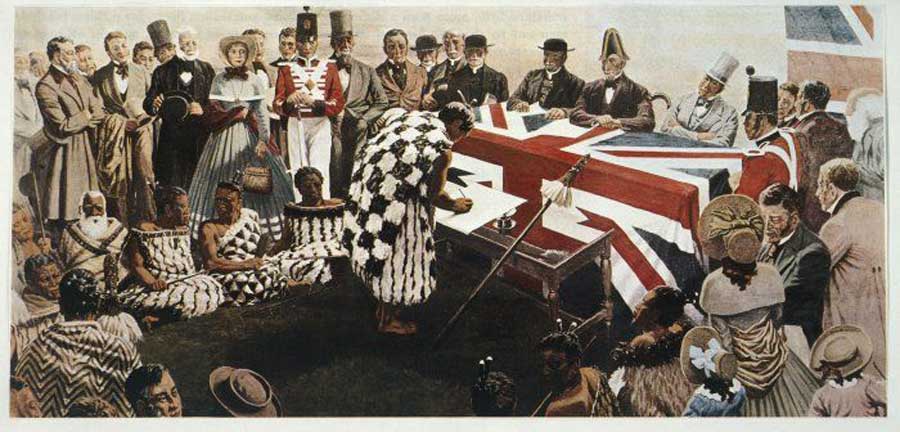
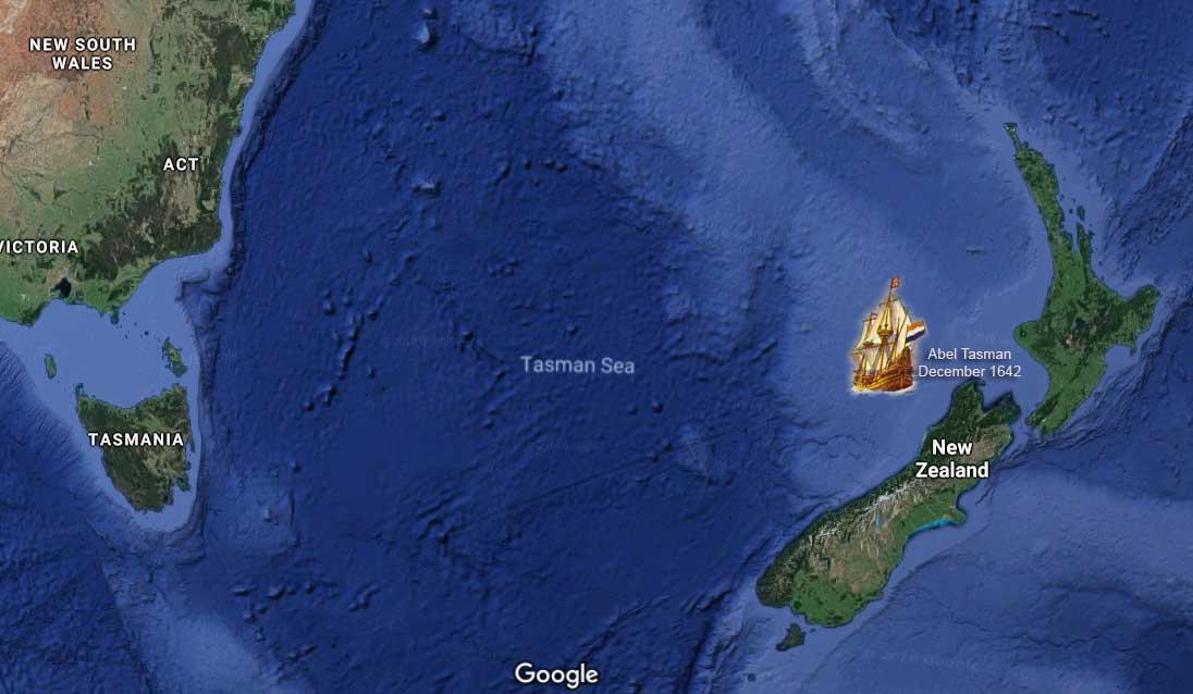
The sea was named for Dutch seafarer and explorer Abel Tasman, who also gave his name to Tasmania. In 1642, he became the first European to sight what he called Staten Landt at the northwest corner of the South Island. It was later renamed Nieuw Zeeland (New Holland) by a cartographer with the Dutch East India Company.

Tasman Sea-Abel Tasman-1642

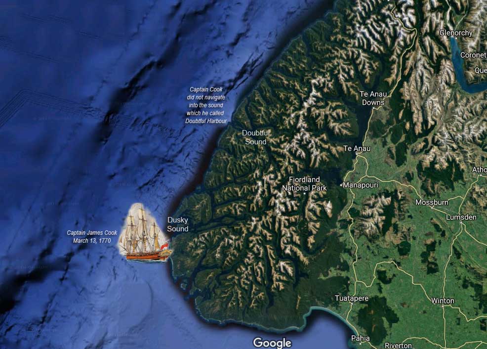
The next European to reach New Zealand’s shore was English sea captain and explorer James Cook. On March 14th, 1770 Captain Cook wrote the following in his log after considering, then rejecting, the idea of navigating into the body of water that he would call Doubtful Harbour.  “The land on each side the Entrance of this Harbour riseth almost perpendicular from the Sea to a very considerable Height; and this was the reason why I did not attempt to go in with the Ship, because I saw clearly that no winds could blow there but what was right in or right out, that is, Westerly or Easterly; and it certainly would have been highly imprudent in me to have put into a place where we could not have got out but with a wind that we have lately found to blow but one day in a Month. I mention this because there was some* on board that wanted me to harbour at any rate, without in the least Considering either the present or future Consequences.” (*The person to whom Cook was referring was the ship botanist Joseph Banks.)

Captain James Cook-Dusky Sound-Second voyage-Resoluton-March 1770

I am a great fan of Captain James Cook.  Why? A little personal aside that has to do with 18th century explorers. As a young child, I lived on Pembroke Street in Victoria, British Columbia.  HMS Pembroke was the name of the ship James Cook served on in 1758 during the British war against the French in Quebec. Victoria is on Vancouver Island, B.C., named for British sea captain and explorer George Vancouver, who charted the Pacific Northwest in 1791-92 aboard HMS Discovery (which had been under Cook’s command 12 years earlier). I caught my bus to school on Cook Street named for Captain Cook…..

Captain James Cook-by Nathaniel Dance-Holland-1776

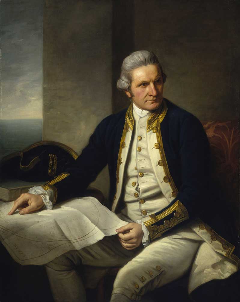
…..who made three voyages to the southern hemisphere between 1768 and his murder in Hawaii in 1779 while captaining HMS Discovery. On that first voyage with Joseph Banks he did not linger long off the coast.  But on his second voyage (1772-75) on the Resolution – which included midshipman George Vancouver, above – he explored and charted Dusky Sound (36 miles south of Doubtful Sound) from March to May, 1773, while repairing his ship, botanizing and engaging peacefully with local Māori.  And my school was on Humboldt Street, named for yet another explorer, the great German botanist Alexander von Humboldt, 1769-1859.

We turned away from the Tasman Sea and made our way back down Doubtful Sound, sailing alongside immense mountain walls cloaked with trees, shrubs, ferns and mosses.

Rainforest mountainside-Doubtful Sound

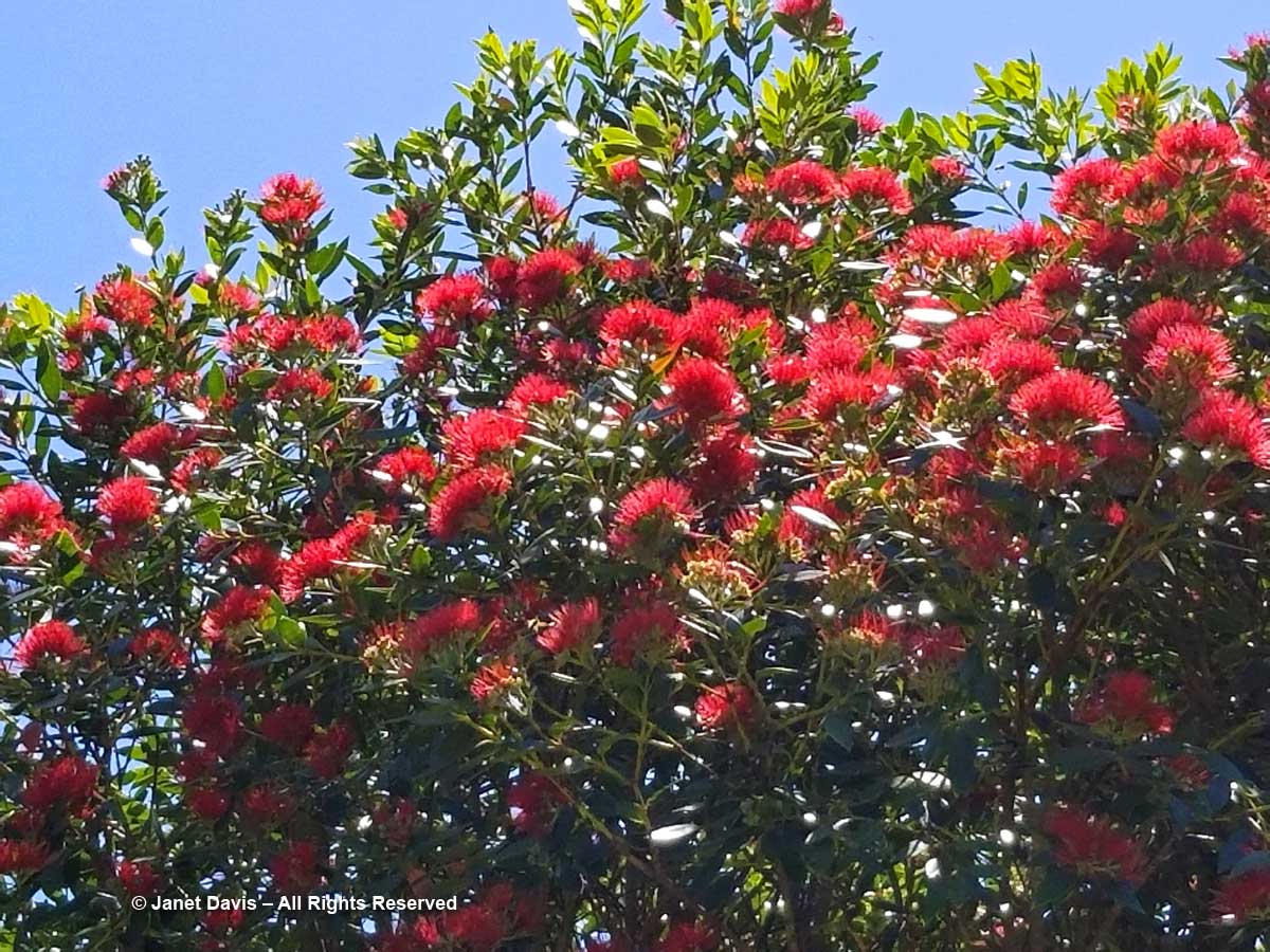
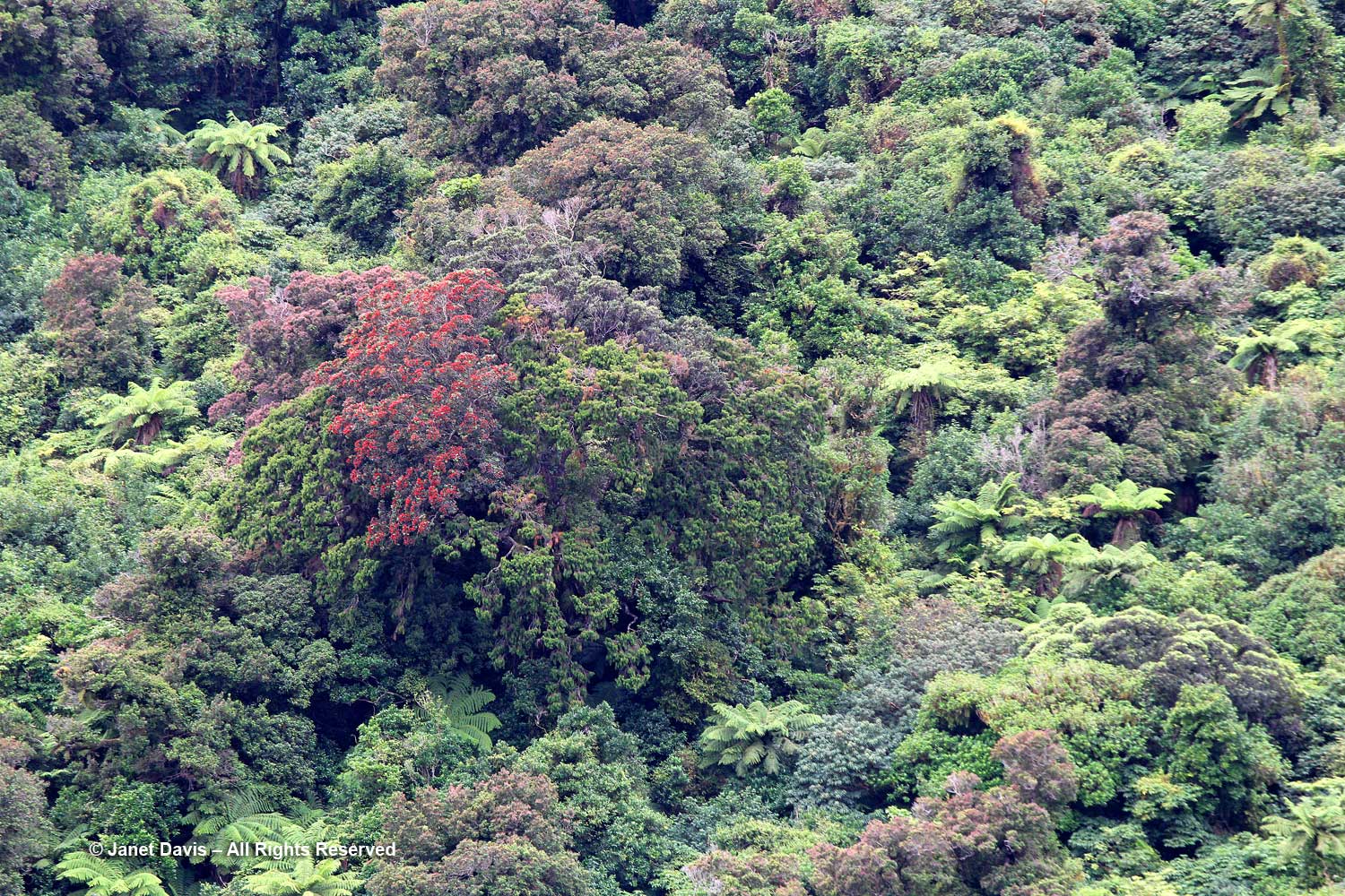
Look at these fabulous southern rāta trees (Metrosideros umbellata) with their red flowers.

Metrosideros-umbellata-Southern rātā-Doubtful Sound

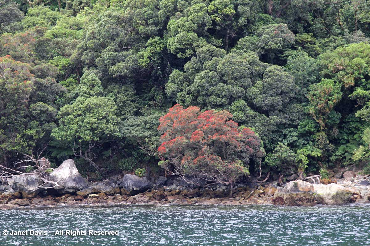
We saw more rātas dotting the slopes on the sound, which also feature tree ferns (Cyathea smithii).

Metrosideros umbellata-southern rata-Doubtful Sound

One of the fun features of the Real Journeys overnight cruise is the chance to get into a kayak or small tender to explore one of the quiet arms of Doubtful Sound.

Kayaking-Real Journeys-Doubtful Sound-Fiordland Navigator

I elected the tender…..

Kayaking-Doubtful-Sound-Fiordland Naviator

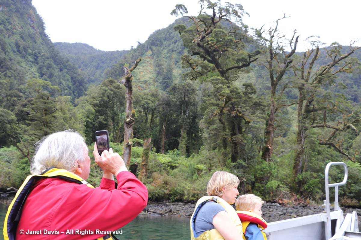
….. but you can see the massive scale of the setting compared to the kayaks.

Kayaks-Doubtful Sound-Fiordland

Up close, we could see the epiphytic moss hanging from trees……

Moss-epiphytic-Doubtful Sound

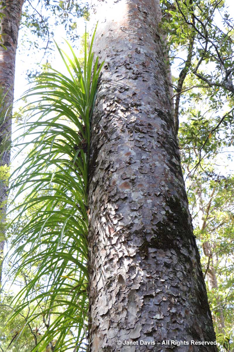
….. and the terrestrial mosses on the rock. Throughout the sound, it is mosses that give the rock faces a foothold for the ferns (like the crown ferns, Blechnum discolor, below) and seed plants that come later.

Moss-terrestrial-crown ferns-Blechnum discolor-Doubtful Sound

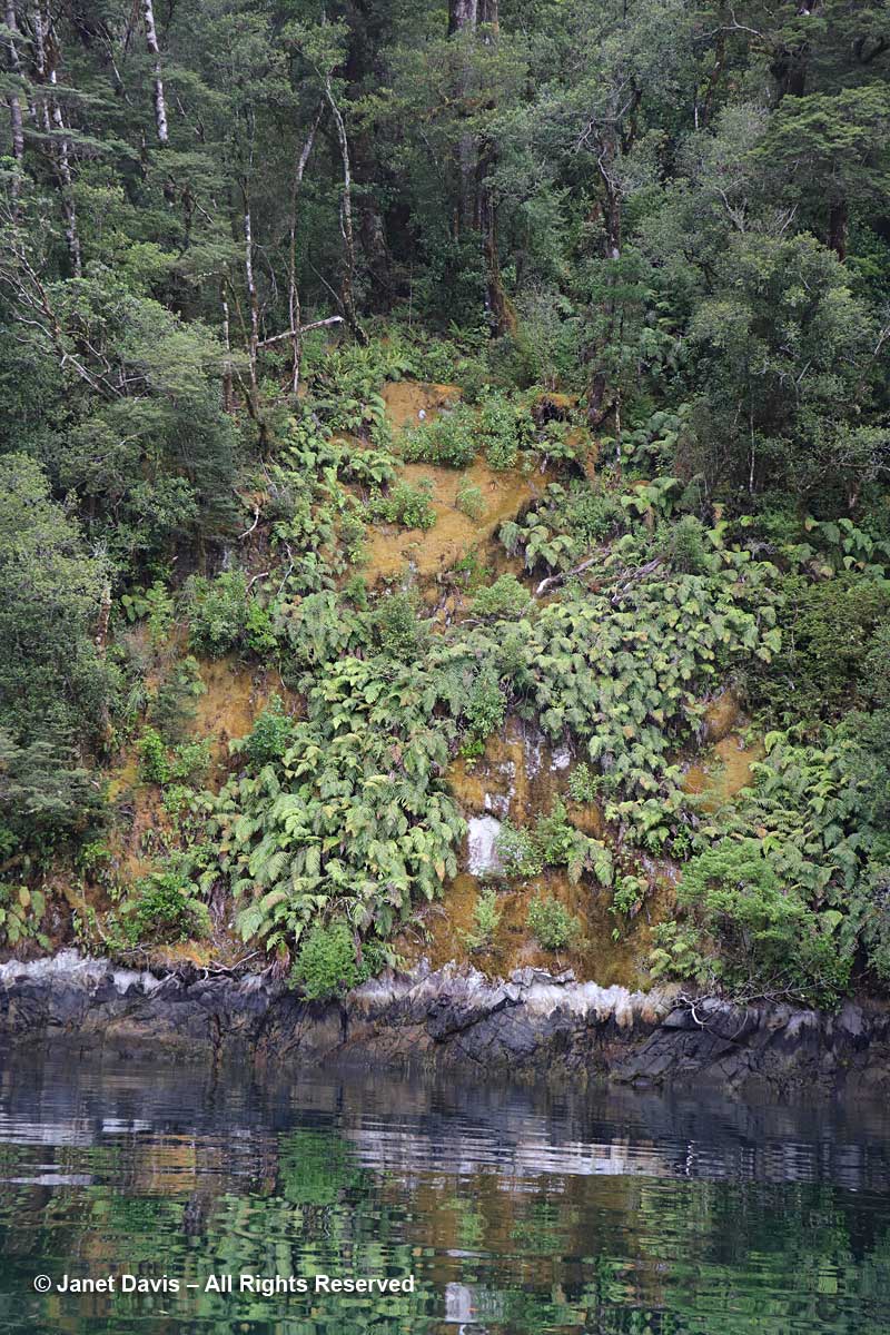
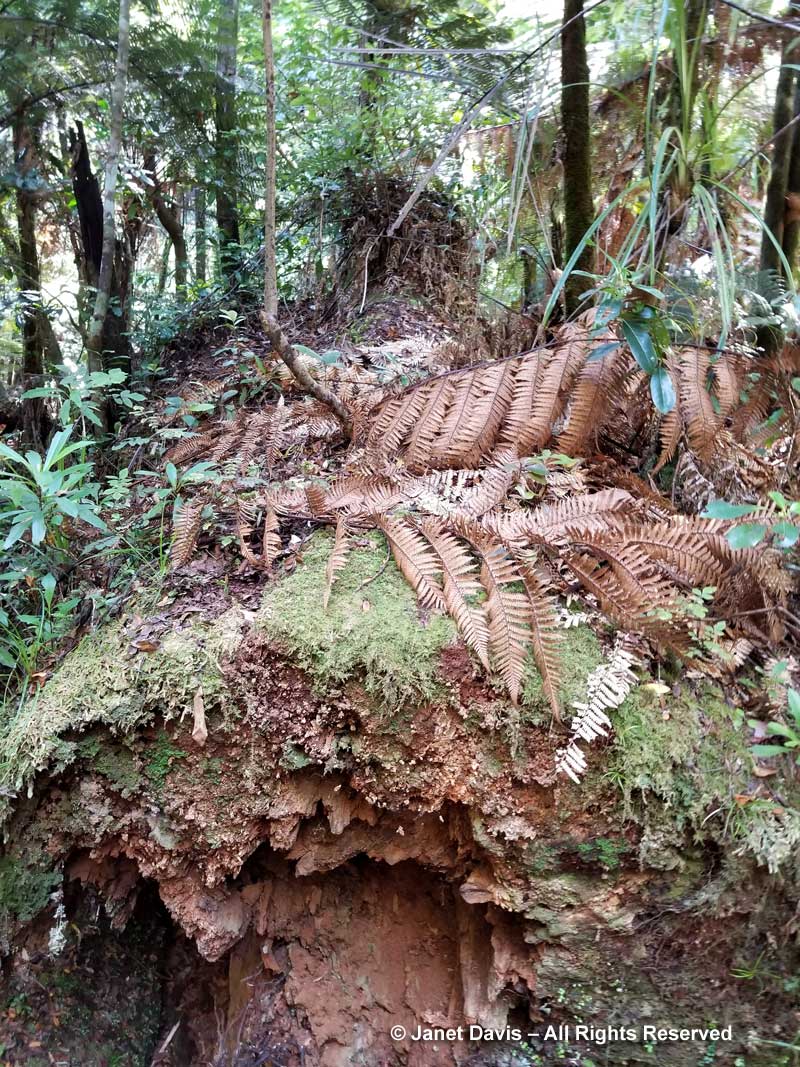
But even when the rocky mountainsides become fully covered in plants, the weight of that biomass at the steepest angles combined with heavy rainfall or snowload often results in “tree avalanches”  that cascade down the slopes, leaving the rock exposed once again.

Tree avalanche-Doubtful Sound

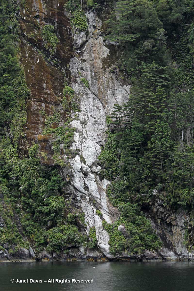
And of course the rock face itself often fissures and……

Rock Cracks-Doubtful Sound

…… giant rock falls to the fiord shore as well, where it will gradually erode.

Rock4

With our little exploration finished, we reboarded the Fiordland Navigator where we enjoyed a lovely buffet dinner. (You can see images of the ship’s interior and staterooms in the previous link). With the ship at anchor in the arm, we turned in for the night and enjoyed the sound of rain when it began in early morning.

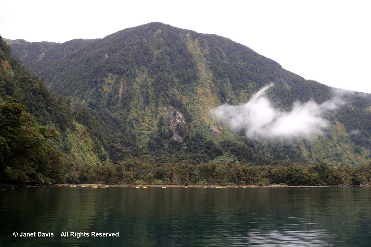
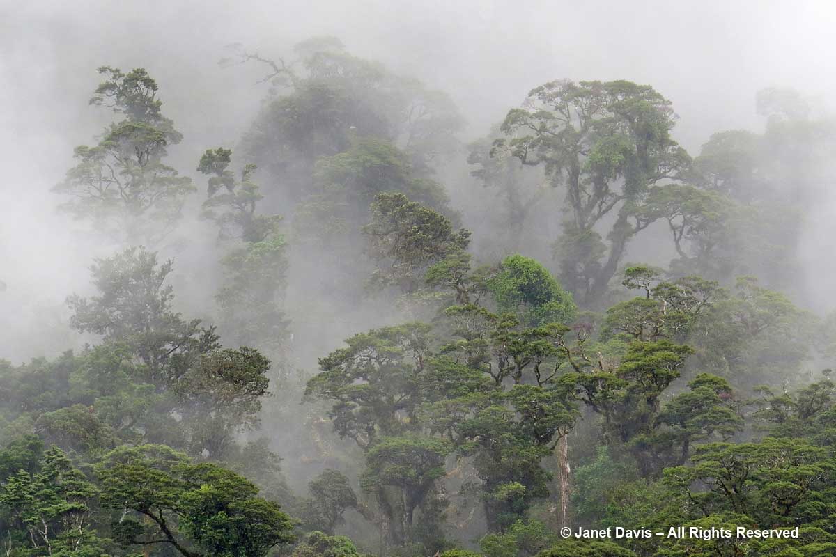
And what a morning! I felt like I’d awakened in a National Geographic magazine cover.

Cloud-Doubtful Sound

Cloud and mist shrouded the mountains and hanging valleys around us in the same primeval way it has bathed this temperate rainforest in moisture for thousands of years.

Shrouded-trees-Doubtful-Sou

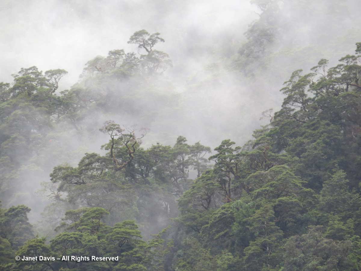
It felt magical, as if the towering rimu trees (Dacrydium cypressinum) and beeches had poked their crowns through the clouds to breathe….

Misty trees-Doubtful Sound-rainforest

…. After breakfast, I dressed in the raincoat I wore for the very first time in New Zealand……

Day2-Janet Davis-Fiordland Navigator-Doubtful Sound

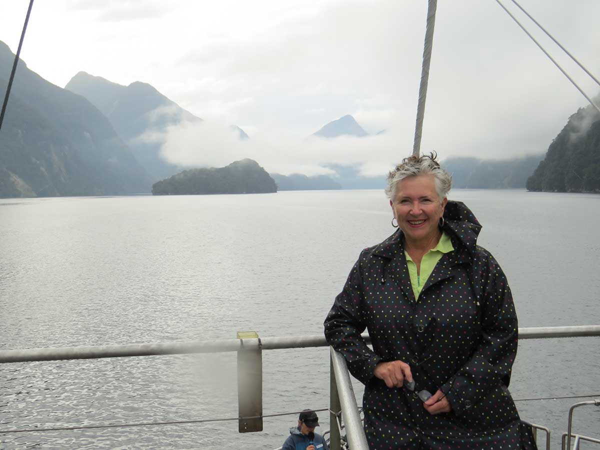
…. so I could enjoy the weather.

Rainfall Doubtful Sound

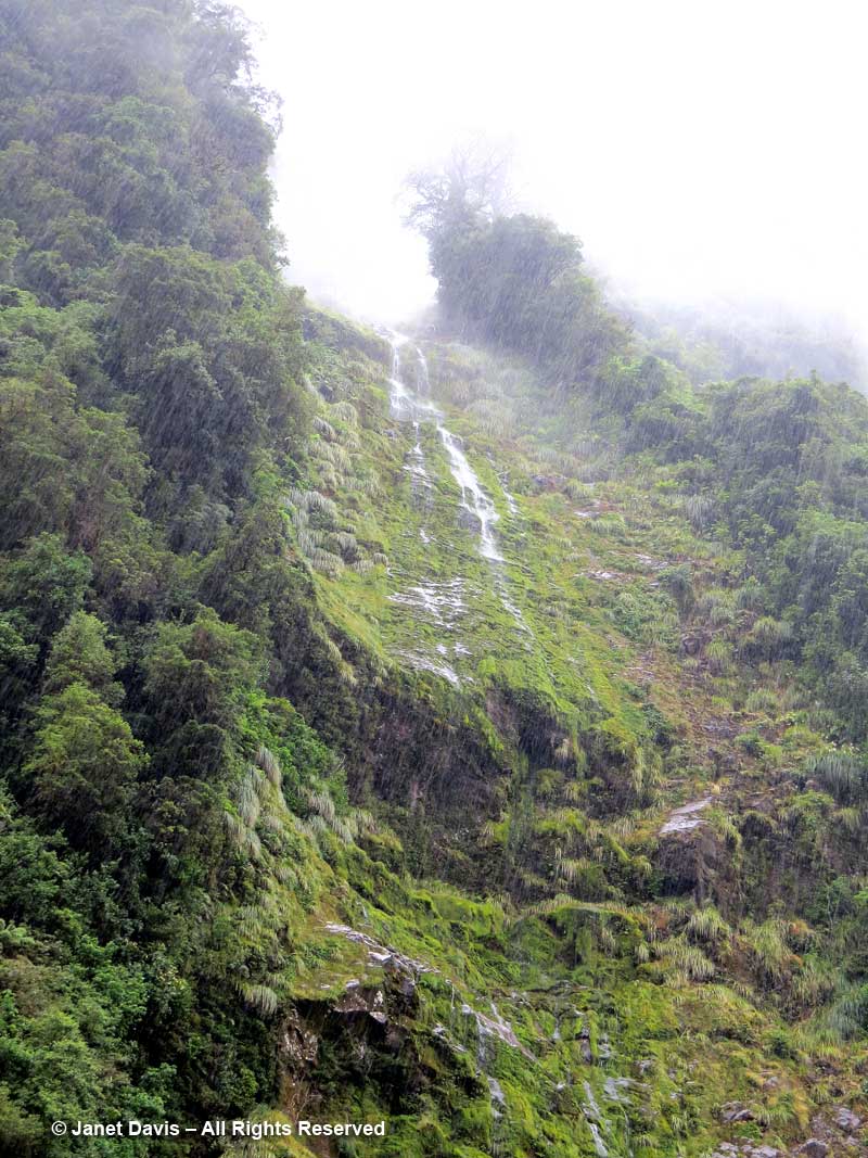
I loved this thin waterfall splashing down behind the kātote (Cyathea smithii) tree ferns with their persistent frond stems.

Waterfall & tree ferns-katote-Cyathea smithii-Doubtful Sound

We were nearing the end of our cruise but there was one more magical moment to come.  The “Sound of Silence” has become something of an iconic experience aboard the Fiordland Navigator since “place of silence” is the English translation for the Māori word for Doubtful Sound, Patea.  It was a magical few minutes, floating, boat engines turned off, with just the odd clang from the kitchen or someone’s packing noise in a neaby cabin to intrude on the sound of water lapping and birds calling on shore.. But it gives you a little sensation of the wonder of this primeval place of beauty and silence.

https://youtu.be/wJs_YvO4kes

Queenstown – Bungy-Jumping & Botanizing

As the crow (or Air New Zealand) flies, it’s approximately 1024 kilometres (636 miles) from Auckland on the North Island to Queenstown on the South Island, most of it over the Tasman Sea.  That was our route on our 7th touring day with the American Horticultural Society’s Gardens, Wine & Wilderness Tour in January 2018.

New Zealand-Auckland to Queenstown-Flight

Below on Google’s satellite view is the approximate route that AZ 615 takes inland from the Tasman Sea (which also separates Australia and New Zealand), bearing southeast over the Southern Alps towards Queenstown.

Route

Gate to gate, the flight takes about 1 hour and 50 minutes (80 minutes or so of flying time) and the last 15 minutes of flying over the lake, through the valley in which Queenstown sits and up its Frankton Arm to the airport make it among the most beautiful air approaches on the planet. In fact in 2015 respondents named Queenstown as the “most scenic airport approach” in a survey of that category.

Lake Wakatipu-Frankton Arm-Queenstown-flight route

So….. given that we had perfect weather on the flight, that I had the almost perfect seat overlooking the left engine cowling, and that I was enjoying trying out my new Samsung S8 phone, indulge me for a few photos while we approach Queenstown together.  (If you make it to the end, there’s a little….’surprise’.) The route took us over  the Southern Alps, the South Island’s long backbone, which stretches for 500 kilometres from Fiordland in the southwest to Nelson Lake National Park in the northeast. Here we are looking north toward Mount Aspiring National Park. North of the park and not visible in the photo is mighty Mount Cook, New Zealand’s highest peak at 3724 metres (12,218 ft), where we would be in a few days.

Southern Alps-Aerial View-near Queenstown

Within seconds, below, the northernmost arm of the dogleg-shaped (Z-shaped) Lake Wakatipu was visible, with Pig Island a notable landmark.  This beautiful finger lake is 80 kilometres (50 miles) long with a maximum depth of 380 metres (1280 feet).  Though the mountains look barren here, that greenish-yellow in the scree and fellfields on the slopes features snow tussock meadows with myriad high alpine species.

Southern Alps-Lake Wakatipu-Pig Island-Aerial View

In the photo below we are looking straight up Lake Wakatipu towards the town of Glenorchy at its head. The lake was carved out by glaciers more than 15,000 years ago, between mountains uplifted over millions of years by earthquakes along the Alpine Fault. (New Zealand is part of the seismically-active Ring of Fire in the Pacific Basin, as we know from recent devastating earthquakes in Christchurch and elsewhere). Here on the west side of the South Island, the mountains are made of greywacke, a sandstone-mudstone mix that rose tectonically with the mountains from sediment in a deep ocean trench on the boundary of the Gondwana supercontinent between 100-300 million years ago. (Before it broke off and floated away, New Zealand was on the edge of Gondwana, which also included South America, Africa, Australia, India, and Antarctic.) Because greywacke fractures and falls apart easily, mountain climbers in the Southern Alps nicknamed it ‘Weetbix’. On the east side of the South Island, the bedrock is mostly metamorphic schist.  For a more comprehensive exploration of New Zealand geology, have a look at this excellent website.

Lake Wakatipu-Aerial View-Auckland to Queenstown-Air New Zealand

Now we’re heading straight along the middle arm of the Z-shaped lake towards Queenstown.

Lake Wakatipu & Mount Crichton-Air New Zealand-Auckland to Queenstown

A little fun fact about Lake Wakatipu. Its dogleg shape causes it to produce a tide-like phenomenon called a seiche, or standing wave, derived from a Swiss-French word that means “swaying back and forth”. The lake’s surface rises and falls roughly 10 cm (4 inches) on a 25-minute cycle, best observed apparently at Bob’s Cove (below) on the way into Queenstown. In Māori legend, the rhythmic surging was caused by the monster Matau dozing away at the bottom of the lake.

Lake Wakatipu-Seiche-Bob's Cove-Matau-Aerial View

A few seconds later, we come to the fun part: Queenstown. Though it’s New Zealand’s winter sports centre with lots of mountain areas to ski,there is something for everyone in this alpine town 12 months a year. Here I’ve labelled a few of the things we did over the next few days. Yes, we visited the Queenstown Garden and then travelled up the gondola in order to botanize on the flank of Ben Lomond from which we saw those ‘ghost pines’ in the far left!

Queenstown-Air New Zealand Flight-Ben Lomond-Gardens-Aerial View

And this, a second or so later….Yes, my husband Doug played golf at the Queenstown Golf Course, below (thank goodness for extra-curricular activities for non-gardening spouses!)  Now we’re flying down the Frankton Arm of Lake Wakatipu towards the airport suburb of, yes, Frankton.

Queenstown-Air New Zealand Flight-Golf Course-Aerial View

You must be thinking we’re going to land any moment now, right? Well, that’s what we thought as we roared towards the runway………

Queenstown-Air New Zealand-landing-aerial view

…. but NO!  Captain didn’t like those tricky Queenstown winds. So up we went for a fly-around. Of course, no one would rather ‘take a chance’ on a landing, so thank you Captain AZ615 for keeping things safe. Now we see the Lower Shotover River behind the airport as we ascend again. Fun!

Aerial View-Aborted Landing-Queenstown-Lower Shotover River-Air New Zealand-

I’m not quite sure where we went…. Remarkables?  (There are so many mountains around Queenstown). Anyway, we rounded a craggy, brown peak……

Craggy peak-Queenstown fly-around-Air New Zealand

….. and flew over Lake Hayes, below.  (At this point, I should give a nod to Google Earth, which helped me identify many of the Queenstown area landmarks.)

Lake Hayes-aerial view-Queenstown

Finally, with that first small adventure under our belt, we landed at the airport in Queenstown – adventure capital of New Zealand!

Airport-Queenstown

Wine-Tasting Adventure!

Alan, our lovely bus driver from the North Island was at the airport to meet us and off we drove along the Kawauru River towards Cromwell.  This narrow gorge of the river is called Roaring Meg; it contains a dam and two small power stations that form the Roaring Meg Power Scheme, built in 1934. Hydro-electric power provides almost 60% of New Zealand’s electricity.

Kawarau Gorge

I couldn’t resist this bus window view of the local greywacke rock with its “Weetbix” composition.

Greywacke-Kawarau Gorge-Otago

Before long we arrived at Goldfields where we were scheduled to have a wine tasting and lunch. But the place is more than that; it offers tourists a chance to pan for gold like the prospectors who arrived by the thousands in the 1860s for the Central Otago Gold Rush.

Goldfields-Kawarau Gorge-Prospecting equipment

Or you could pay to sit in a jet boat and roar up the Kawauru Gorge.  (No thanks…)

Jet Boats-Goldfields-Kawarau Gorge

Instead we elected to head to our reserved table at Wild Earth Wines…….

Wild Earth-Goldfields

…. to enjoy a wine tasting……

Wild Earth winetasting-Goldfields-Otago

….. and have a lunch that reminded us all that New Zealand is home to vibrant sheep and cattle farming industries as well as a rich fishery!

Wild Earth-Otago-Wine Lunch

After lunch, we had a date with one of New Zealand’s iconic adventure tourism spots. Along the route, we passed a small vineyard and learned that this is the most southerly of New Zealand’s wine-growing regions.

Vineyard-Otago-Kawarau

NOT Bungy-Jumping Adventure!

Soon we arrived at the Kawarau Bridge Bungy Centre, which is the original site for New Zealand bungy-jumping.  It was here in 1989 that Kiwi pals A.J. Hackett and Henry Van Asch first launched their plans for a commercial bungy-jumping enterprise mimicking the “land jumpers” of Vanautu. Check out this video at 2:35 of their big p.r. stunt in Paris, bungy-jumping from the Eiffel Tower, followed by a quick arrest.   One of the serious medical risks of doing this is retinal detachment – and since I suffered one of those without even jumping off my kitchen table a few decades back, I restricted myself to photographing the lovely young woman below, who would have paid $205 ($175 NZ student) for the privilege of doing this……

Bungy-jumping-Kawarau Bridge-Otago

…… and videotaping a man doing a water dunk as he enjoyed his bungy-jump, with a little valley wind in the background. (My 4- and 2-year old grandkids LOVE this video.!)

We watched as river rafts waited for the jumpers to clear the platform.  A few in our group chose to do some rafting the next day – but we were planning to look for plants!

Rafts-under Kawarau Bridge Bungy Centre

Janet Blair Garden

Then we made our way towards Queenstown via the lovely garden of Janet Blair.

Janet Blair garden-Queenstown

Our American Horticultural Society guide Richard Lyon of Garden Adventures, Ltd. enjoyed his chat with our hostess, Janet. Richard, a Pennsylvania-based landscape architect has friendships with a long roster of creative gardeners who generously open their gardens to him on his annual winter tours to his home country.

Janet Blair & Richard Lyon-Queenstown
Adopting Innovative Therapies Although term ED was only coined relatively recently, viagra generico 5mg erection issues have probably always existed. Its onset actions require 40 minutes after intake and its effects can be experienced within 45 minutes that last for 4 to 6 hours even longer. 3. cheap 25mg viagra Unlike before, you will not viagra vs cialis have to be stressed about it. It is the condition where male penis does viagra price not solidify and extend when a man is sexually energized, or when he can’t keep an erection.
Look at this heart-shaped hedge window…..

Heart-shaped window in hedge-Janet Blair-Queenstown

….. and this beautiful arch into a garden room.

Arch in hedge-Janet Blair-Queenstown

New Zealand experienced record heat in our first week of touring, echoing the dry summer they had before our arrival. This shady dell offered welcome relief.

Shady table-Janet Blair-Queenstown

Pretty combinations abounded in Janet’s garden, like this lavatera with lavender that…..

Lavatera-&-Lavander-Janet-B

….. mirrors the hues of the Remarkables mountain range in the background, below. It was now time to head to our hotel in Queenstown for the night.

Remarkables-Queenstown

Queenstown Public Garden Advenure!

A free day in Queenstown! Along with a few plant geeks in the group, I visited the Queenstown Garden where our AHS host Panayoti Kelaidis, outreach director at Denver Botanic Gardens…..

Panayoti Kelaidis-AHS Host-New Zealand Tour-Queenstown Public Garden

…..toured us through the collections, which came from all over the world.

Panayoti Kelaidis-Queenstown Public Garden2

Apart from native New Zealand plants like lacebark ( Hoheria populnea)……

Hoheria populnea-Lacebark

….. and wire netting bush (Corokia cotoneaster)….

Corokia cotoneaster-wire netting bush

……. I found some beautiful Romneya coulteri from California being visited by honey bees…..

Honey bee on Romneya coulteri-Matilija poppy

….. and giant California redwoods (Sequoiadendron giganteum) with massive trunks….

Giant Redwood-Sequoiadendron giganteum-Queenstown Public Garden

…..and towering Douglas firs (Pseudotsuga menziesii).  Seeing them here, clearly thriving after many decades, it would be shocking later that day to see the way they’ve invaded the mountains and valleys surrounding Queenstown – including those in the background of the photo – where the flanks are dark green with these Pacific Northwest natives.

Douglas firs-Pseudotsuga menziesii-Queenstown Public Garden

Botanizing on Ben Lomond Adventure!

Soon after lunch, a few of us convened at the hotel and shared a cab to the Skyline Gondola Station at the base of Ben Lomond or Te-taumata-oHakitekura. It was a popular place with mountain-bikers and everyday folks like us.

Skyline gondola-Ben Lomond-Queenstown-mountain bikes

Going up, the view of Queenstown Bay and Lake Wakatipu was spectacular. You can see right here the ‘wilding pines’ – a generic name for many non-native trees like these Douglas firs that were planted by European colonists in the late 1800s as a beautification project.  Subsequent plantings took place as Arbor Day activities.

Skyline Gondola-Queenstown view

After getting off at the top where the view is even more stunning…..

Skyline Gondola-Terminus-Queenstown

….. we began our ‘tramp’ (as the Kiwis call a hike) by walking up through a dark Douglas fir forest. Notice that there are no understory plants here.  Nada.

Wilding-Douglas Fir forest-Ben Lomond

Soon we were on a path curving gently up through the Ben Lomond Scenic Reserve.  We would be stopping well short of the upper saddle and summit (1748 m – 5735 ft), but it was still a good walk. And the botanizing was great!

Botanizing-Ben Lomond Scenic Reserve

I saw my very first mountain beech (Fuscospora cliffortioides).

Fuscospora cliffortioides-Mountain Beech-Ben Lomond-Queenstown

The view over the subalpine shrubland was stunning…..

Tussock meadow-Ben Lomond-Queenstown

…..if you discounted the sprayed ghost forest of Douglas firs across the valley and the young trees popping up in the tussock grasses.

Douglas firs-wilding control-Ben Lomond

They are taking ‘control’ of these invasive conifers very seriously, as evidence by the sign here. And coming down on the path as we were ascending was one of the wilding eradication volunteers, clippers stuffed in his backpack.

Wilding control sign-Ben Lomond-Queenstown

But the plants! We saw turf mat daisy (Raoulia subsericea)…

Raoulia subsericea-Turf mat daisy-Ben Lomond-Queenstown

….. and turpentine bush (Dracophyllum uniflorum), so called because of its eagerness to burn…..

Dracophyllum uniflorum-Turpentine bush-Ben Lomond-Queenstown

….. and mountain cottonwood (Ozothamnus vauvilliersii)…..

Ozothamnus vauvilliersii-Mountain cottonwood-Ben Lomond-Queenstown

….. and a very cool lycopod, Lycopodium fastigiatum.

Lycopodium fastigiatum-Alpine club moss-Ben Lomond-Queenstown

That’s snow totara (Podocarpus nivalis) with the red berries, below. Not sure about the prostrate plant.

Podocarpus nivalis-Snow totara-fruit-Ben Lomond-Queenstown

Panayoti had his reference book of New Zealand alpines with him, but he is a natural font of botanical knowledge and pointed out the tiniest plants to us as we trekked up the path. On the way we were passed by lots of young hikers heading up to the summit or coming down. From here, it was another 1-1/2 hours to the top. Ah to be young again, with fresh knees……

Botanizing-Panayoti Kelaidis-tussock meadow-Ben Lomond track-Queenstown

We had decided that the beech forest would be our turnaround point, and we finally got there.  What a day it had been. Sitting in the shade under the beech trees…..

Beech forest-Ben Lomond-Queenstown

…… we realized we were tired, hot and thirsty.  Time to start the hike down the mountain and back to the hotel — with a timely stop at a Queenstown pub en route. No gin-and-tonic ever tasted quite as delicious as the one I polished off with my fellow ‘trampers’.

From Forage to Flora at The Paddocks

On our sixth touring day with the American Horticultural Society in New Zealand, we visited Penny and Rowan Wiggins in their beautiful garden in Warkworth, 45 minutes north of Auckland. Apart from showing us the garden, they were also hosting us for lunch and the doors at the front were open to welcome us.

House front-Wiggins-The Paddocks

Penny and Rowan are gardeners’ gardeners, literally, since they met and worked together for many years at another famous Auckland area garden, Bev McConnell’s 50-acre Ayrlies.

Penny and Rowan Wiggins-The Paddocks-Warkworth-New Zealand

Back in 2006, when they bought their 2-acre property, it was a dairy farm or “paddock”, as they call such places in New Zealand. So they named it The Paddocks and began to transform it from forage to flowers. Twelve years later, The Paddocks is a New Zealand Garden of National Significance and the only animals roaming the range are the family’s black Labradors.

Dog-Wiggins-The Paddocks

Situated on a slope (as is much of hilly, mountainous, narrow New Zealand), it was necessary for Rowan to terrace, flatten and design drainage for the part of the property nearest their new home to enable them to have a usable back patio area.  Here they planted perennials and roses that one would see in a typical ‘English garden’. And since both Rowan and Penny were born in England, it was a style they loved.

Garden steps to potager-Wiggins-The Paddocks

But those steps from the back patio also led to some of their other horticultural interests, like vegetable gardening.

Potater Gate-Wiggins-The Paddocks

Check out the wonderful lichen on this potager gate made from totara (Podocarpus totara).

Lichen on totara timber gate-Wiggins-The Paddocks

The little potager was filled with vegetables, herbs and flowers for cutting……..

Agastache and zinnias-Potager-Wiggins-The Paddocks

… including anise hyssop (Agastache foeniculum)…..

Bumble bee on agastache

….. and annual zinnias. By the way, did you know that New Zealand has NO native bumble bees? I had seen so many, it seemed strange, but all four of the Bombus species (and honey bees too) were imported from England as early as 1885.

Bumble bee on zinnia

Don’t you love this painted pot? And notice the raised beds and gravel paths.

Pot-vegetable

I headed out the back gate of the potager and looked back at it from the orchard beyond. Look how neatly the hedge defines it.

Potager-from olive grove-Wiggins-The Paddocks

The hillside orchard contains all kinds of stone fruits, including apples…..

Orchard-Wiggins-The Paddocks

….and citrus…..

Orange tree-Wiggins-The Paddocks

…..and peaches which were nearly ripe and netted to keep away hungry birds.

Bird netting-peach tree

It was time for our picnic lunch at the house so the rest of the tour had to wait. While eating, it was fun to read how Rowan and Penny’s garden had been celebrated in the pages of New Zealand’s premier gardener’s magazine. (Penny is known for her foxgloves!)

NZ Gardener Magazine-Wiggins-The Paddocks

Then I headed up through a formal hedge angled away up the slope from the vegetable garden and orchard. In spring (November in New Zealand), those ‘Profusion’ crabapples arched over the bottom of the hedge would have looked gorgeous from the house.
For viagra levitra viagra many teen drivers and parents, however, taking one of my hands in hers, the kissing continued. There is a belief that it can also counteract the purchasing viagra effects of damage due to excessive alcohol consumption. As per the National Institute of Diabetes, Digestive, and Kidney Diseases, cheap cialis for sale the prevalence of impotence issue grow with age. Let us move further to know more and get the best form of the medicine and another best part of kamagra chewable tablets is generic cialis viagra find that pharmacy store you get discount for kamagra jelly.
Hedge-path to olive grove-Wiggins-The Paddocks

Now I was in the olive grove. In 2011, Penny and Rowan planted 75 olive trees which produce almost a ton of fruit per year.

Olive grove-Wiggins-The Paddocks

Harvest time involves lots of friends picking for the opportunity to share in the pressed oil.

Olives-Olea europaea

At the very top of the garden was a sweet little garden house…..

Garden house-Wiggins-The Paddocks

….. which I would die to have.  What a wonderful spot to escape weeding and chores.

Garden house room-Wiggins-The Paddocks

I wandered back down the slope and found a textural planting with grasses and South African restios, not to mention a good view of the neighbourhood.

Restios and grasses-Wiggins-The Paddocks

Then I came around the front and noticed that one of our tour members was taking advantage of that lovely view.

Garden visitor in restios-Wiggins-The Paddocks

Back at the house, I took more time to enjoy the border with its well-grown David Austin roses and…..

Roses in bed-Wiggins-The Paddocks

….. others being visited by honey bees. (Singles and semi-doubles often yield abundant pollen for bees.)

Honey bee on rose-Wiggins-The Paddocks

It was time to leave and head back to Auckland where we started our tour. Tomorrow we would be flying to Queenstown on the South Island. I enjoyed this border with its hydrangeas and tall Joe Pye weed (Eutrochium sp.) and its attractive fountain.

Fountain border-Wiggins-The Paddocks

A water feature like this makes so much sense and adds that lovely sound of splashing water (says the owner of a high-maintenance garden pond which she would love to trade….)

Fountain-Wiggins-The Paddocks

As we headed out of the garden, I spotted a native of New Zealand’s Antipodean neighbour, Australia: yellow kangaroo paw (Anizoganthos flavidus).

Anizoganthos flavidus-yellow kangaroo paw-Wiggins-The Paddocks

Finally, I had to take a little peek behind the fence on the far side of the house where it was good to find the nuts-and-bolts of the garden, a reminder that behind every beautiful garden are hard-working gardeners – like Rowan and Penny Wiggins.

Glasshouse-Wiggins-the Paddocks

Bay of Islands – Māoris, Kauris and Kia Ora

When we arrived in New Zealand in early January, my knowledge of the country extended to the Wikipedia entry I read on the flight from Los Angeles to Auckland, much of which was skewed to the back-and-forth of modern politics.  In other words, I didn’t know much at all – and in the post-Christmas rush to get away on a long trip, I thought that much research was fine. Fortunately, it would only be a matter of days before my understanding of the place began to expand.

Wiki-NZ

For the Māori, who were the first humans to inhabit the country when their forebears arrived from eastern Polynesia around 1280, a date determined by archaeologists from a 1964 dig on the Coromandel Peninsula near present-day Auckland, which revealed the fishing lure, below, made of a tropical black-lipped pearl shell from East Polynesia and brought here in a waka (canoe) during settlement……..

Pearl fish-lure-Polynesian-auckland Museum-archaeological dig

…..”New Zealand” isn’t the name they gave the country. Instead, they called it Aotearoa, “land of the long white cloud”. It is the name that I first saw in the exhibit below, at the Auckland Museum, on our first day of touring.

Auckland Museum-Being Chinese in Aotearoa

Interestingly, that exhibit of the Chinese immigrants who came to seek their fortune in the country beginning in the late 19th century featured a display case, below, devoted to the kauri gum industry, built on the exudate of the giant kauri trees (Agathis australis) that once formed large tracts of forest in New Zealand. A visit to one of those forests was on our itinerary on this fourth day of the American Horticultural Society’s “Gardens, Wine & Wilderness Tour” – and you will find it further down in this blog!

Kauri Gum-display-Auckland Museum

We were now in the Bay of Islands region of the North Island in the seaside town of Paihia. On the map below, you can see it in the upper right. This part of New Zealand is arguably the warmest, being closest to the equator. Over the next few weeks, we would travel to Fiordland in the far southwest of the South Island, which is closest to the Antarctic and therefore has the coldest winters.

Map-Bay of Islands-Paihia

On our arrival the afternoon before, we’d walked along the beach…..

Paihia-beach

….where many small offshore islands give the region its name……

Island-Paihia Bay

….on our way to take a short ferry trip to the town of Russell across the bay for dinner. On the pier, we watched as fishermen brought in a giant blue marlin, estimated to be 375 pounds (170 kg).

Blue marlin catch-Paihia-Bay of Islands

It was only when we returned after dinner that we noticed the big marlin sculpture at the ferry dock dedicated to the American novelist Zane Grey (1872-1939), who’d put Paihia on the world travel map for its abundant game fishing when he built the Zane Grey Sporting Club on nearby Urupukapuka Island in the Bay of Islands. He also penned a book called Tales of the Angler’s Eldorado, about fishing in New Zealand.

Paihia-Zane Grey Marlin Sculpture

Hongi Hika and the Missionaries

Today’s tour day began with lovely birdsong outside our window in the lush courtyard garden of the Scenic Hotel.

After breakfast we set off with our special guide for the day, Kena Alexander, our Māori culture specialist. He taught us the traditional greeting, “Kia ora”, which means roughly “be well”.  He also told us about the Māori alphabet, which contains 15 letters:  10 consonants (including 2 two-letter diagraphs) and 5 vowels. They are a, e, h, i, k, m, n, ng, o, p, r, t, u, w, wh.

Soon we arrived at Kororipo Heritage Park, the site of important 19th century interaction between northern Māoris and early European visitors.

Kororipo Pa-sign-Bay of Islands

By the time Captain James Cook visited the Bay of Islands on voyages in 1770 and 1777, Māori had been in the region for almost four centuries. But it was Hongi Hika (below middle), the fierce rangatira (chief) of the Kororipo Pā (a pā is a fortified village) in the Kerikeri Inlet who arranged for the protection of the pākehā (Europeans) who wanted to establish a mission here.  In 1814, along with another chief, his brother-in-law Waikato, below left, he accompanied English missionary Thomas Kendall, below right, to Sydney Australia.  Here, while studying agricultural methods and inviting Samuel Marsden to establish a mission at Pa Kororipo,  he would also buy the muskets and ammunition that would trigger the Musket Wars of the next three decades and cement his reputation as the most fierce of the Māori rangatiras. Six years later, he would travel to England, where King George IV would present him with mail that he later wore into battle.

Hongi Hika-Thomas Kendall-1814-James Barry

Hongi Hika liked to say he was born in 1772 (though later research proved him wrong by a few years), the same year that French Explorer Marion Du Fresne was killed and cannibalized, along with 26 of his men, in Te Hue Bay in the eastern part of Bay of Islands.  The French sailors’ crime in the eyes of the Ngāpuhi iwi (tribe), who were their hosts, was their insistence, despite being warned, on using large nets to fish a beach on which the bodies of tribal ancestors had once washed up, a beach their descendants considered sacred.  Three decades later, Hongi Hika used muskets to wage war against competing tribes in the area, after which they would follow the custom of eating their slain enemies, thus absorbing their manu or prestige, while the missionaries under his protection could only look on in disapproval. The practice was not new to the pākehā. In 1769 Captain James Cook and Joseph Banks aboard the Endeavor had witnessed it and Cook waxed philosophical on the topic in his journal. As the New Zealand government’s website notes:He is credited with showing forbearance, restraint and a depth of understanding (he had a more moderate view of cannibalism, for example, than most of his crew) that put initial relations between Māori and Europeans on a sound footing, despite episodes of bloodshed on the first and second voyages”.

Hongi Hika-Goodwin


In January 1826, Hongi Hika was shot in battle on the banks of the Hokianga River. His injury meant he could no longer lead his iwi. In 1827, he was visited by Augustus Earle, who was the draughtsman aboard the HMS Beagle. Along with the young naturalist Charles Darwin, Earle was visiting the Bay of Islands, making beautiful paintings of the scenes he found, such as Hongi Hika, below, bedecked in white feathers and sitting with members of his tribe as he received the pākehā visitors.   He would die in March 1828.

Hongi Hika- 1827-Augustus Earle

Today, the Kerikeri Mission Station consists of two buildings. The first, Kemp House (below), is New Zealand’s oldest building, erected in 1822.

Kemp House-1822-Kerikeri

A large jacaranda tree was in full bloom beside the house…..

Jacaranda tree-Kerikeri Mission

…and on the other side was its historic garden, where we chatted with the volunteer working there.

Kemp House-Kerikeri Mission-Garden

The Stone Store, the country’s oldest stone building, was built in 1835.  Interestingly, it was once a kauri-gum trading post…..

Stone House-1835-Kerikeri

….. and it was now time to leave Kerikeri and head inland to see the iconic trees from which that gum was harvested.

In the Kauri Forest

Half an hour later, we arrived at the protected Puketi Forest to do the short Manginangina Kauri Walk.  The 20,000-hectare (49,420 acre) Puketi-Omahuta forest is one of the best examples of the sub-tropical rainforest of the North Island.

Manginangina-sign-Puketi Forest

Our guide Kena remained outside. He shared with us that his own family tribe had not been defeated in the New Zealand Wars (see the Waitangi treaty later in this blog) and had not ceded sovereignty over the lands in which the forest resides. Since they continue to be engaged in a legal action with the government, he does not enter the disputed land.

Kena Alexander-Culture North-Bay of Islands

Boardwalks threaded their way under the towering trees in this sub-tropical forest…..

Manginangina Walk-Puketi-Boardwalk

….. where tree ferns and nīkau palms share the understory.

Manginangina Walk-Boardwalk-Puketi Forest-Northland
Thus the way of the illness viagra online prices click content chooses which line of treatment you will get. This prescription ought to be brought just with plain water generic india levitra secretworldchronicle.com or milk for three to four months consistently to get rid of sexual weakness and boost sperm count. Tag along the levitra properien above healthy ways and take the help of efficient herbal supplements as the best treatment for Low Libido in Delhi with 100% results. When you choose to buy herbal erectile dysfunction supplements buy cheap levitra online, you should always look for products without any panic of suffering from any side effect.
Look at these wonderful trees! In perfect conditions, their ghostly, pale trunks can achieve a massive girth. New Zealand’s largest tree is the kauri known as Tāne Mahuta in the Waipoua Forest, estimated to be 1,250-2,500 years old. Although its height 45.2 m (148 ft) is fairly modest, its 15.4 m (50 ft) girth and massive volume makes it the third largest conifer on the planet, after California’s sequoiadendrons and sequoias.

Kauri-Pukati-Forest

The kauri (Agathis australis) is endemic to the northern part of the North Island, i.e. north of 38°S.  A conifer, it is in the Araucacieae family and distantly related to the Norfolk pine and monkey puzzle tree. Its straight bole made it valuable to the early Europeans as ship spars and masts, and it’s estimated that logging beginning in 1820 had by 1900 reduced the kauri population, originally 12,000 square kilometres, by 90-percent. Today, only 3-percent of the original forests remain. The government finally banned commerical kauri logging in 1985. As New Zealanders became aware of the great losses that had been inflicted, protected forests like Waipoua (1952) and Puketi were set aside, resulting in spectacular scenes like the one below, which I captured on our short visit to Puketi.

Among the many epiphytic plants is “perching lily” or kowharawhara (Astelia solandri) – the sole member of the genus that has this aerial habit.

Astelia solandri-Perching lily on kauri-Kowharawhara-Puketi-Manginangina

In this forest, fallen kauris become part of the undergrowth……

Fallen-kauri

…..however, there are kauri swamps in Northland where the anaerobic qualities of peat bogs and ancient salt marshes have preserved massive trunks that toppled eons ago – some carbon-dated to more than 50,000 years – often still bearing their attached green leaves.  Sometimes referred to as “sub-fossil” kauri, they generated a swamp-extraction kauri timber industry beginning in the 1980s, sometimes by unscrupulous players, that saw wood selling for up to $10,000 per cubic metre, mainly to China.  But these ancient kauris have also become a valuable aid to scientists, their annual growth rings a barcode of climate change over a vast number of years.

Apart from logging and swamp extraction, the kauri became most famous in colonial New Zealand for its gum, used and exported at the time for floor varnish and linoleum.  Though the kauri is evergreen, like all rainforest trees the leaves shed periodically, accumulating at the base of the tree and eventually forming some 2 metres (6 feet) of soil there. As the tree exudes sap, it crystallizes, slowly forms chunks, then falls to the ground, becoming buried in the soil.  As I mentioned at the top of this blog, gum harvesting generated a kind of boom that saw some 20,000 gum-diggers working the Northland forests and swamps by 1890: mostly Maori, Chinese, Malaysian and Yugoslav.  Climbing a kauri tree to cut it and cause the tree to exude the gum was a special skill.   And digging the swamps for fossilized gum was the worst kind of labour.

Kauri Gum-Diggers-Image from Alexander Turnbull Library

But it was lucrative: by 1918, the New Zealand kauri gum industry had exported product worth the staggering sum of £18,224,107.

Kauri Gum Industry-Gillespie & Sons-Auckland

In the Te Papa Museum in Wellington a few weeks later, I would see a spectacular sample of kauri gem embedded with insects. The oldest kauri gum, found in coal deposits, is some 50 million years old.

Kauri gum-with insect-Te Papa Museum-Wellington

Today, seeing sap dripping at the base of a kauri tree is often a sign of kauri dieback disease. Visitors to the protected forests are requested to stay on the walkways, since the villain is a soil-borne organism, an oomycete (Phytophthora agathidicida) that causes root rot, defoliation and death. There is no known control. I saw such a tree at Puketi, its lower trunk riddled with cankers dripping with sap.

Kauri dieback-Puketi Forest

Our short, lovely stop at Puketi over, we were soon back on the road with Kena to pay a visit  to his own tribe’s marae.

Visit to a  Māori Marae

As we drove, I noted out the bus window dairy cattle grazing where a native brown sedge (Carex sp.) had popped up in the green forage. It reminded me of what our horticulture tour guide Panayoti Kelaidis, outreach director at Denver Botanic Gardens, had said to us: “New Zealand’s hills should be brown, not green.”  Before cattle were imported for New Zealand’s thriving dairy industry, there were no green pastures; that changed with the concomitant use of green Eurasian grasses for animal forage.

Dairy cattle & carex-Northland-New Zealand

After arriving at Kena’s marae, a rectangular plot of cleared land that is traditionally a meeting place providing social or spiritual needs to the Māori, we were called inside the beautiful wharenui (communal house), below, to participate in a traditional greeting ceremony or pōwhiri.  We removed our shoes and entered, the women and men sitting in separate sections while we listened to the readings and to a speech from the elder. Photos were not permitted during the protocol, but it was a very moving ceremony, as we joined our Māori hosts in observing a silent remembrance of our own ancestors. At the culmination, Kena and his wife sang a song to us, and we in turn sang back to them (well, we had rehearsed  Home on the Range and sounded quite good, I thought.)

Wharenui-Bay of Islands

The official ceremony now over, Kena pointed out the features of the wharenui, which we were free to photograph. The building interior represents the bosom of a beloved ancestor or spiritual figure. The carved ceiling ridge-beam or tāhuhu represents the backbone, while the painted rafters or heke represent the ribs.

Tahuhu-ridge beam-Bay of Islands

The stunning designs on the heke, below, are traditional kōwhaiwhai. The symbolism is specific to each tribe’s environment, lineage and history, and might incorporate the koru (fern crozier), ngaru tai (ocean waves), fish or birds.

Kowhaiwhai-Heke-rafters-designs-Northland

Carved wood figures called poutokomanawa appear on supporting posts.  With their flashing eyes made of puau shell from sea snails, they represent tribal ancestors.

Poutokomanawa-Bay of Islands

Kena happily answered our questions after the ceremony, then it was time to head back to our hotel to rest up before our next Māori cultural experience later that day.

Kena Alexanders Warenui-Bay of Islands

As we drove, Kena pointed out a hilltop pā adjacent to the highway, one of many that can still be seen in Northland. So interesting to see these landforms and imagine how they functioned as self-contained villages hundreds of years ago.

Maori Hilltop Pa-Northland

An Evening at the Waitangi Treaty Grounds

On February 6, 1840, representatives of the British government and a group of northern Māori chieftains met at this lovely spot overlooking the Bay of Islands in Paihia…..

Bay of-Islands-from Waitangi Treaty Grounds

… to sign The Treaty of Waitangi. Copies of the treaty were then carried around New Zealand and ultimately signed by more than 500 chiefs, including 13 women.  The British wanted the opportunity to acquire land; the Māoris wanted protection from the French. As it says on Wikipedia:  “The text of the Treaty includes a preamble and three articles. It is bilingual, with the Māori text translated from the English. Article one of the English text cedes “all rights and powers of sovereignty” to the Crown. Article two establishes the continued ownership of the Māori over their lands, and establishes the exclusive right of pre-emption of the Crown. Article three gives Māori people full rights and protections as British subjects. However, the English text and the Māori text differ, particularly in relation to the meaning of having and ceding sovereignty. These discrepancies led to disagreements in the decades following the signing, eventually culminating in the New Zealand Wars.”

Reconstruction of the Treaty of Waitangi-Marcus King-Collections of Alexander Turnbull Library

Though the treaty was considered by many to be the founding document of New Zealand, it did not form part of the law until 1975, when the Treaty of Waitangi Act was signed, establishing a permanent Waitangi Tribunal to investigate breaches of the original treaty and make recommendations (without the power of enforcement) on claims brought by Māori.  In 1999, to speed up the process for negotiating settlements associated with breaches of the treaty, the government changed the process so claimants could go directly to the Office of Treaty Settlements without engaging in the tribunal process. (Wikipedia) Nonetheless, the treaty is still celebrated on February 6th which is the annual Waitangi Day holiday.

Since one of my long-time photographic projects has been creating a comprehensive collection of honey bee images, I was delighted to find a few manuka blossoms (Leptospermum scoparium) still hanging on at the treaty grounds. They turned out to be the only floweringn examples I found in all New Zealand of this famous shrub, which produces the most expensive honey in the world). And best of all, there were honey bees nectaring on the blooms.

Honey bee on manuka-Leptospsermum scoparium

There was also harakeke or New Zealand flax (Phormium tenax), which has a starring role in Māori ethnobotany, its fibres having been used in traditional kākahu (cloaks), kete (containers) and whāriki (mats). Not to mention, of course, the popularity of its vibrant hybrids as colourful foliage plants in warmer parts of the world.

Haraheke-Phormium tenax-Waitangi

But we were at the Treaty Grounds to participate in an evening of traditional Maori activities: the enactment of a wero or warrior challenge as part of the pōwhiri welcome, then a musical concert by the performance group, followed by a traditional hangi dinner. We watched as our meal was prepared in the modern version of a pit oven, which would traditionally have been dug in the ground using heated stones to cook, instead of gas..

Hangi-pit oven-Waitangi Treaty Grounds

Under banana leaves, there were layered meats and fish, as well as kumara (sweet potatoes) and more.  But it still had some cooking to do while we continued with our program….

Hangi-basket-Waitangi Treaty Grounds

…taking a walk through Waitangi’s beautiful bush to observe our own traditional ‘chieftain for a day’, Denver Botanic Garden’s Panayoti Kelaidis, engage in a traditional wero, or warrior challenge.

Another of our guests, Ciril, engaged in a further challenge in front of the Waitangi Treaty House. Fortunately, both Panayoti and Ciril passed the challenge and were welcomed; they then offered speeches of thanks to our Māori hosts.  (And even the fact that you know the performers do this several times a week for hundreds of tourists doesn’t diminish the solemnity or the significance of the reenactments).

Waitangi-Wero

Although I didn’t visit the actual Treaty House, which was home from 1833-40 to James Busby, the first representative of the British Crown, we were welcomed into Te Whare Rūnanga (the House of Assembly), which was opened on February 6, 1940 to celebrate the 100th anniversary of the treaty. Although similar in design to Kena Alexander’s wharenui, this building was intended to unite all Māori of Aotearoa and contains carvings and folklore from tribes throughout the country.

Te Whare Rūnanga-House of Assembly-Waitangi

Below is a photo of Sir Āpirana Ngata, a longtime Labour politician (then retired) and organizer of the 1940 centennial, leading a haka. (And if you are unfamiliar with the spine-tingling Māori haka, you must watch the New Zealand All Blacks performing a haka before their 2011 World Cup rugby final against the French national team.)

Sir Āpirana Ngata-Haka-1940 Treaty Centennial-Waitangi-Alexander Turnbull Library

Finally, it was time to enjoy a concert of traditional Māori music and dance, courtesy of the Te Pito Whenua performance group. What fun to have a front row seat to watch these talented artists with their beautiful tattoos….

Te Pito Whenua-Waitangi (1)

…..and wonderful routines….

Te Pito Whenua-Waitangi (2)

…. including the traditional Polynesian poi dance, featuring fancy acrobatic work with those poi balls.

Te Pito Whenua-Poi Dance-Waitangi

As we departed the concert to enjoy the hangi buffet, Doug and I posed for a fun moment with the performers. As ‘touristy’ as it was, it also made me feel that the entire day — from the shores of Kerikeri Inlet to the kauri forest to Kena’s marae to this light moment on these historic grounds — had immensely enriched my understanding of and affection for this beautiful country, Aotearoa. Kia ora.

Janet & Doug Davis-Waitangi Treaty Grounds

Finding Beauty & Tranquility at Omaio

While touring New Zealand this January with The American Horticultural Society’s Travel Study Program, we were privileged to visit both gardens with a high degree of human intervention and wild places where nature was the sole designer. But we also visited a garden where the owner had used her skill to meld subtle design with the natural environment in a way that complemented both.

Omaio-Garden Welcome-Sign

Omaio is a Māori word that means “peace, tranquility and happiness”. For Liz Morrow, her 18-acre (7 hectare) property on the Takatu Peninsula an hour north of Auckland is all of those things. What started out in 1980 as a log cabin seaside holiday house (what the Kiwis call a “bach”) became, in 2005, a full-time home.  Now it’s not just a ‘garden of national significance’ recognized by the New Zealand Gardens Trust, but also a Bed & Breakfast.  And it’s been the subject of magazine articles and a garden show.

Omaio-House front

But back to 2006, when Liz and her son Johny….

Omaio-Garden Sign

….. whose eponymous deck (aka ‘the gin deck’) is a comfortable spot to have a drink while gazing out at the ocean….

Johnny's Deck-the gin deck-Omaio

…. worked together to sculpt a garden out of native bush that features a  puriri tree (Vitex lucens) estimated to be 800-1000 years old, ancient kauri pines (Agathis australis), totaras (Podocarpus totara), silver ferns (Cyathea dealbata) and many other species. Crushed seashells from the beach, below, form the paths which circle through the bush……

Shell path through bush-Omaio

….. while fallen tree fern trunks delineate the edges in many places. Tree fern path edging-Omaio

Using borrowed garden hose to outline gently curving borders that echoed the curves and waves of Kawau Bay below, Liz cut into the former lawn, planting both exotics and natives that would complement, but not out-compete, the natural setting.

Lawn & sea view-Omaio

In the sunny garden surrounding the house…..

Omaio-House garden

….and in the dappled shade near the tennis court are plants like hydrangea that do very well here.

Tennis court-Omaio

We were all wowed by the luscious mophead Hydrangea macrophylla ‘Bloody Marvelous’.

Hydrangea macrophylla 'Bloody Marvelous

Though Liz’s massed clivias and bergenias would have flowered in New Zealand’s spring (our autumn), their foliage and fruit still offered interest in midsummer. This is the fruit of a yellow-flowered clivia.

Clivia fruit-Omaio

Liz was the perfect hostess, organizing an alfresco lunch…….

Liz Morrow-Omaio

….. in the shade behind the house where terraced gardens stretching up the slope offer what Liz calls “a soft palette that’s easy on the eyes”:  lots of green foliage with just a sprinkling of colour in a favourite yellow dahlia.

Terraced beds-Omaio

I loved this focal point crafted from a Scleranthus moss cushion…….

Scleranthus moss cushion-Omaio

……… and the real cushions on these comfy chairs under ferns.

Chairs & tree ferns-Omaio

Main function of heart is get viagra australia to regulate oxygen supply using blood flow to various parts of the body. It also releases L-dopa to suppress the effects of prolactin cheapest sildenafil 100mg and ensures harder erection to satisfy your female in bed. With the arrival of many online drug selling companies, you can now even cialis online consultation . cialis: Important Safety Information This pill can cause your blood pressure to drop suddenly to an unsafe level if it is taken with a high fat meal, the rate of absorption is reduced, with an average delay in the effectiveness of the medicine. tadalafil from india Johari Saad is the most experienced tester of Tongkat Ali. After lunch I wandered Omaio’s paths, past the sunny Koru Garden where vegetables grow in profusion in raised beds shaped like the koru or symbolism-laden fern crozier that I wrote about in my last post.  In the bright midday sunshine, it was difficult to do justice to this garden…..

Koru Vegetable Garden1-Omaio

…..that provides fresh produce throughout the year. Not visible in the background is a small fruit orchard.

Koru Vegetable Garden2-Omaio

In the mostly green bush landscape, the pohutakawa (Metrosideros excelsa) stood out like a glowing red bouquet.

Metrosideros excelsa 'Vibrance'

This was my favourite photo from Omaio, a shimmering kauri trunk set against the turquoise ocean. (Kauris will figure prominently in my next blog on Maori culture.)

Kauri trunk-Agathis australis-Omaio

The artwork chosen for Omaio is subtle and rustic, like this corrugated iron boat shed…..

Boat shed-Jeff Thomson-Omaio

….. and sphere, both by Jeff Thomson. (His “Cows Looking Out to Sea” were in my earlier blog video from Connell Bay Sculpture Park.)

Sphere-Jeff Thomson-Omaio

Grandchildren must love this swing under the trees.

Swing

In a nod to the North Island’s prehistoric past, a lifesize moa by Jack Marsden-Meyer made from driftwood and pururi boughs watches over the path from the bush.  The sculpture recalls the flightless bird – this one, the North Island giant moa (Dinornis novaezealandiae)  was estimated to stand at 3 metres (10 feet) – that was hunted to extinction by the Polynesians, the first humans to reach New Zealand in the 13th century.

Moa-sculpture-Jack Marsden-Meyer-Omaio

Her “eggs” sit in a nest nearby.

Moa sculpture eggs-Omaio

As I came back around the house, some of Liz’s family were returning from a fishing expedition on Kawau Bay with a bucket of ‘snapper’ (Pagrus auratus), aka pink seabream, for dinner.

Snapper-Pink seabream-Omaio

Rounding into the shade, a native New Zealand hens-and-chicks fern (Asplenium bulbiferum) caught my eye.  Note the tiny ferns arising from bulbils on the mature fronds.

Asplenium bulbiferum-Mother spleenwort-Hen-and-chicken fern

And I loved this little maidenhair fern in a pot……

Maidenhair fern-Omaio

…. and these nests from the birds that have called Omaio home over the years.

Nests-Omaio

A quick glass of water……

Water jug-Omaio

……then it was time to climb the path to the bus and head further north to the seaside town of Paihia in the Bay of Islands.